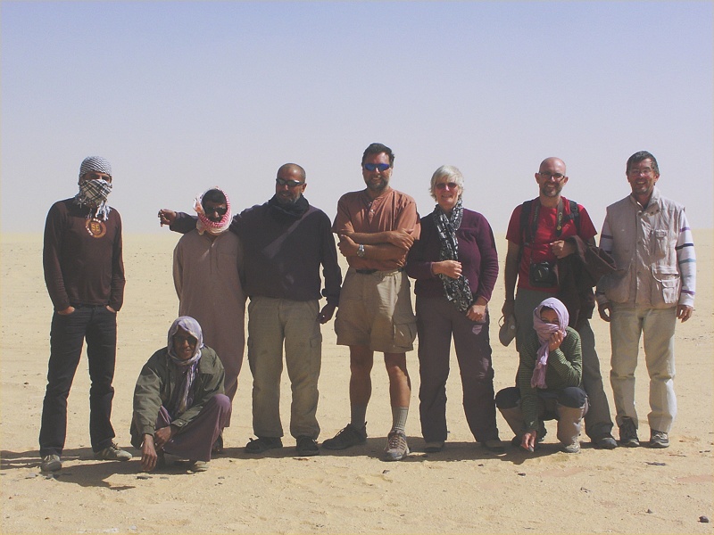
 Click on image for list of participants |
Jebel Uweinat & Gilf Kebir Expedition, Egypt 7th - 20th March, 2010 UPDATE: Mystery of the Wadi Mashi cairn solved |
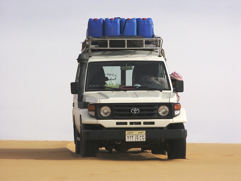
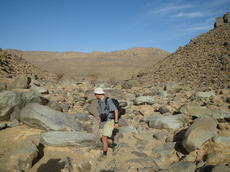
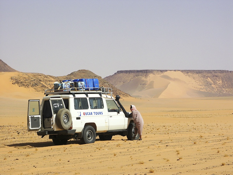
Despite rumors of suspended permits and restrictions on off-road travel to Egypt's Western Desert that sprang up in the middle of February, things were pretty much as usual, we had a very smooth hassle free journey. The trip will probably be remembered most for the extremes of weather, unlike like anything I experienced in the past ten years.
Day 1. - Cairo - Dakhla
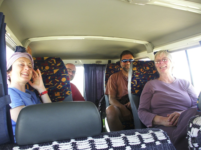
There is not much to say about the first day. It was the customary dull full day drive on the road to Dakhla Oasis, only pausing in Baharya to pick up our accompanying officer, Capt. Mohammed Saleh, who turned out to be a very cheerful and helpful young man, showing genuine interest in all aspects of the desert, quite trait rather uncommon among his fellow officers. We continued to Dakhla, reaching it by sunset, with ample time to change oil in the engines, fuel the cars and do our last minute shopping before departure the next dawn.
Day 2. - Dakhla - Gilf Kebir foothills
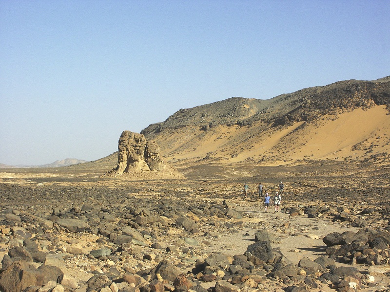
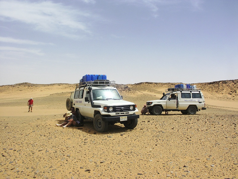
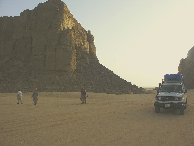
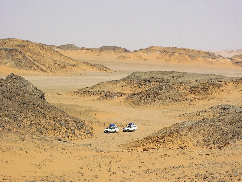
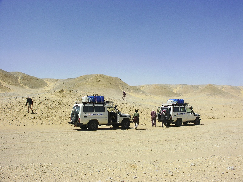
This time we managed a good early start, we were rolling past Dakhla airport before the sun was up. Mohammed whisked us past the military checkpoint on the road south in a couple of minutes, a feat never accomplished before (usually it takes 15-20 minutes), immediately earning our respect for the rest of the trip. We drove south along the road towards Bir Terfawi to our turn-off point without any notable event, and reached the Abu Hussein dunes before midday.


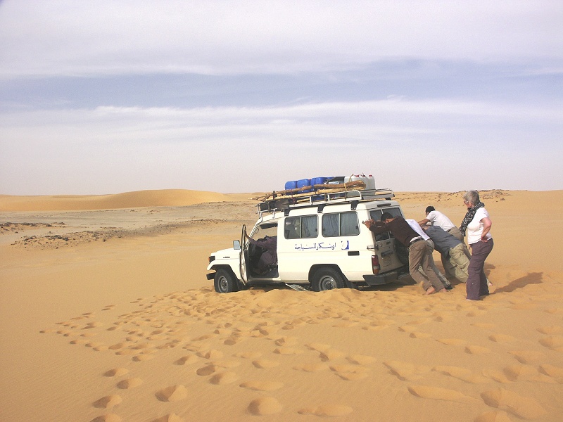
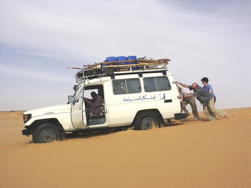
After a pause for lunch, we continued west accross the Selima Sand Sheet towards the foothills of the Gilf, reaching the belt of barchans by mid-afternoon. As we had plenty of time, Salama with a mischievous grin suggested we might try a shortcut accross the dunes, possibly saving a detour of about thirty kilometres. To cut the long story short, after spending an hour or so digging out the very heavy cars from liquid sand, we opted for the detour...
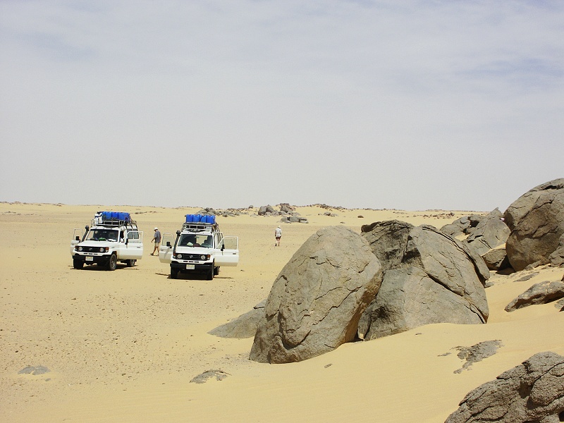
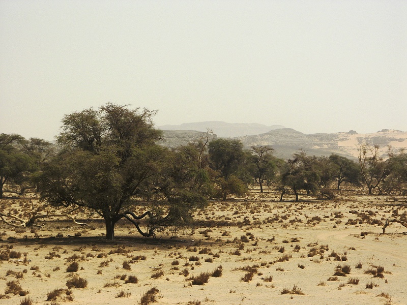
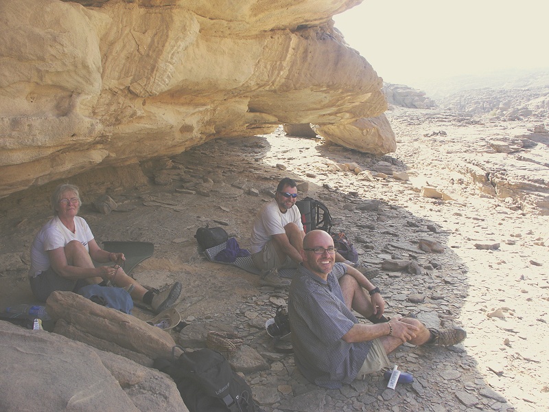
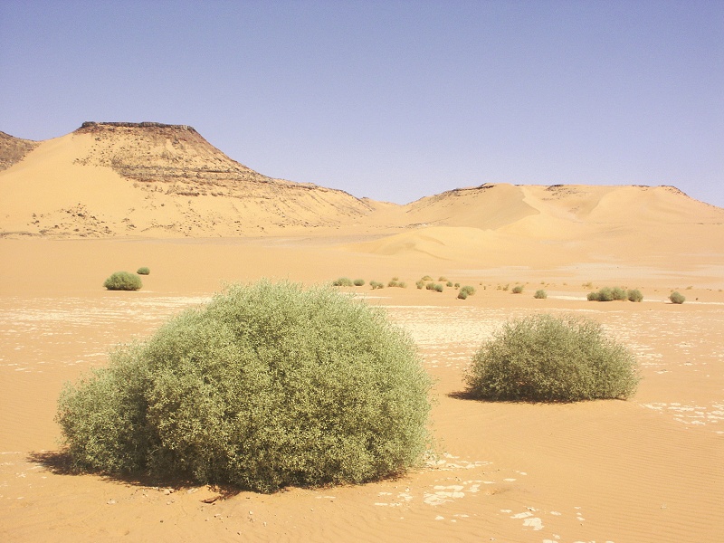
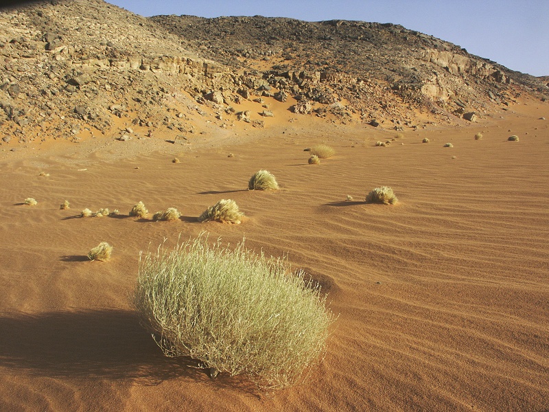
Camp was near the southern end of the barchan range, about forty kilometres from Eight Bells. It was very hot all day, but the reality only sank in at sunset, which despite the overcast brought neither wind nor any significant drop in temperature, that we are facing an uncommonly hot spell of weather. It was 8th of March, yet we could sleep comportably outside our sleeping bags with nothing on, tent door unzipped. I did wake up around 4am to the feeling that it might be just a trife too cool to sleep completely outside, and did crawl half-heartedly into the sleeping bag, but the temperature was still well into the mid-twenties.
Day 3. - Camp - Jebel Uweinat
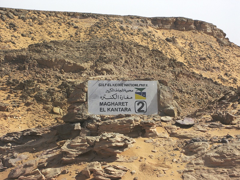
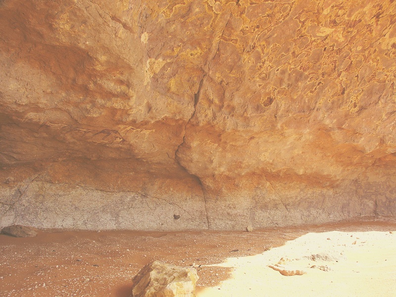
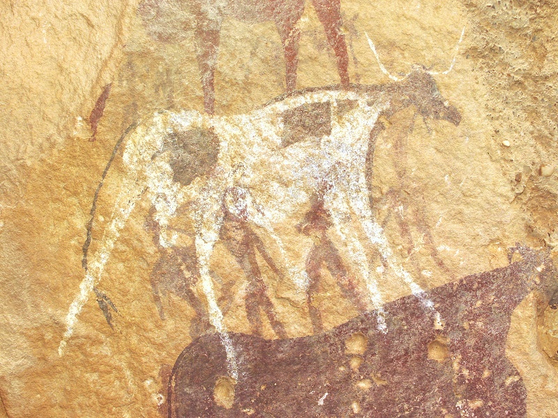
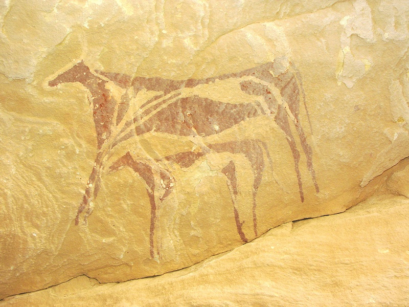
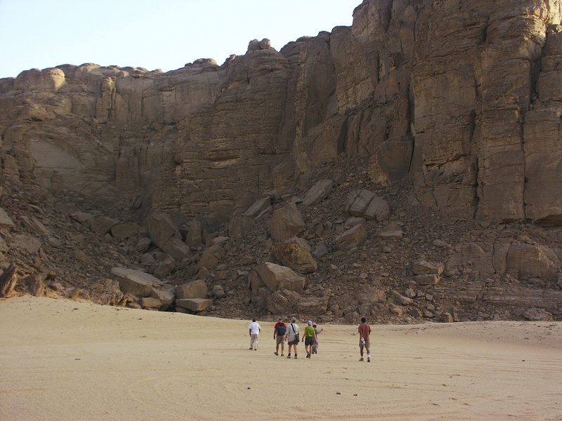
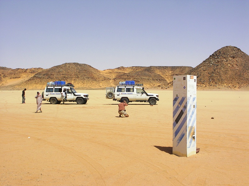
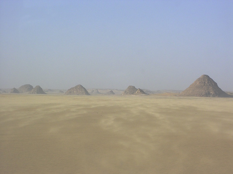
In the morning we set out for the near-by sites. First we passed by Eight Bells aerodrome, a WWII emergency airfield at the foot of the eight very conspicious hills at the foot of the Southern Gilf Kebir. From there we continued to Mogharet el Kantara (Shaw's Cave, or Rupert's Cave), the only known site with paintings in the entire southern Gilf plateau. Unfortunately the authorities deemed fit to place another of the rather unfitting marble "Gilf Kebir National Park" signs here since our last visit.

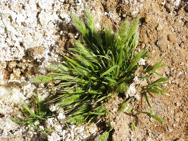
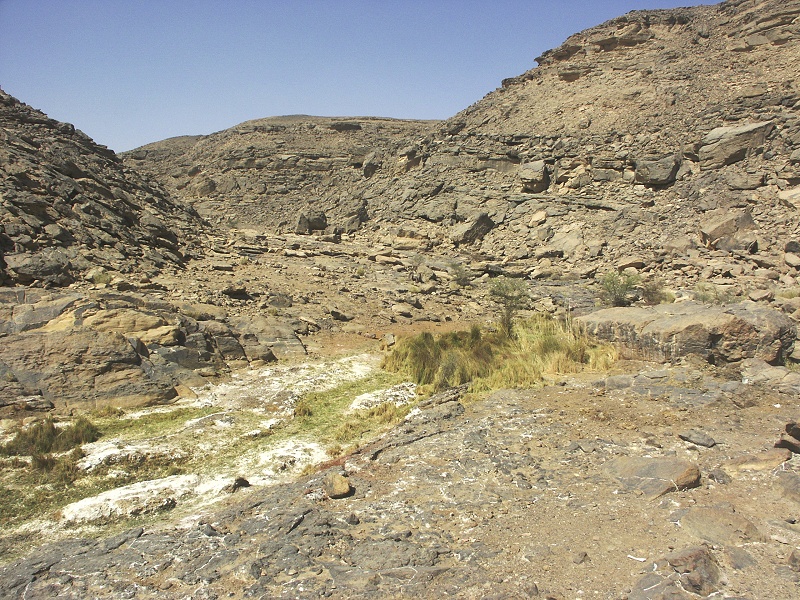
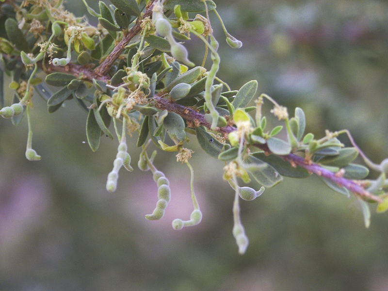
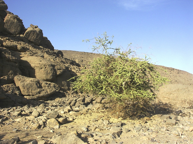
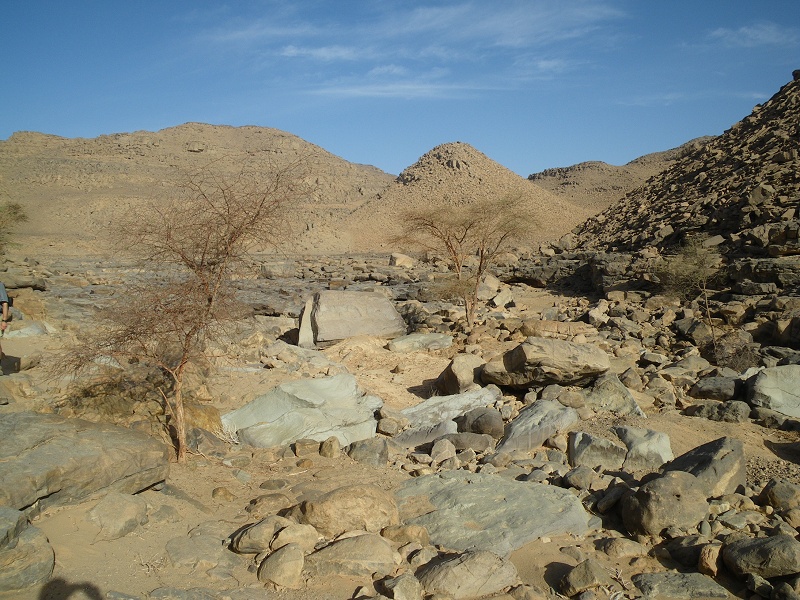
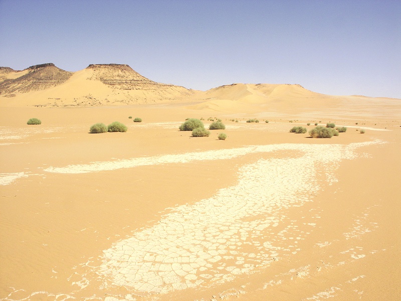
We crossed the Gilf through the Wadi Firaq, emerging on the plains to the west. Interestingly, there was still some green vegetation in the water channel of the wadi, mainly Fagonia thebaica, a remnant of the vegetation that emerged following the rains of winter 2008.
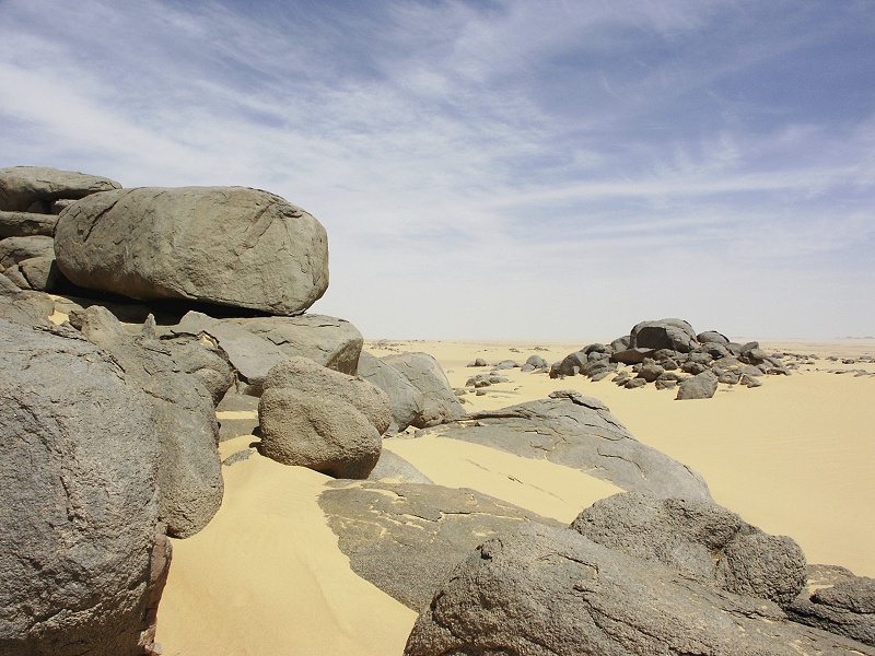
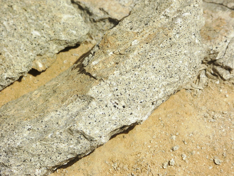
We continued to the granite hills to the north of jebels Peter & Paul (close to where we camped in February 2009) for a brief lunch stop. These hills are among the oldest rocks in Egypt, they are a part of the pre-cambrian basement unlike the much younger granites one can observe at western Uweinat or near Aswan.

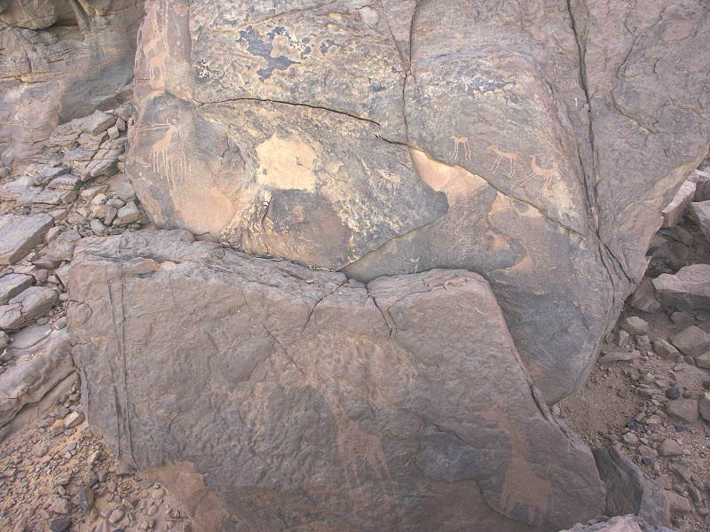
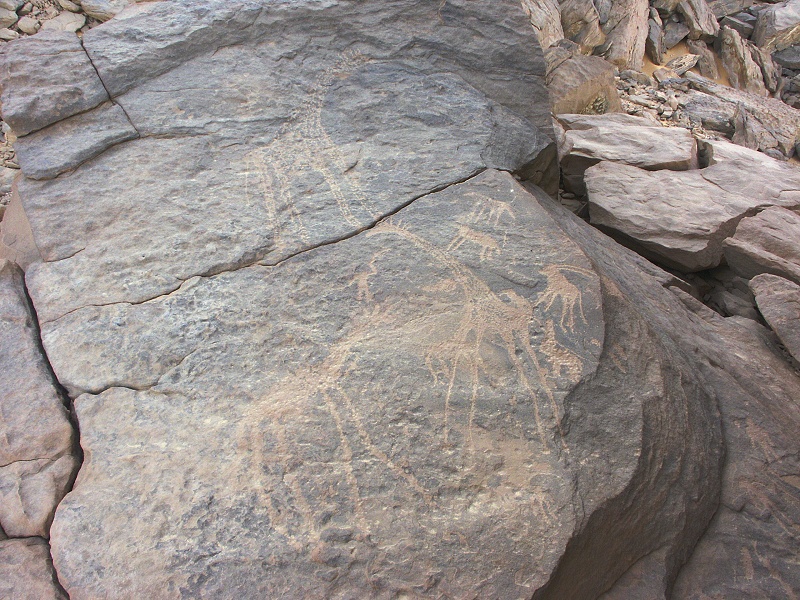
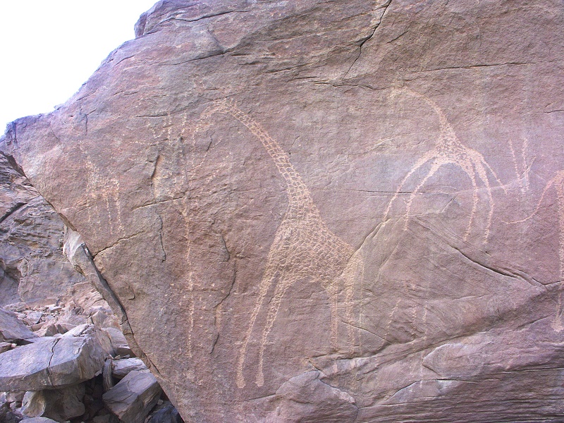
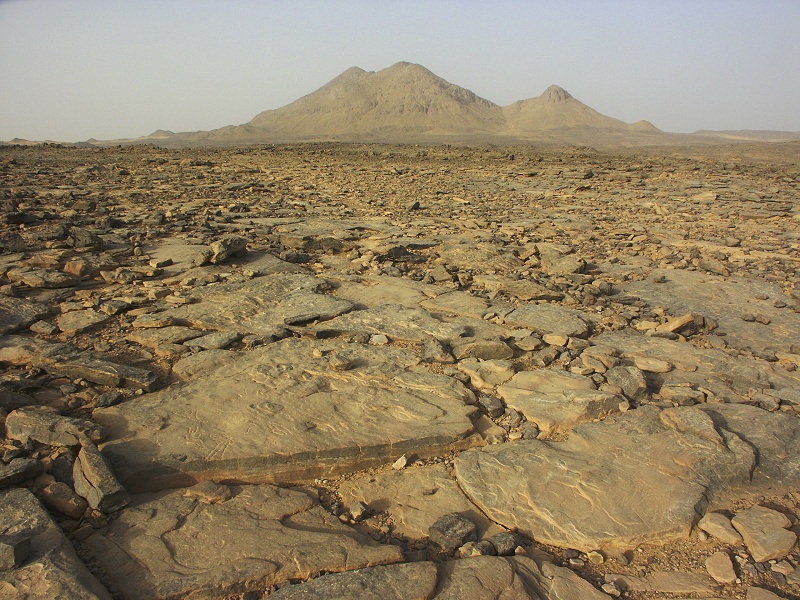
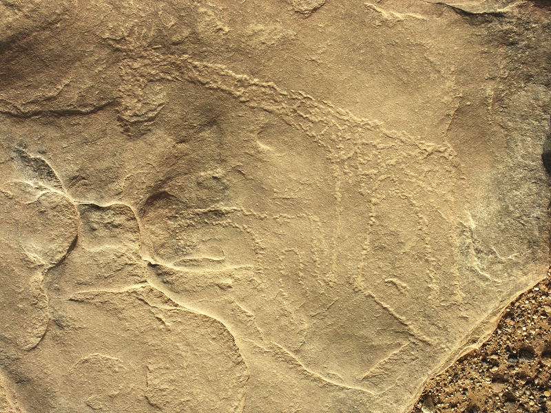
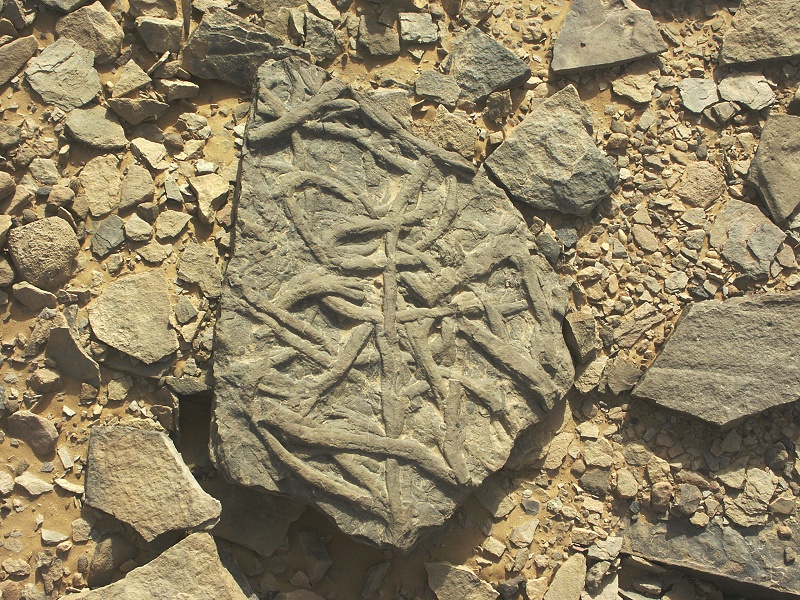
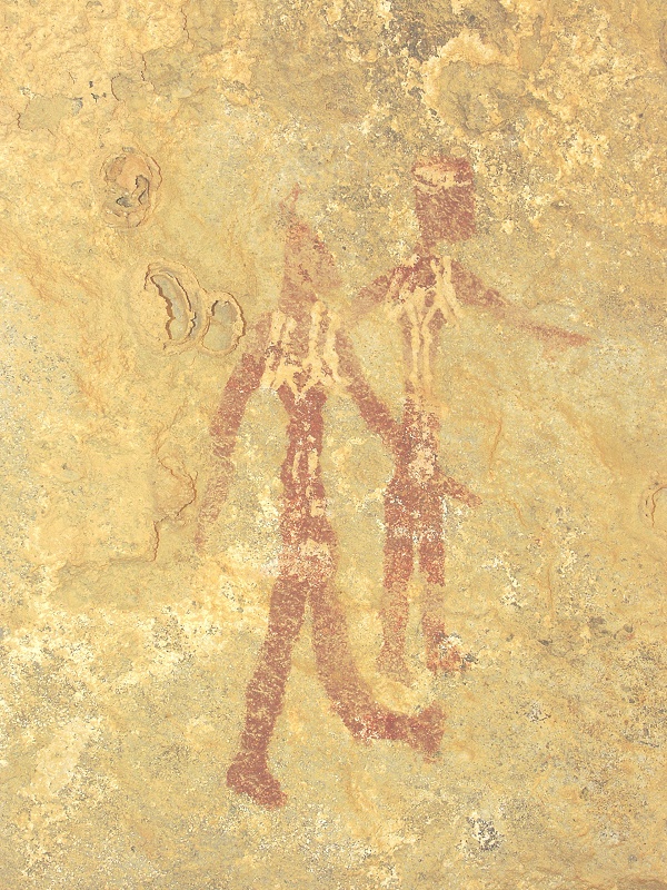
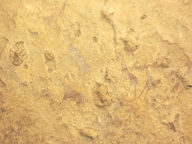
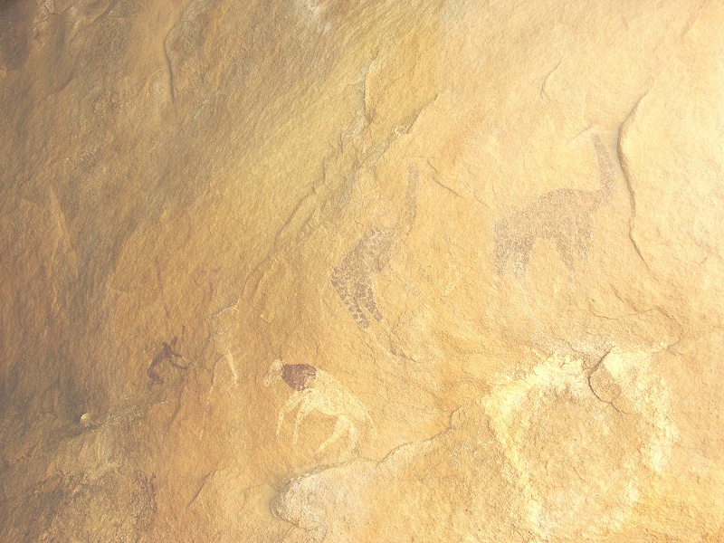
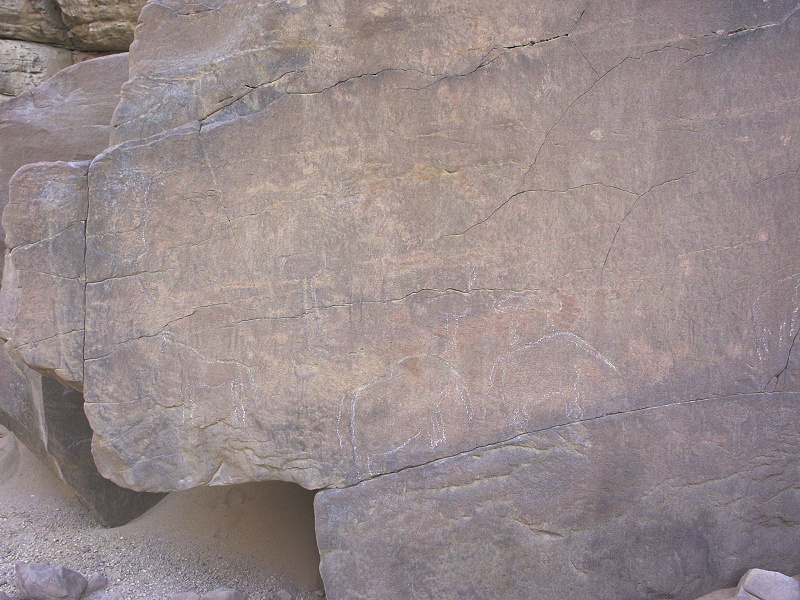
After lunch we moved on towards Jebel Uweinat. It was rather hazy, we only saw the mountain emerge from the haze when we were no more than 15-20 kilometres away. We stopped at one of the small northern foothills, where Mark Borda found a nice panel of engravings with giraffe and other animals early in 2009. The surrounding ground was littered with artifacts and the occasional pottery sherd, including a nice example of the early "Gilf B" type with impressed decoration.

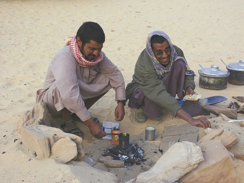
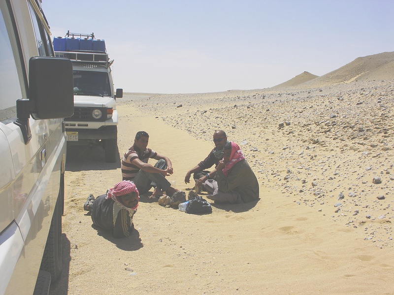
Following the engravings, we went to check in at the newly established Egyptian army checkpoint near the eastern entrance of Karkur Talh. This checkpoint was set up after the 2008 kidnappings, and seems to be an effective deterrent, as we have seen very little trace of recent illicit traffic both at Uweinat and later along the western Gilf. The checkpoint itself was quite neat and orderly by egyptian standards, with two pre-fabricated buildings tucked away in a little valley not being visible from the surroundings, and hardly any rubbish about. We were delighted to find Lt. Mohammed, our escorting officer of November last year in command, who immediately invited us to a rather lengthy tea ceremony, accompanied by roughly half of the flies present at Uweinat.
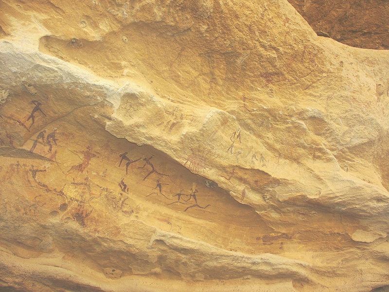
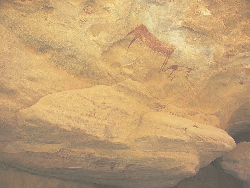
After the checkpoint we drove to the eastern foothills of Uweinat, where two weeks before us an Italian party including my good friend Flavio Cambieri found an isolated rock pillar with a number of curious engravings, including a number of snakes (very clearly horned vipers) that are quite unique (the site is being prepared for publication by Flavio, hence I will show no close-up photographs until the publication is out). Flavio and party were there late in the day (not unlike us) and had no time to explore the vicinity, as the site is a good half hour flom the closest point accessible with car. The sun was getting precariously low for us as well, but a group of conspicious rocks about 15 minutes further away looked irresistably promising. On reaching it, we found a multitude of excellent engravings among the cluster of rocks, certainly worth the extra walk.
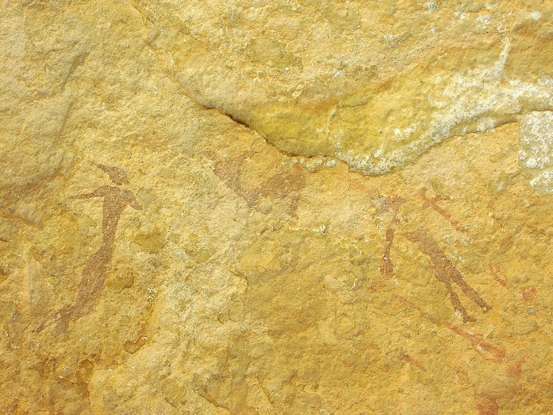
The engravings were mainly of wild animals with a few groups of humans, including a remarkable scene of a giraffe nibbling the top of a tree.
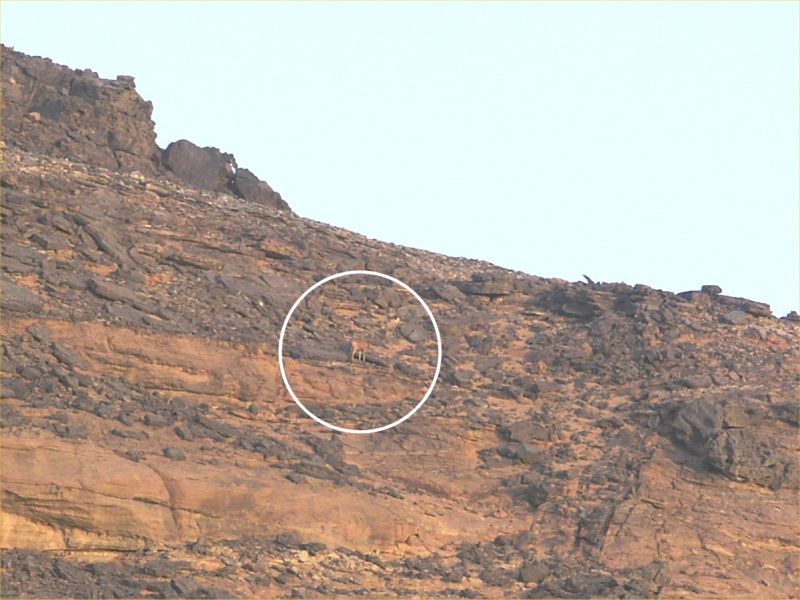
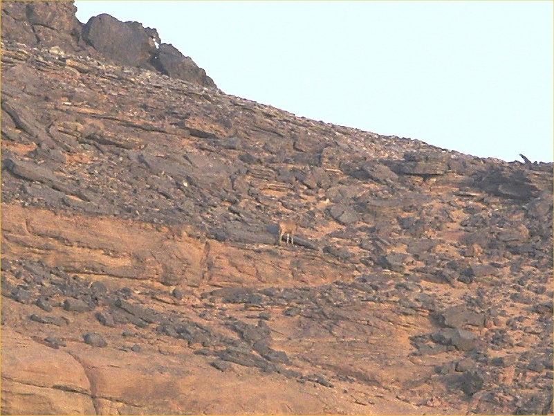
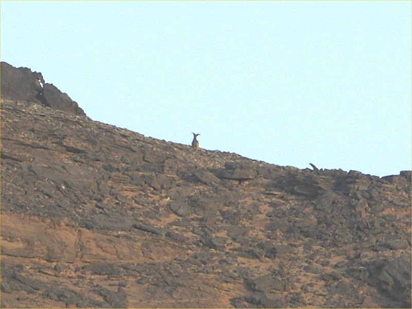
With all the photography to do, it was close to sunset when we entered Karkur Talh to go to our usual camping spot. As we drove deeper into the valley, we spotted a waddan (barbary sheep, Ammotragus lervia) running up the hillside. I have managed to snap two photos before it disappeared over the crest of the hill.
Day 4. - Karkur Talh
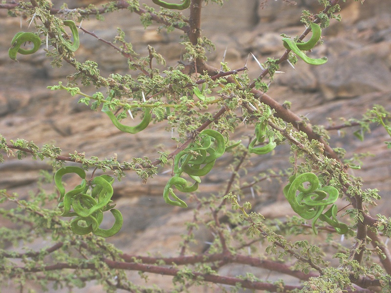
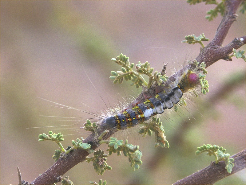
The plan of the day was to visit the rock art sites in the lower sections of Karkur Talh. As we were getting ready, Rocio spotted a very nice caterpillar munching merrily on a small and very green acacia next to camp. It appears to be the same species as the caterpillar we saw in 2005 in Wadi Hamra in the Gilf.
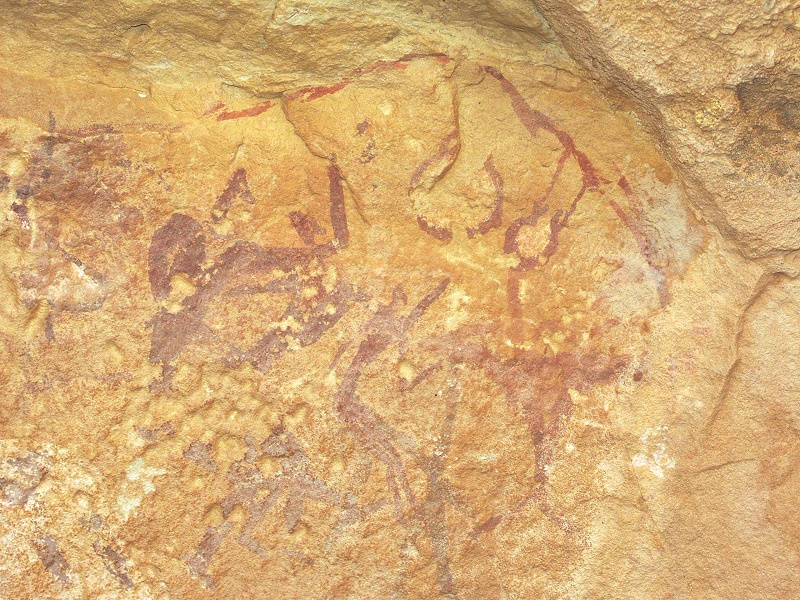
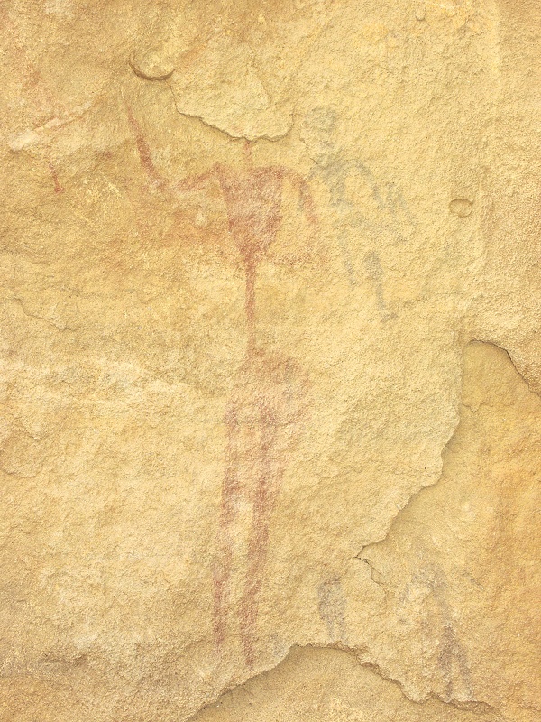
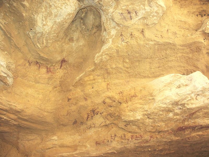
By the time we reached the two central rock islands, it became sizzling hot. By noon the temperature climbed above forty, with a constant haze in the air. We walked along the main row of engravings and paintings along the main section of the valley, and as always before, one invariably finds new details that were unnoted before. In one of the shelters (KT 62) discovered by Rhotert & Almásy, then re-visited by Winkler and the Belgian expedition, I spotted a group of very faint but clearly discernible little "round headed" human figures missed by all earlier visitors, including myself on a number of occasions. They are all wearing a pointy cap, very similar to the better preserved scene on one of the sites found by Mark Borda among the hills to the north-east of Uweinat in 2009, which we visited last November.

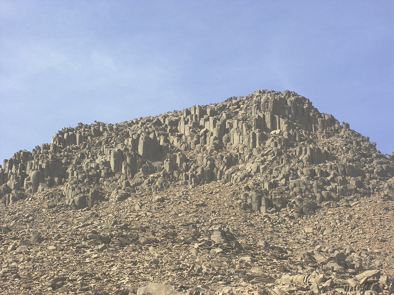
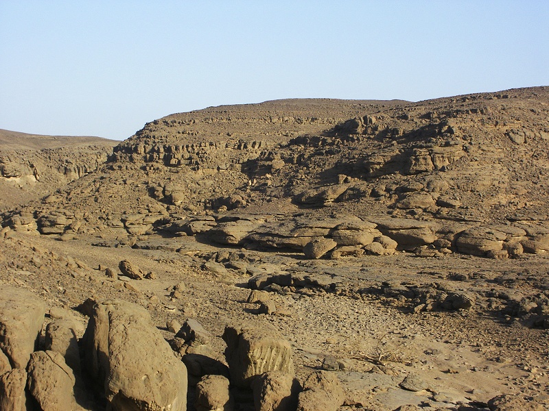
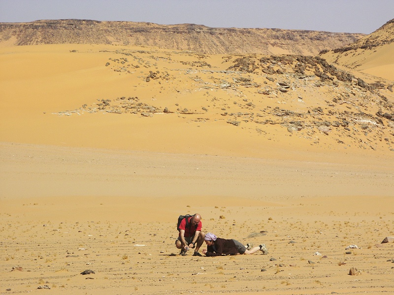
While the others snapped their photos in the shade of the large shelter (KT 82) at the end of drivable section of the south-western branch of Karkur Takh, I made the marginally insane choice of walking up to the outcrop of igneous rocks which we first noted in March 2008. The one kilometre walk in about 44 degrees was anything but pleasant, however at least I did manage to take a few samples, and clear out the matter. What appeared on first sight to be granite was a much softer and less grainy, but very clearly igneous rock, very clearly a part of the basement, with the sandstones lying unconformably on the top of it. This igneous outcrop may be followed on both sides of the valley for a section of about 500-600 metres, and the flowing water has carved and eroded it into interesting shapes, including large eddy holes where a harder quartzite boulder got caught by the torrent. Interestingly at one spot there remains an eroded outcrop of a once much higher gravel terrace, the remnant of times when the wadi was regularly flowing with water, and the pebbles and mud picked up higher were deposited here where the valley flattens. At some point this was followed by a second erosion period, when the present wadi cut deep into this earlier gravel terrace.


By this time we all had enough of the heat, so it was an unanimous choice to return to the camp for lunch, and spend the worst of the day lying in some nice shady spot. The most unusual aspect of the weather was the complete lack of any wind. Usually no matter what, there is an ever present breeze, which offers some relief even if it is of a hair dryer temperature.
Mid-afternoon, as the sun started becoming bearable, we walked accross to the main site of the southern branch of Karkur Talh, Site KTS 15 (one Almásy and Rhotert found in 1933). This is another of those sites, where one may see new details on practically every visit, with numerous layers of overpaintings partially obscuring the earlier ones.

We still had two hours left till sunset, so we set out to do a bit of exploration. Last November as we returned from Karkur Murr, we cahnced upon what appeared to be a north-south running camel trail (similar to the one leading from the south-west branch of Karkur Talh towards the spring in Karkur Murr), descending into the main south branch of Karkur Talh near the rock art site KTS 15. As we descended, a member of our party spotted some cattle engravings, but it was too late to go back and photograph them. This time with ample time, we decided to check out the area in more detail. We soon found the cattle engravings on a rock face near the point where the path descended into the main valley, however we soon found some others nearby on the smoothly worn rock of the path itself. This meant this was no recent camel trail, but an ancient path in use since prehistory!

We followed the path for another kilometre, and we found another three groups of engravings on the path itself, or immediately beside it.

The path led to an area with a few paintings (KTS area 4.) we found in October 2002. Crossing the wadi, the path continued straight south. As the sun was getting rather low, we had to turn back, but this is certainly something to be checked out on a further trip. We passed by a couple of the paintings before returning to camp for the evening.
Day 5. - Karkur Talh
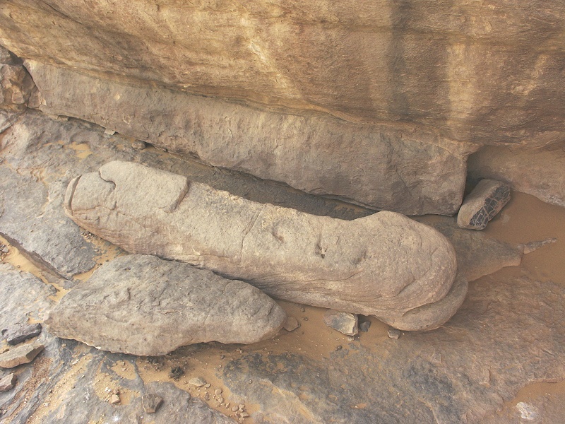
One of our most important objectives at Uweinat was to make a two-day trek to the cluster of rock art sites we have found during our descent from the summit of the mountain in November 2009. With the weather still almost unbearably hot, we decided to put off the trek, and continue visiting the more accessible sites. One such locality was a recent find by Khaled Khalifa, Uwe George and Carlo Bergmann near the northern entrance of Karkur Talh. The locality contains a very fine panel of engravings of a row of running figures, and nearby Uwe George found what to them appeared to be an enormous carved male organ. Having visited the site, I'm afraid all I can see is a piece of naturally eroded rock that has broken off at the rear (the fracture plane is clearly visible), with a groove carved on one end (the only clearly man-made element on the rock) that was more than likely used as a tethering point for animals. Carlo Bergmann just placed his illustrated trip report, together with his ideas on the place on his website a few days ago. While the running figures are indeed remarkable and unique, I see nothing else in the locality that would make it special in any way in the context of the hundreds of other rock art sites in the environs.


We took some time to explore the area a little further, the find was made in a small lateral wadi which we never visited on past trips. Behind the hill bordering the wadi to the north, we did come upon a shelter formed by a large slab of rock, with faint paintings of cattle and goats.


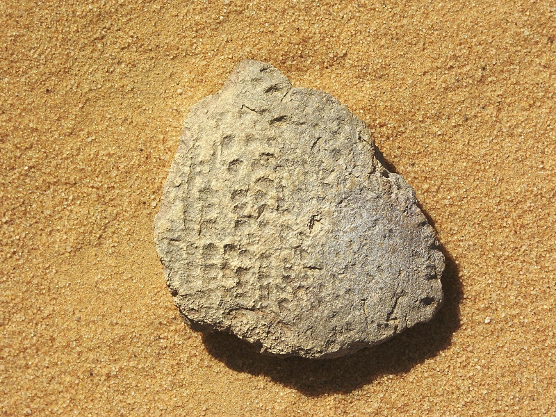
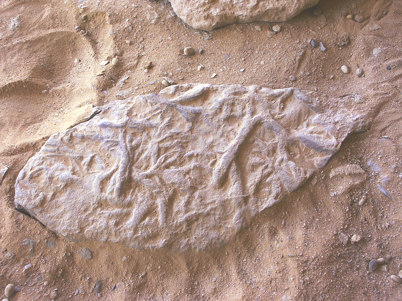
As we rounded the hill, we made another find: a slab containing the trace fossil Arthropicus harlani, from the late silurian or early devonian. The notable feature of the locality was that it was at a much higher elevation (about 100-120metres above the valley floor) than noted elsewhere, and pretty much confirms a continuous sedimentation sequence in the north-eastern Uweinat area.
We visited the other known sites in the northern Karkur Talh area, but by noon the weather again became so hot that it was impossible to do anything, but go back to camp and spend the early afternoon in some nice shaded spot. It was still as the day before, except for a stray dust-devil that took the rather rude idea of visiting Lisette's tent, tipping it over and scattering all contents in the process. By the time the excitement subsided, it was becoming again marginally suitable to go out again. In the afternoon we visited the south eastern branch where we made many of our finest finds in October 2002.
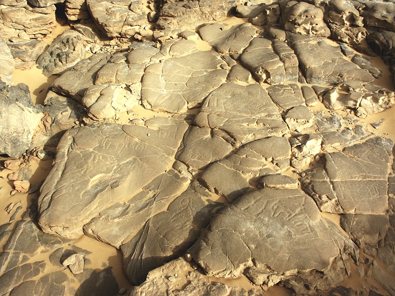
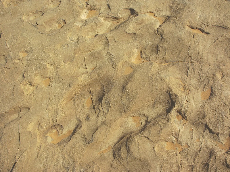
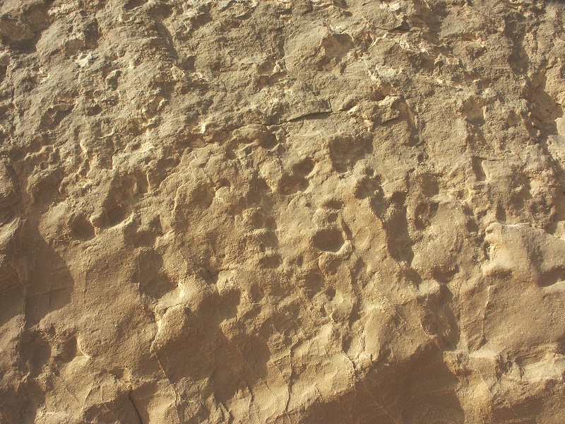
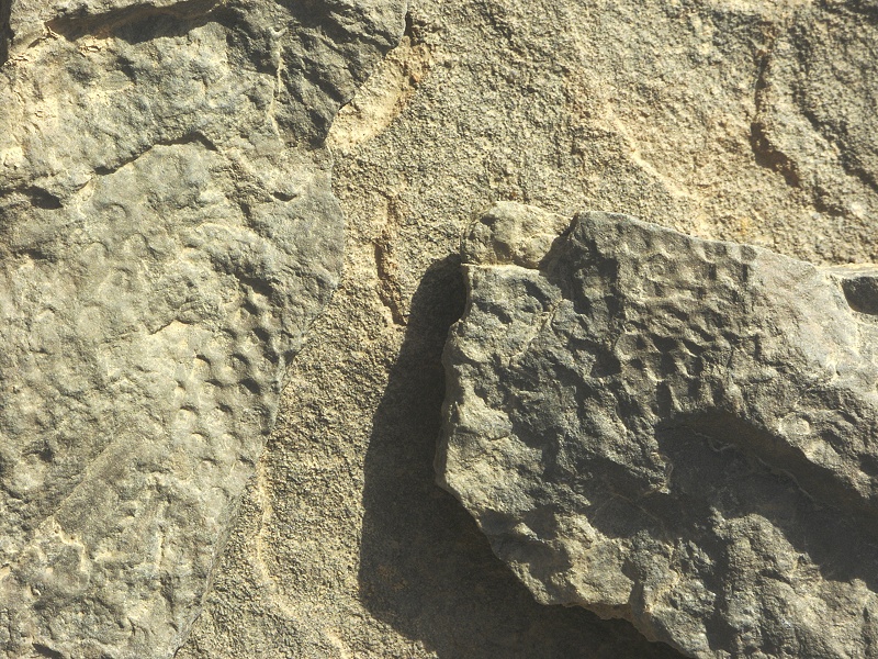
There is a large slab of flat rock in the valley, which we have passed numerous times in the past. Recently, Giancarlo Negro suggested that there may be fossilised footprints visible on the slab (left photo). We had a good look, and came to the conclusion that the depressions on the rock are the produce of water erosion. The slab itself has been split off from the adjacent large block, which can be traced to a place in the lower cloffs from where it has rolled away. The sandstone appears to be silurian to devonian, a period when no large terrestial quadrupeds would have been present. In addition, according to Lisette's expert opinion the bedding planes on the large adjecent rock are in the correct position, whereas the slab on the wadi bed is overturned, the depressions corresponding to protruding lumps in the real surface, which is clearly visible on the uneroded surface of the adjacent block (right photo).
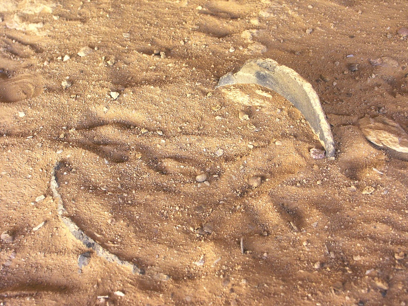
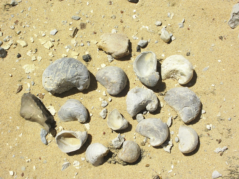
One area of the valley contains numerous implements, Rocio spotted a number of pottery fragments as well, including a particularly fine example of the "dotted wavy line" first noted by Arkell at the Khartoum mesolithic sites, and now shown to be prevalent along the entire southern part of the Sahara.
Day 6. - Karkur Murr
The weather showed no sign of change, it remained hot and still overnight. We decided the previous evening to swap the planned itineraries, and walk down to the spring at Karkur Murr for a day, in the hope that the weather might improve a bit later for the two day trek. Accompanied by Khaled and Capt. Mohammed Saleh, we started along the camel path leading up from the south-western branch of Karkur Talh soon after first light, to make at least the first part of the trek in the cool of the morning.
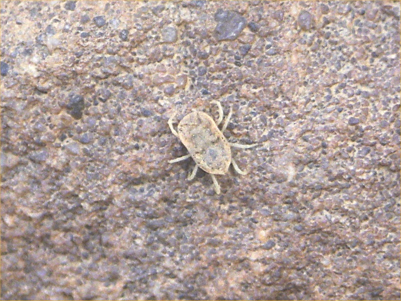
We stopped at Winkler's site 81 (KT 97) and the adjacent other paintings. When we sat down for a pause a little further up, I noticed that we have more company than we bargained for. There was a large camel tick (Ornithodoros) clinging on to my boot, waiting for the opportunity to crawl further up for lunch. I must have picked it up in one of the shelters, where it was waiting for a waddan or some other unsuspecting creature like ourselves.
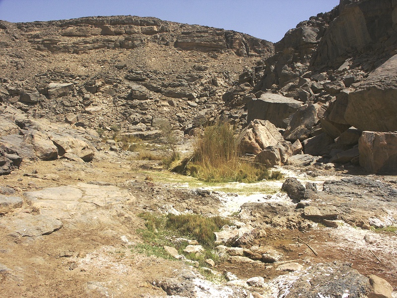
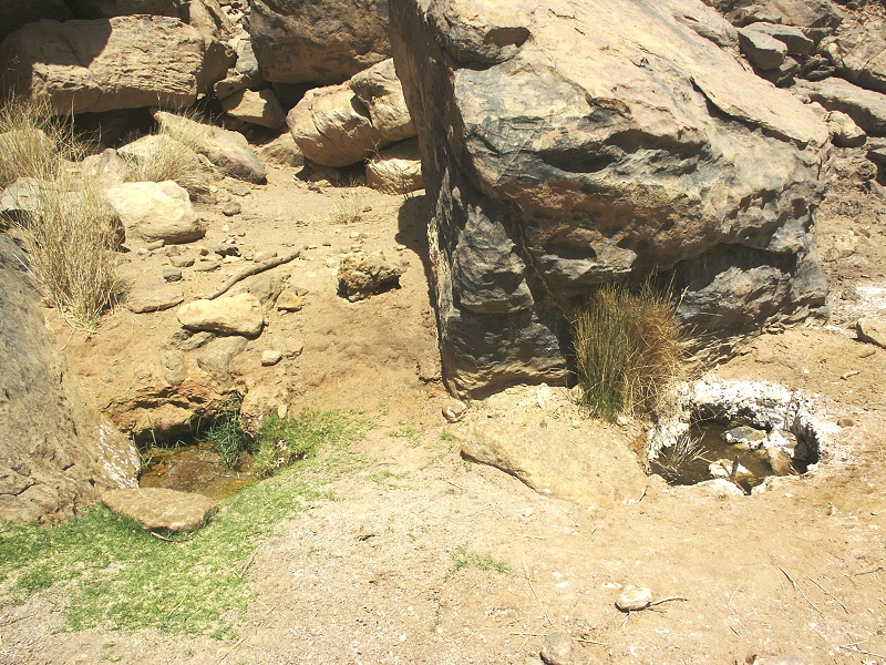
By mid-morning we were accross the watershed, walking down into Karkur Murr. It was as hot and hazy as the previous days, Jebel Kissu, usually sharp on the southern horizon, remained completely obscured. We reached the spring before midday, and found it completely deserted. By the looks of it, noone visited it since we were there last November. Ther was much more water however, the shallow pools between the two springs all had some water or at least wet mud on their bottoms, and the cluster of reeds a short distance south of the main spring were actually standing in water.

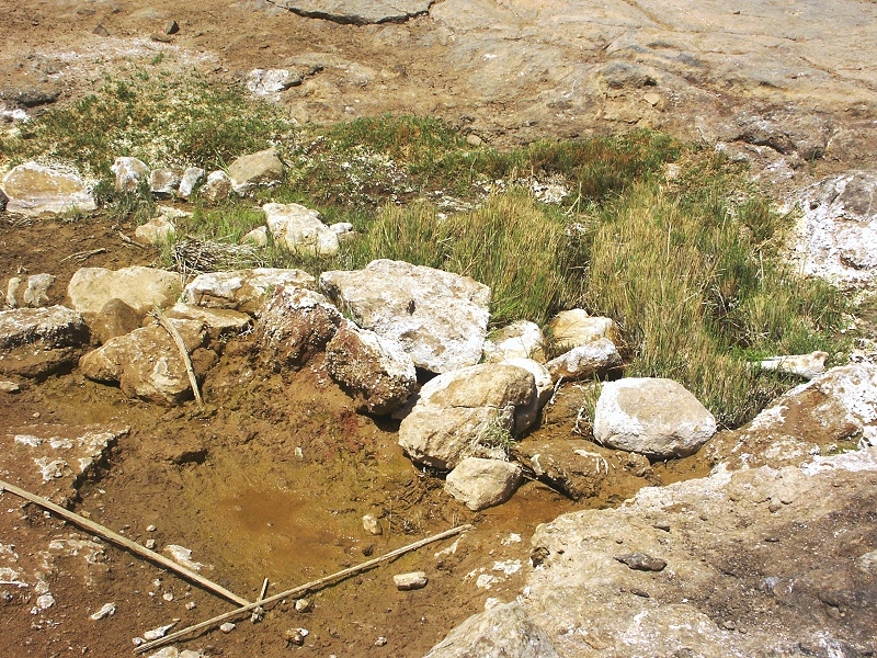
We took turns having a shower in the very nice cool water, enjoying the luxury of being able to drink as much as possible. We also observed a strange transformation of the water. While the upper larger spring was rather bitterish and full of algae when we last visited in novebber, the water taken from under the rock in the smaller spring some 200 metres away was crystal clear, and practically tasteless. Now the lower spring also had much algae in the water, and was as bitter, or even more than the upper one, which appeared to have cleared somewhat. The bitterness is caused by magnesium carbonate in the water, however it is perfectly suitable for drinking, once again noone had any problems.
We stayed till mid afternoon, repeatedly behaving like a herd of hippos, then started out on the flat plateau back directly towards camp. We hit upon the ancient path a little further up till where we explored two days earlier, reaching Karkur Talh well before sunset.
Days 7-8. - Upper Karkur Talh
Our hopes with the weather did not materialise, it was another hot night, with no hope of a cooler day. Rocio decided to stay behind to visit some other sites, while the rest of us set out for the 2009 November sites. A rendez-vous was agreed at the Belgians' sites at 11am the next day, as our plan was to meke the bulk of the hike in the cool of the morning on both days. We set out at dawn, and by 8am we were at the last shady spot in the valley before we had to make the ascent to the plateau towards the two basalt hills, where the going is much easier than in the wadi floor. We started out with five bottles of water, but left one here at a cache in a rock crevice beside a blooming Maerua crassifolia.
As we ascended the plateau, Agusti found a piece of fossil, probably a Sigillaria imprint. It was soon traced to an exposed thin layer of rock, where soon we found a couple of other fragments, including a Lepidodendron.

The going on the plateau till the two volcanic hills was easy, we sat down on the cool smooth rock in the wadi between the two hills in the full knowledge that we are seeing the last bit of shade till we make it up to the small wadi with the rock art sites, at this point still an optimistic hour's walk away.
It soon became apparent that the estimate of another hour was overly optimistic. By 10am it was close to 40 degrees, we were going very slowly, stopping at every opportunity where a larger boulder provided a bit of shade. In the end, it took another three hours to reach the shelter with the paintings, dropping exhausted into the shade of the shelter around 1pm.
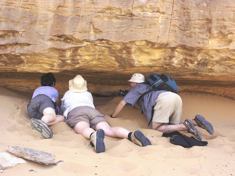
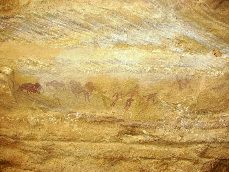
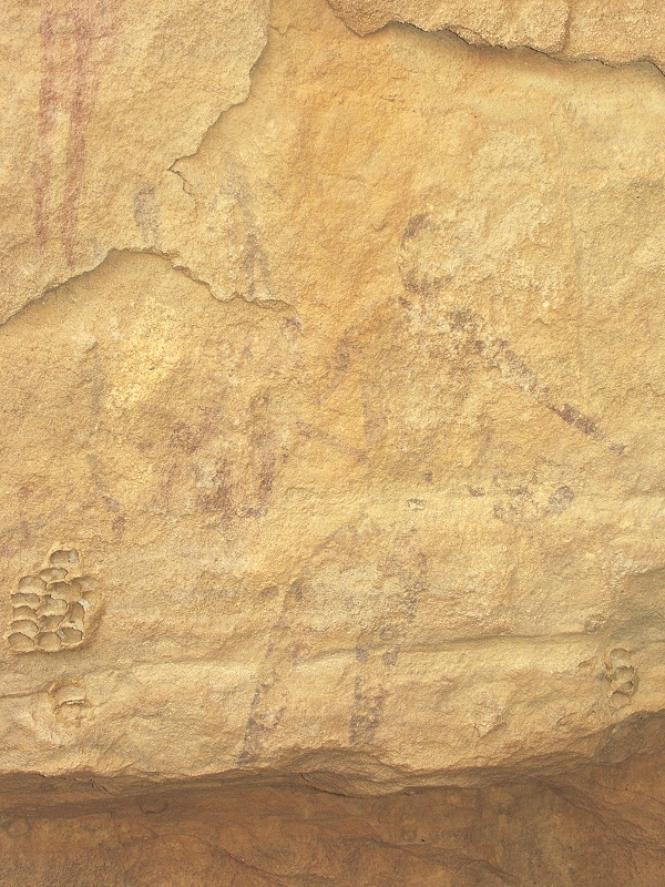
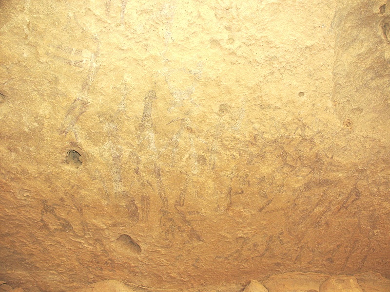
It took close to three hours to photograph this large shelter in it's entirety. When we found it last November we were already running late after photographing several spectacular other finds, I was out of batteries, so could only take a couple of sample shots with a borrowed camera. Now the scale of this site really sank in. Along a length of about 50 metres, the wall and ceiling of the shelter is full of paintings in six main clusters, from several periods. I have taken over 400 photos of this site, it will be published in an article in the forthcoming issue of Sahara.
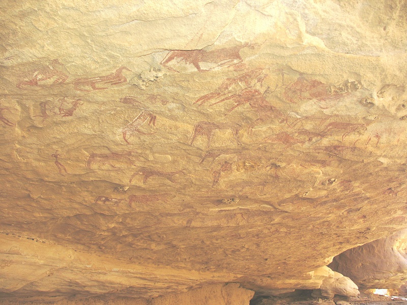
The floor of the shelter also held some surprises. Close to the middle we found the rim of a large pottery vessel emerging from the dust. We resisted the temptation to touch it, it remains there in the hope that perhaps one day a proper archaeological excavation may be conducted there. We also found a slab with the familiar Arthropycus trace fossils. As we were here at an elevation of 1300 metres, a good 500 metres above the occurrence of the same fossils in the lower Karkur talh area, this is a clear evidence for some local faulting and uplift well after these sandstones have been deposited.
We still had several hours of daylight left, first we set out to see the other sites in the explored part of the valley.

There was one side valley left to explore, branching off almost opposite our large initial shelter. Scrambling upstream over a dry waterfall, we found a large closed basin, with some promising looking rocks and shelters along the eastern side. Agusti climbed up to the largest one, and soon signalled that he found something.
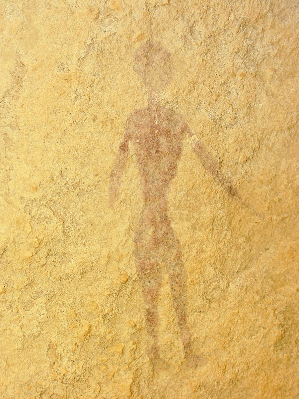
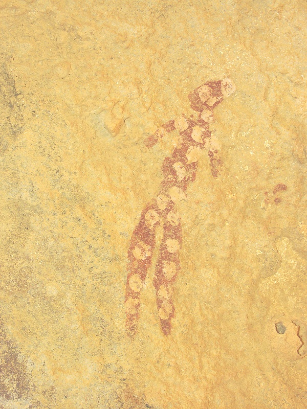
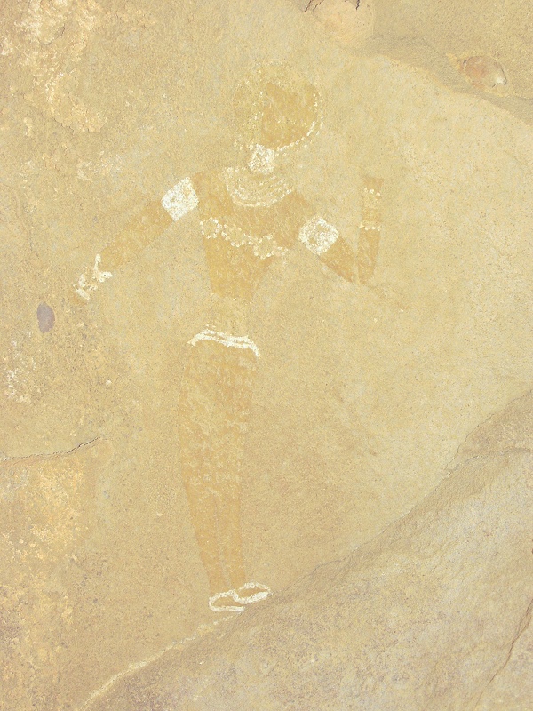
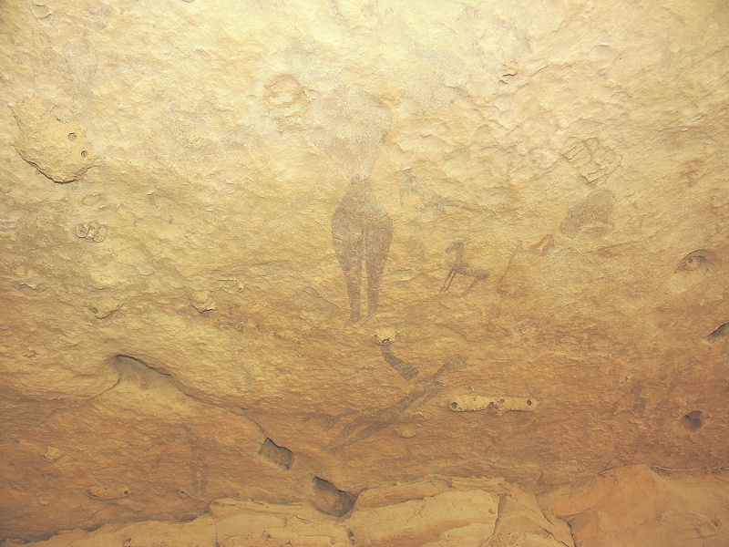
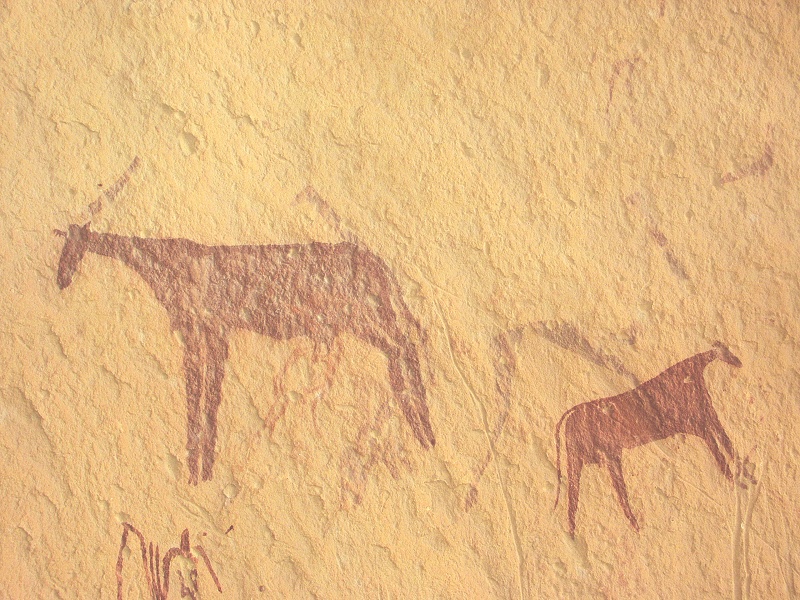
The shelter contained only a handful of human figures, but they were all remarkable. They all appear to be from the oldest "uweinat roundhead" period, with extensive body decoration, some of which (in particular the yellow figure) have absolutely no analogies.
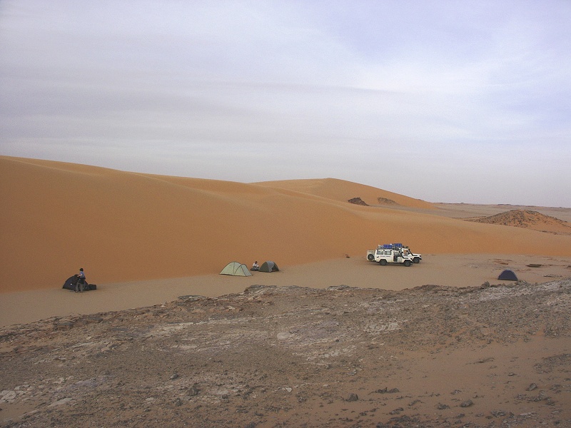
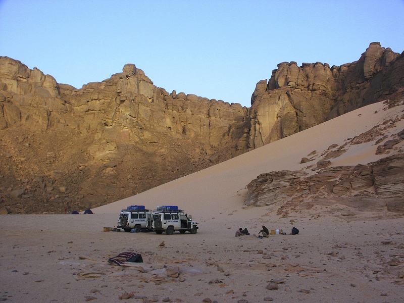
With the sun setting, there was only one thing left - to chose our bivouac spot. Fortunately we soon found a nice sandy stretch of wadi floor just below the large shelter, with even a large uprooted tree washed there by the floods. The night was again incredibly warm - the sleeping bags only served as matresses, it did not cool below 25C at all.
With the first light we set out, in order to make as much of the descent as possible in the cooler morning hours. We have taken a different, more direct route towards the two volcanic hills, first ascending then descending along a steep hillside rather than following the course of the bending wadi. This proved the right choice, in an hour and a half we were down at the base of the conspicious volcanic hills flanking the lower course of the valley.
Continuing downstream in between the hills, we passed the rock vein from which the conspicious blue-grey boulders littering all of the lower sections of Karkur Talh come from. We have already noted this last november, but then we were in a hurry to beat the rapidly setting sun and had no time to investigate. This time we could sample the rock, it was definitely not a part of the basement, but some kind of other fine grained volcanic rock forming a dyke in the surrounding sandstone, probably associated with the volcanism forming the two basalt hills on either side of the valley.

After another fifteen minutes in the canyon, we were sitting in the cool shade of the vertical walls. It took another hour after a longer breakfast stop to reach our water cache, and we just about made it to the Belgian's sites by the agreed time where the others were waiting for us.
We spent several hours visiting all the sites in that short stretch of the valley, then some settled down for a little siesta, while the more restless scrambled about. Rocio and capt. Mohammed decided to have a little rock climbing contest, scrambling up the near vertical cliffs along the northern side of the wadi. This proved to be a rather fruitful exercise, as on the plateu above the vertical rocks, a couple of hundred metres away, they found a large shelter with some very interesting paintings. On seeing Rocio's photos, Augusti & I immediately took the cameras and started out along an easier looking way. We found the site very easily, it turned out to be a major find, with some exceptional paintings of the very early period of Uweinat rock art, including several animal figures that have not been noted from this period.

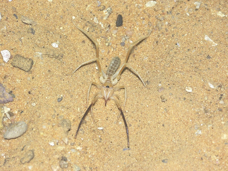
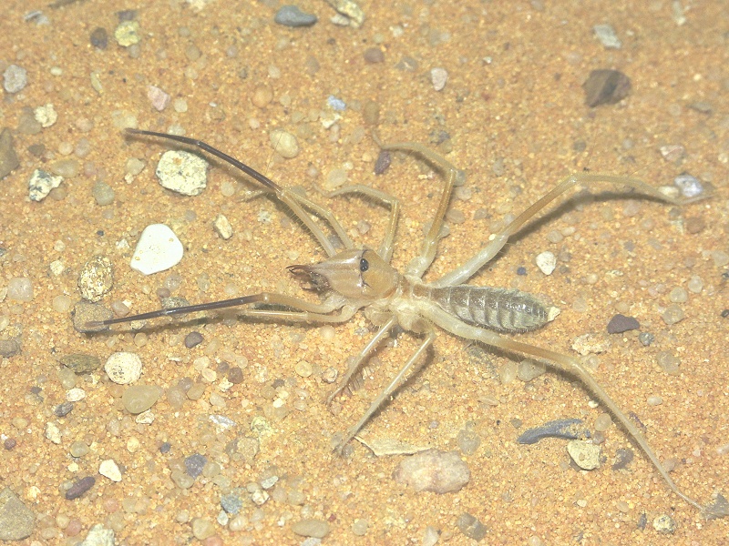
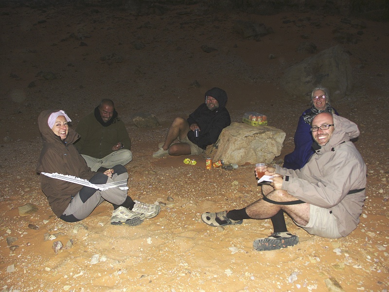
Once the heat of the day started to subside, we made our way to the waiting car, and camp. The rest of the day and evening passed without any notable events, except for a visitor around the camp fire as we were having dinner. All I noticed at first was something small, yellow and many legged running about between us as we were sitting eating our meal. At first I took it for a juvenile hunting spider Sparassus dufouri, the kind of which we have seen several times. However this looked a bit different, and it dashed about much too fast for a spider, it turned out to be a camel spider (Galeodes sp.) which is a relative of both spiders and scorpions. We have never seen any before, Salama explained that they only come out in hot weather, are common in summer but hardly ever seen in other seasons (their arabic name is agrab el shams, sun scorpion).
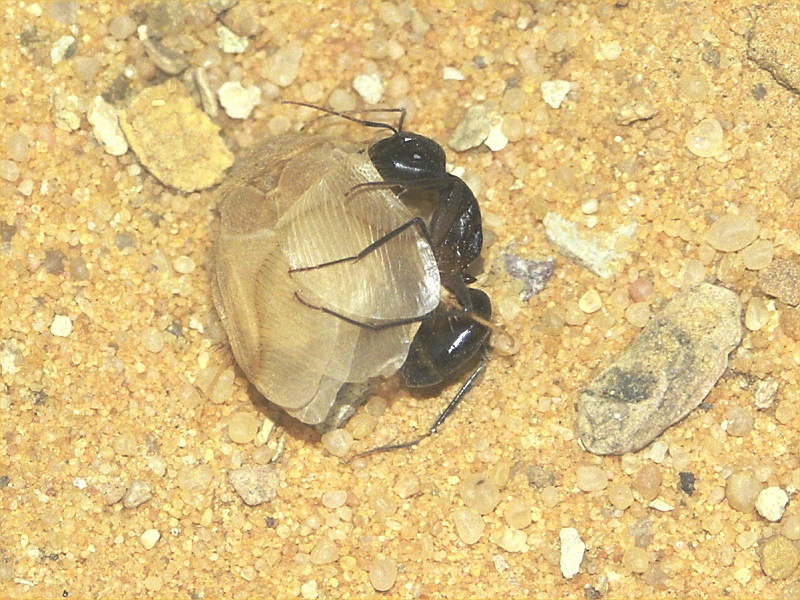
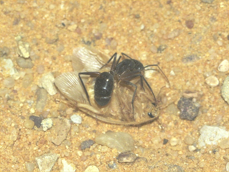
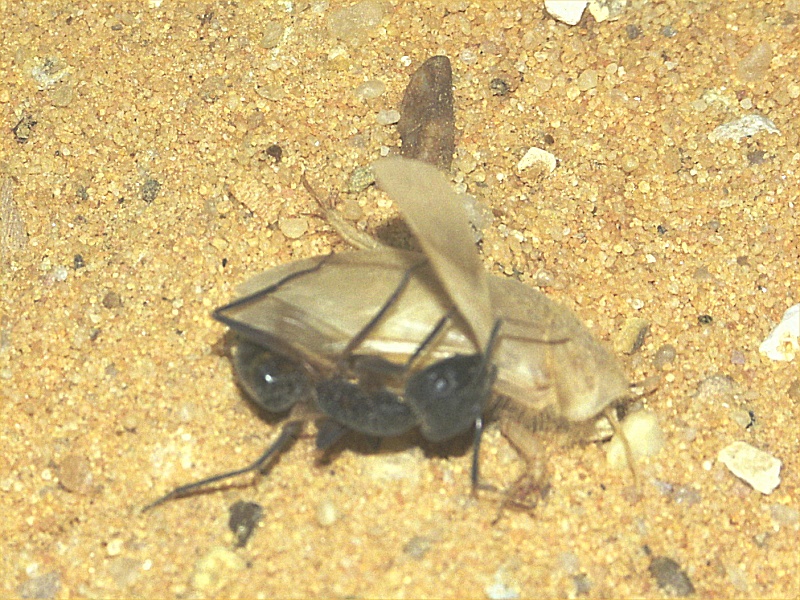
While everyone was excited about the camel spider, another little drama unfolded in the sand nearby. One of the large black desert ants (Cataglyphis fortis) caught something that at first appeared to be a moth. The struggle lasted several minutes, during which I managed to take a couple of photos before they disappeared off into the darkness (I never learned the outcome of the struggle). Looking at the photos, the unfortunate creature was identified as a sand cockroach (Arenivaga sp.), a creature spending most of it's life burrowing in the sand, with only the males ever emerging to seek mates.
The night before the camp was visited by a couple of desert foxes (Vulpes rueppeli), eating the left-overs without fear no more than ten metres from the camp fire, however unfortunately the crowd may have been too big and noisy this evening. We saw one pair of eyes timidly approaching the fire, but as soon as the torches were pointed that way it disappeared, not to return.
Day 9. - Karkur Talh - Wadi Sora
In the morning we broke camp, and set out towards Wadi Sora. First we passed by the army checkpoint to say good-bye to Lt. Mohammed, then drove north to one of the isolated rock outcrops littering the plain north of Uweinat, where Mark Borda found another of his sites in 2009 February.
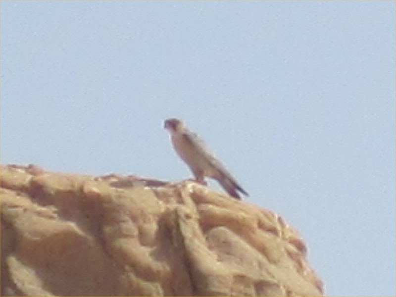
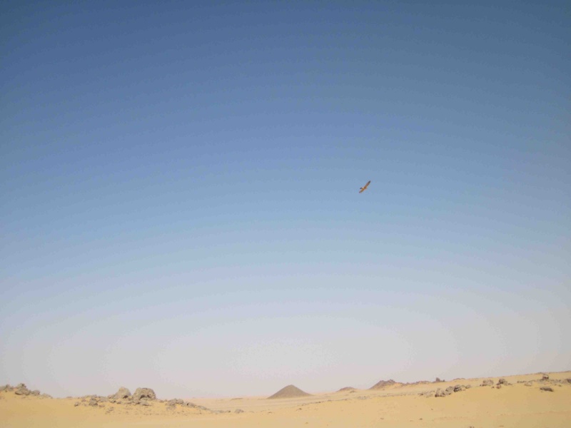
We found the rock outcrop to be in full occupation by a pair of falcons, who did not take too kindly to us intruders. They were circling and screeching above our heads for several minutes, until they gave up in disgust and moved a few hills away, awaiting the return of peace and quiet. We have seen birds of prey before, but this was the first time, thanks to Rocio, to have been able to capture them on camera in an identifiable way. They were a pair of Lanner falcons (Falco biarmicus), a species common in Northern Africa.

We spent most of midday driving up north, only pausing for lunch near the low scarp marking the half-way point. As we neared Wadi Sora, the wind finally started to pick up, and by the time we got there it became markedly cooler.
We reached Wadi Sora early afternoon, after setting camp we immediately set out to visit the main shelters. Later in the afternoon we visited the other near-by sites, including the unique engraved elephants discovered by Giancarlo Negro and party in 2005. Unfortunately someone over the past year decided that it was a good idea to mark out the outlines in chalk...

Day 10. - Wadi Sora area
Overnight the temperature dropped significantly, it was distinctly cold in the morning, Salama and Zayed were still warming themselves by the fire at the time we felt it wise to poke our noses out of the warm tents and sleeping bags. Finally temperatures were getting to a level customary for the season. I have never before experienced a week of 40+ temperatures with no wind at all this time of the year.
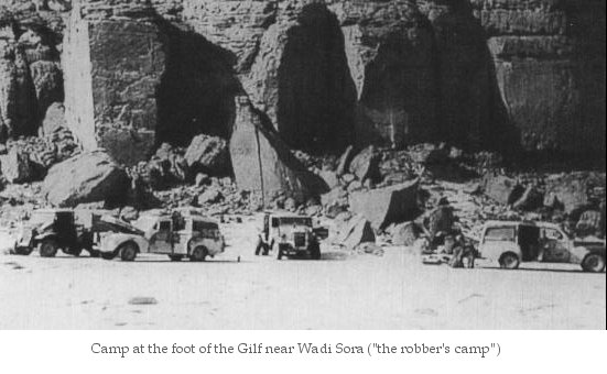
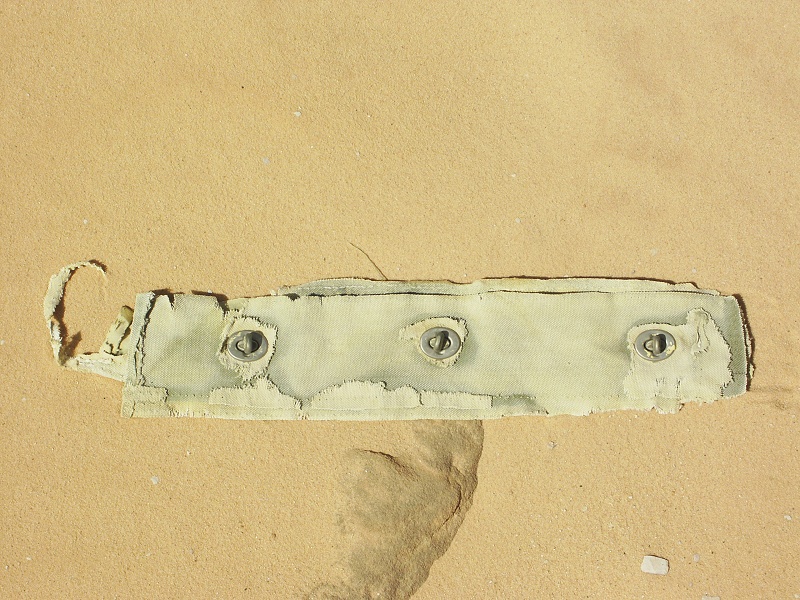
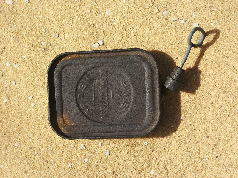
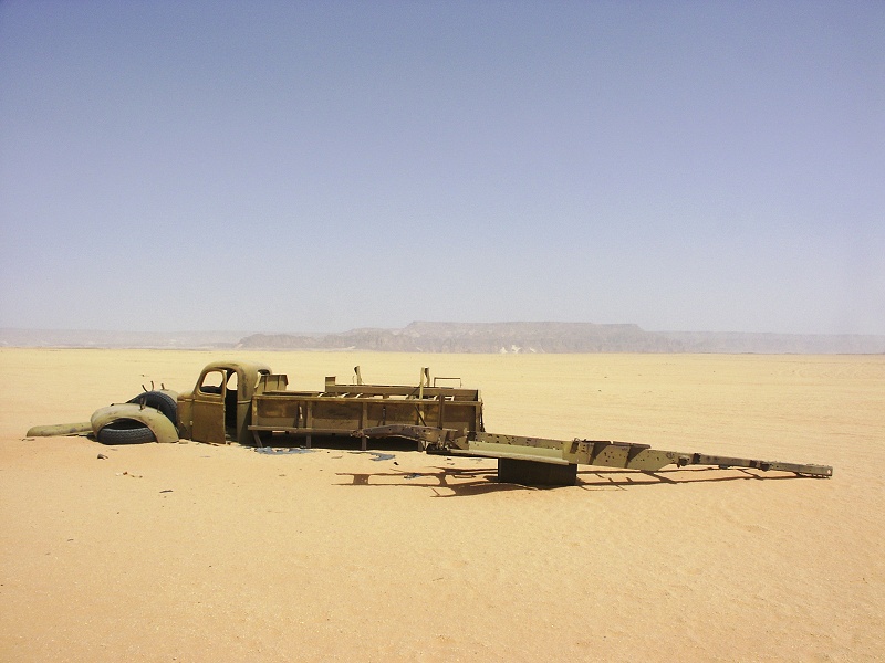
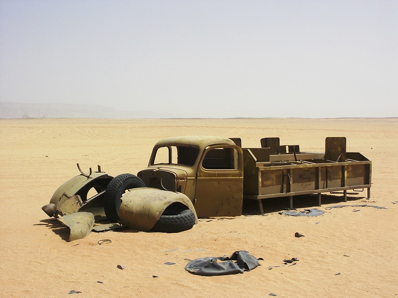
We started the day by visiting the magnificent Cave of Beasts north of Wadi Sora, then continued to another revered site, the location of Almásy's "Robbers Camp" during the Operation Salam. There was much debate on the exact location of this camp, my view being that it was very near to Wadi Sora, in the location where we found in March 2001 several german labeled tins and shreds of an Italian newspaper indicating that Almásy camped there with the Frobenius Expedition in 1933. As Almásy had a habit of returning to his earlier camping spots (just like we do), I took it for granted that this was the location of the "Robbers Camp" described in the Salam Diary. However some of the surviving photos did not match the locality, and fortunately others were more persistent than myself on this matter. The real campsite was located by Raoul Schrott and an Austrian television crew in the spring of 2009. As expected, the 30cwt Ford truck left behind ("Purzell") was no longer there, however many of it's parts were: four tyres, a battery, and shreds of its canvas cover. In addition an 1942 german jerrycan, and several tins thrown about marked the spot, which matches perfectly with the old photo.


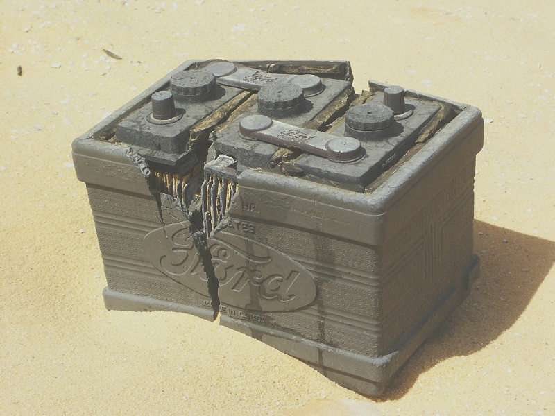
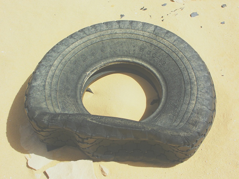
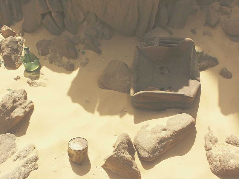
Ironically, I do recall entering this very spot several years ago in search of rock art sites. While checking out nearby shelters I do recall seeing the old tyres, but just assumed them to be from the SDF Kufra convoys. Interestingly, the remaining traces suggest that Purzell did in fact stand here undisturbed for a rather long time. The four tyres have hardened in a deflated state, that must have required over ten years. The plastic battery also cracked frow weathering, and the canvas roof was in tatters all about the clearly identifiable resting place of the vehicle. At some point in the nineteen fifties or even early sixties (coinciding with the start of oil exploration in Libya, when both the Lady Be Good and SAAF Blenheim were found) someone found the vehicle, probably without ever realizing it's history. After putting on new tires and a new battery, it appears to have been driven off merrily. There is a rumor on various internet forums about a WWII era truck having been found in the desert, with only the tires needing replacing, after which it could be driven off at the turn of the key. Perhaps this is the source of the story ? If anyone has any information, please contact me.
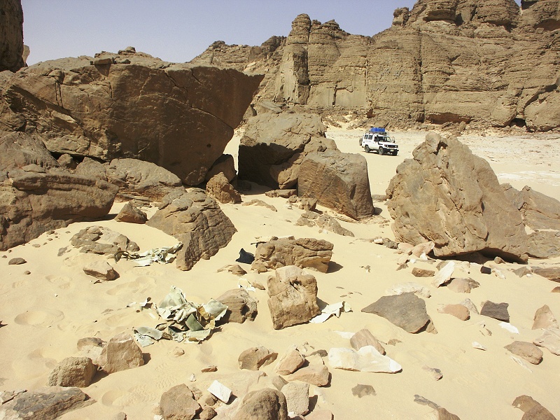

Being in the mood, we drove out to the plain to find the wreck of a WWII era Maple Leaf Chevrolet used by the SDF Kufra convoys. The site has been substantially re-arranged by someone since our previous visit in October 2005, making a rather clumsy attempt at a re-assembly.
We spent the rest of the afternoon doing the rounds about the numerous other rock art sites scattered about the Wadi Sora region.
Day 11. - Wadi Sora - Wadi Mashi (N.E. Gilf Kebir)
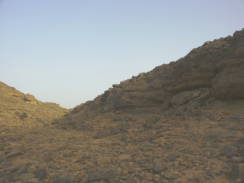
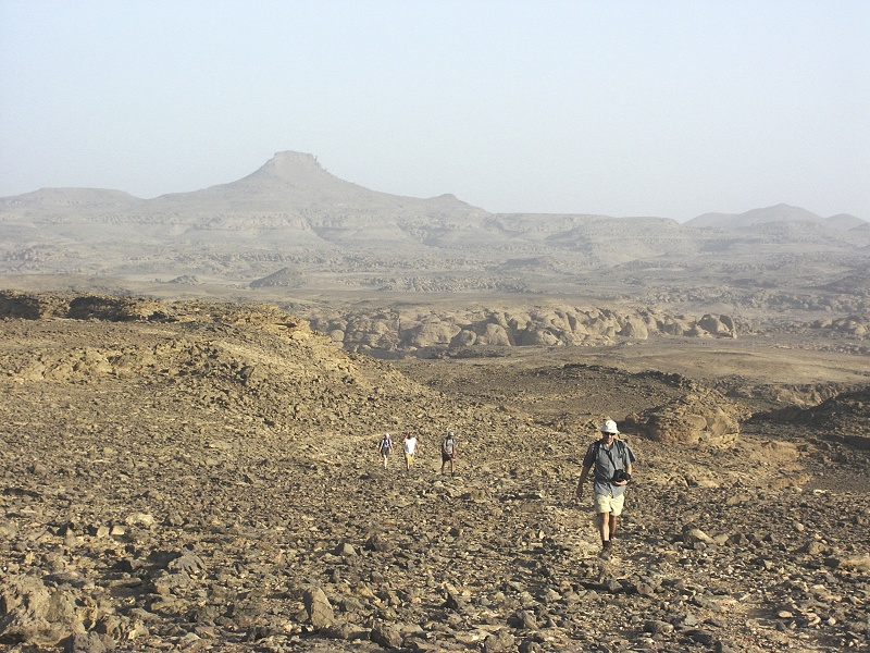
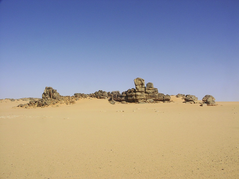
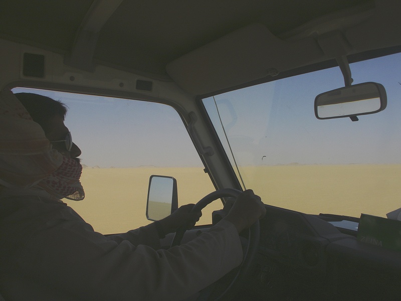
During the night the pleasant wind of the previous day strenghtened into a gale, rattling (and in one case flipping) the tents. With the wind blowing the sand, it looked like a distinctly unpleasant day ahead. We broke camp, and set off for the Aqaba pass, then beyond towards the North-Eastern corner of the Gilf. I have been eyeing a distinctly circular, crater-like feature on the top of the Gilf on satellite imagery for some time now, our objective was to visit it to figure out what it was (secretly hoping it might be an impact crater). We scaled the Aqaba without trouble, continuing north along the "Gap" in the Gilf
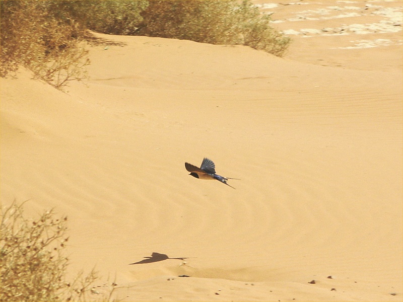
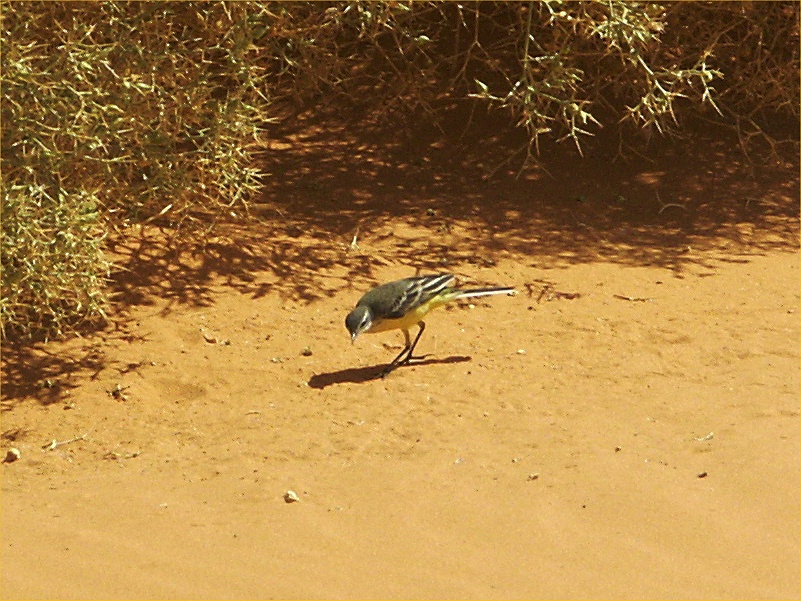
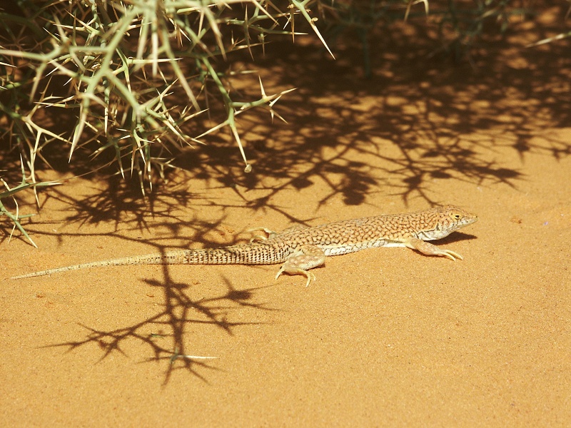
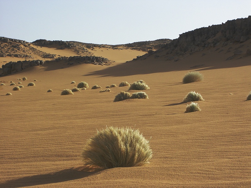
The little micro-oasis made up of Zilla spinosa shrubs at the end of a wadi runoff near the North-eastern end of the "Gap" was in full bloom, no doubt still drawing on the moisture from the 2008 winter rains. There was a swallow circling about at an incredible speed, snapping away at the flies. By pure chance I managed to take a very nice shot of it (after several dozen failed tries). There was a yellow wagtail (Motacilla flava) bird hopping about the bushes, which were also inhabited by the lizards (Acanthodactylus scutellatus)familiar from similar vegetation in Wadi Hamra.
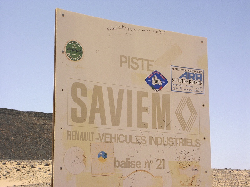
As we rounder the northern end of the South-Eastern Gilf Kebir plateau, purely by chance we hit on Balise 21 of the mid-nineteen sixties Saviem Trans-Sahara Expedition, the twin of which (No. 22) stands close to Hill With Stone Circles on Top.
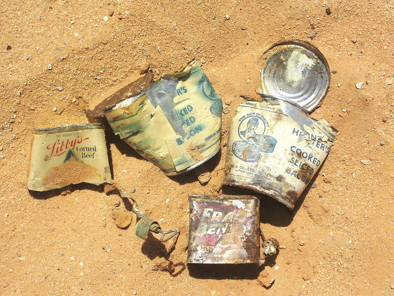
Any place exposed to the wind and blowing sand was rather unpleasant, we left the main track to seek out a spot behind a larger hill for lunch, that looked more sheltered. The weather was no better, but the detour made us chance upon an old campsite, littered with petrol tins. We found a few tins retaining their labels, from which it appears that it was an early Long Range Desert Group patrol camping here in 1940 (no other British unit or other party would have been at this spot during the time).

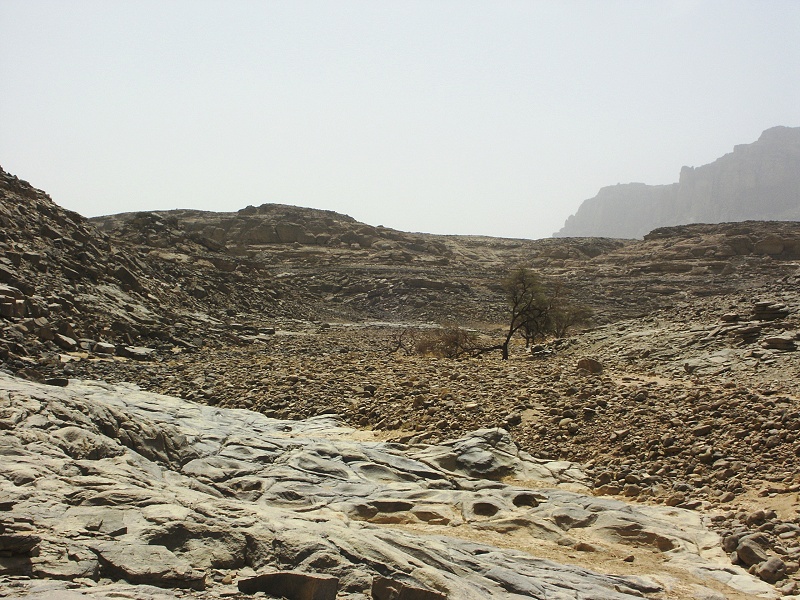
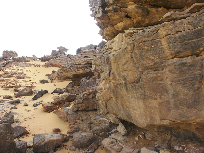
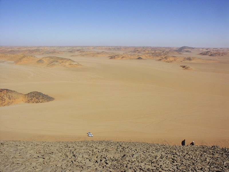
We continued to the eastern side of the Gilf plateau, and entered the northernmost of the large wadis draining the Gilf towards east, Wadi Mashi. We parked the vehicles in a southern tributary, about 1.5 kilometres from the circular feature on the plateau top, and continued on foot.
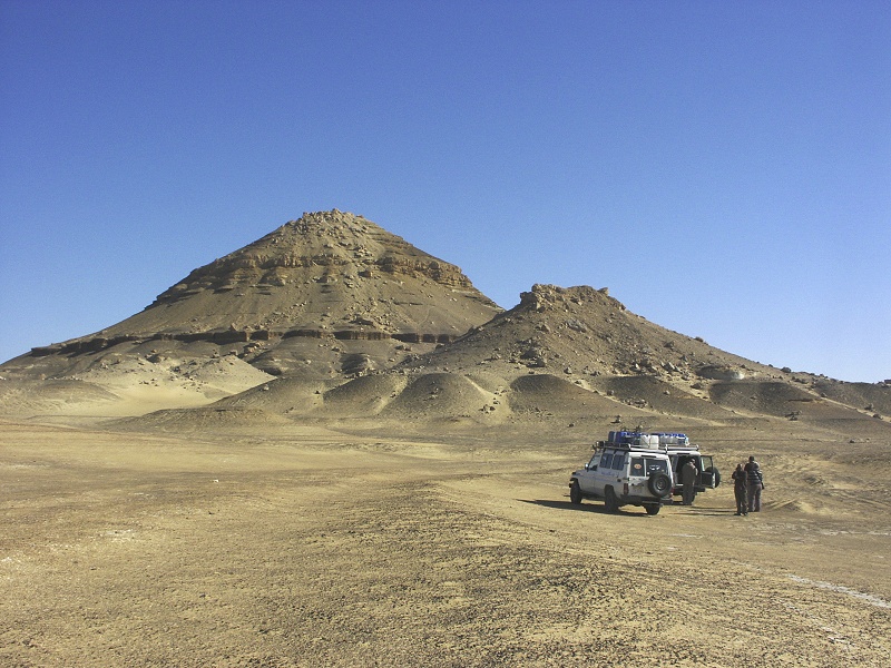
We reached the feature in half an hour. It was a shallow circular basin, with a rim made pout of low sandstone outcrops. Along the rim, we found numerous fragments of fused sandstone that was obviously molten by some intense heat source. On reaching the centre of the crater, the source was evident in the form of a low eroded basalt dome. It was yet another tertiary volcanic feature, certainly not of impact origin.
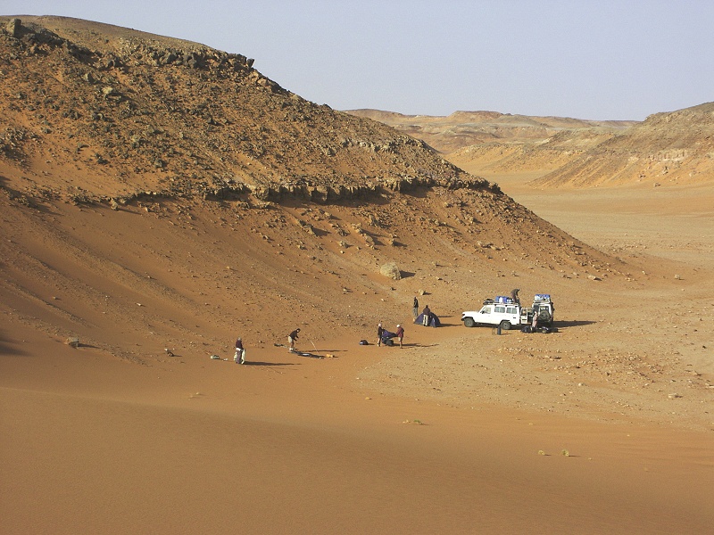
After returning to the cars, we continued deeper into Wadi Mashi, primarily to look for a suitable camping spot sheltered from the stong northern wind. There weren't many choices, the wadi being rather flat and featureless, we finally settled in a small side wadi with some vegetation, where a ridge provided a little shelter.
After sunset the temperature dropped to a level requiring all our warm clothes, which have been lying unused in our bags. By the time the evening bar opened, it was no more than about ten degrees, an incredible change from just two days ago.
Day 12. - Wadi Mashi - Dakhla
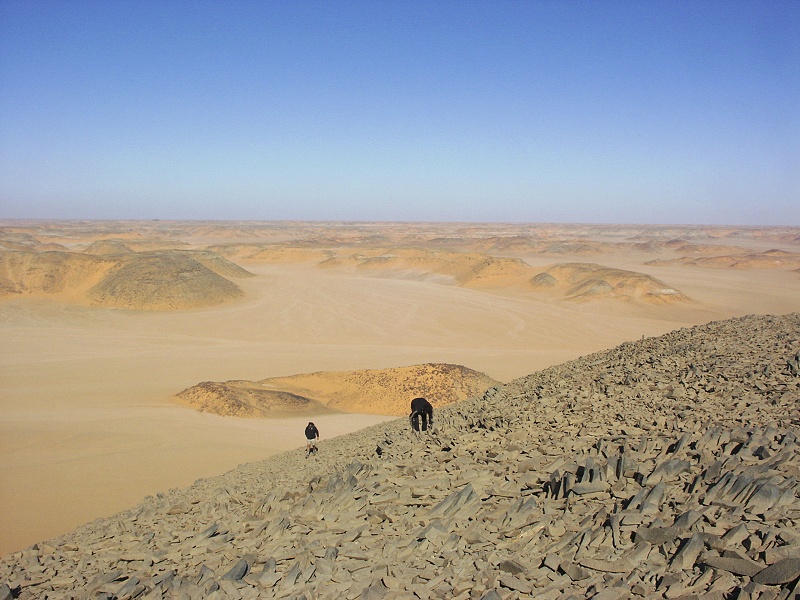
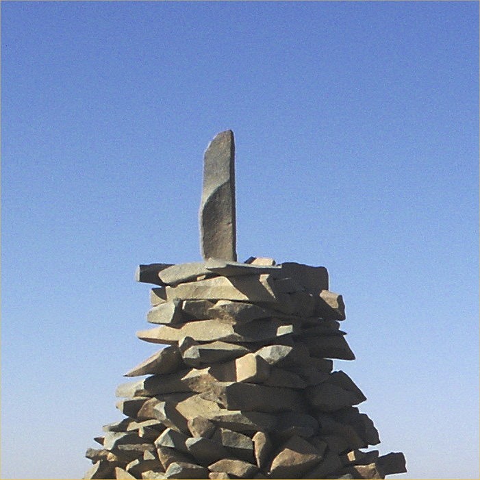
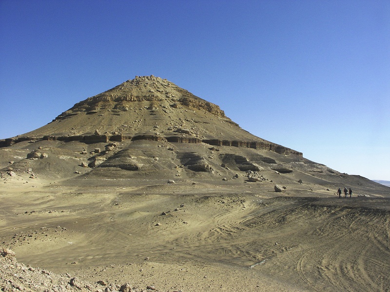
We awoke to a freezing cold morning, the thermometer registered only four degrees. We waited for the sun to rise to be able to do anything at all, soaking in the warmth like lizards. After breaking camp, we drove back along the wadi to a large conspicious basalt hill along it's southern side, where a large conspicious cairn was visible for a great distance. The thought to ascend the hill was spurred both by curiosity, and the need to warm up our frozen limbs with a little climb. The cairn we found on the top was a very well built one, with a large vertical block of basalt on the top. It was very clearly a surveying cairn, not unlike those built by Patrick Clayton elsewhere. However this cairn is unlikely to have been made in the nineteen thirties. Clayton did not survey in this area, and the cairn is not marked on the 1942 edition of the Survey of Egypt map (all other surveying points have at least the elevation marked, but most prominent cairns are also labelled). The conclusion was that it must be of a later date, however there was no note or any other clue as to it's construction.

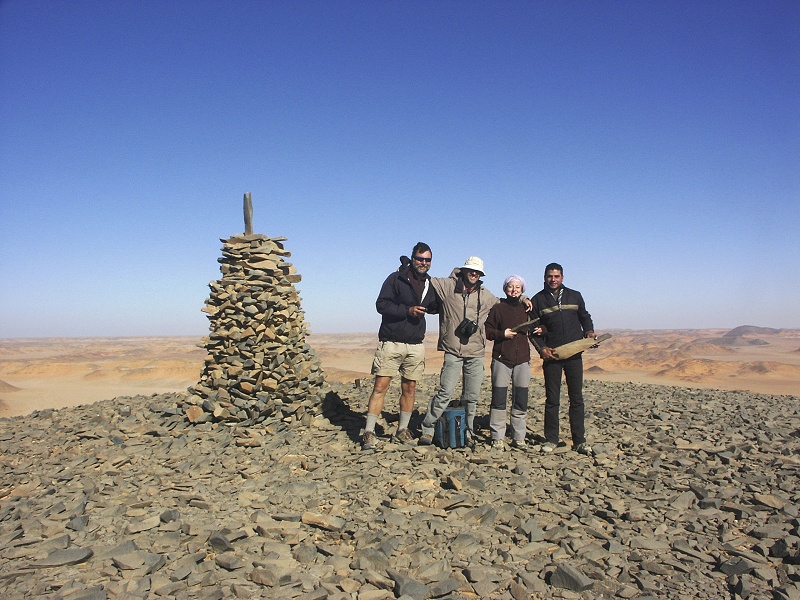
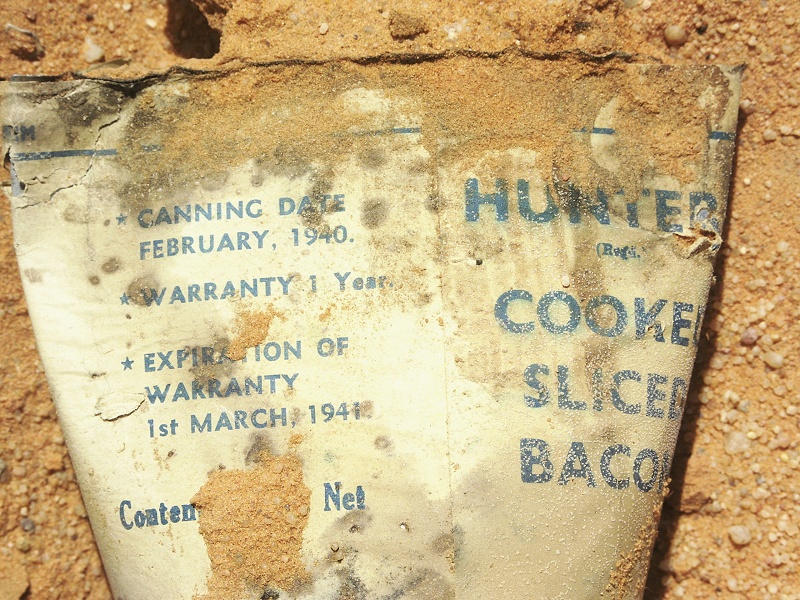
Update: The mystery of the Cairn was solved a months and a half after our return by Alan, who carefully read the recent update on Carlo Bergmann's website, and found a reference to a cairn at the beginning of Wadi Mashi that fit the one we have seen perfectly. Carlo Bergmann, with an amazing memory recalled seeing a similar looking cairn on a photo published by Richard Bermann in his book (Zarzura, die Oase der kleinen vögel, Zurich, 1938) describing the 1933 spring Almásy-Penderel expedition in which he took part. Opposite p.16 there is a page of photos of expedition members, including one of Hugh Penderel with a large cairn in the background. Looking at the full resolution details my photos and the one in Bermann's book, the match is perfect. The arrangement of the corner stones is identical, as is the upright slab, though it has been twisted from it's original alignment. Clearly this cairn was built by the 1933 expedition as a triangulation point, however as this expedition did not do any surveying in an "official" capacity (that was Clayton's job...), their results were never copied on to the Survey of Egypt maps.

We continued east to Hill With Stone Circles on Top, and the adjacent dry lakebed wih the magnificent pink yardangs. By the time we reached there, the wind strengthened to a raging sandstorm, it was hardly possible to walk facing the wind, not to mention doing anything else. After a brief spot we continued, seeking a more sheltered spot for lunch, however none were to be found. Doing the quick math, it was feasible to reach Dakhla by the evening, though that would have meant forfeiting a side trip to Djedefre's Water Mountain, the pharaonic outpost that before discovery of the inscription of Mentuhotep II at Jebel Uweinat, was the deepest known Ancient Egyptian locality in the desert. After a quick vote, most of us agreed that spending a miserable night out in this sandstorm is just not worth it, so we started out back towards the tarmac and Dakhla. We only stopped at Abu Ballas, where we fueled the cars and took our group photo braving the blowing sand before continuing.
As we drove for the next couple of hours the storm showed no sign of weakening, we reached Dakhla with it's comforts of a hot shower and a potential cold beer around sunset knowing that we have made the right choice.

Day 13. - Dakhla Oasis - Baharya Oasis
In the comforts of the Mebarez Hotel we have discussed our options, and decided to move slowly north stopping at sights along the way, and if possible camp in the White Desert at Farafra, or if the weather proves to be still unpleasant, we can continue to spend the night in a Bahariya hotel.
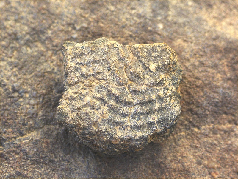
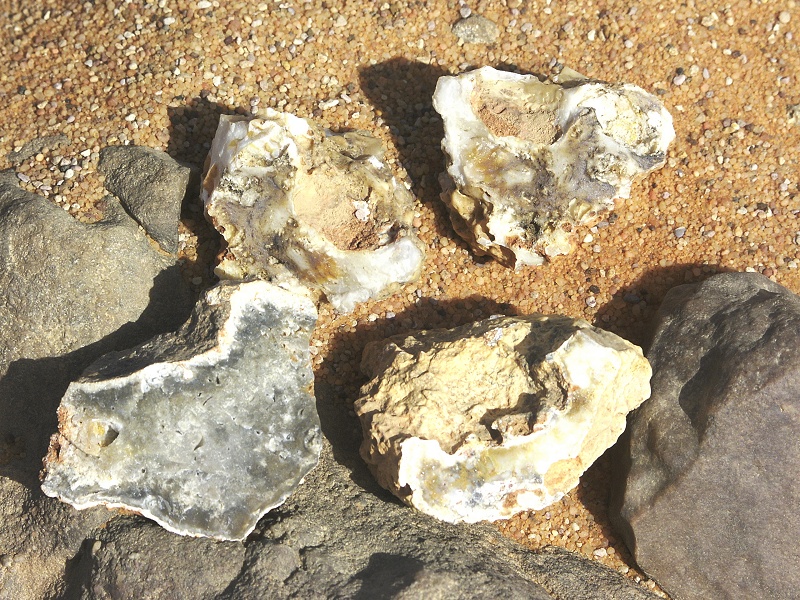
After visiting the medieval town of El Qasr in northern Dakhla, we continued towards a spot on the road about half-way between Dakhla and Abu Mungar, where we have found fossils before during a brief stop. The Dakhla cliffs are upper cretaceous / lower paleocene (one of the type sections of the K/T boundary), and one layer branches off and may be continued for several kilometres to the west as the low Ammonite Scarp, first mentioned by the Rohlfs Expedition. This same formation exists near the Farafra-Dakhla road, if one knows where to look. We stopped for a couple of hours, and did find a couple of ammonite fragments (mainly Libycoceras ismaeli) among the incredibly numerous large oysters (Exogyra overwegi).

In the afternoon we continued north to the White Desert. On reaching it, it was pretty evident that the conditions are no better than the day before. We quickly decided to move on, looking incredulously when passing the dozens of tourist packed vehicles coming the opposite way from Baharya to spend the night at the White Desert as part of their "desert adventure". In Baharya we found a very comfortable new hotel that beat the prospect of spending a night in tents in a sandstorm on all counts.
Day 14. - Baharya Oasis - Cairo
We had nothing left but to drive to Cairo, so we decided to visit Jebel Disht at the North-western end of Bahariya Oasis, the location of the famed dinosaur fossils of Bahariya. While the area is very picturesque, in the hour or so we spent there, we have not seen even the tiniest fragment of fossil bone, we only found a rather meagre collection of small oysters.
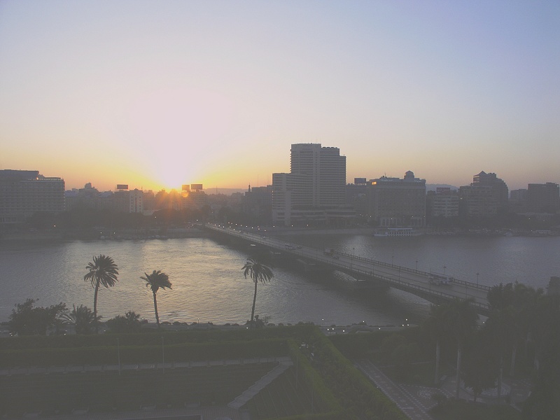
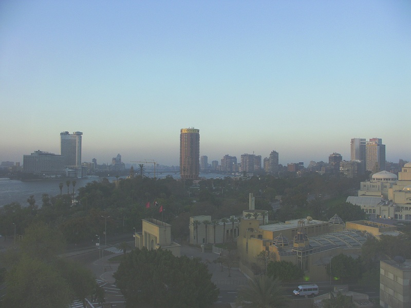
We left Bahariya around noon, getting in to Cairo and the civilised world of the Novotel by late afternoon. Next morning I was able to watch the sun rise over Cairo from my window before taking the flight home.