
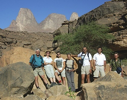
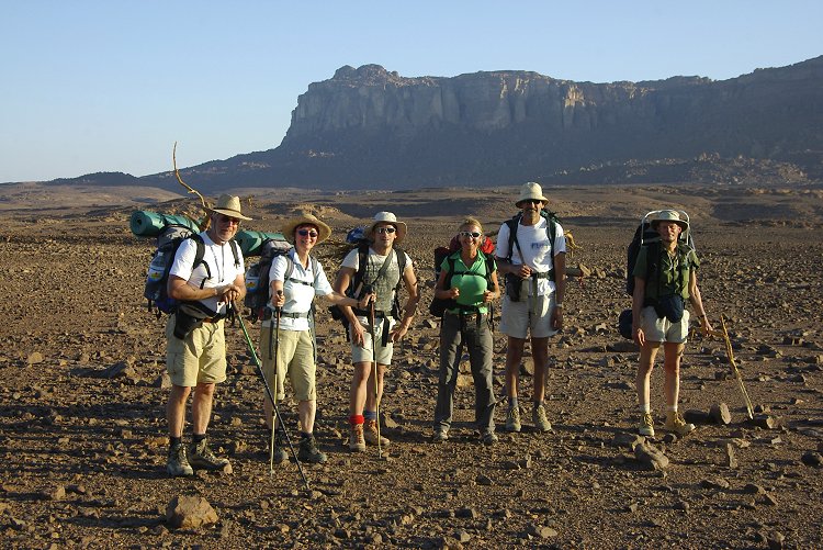
 Click on image for list of participants |
Jebel Uweinat - Gilf Kebir Expedition, Egypt 20th October - 4th November, 2007 |
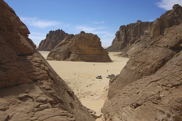
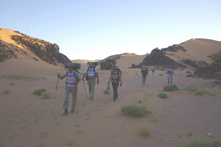
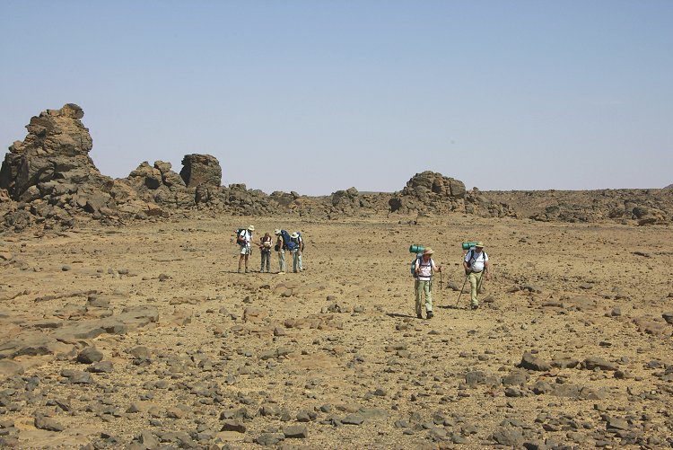
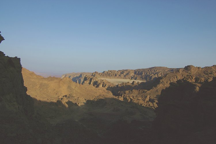
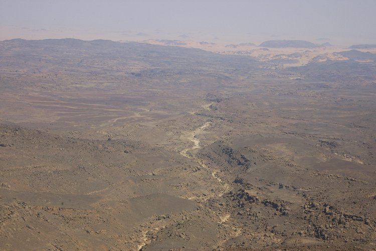
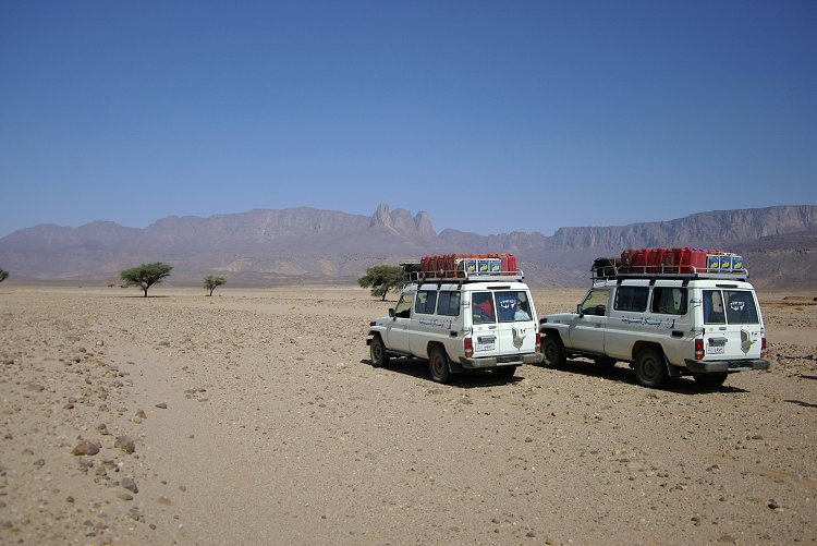
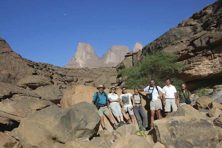
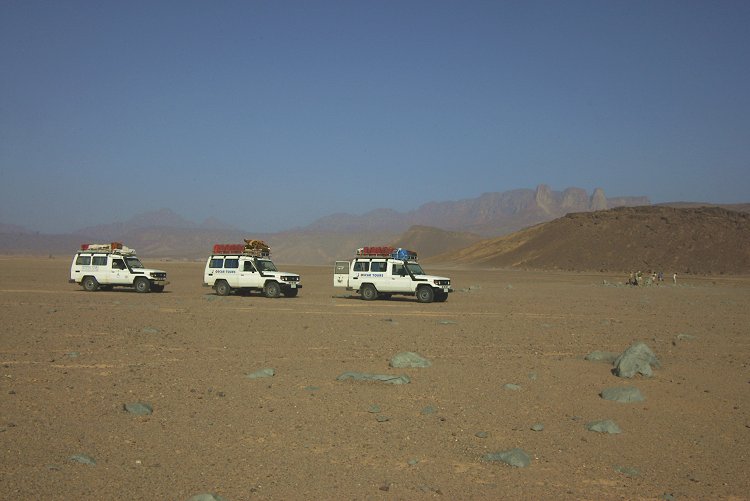
Day 1 - 2. - Cairo - Dakhla - Selima Sand Sheet
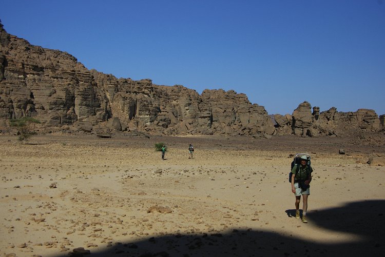
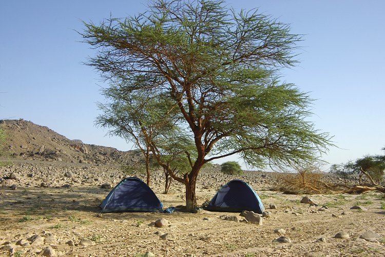
Our first day was spent with the long drive from Cairo to Dakhla, with two short pit stops at Baharya and the cafeteria at Abu Mungar. We made excellent progress on the 2nd day, managing to cross the Selima Sand Sheet and round the southern tip of the Gilf, camping among the granite lumps in the northern part of the "Unnamed Plateau", an area never before visited.
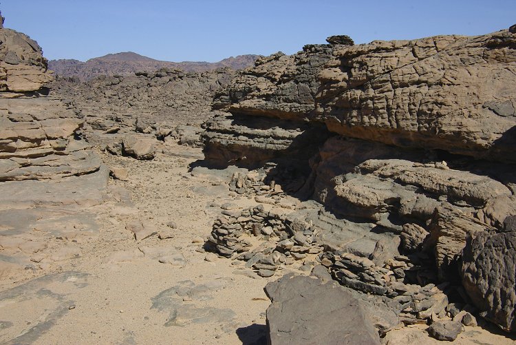
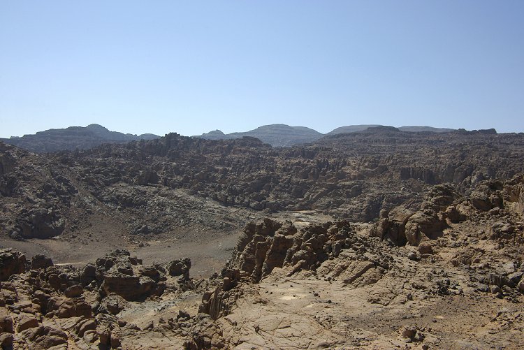
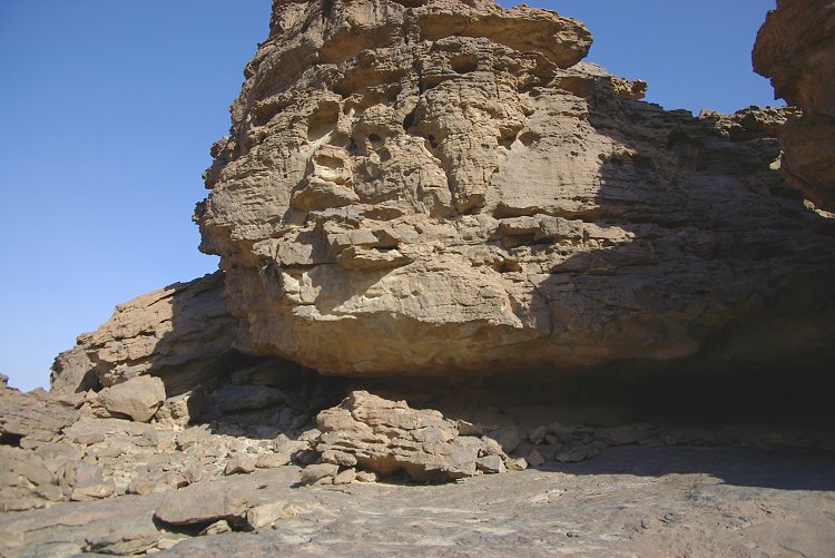
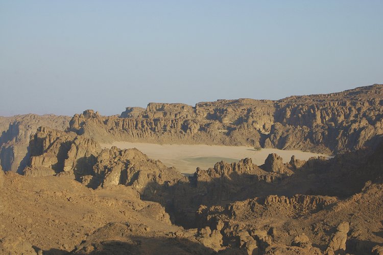
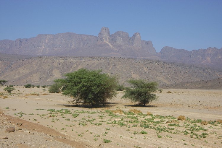
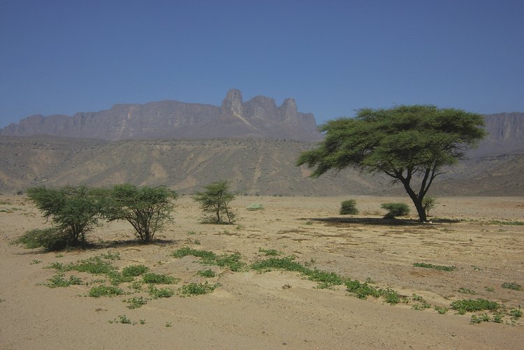
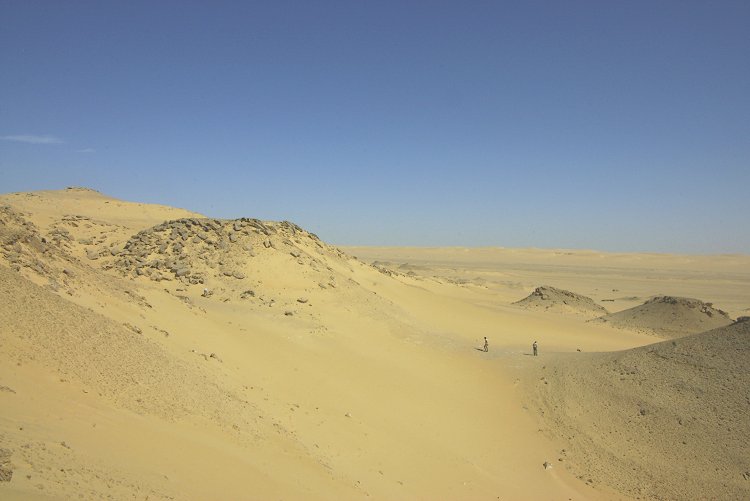
Day 3. - "Unnamed Plateau" - Wadi Sora
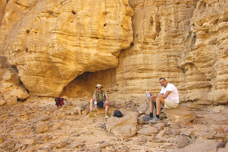
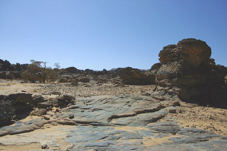
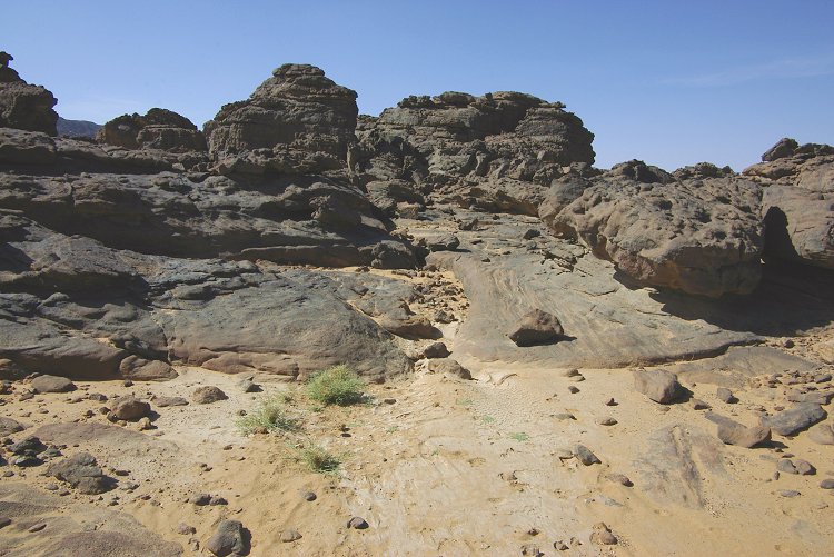
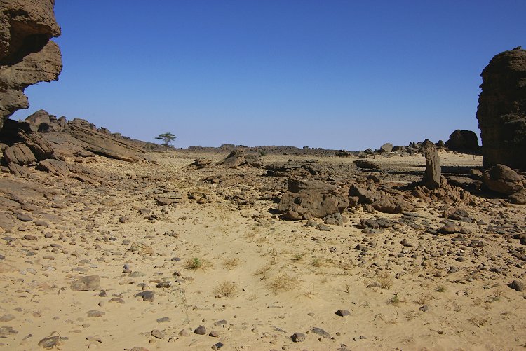
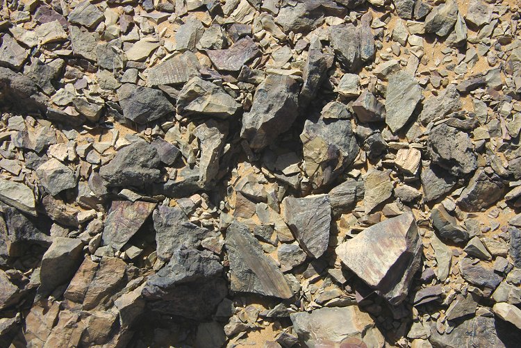
Before start we explored the vicinity of our camp, aside a beautiful landscape littered with granite boulders we found nothing of interest. Unlike other areas of the "Unnamed plateau", we saw absolutely no trace of any ancient human presence.
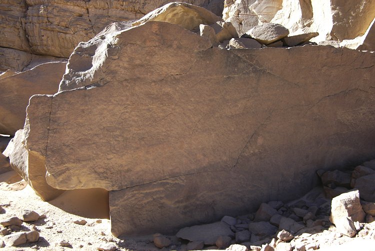
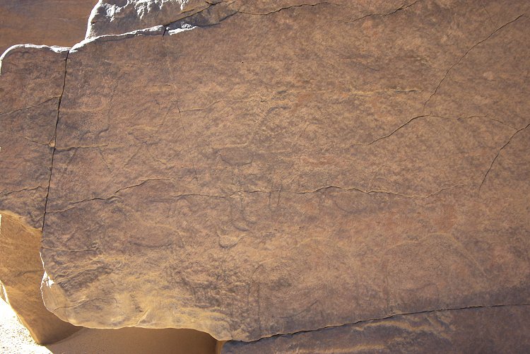
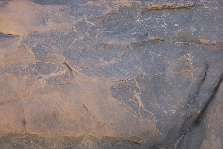
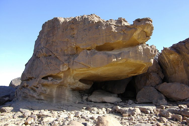
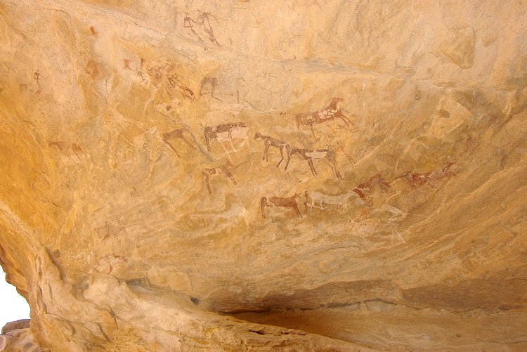
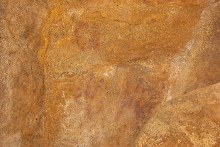
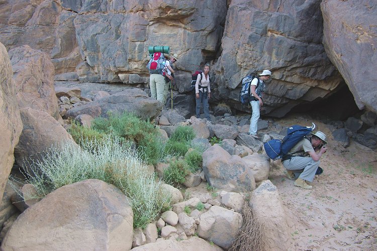
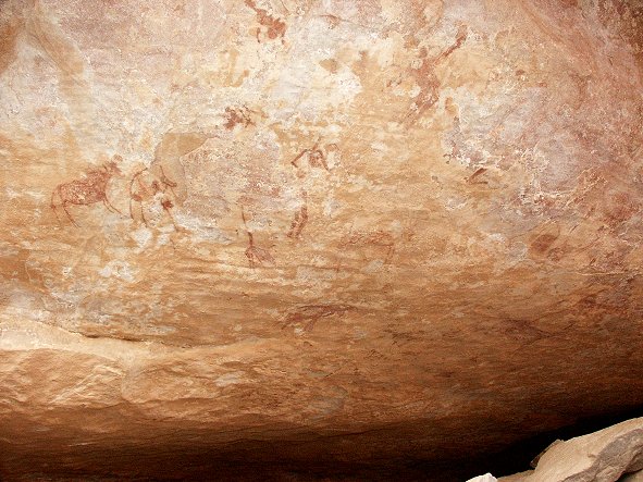
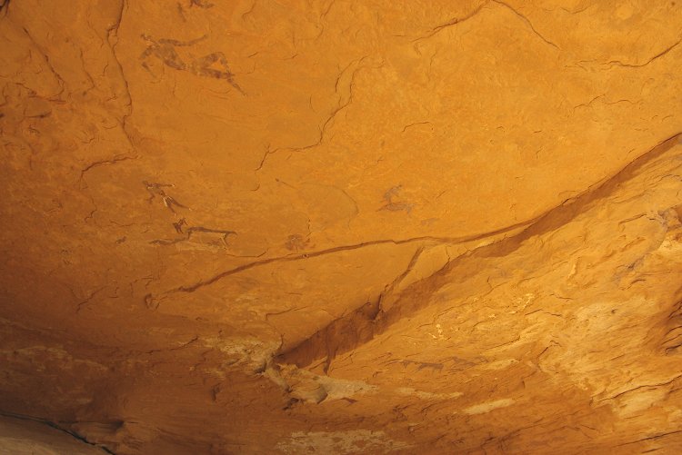
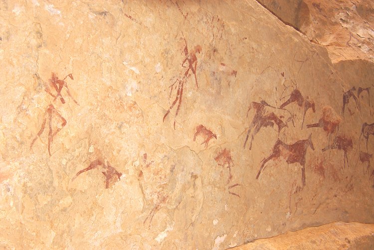
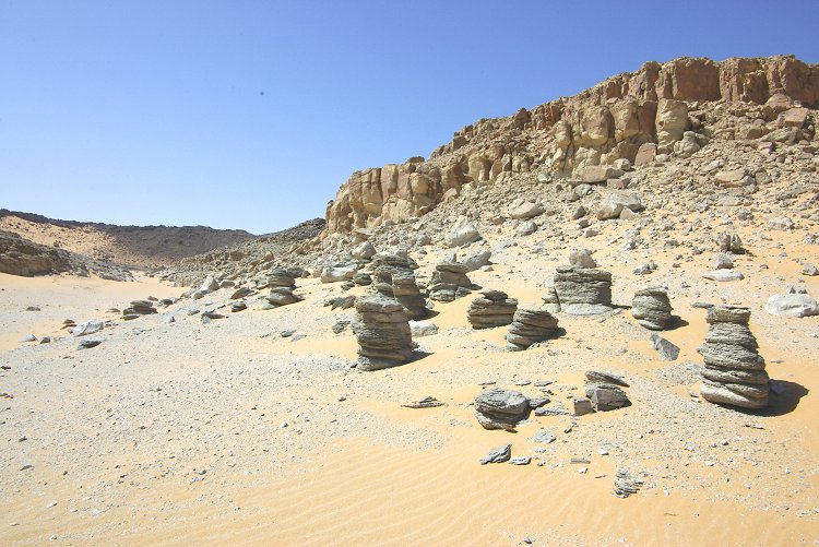
With the early start, we reached Wadi Sora well before noon, and spent the day visiting the major sites, and locating the two newly discovered sites, including the fine panel of engravings with two elephants, reported by Giancarlo Negro in the past issue of the Sahara journal.
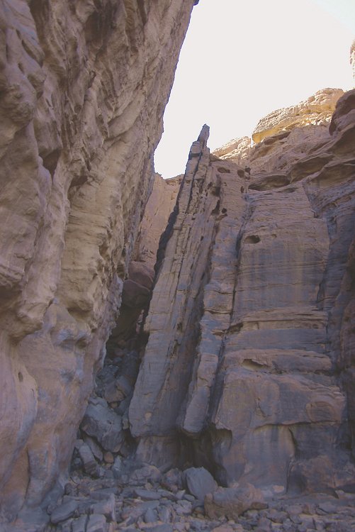
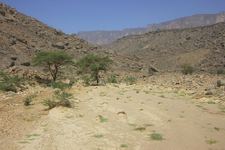
Day 4. - Wadi Sora - Wadi Handal
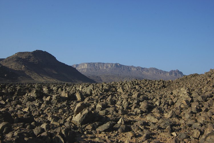
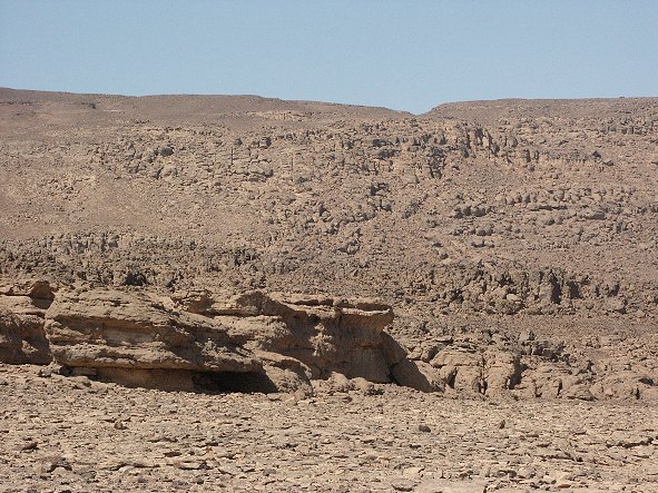
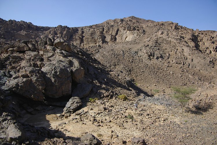
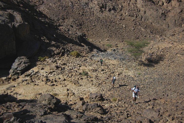
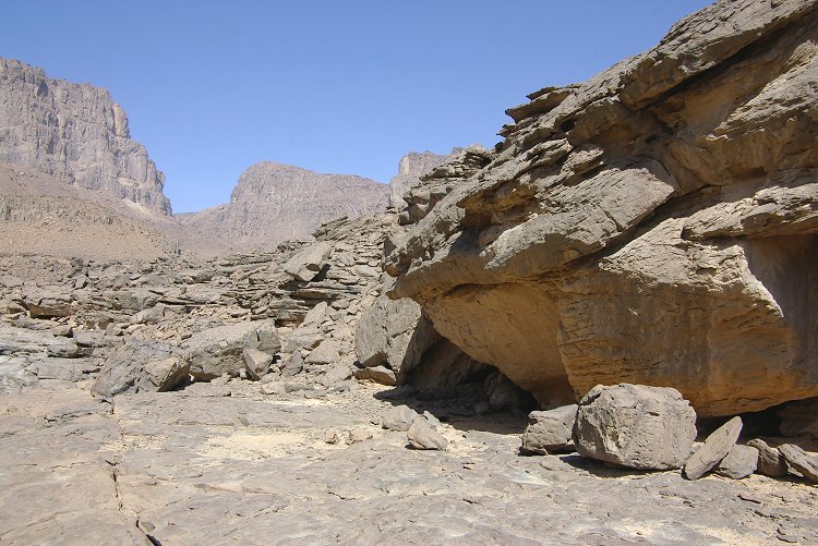
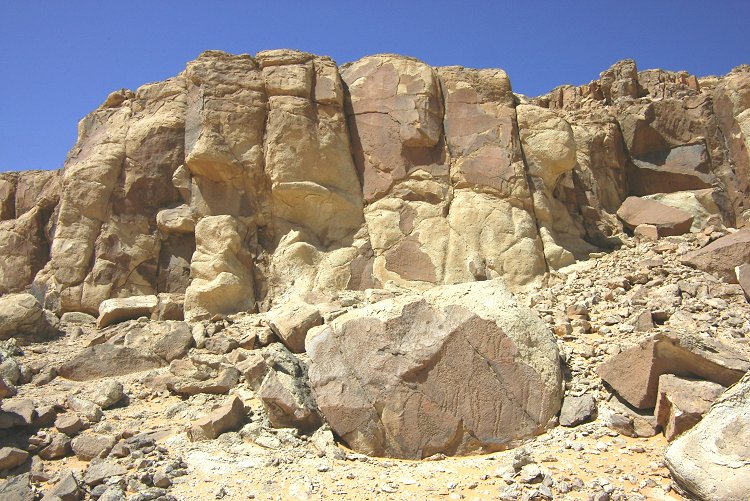
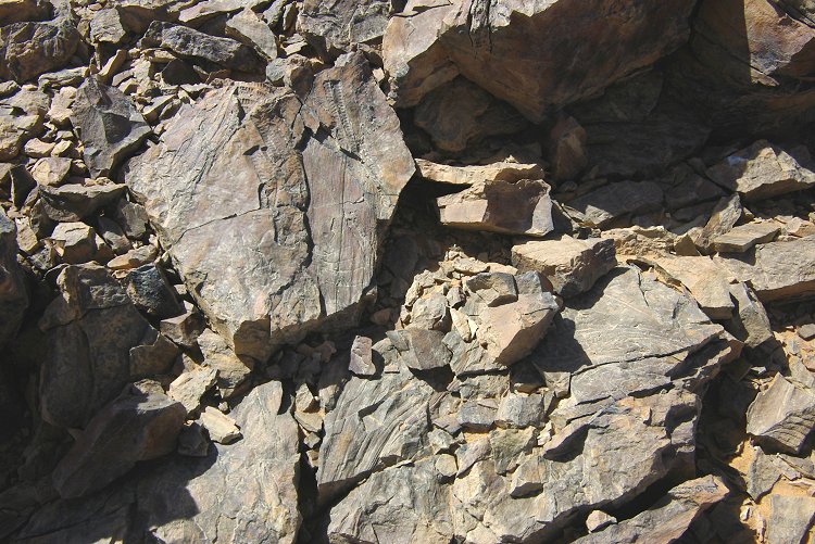
On our way to Uweinat, we explored some remote wadis draining the western cliffs of the Southern Gilf Kebir, east of the Aqaba pass. The country leading up to the cliffs was very rough, filled with the rubble washed from the plateau top. It was very slow and difficult going, and we found nothing of interest in any of the wadis or on the plateau top.

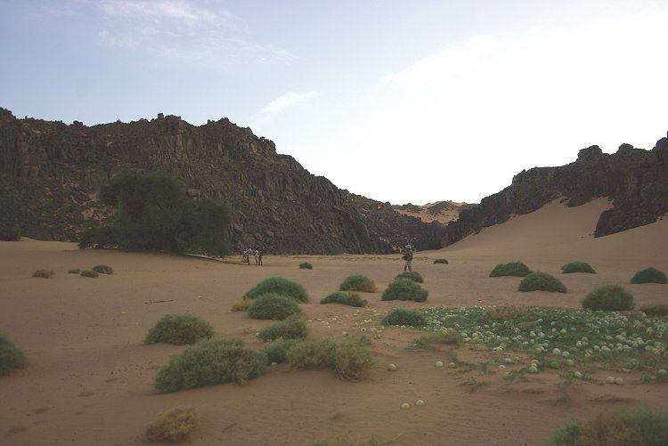
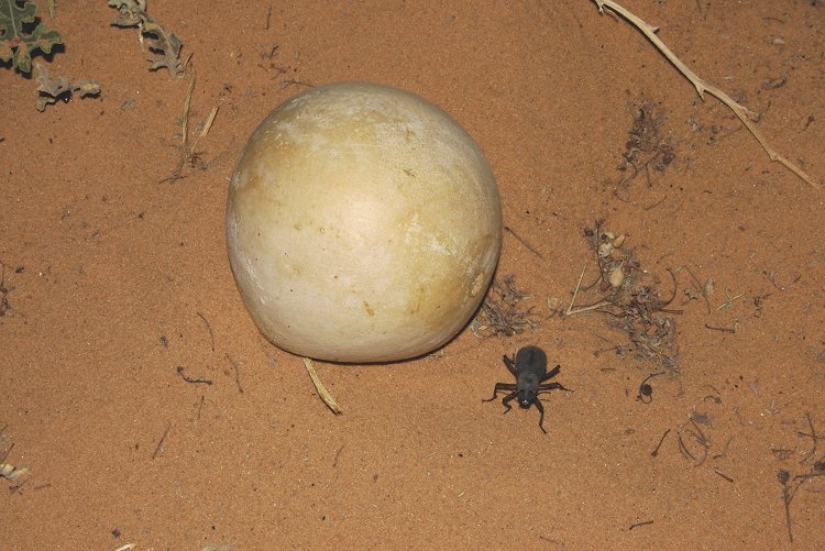
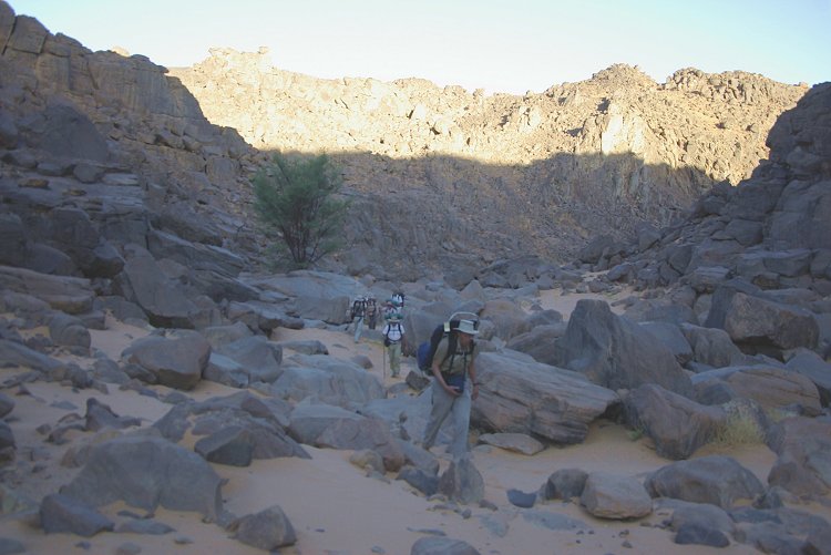
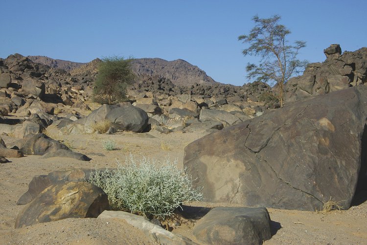
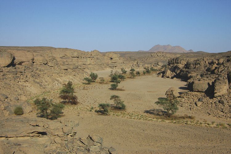
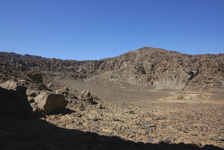
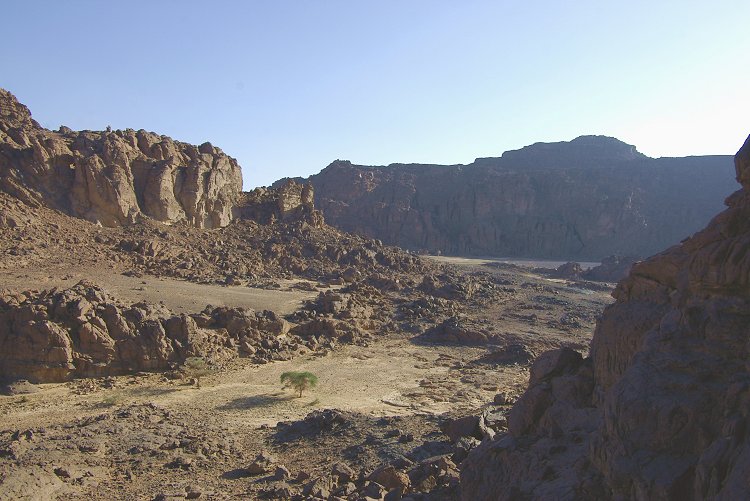
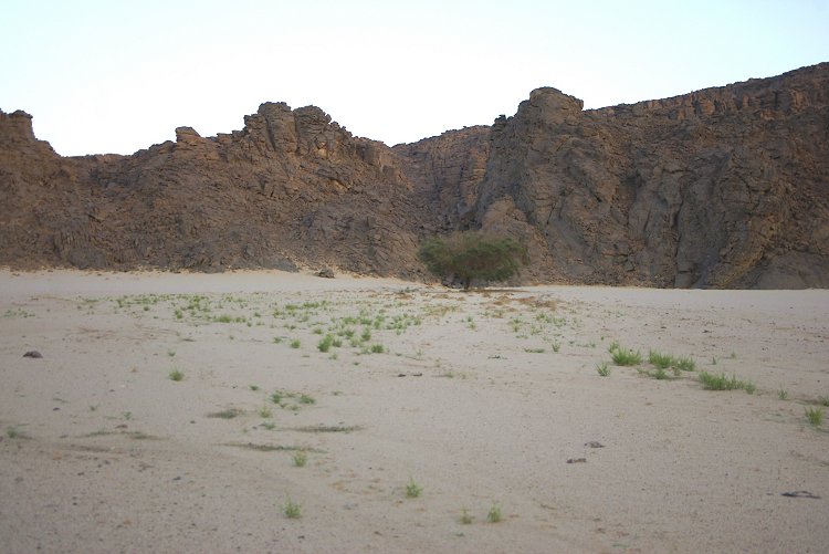
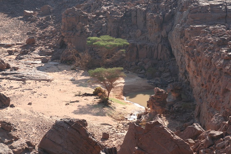
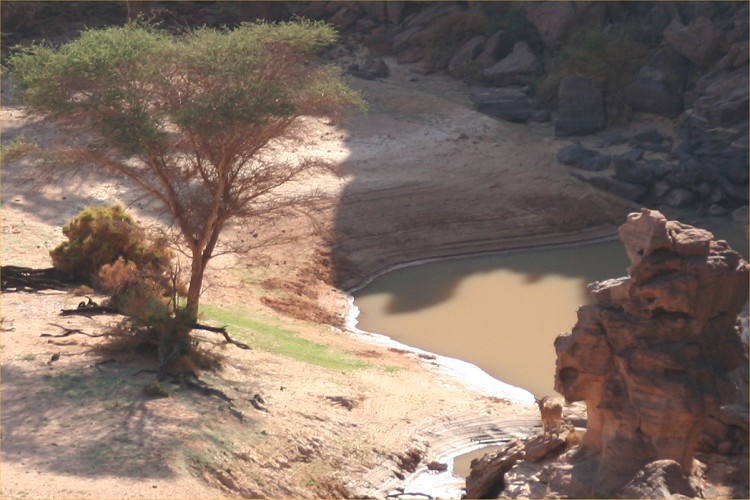
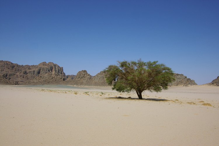
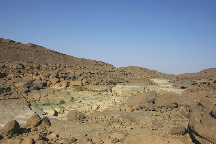
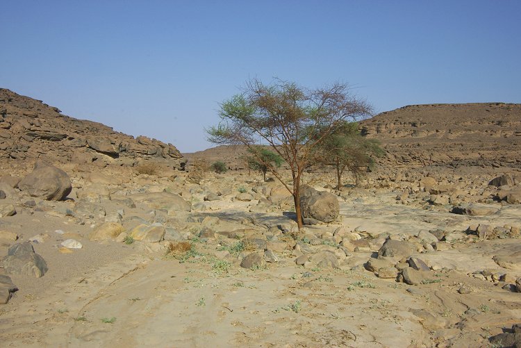
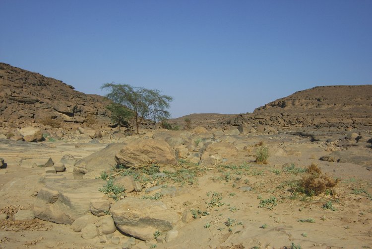
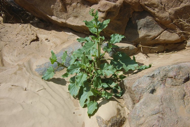
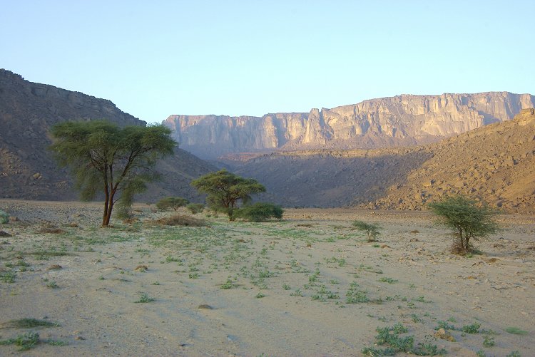
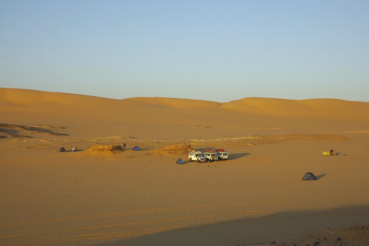
In the afternoon we continued to Uweinat, camping in Wadi Handal. To our amazement, the valley was still green, the large Crotalaria thebaica shrubs thriving, and many of the colocynths still bearing fruit.
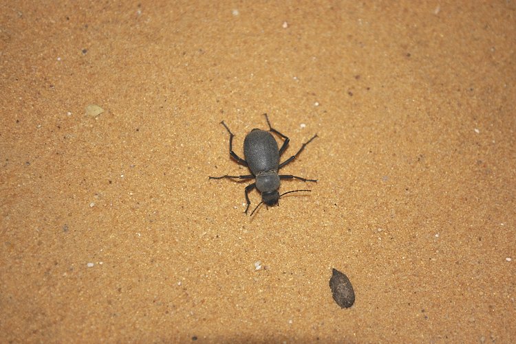
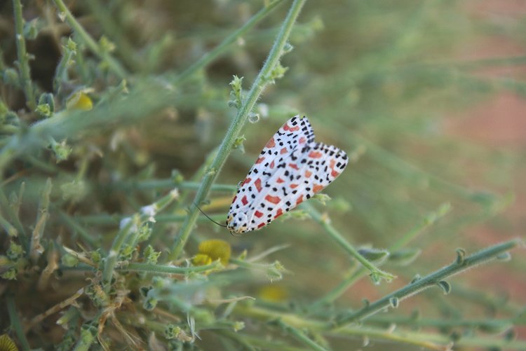
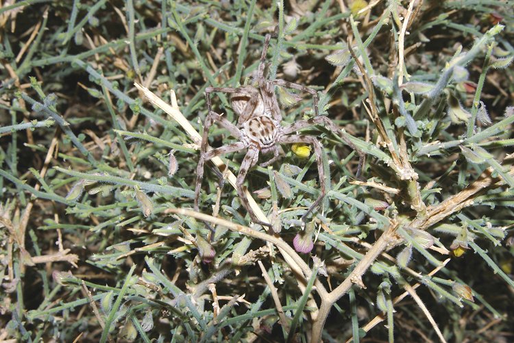
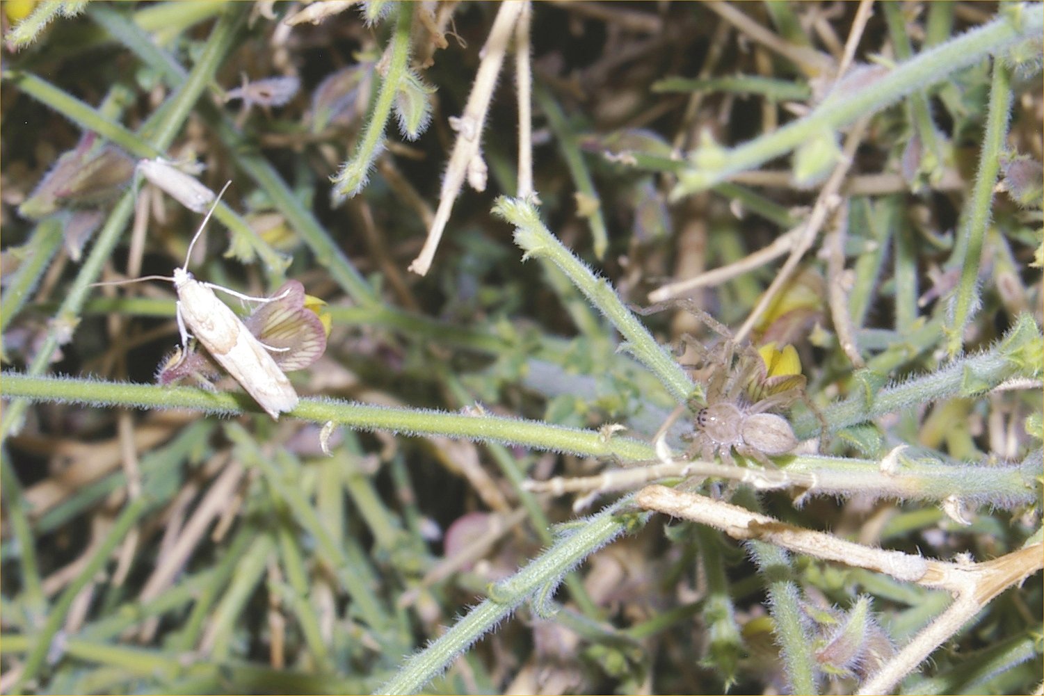
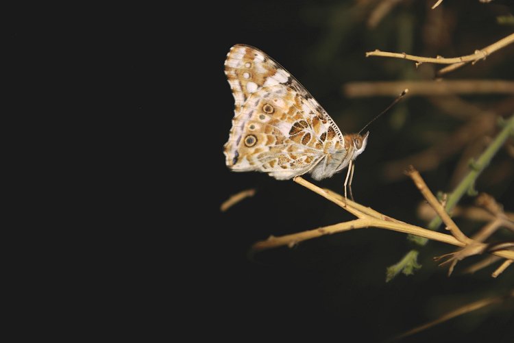
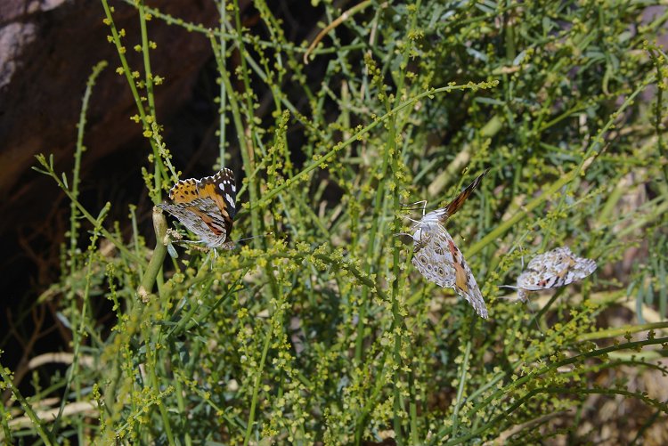
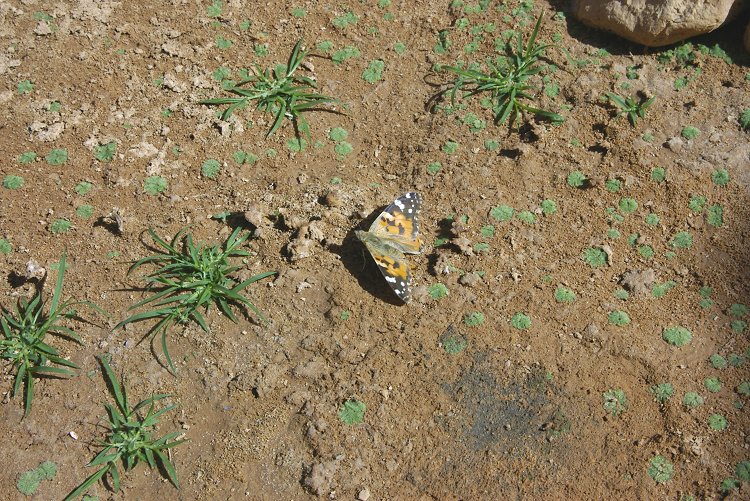
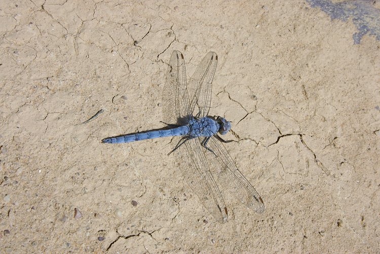
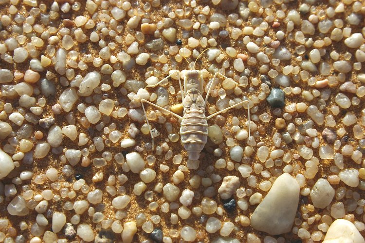
After dusk the shrubs were thriving with life. Large black beetles (Trachyderma hispida) were everywhere, and the colourful moths first seen a year before (Utetheisa lotrix) were plentiful about the shrubs. A single Julodis fimbriata jewel beetle was seen on an acacia. We have also noted several other yet unidentified moth species, and a few Vanessa cardui butterfies sleeping on the Crotalatria shrubs. On these same shrubs several adult and juvenile Sparassus dufouri spiders were lying in wait for their prey.


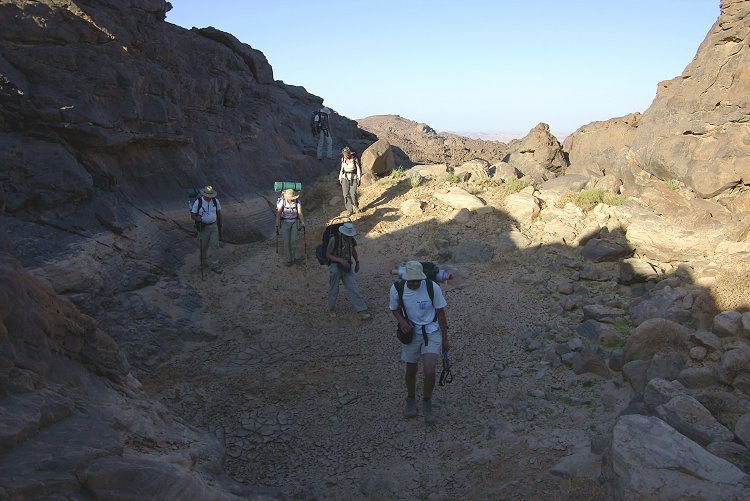
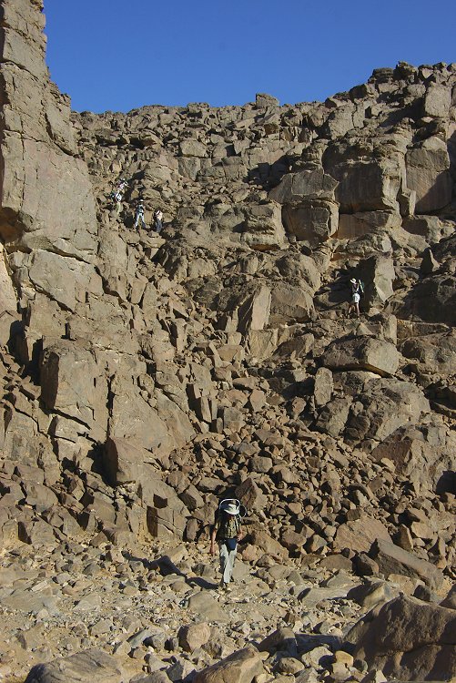
Day 5. - Upper Wadi Handal
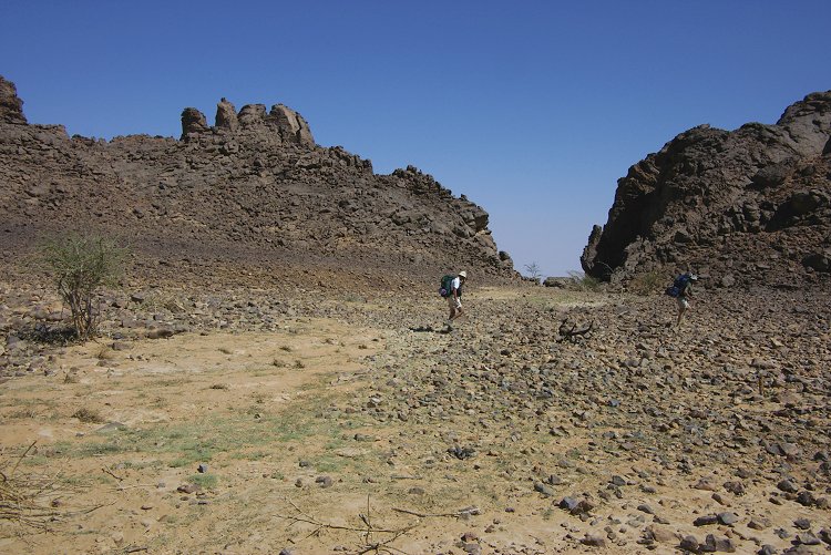
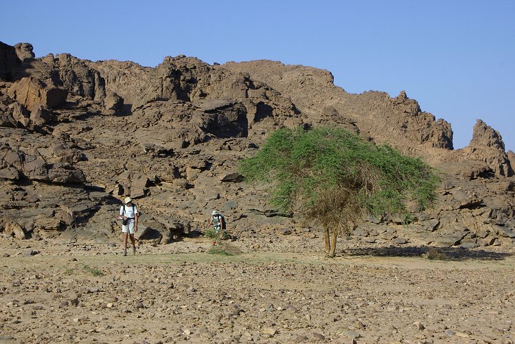
At dawn we set out on the first of our treks to the upper parts of the mountain. Our objective was to explore the upper (south-west) areas of the Wadi Handal basin, as satellite imagery indicated several promising areas for rock art. As we climbed up to the broad flat sandy basin in the middle section of the wadi (the limit of the explored area) we noted that much of the vegetation that sprang up after the 2005 rains were still green.

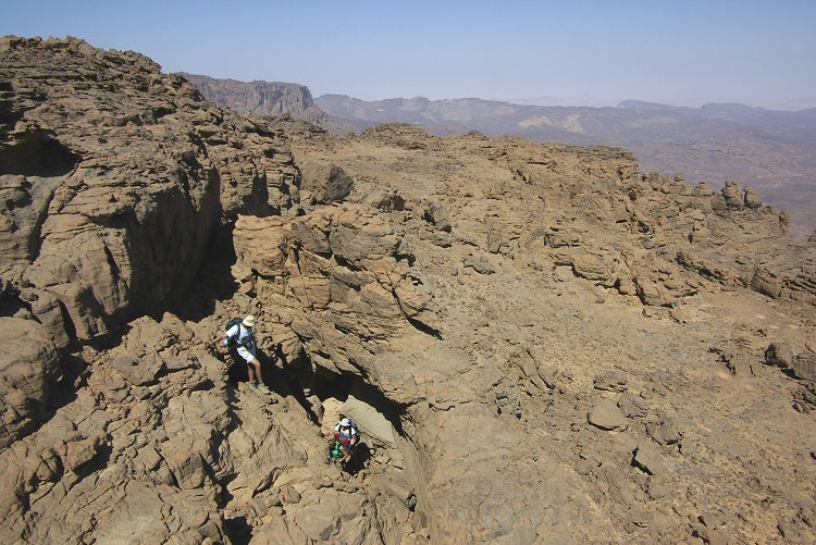
We climbed the cliffs bordering the south-west edge of the basin along the main watercourse. On the top, we found a flat rocky area with no rock art, but several little stone huts dating from the tibou times.

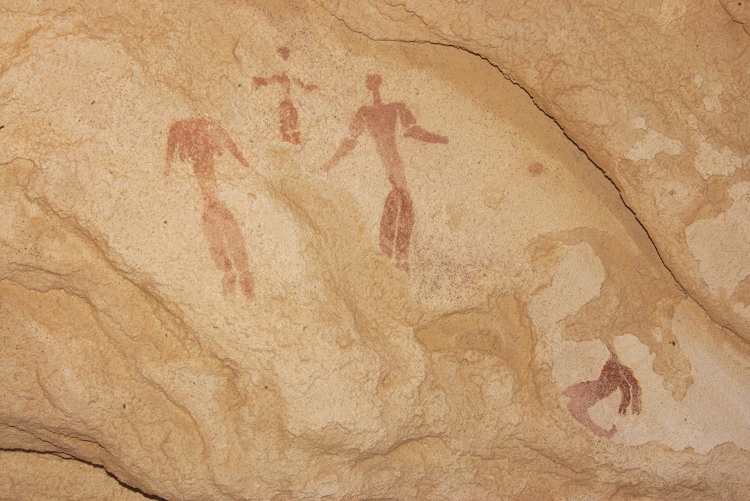
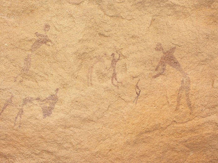
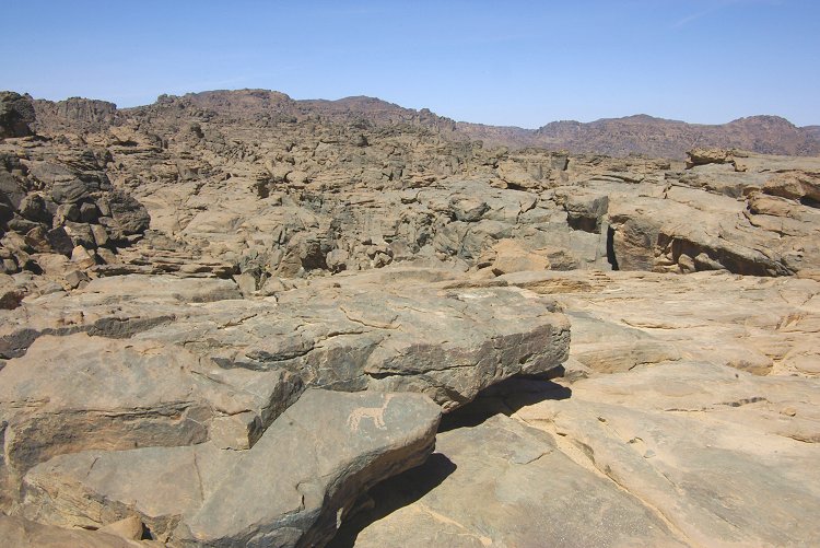
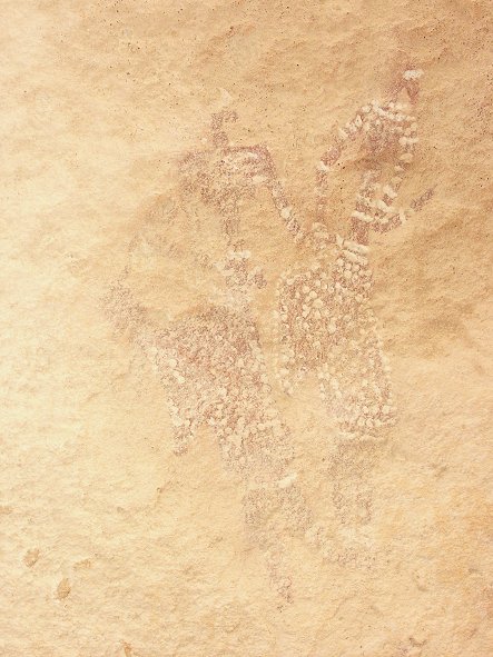
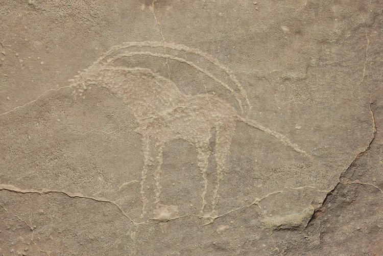
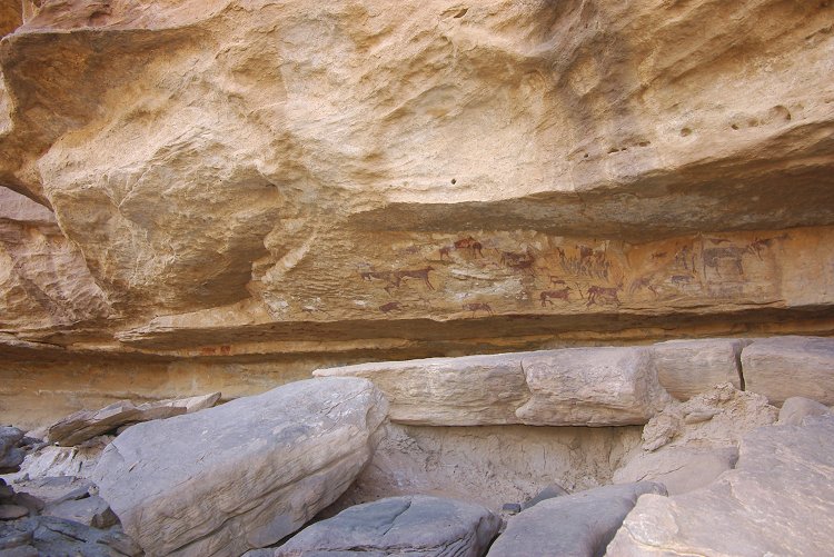
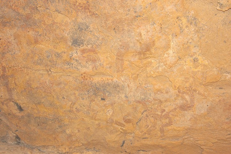
We continued upstream in the main watercourse, and after a bend we came upon a low shelter that contained some very fine paintings of small human figures. Further upstream, we found numerous rocks with engravings. All the rock art sites were associated with large basins in the valley floor where water would collect after a rainfall.
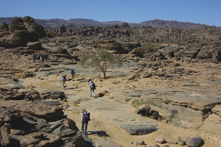

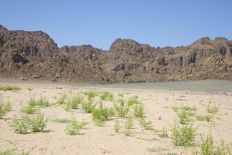
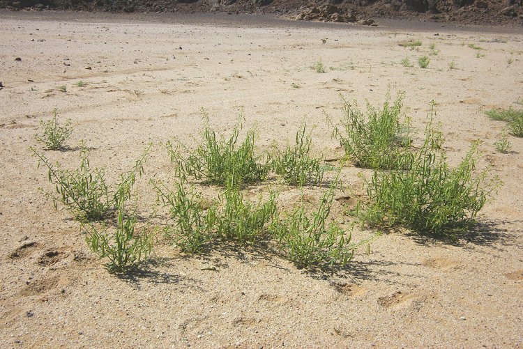
We explored the main valley upstream till the area we reached by taking a different route with Liz and Jon in November 2004. At this point we turned to the west, towards a broad broken rocky area flanking the upper courses of Wadi Handal where several promising rock clusters were noted on satellite imagery. As we moved upstream in a small shallow watercourse, we saw the first unmistakable signs of recent rainfall - fresh growth consisting mainly of Euphorbia granulata and Boerhavia coccinea.
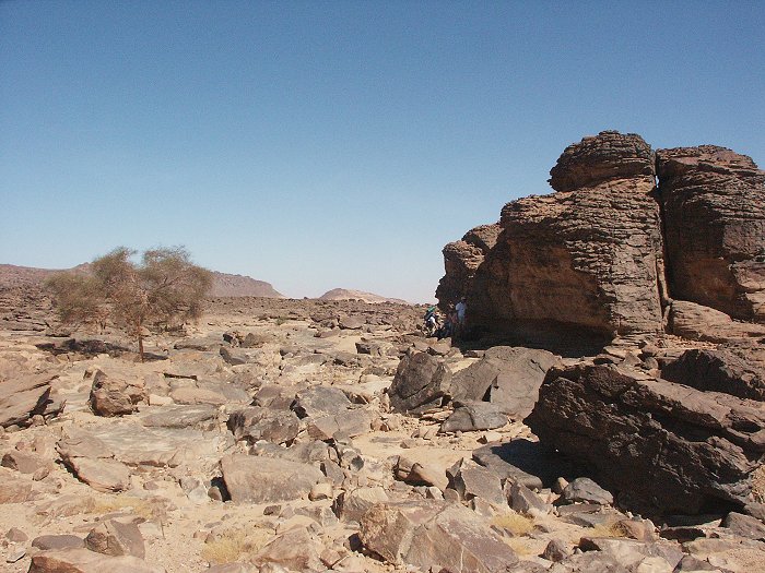
In one of the areas selected for detailed exploration we did come accross a large shelter under an isolated lump of rock, which contained very fine paintings of the cattle herder period, and on an adjacent wall a series of positive handprints. In the maze of rocks surrounding the site there are probably many more shelters waiting to be found, we shall certainly return to this area on a future expedition.
As we progressed further upstream in the little wadi, there were many more signs of the recent rain. Fresh vegetation sprang up practically everywhere where water would have been left standing after the runoff. We bivouced in a small flat area in the upper reaches of the wadi.

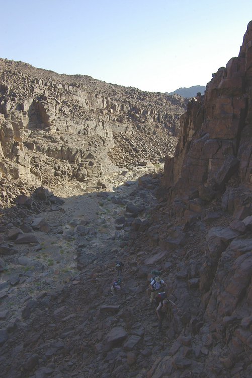
Day 6. - Upper Wadi Handal - upper Karkur Talh
In the morning we continued exploring the area, and soon came up on a shelter with some paintings of the cattle period. A thorough search of the area will probably yield some further sites, this time we needed to move on to reach the main valley of Karkur Talh by the afternoon, where our cars were waiting.

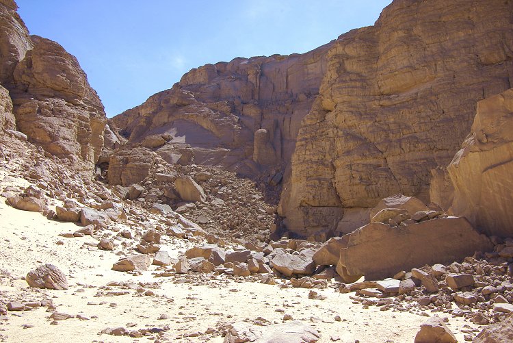
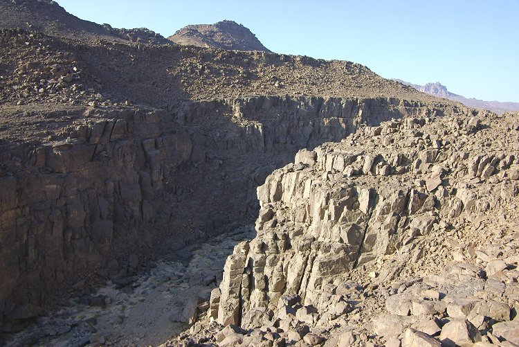
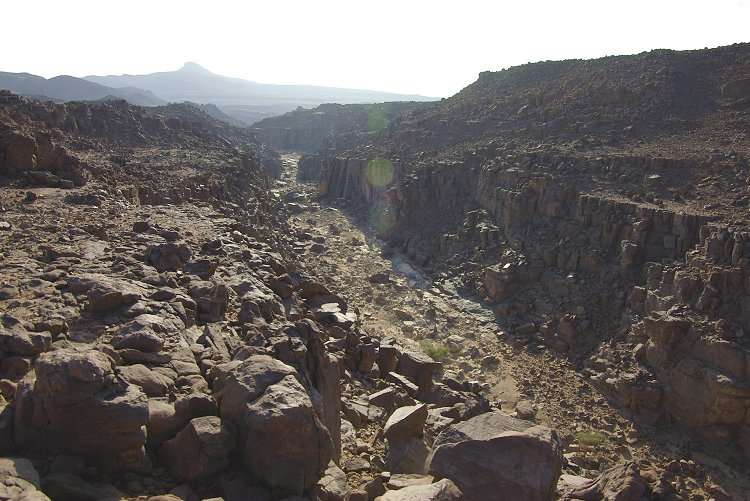
After crossing some very difficult rocky area, we crossed the deep canyon of upper north-western Karkur Talh. It contained much green vegetation, some apparently from the rains of 2006, but some clearly recent growth.


On our way back, we have explored another rocky area to the west of the main valley which was identified from satellite imagery. There were numerous shelters and plentiful signs of past human habitation, however the consistency of the rock was very bad, any paintings that may have been present have long since flaked off. However up on the high plateau above, in a rather unlikely place we did find a single shelter with two unusual human figures painted on the ceiling.
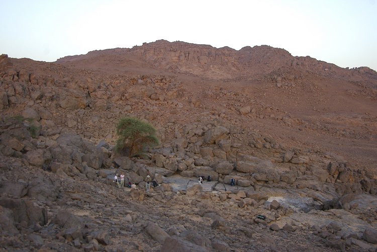
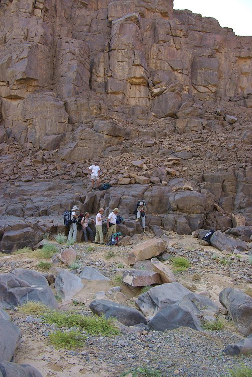
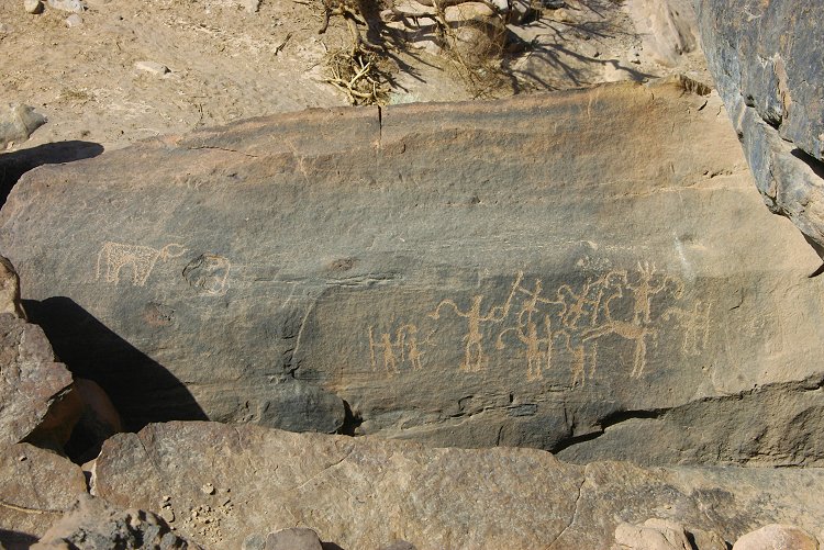
We reached the Belgians' sites in Karkur Talh by late afternoon. As always, there was something new to see - some months ago Mahmud Marei has re-located a fine panel of engravings photographed by the 1967 Belgian expedition. It was in a most unlikely place, very close to the main painted shelters, but on an almosi inaccessible ledge, facing upwards. We have walked just below it countless times previously without expecting to find anything up there.

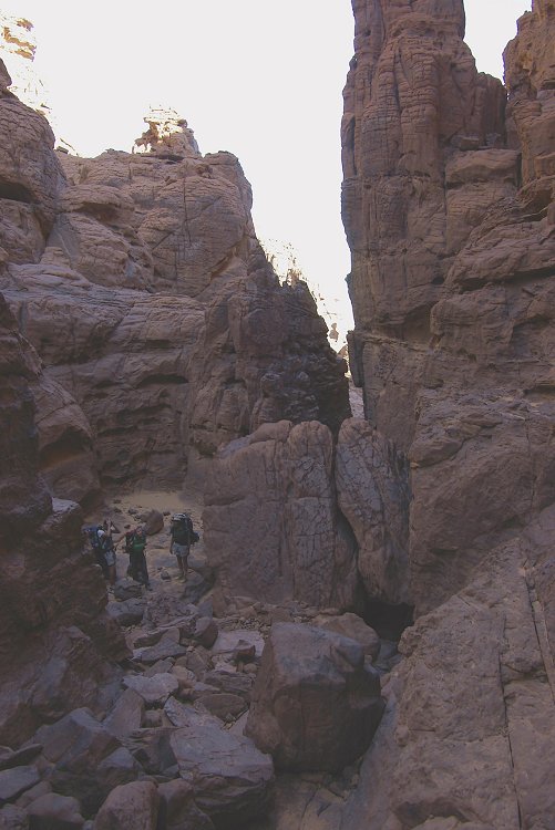
Day 7. - Karkur Talh
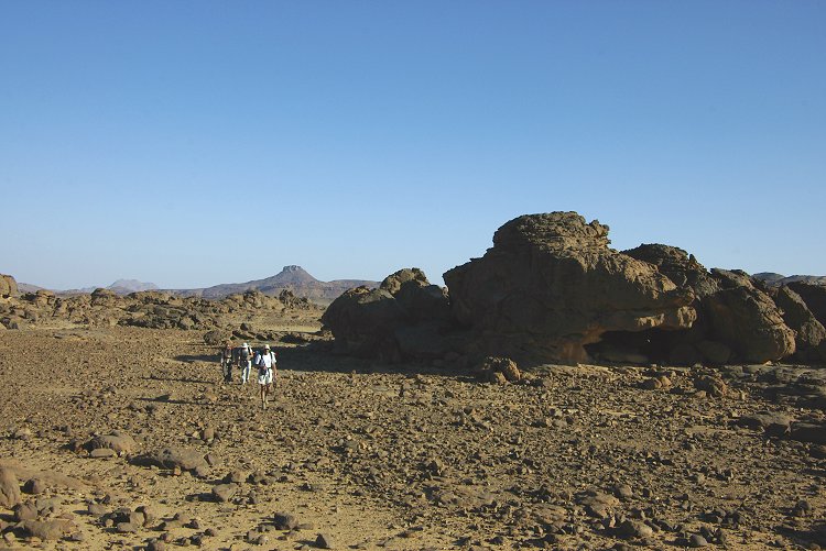
After the long two day march we took a leisurely morning, just visiting a fine locality near the southern branch of Karkur Talh, recently discovered by Georg Zenz and Mahmoud Mohareb. The area contains several engravings, and a large shelter with some exceptional paintings.
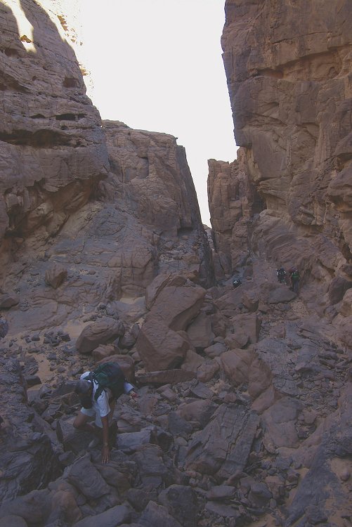
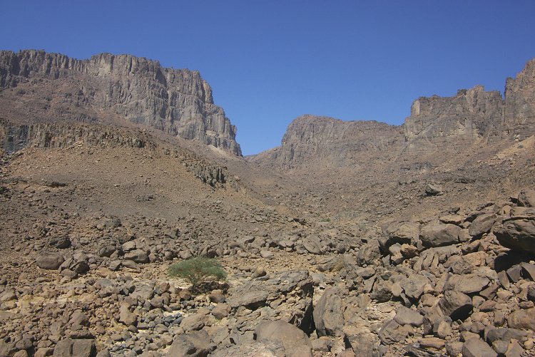
Late in the afternoon we started our longest trek, involving two nights away from camp, to ascend and explore the third high plateau of Uweinat, to the north west of the Hassanein Plateau (which we attempted with Magdi unsuccessfully in October 2006). Our plan was to ascend to the ridge between the two branches of western Karkur Talh at the eastern foot of the plateau and spend the night there, in order to make the most difficult part of the climb in the cool of dawn.
As we set out, we saw that the south western branch of Karkur Talh was full of fresh green vegetation all the way down to the driveable section, stopping short at the bend before the junction of the two main branches. A runoff of this magnitude implied a major rainfall up on the high plateaus, the source of this branch of the wadi.

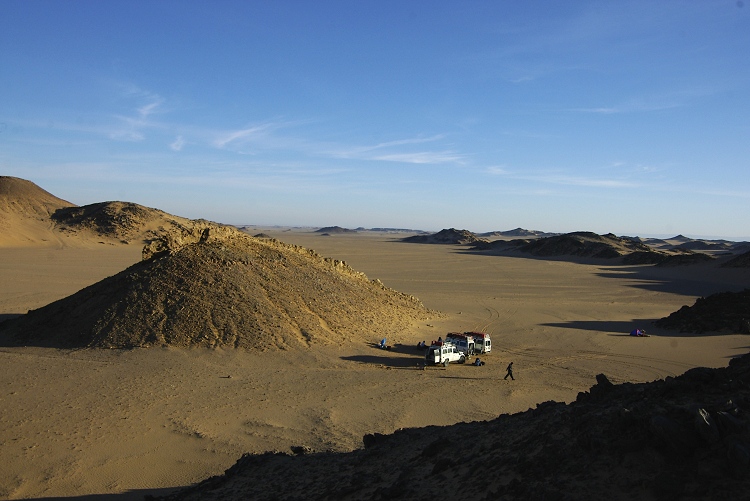
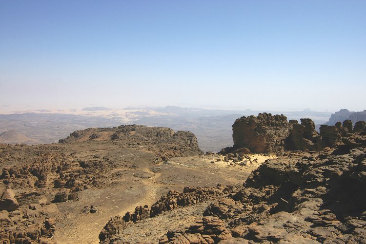
Day 8. - The North Western Plateau
Our aim was to find a passable rockslide along the northern face of the plateau. We set out from our bivouac at dawn, and in an hour reached a deep cleft in the cliffs, which just showed up as a dark gash on satellite imagery. While it was impossible to see fully up, the lower section contained a passable boulder scree, and we took our chances.
This time we were lucky. The chute was passable all the way up, at one point a tunnel offering a convenient easy access through an otherwise rather nasty section of rockfall. In little under three hours from our start from the camping spot, we were at the top of the cliffs.
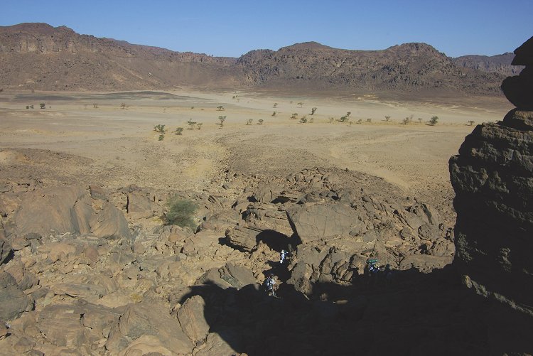
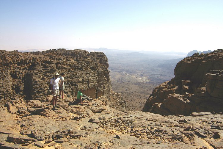
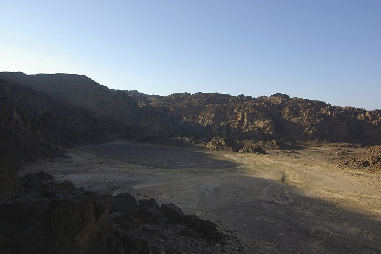
The ravine led straight up to what was identified on satellite imagery as the main valley on the top of the plateau. It was a broad, sand filled valley much like the main valley on the Hassanein Plateau, but with one side open towards the plateau edge, and offering an amazing vista towards the east. The valley floor was full of traces of recent water runoff, and fresh vegetation was springing up everywhere.

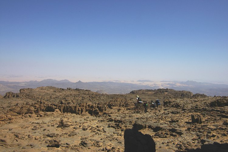
After a quick recconnaissance what was not readily visible on the satellite photos became apparent - we were nowhere near the top of the plateau, just on the first step above the vertical cliffs with the plateau extending several steps upwards. We found a way leading further up, and soon stood on the top of the next step, with more above us.
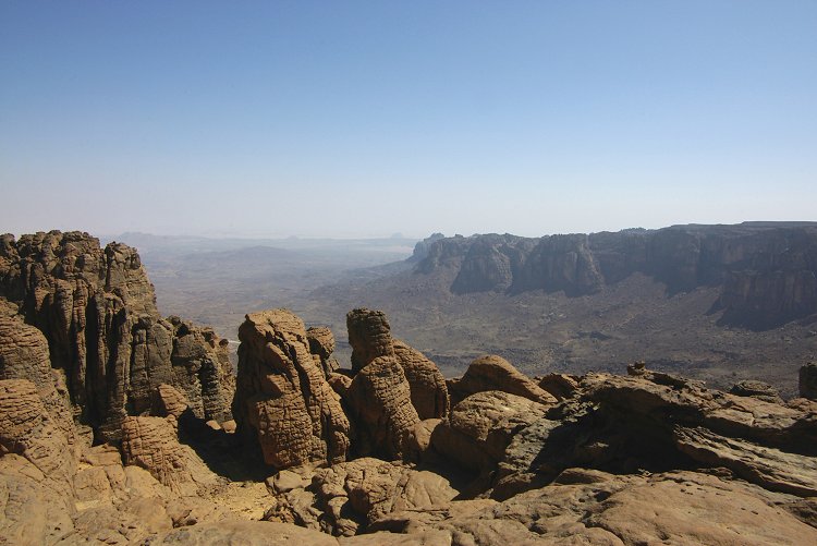
We skirted the plateau edge towards the central part, where another open valley was expected. It was there, but on a much lower level than us. From our vantage point we could see that the whole plateau top was a maze of rocks rising up and down, an impossibly difficult terrain to explore.
The central valley was a rather desolate place, covered with a dark shingle, and no sign of any shelters or other trace of human habitation. The only interesting part was a small watercourse going through the middle and ending in an unpassable ravine down the cliffs, which was at present full of fresh green vegetation.


Following the watercourse upstream the vegetation became thicker, and we found a couple of flowering Ochradenus baccatus shrubs that supported hundreds of Vanessa cardui butterflies.

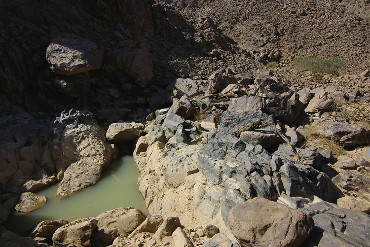
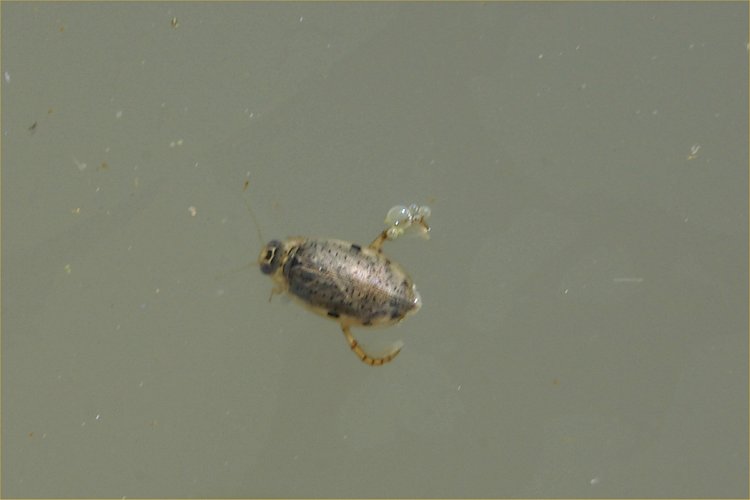
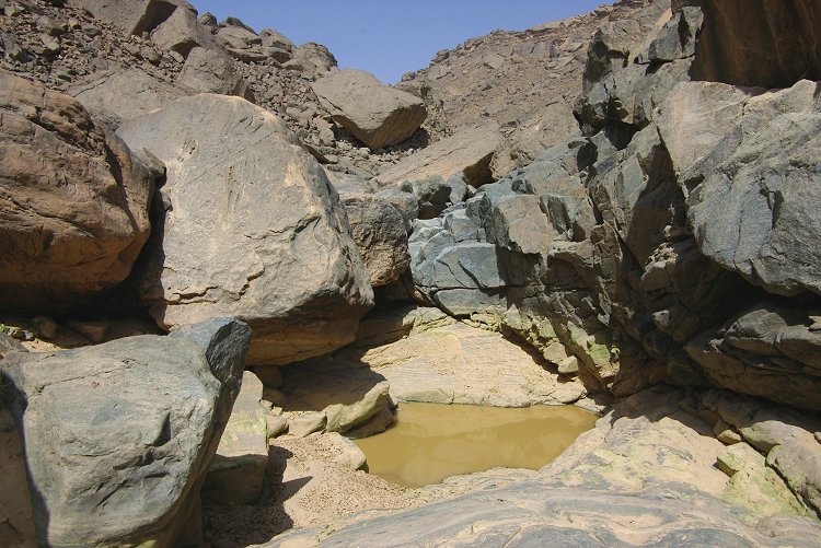
After another bend in the watercourse, at the foot of a low cliff we found a small rock basin that was still half filled with water, an incredible sight in the middle of the desolate valley. However the most amazing find was inside the water - the pool was swarming with large water beetles. How this aquatic species came to live in this area is a mystery, as it is hard to concieve that their eggs could have survived possibly decades of draught on the mountain top.

In the afternoon we followed the watercourse up the southern side of the basin. High above the valley, in front of a small flat terrace we found a large shelter, which much to our surprise and delight contained a large number of well preserved cattle and human figures - the only rock art site we found on the plateau.

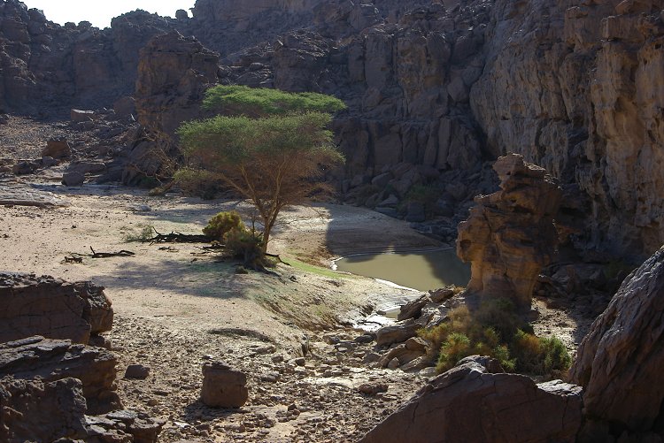
Having discovered the pool in the valley, and with abundant fresh vegetation all about, we could not help but think of the large guelta up on the Hassanein Plateau, which might also be full of water. As the two plateaus are joined, it appeared possible to cross over to the Hassanein plateau to investigate. We continued along the contour, down into a large basin, and up a steep ridge on the other side, till we were looking down on the "white spot" on the far side of a deep gorge separating the two plateaus.

We scrambled accross the ravine, and into the white spot, which was full of fresh green plants, and the solitary tree was bright green, unlike the previous occasions when only the faintest tinge of green was noted. We made camp in the valley above the white spot.
Day 9. - The Hassanein Plateau
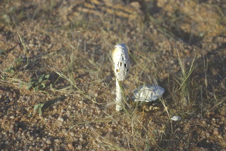
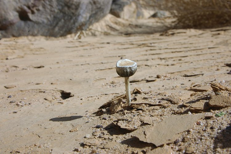
In the morning we spent some time assessing the new vegetation which was abundant in every watercourse. We noted several hitherto unseen plant species, but the most astonishing find was a mushroom (Podaxis pistillaris) in the middle of a shallow watercourse near our camping spot. There were also abundant fresh waddan (barbary sheep, Ammotragus lervia) droppings.
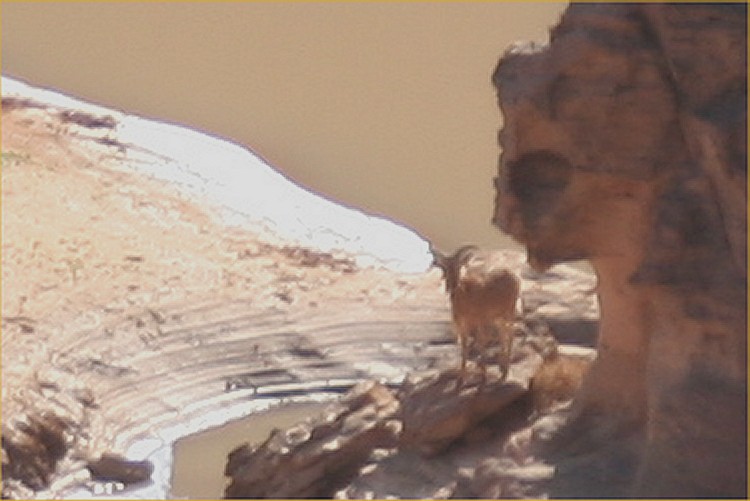
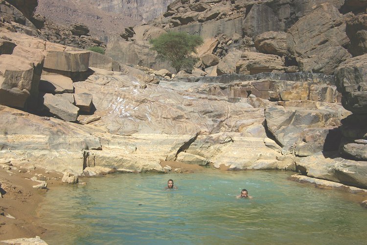
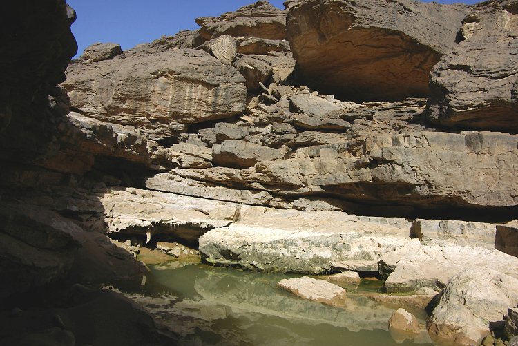
As we approached the valey with the guelta the vegetation was equally abundant, a clear sign of heavy rainfall all over the plateau top. Our high hopes were soon confirmed by a glint of sunlight reflected from a body of water, accompanied by a clatter of hooves as a waddan dashed away on hearing our approach. The water was deep and very cold - we later measured it to be 14 degrees celsius. The pool has lost approximately one metre from its original depth, but still presented a very imposing body of water.
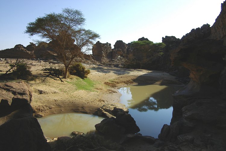


After Gábor processed his photos, he made an incredible find. On the first photo he took of the guelta, he managed to spot the tiny figure of the waddan (Ammotragus lervia) by the pool, already watching us much before we noticed it's presence. To our knowledge this is the third ever successful photo of a waddan in the wild at Uweinat.
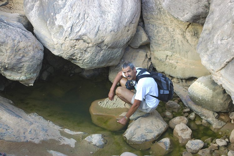
We visited the large shelter discovered in March 2004, located close above the guelta, something that cannot be coincidence. There is a clear pattern of large temporary water sources near practically all of the major rock shelters with paintings in the upper sections of the mountain. After the shelter we returned the guelta, and Gábor braved the icy waters to become the first person to be able to claim to have swimmed on top of mount Uweinat.


It was nearing noon, we needed to start our descent. We paused briefly in the "white spot" to observe the bright green colony of Cleome africana occupying the main watercourse, a plant species not noted anywhere else on the mountain.

We returned to the main valley via the upper section of Karkur Talh, which was found in an equally green state. Salama, who wondered up the lower sections while we were up the plateaus, reported that he found a small guelta in the middle section, where a side wadi joins flowing down from the Hassanein Plateau.
Day 10-11. - Wadi Wahesh
Our last two days at Uweinat were reserved for the the southern side of the mountain, camping at the mouth of Wadi Wahesh. Our plan was to explore the upper sections of the wadi, and possibly some other wadis in the vicinity. As we approached the lower section of Wadi Wahesh, it soon became apparent that dense fresh green vegetation filled the watercourse.

Further upstream, we expected the basin under the large engraved rock noted by Almásy and Arkwright to hold water, but it was dry. However another half kilometre upstream there was a rock basin still containing water, though rather murky. From the walls of the basin it was clear that the water level dropped more than a metre since the rain. We spent the whole afternoon in a leisurely fashion in the lower wadi, enjoying the abundant green vegetation, and the opportunity for a mid-trip wash.

The next morning we set out for a day trek to the upper reaches of Wadi Wahesh. It was an unknown area - though J. Leonard of the 1968 Belgian expedition have visited the upper section of the wadi on his way to the summit of Uweinat, the exact route is not known, and obviously he missed the superb rock art sites in the middle section that we found in March 2005. On our way up, we found a small crystal clear pool of water, and continuous vegetation.
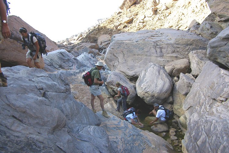

About two kilometres above the main cluster of rock art sites, we came upon an incredible sight: a large pool of water in a basin below a dry waterfall. This pool was almost as large as the one on the hassanein plateau, big enough to swim in, and substantially warmer. It has lost about 1.5 metres from it's original depth. The shores were covered with a hitherto unseen moss or algae species, and the air was swarming with butterflies and dragonflies.


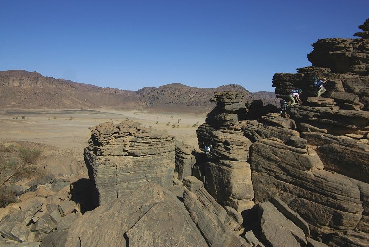
About one kilometre above the pool the varrey narrowed to a gorge, and at the end hidden deep below vertical rock walls lay a further pool. Up on the ledge above, we found a shelter with some rather damaged, faint paintings. We explored a little further upstream, but our time was up and had to start our way down. We reached a point roughly in line with the 'Three Graces' (the three prominent rock pillars detached from the summit plateau, thus named by Bagnold).

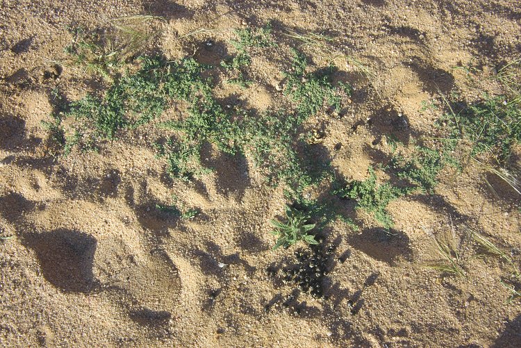
On our way down, we have encountered another mushroom species, and at the cluster of rock art sites we found a pool of water which we missed on the way up. The pool is right in front of the main sites, yet another example of the close association of rock art sites with water sources.

Day 12. - Jebel Uweinat - southern Gilf Kebir
In the morning we starte our return northwards, passing by an interesting outcrop of silvery grey igneous rocks before continuing north to Clayton's Craters.
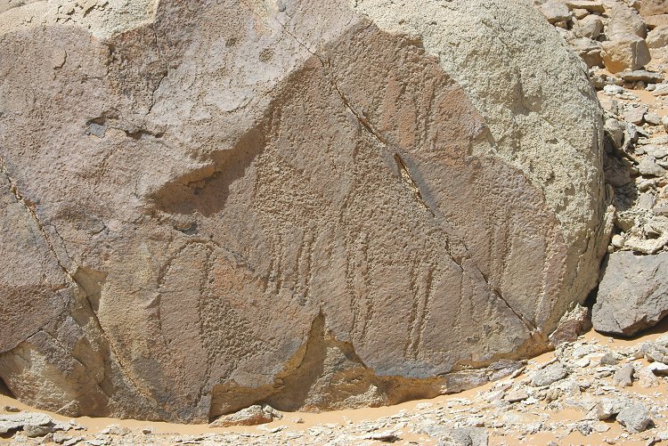
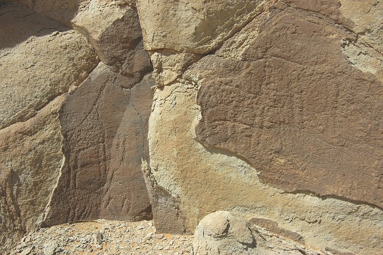
We visited Crater "C" where much to everyone's surprise, Flavio Cambieri and companions have found a series on engravings of giraffe, ostrich and other animals. The engravings were made on the weathered surface of the soft and crumbling trachyte, and unfortunately are in the process of being eroded away. It is certainly a very unexpected location for rock art, and confirms that human presence in the region was not limited to the large massifs of the Gilf and Uweinat.
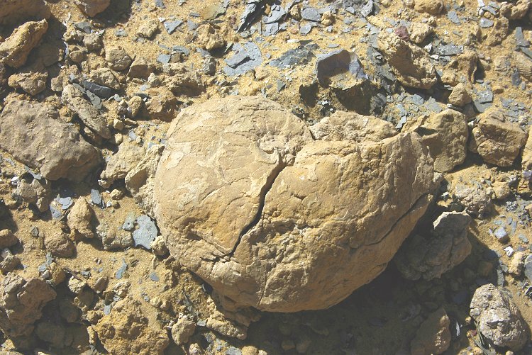
At a spot inside the crater, Geoffrey made another incredible find. A small piece of sandstone with clear imprint of ferns on both sides. With Gabor we soon found the source, a roughly 20 m2 area where the flaking rock was full of fern fossils. The find is very significant, because the rocks in the Gilf-Uweinat area are very poor in fossils, only a handful were known previously. After consultation with Norbert Brügge, the find is tentatively identified as a Pecopteris species of the Carboniferous.

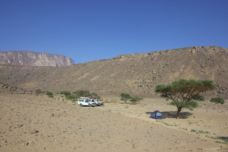
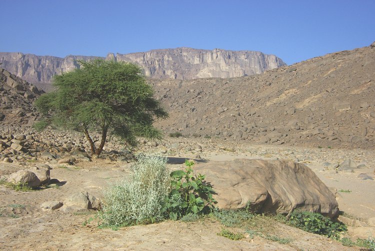
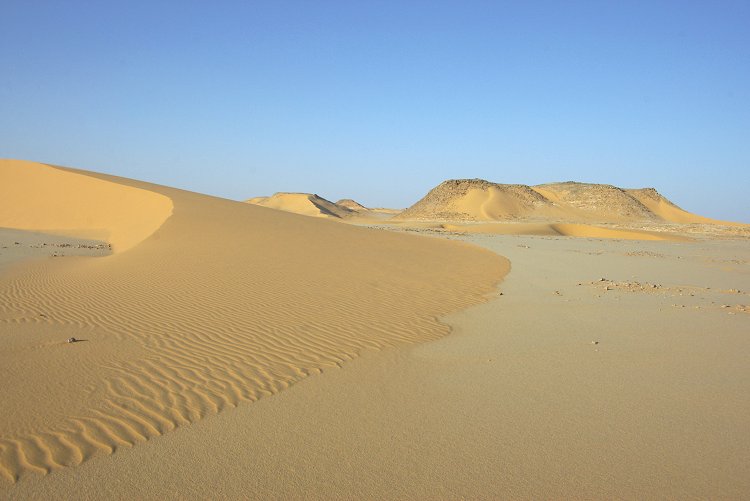
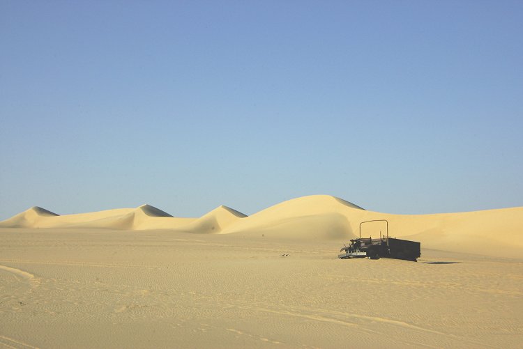
In the afternoon we continued north, camping at the barchan dunes along the eastern edge of the southern Gilf Kebir.
Day 13. - Southern Gilf Kebir - Abu Ballas - Regenfeld
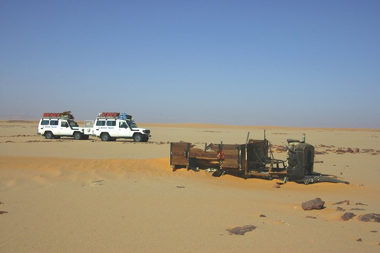
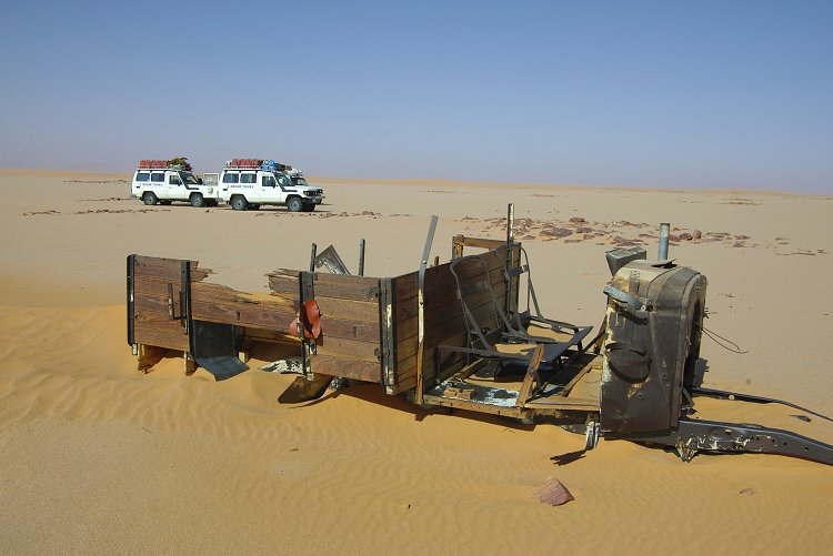
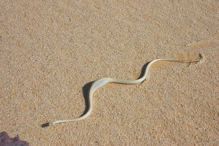
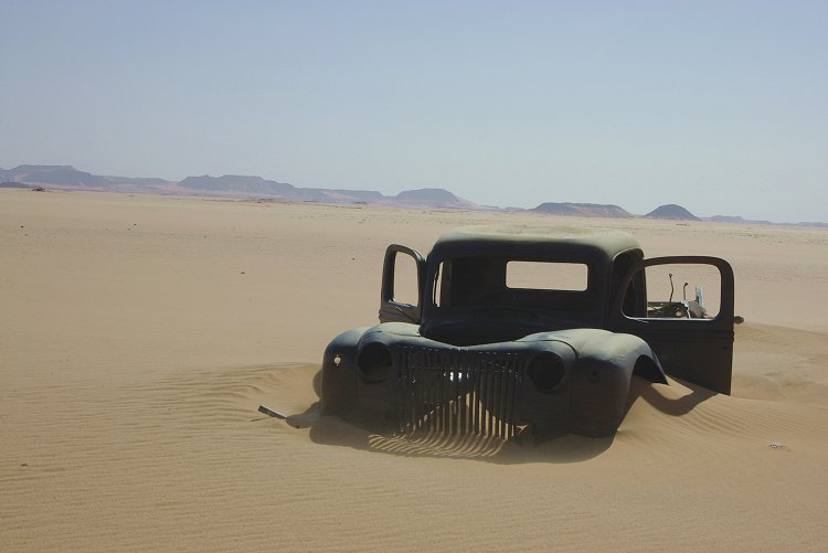
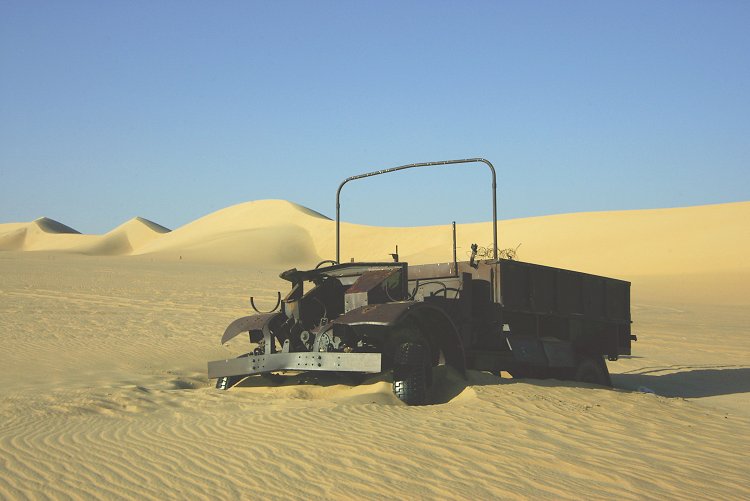
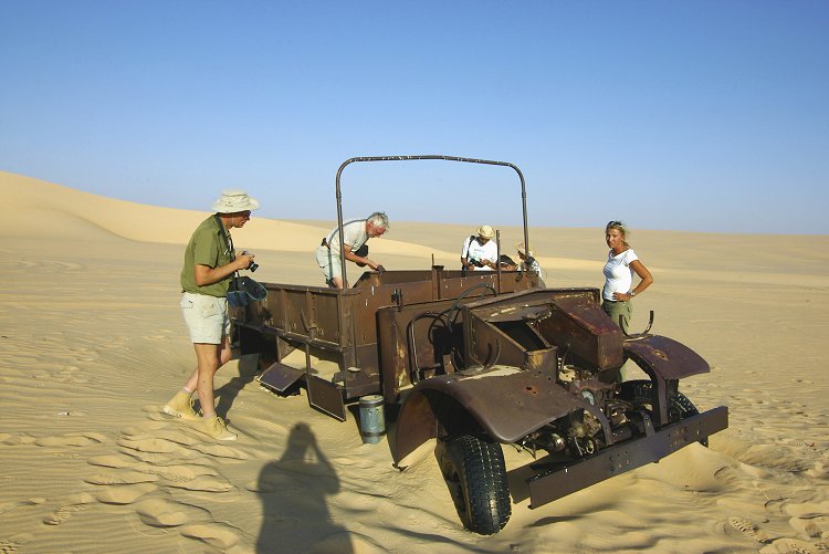
In the morning we planned to re-locate the 1942 Ford pickup of the Sudan Defence Force Kufra convoys which we came accross in March 2002, but failed to find in 2005. As we passed along the dunes bordering the Gilf, we came upon another wreck, almost completely stripped, but recognisable as a Chevrolet 1311x3 patrol car, either belonging to the LRDG or the SDF Kufra convoys. We also disturbed the wreck's guardian, a sand snake (Psammophis schokari) which had recently fed.
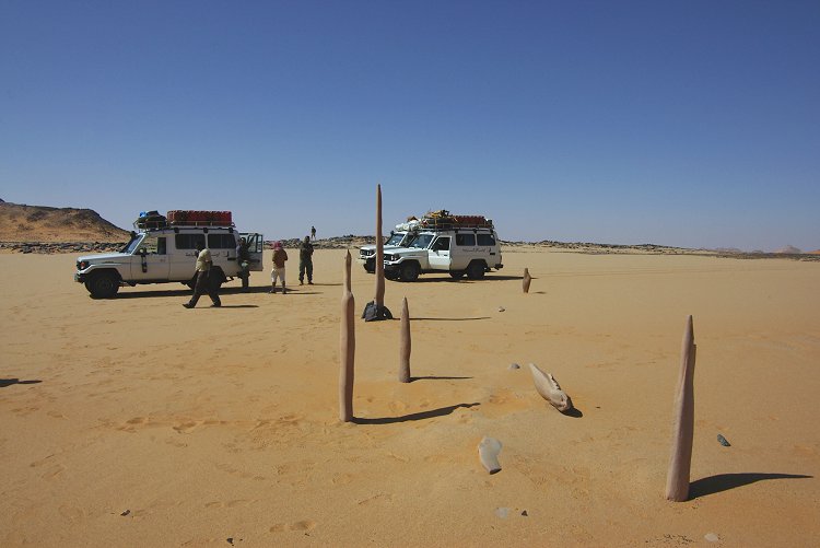
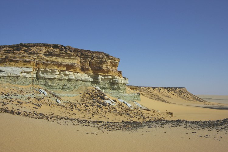
A little further on we did find the other wreck, and at the foot of the scarp beyond the wreck we came upon some very strange sandstone formations. Long needle like hard concretions were eroding out of the surrounding softer rock, some earlier travelers have erected some of them like a line of menhirs. Close to Abu Ballas we stopped to examine an interesting layered outcrop with alternating bands of shale, gypsum and sandstone, a striking feature which we always passed by along our route.
From Abu Ballas we retraced Almásy's 1932 route to Regenfeld. It proved to be a very easy route, most of the going on firm sand. As my GPS batteries had died and all stored waypoints were deleted, we were navigating based on the reading from the Survey of Egypt map - the accuracy was remarkable - as we ascended the dune bordering Regenfeld to the west, our vehicle's nose was pointing directly at Rohlfs' cairn below. Me made camp nearby, the location and the timing was perfect for Geoffrey to conduct his star sighting experiment later that evening.

Day 14. - Regenfeld - Ain Dalla - Great Sand Sea
In the morning we made the obligatory group photo at the Regenfeld cairn, almost exactly ten years after our first visit in November 1997. Sadly the biscuit box which contained the messages of travelers past was no longer there, only a bottle with a note of a visit a few weeks earlier.

We quickly covered the 150 kilometres north to Rohlfs' Ammonite Scarp, driving on hard sand along the eastern edge of the long seif dunes. The scarp is the much lower continuation of the Dakhla escarpment, that turns west after Abu Mungar, and eventually disappears under the Great Sand Sea. Rohlfs and Zittel reported abundant fossils, we were curious to see what we could find.

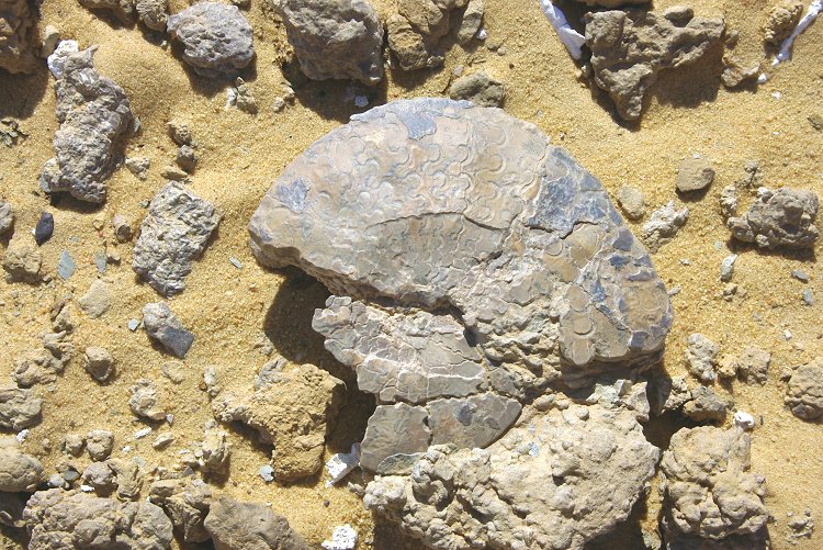
The site did turn out to be very rich in fossils. The majority were molluscs, an ancient type of oyster, Exogyra overwegi was particularly abundant. We have also found several examples of Veniella (Roudaireia) auressensis. It was some time until the existence of ammonites was confirmed. Most were very weathered and fragmented, only a few relatively intact specimens were noted, most the flat streamlined Lybicoceras ismaeli, first described by Karl Zittel, the zoologist of the Rohlfs expedition.


Later in the afternoon we visited the abandonded LRDG Ford 30cwt truck west of Ain Dalla. Despite reports of recent vandalism, fortunately the truck appears to be in the same condition as it was when first reported by Wael Abed some 15 years ago. However numerous tyre tracks in the sand show that it is regularly visited, despite it's remote location.
Day 15. - Great Sand Sea - Ain Dalla - Rohlf's Cave
In the morning we drove the remaining 100 kilometres to Ain Dalla, which was a rather disappointing place. The egyptian army has maintained a small post there for decades, and the resulting rubbish strewn all around was a striking contrast to the pristine desert from which we came from. With a little tidying up, it could be made a pretty place once again. The spring itself sits on top of a quite high mound surrounded by reeds, helping to visualise what all the prehistoric spring mounds must have looked like befour their water sources dried out.


From Ain Dalla a tramac road leads back to the checkpoint at the White Desert. We did not fully go back to civilisation yet, as our objective was to visit Rohlfs' Cave (Djara Cave) lying about 120 kilometres to the east of the Farafra - Baharya road, near the Abu Moharig dunes. We expected to camp there by the evening, however the track, starting from the southern tip of the Baharya depression, proved to be dismal. It was very slow going on the top of the broken limestone plateau, we camped at a solitary dune still 60 kilometres short of our goal.
Day 16. - Rohlf's Cave - Baharya - Cairo
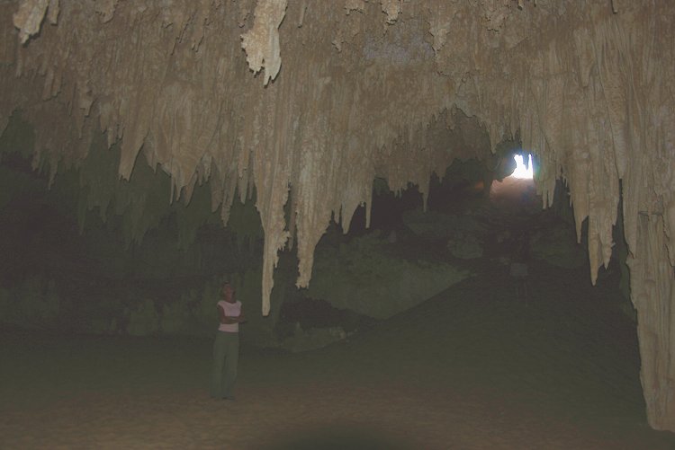
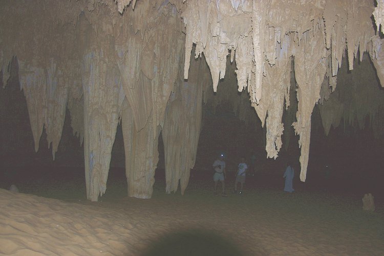
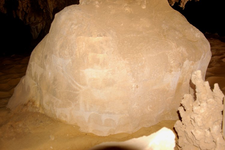
It took over two hours to cover the remaining distance to the cave. What appears to be a shallow pit in the ground leads on one end into a descending shaft, which at the bottom opens up into a grandiose gallery with stalactites hanging from the roof - an absolutely fabulous and amazing sight. Two columns near the entrance contain engravings of wild fauna, attesting to the presence of prehistoric people.

From the cave it was a grueling five hour drive back to Baharya, only interrupted by a stretch of good going on the sand along the edge of the Abu Moharig dunes. It was a relief to reach the tarmac, we reached Cairo by the evening.