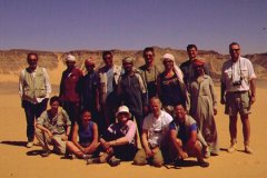
Click on image for list of participants
|
Jebel Uweinat - Gilf Kebir Expedition
17th March - 31st March, 2002
|
Day 1. - Cairo - Dakhla.
We left Cairo at dawn, with Salama, Zayed and Ayed, our bedouin drivers, and three HZJ 75 Landcruisers, packed to their limit with water, food and our luggage. It was the usual long and uneventful drive along the desert highway, with a lunch stop at the White Desert, and a brief halt at the dunes after Abu Mungar to stretch our legs. We made it to our Hotel in Dakhla by 8pm, covering 840 kilometres.
Day 2. - Dakhla - Abu Hussein dunes.
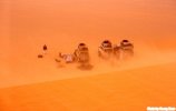
Having fuelled the evening before, we only had to pick up Captain Wael, our military escort, then took the long and perfectly straight road south for almost 300 kilometres. As soon as we mooved out of the lee of the sheltering trees of Dakhla, we met a full fledged sandstorm, that grew in intensity during the day. Fortunately the wind died down somewhat as we left the road, and was courteous enough to allow pitching the tents and quiet dinner at our first camp, in the lee of a giant barchan at the northern edge of the Abu Hussein dunes.


Day 3. - Accross the Selima Sand sheet to Wadi Bakht.
During the night and the following morning the storm picked up, making it the worst I have ever experienced in the open desert. We hurriedly packed and started out in the fog. We drove almost blind, there was no horizon, only a slightly lighter haze above hinting the position of the sun. Occasionally we passed darker lumps, scattered dunes, but for most of the morning it was an eerie floating accross the flat plain, with hardly any sense of motion or direction. Only the GPS dial showed a reassuring steady speed of 80 kms straight towards the Gilf.
Towards noon the haze lifted a little, and the sun occasionally shone through patches in the overcast sky. Slowly a dark featureless streak somewhere close to where the horizon was supposed to be became more defined: the cliffs of the Gilf, no more than 15-20 kilometres ahead. To reach them, we had to drive around a belt of rather unpleasant jumbled barchans guarding the eastern side of the Gilf. The WWII convoy tracks led us straight to the only easy gap in the dunes for 80 kilometres, and nearby, quite by accident, we came upon the wreck of a 1942 Ford light truck. The faint
insignia of the Sudan Defence Force was still visible on the roof and doors.
This car was first reported by Faruk el Baz in 1978, there are two more somewhere along the eastern edge of the Gilf. Two years ago we spent several hours in much better visibility looking for them, without any luck...
The entrance of Wadi Bakht is almost opposite the pass among the dunes. As we moved in, the mass of the Gilf sheltered us from the wind, and the storm was left behind us. It was a lovely calm afternoon in the valley, we set out to explore in all directions, enjoying the freedom after sitting in the cars for three days.
Day 4. - Wadi Bakht - Karkur Talh.
We left Wadi Bakht in the morning, and soon turned west into Wadi Wassa, then crossed a pass into Wadi Firaq to visit Shaw's Cave. From the cave we returned east along Wadi Firaq till the WWII airfield at Eight Bells, then rounded the southern tip of the Gilf to the Prince Kemal el Din monument. It was an easy afternoon's drive accross the hard sand plain to the mouth of Karkur Talh, passing Clayton's Craters along the way.
Day 5. - Karkur Talh rock art sites
We spent the day exploring the rock art sites and spectacular scenery of Karkur Talh.
In the afternoon a part of the group explored the northern side of the main wadi. A surprising discovery awaited us some distance up a little side wadi: a lovely group of paintings, the first one ever to be discovered at Uweinat by Prince Kemal el Din in 1925. This scene was subsequently lost, none of the later explorers have reported seeing it (or published any photo). It is really strange, that with all the other, much more accessible paintings at prominent locations, Kemal el Din only saw this remote, hidden one.
As we walked back along the wadi, we discovered another two unreported sites with paintings. Later, with Salama and one car, we explored the side branches of the main southern branch of the valley, finding more of the paintings and engravings reported by Rhotert.
Day 6. - Karkur Talh - Unnamed Plateau
In the morning we walked to the sites discovered by the Belgians in '68. A little further upstream from the main shelters, under a rock ledge that I'm sure we have seen several times before, Hannah found one of the sites that we had been looking for on all previous trips. As we walked back, under another low shelter that I recall having explored several times before, Lajos found a small but beautifully preserved scene of white, almost abstract cattle.
In the afternoon we drove north, stopping at Clayton's Craters for a brief peek into crater B, and a glimpse at Uweinat on the horizon.
We continued north for another hour, then turned west, and after crossing a few low dunes entered the main wadi of the large unnamed plateau lying to the north-west of Jebels Peter & Paul. This valley was a very sharp contrast to Karkur Talh. The plateau is of granite and other igneous rocks, weathering into dull grey rounded heaps and gravel. The valley was almost completely lifeless, except for three low dome shaped akacia clusters that we stumbled upon quite unexpectedly.
Day 7. - Unknown Plateau - Wadi Sora.
We planned a full day to explore the valley, but it soon became evident that there is not much to explore. We found several stone circles on the plateau top above our camp, but a a drive and a walk into the upper reaches revealed nothing but barren rock. The tone and dryness was very reminescent of Jebel Arkenu, just with lower hills. On the return leg, Magdi spotted a very faint, crude engraving on a vertical slab. The highlight of the place was a lizard caught by Salama, apparently it's only living inhabitant.
At noon we broke camp, and drove north along the edge of the Gilf to Wadi Sora via the 'three castles'.
We arrived to Wadi Sora just in time to catch the half hour when the paintings in Cave C (the main cave) are in full sunlight, bringing out many details that are practically invisible in diffuse light.
Day 8. - Wadi Sora.
A relaxed day was spent at Wadi Sora and it's spectacular surroundings. A part of the group attempted to tackle the great cliff of the Gilf looming above the valley, while others went to look for the numerous smaller rock art sites in the surroundings.
The climbers came down tired, but richer with a fabulous view from above, the others found an unreported site in the valley to the north of Wadi Sora. (Not unknown, based on the numerous tire tracks of previous visitors, but not reported in any publication.)
In the afternoon we visited Chianti Camp, and the lovely painted cave discovered by Werner Lenz and party last March. With Magdi we walked the five kilometres back to camp, enjoying one of the most magnificent sunset shows I've ever encountered in the desert.
Day 9. - Wadi Sora - Wadi Abd el Melik.
We broke camp early morning, driving back east to the Aqaba pass. The ascent was lucky this time, all three cars got up in one go, with only a little push needed for the lead car a few metres before the top. We continued north in the 'gap' till the pass up the top of the plateau. This involves the crossing of a number of transverse dunes blocking a side valley, the only place where some seroius pushing was required.
The rest of the day was spent driving along the plateau top, on country alternating between dismal dry watercourses and boulders hardly offering a drivable way, and gravel plains as flat as a pool table. We reached Lama Pass, the only known descent into Wadi Abd el Melik, late in the afternoon. The pass is a narrow sand filled ravine, quite steep in places, with large rocks on both sides coming far too close to the sides of the cars for comfort. Fortunately the hair raising part is no more than a hundred metres, and all cars made it without a mishap in a few minutes. We made camp near the pass at the eastern branch just as the sun set.
Day 10. - Wadi Abd el Melik - Wadi Gubba - Silica Glass area.
Wadi Abd el Melik is much dryer then it's companion, Wadi Hamra, only a dozen kilometres further east. Most of the once lush vegetation is dead, huge dry stumps stand where once a grove of Akacias stood as thick as in Karkur Talh today. Only a few trees manage to survive, but probably they too are fighting a losing battle. Animals too sem to have deserted the valley, we saw no fresh tracks, only innumerable remains of waddan (barbary sheep), some only horns, some complete mummified creatures.
We have spent a couple of hours in the morning searching for a painted shelter situated somewhere 12 miles up the eastern branch reported by Bagnold & Peel in 1938, but had no luck. However as we neared camp, we found an unknown series of engravings, fairly crude giraffes and some cattle, at the end of a little side wadi. The spot was also chosen as the last resting place by the largest waddan we have seen in the valley.
In the afternoon we started our long drive out of the wadi. From the junction of the two branches (the approximate north limit of vegetation) the wadi continues north for another 120 kilometres, finally widening and disappearing into a broad plain along the western side of the Gilf.
We touched the Egypt - Libya border (25 00 East), then turned east into the broad and shallow Wadi Gubba, that leads accross the low northern part of the Gilf to the Great Sand Sea. The first part in the valley was easy going, but soon we had to ascend the low plateau, and the going became really bad on the top. The track was constantly criscrossed by shallow wadis, we covered the 30 kilometres in almost two hours. Finally, as the sun set, we glimpsed the orange crests of the big dunes behind the last hills. We soon met the dunes, and ran up the length of one of the corridors to the heart of the Silica Glass area. We made camp at the foot of one of the huge ranges just as the sky turned an incredible pink-purple, the clouds illuminated on the underside by the setting sun.
Day 11. - Silica Glass Area - Wadi Hamra.
After a morning of prospecting, we took to the cars again, driving south along the big tongue of the Great Sand Sea that juts itself into the 'Gap'. There were no unexpected delays along the way so far on the trip, so we had some time to spare. Thus instead of making a direct crossing of the dunes, we slipped into Wadi Hamra for the afternoon. We visited the engravings found by Giancarlo Negro, in the best possible lighting. Looking at two photos below, I think there is little doubt in identifying two creatures as rhinoceros, the only such representations in the Eastern Sahara.
Day 12. - Wadi Hamra - Bagnold's Stone Circle.
In the morning, Captain Wael led us to another group of engravings near the first, that he visited last year with another group. These were rather similar in style, crude giraffes, cattle and some ostrich.
This day was the start of the long day back. We drove some distance to the north, to the spot where there is a weak spot in the side of the dunes. We found this pass based on satelite photos in November 2001, it is the only reasonably easy way accross the dune barrier. With a lunch stop the crossing took no more than two hours, a formidable improvement over our seven hour performance coming westbound two years ago.
Once on the far side of the dunes, it's easy going till the north-east corner of the Gilf. After a few more low dunes at the eastern edge of the plateau, we turned north to camp at the dunes near Bagnold's Stone Circle.
Day 13. - Bagnold's Stone Circle - Abu Ballas.
We continued north-east, back towards Dakhla all day, first passing the Saviem Balise 22, notable for being the only feature marked on the 1:2M Michelin map in the whole region, aside the very rough outlines of the Gilf.
Our lunch stop was at "Hill with stone circles on top", one of the most beautiful spots east of the Gilf, at the site of a dry prehistoric lake along the side of a golden dune. For some reason the dry mud in this lake is of a pink hue, and was carved into a maze of yardangs along the dune. Apparently there was a large neolithic settlement here, with the remains of several huts scattered at the foot and on the top of the surrounding hills.
We continued to Abu Ballas, then on for another 60 kilometres to camp at the foot of the scarp among the scattered hills.
Day 14. - Camp - Dakhla - White Desert.
We took a lazy start in the morning from our last camp out in the deep desert to cover the remaining two hours till the tarmac at Australia Pass. As we neared the road, the southern wind started, and by the time we reached the tarmac, it was turning into a sandstorm. The desert's farewell matched it's welcome.
By the time we reached Dakhla, the storm was raging in full force. The wind ripped the cables somewhere, there was no electricity in the whole town, hence no fuel at the gas station. Luckily we had enough of our reserves to last till Baharya, so we moved on after a warm farewell to Captain Wael. We found the only hotel in Farafra full, so we moved on to camp in the White Desert, where the chalk hills offered some protection from the wind and sand.
Day 15. - White Desert - Cairo.
During the night the storm reached it's peak, possibly surpassing that at the Abu Hussein dunes. The only thing that prevented our tents from flying away was us inside, plus after a while a generous amount of sand that poured in through the ventillation holes.
By the morning it lulled somewhat, enabling a reasonably organised packing of our gear, then we set out for the long drive back to civilisation, with a promise of a warm shower, a nice dinner (anything but canned turkey ;)) and a sleepy taxi ride to the airport at dawn.
See Georg's superb website with photos of our trip at:
www.desertdream.net


