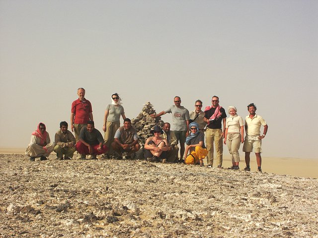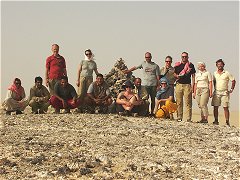
Click on image for list of participants
|
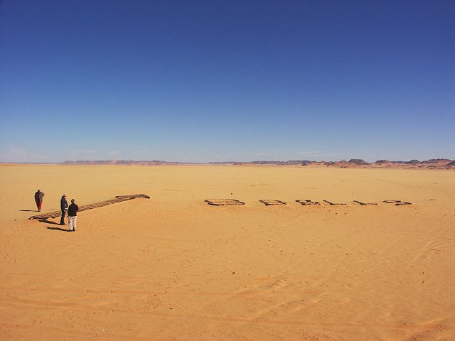
Jebel Uweinat - Gilf Kebir Expedition
20th March - 4th April, 2004
NOTICE: The rock art photos on this page are strictly copyrighted ! No photo may be copied / used for any purpose without written permission.
|
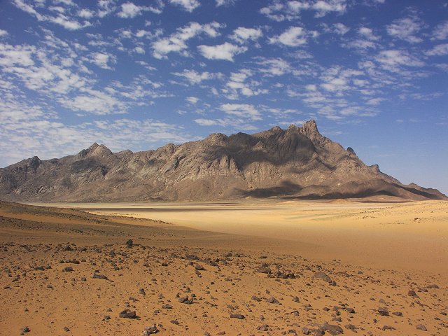
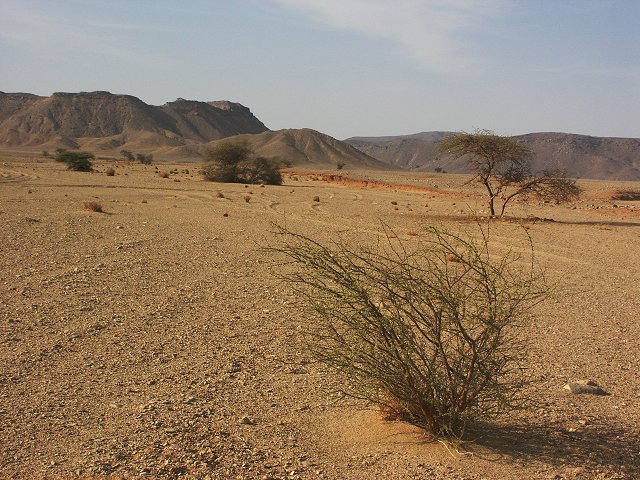
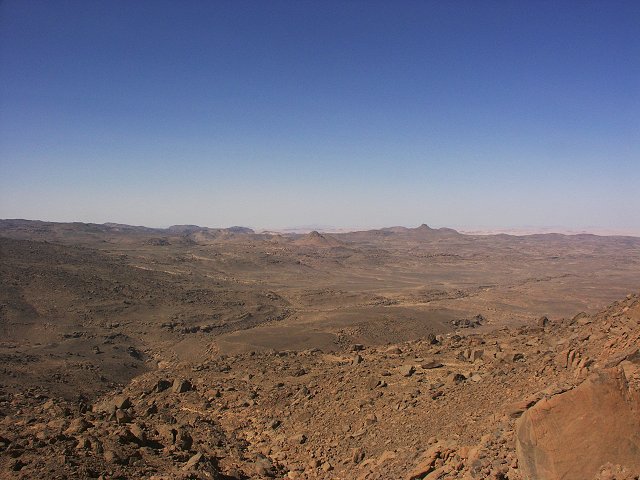
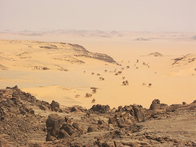
Day 1 - 2. - Cairo - Dakhla - western Gilf Kebir.
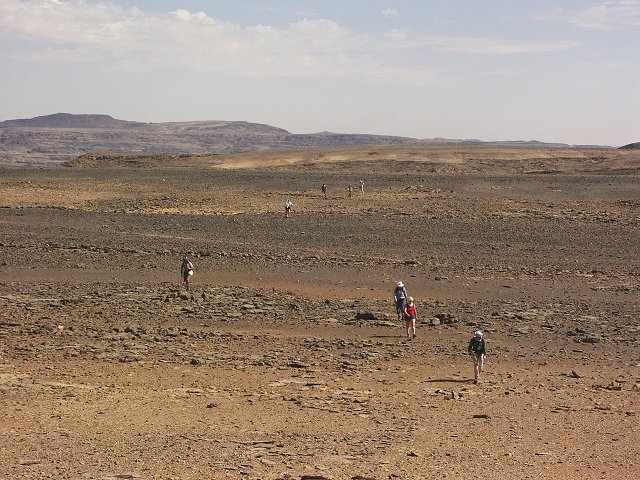
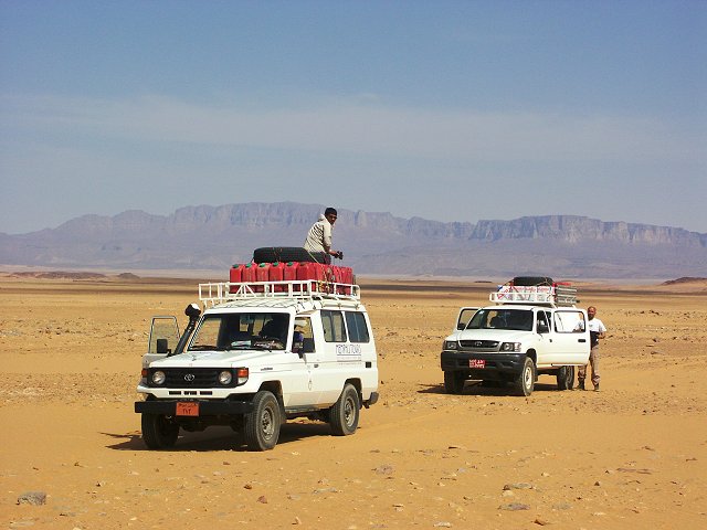
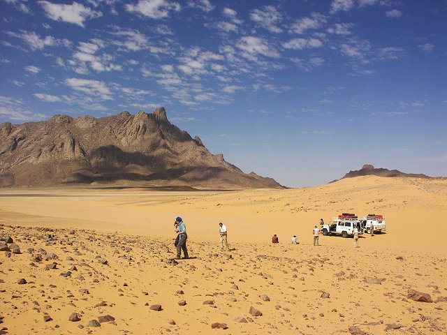
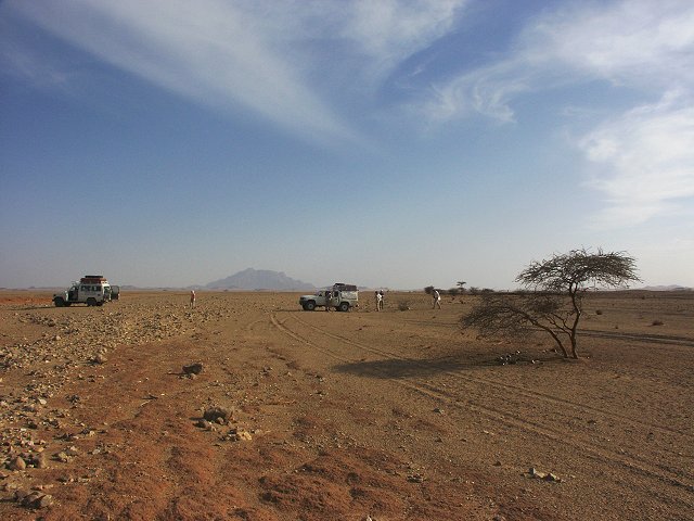
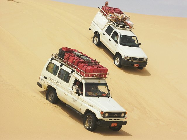
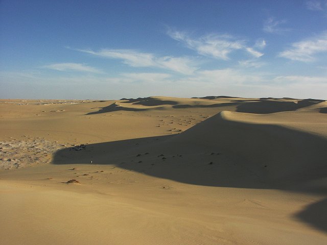
We started at dawn from the Hotel Cosmopolitan in Cairo, with two -75 Landcrusers of Salama and Zayed, plus Mahmoud's superbly modified 2.8D HiLux. We made very good speed on the long Cairo - Dakhla stretch, with a brief stop in Baharya and the White Desert for lunch, we were in Dakhla by dusk. By evening we have fuelled, topped our supplies, collected major Shaban, ready for an early start. Our concerned looks at the HiLux's flat springs proved to be unwarranted, the HiLux passed the gruesome test of the 1900 km trip with flying colours. The following day was equally uneventful, driving south along the tarmac past the checkpoints, then crossing the Selima Sandsheet towards the foothills of the Gilf. We camped at the same spot as in March 2001, just a full day earlier, among the golden barchans.
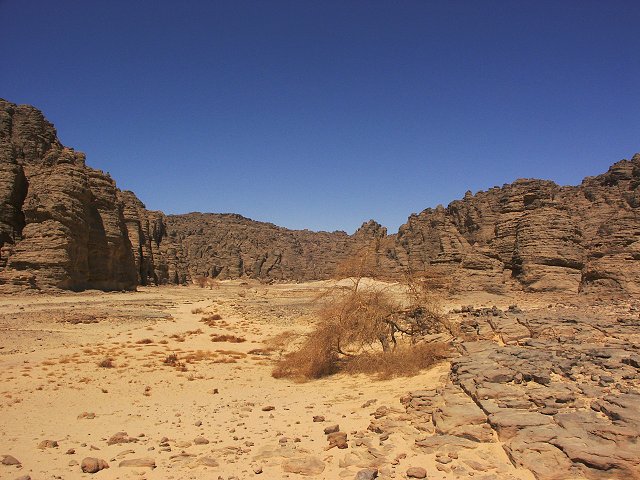
Day 3. - Accross the Selima Sand Sheet to Karkur Talh.
Next morning we briefly stopped at the WWII airfield at "Eight Bells", and at the Kemal el Din monument.

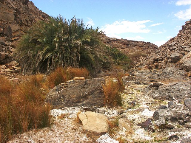
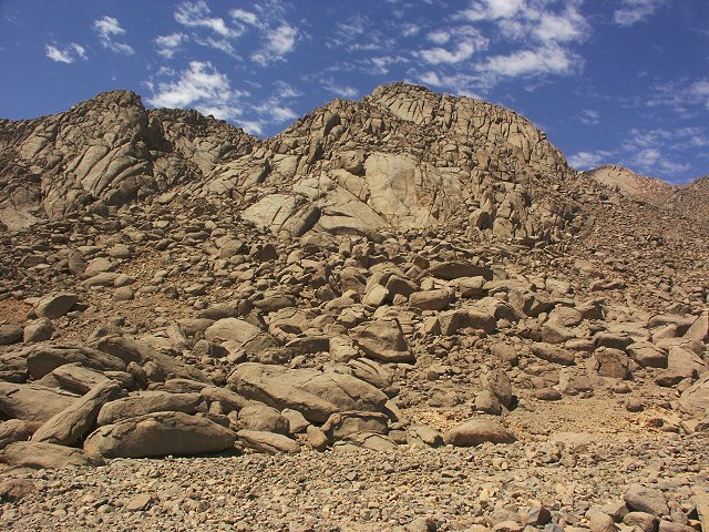
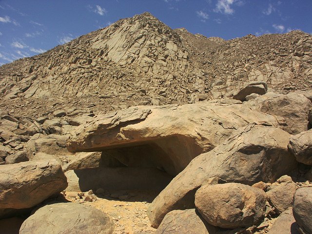
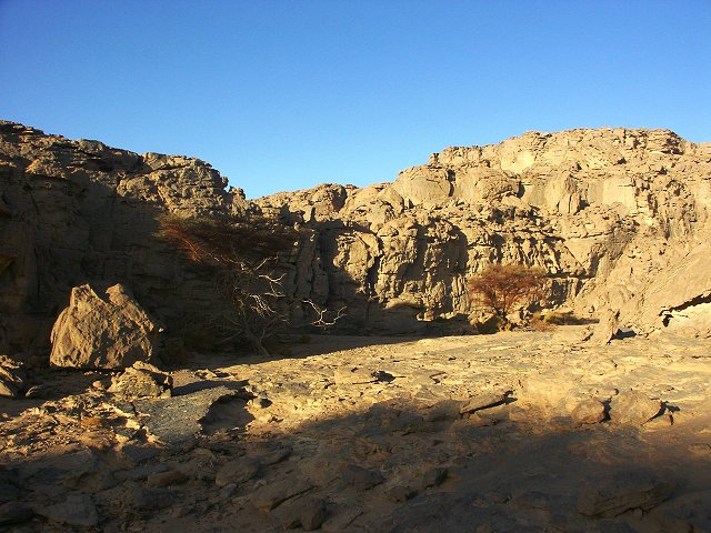
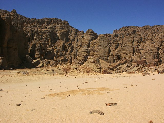
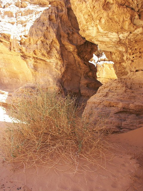
By early afternoon we made camp at Karkur Talh in the southern branch. We spent a leisurely afternoon visiting known sites and exploring some unvisited side valleys. We found one large and several smaller shelters with paintings on the low dissected plateau to the south.
Day 4. - Day trip to Karkur Murr.
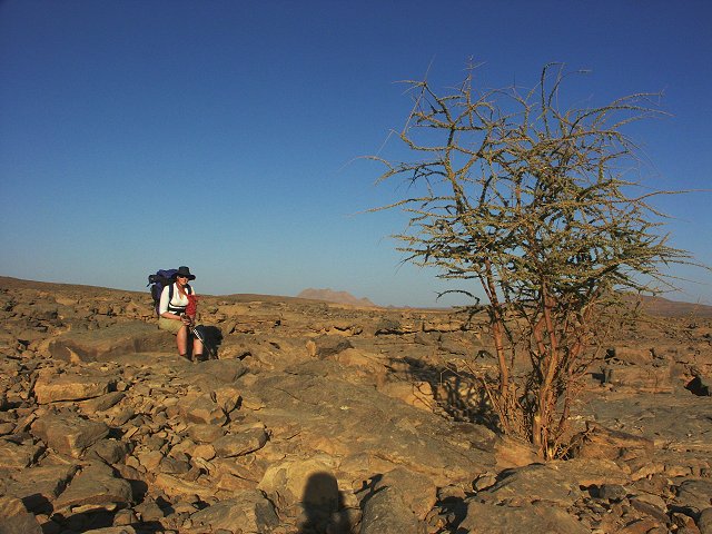
We woke to a beautiful unusually cloudy day, the day's plan being a full day's walk to Karkur Murr. We set out on the old Tibou footpath, then descended into the little side wadi to visit Winkler's Site 81, and the fine shelter we found with Wolfgang and Salama three years ago.
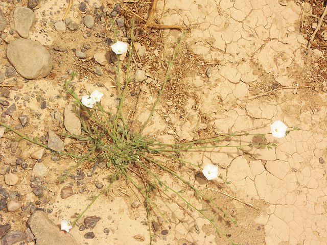
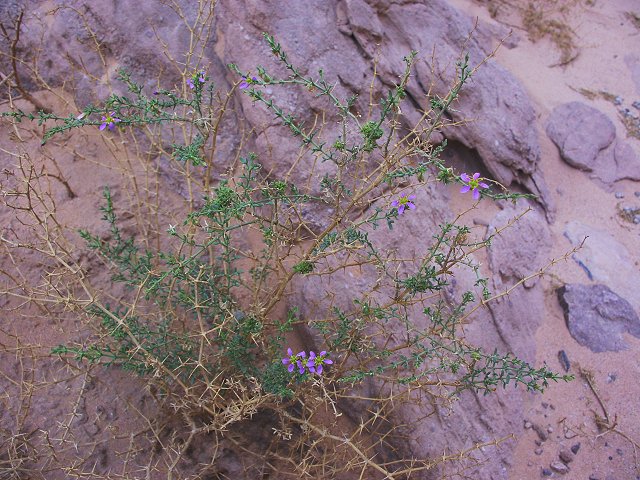
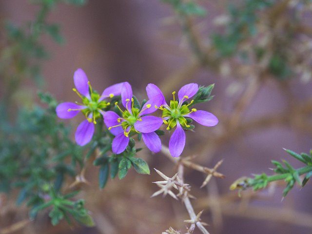
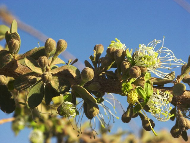
One of our main objectives was to finally find Winkler's missing site 75, somewhere in the upper reaches of one of the western tributaries of Karkur Murr. We spent several hours thoroughly exploring a large area, but without any luck. We did find a pair of large stone circles at the base of the eastern cliffs of the Hassanein plateau, and some flowering Convulvulus prostratus in the bed of one of the wadis.
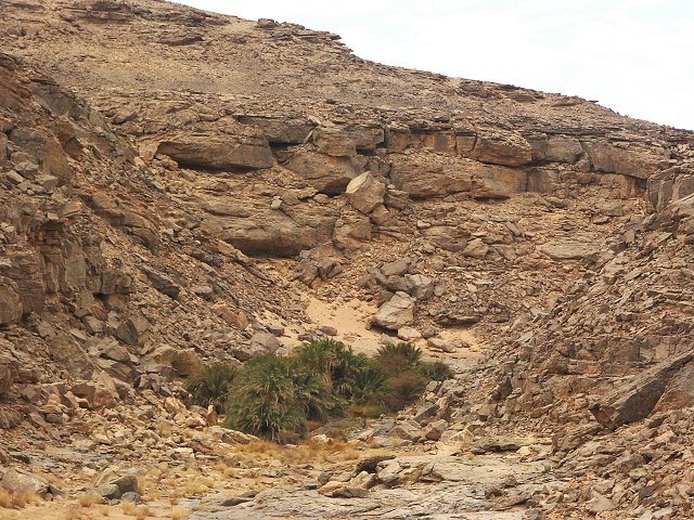
For lunch we descended to the spring in the main valley of Karkur Murr, then spent some time exploring the vicinity of the spring, before walking back accross the plateau to Karkur Talh. It was interesting to note, that water was seeping out from cracks in a distinct rock band for about 200 metres along the wadi, forming numerous little pools. Though the vegetation in both Karkur Talh and Karkur Murr indicated no rainfall, the water seemed more abundant then when we last visited in October 2002.
After our return, I did a bit of reading, that cleared up the confusion surrounding the name of the well. It is apparent, that we have been at "Ain Murr", not "Ain el Brins" as marked on the Survey of Egypt maps (ALMASY, L.E., "Bir Bidi", Sudan Notes and Records, Vol XVIII (1935), pp:259-276):
"Now we know that there are actually only three principal springs at Uweinat - Ain Murr, Ain Dowa (or Ain Ghassal), and Ain Zweia... Of course at the time when Bidi visited Uweinat some other springs might have held water... Thus the fourth well may have been the source that lies some 15 kilometres to the west of the entrance of Karkur Murr, in which I found a little water in May 1933, but which was completely dry when I re-visited it in March 1934.... In 1933 I met an old Tibu at Uweinat ... who told me about this spring, which he called "Ain el Prince". He said it was in a wadi at the foot of the mountain somewhere between Ain Dowa and Karkur Murr, but nearer to the latter ... I found the spring under a rocky step in a wadi bed almost due south of the "Triple Peak". In 1934 I went there again with Capt. Arkwright ... there was no trace of any moisture where there had been a cup of water, and we found on the flat top of the rock many rock carvings that I had not noticed on my previous visit."
Based on the above description, Ain el Brins should be somewhere in the lower course of the Wadi Wahesh, the large wadi that separates the main peak and the Hassanein Plateau.
Back in camp we learned from Salama that a few drops of rain actually fell from the clouds, which was repeated again during the night. It was not enough to moisten the ground, but the telltale little impact points were clearly visible in the sand the next morning.
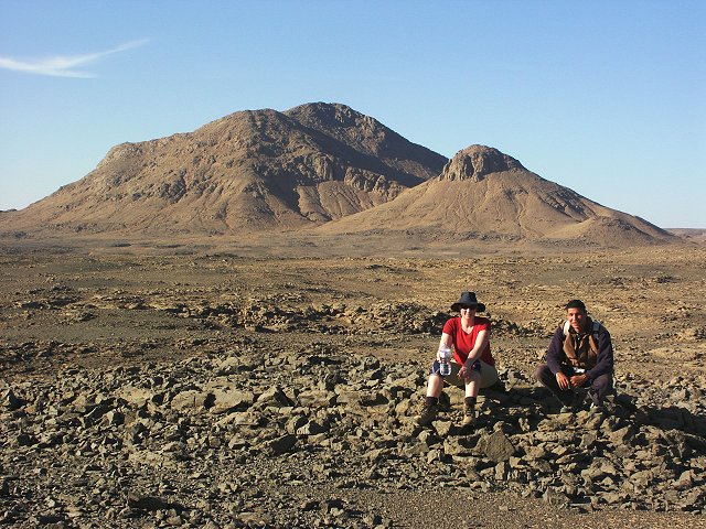
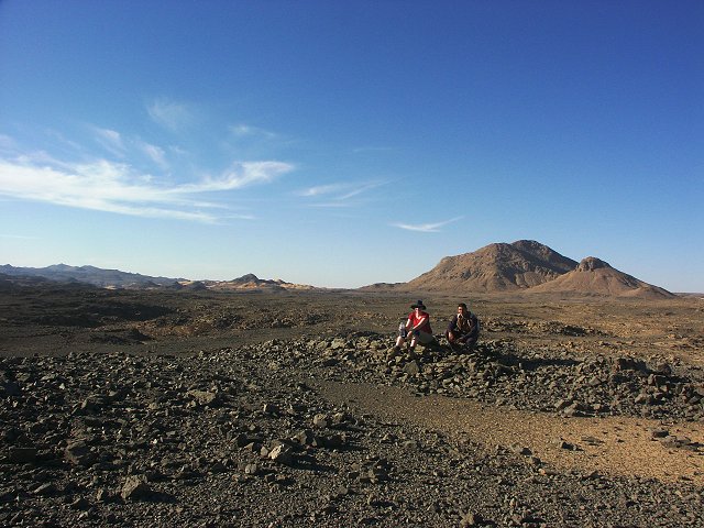
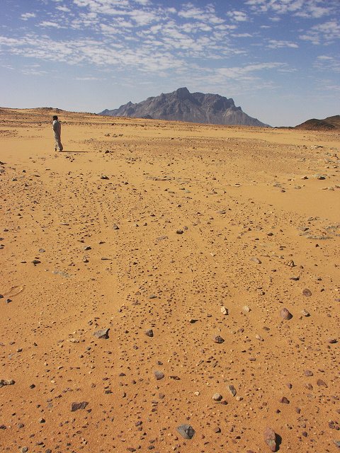
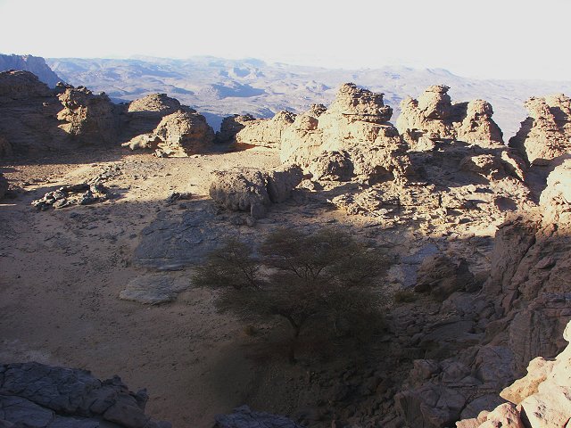
Day 5. - Day trip to Jebel Kissu and South Uweinat
In the morning we drove around the foothills of Uweinat to the east with a Landcruiser and the HiLux, passing the black dome of Ras el Abd, where Bagnold and company left their derelict car in 1930. Our objective was Jebel Kissu, which we intended to visit from Libya in October 2003, but were prevented from doing so. This time we had no problems, no authorities being present to object. As we approached Kissu, on a pass we found very old thin double car tracks. While we cannot be certain, they strongly resemble the 1924 tracks of Prince Kemal el Din, photographed by Almasy. One thing is certain - all Bagnold's Fords were single track, and later expeditions' cars had the thicker balloon tyres.
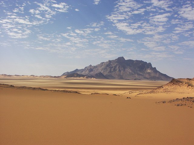
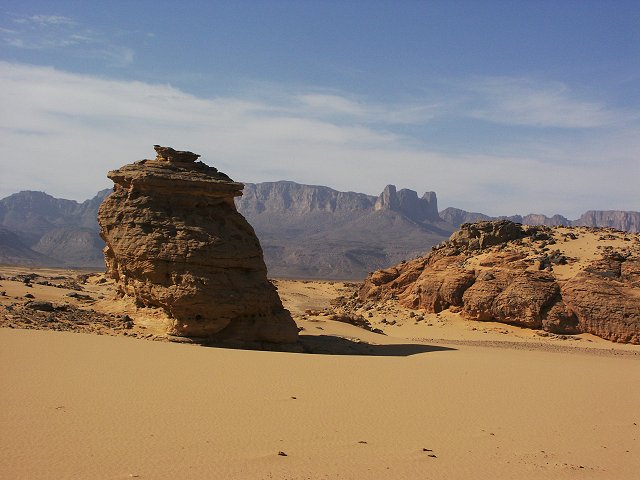
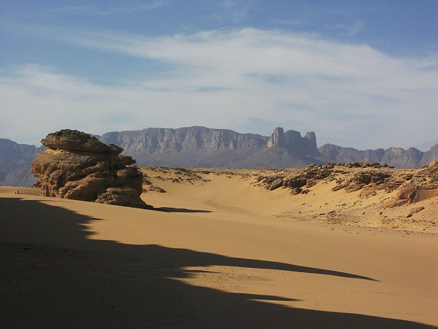
From the pass Jebel Kissu made a particularly splendid appearance, with lingering tufts of clouds, and golden sands surrounding it's base.
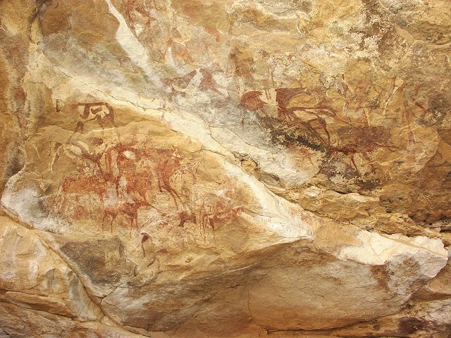
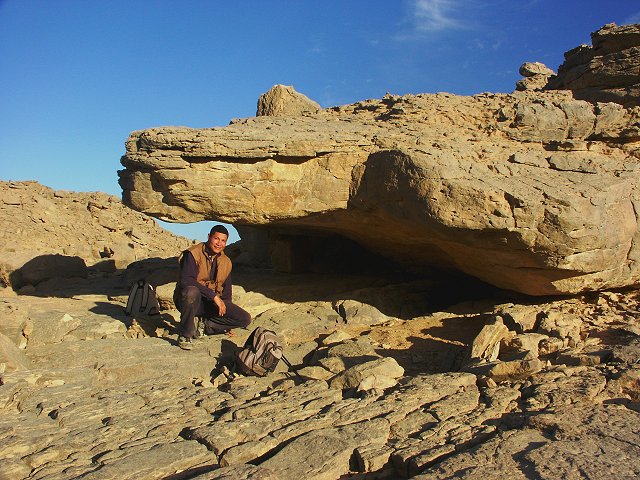
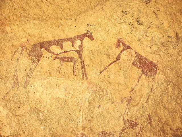
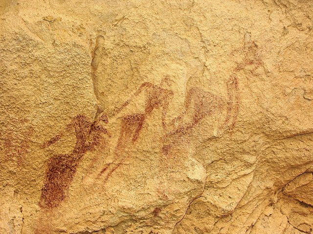
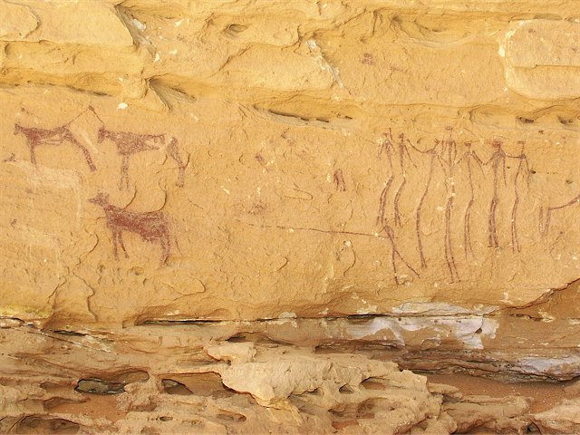
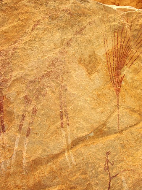
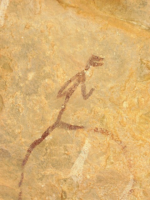
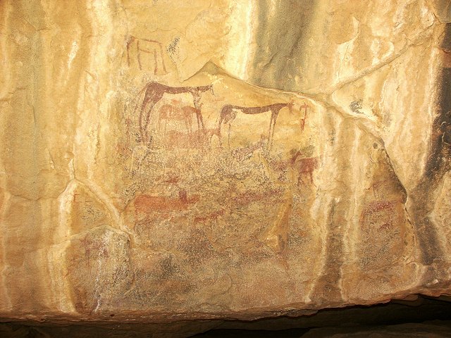
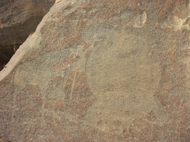
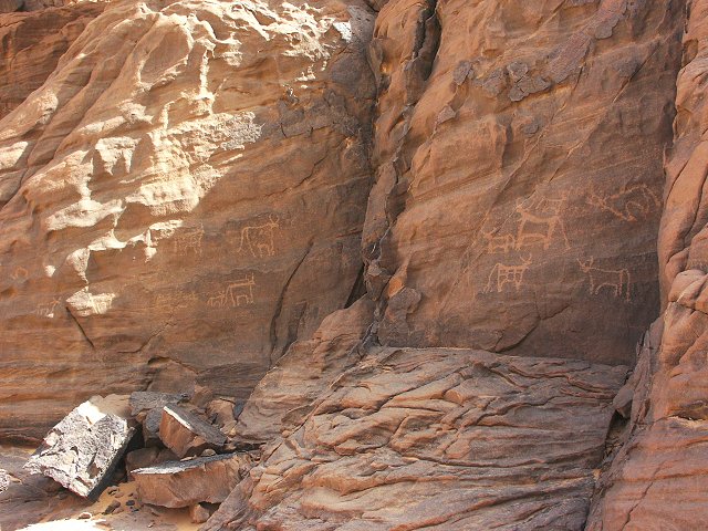
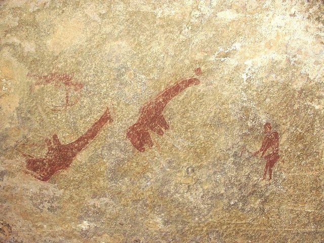
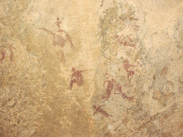
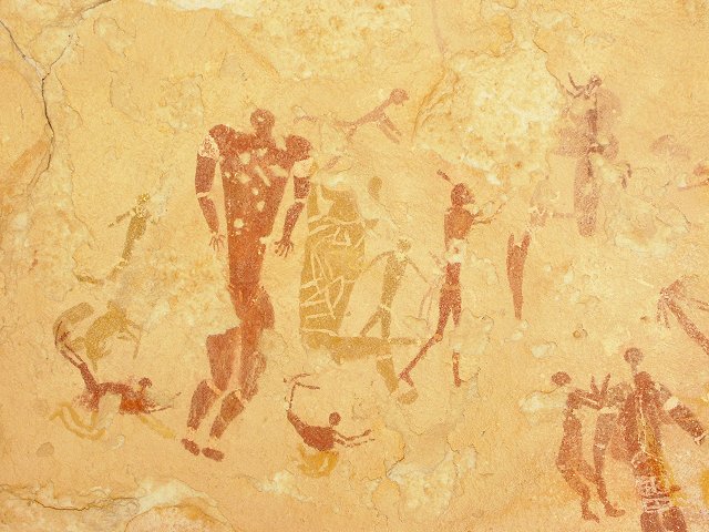
From closeup, Kissu has the same appearance as western Uweinat or Jebel Arkenu, with large grey granite boulders piling up on the slopes and along the foot of the mountain. We knew that F.G.B. Arkwright discovered a painted shelter somewhere along the south side of the mountain (which he later showed to Almásy), but did not know the precise location. We started searching at the base of the mountain wherever suitable shelters were formed by large boulders. At one point along the south side, we spotted a large conspicious shelter. It proved to be full of paintings of cattle, goats and people along its rear wall and ceiling. It was a new site, not the one we were looking for.
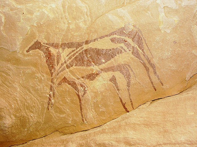
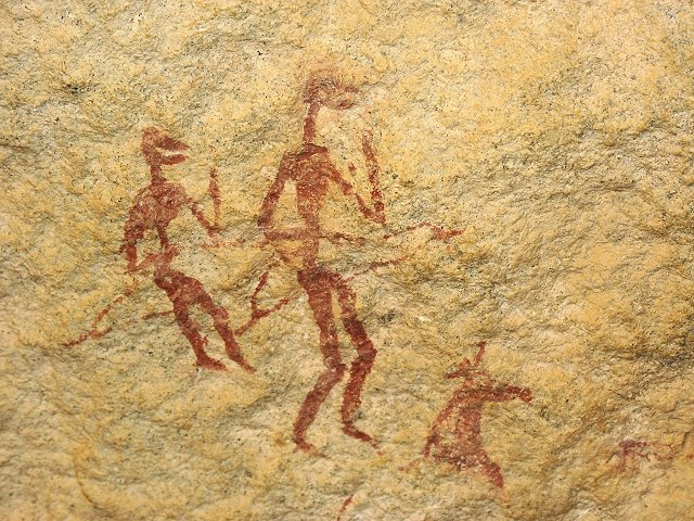
A short distance up a gully among the boulders, Georg found a small shelter with very unusual figures of two archers. A few kilometres to the west, we came upon another shelter with some faint cattle.
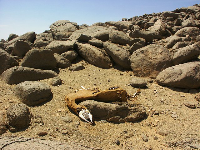
Finally along the south west side, we found Arkwright's site too. By this time the clouds disappeared, becoming very hot. We had lunch in the shade of a large rock nearby, which appeared to be a favorite stopping place for the sudanese camel caravans, judging from the many dead camels littering the area, much like the vicinity of the checkpost at Ain Zoueia.
Leaving Kissu, we turned to the southern foothills of Uweinat, where in 1996 Jean-Loïc Le Quellec and party found a number of interesting paintings, some strongly resembling those at Wadi Sora. We did find some of Jean-Loïc's sites, before the setting sun compelled us to start our way back to camp.
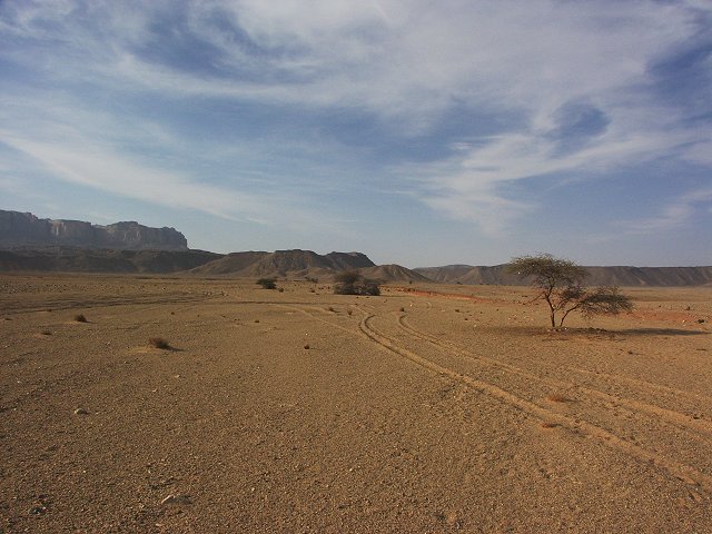
On our way back, we passed the lower course of Karkur Murr, which extends for several kilometres into the plain towards Jebel Kissu, it's course traced by a sparse but continuous line of acacias. We reached the eastern entrance of Karkur Talh just as the sun disappeared behind the mountain.
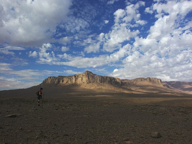
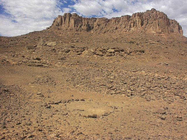
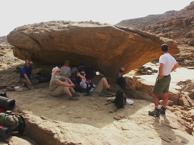
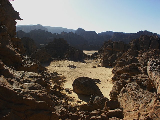
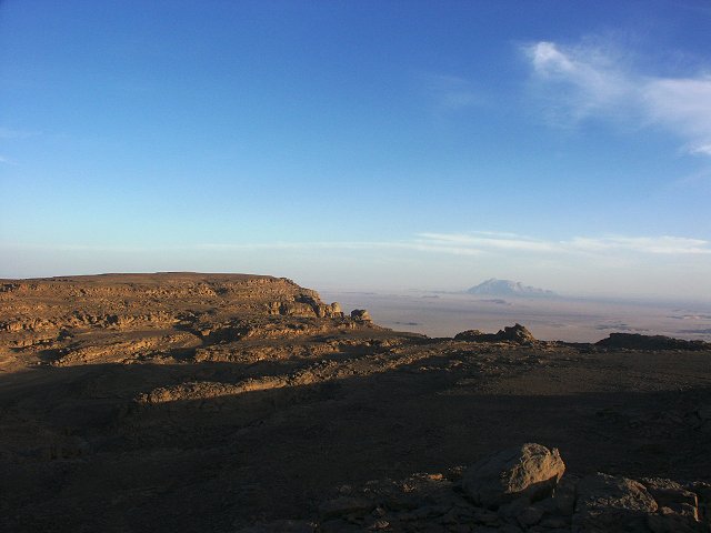
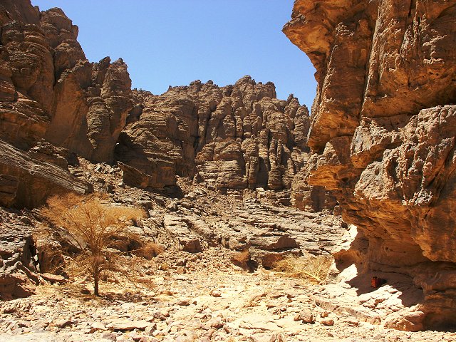
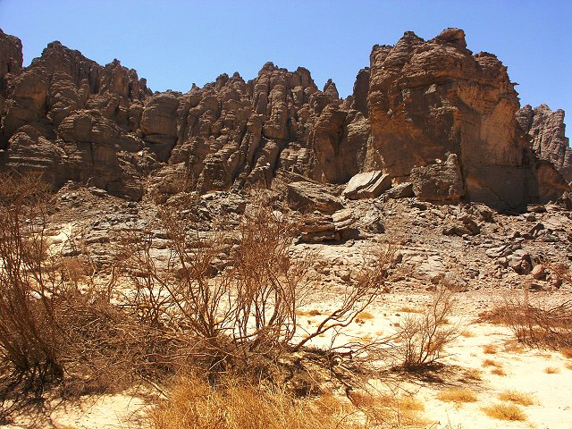
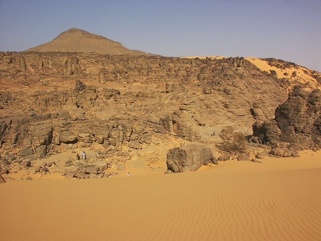
Day 6 - 7. - Exploring the Hassanein Plateau
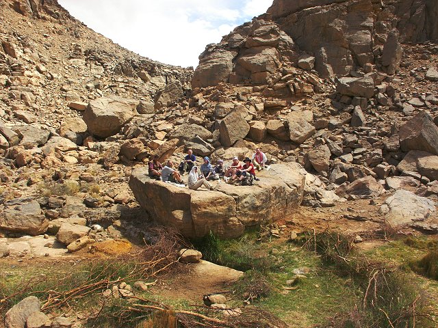
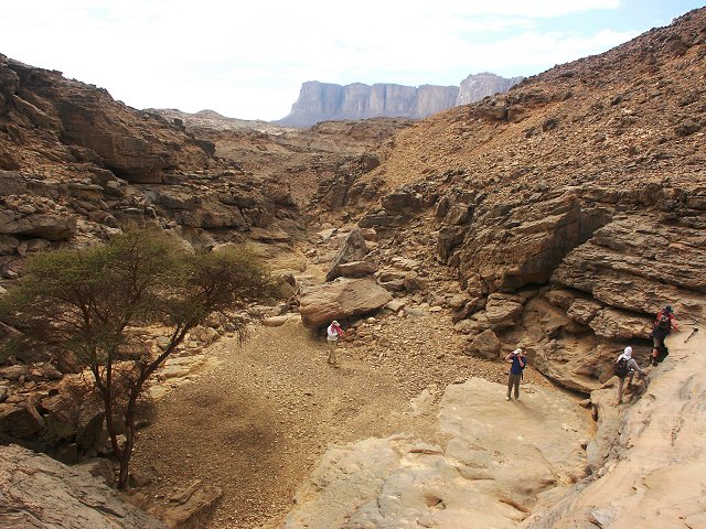
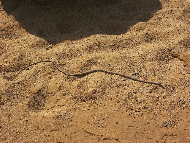
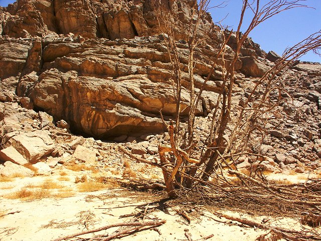
The Hassanein Plateau remained one of the largest unexplored areas of Uweinat. In February 2003 with Mario and Salama we made a very brief visit, sufficient only to explore the "white spot" and imediate vicinity. Even during that brief hour, we found two rock art sites in the valley east of the "white spot", and satelite photos indicated several other promising large wadis. Last time we were delayed by the many superb rock art sites we found in the upper reaches of Karkur Talh leading to the foot off the cliffs. This time, we were hoping to be up by midday, chosing a direct traverse to the foot of the cliffs accross the high plateau rather than the valley bottom. We started out at dawn, and by mid morning we were at the 2003 rock art sites. Here the party split, with Anders, Eva, Erika, Hannah, Mahmoud, Pascale, Salama and myself continuing the climb, while the others opted for a leisurely visit of the rock art sites, and some less arduous walks in the main valley the next day. As we continued up the valley, Salama spotted a small sand snake warming itself in the morning sun.
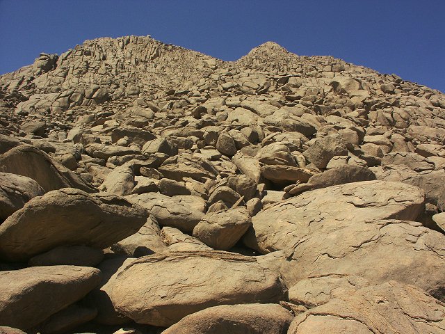
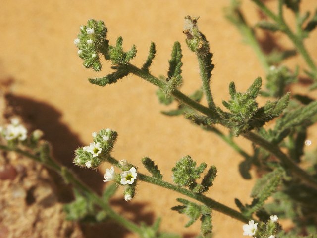
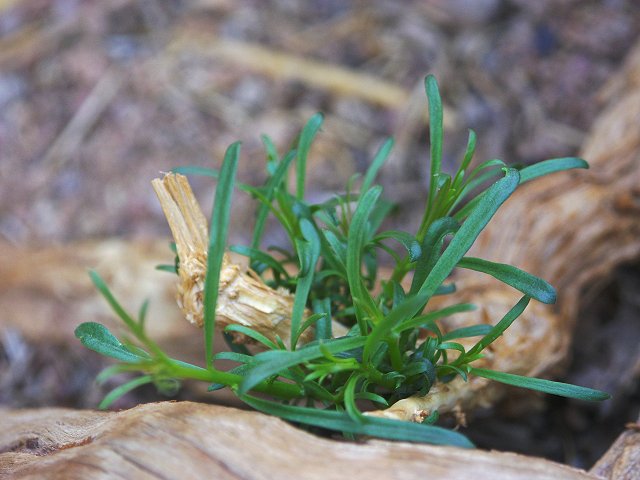
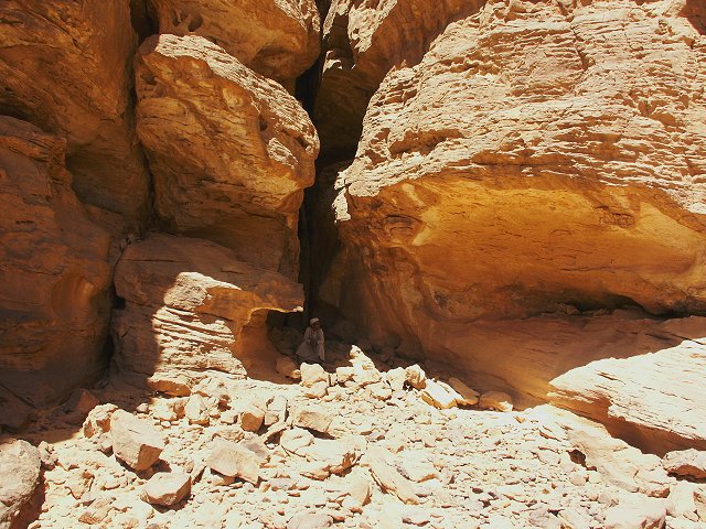
After a difficult climb up the steep rock rubble slopes at the foot of the cliffs, then the even steeper rockslides up in the cliff crevasses, we finally made it up to the "white spot" by early afternoon. We had lunch at our previous campsite, where we noted some bright green plants growing from the sand, with tiny white flowers. Many more of this never before seen species were found on the plateau.
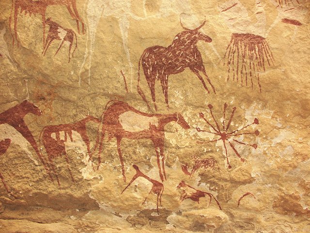
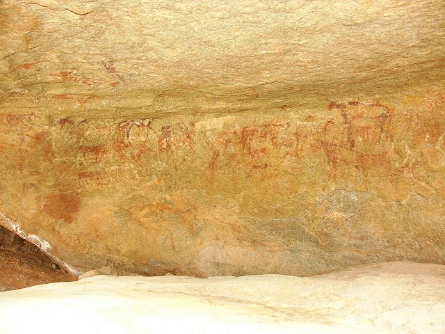
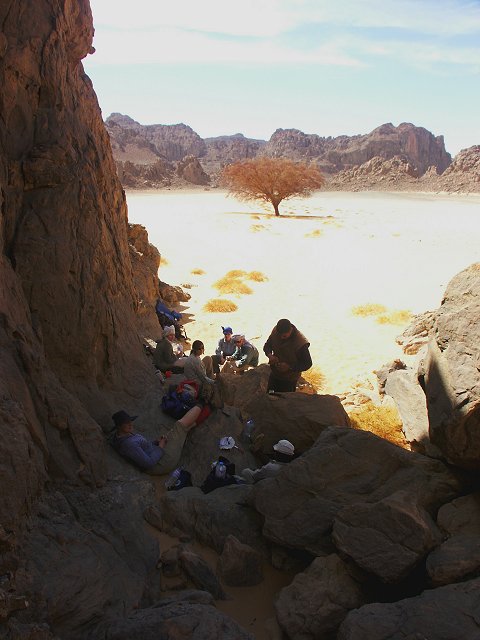
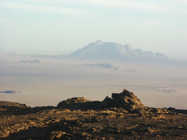
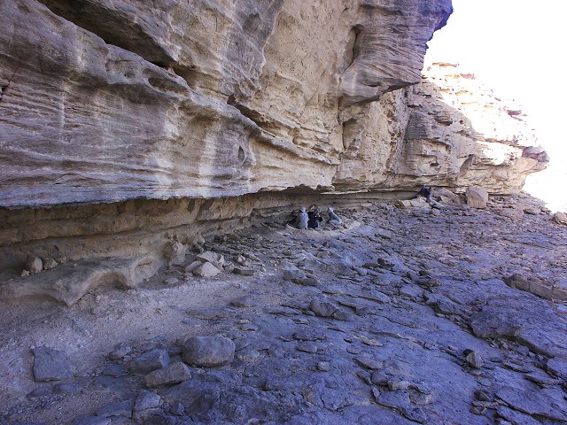
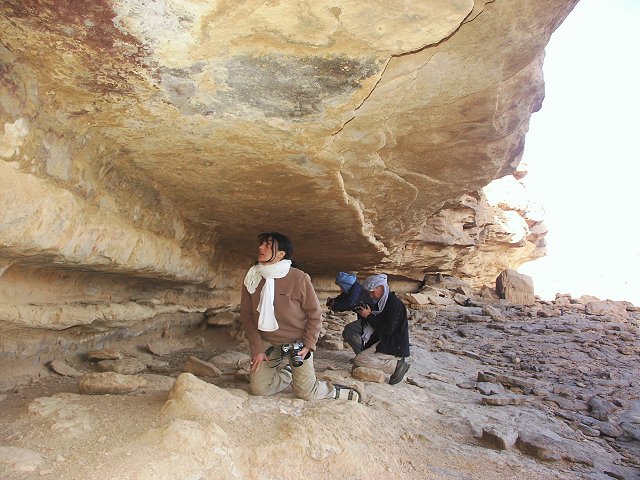
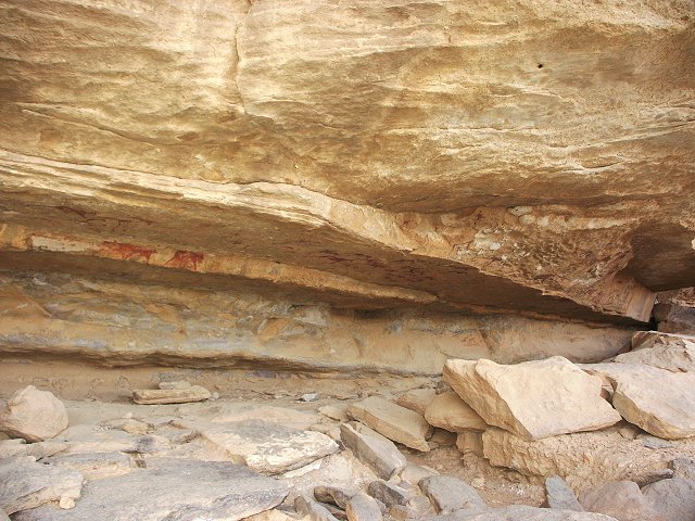
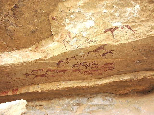
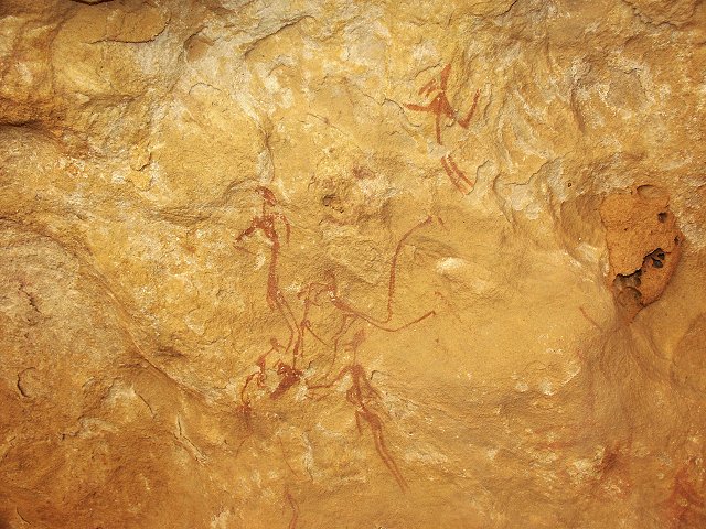
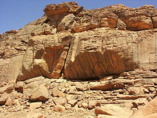
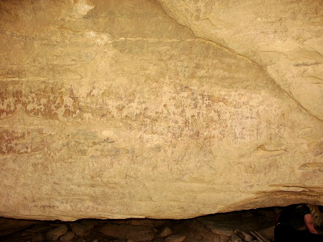
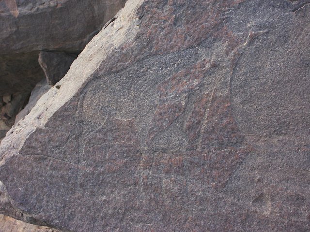
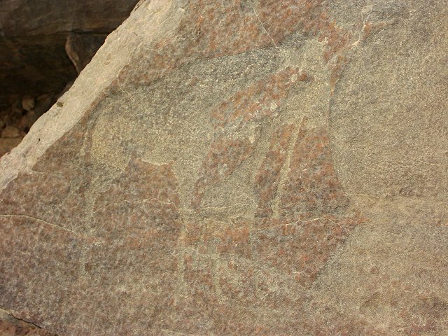
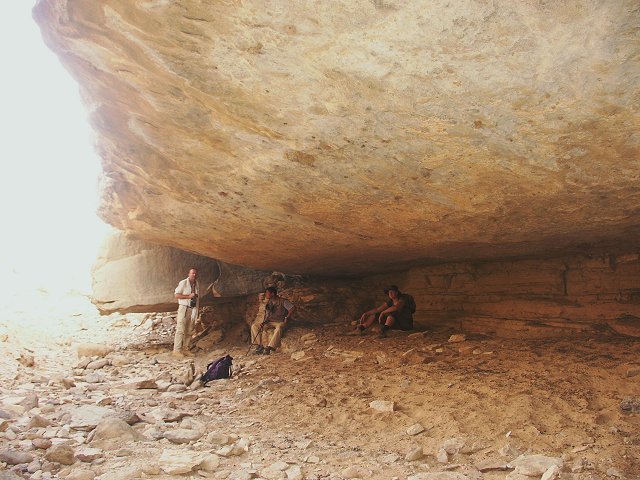
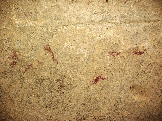
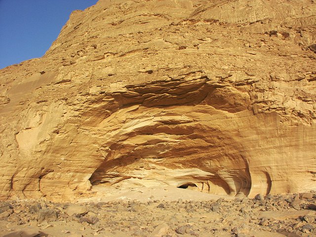
In the afternoon we visited the sites found the year before, then set out to explore the ground further east. After a rise there is a large wadi draining much of the western part of the plateau, flowing to the north and ending in a rocky basin before plunging down to another sand filled basin with a large dry guelta. Along the north side of the upper basin, we spotted a very long low shelter. On close examination, it proved to be over 100 metres long, it's ceiling and rear wall covered with paintings along it's whole length in numerous clusters !
By the time of the discovery it was too late and dark to start photography, so we headed back to our camp for a very excited evening, pausing at the high point of the plateau for a wonderful view of the "white spot" and Jebel Kissu to the south.
This unexpected major discovery changed our plans significantly. We were planning to spend the morning exploring the plateau before making a leisurely descent at midday. However photographing the new site required much of the morning, leaving little time for else. To maximize time, we set out towards the shelter at first light, pausing at the basin with the large guelta to check if there are any others. There were none, but we found an unidentified plant species (possibly Crotalaria thebaica ?) thriving in several clusters.
We spent the next several hours photographing the shelter, and simply marveling at the innumerable fine details. This new site is one of the largest known at Uweinat, only surpassed by the shelter discovered by the Belgian expedition at Karkur Talh in 1968.
While we were busy at the site, Salama went off alone to explore the large basin to the west that shows up prominently on satelite photos. He returned excitedly, having found five new shelters inside the valley. However the terrain was dismal, steep almost vertical climbs among the eroded rock pillars. It was decided that the rest of the group will return by the known route from the "white spot", while Salama and I will remain for a few more hours to fully explore the other valley. The way down the basin was worse than I expected. I soon realised that when Salama says 'tariq mis kwais' (bad going), that translates into a vertical cliff with no going at all, except for mountain goats, and of course Salama. While Salama was off to collect our gear from camp (in the hope that we might find another way down) I managed to scramble down among the pillars, finally reaching a little side basin filled with flowering Fagonia arabica.
The basin itself was a large sand filled, flat bottomed valley, with amazing rock formations surrounding it on all sides. The landscape is very reminescent of the Tassili N'Ajjer, with the eroded rock spires and narrow passages. In sheltered coves, I've seen several flowering Pergularia tomentosa, and numerous Fagonia, plus the small white flowers seen also in the "white spot". The few acacias were all dead or dying.
The rock art sites are all in shelters along the bottom of the basin. Some were faint and damaged, but two sites were in excellent condition with interesting scenes.
Soon after midday we started finding a suitable way down. From below we have seen that in one gully descending from the vertical cliffs, there was an apparently passable rockslide. We were hoping that the wadi draining the basin will lead to this gully. Before reaching the cliff, the wadi made a few turns, and broadened into a basin filled with dead acacias. At the side, a small shelter contained some very abstract paintings of human figures.
We soon reached the cliff face. The wadi dropped near vertically, but Salama spotted a "passable" crevice where it was possible to scramble down to the boulder slope below. We made our way down the scree for several hundred metres, until we reached a point where the cliff fell again vertically, this time for a hundred metres, with no possible way down. There was no choice but to climb back up again, past the basin with the dead trees and small shelter, then scramble up again among the rock pillars to the watershed. This time we were lucky, behind the rocks indeed there was the gully with a rock slide all the way to the cliff bottom. It was an easy going, we were at the foot of the cliffs in less than half an hour.
Our descent was much closer to the agreed meeting point than the other way up, in less then an hour we reached the rock where we left our reserve water bottle near the rock art sites. The rest of the party were waiting, soon we started the long walk back to the main valley to the waiting car. On the low plateau in a small shallow wadi, we passed a solitary Maerua crassifolia, the only living plant above the larger valley floors, full of fresh growth and flowers.
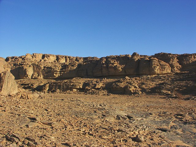
Day 8. - Karkur Talh
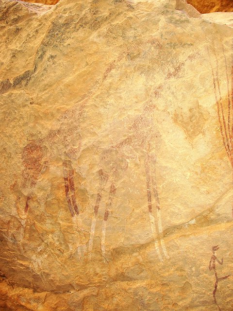
After the long two day hike, we spent a leisurely morning visiting the Belgians' rock art sites in the main valley. Near the western edge of the large shelter, I found a faint scene which was not recorded by van Noten: two beautiful large giraffes beside (palm?) trees, and a single human in the same strange style as the ones in the little shelter at Kissu.
On the opposite bank, in a fairly conspicious shelter visible from afar, we found a new set of paintings, a site both ourselves and other explorers have walked by many times over the past years without noticing.
In the afternoon we visited the northern tributary with the rock art sites found in October 2002. We also had a little time for exploration, we covered a large area to the west of the wadi on the plateau. Our only find was a large rock, with once abundant but now almost completely weathered paintings on the wall.
On the return walk, we found a little tibou storage hut perched high up on the cliff above the valley. It was unusual that it's walls were strengthened with mud, not just the bare stones placed atop each other.
At sunset we went to the amazing turtle engraving found last november, to take photographs in the best possible light. On the new photos it can be seen that the two giraffes to the left are nibbling a tree with round foliage. This engraving remains unique both in subject and style, it is suspected to be one of the oldest at Uweinat.
Day 9. - Karkur Talh.
The morning was spent visiting the sites under the dry waterfall near the northern entrance of Karkur Talh, and some exploration along the wadi above, and among the hills to the west of the main valley. A few new engravings were found, plus a wonderful scenery from above.
In the afternoon we visited the large shelter containing the perfect miniature little human figures that Salama found in October 2002. On our last visit with Bernhard, it was close to dusk, we only had a bare 15 minutes before we had to return to camp. This time we thoroughly explored the ceiling, and found several new scenes that were missed previously, including several finely drawn giraffes.
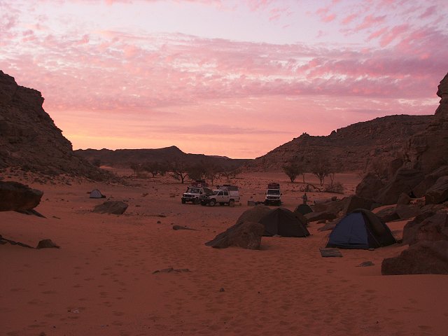
Day 10. - Karkur Talh - Wadi Sora.
We departed from Karkur Talh in the morning, driving to Clayton's Craters, visiting the interior of previously neglected, trachyte filled "Crater C".
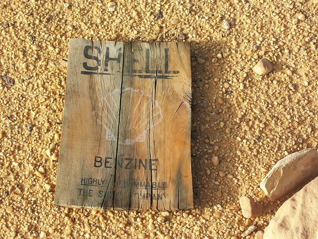
We continued along the easiest route to Wadi Sora, reaching it by noon. A lazy afternoon was spent visiting the main shelters, which yet again revealed several previously unseen details. A fine intact WWII vintage Shell petrol box lid was found a little distance outside on the plain.
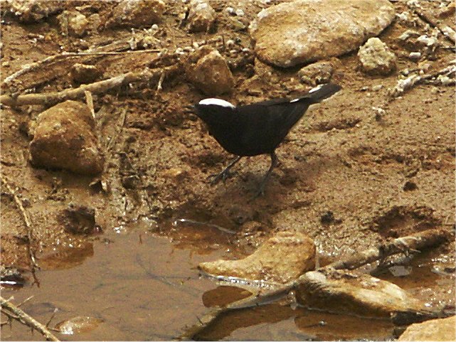
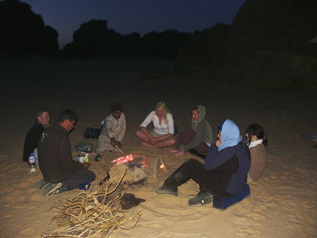
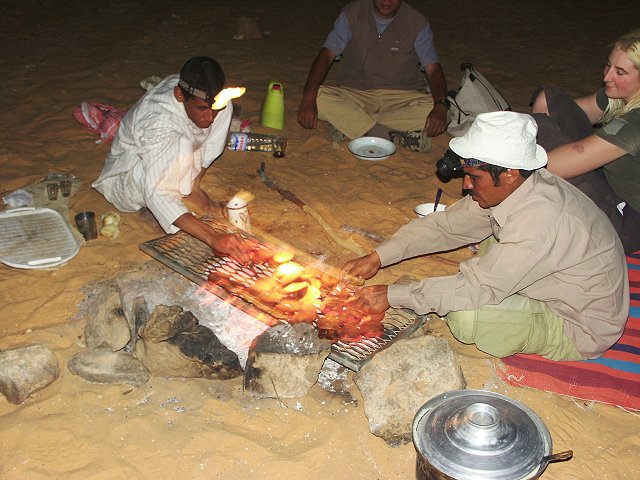
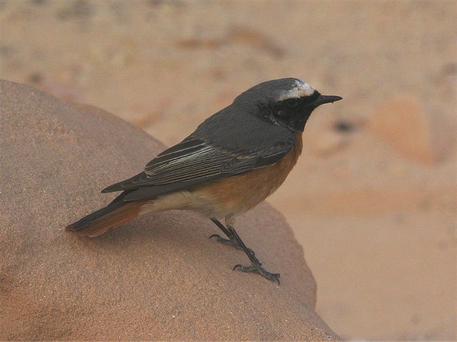
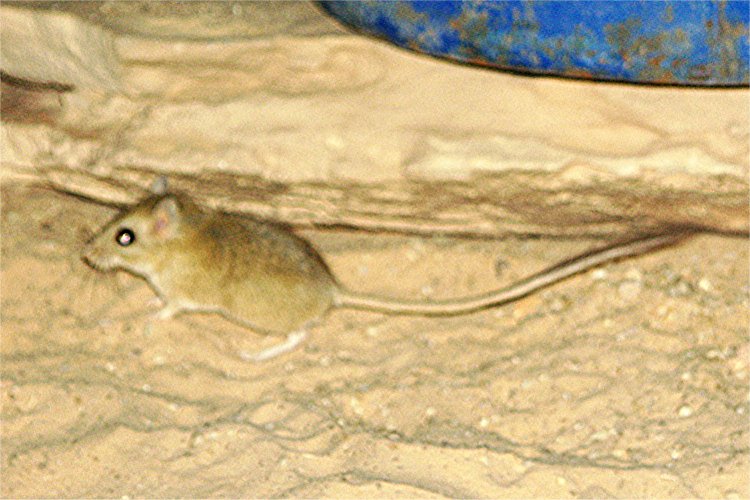
We had several visitors during the afternoon and the evening. A little stray bird (red-breasted wheatear, Oenanthe bottae ?) landed at our camp, and hopped all about us (and occasionally on us) without any apparent fear. It enthusiasticly splashed about in the bird bath prepared in Hannah's plate. Later in the evening while taking our meal around the fire, I suddenly felt something soft nudge my hand. As I turned back, I saw a dark little shape scurry away. They soon returned, a pair of long tailed cute little gerbils (Gerbillus gerbillus, lesser egyptian gerbil). They thoroughly explored the camp, taking anything looking remotely edible.
Day 11. - Wadi Sora.
We spent the whole day visiting the magnificent Foggini/Mistekawi shelter, and the other sites discovered during our October 2002 expedition.
Day 12. - Wadi Sora - Silica Glass Area.
The day was spent uneventfully, driving up along the track skirting the western edge of the Gilf Kebir, then along the Wadi Gubba, making camp at the north-western edge of the Silica Glass Area.
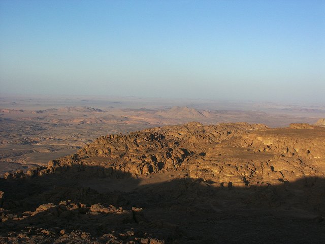
Day 13. - Silica Glass Area - Big Cairn - Great Sand Sea.
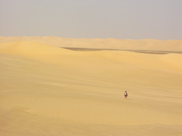
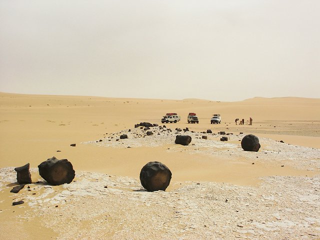
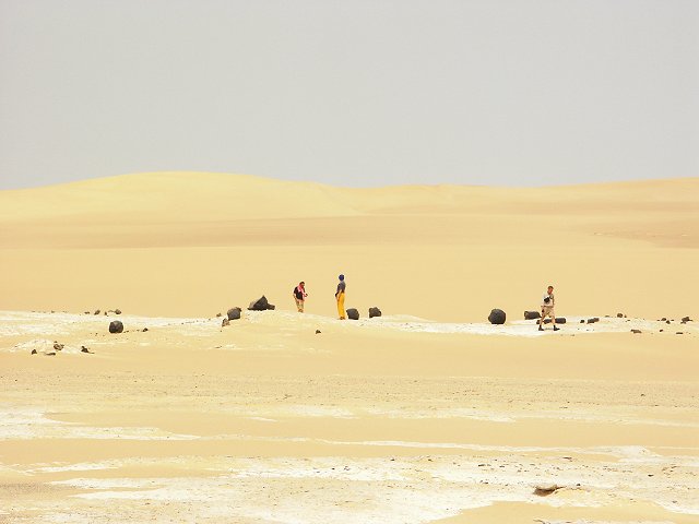
In the morning we made a short prospecting trip along one of the corridors, and attempted to walk accross the dune barrier into the 'hidden valley', surrounded on all sides by dunes. This was abandoned, as a nasty hot southern wind started picking up the sand, making the two kilometre walk in soft sand a rather unpleasant proposition.
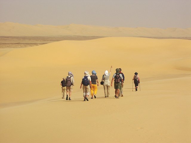
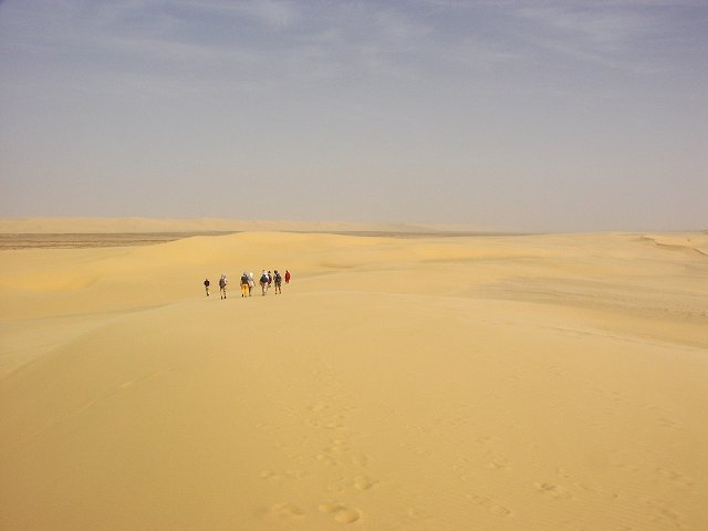
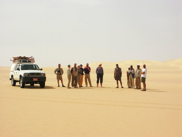
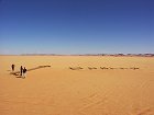
At midday we started the long drive north along the western edge of the Great Sand Sea, stopping for a group photo at Clayton's "Big Cairn".
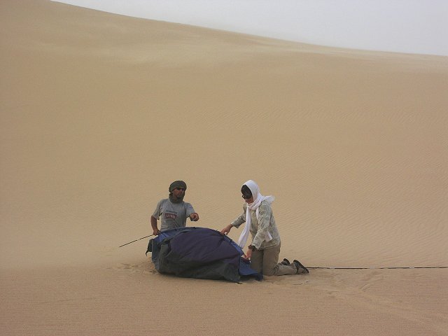
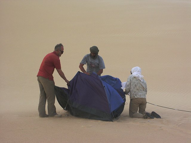
As we entered the low dunes of the edge of the Sand Sea, the hot wind developed into a full blown sandstorm, accompanied by suffocating heat. At sunset we camped in the lee of a large dune, which however did very little to block the wind and sand. After struggling with the tents, we opened the evening bar in the relative comfort of one of the cars (the wind was blocked, but it felt like an oven). Miraculously, as dusk fell the wind died, and by the evening we were sitting peacefully around the camp fire in almost total calm.
Day 14. - Great Sand Sea - Siwa.
Next morning felt like a different season. The temperature dropped a good 10 degrees, and a cool north wind was blowing. We started to drive in among the dunes in earnest. Conservatively a day and a half was planned for the 140 kilometre crossing to Siwa, however we made excellent progress with the now light cars, in the first two hours we covered eighty kilometres. Soon the first vegetation appeared among the dunes, clusters of low green shrubs (Calligonum comosum), incredulously growing out of the sand.
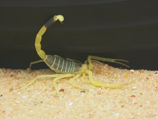
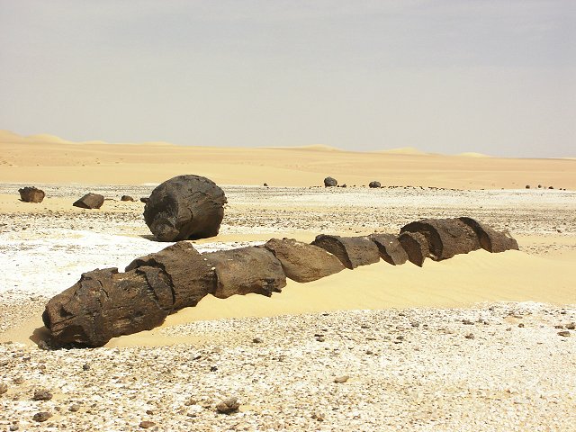
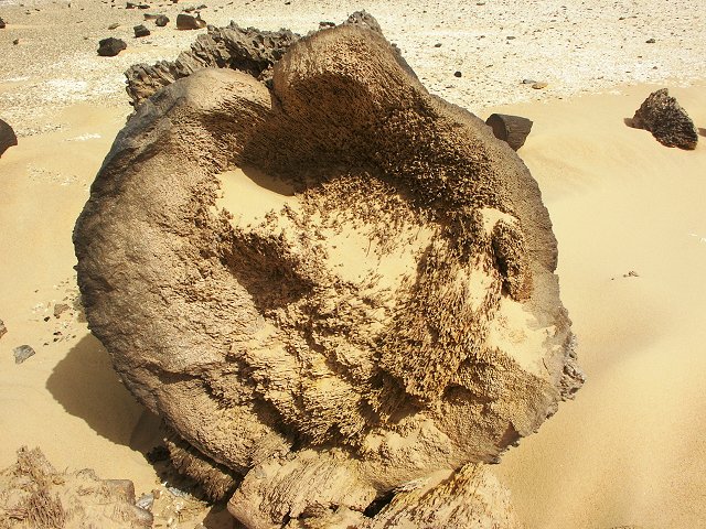
After crossing a large dune range, soon hard patches and rocky hills appeared. We stopped for lunch near a pile of black rocks which turned out to be petrified palm trunks. Every detail was preserved, even the intricate fibres forming the root bulb of the trunk. Under a rock Salama found a beautiful bright yellow scorpion (Leirus quinquestriatus), with unusually long, slender claws.
The remaining 40 kilometres to Siwa were a bit more difficult, with confused dunes and rocky outcrops, however by mid afternoon, after descending from the last dune, we saw the green palms and blue lake in the valley beyond. We moved slightly back into the dunes for our last camp.
Day 15. - Siwa.
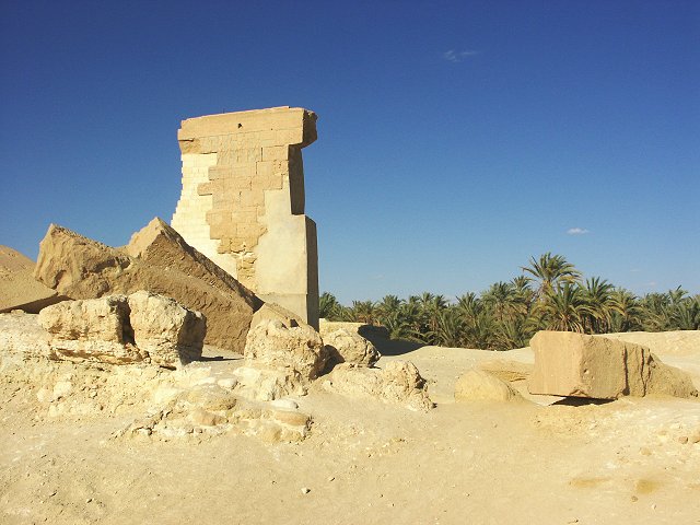
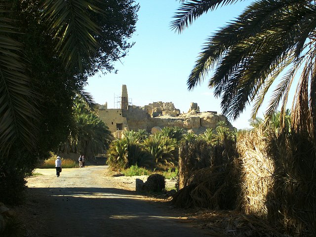
Mid morning we drove into Siwa, and took claim of our rooms and showers in the local hotel. It was a very changed appearance group who took lunch at the main street restaurant. In the afternoon we took a pleasant long walk seeing all the main monuments around the oasis.
Day 16. - Siwa - Cairo.
Wishing good bye to Geert who stayed in Siwa for a few more days, we departed at sunrise driving north along the good but monotonous road to Mersa Matruh, where we said farewell to Mahmoud and major Shaban. With an almost continuous drive along the coast, we reached cairo by late afternoon.
An article describing the large rock shelter discovered on the Hassanein Plateau was published in Sahara 15