
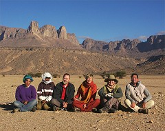
 Click on image for list of participants |
Jebel Uweinat - Gilf Kebir Expedition, Egypt 20th November - 5th December, 2004 NOTICE: The rock art photos on this page are strictly copyrighted ! No photo may be copied / used for any purpose without written permission. |
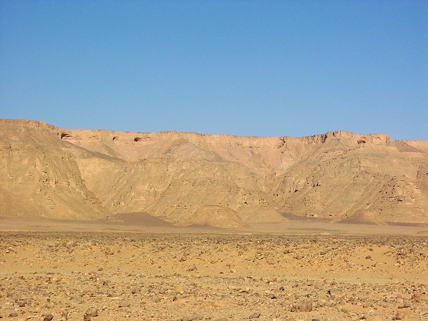
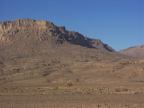
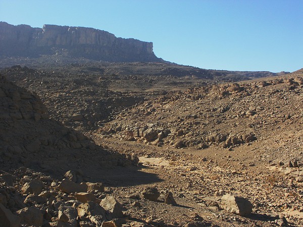
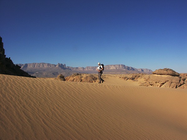
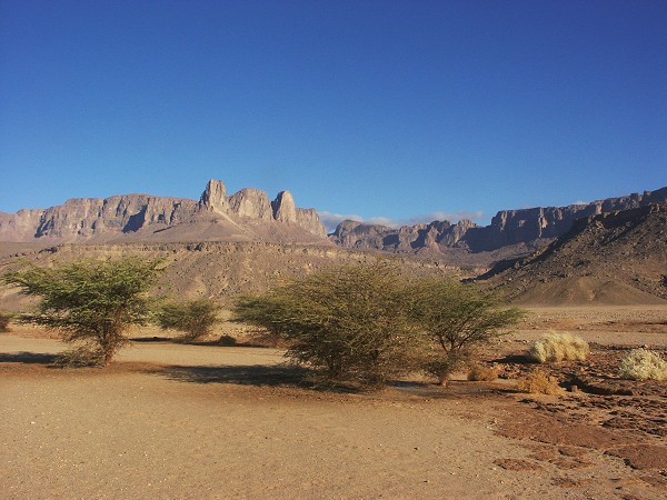
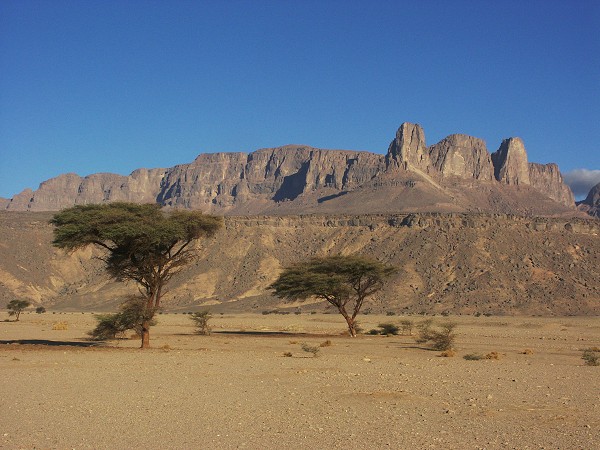
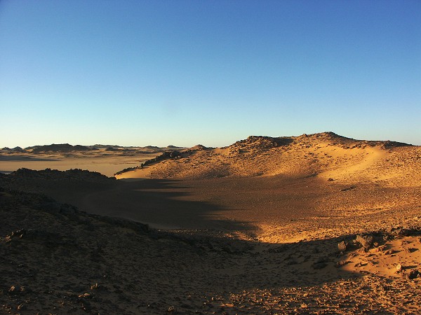
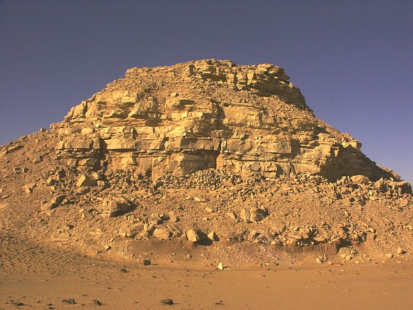
Day 1 - 2. - Cairo - Dakhla - western Gilf Kebir.
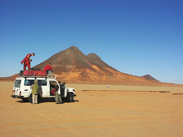
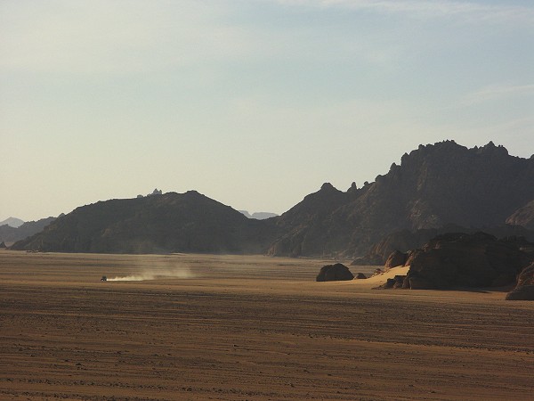
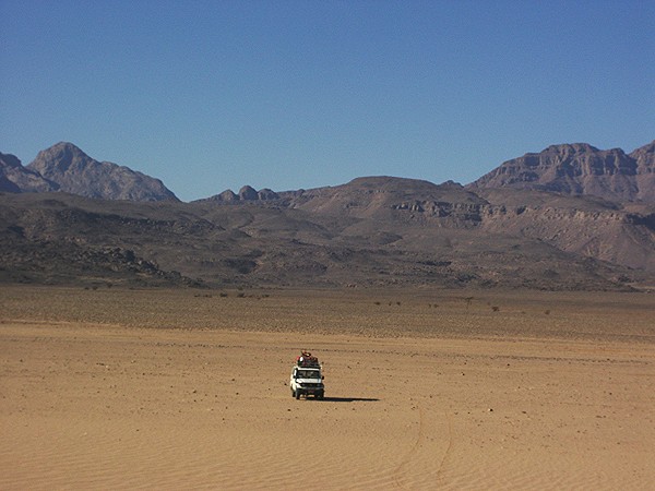
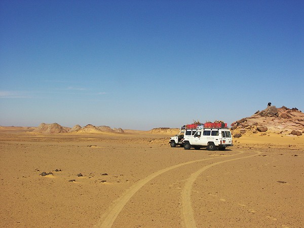
The trip was made with two -75 Landcrusers driven as usual by Salama and Zayed. The first two days were long continuous drives on tarmac, sleeping at the Mebarez Hotel in Dakhla, then turning off the road to follow our usual route accross the Selima Sandsheet towards the foothills of the Gilf Kebir. We camped by the large barchans at the same place as in March 2004, the only notable event being a little fun in the sand on the second day, only two kilometres before camp.

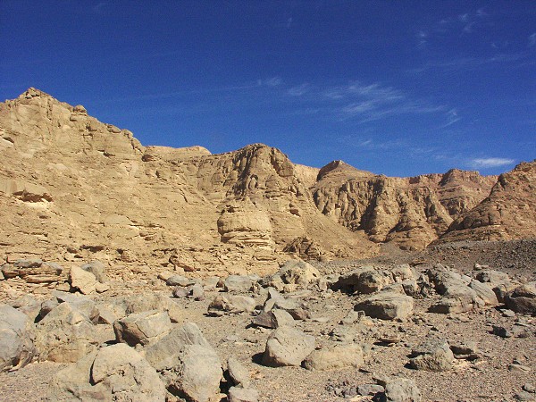
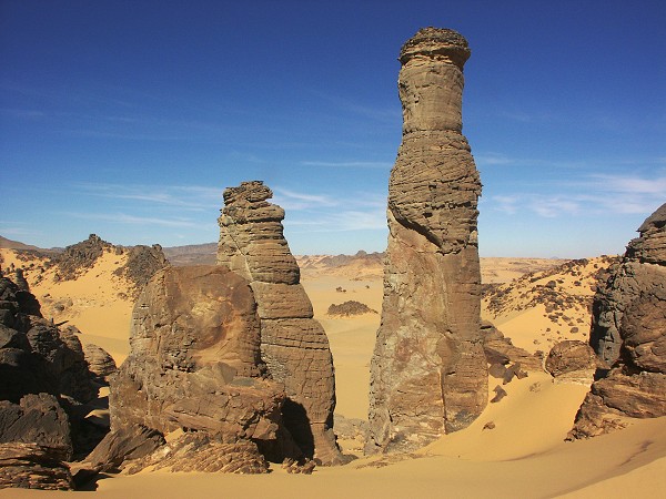
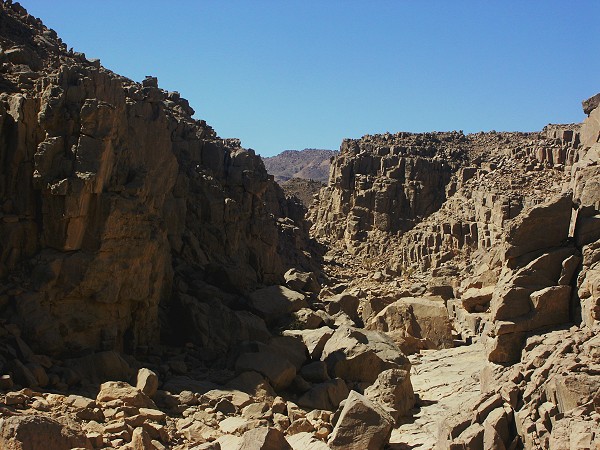
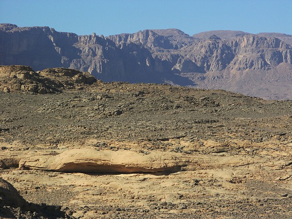
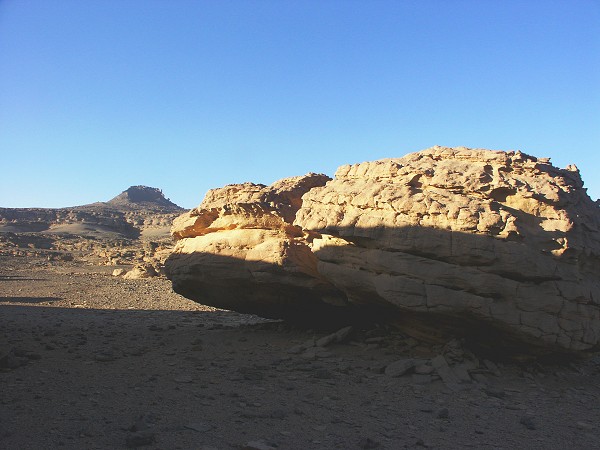
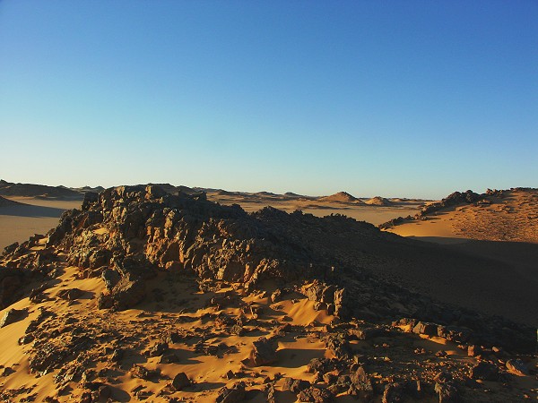
Day 3 - 4. - Wadi Sora area
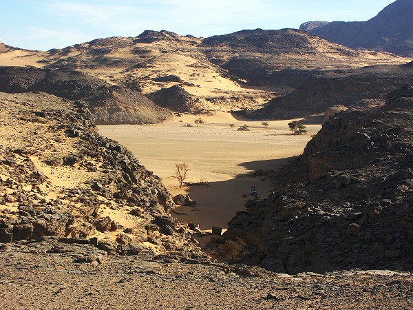
From camp, we followed the track leading around the Southern Gilf, pausing at the WW II airfield at "Eight Bells". We reached Wadi Sora by midday.
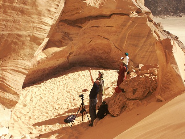
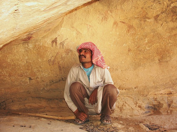
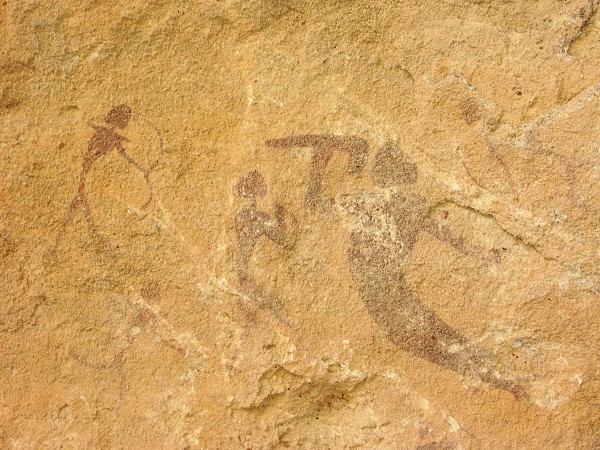
The next day and a half were spent visiting the major rock art sites of the area, including the incredible Foggini/Mistekawy shelter.

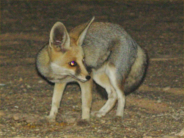
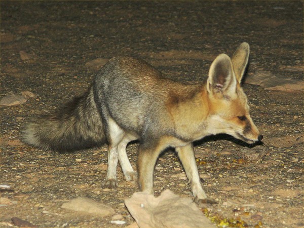
Both evenings we were entertained by a delightful visitor. A little sand fox (Vulpes rueppeli) came like clockwork for the end of the evening meal, and it's presence also explained the lack of the cute jerboas seen in spring.
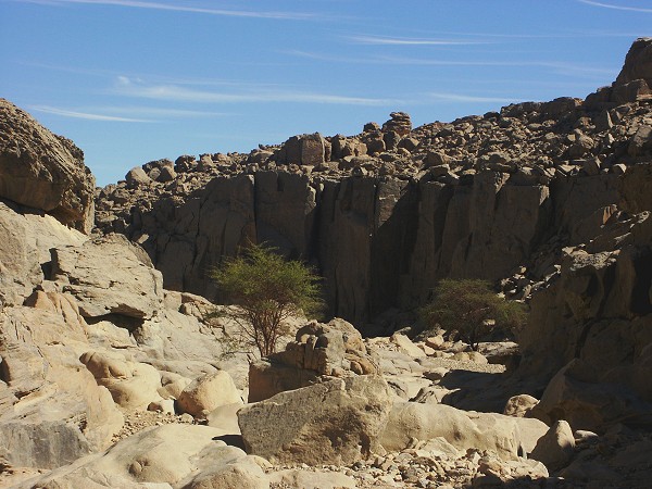
Day 5. - Wadi Sora - Karkur Talh
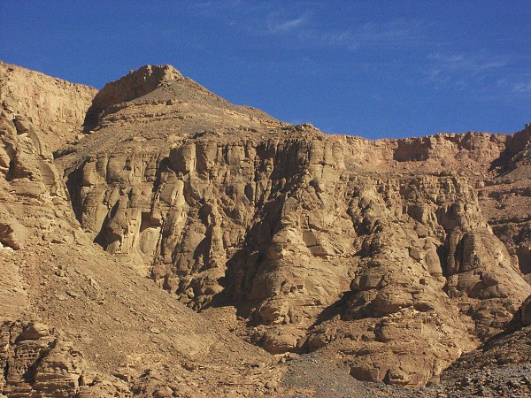
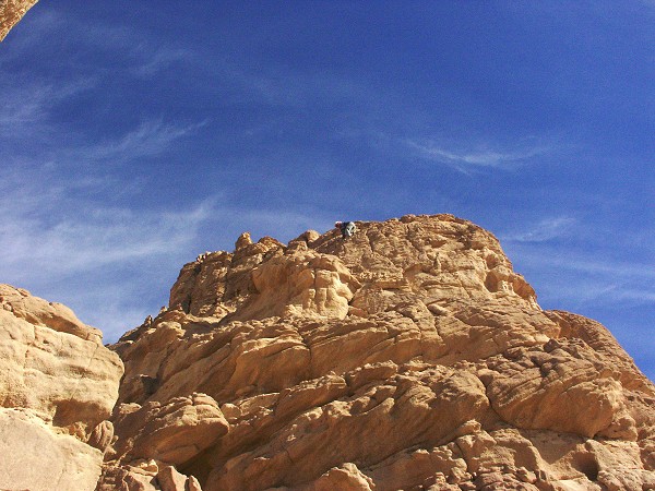
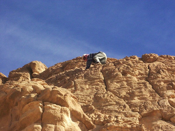
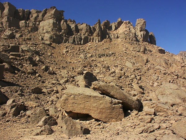
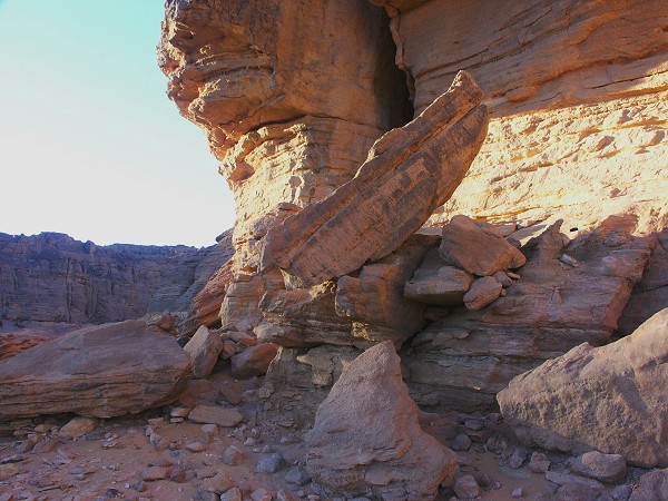
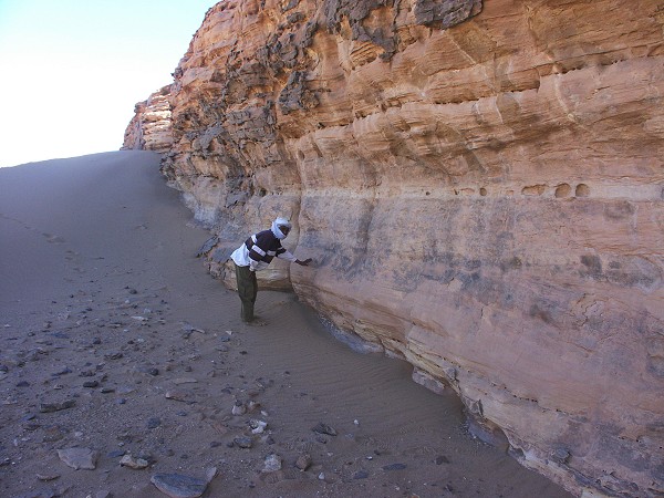
Visiting some sites to the east of Wadi Sora the previous afternoon, we noted a number of large shelters just below the top of the cliffs some distance to the east of Wadi Sora, evident only for a short time in mid-afternoon light. One in particular looked promising, we decided to attempt to climb up to it in the morning.
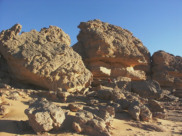
In the morning we drove along the base of the cliffs as close as we could. The terrain did not look promising, several vertical steps separated us from the cave high up. While the rest of the group scattered to seek out shelters at the cliff base, Salama and myself trekked up a steep walled rocky wadi leading in among the cliffs to seek a possible route up. We were lucky, a rockfall to the right seemed to lead all the way up to the top of the cliffs, from where a horizontal ledge appeared to lead straight to the cave. The rockslide itself was easy, but it proved to end in 30 metre high near vertical rock face. I chickened out, but Salama, having had some mountain goat ancestor, scaled the rock step in no time, only to return a half hour later finding the large shelter empty.
Nobody had better luck, so we continued towards Jebel Uweinat, reaching our camping spot in Karkur Talh by late afternoon.
Day 6. - Karkur Talh area
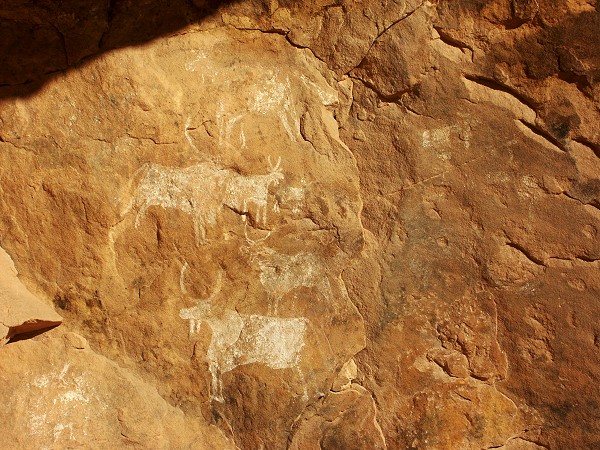
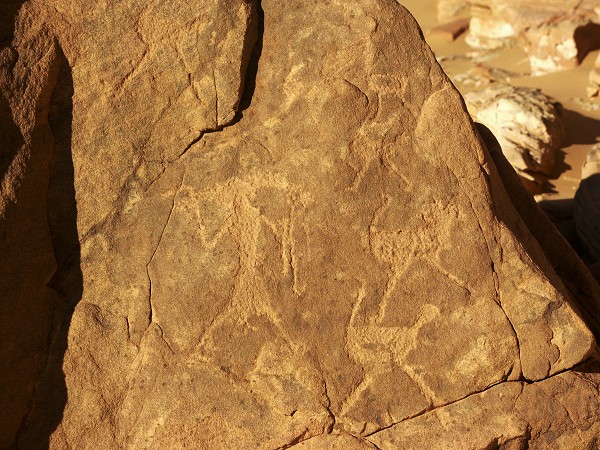
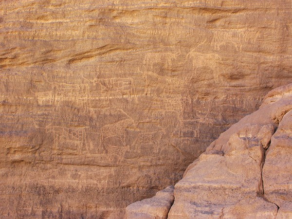
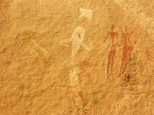
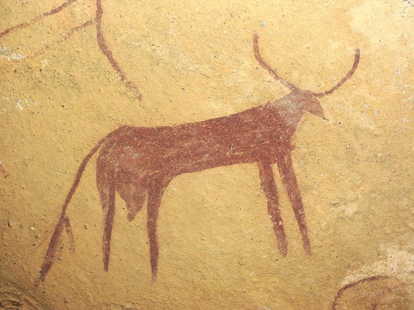
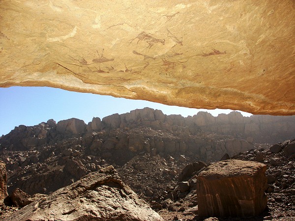
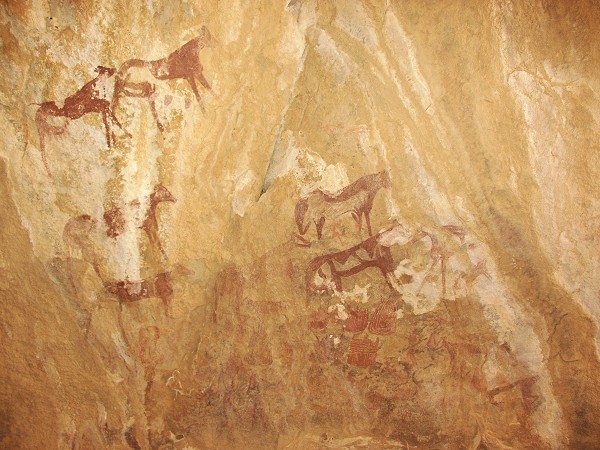
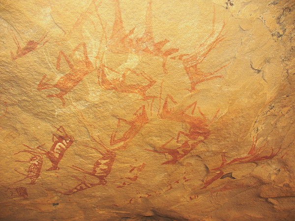
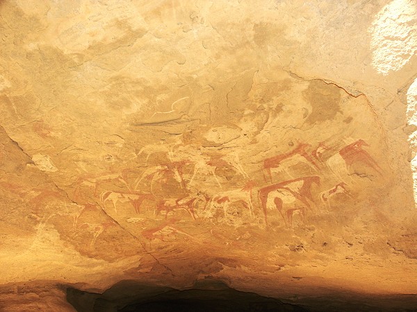
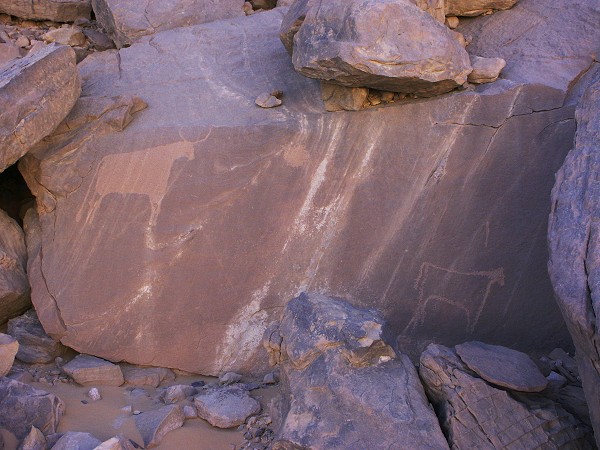
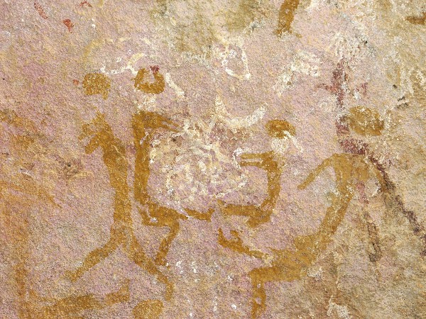
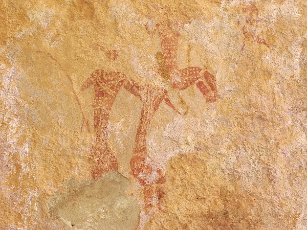
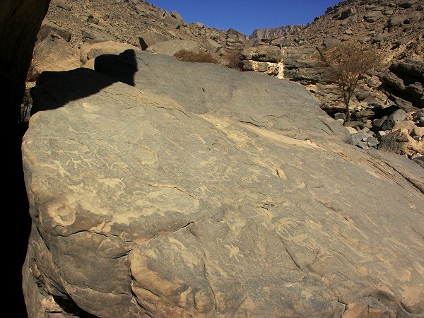
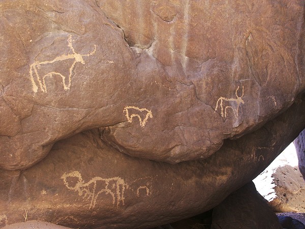
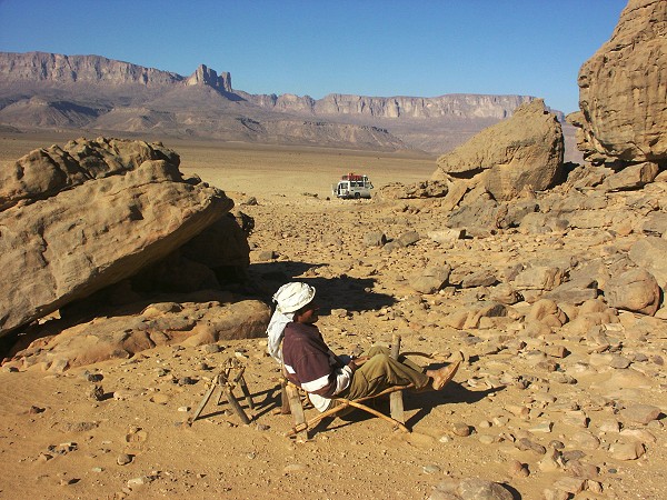
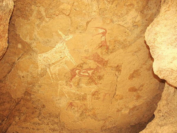
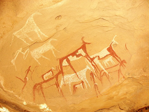
Our first day at Karkur Talh was spent visiting the numerous sites in the centre of the valley, and tying off several loose ends. It never ceases to amaze me how one may find major new sites at places which have been visited and searched repeatedly. Just beside a well known shelter on the first of the central rock islands, Salama casually asked whether I have seen those cows up there ... Sure enough, on a sunlit rock face where none of us could not see anything from afar, there were several painted cattle and numerous engravings on the rocks all about.

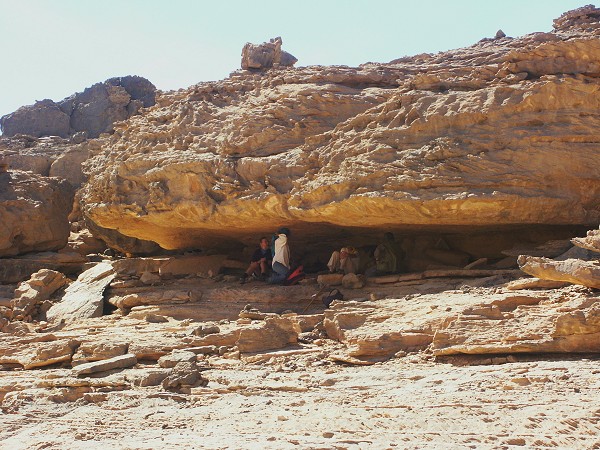
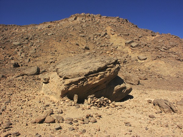
At another location with fine engravings first noted by Giancarlo Negro and party, there is a large low shelter, which myself and others repeatedly searched and found empty. This time perhaps the light was different, as I have noted something on the lowest part of the ceiling. After sweeping some sand away to fit in (there was no more than 20 centimetres between the sand and the ceiling), a lovely scene revealed itself.

While the others followed the line of engravings at the rock islands, with Salama we went to the northern section of the valley. We located the site found by Scott Thybony in November 2000, then proceeded to explore the western bank towards the central area, noting several engravings along the way.
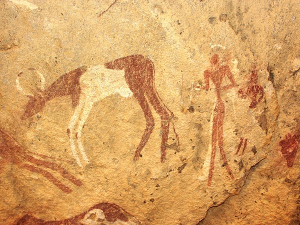
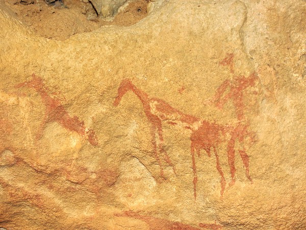
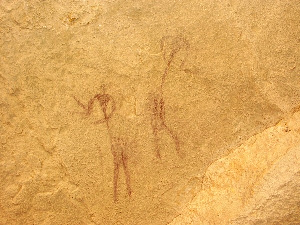
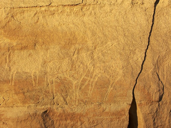
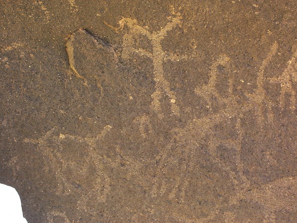
In a small side wadi we finally found Talh 4 of Rhotert, and not far above Salama came upon a small shelter with some remarkable paintings of giraffes and humans.
Day 7. - Karkur Talh area
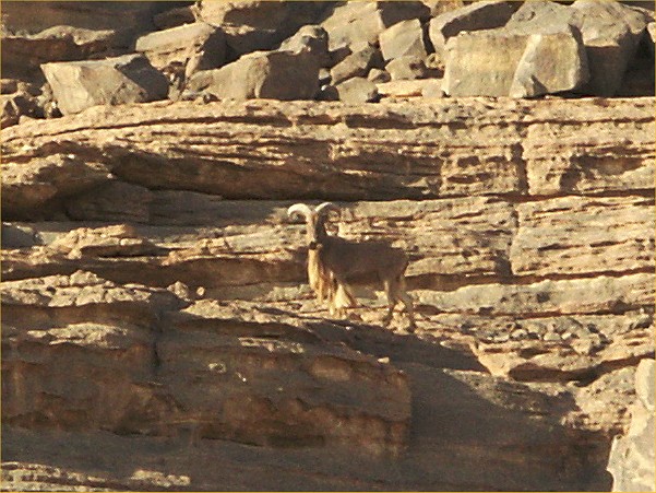
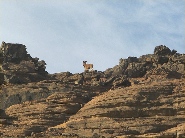
On this day our group split, Astrid and Gina spending the day at the sites discovered by the Belgians. Liz, Jon and myself planned to explore the last majur unvisited wadi, looping around the prominent flat topped hill dominating the northern foothills of Uweinat, and ending in the dry waterfall near the mouth of Karkur Talh. As we approached our starting point by the dry waterfall, we noted a small speck running accross the sand and up the rock walls. Salama slammed on the accelerator, and we arrived just in time to be able to snap a couple of rapid lucky shots of the startled waddan.
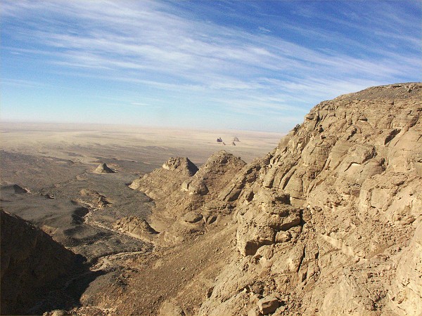
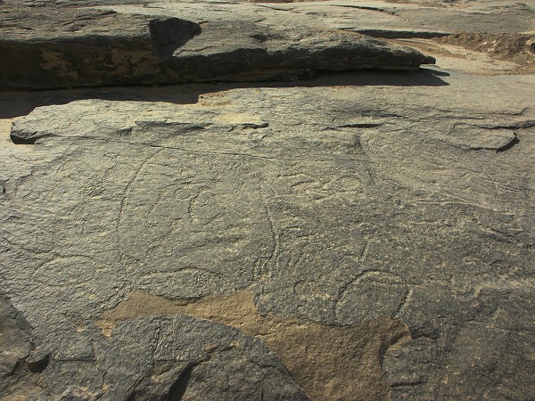
We walked up the series of dry gueltas in the wadi bed till the strange engravings we noted with Irina in November 2000. Past the engravings, the valley flattened out, and made a long loop behing the flat topped hill. We only saw a few small engravings along its whole length. After about five kilometres the wadi merges into a broad flat basin with white sand, prominently showing up on satelite imagery. There were ample signs of human habitation, but no rock art.


Beyond the basin we encountered a rocky wadi that led down to the northern plains. Following it upstream, we met the upper section of the northern branch of Karkur Talh, which here cut a deep gorge as it negotiated a prominent lump of basalt.


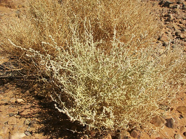
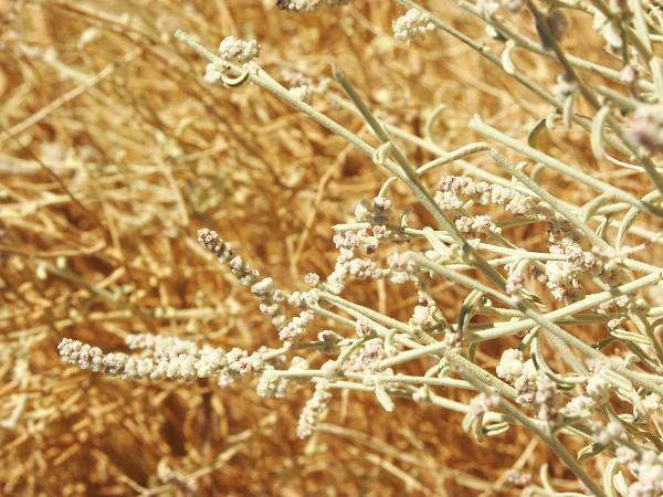
As we followed the wadi downstream to join Astrid and Gina, we noted several species of plants showing fresh growth. As there was no sign of recent rain, it must have been a seasonal phenomenon. (Pergularia tomentosa and flowering Cleome droselifolia).


Measuring out our course on the satelite photos in the evening, we have covered a good 20 kilometres that day.
Day 8. - Karkur Talh area
The morning was spent in the south-western branch of Karkur Talh, visiting Winklers Site 80 and 81, and exploring some outlying areas. Several lesser sites, and a large shelter was found near the Karkur Talh - Karkur Murr camel track with interesting but much weathered paintings.
In the afternoon we set out with Jon and Salama to explore two smaller northern tributaries of Karkur Talh. The first proved to be unexciting, however Salama found several paintings near the head of the second one.
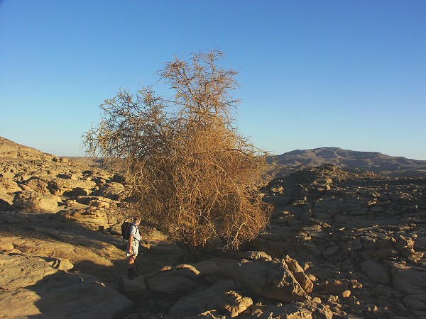
Descending in the second wadi, we found an exceptional tree sized Maerua crassifolia, the largest specimen I have ever seen. Further down, it was again Salama who found a large shelter with very fine paintings of the cattle period.

Day 9. - Karkur Talh area
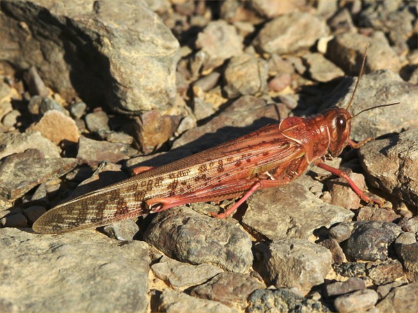
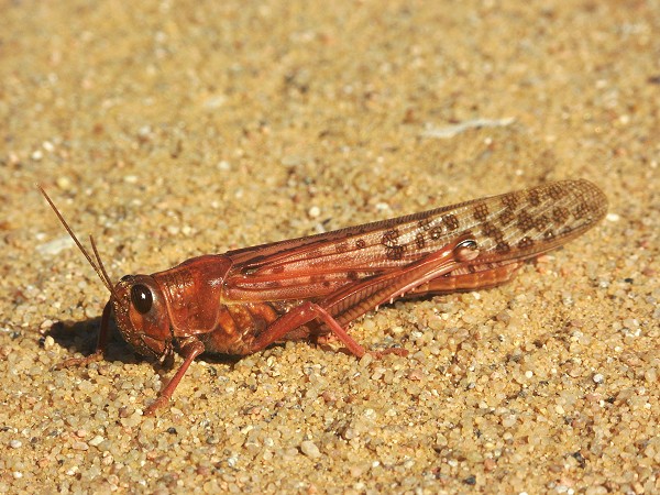
Astrid and Gina elected to stay in the main valley while we walked with Liz and Jon to the amazingly rich group of sites in the south-western branch of Karkur Talh found in February 2003. Along the way I've finally managed to photograph one of the numerous bright pink swarming locusts. The locusts were seen continuosly at Uweinat, and also in the open desert between Dakhla and the Gilf.
Liz and Jon spent the day at the sites, while I took the opportunity to do some exploration. My objective was a major new shelter found by Mahmoud Marei in spring 2003, near the col between the two northern plateaus. The ascent was long and difficult among huge boulders at the base of the cliffs, close to the course we have taken during our ascent of the peak in October 2002.

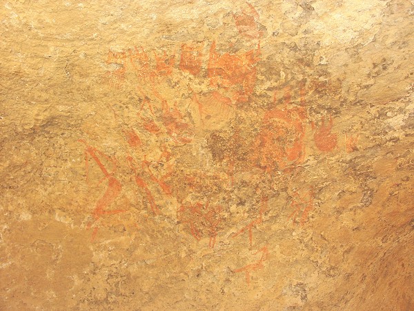
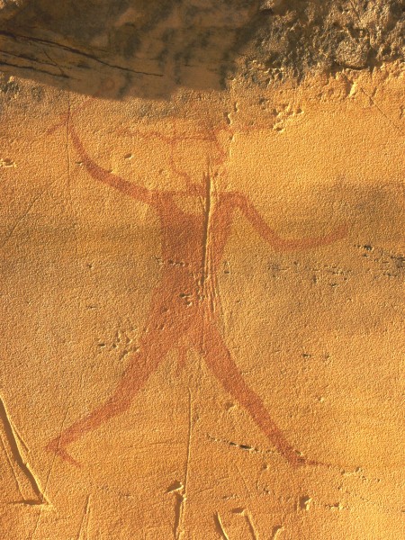
The site proved to be well worth the climb. It is a large double shelter under a pair of fallen blocks (named "Nour's cave" by Mahmoud, after his daughter) with numerous well preserved scenes, mainly from the cattle period, but also some earlier human figures.

On the descent I passed by the sites we found in October 2002, when we first explored this part of the valley. In a very low part of the second shelter I found a large new panel of cattle that we completely missed last time, even though we saw a scene no more than a metre away. A little downstream there was another shelter, with further paintings.
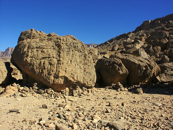
On the col between the two western branches of Karkur Talh, there is a conspicious group of rounded sandstone boulders, with many promising shelters underneath. In November 2003 I spent half a day exploring them without finding anything. This time, passing along their only side I have not visited last time, I immediately came upon two shelters containing excellent paintings.
Day 10. - Karkur Talh area
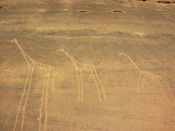
Our last day at Karkur Talh was spent in a leisurely fashion. In the morning we visited a small side valley of the southern branch near camp, where Khaled found some paintings a few days before. Near the entrance of the valley, Salama immediately spotted a fine panel of engraved giraffes that we missed several times before.
Re-visiting a number of areas in the main valley, we found several new sites at places which have been thoroughly searched before (apparently not well enough...). We also found the last unlocated site of Rhotert (Talh 33), right where it was supposed to be based on the numbering sequence. We have driven by several dozen times on previous trips, with eyes set on the rock face, not realizing that the faint engravings were half hidden under modern graffiti. With this find, all of Rhoterts 1933 and 1935 sites have been positively identified and located.

In the afternoon we returned to the northern part of the valley we searched with Salama on our first day. We did find a couple of sites reported by Giancarlo Negro, and also a number of new engravings.
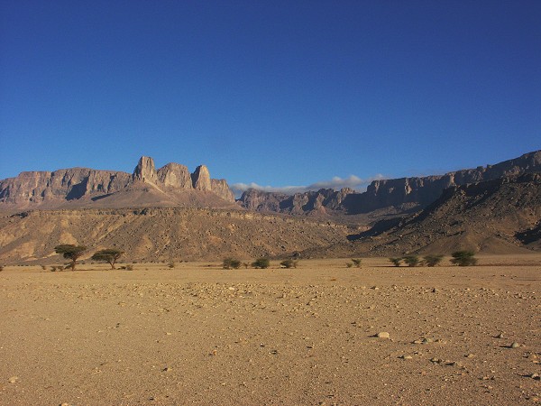
Day 11. - South Uweinat
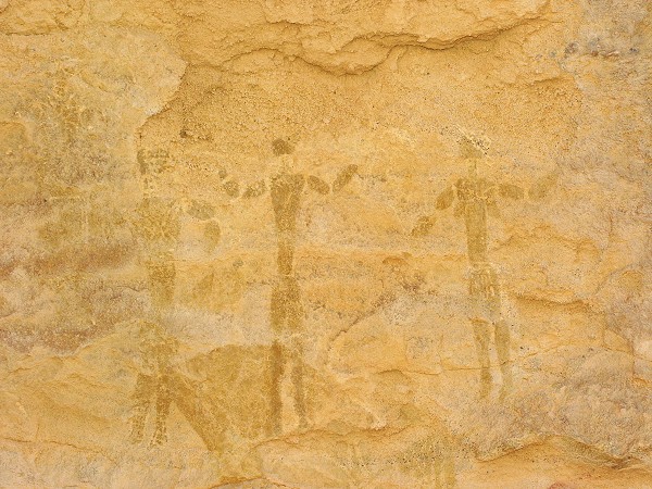
In the morning we left Karkur Talh, driving around the east and south of the mountain to "Man Rock", a prominent round sandstone rock just east of the Libyan border along the south of the mountain. We continued exploring the area where we left off in October, and this time did find the most important site recorded by Lean-Loïc Le quellec and party during their 1998 visit. The large shelter contains numerous human figures in several groups, and there is a close resemblance to the Wadi Sora style. Of course any link is highly speculative, but certainly this site is unique in style in the Uweinat area.

The locusts have followed us here too, a bright pink blur zoomed away from just before our feet every few minutes.
In the afternoon we followed Jean-Loïc's trail, finding most of the reported sites, making camp by a small group of paintings and engravings between the mouths of Wadi Wahesh and Karkur Murr.
Day 12. - South Uweinat
The morning's plan was to explore as far as we can the Wadi Wahesh, the deep wadi that separates the Hassanein Plateau from the main massif of the mountain. Almásy and Arkwright, the Belgian team and Jean-Loïc all reported seeing rock art sites near it's entrance. The day started out with a very strange phenomenon, mountain effect clouds formed from the strong and apparently moist eastern wind over both Jebel Kissu, and Uweinat.
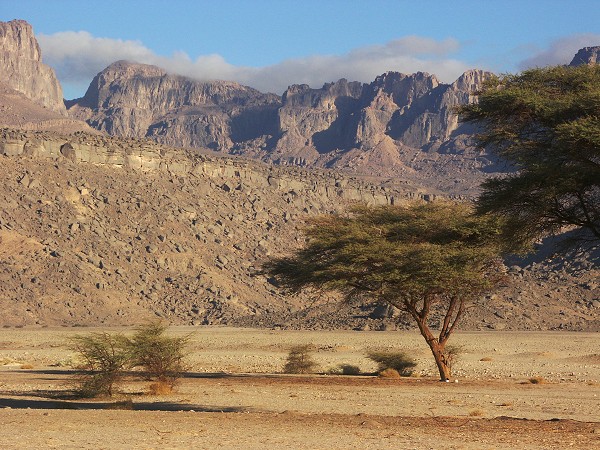
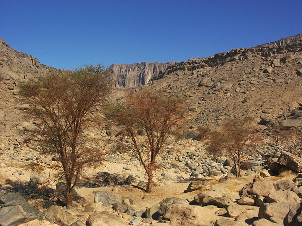
The Wadi Wahesh drains far out to the plain to the south, and the watercourse contains a very healthy grove of acacias, there was not a single dead tree anywhere.

The wadi is also home to a large colony of Aerva persica, some exceptionally large. All the specimens we noted were in full flower.
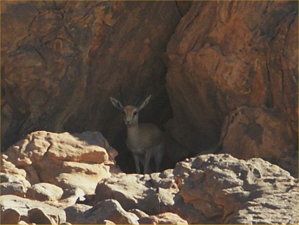
As we approached the rocky gorge where the wadi climbs the terraced mountain, salama Suddenly froze, and started waving wildly for us to follow cautiously. He was pointing towards a dark shelter, where at first nothing was visible. Then with binoculars I could spot the big Bambi ears, then the head between them: a dorcas gazelle (Gazella dorcas) hiding in the shadow, and observing our every move. It allowed us quite a few pictures before calling it quits, and disappearing with graceful hops.


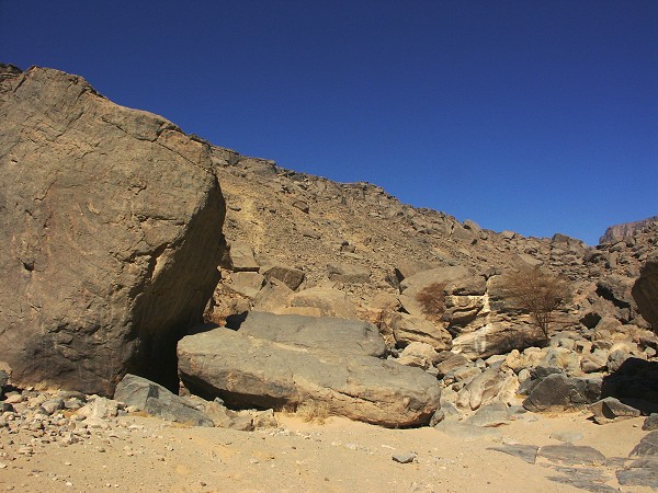
We proceeded to explore the wadi, where we saw many engravings and a few weathered paintings, including the large boulder with engravings and the guelta underneath, that Almasy tentatively identified as the water source seen by Prince Kemal el Din ("Récentes explorations..."). We also realized why the Belgians named the wadi thus (Wadi Wahesh = "Bad wadi"). The bed was filled with huge fallen rocks and rounded granite boulders, a near impossible going. In an hour we barely made it a few hundred metres upstream, where we decided that the complete exploration of the valley will have to wait for next time.

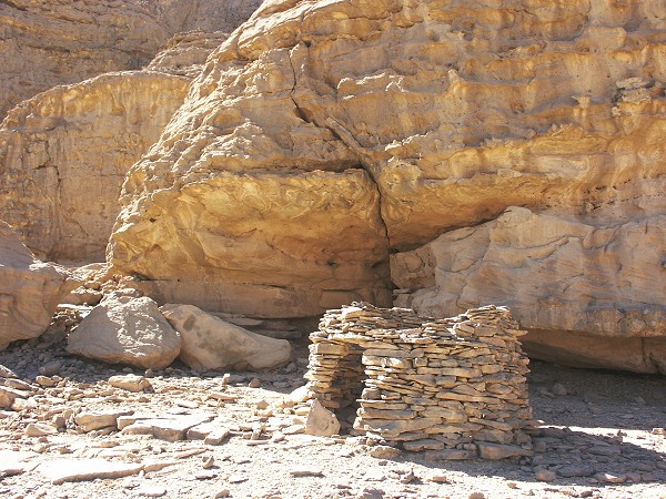
Around the wadi mouth, the large blocks and shelters were surrounded with innumerable stone structures. They appeared to be more ancient than the tibou structures encountered in Karkur Talh, however it is impossible to say whether they may have been contemporary with the rock art nearby.

The plan for the afternoon was to explore the large wadi to the west of the Wadi Wahesh. However as we made our way upstream, the wadi bed filled with football sized rounded boulders, impossible to traverse with a car. We were still 3- 4 kilometres from the wadi mouth, so we decided it will be a better use of time to retreat and explore the foothills around "Man Rock", rather than spending a full afternoon stumbling accross boulders.
The choice was well worth it. As soon as we started surveying the little line of hills to the south of the wadi, we found a vertical rock wall, that was covered with engraved handprints. This site is absolutely unique, I know of no other such representation anywhere in the Sahara (there are innumebarble handprints, mainly negative and a few positive, but they are ALL painted).

As we progressed along the low scarp, we came upon a shelter with some fine paintings...then another...then another. There were five shelters in all, progressively better and better, the final one being the most interesting, with svereral figures in the "Uweinat roundhead" style. While we photographed the paintings, salama was busy collecting camel saddles (probably hidden by tibou or possibly the Kababish herding camels north from Sudan to Kufra). In Salama's educated opinion they were far better than anything available in Egypt, and his relatives will be delighted to have so fine saddles for their camels.

It was an incredibly eventful and rewarding day, a fitting ending to our week at Uweinat.

Day 13. - Uweinat - Crater GKCF2
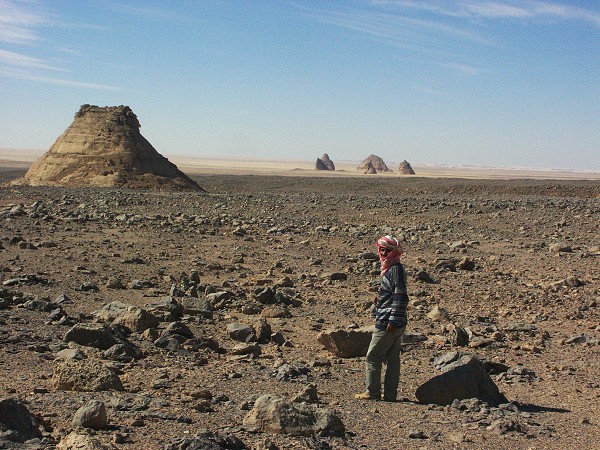
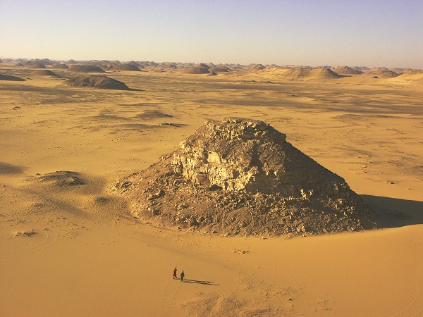
In the morning we started on our return journey, driving north to the southern tip of the Gilf, then passing north-west towards Abu Ballas. We were aiming for the centre of the crater field announced by Philippe Paillou and his team for camp. We arrived late afternoon, and we only had a short time before sunset to see crater GKCF2. Like GKCF13 visited in October, this one too had horizontally bedded sandstone around it's rim, and we noted some breccia at the edge.
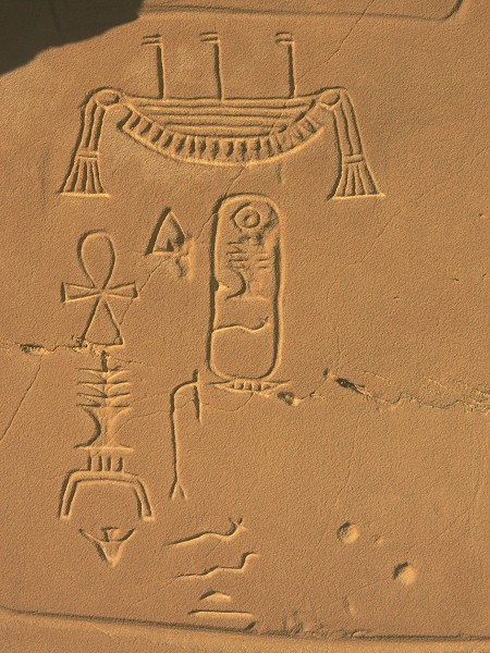
Day 14. - Crater GKCF2 - Khufu/Redjedef inscriptions
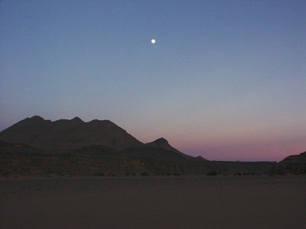
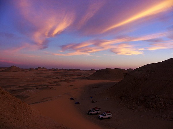
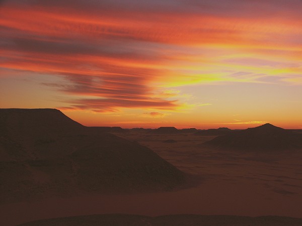
Continuing north, we stopped at the dry lake by "Hill with stone circles on top" and Abu Ballas, then continued to camp near the Khufu/Redjedef inscriptions discovered by Carlo Bergmann. This time we found an easier route than in November 2003, but still it was a rather difficult drive. We made camp in a most wonderful sunset.
Day 15. - Khufu/Redjedef inscriptions - Dakhla
In the morning we visited the inscriptions, then spent a few hours in the area searching for other sites indicated by Carlo Bergmann, without any luck.
At noon we departed towards Dakhla. Despite the different course the terrain proved as bad as last time, it was late afternoon when we arrived to the Mebarez Hotel in Dakhla.
Day 16. - Return to Cairo
We said good bye to Salama and Zayed, who returned with the Landcruisers via Kharga to their base in Hurghada, and we took an Oscar Tours bus for the seemingly endless drive to Cairo.