
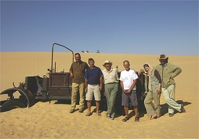
 Click on image for list of participants |
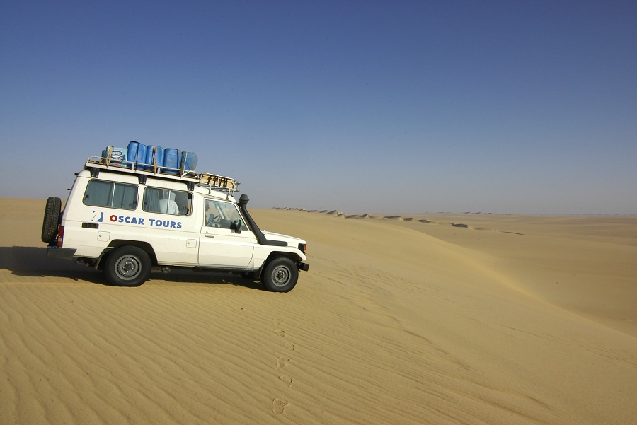
Salam / LRDG Expedition, Egypt 17th - 30th October, 2010 |
Unlike previous expeditions to the Gilf Kebir area which primarily focused on prehistoric rock art, the itinerary of this trip was tailored to those interested in the rich World War II history of the area. One of our primary objectives was to retrace the Egyptian part of Almásy's Operation Salam, the route (littered with wrecked and abandoned vehicles) of the SDF Kufra supply convoys and other WWII era remains, as well as the prime rock art sites of the Wadi Sora area. While our trip was successful in all objectives, the newly introduced requirement to have an escort of eight policemen in two cars did not make our lives any easier. As anticipated, their presence caused many delays and frustration throughout the trip, not exactly improving on the experience.
We were particularly successful in retracing Almásy's 1942 route. With Kuno we have been working for some time on a project covering 'Operation Salam' and related activities of Almásy and the German 'Abwehr' in North Africa, based on a multitude of archival sources. This journey brought new light on the story, which will be presented in all details in the coming book, planned for publication in the second half of 2011.
Day 1. - Cairo - Farafra
Our plans were to make it to the dunes just off the at the edge of the Great Sand Sea after Bir Abu Mungar by late afternoon, however the day turned out to be an endless series of delays. Already we wasted almost an hour at Cairo departure due of the insistance of the Tourist Police at the hotel that we must have an escort till the edge of the town, only relenting after some serious arguments at a substantially raised tone, by which time we became stuck in the morning rush hour traffic, another hour gone... We had some deep concerns about the ability of all our excess baggage (the police escort, as well as the still compulsory military officer joined us in Bahariya) to depart in a timely, not entirely unfounded as it took over three hours for all the paperwork to be completed. By the time we could leave Bahariya, it was well into the afternoon. Our hopes that at least our police escort will speed the time needed at checkpoints was soon shattered, the highlight of the day was when at the military checkpoint at the turnoff to Ain Dalla, the soldiers started to enter the serial numbers of the submachine guns of the police into a notebook, one by one, taking at least five minutes for each... (as thes say, "Welcome to Egypt..."). This was followed by another hour in front of the police in Farafra, waiting for God knows what, by which time the sun was setting, and we had no choice but to spend the night at a local hotel.
Day 2. - Farafra - Kharga
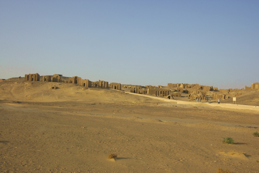
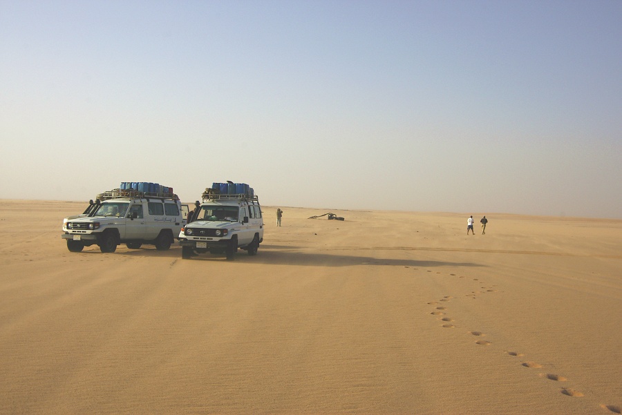
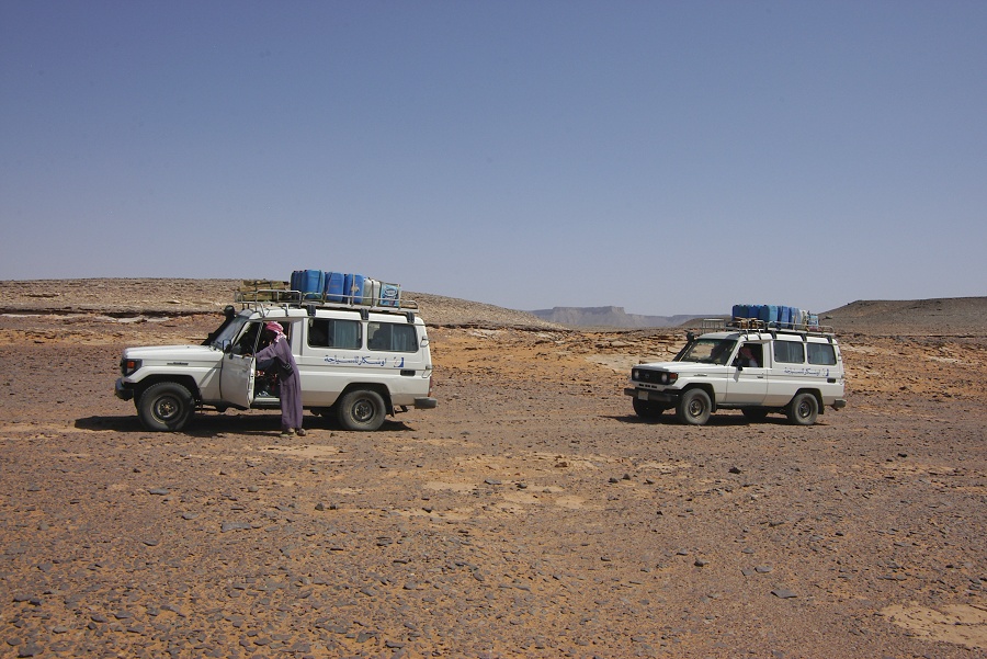
We have managed a reasonably quick start in the morning, but it was still mid-afternoon by the time we have reached Kharga oasis, the starting point of our journey. It soon emerged that the cars of the police were two rather dilapidated model sixty Landcruisers, that at best could do 80-90 on the road before starting to overheat. While at least the drivers appeared to have proper desert experience, the condition of the cars was not exactly promising... The only reason we went to Kharga was to visit the old Yabsa pass, where Almásy ascended and returned on the way to Assiut, delivering the two german agents, Eppler and Stanstede. With all the delays of the day, it was too late to go to the pass, so we spent the remainder of the afternoon visiting the Temple of Hibis (which is still a closed and pretty drab construction site, the 'restoration' project has completely destroyed the once lush and pretty palm groves surounding the temple) and the early christian tombs of El Bagawat.

In a comic twist, at which by this stage we could only laugh irritating as it was, while in Karga we were also escorted by the local police (at least six of them in a pickup), in addition to our already sizable entourage. Six of us, escorted by 21 Egyptians (including our three drivers)! To cap of this fine day, our military officer decided that the rule to stop at five o'clock applies not only in the desert but in Kharga too, so we went out to the edge of the oasis, among the dunes of the Abu Moharig, to make camp.
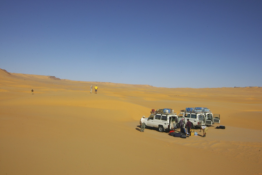
Day 3. - Kharga - Camp near "Two Peak Hill"
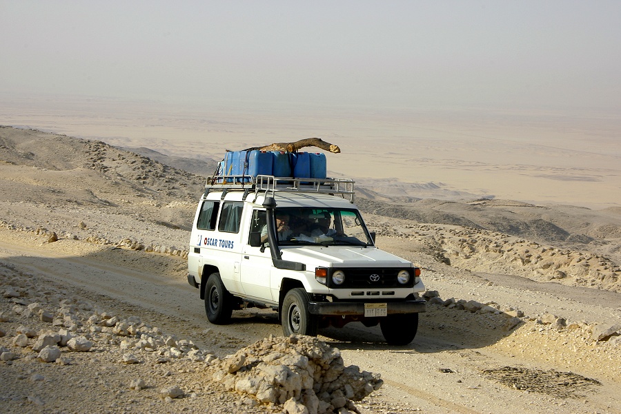
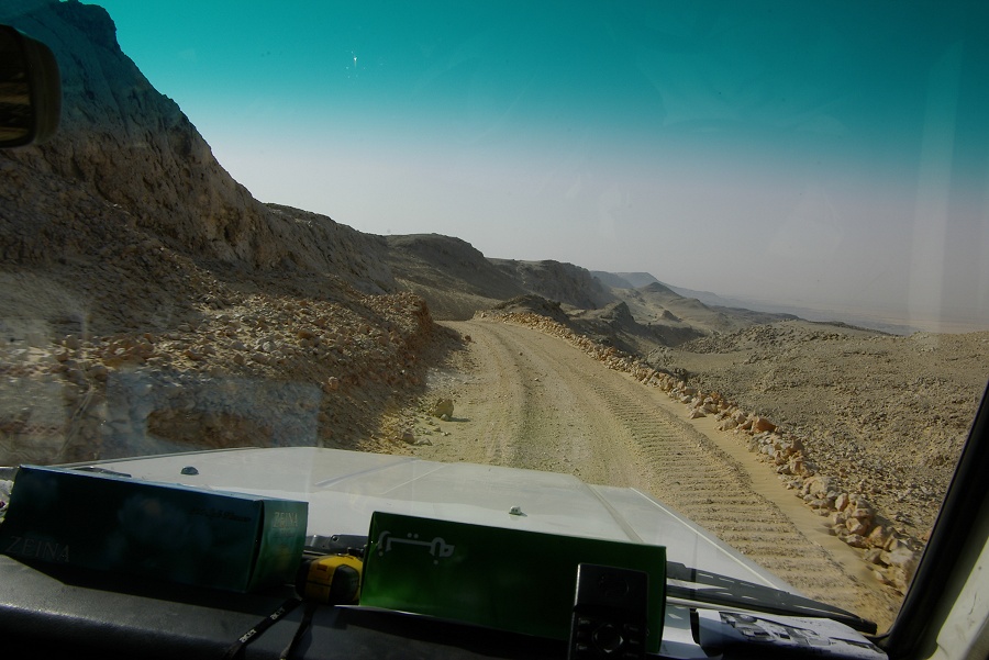
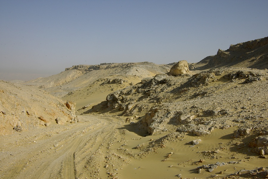
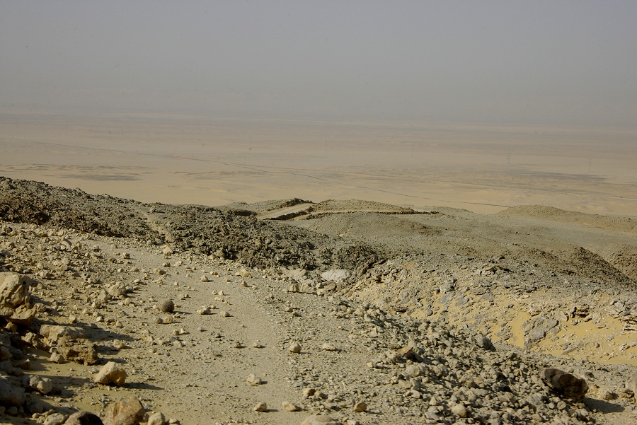
In the morning we set out for the Yabsa pass, again escorted by bouth our assigned detail and the local police. Much to the dismay of the local police, we turned off the modern road about sixty kilometres north of Kharga city, and they were unable to follow in the soft sand. After several minutes of arguments they finally gave up to the idea that they must wait there until our return. The modern road ascends the plateau about ten kilometres to the north of the old Yabsa pass, however the old road was in use till something like twenty years ago, I recall coming down that route on my very first visit in 1980. We soon hit upon the old track, the tarmac was all but gone, reclaimed by the desert. The appearance of the pass did not differ very much from when Almásy used it in 1942.
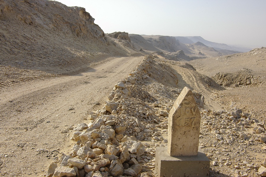
We continued to the top of the pass, in the slim hope that we might actually find the 'Dangerous descent' sign, beside which the well known photo of Almásy was taken. However on the top there was no trace of the sign, and the ground was probably re-worked several times.

Mission accomplished, we returned the way we came down the winding pass, back to the policemen patiently waiting for us on the modern road.
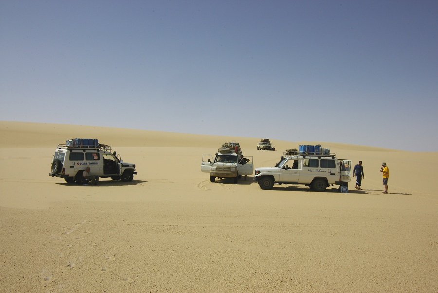
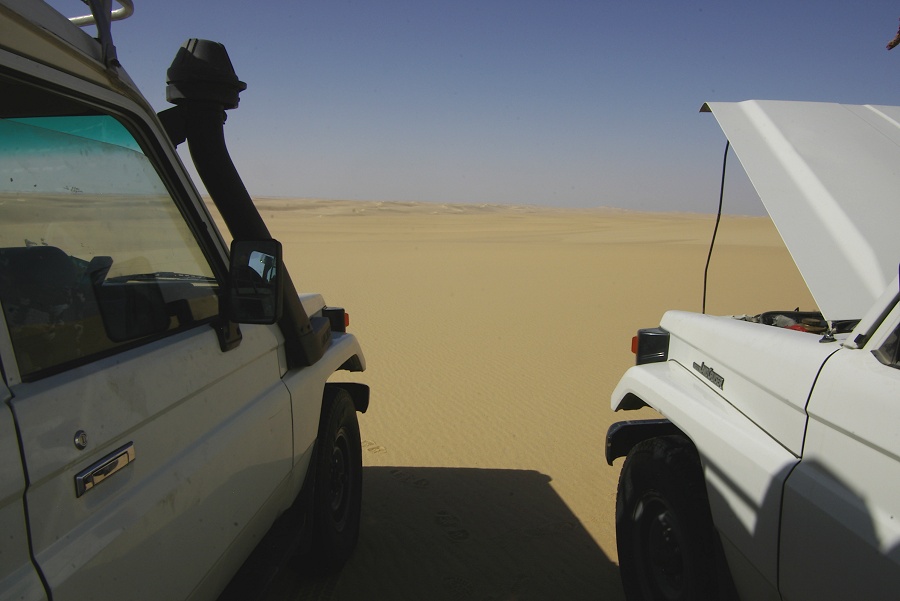
The rest of the morning was spent changing oil on the cars (which we could easily have done the evening before, except for the meddling of our officer), then fill our jerrycans with fuel (which would have been imprudent prior to making the steep and narrow ascent on the Yabsa pass). It was only at the gas station thet we noticed, that one of the police cars was not diesel but petrol, yet they were planning on taking about the same quantity of fuel as for the diesel cars (a petrol Landcruiser has a specific consumption 20-30% above a diesel one). A quick calculation showed that their petrol would have ran out in the middle of the Great Sand Sea. Their car was completely full, fortunalely one of ours still had some space to take over some of their water so they could load the needed extra petrol, but still they appeared badly overloaded. With all this taking up time, it was around noon when we could finally depart, approximately one day delayed from our original plans.
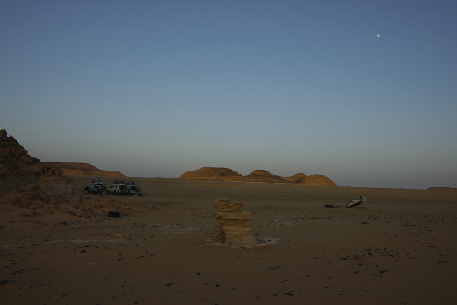
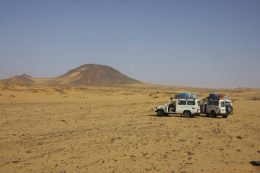
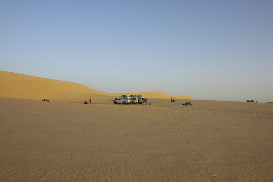
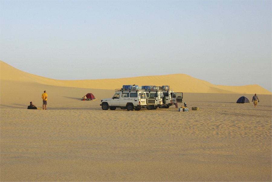
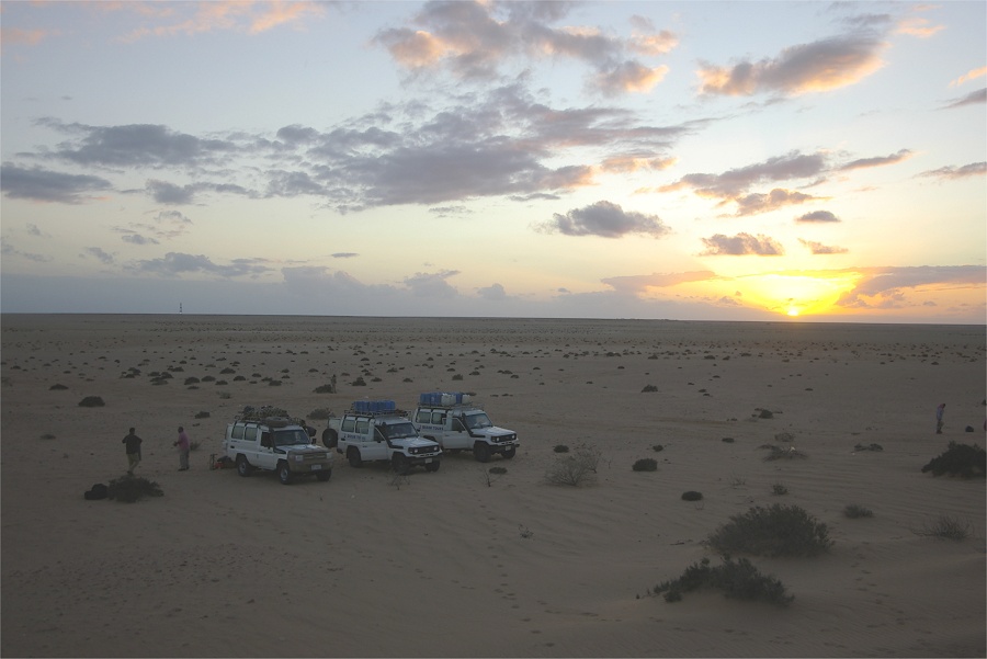
Fortunately the route Almásy followed from the Gilf Kebir to Kharga and back proved a very good, easy one, following the sand plain at the foot of a scarp running practically from Kharga to the Gilf Kebir foothills. After driving along the Kharga - Dakhla tarmac road for about sixty kilometres we turned off into the desert, and drove at a very good pace towards our first aiming point, "Two Peak Hill" some 200 kilometres away. On the firm sand the two police cars could keep up with us reasonably well, by late afternoon we crossed the tarmac road leading south from Dakhla, and made camp at the foot of a cluster of low hills about 50 kilometres before "Two Peak Hill".

Day 4. - Camp - Bagnold's 1938 campsite
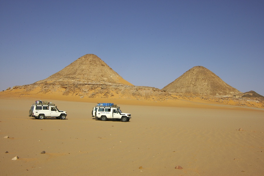
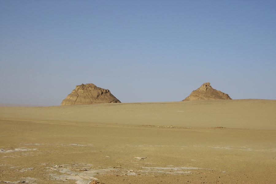
Next morning we continued towards the Gilf Kebir, stopping at 'Two Peak Hill', the farthest point reached by Harding-King on his 1911 camel journey. In 1942 Almásy left their third vehicle "Maria" (one of the CMP Ford trucks) at the foot of this hill on their way to Kharga, and picked it up on their return journey. In November 2000 we found a memento of their short stay, a discarded Scho-ka-kola tin. This time the wind started to pick up the sand, finding nothing more of interest we did not linger for very long.
We drove on for another short distance to the spot where Samir Lama had found some twenty years ago the empty jerycans of the petrol cache left at "Barchan camp". The jerrycans themselves have been removed for safeguarding by Rudolph Kuper, and are now in the HBI expeditions house in Dakhla, however we hoped to find at least some further traces of the camp. However probably the dunes have shifted again since then (as it had by about 20 metres since 1942), and the sand probably covered again all remaining traces.
We continued to "Hill with Stone Circles", to the eroded lakebed littered with pink yardangs and surrounding prehistoric settlements (Almásy probably passed to the north of the hills, as the long trailing dunes blocked the passage further south for dozens of kilometres).
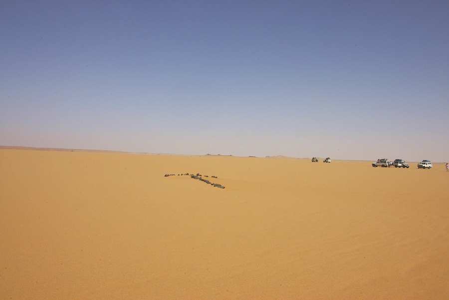
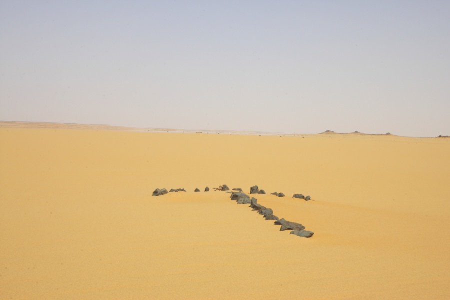
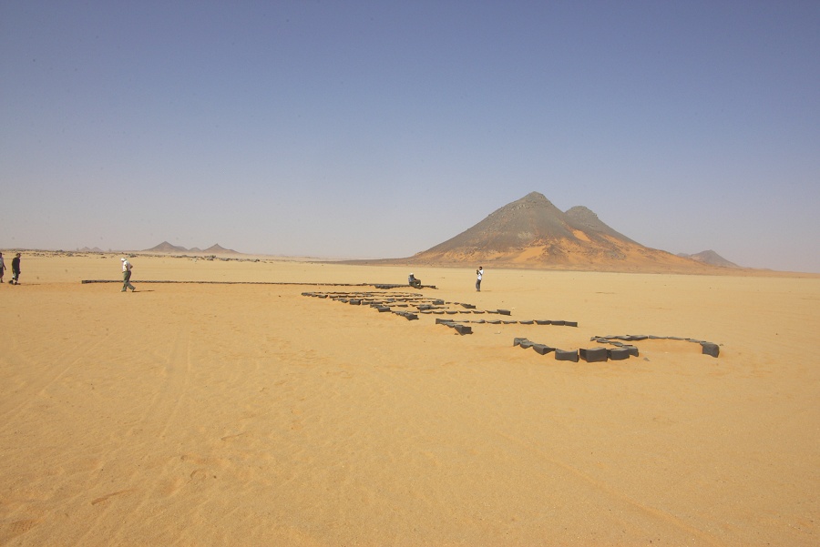
About thirty kilometres further west, we passed a landing ground that was well marked out with a large arrow of stones pointing out the runway heading, as well as a row of stones marking out the runway limits. We found nothing that would indicate its age, however the style is more reminescent of more recent oil exploration fields rather than WWII landing grounds. It is not marked on the 1943 AMS 2201 Libyan Desert sheet, however neither is the Wadi Sora landing ground which is certainly of WWII era.

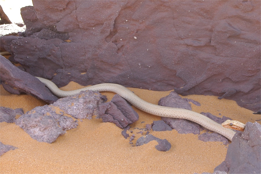
As we drove on towards the Gilf, Salama's sharp eye spotted an uncommonly large and very pale coloured sand snake (Psammophis schokari) in the shade of a rock. A huge commotion followed, with all our policemen and their drivers justling to catch a glimpse as we stopped to take photos.
We reached the foothills of the Gilf Kebir at the two conspicious hills named "Two breasts" by Almásy. We searched for the remains of their camp at the foot of the hill, but time was pressing, and there was no conspicious spot where one would look. After a quick search without any results, we continued towards the south along the edge of the Gilf.
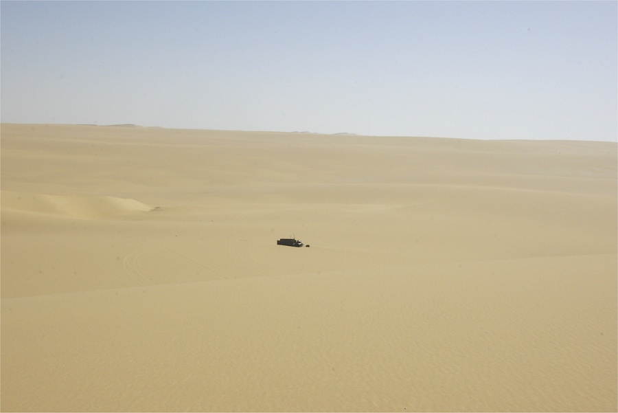
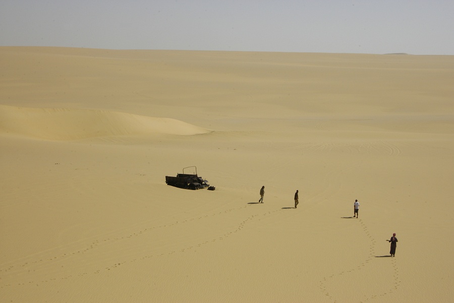
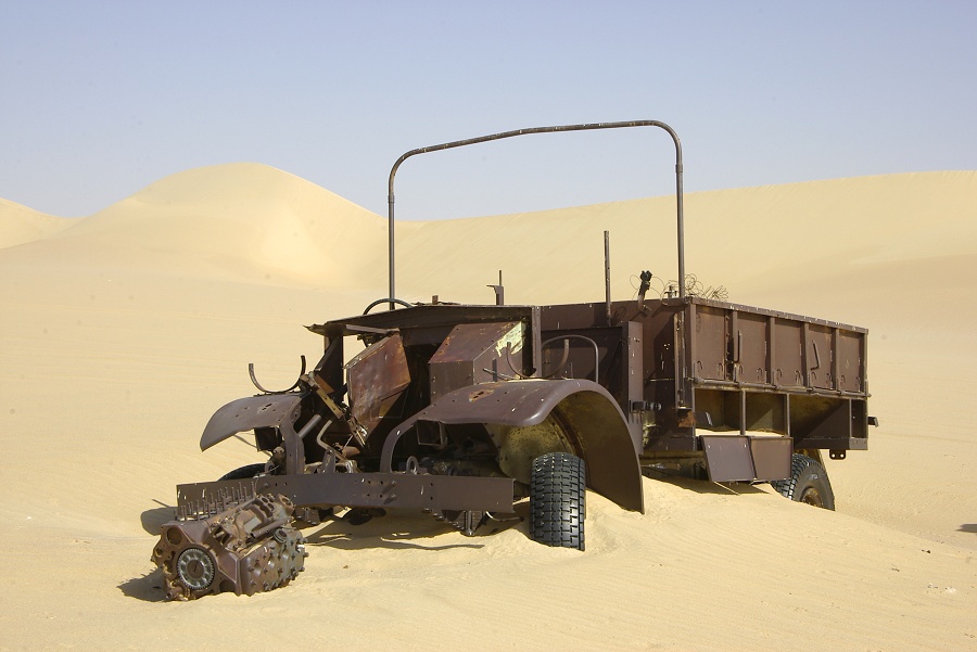
Some forty kilometres further south, we came upon the wreckage of a CMP Ford truck, most likely one that was a part of the SDF Kufra convoys, though hard to say what it was doing so far north. Though I have never visited it before, this truck is well known to passing tours, from Carlo Bergmann's 2001 photo (pict. 209) it is evident that the wreckage has clearly been re-arranged, on the 2001 photo it is in a very different state and orientation.

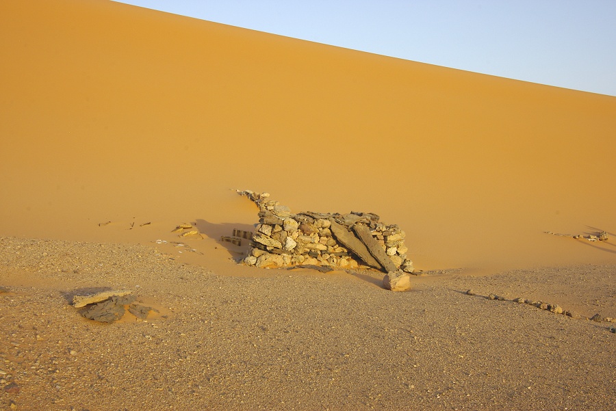
Our target for camp for the evening was Bagnolds's 1938 campsite, the same spot where we camped in March 2008. That time inexplicably we failed to spot the little stone structures that marked the campsite, this time we had no trouble finding the location at the base of the long trailing dune.
Day 5. - Camp - Wadi Sora
Next morning we first visited the wrecked SDF 1942 Ford pickup truck opposite the entrance of Wadi Bakht, which still has the SDF insignia painted on the roof. This one was certainly part of the Kufra convoys, the northernmost route from Bir Missaha passed this way, rounding the northern tip of the dines before turning into Wadi Wassa accross the Gilf.

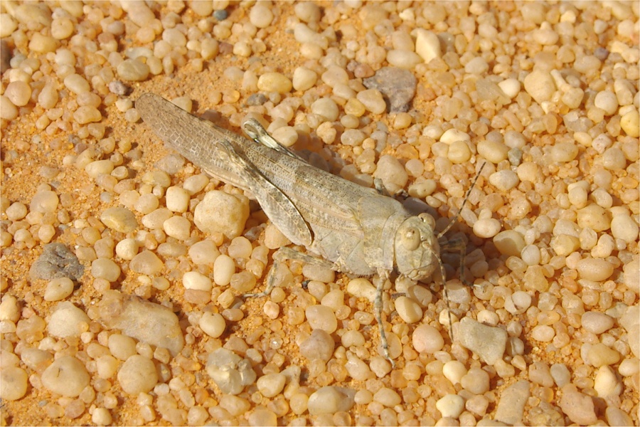
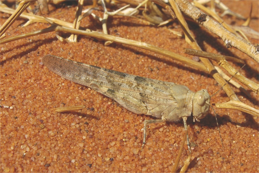
After the truck we set out to see the location of Bagnold's 1930 Camp 14, re-located by Francis Hervieux in October 2007. Not much remains, but it was still a touching spot. I encountered a large grasshopper (or small locust) of a species that was not recorded before in the area (about half the size of an adult desert locust).

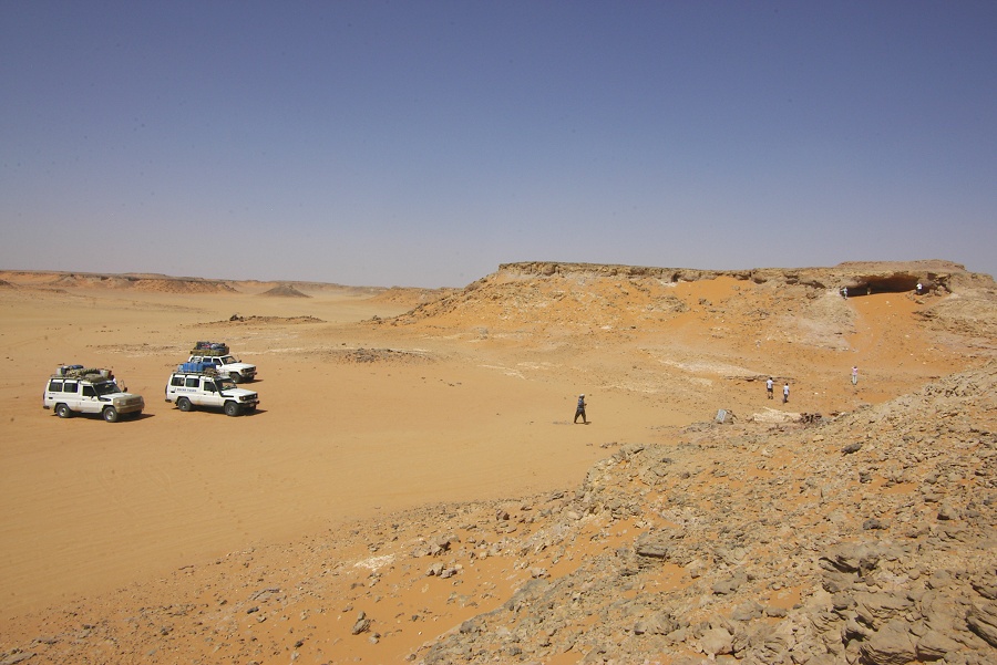
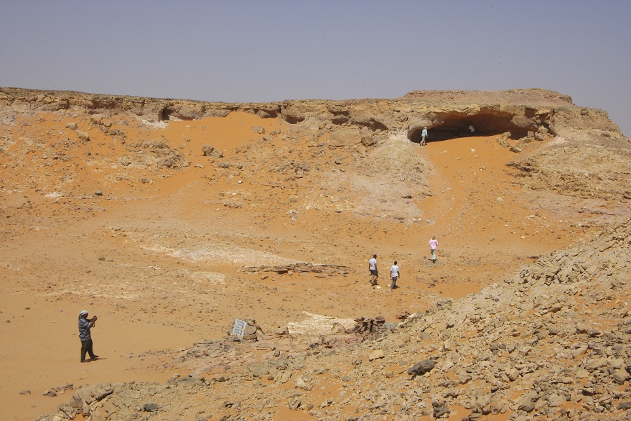
After the camp we entered Wadi Wassa, and crossed over the col into Wadi Firaq, to visit the WWII era "Eight Bells" aerodrome and Shaw's Cave.
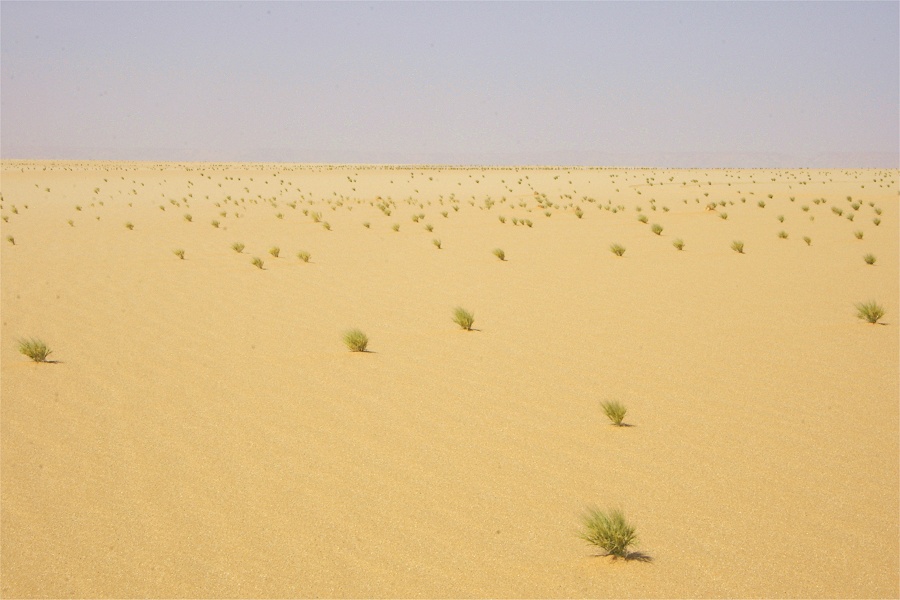
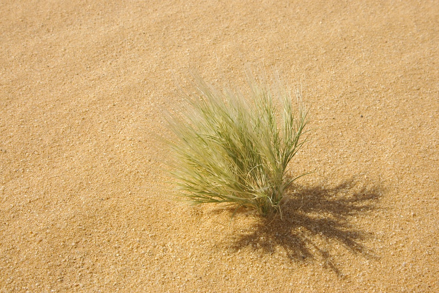
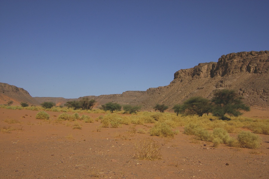
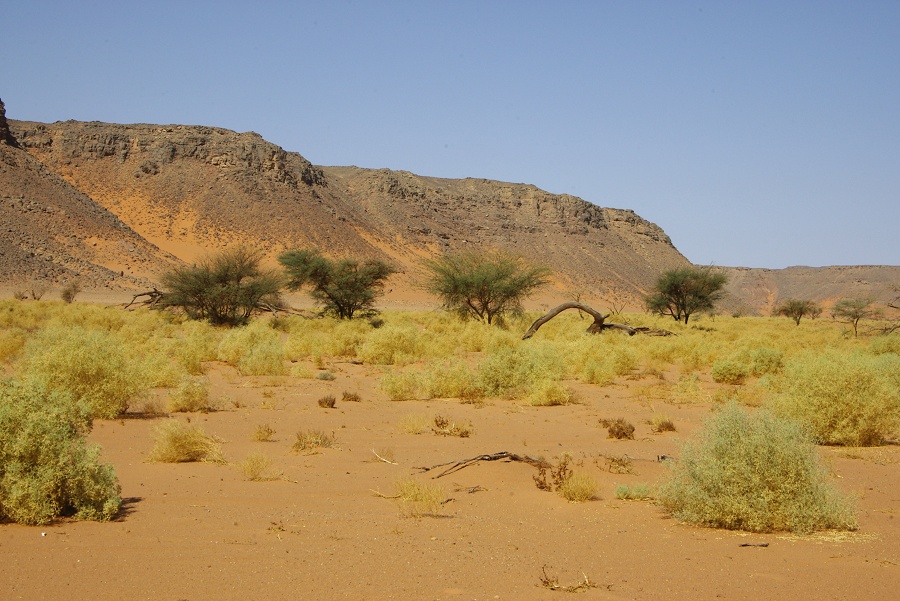
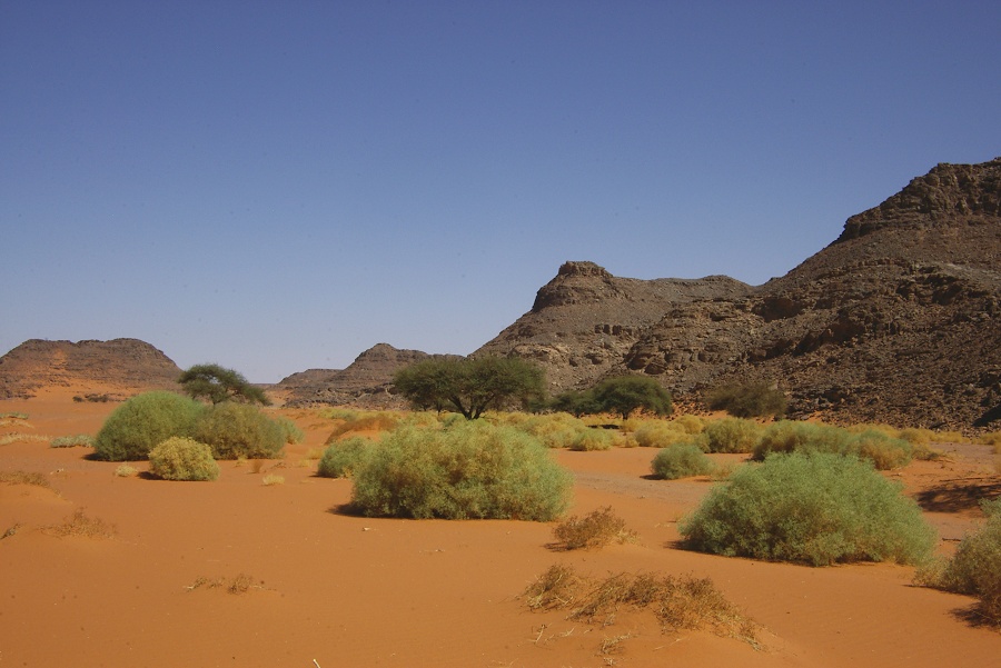
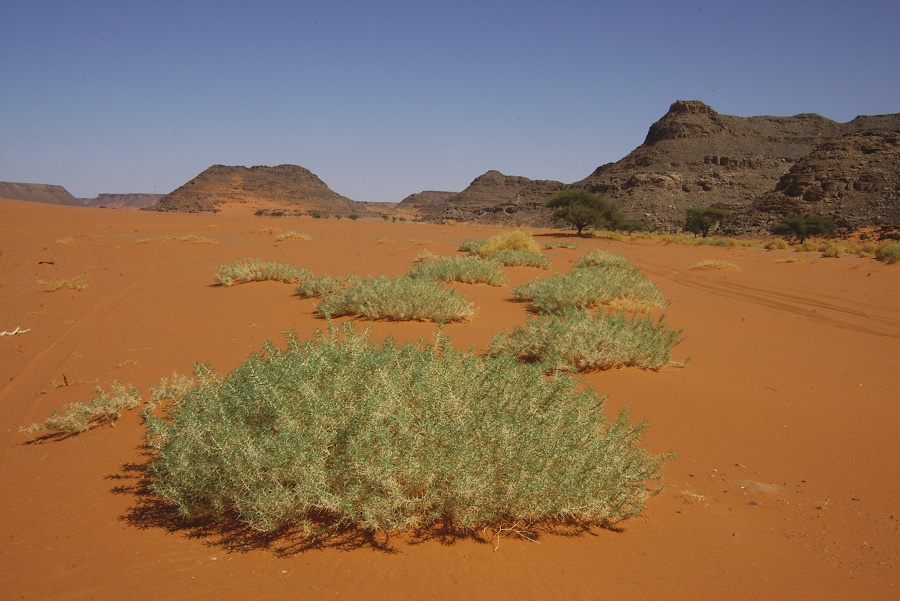
As we entered the sand plain to the west of the Gilf Kebir, we noted a couple of large areas covered with fresh vegetation, exclusively the grass Stipagrostis plumosa. I was notified by a major rain event at the end of July this year by Peter & Maja Ekel-Schwarzenbach (see here), the new growth must be the result of this event.

We passed by the wrecked SDF White truck at the foot of the Gilf, and continued to Wadi Sora for a two night camp.

Day 6. - Wadi Sora environs
In the morning we first went to visit the Cave of Beasts. By this time it appeared that the need for our 'protection' had relaxed a bit, only the our police officer and one ploiceman tagged along, the rest elected to stay in camp, a rather welcome change in attitude.
This time I have focused my attention on photographing the less well preserved areas, looking for interesting scenes that have a good potential for improvement with DStretch software. The results can be quite amazing, with almost invisible paintings vividly coming to life, as the below example clearly illustrates.


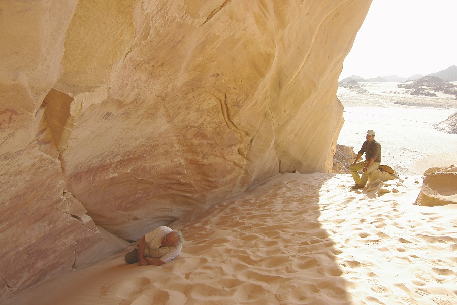
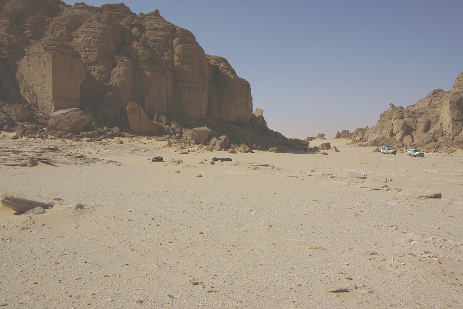
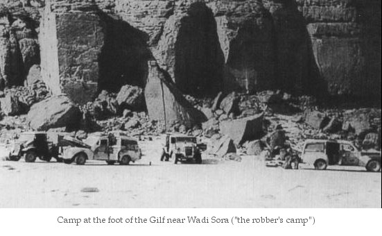
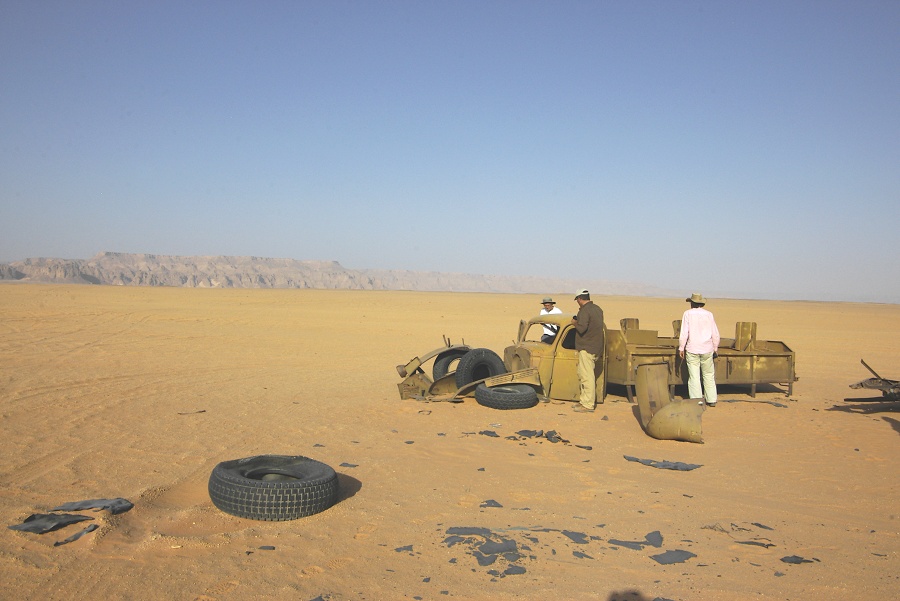
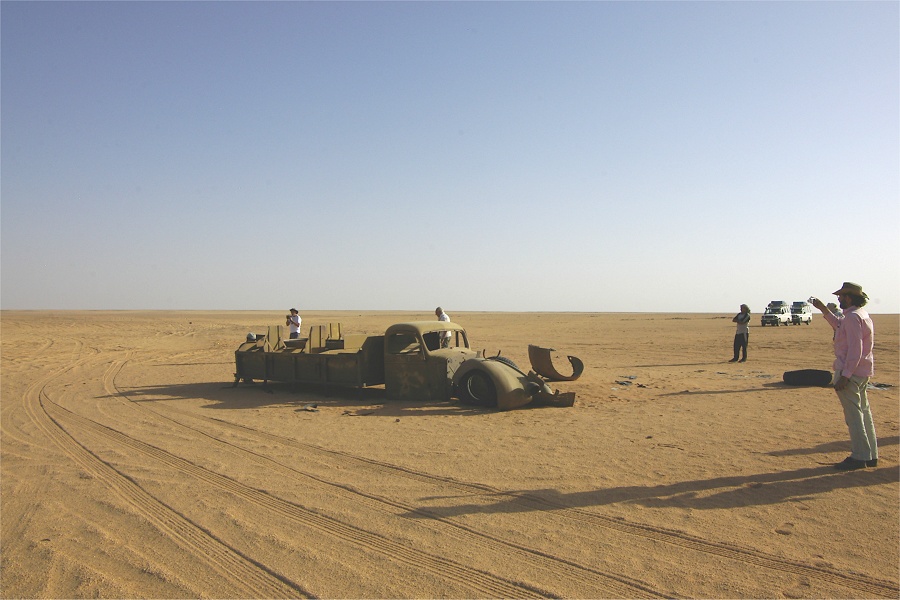
After the paintings we continued to the site of Almásy's 1942 "Robber's Camp", where "Purzel" (the other CMP Ford) was hidden. It appears that while the location is increasingly visited, visitors do seem to respect the location, everything was pretty much as it was on our visit last March.
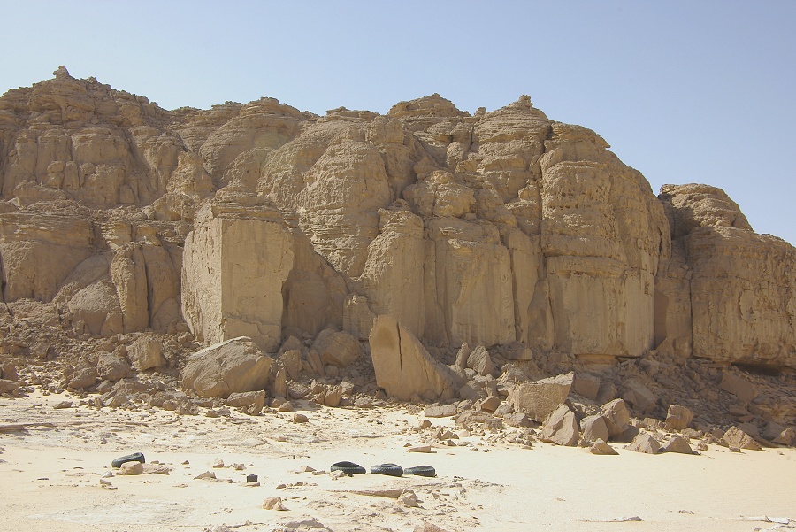
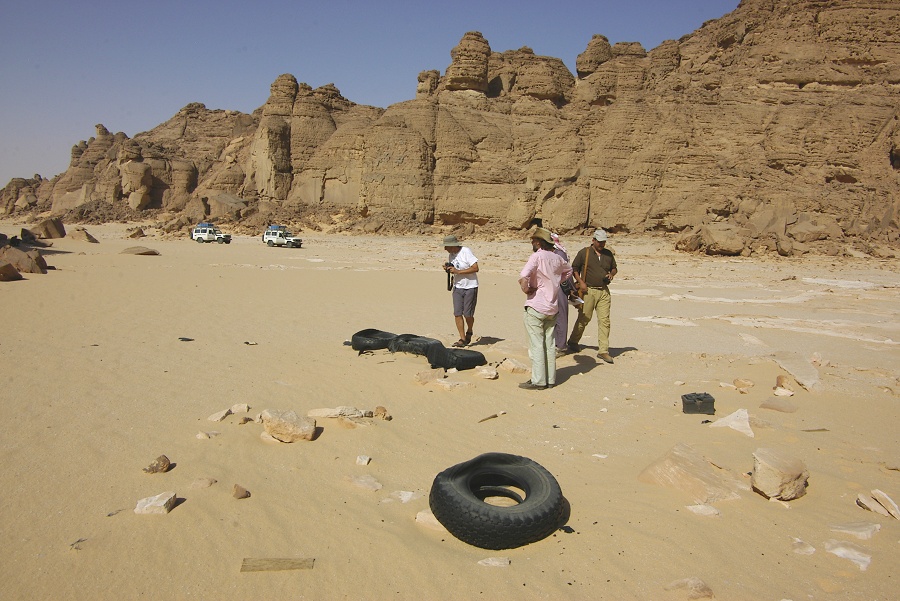
The re-discovery of "Robber's Camp" is an interesting story by itself. The location was visited by Giancarlo Negro and companions on the 15th August, 1985. The discarded tyres and battery were noted and photographed, however the true nature of the finds were not recognised.

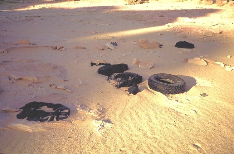
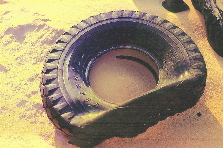
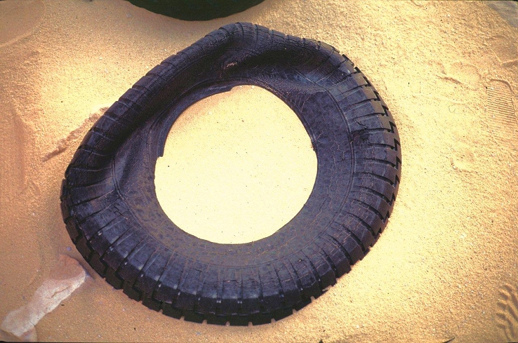

In February, 2003 we were back again, together with Giancarlo Negro, surveying te area for rock art sites. I recall seeing the tyres, but at the time I thought that they were just another bunch of trash from the SDF Kufra Convoys, and did not even bother to investigate, my mind being fixed on prehistoric paintings. The reason I did not even consider the possibility that it might be "Robber's Camp" was due to our finds in March 2001, when we found some german labelled tins at the site of Almásy's 1933 autumn camp (with Frobenuis and Rhotert). Almásy (just like myself) had a habit of returning to his former camp, and it was a logical to assume he chose the same spot in 1942, which incidentally fit the description of the Salam diary perfectly, so I considered the case closed. We had lengthy discussions with Tarek el Mahdy on the topic on the HUBB Sahara Forum, with me defending my opinion rather vehemently, and as it turned out, completely incorrectly.
Fortunately there were others who still believed Purzell could be out there somewhere. In April 2009 Raoul Schrott organised an expedition together with an Austrian television crew, and they have correctly identified this valley and the remains as the vestiges of Almásy's "Robber's Camp".
Continuing, we explored the country to the north between "Robber's Camp" and the Libyan border, stopping at the numerous WWII remains, mainly rubbish piles of the SDF Convoys.

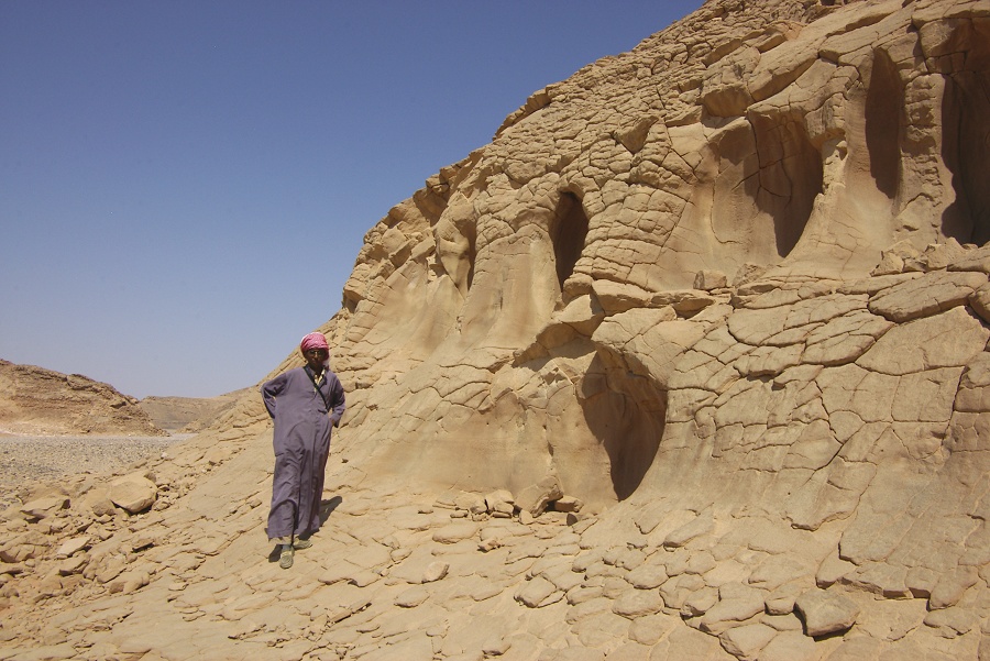
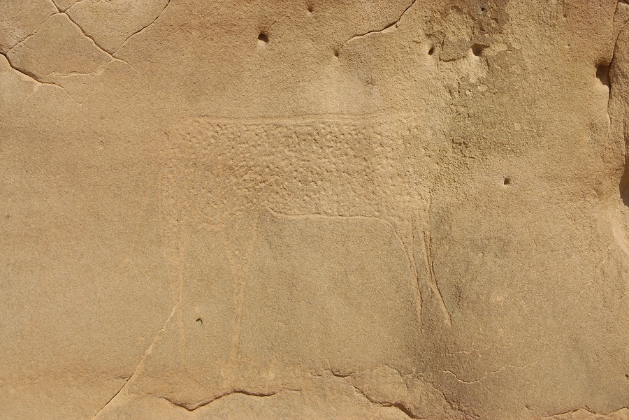
As we searched for more recent remains, a familiar looking conspicious eroded rock formation caught my eye near Almásy's "Bab al Misr". On close look we found a large engraved cattle, for which I had been looking now for almost ten years. This site had originally been found by Giancarlo Negro and Aldo Boccazzi in 1985, but the precise location was lost.

On our way back to camp at Wadi Sora, we passed by the wreck of the SDF Maple Leaf Chevrolet, and the Wadi Sora landing ground, marked out on the corners by a row of Shell petrol tins.

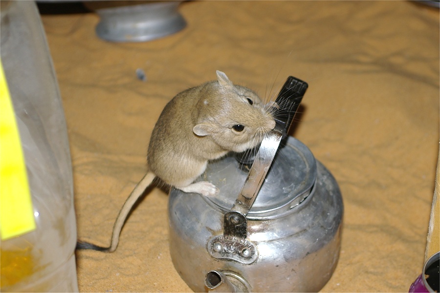
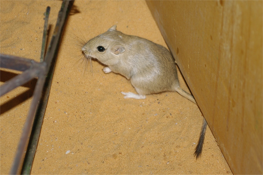
As we had our evening bar in Wadi Sora, we were joined by a little gerbil (Gerbillus gerbillus), that scurried about us seemingly without fear. As he passed by Kuno, he managed to catch it with his hand, at which moment the previously cute little creature suddenly turned vicious, and sank its teeth deeply into Kuno's palm, securing a quick getaway. Needless to say, everyone but Kuno found the incident highly amusing.
Day 7. - Wadi Sora - Camp in "The Gap"
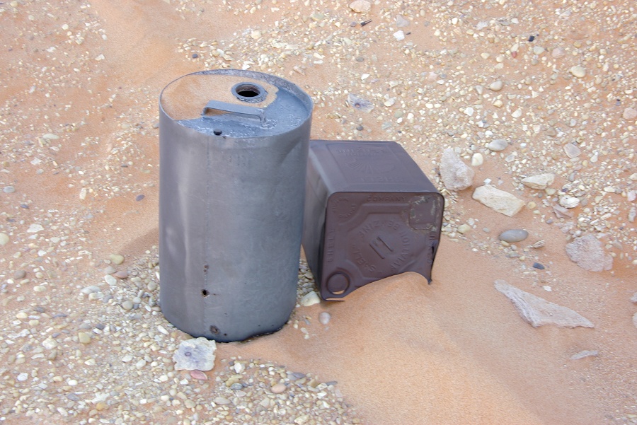
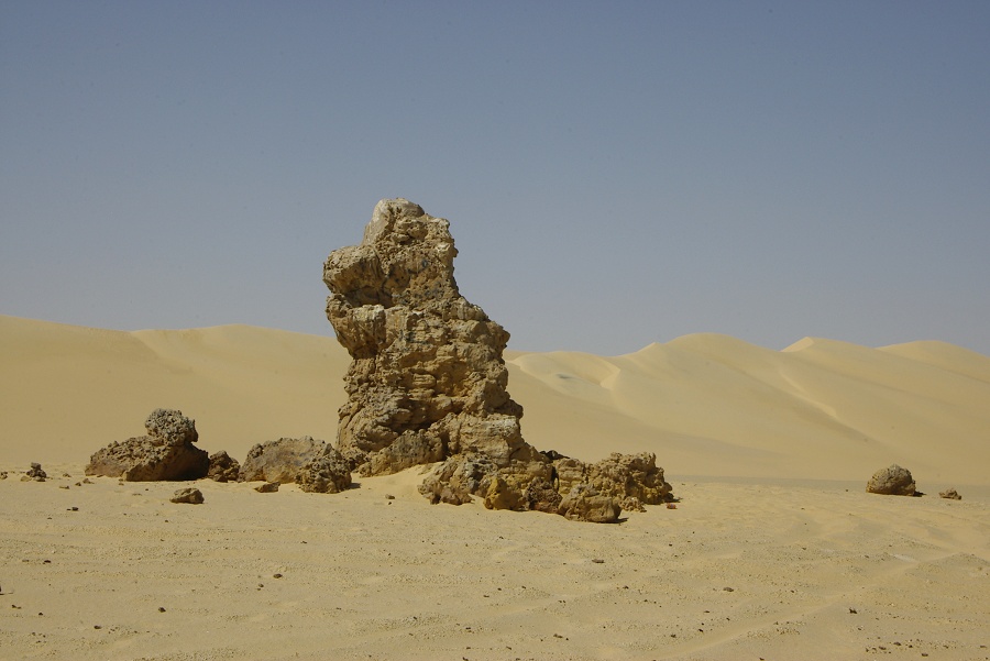
Over the night the wind picked up, with unpleasant near-sandstorm conditions by the morning. We struggled to get the reluctant tents into their bags, broke camp and drove east to "Three Castles". It was distinctly unpleasant in the blowing sand, we did not linger for very long, but we could ascertain that one of Almásy's 1932 water tins (recognisable from the soldered sealing plate) is stil there, together with an unidentified cylindrical cannister that could have been left there during the 1942 journey.
We continued a further 20 kilometres east, to the general area where Almásy made his "Booty Camp", stashing away the drums of petrol that were captured from the parked SDF trucks at "Three Castles". At this point our policemen and the two extra cars actually came handy, they enthusiastically participated inthe search, finally having something purposeful to do. We spilt the area into separate areas for each car, and looked for several hours in vain for a low pointed hill and adjacent ridge that hid the drums from sight. We have thoroughly searched the whole area within a radius of five kilometres, but found nothing. Possibly the drums have been taken and re-used at some point, without them the campsite would be impossible to identify.
We continued to the Aqaba pass, which we ascended without any trouble with all five cars, though not on the original ascent, but in the northern side-wadi that offers a steeper but firmer ascent than the route pioneered by Almásy.
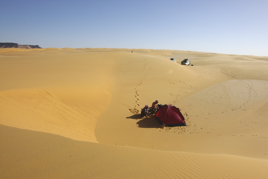
After the Aqaba we drove North into "The Gap", the broad dune filled valley separating the North-western and South-eastern parts of the Gilf Kebir.
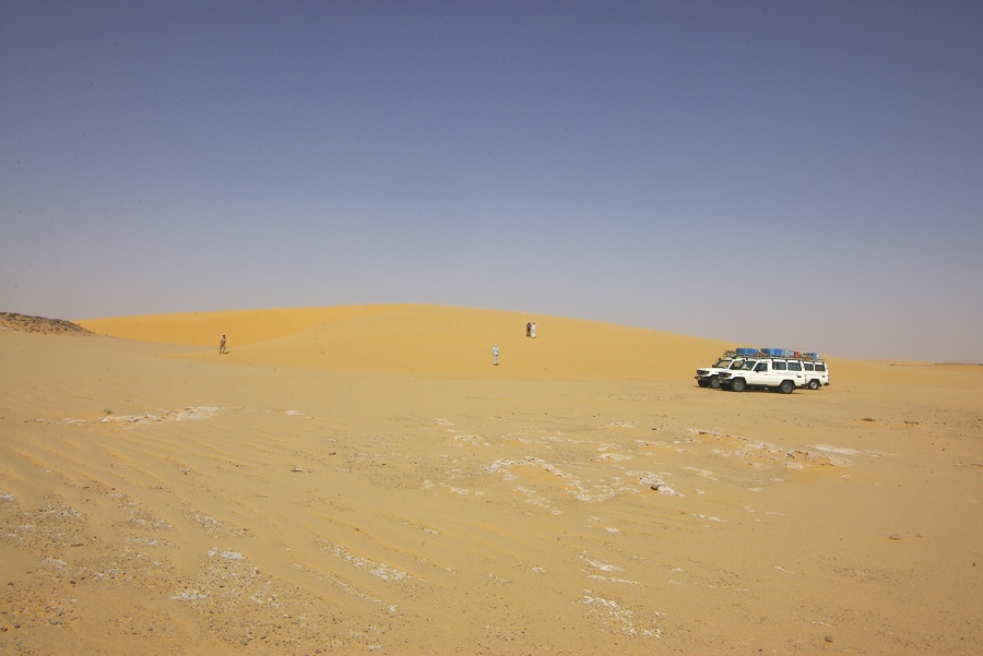
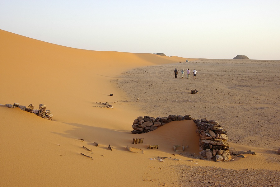
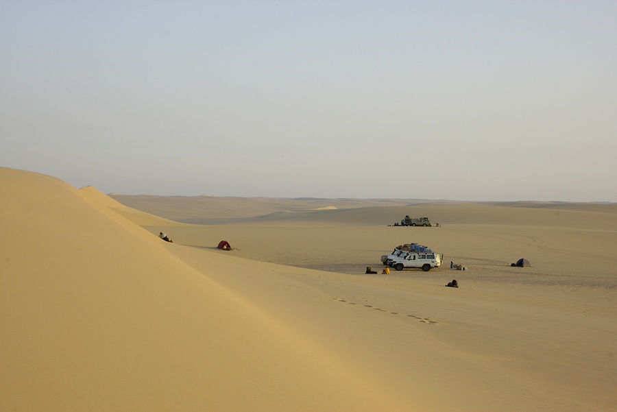
We drove north along the eastern edge of the huge dune range in the middle of the valley till the suitable crossing point. We made it into the central inter-dune corridor without any mishaps, and made an early camp among some lovely golden dunes resting against the foothills of the Gilf.

In the evening our camp was visited by yet another gerbil, even less afraid of humans than the one the night before. This time Kuno knew better, and it scurried about camp all evening, obediently posing for the cameras.


Day 8. - Wadi Hamra - Lybian desert Glass area
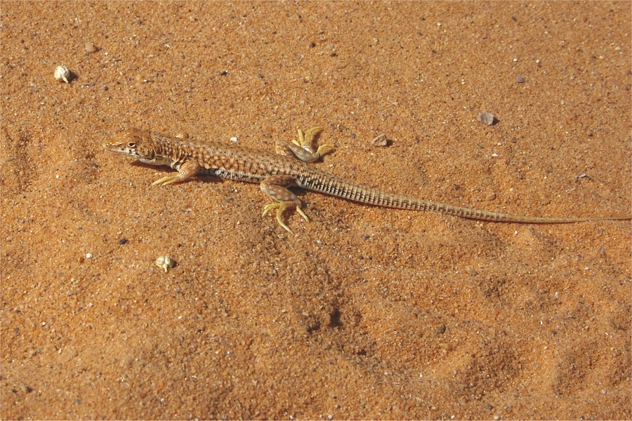
In the morning we easily crossed the remainder of the dunes, making better than anticipated progress. This allowed us to make a foray into Wadi Hamra with two cars, leaving our supply car and one of the police cars at the wadi entrance to save fuel. Wadi Hamra was still very green, but all the vegetation was old, all the remnants of the fresh growth following the rainfall of February 2008 two and a half years ago. Lizards (Acanthodactylus scutellatus) and a medium-sized locust species were abundant, but the butterflies, so abundant a year and a half ago, were completely absent.
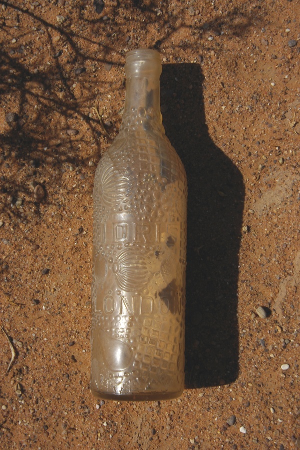
As I walked among the big green Zilla spinosa bushes, I came upon a discarded bottle. Looking at it closely, it appeared old with molded fruits as decoration, and the inscription "Idris, London". Raymond soon confirmed that it was a brand of lemonade and fruit syrups he remembered from his childhood. The bottle must be a relic either of the 1933 Patrick Clayton / Lady Dorothy Clayton expedition, or the 1935 Shaw expedition.
After lunch we started driving north towards the Libyan Desert Glass area. About half-way, we saw a single stationary car in the middle of the flat sand plain in the distance. Our policemen had their finest hour, zooming ahead to intercept. We came upon a rather dilapidated landcruiser with Libyan plates, with two libyans sleeping in its shade, quite startled to be surrounded by five vehicles and eight armed Egyptian police. They were clearly poachers, hunting for falcons (a search of their car revealed a box of live bait pigeons, plus a variety of traps and snares). I was hoping that our official escort might actually do something, but after some discussion to the extent that they are in Egypt and they must leave immediately, they were free to go. I'm sure after the first five kilometres they have made an U turn, ignoring and mocking Egyptian officialdom. Both our military officer and the police showed a total lack of concern, after al they were "only Libyans". I wonder if they would have reacted the same if a car with european tourists would have been intercepted in the area without any permits...

Day 9. - Libyan Desert Glass area - Great Sand Sea
We had our camp in "corridor B", the second interdune corridor counting from the east where the enigmatic Libyan Desert Glass may be found, at the south-western edge of the Great Sand Sea. Most of us were up before sunrise to do a bit of prospecting before we start out for the long drive towards the North.


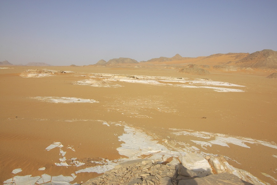
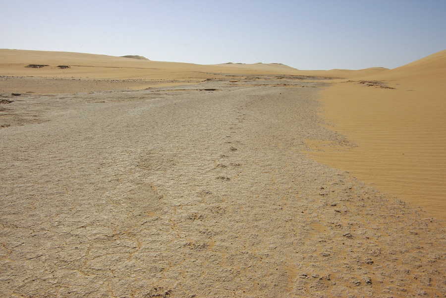
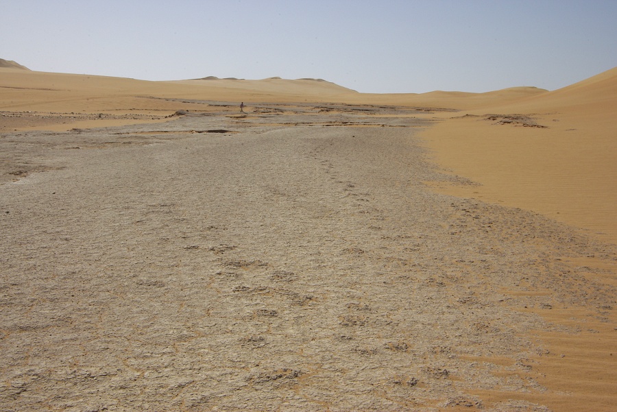
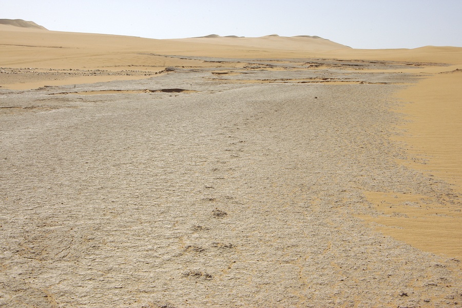
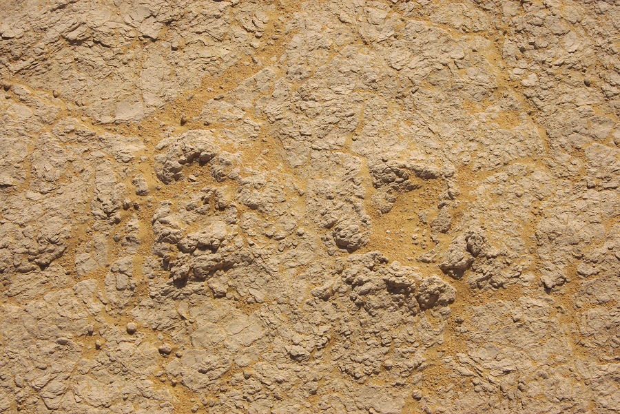
Later in the morning we drove to Lake Jux, a playa that was an intermittent lake during the early holocene, forming thick deposits of pink mud (named after the German geologist who first described it). A few years ago a visiting pary found a few fossilised trackways on the uppermost mud terrace. The news of "dinosaur tracks" in the Great Sand Sea quickly started spreading, but once the location was known, it did not take much to figure out they are much more recent. The uppermost lake sediments containing the tracks are about 7000-8000 years old. There at least two parallel trackways, the prints are not very telling, being just round elevated lumps of mud, about 7-8 cm in diameter. They were formed by the compressed mud being more resistant to erosion than the surrounding uncompressed sediments, thus the tracks are not imprints but little elevated platforms that rise above the present surface. It is hard to tell what animal it could have been, but based on the distance between the prints (30-40 cm) it was a fairly large and long legged animal.
For the rest of the day we drove North along the western edge of the Great Sand Sea towards "Big Cairn", a surveying cairn built by Parrick Clayton in 1932 upon completing the first successful east-west crossing of the Great Sand Sea. Later the cairn vas used as a key navigation point by the LRDG during WWII. We made camp among the undulating low dunes of the sand sea about forty kilometres to the south-west of Big Cairn.

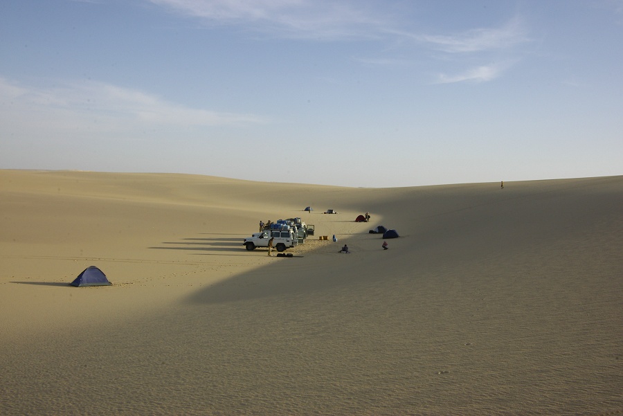
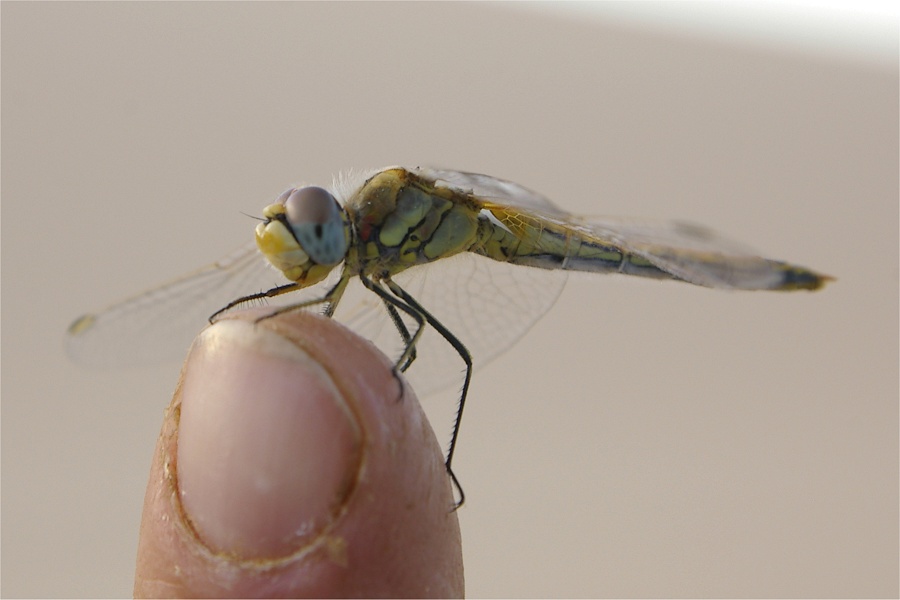
As we were refuelling the cars, a large dragonfly started buzzing about one of the cars, then landed on the edge of the rear door long enough to be photographed. Eventually, I could even pick it up with my fingertip, on initial look it appears to be a female Sympetrum fonscolombii.


Day 10. - Great Sand Sea
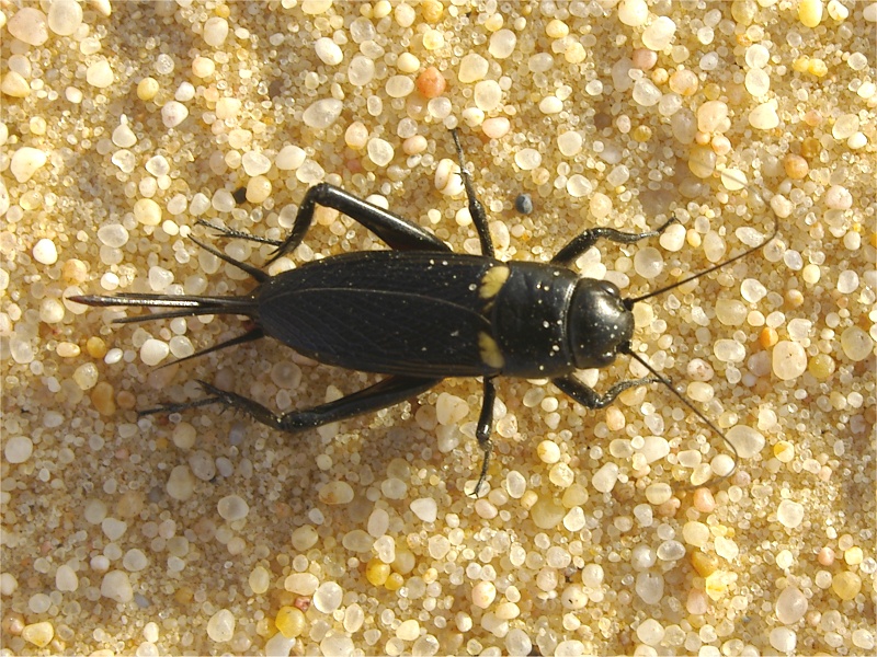
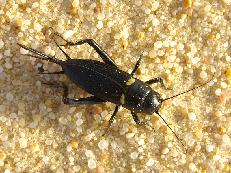
In the morning as we packed away camp, we found a large cricket (Gryllus bimaculatus) under one of the tents. It is amazing how such a creature can survive here, at least 200 kilometres from water in any direction.
As we continued towards Clayton's "Big Cairn", Kuno suggested to look for a landmark marked "cairn of petrol tins" on the 1942 Survey of Egypt map just five kilometres off our course. It appeared to be a fairly long shot given the inherent inacuracy of the map and the shifting sands covering up everything, but amazingly as we reached the position read off the map, no more than fifty metres away on the broad back of a large dune we found a pile of sand eroded tins, barely sticking out of the sand. Subsequently the point was found on a pre-war map too, so the cairn was not erected by the LRDG as previously thought, it may have been done by Clayton himself in 1933.
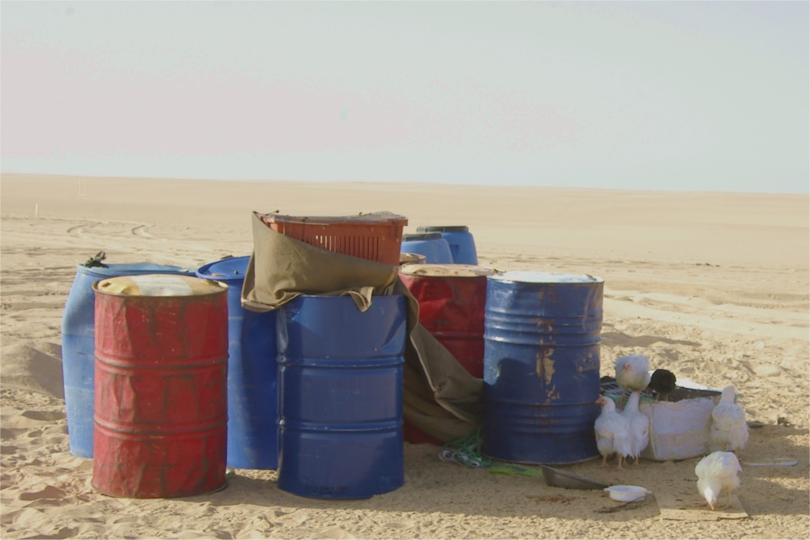
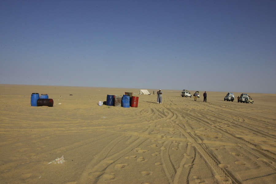
A few kilometres away we came upon remains of a very different kind: the fully equipped base camp of Libyan poachers, complete with tent, fuel and water drums, and even a flock of live chickens! Clearly the establishment was in use for an extended period, as attested by the huge amounts of rubbish strewn about, and the permanent-looking facilities. There was nobody there, but near big cairn we did meet a landcruiser with two Libyans, and they actually had a captured falcon with them. Again the indifference of our fine official entourage was astonishing, after a short discussion the Libyans were free to leave, and I doubt wether any action has been taken since to eliminate the base.
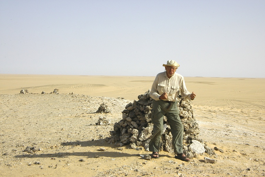
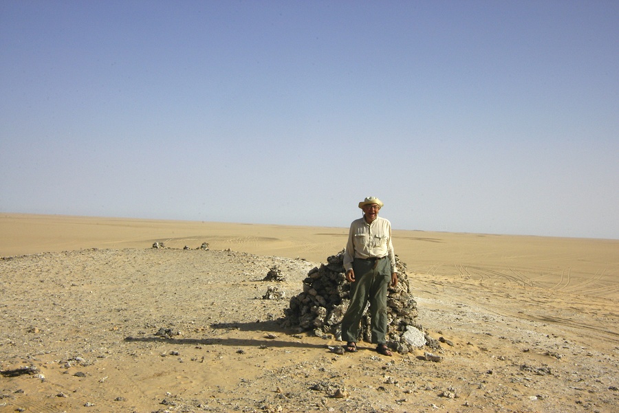
we stopped briefly at "Big Cairn", unfortunately the place is now very disturbed (I will never understand why people need to drive right up to the cairn), and the cairn had been rebuilt (probably several times), appearing nothing like the one on Clayton's original 1932 photograph.

We spent some time trying to locate the "Big Cairn" landing ground about 5 kilometres further west. We did find a large fuel drum, some piles of discarded petrol tins and other assorted WWII rubbish, but no markings that would indicate an airfield.
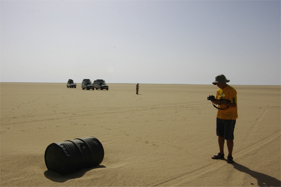

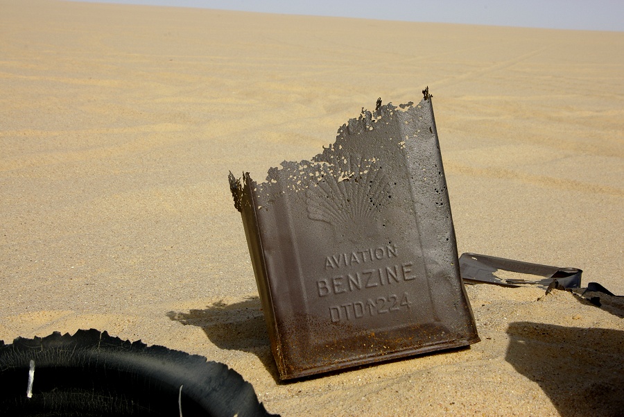
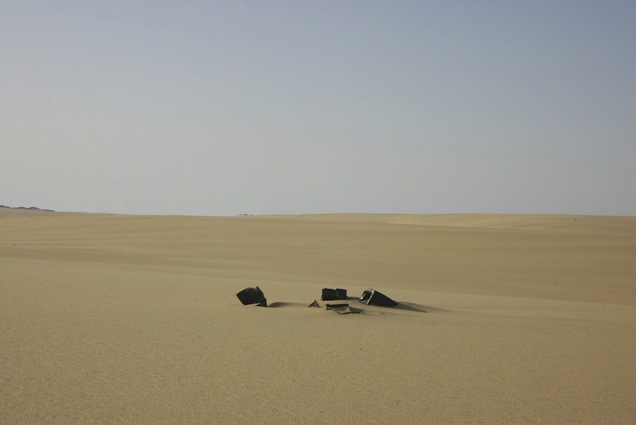
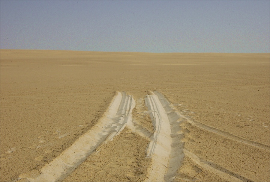
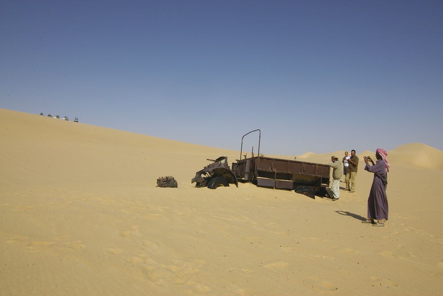
Mid morning we turned east, starting the most formidable challenge of our trip, the crossing of the Great Sand Sea from "Big Cairn" to the wrecked CMP Ford about 80 kilometres west of Ain Dalla, the only WWII era wreck in the Egyptian part of the Libyan Desert that unquestionably may be attributed to the Long Range Desert Group. Initially the going was very good on firm undulating sand, with the crested seif dunes being sparse and widely spaced, allowing easy passage. Frequently we came upon discarded petrol tins and other rubbish, the remnants of LRDG patrols on their way from or to Ain Dalla.

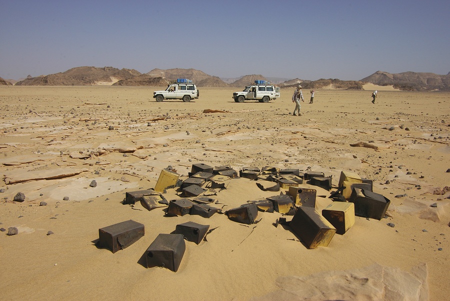
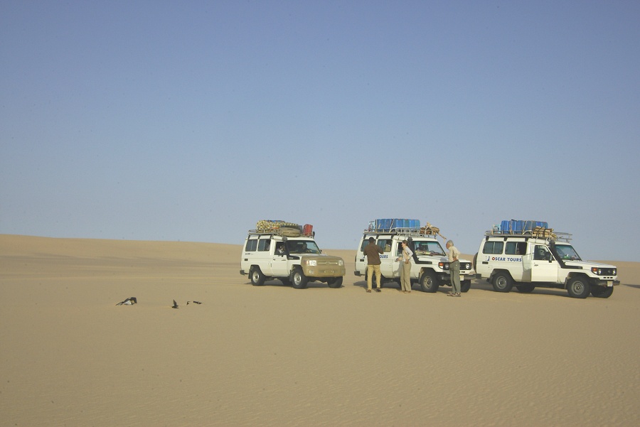
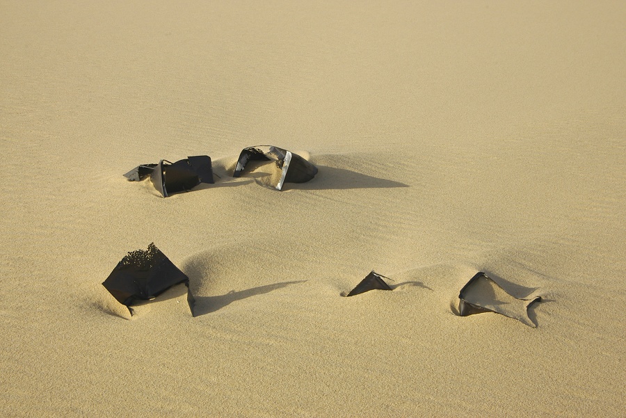
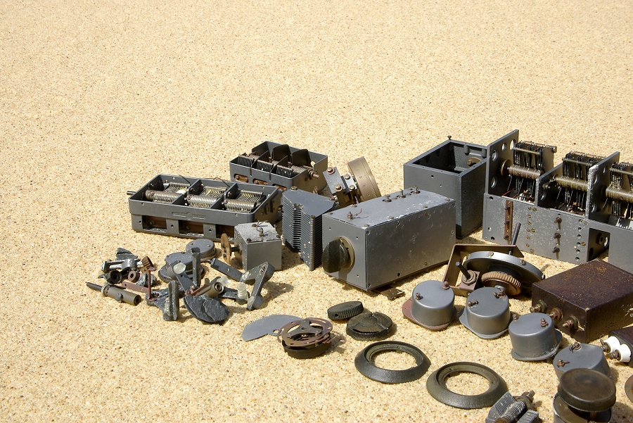
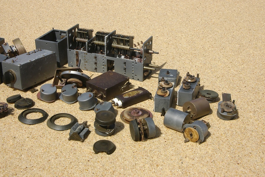
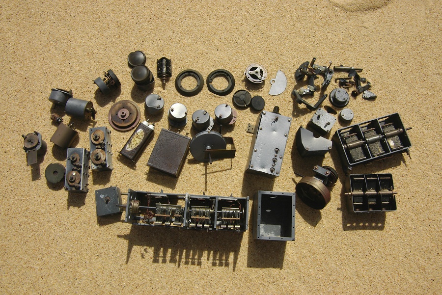
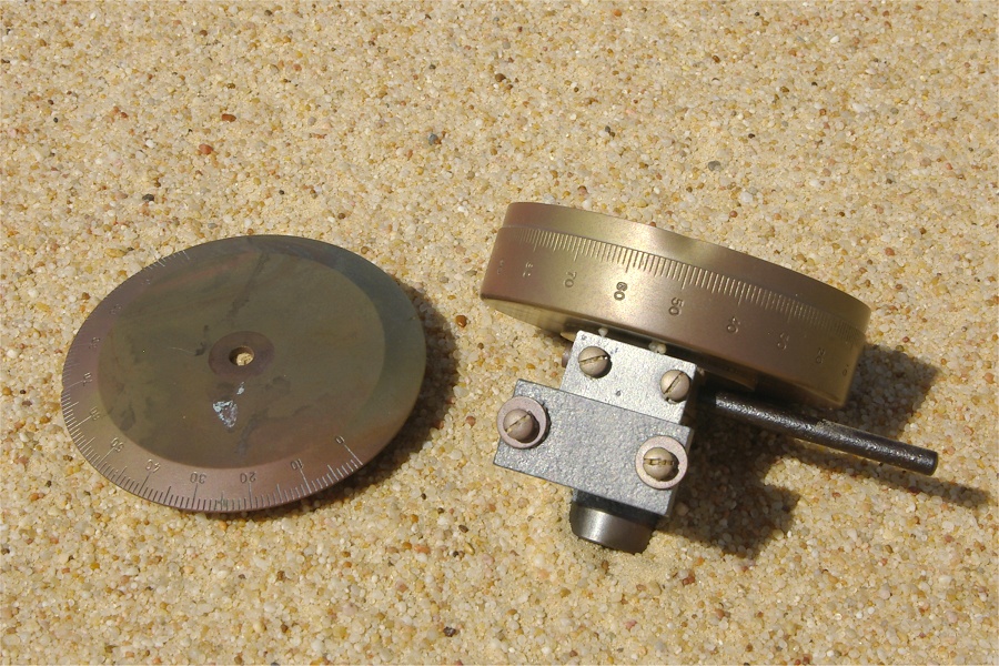
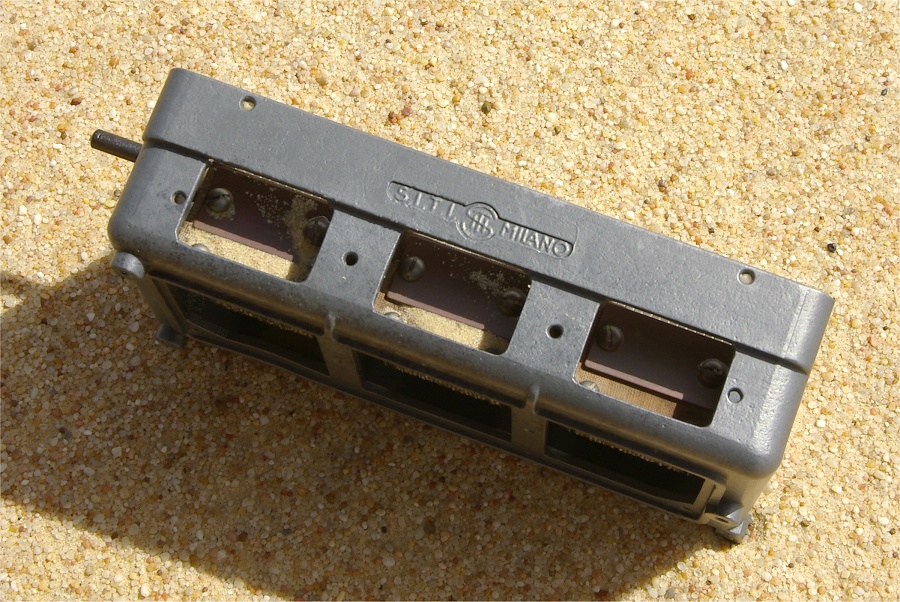
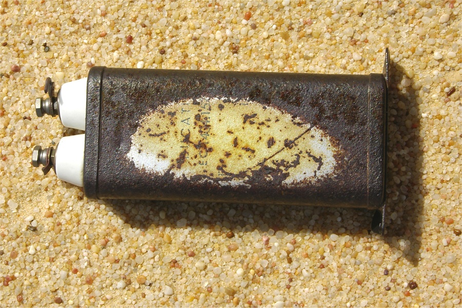
We made our most interesting find around noon. What initially looked like just another pile of discarded tins turned out to be an asortment of radio parts, all Italian made. Raymond (who served as a wireless engineer for the RAF during WWII) soon identified them as various components of several very sensitive radio direction finder units. They could have been either captured during one of the raids on the Kufra supply trucks before February 1941, or possibly taken from Kufra after its capture. In any case, someone apparently decided that they were worthless, and discarded them in a pile at this desolate spot.
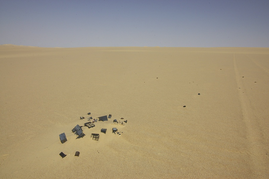
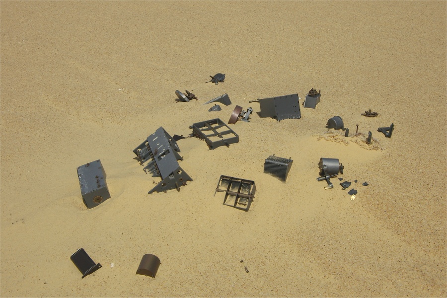
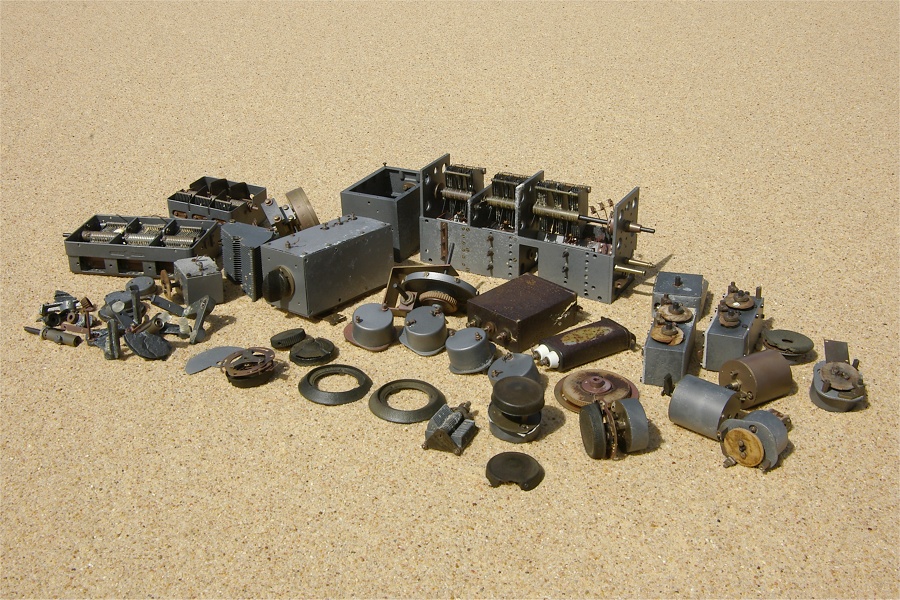
The bulk of the parts were large tuning capacitors (one with a cast S.I.T.I. Milano inscription), variable resistors, tuning dials and knobs, and a Ducati capacitor. If anyone can shed more light on this find, please send me an email.
After about a hundred kilometres the going started becoming more difficult. The dunes became larger and more continuous, with lurking soft patches on their deceptively smooth western sides, trapping one or more of our cars several times. A couple of clear areas appeared in the inter-dune corridors, but instead of firm gravel, they turned out to be very fine white sand under a thin firm crust with the consistency of flour, not exactly aiding our progress.
Soon the crested seif dunes merged into continuous barriers, with steep descents on their eastern sides, causing much excitement among our policemen, for whom this was all a novel experience. Fortunately the Bahariya drivers were skilled, we managed all the dune crossings without any mishaps, aside occasionally getting stuck in soft patches.


Despite all the hindrance, we have made unexpectedly good progress. We have set aside two days for the crossing, planning for longer delays, but by sunset we were able to make camp about thirty kilometres to the west of our target.
Day 11. - Great Sand Sea - "Russian Spring"
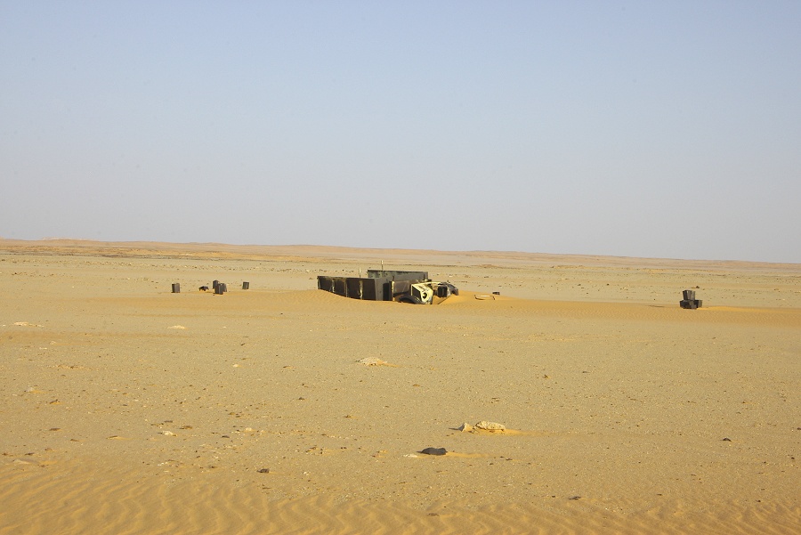
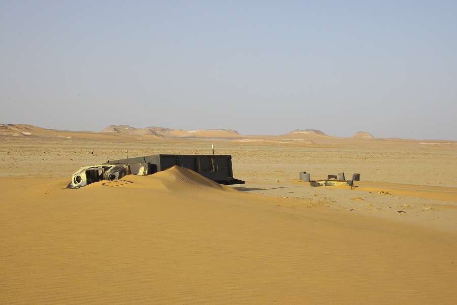
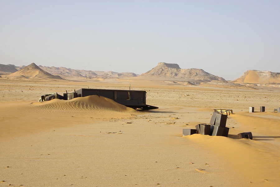
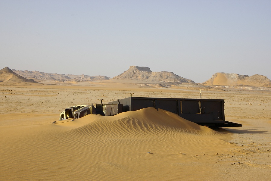
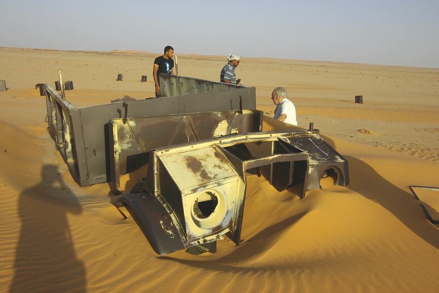
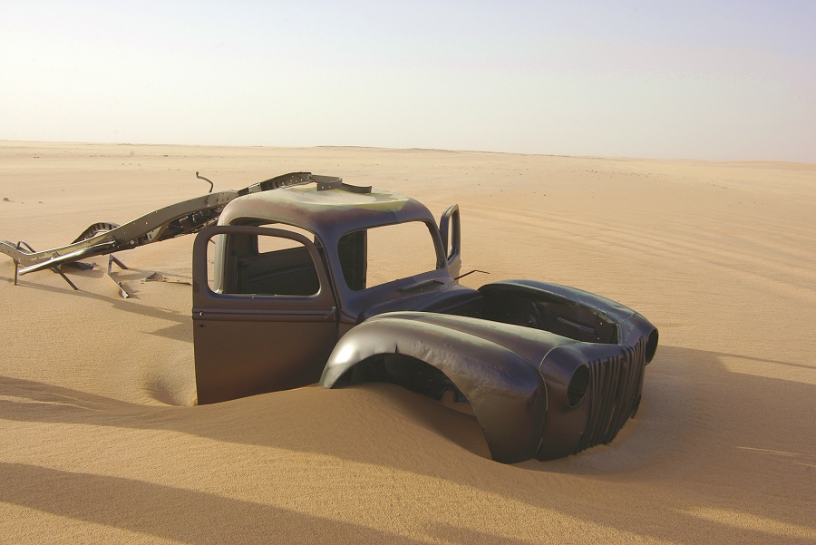
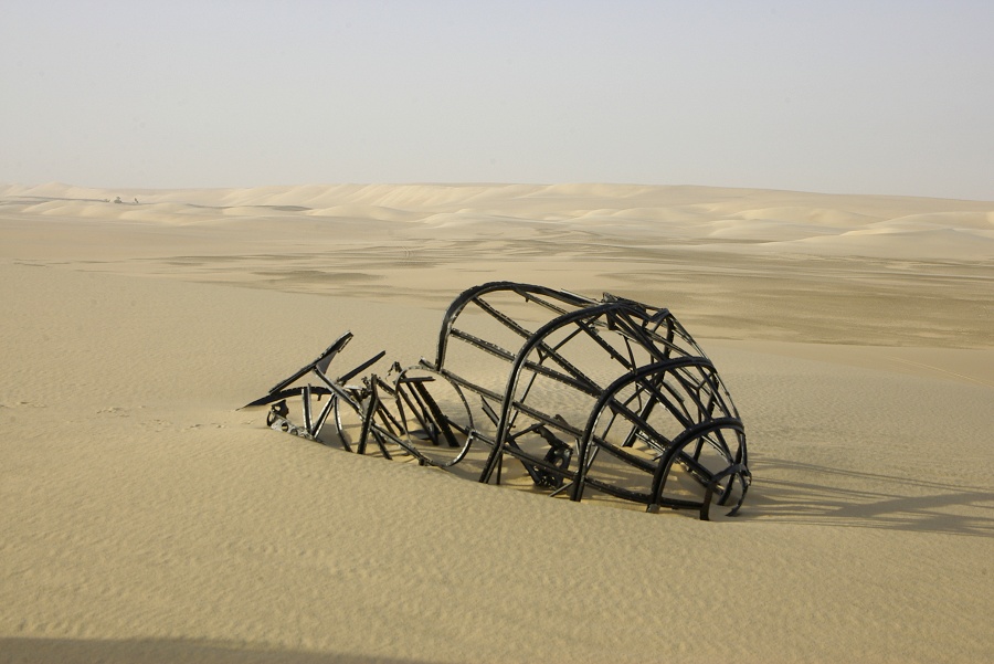
In the morning we continued crossing the remaining dune ranges towards the LRDG truck. The remaining distance was covered in little over an hour, and soon we were standing on the crest of the dune range above the truck. This CMP Ford belonged to the Rhodesian LRDG S-Patrol, it was left here with a broken steering column in April, 1941.

We left the cars on the top of the dune to avoid getting stuck in the soft sand around the wreck. From the surrounding tracks it is clear that the place is very frequently visited. Since our October 2007 visit, someone went through the effort of removing and partly disassembling the engine, but the remaining parts were substantially in the same condition as last time.

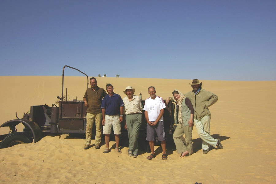
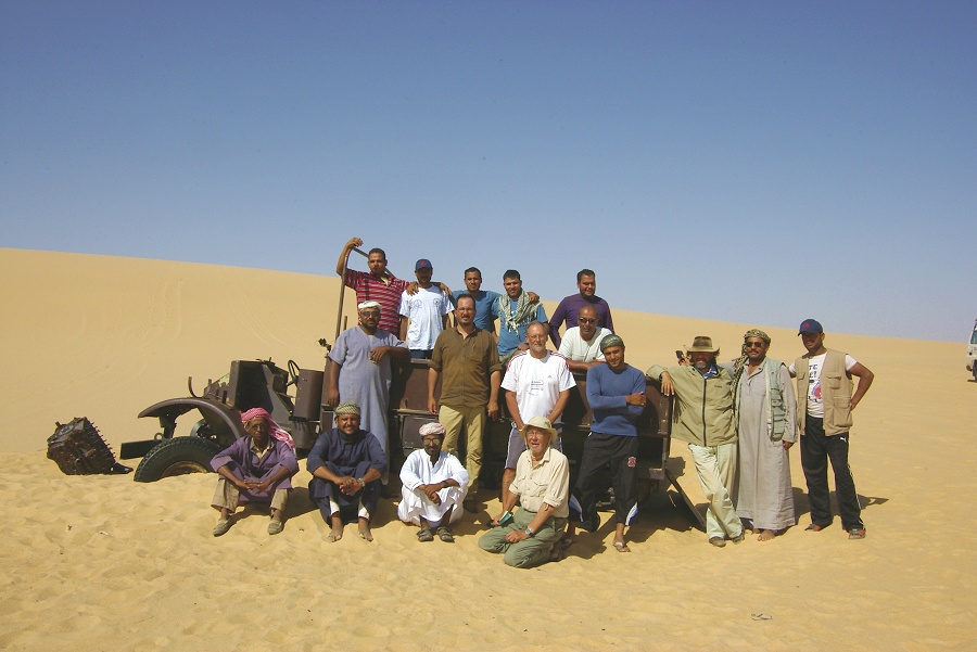
Before moving on, we took our group photos, including one with our (almost) complete escort. For the six of us we had 15 Egyptians, 2.5 for each - we were certainly very safe!
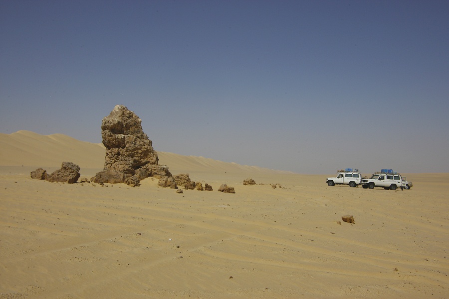
We turned towards the North-east, making a direct course for Siwa, about 300 kilometres away. With reserves, we were planning on two days to reach Siwa, as most of the traverse was on country unknown to me, with any number of possible surprises. For lunch we stopped at "Pillar Rock", so named by the 1930 Bagnold Expedition, the only rock outcrop of any sort withn a radius of 100 kilometres. Unfortunately the environs showed that it is not far enough from "civilisaton", discarded tins and other trash of recent visitors littered the area.
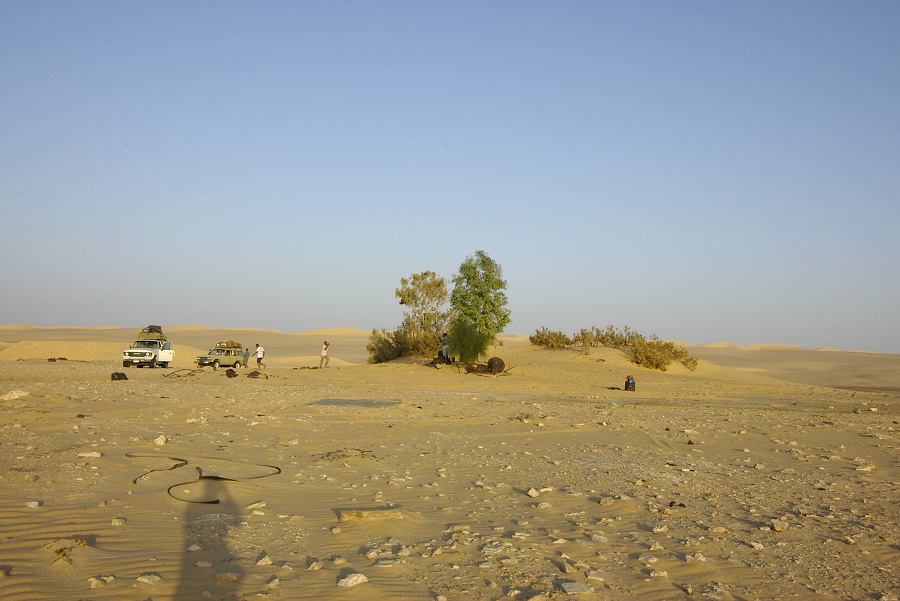
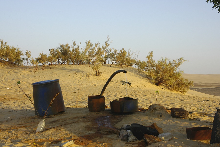
In the inter-dune corridors pointing exactly in our intended direction, the going continued to be very easy, by late afternoon we already covered nearly two hundred kilometres. We made camp at the little artificial oasis that sprung up beside the drilled well of "Russian Spring" (evidently it must have been drilled by Russian engineers during the seventies). Unfortunately this place too was full of the trash of recent visitors, not a very pleasant experience after ten days in the fortunately still reasonably pristine parts of the desert.
Day 12. - "Russian Spring" - Siwa Oasis
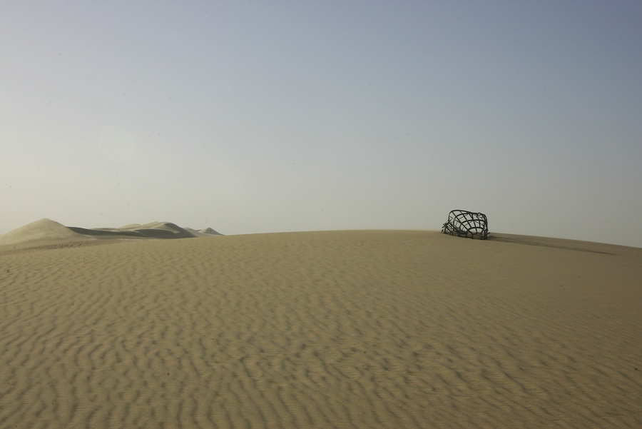
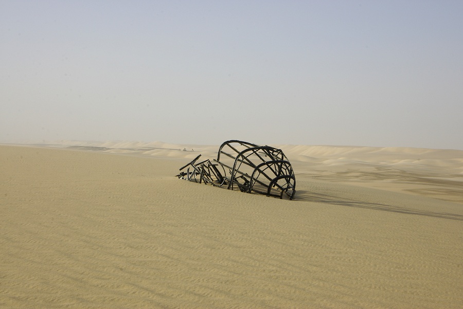
Next morning we awoke to a distinctly unpleasant day. There was a strong wind that picked up the sand, with a grey overcast. In the near-sandstorm conditions we drove to the nose section of a wrecked Caproni Ca.309 "Ghibli" utility aircraft, reported to be about three kilometres from the spring. We found nothing at the spot, however soon we spotted something on the top of a large dune nearby - it turned out to be the aircraft wreck. Someone apparently decided recently that it was a good idea to move it to the top of the dune, probably for a more photogenic location. Nothing is known about the history of this wreck (often it is mistaken for a German Heinkel 111), though it is thought to be the sole surviving remains of a Ca.309 anywhere. If anybody has any further information, please email me.
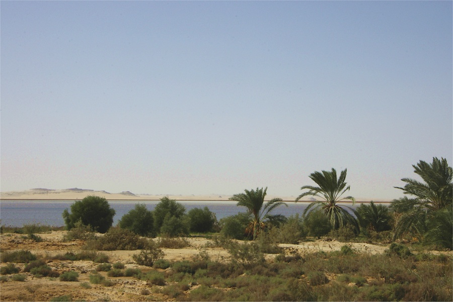
We continued driving up among the dunes, and by mid morning we have approached the northern edge of the Great Sand Sea. Our plans were to spend a last night among the dunes south of Siwa, however he conditions showed no sign of improvement. We decided to go straight for Siwa a day early, allowing us to split the long journey back to Cairo.

The jumbled edge of the dunes was probably the most difficult to navigate along the entire route, but by midday we were out of the sand, and heading towards the tarmac road that connects Siwa and Baharya. By early afternoon, we reached the eastern edge of the Oasis.
Day 13. - Siwa Oasis - Serir South of Mersa Matruh
We spent the afternoon of the previous day and the morning visiting the sights of the oasis, and after lunch we set out North, to cover most of the distance to the Mediterranean coast, camping just before the populated area starts. Our police have left us the day before, immediately leaving for Bahariya after a quick farewell as soon as we hit the tarmac. Our military officer too stayed in Siwa, so for a brief afternoon we were actually just by ourselves. The weather did not improve much, there was a distinctly cold wind blowing with scattered clouds as we made camp off the road among the scattered shrubs, about sixty kilometres south of the coast.
Day 14. - Camp - el Alamein - Cairo
By the morning it was densely overcast, and as we reached the coastal road, we went through several light rainshowers.
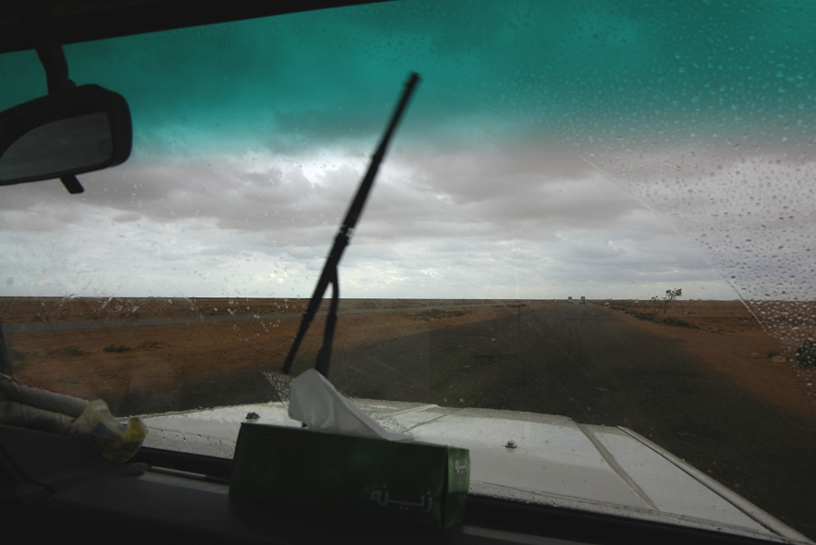
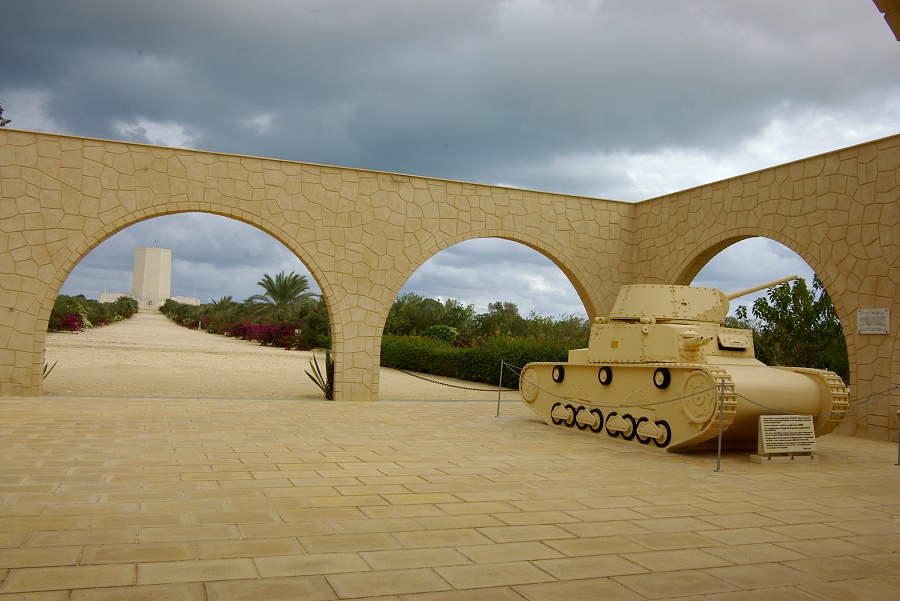
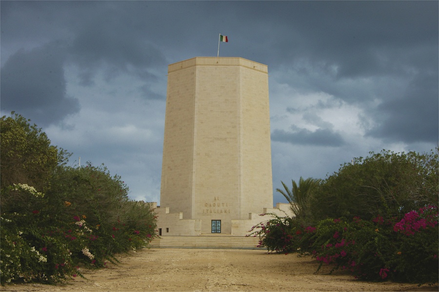
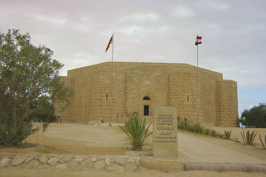
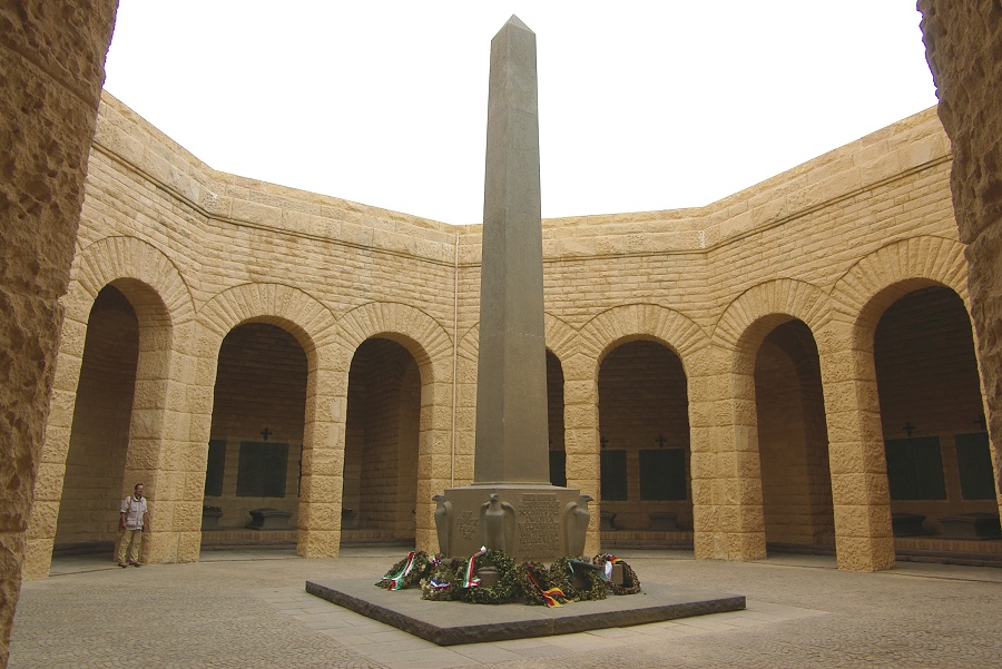
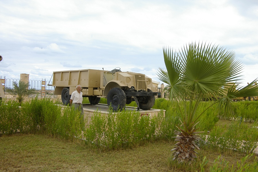
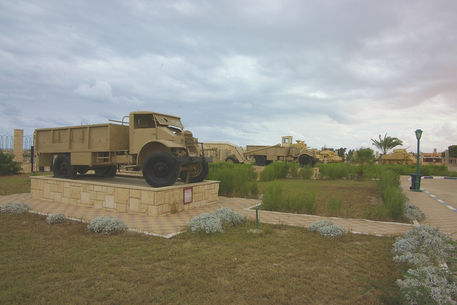
We reached el Alamein by mid-morning, first visiting the Italian and German war memorials.
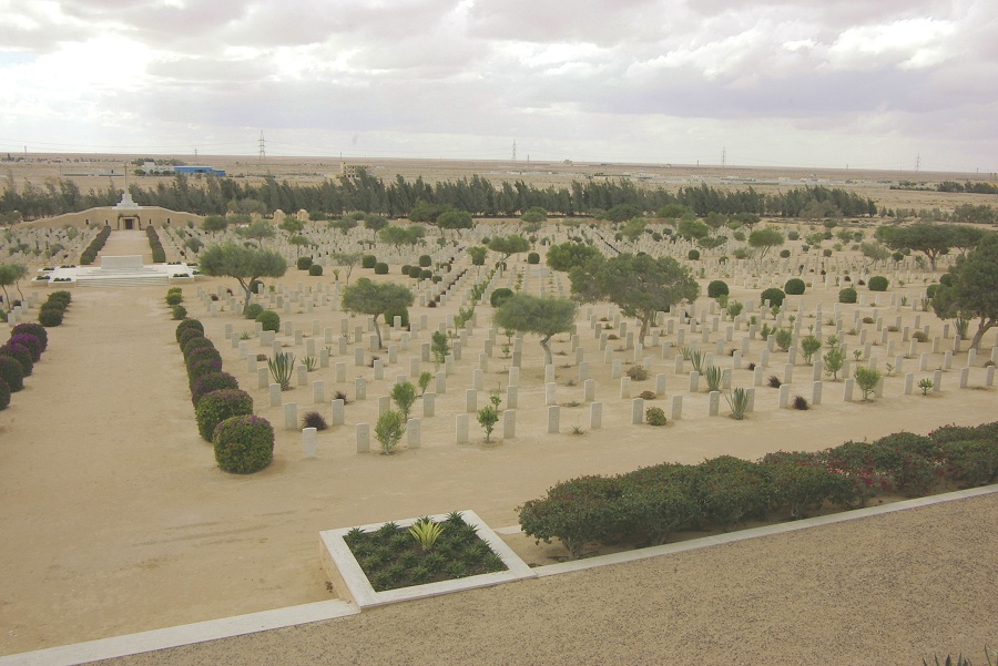
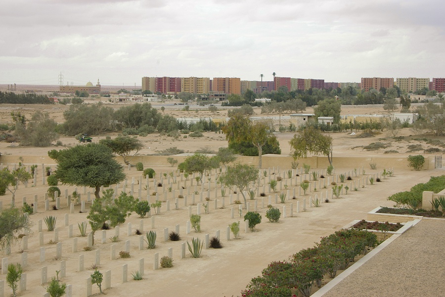
We continued to the modern town, where hoards of highrise holiday apartment complexes are springing up around the museum and the Commonwealth War Cemetery.
After a leisurely visit, we continued our journey towards Cairo, reaching it by sunset.
Postscript: It must be mentioned in full fairness, that despite the significant general nuisance factor, individually all members of our police escort were very nice people. Their commander, Captain Mohammed was genuinely interested in all aspects of the desert, and they all tried their best to please and assist us in whatever way they could. However their inability as a group to get ready in time, their one and a half hour lunch breaks, the noise of their camps which were always set far too close for comfort, and simply their mere presence detracts considerably from the main purpose of why one goes to the desert - quiet, solitude, and simply to be left in peace. Based on this experience, I have decided that I will discontinue the expeditions to the Egyptian part of the Libyan Desert until such time when the authorities come to their senses and abolish this ridiculous system. (It took them 12 years to do away with the convoy system in the Nile valley, something that was introduced after the 1997 Luxor attacks, and made independent travel in Egypt proper practically impossible...)