
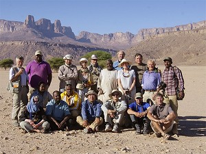
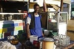
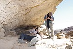
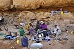
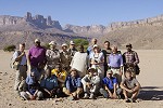
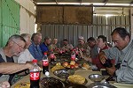
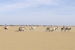
 Click on image for list of participants |
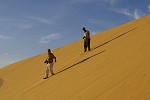
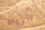
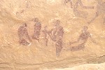
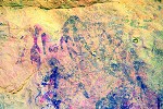
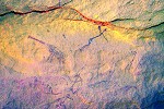
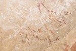
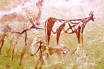
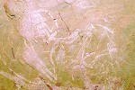
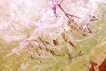
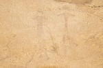
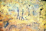
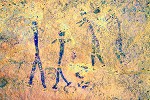
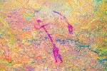
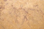
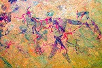
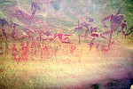
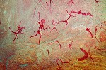
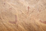
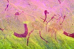
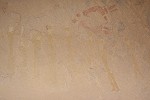
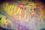
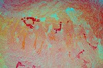
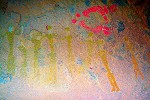
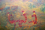
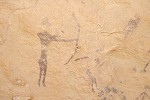
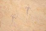
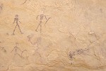
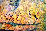
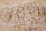
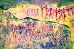
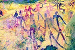
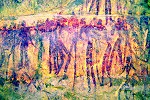
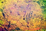
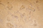
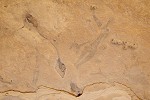
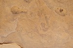
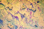
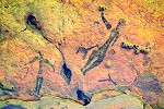
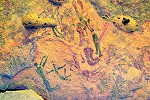
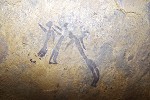
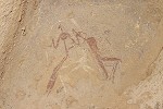
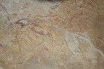
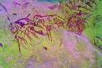
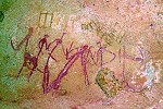
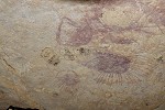
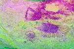
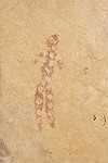
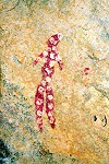
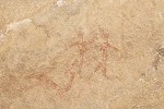
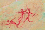
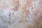
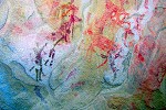
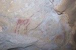
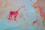
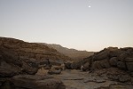
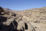
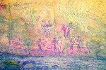
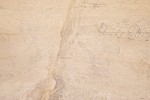
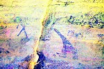
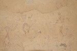
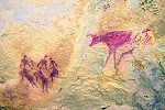
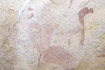
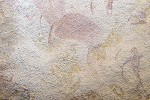
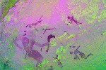
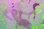
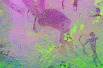
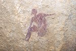
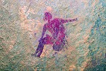
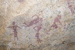
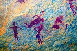
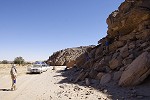
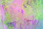
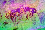
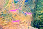
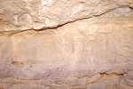
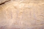
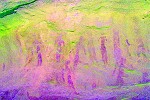
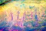
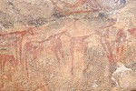
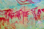
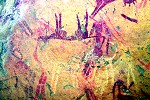
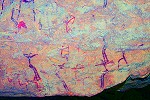
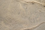
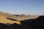
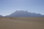
Jebel Uweinat Expedition, Sudan 19th November - 6th December, 2015 False colour images processed with dStretch, a freely available software developed by Jon Harman |
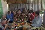
Day 0. - Khartum
With our party flying in from all corners of the globe, we met in Khartoum a day before departure to arrange the travel and photo permits. Like on the previous trip, we stayed at the Grand Hotel on the Blue Nile corniche, and was quite pleasantly surprised to find the service standards considerably improved. While Moez was chasing the permits, the rest of the group went off to visit Omdurman while I tended to our supplies.
Day 1. - Khartum - Merowe
Our departure was not quite as smooth as anticipated, some of the paperwork slipped over to the morning, in the end we had a quick lunch at the Grand Hotel before Moez arrived, much to the relief of everyone, with a broad smile indicating that all papers were in order. We were still ahead of schedule as our original departure was planned for the following morning, only changed when everyone elected to take flights arriving a day and a half earlier.
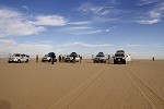
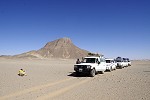
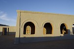
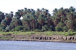
We hit the road around 1pm, taking a good hour to make it across the mess of Omdurman before reaching the open desert road leading North along the West bank, cutting across the big bend of the Nile. We drove near continuously with a brief stop at the half-way rest house to Karima. This time we stayed at a basic but clean and comfortable local hotel on the Merowe side, arriving a little after sunset.
Day 2. - Merowe/Karima - Soleb
Our plan was to reach Soleb by the evening, so we had plenty of spare time for sightseeing at Jebel Barkal. Shortly after sunrise we drove across the bridge to a very sleepy and deserted Karima, fortunately we did find one of the main street restaurants open to have breakfast.
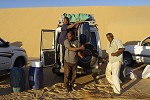
After breakfast we quickly fueled our passenger vehicles and the group went off to visit Jebel Barkal, while with Moez we stayed behind to fill all the jerrycans in the "buffalo", the big Landcruiser used to carry all the reserve fuel. After some shopping for vegetables we re-joined the group at the pyramids of Jebel Barkal.
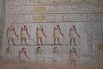
We continued to el-Kurru, 15 kilometres south of Jebel Barkal, the site of the principal royal Necropolis of the Napatan kings of the 25th Dynasty. These tombs, all of which were capped by small pyramids, are much less impressive than those at Nuri on the far side of the river, where King Taharka was buried in a much larger pyramid, and which later became one of the Meroitic royal necropoli. At el-Kurru the tomb superstructures have completely vanished over the ages, and most of the subterranean tombs are in ruin (like that of Piye, the first Napatan king who conquered Egypt). Only two remain complete with decorations, that of King Tanutamani and his mother Queen Qalhata (which is now closed to visitors).
There is a large ruined pyramid at the centre of the el-Kurru necropolis, the owner is unknown but is dated to the early Meroitic period, hundreds of years after the Napatan kingdom. There are many graffiti of boats on the blocks of the Eastern side, based on the accompanying camels they are probably historic or even modern. Nearby there is a rock-cut temple, only discovered recently by a Spanish team, which is also thought to be Meroitic. The oldest part of the cemetery consists of simple tumuli, the graves of local rulers and family members pre-dating the rise of the Napatan Kingdom.
After a quick lunch we continued on our journey, taking the road cutting across the loop of the Nile from Karima to Dongola. We stopped briefly at the latter to buy some fruit and vegetables which were unavailable at the Karima Market, and top up our fuel tanks before continuing along the road North.
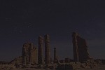
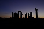
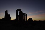
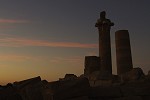
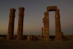
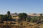
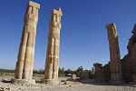
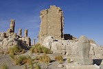
We reached Soleb after sunset, and stayed at the former excavations house like on our last visit. After dinner some of us went out for a magical photo session at the temple, illuminated only by the light of the setting half moon.
Day 3. Soleb - Selima Oasis
The next morning we re-visited the temple at dawn for some more photos, then after a quick breakfast packed and departed for our last chores before leaving the road.
Two years earlier Moez had to organise a dump of several drums of diesel at the tiny village of Toshka about twenty kilometres North of Soleb. Now there was a huge miners' encampment between the road and the Nile, processing the ore trucked in from various mining localities in the desert (including the area adjacent to Jebel Uweinat), but also catering to the supply trade, with a fuel pump and dozens of water pumps lifting water from the Nile. We topped up our fuel tanks, took Nile water for cooking, and made a hasty departure from the rather unpleasant place, filled with miners not only from all over Sudan, but also from Chad and some farther-off parts of the Sahel. We left the road about 40 kilometres North of Soleb, setting a straight course towards Selima Oasis, about 120 kilometres away. We only stopped at a prominent rock outcrop near the half-way point for a quick lunch.
We reached Selima Oasis by mid afternoon. The small military post looked the same as the last time, the soldiers were welcoming and we were given an escort to visit the small stone building at the south eastern corner of the oasis. It was previously thought to be a Coptic monastery, but recent archaeological excavation by Karin Kindermann found no evidence for this, most probably it is a structure associated with the slave trade along the Darb el Arbain, built in the last couple of hundred years. I did not notice a feature previously, all the door lintels were made from shaped pieces of fossilized wood which may be collected not far from Selima.
While we made a round of the oasis, Moez presented our permits to the officer in charge. Last time they could verify their validity over their radio in a matter of minutes, but this time there was some glitch with the reception, so Moez and the officer drove off in a Landcruiser sporting a serious looking two metre antenna to some high ground some kilometres to the south, from where supposedly "it is always possible" to call.

It took Moez over an hour and a half to return, and from the look on the faces it was clear that contact was not made. A discussion with the officer ensued, with the conclusion that we should camp at Selima for the night, and at dawn the radio car will drive further back along the track to surely make contact. While the stay by itself did not delay us much as our plans were to camp a short distance beyond Selima, we have seen similar situations in Egypt leading up to multi-day delays (or worse), so the mood that evening was slightly apprehensive.
Day 4. Selima Oasis - Selima Sand Sheet
In the morning Moez and the officer drove off in the radio car as promised, while we had breakfast and packed camp. It was a long wait, they had to go back nearly half way to the Nile to be able to talk with Wadi Halfa and only returned past 10am. Fortunately our apprehension was unfounded, once the confirmation was received that our papers are genuine we were permitted to continue without further delay. However we did take note to bypass Selima in the future to avoid any repetition.

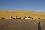
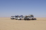
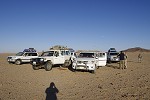
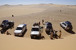
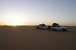
Having picked up a good half days' delay, we drove almost continuously across the Selima Sand Sheet as quick as we could for the rest of the day, only making a few brief stops for lunch and a couple of flat tyres.
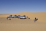
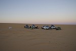
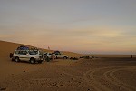
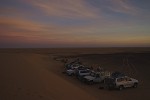
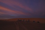
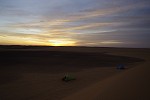
By sunset we reached the range of dunes at about 27 degrees East, and made camp in the lee of a large barchan dune on the far side.
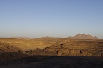
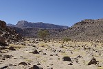
Day 5. Selima Sand Sheet - Jebel Uweinat
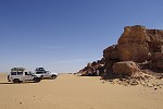
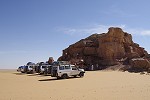
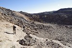
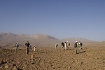
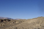
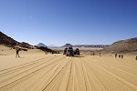
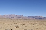
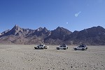
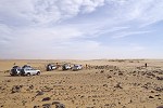
The day was spent with a continuous drive towards Uweinat, only making a brief lunch stop on the featureless flat ground. The going was progressively worse, with alternating patches of stony ground and soft sand, the latter badly churned by the hundreds vehicles of the gold miners, only passable with much reduced tyre pressures, especially for the heavily laden "buffalo".
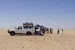
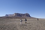
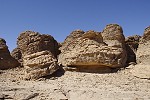
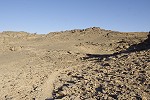
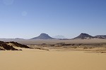
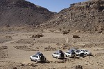
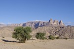
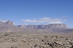
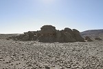
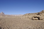
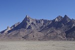
By mid-afternoon we were within sight of Jebel Uweinat, and we left the soft and difficult track looking for firmer ground to the North nearer to the Egyptian border. We did not have much luck, soon we entered an area that was littered with excavated gold mining pits, forcing large detours. Among the hills about ten kilometres to the East of Uweinat we unexpectedly came upon a working miner's camp, with bulldozers and excavators digging large pits in the exposed basement rocks. In the middle of this all we were surprised to find an Egyptian army post apparently keeping an eye on the miners, several kilometres inside Sudanese territory. A car with an officer and a couple of soldiers came out to check us, but after exchanging a few greetings and confronted by Moez on what were they doing inside Sudan, they retreated to their tent leaving us to continue in peace.
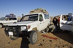
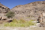
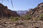
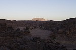
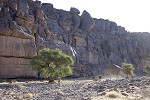
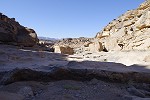
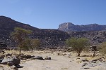
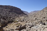
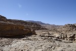
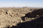
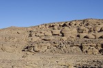
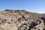
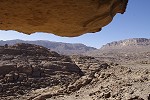
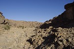
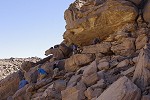
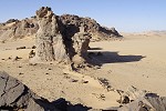
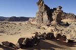
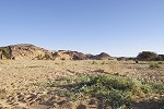
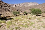
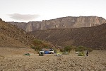
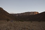
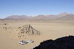
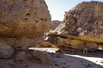
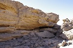
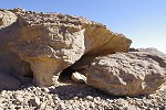
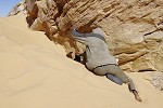
The alternating hard and soft ground took a toll on the tyres of the "buffalo", we had to change three of them that day. The last flat tyre was within sight of the entrance of Karkur Talh, with a sun precariously close to the horizon. We made it up the difficult sandy entrance without any further mishaps, and reached the valley as darkness was setting in. We camped at the end of the drivable section of the South western branch, well positioned for the start of several of the walks we planned to make.
Day 6. Karkur Talh / Karkur Murr
The plan for our first day in Karkur Talh was to visit Winkler's sites 81 and 75, both lying near the watershed between Karkur Talh and Karkur Murr, and for the sturdier of our party to continue to Ain Murr, the spring in Karkur Murr. We set out from our camp at sunrise upstream in the main wadi, soon entering the small southern lateral wadi leading up to the sites.
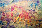
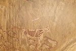
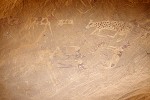
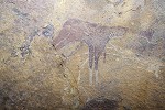
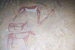
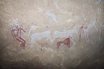
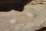
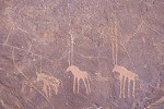
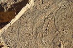
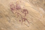
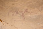
The southern lateral wadi broadens into a large natural amphitheatre soon after the junction with the main valley, we have found several minor sites along its eastern side on our first systematic rock art survey in 2002. There is a large conspicuous shelter on the western side, which was checked out many times and found to be void of ant rock art, however this time we did find a rather unexciting, nevertheless unrecorded engraved giraffe some distance below the shelter. We also located the fine engraving of a pair of oryx being hunted by a pack of dogs found by Hardy Böckli in 2009 on the southern slopes of the basin.

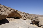
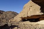
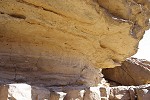
At the point where the valley narrows again at the southern corner of the basin, there is a large shelter located about 15 metres above the valley floor, with a commanding view of the basin. In 2002 Jean-Marc Mercier and companions found a splendid panel of miniature style paintings in it (Site KT 96), at the time these were the best example of these peculiar little figures.
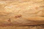
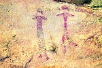
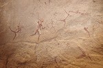
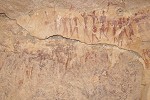
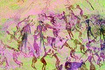
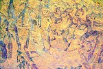
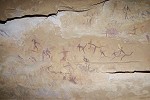
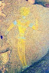
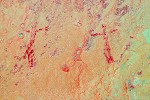
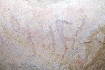
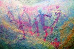
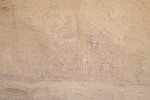
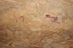
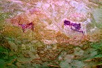
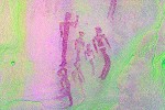
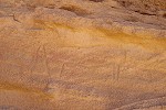
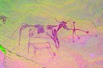
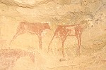
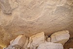
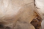
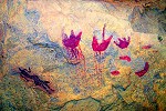
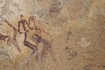
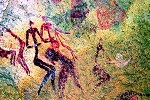
There are many more paintings in this shelter, mostly on the rear wall, unfortunately mostly damaged and very faint, most of them are barely visible with the naked eye. Now with the magic of dStretch it is possible to see them for the first time. There are several figures which appear to be of the "Uweinat roundhead" style, and some incoherent blobs of paint turned out to be a fine group of giraffe.
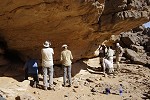
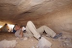
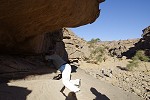
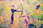
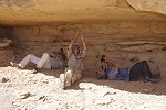
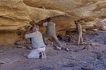
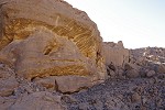
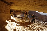
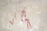
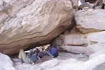
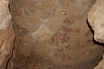
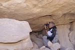
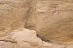
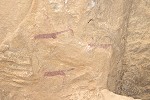
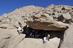
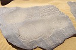
Winkler's site 81 (KT 97) is just six hundred metres further upstream. It is an exceptional site, both in terms of preservation and content, with the strange "star" shapes, and the white/red objects which most probably represent rain clouds. As there is only room for a single person inside the shelter for photography, we settled down for a longer stay, everyone taking their turns.
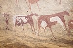
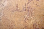
In 2001 when with Wolfgang Düchting and Salama we re-located this site during a long afternoon, we found several lesser sites immediately upstream just a hundred metres away, inexplicably not seen by Winkler, or at least no record of it remains. The largest, Site KT 98/B contains some fine and intriguing paintings, including some rare giraffe from the Cattle Pastoralist period, unfortunately all very damaged. With dStretch much more is revealed than what we could see before.

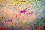
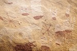
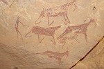
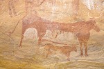
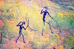
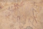
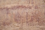
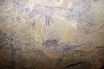
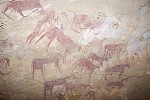
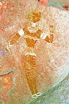
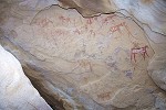
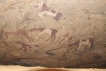
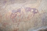
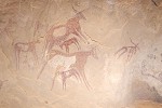
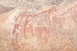
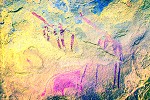
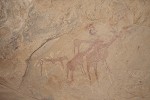
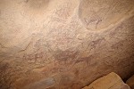
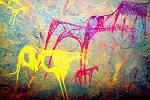
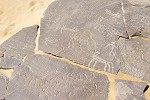
We continued across the low plateau towards Winkler's elusive site 75 (KM 17) in the upper reaches of Karkur Murr, for which we searched for five years in vain until finally stumbling upon it with Liz & Jon Hales in 2006. It is the most spectacular find of the 1938 Bagnold-Mond expedition, both in terms of quality and the sheer quantity of cattle pastoralist paintings in the long double shelter.

The most interesting feature of this site are the multitude of white, ghost like figures painted over the more conventional red and white cattle pastoralist figures. They appear to be also cattle pastoralists (there are a few white cattle belonging to the same layer, and the skirted women are not unlike what can be seen at other pastoralist sites), but the male archers, especially the two with long "tails" are absolutely unique, may only be observed here. As the white paint weathers more easily than the red, despite their apparent younger age they are quite hard to make out over the well preserved red figures.
We had our lunch in the shade of the deeper part of the shelter, after which some of our party returned to camp, while the remainder set out across the plateau top towards the spring in Karkur Murr. We soon hit upon a well traveled waddan trail that was leading us straight towards the only practical pass descending into the valley below.
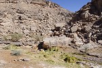
The vegetation around the spring of Ain Murr was much less than on previous visits, the secondary pools were all dry. There was no trace of any recent human activity, the spring itself under the big rock was almost completely overgrown with vegetation, showing only a small patch of open water. We took the opportunity to have a quick shower using our empty water bottles, then started back towards camp at Karkur Talh.
On our way up the valley we passed site KM 12, another site found on the 2002 survey. Photographing the scattered paintings, we found a nice panel of goats in a hidden spot on the ceiling which I failed to note on previous visits.
On all our previous visits to the spring we continued Eastwards across the low plateau to our regular campsite in the main Southern branch of Karkur talh. This time we intended to follow the full length of the camel path linking the two valleys, something I had not done before. At the time we did not notice that the trail ascends just adjacent to site KM 13, the site we found on our first foray into Karkur Murr with Wolfgang & Salama in 2001 (at the time, not knowing its exact location, we turned back just 500 metres short of the spring).
As we started ascending the path, only a short distance above KM 13 we came upon a small terrace with a conspicuous shelter in the surrounding rock wall. Approaching it, some faint figures became visible on the rear wall. Unexpectedly we have stumbled upon a new site, proving once again that the potential for new finds is far from being exhausted at Jebel Uweinat.
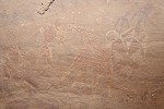
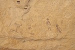
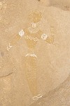
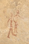
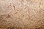
The site turned out to be a rather exciting find, on close look it emerged that all the figures were of the "elongated roundhead" style, the earliest of the Uweinat paintings. Some of them have extensive body decoration, and are associated with a wavy line, starting out solid then becoming a row of dots, evoking non-figurative elements found at some other elongated roundhead sites, and also the decoration of dotted wavy line ceramics which may be associated with these paintings. It was definitely a fine ending to our first day at Uweinat.
With the unplanned stop at the new site, we made a hurried retreat along the camel path towards our camp, as the sun getting rather low. Up on the plateau, in an area far from any vegetation, we encountered a small dark coloured lizard of a type I have never seen at Uweinat before. It was subsequently identified as an unusually dark variant of Mesalina guttulata, a species known from Uweinat in the literature. We reached Karkur Talh just in time for the last rays of the sun before it disappeared behind the mass of the Hassanein Plateau.
Day 7. Western Karkur Talh
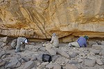
We set out once again at sunrise, this time to visit the concentration of sites at the end of the South western branch of Karkur Talh discovered in 2003 as we were making our first ascent to the Hassanein Plateau. I have not really thought into it previously, but it had been nine years since I last visited and photographed these sites, with more recent trips focusing on remaining blank spots. As my old digital photos are mostly of insufficient resolution to achieve good results with dStretch, I was very much looking forward to taking better photos with my current camera, hoping to see more details at some important sites than what could be observed before.
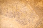
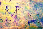
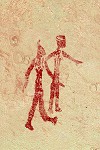
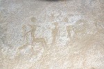
It was a two hour walk to reach the group of sites. Leaving our packs in the shade of rocks near the centre, we first visited site KTW 21, the locality with a panel displaying a triple superimposition of "Uweinat roundhead", miniature style and cattle pastoralist figures, the key to the relative rock art chronology of the area.
After site KTW 21 we moved to the far Western end of the cluster, site KTW 28/C, a very low shelter under a huge boulder, with a series of long and very complex "Uweinat roundhead" (and possibly slightly later) scenes on the rear wall, one of the most important archaic sites at Uweinat. The paintings are all very faint and weathered, the new photos help considerably in making out the scenes.
Having pointed out the other sites along the way, our party scattered to avoid crowding the sites. At site KTW 27/A (known for the unique large archaic figure of unclear affinities on the ceiling, plus the fine cattle representations), I found a previously unrecorded panel at the rear of the site with two very fine male cattle pastoralist figures with the characteristic tailed quiver hanging from their shoulders.
At site KTW 26/B I could confirm what was only suspected from an incomplete photo, having never taken a wide angle shot of the entire scene. Under the two very fine running archers it is possible to observe a row of ostrich, another unique theme at this site not appearing elsewhere on cattle pastoralist paintings.
Early afternoon we re-converged on the group of rocks sheltering our packs. We had a quick lunch, then set out together for site KTW 27/G, the double shelter under a huge boulder a bit removed from the other sites, only discovered in 2005. The East facing shelter is small and low, there are many "elongated roundhead" figures on its ceiling. Many of them are executed in yellow, and most are so faint that they are hardly visible in natural light. With a wide angle lens and an external flash I could capture many more details than I saw before, including entire groups of figures that I never noticed previously. It is interesting to note that the yellow figures, demonstrably among the oldest of the Uweinat paintings, are holding what appears to be composite bows (made from several separate pieces of wood, or sometimes animal horn), a technology much more advanced than the simple bows shown on "Uweinat roundhead", miniature style and pastoralist paintings. On a newly found scene a group of people are holding some strange white blobs, a scene without any known parallels.
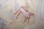
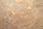
The North facing shelter is much bigger, with a multitude of "Uweinat roundhead" figures, and the unique drawn and decorated hands. On this side I did not find any new scenes of figures, but dStretch reveals that a yellow "Uweinat roundhead" figure is clearly superimposed over a partial but still recognisable elongated roundhead figure, supporting the evidence from the other two much less distinct occurrences.
I was the last to leave the site, taking the same path back as always, past a long shelter which I must have checked out sometime in the past. Now, perhaps because of different lighting, I spotted a couple of scattered faint figures on the very rough rock surface. On closer scrutiny there were several clusters of paintings, located in more sheltered hollows in the rock.
Even with dStretch the affinity of these paintings are not easy to make out. Some are definitely of the "Uweinat roundhead" style, others possibly Uweinat elongated roundheads or miniature style, but there are some that do not appear to fit into any of the defined categories. A particularly interesting and thought provoking scene is a pair of human figures (elongated roundheads ?), one of which is wearing a loincloth or other accessory not seen on any other Uweinat painting, which is strongly reminescent of accessories associated with true roundhead figures in the Tassili n'Ajjer.
All these new finds pushed us past our planned departure time, a part of our group already left for the way back. We followed in haste across the plateau flanking the wadi, and reached the edge of the valley above or campsite just as the sun was setting.
Day 8. Karkur Talh
After the two days of long walks we planned a more relaxing day, visiting the Belgians' sites in the North western main branch of Karkur Talh, then spending a relaxed afternoon in camp visiting the nearby sites. We drove to the end of the motorable section and set out on foot, stopping at the small site KT 81/A near the half-way point. We found this site already in 2003, high up on the ceiling of a shelter in a seemingly unreachable spot about 15 metres above the valley floor. This time we found a difficult but manageable way up to the rock ledge just below the site, enabling some close-up photos of these intriguing paintings.
The figures on the two separate panels are hard to assign to any defined style. The largest archer shows some similarities with "Uweinat roundhead" figures which hold similar bows with an outstretched arm, while the others more resemble the miniature style, but the "feel" is not quite right. Despite the protected location they are quite weathered, and probably at the time of their making the gravel terrace below was much higher, allowing easy access to the ledge.
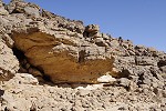
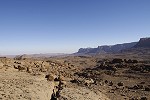
One of my key objectives on this expedition was to map out the extent of the laclustrine sediments that appear in a bathtub-ring fashion in the area or the rock art sites discovered by the 1968 Belgian expedition. The true nature of these deposits were recognised by Margarita Marinova and Chris McKay on our October 2005 expedition, presented in a 2014 paper, and although there are some lingering questions about the exact process of their formation and their age, they are certainly freshwater deposits which appear to have formed in a large standing body of water. Taking GPS readings of all the outcroppings, I could follow the edge of the ancient lake for a stretch of 500 metres, with the principal cluster of rock art sites right in the middle. There is a perceptible depression in the valley floor where the lake once stood, the deposits follow the 697m contour (at least the GPS readings hovered around this average), and the western end of the lake was at a rock step upstream of which the valley floor was smooth bedrock. At present the deepest part of the basin is 4m below the top of the sediment ring, but it could have been considerably lower at the time the lake was filled. The eastern end is marked by a gravel terrace across the valley gently rising to the level of the sediments. The whole setting is very similar to the large lakes we have seen on the Tadjelahine Plateau in 2012.
While I was surveying the ancient lake, the rest of our party dispersed among the numerous sites. I returned to the main site (KT 83) where we left our gear, and re-photographed it at a leisurely pace, focusing on those areas which were promising for processing with dStretch. Slowly the rest of our group also converged on the site to have our lunch and a little rest in the shade of the rock wall.
After lunch some of us ascended a steep rocky ravine on the North side of the valley to the bordering low plateau to re-locate a unique site found by Rocio and Captain Saleh when they went for a little rock climbing on our last expedition to Uweinat from Egypt in 2010. My photos of the site did not turn out too well, and having lost the precise coordinates I was unable to find the site again in 2013 among a maze of huge boulders on the low plateau. It was again a lengthy search, finally we did find the site, much higher among the rocks than I recalled. It is a low shelter under a large boulder, with a multitude of very faint human and animal figures on the ceiling in a style that is markedly different from other paintings of the area.
The human figures show some affinities with the "Uweinat roundhead" style in terms of body posture and the arm bands some can be seen wearing, while the body decoration more resembles those of the "elongated roundhead" style. Based on the advanced state of weathering they are certainly ancient - this is also confirmed by a couple of similar human figures underneath the cattle pastoralist paintings at site KT 83/C in the valley below which previously were an oddity. However the most intriguing figures are a group of animals drawn with a triangular head and prominent round ears, which have no parallels anywhere in the region.
While we were busy photographing the ceiling, Robert wandered about and checked out some rocks in the vicinity. In a very low and deep shelter he found some a group of humans of the same type and some very fine polychrome giraffe at a very strange location. The shelter is only about 60cm high, one may only crawl in on one's back, and the paintings are a good 3-4 metres inside the shelter on the ceiling, making them very difficult to see and photograph.
We returned to camp for a lazy afternoon, some taking the opportunity to rest, while others explored the sites scattered about the camp. Among the rocks above the Northern bank I found a small site with some very faint human figures which have not been recorded before.
In the late afternoon some of us visited the cluster of sites we found in 2002 on the plateau above the valley. At the last site, KT 94/A, just as we were preparing to leave, we found an intriguing panel of paintings on the low ceiling of the shelter some 20 metres from the known panels. Aside some fine cattle and goats, there were several shelter scenes and some strange shapes the likes of which have not been recorded elsewhere.
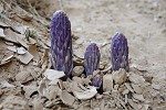
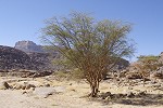
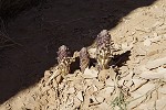
With the unexpected find it was close to sunset when we returned to our camp in the valley. While we were on he plateau Pluche walked about along the watercourse, where there still was some green vegetation, the remnants of the growth spurred by the 2014 summer rains (observed by Mark & Moez a year earlier). Near a dried pond she found a cluster of sprouting Cistanche phelypaea, a parasitic plant growing on the roots of a nearby Aerva persica host plant. It was the first time I saw this species live at Uweinat, previously I only found a shriveled and dried specimen a year after the 2005 rains occurred.
Day 9. Western Karkur Talh
In the morning we set out for the longest trek of our trip, with some of us planning to get up to the cluster of sites in the small side wadi above the main North-Western branch of Karkur Talh discovered on our descent from the summit of Uweinat in 2009, the rest of our party accompanying us till the bottom of the side Wadi to see the cluster of sites a little further upstream and returning the same day. As we drove from camp to our starting point, the remnants of the new vegetation from the previous years' rains was very much evident.
Passing the Belgians' sites where we spent the previous day, we continued to the bend of the valley where it is possible to ascend the flat plateau above, offering a much easier going than the rocky riverbed. We aimed for the pair of conspicuous basalt hills, and continued up in the gorge between them.
It was a rather hot day, we made several rest stops is scarce patches of shade, by the time we crossed the flat basin beyond the two hills it was well into mid-morning. We took a last rest in the shade of a big rock at the bottom of the rock-strewn gully leading up to the side wadi, then our party split, our smaller part making the climb along the more passable rubble slope along the sides of the gully.
It was early afternoon when we reached the principal shelter of the cluster of sites in the side valley, KTN 51. We took a good long rest in the shade after the exhausting walk and climb of the morning, not surprisingly everyone was more interested in the paintings than in the prospect of having something for lunch.
After the heat subsided a little we set out to accomplish what we primarily came for: a thorough survey of the high rocky ground to the North of the valley, where satellite imagery showed some rather promising rock formations along a series of terraces in the hillside. We already found two sites here when we made our visit in 2010, but the area was far from being exhausted, the prospects looked good. We ascended up from the valley past the 2010 sites along a wide gully with a huge North facing rock wall along its side. We did find the expected shallow shelters at its base, and the scatter of artifacts clearly indicated ancient habitation, but all the rock faces were empty. The same happened further up, where we did see a number of good shelters, but alas no paintings.
A little discouraged, we returned to the 2010 sites, primarily to the large shelter (KTW 54/A) with the stunningly beautiful yellow-white "Uweinat roundhead" figure and the curious red figures with striped and spotted body decoration. I did not notice before, but dStretch reveals a very faint but discernible thin dark outline to the entire figure.
Taking our time, we found two further panels of red figures which we did not note in 2010. They appear to be of the same type as those in the shelter adjacent to the Belgians' sites in Karkur Talh which we saw the previous day.
With the approaching sunset we returned to the valley, and used up the remaining light to photograph the known sites. KTW 52/A is particularly interesting, as there are a number of older paintings below the cattle pastoralist figures, some not readily fitting into the established stylistic framework. The pair of prominent "elongated roundhead" figures are a bit puzzling on first look, as they appear fresher than the surrounding cattle, but dStretch reveals that the older figures have apparently been made with a paint resisting weathering, while the overlying red cattle faded to the point of being almost invisible.
On the side of the rock, to the right of the shelter there is a painted giraffe which I already noted in 2009. This time I took some overview shots, and with dStretch it is possible to see an entire giraffe hunt scene (with a second giraffe), with several archers and arrows embedded into the chest of the animal. This is one of just four such hunting scenes which appear to be assignable to the cattle pastoralists.
We finished at site KTN 53 which contains some of the artistically most accomplished scenes. Aside the bright cattle pastoralist paintings there are several very faint but recognisable "Uweinat roundhead" figures scattered about the shelter, including several which I have not noticed on our previous visits, only showing up on the taken photographs. This time I could photograph everything properly at leisure.
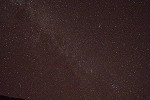
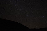
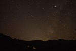
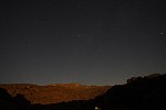
By the time we finished it was becoming dark, we returned to our bivouac spot in the riverbed near site KTN 51 and had our dinner at the light of a small campfire. The moon was not yet up and the stars put up an amazing display with the milky way right overhead, tempting me to spend an hour playing with my camera's high sensitivity settings to try to capture some of the view. A few of the photos came out surprisingly well, with the Milky Way and even the Andromeda galaxy clearly visible, though sharpness and noise are less than perfect. Once the moon came up, it illuminated the cliffs of Uweinat, with the stars providing the backdrop.
Day 10. Western Karkur Talh
We were up at first light, to take opportunity of the twilight to photograph site KTW 51 again without the disturbing side lighting. On the disjoined rock at the end of the shelter we noted some paintings which were not recorded before, including a group of hard to classify archaic-looking figures.
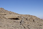
Our plan for the morning was to explore the higher terraces along both sides of the valley upstream of the cluster of sites, as when we came down from the summit in 2009 we only did a very rapid checking of potential shelters on our way to the most promising area identified on satellite imagery. We checked all possible shelters for a stretch of almost a kilometre along the shaded southern side of the valley up to the level of the flat plateau above, without finding anything, however from our elevation we did notice a conspicuous boulder with a large shelter underneath on the crest of the ridge on the north side, not visible from the valley below. On our return it was Bruno who took the effort of climbing up, and we soon herd him yell down: paintings!
It is only possible to appreciate how spacious the site is after a steep five minute scramble up the rocky slope to the boulder. The big shaded area underneath, with a number of large cupules on the floor, can comfortably accommodate at least a dozen people, with a commanding view over the entire surrounding area. Bruno found some very faint paintings on both the rear wall of the shelter and on the narrower ceiling section on the valley side (to be designated site KTW 55).
The paintings on the rear wall depict a number of small scale human figures which seem to be of the same type as those at site KTN 52 (above the Belgians' sites) which we visited earlier. There is also a giraffe, accompanied by a number of smaller quadrupeds, which may only be discerned with dStretch.
The more important paintings are on the ceiling, and depict exclusively "Uweinat roundhead" figures. On the spot it was very difficult to make them out, mostly one could only guess where the figures were (and many photos were simply taken point-blank), however with dStretch these scenes undergo an incredible transformation. The site is definitely the most detailed and elaborate of this early painting style, and while all the figures are faint, they are perfectly preserved and all details become vividly visible after processing. This site was certainly a major new discovery, adding considerably to our knowledge and understanding of these early inhabitants of Uweinat.

Returning to our packs at site KTW 51 we had a quick lunch, then started our return trek along the way we came, down to the main valley then back between the two basalt hills. On the plateau above Karkur Talh we passed a number of clearly man-made structures, the likes of which I have not seen before. They appeared to be small ruined enclosures, with a floor paved with large stone slabs.
Soon afterwards we descended down the rubble chute to the bottom of the valley, and soon passed the lake deposits above the Belgians' sites. I collected a small sample from near the top of the sediments, then we continued to the waiting cars, reaching them well before the agreed sunset time.
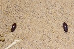
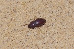
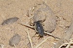
As I returned to my tent after the evening around the camp fire discussing the events of the two days, I noticed a large number of small beetles (~8mm in length) scurrying about in the sand, of a species that I have not seen before at Uweinat. They were subsequently identified as Scelosodis castaneus, a North Saharan species prevalent from Algeria through Libya to the Sinai.
Day 11. Karkur Talh
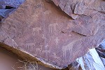
On our last day in Karkur Talh we set out early morning to visit the sites in the Northern tributaries of Karkur Talh, which were our finest finds on our first surveying expedition in 2002. We followed the clearly visible cattle trail leading up to the big guelta adjacent to the cluster of sites KTN 25 - 28, passing the very fine line engravings of cattle near the middle of the trail, carved into rocks already worn smooth by the innumerable passing hooves.
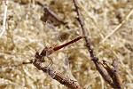
As I was taking photos of the engravings, one of the dreaded Uweinat botflies (sheep nasal botfly, Oestrus ovis) landed right on the panel, enabling some of the best photographs yet taken of this nasty creature (on this trip too, some members of our party were infected in the eye with their larvae despite the precautionary nets, fortunately without any lasting symptoms after removal, and Hans-Peter received a load of them almost every day on his prominent large Leica lens).
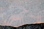
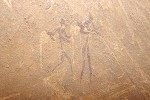
As we continued along the trail, we spotted a female barbary sheep (Ammotragus lervia) with it's young, standing perfectly still on a ledge, both intently watching us. They bolted on realising they have been spotted, but remained visible long enough for a couple of reasonably good photos. This was already our third sighting on this trip, an encouraging sign suggesting that the population is healthy and recovering after the civil war in Libya blocked access from the West to poachers (including, as the rumor goes, rich Gulf hunters).
We soon reached site KTN 27, the principal site of the cluster overlooking the guelta and the many engravings below. Our party settled down for a lengthy photo session in the large shelter and at the adjacent other sites.
While everyone was merrily snapping away at the panels of paintings, we made an exploratory walk with Robert, following the contour above, along the Eastern edge of the wide plain shortly above the guelta and the dry waterfall. Jean Bernard and companions have found a very nice shelter with well preserved paintings in this area in 2009 (together with two minor engravings sites), while the exact location was not recorded it was reportedly just a short distance to the North of site KTN 27. We searched the promising rocks and shelters along the edge of the terrace for a good one kilometre, without finding anything. On our return I did find some engravings on an outlying rock, which proved to be one of the trhee missing sites, so we were searching in the right general area.
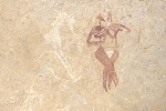
Robert went to check out another outlying rock with a shallow shelter at the base, and did find a panel of very faint unrecorded paintings, so we did have some success after all. Adjacent to a group of three skirted women (one with child) there is a rather rare damaged scene of a cow with the udder is depicted before the (now disappeared) rear legs, feeding its calf.
We were reasonably certain that the sites we were looking for had to be across the ridge to the East, however our time was up and we re-joined the others at the main sites, leaving the search for another time. We returned along the trail, and moved with the cars a little upstream in Karkur Talh to the large circular tomb on the terrace bordering the valley, most likely a modern Tibou construction (when Peel photographed it in 1938, it had a rather fresh look). From here we walked up a small wadi to site KTN 31, the largest and best preserved site with miniature style paintings, discovered in 2002.
As all my photos of the site were taken over ten years ago with lower resolution cameras, I took the opportunity to re-take the site in high resolution, and dStretch revealed a number of previously unrecognised details. The large amorphous red blob at the extreme right of the shelter, surrounded by smaller figures, turned out to be a large human figure, apparently of the same style, holding a crooked object in the hand and apparently being attacked by the small surrounding archers. This scene is without parallels, and appears to convey some narrative of a real or mythological event.
While the paintings are generally in an excellent state of preservation due to their protected location deep inside the horizontal ceiling, dStretch reveals much more defined details, especially for some of the fainter figures which are more exposed towards the edge of the shelter.
On our way back to camp we stopped at site KT 62/B, one of the few paintings in the lower section of the main valley of Karkur Talh. Already in 2003 I noted and photographed three archaic-looking figures, but the photos were unusable for dStretch. The new photos not only reveal the figures in full, but also some very strange objects adjacent to them, for which there are no clear analogies.
After lunch we had a pleasant siesta at camp, some taking a rest, some taking the opportunity to wander about. I checked out the remnant vegetation in the main watercourse, still showing plenty of green after the 2014 August rains.
This was also a perfect time to visit site KT 92 close to our camp, with Almásy's group of opposing archers on the very low ceiling. While these too are very well preserved, the colours blend into the background and are quite hard to make out, especially in the strong sidelight at the spot. These too are beautifully revealed by dStretch in every detail.
Mid-afternoon we set out again to the main valley, to see site KTE 12 not far from the confluence of the main valley and the Southern branch, overlooking the enclosed sandy basin towards the East. It is an excellent case study in how difficult it is to find some of the sites, even if one is doing a thorough and systematic search. It was missed by both Rhotert and Winkler (the latter did find another nearby site) who both surveyed both sides of the valley. They may have noted the stone wall blocking the entrance into Karkur Talh from the direction of the basin, however the numerous panels of fine engravings on big angular boulders on the far side were only found by Samir Lama and Giancarlo Negro in 2001.
In 2003 I easily re-located the site based on the description given by Giancarlo, and just like they must have, I checked out the sand-filled low shelter adjacent to the engravings to see if there were any paintings but found none. When I returned in 2004, perhaps the light was different, or maybe the sand shifted, and much to my surprise I found a very fine panel of paintings deep inside on the ceiling. There was only 20-25cm between the paintings and the sand fill, I had to dig a deep trench to be able to take photographs. Now when we returned, we found the entire shelter filled with sand again, almost to the ceiling.
Rosa and Santi came to Uweinat in September 2012, visited the site, and found a panel of paintings in the jumble of rocks behind the engravings which they could not identify in my catalogue of sites. After a short correspondence we could establish that it was definitely a new find. It was so well hidden among the rocks that this time, even with the benefit of knowing that it was definitely there somewhere within 20-25 metres, it took us a good ten minutes of scrambling over the boulders to finally find it again.
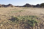
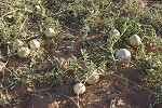
As we crossed the main valley of Karkur Talh, we found the watercourse to be full of green colocynths (desert melons, Citrullus colocynthis). This plant was observed several times to flower and bear fruit in the year following the rains. From Mark's description and photos from January 2015, the green vegetation growing in the path of water reached well over the border into Egypt, making it the largest known rainfall in the past 20 years (the 1998 flow ended just beyond the border).

We finished the day at the unique soft-shelled turtle engraving (site KT 22) on the Northern bank of Karkur Talh, found in 2003, timing our arrival to have the best possible side lighting.
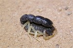
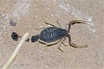
In the evening as we were tidying up camp after dinner, I noticed a small dark speck move on the ground in the moonlight. I assumed it to me one of the many black beetles, but shone my torch at it nevertheless, and found something strange not resembling a beetle at all. It took a good close look to realise that it was a juvenile black fat tailed scorpion (Androctonus bicolor), the first time I have ever seen this species anywhere in the Libyan Desert. This was only the second scorpion ever seen at Uweinat, the first was noted at this same campsite in 2005.
Day 12. Karkur Murr - Wadi Wahesh
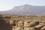
In the morning we packed up camp and drove out of Karkur Talh through the "back door", a difficult sandy pass leading out directly to Sudan in the East, avoiding having to briefly enter into Egypt. We continued along the series of passed to Abd el Ras, the prominent basalt hill at the South eastern corner of Jebel Uweinat. We were a bit apprehensive on what we'd find, but fortunately there was no trace of any gold-mining activity close to the mountain.
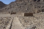
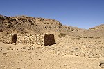
Mid-morning we entered Karkur Murr, which too was completely deserted. All the car tracks we have seen were very old, there was no sign of any recent activity, the little huts of the 1934 Sudan Defence Force camp stood there undisturbed. We spent an hour wandering about, finding a couple of artifacts including a fragment of a gramophone disc which must have ben played on the portable gramophone shown on one of Arkwright's photos.
After lunch we continued along the South of the mountain to Wadi Wahesh, our intended camping spot for another two nights. The mountain was in perfect light, providing a perfect backdrop for our group photo.
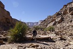
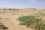
Wadi Wahesh was still full of green vegetation, the 2014 rain must have fallen over the high plateaus feeding the wadis both to North and South (Karkur Murr appeared dry and unaffected). We set up camp, and spent the remainder of the afternoon visiting the scatter of rock art sites on both sides of the Wadi Wahesh entrance.
Day 13. South Uweinat
We had a rather unpleasant cold and windy night (fortunately all tents fared well in battle), and at dawn a mountain wave cloud started to form over Uweinat. In retrospect, it was not one of my better ideas to choose this day to sleep without a tent, the nasty cold caught overnight in the cold wind persisted for the remainder of the trip.
By the time we set out to visit the cluster of sites at South Uweinat found in 2004 close to the Libyan border the clouds over the mountain multiplied, and lingered on till past midday.
It was good to be able to re-visit the cluster of sites, some of which I have not seen for 10 years. We spent the morning going through the sites at a relaxed pace, the much better photos (and of course dStretch) revealing several details which I have not noticed before.
Our party split at the sites, half electing to return to Wadi Wahesh with our cars to see the remaining sites around camp or to spend a relaxed afternoon on our last day at Uweinat, just enjoying the scenery. The rest of us planned to walk back via the rocky area just East of the Libya-Sudan border, reaching Wadi Wahesh via the pass we have used in 2013 when we made the long walk to Wadi Waddan. The rocky area between Wadi Waddan and the broad unnamed wadi descending from the cliffs of the Italia plateau (the summit of Uweinat) was explored by Mark Borda and Mahmoud Marei in December 2007, on the same surveying trip when they discovered the inscription of Mentuhotep II (Nebhepetre). They have found 17 sites in the area, which I have never managed to visit before. To reach the sites, we first had to cross a rather inhospitable 1.5 kilometre wide boulder field, very difficult to walk in and impassable for any vehicle (dubbed "Petraia" by the 1968 Belgian expedition).
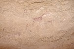
The first site we visited was SU 42, several panels of cattle pastoralist paintings within a maze of giant rocks close to the edge of the boulder field, with a particularly nice male/female couple, and several other fine human representations.
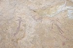
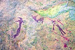
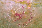
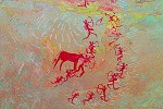
Moving in a few hundred metres among the rocks, we reached site SU 43/A, a large shelter where Mark only photographed a couple of cattle. We easily found the paintings, but there was more than just cattle. The three indistinct red blobs at the left of the panel turned out to be dama gazelle, a very rare theme at Jebel Uweinat, hitherto only known from a single site, KTW 26/B.
About 15 metres to the left of this panel we found some more paintings apparently missed by Mark, a series of very faint, barely discernible human figures. Even with dStretch they are very hard to make out, but at least some of them are of the distinct "Elongated roundhead" style, the oldest paintings at Jebel Uweinat, superimposed by some figures of an unclear affinity, the two layers responding quite differently to dStretch treatment.
At the nearby next site, SU 43/B Mark reported three very faint, barely discernible elongated human figures. With dStretch it is possible to make out many more figures, they appear to be archaic though their affinities are unclear.
For a short distance we continued upstream in the riverbed to the East of the area, till a large shelter (site SU 44/B) which strangely contains only a single very crude cattle engraving.
Site 45/B was again inside the maze of rocks at the side of a small side gully leading down to the main riverbed. It is a fairly large shelter, with many paintings, including a couple of well preserved cattle pastoralist scenes.
However the more interesting scenes were the faint and damaged ones. At one place dStretch reveals a second layer below the more recent cattle which we completely missed on the spot, with cattle and figures which Van Noten termed "people in double loincloths". Adjacent to one cow there is one of the strange "star" shapes known from Winkler's site 81 (KT 98) and one other location in the Wadi Handal. At the upper right of the shelter there are two rather crudely executed faint giraffe, the front legs of the larger revealed by dStretch to be clearly superimposed over a cow.
Site 45/A was on the plateau above, in a commanding location overlooking the wide river valley. It is a shelter opening toward the North offering less shade at midday, but with several deep sections where a small group can have shelter. We too took the opportunity for lunch and a short rest. There are numerous paintings in patches for a stretch of about 25 metres, but most of them are very faint and weathered. The most notable feature is what might be the only known painted sheep representation in the Libyan Desert (whether wild or domestic is another story...). There are also a few cattle engravings on the rear wall of the shelter.
Sites 46/A and 46/B are located a few hundred metres further North, among a cluster of eroding boulders. The first has a very nice panel of cattle and giraffe in the same style, while the latter (rather difficult to find) site contains some very faint "Uweinat roundhead" figures under some weathered cattle pastoralist paintings.
Sites 46/C is a little removed from the other two, under a big mushroom shaped rock overlooking the broad wadi to the East. The ceiling is covered with a large panel of cattle pastoralist paintings, unfortunately all rather weathered.
Site 47/A, a very large shelter under a huge eroding boulder flanking a low hill on the far side of the watercourse to the East is definitely the principal site of the area. There are paintings on several panels on the rear walls and on the large ceiling, plus a number of engravings on the huge boulder blocking the entrance that must have broken off from the ceiling many millenia before the paintings were made.
The paintings are mainly cattle pastoralist themes, but there are several unusual or uncommon scenes. It is hard to make sense of the upside-down cattle, and there appear to be two later white felines (or dogs) superimposed on this scene. On the rear wall there is a large panel of opposing archers, and on the ceiling there are several of the strange red &white lumps which are likely depicting rainclouds. Hidden among the cattle (and partially superimposed by them) there are two very unusual giraffe with spotted body decoration, the outlines more reminescent of some giraffe engravings than other known giraffe paintings of the cattle pastoralists.

About 100 metres upstream there is a very fine panel of engravings on a smooth flat stretch of rock at the base of the low hill. The depicted animals are a mix of cattle, giraffe, ostrich and something that appears to be a rather badly drawn oryx or some other antelope.

There were still a few sites left along the riverbed, but we were already stretching our time, we did not expect so many paintings at the last shelter. We still had a trek of five kilometres ahead of us to camp in Wadi Wahesh, so we set out across the boulder field towards the pass between the two valleys, the half-way point. We made good time, the sun was still well up as we reached the top of the pass.
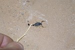
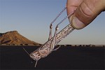
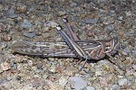
The only remaining minor excitement was caused by a big adult desert locust (Schistocerca gregaria) which allowed itself to be caught, making for a perfect photo-op with the sunlit Wadi Wahesh as a backdrop.
Day 14. Jebel Kissu - Selima Sand sheet
Before starting on our return journey, we made a quick excursion to Jebel Kissu. The plain between Uweinat and Kissu was deserted as always with very few fresh tracks, very clearly all traffic between Libya and Sudan which used to pass this way has ceased.
We went to see the site discovered by Bimbashi Arkwright in 1934 (and reproduced by Almásy in his book), which also provides a glimpse of the typical granite landscape. While taking photos I noticed a detail I have missed before - in the shelter scene the woman appears to be pregnant, an absolutely unique depiction.
We left Jebel Kissu in the late morning, and drove for about sixty kilometres towards the East, passing the gold-mining area by a wide margin. We stopped for lunch and a rest at a series of low barchans just within sight of Kissu and Uweinat.
The rest of the afternoon was spent driving further East, covering around 200 kilometres to the Western edge of the Selima Sand Sheet. With sunset approaching, we made camp among some low barchans.
Day 15. Selima Sand sheet - Burg el Tuyur - Soleb
The objective of the day was to reach the Nile, our only longer stop was at the rock of Burg el Tuyur in the middle of the Selima Sand Sheet, the only significant landmark for a radius of 150 kilometres. We found the single cow engraving covered with deep sand, it took a rather strenuous effort to dig it out.
The rest of the day was an almost non-stop drive straight due East, first over the sand sheet, then across increasingly rocky ground. By sunset as fe made a refueling stop, we were within 10 kilometres of the road, which we reached just at the end of twilight. It was another forty kilometres to the house at Soleb, with the promise of a shower and actual beds.
Day 16. Soleb - lower Wadi Howar
We still had our contingency reserve day, which we planned to use to visit Gala Abu Ahmed, the Napatan fortress in the lower Wadi Howar. It was a crisp cold morning when the cars left to the gold miners' camp to change oil and refuel, leaving us with a couple of hours in the house (the old excavation house) to ourselves till they would return.
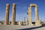
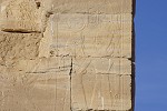
After breakfast we visited the temple again, with some of the finest reliefs in perfect light. We were completely alone again, a wonderful and rare privilege in our present world.
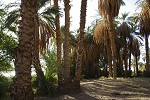
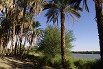
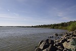
Not in a rush like on all previous visits, we had time to walk down to the Nile bank past the original temple quay which marked the riverbank in ancient times. Now the Nile is a good two hundred metres further East, past a dense date palm grove lining its banks. We were secretly hoping to catch a glimpse of the crocodiles basking on the sandbank on the far side. There were none, but in return we had half an hour of peace and solitude on the riverbank.
Once the cars returned, we immediately started south along the road towards Dongola. We entered the town to buy some fresh supplies and to have lunch, which was not an easy task as all restaurants were closed for the Friday prayer. Finally we did find one that was open, and after a quick lunch we continued.
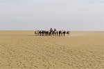
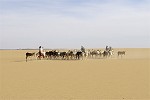
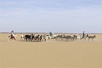
Our turnoff point was another hundred kilometres further South, near Old Dolgola, where the Wadi Howar once joined the Nile. As we left the road, we had a lucky encounter with one of the donkey caravans that still on occasion travel between El Fasher and the Nile, following the Wadi Howar for a while. These caravans are the best modern analogy for what an Ancient Egyptian (like Mentuhotep's expedition that reached Uweinat) would have looked like, the only means of long-distance desert travel before the advent of the camel. With the Toyotas gaining ground in Sudan too, we were very fortunate to witness one before they completely disappear.
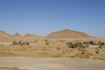
Soon after leaving the road we picked up the bed of the Wadi Howar, a barely perceptible dip in the surrounding flat plain. However after the first ten kilometres it became easy to follow, as the course was still marked by some meager vegetation, completely absent elsewhere.
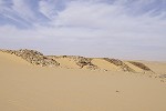
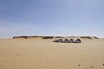
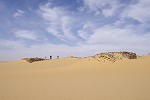
By late afternoon we covered nearly 100 kilometres to the edge of the dune field lying to the East of the fortress. We tried to find a suitable crossing to make camp at the fortress itself, but the sand was very soft and we became repeatedly stuck. We decided to make camp on some firm ground at the base of a larger barchan, leaving the crossing for the next morning in better light. The sun set as we were making camp, and the clouds put up a beautiful spectacle.
Day 17. Gala Abu Ahmed - Merowe
A howling wind descended on us overnight, and at sunrise we had fully fledged sandstorm. We hastily packed up the flapping tents, and re-traced our tracks to a point where the dunes appeared passable. This time we managed without any mishaps despite the bad visibility, and soon we were overlooking the fortress on the far side of the Wadi Howar.
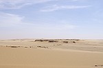
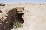
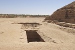
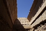
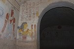
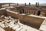
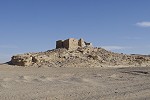
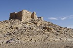
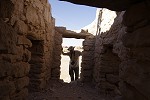
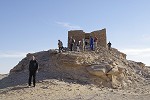
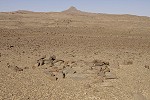
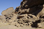
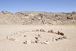
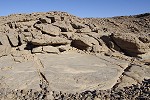
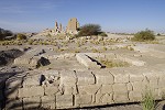
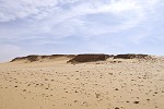
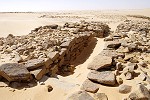
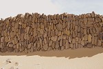
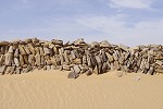
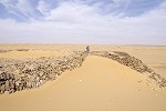
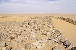
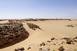
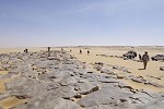
Gala Abu Ahmed ("the castle of Ahmed's father") was only discovered in 1984, when the Heinrich Barth Institut of the University of Cologne made their first surveys of the lower Wadi Howar (it was at this time that it was recognised that the Wadi Howar was in fact a flowing tributary of the Nile in ancient times, and did not disappear into the sands of the Libyan Desert near Jebel Rahib as previously thought). An excavation led by Frederike Jesse in 2008-2009 identified the structure to be Napatan, with the earliest signs of habitation dating back to 1100 BC, with the Wadi Howar still flowing seasonally at the time. The purpose of such a massive building at this remote spot is unknown, but it is clearly a very impressive structure. It is not a perfect square but slightly rhomboidal, with each side approximately 100 metres, with buttressed dry masonry walls that reach a thickness of 8-10 metres. Before the structure became buried in sand, the walls must have stood about 5-6 metres high. There are two bastioned gates on the Northern (river facing) and Eastern sides, at both it is possible to see a staircase leading up to the top of the wall in both directions. Excavations have revealed the foundations of some rather meager buildings within the enclosure, but nothing that would shed light on the purpose. To the east there some foundations of auxiliary structures visible.
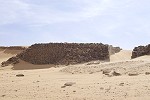
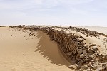
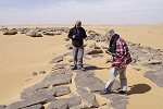
We spent a good hour and a half exploring the structure and surroundings, braving the cold wind and the blowing sand, trying to find our own answers on what kind of enemy could have prompted the construction of this super-strong fortress, appearing to be an overkill by the military standards of the day just to guard the frontiers against desert nomads. A "show of force" is equally hard to imagine, as the remote location would defeat the very purpose - unless it emerges that the Wadi Howar was a heavily traveled trade route in those times, for which at present there is no hard evidence.
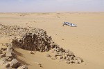
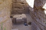
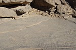
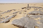
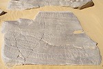
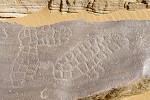
About a kilometre to the East of the fortress, near the site of a burried well where groundwater is still indicated by a cluster of green colocynths, a series of flat, water smoother rock outcrops contain a series of very strange engravings (bearing much resemblance to engravings found at Azrenga along the North eastern side of the Ennedi plateau, 700 kilometres to the West of here). They are amorphous but generally oval shapes with a solid outline, and the insides are divided into small irregular but roughly rectangular shapes. They appear to be rather ancient, as attested by several of them having been obliterated in part by using the slabs as milling stones. There are a few more recent engravings on the slabs with much lighter patination, some quadrupeds and matchstick humans, plus a single 'Ankh hieroglyph (sign meaning life).
Our original plans were to spend more time at Gala Abu Ahmed, trying to locate another area with engravings a few kilometres upstream, but the weather remained rather uncooperative. The cold North wind blowing the sand showed no sign of abatement, so we decided after a quick lunch to return to the Nile valley in the afternoon, rather than having to spend another night camping under these conditions. Re-tracing our tracks We reached the road before sunset, and continued to Merowe for the night (the closest town offering any accommodation), staying at the same hotel as on our outward journey.
Day 18. Merowe - Khartum
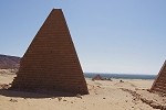
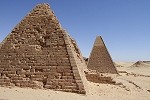
The unplanned detour to Merowe had an added bonus - we could visit the pyramids of Nuri before staring our way back to Khartum, for which we did not have time on our outward leg.
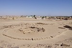
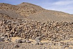
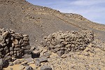
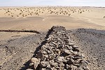
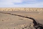
On our way back we stopped at a large stone enclosure at the side of a conspicuous solitary hill a few kilometres off the main road. Rosa and Santi have visited this place before, which has masonry of upright stones that is practically identical to that at Gala Abu Ahmed, suggesting it is also of Napatan age. No excavations have ever been undertaken here, and the ground offered very little clues. There were a few barely visible stone circles not far from the structure, but nothing inside. The walls were about 6 metres thick and 2-3 metres high, creating a cattle-horn like enclosure at the base of the hill and the steep hillside. There is a single entrance in the centre, the only feature in the otherwise solid walls.
We had a quick lunch at this spot, then returned to the road and drove pretty much without stops to the fine Grand Hotel in Khartoum, where preparing for the early morning or next day flights back home.
Conditions permitting, another expedition is planned to Jebel Uweinat from Sudan, tentatively targeted for November 2017. Please visit the planned itinerary page for more details, to be updated as new information becomes available (or "like" the FJ Expeditions FaceBook page to receive notices of news and updates).