
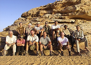
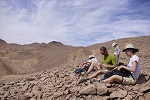
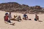
 Click on image for list of participants |
Jebel Uweinat Expedition, Sudan 7th - 24th March, 2013 Quick link to the story of Bristol Blenheim No. N3624 of the GRB1 |
It was strange to be back in Khartoum after 32 years. That first solo voyage remains one on my most cherished memories, I was a bit afraid of spoiling them, but that was unwarranted. True, Khartoum has more paved roads, bridges and much more cars, but overall it remains the same friendly backwater I so fondly remembered. One astonishing and delightful aspect of traveling in Sudan remains to this day: the total lack of hassles and harrasment that one sadly had to become accustomed to in Egypt and elsewhere in Africa and the Middle-East. One can freely walk about both in Khartoum and in the countryside without being stopped every two minutes to be sold or asked for anything, just blending in with the locals. While this should be normal everywhere, it was so refreshing to actually enjoy it again.
Day 1. - Khartum
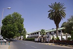
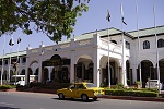
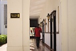
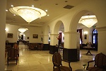
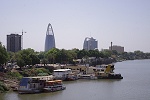
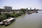
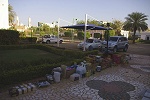
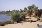
Our party assembled flying in from all corners of the globe a day or two before departure, leaving a day in Khartoum to arrange the necessary travel and photo permits where the original passports are required (what a contrast to the six weeks or more needed in Egypt!). We stayed at the venerable Grand Hotel on the Blue Nile corniche, "the" place to stay in Khartoum of bygone days, one almost expected a parked Steyr tucked away in a corner among the modern Landcruisers... The Hotel was recently taken over by a Pakistani group and restored to at least some of its former glory. While service was not quite up to expected standards, still it was a nicer experience than chosing any of the modern alternatives.
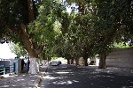
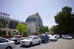
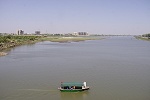
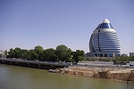
While the others spent the day visiting Omdurman and the nearby National Museum, I was doing the rounds purchasing the necessary supplies with Moez, managing a short hour only before loading the cars to have a quick look around along the Nile bank, going up the new Chinese built bridge that now connects the big island between the Blue and White Niles with the city. The most prominent new landmarks are the rounded Corinthia Hotel, built with Libyan money in the old days on the grounds of the former Khartoum zoo (the animals were given as a present to Khadafi), and the two towers of the Sudan Oil company just behind the former Hilton Hotel along the banks of the White Nile, the rest of the waterfront remained pretty much unchanged over 30 years, except the paving of the corniche sidewalks and the traffc jams.
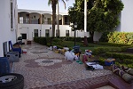
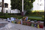
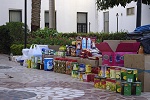
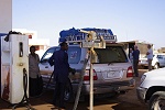
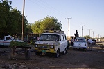
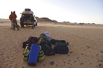
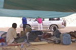
Temperature was well into the thirties in Khartoum, I waited for the sun to get low before starting to sort and pack our supplies into the boxes at the rear of the hotel, much to the astonishment and amusement of hotel staff, clearly unaccustomed to such travelers. The cars arrived in the evening, and we loaded the supplies onto them, ready for an early morning departure the next day.
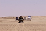
Day 2. Khartum-Merowe/Karima
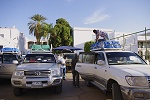
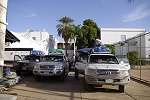
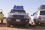
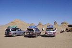
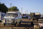
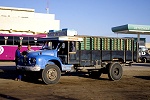
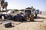
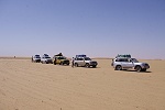
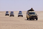
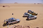
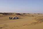
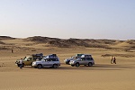
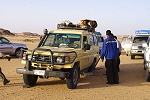
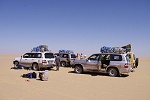
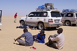
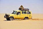
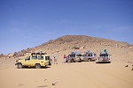
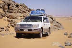
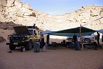
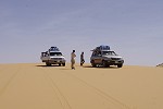
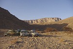
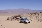
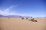
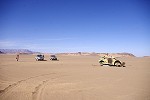
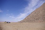
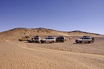
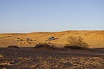
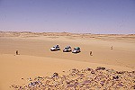
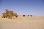
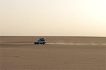
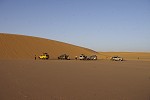
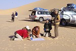
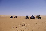
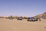
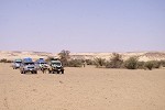
After a quick breakfast we got all the bags loaded into the now rather full cars. We had four model ninety Landcruisers which were carrying all our water (on the roof), supplies and bags plus three people in each. We also had a yellow model 75 landcruiser to carry all our reserve fuel of 2000 litres in large 70 litre plastic cans. It was already loaded with most of the fuel during the night (as availability of fuel outside Khartoum is not very reliable), the springs were flat already from the heavy load. In sudan they are called "buffalo" on account of the load they can carry and their strength, we preferred to call it "vanilla" on account of its colour. The loading involved the usual comotion, re-packing and inevitable delays, but our drivers, Abbas, Mzab, Sami, and Walid were all very cheerful and enthusiastic. We finally managed to depart within an our of our planned start, not a bad time with a new team.
Start did not quite go without hiccups, one of the brakes on a Landcruiser was seizing and we had to make some temporary repairs at the gas station at the edge of Omdurman before hitting the road. It turned out that Walid and Sami were competent mechanics, they soon found the source of the problem and managed a temporary fix so we could proceed. We also topped up the tanks of all the cars while the fix was done, and finally we were really on our way, though for now only on the new tarmac road crossing the Bayuda desert to the bend of the Nile.
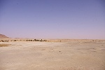
The road accross to the Nile bend is a good 300 kilometres, first accross sahelian scrubland dotted with termite mounds, then vegetaton becomes more sparse, until about 200 kms north of Khartoun the true desert starts. We stopped at the resting spot a little over half way for a quick lunch before continuing.
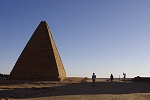
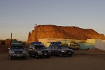
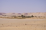
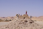
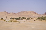
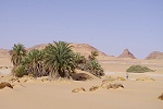
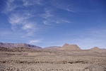
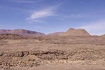
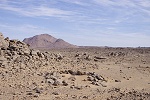
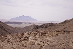
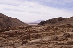
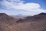
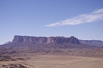
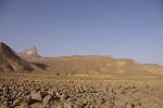
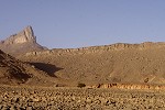
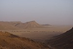
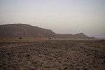
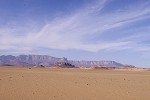
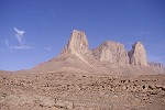
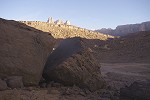
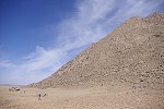
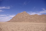
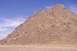
From the Nile bend junction we turned towards Merowe, still another 100 kilometres. As we approached, Jebel Barkal became prominently visible on the far side, a huge rectangular block of sandstone that time somehow left here while all other remnants of the former plateau have been completely eroded away for many miles.
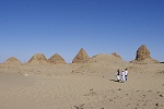
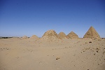
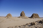
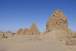
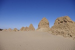
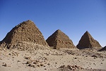
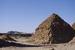
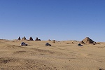
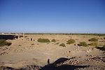
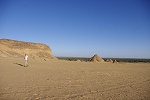
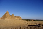
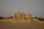
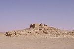
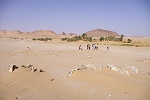
We headed straight to the pyramids of Nuri, the royal cemetery of the later Napatan kings and consorts, including Taharqa, the greatest ruler of the 25th Dynasty. The site was very peaceful, though not quite as remote as one would have expected, with houses and vegetation quite close, but not disturbingly so. Like elsewhere, we were completely alone without any other tourists or locals other than the single caretaker who walked up from the nearby village.
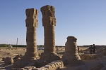
After seeing the pyramids we drove back to cross the Nile on the new bridge a little downstream from Jebel Barkal, approaching the holy mountain of Amun from the west. We stopped the cars on the road circling the mountain, and walked past the meroitic pyramids and the modern cemetery to the temples at the foot of the southern cliffs.
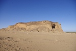
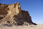
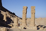
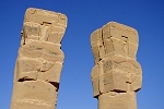
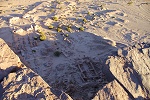
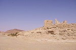
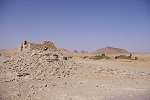
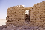
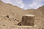
In all fairness, there is very little left at the base of the mountain of the past grandeur of Napata, which was already an important Egyptian outpost for several centuries before the Kushite kings made it their capital. There is a small chapel dedicated to Hathor with a few standing columns, and parts of the colonnade of the temple of Amun have been restored, but generally only the foundations and outlines of the temples are visible, best viewed from the top of the mountain. The only remaining finer object, no doubt being too heavy to be carted off to some museum, is a large black granite altar or pedestal near the sanctuary of the Temple of Amun, bearing an inscription of Piye (Pyankh), the father of Taharqa who conquered all of Egypt during a period of strife and instability.
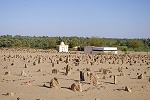
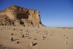
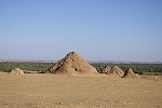
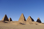
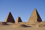
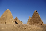
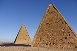
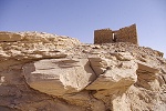
From the temples we walked up to the late Napatan and Meroitic Royal cemetery, a group of pyramids for obscure kings and queens built in the 300-50 B.C. period, several hundred years after the Kushites were expelled from Egypt by the Assirians, just before the capital itself was moved south to Meroe to move it farther from the threat posed by the Roman Empire. The northern group contains the only meroitic pyramids that survived intact, all others having been demolished to various degrees by treasure hunters and self proclaimed 'archaeologists' in search of (non existent) internal chambers.
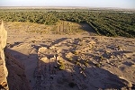
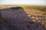
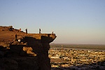
With sunset approaching we climbed the rear of Jebel Barkal, to have a superb view of the temples below and the town of Karima beyond to the west. We found the top of the mountain very lively, being a friday night with numerous locals having come up here for the view and a cooler breeze. Despite the lack of solitude, it was all very peaceful, much like it used to be when climbing the cliffs of Deir el Bahari at Luxor for sunset many decades ago.
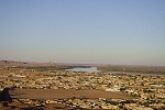
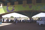
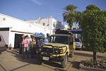
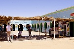
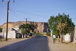
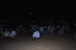
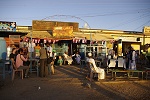
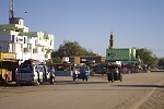
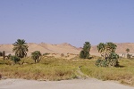
After sunset we drove into he town of Karima for our accommodation, a large spacious house arranged by Moez with several rooms and a large courtyard in the front. It was very warm, most of us opted to sleep outside, bringing out the beds to the verandah or the courtyard. After settling in, we went to the bustling market square for dinner at one of the several small restaurants surrounding the lively square.
Day 3. Merowe - Dongola Soleb
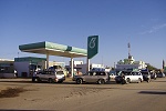
When we went to the same market square in the morning at sunrise it was deserted, with all the little restaurants packed up, just a single place open for breakfast. Clearly the people of Karima do not like to rise early. We had a quick breakfast then drove to the petrol station to fill up.
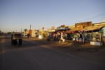
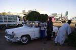
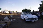
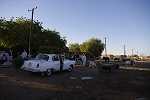
The car with the problem the previous day drove off to a mechanic to have the brake fixed properly before getting out to the desert. As we waited for its return, we had the opportunity to observe the town coming to life, with cars and trucks bringing in fresh produce to be traded immediately along the now abandoned railway tracks. There were some beautiful vingage vehicles, including an acient Soviet Volga, and many of the Morris and Bedford trucks from the fifties that are still all over Sudan to this day (only the engine and chassis was shipped from Britain, the bodywork was made locally).
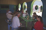
The repair was dragging on, and the wait turned into hours, having some tea and coffee at the local tea lady at a stall accross the railway tracks. While waiting, we also purchased our supplies of fresh fruit and vegetables, which we originally planned to do at the market of Dongola. Finally we decied that we might as well have lunch as it was approaching midday. While doing that, the car finally arrived, apparently with the whole main brake assembly replaced, and after flling our five large 70l water containers with the good water of Karima we were ready to start.
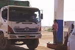
The direct Karima - Dongola road accross the bend of the Nile is a flat and featureless 170 km, we did it in two hours. As we reached the Nile again, a strong wind started picking up the sand, and it was very hazy and dusty as we entered Dongola after crossing the bridge. We only needed fuel, which we found at the third station at the outskirts, and after topping off all the cars we were on our way again towards Soleb.
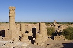
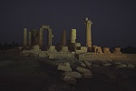
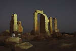
With all the delays of the morning, we only reached the temple shortly after sunset. The drivers lined up the five cars on the little rise behind the temple and switched on the headlights, and it was a lovely and unexpected experience to walk about the illuminated temple as the stars were coming out. We were planning to spend the night at Toshka, a small village 40 kms further North, but with a quick change of plans Moez found us a pleasant house right next to the temple, with numerous rooms and courtyards, with more than enough beds for all of us.

Day 4. - Soleb Selima Oasis Camp 1.
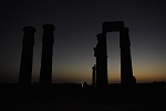
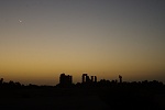
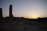
We were all up at the first light of dawn, just in time to catch the crescent of the waning moon before being lost in the glare of the rising sun. It was magical to have the entire place for just ourselves in the silence of dawn. The enjoyment was only disturbed by millions of small flies awakening with the sun which attempted to enter any orifice, soon the mosquito nets which we brought against the botflies at Uweinat became very necessary... Moez told us that these tiny and extremely irritating flies were actually very welcome by the locals, as they pollinate the palm trees and avoid the very laborious task of having to do it by hand.
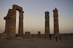
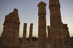
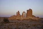
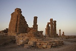
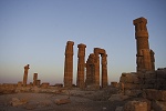
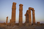
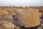
The Soleb temple is the finest Ancient Egyptian monument in Sudan, built by Amenhotep III in the most refined period of the New Kingdom. Many of the finer details are on blocks laid out beside the temple. We spent the half hour after sunrise wandering about the structure, somewhat reluctantly returning to the house and cars to get on our way.
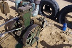
Returning to the main road, we continued North for half an hour until we reached a series of barchan dunes. We drove down a track to the Nile bank to Toshka, which turned out to consist of just a small and fairly miserable cafeteria with an owner who was cleary old friends with Moez. He was waiting for us with the three pre-arranged drums of diesel, to top up the cars after the 250 kms from Dongola, and also to have an emergency reserve here should we run low on fuel and have to return to the Nile by the most direct route. We filled all the tanks, and a couple of extra plastic jerrycans for the "buffalo", having about 2500 litres of fuel for the trip between the five cars.
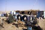
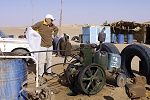
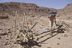
There was an antique singe cylinder water pump cum generator by the cafeteria, which grabbed the attention of the more mechanically minded among our group. It was of Indian manufacture, we could not figure out when it was made but probably at least 30-40 years ago if not more.
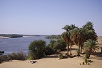
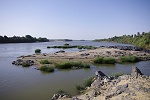
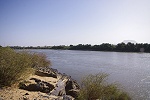
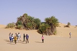
While the cars were fueled, we walked down to the Nile bank, just a hundred metres away, with a very narrow srip of vegetation along the side. It was a very pretty spot with the river still running untamed here, but the flies were even denser than at Soleb, we were soon chased back to the cars despite the mosquito nets.
Leaving Toshka, we drove another 15 kilometres on the tarmac before reaching the point where the road was the closest to Selima Oasis, about 120 kilometres distant. We left the road, suitably deflated the tires, and finally were ready for the real start. The terrain to Selima was good, except for the first 20-30 kilometres or so, where the ground was terribly rutted by the tracks of thouands of trucks. Moez explained that much of the cement needed to build the Merowe dam was trucked in from Egypt before the road was built.

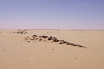
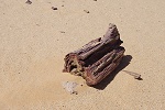
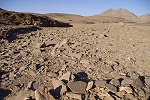
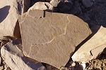
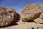
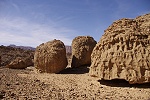
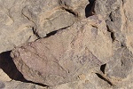
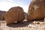
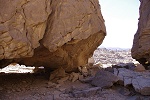
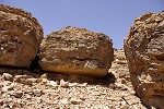
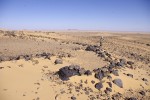
We halted at the foot of a low escarpment for lunch which posed no challenge to ascend, even for the heavily laden "buffalo". We briefly stopped as we passed a number of large petrified tree trunks, with smaller fragments scattered all about the area, all turned into an attractive reddish stone.
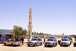
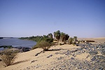
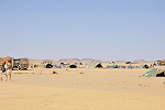
We reached Selima Oasis by mid-afternoon. There is a small military post there, they were forewarned of our arrival a day earlier, and greeted us with a sincere welcome. It is not only a military post but also an official border post for trucks coming from Kufra, the customs officer spoke good english and eagerly showed us around the small place, delighted of actually having smething to do. We started out with the only ancient structure, supposedly a small coptic monastery (but there is no direct evidence for this), perched on a low rock above the Oasis, consisting of only five small cells, with a number of aramaic inscriptions on the rock below the building.
From the monastery we went down to the palm groves. On the flat ground in-between one could make out the remnants of some palm-leaf structures, quite possibly the remnants of the truck maintenance base set up by the SDF in 1934.
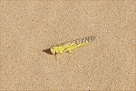
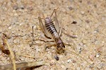
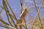
We continued into the palm groves surrounding the water sources. We did not see much animal life, but the soldiers warned about snakes, and we did stir up quite a number of desert locusts (Schistocerca gregaria), includng some yellow mature swarming adults. Later I learned fom Keith Cressman of the FAO that there was a severe plague starting in the Red Sea mountains, and our observations were quite valuable in determining the western extent of the swarm.
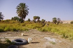
The present water source is in the centre of the oasis below the military post, about twenty metres from the old spring, which is now completely overgrown. It is protected by a tyre sunk into the ground, and it provides very good cool water.
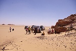
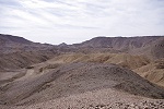
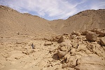
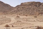
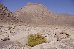
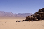
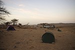
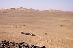
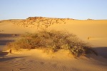
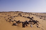
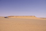
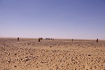
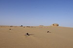
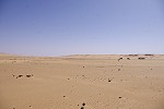
It was late afternoon when we left Selima, aiming for a conspicious group of stone circles on a hilltop that Mark spotted on Google Earth about fifty kilometres to the North East. We were expecting an easy hour's drive, but the terrain turned much nastier than anticipaded, with rocky ridges and valleys running perpendicular to our intended direction. The heavy fuel car fared particularly badly, and after it developed a flat tire we decided to make camp nearby, a mere 30 kilometres from Selima.
Day 5. Camp 1. Jena Dump - Camp 2.
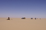
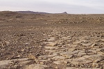
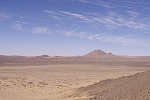
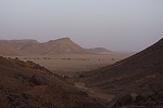
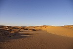
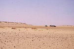
We continued next morning after a rather cool first night in the desert, a marked change from the Nile valley where it remained warm througout. As we wanted to reach Uweinat by the evening, we decided to give the first group of stone circles a miss, as they lay in the middle of the rather difficult ground. After emerging from the rocky area after 20 kilometres, we started to make reasonable progress over the Selima Sand Sheet.
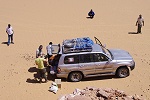
After driving for about two hours one of the Landcruisers developed a rattle. The drivers disappeared under it, and after some time it was announced that one of the driveshaft bolts came loose, and knocked against the restraint. However the bolt became stuck in that position, and it took a lengthy effort to manage to wind it back to its proper position, access being very akward. While this was done, we were visited by a pair of yellow wagtails (Motacila flava), finding shade under the cars and gladly accepting water and morsels of food. At this stop it was also decided that I will drive the heavy -75, as its young driver from the Darfur had very little desert experience, and was constantly struggling to keep up with the lighter Landcruisers. This improved our progress substantially, nevertheless it was rapidly becoming clear that with all the delays we cannot reach Uweinat by the evening.
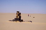
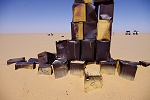
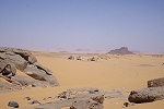
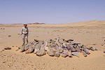
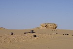
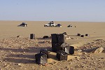
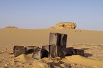
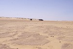
With a temporary fix in place, we continued accross the Selima Sand sheet towards our next aiming pont, Jena Dump, clearly marked on the 1934 Sudan Survey Department map. This dump was made by the Sudan Defence force in January 1934 as part of the operation to occupy Karkur Murr. It was also very close to the 1941 Kufra Convoys route from Selima to Jebel Kamil, so we could reasonably expect to find some historic remains there. Sure enough, as we reached the spot read from the 1934 map a short distance from the large belt of merged barchan dunes blocking the way West both in Egypt and Sudan near E 27 longitude, we noticed a large dark object sticking out of the mostly featureless sand plain less than a kilometre away. It turned out to be a large cairn of four gallon Shell petrol tins, very much like the cairn at Jebel Kamil. It probably dates from 1941/42, used as a navigation point by the Kufra Convoys. In its vicinity we found the usual assortment of old tins and other rubbish associated with the Convoys, but nothing that could be identifed as a part of the original 1934 dump.
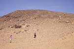
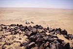
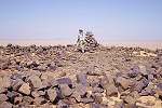
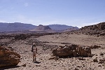
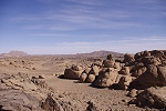
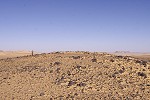
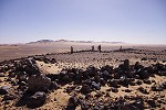
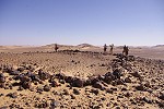
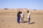
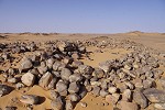
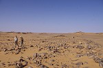
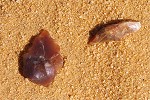
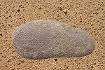
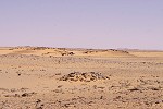
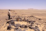
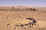
Adjacent to Jena Dump there was an easy route accross the dunes as marked on the 1934 map, from where we continued around the adjacent dune belt at "Sand Dune Gap" a mere 5 kilometres from the Egyptian frontier. Some distance beyond the dunes we reached a solitary group of hills, on the top of whick Mark spotted another group of stone circles on Google Earth. The most prominent hill contained a large well-built cairn on its top. Based on its construction and the fact that the location is a marked altitude point on the Survey of Egypt maps, it is almost cetrainly one of Patrick Clayton's surveying cairns of 1931, when he carried the triangulation from Wadi Halfa to Jebel Uweinat during the winter of 1930/31. While there was apparently nothing in the cairn (I looked among the stones but we did not attempt to dismantle any part), there were indeed several stone circles on the top of the hill, with a number of crude stone flakes attesting to its prehistoric inhabitants.
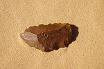
At the foot of the hill Ursula found a curious discarded petrol tin with a gazelle and arabic inscription, a kind which we did not encounter before on our numerous other expeditions. It could be either from the time of Pat Clayton's surveying, or from the 1934 SDF column which also passed this way on its way to Uweinat.
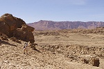
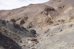
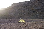
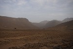
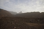
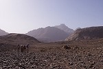
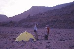
From the stone circle site we continued West, first accross good firm sand, but after 40 kilometres we encountered a very rough rocky terrain, where we could only make very slow progress. With sunset approaching, we found a small sandy basin near the track where we could comfortably pitch our tents for the night. The day's progress was a mere 300 kilometres, but at least we were withn easy reach of Uweinat, now only 140 kilometres away.
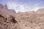
Day 6. - Camp 2. - Karkur Talh
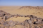
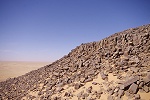
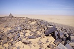
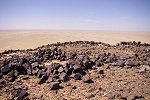
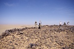
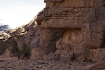
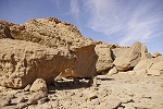
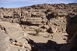
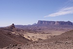
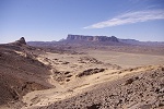
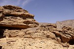
In the better light of the morning we saw that the rocky patch could have been easily circumvented by just a small detour to the south, and soon we were driving on good firm sand towards a solitary flat topped hill, capped by a hard layer of heat-fused columnar sandstone, which supports a remarkable stone structure on the top. The entire flat plateau on the top of the hill is fringed with a rock wall, with a clear entrance, and a number of stone circles inside. This too was discovered by Mark on Google Earth, and had already been visited by him in the spring of 2011. The site was clearly a settlement, perhaps a fortress, at a commanding location overlooking the surrounding flat country. The cairn on top may have been another of Clayton's surveying cairns, though it is surprising that no mention was made of this rather imposing structure. Inside the structure we found a piece of the ancient wavy line (Gilf B) pottery, and several rather crude flakes of silicified sandstone.
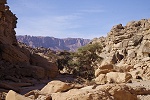
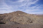
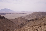
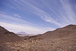
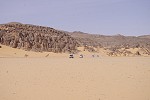
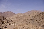
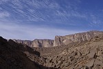
While Jebel Uweinat was not yet visible from the hilltop, in clearer weather it definitely should be, being less than sixty kilometres from the hill. Soon after leaving the hill, the mountain emerged from the haze, already looming tall on the horizon. In another dozen kilometres or so we encountered the first gold mining camps, consisting of rather miserable makeshift structures covered with some plastic trapaulins adjacent to the pits from where the gold bearing rocks were dug out. Moez and Mark first encountered these encampments in September 2012, apparently quite significant amounts of gold were found in the form of nuggets by the miners, but there is also a large quantity of high grade ore in veins among the igneous rock outcrops, which are being mined with heavy equipment, and the ore is trucked back to the Nile valley for processing.
While we were all concerned by the environmental damage caused by all this activity and the human presence, in fact the mining is localised to a fairly small area about 20-30 kilometres to the East of Uweinat, and as there are no similar geological formations closer to the mountain, it seems that aside a few exploratory pits the miners have left the mountain and its environs pretty much untouched. This time we did not stop, as we did not want to reveal our plans of staying at Uweinat for over a week, but on their last visit Mark & Moez visited the miners who were very welcoming, and proudly showed off their hoards. It appeared that the activities shifted a little to the west, and they were on a smaller scale now than when first observed six months ago. One can only hope that the ore will soon be depleted and the area will be abandoned once again to the sand and wind.
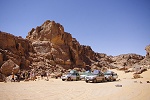
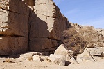
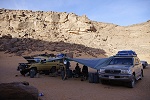
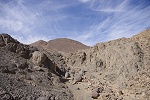
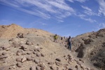
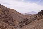
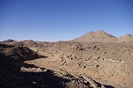
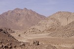
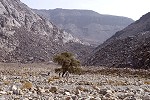
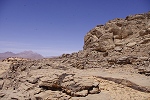
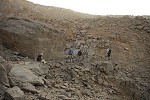
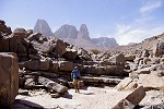
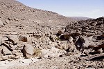
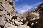
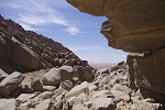
Passing around the miners camps, we soon reached the bad rocky country skirting Uweinat to the South and South East, and bumped along the tracks that have very cleary been out of use for a long time. We passed through the 'back door' of Karkur Talh, which allows a difficult access for vehicles from the Sudanese side, avoiding the need to enter Egypt for even a short distance. We discovered this passage with Salama when surveying for rock art sites, and tried it once on our return from a day-trip to the south of the mountain. It appears that hardly anyone used it since. Once inside, we found Karkur Talh completely deserted, with only the tracks of an Italian party that have made it along the same way as we did some months earlier. Clearly no visitors have come from the Egyptian side for a long time, possibly we were one of the very last ones using that route in March 2010. Certainly nobody disturbed our usual campsite in the southern branch since our ast visit, all the firewood collected by Salama & Zayed for the next visit were stil there neatly stacked up by the fireplace, ready for use.

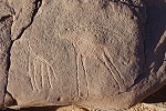
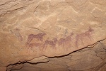
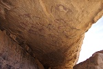
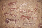
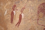
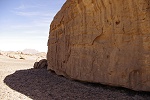
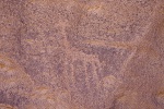
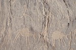
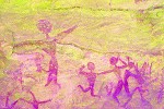
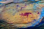
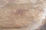
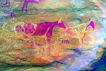
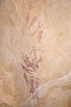
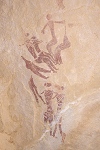
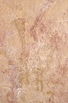
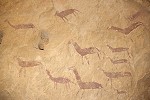
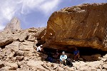
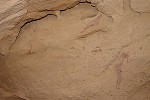
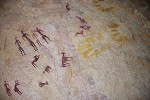
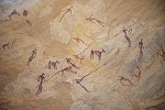
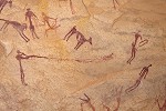
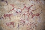
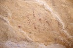
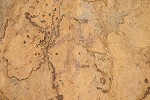
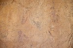
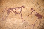
After a quick lunch we set out to visit the sites of the environs, splitting into smaller groups each to their interest. While the majority went to see the principal paintings and engravings of the southern branch adjacent to camp, with Moez we walked up to the major of site KTS 54, discovered by Georg Zenz and Mahmoud Mohareb in 2007. I have only visited this site in October 2007, the photos taken then revealed a number of very interesting details which very much warranted a re-visit. The main shelter contains paintings from several periods, and there is a very rare example of a decorated handprint below some more recent cattle figures.
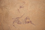
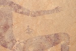
Near the shelter there are several panels of fine engravings depicting wild fauna and hunting scenes. A short distance away we found an unrecorded panel which both the discoverers and I seem to have missed in 2007, depicting among others a 'horned' human figure accompanying cattle.
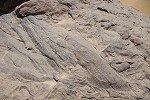
We walked back to camp via a different route than I've taken before, and along it we encountered several outcrps with well preserved ripple marks and trace fosils in the thinly bedded sandstones, marking an episode when a shallow sea covered this area sometime in the middle paleozoic period (silurian ?). In one place the flowing water carved a vertical walled canyon in these layers, which we followed back to the main valley.

Day 7. - Karkur Talh
The plan of the day was to visit the sites discovered by the 1968 Belgian expedition in the middle section of the Northern branch of Karkur Talh, and explore some remaining blank spots on the low plateau to the immediate North West of these sites. After the rush of the previous days it was nice to have a lazy morning before setting out to the sites, first by car then on foot. Mark and Richard went separate ways, deciding to spend the day exploring the Northern part of the plateau between the main and south branches of Karkur Talh. We made a single traverse with Jon Hales in October 2006 leaving many remaining blank spots.
While the others stayed to photograph the principal sites, with Gábor we climbed up to the Northern terrace to check out a number of rock clusters that appeared promising from Google Earth. At the first cluster we found nothing, except a nice piece of a carboniferous Lepidodendron imprint which was picked up by Gábor.
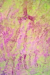
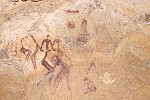
In the next cluster of rocks that we investigated, Gábor found a low shelter with a couple of cattle and human figures, and on close scrutiny there were a number of other faint earlier figures underneath one of the cattle. While nothing spectacular, it was the first new rock art find of the trip..
We continued along the edge, checking out other areas, but there was nothing aside the spectacular view of the mountain. We reached the sites we found with Magdi in October 2006, beyond it was surveyed country so we turned away from the wadi to check out two more clusters of rocks, but again nothing. It was starting to become very hot, so we returned to the others for lunch, a little disappointed with the results.
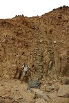
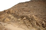
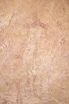
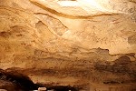
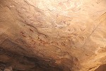
After lunch and a very welcome rest in the shade at the principal "Belgian" site, KT 83, I crossed the wadi to the large conspicious crack some way up the rock wall, hiding site KT 85/A. We first saw this lovely site in March 2000 on our second time to ever reach Uweinat, and the first time we ventured deeper into Karkur Talh. Being right next to the main site, we took it for granted that this too was found by the Belgian expedition. It has only dawned on me recently that none of the scenes are shown in Van Noten's book, and none appear in the expedition photographs archived at the Africa Museum, Tervuren. Without knowing, we have made a major discovery at the time, I still cannot comprehend how the Belgian expedition missed it. On previous visits I have taken many photographs of the site, but some details did not come out well, so this time I took the opportunity to photograph the entire shelter systematically. It was not entirely surprising that I noticed several details, very difficult to see in the strong sidelight, but coming out pefectly on photographs taken with flash, which I have completely missed on all previous visits.
After the weather cooled a bit with the sun lower, we set out again, this time with half of our group, to check out another two rocky areas on the plateau, immediately to the North of the principal "Belgian" sites.The first one was again empty (probably on account of the bad quality of the rock, we did find some excellent shelters with signs of habitation), in the second one on a very inviting rock face we found a single crude giraffe.
Just before returning to the main valley, we came upon a small and shallow shelter with some very faint and damaged remnants of a couple of painted human figures - a new site nevertheess.
We returned to camp to find our drivers comfortably settled in, with a large trapaulin stretched between the cars to form a large tent, a sensible thing as the campsite offered little shade in the midday heat. After sunset Mark and Richard walked into camp, they too found a few new engravings and paintings.
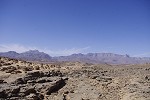
Day 8. - Karkur Talh - Karkur Murr east basin
A large flat basin occupies the country beyond the watershed to the south from Karkur Talh, draining into Karkur Murr near the former Sudan Defence Force base. There are a series of hills separating this basin from the southern plains, and among them there is a curious crater-like feature, on first look appearing to be an explosive volcanic crater. Mark visited its bottom in 2007 coming up the wadi draining it from the south, and found granite at the bottom of this feature, countering the volcano theory. Nevertheless it appeared a very interesting geological feature, we decided to spend the day visiting it. The trek there and back also privided an opportunity to try to fully trace the prehistoric trail, which we found in March 2010. We started out in the early morning, ascending the trail and folowing it for as long as we could. There was a thin cloud cover, promising a cooler day than the previous very hot one.
At first the trail could be followed easily. We found no more engravings other than those already seen in March 2010, but as we continued along the unsurveyed part, there were a number of stone circles and other prehistoric remains along the way.

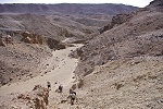
We passed the point where the trail forked, one branch turning right towards the basin and Karkur Murr, while the other continued little East of South accrss a low rocky plateau, generally in the direction we wanted to take. Then there was another fork, where a branch turned markedly to the East, apparently heading towards a pass among the hills bordering the mountain along the south and the East, and then descending to the plain around Ras el Abd, the prominent volcanic hill at the South East corner ow Uweinat. We continued southwards, soon losing the narrow and indistinct trail in a very bad broken and rocky country.
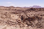
After struggling accross the rocks, the landscape at the foot of the southern hills hiding the crater changed completely. Instead of the prevailing sandstone country, we entered a region of eroded badlands, carved out of a soft light coloured volcanic rock that filled the entire area at the foot of the hills. Going became very dificult, as the watercourses carved deep ruts into the soft terrain.
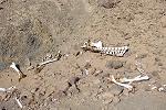
We were accross the watershed, these badlands drain to the south through a wadi that skirts our objective. We reached the uper branches, and found a well traveled trail littered with camel skeletons. The same trail and skeletons were seen by Mark in 2007 as he entered the wadi from the south - clearly this camel trail was one of the principal routes connecting Karkur Talh with the south - probably it crosses the large basin then joins the camel path leading from Karkur Talh to Karkur Murr, rather than being a continuation of the trail we followed this morning. It does seem to make a large detour, but there is no other practical way for camels down to the plains from the upper well of Karkur Murr to the southern plains anywhere else other than this wadi, it is all steep rocky rubble. The bottom of the wadi is difficult soft going, the skeletons were concentrated at the steeper parts, clearly the weaker animals being unable to go any further.
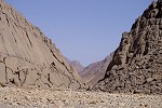
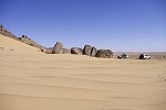
We followed the wadi for a short distance, then started climbing the steep slope on the far side to get up to what we hoped to be the crater edge. However on the top we found out that still a good several hundred metres of badlands separated us from the true rim. This country was unlike anything else encountered at Uweinat, a very unpleasant dull grey terrain with no real features, shade or even flat ground, feeling like the inside of an oven in the scorching midday heat despite the clouds. The terrain is criscrossed by innumerable dykes, apparently there was a major volcanic event here sometime after the formation of the sandstones, and we were crossing the eroded innards of a former volcano, the "crater" being a part of this larger area.

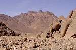
Finally we reached the last slope, and ascending it we reached the rim looking into the large circular basin with Jebel Kissu looming in the background. There is a deep V shaped breach on the southern side of the basin draining into the wadi with the camel path, and the centre is filled with the emerging dome of a granite ring complex. The apparent crater shape was formed by a ring dyke surrounding the granite plug, made up of a very hard grey volcanic rock much more resistant to erosion than the surrounding light coloured, soft volcanic rocks (the explanation of the geological structure was provided by Norbert Brügge).
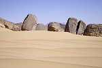
We found a tiny patch of shade at the foot of a rock outcrop on the rim, we had a short rest and left or packs there before descending into the crater itself. At the bottom of the scree there were a couple of large angular boulders of the very hard volcanic rock of the dyke, offering the only shade in the basin itself. By now it was becoming very hot despite the thin clouds, and there was no movement of air down here. We walked to the granite dome, which showed the typical rounded shapes and "onion" weathering patterns. There was no trace of any prehistric inhabitants, probably even at that time this corner of Uweinat was as barren and hostile as it is today. We spent a good hour exloring the basin, before retreating back up the lope to our packs.
We moved along the rim to find a large rock oucrop where we could wait in the small patches of shade till the worst of the midday heat was over before starting our way back to camp. Taking a last view of the view of the basin, we climbed a col to the adjacent hill, looking into the large basin and a superb view of Uweinat beyond.
We crossed the basin, which was filled with a stony rubble intermingled with sand, rather than a flat hard sand plain suggested by the satellite imagery. There was very little trace of prehistoric inhabitants in the basin, apparently the rocky ground was not very inviting even then.
We had an uneventful walk back to the trail, then towards camp. Instead of walking all the way to the descent on the trail, we descended into the southern branch of Karkur Talh a half kilometre earlier to meet our two waiting cars there. In October 2002 we found a small panel of engravings here, right at the end of the driveable section of the wadi. When taking a look, I was very surprised to find a much finer panel of engravings on an adjacent boulder, which I have completely missed ten years earlier and on several subsequent visits. It was however recorded by Sayed Hilmy and Regula Steinhauser-Zimmerman in 2006.
Day 9. South Uweinat
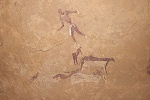
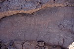
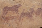
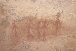
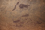
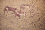
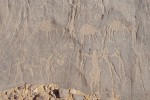
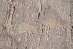
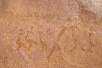
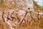
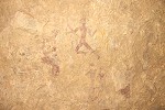
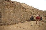
Next morning we packed up camp, preparing to move to the Southern part of the montain. However before doing so, we drove up to the entrance of Karkur Talh, to have a look at the panel of engravings discovered by Flavio Cambieri and party a few years ago on the terrace above the dry waterfall where a small tributary joins the main wadi. The engravings are on the smooth flat rock of the terrace, unless virtally standing on them one may easily pass by without noticing. The most readily visble part of the panel is a large herd of cattle and goats, the latter a rare subject on engravings. A few cattle are shown with human-like feet, a very unusual feature.
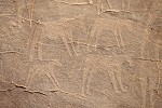
However it is not this panel of cattle which makes this site exceptional. A short distance away, bordering a natural fracture in the rock, there is an unambiguous sereis of engravings of a donkey train, each animal carrying a pack on its back, and each havng its owh herder. The style of these engravings and the associated other ones, including the running figure above, is very similar to others found in the environs of the Mentuhotep inscription, which are demonstrably roughly contemporary. It is not inconcievable that the engraving is the depiction of the actual Egyptian caravan.
We paid a quick visit to the other sites in the small cove under the dry waterfall, first recorded by Winkler in 1938. The air was full of a swarm of large dragonflies (Anax ephippiger), buzzing about us but never resting for a moment. I have taken a couple of point blank shot at them, to my great surprise one captured one of them perfectly in mid-flight.
We drove out of Karkur Talh along the easier regular route, and skirted the mountain to the south eastern side, near the prominent rounded volcanic hill, Ras el Abd.
In September 2012 Mark visited and surveyed this area on foot, and at the end of a small valley he found a very exposed site with some faint paintings in the "Uweinat roundhead" style. We made a small detour to visit this site, sitting quite alone at this rather inhospitable corner of Uweinat. Typical of these style of paintings, the panel sits on an exposed vertical rock face. The figures are very weathered, barely discernible on the spot, but with dStretch they become perfectly visible.
While we visited the site, Mark walked about double checking larger boulders along the edge of the valley for possible engravings. He did find one huge boulder with patterns in it, not man made, but much more ancient. When Mark first mentioned fossils, I expected some small patches, but as we returned together to the boulder, it became evident that the entire surface is covered by inprints of thick stems and branches of Lepidodendron, a carboniferous plant, small fragments of which we have found before at Uweinat. This large block is absolutely unique, nothing approaching this size have ever been recorded in the carboniferous sandstone layers of Uweinat or the Gilf Kebir.
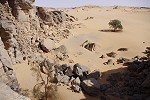
For lunch we moved into Karkur Murr, a little apprehensive of whom we might find there - if the gold miners were visiting Uweinat for water or firewood, that would be the place. However, we found the place totally deserted. No vehicle seems to have passed along the trail leading to the 1934 SDF encampent for many months - clearly the miners do not visit Uweinat, and apparently neither do the Libyan hunters these days.
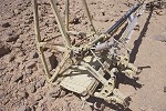
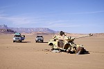
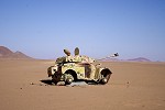
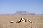
It was a very hot day, by early afternoon it was close to forty, quite unusual and unpleasant for mid-March. We mostly spent the hottest hours in various little spots of shade, venturng out for short spells to explore the SDF huts and the vicinity. Some of us investigated the remains of the French Bristol Blenheim bomber just beside the track leading in to the SDF camp. From the diary of Captain Dubois we already knew that it was N3624, and it must have belonged to the Groupe de Bombardement No. 1 (later renamed the Groupe Lorraine) based in Chad, likely to have become wrecked while making a forced landing here during the 1941 Kufra campaign. Of the wreck only the main wing spars and the engine and gear mounts remain, these being made of steel, all the aluminium parts have been scavenged long ago.
It was only recently that I have discovered the full story of the wreck on a French aviation history website, quoted from Jean de Pange, Nous en avons tant vu, Editions Serpenoise, Metz, 1990 (de Pange was the personal pilot of Leclerc during the Kufra campaign). The following is a short edited summary (eerily reminescent of the events leading up to the tragedy of the SAAF Blenheims a year later):
On the 26th December 1940 Leclerc gave orders for a recconnaissance mission to the Kufra area, in preparation for the campaign to capture the Oasis. On the 28th December two Bristol Blenheims of the Groupe de Bombardement No.1. (GRB 1, later to be renamed the Groupe Lorraine) flew from Fort Lamy to Ounianga Kebir, with an anxious Leclerc on board as passenger, wishing to see the taken photographs immediately on the return of the recconnaissance mission to Ounianga. A sandstorm whipped up by the strong winds kept them on the ground for two days, but on the morning of 31st December the winds subsided and visibility improved (though not as much as de Pange wished for). Pressed on by Leclerc who repeatedly ignored the concerns of his pilots, the two Blenheims departed Ounianga on their mission. The first, commanded by Captain Lager (the group commander), with de Pange as navigator, Sargent Dispot as gunner and the rather unwilling meharist captain Barbotieu (commander of the Ounianga garrison, ordered to join the risky mission by Leclerc, in order to gain his first flying exprience) as observer, had the task of observing and photographing the Italian installations and the general environs of Kufra oasis. This mission was a full success, however de Pange had much difficulty finding their way back to Ounianga due to changing appearance of navigation landmarks depending on the morning or afternoon light (foretelling the tragic loss of another Blenheim of Lt. Clarion and the entire crew just a month later after a bombing run on Kufra airfield).
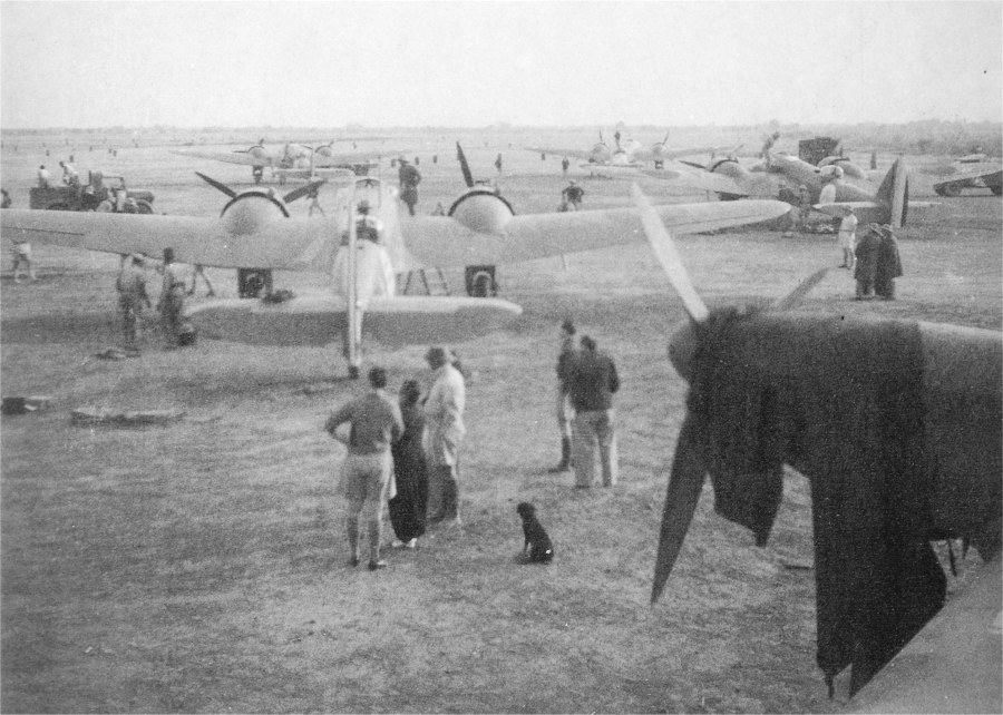
GRB 1 at Fort Lamy (Ndjamena) airfield
(late 1940)
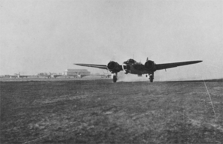
Bristol Blenheim taking off from Fort Lamy for Ounianga with Lager, de Pange and Dispot on 28 December 1940
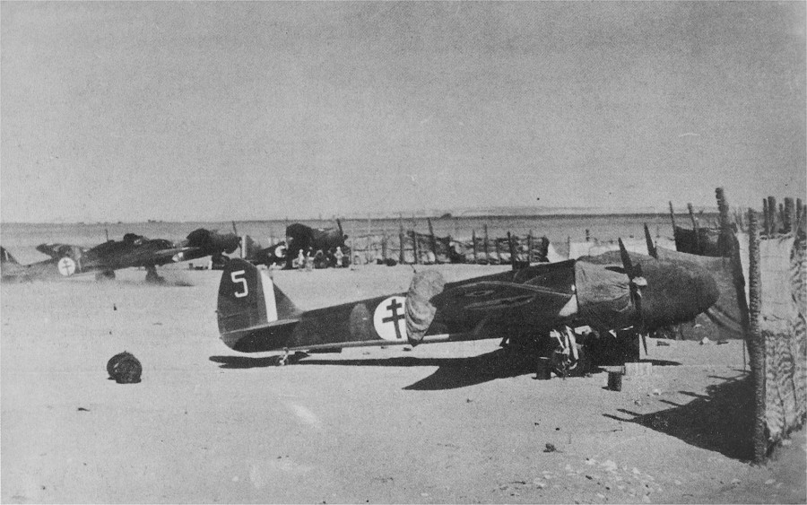
GRB 1 Blenheims and Lysanders at Ounianga Kebir (January 1941)
The other aircraft was commanded by Lieutenant Stadieu, with Sargent Privé as pilot and Lieutenant Meurant as gunner and radio operator. They were tasked with making a recconnaissance of the Italian post and airfield at Jebel Uweinat to assess the strength of the Italian units stationed there. After two hours of flight at an altitude of 2000 metres, they should have been in sight of Uweinat, but could not see the mountain in the lingering haze of the sandstorm which also blocked the sun. Stadieu made the mistake of deciding to turn around, even though the chances of successfully navigating back to Ounianga from an unknown point were rather slim. After some time Privé caught sight of the sun, and they immediately realized that their heading was wrong. They decided to land on a stretch of smooth sand to assess their situaton. After failed attempts to contact Ounianga by radio, they spent a miserable night inside the cramped cockpit, their only protection from the bitter cold. The next day, wishing each other Happy New Year despite the circumstances, they decided after much deliberation that they must be east of the Tibesti, and a course of 140 degrees should be flown for Ounianga. After another very cold night, they were able to crank start the engines and take off on the agreed course. After twenty minutes of flight, they saw a mountain and decided to land in a valley to find water. The valley bottom was very rocky, and the attempted landing resulted in the aircraft wrecking on the boulders. Mistaking the red dust for a fire, they rapidly jumped out of the wreck. Stadieu and Privé were burned by sulfuric acid that spilled from the battery, and Meurant was badly bruised in the back, but at least they were all alive.
After the initial shock they started to explore the surroundings. There were the stone huts of the abandoned SDF camp 150 metres from the wreck where they found only a few empty packs of cigarettes. Separating, they fanned out in search of water, Meurant soon came back with the news of a small water hole with animal dung and magnesium tasting water a short distance away. As Meurant was the most badly hurt, Stadieu and Privé went to collect water, making an improvised filter from a tin filled with sand and charcoal. They had enough to drink now, but were facing the prospect of starvaton. They only had a few biscuits that were fouled by sulphuric acid, they munched those over the next three days after soaking them in water.
They tried to assess their position. Their radio was miraculously still working, and Meurant could capture a Greenwich time signal. By removing the compass from the aircraft and drawing a long line in the sand corresponding to the assumed true north, they waited till the shadow of a plumb line coincided with this drawn line. The result was 26 degrees East which they considered very doubtful. In the night they took several sightings of the pole star, giving a latitude of 22 degrees. (Actually their readings were quite accurate, the 90 km error in longitude is quite small given their rudimentary methods.) The figures suggested that they were at their initial goal of Uweinat, but it sounded so incredulous that they put little faith in this conclusion.
By the forth day at this spot, their morale started to plummet. The sulphuric acid burns turned to black scars, and the huge differences between the day and night temperatures without any food started to make them very weak. They set out some rescue signs with parachutes, and prepared a smoke signal with petrol syphoned off from the wreck. One day they had a culinary event: Meurant heard a splash in the water filter, and found a struggling jerboa. Without much thinking, he proceeded to boil the creature, and in the evening they drank the broth with their two biscuits soaked in it, while to lose nothing, Meurant swallowed the boiled gerbil in one gulp.
On the 5th January at daybreak they heard the drone of engines, and saw an aircraft flying high above to the south, then making a sharp turn to the west. They assumed it to be either a search aircraft, or a regular flight passing this way. Even though the aircraft disappeared, they decided to celebrate this event by opening their salvaged bottle of rum. Then nothing happened for two days, and morale plummeted again. Stadieu by now had his entire right side covered with a black acid burn scar. Without saying anything to the other two, he put his pistol beside himself before falling asleep.
On the 8th January they heard and saw a plane again. This time they activated their smoke signals, and it appeared that they were noticed. Spirits were raised, taking a toll on the remnants of the rum bottle. The next morning an Italian aircraft came and passed over them at a low altitude, dropping a weighted message "You are at Ain Prinz. If you seek help, move away from your present position as a sign of agreement, otherwise we bomb you. A vehicle will be coming to you from the direction marked on the attached sketch map." Without much hesitation they moved away, and the Italian aircraft dropped five cans of condensed milk, which however all broke on impact without them being able to recover a drop.
After the Italian aircraft left, they progressed to hide in the sand all their maps and notes and everything else that could give the Italians any indication of the purpose of their mission. Dressed up the smartest they coluld, they started out in the direction indicated on the sketch map dropped by the plane, rather surprised that they were very close to their measured position. On the way they agreed on their story: they were flying a regular communication mission between Fort Lamy and Khartoum, with a stop-over in Ounianga, and they had an engine failure on the way, thus avoiding any hint of Leclerc's intentions. After a seven hour walk finally they were picked up by an Italian car driven by a Lieutenant, guided by the same aircraft. The Lieutenant offered cigarettes and French cognac - they would have much preferred something to eat. They were driven to the airfield of Ain Dua, where two Ghibli planes and Colonel Léo, the commander of the Kufra garrison were waiting. It was Léo himself who spotted them the day before and dropped the note. After inquiring about their names and ranks, Léo invited Stadieu and Meurant into his plane, while Privé took the other. After a two hour flight to Kufra, they were taken to the Fort at el Tadj, and offered a room to rest. Soon they received a visit from a barber, after which a young officer arrived with an invitation from Léo to join him and the other oficers for dinner in the Oficer's Mess - traditional hospitality in the middle of the desert. After dinner Stadieu requested permission to leave to rest, while Meurant and Privé stayed on to play bridge with the Italian officers, and won a few lire.
They were hoping to be soon rescued by Leclerc's forces while at Kufra, but they were sent North to Bengasi before this could happen. Their status was uncertain, as the Vichy government signed an armistice with Italy, and de Gaulle and the Free French forces were not recognised as lawful combatants. Initially they were put in a regular prison, and at some point they feared they would be executed as traitors. However in the end they were designated Prisoners of War, and sent to various camps. Jacques de Stadieu was able to escape two years later from a German prison camp south of the Alps, and joined a group of Italian partisans. Later, he re-joined the Groupe Lorraine and participated in its operations until the end of the war.

|

|
|
|
Jacques de Stadieu (from Pange, Nous en avons tant vu) |
||
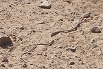
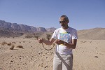
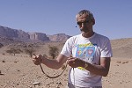
Once the afternoon heat started to subside a little, we moved on towards our camp in Wadi Wahesh. We passed by the huge insignia of the No.1. Motor Machine Gun Battery and the Western Arab Corps of the SDF made in 1934, probably just to keep the soldiers busy. As we stopped, we noticed a sand snake (Psammophis schokari) disappear under the cars into the shade. After a game of hide and seek, Gábor managed to catch it, but not without a struggle, it was very swift and while not venomous, it has tiny but needle sharp teeth and not afraid to use them...
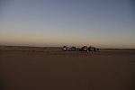
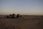
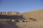
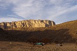
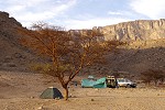
It was late afternoon when we reached our campsite at the very end of the drivable section of Wadi Wahesh. We made camp among the acacias in the soft fine gravel of the riverbed, to be used as an exploration base for the sorties we were planning over the coming days.
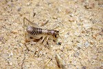
In the evening as we were sitting around the fire, Moez spotted a strange visitor, a translucent cricket-like creature of a kind that I have not seen before at Uweinat. Later it was identified indeed as a common cricket nymph (Gryllus bimaculatus) of the fourth or fifth moult stage.
Day 10. South Uweinat
Our initial plan was for a part of our party to make an ascent of Jebel Uweinat, while the other part would make a survey of the hills dotting the plains south of Uweinat, where a number of prehistoric settlements have been observed by Mark and Ursula on Google Earth. The unexpected heat forced us to adjust plans, as it was the general feeling that even if we were to make it, it would not be fun to climb the mountain is such weather, especially with all the extra water we would have to carry. We decided instead to spend a day exploring an unsurveyed part of the mountain on foot between Wadi Wahesh and Wadi Waddan on the Sudan-Libya border.
There seems to be a large rift running from the granite part of Uweinat all the way to Karkur Murr, clearly identifiable on satellite imagery. Where the rift crosses the ridges between the south flowing wadis, it forms a straight narrow transverse valley, the path of least resistence if going from Wadi Wahesh to Wadi Waddan. We planned to follow this route, 9 kilometres there and back, a good day's trek. To our knowledge nobody had been along this path, and some rock clusters along the way looked promising for possible rock art sites. Satellite imagery also revealed the existance of a well travelled path along some of the way - not surprising as the Tibou living in the southern valleys would have used the same way, avoiding the alternate of making a long detour to the south to clear the ridges and difficult to traverse rocky rocky ground.
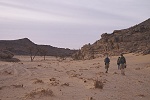
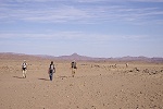
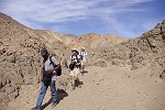
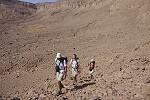
Our trekking party started at 5am, two hours before sunrise to make the most of the cool of the morning. Our aim was to make it accross the flat bottom of the western flank of Wadi Wahesh, and reach the narrow watercourse leading up to a low pass and then into the next valley before sunrise. We trudged along the gravel terraces in darkness for nearly an hour, only following the lit screen of the GPS, and it was still dark when the sides of the valley started to close in on us, and soon we were scrambling up among the boulders in the watercourse. Fortunately the first light appeared, and we soon spotted a trail that was leading up towards the pass on the side of the slope. We reached the pass before sunrise, and it became clear that on the other side of the valey there was a much better trail, of which we took a mental note for the return journey.
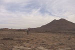
There was a clear path leading into the shallow descent ahead of us. The terrain was very soft, eroding granite and gravel, we did not find anything of interest save for a good walking stick that was left here by some Tibou. We hid a couple of bottles of water under a prominent rock to save on the weight we need to carry, then continued towards the broad gravel terraces of the large three forked wadi without a name to the West of Wadi Wahesh. The terraces looked flat from the distance, but close-up they proved to be formidable obstacles, 20-30 metre high ridges covered with large rocks and boulders, offering a very difficult going. In the mean time the sun came up, but for a long time in the morning it was semi-covered by a layer of high altitude clouds, for which we were very grateful. An unusual haze also lingered on at low altitude till mid-morning.
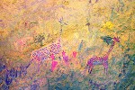
It was a long and difficult walk accross the rocky terraces, it was well into the mid morning when we reached the ascending valley on the far side, where on Google Earth we have previously noted some promising looking rock clusters. Near one of them, about an hour's walk from the wadi mouth, we spotted a large rock with a prominent shelter underneath, which contained a small hollow with some rather weathered paintings of cattle and human figures.
The paintings appeared like those of hundreds of other small cattle pastoralist sites all about Uweinat. It was only at home, with the help of dStretch that I noticed some unusual features on the cattle: they have very prominent udders, and unlike the typical Uweinat cattle where the udder is shown between the widely spaced rear legs, in this case they are shown in front of the closed rear legs. Also there is a very indistinct calf under the left cow, apparently suckling, a fairly rare scene. At the time we did not know, but this new find proved to be the only one we were to make during our long walk.
By this time it was starting to be hot again, though fortunately not as hot as the previous day. More alarmingly, both my and Tomoko's shoes were starting to give signs of fatigue, with large gaps appearing between the soles and the tops. With the shoe glue and silk tape brought along for just such eventualities we made repairs, and quietly we were thanking our fortunes for this not happening somewhere halfway up to the peak. Eventually both pairs lasted till the end of the trip, but probably the soles would have totally separated on the tougher climb up to the peak. Mine have already made two trips to the much tamer Tassili, and I have made the ill judgement of assuming they will still manage another to Uweinat...
After the repairs we continued up the valley to a high col (crossing the border into Libya in the process), and were soon looking into Wadi Waddan on the other side, with the prominent granite cluster at the botom. The descent on the far side was fairly difficult, it took a good hour of scrambling over a bad scree cut by deep watercourses till the bottom of the very scenic valley.
This large granite dome at the middle of the valley was already reached and explored by Mark some years ago. While it cried for being a superb rock art location, and indeed there are several large shelters behind the large boulders around the perimeter, all of them are empty, there are only a few small sites further downstream towards the plain opening out in the South. By this time it was very hot, after double-checking the shelters we had our lunch and took a long rest in the shade before starting on our return trek.
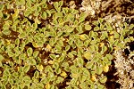
Our return was via the same route, first accross the bouldery wadi bottom, where much to our surprise we have found a bright green Cleome droserifolia, aside the scattered acacias the only green plant we have observed along our entire way. We crossed the gullies dissecting the unpleasant granite boulder terraces, climbed back up on the scree slope to the pass right on the Sudan/Libya border, descended the valley past our only rock art find then crossed the terraces of the three forked wadi towards the pass leading into Wadi Wahesh.
We reached the pass just before the sun passed behind the mountain to the west, missing our water cache along the way. We have placed it at a boulder much farther on the way coming down as we thought, and with plenty still left we had no inclination to go back to fetch it. It remains there for some other time...
On our way down we have noted several geological features that we missed in the darkness in the morning. At one point the watercourse cuts a basalt dyke, solving the mystery of the source of the basalt fragments that litter the lower course of the Wadi Wahesh, being the raw material for a number of prehistoric implements. The other was a clearly defined boundary between the sandstones and a more recent granitic intrusion, with the fused sandstones traceable for a long time along the hillside. We reached camp just as dusk was setting in. While we were away to the West, Mark & Richard explored the plateau East of the Wadi Wahesh, and found several engravings along the plateau edge, much highr than the vast majority of engravings kown at Uweinat (usually along the lower courses of wadis and at the foot of the mountain). Some of these engravings uniquely depict typical cattle pastoralist figures as shown on paintings, something never before recorded at Uweinat (to be published in an article in the forthcoming issue of Sahara)
Day 11. South Uweinat
The 'plains party', Brenda, Els, Gábor, Mark and Ursula left in the early morning with Moez and two cars, while the remainder of us decided to take a more leisurely day after the long walk of the previous day, visiting the known rock art localities along the southern side of Jebel Uweinat up to the Libyan border. We started out with the group of sites found on our November 2004 expedition.

We moved on to the cluster of sites found by Jean-Loïc Le Quellec in 1998. This cluster included a very interesting site with several yellow "elongated roundhead" figures in a conspicious large cave. I have visited this cave several times, and have failed to spot the paintings, however Mark has found them some years ago. This time they were readily visible on the left wall - apparently in the morning light they stand out clearly, however in the afternoon light they completely blend in with the colour of the rock. One surprising result was the finding of several more figures (clearly visible with dStretch) than what was originally visible on Jean-Loïc's scanned slide.
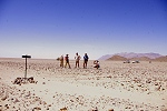
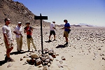
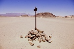
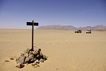
We continued up to the border with Libya to see the old border signs set up by the 1934 Anglo-Italian Boundary Commission. As we parked the cars at the foot of a low hill, we spotted one sign, evidently the first in the row, set up on the top of the hill, missed on our previous visits.
The next sign which we did visit before was exactly 1.5 kilometres south of the first, folowed by another two at equal distances, with a row of further posts visible until a range of low hills about level with Jebel Kissu.
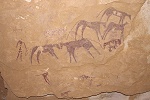
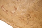
For lunch we moved to the foot of the prominent flat topped sandstone hill just east of the Libya-Sudan border, where Jean-Loïc found two large shelters with a series of very interesting paintings resembling some of the figures at Wadi Sora, which are now known as the distinct "Uweinat elongated roundhead" style, the earliest paintings of the Uweinat region. This time I had the opportunity to photograph the sites in better light conditions, and was amazed to find dozens of very faint figures of this early style at both shelters. This new evidence marks the locality as the most important early rock art site of the area, arguably on par with the better known "Cave of Swimmers" Wadi Sora.
The larger of the two shelters contains four separate panels of paintings, all with "elongated roundhead" figures, but there are some strange overpainted animals that don't seem to fit any of the described styles. There are several well preserved groups of figures with body decoration that were noted by Jean-Loïc, however the really interesting panels only show traces of paint, the majority of the figures only properly visible with dStretch
The most conspicious feature of the other shelter is a large group of antilopes in a strange style, without parallels in 1998 when Jean-Loïc first saw them, now we know they belong to the Wadi Wahesh style. There are several other animals in a similar style within the shelter, however this time I have also observed a number of very faint, barely recognisable "elongated roundhead" figures.
In the afternoon we decided to investigate a larger object that appeared to be perfectly in line with the row of the 1934 boundary posts, but appeared oddly larger than the pile of stones forming the base of the signs. As we approached, it turned out to be a wrecked armoured car, apparently burned out. Close investigation revealed it to be a Pahhard AML 90, similar to the one at the entrance of the main wadi of Jebel Arkenu. It must be a relic of the Libya/Chad war, placed purposefully here as a boundary marker sometime in the late nineties, based on the earliest grafitti found on it.

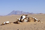
We looked at another two of the boundary posts, interestingly here three being only one kilometre apart before the remaining five reverting to the 1.5 km spacing. Turning back towards camp we passed several camel skeletons, remains of the lucrative camel trade between the Darfur in Sudan and Kufra before instability in the Darfur closed down this route.
We reached to camp well before sunset, spending a quiet afternoon with half of the party gone to the South.
Day 12. South Uweinat
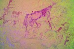
For this day we also planned a longer trek, going up to the western plateau adjacent to the Wadi Wahesh, where Mark, Flavio Cambieri and Lorenzo de Cola found a very nice rock shelter with some exceptionally fine paintings of the cattle pastoralist period in March 2012. They have made a very steep and difficult ascent on the scree slope and up the capping cliffs a few kilometres west of our camp, we decided to go up via the Wadi Wahesh that appeared to be an easier route.
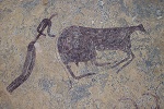
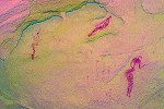
As we made our ascent, we passed the dry rock pool which was full of water in October 2007. About fifty metres above it, we passed the large rock with some cattle engravings on it, and the adjacent boulder with a shallow shelter which was scrutinized before but was found empty. This time, perhaps due to different lighting conditions (though our previous visits were also about the same time...) we spotted several painted figures. The most interesting and astonishing scene was one showing a pair of cattle in a dynamic pose, the lower one apparently being pursued by a pair of humans with lassoes, a unique scene in the entire Sahara. The upper cattle was already captured, with two figures holding on to the ropes (this scene will be published in detail in an article in the forthcoming issue of Sahara).
Continuing up the wadi, we saw a place where the capping sandstone layer could be ascended without any apparent difficulty. We climbed up the scree, however found what appeared to be a rubble filled crevasse to be blocked with impassable large boulders. Everywhere else there was the 6-8 metre high vertical rock face, we had no choice but to struggle along upstream at the base of the cliff to find a suitable ascent but there was none. We had to descend back to the valley bottom and go up to the western side valley, where finally we found an easy ascent to the plateau above.
The shelter we were aiming for was still several steps above us. The plateau turned out to be rather broken with difficult going, it took well over an hour to reach the shelter, perched high up under the triple peak, with a magnificent view over the plateau and the plains below up to Jebel Kissu. The paintings here are exceptional that while most known cattle pastoralist paintings depict cattle with a few humans, in this shelter human figures dominate, far surpassing in numbers the depicted cattle (this shelter will be published in an article by Flavio Cambieri and Lorenzo de Cola in the forthcoming issue of Sahara).
After spending a long time taking photos of these magnificent scenes, we moved east along a terrace with patches of the same rugged rock outcrops that formed the shelter we visited. We were now in unexplored country, we looked at every likely shelter without finding anything for a stretch of about one kilometre, until reaching a cluster of rocks which was already identified on Google Earth as a likely spot for rock art sites. Sure enough, we rapidly found three shelters with cattle pastoralist paintings, while not as spectacular as the ones seen in the morning they were still unrecorded sites.
Having run out of areas to explore, we started our descent via the princpal Wadi Wahesh shelters which we found in March 2005. The main shelter has paintings along the ceiling for over 20 metres, and is one of the largest sites with paintings at Jebel Uweinat. The style is so different to what was hitherto known at Uweinat that it gave rise to the Wadi Wahesh style, a culture markedly different from the other pre-pastoralist paintings. Interestingly, this style bears more than a passing resemblance to some elements of the Wadi Sora paintings, including negative handprints, ostriches wthout bodies and the overall style of depicting humans.
With sunset approaching, we made our way down to camp along the Wadi Wahesh, the other members of our party being already there since the late afternoon, having completed their survey of the stone circle sites.
Day 13. Jebel Kissu
Anticipating some delays on the return like on the way to Uweinat, we decided to break camp at dawn a day early, to start on the first leg of our way back to the Nile immediately after a planned visit of Jebel Kissu, instead of returning to Uweinat for the night.
Before departure, some of us visited a large rock with some engravings discovered by Mark a year ago, close to some known sites. This locality is highly unusual, with the main panel executed on one side of a narrw crevasse splitting a huge boulder, with some exceptionally large engraved giraffe, only visible from the top of the larger half of the split rock.
Approaching Jebel Kissu, we drove as close as possible to the entrance of the main wadi draining the centre of the mountain, a smaller granite ring structure like Jebel Arkenu or the western part of Uweinat. We managed to get to within a kilometre of the entrance, and walked the remaining distance over the rough rubble fan flanking both sides of the very narrow outflow.
Bagnold and Shaw have explored this single wadi of Jebel Kissu in 1932, but have reported no rock art sites. Apparently they were more keen to find (unsuccessfully) a route to the summit, as on the only further expedition known to have surveyed the valley, Mark, Flavio & Lorenzo have found two rock art sites very near the entrance last September (2012). The first site is under a large rock right at the wadi entrance, with some human figures of an unclear affliation, while the other is a large shelter a short distance upstream, at the narrowest part of the wadi where it breaks through the outer ring structure of the mountain, with several very faint "Uweinat roundhead" figures and a few very unusual positive handprints.
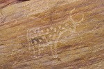
After visiting the main wadi we went back to the nearby site along the western edge of the mountain, discovered by F.G.B. Arkwright and copied by Almásy in 1934. This site shows some very fine cattle (including one with the same prominent udder depicted before the legs as in the new site found four days earlier) and some associated human figures. Here too I have managed to spot a faint panel near the edge of the rock which remained unnoticed before, including a very fine shelter scene and several cattle.
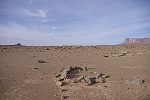
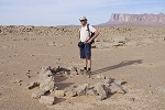
After a quick lunch we set out towards the south east, to investigate a large stone enclosure on a hilltop some 70 kilometres from Jebel Kissu which was spoted on Google Earth by Ursula, a little displaced from the area of stone circles investigated in the past two days. The hill proved to be a fairly low inconspicous one, and the enclosure did not quite follow the flat area hilltop, but only a part of it. Unlike the structure visited on our way to Uweinat, the enclosure did not have the appearance of a wall, rather it was a very low pile of smaller stones, more like a boundary marker. Inside there were several smaller enclosures. We found a single eroded sherd of wavy line pottery, and several paleolithic tools - nothing that would have suggested more recent occupation.

While we explored the hilltop, our drivers immediately assembled their cheap chinese metal detector and set out hunting for gold, like on all stops, dismissing any comments that in sandstone country the geology is not particularly conductive for their quest. Soon even from the hilltop one could hear the excited chatter, apparently the detector was giving off strong signals. It was all eager smiling faces until I crashed the party by demonstrating that each and every one of the dark iron-manganese concretions littering the desert floor gives off a loud beep if brought close to the detector disc...
We still had some way to go to our planned campsite, a small patch of large trees and other vegetation that showed up on Google Earth while Mark was scrutinizing it for stone circle sites. It seemed incredulous to find vegetation over 100 kilometres from Uweinat in the open desert, far above the groundwater level which supports life in the oasis depressions. It was definitely worth investigating, we made a beeline towards it on rather difficult rocky terrain. The elsewhere abundant vehicle tracks disappeared, apparently noone had a good reason to press forward in such bad country - we were back again on unexplored terrain. After several hours of bumping along in first and second gear finally we spotted the tops of trees behind a low dune just before sunset. Rounding the low ridge, the mystery was solved: a shallow wadi is blocked diagonally by the low dune, and apparently after rains a shallow pool forms here, trapping enough moisture underground to support a small colony of tamarisks.
Day 14. South-East of Uweinat - Burg el Tuyur
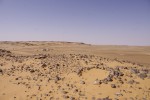
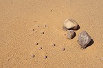
In the morning Mark and Moez proceeded to dig a deep hole near the tamarisks in search of traces of water, but gave up at a depth of about one metre without any sign of moisture in the reddish soil mixed with sand. Later with three cars we set out to visit a series of stone circle sites spotted on Google Earth in the general area of our camp. The first site we saw was a very typical one, with a number of stone structures consisting of rough rounded boulders heaped in a circle, some merging into each other, occupying the top of a low ridge. There were very few artifacts or any other remains of human settlement lying about, however the flat sandy basin adjacent to the ridge was littered with small flakes and microliths. At one spot we found an overturned lower grinding slab with the upper grinding stone neatly tucked away underneath, clearly placed there in anticipation of the next use some 6-8 thousand years ago.
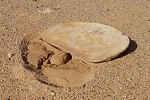
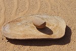
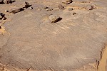
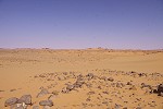
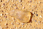
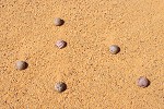
Another site a few kilometres away was much more unusual. The locality was a low oval hill, with a shallow depression in the middle. The stone circles of the usual type were arranged along the rim, with the depression (which must clearly hold a shallow pool of water for some time after rains) was densely covered with artifacts and pottery fragments. We were surprised to note a number of flake tools made of Libyan Desert Glass. There were no LDG waste flakes or cores, clearly the tools themselves were brought here, more than 350 kilometres from the source. We also noted something very curious and unexplained: an arrangement of 14 uniformly sized, perfectly round stone balls, about 2.5cm in diameter, apparently man made and of an unknown function.
At yet another site we only saw a single but unusually large stone circle on Google Earth. Approaching the location, we found a very low flat topped hill, and instead of a stone circle the structure turned out to be a round tumulus, common in the central Sahara but very scarce in the Libyan Desert.
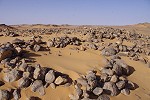
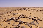
We returned camp and after packing up we approached the last site we were to visit, located on a barely perceptible rise on the middle of a rocky plain. There were a number of full and partial circles built of large crude black sandstone blocks. As common with such circle stes, we saw hardly any artifacts or other signs of human occupation.
It took us several hours of slow going to navigate our way out of the difficult rocky ground. As we were approaching the Selima Sand Sheet, we were following the course of a broad shallow ancient riverbed. Unexpectedly we noticed a dark dot in the distance that grew as we approached. It turned out to be a shrub on a low mound, not a tamarisk as first thought but a plant with small pink flowers which I never encountered before in the Libyan Desert (Capparis decidua, later we saw several in the desert adjacent to the Nile valley). The branches of the shrub were loaded with desert locusts (Schistocerca gregaria), mostly brown non-swarming adults, but also a few yellow swarming ones.

It was mid afternoon by the time we finally made it out to the smooth sand plain, and it was still another 120 kilometres to go until the rock of Burg el Tuyur, our next aiming point. With little risk in doing so, and not much to do while driving the yellow HZJ 75 on the featureless sand plain, I decided to try out the basic navigation used by Bagnold and companions in the nineteen thirties. I took a bearing on our target with the GPS, then switched it off, and started driving by keeping the shadow of our roof rack on precisely the same point on the bonnet, making a slight adjustment every 15 minutes to allow for the changing sun angle as it was setting behind us. Watching the odometer, I started looking around at 110 kilometres from the start for the rock - it was nowhere, but after continuing another seven kilometres I spotted something dark immediately to the left - my error was six kilometres over 120 using this very crude method - clearly had we stopped every 15 minutes to properly adjust for the changing sun angle like Bagnold and later the LRDG navigators did, our course would have been much more precise.
The foot of Burg el Tuyur is still littered with petrol tins of the early Bagnold and other expeditions. It is a rather inconspicious rock, but it is the only landmark in a radius of 150 kilometres, first spotted by Newbold & Shaw during their 1927 camel expedition. It was used as a navigating landmark by most early expeditions, the photo of the 1930 Bagnold expedition party was taken on its top.
We also took our group photo at the foot of the rock, then proceeded to find the single engraving of a spotted cow reported by Newbold & Shaw. Unfortunately by now the rock is not nearly as remote as it once was, the sides are covered with innumerable modern grafitti, mainly truck drivers and passengers on the Dongola - Kufra route. Fortunately the area of the cow was left untouched, but practcally everywhere else the rock is densely covered with inscriptions.

From the rock we spotted a range of low barchans on the horizon some ten kilometres to the South-east. With sunset rapidly approaching, we made for the dunes to make camp in their cover, both as a windbreak but also to be out of sight to any possible passers-by.
Day 15. Burg el Tuyur - Camp
The next morning, after some serious pondering over the maps and satellite imagery and assessing our fuel and water reserves, we decided to make a little backtracking to Wadi Shaw, about fifty kilometres west of south from Burg el Tujur before turning East, and starting our return to the Nile valley via the Laqiya wells, hoping to be close to Dongola by the evening.
We covered the fifty kilometres on the flat sand sheet easily in an hour, and entered the broad wadi, the remnants of a long ago defunct drainage system draining the plateau above teh Laqiya scarp towards the north east before disappearing under the flat sands of the Selima Sand Sheet. It was first traversed and recognised by Newbold and Shaw in 1927. Shaw noted several an astonishingly dense pattern of prehistoric settlements and remains in the wadi, and he even excavated a prehistoric burial, prompting the Heinrich Barth Institut team conducting excavations here in the nineteen eighties to name the wadi after him. To this day some sections of the wadi floor are practically carpeted with prehistoric tools and other remains, like at the place where we made a brief stop in the centre section of the wadi near a dry playa. Interestingly, I have found another small perfectly made stone sphere about 3 cms in diameter, this time in isolation, slightly larger but probably of the same function as the assortment of stone balls we saw the previous day.
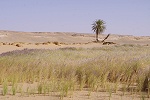
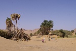
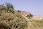
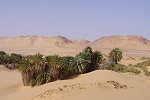
After our short visit we turned into the Wadi Sahal, leading from the Wadi Shaw towards the South east down to the foot of the Laqiya escarpment. We saw no larger green vegetation in the Wadi Shaw, but after only a few kilometres we encountered the first tamarisk mound in the Wadi Sahal. They became more frequent as we descended imperceptibly to lower ground, until after a bend we came upon a true oasis, a grove of small acacias at the foot of the hills marking the edge of the dissected scarp, indicating the presence of permanent groundwater.
At this point we were still 50 kilometres from the well and oasis of Laqiya Arbain (and rather more along the track zigzagging along the contours of the foothills on rather bad rocky country), and from hereon vegatation was almost continuous along the edge of the scarp, mainly large tamarisk mounds visible from afar.
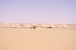
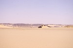
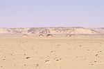
Shortly after midday we reached a large field of yardangs (mud lions), the remnants of a large eroded lakebed a few kilometres to the west of the oasis. We decided to take an early lunch, allowing some time to wander about the eroded mounds, the ground littered with the remnants of prehistoric settlement.
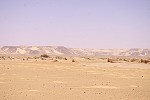

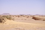
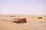
The oasis of Laqiya Arbain was just a few kilometres beyond, a small cluster of palm trees and tamarisks surrounding a few rather miserable looking mudbrick huts, most of them ruined. This was another Sudanese army post, and we approached cautiously, making clear signals of our benign intentions. Here our welcome was markedly cooler than at Selima. While we were invited for the obligatory tea, we were not permitted to have a look around (not that there was much to see) nor to take any photos. After finishing the tea we quickly said our greetings and excused ourselves to get on our way without further delay.
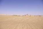
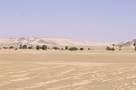
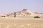
Continuing along a now well defined track (used by the army supply convoys) leading to Dongola, we passed by Laqiya Umran some 25 kilometres beyond Laqiya Arbain. Unlike the latter, this place is not really a true oasis, while there are some tamarisks in the depression, we could not see any palm trees that would indicate the location of the well. Here too there was a large field of yardangs, after stopping for some photos we pressed on.
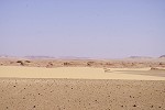
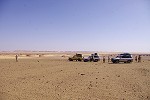
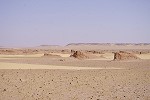
The track proved to be dismal going, the trucks having clear preference for rocky but firm terrain rather than soft sand that would have offered a much smoother ride for our landcruisers. In retrospect we would have been much better off following a course I plotted from Google Earth that would have mostly avoided the rocky terrain at the expense of some 100 kilometre overall detour, but once we were committed to the track it was too late to contemplate. We bumped along the rough terran all afternoon, and made camp at the only group of dunes we encountered since leaving the Laqiya oases. We were still a good 200 kilometres from the Nile, just about half way along the route we intended to cover that day.
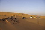
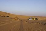
Day 16. Camp - Dongola - Karima
After packing camp at sunrise, we continued along the same bumpy track all morning, averaging 30-40 kilometres an hour. It was midday as we started approaching our only remaining objective in the desert among the first appearing clusters of green vegetation, the fortress of Gala el Sheik first reported by Stefan Kröpelin in an article in Sahara 17. This fortress appears to have been a Meroitic outpost protecting the Nile valley from desert raiders, just like the much larger fortress in the Lower Wadi Howar some 150 kilometres further south.
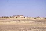
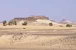
The fortress consists of two structures, the main fort on top of a large flat topped hill, clearly in a commanding location overseeing a large area. There is a smaller enclosure at the foot of an adjacent conical hill. The access to the main fort is through a massive, well built gate, but there are no more readily visible buildings once inside the walls on the hilltop.
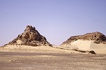
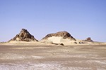
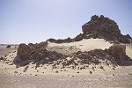
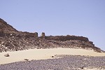
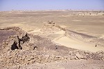
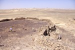
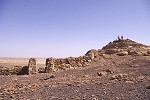
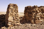
However the most interesting feature of this locality is not the meroitic fort, but a series of apparently prehistoric engravings on a small outlying rock, linked to the main fort by a smaller wall. On the far side, there is a rough shelter with the floor and rear wall covered with engravings, including several "water mountain" symbols well known from "Redjedef's water mountain", first thought to be of ancient egyptian origin on account of the similarity to the 'mountain' and 'n' (water) symbols, but now known to be of prehistoric origin (with the later pharaonic inscriptions just inserted into the earlier engravings). These new finds reported by Stefan extend the range of these symbols hitherto known from the Dakhla Oasis area down to the South Libyan Desert.
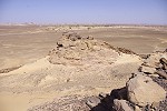
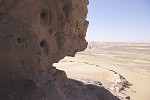
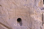
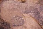
Aside these engravings there are also a number of other nonfigurative shapes and symbols, including several ovals and rectangles which seem to come in pairs, and have a pair of dots resembling eyes. There are no known analogies to these curious symbols, only found at this location.
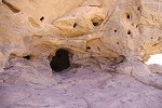
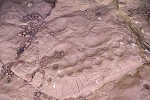
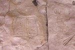
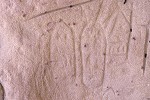
As we moved on, the sparse patches of vegetation started to become denser, and we soon reached larger continuous oases and date palm plantations, the first signs of human settlement after our long journey.
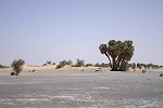
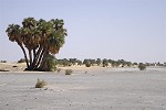
We reached the main road a little to the North of Dongola airport, a rather surreal feeling after two weeks in the desert. Our plan was to stay at the main hotel in Dongola (eerily reminescent of the fine Sudan hotel in Kufra) however it soon emerged that some government conference was held in the town, and the fact that we had reservations meant nothing - there were no rooms. After finding the situation the same in another two hotels, we rapidly decided to use the remaining two hours of daylight to reach Karima, where we could have a house for ourselves. Resigning to the fact that there will be no hot shower that night, we were soon back on the road towards Karima, the only traffic we met being several of the large trading trucks coming down from Halaib on the Egyptian border. We reached Karima by dusk, settling in to a different house much closer to Jebel Barkal.
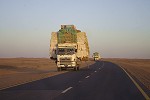
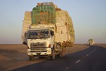
Day 17. Karima - Meroë
At first light the next morning while everyone was still asleep, I quietly got up to make a quick sunrise visit to Jebel Barkal, a few hundred metres beyond our house.
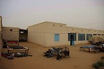
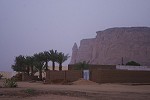
I was completely alone, apparently the whole town was still asleep. It was lovely to be able to wander about the ruined temples undisturbed, bringing back some memories of Egypt thirty years ago when one could still have such an experience. This time at a more leisurely pace I could find some details which we missed on our hurried visit two weeks earlier, like the row of rams at the entrance to the temple of Amun, and some remains of painted reliefs in a smaller sanctuary at the base of the mountain. At some point the sun appeared, just fading in from the overall white haze already well above the horizon.
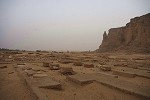
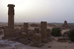
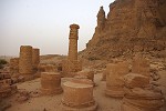
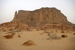
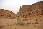
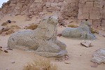
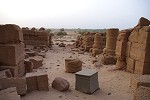
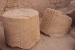
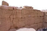
As I made our way back to our house, the town as well as our party was slowly awaking. Our drivers took the cars for servicing and fueling while we had breakfast, then we loaded up ready to go. Here we said good by to the "buffalo", as we had no more need for it. It returned directly to Khartoum while we were to go by the longer way, visiting the principal meroitic sites in the Nile valley, first taking the road from Merowe to Atbara.
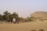
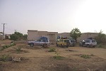
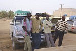
Cutting accross the bend of the Nile in the persisting haze that greatly reduced visibility, we reached Atbara after midday, crossed the old British built railway bridge over the Atbara River (the last permanent tributary of the Nile for the remaining 3000 kilometres till the Mediterranean), and went to the central market to find a restaurant for lunch. We found the town to lack any particular charm, after a quick lunch we were on our way again, leaving this time on the new bridge.
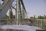
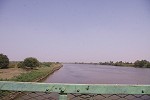
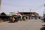
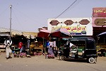
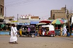
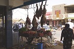
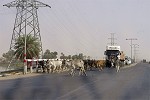
We soon reached the junction of the road to Port Sudan, and from hereon there was very heavy traffic, mainly huge trailer trucks hauling two full sized containers, and of course constantly playing the game of overtaking each other at marginal speed differences, bringing traffic to a crawl. It took us over two hours to finally reach the pyramids of Meroë, looming on the ridge about a kilometre from the road. While there were a few souvenir stands selling miniature pyramids carved of the soft local sandstone, and a couple of camels offering rides and photo-ops, we were allowed to wander about the field totally undisturbed. A surprising feature was the arrival of a chain of barchan dunes from the North since I last visited in 1981, filling the entire northern group with a carpet of golden sand. Also almost every pyramid had its chapel restored to a varying degree, while in '81 only two of the smallest pyramids had restored chapels.
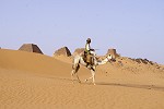
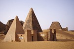
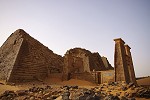
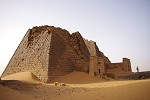
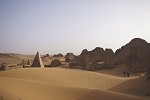
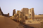
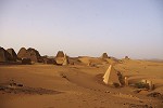
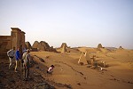
Having seen the North group we walked over to the South group accross the valley, politely declining the suggestions that a camel is absolutely essential to safely cross such vast distances.
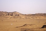
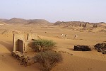
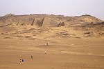
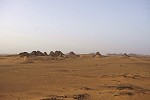
We found the same at the South group - all the chapels I have seen ruined have been restored, with some having fairly well preserved reliefs on the inside walls. Our camp was behind the ridge to the south, just outside the archaeological area. Our cars have already driven there, so we could afford to linger on till sunset, just enjoying the view and the surroundings.
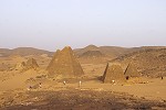
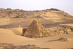
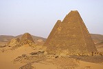
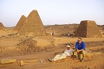
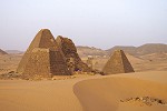
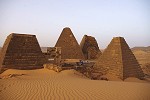
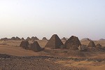
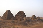
Day 18. Meroe Naqa - Khartum
Next morning as we were packing up camp and having breakfast, an old man appeared on a donkey ... then another ... then two on camels ... one by one all of the souvenir vendors arrived sensing the opportunity, they dismounted and sat down quietly in a semi-circle and just looked at us packing up without saying a word. This was the only episode during our trip which felt like being on the tourist trail again.
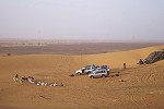
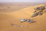
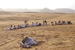
Prior to departure we climbed up to the ridge above our campsite, from where there was a splendid view of the pyramids in the morning light.
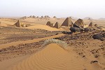
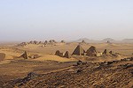
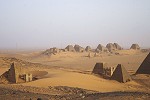
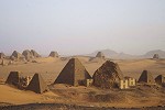
Leaving Meroë, we drove along the tarmac road for some distance till the Naqa turnoff. The dirt track leading to the temples has not changed much in thirty years, nor did the scene of the nomads watering their animals at the well beside the temples. Fortunately it seems Naqa is still well off the beaten track, they barely took notice of us except for a few greetngs and smiles. The only conspicious change was plastic jerrycans replacing the animal skins to hold water.
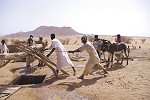
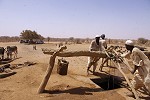
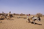
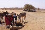
In contrast to the environment of the temples, the monuments themselves have changed somewhat since my last visit. The temple of Apademek, the lion god, looked substantially the same, but approaching it closely it was clear that the foundations have been excavated and strengthened by the University of Berlin team who were working here in the past two decades.
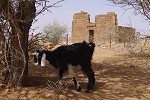
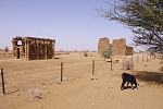
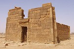
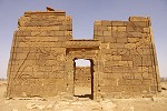
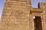
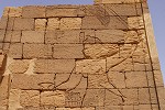
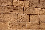
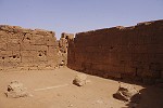
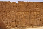
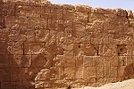
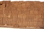
The adjacent "Roman kiosk", with a curious mix of classical Egyptian, Roman and Meroitic architectural features, was completely dismantled and reconstructed on a firm concrete platform some years ago, with a couple of iron girders strengthening the rather precariously balanced blocks at the top. Fortunately the reconstruction was done in good taste preserving the old appearance, the philosophy of german team was to do no modern reconstruction (unlike the rather unsightly cement pyramids at Meroë), only to re-assemble any fallen blocks.
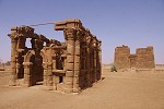
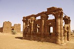
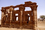
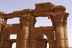
The biggest change was at the temple of Amon, on the far side of the site opposite the well. In 1981 it was just a pile of ruined blocks, only the first doorway still standing, with the fallen rams from the preceding avenue half sticking out of the sand. Now it was all neatly restored with minimal reconstruction, with standing columns and the row of rams placed on ther pedestals in front of the temple.
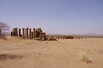
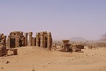
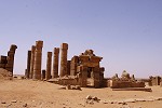
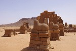
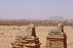
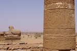
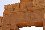
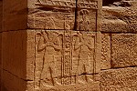
Leaving Naqa, we drove along the track leading west. It was highly amusing to watch one of the landcruisers (with tyres pumped hard for the tarmac) getting stuck at the very same riverbed crossing where in 1981 we were struggling to get through with the heavily laden Land Rover. This was our last real desert stretch, after some searching for the correct track we soon saw the row of electricity pylons marking the main road along the Nile.
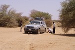
Before ending our trip in Khartoum, we left the main road to have lunch at the 6th Cataract, one of the last remaining untamed rapids of the Nile (though Moez told us that there are plans for another hydroelectric dam here too, soon this lovely spot too may be a thing of the past). Here the Nile crosses a range of granite hills, channeled into a deep narrow valley with a series of rapids and low waterfalls in places at the outflow end. There are a number of small local restaurants at the bank, all selling the freshly caught and fried small Nile catfish abundant along this stretch of the river.
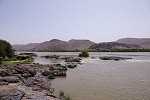
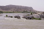
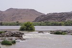
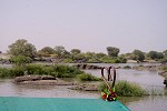

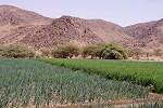
It was still a good three hour drive from here to Khartoum, not because of the distance but because of the very busy road. We reached the Grand Hotel and the lxury of a hot shower at sunset. Most of us flew ot with flights in the small hours of the morning, so it was just a quick dinner and a quick nap before leaving to the airport. We found out the next day that there was a huge early spring snowstorm accross the whole of Europe, most of us arrived to a white winter land. The photo of our garden taken in the morning straight after arrival shows a rather brutal change from the previous one in the sequence...
Conditions permitting, another expedition is planned to Jebel Uweinat from Sudan, tentatively targeted for November 2015. Please visit the planned itinerary page for more details, to be updated as new information becomes available (or "like" the FJ Expeditions FaceBook page to receive notices of news and updates).