
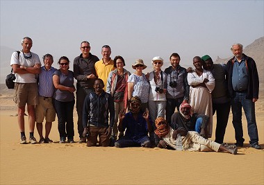
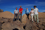
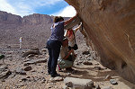
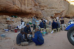
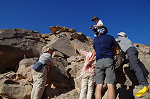
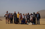
 Click on image for list of participants |
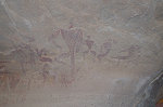
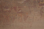
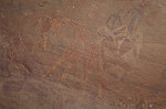
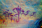
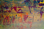
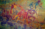
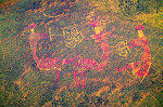
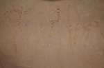
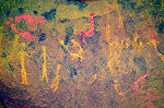
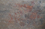
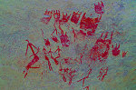
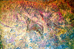
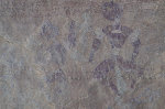
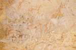
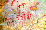
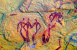
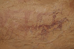
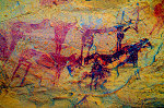
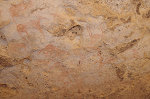
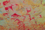
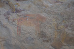
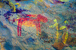
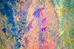
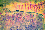
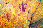
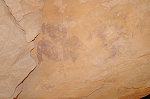
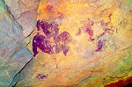
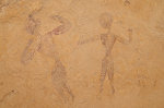
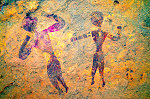
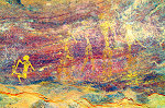
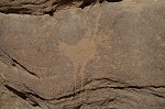
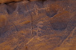
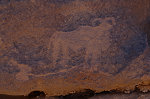
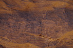
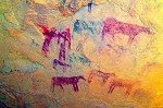
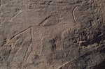
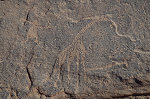
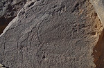
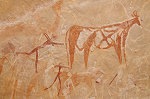
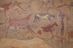
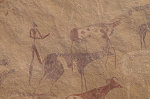
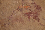
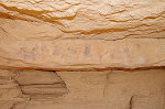
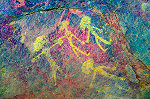
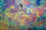
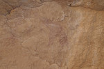
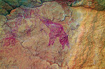
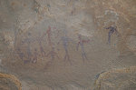
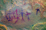
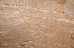
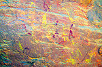
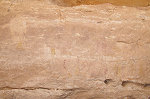
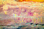
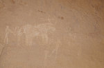
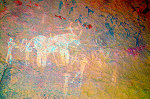
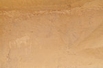
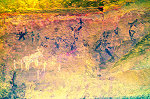
Jebel Uweinat Expedition, Sudan 3rd - 18th March, 2019 False colour images processed with dStretch, a freely available software developed by Jon Harman |
Day 1. - Khartum - Soleb
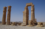
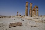
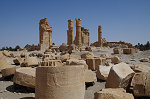
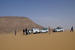
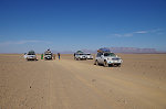
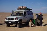
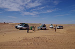
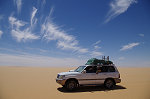
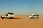
With a full day available the day before for purchasing supplies and loading the cars (the same ones that we used on the preceding Bir Nurayet trip), we immediately started rolling after a short night for those arriving to Khartoum in the small hours. It was a long day, driving continuously till Soleb save for some short pauses for lunch and dinner. With the fuel situation in Sudan, the "buffalo" (the HZJ-75 landcruiser) was fully loaded with jerrycans of fuel from Khartoum which Moez pre-arranged for the trip, making our progress much slower than planned. It was well past 9pm when we finally settled in to the rest house by the Soleb temple.
Day 2. - Soleb - camp before Selima
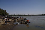
While Moez went off to the miners' camp near Toshka to fill the empty tanks and if possible get some more fuel for the road to Uweinat, we had a pleasant lazy morning visiting the Soleb temple and the nearby Nile bank.
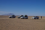
Moez only returned with the cars mid-afternoon, it was no easy task to find the required amount of fuel, and we did not quite have the amount we wished we had. Normally on a trip to Uweinat one carries a minimum 20% reserve, now we barely had enough to make it there and back with the five cars. The situation changed somewhat with the gold mining town 40 kilometres to the East of Uweinat, theoretically one could purchase fuel there (smuggled from Libya), but we were also prepared for the option that two vehicles may need to stay in the desert while the remaining three go back to the Nile to fetch fuel on the return.
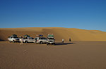
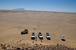
By the time we left the rest house, we only had a couple of hours of daylight left. We drove north on the road passing the miners' camp near Toshka, then turned off along the now very busy and clear track leading towards the gold mines near Uweinat. We drove on the plain bordering the Nile valley till the appearance of the first smaller hills, then turned away from the track to make camp in the lee of a low rock along the trailing dune.
Day 3. Selima Sand Sheet
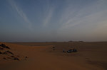
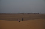
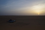
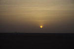
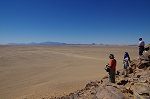
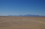
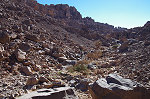
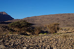
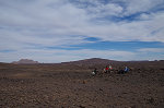
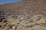
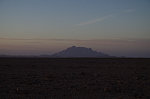
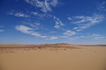
This was another long day full of driving, mostly along the Selima Sand sheet, only interrupted by a quick lunch break and the occasional flat tyre. We made good progress, by the evening we were camping among the belt of barchan dunes not far from the western edge of the sand plain, only 200 kilometres to the east of Uweinat.
Day 4. Selima Sand Sheet - Jebel Uweinat
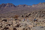
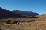
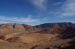
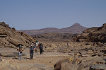
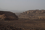
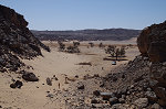
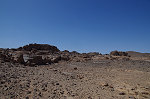
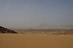
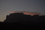
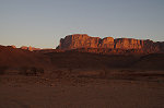
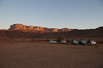
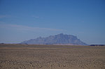
We covered the remaining distance to Uweinat in the morning, despite a couple of instances of getting stuck in the soft sand churned up by the heavy trucks serving the gold miners. We passed the miners' town, giving it a wide berth, and by early afternoon Uweinat was in full view from the top of a low hill as we approached it from the south east.
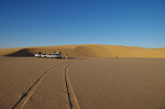
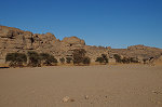
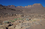
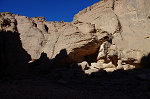
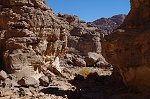
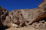
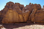
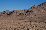
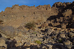
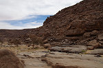
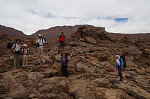
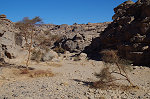
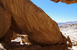
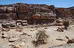
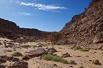
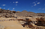
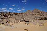
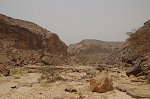
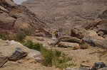
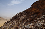
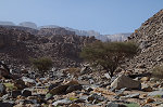
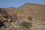
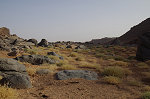
It took another hour and a half to finally make it to our campsite in the south western branch of Karkur Talh. The valley appeared very dry and completely deserted, there were only some very old car tracks, quite possibly our own from November 2017. After a quick lunch we scrambled to visit the nearby sites and just enjoy the surroundings after nearly four non-stop days of sitting in the cars.
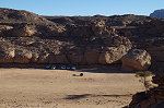
Day 5. - Trek to upper south-western Karkur Talh
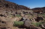
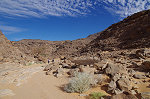
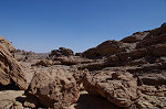
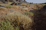
On our first full day at Uweinat we set out on the top of the low plateau bordering Karkur Talh to the cluster of splendid sites discovered in February 2003. Descending into the valley again near the sites, we were surprised to find some fresh vegetation along the watercourse, apparently there was a little rain in the summer of the year before, however not enough for the flow to reach the lower part of the valley.
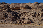
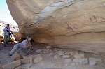
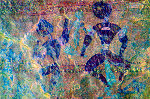
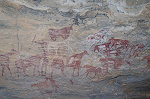
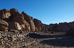
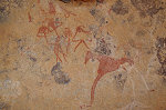
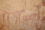
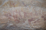
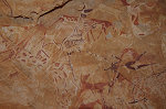
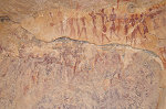
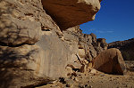
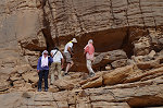
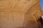
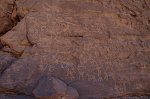
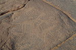
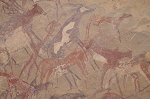
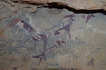
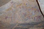
We started out site visit at KTW 21/A, the fist shelter one encounters if approaching the cluster along the valley. With its unique triple sequence of superimpositions, this site provided one of the early keys to the relative chronology of some of the most important local styles.
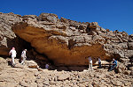
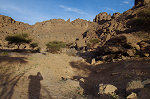
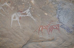
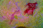
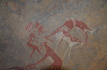
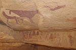
We spent the rest of the morning continuing along the row of sites along the west bank of the wadi, then returning to our base among the rocks at the foot of site KT 24 (with the unique representation of a dog on leash) for lunch and a pause before continuing to the sites further upstream.
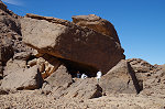
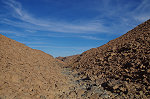
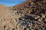
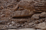
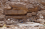
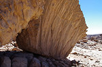
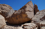
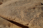
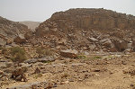
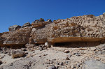
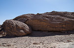
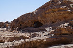
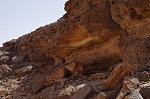
Going upstream towards the huge boulder with archaic paintings we made an interesting find, which in part may explain such a rich concentration of sites at this particular locality. In a low and otherwise inconspicuous shelter which we passed numerous times before, I noticed a rock outcrop that appeared different from the surrounding sandstones. Sure enough, close inspection revealed it to be a deposit of spring carbonates, along a crack where water seeped out of the ground at some point in antiquity, possibly at the time when the area was inhabited.

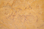
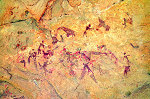
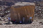
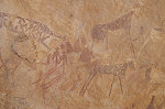
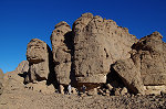
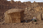
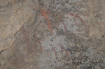
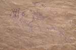
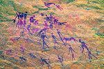
Continuing to the huge boulder of KTW 28/C, we spent a long time photographing the amazing but very faint archaic paintings in the shelter under the rock.
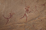
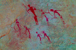
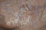
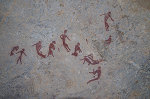
We finished site KTW 27/G, the other major archaic site in the area with a one of the finest ensemble of "elongated roundhead" figures anywhere on the mountain.
While the others returned to camp, with Gábor we made a brief detour to the top of the ridge bordering the basin to the North, separating it from the north-western branch of Karkur Talh. Our aim was to deposit a water cache for the trek of the following days, but it also gave be the opportunity to visit a small site with both pastoralist and older scenes among the rounded boulders which I have only seen once when finding it in November 2004
Even with the detour we almost caught up with the rest of the party, reaching camp in the valley well before sunset.

Days 6-8. - Trek to the summit of the Northern Plateau
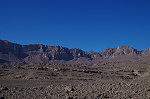
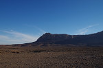
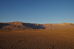
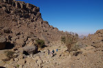
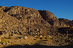
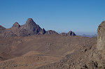
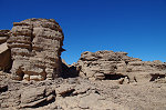
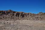
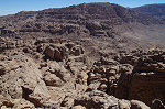
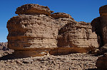
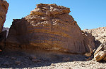
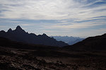
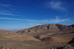
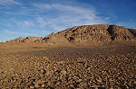
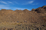
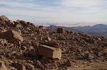
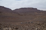
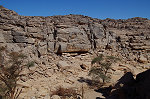
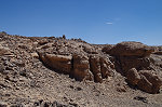
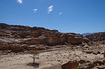
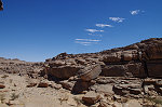
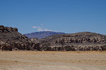
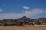
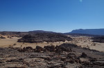
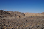
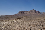
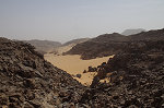
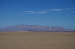
The eastern part of Jebel Uweinat consists of a series of four high sandstone plateaus, separated by the upper sections of Karkur Talh and the Wadi Wahesh. The palaeozoic strata have been tilted and uplifted by the later granitic intrusion that formed the ring-like western part of the mountain. The southernmost one, named the Italia Plateau by the 1933 Marchesi expedition is the highest, we first climbed it from Libya in November 2001. The Hassanein Plateau (named by the 1968 Belgian expedition) is to the east, dominating the skyline if one approaches the mountain from the south-east. We first climbed the Hassanein Plateau to visit the mysterious "white spot" in February 2003, and on a second ascent in March 2004 we found an amazingly rich site (plus several smaller ones) proving that rock art may be found at any altitude on the mountain. In October 2007 we climbed the adjacent North-western Plateau, also finding a single shelter with painting. Only the smallest and lowest Northern Plateau remained unexplored to date, separated from the North-western Plateau by the deep ravine of the north-western branch of Karkur Talh.
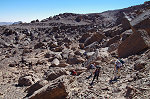
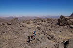
One of the main objectives for this trip was to reach and explore the summit of the Northern Plateau. While Lorraine, Rosa and Santi stayed behind to explore the sites in the lower valley, the rest of us set out at dawn for a three day trek to the upper reaches of the mountain. We followed the same route as we used during the November 2009 ascent to the summit, first climbing up to the cluster of sites among the rounded boulders on the ridge between the two branches of Karkur Talh, where we left the water cache with Gabor the day before to lighten our initial load.
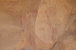
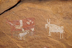
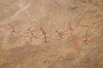
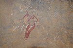
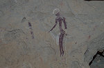
After collecting an extra bottle of water each, we took a pause at the impressive panel of early "Uweinat roundhead" paintings which was discovered by Mahmoud Marai in 2007 when making the same ascent towards the summit along Karkur Talh with Hardy Böckli. The very faint paintings are on a near vertical wall, I completely missed them when I explored these rocks a couple of years earlier, probably because the panel was completely exposed to the afternoon sun. Unlike pastoralist (and other style) paintings, the "Uweinat roundhead" people seem to have preferred such exposed vertical rock walls, which unfortunately did not help preservation.
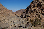
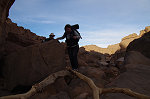
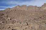
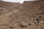
After the pause we began the climb in earnest, first following a series of terraces along the southern side of the valley, but then entering a rough rocky area that was very slow going. However we continued to gain elevation, and the Northern Plateau was looming right above us on the far side of the valley.
At some point we descended into the riverbed and crossed to the far side, where another series of terraces allowed for a marginally easier going. By lunchtime we reached the large terrace with the major rock art site which was also found by Mahmoud Marei in 2003 during an early ascent.
While we were already high up, it was another several hours along the riverbed until we reached the saddle between the north-western and northern plateaus, where the terrain flattens and the upper Karkur Talh makes a big meander, turning back towards its source between the North-western and the Italia plateaus.
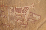
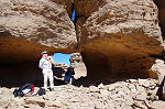
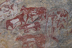
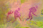
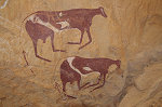
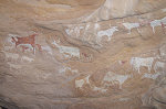
In 2007 Hardy Böckli found a very fine shelter with pastoralist paintings (published in Sahara 19) somewhere in a ravine leading down from the Northern plateau. In November 2009 we did not have time to search for it, but now we had enough time till sunset. The others were in no mood to do any additional unnecessary climbing, they continued towards our planned camp while with Max we tried our luck in the ravine. After a steep climb up the rubble filling the lower parts of the gully, we reached a little terrace where a side-valley joined the main ravine. There were two shelters at either side, a long low one at the left with some very damaged paintings, and a much larger shelter on the right with the bright cattle paintings familiar from Hardy's photos. We made a quick photo shoot of the sites, then hurried after the others, hoping to return on our way down with the entire party.
By the time we caught up with the others and reached the flat plain at the foot of the opposing plateaus it was getting close to sunset, we needed the best part of the whole day to make the ascent. We looked for a suitable bivouac spot in a sandy stretch of the riverbed.
It was a fairly cold night, at daybreak we all cuddled around the small fire for a little warmth before setting out for our objective with just light packs, leaving our camping gear and water for the return at our bivouac.
We started out along the route we already tested in part in November 2009, finding a couple of smaller sites on a large terrace about fifty metres above the level of the plain.
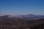
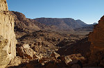
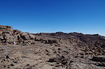
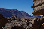
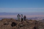
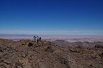
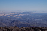
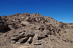
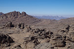
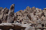
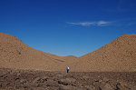
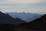
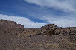
To the west of the terrace the terrain looked passable, rather than a series of vertical cliffs that border the main watercourse of Karkur Talh, to the west the plateau slopes more gently, rising in a series of rock steps. We always found an easy passage between the various levels, finally reaching a boulder filled chute that appeared to lead straight up. It took a little over an hour to stand on the flat top of the plateau, much easier than expected based on our previous experiences on the other high plateaus. From the southern corner of the plateau there was a perfect view over the basin with our bivouac, with the Italia plateau looming behind, and the granite towers of Mt. Bagnold to our right, already well inside Libya. There was a cluster of eroded boulders near the southern edge of the plateau, we thoroughly explored the shelters under them but found nothing. There was another promising area surrounding the high point of the plateau about a kilometre away across a rather featureless dark plain.

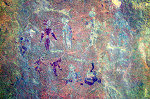
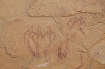
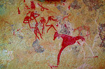
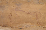
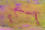
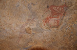
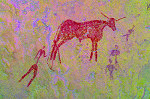
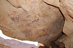
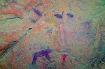
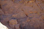
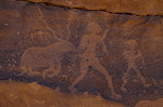
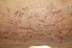
On reaching the central part of the plateau, after rounding a prominent rock tower we came upon a prominent shelter that looked just like a place one would expect to find some paintings. Our instincts proved correct, on entering we immediately spotted some faint but clearly recognisable human figures and cattle, a fairly large pastoralist scene. Up till now we saw no traces of ancient habitation, but all of a sudden here the ground was littered with quartzite flakes and pottery fragments.
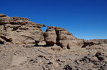
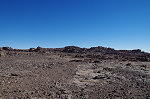
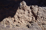
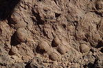
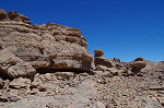
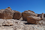
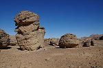
Surrounding the high point of the plateau there was a larger eroded rocky area with a number of shelters, we spread out to explore the area but found no more paintings, despite a number of promising locations. However at one place along the rocks we came upon a strange geological phenomenon, with perfectly round concretions eroding out of a layer of Devonian sandstone. Such concretions are more commonly associated with marine deposits, how they formed in fluvial sandstones remains a mystery.
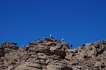
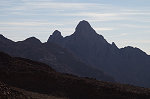
We continued to the high point of the plateau, a clump of rocks on the top of a small rise just reaching above the general level of the surrounding outcrops. Towards the north the plateau already started to give way in a series of stepped terraces, providing an unobstructed view towards Jebel Arkenu in the distance.
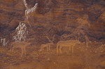
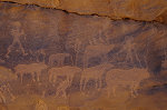
We loitered on the top for a while enjoying the view, then descended to the north east to explore the nearest terrace (we found nothing) continuing backwards along the eastern edge of the plateau, to a large terrace bordered by a low cliff with some promising shelters. We spread out to check out all, Karin and Clemens were the lucky ones to find a series of pastoralist paintings in a low shelter near the middle of the terrace.
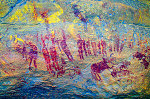
It was not yet midday, we still had plenty of time to explore the plateau top, but the areas with potential were rapidly diminishing. Again we spread out, agreeing to meet at our first rock art site for lunch, and each explored a more distant area of rocks. This time I was the lucky one, descending to a large basin about 50 metres below the level of the plateau top, overlooking the Karkur Talh basin. A number of shelters around the perimeter were found empty, but one very low deep shelter on the western side did contain some cattle paintings. Crawling further in, I found a very fine shelter scene with a number of utensils and accessories hanging above the heads of a family.
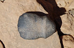
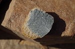
By early afternoon we have thoroughly explored all the potential rocks of the plateau top. We found no more sites, but we have already exceeded all expectations with the discoveries of the morning. After a quick lunch at the first site we re-traced our way on the plateau top to the rocky chute which provided the final ascent. Going down, we could see that the chute made a steep direct descent to the little terrace where Hardy Böckli found the site which we saw with Max the day before. The direct descent looked very steep, with a possible vertical drop mid-way, so we rather re-traced our way up, and re-joined the chute near its very bottom in a small side-wadi. This time there was no time pressure, we could spend a long time checking out both shelters. In the low southern one I found several archaic figures which I completely missed the previous afternoon, while Gabor found a beautiful polished Darfur type axe head made from basalt.
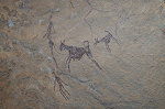
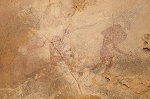
We did not fllow the chute down, but returned via the small side valley to continue down our original ascent route. We found that the side valley led directly down to the terrace with the 2009 sites. With plenty of time available I re-checked the two minor sites at the edge of the terrace, and in the better light I found a very faint scene that appears to be two "Uweinat roundhead" figures (one holding a bow) facing a large animal, perhaps a lion or other large feline on account of the curved tail.
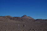
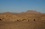
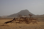
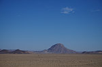
We reached our bivouac by mid-afternoon, with still a couple of hours left till sunset. Some of our party have never visited Libya before, so the proposal to make a short foray across the border on the far side of the plain was met with universal enthusiasm. We set out on the plain towards a pair of hills which turned out to be of basalt, the remnants of ancient volcanoes similar to those in the lower course of Karkur Talh, probably linked to the magma intrusion that created the igneous ring complex forming the western side of the mountain. Making our way in a narrow ravine, we reached another open pain bordered by a high ridge to the west, blocking the view. The "border", the 25th eastern longitude was just on the far side of the plain. A flat stone slab was erected as a marker, and we made a foray of a few metres to the west to acquire the bragging rights of having visited Libya (no small feat in 2019), proven by photos of the GPS screen.
The ridge to the west looked like a rather unpleasant and difficult climb on a steep scree slope, and the members of our border party were not particularly enthusiastic about an attempt, especially after the morning climb. However, there was still over an hour left till sunset, so while the others returned to camp, I made a quick dash up fo the view to the west, into Libya proper. In retrospect the climb was much easier than anticipated, by the time the others disappeared between the two basalt hills I was more than half-way up, in twenty minutes I was on the top. The view was not as spectacular as hoped for, there were still a number of ridges to the west, mostly blocking the view int Karkur Idriss far below in the distance.
With sunset approaching, I made the quick descent following the others back to camp. In the ravine between the two basalt hills I took some rock samples, and on the plain beyond I noted another almost completely eroded volcanic plug that now was almost completely level with the plain.
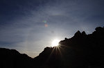
The next morning we started our descent back towards the Karkur Talh base camp, at first following the watercourse until the saddle between the two plateaus, from which point the going was easier along the scree slope and the series of terraces. We were lucky with the weather, with a thin layer of high altitude cloud blocking the heat, and producing a bright halo around the sun.

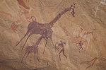
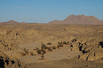
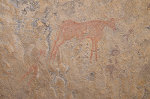
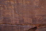
As we descended along the slopes and terraces, we had time to check out a number of large rocks which we always passed by on previous trips. However despite a thorough search, for some time we found nothing other than the sites of Mahmoud Marai (KTW 14/A-C). As we approached the flat topped low plateau bordering the mid-section of Karkur talh, we did come upon an isolated large rock with no perceivable shelter, however much to our surprise there was a panel of giraffe with some miniature style figures on the vertical side of the rock, hardly visible in the direct sunlight.
We continued on the plateau top for a while, then descended into the main valley to visit the cluster of sites which we found during our ascent of the summit of Uweinat in October 2002. We settled down for lunch and a rest at the foot of KTW 12 along the southern side of the valley which I have not seen since the hurried visit in 2002, this time with plenty of time on our hands I could re-photograph the site in high resolution, and as usual the process revealed several new scenes which we missed on the previous visit.
With no time pressure we spent the hottest part of the day resting in the shade and visiting the row of sites on the far side of the valley. These I have seen in November 2004 when returning from the day-trip to KTW 14, and I have done a more thorough job as we found no new sites or scenes.
Mid-afternoon we set out on the last leg of our trek, first climbing out of the valley on the southern side, then continuing along the plateau top to the rounded boulders of the site KTW 11, where we started out with our water cache. In another hour we were in sight of camp, which we reached well before sunset.
Day 9. Karkur Talh
After the three day trek we chose to have a relaxing day, making the short walk in the north western branch of Karkur Talh to the sites found by the 1968 Belgian expedition. As this is one of the richest cluster of sites at the mountain, it was easy to spend the whole day within a few hundred metre radius, visiting and photographing all the shelters and panels.
While the others were busy taking the photos in the principal shelters, I took the opportunity to climb up to the terrace above the valley to the north, where during our November 2015 visit Mark Borda found a few sites among the scattered large boulders with "Uweinat roundhead" and miniature style paintings, and which I have not yet had the opportunity to see.
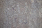
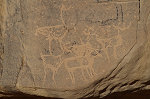
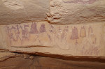
The sites are tightly clustered, with only a few dozen metres between the four boulders, all containing a single panel of paintings, the majority depicting miniature style figures, with a hard to define archaic-looking scene showing an archer with a quadriped and a row of ostriches, the latter very rare in painted scenes.
There were still a few areas on the terrace which looked promising on Google Earth and have not yet been checked out, now I took the opportunity but found nothing new. I returned to the valley by way of the known panel of engraving (KTN 51), which I have not seen since its discovery in October 2005.
We converged in the shade of the principal site for lunch, then continued in the afternoon along the row of sites along both sides of the valley. Mid-afternoon we started walking back to the waiting cars, with the engravings along the northern side of the valley in perfect sunlight.
Day 10. Karkur Talh
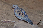
A dove was already seen around the camp in the past days, growing increasingly bolder. As we were having breakfast it merrily wandered about our feet, picking up the crumbs, staying with us for the rest of our stay. It was later identified as a European turtle dove (Streptopelia turtur), the first time I have ever spotted one at Uweinat (however they do cross the Sahara on their migration route, and are known from Egyptian and Libyan oases, so its presence is not surprising).
In the morning we set out to visit the eastern lateral valley of the south branch of Karkur Talh, the site of some of our finest discoveries on the October 2002 expedition.
We spent the best part of the morning going through the chain of sites, some of which I did not have the opportunity to visit for over a decade. The photos, taken this time with far better equipment, reveal a number of hitherto unseen details.
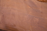
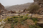
On the return we visited the main sites of the south branch recorded by the 1933 Almásy-Frobenius expedition. Here too dStretch reveals a number of hitherto unseen details. In the main watercourse we noted abundant fresh vegetation, clearly there was a rather substantial but very localised rainfall in the summer of 2018.
After a quick field lunch we continued along the row of engravings (and a few late pastoralist paintings) along the edge of the two rock islands in the middle of Karkur Talh, some of the longest known sites in the valley.
In January 2015 Mark Borda explored the low plateau adjacent to the western bank of the main valley north of the confluence of the main and southern branches of Karkur Talh, and found a number of engravings in a very scenic spot overlooking the main valley among a cluster of eroded sandstone pillars. I have been Waiting for an opportunity to visit them ever since, while the others continued exploring the sites of the main valley I made a quick excursion to the plateau, easily finding Mark's sites at the reported location.
Mark also found a low shelter with some very faint, barely recognisable pastoralist paintings in the same area.

A little further north Mark found some further engravings, along the smooth rocks of the bed of the small wadi leading down to a dry waterfall.

Meeting up with the others in the main valley we finished the day at the unique engraving of the soft-shelled turtle (site KT 22) along the northern bank of the main valley, best visible in the low late afternoon light.
Day 11. Karkur Murr
After two easier days we were ready for another longer walk, this time to Karkur Murr, the main objective being the magnificent site 75 of Winkler (KM 17), which we have found with Liz & Jon Hales in October 2006 after a number of previous futile searches in the general area.
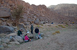
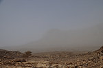
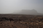
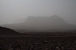
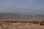
As we were busy photographing KM 17, all of a sudden the cliffs of the Hassanein plateau started disappearing in a haze, and by the time we continued to the spring in the lower part of the valley everything turned a gloomy dull grey with the onset of a dust storm. We found the spring of Ain Murr deserted, with abundant water both at the main source and along the series of shallow pools below.

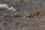
In the unpleasant weather we only did a little exploration around the spring. One feature I have not recognised before was a large eroded slab of rock just upstream of the palm grove below the spring. We always crossed it presuming it to be just sandstone like the surrounding rocks, however this time I noticed the pitted and eroded surface that does not occur in sandstone. Knapping the weathered surface revealed a bright white rock underneath. I first thought it might be some limestone (which would finally explain the source of the carbonates in the noted spring and wadi deposits), however testing back home revealed it to be some light coloured igneous rock, most probably trachyte. This hard impermeable dyke is the likely explanation for the location of the spring so high up the valley. The rock slab was also the home of a rather friendly desert agama (Trapelus mutabilis) which readily posed for the photographs.

By the time we started walking back along the old camel trail to our camp in Karkur Talh, the dust storm started showing some signs of abating. While the Hassanein plateau was completely invisible in the early afternoon, it started coming into view as we passed it. After the long walk we reached camp at dusk, with the summit of Uweinat just discernible in the haze.
Day 12. Karkur Talh
By the next morning all traces of the dust storm dissipated, we awoke to a fine clear morning. After the long walk the day before, we were planning a more relaxed day as our last one in Karkur Talh. In the morning we made the ascent to the large dry guelta we found in October 2002 with the major pastoralist site (KTN 27) and the cluster of others around it.
In 2009 Jean Barnard and party found a shelter with fine pastoralist paintings on the ceiling and rear wall somewhere to the north of the dry guelta, but have not marked the exact location. In November 2015 we have looked for it in vain (but did find some of the reported engravings), this time I set out to look in the only remaining unexplored area just to the north east of site KTN 27, behind the hill of the shelter with the cluster of stone circles on top. After some searching finally I did find the site, which turned out to be not one, but two adjacent shelters, one with the fine ceiling paintings, the other with the dense cluster of scenes on the low rear wall.
Prior to returning to camp for lunch, we finished the morning with the lovely miniature style site of KTN 31, a short walk from the main valley.
Several of our party decided to have a lazy afternoon in camp, the rest of us set out for a last short exploration of the plateau to the east of our camp. We started at the cluster of sites found in October 2002, but the country between them and the north-western branch of Karkur Talh remained unexplored.
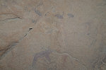
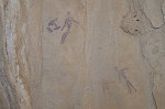
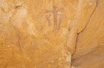
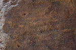
At first we found nothing promising, the whole area was a gently undulating country with few outcrops and no shelters. Then we came upon a very small hole in the side of a shallow valley that seemed a very unlikely spot for any rock art. At first it did appear empty, but then I noticed a row of very faint and unusual small yellow figures on the rear wall, quite unlike anything we have seen before at Uweinat.
Day 13. South-east Uweinat
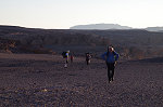
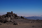
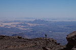
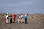
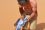
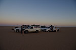
We planned to spend our last day at Uweinat visiting the south-eastern part of the mountain. After packing camp in the morning we set out along the track leading out of Karkur Talh towards the southern side, stopping at the top of the dune to take our group photo. It was again a windy and hazy day, the panorama was not as spectacular as expected with Jebel Kissu completely lost in the haze. However Max took care of the entertainment, bringing along the large huntsman spider (Eusparassus laevatus) he caught under his tent in Karkur Talh. At first the spider patiently posed for the photos, but then thought better of it and ran for the nearest shadow which happened to be me, dashing up my leg and disappearing in my shirt. The subsequent impromptu strip-tease show caused much amusement among the unaffected.

In 2015 Mark Borda found a number of interesting shelters with paintings among the low foothills of Uweinat to the north of Ras el Abd, an area that was never properly surveyed before. Our morning targets were these sites, accessible from a small valley facing the volcanic lump of Ras el Abd (Bagnold's "Chunk hill").
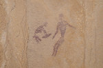
After climbing up a sandy slope and crossing a ridge, we soon reached the principal site of this cluster, a large north facing shelter with a number of faint paintings, the most interesting ones done in the miniature style. There is also an unusual large slab in the shelter with two cupules with draining channels, the only known example of such features at Uweinat (though a few others are known from the Gilf Kebir).
Not far from the large shelter there is a second one perched at a rather uncomfortable location above a steep talus slope, with hardly any flat space in the shelter itself. Nevertheless there is a fine miniature style scene on the rear wall, and several other scenes in red and yellow paint, also human figures but their stylistic affinities are not clear.
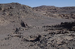
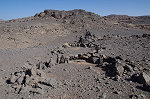
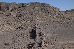
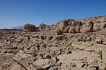
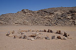
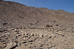
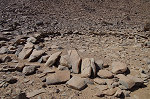
For lunch we moved to the valley adjacent to Karkur Murr, named Karkur Delein by the 1968 Belgian expedition. While some elected to take a short rest, I took the opportunity to visit a nearby site with some engravings and two exceptionally large stone circles which were found by Mahmoud Marai in 2007. The stone structures made of large basalt slabs (which outcrops locally) are around 10 metres in diameter, are large enough to be clearly visible on Google Earth. They appear to be hut circles but of an exceptional size, I know of no other similar structures elsewhere in the region.
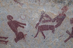
In the afternoon we walked up Karkur Delein to visit the splendid site originally found by Aggelo Pesce, an Italian geomorphologist in the early sixties, re-discovered by Mark Borda in 2007. This site was published by Graziosi in 1962 however the photo was attributed to Karkur Idriss, where we searched for the site in vain several times.
During our November 2009 visit to this site I noted an interesting unique scene at a now inaccessible location to the left of the shelter, with a group of archers attacking a cattle-like animal, possibly an aurochs. Lacking a telephoto lens the photos I took at the time were not very good, one could just make out some darker shapes. Now with much better photographs (and dStretch) it is possible to make out a large group of archaic figures above this scene.
After checking out another rock with engravings that Mark found at the same time, we returned down along the valley towards our camp. The watercourse was full of fresh vegetation after the rains of the previous summer. We noted a number of still flowering parasitic Cistanche phelypaea plants, a clear sign of abundant flowing water.
While we were in the valley the wind subsided and Jebel Kissu reappeared from the haze, we had a lovely calm sunset and evening. Moez, who left after lunch with the pickup to the gold-miners' village to get some more fuel also returned safely, he was lucky to reach the village just as a truck from Libya arrived, and he immediately commandeered a 200l drum of diesel, solving our fuel concerns.
Day 14. Uweinat - Selima Sand sheet
With our time up, we packed camp at sunrise and set out on the long journey towards the Nile and Khartoum
Soon after leaving Uweinat the "buffalo" had a flat tire (the only one on the trip), that gave us a good excuse to take a couple of parting shots of Kissu and Uweinat in the fine morning light.
Not much interesting happened for the rest of the day, we drove almost continuously along the sandy plain east of Uweinat, reaching the Selima Sand Sheet by the afternoon.

Day 15. Selima Sand sheet - Soleb
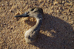
Our camp was on the completely featureless sand plain, the only object of interest we could find were the mummified remains of a migratory Northern pintail duck (Anas acuta). Again we broke camp at sunrise and continued on our way towards the Nile.
As we progressed along the Selima Sand Sheet, the Hi-Lux started showing signs of trouble. The engine lost power intermittently, and could not keep up with the rest, requiring frequent stops for it to catch up. Finally the engine stopped altogether, and while it could be revived a few times no amount of troubleshooting could find the source the problem. Finally we took it into tow, the now empty buffalo could easily manage on the smooth hard sand.
Once we reached the undulating rocky ground interspersed with patches of soft sand, the going became much more difficult. It quickly became clear that at this pace it would be impossible to reach Soleb by nightfall, and with our outbound flights the following night any delay was not an option. After some discussion it was decided that Moez will stay behind with Amara and Nazar to tow back the Hi-Lux to the road over the remaining 150 kilometres, while we would continue with the three landcruisers to Soleb, with Moez sending hourly messages on their progress over the Thuraya satphone. We reached Soleb by dusk, while the others finally made it to the road by 11pm, and were at the Soleb resthouse by midnight, a rather spectacular feat given the distance to be covered, much of it in darkness.
Day 16. Soleb - Khartoum
We had another early rise as we needed to reach Khartoum by the evening, with a beautiful sunrise spectacle over the Soleb temple. Nazar stayed behind with the Hi-Lux to have it fixed (it turned out later that the electronic fuel injectors became clogged with the low quality Libyan fuel Moez bought at Uweinat) while the rest of us started out on the full day drive back to Khartoum, reaching the regency hotel by the early evening.
Assuming that the conditions in Sudan remain favorable, the next expedition to Jebel Uweinat from Sudan is tentatively targeted for March 2021. Please visit the planned itinerary page for more details, to be updated as new information becomes available (or "like" the FJ Expeditions FaceBook page to receive notices of news and updates).