
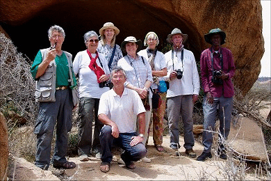
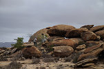
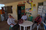
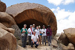
 Click on image for list of participants |
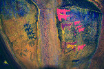
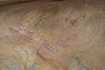
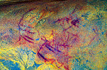
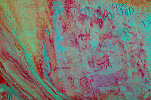
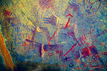
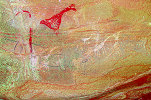
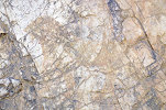
Somaliland and Bir Nurayet (Sudan) 13th February - 1st March, 2019 False colour images processed with DStretch, a freely available software developed by Jon Harman |
The quick exploratory visit to the amazing rock paintings of Laas Geel in 2017 showed that the sights and conditions warrant a longer visit. We returned to make a 6 days circuit of the most important rock art sites in the Western part of the country, the highlight being a visit to Laas Geel. This trip was combined with a nine day expedition to the remote but wonderful engravings of Bir Nurayet in the Red Sea Hills (Eastern Desert) of Sudan.
Day 1. Addis Ababa - Hargeisa
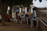
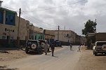
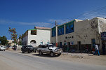
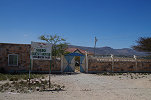
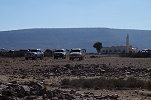
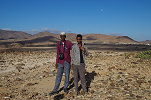
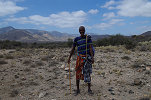
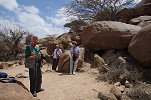
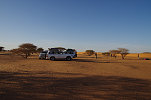
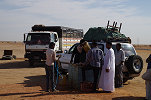
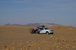
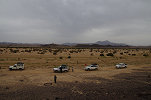
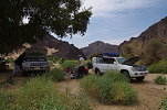
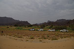
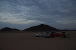
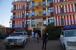
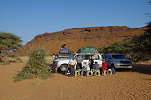
Our party converged on Addis Ababa from various corners of the world, some arriving early morning, some the day before. By mid morning everyone reached Addis safely, instead of waiting at the not particularly pleasant airport we spent the time at the much more inviting lobby of the nearby Jupiter International hotel, where the early birds stayed for the night. Our short flight to Hargeisa was in the mid-afternoon with Ethiopian Airlines, by the time we went through the arrival formalities and reached the Ambassador Hotel in Hargeisa the day was pretty much over. In the hotel we met Mohamed Abdi Ali, who almost single handedly completed the archaeological survey of Somaliland, and recorded a number of rock art sites and ancient monuments which were not known previously. It was a privilege to have Mohamed as our guide for the next six days, with his knowledge we could expect to see much more than what we could have hoped for. With most of our party feeling rather tired after the long overnight flights of the day before we all retired early after a quick dinner.
Day 2. Dhagax Kureh - Dhagax Marodi - Derbiyo Caddo
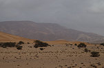
With a full day ahead, we made an early start form our hotel, under a rather gloomy grey sky and an unexpected rain shower which was strong enough to make the ground wet.
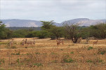
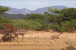
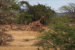
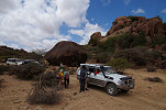
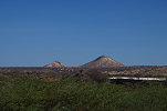
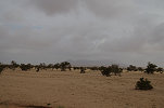
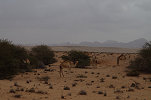
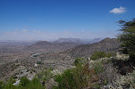
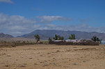
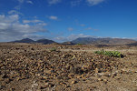
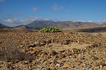
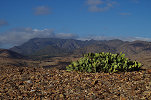
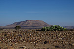
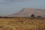
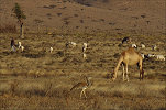
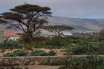
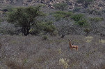
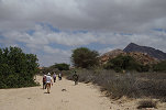
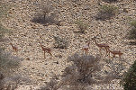
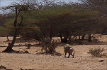
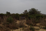
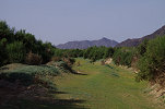
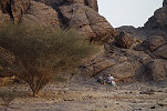
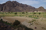
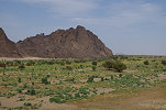
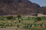
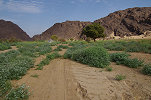
Heading towards the west, our first target was the rock art sites of Dhagax Kureh about 40 kilometres from Hargeisa. First we followed the main road leading to Djibouti, then turned off towards the north along a fairly good track. As we approached the site, we spotted a large herd of Northern Gerenuk (Litocranius walleri ssp. schlateri). They remained fairly still looking at us with curiosity rather than alarm, I could manage to get quite close to them in the cover of the low acacias.
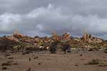
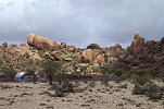
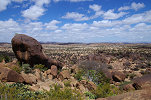
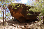
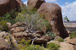
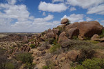
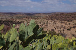
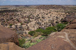
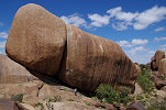
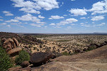
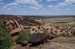
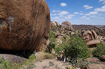
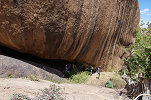
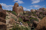
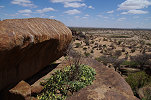
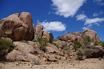
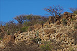
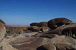
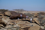
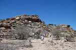
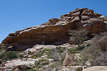
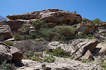
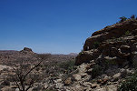
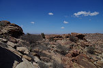
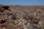
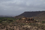
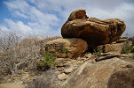
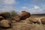
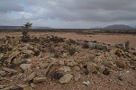
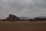
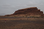
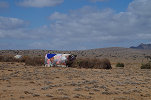
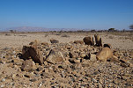
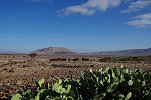
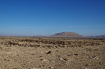
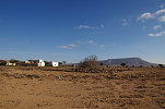
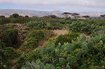
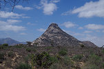
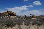
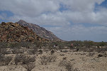
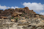
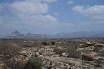
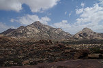
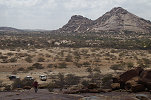
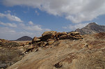
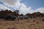
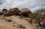
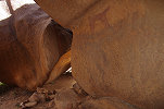
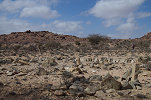
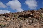
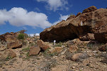
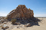
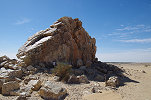
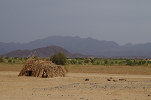
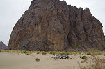
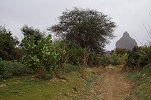
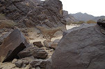
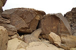
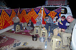
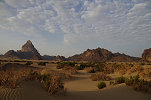
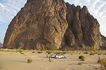
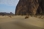
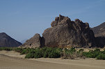
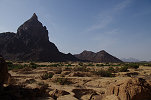
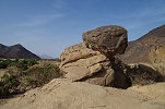
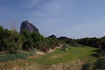
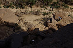
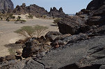
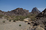
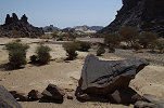
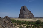
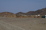
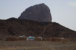
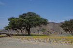
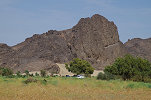
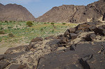
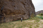
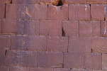
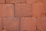
Dhagax Kureh is (like Laas Geel) a group of sites, located among a group of spectacular granite outcrops with the classic rounded boulders, a familiar sight in many parts of Africa. The landscape and vegetation showed a remarkable similarity to the Erongo region of Namibia. Leaving the cars behind, we made the final approach on foot among the low shrubs. This was inhabited country, nearby there were small enclosed fields and animal pens with small homesteads with the colorful fabric covered traditional huts.
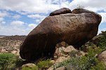
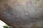
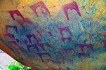
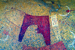
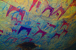
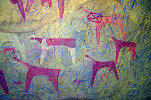
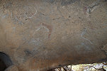
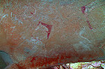
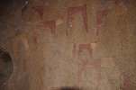
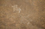
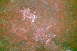
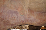
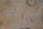
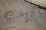
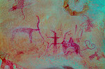
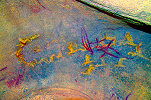
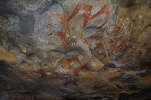
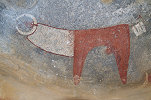
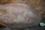
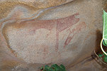
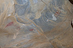
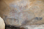
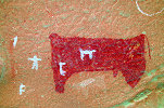
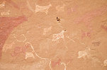
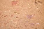
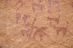
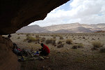
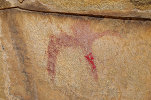
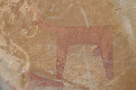
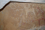
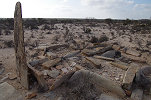
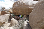
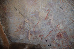
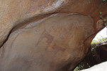
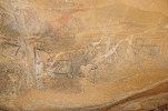
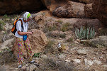
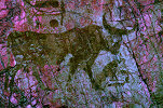
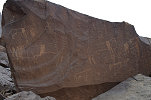
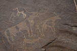
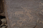
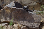
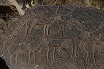
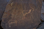
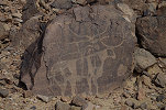
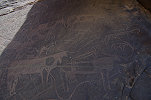
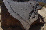
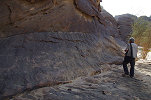
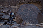
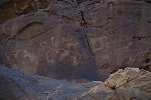
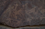
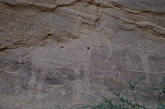
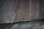
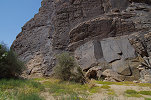
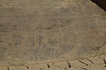
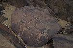
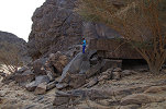
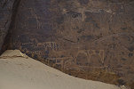
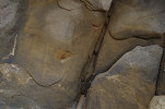
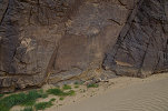
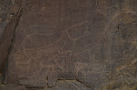
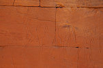
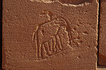
The first site was located near the base of the most prominent cluster of rocks, in a narrow shelter formed at the rear of a large boulder. The paintings at this site are very different from the abstract cattle of Laas Geel, on first look all appear to depict humped zebu cattle (indicating a relatively young age), but at the left of the shelter there are some much older scenes, including a large unclear animal (apparently also a cattle without hump) in red.
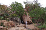
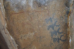
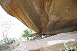
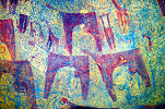
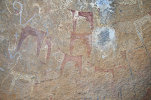
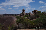
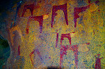
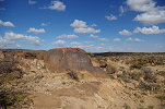
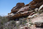
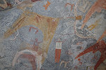
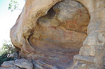
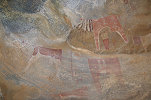
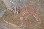
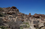
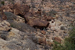
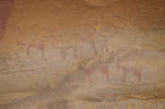
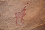
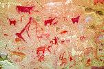
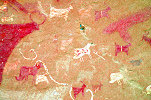
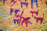
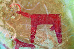
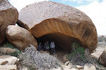
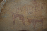
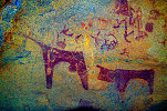
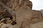
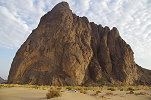
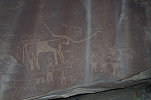
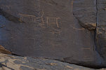
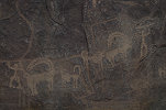
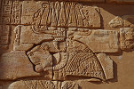
The second (principal) site was at the rear of the granite hill, some way up the hillside, in a large spacious shelter located under an enormous boulder, very reminiscent of many rock art sites on the Brandberg in Namibia. The scenes here are mostly the striking cattle in the abstract Somali style - prior to the discovery of Laas Geel this was the largest and best preserved site of this peculiar style. However while at Laas Geel there is just a single giraffe among the thousands of figures, here there are multiple giraffe mingled with the abstract cattle and human figures. The giraffe appear to be o the same tone and degree of weathering as the cattle, however one giraffe is clearly superimposed over one of the larger abstract cattle.
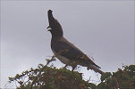
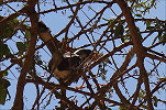
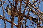
Despite the seemingly tranquil setting the site turned out to be a rather noisy one, with a pair of large birds hidden in the upper foliage of an adjacent dense tree making an awful rattle. Sneaking around the tree I could catch a glimpse and take a good photo of one of them before it zoomed off into the valley - they were White-bellied Go-Away-Birds (Corythaixoides leucogaster), later we saw many all around the country.
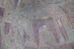
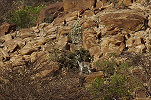
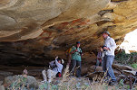
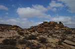
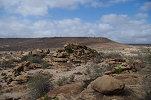
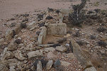
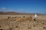
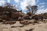
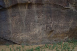
For most visitors the trail ends here, as only these two sites are generally known (but neither had been published, though a 3d documentation project included the principal shelter). Having Mohamed as our guide permitted a visit of the lesser sites scattered about the granite hill. The first one was just a few dozen metres above the main shelter, with a couple of the well known abstract cattle. Not far, there was another huge shelter formed among the granite blocks, with plenty of signs of prehistoric habitation, but strangely no rock art anywhere on the walls or ceiling.
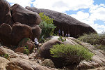
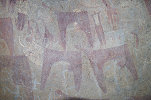
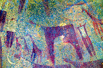
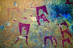
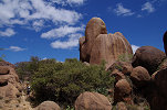
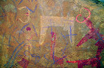
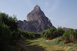
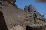
Another rather impressive site with a panel of abstract cattle and human figures is located almost on the top of the granite outcrop in a rather uncomfortable narrow shelter under a huge rounded boulder overlooking the hilly country to the north. Despite the fine well preserved paintings, I have never seen any publication that mentions this shelter.
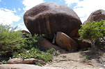
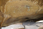
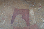
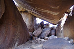
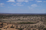
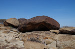
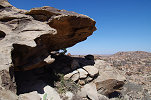
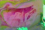
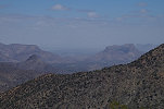
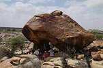
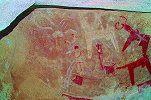
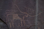
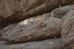
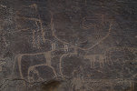
At the other side of the granite outcrop there was a long but rather shallow shelter under an enormous boulder, again very reminescent of rock art site settings on the Brandberg. The shelter itself only contained two white figures, one a small and rather crude giraffe. The other appeared to be an elephant on the scene, but a good second look with DStretch makes it clear that it is in fact a humped cattle. The most spectacular aspect of the site is the scenery, with a clear view towards Hargeisa, just visible on the horizon.
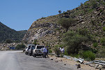
Mohamed told us that there were many more small sites scattered about the region to the north in the other granite hills, but reaching them involves several hours (or even days) of walking in the road-less country. However we have seen all the sites at this cluster, so we returned to the cars which came around to meet us on the southern side of the hill.
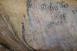
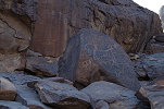
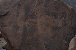
Returning to the main road we drove another twenty kilometres west till the town of Gebilay, where we had lunch at the restaurant of a very pleasant roadside hotel, then continued to the rock art site of Dhagax Marodi along the northern outskirts of the town. This locality contains only a single engraved panel, unfortunately much defaced by modern graffiti done in the past decades. However it is absolutely unique, with a clear large depiction of the Somali style abstract cattle, the only one known that is not painted.
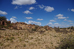
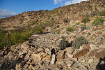
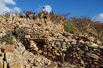
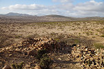
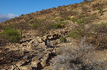
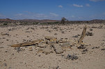
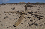
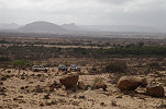
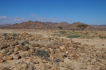
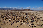
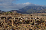
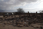
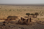
To finish the day, Mohamed took us to the ruined ancient town of Derbiyo Caddo, about forty kilometres further west of Gebilay. The ruins were spread along the side of a series of low hills, with circular buildings and several long walls running up the hillside, suggesting fortifications. Strangely there was very little surface archaeological material, in the whole vast area I have seen a single potsherd and a few crude stone flakes. The dry stone masonry gave no clue to the period, according to Mohamed an initial survey he did with a Spanish team suggests an age of 2-3 thousand years.
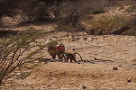
As we wandered about the ruins, we stirred up two Klipspringer antelopes (Oreotragus oreotragus), but they were not very shy, after dashing up some distance up the hill they stopped and stared at us curiously, apparently they are not much bothered by humans.
With the sun getting low, we returned to the cars to drive back to Hargeisa for the night, reaching the Ambassador Hotel after sunset.
Day 3. Hargeisa - Laas Geel - Berbera
With another early morning start we left Hargeisa after checking out of our hotel, this time towards the west, passing the double conical hills dominating the city skyline.
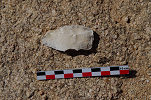
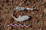
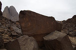
Before reaching Laas Geel we turned off the main road onto a rough track, which we followed for a couple of kilometres before continuing on foot towards a low granite ridge. Along the way the ground was littered with well-made flint tools, a strange material to be found in the granite country - it must have been imported from the limestone hills which may be found dozens of kilometres away.
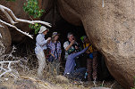
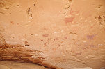
On the far side of the ridge a shelter under a low boulder contained a number of faint paintings, apparently a multiple succession of several styles, all fairly hard to make out. Mohamed called the locality Dhagax Ooman, which he found when surveying the Laas Geel area for more sites.
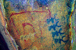
Nearby there was a second shelter, with some better preserved and more interesiting paintings, including a number of white figures, and some strange shapes which at first appeared to be some form of writing, but they are in fact a row of small animal figures.


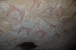
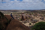
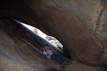
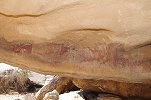
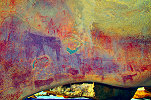
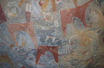
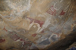
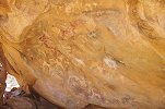
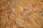
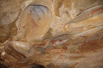
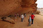
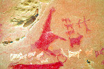
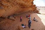
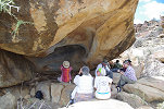
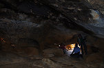
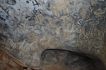
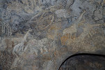
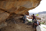
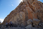
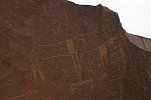
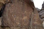
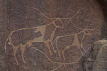
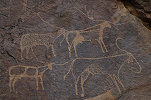
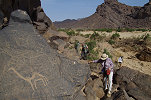
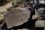
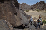
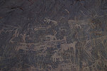
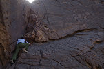
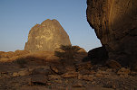
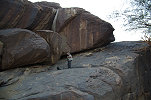
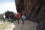
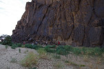
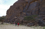
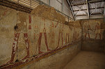
We returned to the cars and covered the remaining short distance to Laas Geel, the principal rock art site of Somaliland, and really the main reason for our trip, with all others just being add-ons. There was a visible change at the site since our visit in late 2017, there was now a robust primeter fence encircling the entire hill, fortunately far enough that it was not disturbing in any way. Following the built path we ascended the stairs to the first (and main) shelter, and settled into gazing and photography mode under the amazing roof full of vividly coloured cattle and other figures.
In December 2017 when we made our exploratory trip with Magdi I have photographed most of the sites in full, this time I wanted to focus on details which I have missed. While our party continued along the row of principal sites with Mohamed, I scrambled over to the side of the hill to Shelter 8, which I have only visited hurriedly towards the end of our last visit. Aside the panel I have seen, I did find some further fine paintings at the very end of the shelter, partially obscured by vegetation, which I completely missed before.
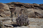
Mohamed told me that if I crawl past the magnificent Shelter 9. along the narrow precarious ledge, there will be some more paintings in the subsequent niche. The spiny cacti at the bottom of the drop made me think twice, but ultimately I did find the missing panel, though to be fair not a very exciting one, especially in comparison to the adjacent magnificent scenes.
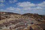
After the initial excitement we all spread out among the various sites to avoid being in the way for each other in the small shelters, busy photographing all the scenes and details for several hours.
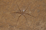
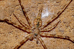
Finishing off at the left side of shelter one, I spotted a strange spider above one of the panels of a kind I have never seen before, with seemingly only six legs (in reality eight, but the third pair are much reduced in size). It was subsequently identified as a long-spinnered bark spider, most probably a Hersilia species.
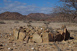
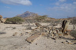
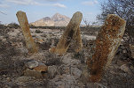
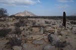
As we left Laas Geel after lunch, we passed the first of a peculiar kind of stone monument, of which we saw many more as our trip progressed. It was a cruciform stone structure with originally upright tall stones at each end, of which here one was still standing. Mohamed suggested that they are Christian tombs from the period when the area was under the influence of the Axum kingdom, but there have been no documented excavations to confirm this.
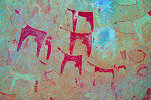
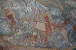
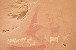
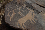
After driving along the main road towards Berbera for about thirty kilometres, we turned off the road again to approach the edge of a low plateau, where a number of granite outcrops were visible from a distance. This was the locality of Dhagayho Gobaad, another rock art site found by Mohamed during his foot surveys. The first shelter on the top of the largest hill contained a very well preserved (and fairly recent) panel of humped cattle and human figures. The paintings in the second shelter at the next hill were more difficult to make out, they appear to be a giraffe and several other animals in a very simple stick figure style.
As we returned to the cars and drove back towards the road, we passed a rectangular stone structure, the ruins of an ancient building. The small niche on the side facing Mecca clearly identified it as an old mosque, likely from the very early period of Islamic conquest.
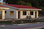
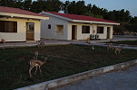
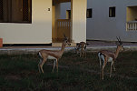
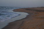
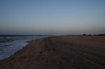
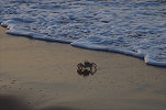
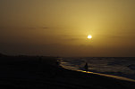
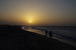
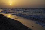
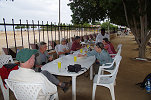
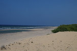
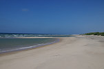
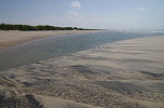
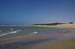
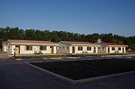
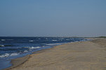
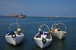
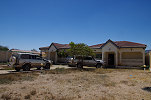
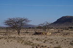
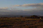
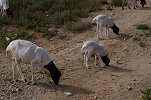
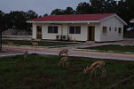
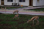
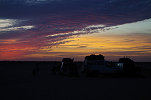
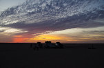
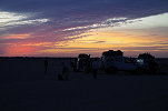
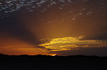
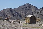
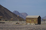
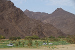
We reached Berbera by late afternoon, going straight to the Mansoor Hotel outside town along the coast. It turned out to be a rather pleasant place with small bungalows and a herd of tame Dorcas gazelle in the garden. We finished the day on the perfect sandy beach just outside the hotel, watching the ghost crabs and the sunset until it was time for dinner.
Day 4. Dhambalin
Morning entertainment was provided by a rather noisy flock of House crows (or Indian crows, Corvus splendens), perched on the hotel fence and the surrounding trees, looking for any opportunity to snatch something from the breakfast table. They only retreated to a safe distance when one of the waiters approached with a slingshot, otherwise they merrily hopped about just outside arm's reach.
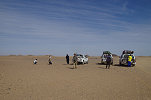
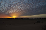
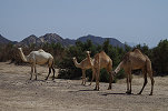
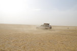
The day's target was the rock art site of Dhambalin, about 50 kilometres to the East of Berbera. We set out along the un-surfaced but quite well built track leading east, entering a country very different from what we have seen in the previous days. First we crossed a number of major wadis crossing the coastal plain, then as we moved away from the shore the landscape distinctly turned to a true desert, with camels and sand dunes appearing as we approached our destination. One very conspicuous feature was the constant row of cellphone towers along the route, we had constant coverage throughout the trip, a far cry from the perceived remoteness of our travels.
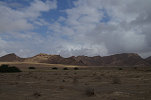
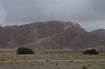
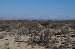
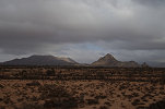
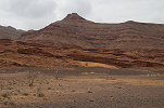
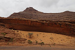
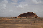
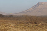
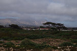
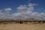
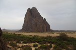
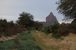
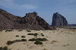
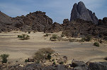
As we approached Dhambalin, the limestone hills gave way to a yellow sandstone country, remarkably similar in appearance to several areas of the Sahara, with a number of isolated hills dotting the barren landscape.
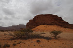
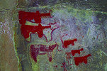
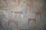
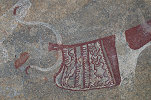
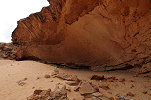
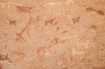
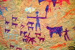
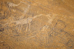
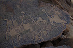
The paintings are located in a huge shelter at the base of one of the outcrops, sheltered by a large dune in front of it, again recalling many of the Saharan sites. There are paintings located throughout the shelter, but the main concentration is at the left end. The style is very different from the paintings we have seen before, with a mix of wild animals (including giraffe and ostrich), cattle and more importantly sheep, the only such depictions in the rock art of the Horn of Africa. They date to a slightly later period than the abstract cattle of Laas Geel and elsewhere.
We lingered at the site for the rest of the morning, taking in all the fine details and the superb view from the location. It is somewhat strange that there are no other sites in the area, we passed several suitable-looking shelters along the way and Mohamed told us they were all empty - he spent several weeks in the area surveying every outcrop, and found nothing else in the whole region.
We drove back along the track towards Berbera along the limestone escarpment to find a suitable spot for lunch in the shade of one of the sandstone outcrops, again a very fine shelter but with no signs of any ancient human occupation.
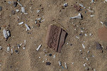
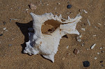
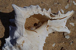
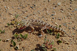
On our return we took a different route, making a perpendicular approach to the coast along one of the wadis, to visit the rather meagre remains of a medieval port city of Bender Cabaas a short distance to the west of our Berbera hotel. Not much remains to be seen other than a few wall foundations, with broken ceramics and heaps of mollusc shells littering the ground. I spotted a small movement under a nice snail, picking it up I found it inhabited not by the expected hermit crab, but a tiny gecko blinking back from the shell.
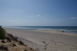
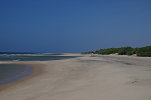
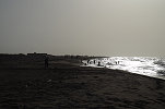
Next to the ruins there was a beautiful deserted white sand beach stretching to the horizon in both directions, but quite hard to access with a dense thicket of a rather mean invasive acacia species (Prosopis juliflora, originally from Mexico, introduced in the last century by the British colonial administration with the benign intent of stabilising the coastal dunes) with huge thorns along the entire coast.
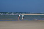
Mid-afternoon we returned to the hotel, some taking the opportunity to have a dip in the ocean at the adjacent beach.
Day 5. Berbera - Sheekh
In the morning before heading inland we made a short tour of the old town of Berbera.
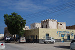
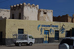
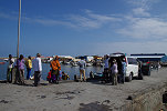
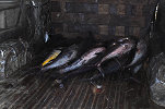
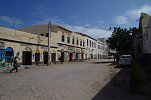
In all fairness there is not much to see in Berbera, the most interesting sight was the old fishing port, which we were permitted to see only after a lengthy haggling session between Mohamed and the security guards at the gate. Probably we were rather late as there was not much activity, only one boat was unloading the catch of the day, a good load of yellowfin tuna (the same as we had for dinner the previous evening in our hotel) into a waiting truck.
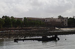
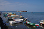

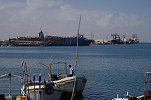
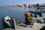
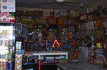
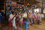
The port is surrounded by a cluster of fish merchants, and a single building supposedly dating back to Ottoman times, which is now just a facade with the rear a heap of collapsed ruins. There were a host of little stores selling everything from fly paper to scuba gear, a perfect place to stock up on our road supplies.
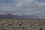
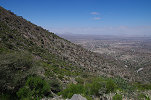
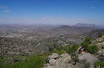
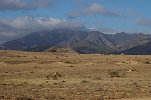
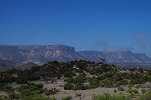
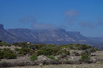
From Berbera it was a sixty kilometre drive south across the coastal plain until we reached the edge of the escarpment, with a winding road making a slow ascent towards the top, with increasingly dense vegetation and a spectacular view.

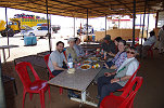
The small but unexpectedly neat town of Sheekh was just a few kilometres beyond the top of the ascent, with an impeccable guest house where we planned to spend the night. After settling in to our rooms we took a quick lunch at one of the many small roadside restaurants before continuing to sites on the plateau beyond.

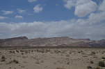
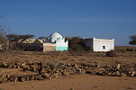
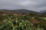
The limestone plateau beyond Sheekh presented yet another face of the country, very different from the typical African granite and shrub landscape around Hargeisa and the semi-desert of the coastal plain. Here there were numerous small hamlets with the characteristic colorful fabric covered huts, set among worked fields in a landscape that reminded me of Syria or central Iran.
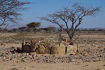
Our destination was the village of Gidhdhays about 30 kilometres to the East of Sheekh, a good hour and a half along the winding and bumpy track. There are some rather meager ruins of large (probably medieval) settlement beside the modern village, but the more interesting sights are two well built circular stone monuments, most likely tombs from a much greater age.

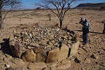
On the return we stopped at a ridge that was practically covered by a row of circular tumuli. It is rather difficult to place any timescale beside such structures. There are several clearly recognisable basic mosques next to the tumuli, but their association is doubtful. There is another rectangular structure with a megalithic doorway in the centre of a large stone circle, very different from the clearly medieval mosques.
Further along the track back towards Sheekh we passed a small marabout (tomb of a holy man), and a short distance further we spotted a pair of Salt's dik-diks (Madoqua saltiana) near the road.
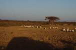
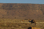
Before reaching the junction with the main road we passed a field filled with grazing camels and sheep, and amongst them two large birds that turned out to be Kori bustards (Ardeotis kori), apparently not particularly bothered by our presence and approach.
With all the halts along the way it was sunset by the time we reached the road, continuing for the remaining few kilometres to Sheekh for the night.
Day 6. Sheekh - Dhaymoole - Berbera
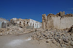
In old British times Sheekh used to be the hill station retreat of Berbera (the administrative capital of British Somaliland) in the unbearably hot summer months, when the altitude and breeze made all the difference. In the morning we took a walk around the town and its outskirts, with the extensive but very overgrown ruins of Fardusa, the medieval predecessor.
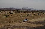
Re-tracing our previous day's route we descended from the escarpment, and soon left the surfaced road following a very rough track leading to the West. The country appeared uninhabited, but as soon as we stopped for photos a man approached, asking in a very polite and friendly manner if we would do the favor for him and deliver the big bundle of Khat he was carrying to his relatives in a small village down the track.
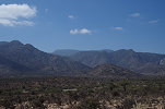
Continuing along the track, approaching the granite hills of Dhaymooleh, we spotted a pair of gerenuk in the bush, this time they did not run away but looked at us with curiosity. This area was the only where we saw some remaining traces of the civil war - in places the track was marked out on both sides with ble painted rocks. Mohamed confirmed my suspicion, indeed they indicated mined areas, where it would have been rather unwise to leave the marked road.
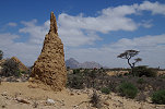
After a good hour on the track we reached a large boulder with an adjacent prominent termite nest, one of the minor rock art sites known to Mohamed. At first look there was only a single recognisable cattle, but a close scrutiny revealed more paintings under the modern charcoal inscriptions (probably dating to the civil war).
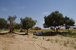
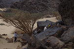
While the hills of Dhaymoole were continuously visible a a seemingly short distance, it took over another hour to approach them along a series of narrow zigzagging tracks leading to various small hamlets. We stopped in a dry sandy riverbed, and after a quick lunch set out on foot towards the nearest of the hills, towards a large prominent boulder on its lower flanks.
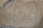
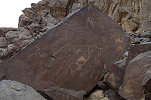
Under the huge rock there was a cavity with a domed ceiling, which was covered with a fine panel of the typical Somali abstract cattle and associated human figures.
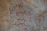
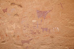
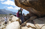
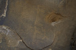
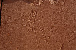
Returning to the cars we continued in a wide loop to the far side of the hills, then along a very rough track to the interior. Only when we stopped after a good half an hour did we realise that we were just a few kilometres from the previous site, probably it would have taken less time walking. Reaching the second site required climbing series of smooth granite plates to a cluster of rocks on a low ridge. The site under the largest boulder was almost a true cave, with only a single entrance for both people and light. The ceiling was covered with what appears to be a proto-script, as well as several white depictions of giraffe and other unrecognisable animals.
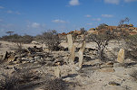
On our way in we already passed a large field of ancient tombs (?) marked with large standing stones, now we stopped to investigate. Some had the same cross shape as the one we have seen near Laas Geel, others were an indistinct mound with similar four rock pillars. There also were a number of classic Islamic style tombs with a low rectangular or oval structure marked with a standing stone on both ends.
With all the places to see and the slow going it was close to sunset by the time we reached the main road along a number of smaller tracks, settling in once again to the now familiar Mansoor Hotel.
Day 7. Berbera - Dhagax Nabi Galay - Hargeisa
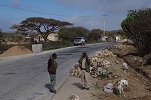
In the morning we left our pleasant hotel for the last time, taking the road towards Hargeisa, only stopping at the outskirts of Berbera to fuel. It only now registered that throughout our trip our drivers never used any cash to pay at shops or gas stations, astonishingly every merchant including the roadside tea ladies were set up to accept mobile payments.
As we left Berbera the sky slowly changed to a leaden grey, and soon we were caught in a rather heavy squall, requiring wipers for driving, and forming puddles on the road and on surrounding firmer ground. However as we reached inland the clouds thinned and soon all traces of rain disappeared. After driving for an hour we passed the turnoff to Laas Geel, and soon afterwards we left the road in the opposite direction to the last unvisited major rock art locality, Dhagax Nabi Galay, about fifteen kilometres further.
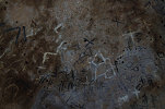
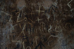
The first shelter is located under a flattish boulder with a single entrance (very reminiscent of the second shelter at Dhaymoole), and only contains a series of symbols which, while undated, are considered the oldest known script in the broad region.
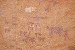
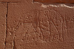
The second shelter is not far, with two separate series of paintings in the large shelter at right and among the smaller rocks on the left. All the depicted scenes show the typical abstract cattle with a number of more recent superpositions.
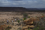
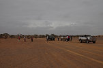
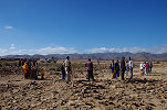
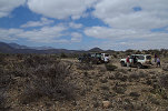
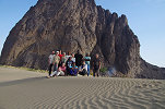
The place provided a perfect opportunity to take our group photos, a rather lengthy affair until we could gather all the drivers and security detail, with the site guardians thrown in for good measure.
On the way back we encountered another herd of gerenuk, and a bit later a large band of hamadryas baboons (Papio hamadryas) which crossed our path and quickly disappeared in the bush.
We had lunch in a large dry riverbed adjacent to a lush eucalyptus grove, clearly a former plantation pre-dating the civil war. The trees flanking the river were full of noisy birds, among the many we spotted we could identify several go-away-birds (Corythaixoides leucogaster) and an eastern yellow-billed hornbill (Tockus flavirostris).
Before returning to Hargeisa we visited one last site discovered by Mohamed in the vicinity of Laas Geel, requiring a roughly one kilometre walk from the cars. Along the way we found a very large rodent mandible, later identified as a crested porcupine (Hystrix cristata).
The prominent shelter we were aiming for was in the side of a granite ridge, with several white and red depictions of giraffe and some other unclear animals.
On our way back to the cars we found the empty shell of a Leopard tortoise (Stigmochelys pardalis), the second largest mainland tortoise (the giant ones are all island species) prevalent all over eastern and southern Africa.
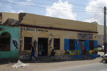
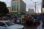
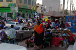
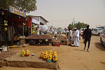
We reached Hargeisa before sunset, we made a quick round of the downtown area and the spice market before going to the Ambassador Hotel.

Day 8. Hargeisa - Addis Ababa - Khartoum
This day was all about traveling. In the morning we went to Hargeisa airport just a short distance from our hotel to catch the midday Ethiopian flight to Addis Ababa, where we said farewell to Donatella and Roberta who only joined us for the Somaliland part. The rest of us took a connecting flight to Khartoum in the late afternoon, staying in the Regency Hotel for the night (which did not get any better since our last stay...).
Day 9. Khartoum - Meroë
Rosa, Santi & Natalie joined us in the small hours of the morning, and by 9am we were ready to start, Moez having loaded all the cars the previous evening. As we rolled out of town everything appeared normal, people went about their business, the only visible signs of the brewing political troubles were the long queues at the few open fuel stations. Moez already secured our fuel supplies well in advance so we just drove past on our way North. Once we were farther from Khartoum, little stalls appeared everywhere selling petrol by the bottle along the roadside. Our only stop was for a quick lunch around Shendi in one of the roadside restaurants.
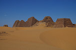
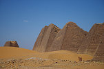
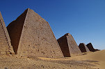
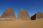
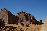
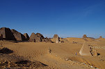
Mid-afternoon we stopped at the pyramids of Meroë, spending an hour and a half wandering about the royal cemetery in the perfect low light.
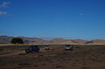
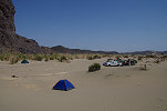
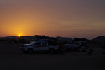
For the night we continued a few dozen kilometres towards the North, finding a perfect secluded campsite in the lee of a series of low dunes not far from the road.
Day 9. Meroë - Kurgus - camp east of Abu Hamed
This day was mostly a long drive North on the road along the East bank of the Nile. Mid-morning we passed one of the roadside rest-stops where a stall had several jerrycans of diesel, we jumped at the opportunity and bought the lot, filling up all the cars not knowing where we could find fuel before we leave the road.
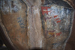
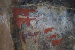
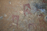
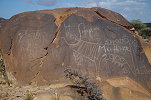
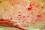
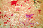
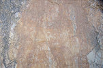
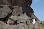
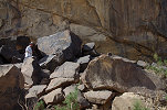
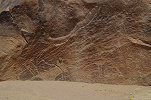
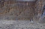
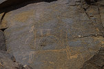
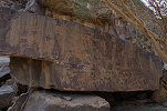
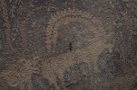
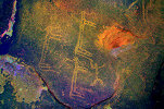
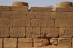
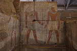
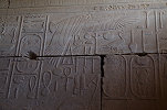
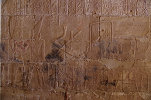
After the fueling stop we passed the city of Atbara and continued with a brief lunch-stop till Kurgus near the fifth cataract, a good 500 kilometres from Khartoum. In the New Kingdom Kurgus was the southern boundary or the Egyptian Empire at its maximum extent, with the inscriptions of Thutmose I and Thutmose III at a white quartzite outcrop now called Hagar el Merwa. Due to the extremely hard rock (not really suitable for deep engravings) and the subsequent weathering the inscriptions and scenes are now very hard to make out, but fortunately DStretch turned out to be very helpful, enhancing the slight difference in patination between the undisturbed rock and the engraved surfaces.
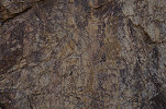
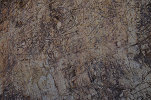

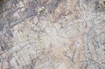
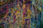
The change is particularly impressive with the two lions representing the Kings. They were engraved in the outline only, and finer details were filled in with red paint. On the spot hardly anything is visible except the ghostly shapes, but with DStretch all details are revealed, especially on the better preserved lion of Thutmose III.
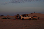
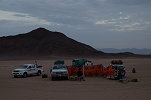
Once we have taken our full measure at Hagar el Merwa we returned to the road and continued a short distance till the outskirts of Abu Hamed. Moez went with one car into town to seek diesel (with full success) while we waited some distance off the road. Once the "buffalo" (the big HZJ 75 Landcruiser) returned with the full jerrycans, we turned east and drove till sunset on a flat sandy plain. For some time it appeared that we will have to camp out in the open, but just in time a chain of low hills appeared on the horizon, we reached them to make camp in the lee of the largest one before the sun disappeared.
Day 10. Camp east of Abu Hamed - Camp west of Wadi Di'ib
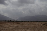
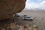
This was a rather long and uneventful day driving across the Nubian Desert towards the Wadi Di'ib, the principal watercourse of the Red Sea Hills of Sudan, running parallel to the Nile for a good 400 kilometres before reaching the Red Sea north of Hala'ib. The distance to be covered was about 250 kilometres from our morning campsite, but we made a few shorter detours to enable Natalie to collect dust samples at some pre-identified locations (her PhD thesis will be on the effect of Saharan dust on the Amazon rainforest). The detours also created some entertaining moments at softer patches, with all cars heavily laden with fuel and water.


For the rest of the day we ground along the rather featureless desert, mostly flat except for a few smaller hills. This area is the center of the recent gold rush, the single track going towards the Wadi Di'ib had been replaced with innumerable tracks leading to the mining localities and the support camps, it was very difficult to maintain our correct course, it was mostly guesswork which tracks to take.
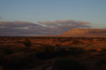
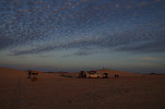
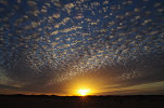
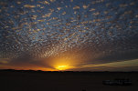
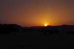
With a number of wrong turns and backtrackings, we did not reach the Wadi Di'ib as planned, but made camp at dusk near a low mound still a good 50 kilometres short of the Wadi, with the clouds providing an amazing sunset spectacle.
Day 11. Camp west of Wadi Di'ib - Bir Nurayet
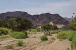
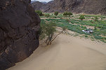
After packing camp in the morning we reached the broad valley of the Wadi Di'ib in an hour, with the Red Sea mountains rising along the far side. With the good rains of the previous summer there was dense green vegetation in the riverbed, with the main watercourse blocked by an impenetrable barrier of the thorny Prosopis juliflora shrubs which we already encountered in Somaliland, and are an even greater pest now in the Sudan. We needed to cross to the eastern side of the Wadi to reach Bir Nurayet, but a feeble attempt clearly showed it is impossible without a built track, so we continued along the well traveled track along the western bank, passing a number of small Bisharin villages.
As we continued north the scattered clouds of the morning congealed into a solid grey overcast that continued the rest of the day, we even had a few drops of rain as we stopped for photos.
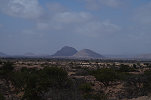
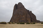
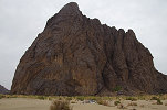
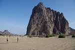
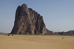
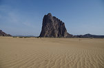
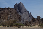
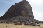
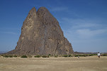
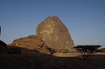
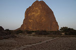
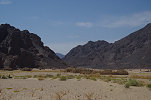
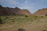
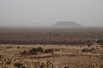
We followed the west bank track northbound for a good 70 kilometres, until it suddenly turned west and wound its way among the dense vegetation to the far side, the only possible crossing for vehicles for a good 70 kilometres in either direction. From here it was another almost 100 kilometres along (and sometimes in) the Wadi on a very dusty track until the wadi made a series of turns towards the east into the high mountains, and after the last bend we were facing the conical volcanic hill of Jebel Magardi, the main landmark of Bir Nurayet, our final destination.
The engravings of Bir Nurayet were only discovered in 1999 during a long camel trek from the Nile to the Red Sea by Arita Baaijens and Krzysztof Pluskota. More recently (in 2010 & 2011) an archaeological survey was conducted by a team from the Poznan Archaeological Museum, the full publication of which is still in the works, so for the time being aside some popular journal articles there is very little published on this amazing locality.
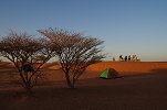
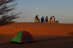
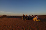
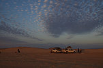
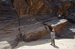
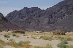
As it was well into the afternoon and the light was not very good, we left the systematic visit of the sites for the following day. We made camp in a suitable sandy patch at the foot of Jebel Magardi, then set out to gain a first impression of the engravings situated nearest to camp, crossing the deep gully of the main Wadi Di'ib watercourse with dense vegetation on both sides.
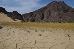
The far side of the valley was covered with a deep layer of silt reaching high up among the rocks, a good indication of the high water levels when the river is in full flow. Climbing higher on the small ridge separating the main valley from a small lateral branch joining further downstream, we soon encountered the first engraved blocks, then many more, all depicting cattle with a few later superimposed camels.
Reaching the floor of the lateral valley on the far side of the ridge, we found a cluster of large boulders with very fine engraved panels on nearly all the sides. Here too the vast majority of the depictions were cattle in various sizes, but this time they were accompanied by a few rather schematic human figures, and some later camels. This was the principal site of valley 10-2 (as designated by the Polish team making the initial survey), one of the two richest areas of Bir Nurayet.

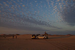
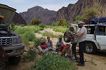
We explored a little further into the valley, but soon the rain started to fall in big drops, quickly turning into a proper downpour so we had to take cover in the meager shelters along the sides of the larger rocks. The shower lasted a good ten minutes, not quite enough to create flowing water, but the rocks were glistening (and slippery). As dust was approaching, we made a hasty retreat across the riverbed towards our camp, where Yasser (who turned out to be a very enthusiastic and talented cook) was already preparing our dinner.
Day 12. - Bir Nurayet
By the morning the grey gloominess of the previous day vanished, we awoke to a beautiful crisp sunrise, with just a few high clouds that soon dissipated as the sun made its presence.
The previous afternoon we only took a small sample of the innumerable sites at Bir Nurayet, now we had the full day to make a systematic exploration. We started out towards the southern tip of the rock art bearing area about a kilometre and half from our camp at the foot of the Jebel Magardi, along the far side of the Wadi Di'ib.
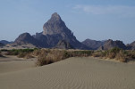
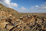
The geological context of the rock art is very curious, and provides a good explanation for why there is such a prolific concentration of engravings at this particular point, while they are rather scarce elsewhere in the Red Sea hills region to the East of the Nile. While the surrounding mountains are of igneous origin (including Jebel Magardi, which is an ancient volcanic plug), for a stretch of about three kilometres a tilted layer of sandstone is exposed bordering the bed of the Wadi Di'ib on the west, miraculously surviving the massive faulting and volcanics associated with the opening of the Red Sea rift. All of the engravings are made on the soft sandstone, mostly on vertical rock faces, the other igneous rocks are far too hard to make any such depictions.
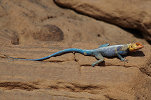
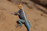
The very first rock art sites appear on the first (southernmost) sandstone outcrop along the edge of the wadi (area 10-5 of the Polish expedition), though the depictions here are rather crude compared to the ones we have already seen. The rock was guarded by a bright blue male spiny agama (Agama spinosa) which posed rather patiently for the cameras.
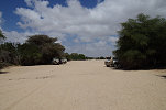
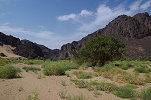
We walked back along the riverbed scanning the rocks, but here the rock art sites were sparse with gaps of hundred metres without any depictions. However the riverbed was incredibly lush green after the rains of the previous summer, more like an alpine pasture than the Sudanese desert.
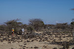
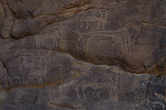
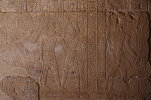
Rounding a promontory the river turns straight north, and this turn marks the beginning of the main concentration of sites, mostly on boulders at the base of the sandstone cliffs. From here on, nearly every rock had a depiction, with some bearing dozens on large panels. Again the main theme was cattle in many flavors and sizes, as well as several clearly later camel depictions.
There was a large embayment beyond the promontory (area 10-4), with the flat bottom covered by a deep silt deposit washed in by the river floods, reaching right up to the engraved rocks which were near continuous on both sides, though none of the depictions were exceptional in any way, just more of the same.
After rounding another promontory we reached area 10-2, a deep broad valley, which on satellite imagery clearly stands out as the largest one draining the small igneous massif bordering the sandstone ridge towards the west. This was also visible from the large acacias growing in the valley, while the other inlets only had flood supported vegetation. The engravings continued along the southern side until the sandstones gave way to the igneous rocks, where they abruptly ended.
We crossed to the northern side, the exploration of which was interrupted by the rain the day before. One of the first major panels we encountered was partially covered by the flood deposited silts. The Polish team made a deep trench at the base (exposing more engravings, which were subsequently re-covered by the recent floods). Thermoluminescent dating of the silts covering the engravings provided a terminus ante quem date of 2200BC (Boborowski et. al. 2013), but it is rather likely that the engravings are a millenium or two older.
There were several more large panels (again mostly with cattle) before we reached the principal panel which we already saw the day before. It was midday, just about the right time to take a break and return to the nearby camp for lunch and some rest before continuing in the afternoon.
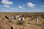
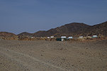
While the rest of our party took a little rest, with Moez we drove to the small (and rather miserable looking) small Bisharin village on the far side of Jebel Magardi, next to the well of Bir Nurayet. Rosa and Santi had a photograph of a rather interesting site with paintings (of which none were reported previously in the area), taken by a tourist on a trip that included Bir Nurayet, but without any other information. We hoped that some of the villagers might recognise it, however none ever saw any paintings just engravings. The elder of the village agreed to take us to the modern village in a small valley some kilometres away, where we might have better luck, but again we just met blank faces, the location of the site with paintings remains a mystery.
Mid-afternoon we set out again to the last principal rock art area at Bir Nurayet, 10-1, a small valley opening right abeam of Jebel Magardi with a very dense concentration of engravings. The rocks along the southern side are almost continuously covered with engraved cattle (and very little else), including several panels at very difficult to reach elevated positions, a good opportunity for Natalie to show off her rock climbing skills.
Along the southern side of the valley there are further panels of engraved cattle on large vertical surfaces, and an exceptional scene that appears to show an elephant hunt. This is the only one among the thousands of engravings at this locality which shows any human interaction with wild fauna. It is hard to say whether this scene is contemporary with the majority of the cattle engravings, or perhaps pre-dates them.
There were some further engravings in a little side valley to the north of the main area, but nothing exceptional.

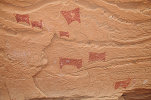
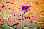
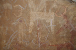
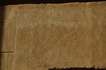
The sun has set, most of our party started back towards the camp, but with Jacques we made a quick dash to see area 10-3, the rock wall facing the Wadi Di'ib to the north of area 10-1. It turned out to be more than worthwhile, as in a little inlet we found a large panel which contained several rows of strange rectangular human figures associated with the same cattle as elsewhere, a very fitting ending to the Bir Nurayet visit.

As we walked back to camp at dusk, we spotted some movement among the rocks high above the valley. They turned out to be a large family of rock hyrax (Procavia capensis), I was not aware of their existence so far North in the Red Sea hills.
Day 13. Bir Nurayet - Khor Daiat
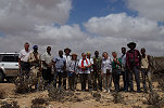
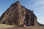
After packing camp in the morning we took our group photo on the top of the small dunes bordering the campsite, with Jebel Magardi towering in the background, then set out towards the south, to a location in the Khor Daiat about 80 distant where Rosa and Santi have found a rich concentration of engravings on another trip the year before.
We did not return by the way of the Wadi Di'ib, but through the centre of the Red Sea mountains along the Khor Yemumunti, leading into the hills almost straight south from Bir Nurayet. After about 20 kilometres we passed the small mining village of Salala, with a few still surviving derelict huts dating from the British times.
We followed the Khor Yemumunti for another 30 kilometres, making only a brief rest stop in the upper reaches before continuing along a low divide to a large open sandy basin among the hills, which was crossed by the Khor Daiat near its southern end.
After crossing the sandy plain, the Khor Daiat enters a range of hills on its way towards the Wadi Di'ib. Near the place where the watercourse reached the hills, there is an outcrop of the same sandstones as at Bir Nurayet. Near the entrance we passed a small abandoned village, and soon the first engraved cattle on a vertical wall along the northern bank of the wadi.
The recent rains have softened up the sand and the mud in the riverbed, and with dense green vegetation blocking the way everywhere on the plain, the only way for the track was in the watercourse. It became a rather difficult going, our cars became stuck in several places and freeing them involved a lot of digging and pushing. Finally we reached some hard ground around a prominent acacia, which looked like a perfect spot for lunch after all the hard work.
Rosa & Santi found a few engravings on the small sandstone outcrop a few hundred metres from our lunch spot, we set out to take a look before continuing to the main concentration of sites. The area around the rock was covered in deep but now dry mud, and the high water mark on the rock was around chest height, indicating the huge amount of water that flowed in the valley. There were a few engravings, some of them partially covered by the mud, mostly depicting crude cattle.


As we walked around the rock, at an elevated spot facing the riverbed we spotted a panel of engravings that turned out to be the finest of the locality, perched at a rather difficult to reach location, but with a perfect shaded platform at its feet with a magnificent view over the whole valley entrance.
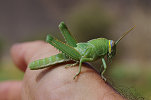
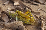
We already saw numerous desert locusts (including a bright green hopper) around our lunch spot, but as we moved into the hills along the wadi they were everywhere, with numerous mating pairs, all in the gregarious yellow colour. Later I learned that the red sea hills of Sudan are the central area for the formation of swarms that migrate in both directions to Arabia and along the Sahel, we were just witnessing the emergence of one such swarm.
Near the track there was another low sandstone mound to be checked out, on the very top Jack found a very fine pair of engraved sandal prints, the best example in the area.

Just a little further along the valley we reached the main concentration of engravings, along boulders and vertical rock faces along he southern side of the valley, in a setting very similar to those at Bir Nurayet. The style too was similar depicting mostly cattle, clearly the same people made them. However here on the very first roc of the series, we found a beautiful and unambiguous rhinoceros, a theme completely absent from the much larger locality of Bir Nurayet.
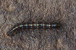
Following the edge of the rock we came upon two large panels, the first half-hidden behind a small dune depicting cattle. The second was also a panel of cattle, but at some later date a very fine ibex hunting scene (with spear and dogs) was superimposed, with a caterpillar crawling leisurely right across the scene.
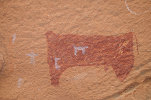
Not far, another panel showed some rather strange depictions, a series of "sitting" cattle with their bodies vertical. There is no question of their intentional placing like that as the scene is on the bedrock, not on a boulder that could have moved, and there is a properly oriented human figure right next to them.
The entire locality runs for about 400 metres around a detached sandstone hill bordering the river on the southern side. Following a sharp left bend in the river and the adjacent rock we came upon the last panel, which again had a unique depiction, a large and rather strangely drawn cattle over a metre long. We have seen no other engraving on such a scale at either of the visited localities.
We still had a good hour of daylight left, we used it to continue for some distance back along our return route, following the Khor Daiat for some time, then as it turned north we left the riverbed, cutting across the wide sandy plain on the far side of the hills directly towards the Wadi Di'ib. At dusk we moved off the track to camp out of sight at the foot of some low hills.
Day 14. Wadi Di'ib - Atbara
In the morning we quickly reached the Wadi Di'ib, and continued along it for about fifteen kilometres northwards, reaching the point where we crossed it three days earlier. Reaching the western side, we set a direct course towards the Nile across a generally flat, undulating terrain crisscrossed with innumerable shallow wadis. The best going was along the watercourses, but they were invariably at an angle to our direction, so the gong was rather slow and difficult. Nevertheless we made reasonably good progress, by lunchtime we made it about half-way back. However as we progressed, the wind picked up, and by the time we reached another of Natalie's dust sampling points after lunch, it was a howling sandstorm.
We planned to camp before reaching the Nile, but the conditions were so uninviting that we made a decision to press on till the Nile, and then continue along the road to Atbara, with the promise of a reasonably good hotel, a warm shower and a restaurant instead of a miserable windy night in the desert. We did reach the Nile road shortly after sunset, and by the evening we were in Atbara, taking a good dinner while Moez organised our accommodation for the night.
Day 15. Atbara - Naqa - Musawwarat es-Sufra
After the long and tiring previous day we all enjoyed a good rest and a worm shower in the unexpectedly good Adel Hotel, and with the extra distance covered we could afford a lazy morning. We had breakfast at one of the small Atbara restaurants, then moved to the edge of the town to do some fixing on one of our cars, spending the time at the local coffee shop.
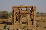
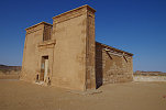
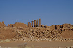
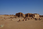
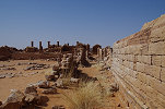
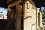
When all was completed, we started out along the road towards Khartoum, then along the new asphalt side road that now almost reaches the site of Naqa (and reducing the time from the road from two hours to a mere 30 minutes). We reached the ancient Meroitic temple town after midday, and after a quick lunch in the shade of the trees near the well we set about to explore the place at a leisurely pace, having the whole afternoon for the purpose, starting with the will behind the Temple of Amun with a magnificent view over the site, which I never had the opportunity to climb before.
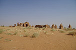
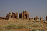

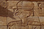
The kiosk and the Lion Temple looked very different in the afternoon light. While not ideal for the main scenes on the pylons facing east, finally I could properly photograph the reliefs at the rear, which I have only seen in the shade previously.
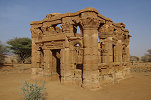
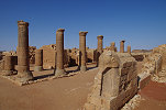
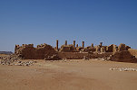
Late afternoon we drove the short distance to Musawwarat es-Sufra, another large Meroitic temple complex spending the night at the densely wooded wadi nearby, the same place where we stayed on the November 2017 trip.
Day 16. Musawwarat es-Sufra - Khartoum
After another lazy morning at camp, basking like lizards in the morning sun after a rather cool night, we packed camp to visit the temples.
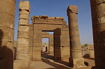
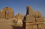
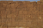
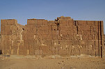
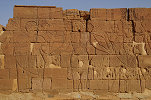
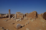
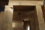
We started out at the Lion Temple, reconstructed from a pile of rubble by the East German team of Friedrich Hinkel in the nineteen sixties. We were early enough to see the beautiful reliefs of the northern wall in a perfect contour light, these stay in the shade for all of the rest of the day.
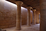
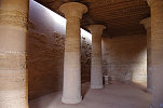
We continued to the main complex, where we were hoping to find the fine relief of a pharaoh sitting on an elephant published by Peter Shinnie (Thames & Hudson, 1967, p.95. fig. 27.). The walls of the temples and adjacent structures are covered with various graffiti from many periods, ranging from the Meroitic reliefs to the inscriptions of the first European adventurers and scholars to visit the site.
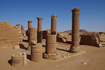
We spent a good two hours at the site, systematically surveying all the walls. We did find many fine details which I have not seen before, but the particular scene remained elusive. It may have been on a block removed to a museum somewhere around the world, and now it languishes in some store room, long forgotten.
With the Musawwarat visit the trip was practically over, mid-morning we commenced the remaining drive to Khartoum, and we were in the town by lunchtime, taking advantage of the relatively light midday traffic.
Day 17. Khartoum
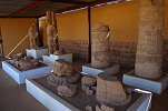
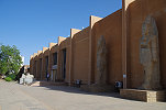
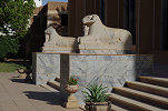
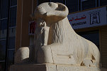
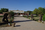
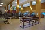
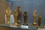
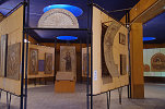
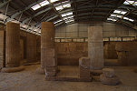
Those leaving departed in the night or in the morning, while those coming for the immediately following Uweinat trip were only due in the small hours of the following day, those of us doing both had a day to waste while Moez was preparing the cars and supplies for the long journey. Joined by Max who arrived a day early, after lunch we made a visit to the National Museum on the Nile bank, which I have not seen for many years. Much to my surprise the glass hangars housing the relocated temples in the garden had their windows cleaned, and now there was proper light inside, not the gloomy yellow that filtered through the thick layers of dust. Also inside the museum building lights were working, so it was actually possible to see the various displayed objects. All in all it turned out to be a very pleasant afternoon.

We plan to return to Laas Geel and the other sites of Somaliland in February 2021, please check this page periodically or "like" the FJ Expeditions FaceBook page to receive notices of news and updates.