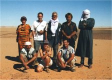
Click on image for list of participants
|
Jebel Arkenu - Jebel Uweinat
Expedition, Libya
28th October - 14th November, 2001
|
It was really easy in the 1930's, with conveniently undefined
international boundaries, and freedom of movement. In 1932,
running short on water, Almásy only needed to hop over to Kufra,
a mere 160 kms from the Gilf Kebir.
Unfortunately todays realities make life much more complicated.
While there is still no problem crossing the border from Egypt to
Sudan at Karkur Talh to visit the rock art sites (a practice
approved by the escorting military officers), should one try doing it anywhere closer
to the Nile, one can receive a quite unfavorable reception from
the authorities looking for that magical entry/exit stamp in the
passport.
The situation is much the same if not worse with Libya, with the
added problem of the Libyan border post at Ain Doua and Ain Zueia making
sneaking through without getting caught extremely unlikely. It is
really frustrating, sitting at Karkur Talh after having traveled
1400 kms accross the desert, not to be able to cross over to
visit the rock art sites on western side of Uweinat, so close !
(A mere 15 kms to Karkur Idriss, whereas the only 'official' crossing
between Lybia and Egypt is at Sollum, on the mediterranean coast,
some 1200 kms to the North.)
Being no alternative, I've looked into the possibility of doing a
trip starting from the Libyan side, using locally rented vehicles
like in Egypt. The trip was organised in cooperation with Arabica Orient
Reisen of Switzerland. Aside the usual Libyan visa hassles
(half of the group received their visas the day before departure), the
trip went really smoothly, beating even our best expectations:
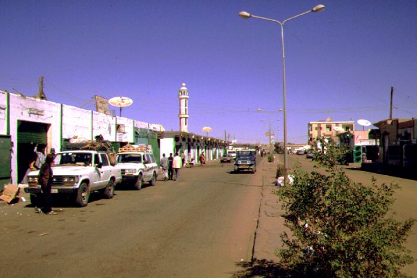
Day 1. - Tripoli - Sebha.
We were planning to take a flight, but
the morning was flight cancelled and the time of afternoon one was very doubtful,
so we took a minibus to Sebha, reaching there by the evening.
Day 2/3. - Sebha - Timsah - Wau Kebir - Waw Namus.
We met our drivers, Ahmed, Omar & Tahat
and the vehicles (All Toyota Landcruisers, a model 80, a model 60 and a model
75 pickup, provided by Alawy Tours) in the morning, and set out for Wau Namus
after the inevitable delays for loading, shopping and permits by midday. We took
the tarmac road till Timsah (where we camped at the dunes), and reached Wau Namus
by the afternoon of the next day. After visiting the crater, we camped at the small
crater to the north of the main one.
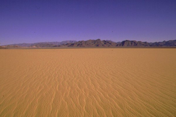
Day 4/5/6. - Skirting the north edge of the Rebiana Sand Sea
till Tazerbo, then on to Kufra - Camp 200 kms beyond Kufra.
The first
part of the route till Tazerbo was a pleasant surprise: the track from Wau Namus
to Tazerbo, contrary to several descriptions and reports, is very clear
and easy. We completed the 400 kms comfortably in a day without any difficulties, camping
at the dunes before Tazerbo.
The next morning we had the only mishap of the trip, five
of the six bolts of the right rear wheel on the -62 snapped off as if cut by a knife (probably they were not
tightened properly), with one bolt precariously holding the wheel in place. We took two bolts
from the other side and limped in to Tazerbo 20 kms away to make the permanent fix. From Tazerbo
we took a course due east accross the flat serir to Bir Zighen, meeting the Aughila - Kufra road just
beyond. After the flat serir the corrugated tarmac was a marked turn for the worse ! We camped
about 100 kms before Kufra near the road, reaching Tadj by mid morning.
Again all our apprehensions based on previous accounts were unfounded: petrol was available, and the
issuing of the permits to go beyond Kufra only took the time needed to finish the rounds of tea offered
by the very friendly policemen. (Contrary to some other reports, no special guide or police escort was necessary).
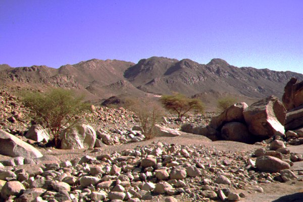
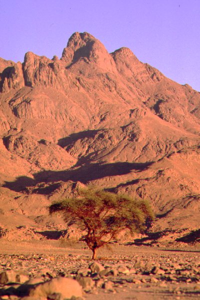
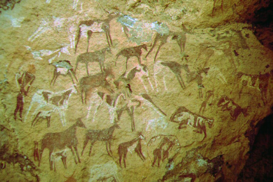
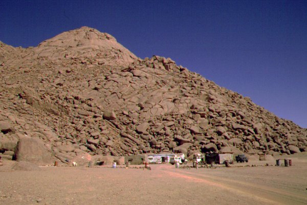
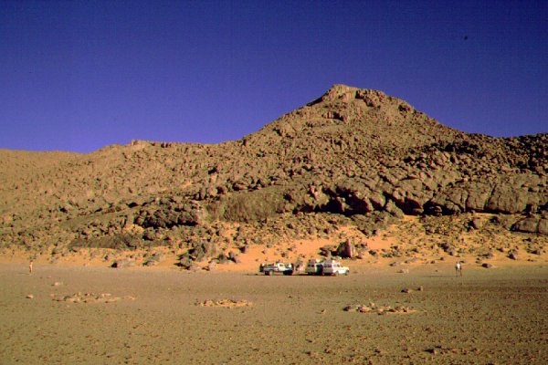
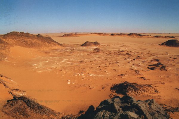
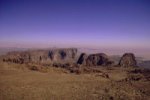
Day 7/8. - Exploring the main wadi of Jebel Arkenu, then continuing to Karkur Idriss at Jebel Uweinat.
From our camp we reached Arkenu by midday,
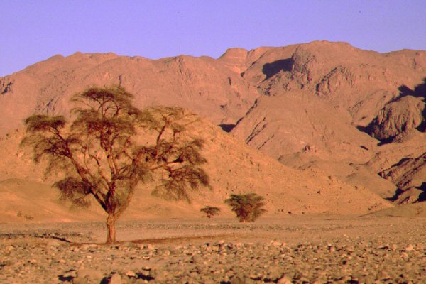
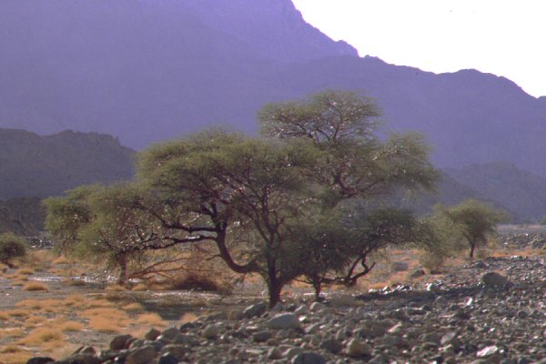
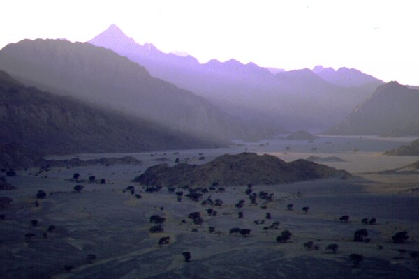
after crossing some fairly easy dunes between jebels Bahari and Arkenu. We found the main wadi to be very dry, only a few trees surviving, and
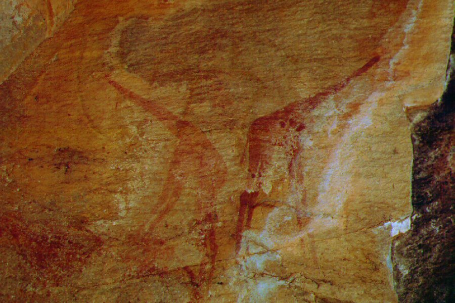
as we moved deeper inside, all traces of recent visitors disappeared. That afternoon, and the morning of the following day we succeeded in locating four
of the seven rock art sites recorded, but not published by the 1962 Sandhurst expedition. The paintings, located in the central
part of the main valley, are all very faint, barely recognisable. However there is a very fine set of engravings far up in the valley. We have also found
the spring first mentioned by Hassanein, and reported dry in 1962. The water was slightly bitter, but not unpleasant. In the afternoon we crossed the dunes
between Arkenu and Uweinat (an easy 15 minutes at the right spot, marked by fresh tracks), and camped at the entrance of Karkur Idriss.
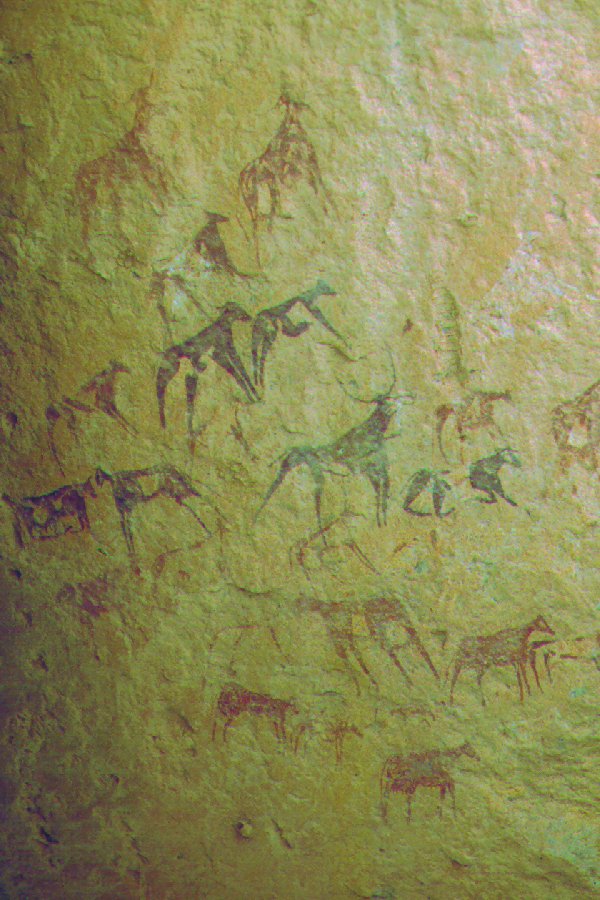
Day 9. - Karkur Idriss rock art sites
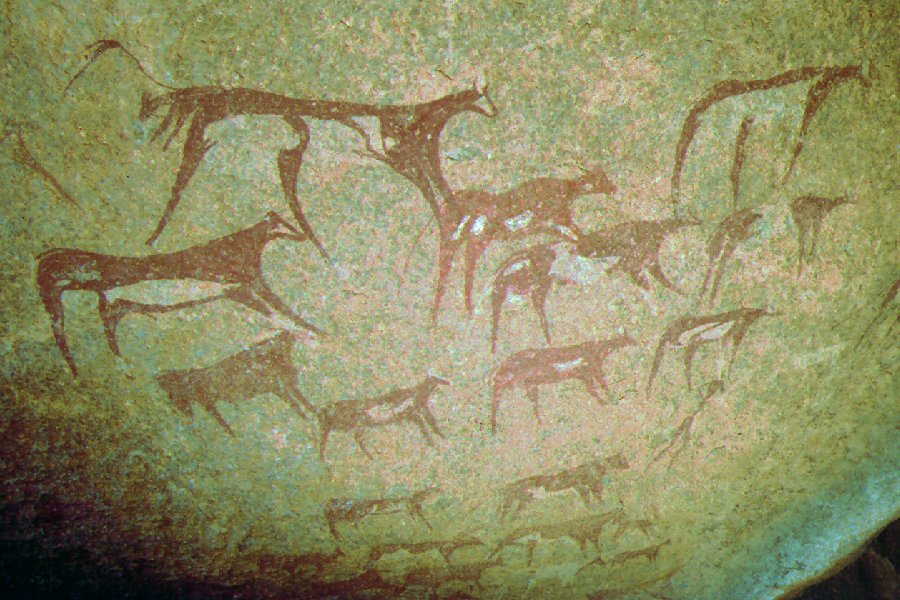
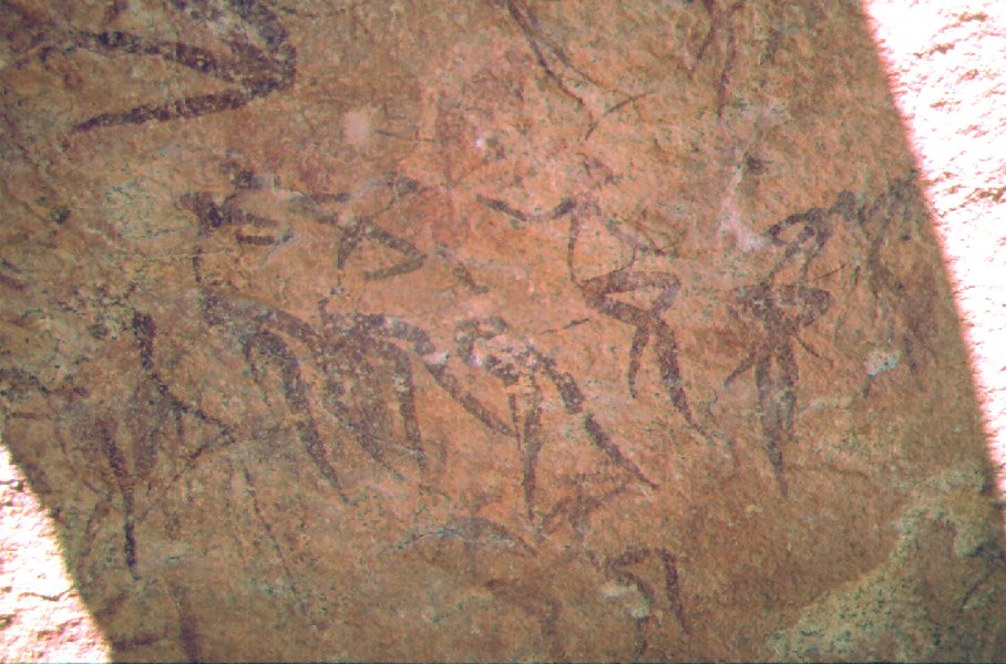
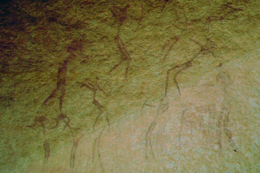
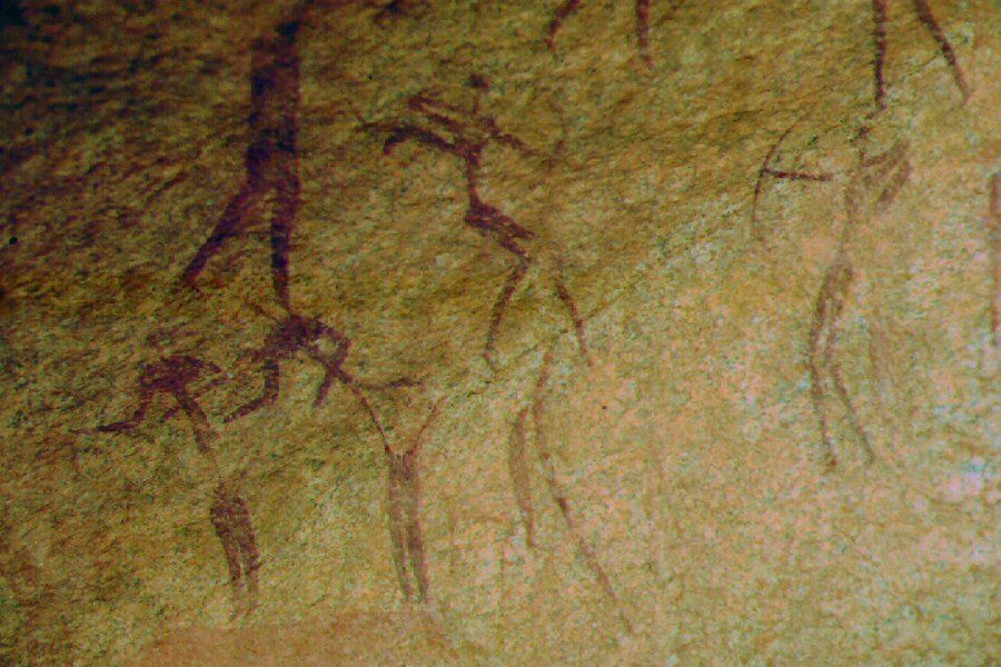
We spent the day exploring the rock art sites and spectacular scenery of Karkur Idriss, starting with the magnificent granite shelters at Bu Helega, at the junction of Karkur Idriss and Karkur Hamid.
All four known sites were found in good condition without any recent damage. Further in the valley we have located sites KD1 and KD2 reported by van Noten and Le Quellec (Sahara, 10/1998).
Near the site of KD1, some 20 metres above the valley floor, Bernhard found a small shelter, with a series of paintings of archers, and curious skirted figures. To our knowledge, we were the
first to record this new site.
In the evening we crosssed over to Karkur Ibrahim to make camp.
Day 10. - Ascent of Jebel Uweinat
 click on image to read account
Day 11. - Karkur Ibrahim rock art sites - Ain Doua - Yerghueda Hill
With extensive search we have only managed to locate le Quellec's KI4 and KI3 sites, the
other two eluded us. Late morning we moved on via the check point at Ain Zueia to Ain Doua,
visiting the rock art sites and replenishing our water supply from the spring.
We managed to locate 8 of the 11 sites reported by di Caporiacco, but did not find Rhotert's "D" site, unseen by the former. Ain Doua 1 & 2 are in good condition, however all other
sites closer to the ground level are much damaged and faded. As no photographic record exists, it's difficult to judge how much of the damage is recent. The spot is unfortunately much frequented due to
the presence of the spring, and the enormous amounts of refuse thrown about the granite boulders give a very disappointing athmosphere after the pristine desert. Later that day we made the easy 80 kilometres south to Yerguehda Hill, a very pleasant untouched, isolated spot, visiting the rock art sites and
camping among the nearby dunes.
Day 12. - Return northwards (camp 150 kms before Kufra)
It was a full day drive north, crossing the dune ranges after Uweinat and Arkenu.
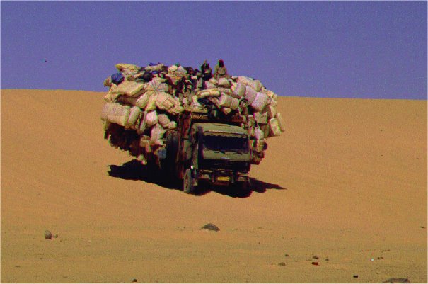
Along the way we met several of the huge trucks ("taxi sudani") making the trip between Kufra and el Fasher
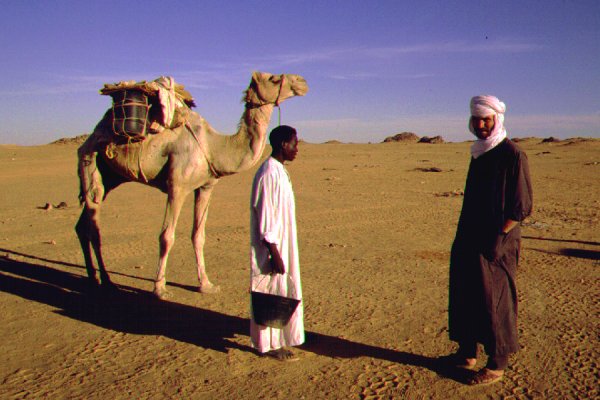
in the Sudan in about 8-9 days. We also encountered Sudanese of the Kabbabish tribe, who herd their camels from Mellit via
Uweinat to the camel market to Kufra (from where after being fattened, they are trucked up north). They claimed the
1200 kilometres is covered in 21 days! (16 from Mellit to Uweinat via Merga, then 6 days for the remaining 350 kms).
Day 13. - Kufra - set out to the search area for the SAAF Blenheims.
After a brief stop in Kufra to replenish our fuel and supplies, we set out north along the tarmac road for about 40 kms, then turning off east,
reaching out targeted area by the evening. We camped in the lee of a large dune trailing a small plateau. In the middle of the night, suddenly and without warning
a deep rumbling loud sound appeared, like the noise made by a propeller driven aeroplane. Almost everyone of the group awoke to this strange sound, that stopped in
a few minutes as abrubptly as it started - it was a first time experience for all of us to hear the song of the dunes, a sound made by sand blown accross the
crest of a dune by the wind under some very rare conditions.
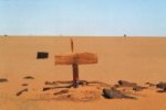
Day 14. - Search for the first landing site and graves.
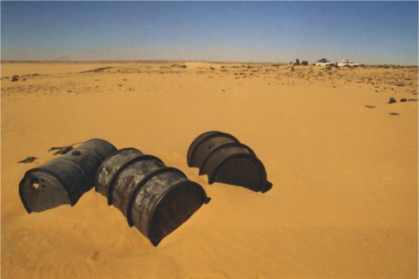
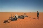
The morning was spent with an extensive grid search using two vehicles in a 12 x 12 kilometre square based on the RAF Court of Inquiry documents. To be honest, we had no idea what to look for. Our only clue was that the aircraft have been refuelled and flown out. Thus several hundred litres of petrol must have been trucked in the four gallon cans of the times, so most probably a litter of empty petrol cans is what we are looking for. However after four hours, climbing all high ground around the perimeter of the search area to look around, there was still nothing but barren desert. Just before noon, as we were prepared to return to camp and rethink our strategy, Francois noticed an unnatural looking pair of objects quite far, on the top of a ridge. Nearing them, they proved to be two oil drums. Below, on the far side, there were dozens of petrol tins littering the flat expanse of sand stretching to the horizon. We found the site
just inside the planned search area.
 click on image to read details
Day 15. - Search for the aircraft - Camp at BP Structure.
We moved 40 kms to the north west, based on the documents, to locate the third aircraft, reported
to be still there by an oil exploration team in 1959. On a plain we did locate the aircraft remains, however it was too destroyed to make a positive
identification. We could only ascertain that it was a British built two engined WW2 aircraft. (Since then, the wreck has been positively identified as Z.7513).
 click on image to read details
Later that day we moved to the BP structure, a meteorite impact crater (see more info on this, and the nearby Oasis Structure, at this link.)
Day 16/17/18. - Return to Road, drive north via Jalo to Agdabya, then west along the coast to Tripoli (stopping at Leptis Magna).
Just before reaching the road, on a little hill we came upon a few relics of the Italian Occupation: a few tins from 1931, a broken chianti bottle, and three oil drums of the "Societa Italo-Americana pel Petroleo, Genoa, 1927".
To our great surprise, two of the three drums were full with some liquid. We opened one of them - it was water, with a thin film of petroleum on it's surface. Underneath it was perfectly clean & fresh - the 1931 vintage! Probably
this was a water depot from the time of the Kufra occupation in January 1931.
The remainder of the trip was a dull and uneventful 1800 kilometre drive back to Tripoli, with our last camp on the serir some 150 kilometres before Jalo. We reached Sirt by the evening of the following day, where we parted with our
superb drivers and the three Toyotas, and took a minibus to Tripoli on the last day. We stopped at Leptis Magna, where we had our first and only unpleasant encounter with Libyan officialdom: the police officer on guard told us that as Leptis Magna is not explicitely
written on our travel permits, we cannot enter ! (All this after driving over 4500 kilometres in the remotest parts of Libya without any problems...) After a lengthy and somewhat heated argument, we did gain admittance...
See Bernhard's photo site of our trip at:
www.arkenu.de