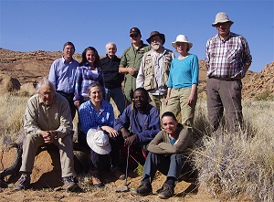
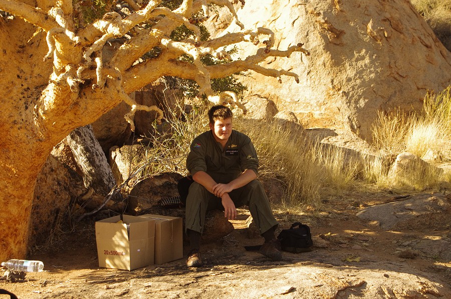
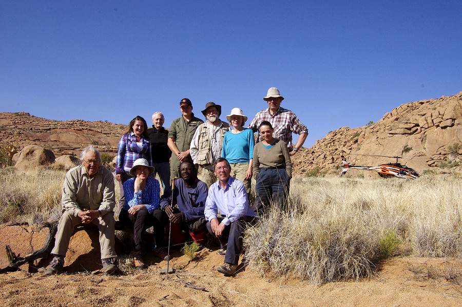
 Click on image for list of participants |
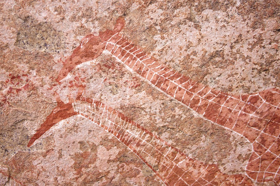
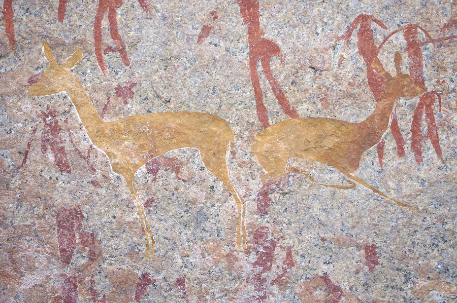
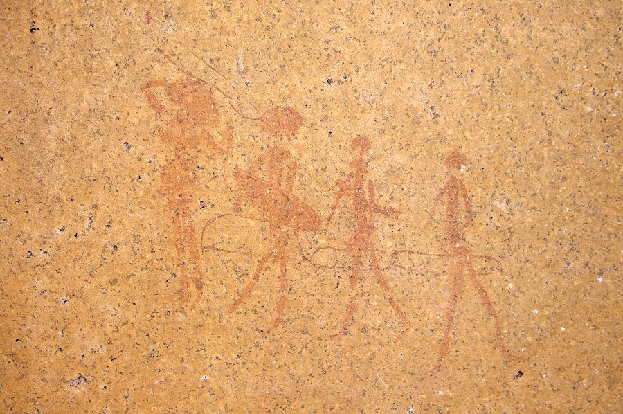
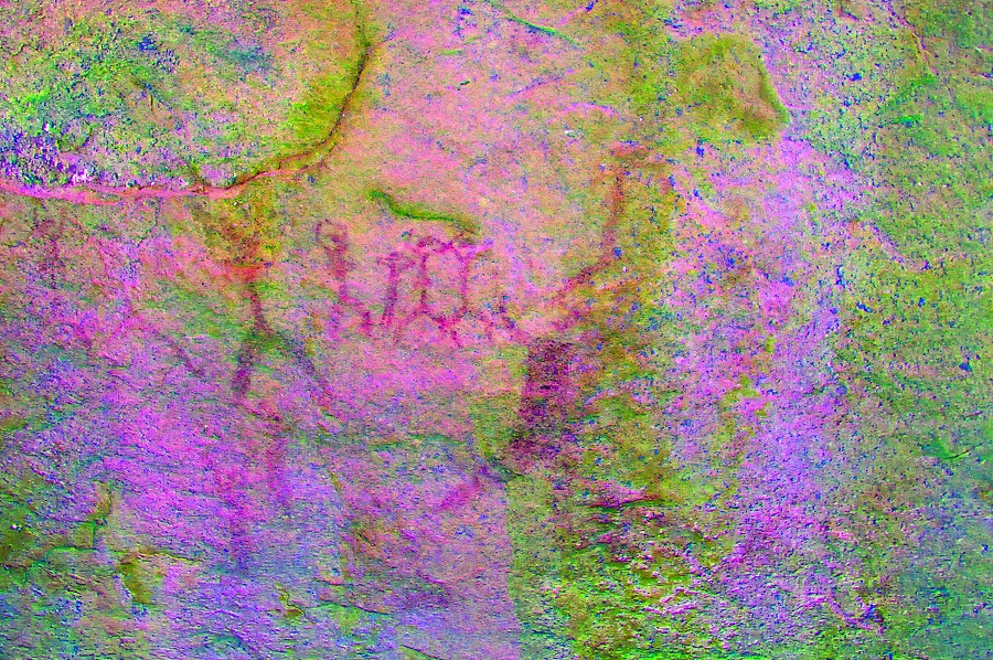
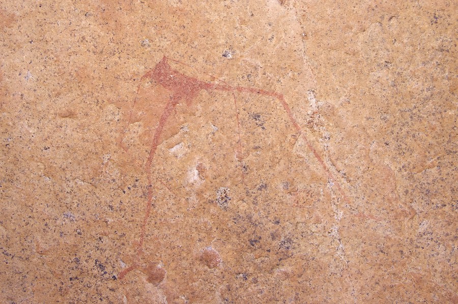
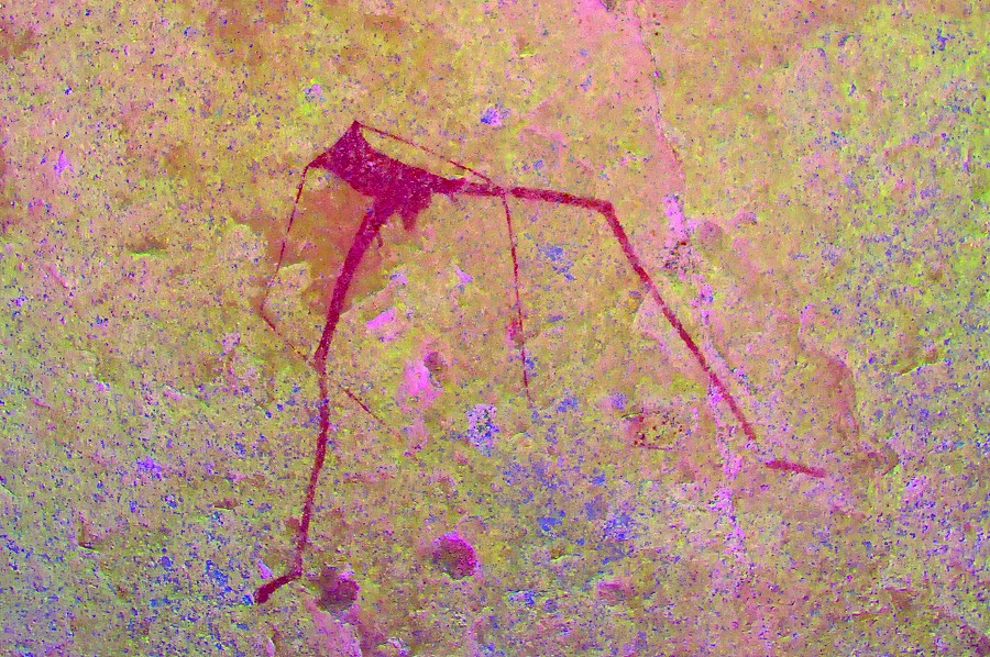
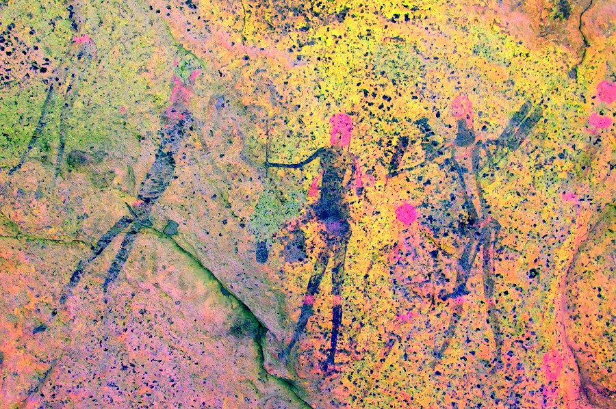
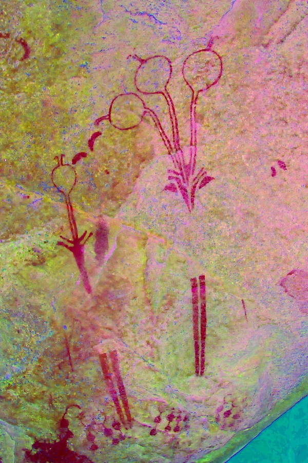
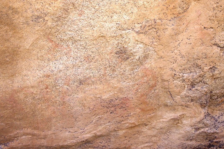
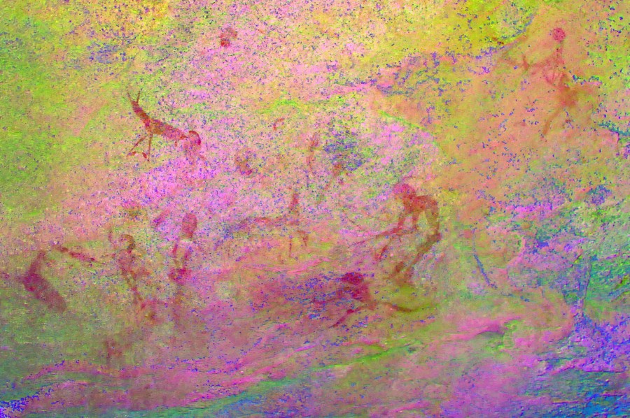
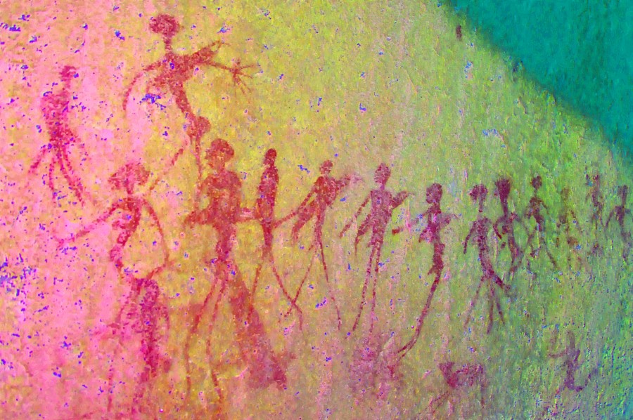
Upper Brandberg, Namibia 24th May - 8thJune, 2012 All site references based on Harald Pager's numbering system False colour images precessed with dStretch, a freely available software developed by Jon Harman |
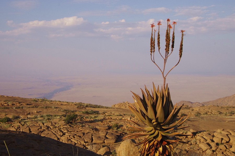
Pre-trip excursion to Southern Namibia
The flight logistics for the trip turned out to be more complicated than anticipated, Air Berlin suspended the convenient Windhoek flights from Munich (it is rumored they will launch a direct Berlin - Windhoek service) and we had to use Air Namibia via Frankfurt. With one of their two longhaul aircraft on scheduled maintenance, they only offered two flights per week in the second half of May. The majority of the group took the flight on the evening 28th May, as I needed a day in Windhoek to buy and pack supplies it was necessary to take the one earlier flight on the 23rd. With Raymond we decided to spend the extra days doing a short circuit in the southern part of Namibia, partially re-tracing some of the route we have taken in 2005 but going as far as the Fish River Canyon, which neither of us had the opportunity to visit before.
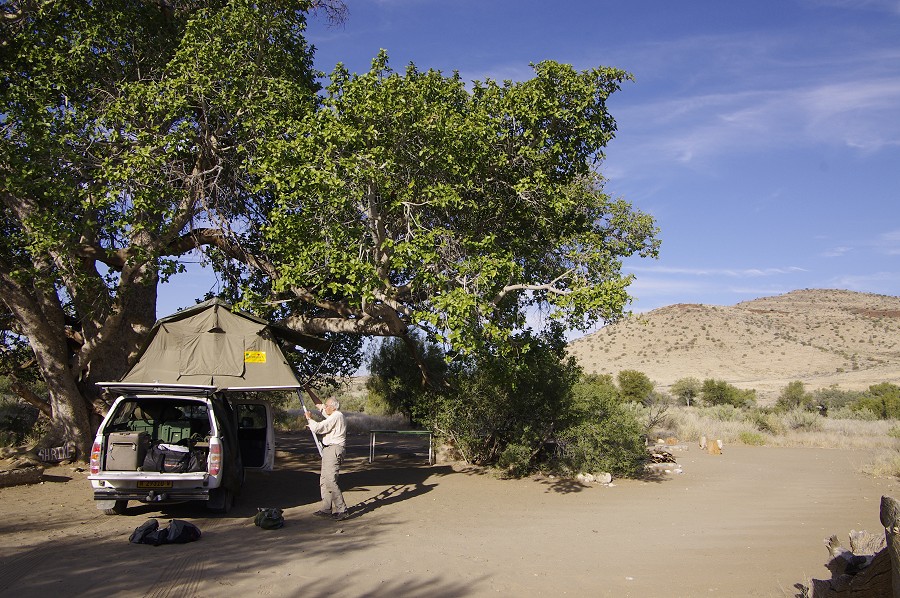
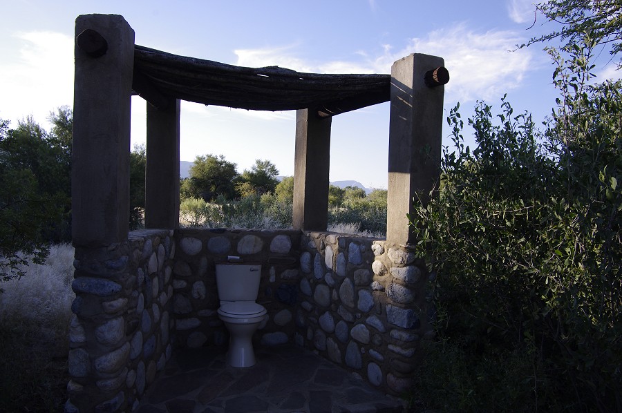
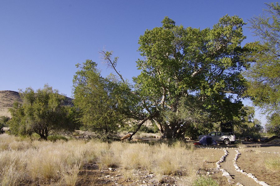
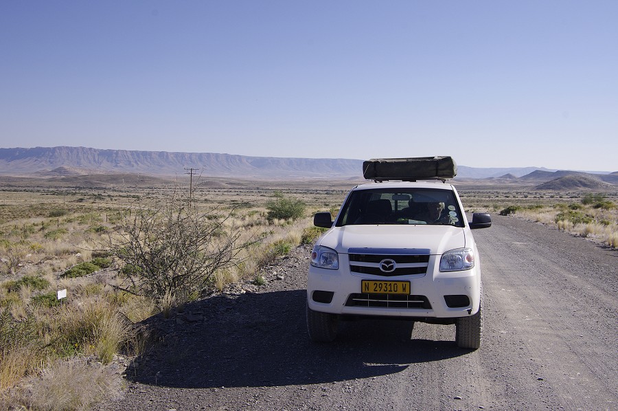
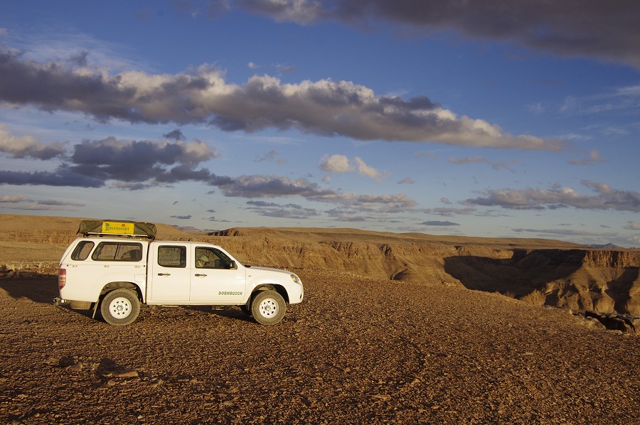
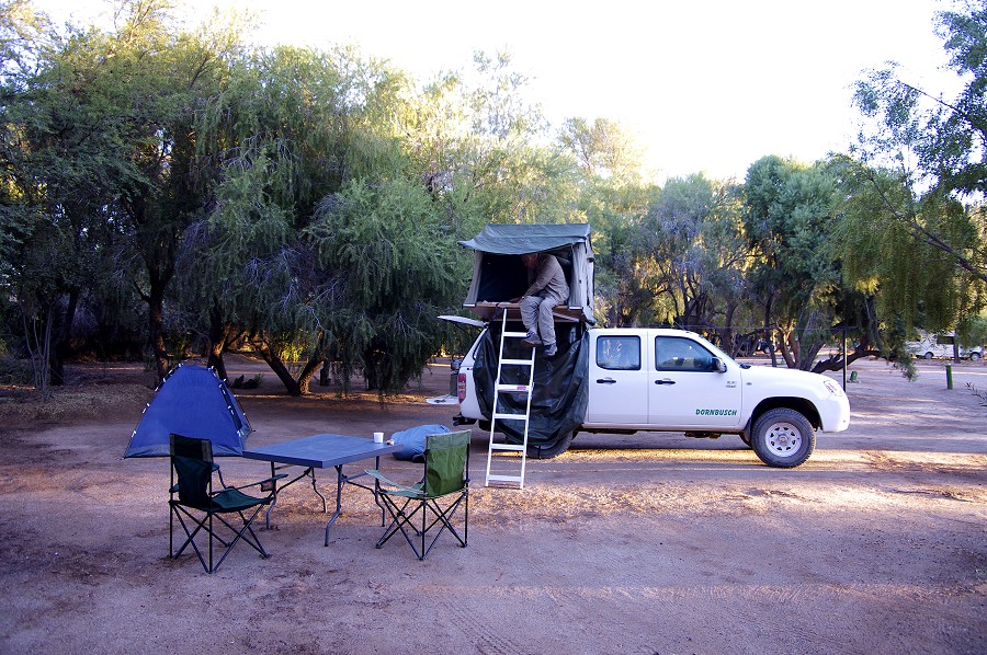
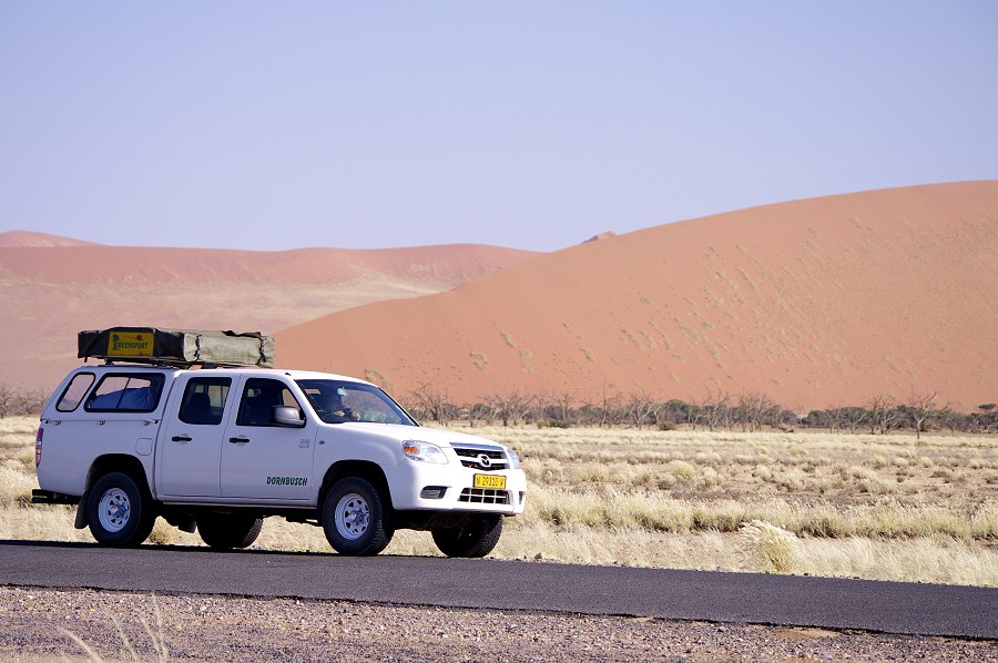
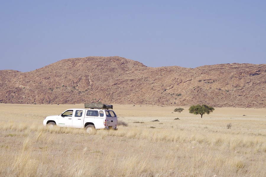
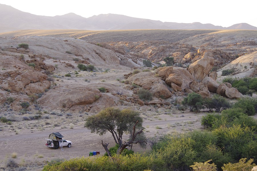
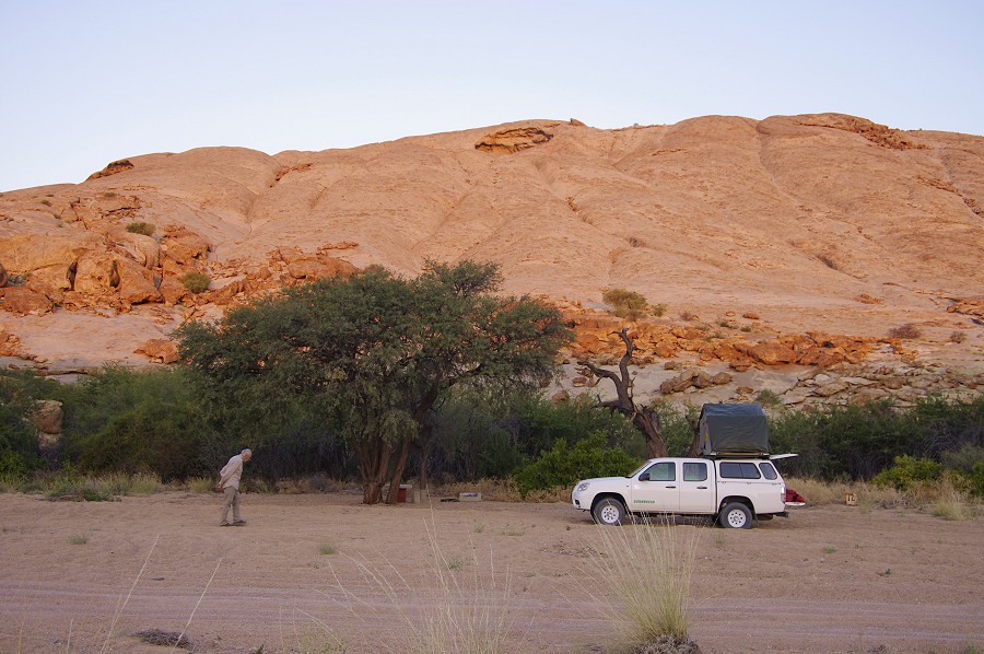
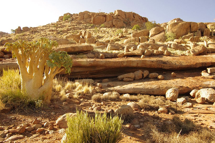
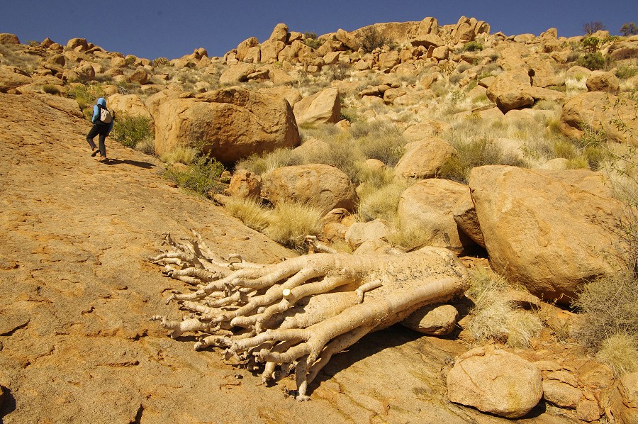
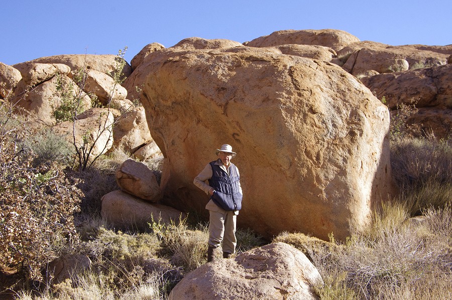
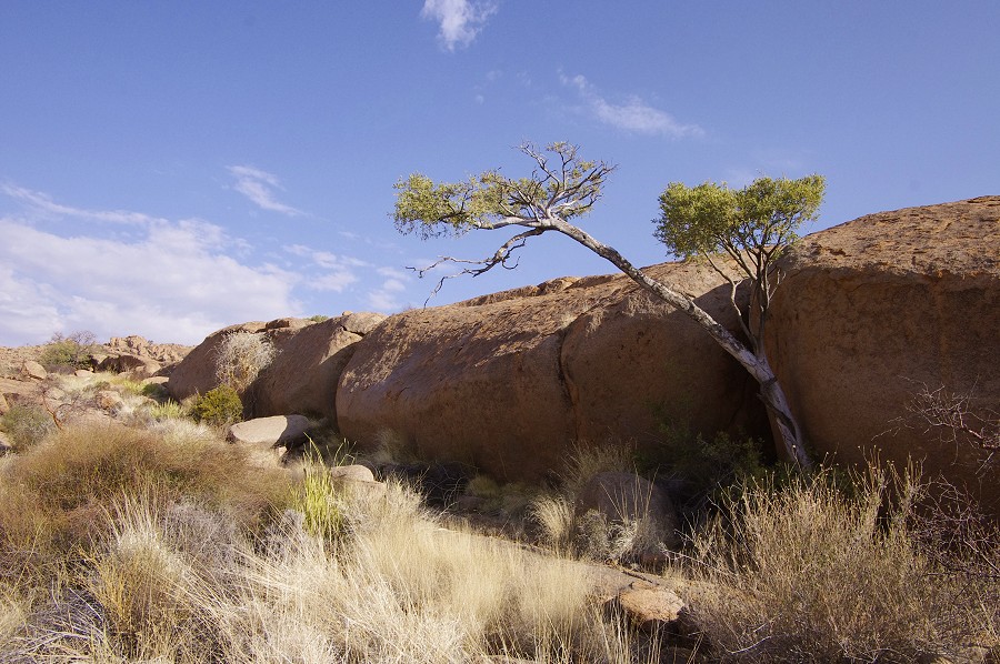
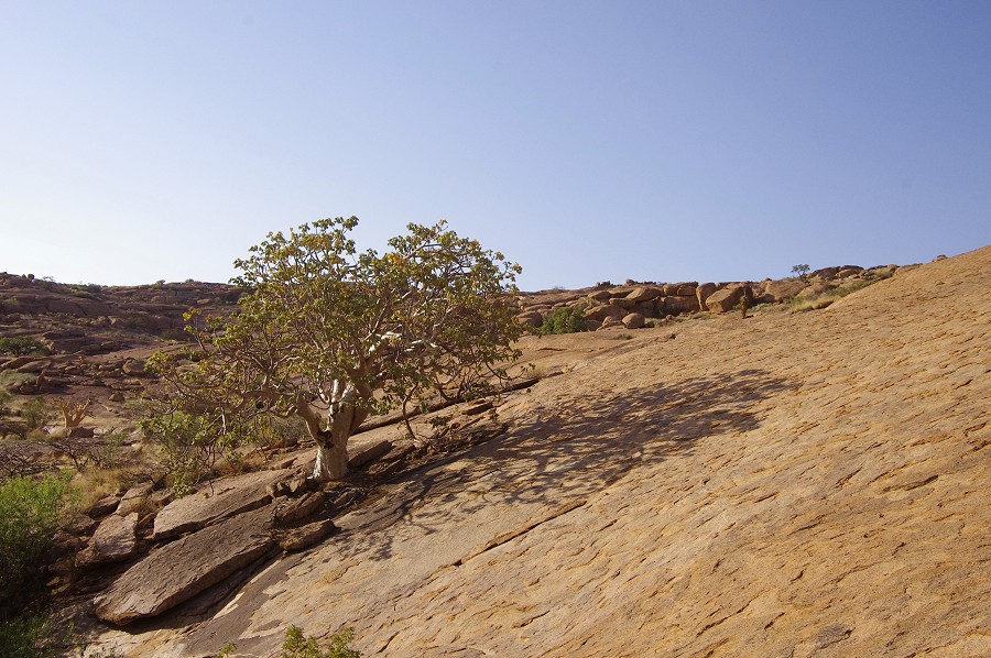
Not surprisingly the flight to Windhoek was completely full, I had better longhaul flights, but it was on time, Mark of Dornbusch Car Hire picked us up at the airport and provided us with a superbly equipped camper pickup with a roof tent for the five days. We did our shopping for the excursion in Windhoek, then started out on the main road towards Rehoboth. After a brief stop there to purchase some forgotten items and obtain more cash at the local bank (it turned out that credit cards are accepted practically everywhere in Namibia...except gas stations), we left the main road soon after the town and drove along the small grave roads to our destination at the foot of the Naukluft hills, the Tsauchab River Camp ran by Johan & Nicky Steyn on their farm. We have already stayed here in 2005, it is an absolutely lovely place with secluded campsites at stunning spots and excellent facilities, probably one of the best camping spots in the country. This time we set up our camp for the night under an enormous wild fig tree growing right next to the riverbed that was still trickling in places.


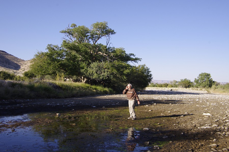
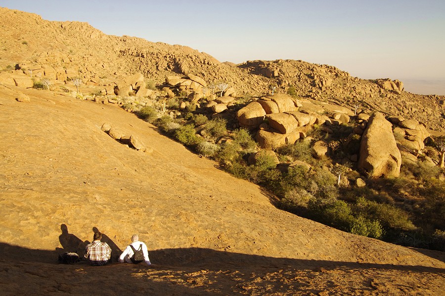
Next morning we got off to a slow start, enjoying the a warm shower from a wood fired boiler, taking a short walk in the riverbed, and just enjoying the spot before continuing our journey to the south.

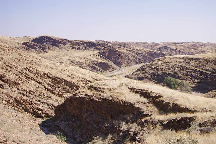
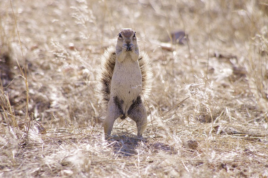
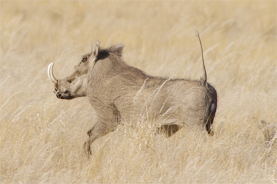
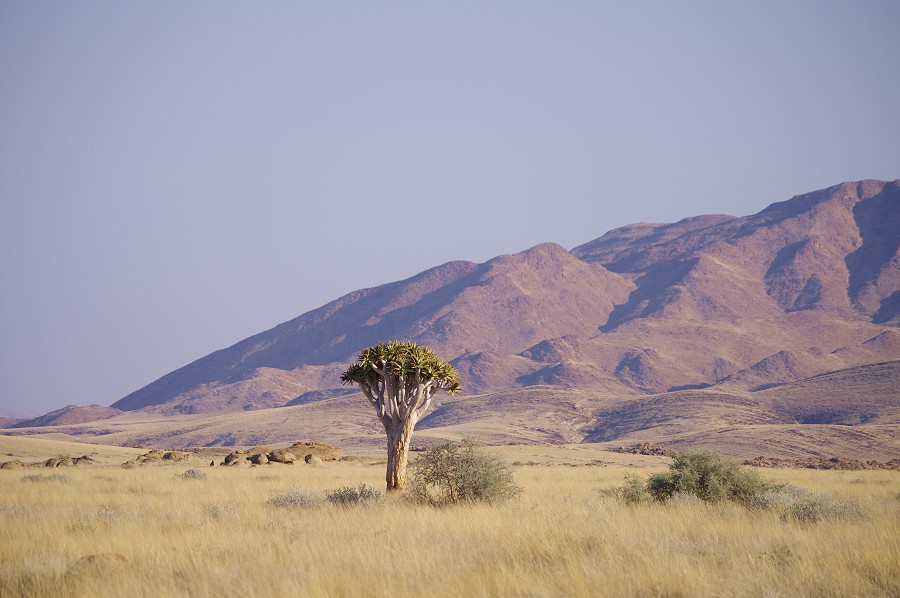
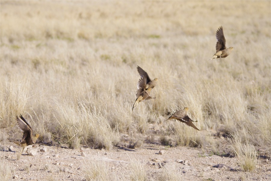
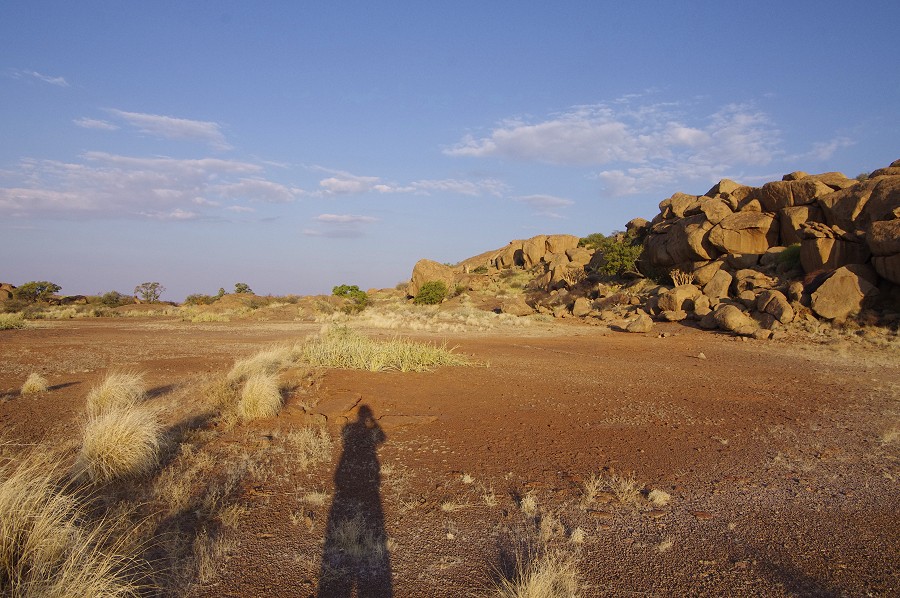
We have deliberately a series of small secondary roads on our way south, hoping to catch sight of some wildlife and to simply enjoy the remote scenery - we have hardly met any other vehicles on the first two hundred kilometres. With wildlife we were less lucky - we only saw a fine pair of secretary birds (Sagittarius serpentarius) and a large weaver bird's nest by the road.
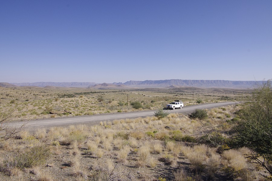


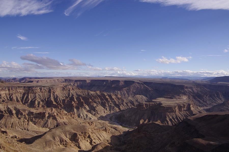
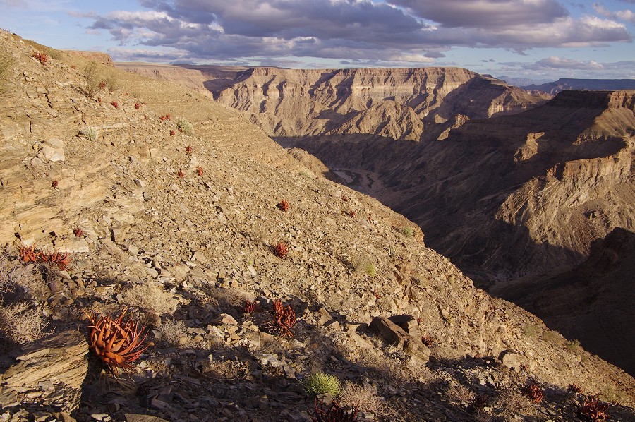
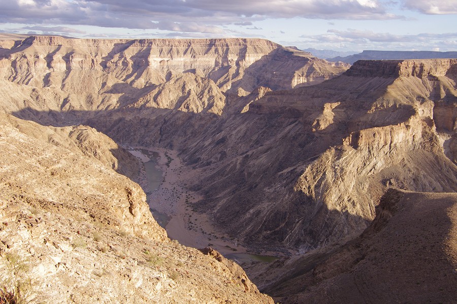
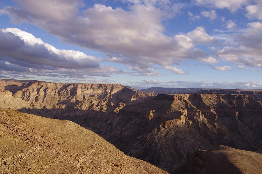
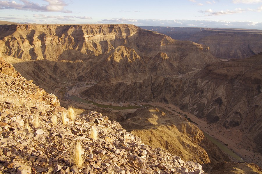
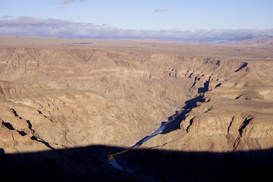
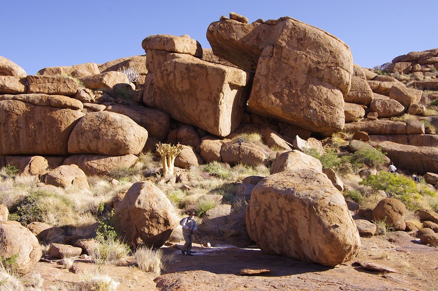
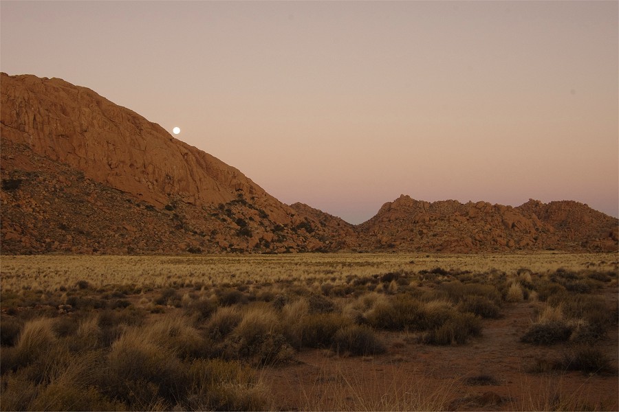
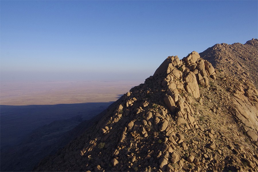
Driving for hours along the empty roads makes one appreciate just how big Namibia is. We had to cover over five hundred kilometres that day to reach the campsite by the Fish River Canyon. It took us all morning and most of the afternoon, we only had an hour left before sunset as we reached the edge of the Canyon. It is truly an amazing sight, the second deepest canyon in the world. I have not seen the other, but Raymond compared it rather favorably to the Grand Canyon, the major difference being our ability to be just the two of us along the edge of the cliffs, with no one else in sight. The Grand Canyon must have been like that - 300 years ago...
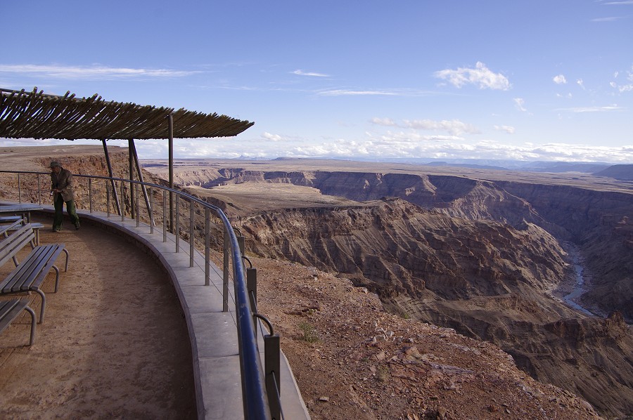


We moved along the canyon edge to several viewing spots, at one of them it was possible to descend along a path to a little platform about a hundred metres below the top of the cliffs.

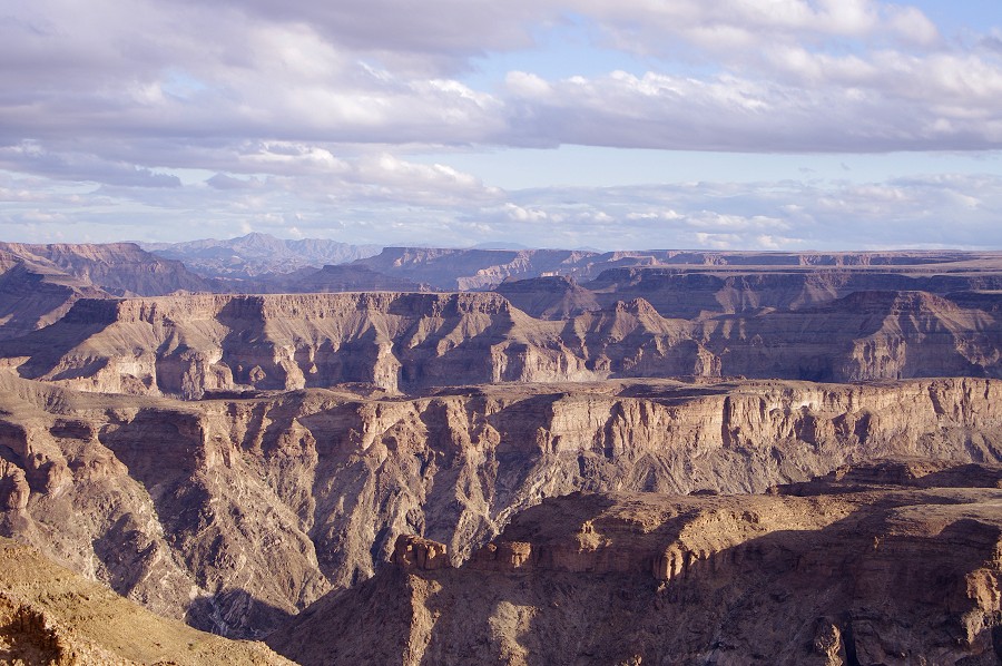

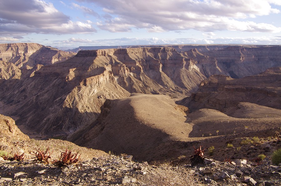
We waited for sunset at the last spot before droving back at dusk to the campsite about 10 kilometres away from the canyon edge for the night.

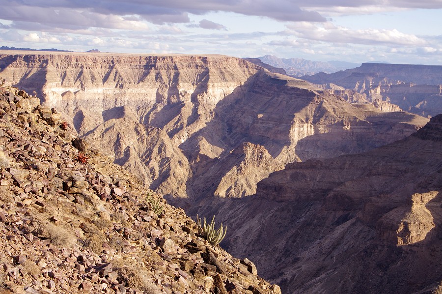
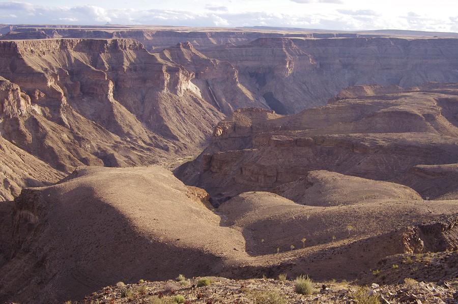
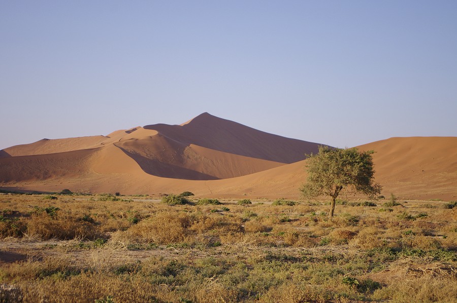
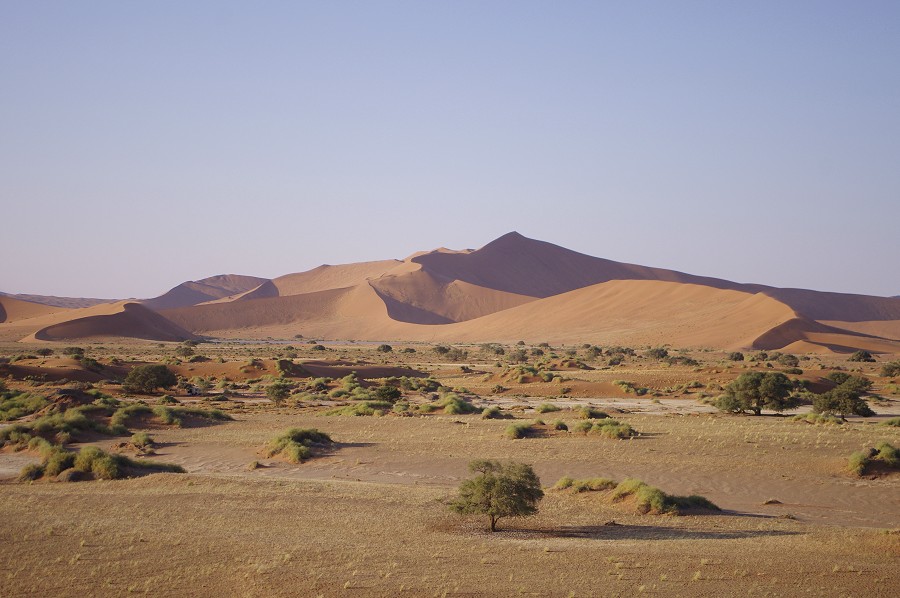
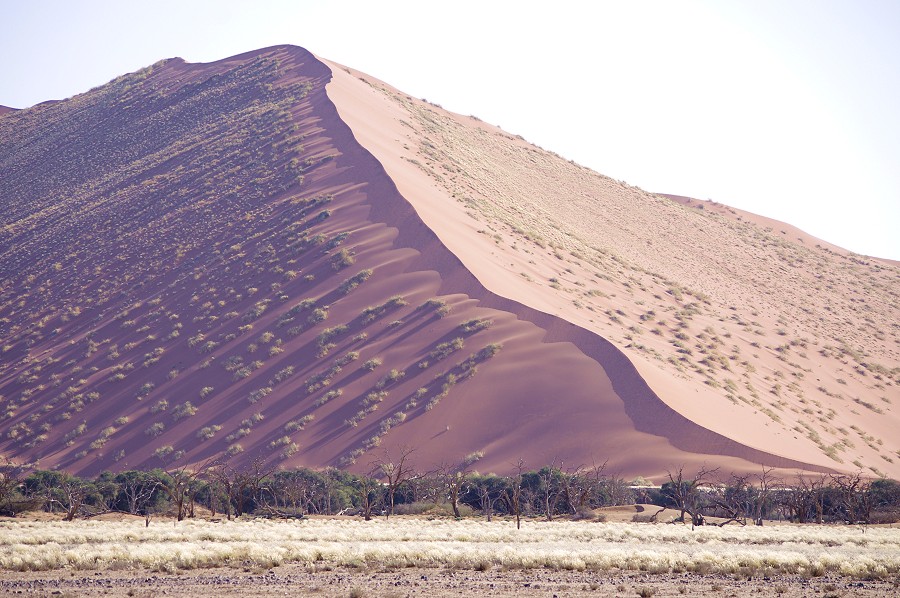
In the morning we packed up rapidly at sunrise, and made a quick dash to the canyon edge to see it in the morning light before hitting the road again. Our plan was to reach Sossusvlei some 600 kilometres away, which Raymond did not see on his prior visit to Namibia, and spend the hours before sunset there before moving to the Sesriem camp.

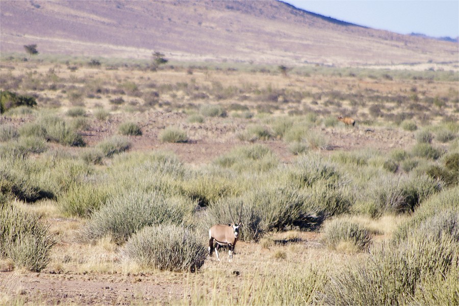
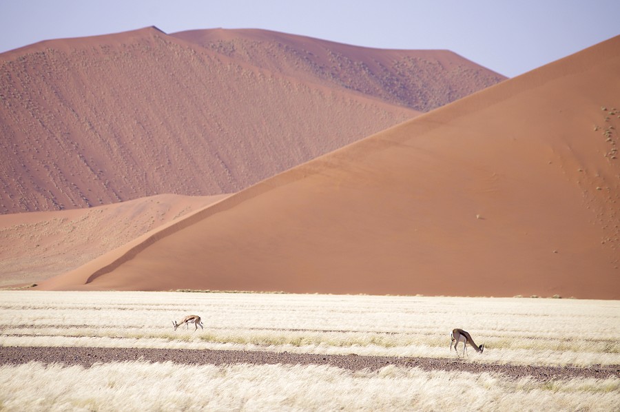
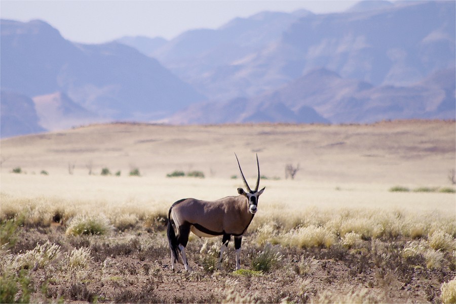
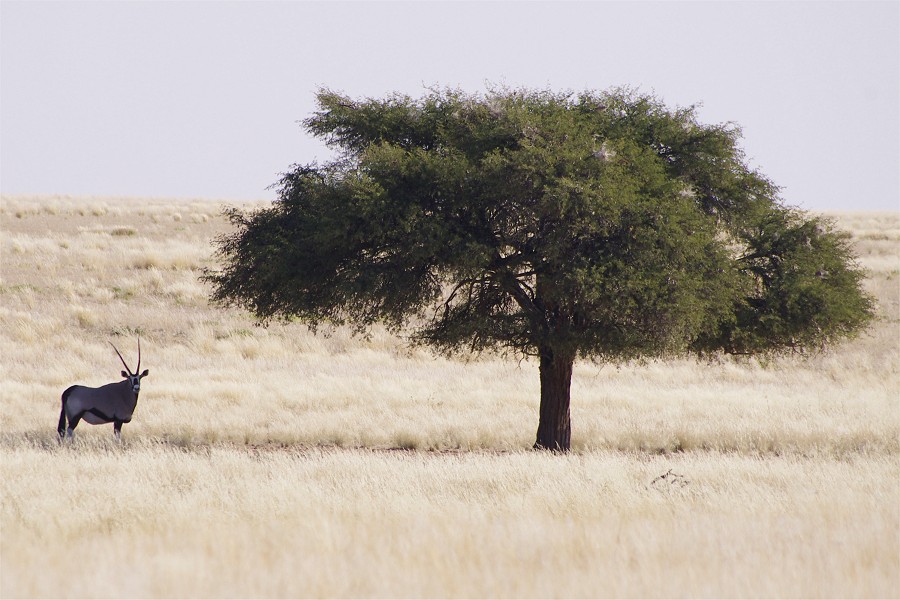
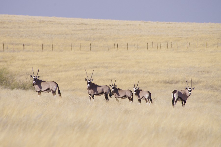
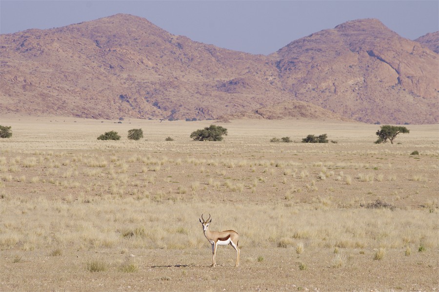
We encountered some sparse game as we were driving away from the park, a couple of oryx and gazelle grazing peacefully some distance from the road and not taking too much notice of us.


This time instead of taking the little back roads, we drove north on the main road linking Windhoek and Walvis Bay towards Keetmanshoop. Our aim was to drive North on the excellent road at a good speed for 300 kilometres saving a considerable time, even if the overall distance was a little more. At Keetmanshoop we entered the sleepy little town to fuel, delighted to have found a petrol station accepting cards. On payment however it turned out that the sticker was just a tease, none of our cards worked, nor did they at any of the ATM-s in town (I later learned that due to some technical glitch Namibia was disconnected from the global payment systems for three days...). It took over an hour of endless form fillings to get euros exchanged at a bank and get on our way again.
The drive North on the road turned out to be slightly more adventurous than we expected. A good 80 kilometres after Keetmanshoop on the entirely empty 200 kilometre stretch to Mariental, the little red battery light illuminated on the dashboard. Finding the car manual in the glove compartment, Raymond soon found the helpful entry to our problem: "Pull to the side of the road and call the nearest authorised Mazda repair station." As we started musing whether the closest authorised Mazda repair shop was located on the continent, or perhaps overseas, the engine temperature started rising alarmingly, and by the time I stopped by the road steam was blowing from under the hood. It did not take long to confirm our suspicion - one of the three main fan belts shredded, the one that drove the generator, but unfortunately also the cooling pump. By a spell of luck this just happened past a bridge over a small river that still had some pools of water in it (the only one on the 200 kilometre stretch), we could fetch plenty of water to refill the lost coolant. Unexpectedly there also was mobile reception, we could call Mark who set about to arrange a tow truck to start out from Mariental, as we were hoping to be able to roll slowly in that direction. We found that by filling the radiator with cold water we could drive 10 kilometres at a low RPM before the water boiled again. Refill and cooling took about 30 minutes, we repeated this three times before running out of water, so we pulled to the side of the road awaiting the repair truck.
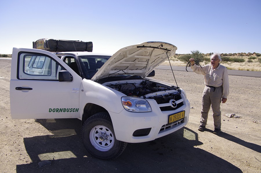
We were expecting a tow truck, but in 30 minutes a huge Hummer pulled up beside us with a mechanic, his young son and a helper. Instead of towing us to a repair station, they immediately set about removing the two outer belts (of course Murphy was at work, it was the innermost of the three that failed), finding a suitable replacement among the dozens of types and sizes in the rear of the Hummer (which was in fact a repair shop on wheels). Within 20 minutes the job was done, and we could continue under the watchful eyes of the Hummer close behind. Seeing that all was well, they waved us off at the turnoff leading West towards the Namib Desert just before Mariental. While our problem was fixed impressively quickly and efficiently, it was already well into the mid-afternoon, with a good 250 kilometres left to Sossusvlei. Obviously we could not reach it before nightfall, but at least we could still camp there to visit the dunes at sunrise the next morning instead of sunset as planned. We continued, with darkness catching up with us at about the half-way point. We reached the Sesriem campsite about seven o'clock, everything was dark and quiet, the gates were already locked, and it took some persuasion to allow the night watchman to allow us inside to make camp.

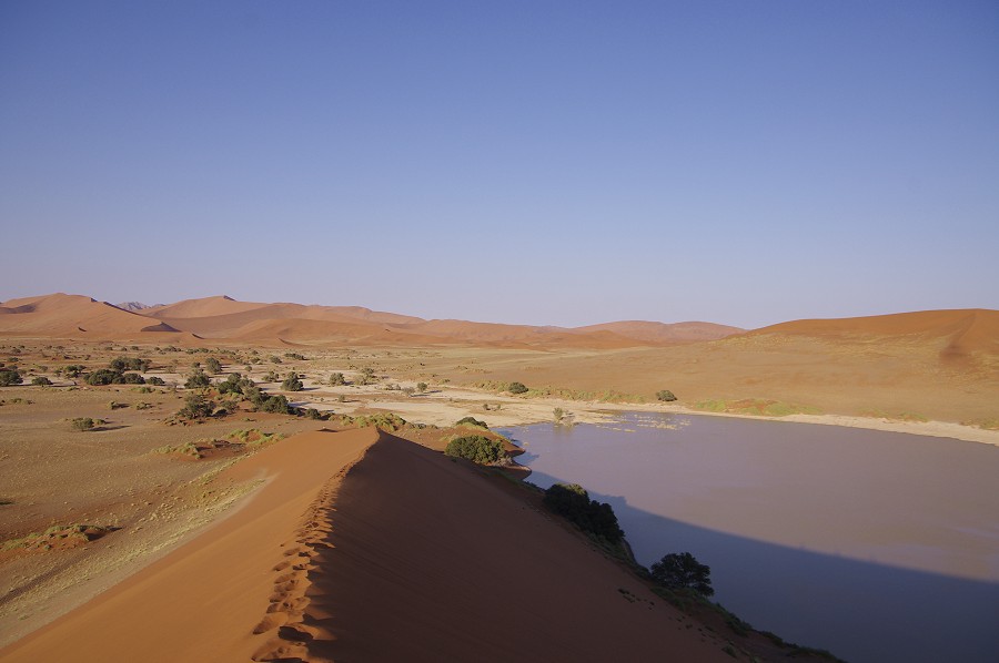
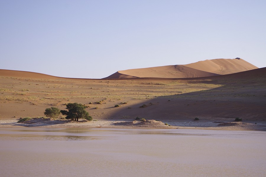
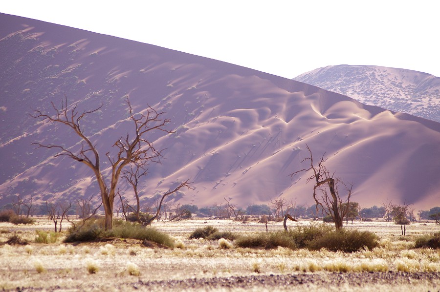
Next morning we were up in the dark, and were among the first to make it through the gates to Sossusvlei when it opened at 6am. We reached the end of the valley among the gigantic dunes just a little after sunrise in perfect light, with nobody else around. We found the large playa where the Tsauchab river ends among the dunes still half full of water.
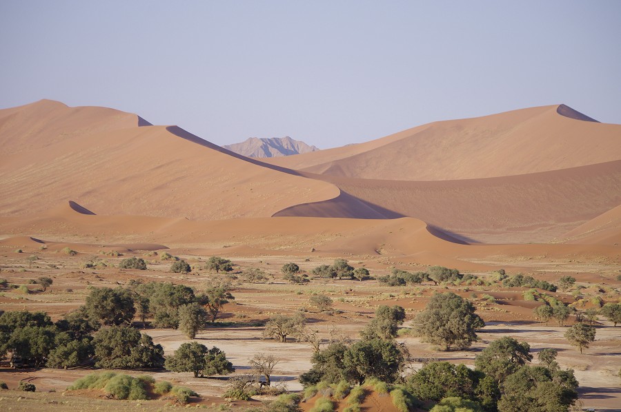
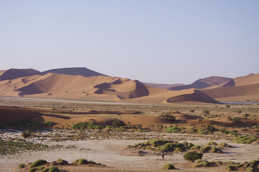
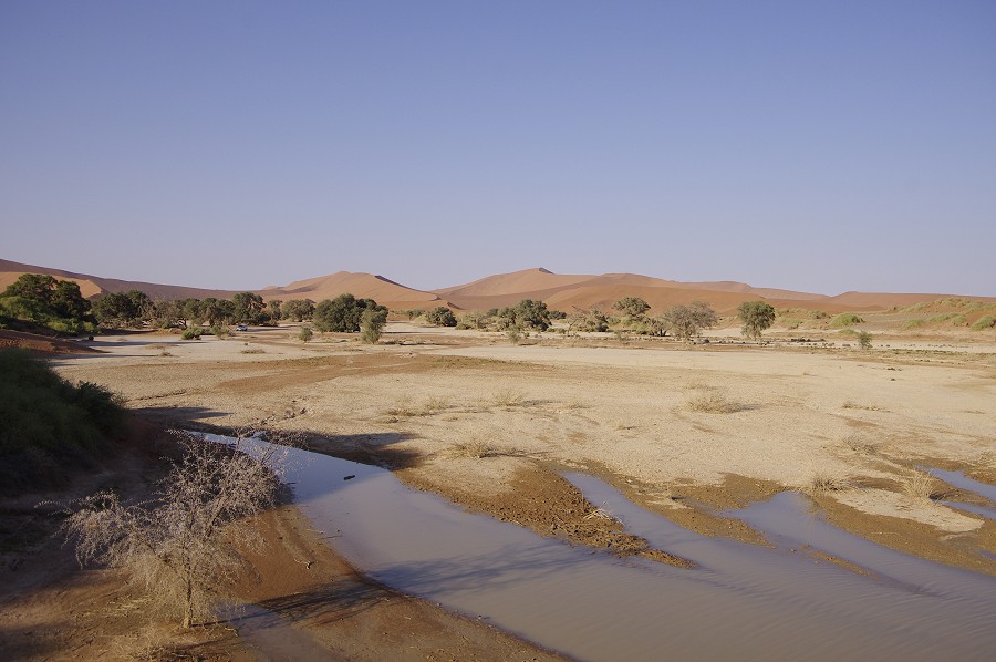
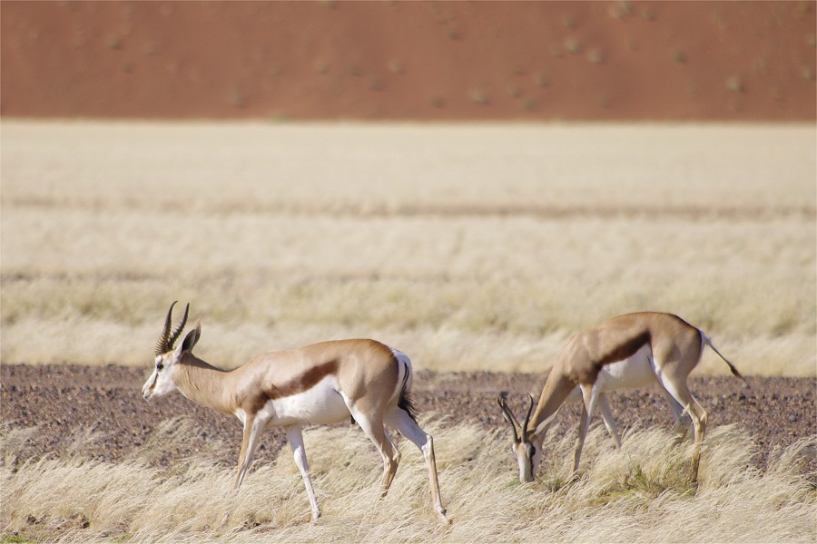
We had the whole place almost entirely for ourselves for an hour, after which other visitors started to arrive, losing quite a bit of its magic in the process. In retrospect it was not bad at all to have had the mishap the day before, with the sunset crowds I don't think it would have been the same wonderful experience. It was time for us to drive out, we moved slowly watching the abundant game on both sides of the road, grazing on the grassy plains at the foot of the dunes.

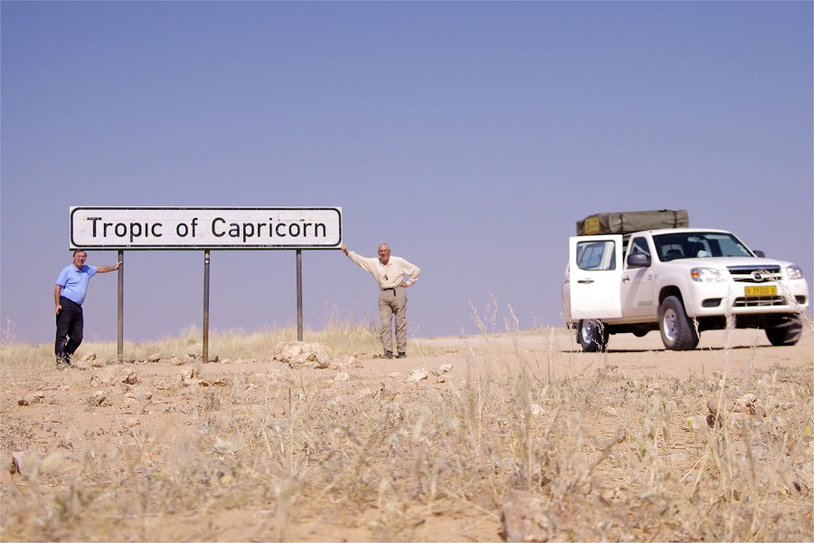
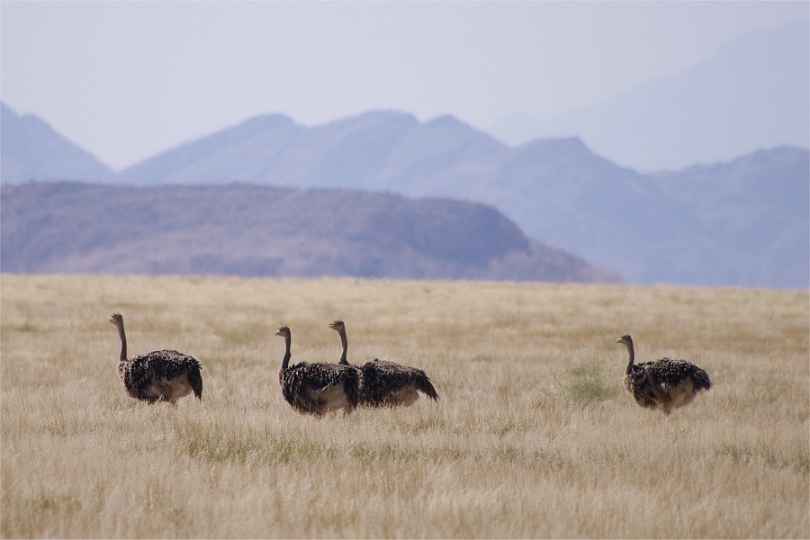
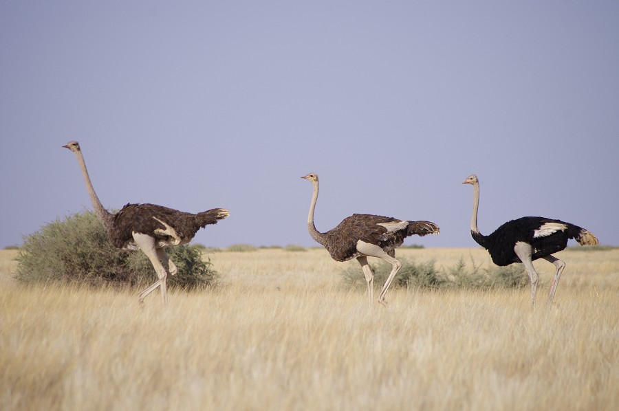
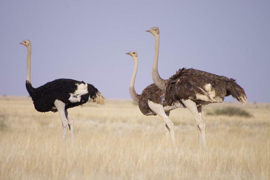
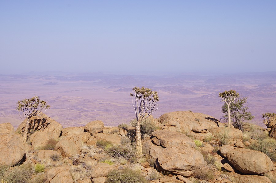
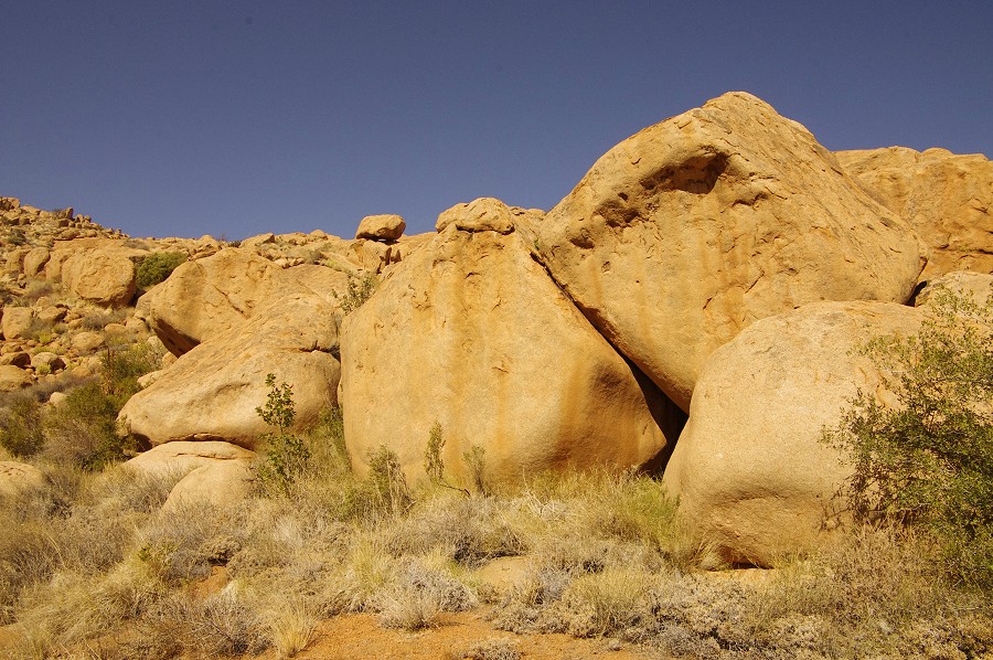
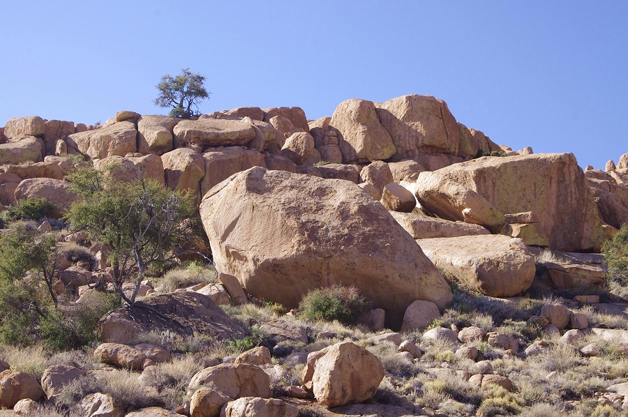
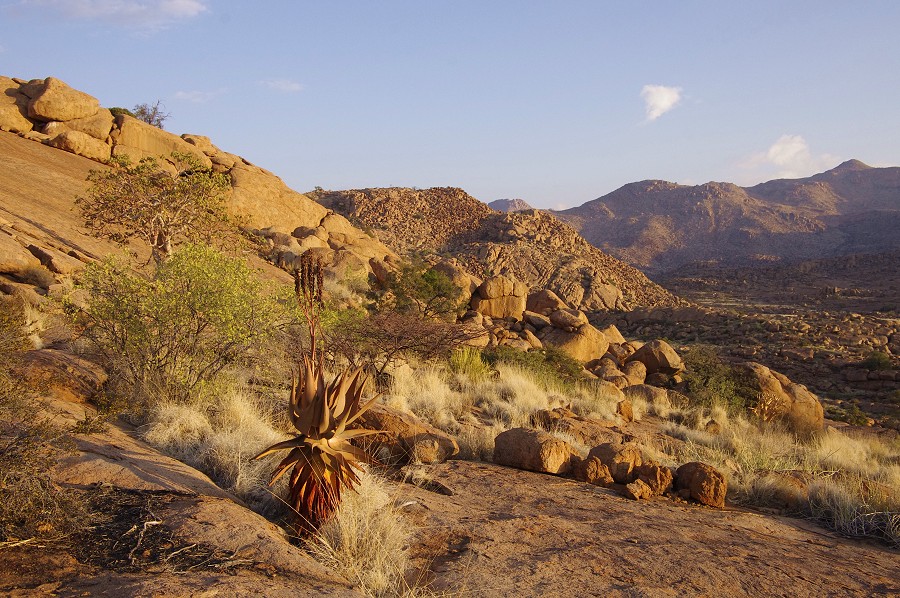
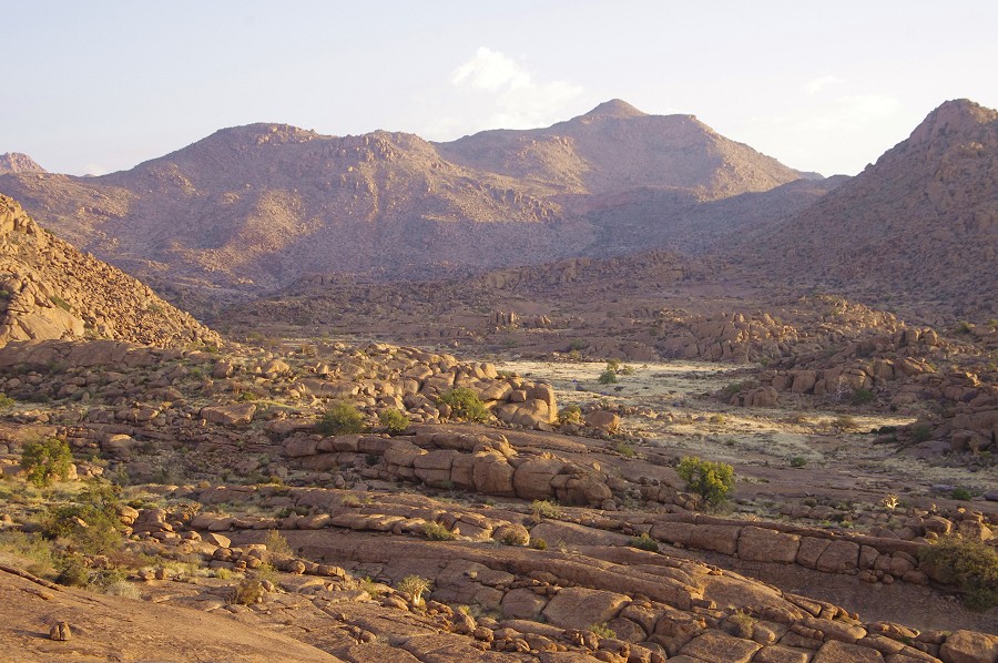
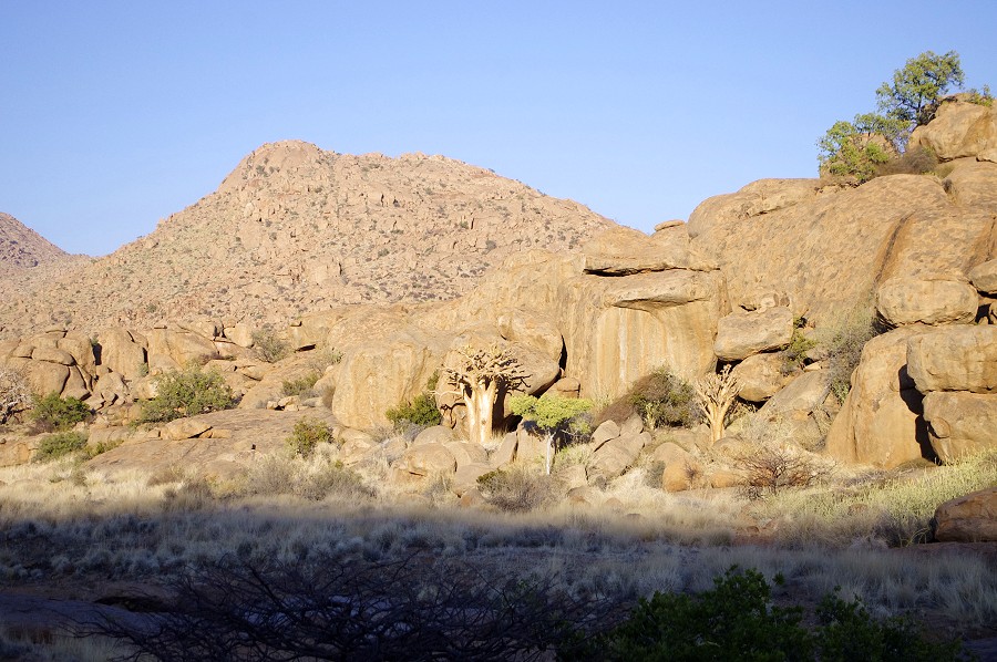
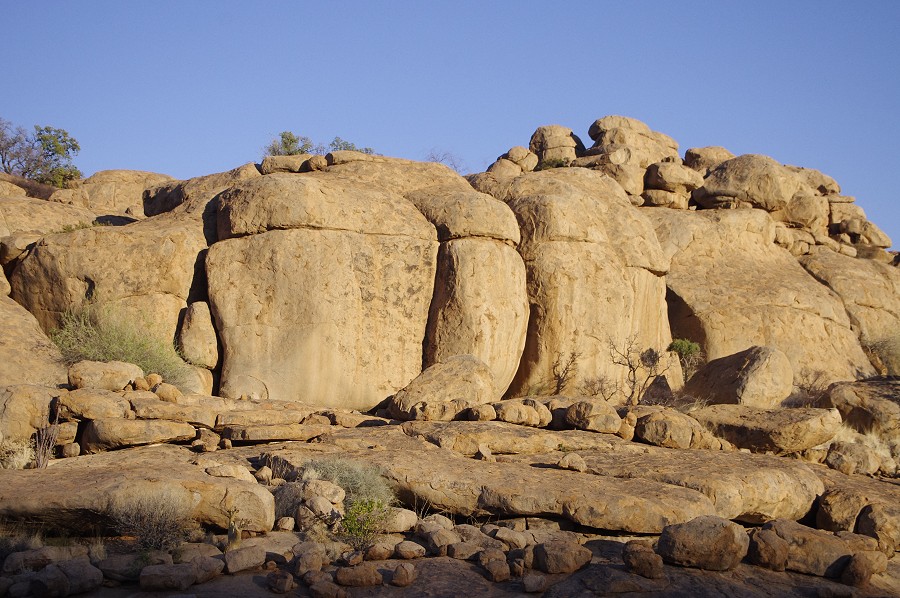
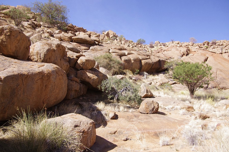
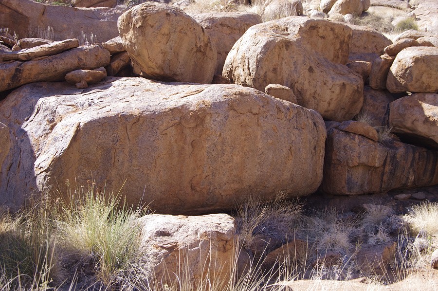
Leaving Sesriem, we continued North towards Swakopmund along the edge of the Namib Desert, to the northern areas of the National Park where most people simply drive through on their way to Sossusvlei. We passed the big sign announcing the Tropic of Capricorn, and also a fine flock of ostrich quite close to the road who appeared to be quite unperturbed, strolling slowly as we passed by. We also crossed two canyons gouged deeply into the very ancient and contorted schists (late Pre-cambrian Kuiseb formation), one of the oldest surface rocks in the complex geology on Namibia.

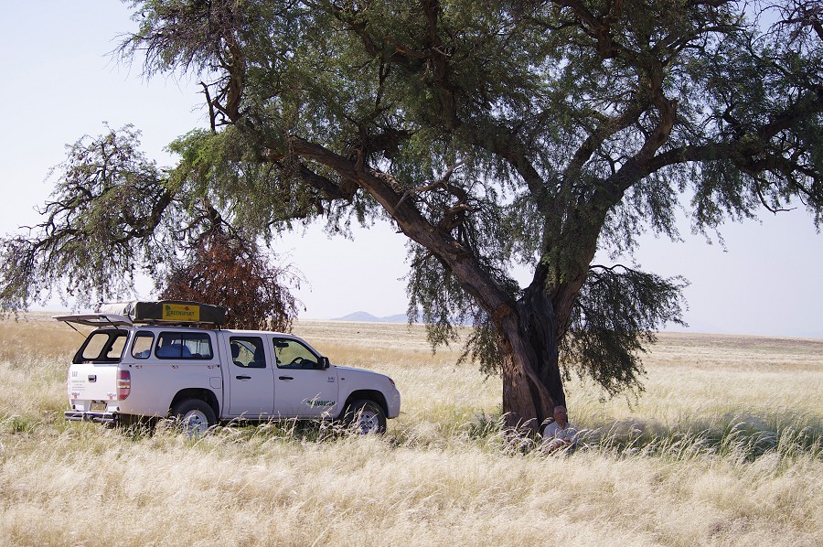
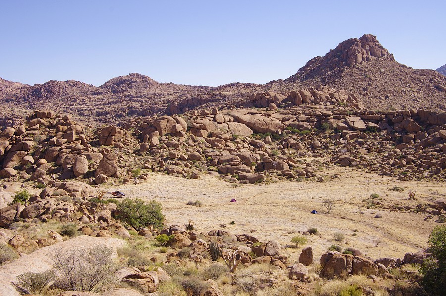
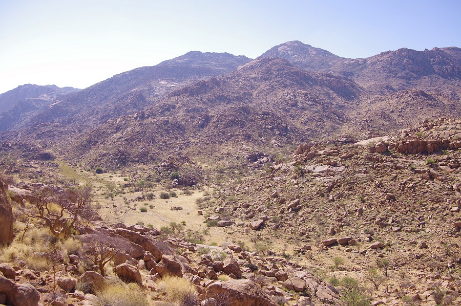
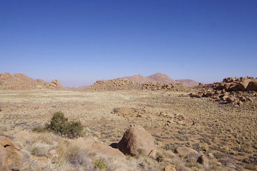
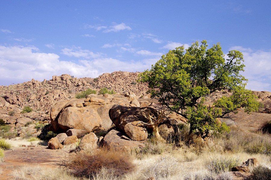
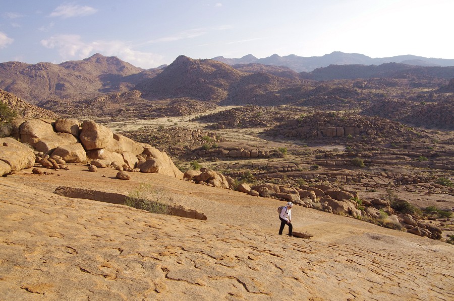
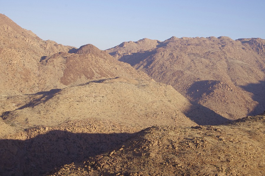
The northern part of the Namib-Naukluft National Park is made up of large grassy plains interspersed with numerous granite inselbergs. There is little to see on the main roads as the wildlife prefer to keep their distance, but there are a couple of sparsely traveled small roads where game is abundant. After having our lunch under a shady tree, we spent a lovely afternoon driving slowly along these tracks, stopping frequently whenever we saw something.
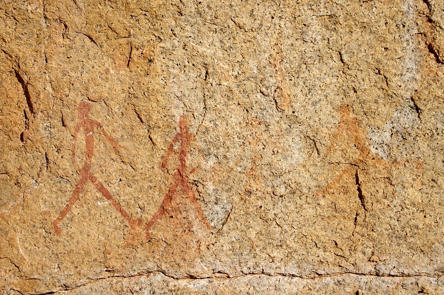
As we were driving along one of the tracks, I half jokingly turned to Raymond "and after the next tree, there will be the giraffe", on account of us meeting our first giraffe there in 2005 when we passed along the same route. I was the one more surprised, when sure enough there was a lovely giraffe right after the tree, exactly in the same spot as seven years previously. It must be one of their favorite grazing spots, based on the pattern of their coats they were not the same animal. Walking slowly, I could approach it to about 15 metres before is started to gallop away, displaying the characteristic curled tail of an agitated giraffe that may be seen on several of the Jebel Uweinat paintings.


As sunset approached, we finished the day at the Blutkopje campsite, so named after the adjacent granite knoll that turns blood-red at sunset.
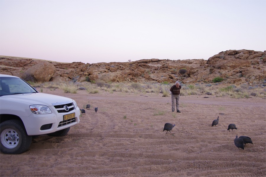
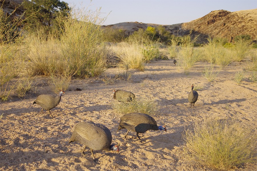
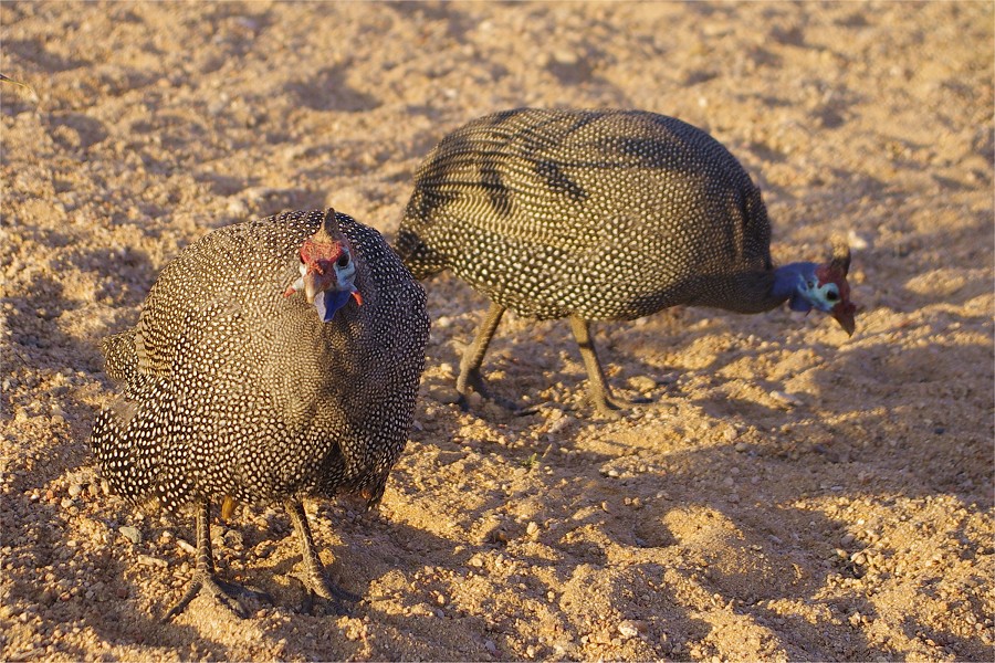
Next morning, as we were having our breakfast, the camp was raided by a large flock of guinea fowl, picking up every edible scrap (and even pecking at anything remotely looking edible, like the knob of the gas light...). They were shy at first, keeping a few metre distance, but eventually they even picked morsels from our hand.
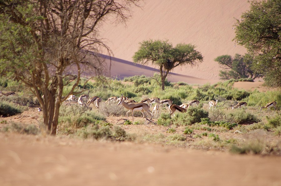
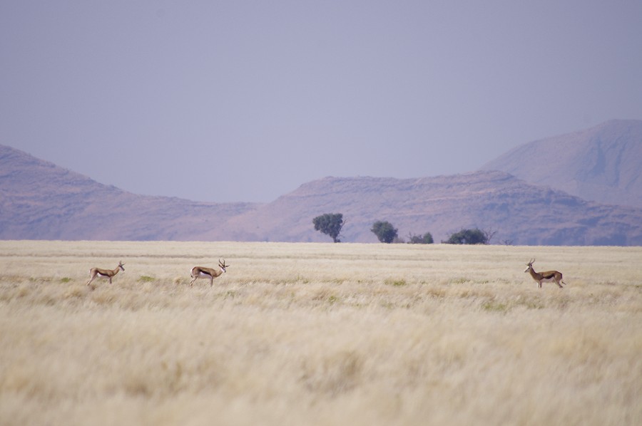
We needed to be back in Windhoek by the afternoon to do our shopping for the Brandberg trip, but we were in no particular hurry, we could afford another game drive along a remote track in the Tankas region, tucked away in the North eastern corner of the park. It is a lovely area of low granite knolls and grassy plains with abundant wildlife. As we were approaching the main road leading to Windhoek, we encountered a huge herd of gazelle that must have counted several hundred animals.

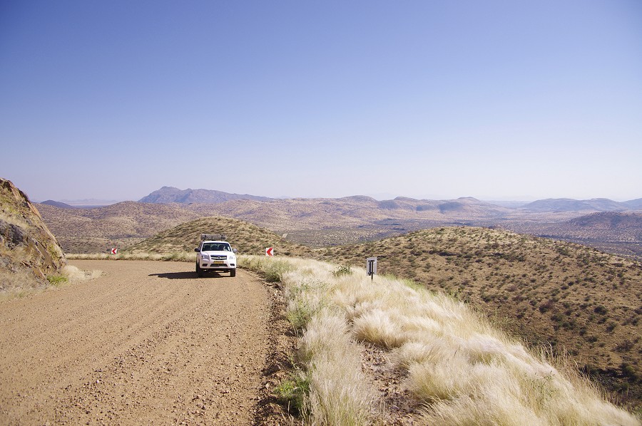
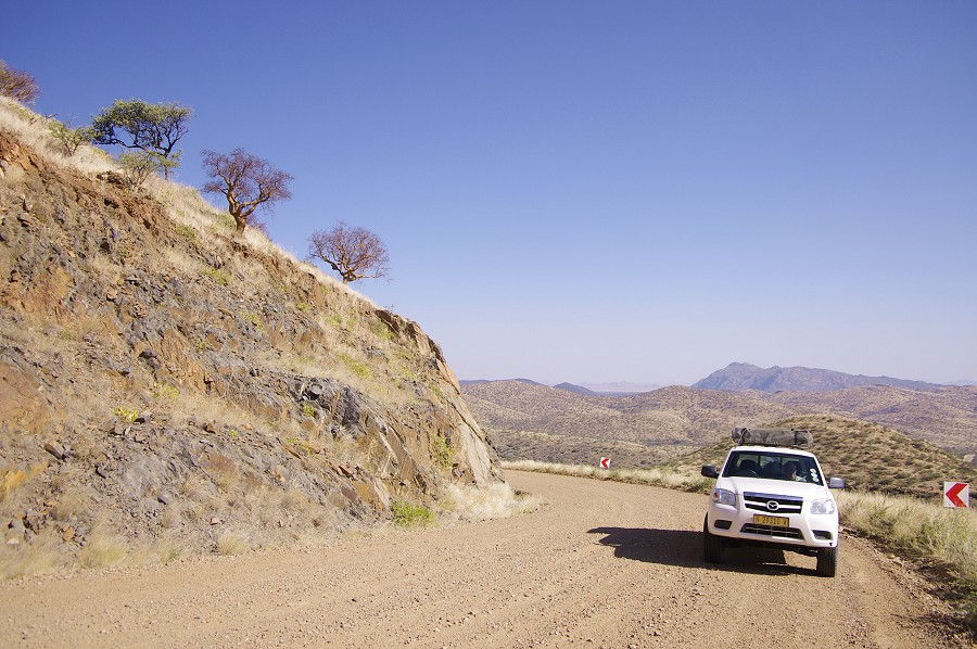
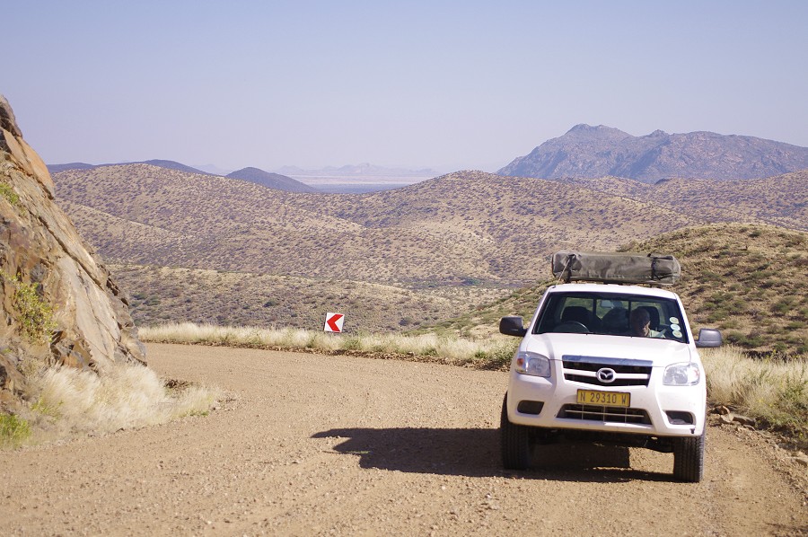
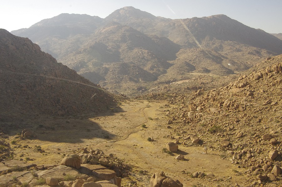
We drove back to Windhoek on the C28, the direct route between Windhoek and Swakopmund. The road was completely empty, and it took us some time to realise why everyone is using the seemingly much longer B2 tarmac road well to the north. The C28 makes an extremely steep ascent of about 1600 metres to the high plateau, across some incredibly rugged country. The ascent is not in one step but several, and usually it involves a descent of about half the height gained after the next ridge. There were some ascents which we could only tackle in first gear, we started to grasp that the sign "strictly no trucks, caravans or trailers" is actually to be taken seriously. For a stretch of about 100 kilometres there was not a single straight stretch on the road. What appeared to be a distance of around 150 kilometres on the map was more like 250 with all the twists and turns along the road. Along the entire route we only met a single car coming in the opposite direction. As our petrol was planned for the 150, we finally reached Windhoek with only fumes left in the tank...
Once back in Windhoek, we went to shop for supplies, packed them into boxes at Mark's garage, and loaded the trailer with them in preparation for next morning's drive to Uis straight from the airport when the others arrive. We spent the night at the Etango Ranch just beside the airport, where Thierry was already awaiting us, having arrived that afternoon. In the evening we collected Brenda after her looong flight from Sydney via Johannesburg, and just had to wait for the others to arrive in the morning.
Day 1. - Windhoek - Uis
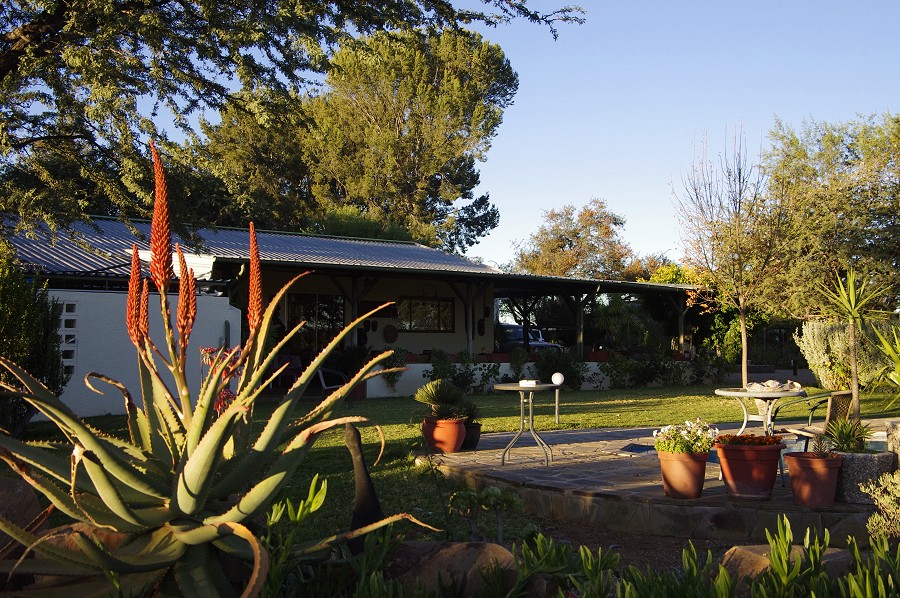
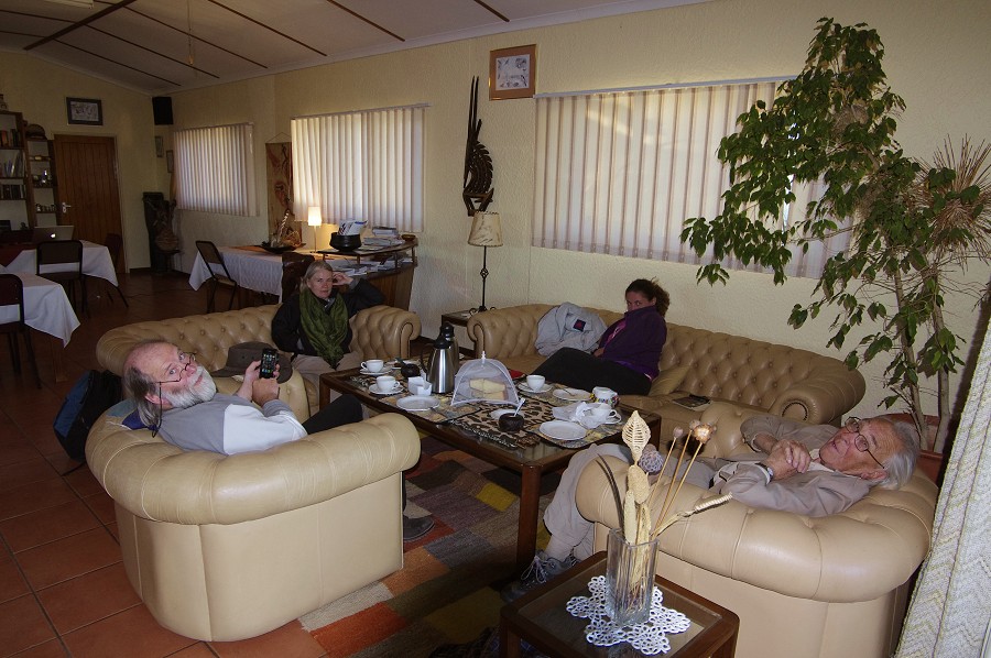
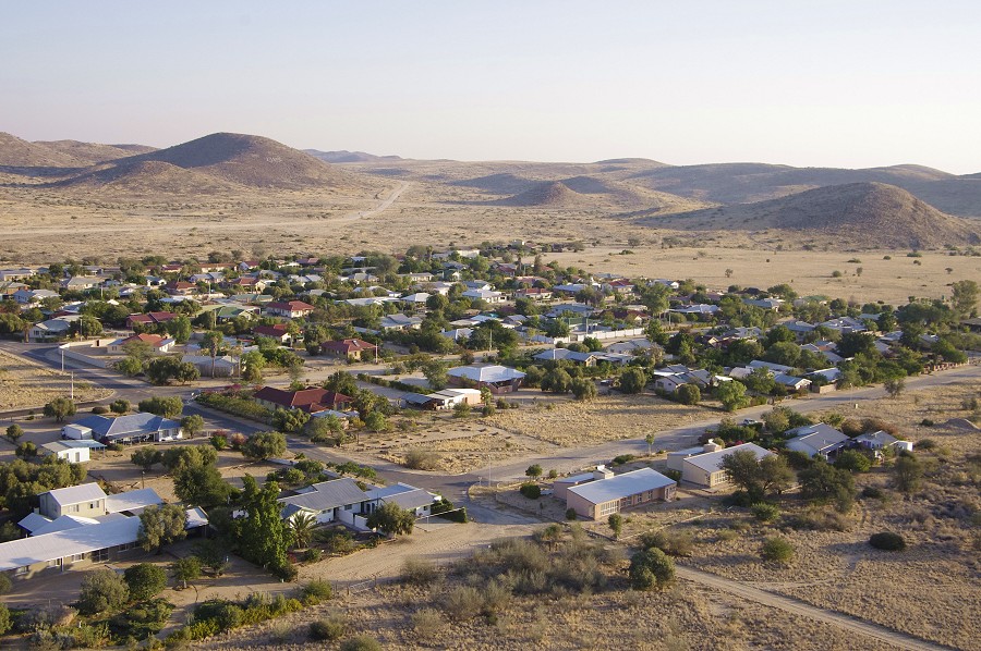
The Air Namibia flight was on time, and our group was soon assembled at the Etango Ranch for breakfast before leaving to Uis. We were in no hurry as the supplies were already purchased, we had a leisurely start at 9am with most fast asleep after the long flights till Omaruru, where we stopped for lunch before moving on to Uis, staying at the White Lady B&B with Annalene and Karl. I purchased the bottled water necessary for the trip, now everything was ready to be sorted into the various supply boxes.
Day 2. - Twyfelfontein
While Mark left with our group to visit the engravings of Twyfelfontein some two hours from Uis, I stayed behind to pack and label the supply boxes which needed to be uplifted to the mountain at a pre-determined schedule. Stefan arrived with the helicopter around midday, and in the afternoon we worked out and finalised the rather complicated flight plans and fuel requirements for the various days. In the mean time the others have returned from Twyfelfontein, and excitedly reported that they have met a herd of desert elephants by the road on their return drive. All seemed fine for the flight the next day, when we received the news from Windhoek that there was still an issue with one of the required NHC permits (The Natural Heritage Council controls access to the Brandberg). There was a reserve day planned for such eventualities, so we decided for the group to visit the White Lady and the other Tsisab Gorge sites with Alfons the next day (instead of after returning from the mountain), while me & Stefan were to sort things out and hope for the best.
Day 3. - Tsisab Gorge
Fortunately by midday everything was solved and our permits were in hand, the multi-day delays envisioned the evening before from our various experiences in Libya, Egypt and elsewhere on the African continent did not materialize. The Tsisab party returned in the afternoon very much impressed with the sites, and this time all seemed set to go.
Day 4. - Ascent - Eastern Amis Gorge
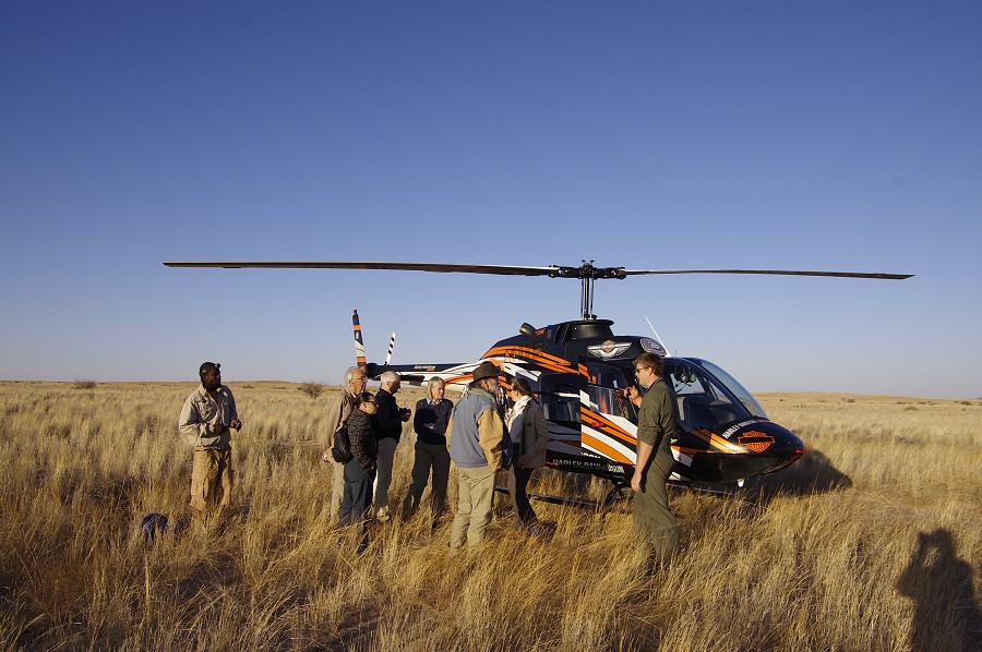
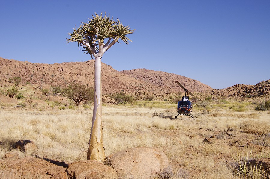
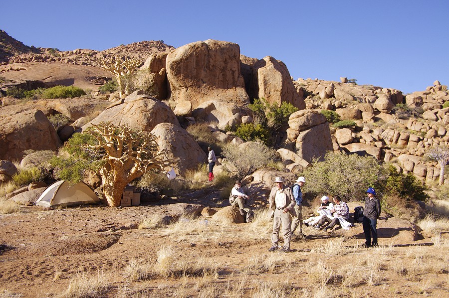
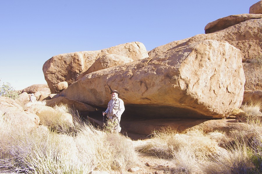
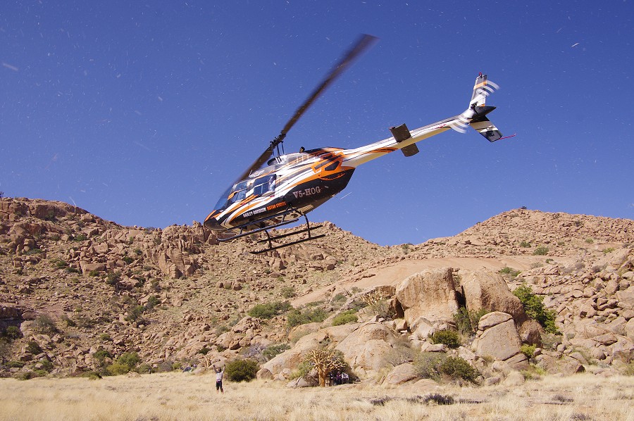
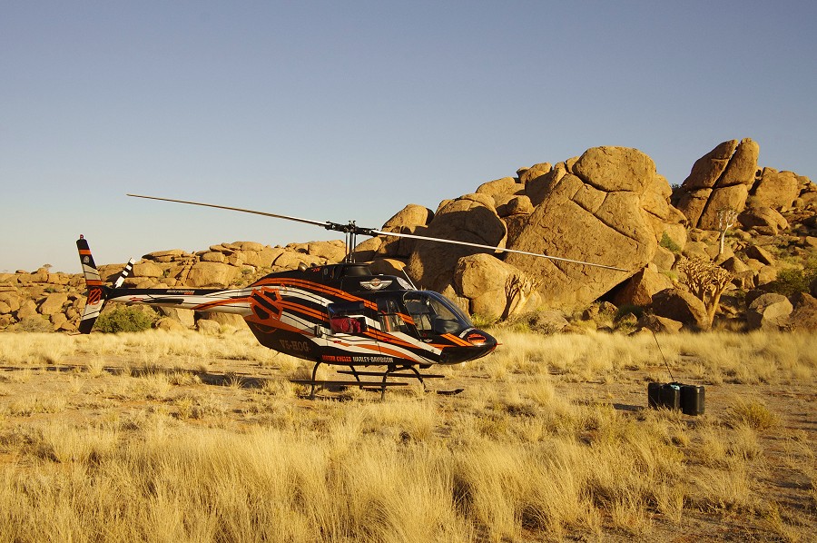
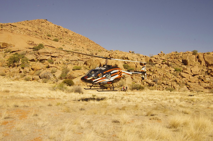
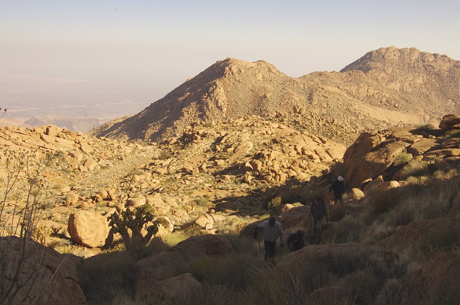
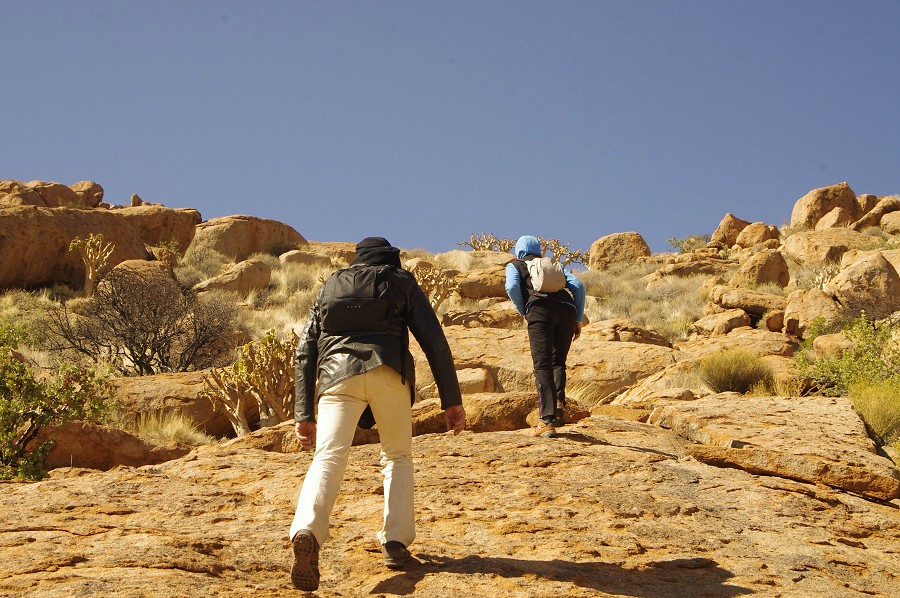
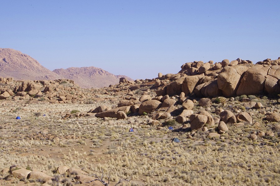
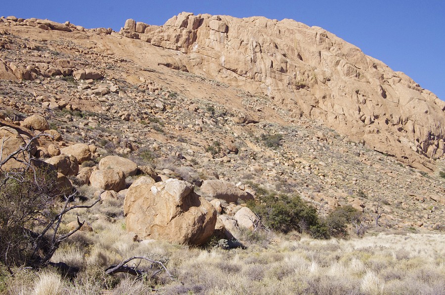
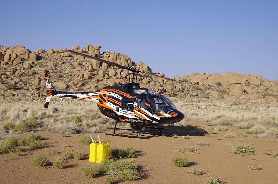
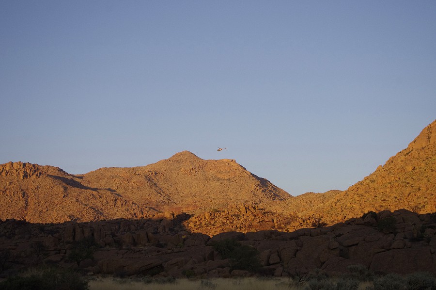
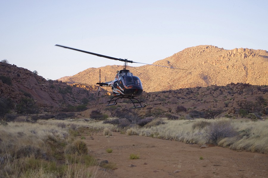
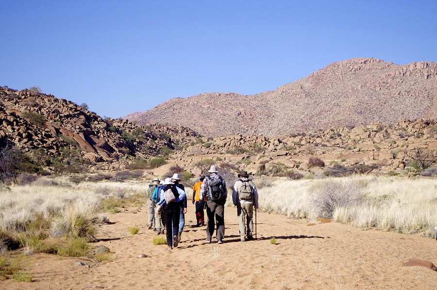
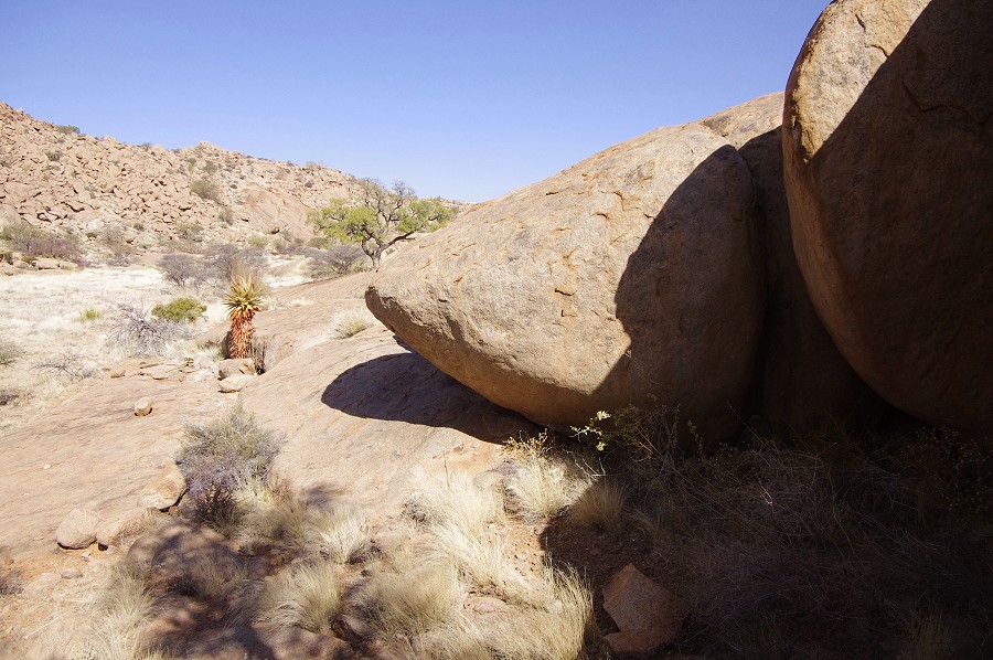
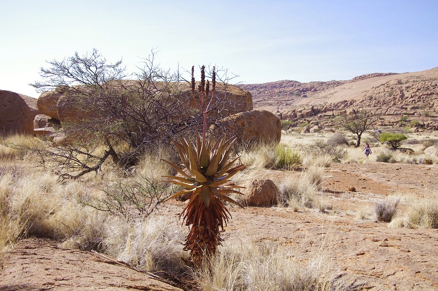
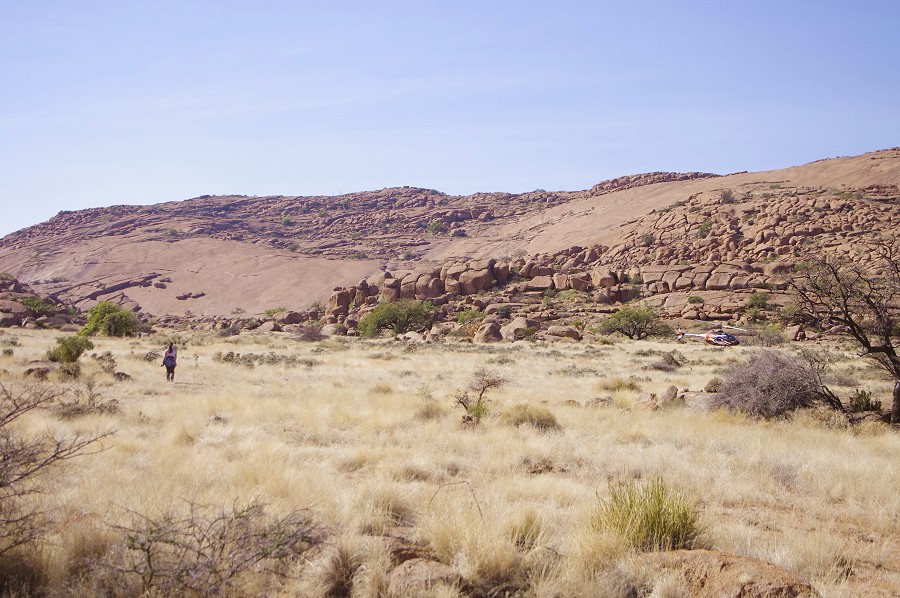
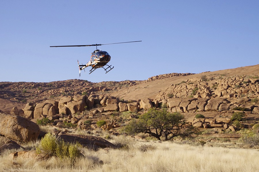
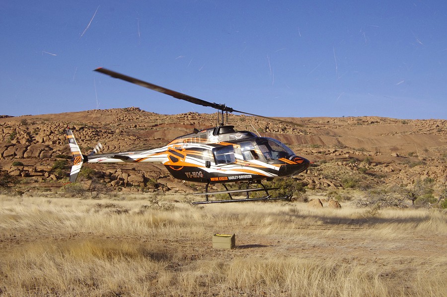
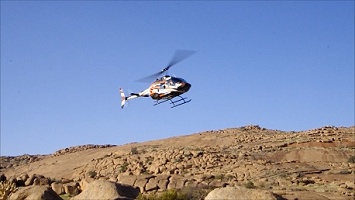
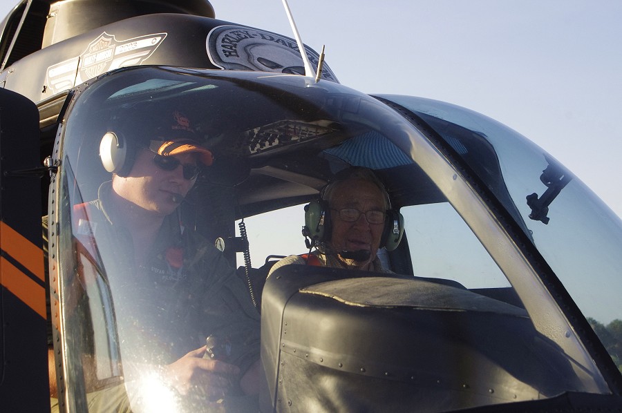
We were up before dawn, and started out to the agreed rendez-vous point by the D2342 road at the south western side of the Brandberg, about one kilometre from where the Messum (Hungorob) river crosses the road. This location offers a good unobstructed landing spot, and is as close as one can get to our target in the Upper Amis without the minibus having to struggle across the sandy bed of the Messum river. This time there was no fog like the year before, we were there in about 40 minutes, just about the time Stefan started from Uis at sunrise. Stefan landed by us in about 15 minutes, and after a safety briefing we started to make the turns ferrying the people and supplies up the mountain.

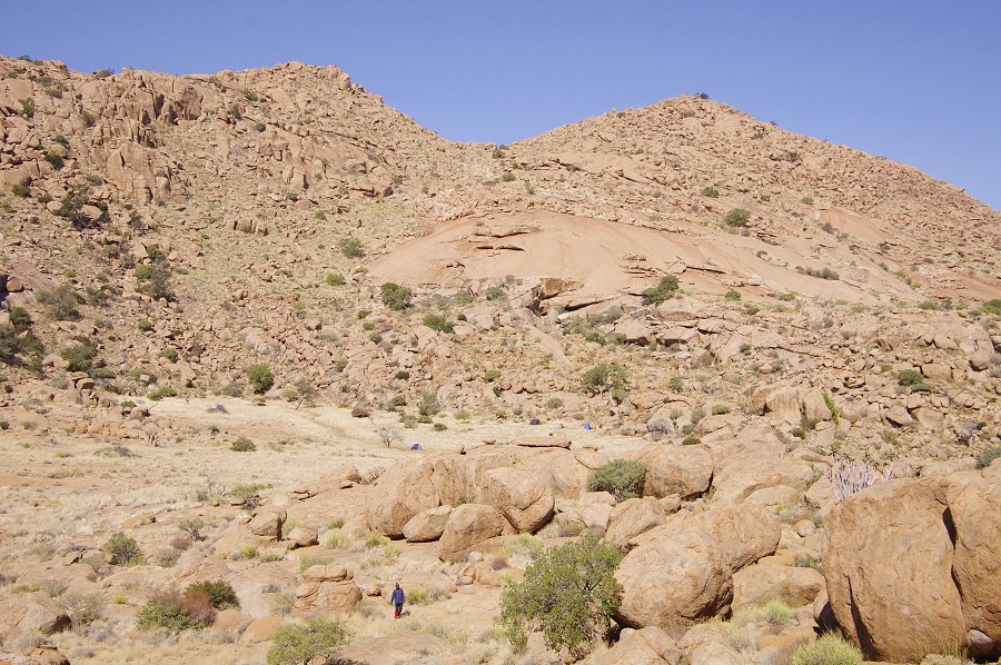
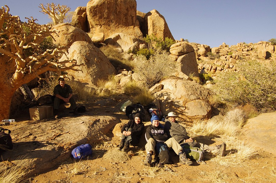
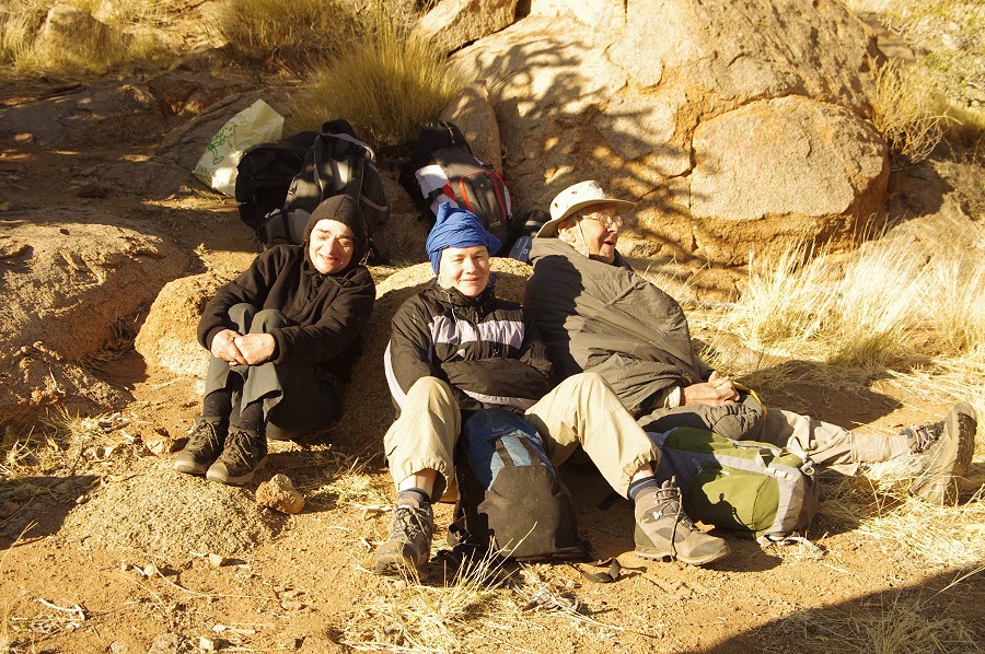
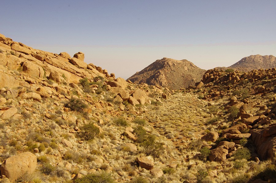
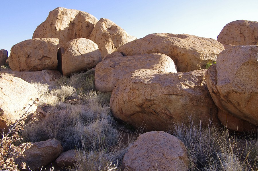
It took four turns to get all up to our cam in the Upper Amis gorge, on the flat plain under the "Giant's Shelter" (A10). On the last flight we made a supply dump in the middle Numas in preparation for the trekking expedition planned immediately after this trip. By about 10am we were comfortably established in the Amis camp, and were ready to set out.

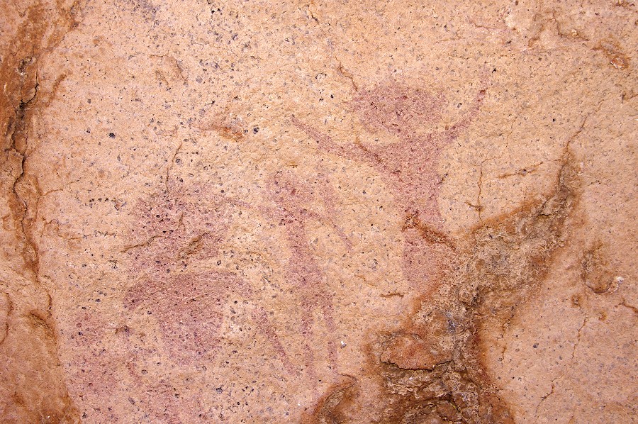
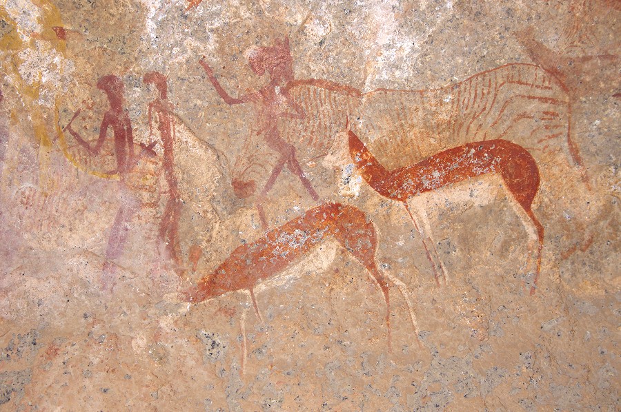
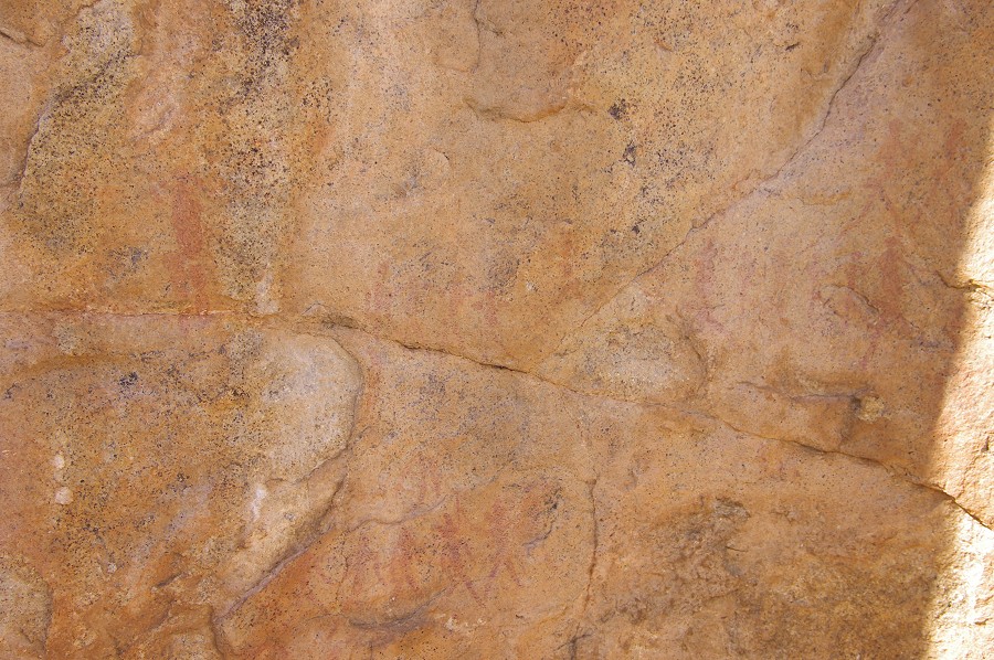
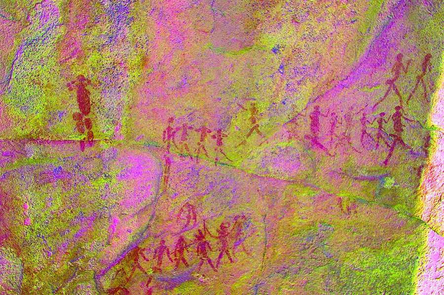
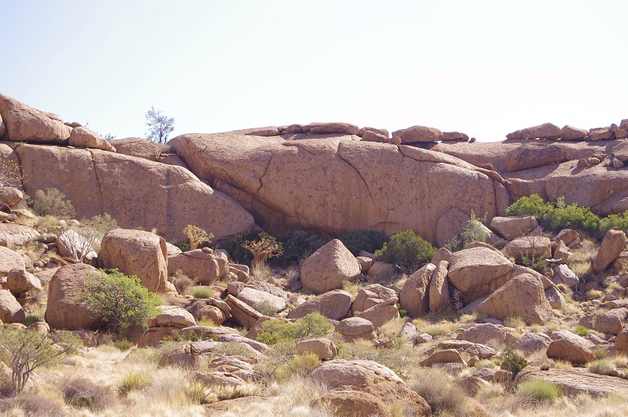
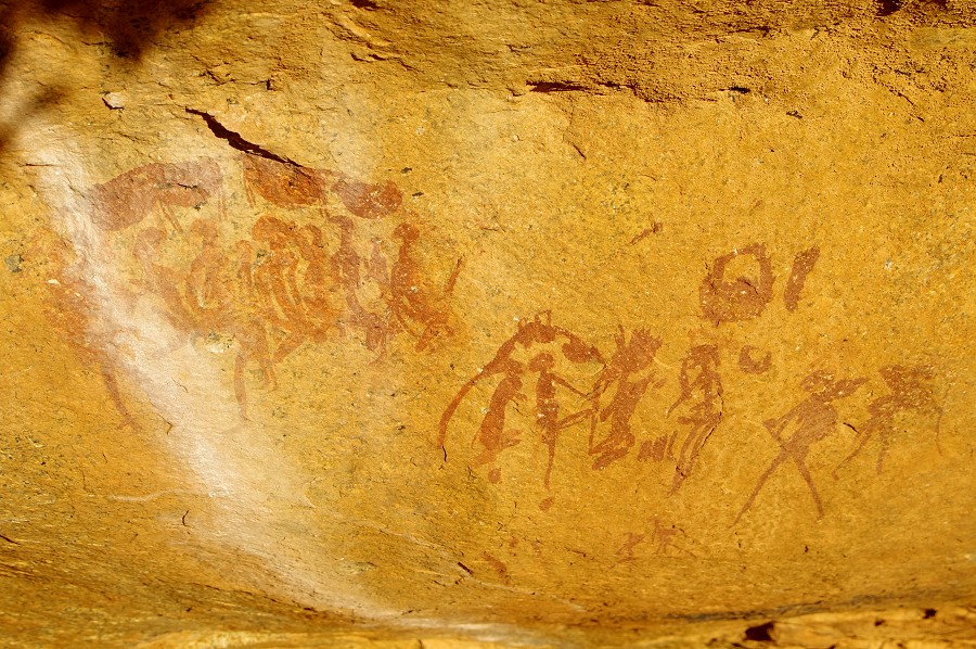
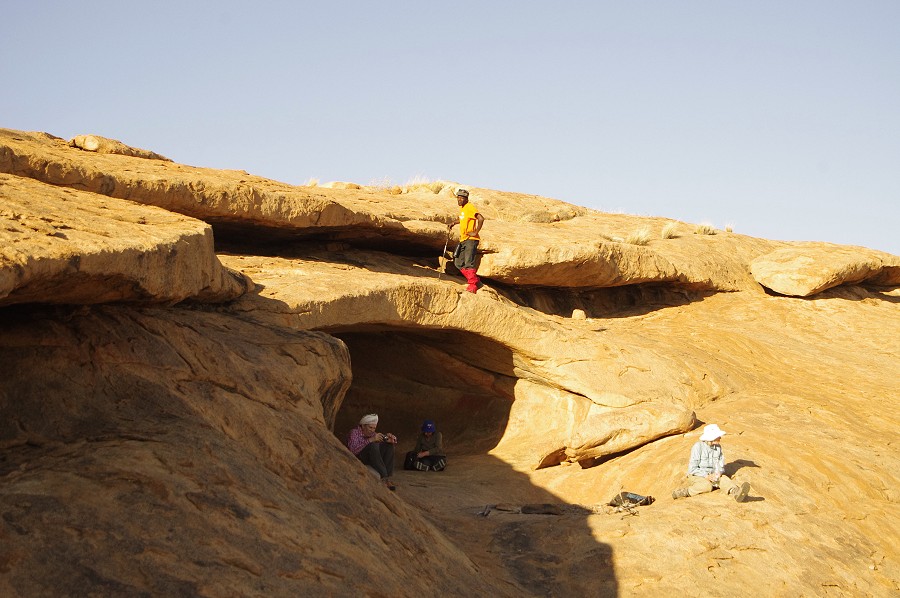
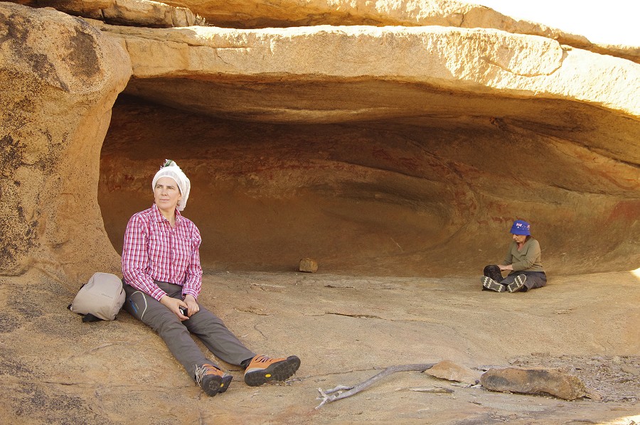
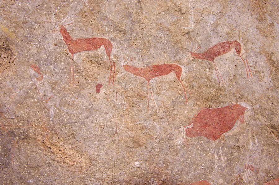
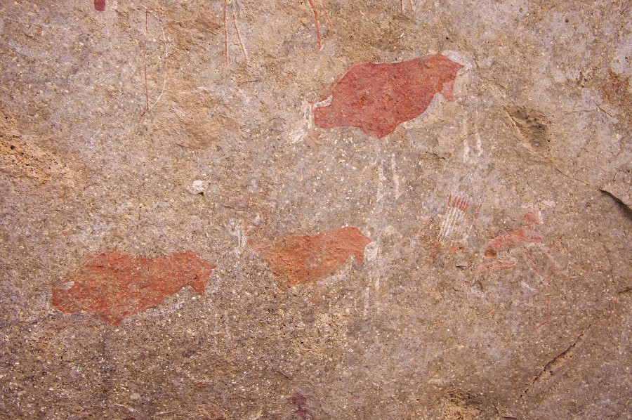
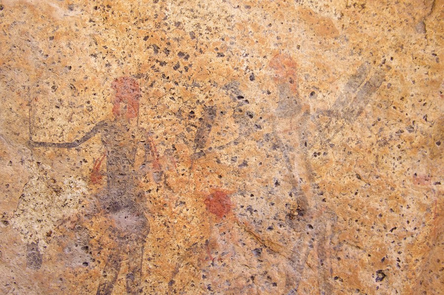
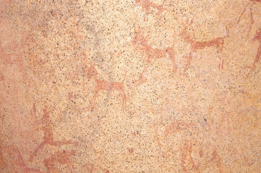
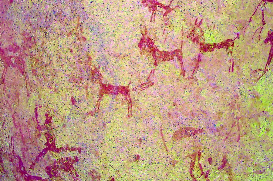
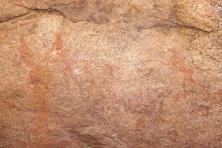
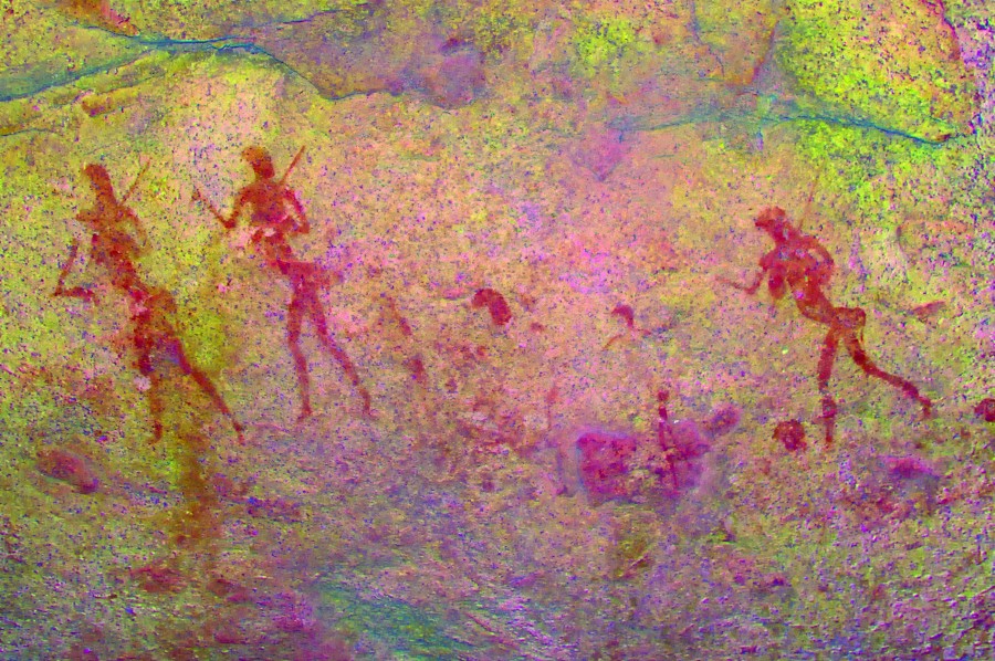
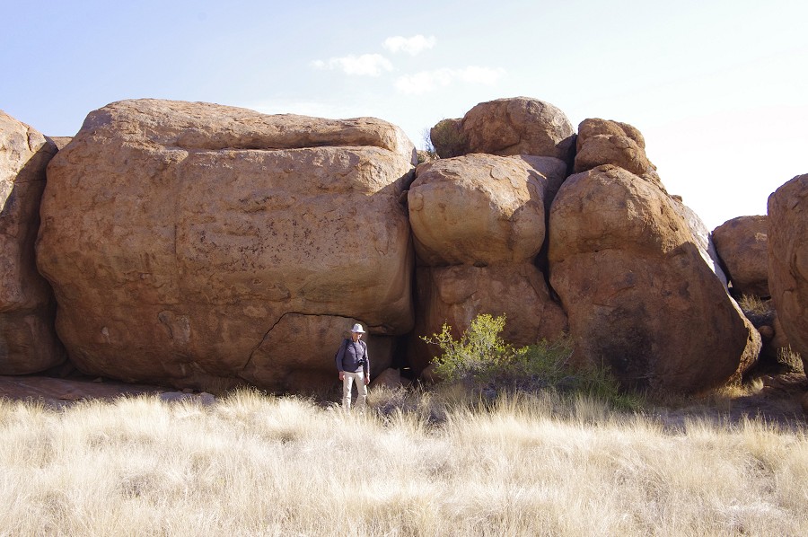
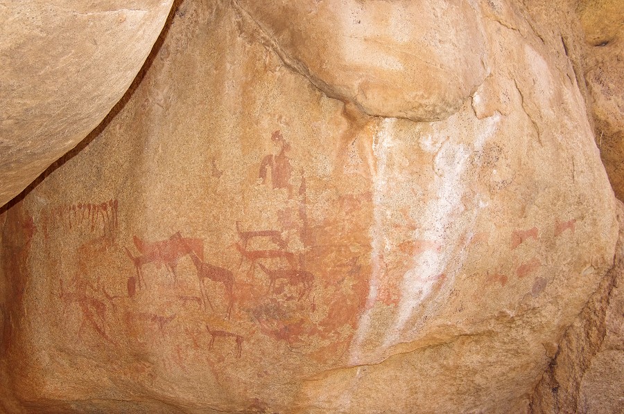
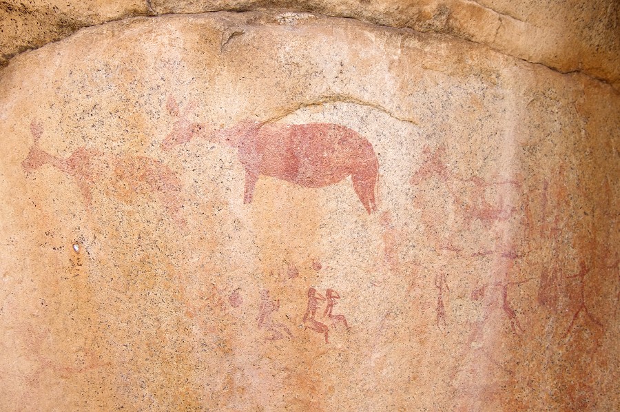
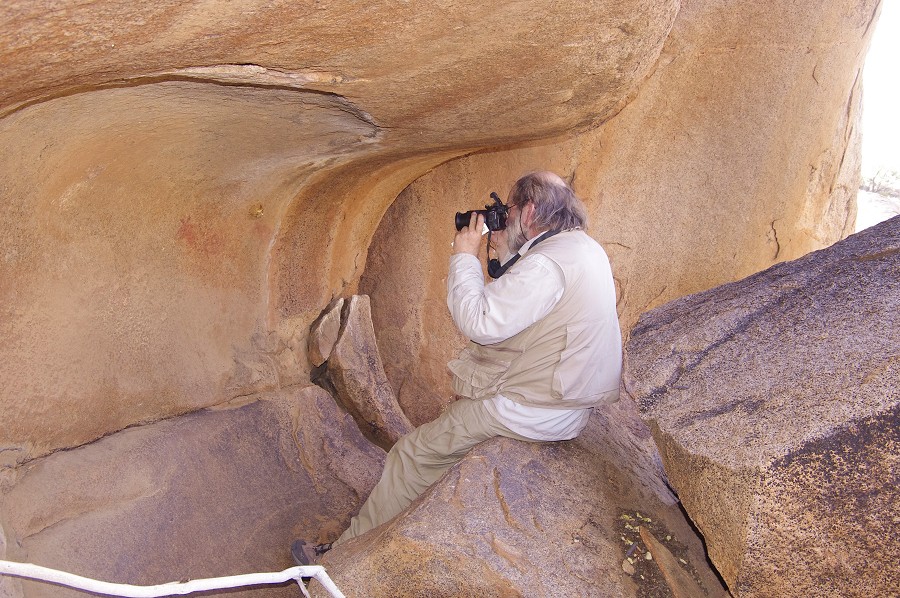
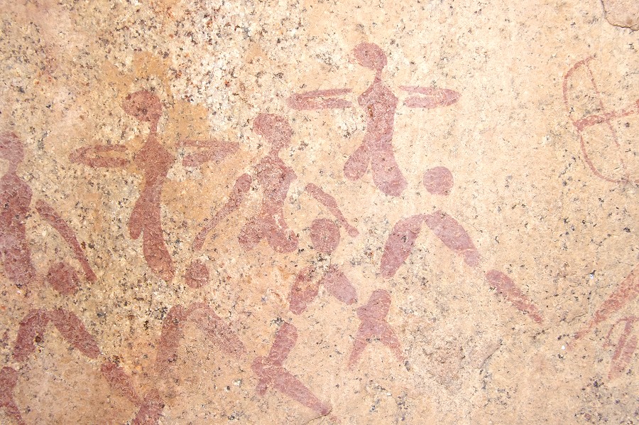
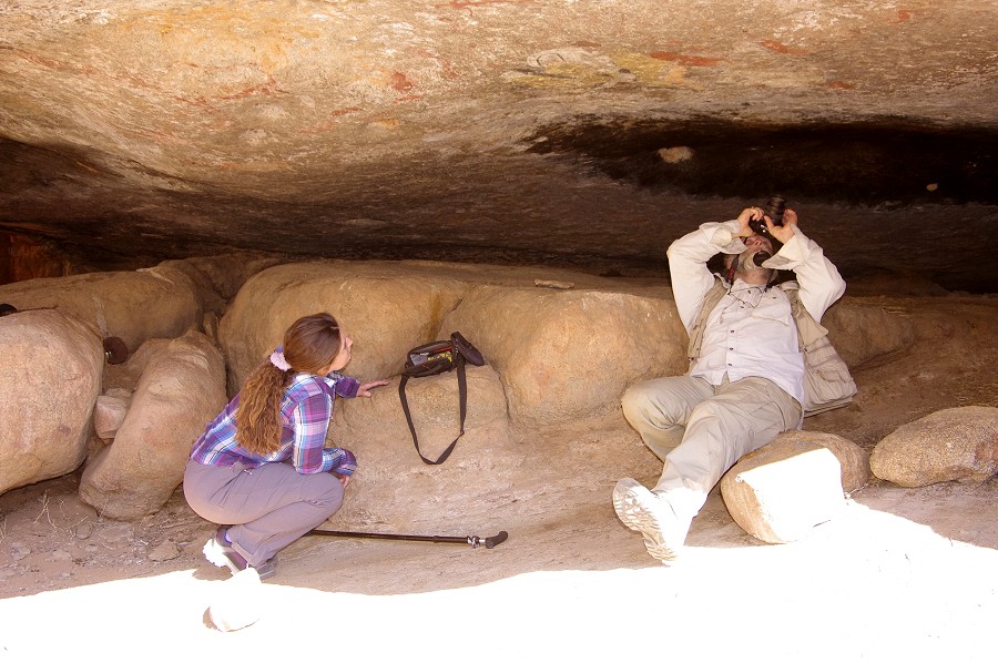
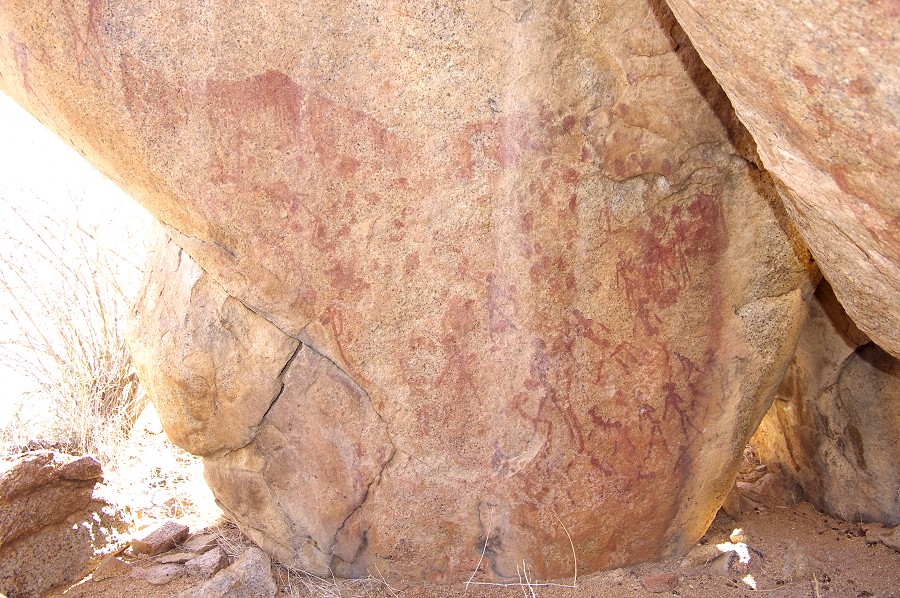
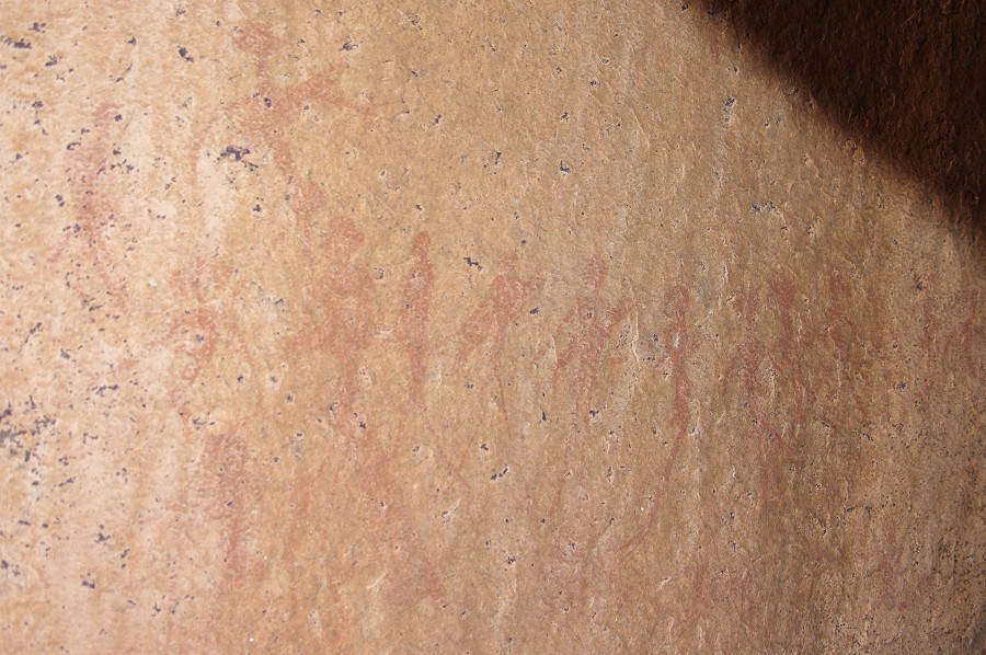
Our first objective was A10, the "Giant's Shelter" (Riesenhöhle) situated a short climb above our camp. This is the single largest shelter with paintings on the Brandberg, we spent several hours photographing and simply looking at the exquisite details.
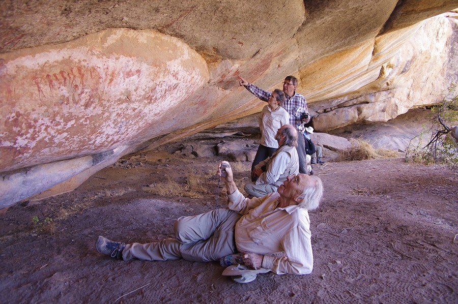
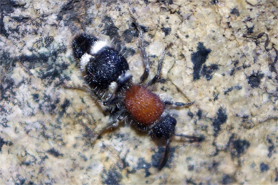
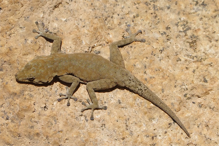
On a rock outside the shelter I have spotted colorful half an inch long creature which I have not encountered before. It appeared to be a mixture of being a wasp and an ant. Alfons identified it as a velvet ant (Dasylabris merope ?) with a rather nasty bite, someone to be respected and kept at a comfortable distance. Despite their appearance and name, these creatures are in fact wasps, the females like the one we encountered are wingless.
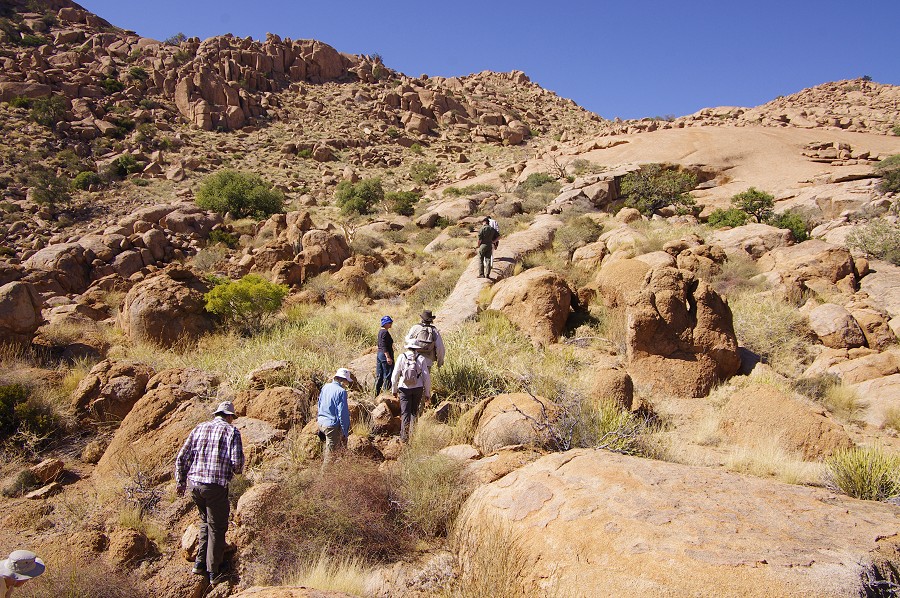
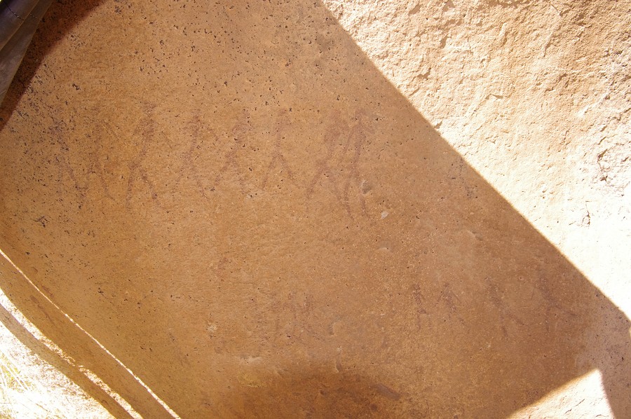
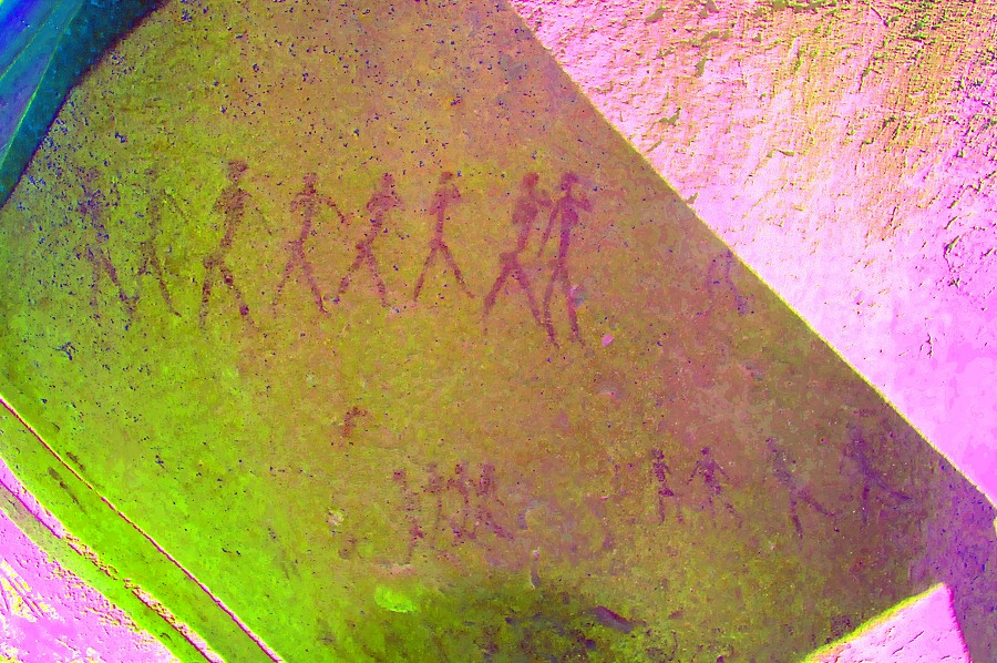
After lunch Stefan departed with the helicopter. With Eva, Nathalie and Nicolas we made an excursion to the side valley of the Silberweide (middle Numas) to see site N21 at about one hour's distance, involving a fairly steep descent into the Numas valley. We passed by N8, the small but exquisite site on the lovely little plain separating Amis and Numas with four walking archers. N21 is a major site on the face of a large boulder next to the watercourse, with a large number of well preserved human figures. While I have been here twice already, rather embarrassingly I could not find the site among several large rocks that all looked the same, finally Nathalie found it about 100 metres further upstream, much higher in the valley than I thought it to be. Overall we took over three hours to go to Numas and back, it was close to sunset when we returned to the camp.


Day 5. - Eastern Amis Gorge
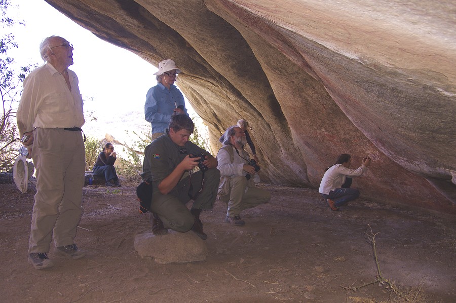
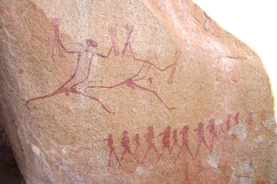
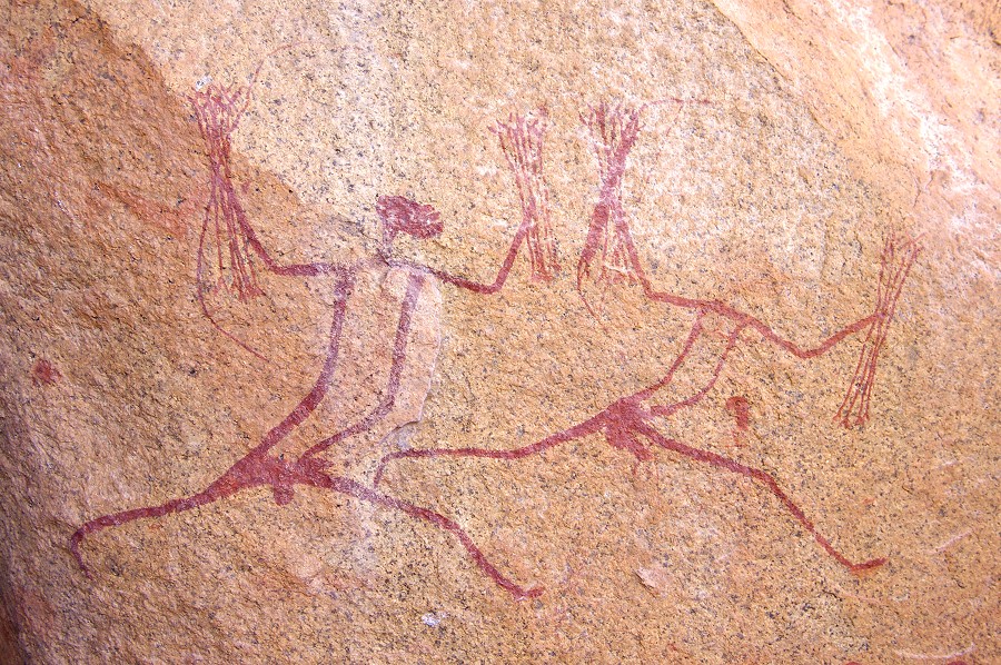
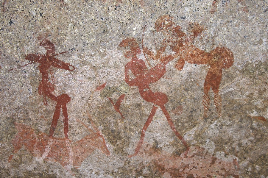
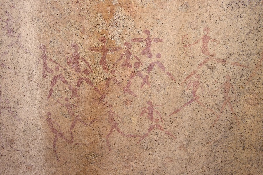
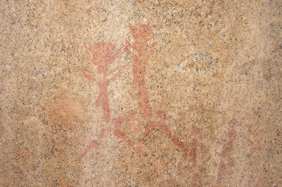
Next morning we set out to see the other principal site of the Eastern Amis, A6 the "Wind Shelter" (Lufthöhle). On the way we passed by site A12, with the impressive panel of two large running archers with bundles of arrows in each hand, and a procession of smaller figures. This panel is on the sun for practically the whole day, it can be photographed properly only in the early morning.
Between A12 and A6 there are two lesser sites which we have not seen on our previous hurried visits. This time with Pager's site plans in hand we had no difficulty finding A13 and A8, both containing a few faint human figures.
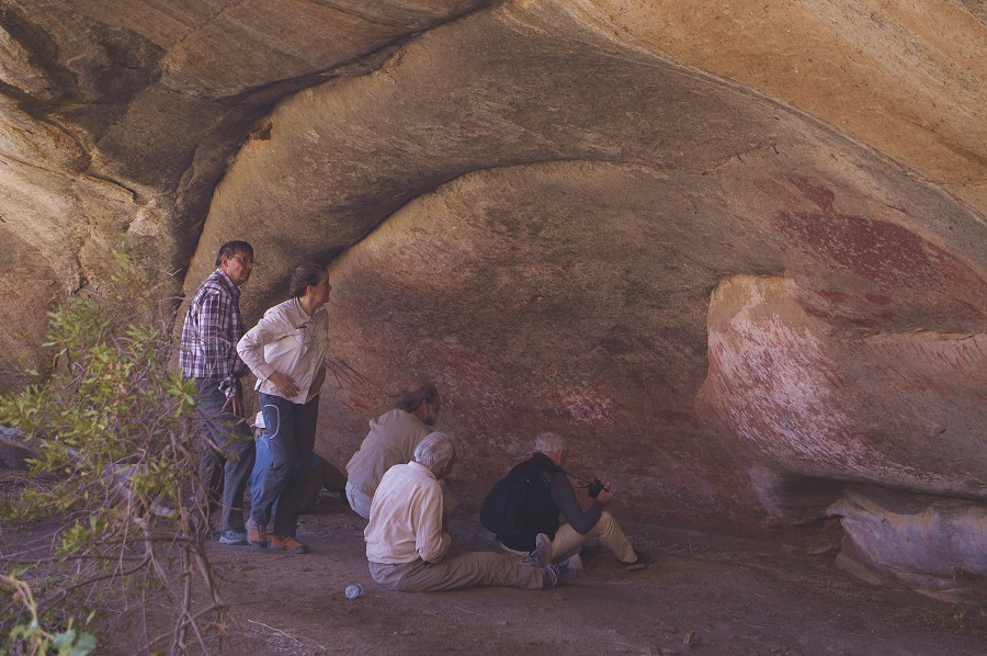
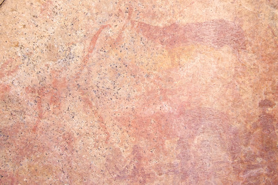
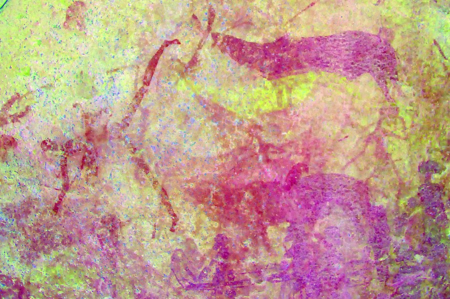
We moved on to A6, and spent the better part of the morning viewing and photographing the amazingly fine and detailed paintings in the shelter.


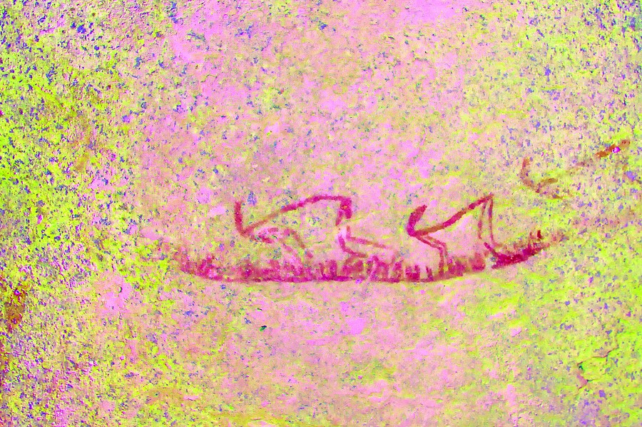
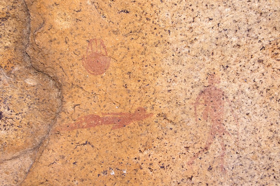
Site A9 is located right under A6. It is on the sun for most of the day, this time we were early enough for me to take some photos before the principal panels came out on the sun. The paintings are very faint, but dStretch reveals a fine grouping of human figures.
We used the opportunity of visiting A6 to go down to the water hole about twenty minutes below the site to fetch some water. The pools are at the bottom of a narrow crevasse, and were very near the end of the supply. Only the largest of the basins had water in it, but that was good quality, a welcome addition to our supplies. As we started back with the water, we heard the noise of the helicopter, Stefan was approaching with a local party to see A10 after tackling the summit of Königstein from the closest and highest landing place at the foot of the last rise. By the time we reached back to camp our visitors were ready to depart, and we settled under the meagre shade of the bottle tree beside our camp for a quick lunch before setting out again.

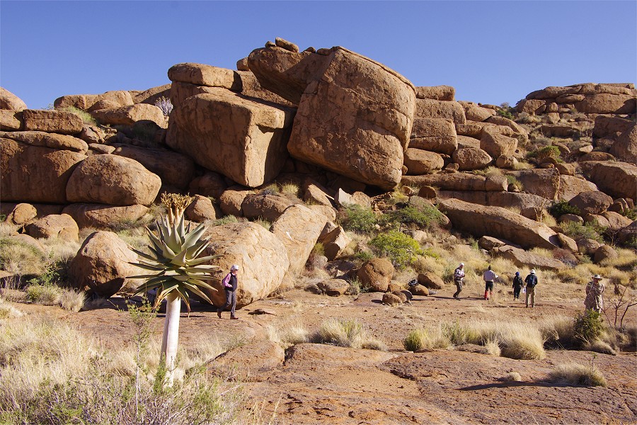
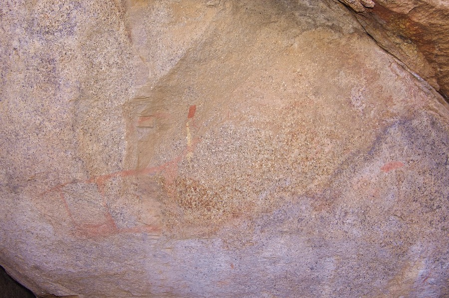
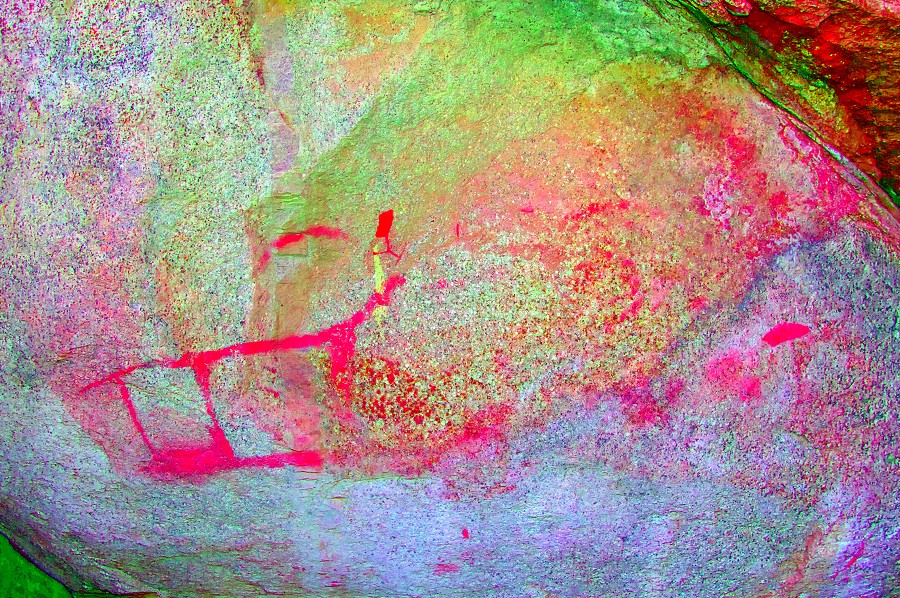
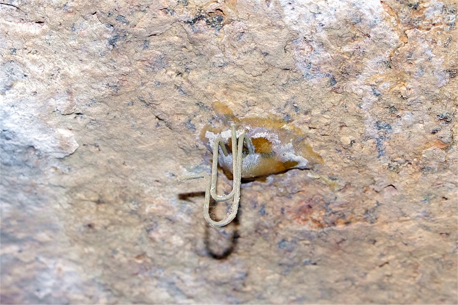
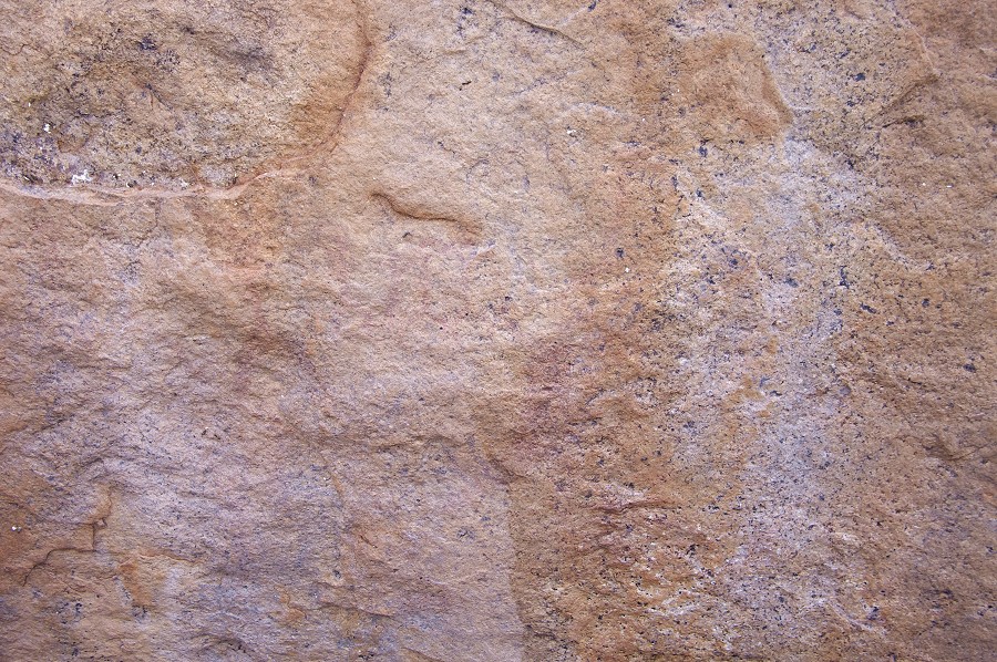
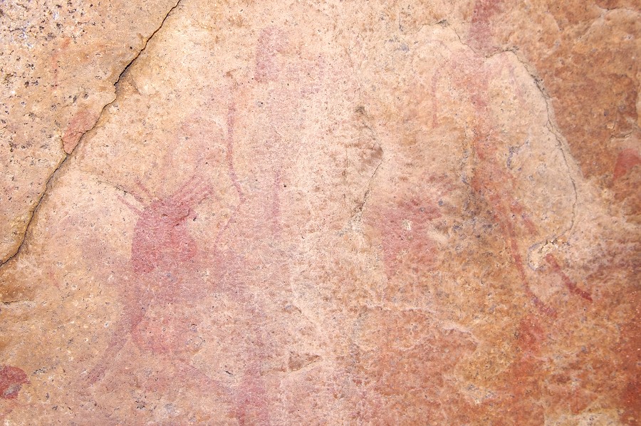
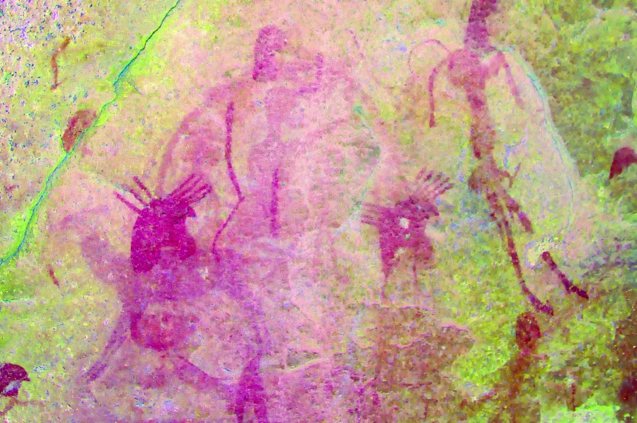
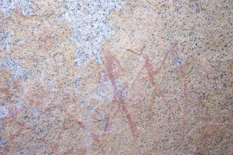
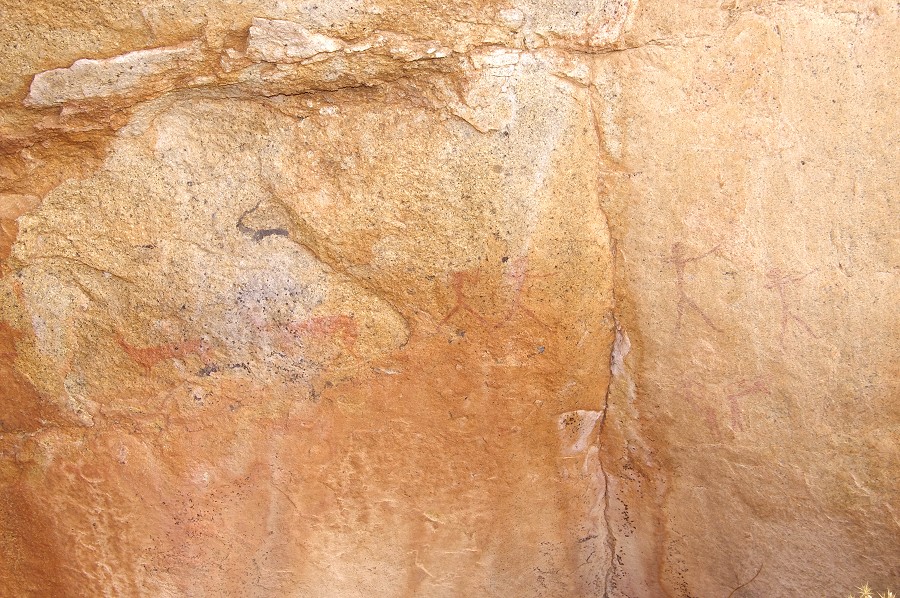
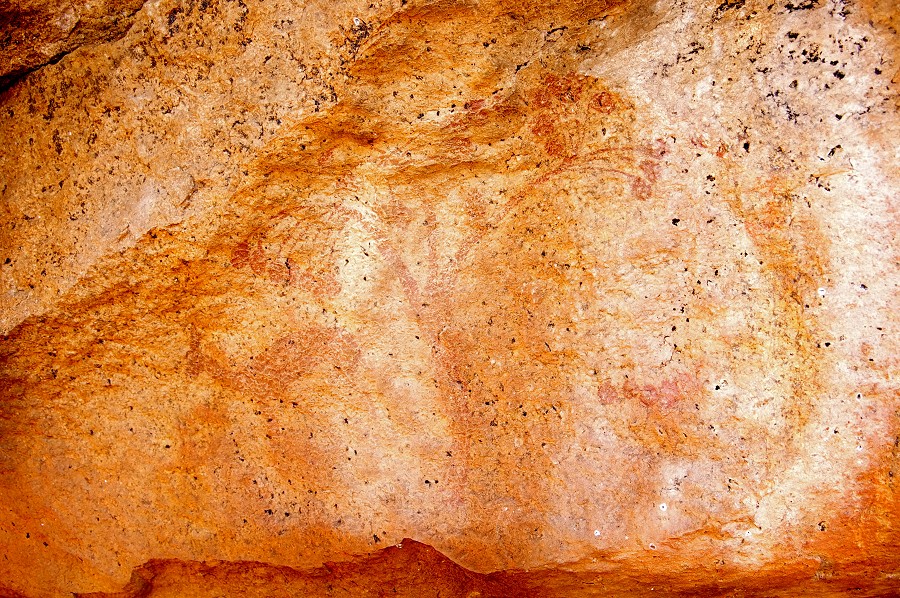
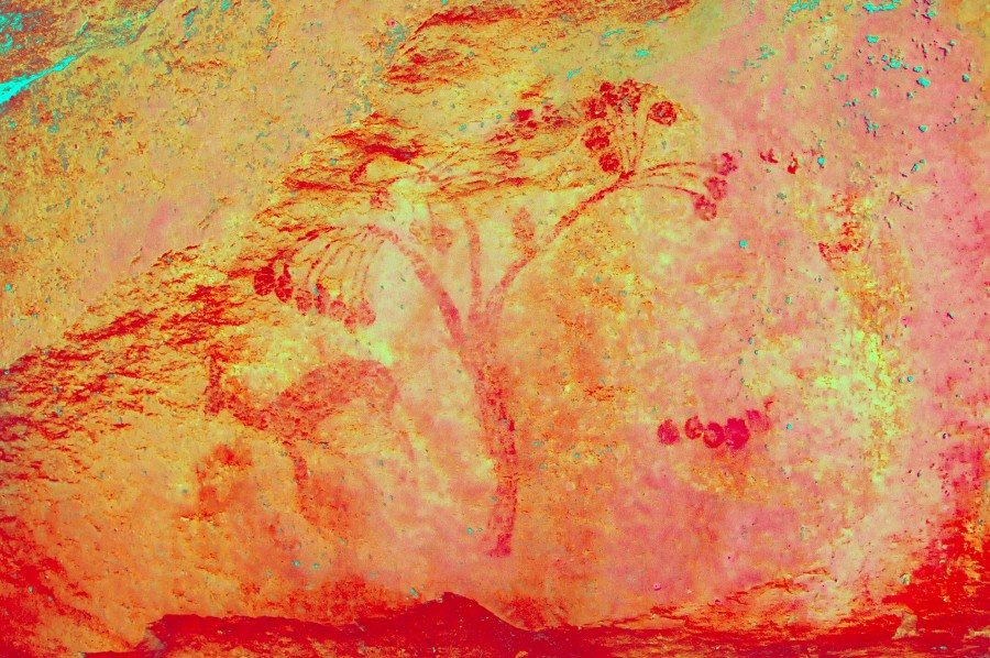
In the afternoon our plan was to find a number of sites to the west of the "Riesenplateau" (Angula showed us one, A22 last year). We started off with a site on the far side of the plain, A11 within sight of our camp. The location is quite difficult to access, guarded by large boulders and thick vegetation, based on the state of the plants along the shelter bottom it had not been visited for a long time. The paintings are not very exciting, the most important scene shows an unidentifiable amorphous shape that does not seem to make much sense even with dStretch (perhaps part of a giraffe ?). However there is one rather moving detail - a paper clip glued to the ceiling, which held Pager's transparent foil when he copied the adjacent faint figures.
We proceeded into the large basin that is to the West of the "Riesenplateau" and north of the granite rise containing A6 on its south side. We found A23 quite easily based on Pager's site plan, along a continuous granite wall bordering the valley leading in to the basin. This is a relatively minor site, with four walking human figures painted on a vertical section of the rock face.
Site A22 is in the centre of the basin, a very prominent cluster of rocks visible from afar. Last year we only saw a part of the panels, now with a printout of the site plan we could find all of them, though only one panel with a number of shelter scenes is well preserved. One scene which is hardly visible on the spot is actually a very interesting one, with some human (or animal ?) figures apparently climbing up the neck of a giraffe, most of which has disappeared.
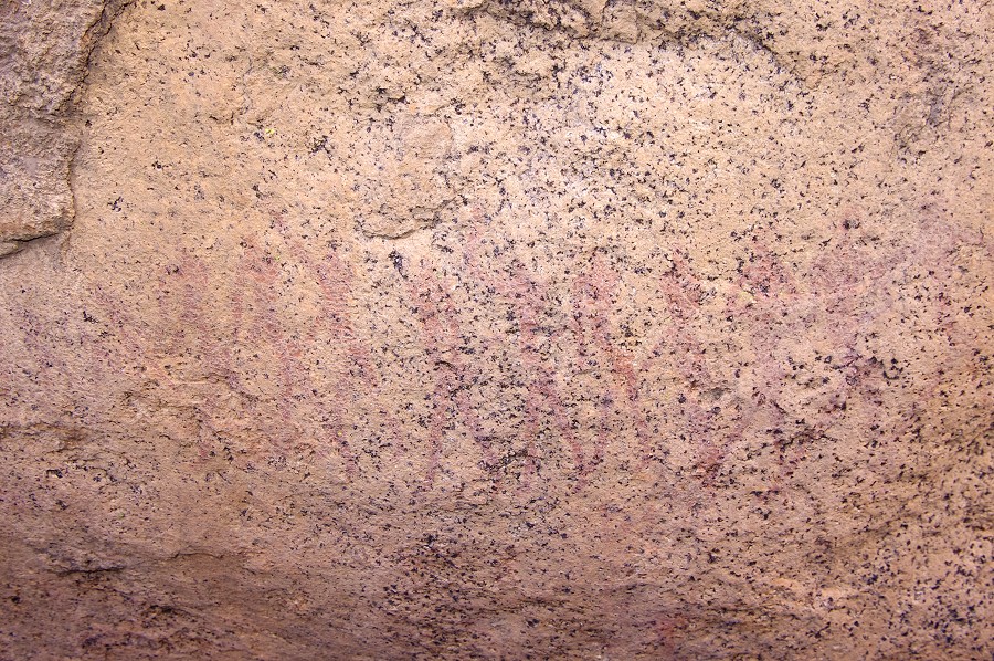
A24 was supposed to be somewhere near where main watercourse exited the basin towards the south, and dropped rapidly in the steep valley. In this case the site plan did not help much, we searched in vain both in the basin and along the steep slopes. Finally, looking back one boulder right in the riverbed did seem to resemble the site plan, on close scrutiny it did have some unrecognisable traces of paint on it. However processing the photos with dStretch did reveal the paintings visible on Pager's copy, another example of the amazing ability of Pager to copy even the faintest traces of paint accurately.

There were a couple of more sites in the vicinity but the descriptions did not sound very encouraging, and our enthusiasm was somewhat dampened by the lengthy search for the not very impressive A24. We decided to move back to A6 and spend the last hour of sunlight there before retiring to the camp for the evening.

Day 6. - Eastern Amis - Engelhard Plain
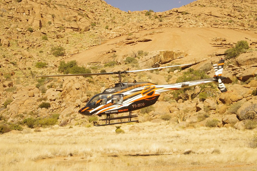
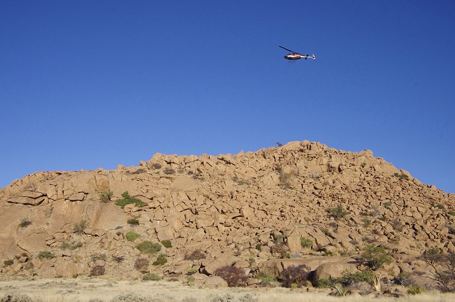
During the night we were all awoken by a strong wind that rattled the tents, and eventually strengthened to a full gale, collapsing some of the tents and generally making things rather miserable. At first light we started to pack things up, as sleep was pretty much impossible. It was not particularly cold, it was an eastern wind blowing from the Kalahari. The wind subsided a little by the time Stefan arrived with the helicopter at the prescribed 7am, and we all watched anxiously as he approached, swaying in the wind rather alarmingly during landing. Soon afterwards the wind strengthened again, and it became clear very rapidly that we and the helicopter were not going anywhere until the weather improved, with the surrounding hills causing treacheruos and unpredictable air currents in every direction. There was nothing left but to tie down the helicopter and wait patiently. With the pitot tube facing the wind, it was possible to measure the strength - it was steady 25 knots, occasionally gusting to 35-40... The tie-down strap of the main rotor snapped twice due to the wind flapping the rotor rapidly, to prevent this we tied down the rotor to two fuel jerrycans, with a total of 50 litres. It well illustrated the strength of the wind that the two jerrycans were lifted clear off the ground twice. Finally four of them kept the rotor reasonably steady.
There was not much to do but wait. We re-visited some of the rock art sites, but with the howling wind there was not much left eventually to do but take cover and hope for some improvement. With Stefan we climbed up to the ridge separating Amis and Numas (the direction we had to fly) and could hardly stand in the face of the wind. On the ridge there was mobile reception, Stefan could check the weather forecast for Uis and it did not bode well - the same strong winds for the next two days... Our plans for the day were to make two hops to the upper Numas and Circus Gorges, to see the Okapi Shelter and C10 before continuing to the Engelhard Plain for the night. By now our best hopes were that if the wind subsides a little in the afternoon, we might just be able to make it to the Engelhard plain.
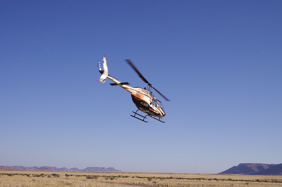
Around 2pm the wind started to reduce in strength, it now only reached a steady 15 knots, and the gusts became less frequent. Climbing to the ridge again, at 3pm Stefan decided to give it a try with a light load, taking over all the supplies and the surplus fuel to the Engelhard plain. Take-off from the Riesenplateau was smoother than anticipated, but it was a rather bumpy ride up the Numas valley, then across the Naib basin to the edge of the Engelhard plain. The wind was still rather strong, we finally managed to land on the far side of the plain, quickly dumping the load without cutting the engine, then taking off again back to Amis. With the wind rising over the mountain to our back, it lifted us to over 3000 metres in no time, and it was a real struggle to descend, we had to make several spirals above the Amis camp to get down. However Stefan's assessment was that he was ready to do it again, so we made four flights in rapid succession to ferry everyone across while the acceptable weather lasts.


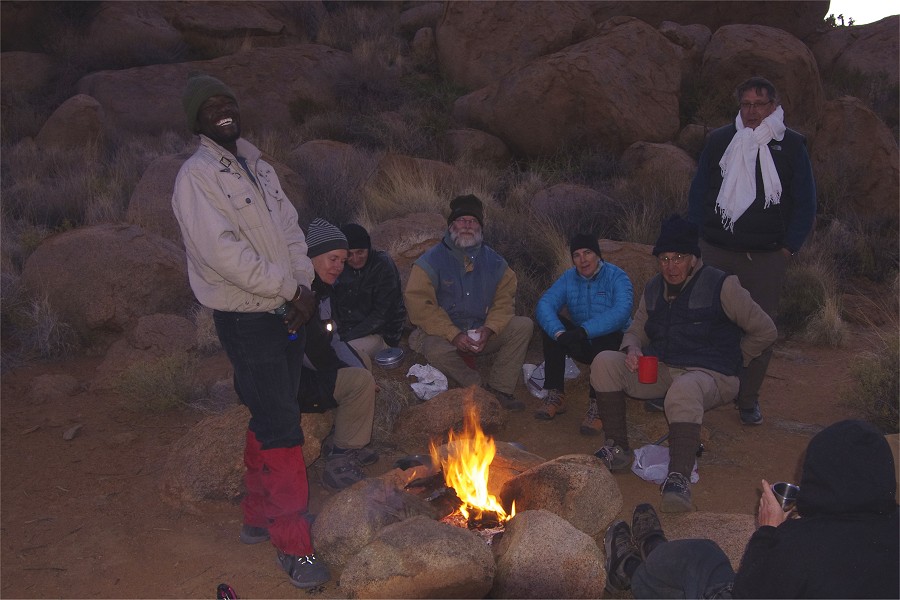
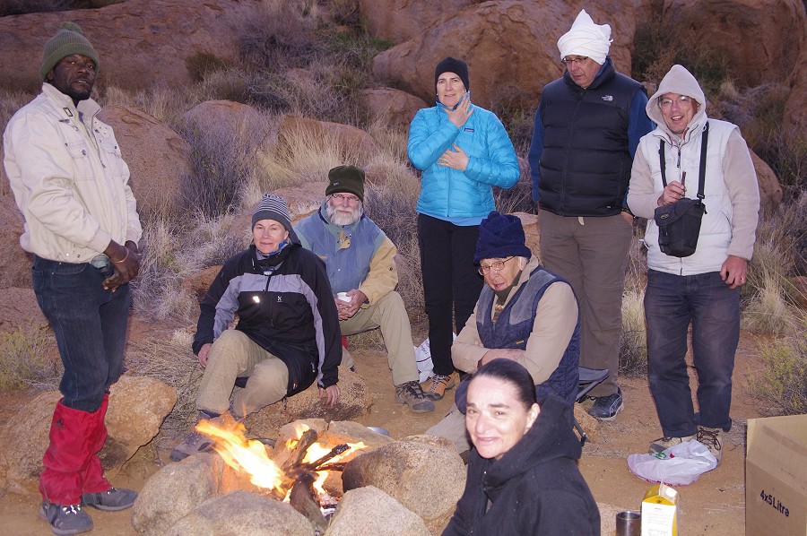
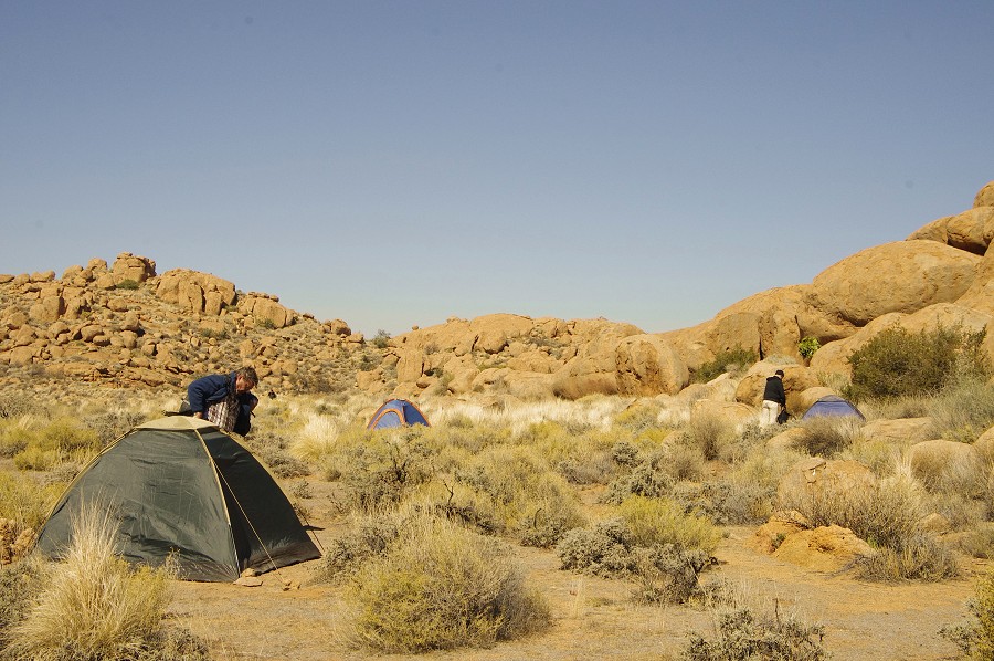
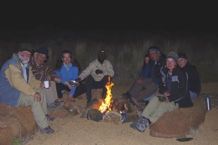
By half an hour before sunset all of us and our supplies were over at the Engelhard Plain. Stefan departed rapidly, and we were left to collect our belongings scattered about the plain, as Stefan just landed wherever the wind blew him and he could hold the helicopter steady enough for landing. By sunset all was assembled at the western end of the plain, and we made camp as the full moon was rising behind the Horn (second highest peak of the Brandberg). It was much colder here, some 600 metres higher than our previous camp, and we all huddled around the warm fire before tucking in, hopefully for a quieter night.

Day 7. - Engelhard Plain
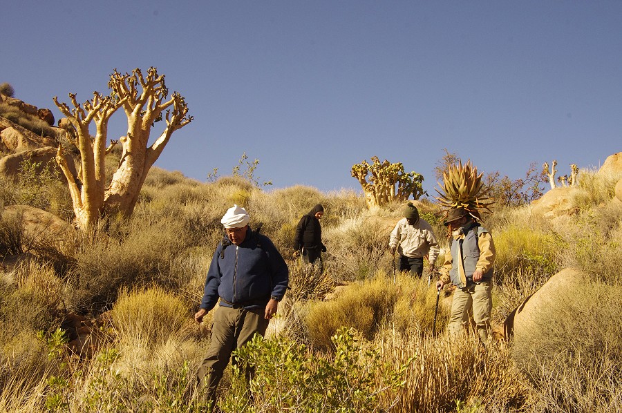
The night was indeed quiet, after a decent rest we started in the morning by visiting site I47 (Naib 47, the Engelhard Plain drains into the Naib basin). Reaching this site requires some effort, it is in a valley adjacent to the plain to the west, a huge solitary boulder far up on the hillside. Reaching it involves a steep descent to a level about 50 metres below the site itself, then a climb up to the site. The site itself is one of the Brandberg highlights, well worth the scramble among the thorny bushes.


While the others started the climb back to the Engelhard Plain, with Nathalie and Nicolas we made a quick side-trip to the lower section of the valley to find site I46, which we passed unknowingly last year on our way to Porters plateau. Armed with Pager's site plan, it did not take long to find the paintings among a cluster of large boulders. They were fully exposed on the sun and were tricky to photograph, the shade having been provided by Nicolas' jacket. The scenes show several processions of faint but finely detailed human figures.
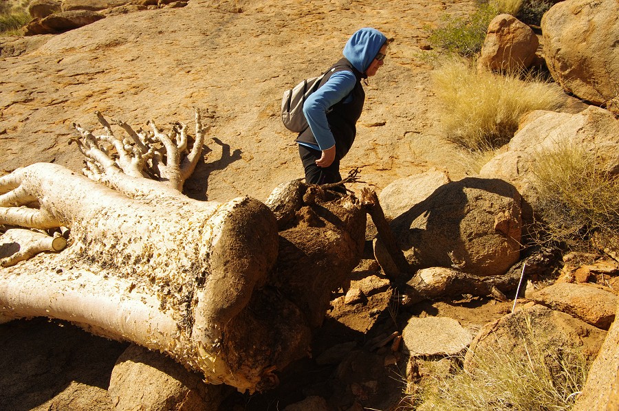
On the way back we encountered a bottle tree that was toppled by the gale of the day before. We were surprised to see that it hardly had a root system, it was basically standing on its flat base, lodged in among the rocks - little wonder the wind could dislodge it easily.
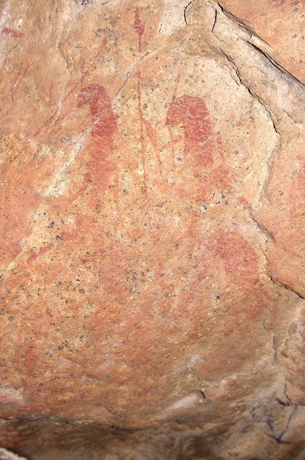
After checking that our tents would stay in place in the wind that was picking up again and leaving our warmer clothes, we walked to the far end of the plain, to see the cluster of sites I169-171 in the little valley leading out to the plain from the East. I169 contains among other enigmatic scenes a curious headless human figure with disproportionately long, spider-like limbs.
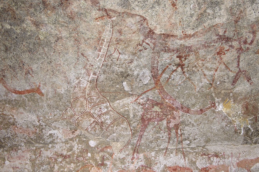
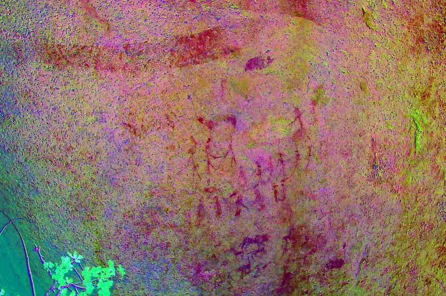
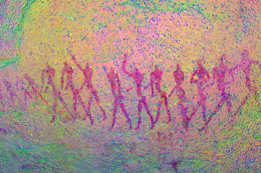
We spent a long time at I170, one of the principal sites on the Engelhard Plain. The most conspicuous feature is the long entwined double (or just two headed... ?) serpent, about six metres long, on the side of a huge boulder. There are numerous other fine scenes scattered about on several panels. Unfortunately there is a large thorny bush right at the corner of the rock where the two snake heads are supposed to be, it took some time to trample and push aside the branches sufficiently to be able to photograph both heads in one scene, something I was unable to accomplish before. There are a number of scenes under the snake, also obscured by the bush. The base of the branches are already too thick to break, I made a mental note to bring an axe along the next time we have full helicopter support to cut it down.


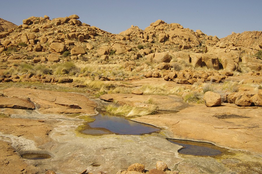
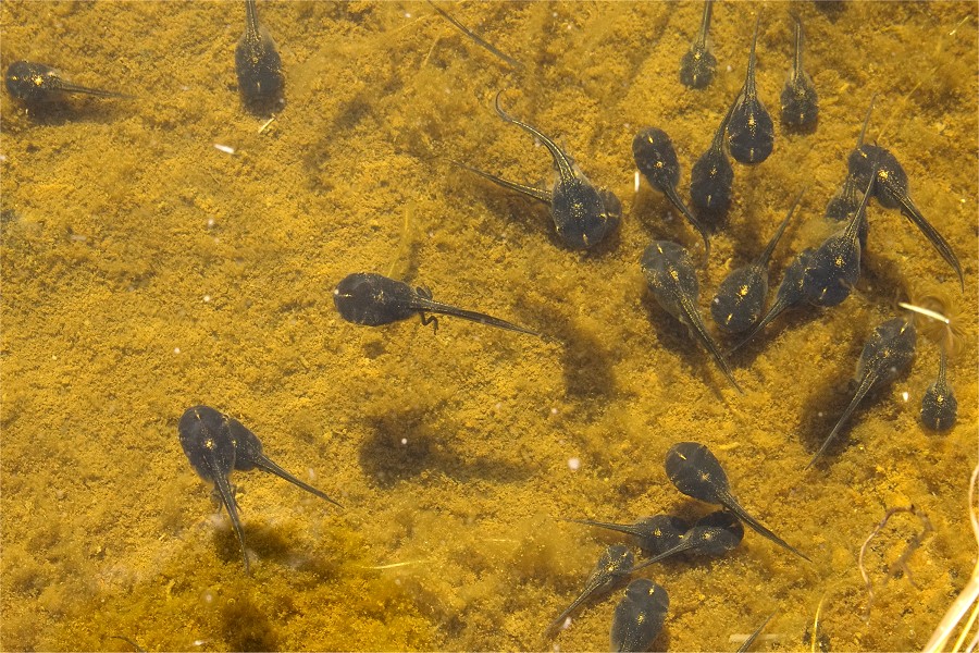
Moving back towards camp, we found the pools at the edge of the plain to be still full of water, despite the mountain being generally very dry. One of the ponds was full of fat tadpoles, some already showing the rear legs. The crevasse below the pools some distance down the steep descending granite plates held plenty of good drinking water.
I55, next to the pools it the central site of the Engelhard plain, with the curious double-clawed creatures at the northern side of the huge egg shaped boulder. There are numerous other scenes all around, unfortunately all rather weathered, but dStretch brings out the complex superpositons.
We returned to camp for lunch, and the entire afternoon was free to wander about the western Engelhard Plain sites (I56-58) close to camp, re-visiting them as various panels went in and out of the sun. I took the opportunity to scout the northern perimeter of the plain, where Angula looked last year for the four sites recorded there by Pager, but failed to find them. This time I had the site plans, and with some searching could identify all four sites, I51-54. I51 was an enormous boulder, conspicuous from afar opposite our camp. It contained a spacious shelter at its base, fully overgrown with thorny weeds, and contained only a few damaged scenes of faint human figures.
Of the four sites, only I52 warrants more than a passing interest. It is a large boulder at the edge of the plain, with a scene containing a leopard or another large feline.

I53 contains a single large human figure, which appears to be entirely covered by a growth of black lichen, perfectly conforming to the outlines of the pigment. I54 some distance away are some insignificant human figures on a cluster of boulders right opposite I55.
Back on the southern side of the plain, I56 is a large site with numerous panels, having Pager's site plan with me I realised that on previous visits we have missed many of the paintings, as they are exposed to the sun at different times of the day. This time I could patiently wait until all panels could be photographed in the shade, revealing many interesting previously unseen details.
Day 8. - Engelhard Plain - Nuwuarib Gorge
The next morning it was perfect calm flying weather, Stefan arrived on schedule at 6:30am, and we shuttled everyone over to the Nuwuarib plain in three turns.


We made our Nuwuarib camp in the sandy riverbed at the middle of the lower Nuwuarib plain, about half-way between the principal sites of the Mason Shelter and "Bildergalerie". While the majority of the party went off with Alfons to see the "Bildergalerie" site, with Eva and Nicolas we decided to take a longer trek over into the Umuab valley to see the major U21 site. I have over flown the route to be taken, and looked for a more direct and easier route than the one taken during our first visit to Nuwuarib b>in 2010. We reckoned with about 1.5 hours each way, planning 4 hours for the entire trip we expected to be back by 2pm in the afternoon.
While the route was indeed shorter and easier than the one taken in 2011, it still took over 2 hours to reach U21, making some unnecessary detours among the confusing hills as we climbed out of Nuwuarib. We spent about half an hour at the site taking some rapid photos, before starting on our way back again. The return was easier with the benefit of the known route, we completed the entire journey in just under four and a half hours.


While the others had an afternoon rest, we also took the opportunity to visit the "Bildergalerie" site, with its very fine panels of paintings.

As we were viewing the site, we noticed that Alfons was coming down the huge granite plates bordering the valley opposite the "Bildergalerie" site. He happily announced that he found two sites nearby. They were both sites along the sides of the low granite ridges paralleling the one containing "Bildergalerie". Both were minor sites with some faint paintings, only a single scene in one, several clusters of somewhat better preserved paintings in the other.

Later that afternoon with Nathalie we climbed the granite plates. The ascent looks formidable from the bottom, but actually it is a fairly easy 15 minute climb to the top, about 100 metres above the level of the plain. From the top there is an unobstructed view towards the east into the Ugab river valley, as well as a superb overview of the Nuwuarib.

On the top, behind the granite plates separated by a low ridge, we found a large flat plain that appeared to be a perfect location for a rock art site. Sure enough, after some search along the edge of the ridge, I soon came upon a panel of paintings on a vertical rock face at the rear of a shallow shelter. There were a couple of dead trampled plants in front of the paintings under the fresh growth, clearly a few years earlier the site had been visited by someone.
As we descended in the light of the setting sun, we had a perfect view of the "Bildergalerie" site facing us below. However we could also see a towering rock on the far side of the watercourse to the West, with an apparent large shelter underneath, that cried for a rock art site. We decided to investigate it before returning to camp. From the riverbed the shelter is completely invisible, but when we climbed the terrace bordering the watercourse, we immediately found two superb large panels of human figures, exceptionally well preserved. Clearly this site too was visited sometime in the past, as some older branches of a large shrub partially obstructing the paintings were broken. However several younger shoots were not, the site was clearly not visited for at least a decade (later from Angula we learned that he knew about this site, though he could not recall when it was first found). Certainly this site ranks among the finest in the Nuwuarib valley.


It was well past sunset as we started going back towards camp, but Nathalie came upon another site some 100 metres away, which also contained some exceptional paintings. The most striking feature was a pair of bulbous plants (?) almost like a bunch of balloons. However on close scrutiny the row of human figures also revealed a curious feature - the shape of the points on their spears strongly suggest that they were of metal, meaning that these paintings were relatively young within the local cultural sequence. I cannot recall any analogies to such spears on other Brandberg paintings.


By the time we reached camp it was close to dark, and a nice big fire was going. We learned that Alfons and Jean-Loïc also saw the "balloon" site, but did not go up to the other one. There was certainly much left to do the following day.

Day 9. - Nuwuarib Gorge - Descent
Before sunrise everyone left to see the newly found sites, as both would be fully exposed on the sun for most of the day, impossible to photograph. I waited for the helicopter to arrive with Magdi, who flew in to Windhoek the morning before and drove to Uis with Mark. Stefan was also to spend the day with us, taking us down in the late afternoon. We all went after the others, it was good to start early as by the time we reached the sites both were fully on the sun.
After breakfast we set out to see the Mason Shelter, about half a kilometre upstream from our camp, one of the principal sites of the mountain. The ceiling of the large low shelter contains an amazing abstract polychrome depiction ("The Picasso") without any readily appreciable meaning, surrounded by human and animal figures of the more customary styles.


Harald Pager did a preliminary site survey in the Nuwuarib, but never completed any site tracings here. We don't know if he saw the two sites we found the evening before, but he did plot twelve sites in the vicinity of the Mason Shelter (which he marked as W1) on an aerial photograph. The photo is of a very low resolution, but after some trial and error we did manage to get its scale and orientation right, after which Alfons found several of the sites in rapid succession. Two of the sites were in the main watercourse a little below the sandy basin which still contained water (and plenty of tadpoles).

W7 is a little above the watercourse within shouting distance of the waterhole, it is not really a shelter just a vertical rock face with some very faint traces of paintings, which however become well visible with dStretch. W8 is just below, a cluster of rectangular boulders by the watercourse with some very faint traces of human figures.

As some of the other sites were fully exposed on the sun, we returned to the camp to have lunch under the shade of a large tree before setting out again to see the other sites dispersed to the west of the watercourse. W13 was closest to camp, a cluster of rounded boulders with two fine panels of paintings.

W12 some 200 metres away is a major site located on several sides of a large fractured boulder, with some very well preserved and unique paintings.


Another two hundred metres to the south there is a low rock ledge, with a series of very weathered paintings on the top of what barely qualifies as a low shallow shelter. Most are weathered to the extent of being hardly visible, there is a single scene which warrants special mention, depicting a tree with fruit or round leaves adjacent to a gazelle.
Going back towards camp I have managed to find W12, a very strange location with a long procession of human figures painted on the vertical side of a crevasse barely 60 cm from the facing wall. It is impossible to photograph the entire panel, except in a twisted perspective.

Having finished with all the rock art sites, we packed up camp and completed our last chore, the obligatory group photo, then retired back under the tree to wait for the temperature to drop so we may have a better payload on the helicopter.
By 3:30 the temperature dropped below 25C, Stefan was comfortable taking off with a full payload, and in two turns all except three of our group were down at the base of the mountain near the end of the White Lady road, where Mark was waiting with the minibus.
The last flight was direct to Uis from the mountain, offering superb views of the mountain in the low light. We landed well before sunset, and within half an hour the rest of the group arrived with Mark to the White Lady B&B.


Day 10. - Uis - Omandumba - Windhoek
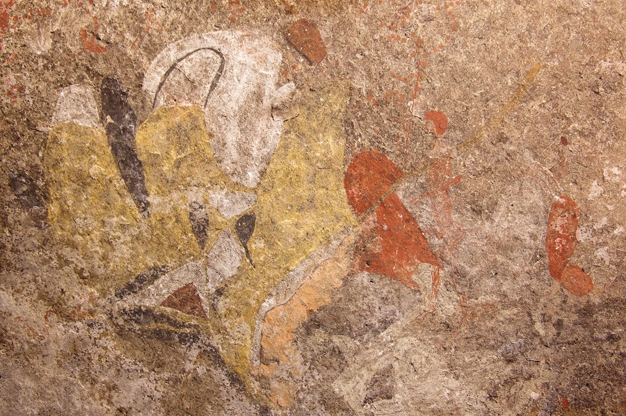
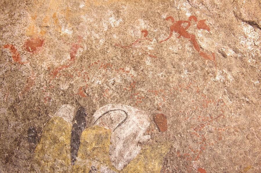
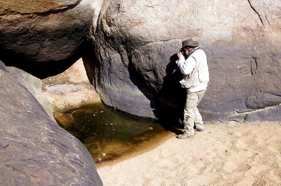
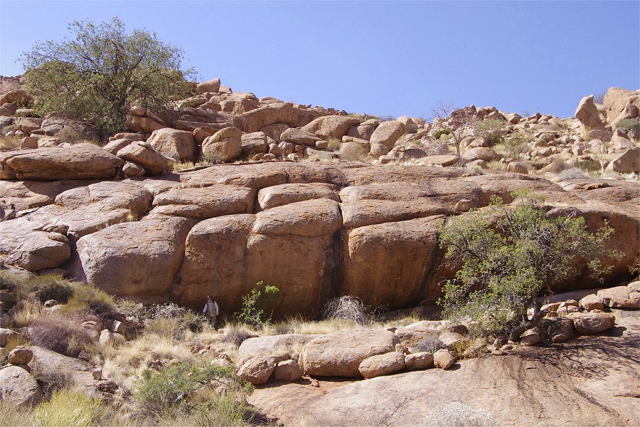
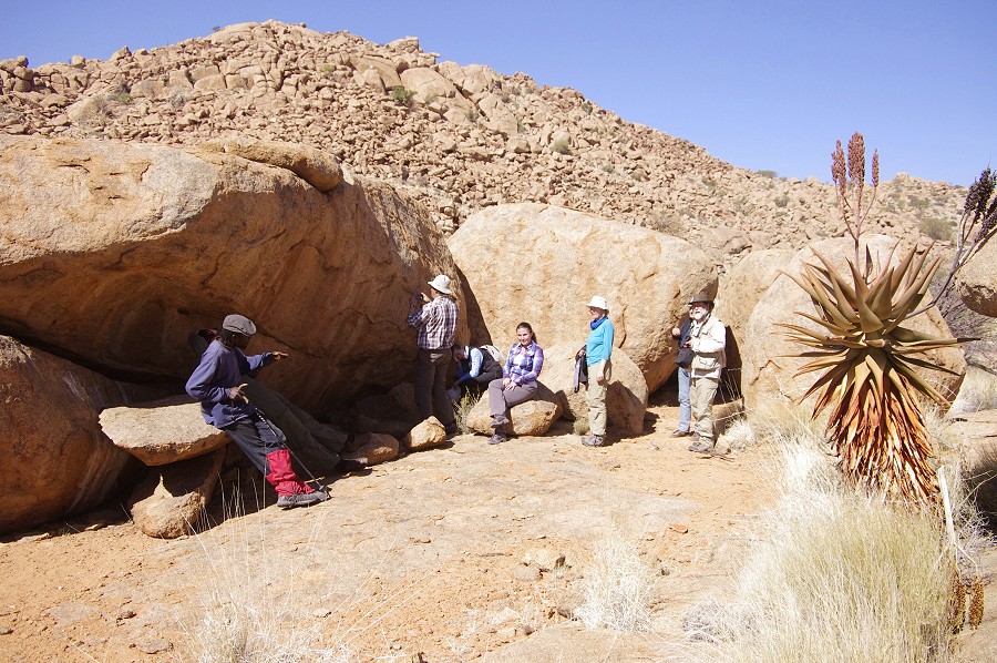
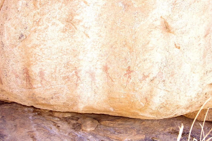
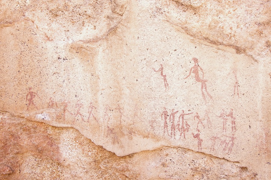
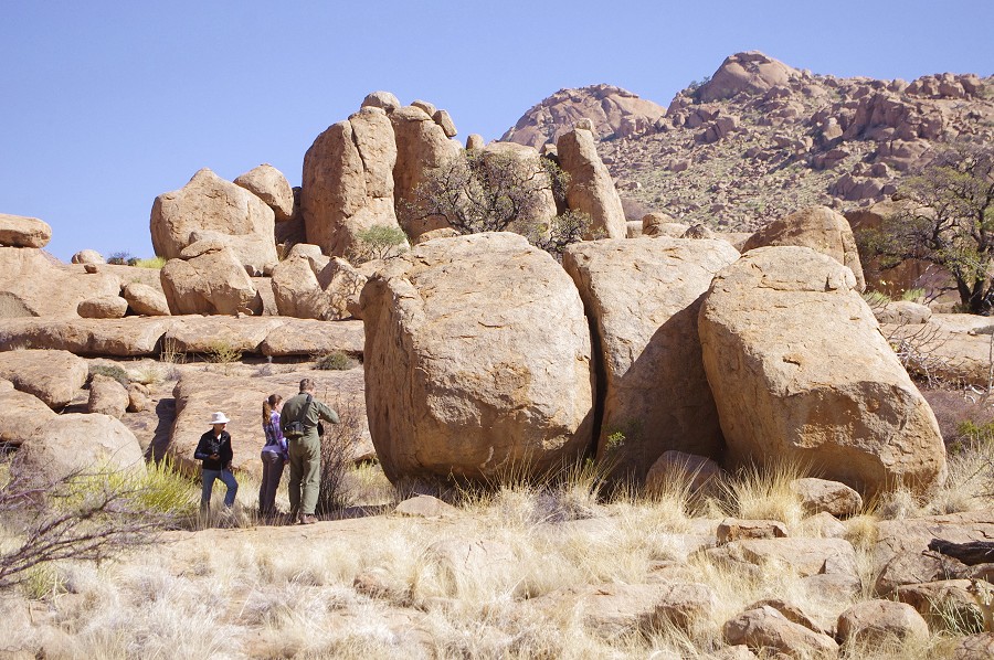
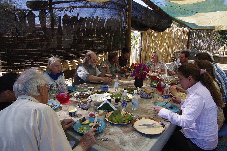
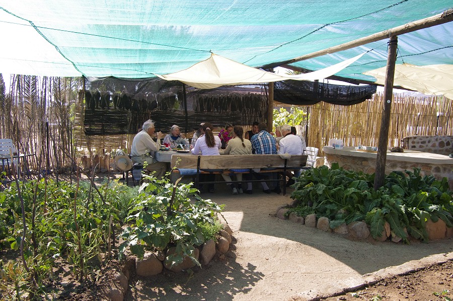
The next morning we left Uis early to squeeze in a visit to the rock art sites of Omandumba West a huge cattle farm at the north western side of the Erongo Hills ran by Harald and Deike Rüst. The location is well known from the copies made by the Abbé Breuil in the nineteen forties. After visiting the sites scattered about the farm we were treated to a superb lunch by Harald and Deike before we moved on to Windhoek.
In Windhoek we went straight to the airport, saying good-bye to Nathalie and Nicolas who took the evening Air Namibia flight to Frankfurt, while the rest of us went to the Etango Ranch for a quiet evening. Me and Magdi were expecting Jon & Attila to arrive the next morning for the trekking trip back on the Brandberg, while the rest of the party took their various flights back home the next day.