
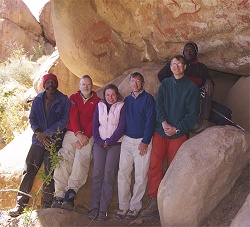
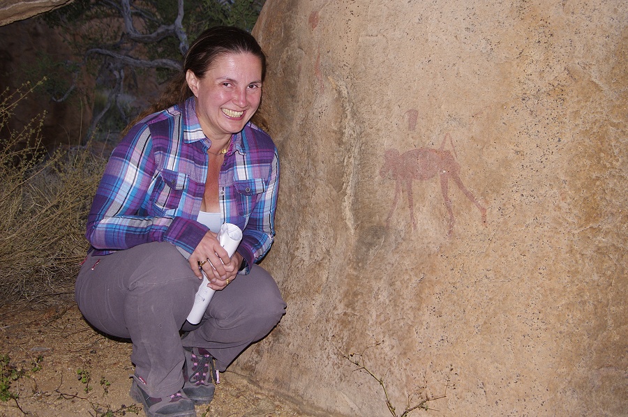
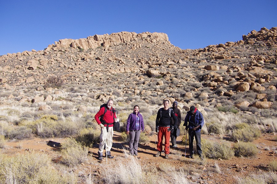
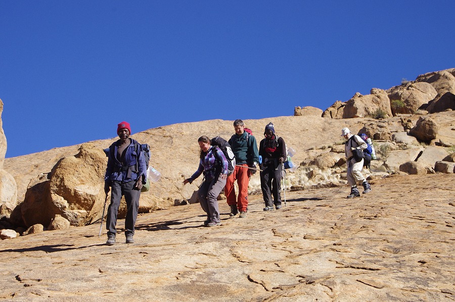
 Click on image for list of participants |
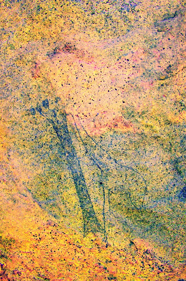
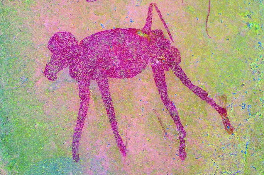
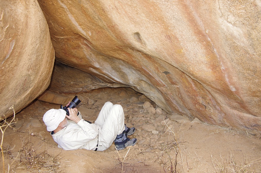
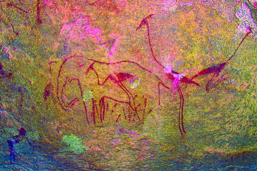
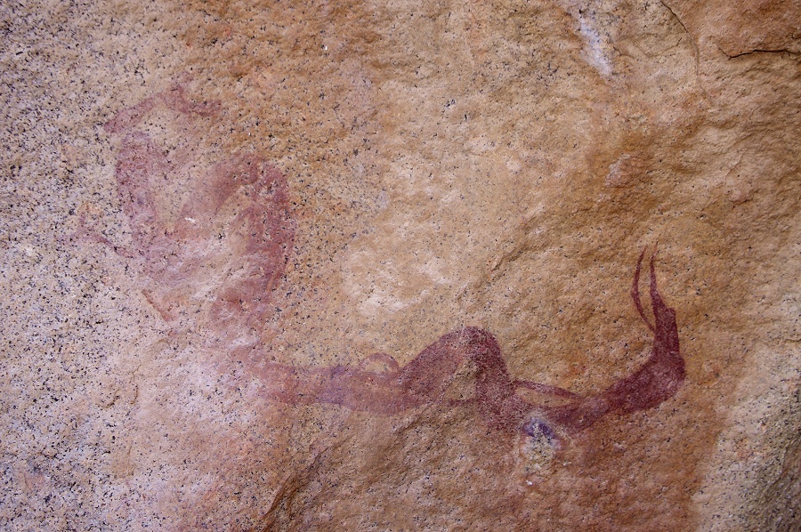
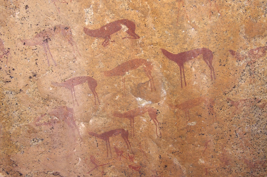
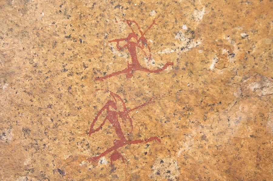
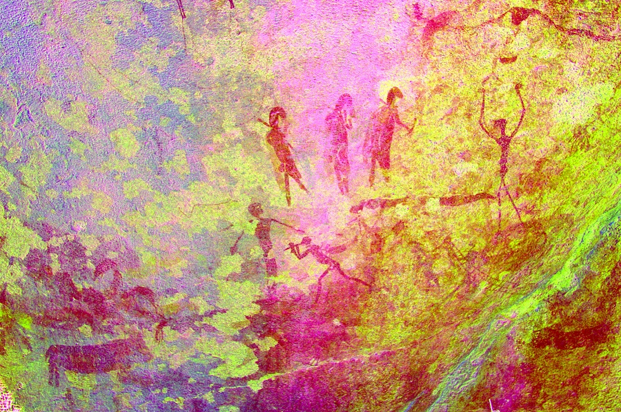
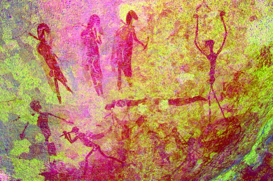
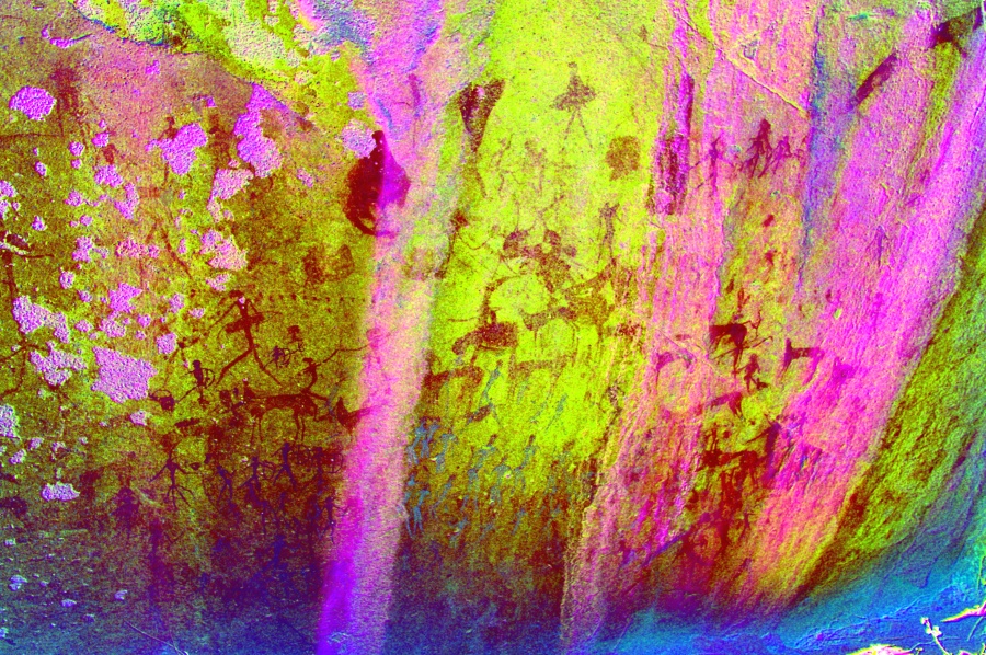
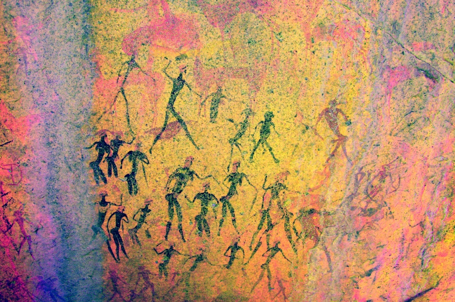
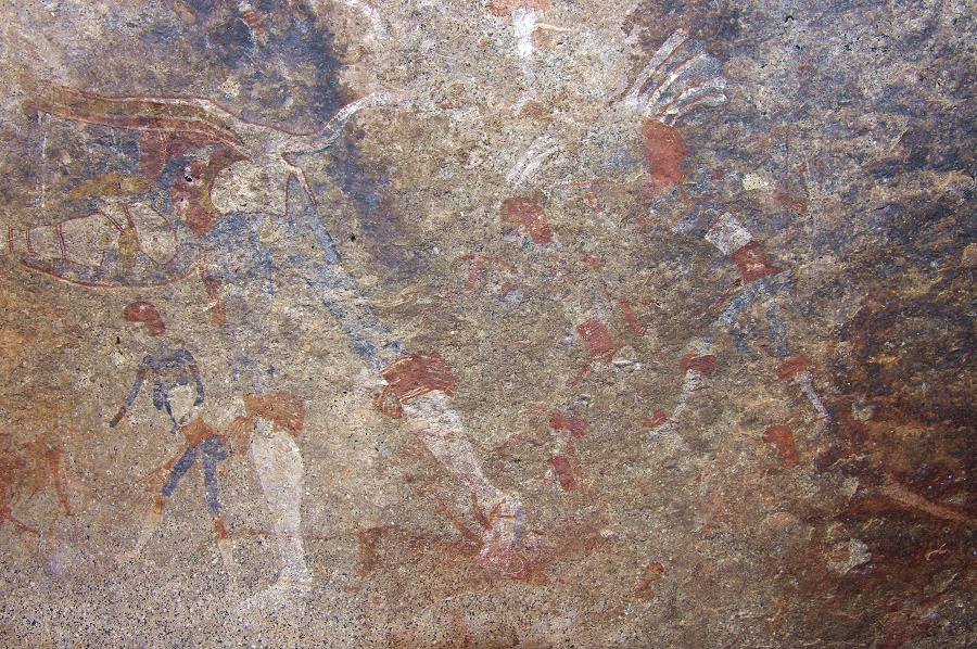
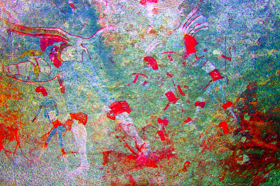
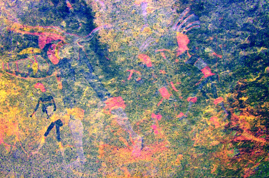
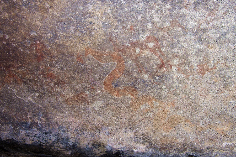
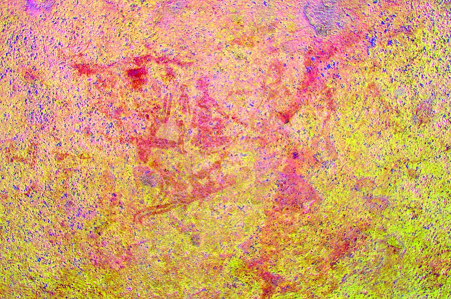
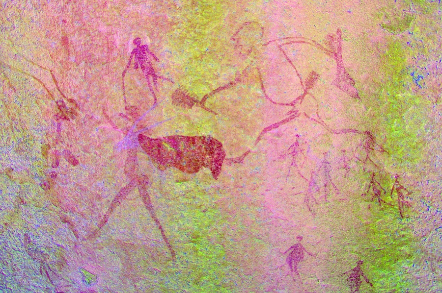
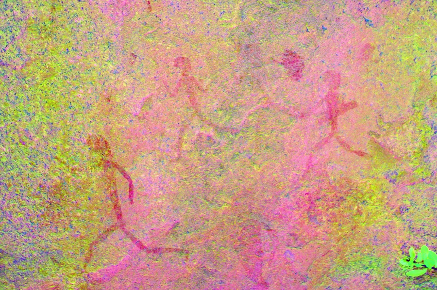
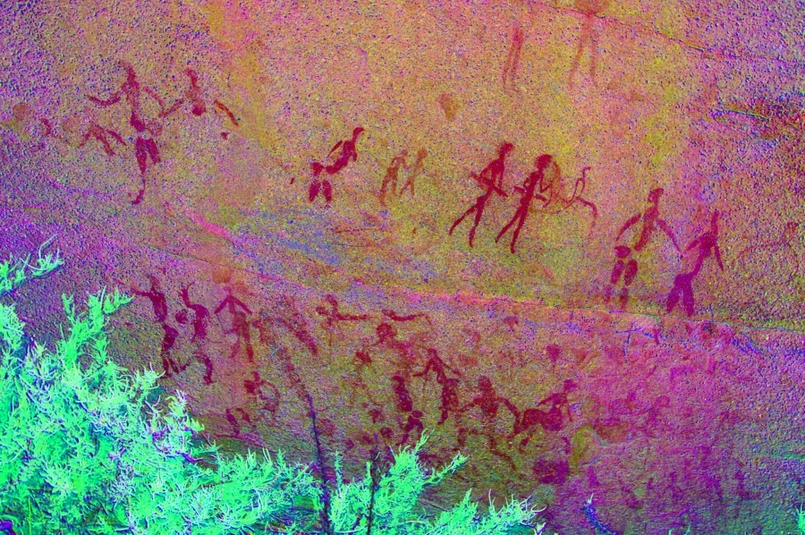
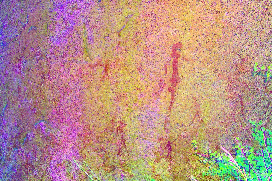
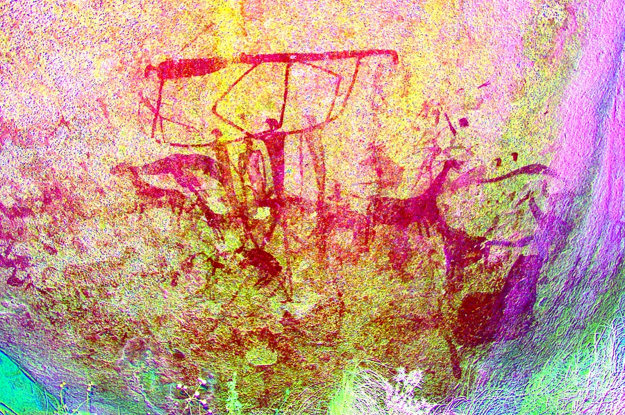
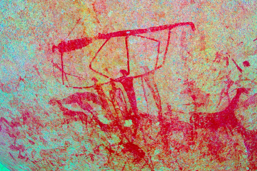
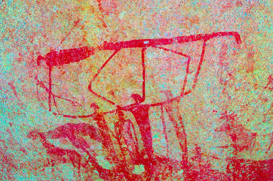
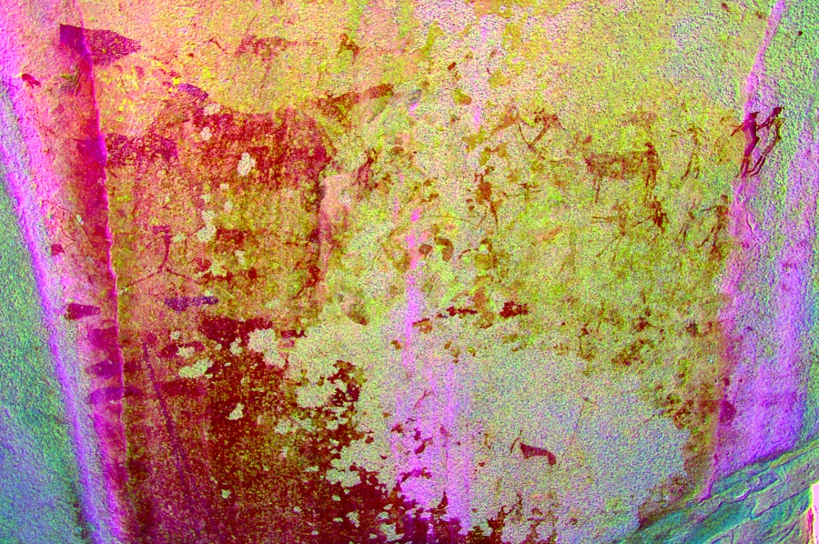
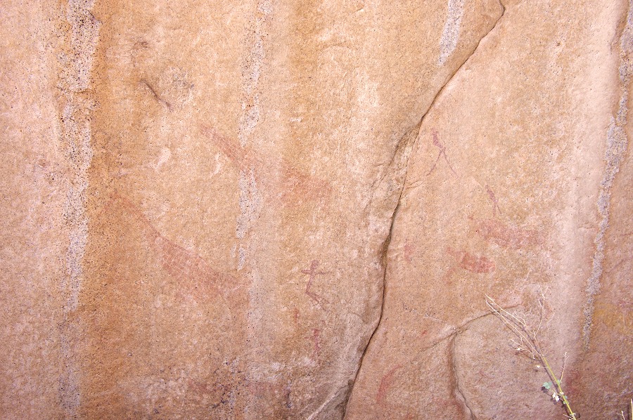
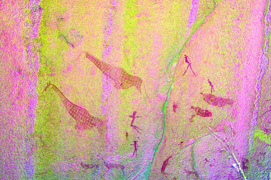
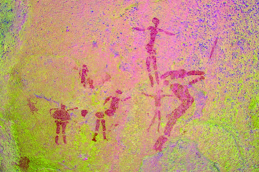
Upper Brandberg, Namibia 9th - 22ndJune, 2012 All site references based on Harald Pager's numbering system False colour images precessed with dStretch, a freely available software developed by Jon Harman |
Day 1. - Windhoek
Unfortunately this time Air Namibia was not as punctual as on the previous occasions. Soon after we parted with Nathalie and Nicolas at the airport the day before, we received a note from Attila and Jon in Frankfurt saying that their flight had been cancelled and they are being moved to a hotel for the night. By next morning it appeared that Air Namibia managed to get their act together and depart Frankfurt at 10am, with an expected arrival around six in the evening. This was too late to drive to Uis (the roads at night, especially the one between Omaruru and Uis, are full of wildlife making them extremely dangerous), so we rescheduled our drive to Uis for dawn the next day. With Magdi & the remainder of the party of the previous trip who were due to fly out that evening, we went into Windhoek to do the shopping and see the rather meagre National Museum in the centre of the town. Our tasks completed, we returned to the Etango in the afternoon, said farewell to the parting and collected Attila and Jon from the airport.
Day 2. - Windhoek - Uis - Western Amis Gorge
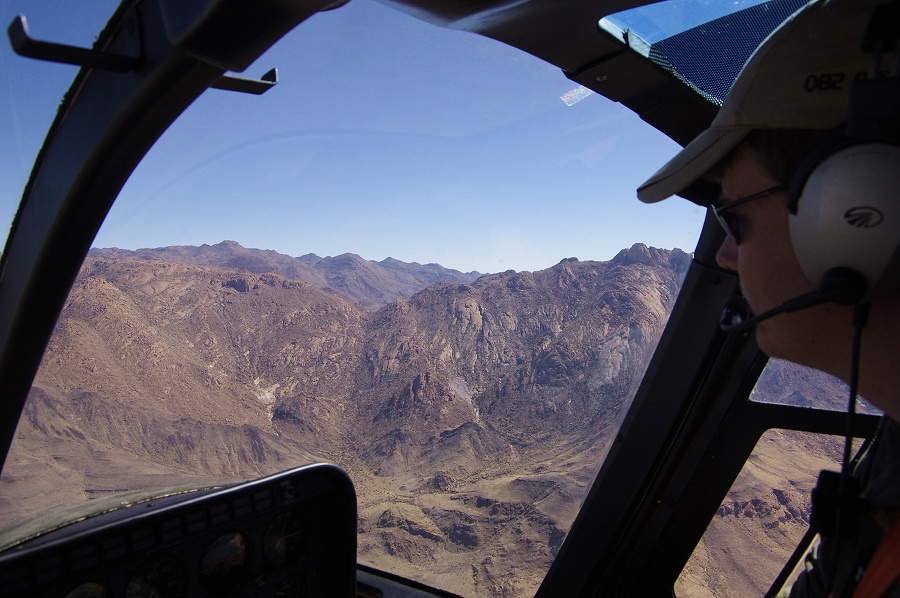
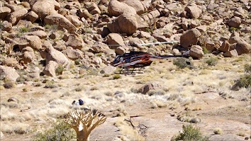
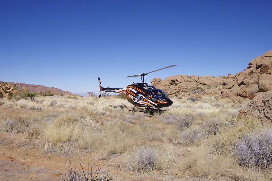
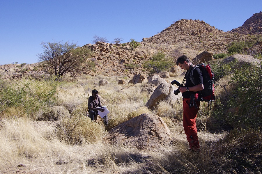
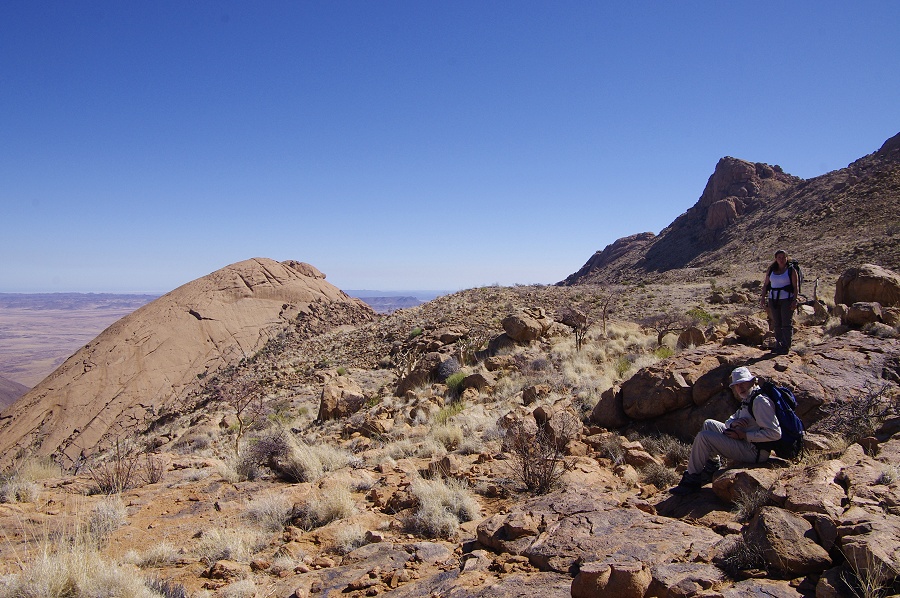
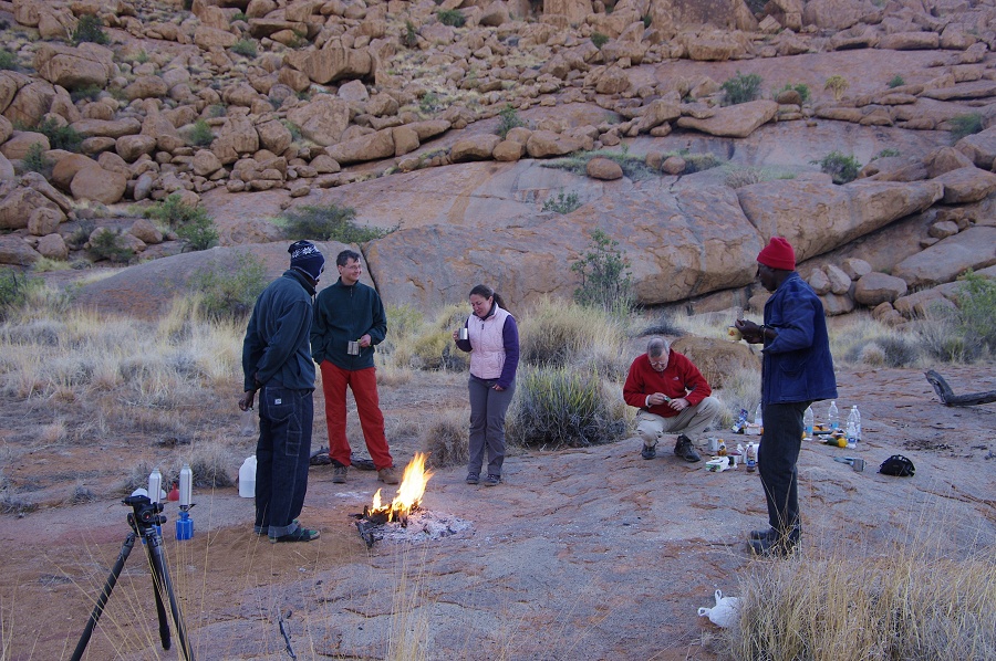
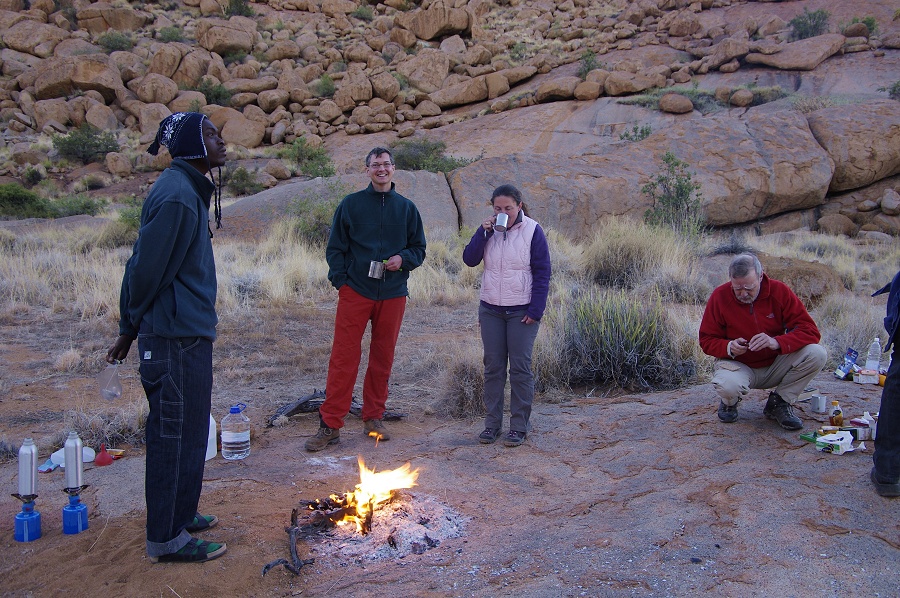
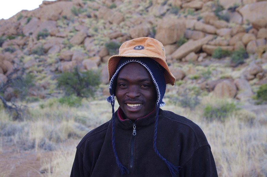
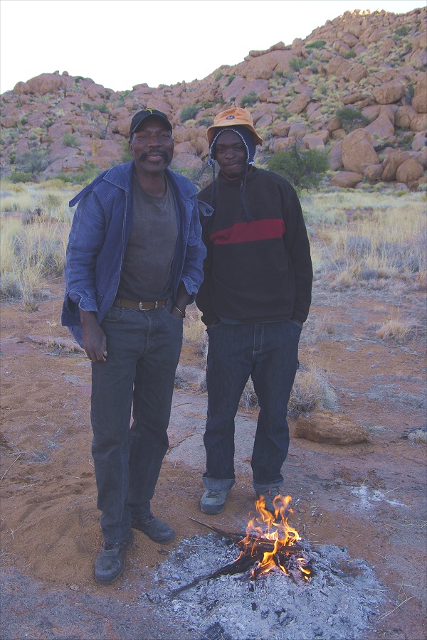
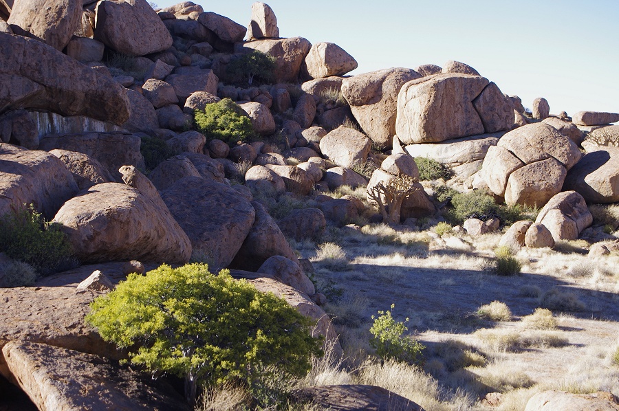
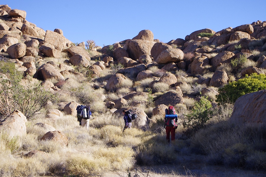
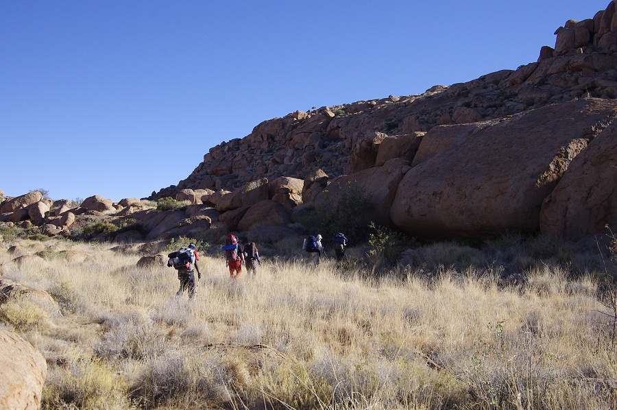
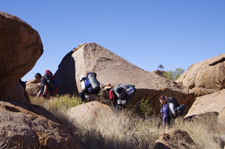
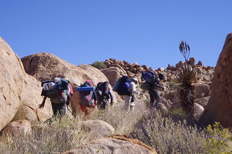
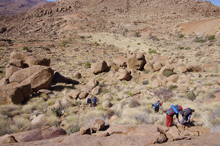
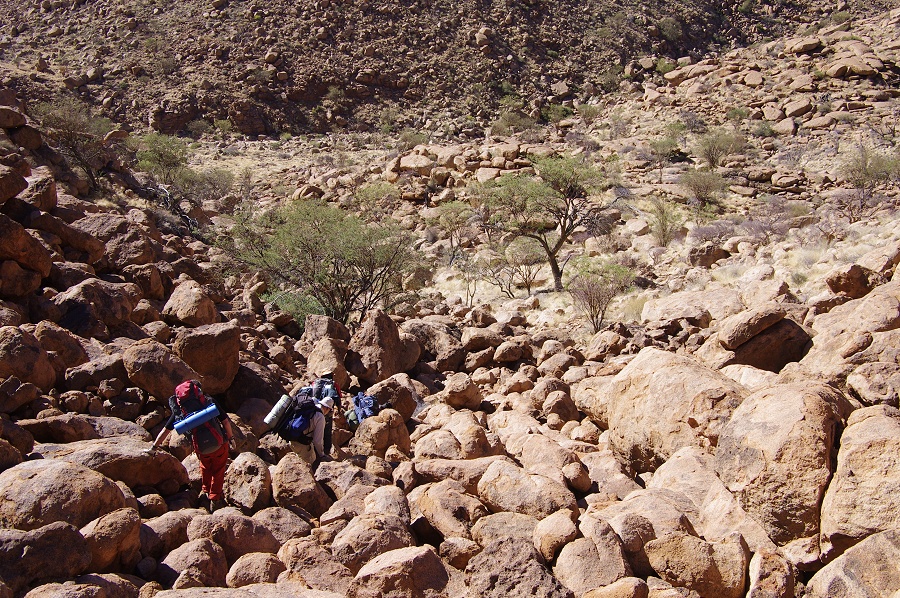
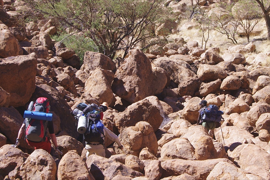
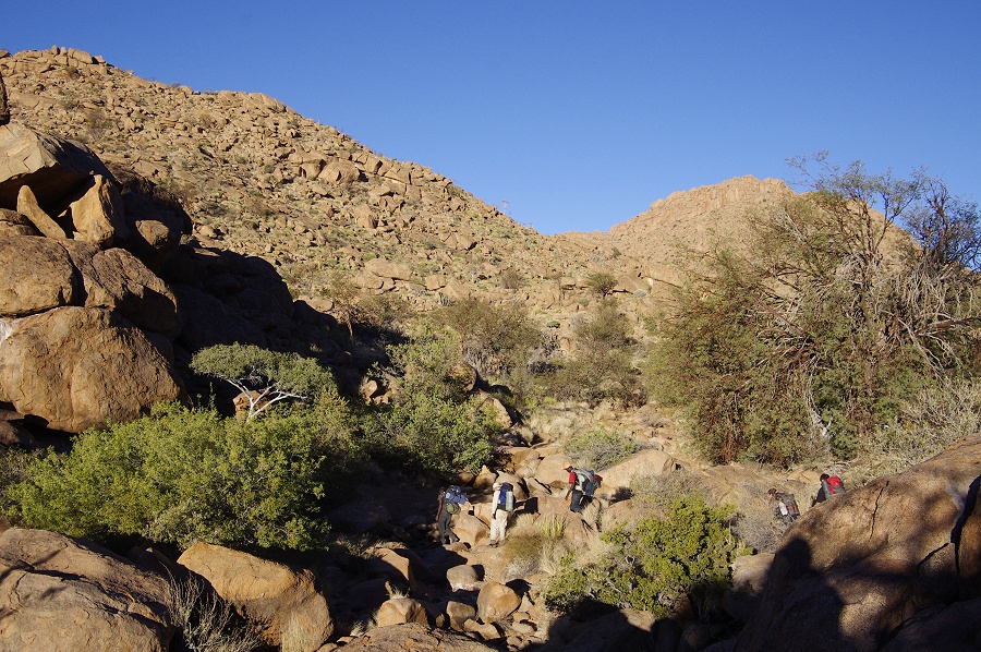
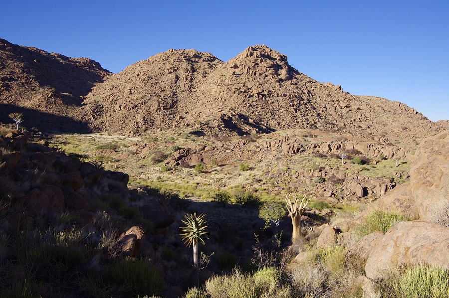
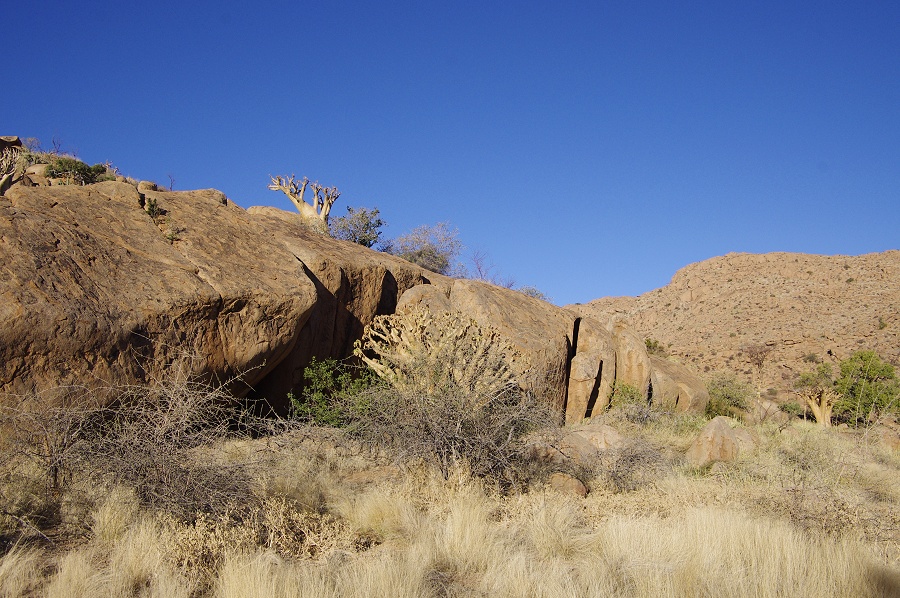
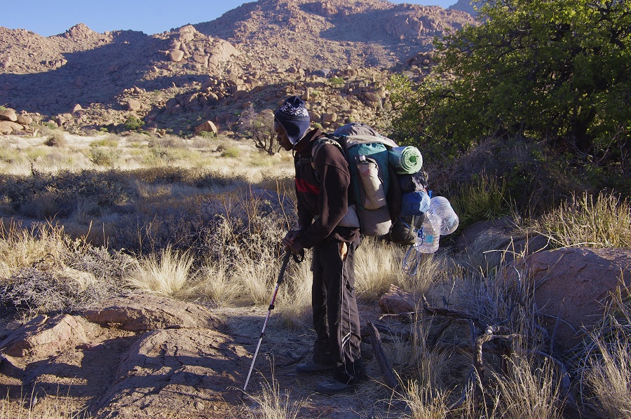
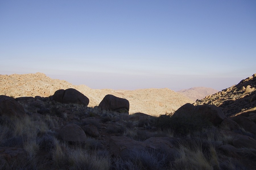
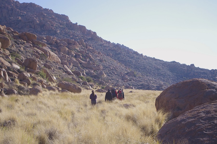
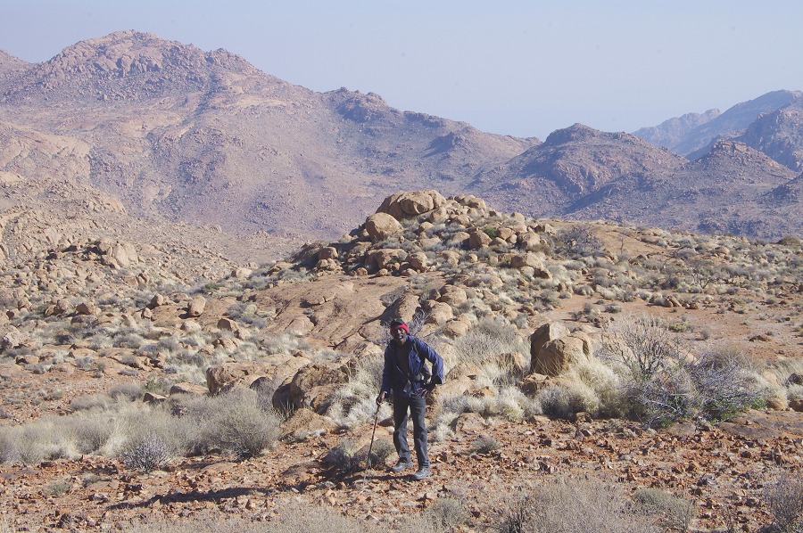
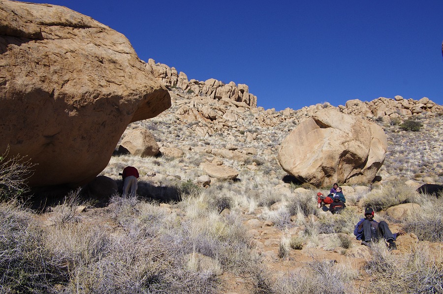
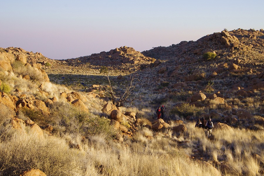
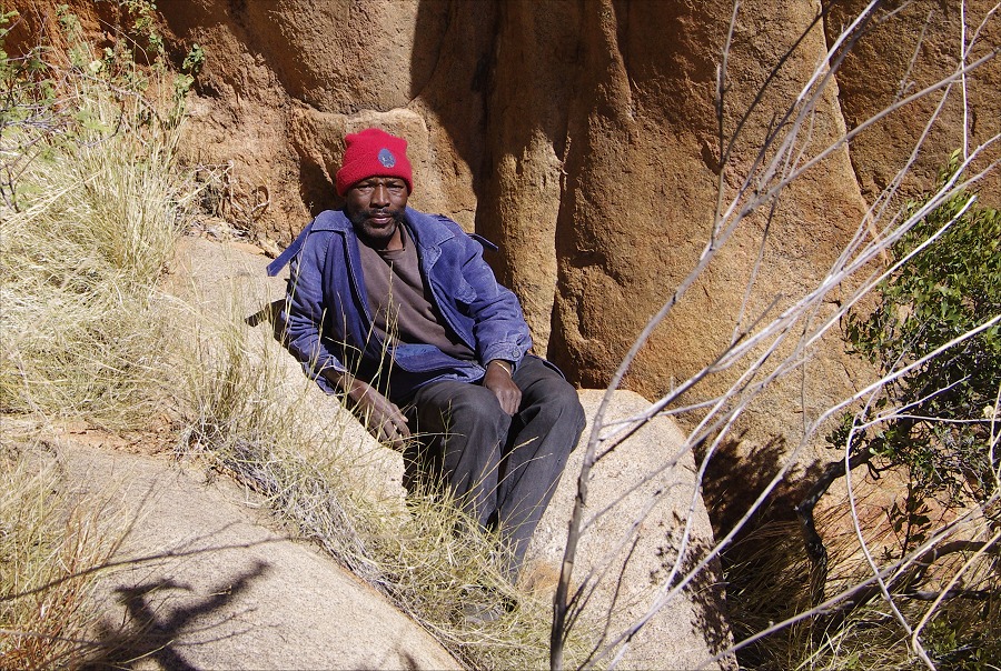
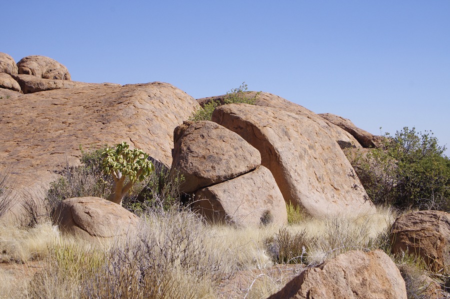
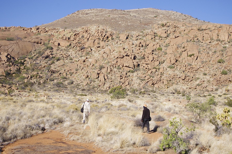
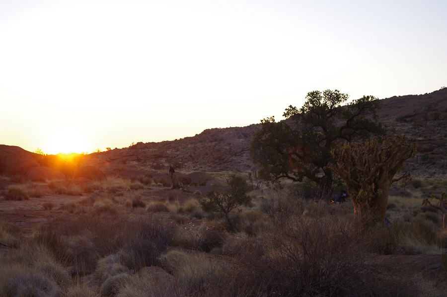
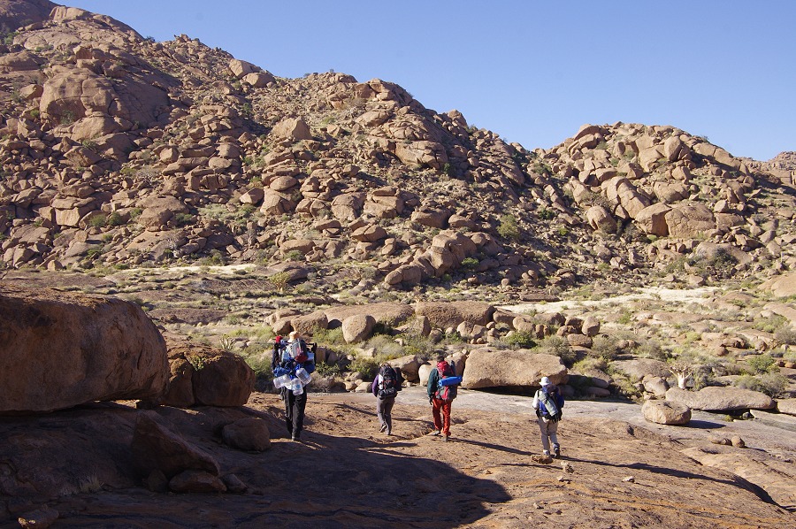
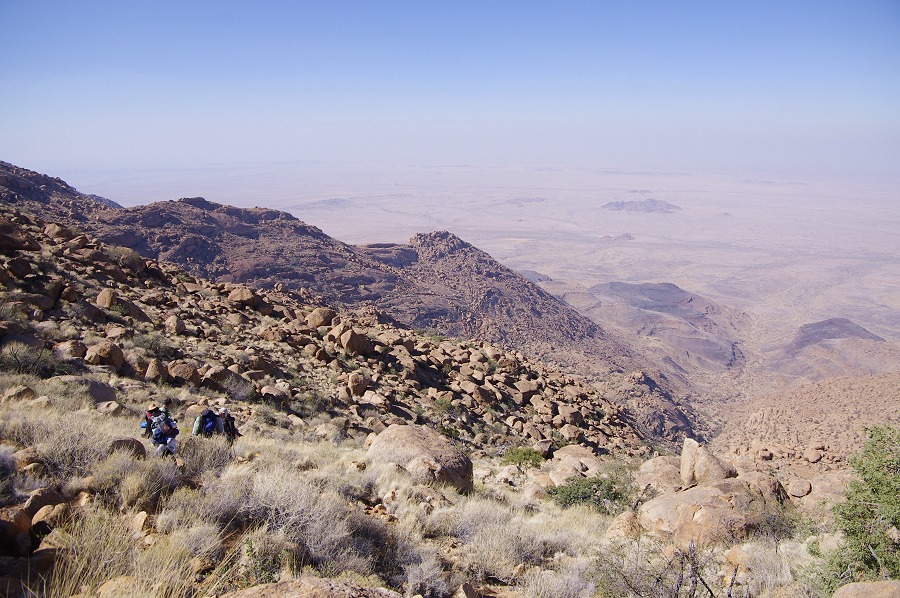
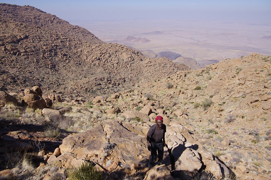
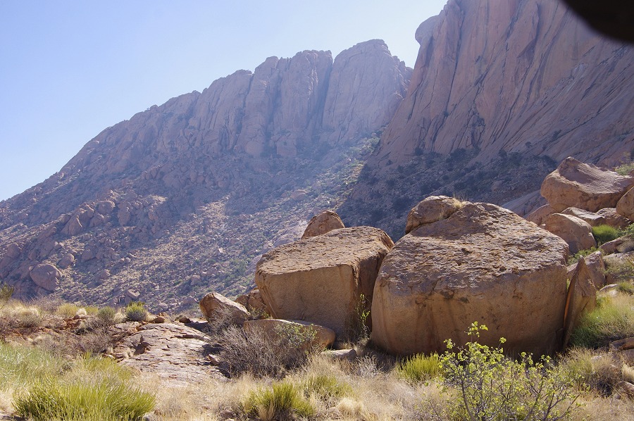
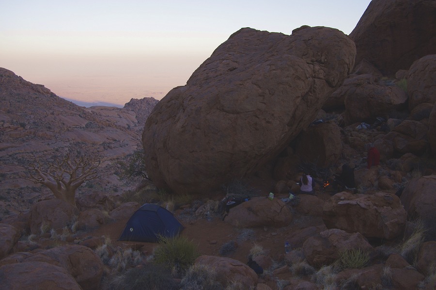
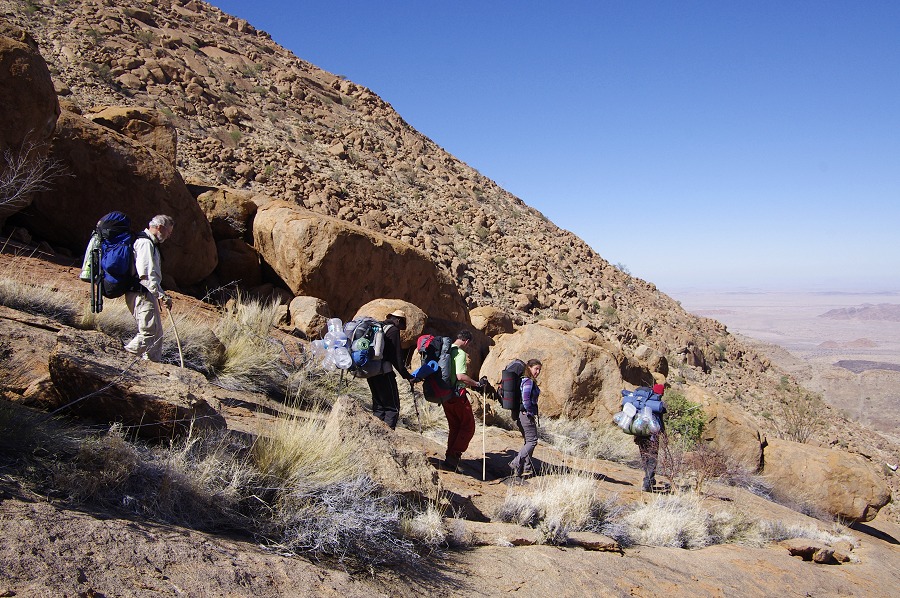
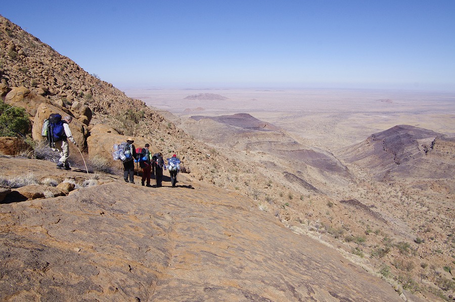
We left from the Etango Ranch before daybreak at 5am, and reached Omandumba just as the sun rose. Driving non-stop, we reached Uis before 9am, and hastily packed and prepared our gear and supplies, then Attila, Jon & Magdi left with Basil (the owner of the Brandberg Rest Camp where Stefan and we stayed this time) to the agreed rendez-vous point where the western Brandberg road crosses the Hungorob river. With Stefan we loaded all the supplies to be cached on the helicopter at the pad beside the Rest Camp, and at around 11am we finally managed to take-off. In the mean time, Basil had already dropped off our guide Angula Shipahu and his son Thomas (who also guided us the previous year) who were to make their ascent on foot to our agreed campsite in the Western Amis Gorge.
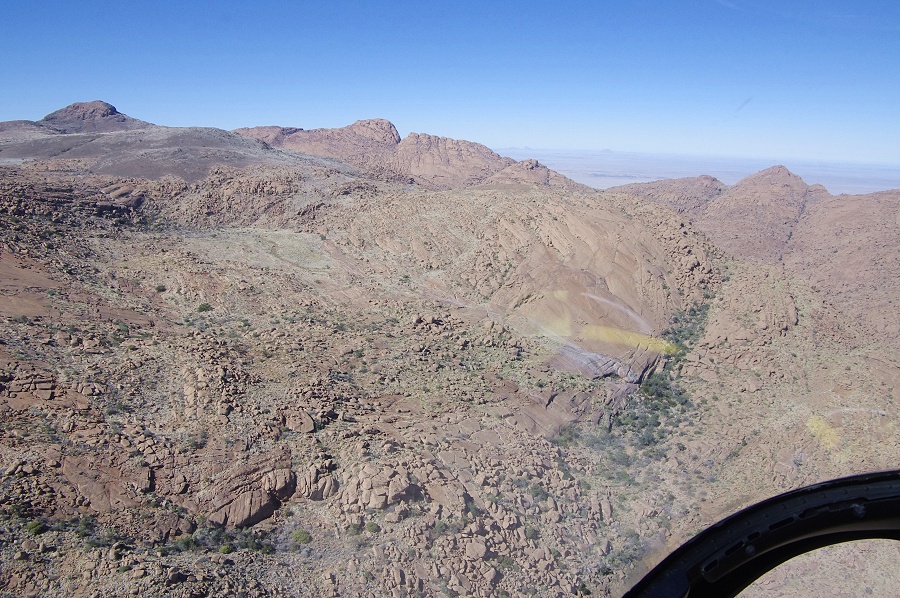
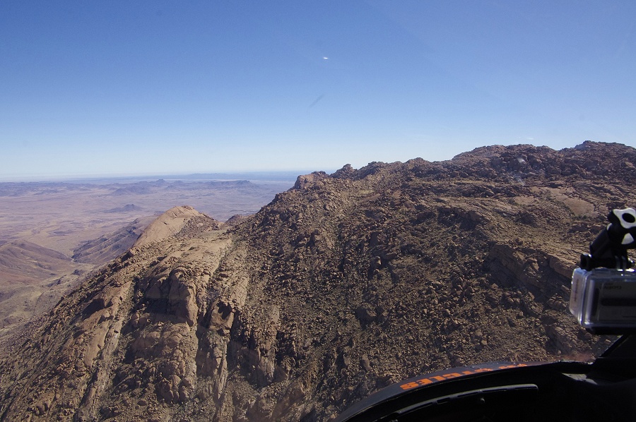
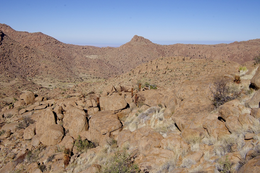
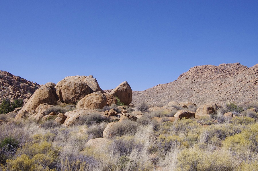
On this first flight, we were to prepare three dumps of supplies along our route (a fourth one was already made a week ago at the middle Numas), leaving me and the remaining supplies at the Western Amis camp, Stefan returing to the rendez-vous point to bring up Attila, Jon & Magdi and their gear in one turn. Despite our belated departure, the weather was calm and not too hot, perfect for flying. It took us about 10 minutes from Uis to reach the edge of the mountain.
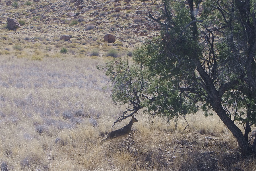
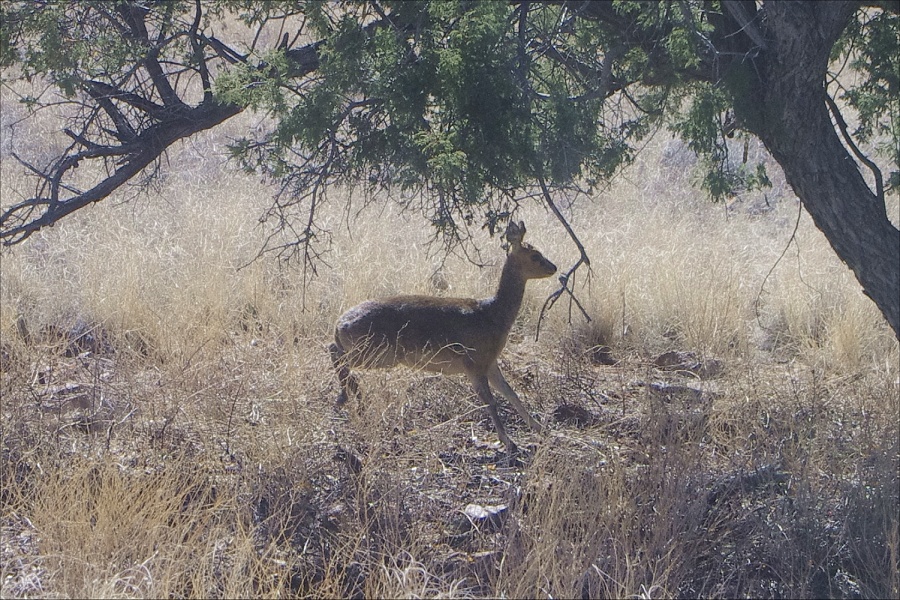
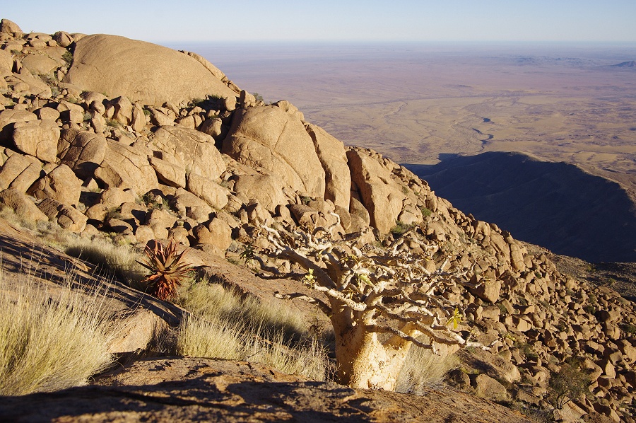
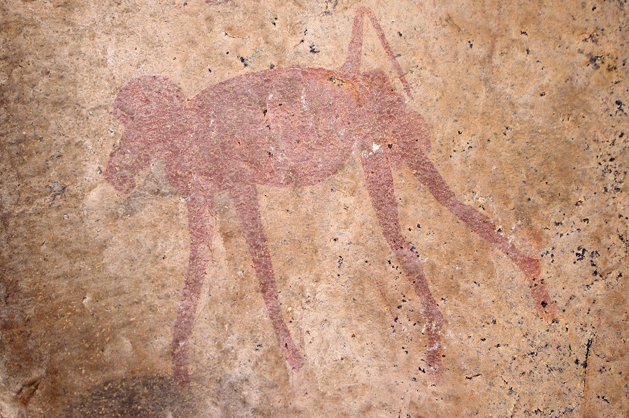
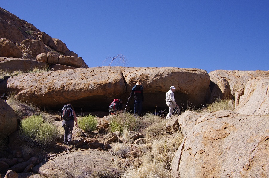
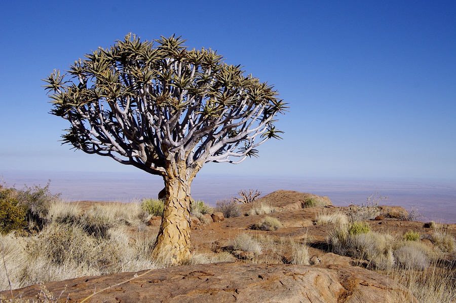
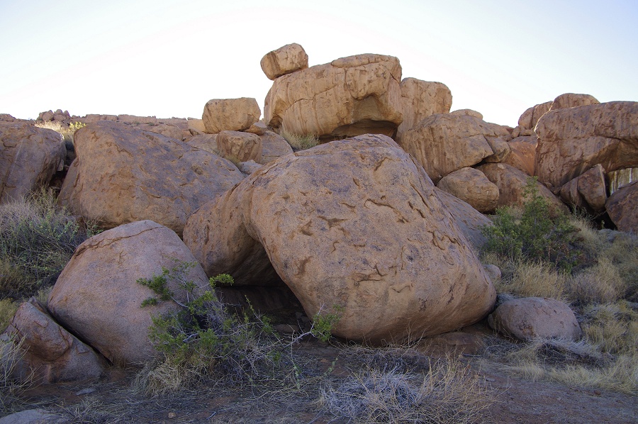
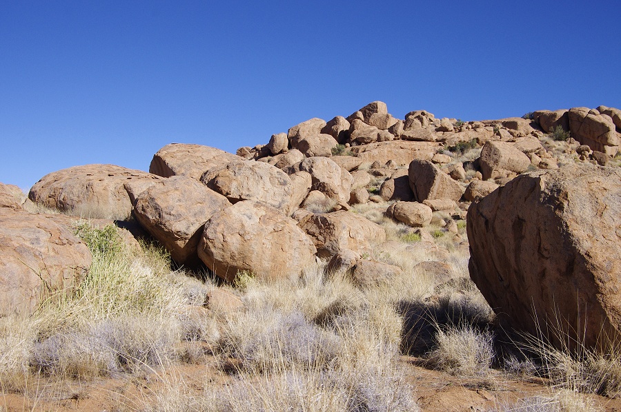
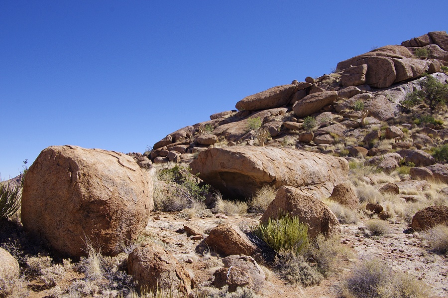
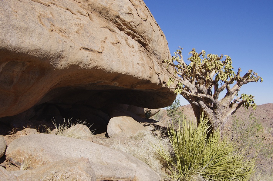
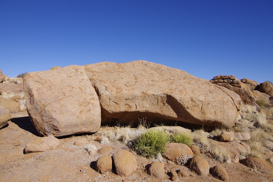
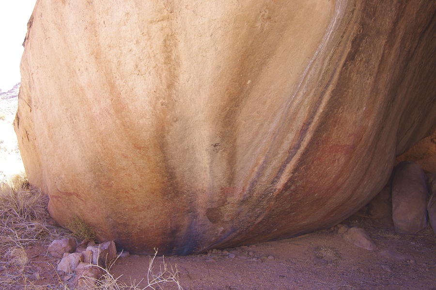
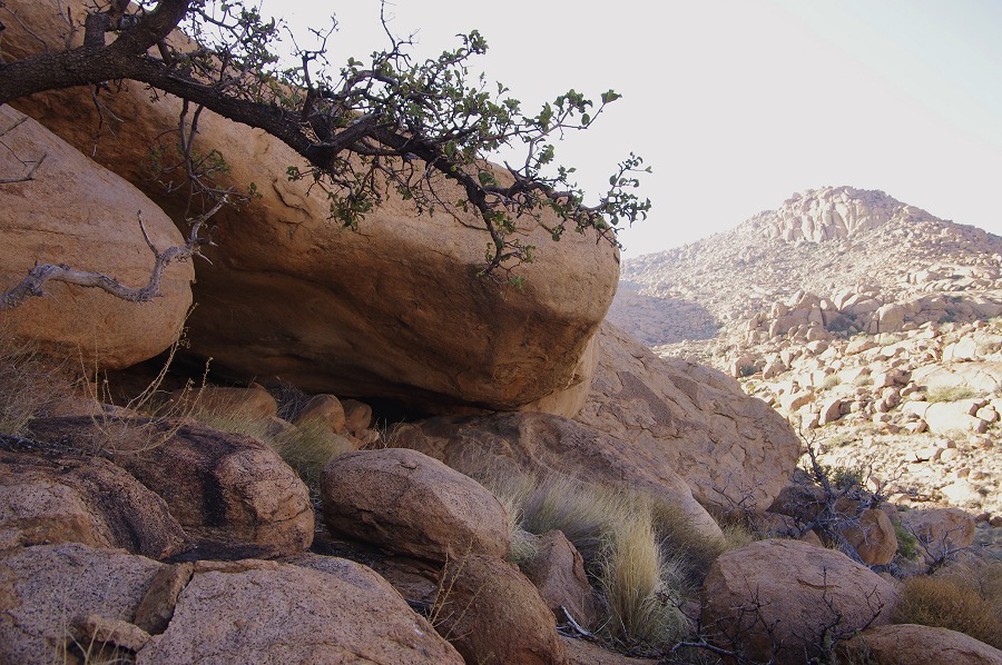
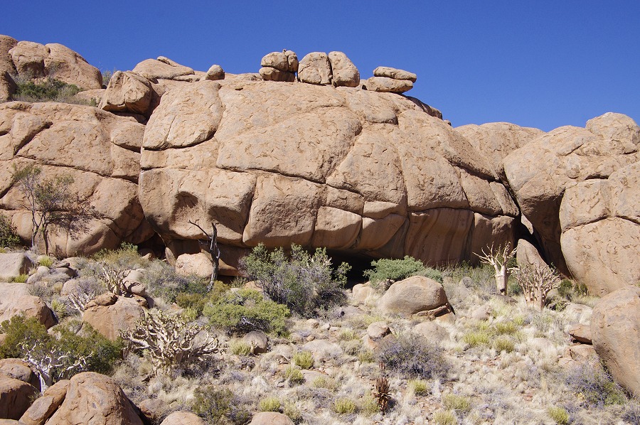
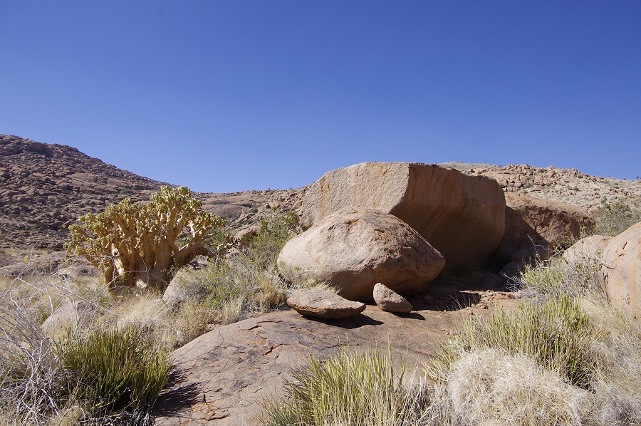
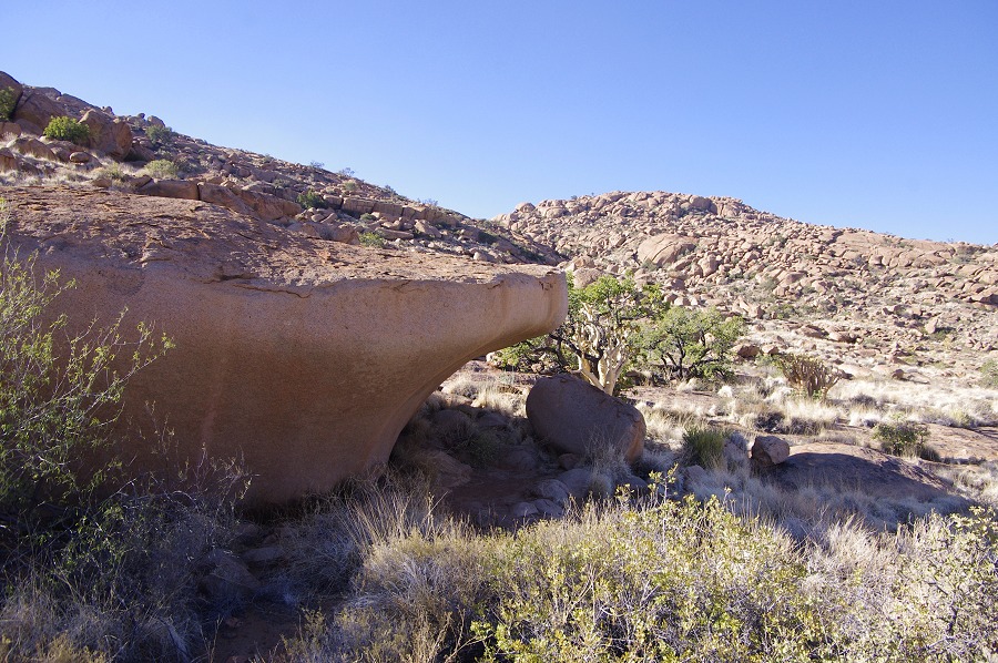
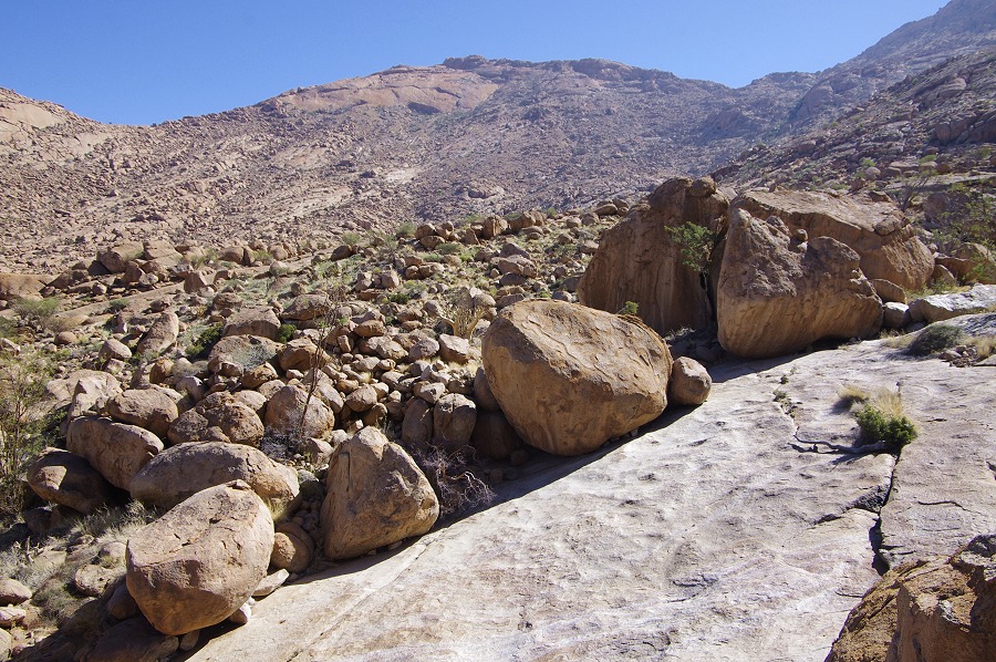
Our first dump was to be made in the upper Hungarob, at our planned campsite on a small plain following the direct ascent eastwards from Hungorob Mulde. Making a pass over the intended spot, it appeared rather rough, so after a quick discussion we decided to make the dump at the base of a prominent tree on a larger, easily approachable plain a little further east (that 'little' further, which was half a minute for the helicopter, later turned out to be a good half-hour trek from the campsite). As we approached the chosen tree, we saw two klipspringers (Oreotragus oreotragus) hiding in the shade under the tree, not knowing what to make of the approaching noisy creature. They eventually bolted as we landed and I opened the door. With the engine running, the dump was quickly placed under the tree, and we were in the air again for the brief flight down to Falls Rock Plain for the next dump.
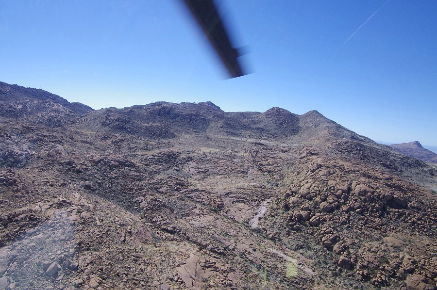

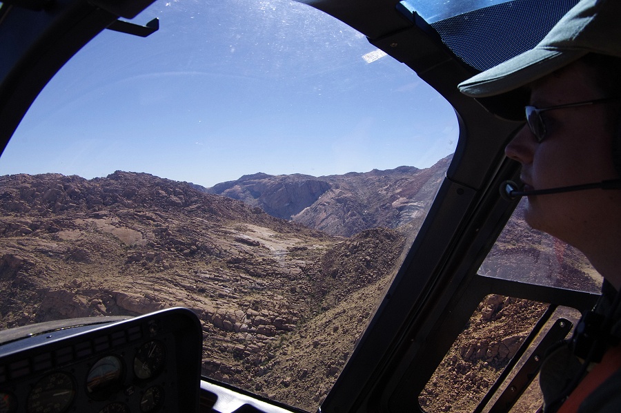
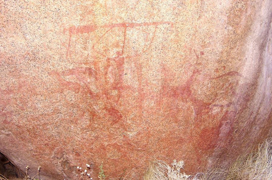
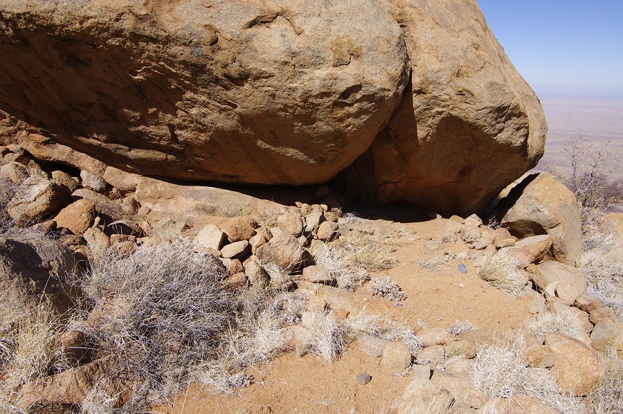
We overflew Falls Rock shelter (H28) as we approached the plain beyond. There was some movement in the grass, as we flew over the creature it was clearly a small feline, most probably a black-footed cat (Felis nigripes), the smallest of the African wild cat species. Unfortunately it vanished before I could grab the camera. Stefan landed close to the large tree at the south-eastern edge of the plain and the dump was rapidly placed at the foot of the tree. With now a substantially lighter load (hence more hovering margin) we rounded the intervening hills and descended into the upper Gaaseb Gorge, where we were hoping to leave a cache of water in the vicinity of site G12, on the col between Gaaseb and Eros gorges. However on making the approach and hovering over the intended spot for a few minutes, it became clear that there is no feasible landing spot anywhere in the vicinity, the terrain is too rough, and the few flat patches are too close to large rocks or trees to permit a safe landing. We flew back along the upper Gaaseb to find an alternate spot, but here were none, so in the end we made the dump at one of the grassy plains near Helm Pools.
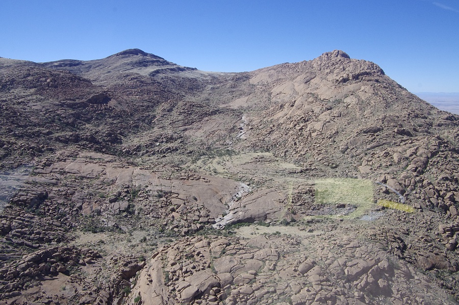
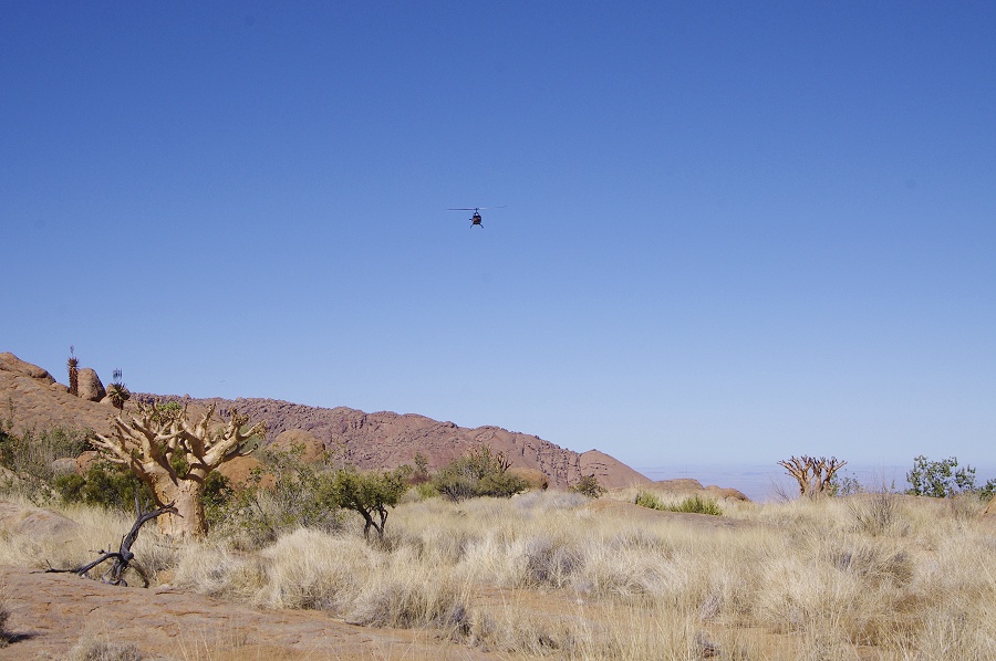
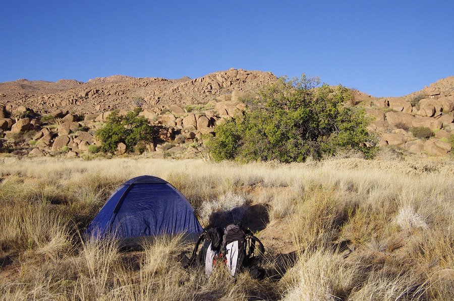
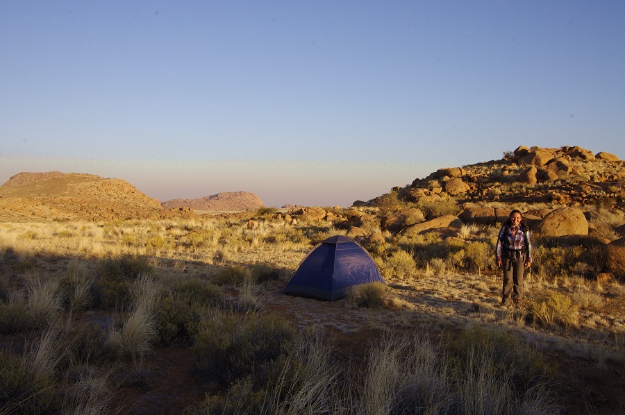
The dumps made, we set course for the Western Amis, where a week earlier we have already scouted a suitable landing spot, the only approachable flat bottomed valley amongst the otherwise very rough terrain. Leaving me and the remaining supplies at the campsite, Stefan rapidly departed to fetch the others.

The helicopter returned in less than 20 minutes, and after quickly unloading went back to Uis, leaving us alone in the quiet small valley.

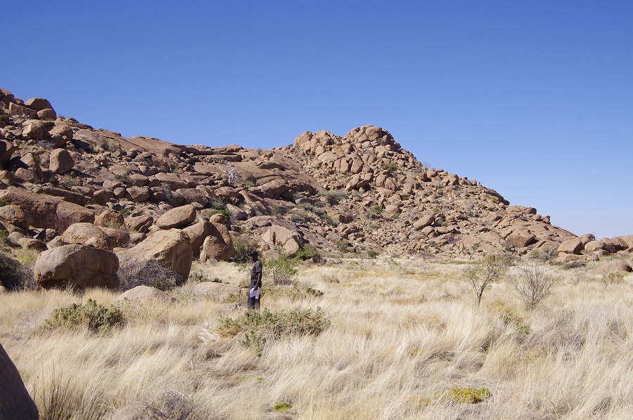
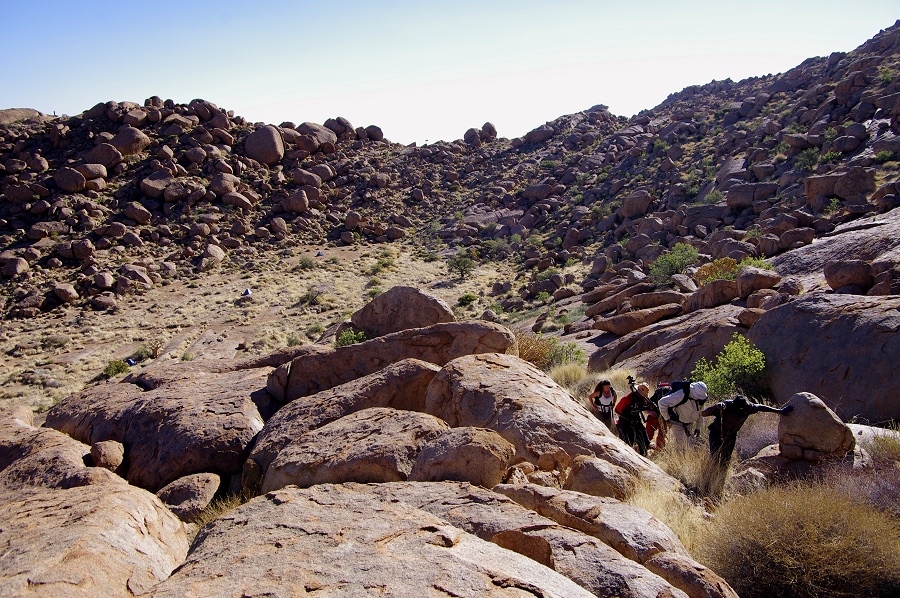
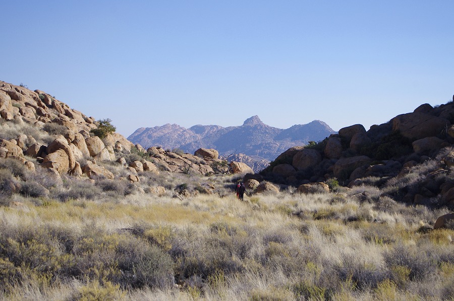
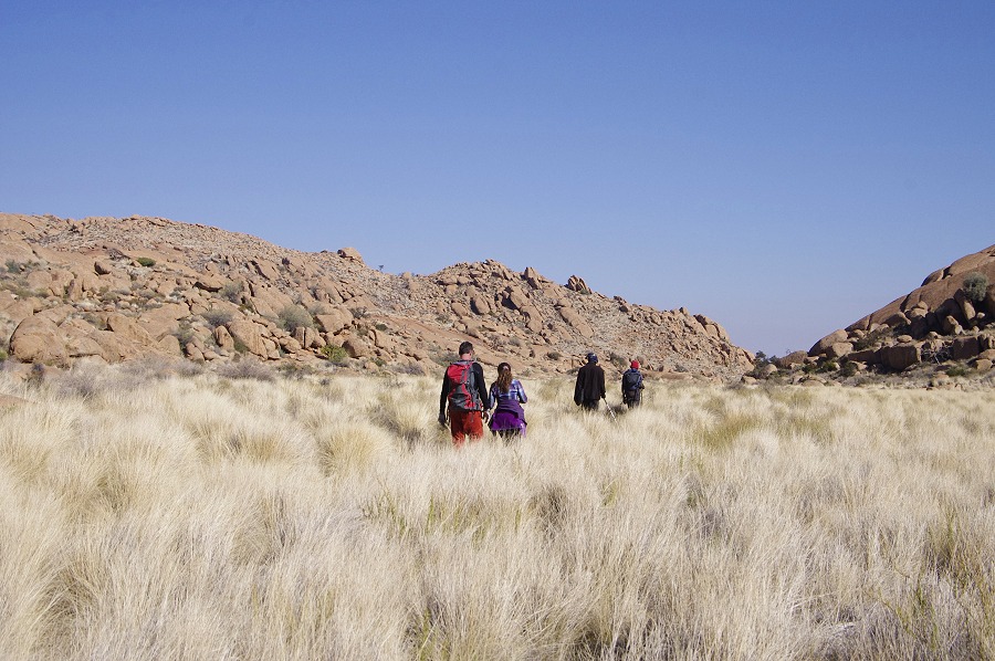
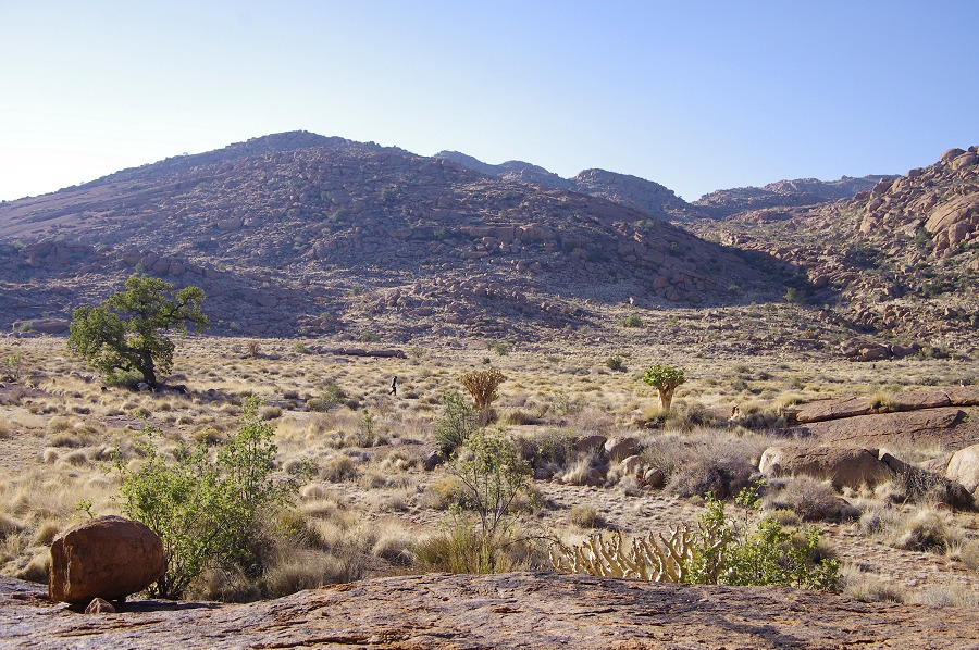
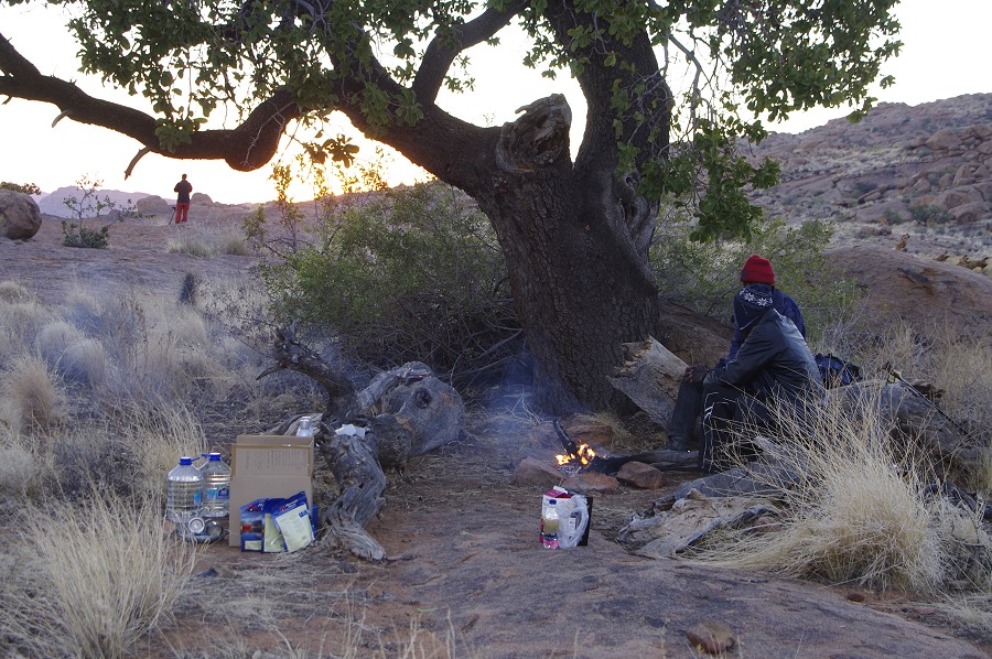
As we only expeced Angula and Thomas to reach us by the evening, we had the afternoon to ourselves. After a quick lunch we set out towards what we believed to be the direction of sites A46-50, located somewhere below and to the west of our little plain. I had a printout of Pager's hand sketch of the Western Amis sites, plus the sketch of each individual site with us, so the task of finding the sites did not appear to be dificult. However after a scramble of about three hours on the very difficult rocky slopes overlooking Dom peak below us, we had to concede that the sites were somewhere else...

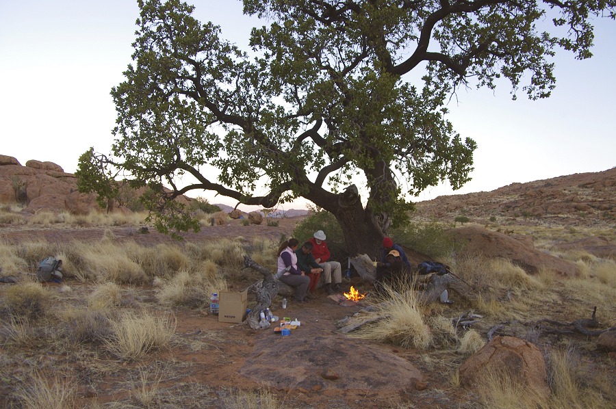
With the shadows growing long, we returned to our camp and made a further attempt above the plain, where the sketch marked site A44, one of the principal sites of the area. As we ascended the gully ending on the plain, near the top we saw at a distance a long rock with a shalter all along that just had to be a rock art site - though it did not resemble the sketch of A44 at all. Magdi was the firs to reach it, and she soon yelled that the rock is full of paintings. A leafing through the site sketches revealed that we found A47, the main site of the cluster that we were looking for all afternoon.


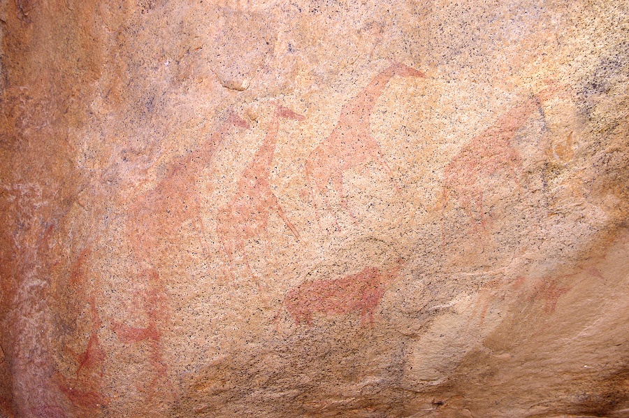
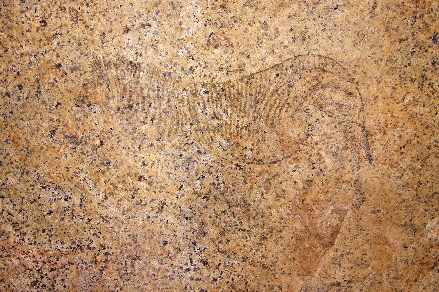
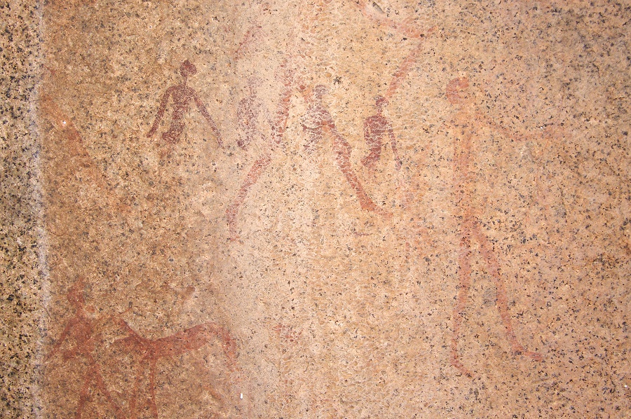
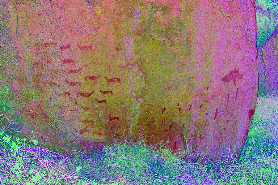
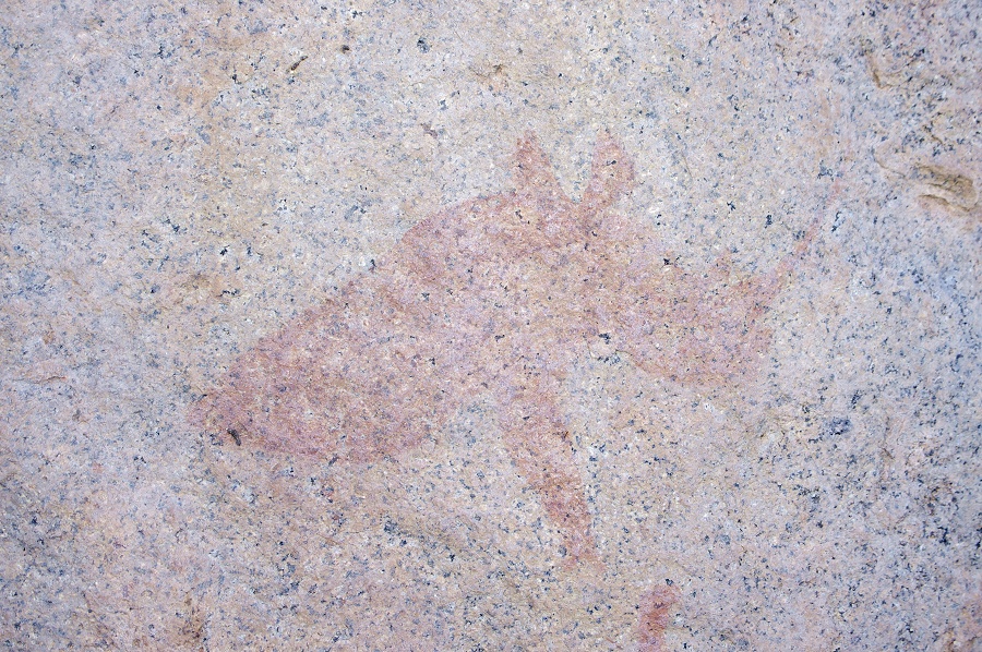
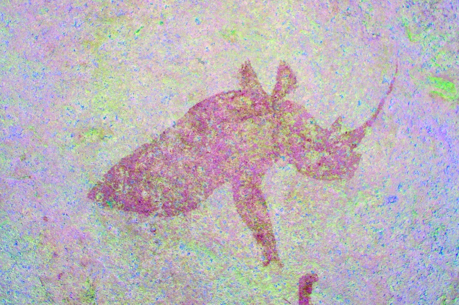
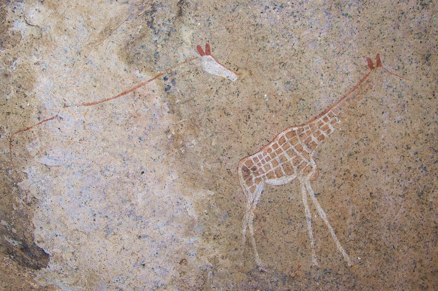
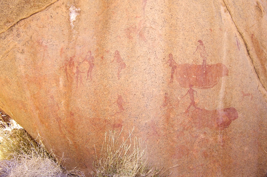
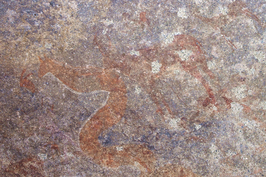
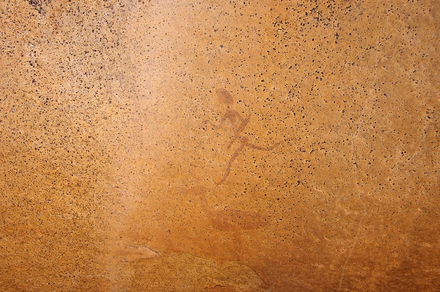
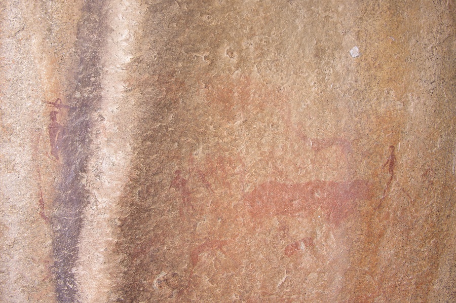
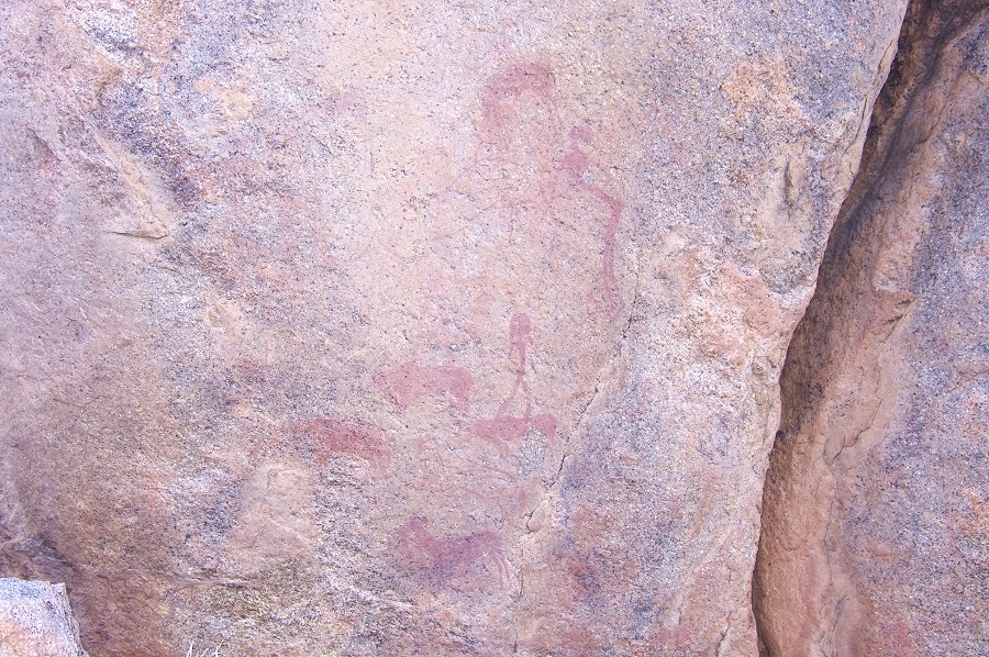
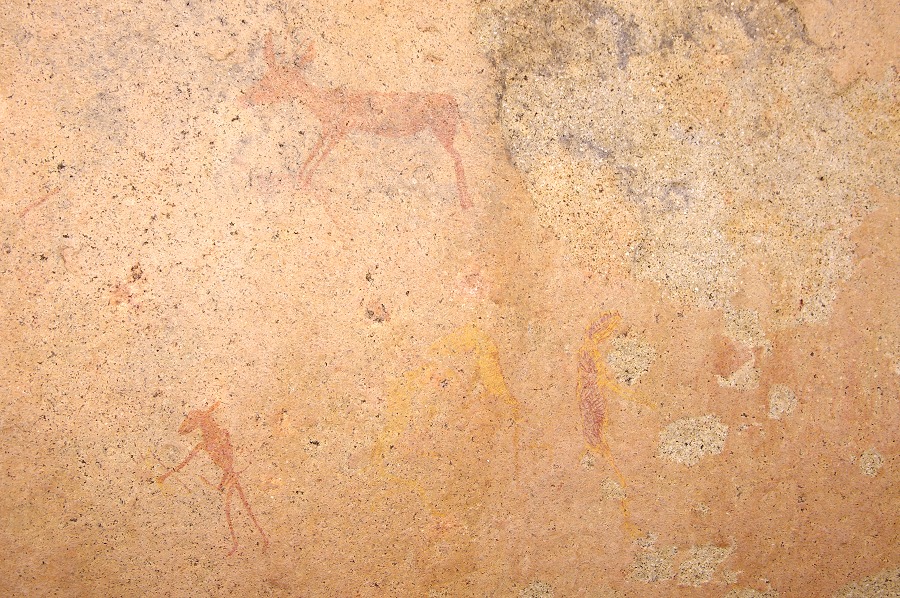
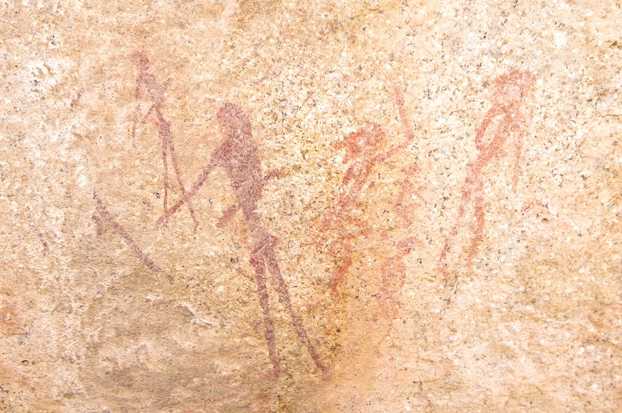
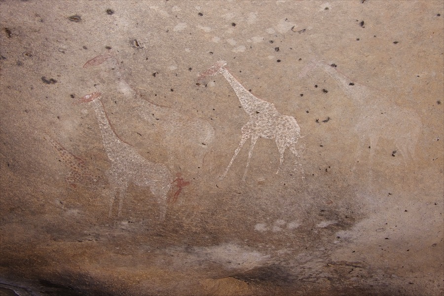
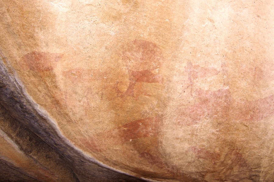
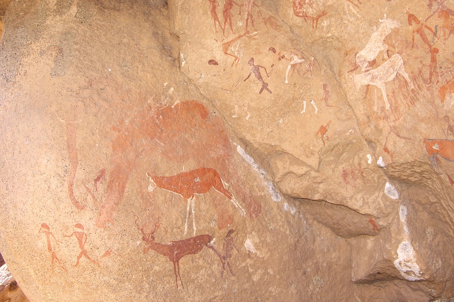
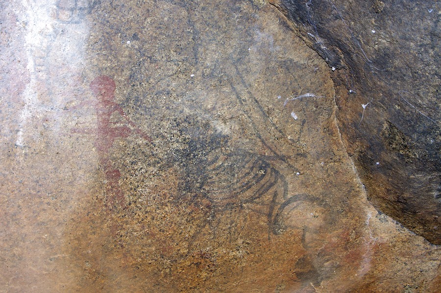
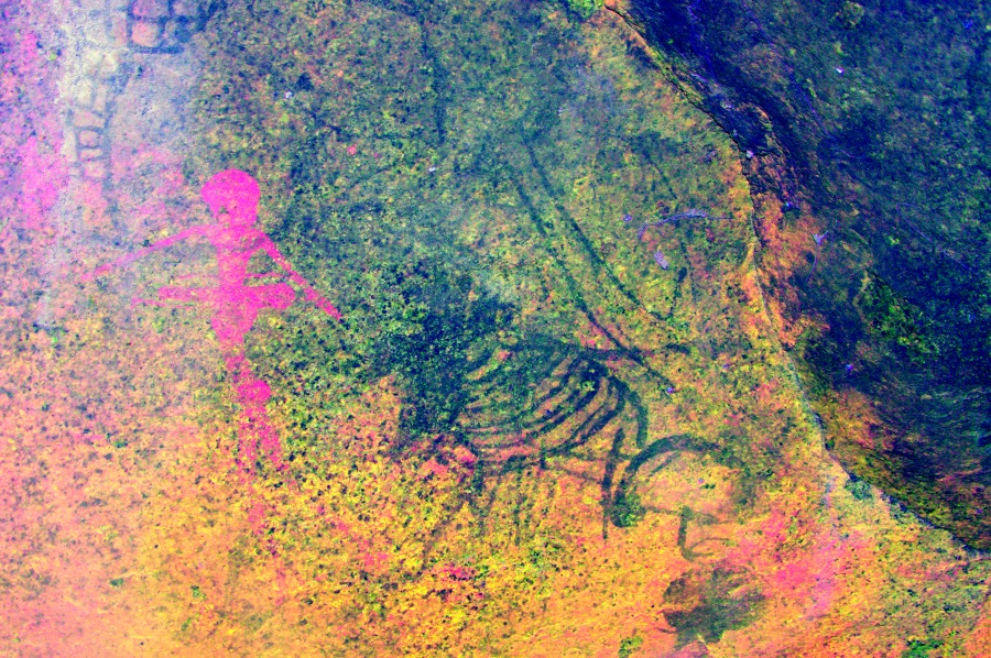
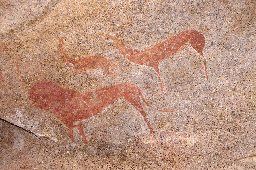
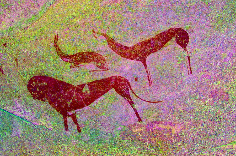
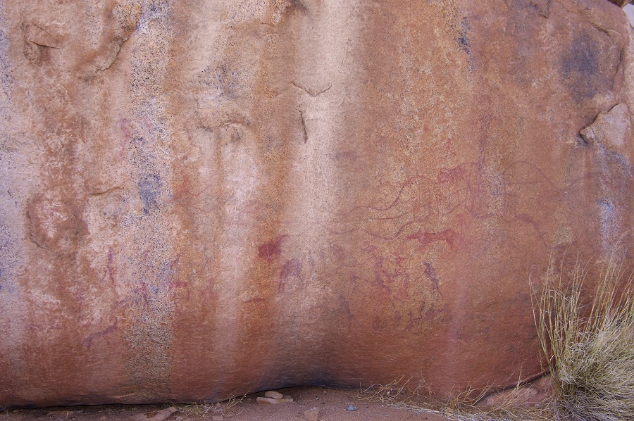
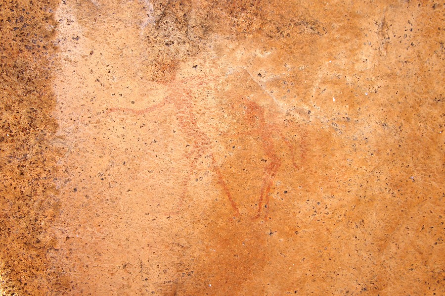
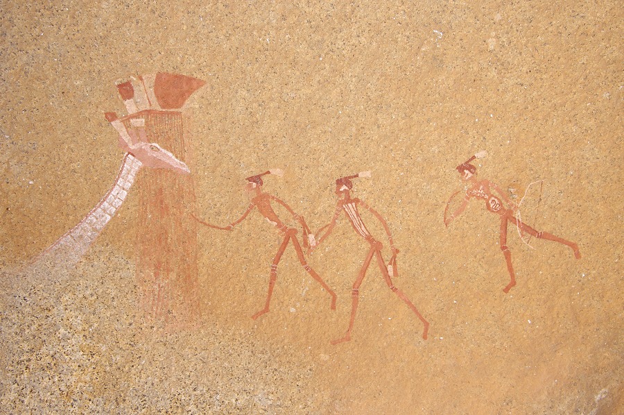
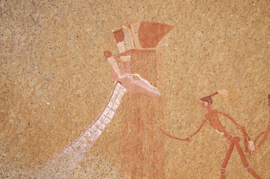
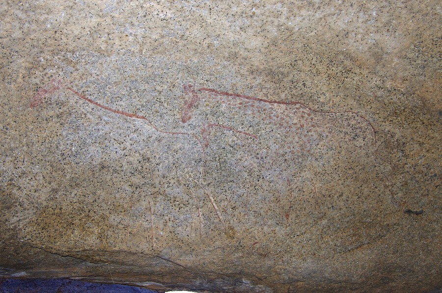
Now that we found our bearings, it quickly became obvious that Pager's sketch as published in the HBI Amis Gorge volume is quite incorrect. Based on the site description, A46 had to be very close overlooking the slopes below. Rounding a little terrace at the end of A47, we soon saw the long low site just on the other side of the same rocky ridge. A46 only contains a few paintings, but these are exceptional, including an exquisitely drawn rhinoceros and a giraffe nibbling the top of a tree.


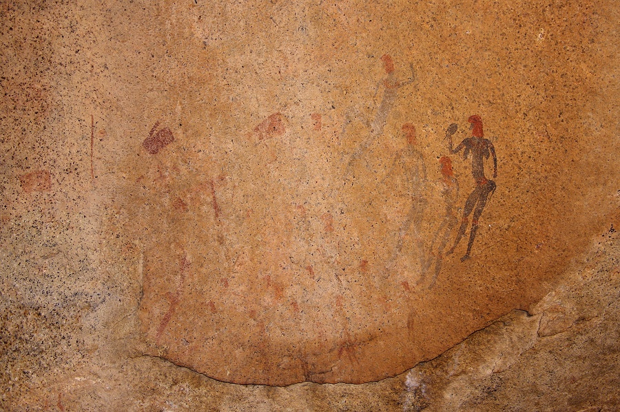
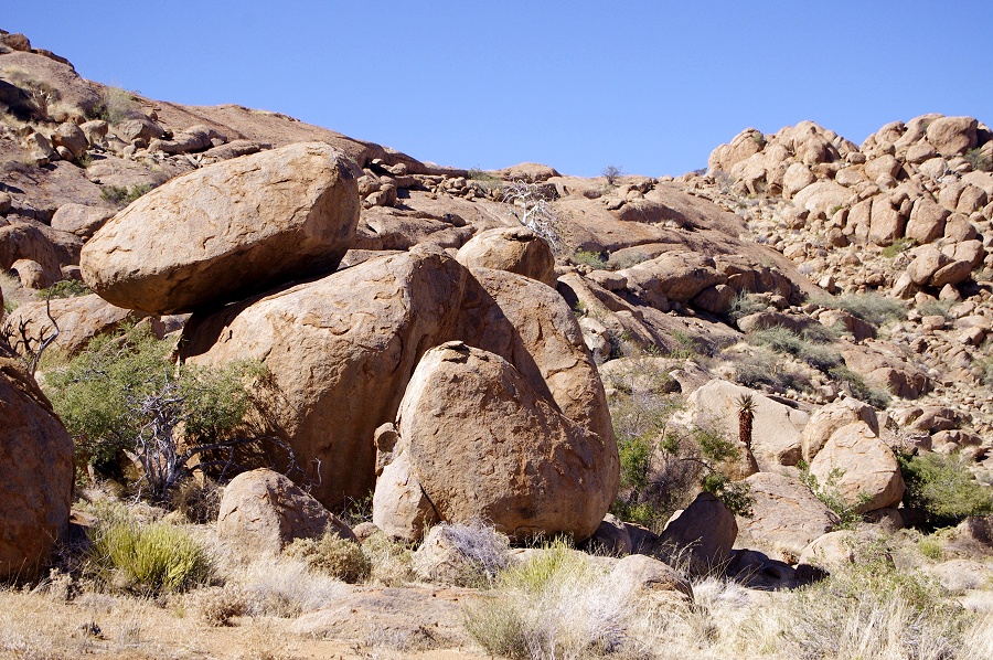
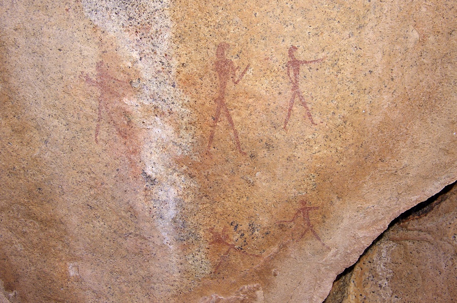
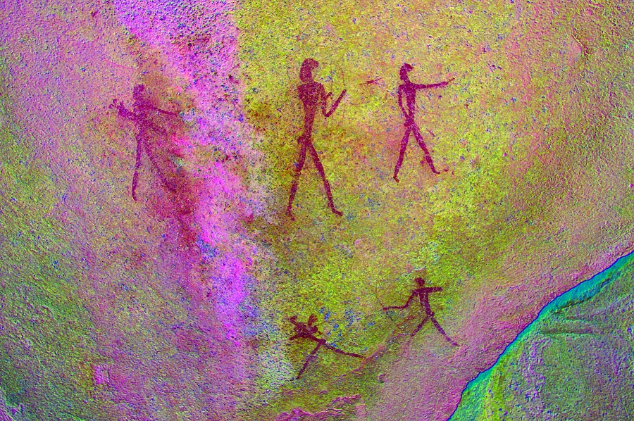
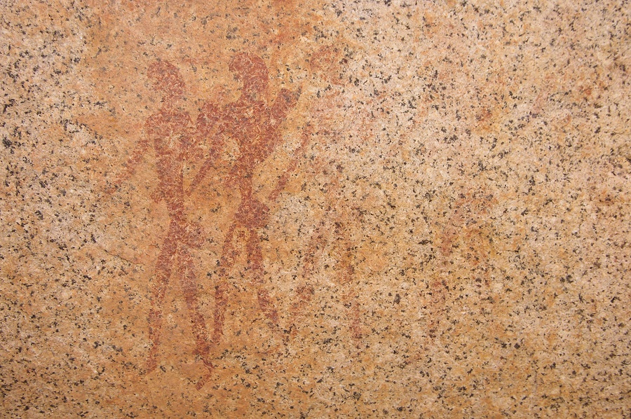
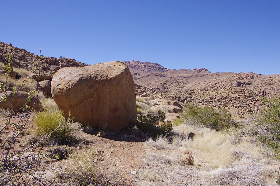
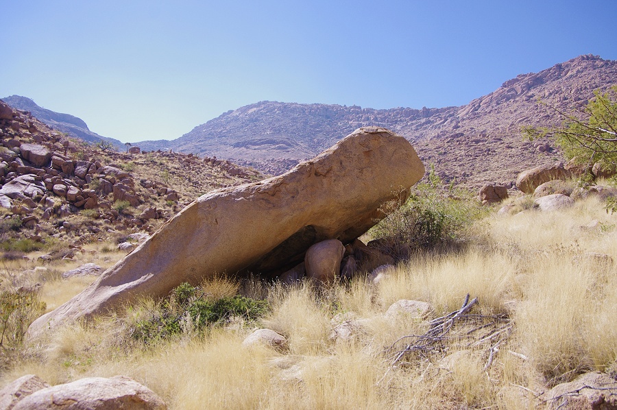
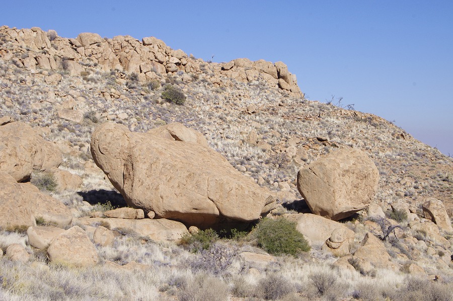
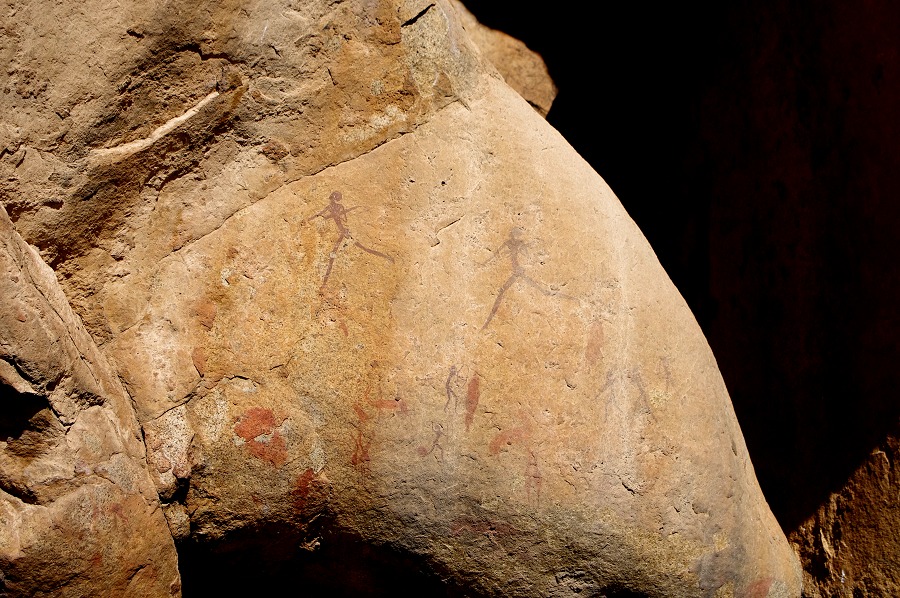
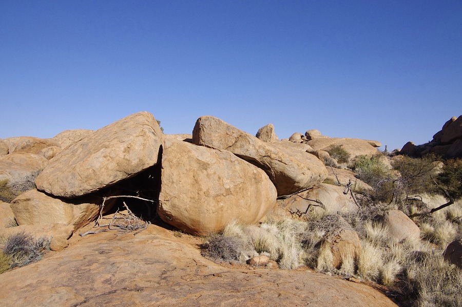
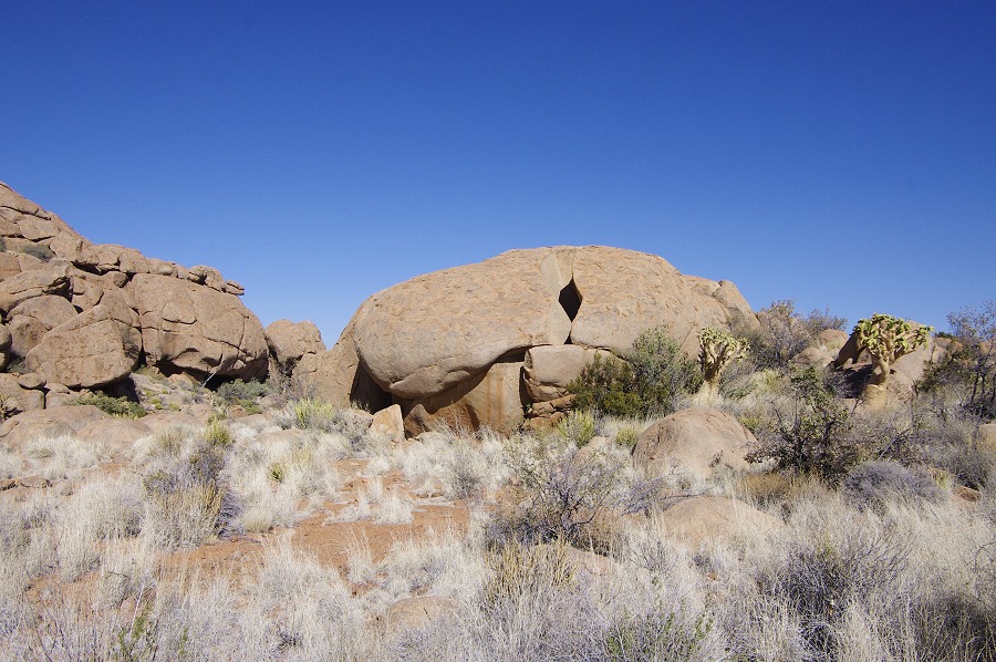
With sunset approaching we returned to our camp, finding two minor sites along the way. Based on the site description, now we were sure to find site A50 at the south western corner of the plain, a huge boulder resting on five smaller ones. With our orientation finally established, it did not take long to find the prominent boulder. The side of the boulder contains an excepionally large human figure (~60 cm high) with an unusually fine detailed face, and there is a remarkable representation of a baboon on the inner side of one of the supporting boulders.

Day 3. - Western Amis Gorge
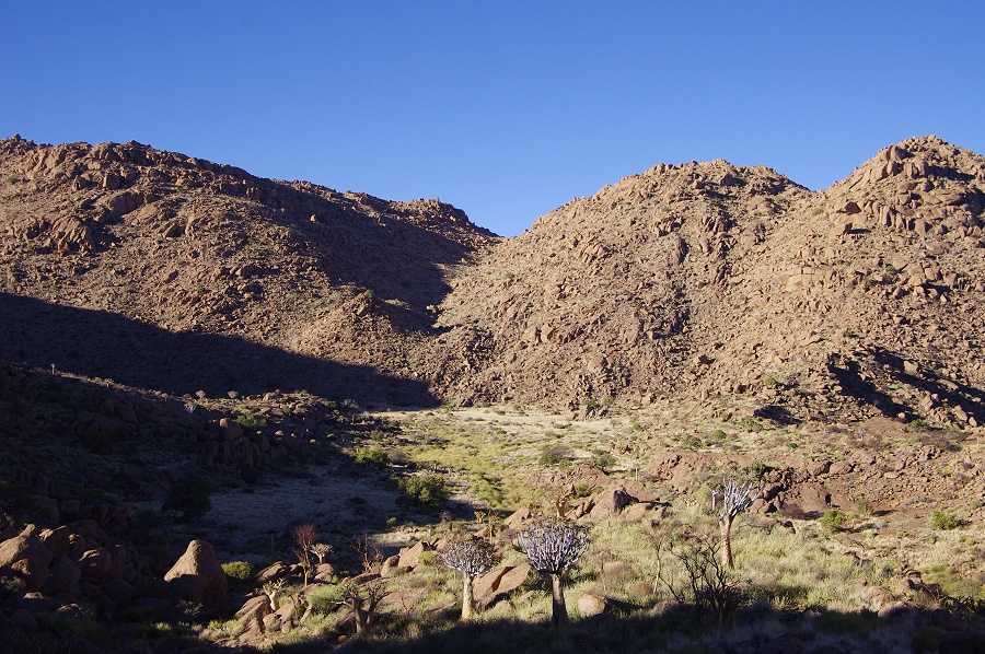
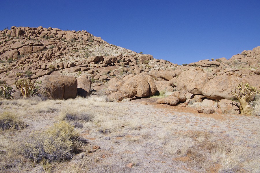
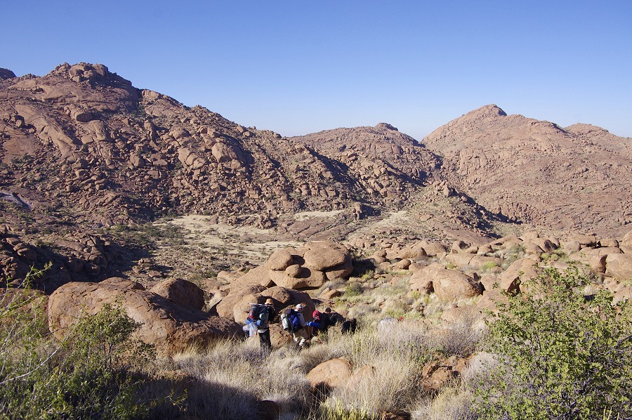
The night and the morning passed without Angula and Thomas appearing. As the previous afternoon we have seen the small plain far below A46 towards the Dom peak that we believed contained sites A56-59, we started out soon after sunrise, hoping that Angula with his amazing knowledge of the mountain will find us. We climbed up to the col beyond the sites of the previous afternoon, and started to descend on the steep and very difficult slope to the plain seemingly so near below. After a good hour we were nearing the bottom, when we heared a faint yell from far above. Sure enough, Angula and Thomas were waving at us from where we started from. Within 15 minutes they caught up with us, just as we reached the plain. It emerged that from their point at the ascent they could not see the helicopter landing, only heard it, so in order not to run out of water, they first went to the water hole below the Lufthöhle (A6), and only came accross to the Western Amis this morning. They easily found the camp, and picked up our tracks of the morning. A good thing they did, because the valley we were aiming for was not the correct one, but the one below, a further half hour away. Angula led us straight to site A56 at the western end of the plain, a very large site spread accross many boulders along the plain edge, with several fine panels of paintings.

The principal site on the plain, A57 is a huge boulder a few hundred metres away along the hillside edge of the plain. Another smaller boulder is perched precariously on the top. The eastern side of the boulder contains a huge panel of paintings, including an abstract oval composition of unclear meaning.

A58 and A59 are relatvely minor sites on the slopeward side of the plain, overlooking the steep drop down into the lower Amis Gorge and the Dom peak, the top of which rises slightly above the level of the plain.

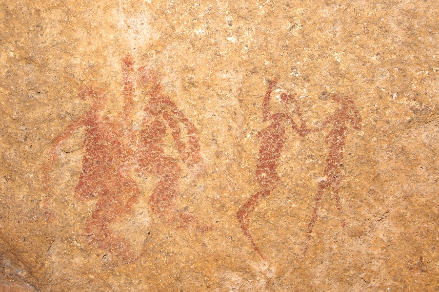

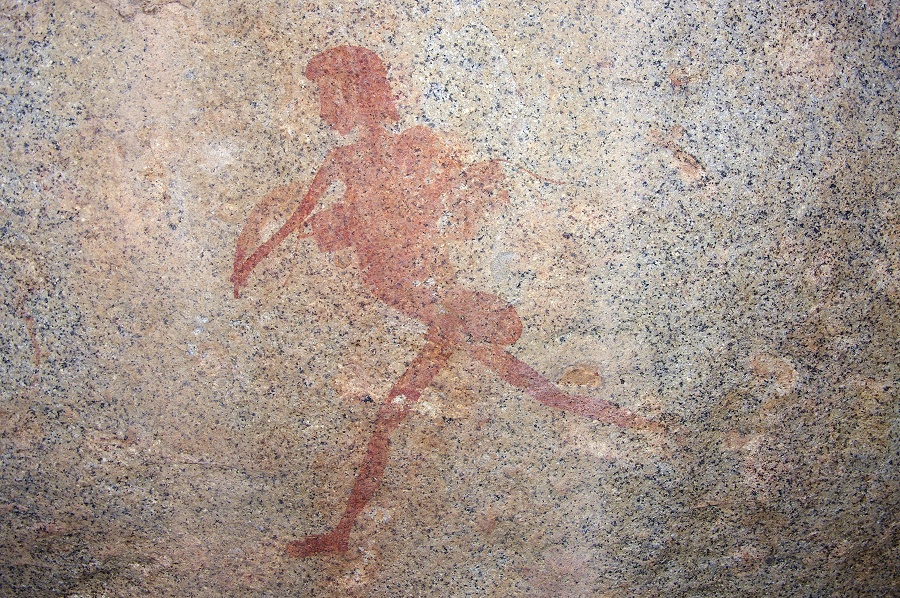
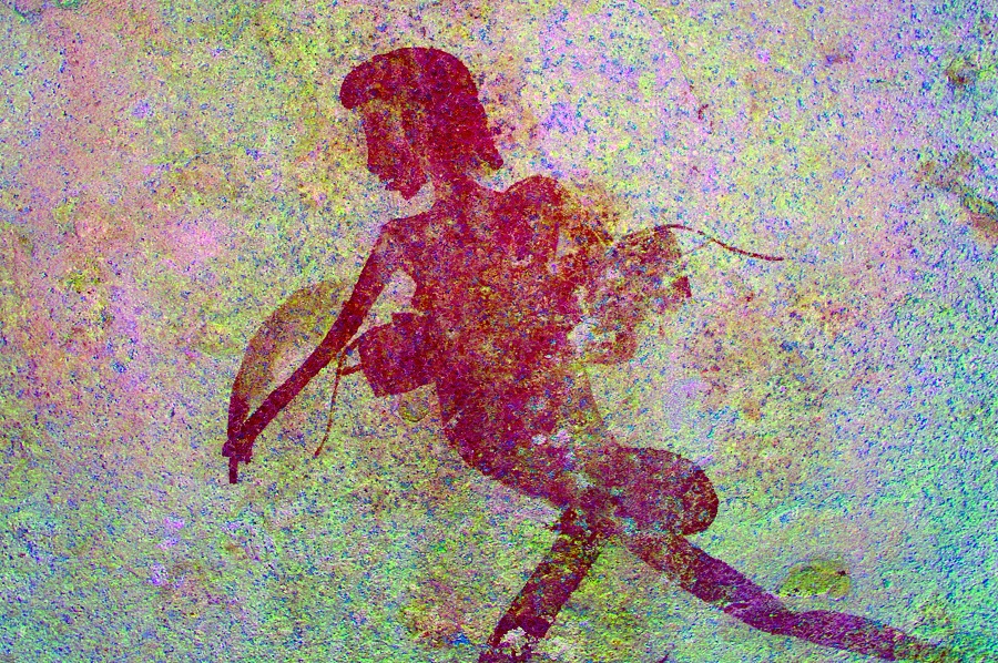
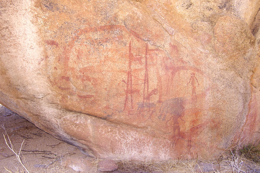
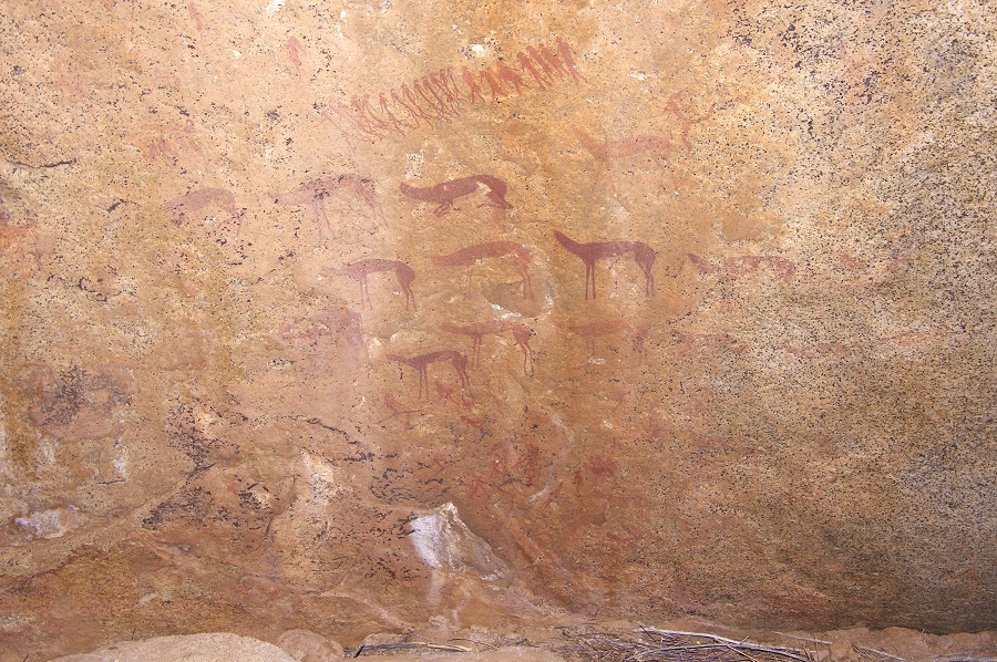
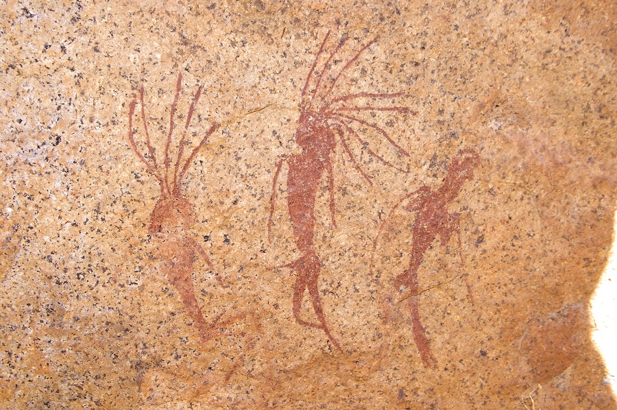
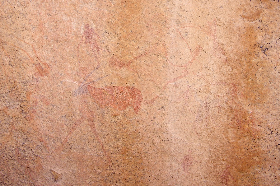
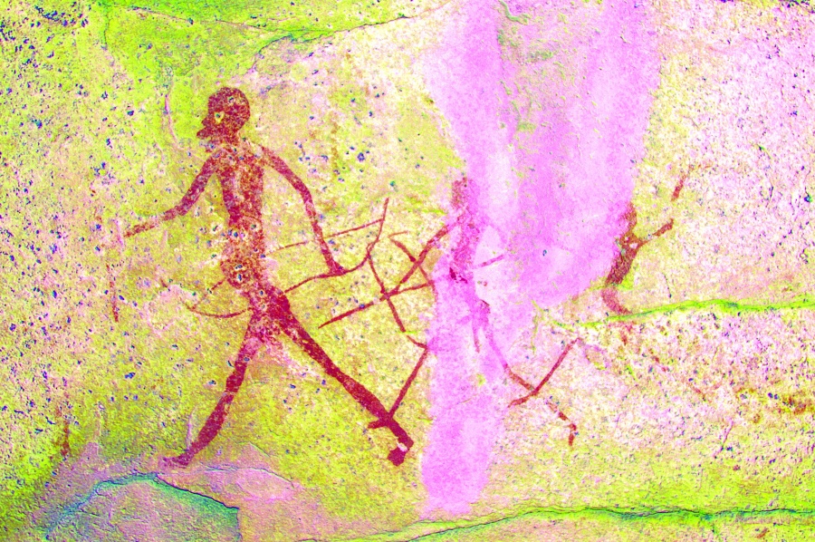
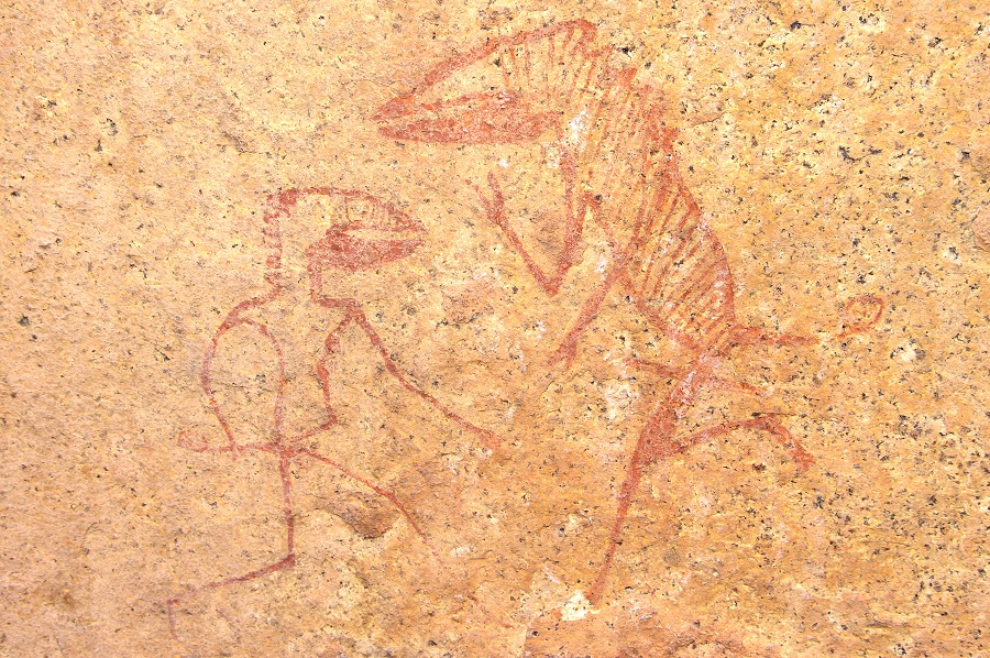
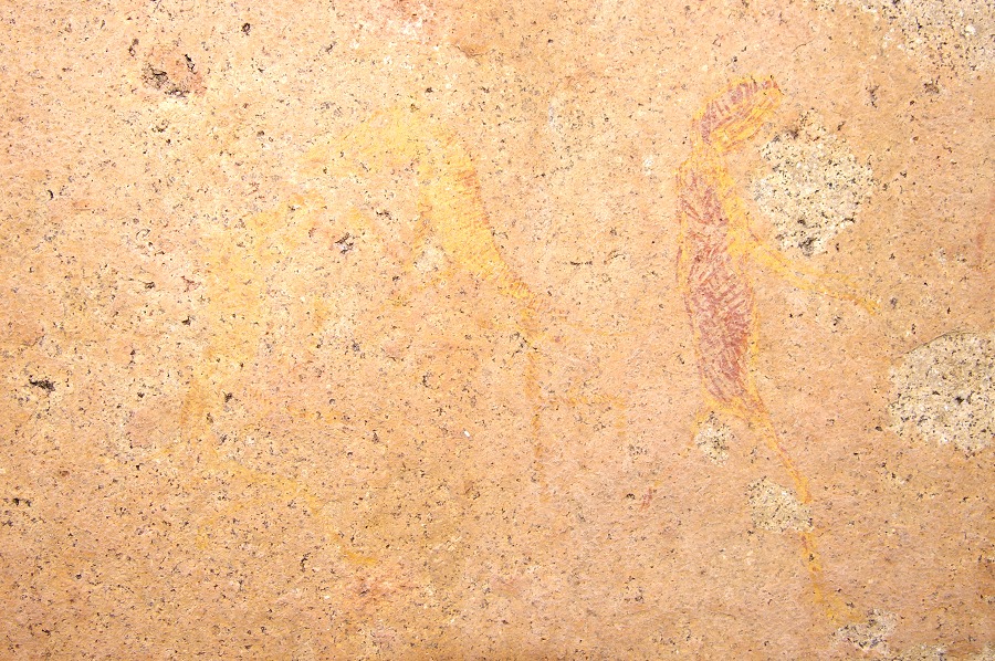
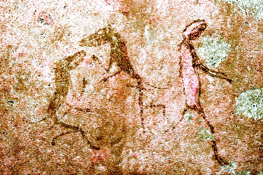
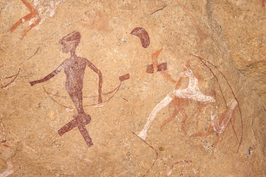
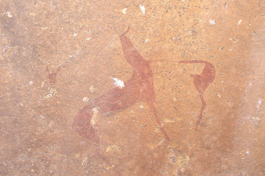
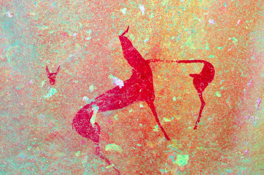
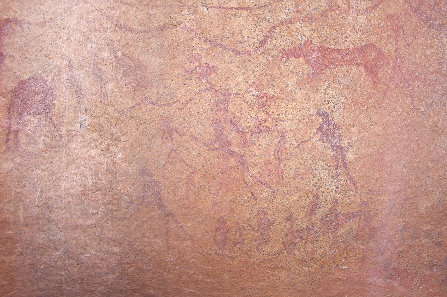
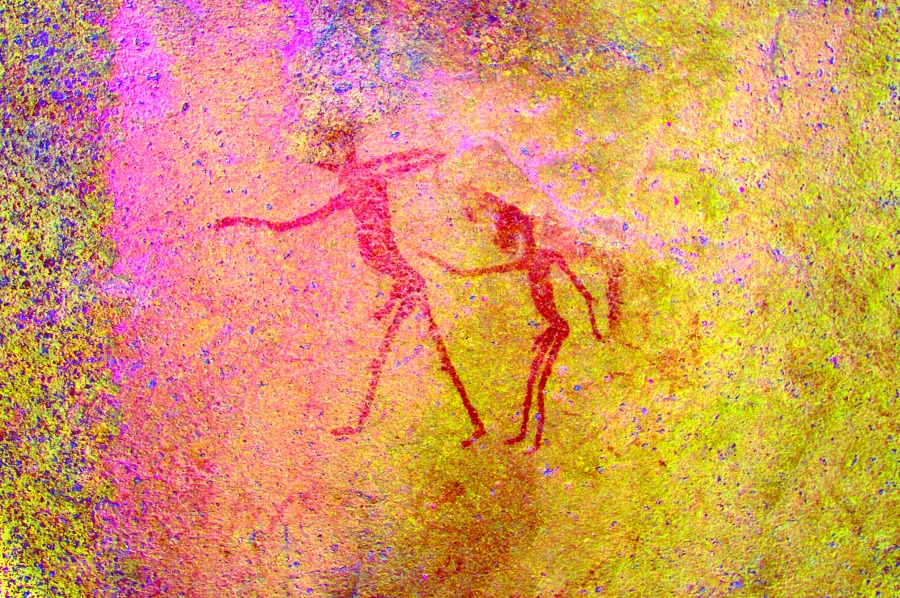
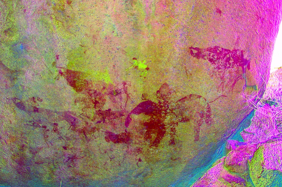
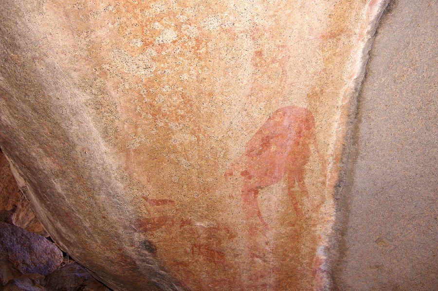
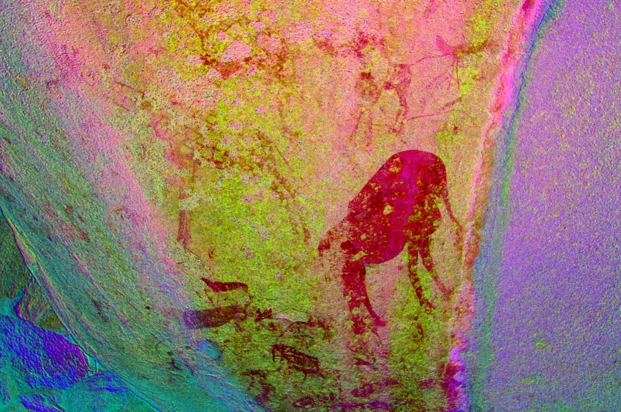
A60 is one of the principal sites of Western Amis, lying a little above and to the east of the plain we just visited. It is a large triangular shelter under an immense boulder, its importance lies not in the numbers of paintings but in the exceptional scenes and fine detail showing the mythical human-antelope transformation.


We started to move back towards camp, not up the same slope we came down but towards the lower outlet of the plain containing our camp, crossing the same terrain where we searched in vain for sites the day before. Soon after A60 we saw another two lesser sites, A51 and A52, both of which appear misleadingly far below A60 on Pager's overview drawing, whilst in reality they are slightly above and to the east.
After lunch and a short rest we set out again, this time to the east of our camp, to see a series of sites along a long narrow terrace along the mountainside slightly above our camp level a few hundred metres away. This time the going was easy on smoth granite plates, and we soon reached the first of the sites, A35 at a cluster of large boulders near the western edge of the terrace.
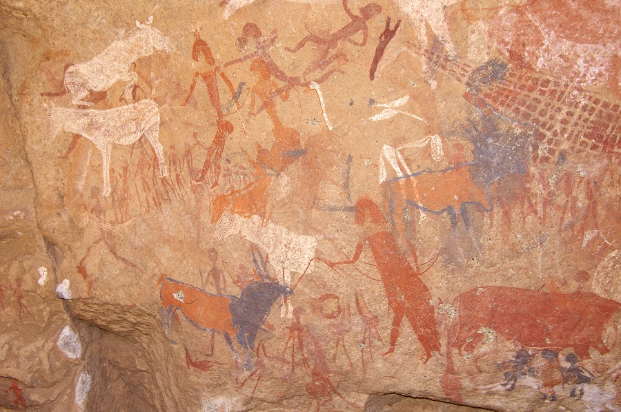
The main site of the terrace is A34 a few hundred metres beyond. It is a large site consisting of numerous boulders and several panels of varying quality, some (eg. hyena or the elephant with cranes) very special and unique scenes.


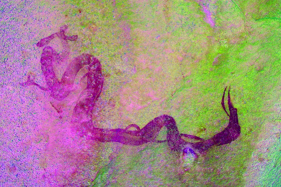
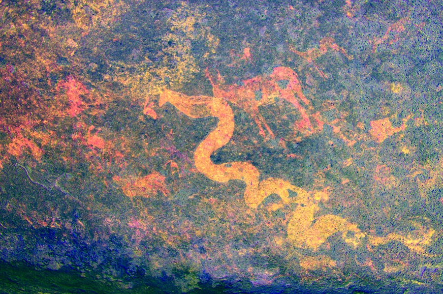
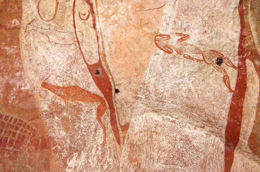
We still had some time before sunset to visit two sites some hundred metres below A34 (but requiring a lengthy detour due to impassable vertical rock ledges). A32 is a large rectangular boulder and some adjacent smaller rocks, with a strange depiction of two entwined eared serpents, one thick and the other thin, and some other scenes. A33 was supposedly on some nerarby boulders, but despite an extensive search we could not find it.
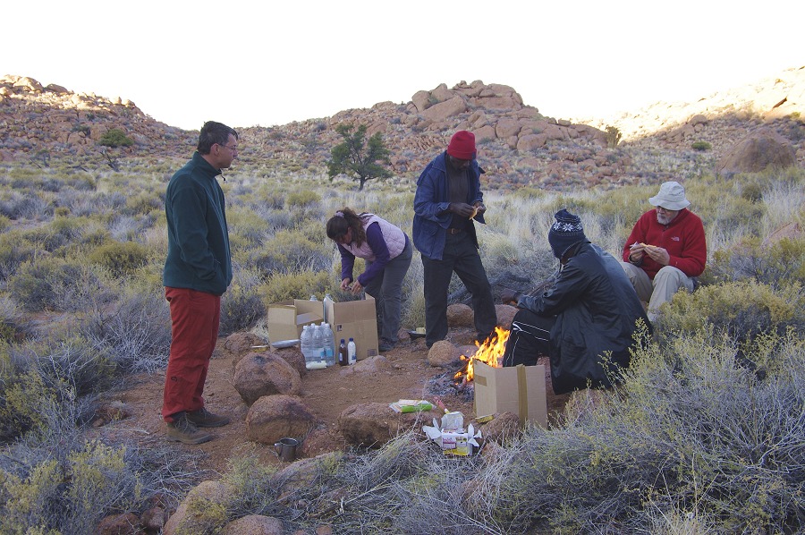
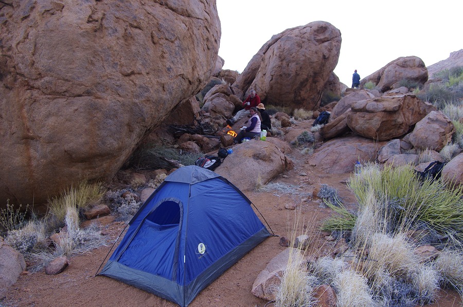
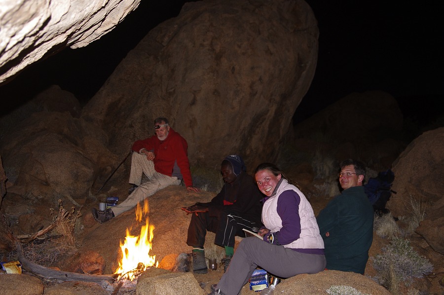
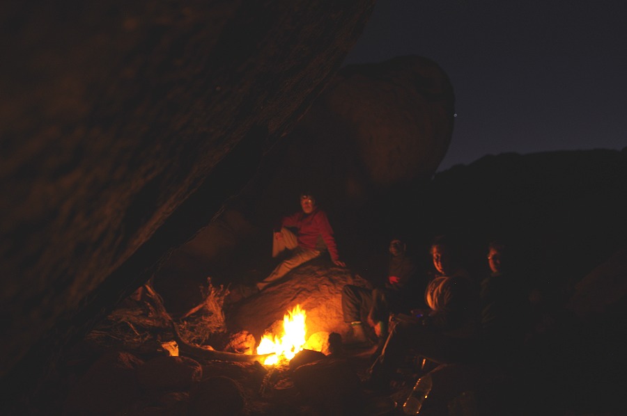
With dusk rapidly approaching, we had to make a hasty retreat to camp, getting back to our tents and making a fire in the last light of the day.
Day 4. - Western Amis Gorge - Middle Numas Gorge
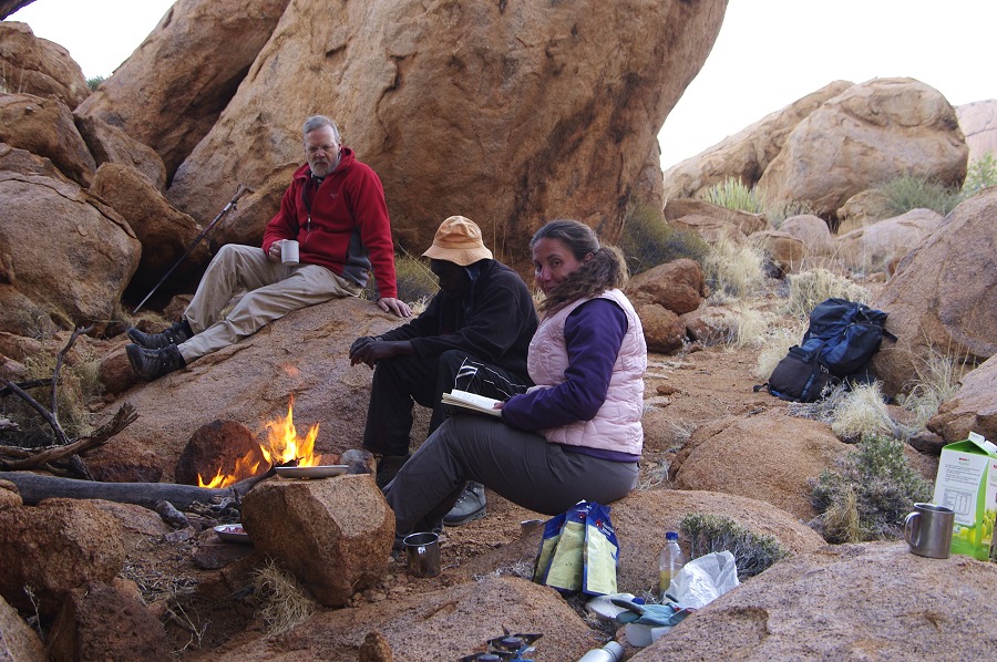
The morning was chilly, after packing up we all crowded around the small fire for warmth. Thomas even decided that it was a double hat morning...
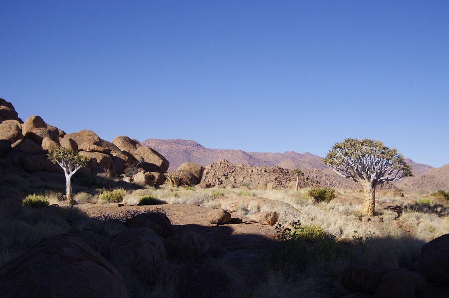
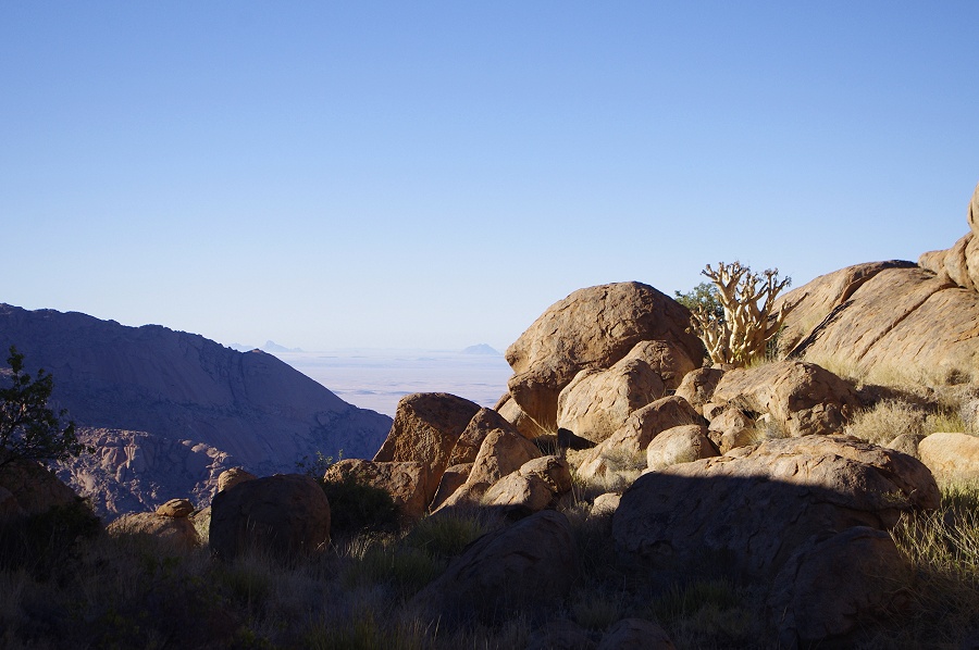
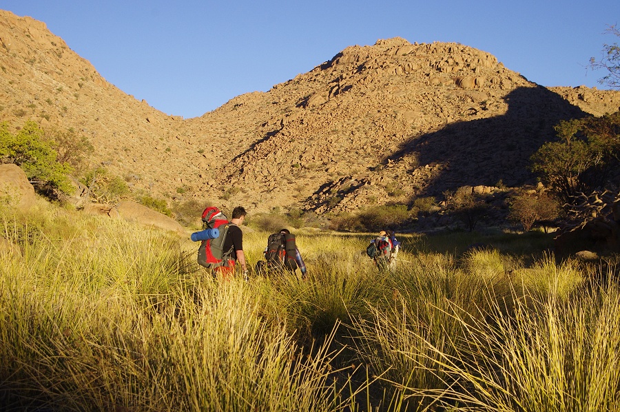
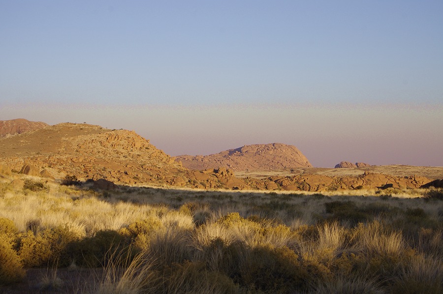
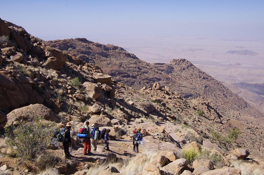
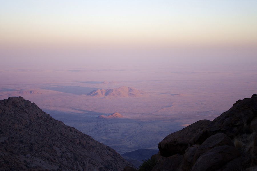
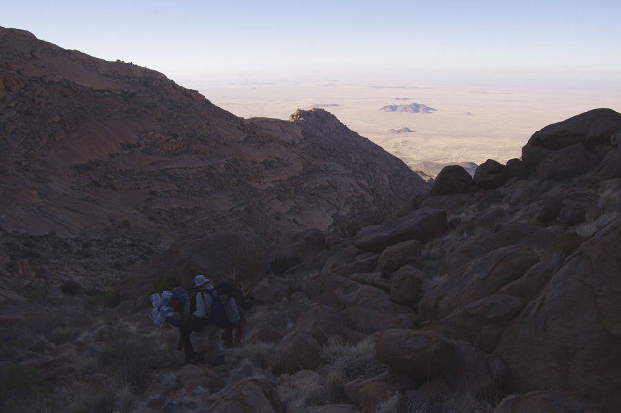
We had a long day ahead of us. Our plan was to visit the remaining Western Amis sites above and to the north-east of our camp, then descend into the Numas valley to the area of Dreilochwasser to see the principal site of N10, before climbing up the valley to Silberweide then up the middle cascades to our depot and camp. We started at sunrise, with he first rays catching us as we passed site A47 on our way up to the yet much higher A44. It was a clear crisp morning, there was no fog on the coast either, we could clearly see the Atlantic Ocean beyond the Messum Crater from our vantage point.
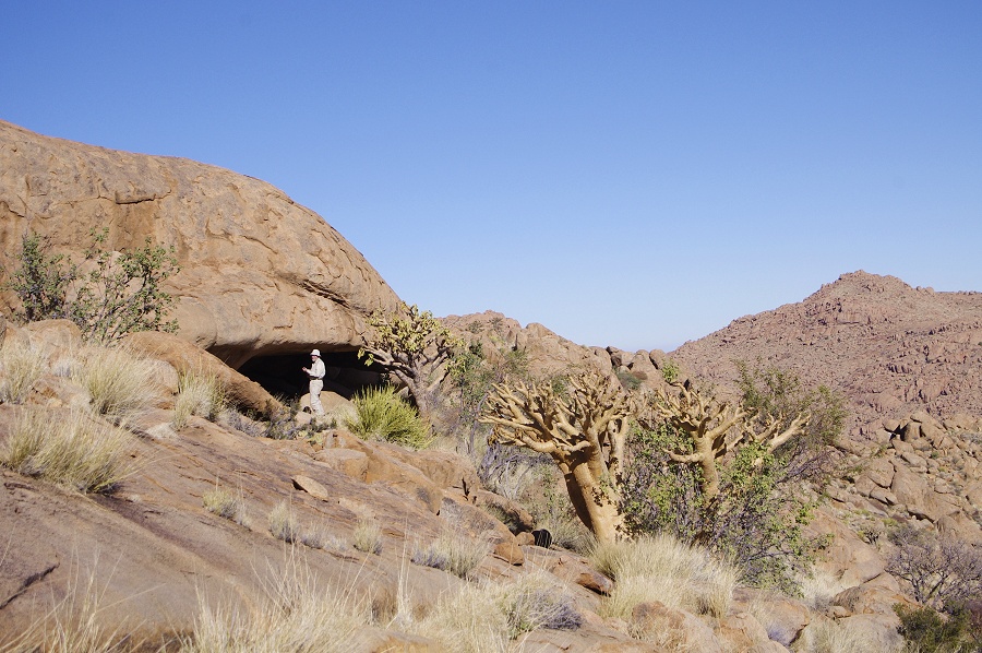
A44 turned out to be a true little gem, located on a small level plain about half an hour's climb from our camp. The site is a small shelter under a medium sized boulder, with some exceptonally fine paintings of humans and animals on the rear walls of the shelter. Clearly it had not been visited for a long time (not since Tilman Lennsen-Erz visited Western Amis with Angula preparing for the first of the Pager / Upper Brandberg volumes in 1987/88) as a large bush had grown at the entrance, that had to be removed to access the shelter.
We continued up the slope through a series of terraces to the concentration of sites in "Flute player's Valley", a narrow defile between granite ridges named after a scene in the principal site. The first site we encountered as we entered the upper end of the valley was A41, with a group of three figures on the side of an exposed boulder wearing a bizarre headdress.
Continuing into the valley, we pased by A39, a large rock with some paintings on its vertical face. Leaving our packs there, we climbed up a side valley to A40, a larger site that has several fine complex scenes with several superpositions. Two faint blobs of paint turned out to be a pair of curious tailed creatures (lizards?) which were apparently missed by both Pager and Tilman on his re-visit.


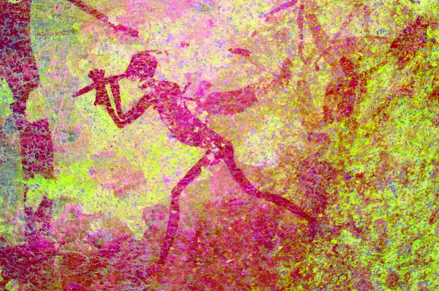
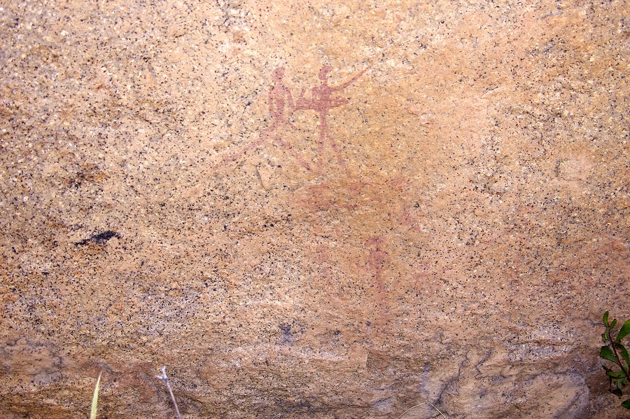
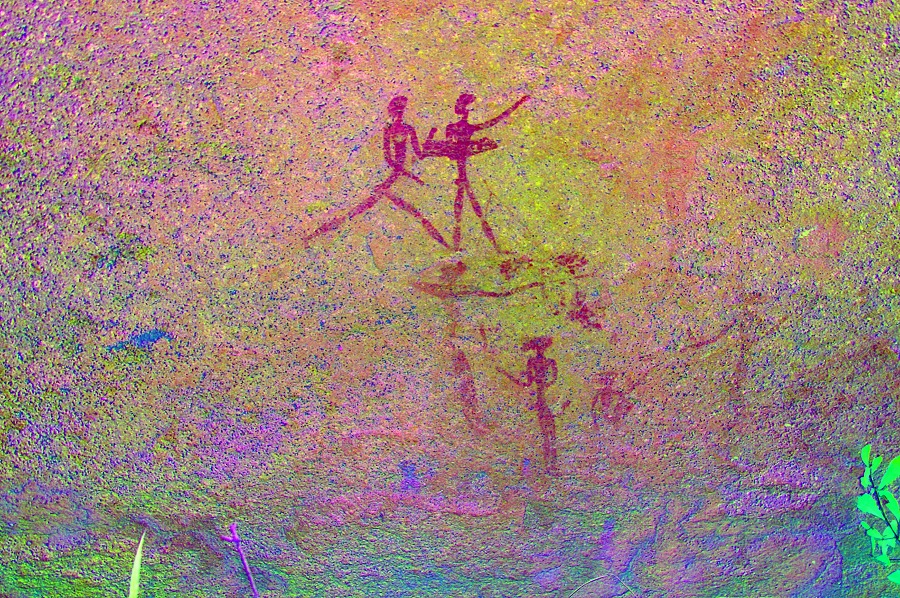
A38, the "Flute player's site" is located about a hundred metres downstream from the big rock of A39, within clear site of each other. It is a large site with several panels along several boulders and rock faces, but the principal panel is under a large overhanging boulder. Unfortunately there is a lot of water damage on the panel, and the numerous superpositions blend into a single undecypherable paint layer. The "Flute player" (or whatever else it is really doing...) scene is located on the left, and it is clearly the last of a number of superimposed layers.

Continuing, we passed by site A37, a rather insignificant site before climbing up on the far side of the valley, and starting to move among the maze of rocks towards the northern end of the ridge contaning the Western Amis sites. After a turn the vista opened up to reveal the great mass of the Numasfels ahead, and the deep Numas valley below.
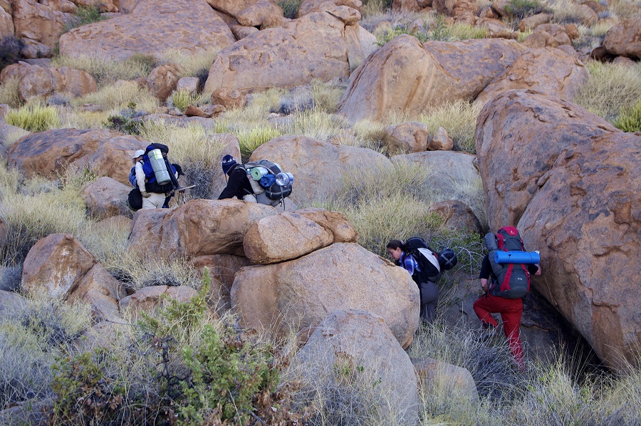
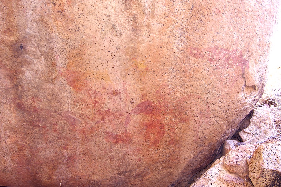
By this time it was becoming unpleasantly warm with the heavy packs. After some rest we started the descent down the very difficult slope, strewn with loose boulders and overgrown in places with thick vegetation. There were several flat terraces to break the descent, occupying a patch of relatively flat area on the col between the Amis and Numas gorges. Technically they are all a part of Numas, our target was the largest of these flat areas right next to the watershed, that contained site N5. we presumed that is must be one of the two prominent cluster of boulders a short way up the slope before the bottom of the flat basin. After some search, we did find the fine panel of paintings in a little hidden shelter right in the middle of the farther cluster of rocks.


By now it was full midday heat. It would hav been nice to rest awhile in a shady spot, but we were still far from the bottom of the Naib valley, and our intended campsite with the supply dump was at least a two hour further climb from Dreilochwasser. We had to move on, accross the final basin before looking down at the formidable boulder and rubble filled descent into Naib. The altitude difference was a little over 200 metres, which does not sound much, but the terrain was rather nasty, the descent took almost an hour and a half with a pause for lunch half-way in a large but undecorated shelter.

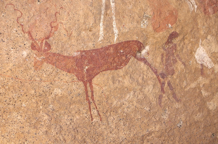
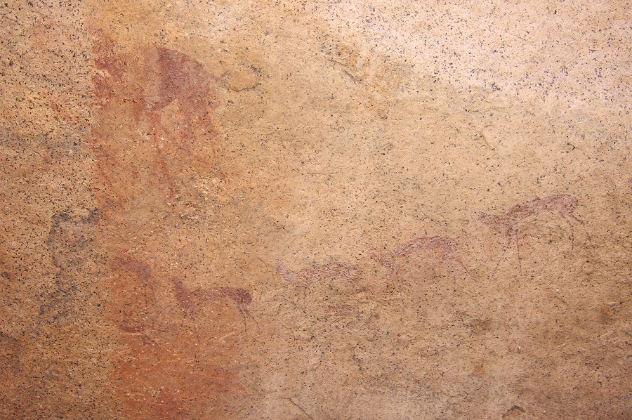
Our key purpose for taking this difficult route was to see site N10, one of the Brandberg highlights, situated somewhere on the slopes above the pools of Dreilochwasser. After our last year's trip Jon stayed on with Angula and Thomas to visit some more Numas sites. They came down to Dreilochwasser but failed to find the site. Rather annoyingly it only emerged that Thomas saw what must have been the site only when they were already well on their way back up to camp at Silberweide. This time with a good general idea about the site's location, we have found it within five minutes of starting to look. It is a small but wonderful site, with perfectly preserved paintings, including the lovely little scene of gazelle or antelopes nibbling at the leaves of a tree.

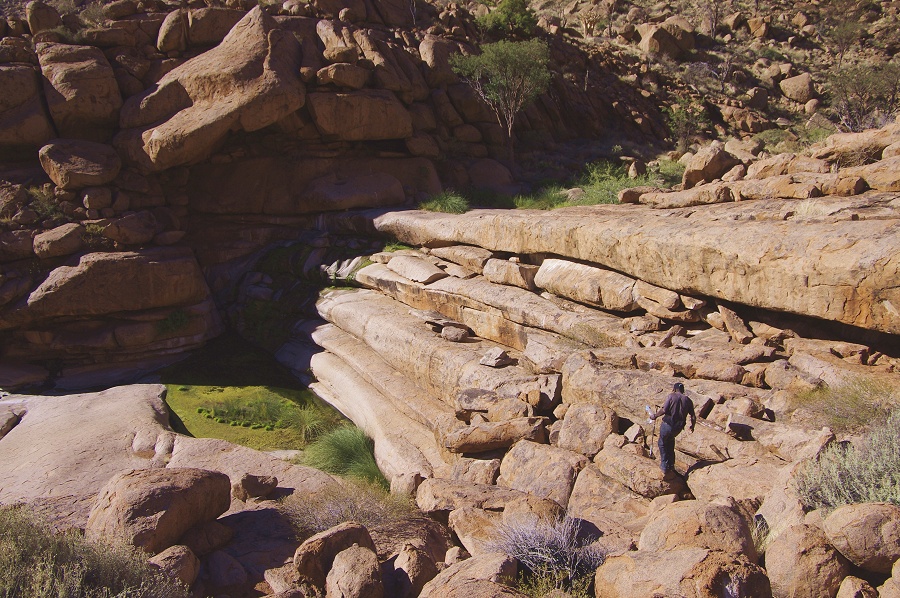
By this time we were well into the mid-afternoon. It was still hot, and our water reserves were running uncomfortably low, considering that it was still at least a two hour climb from our present positon to reach the dump. Whie the others stayed to photograph the site, with Angula and Thomas we went down with a couple of empty 5l bottles to see if there was water in the pools. Fortunately there was so we could return with three full bottles, more than enough should we need to make camp before our dump. This little side trip also provided me the opportunity to see site N14 a short distabce below the pools of Dreilochwasser.

It was past 3pm as we returned to the others. With everyone visibly releived seeing the full water bottles, we immediately started on he long climb up to the Silberweide. The altitude to be gained was not more tahn 200 metres, but the route was a long and difficult one, high up the slopes above the impassble valley bottom. Finally it started to flatten out after a good hour and a half, and finally we were crossing the broad grassy plains of the Silberweide before turning t tackle the last obstacle, the middle cascades of Numas. It was past sunset, well into dusk by the time we reached the prominent tree on the plains above that hid our depot, finishing what in retrospect was our toughest day of our trek.

Day 5. - Middle Numas Gorge
We were to stay two nights at this camp, with the day's objective to visit the two principal "sanctuary" sites of N52 and N145 far above us on the side of Numasfels, plus any other sites we may pass along the way. Jon already visited these sites last year, but it was a rather hurried visit and he too was keen to go back for more and better photos. We started out soon after sunrise, making an almost straight go at the southern slopes of Numasfels above our camp. There was a strong wing during the night (strong enough to collapse some of our tents) that stayed on for the day - with the light packs and welcome cold we made much faster progress than it the heat the previous day.

The first site we encountered on the way up was N42, an immense rectangular boulder in the middle of a small flat terrace, with some fairly well preserved human figures on the side. N43 was some 50 metres higher, right above the terrace, a cluster of large boulders with several panels of paintings.


We continued our climb to the 2000 metre contour, about 300 metres above our camp.
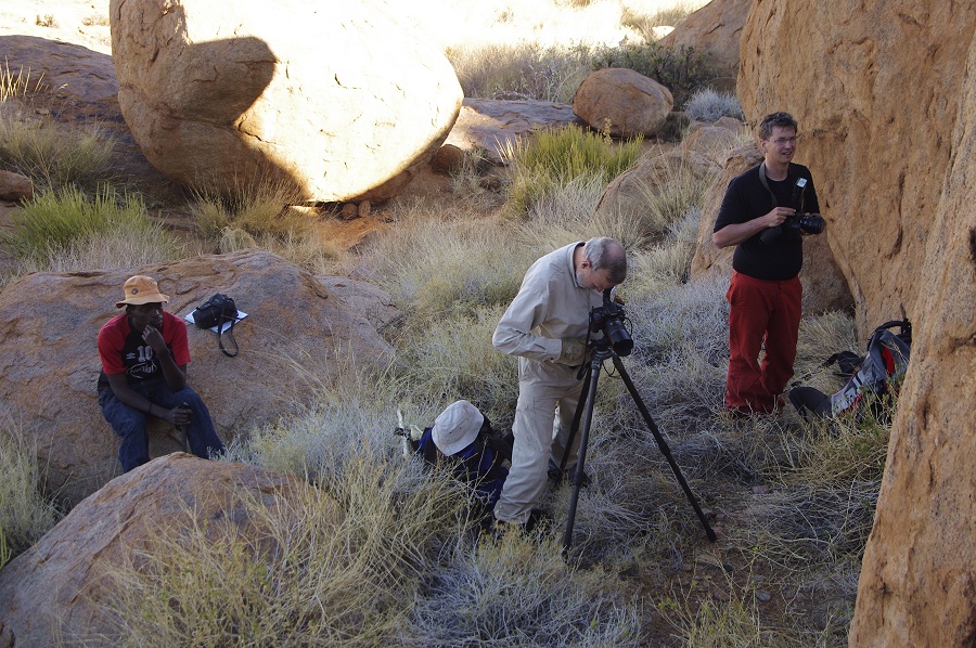
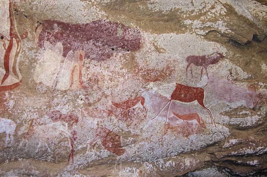
Folowing the contour east for a couple of hundred metres, we soon reachded site N52, an immense boulder with a large east facing shelter underneath, densely packed with very fine paintings. We were a bit early, there was still sunlight on some of the panels, but we were in no rush. We could spend two hours at the site, photographing all the paintings at a leisurely pace and looking at all the finer details.


Finishing at N52, we started moving generally along the 2000m contour towards N145, little over a kilometre and a half to the west as the crow flies. However on the Brandberg straight and level is never as it sounds. Immedately we had to make a descent of a good 100 metres into a basin, whic contained a roundd boulder in the middle with some very fine paintings (N45).
Contnuing past a dry Falls Rock we passed another couple of minor sites (N48 & N148) before rounding a ridge, and looking at the boulder strewn slope which contained N145 somewhere under a large boulder. From our vantage point we had a perfect view of the route we have taken down from Western Amis into the Numas Gorge the previous day, seemingly at an unreachable distance.
N145 s not easy to find. It is a low shelter under a large flat granite outcrop, not readily visible if approaching from the east. Even though he was here a year before with Jun, Angula missed the site several times until he found the correct path and finally led us to the site. The interior is on first look very unassuming, a black encrustation covers the rear walls of the shelter, with some barely discernible patches of paint.
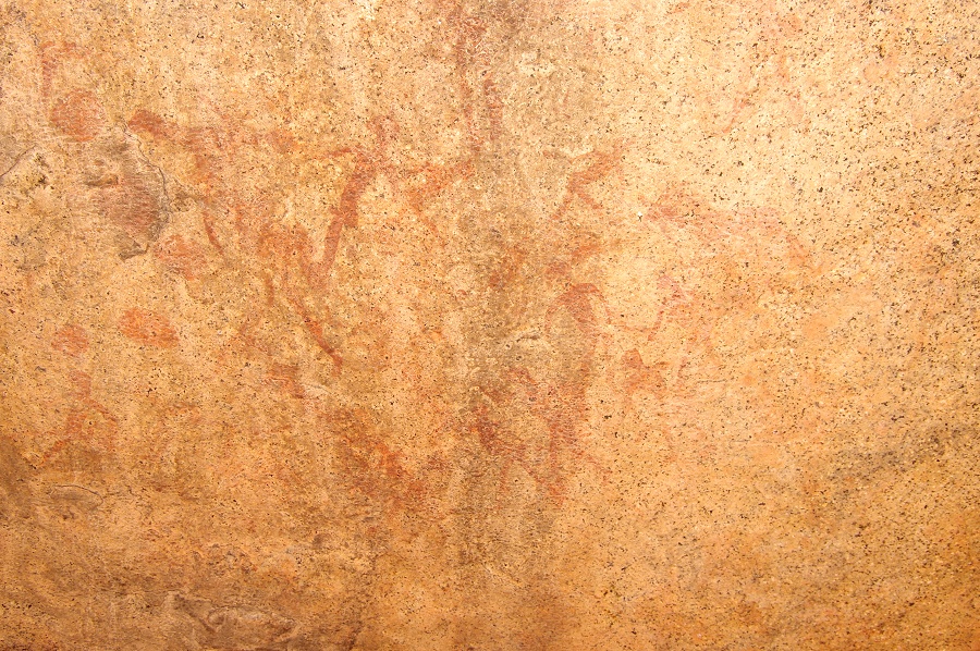
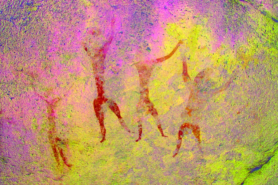
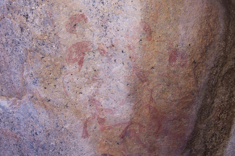
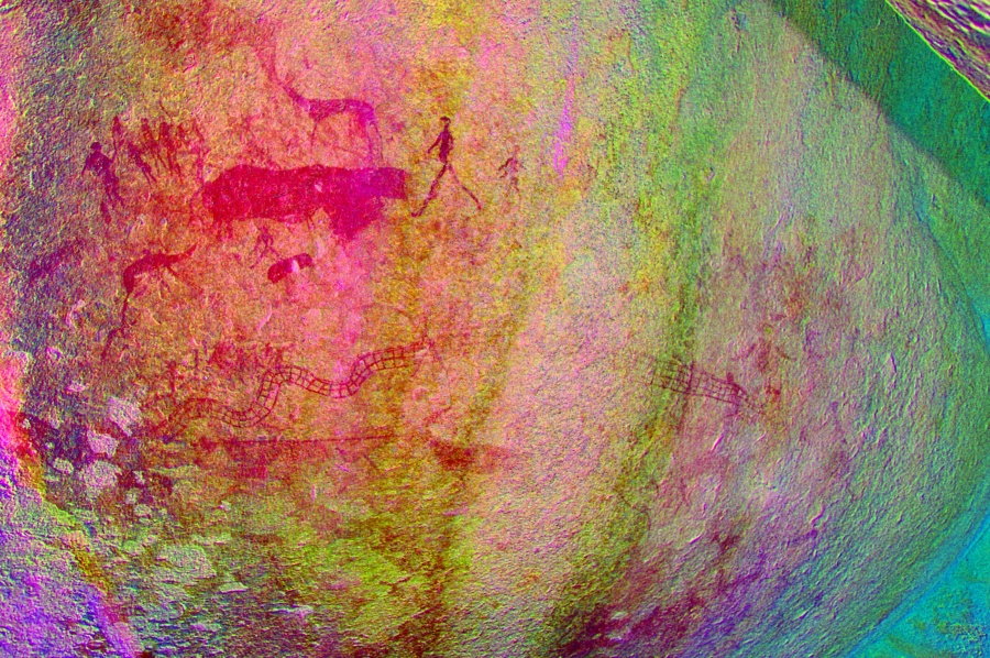
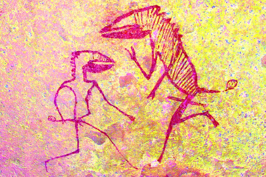
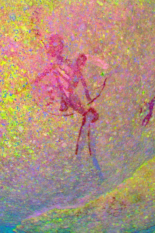
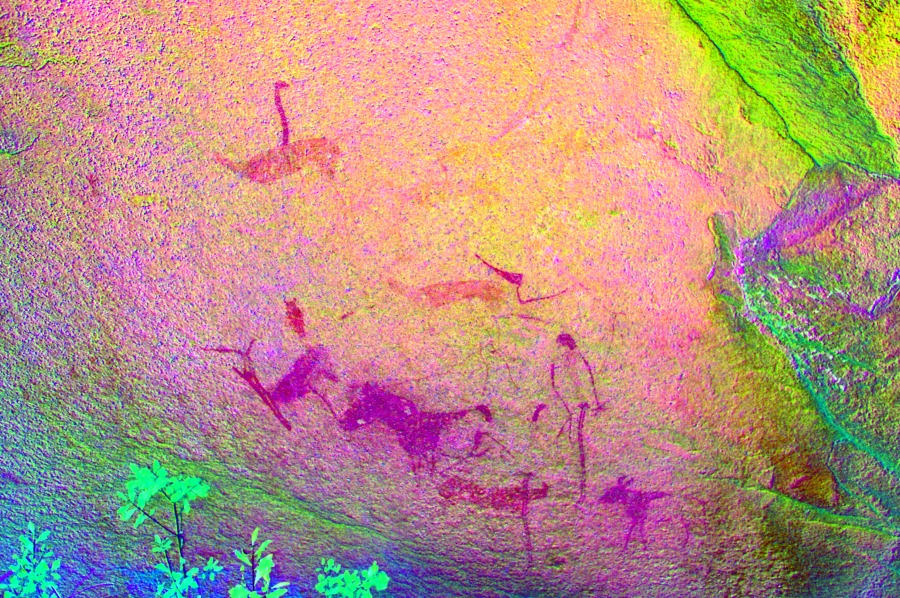
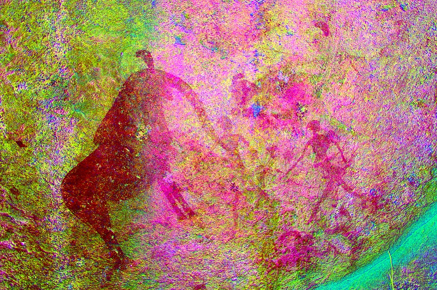
Once ones eyes become accustomed to the twilight, amazing scees begin to emerge. The left side of the shelter is dominated by a huge animal figure, over one metres in length, with human rear legs - the finest known depiction of the mythical antelope-human transfornation. There are several very elaborately decorated human figures surrounding the animal figure. Unfortunately dStretch is not particularly helpful here due to the dark background and the multiple colours used for the paintings, several filters must be used to reveal different details.

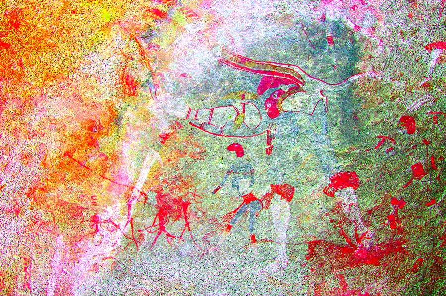
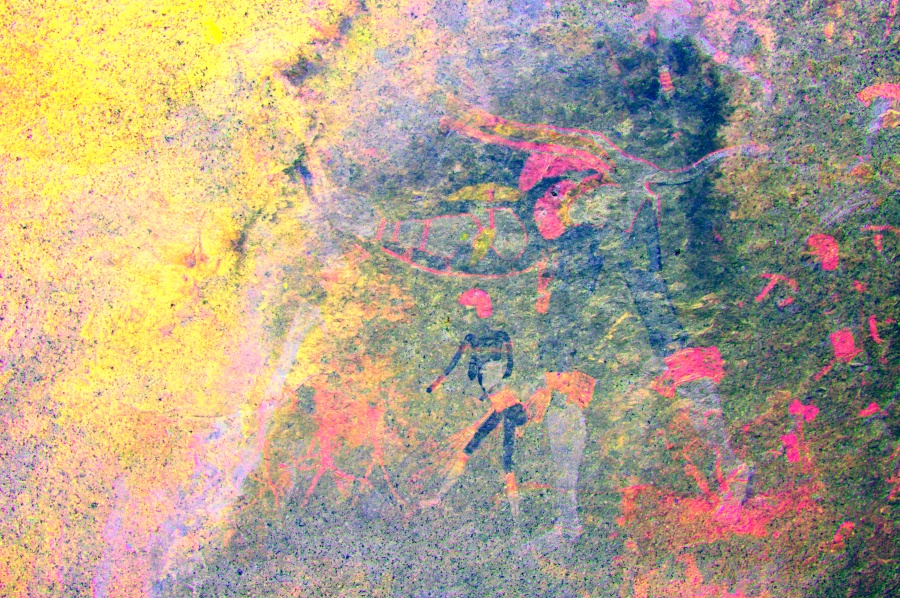
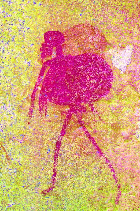
The right side of the shelter contains, among others, a huge serpent figure. With the more uniform colours, dStretch does a better job at revealing the details.

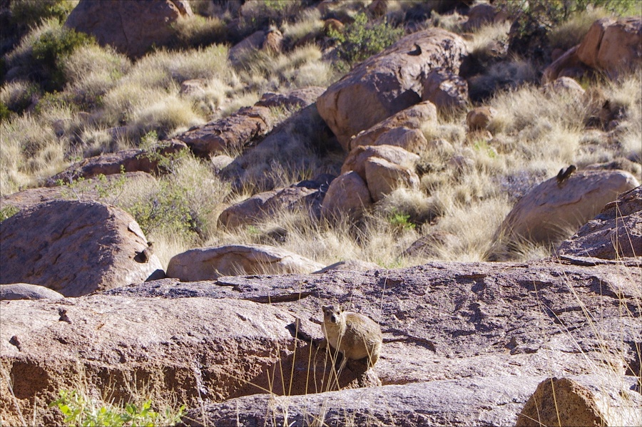
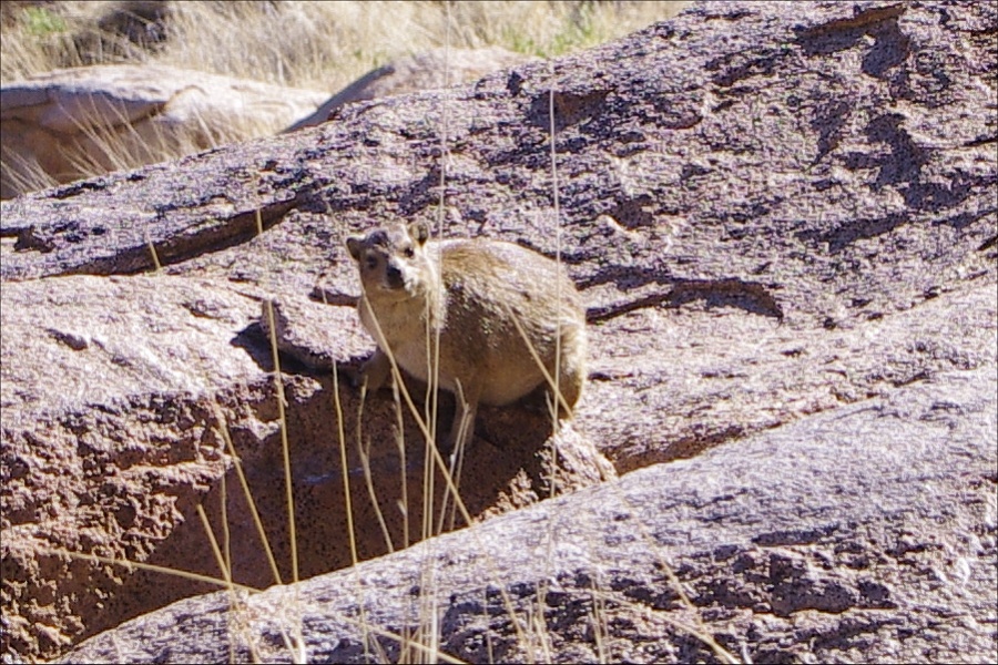
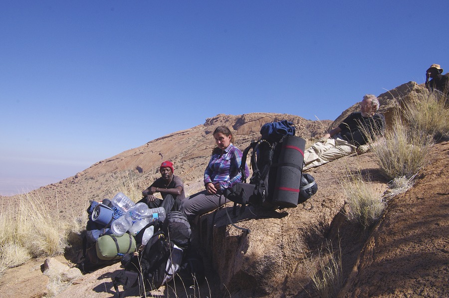
We have spent a good two hours at this site, taking in all the details and making the photographs. Throughout this time we were closely watched by a goup of dassies (rock hyrax) who lived among the adjacent rocks. With some patience I was able to snach a few photos of them, but after a while they had enough of us and disappeared under the rocks for good.

Camp was straight below us, it was a surprisingly fast and easy straight descent to the readily visible plain below. In about an hour we were down on the plain, approaching our camp by the prominent large green tree well before sunset. Before camp we pased by the last site of the day (N31), with a himan figure accmpanied by a bird


Day 6. - Middle Numas Gorge - Hungorob Mulde - Upper Hungorob Gorge
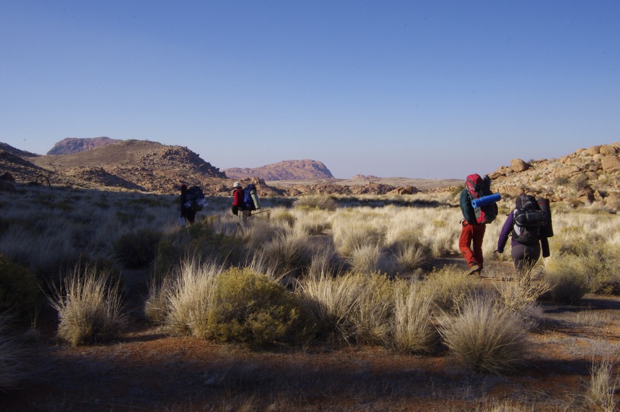
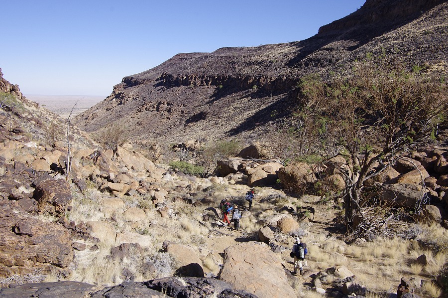
From hereon, our route essentially re-traced that taken in June 2010 with some variation, but allowing four days for what we covered in two last time. In 2010 we had to press on to get down in time stopping only at a few principal sites, now we were planning on visiting the numerous other sites along the route (plus a day to be spent on the Aigub sites). We started at sunrise, passing the rather non-descript site N39, then our campsite of 2010 in the bend of the Numas Gorge before climbing up the ridge into the Hungorob Mulde.
The climb was short, we were soon up at the watershed, and started looking for the two sites that were supposed to be in the close vicinity. We soon found H97, however H96 prved to be elusive. Angula did not know it, and as it was not an important site, we soon gave up the search to move to more important ones.
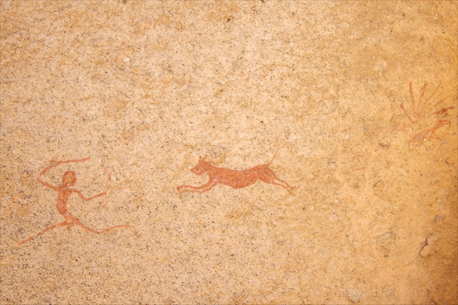
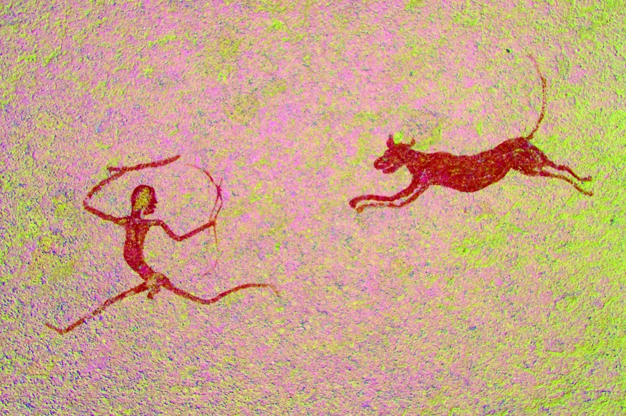
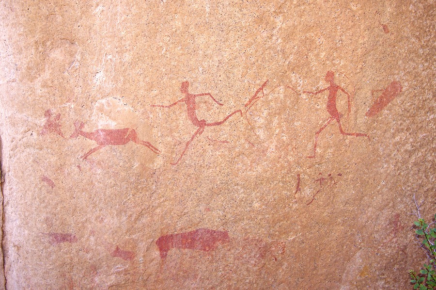
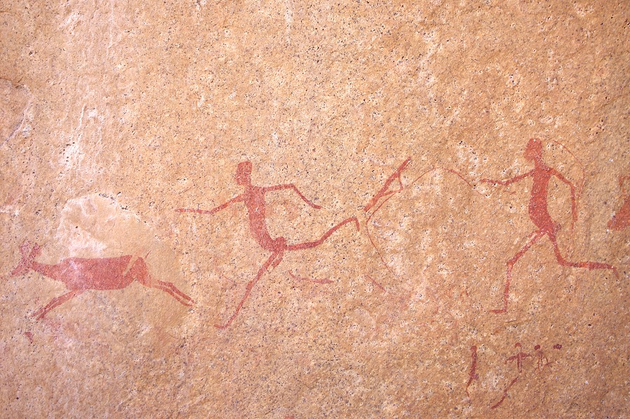
The next site, a few hundred metres further east was one of the trip highlights. We mush have passed it within a couple of dozen metres in 2010. The site itself is small, only a single panel on the face of a rock, but the scene of a hunter being chased by a lion is absolutely delightful.

We continued past the two minor sites of H92 and H91 to the main cluster of sites in the Hungorob Mulde. We left our packs at the large cluster of rocks that is site H87 near the now very murky water hole, and set out to exlore the other sites. We started with the huge rock of H85, clearly visible from nearly all parts of the basin. In 2010 we mase a brief and hasty visit with Jon, now we could have a good look at the extensive panels at leisure.


As Angula was not aware of the other sites, we started serching based on Pager's sketch and the site descriptions. We found the site supposed to contain H86, but there was absolutely no trace of the single oryx Pager copied (though the site plan matched). We had more luck wth sites H84 and 89, based on the sketch and description we could see them clearly from a distance.
We returned to the rocks of H87, an extensive site with several large panels, but only one in a good state of preservation. We also had our lunch and a good rest before starting out for the climb to our camp in the Upper Hungorob two kilometres to the west, and a good 250 metres higher.


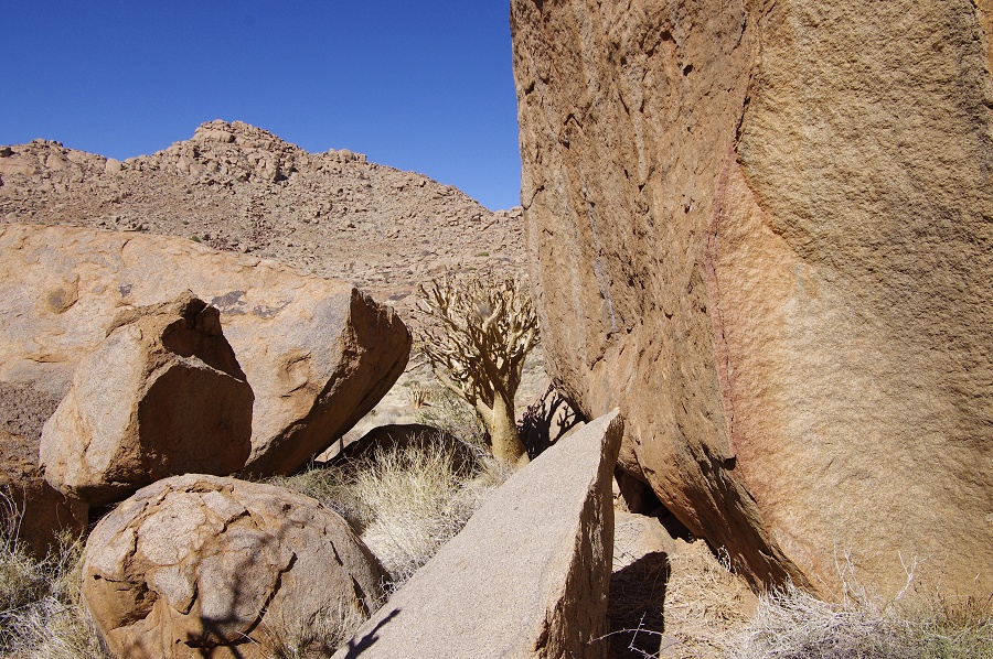
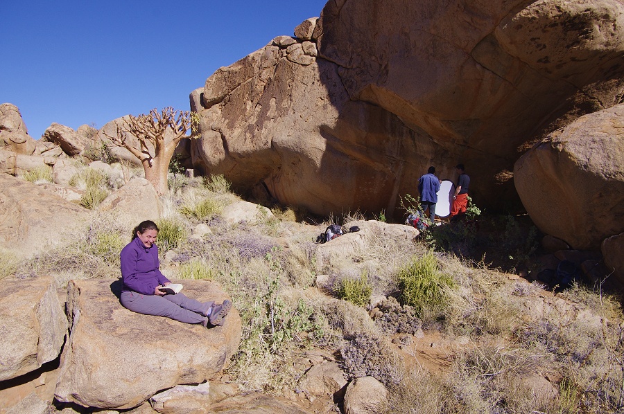
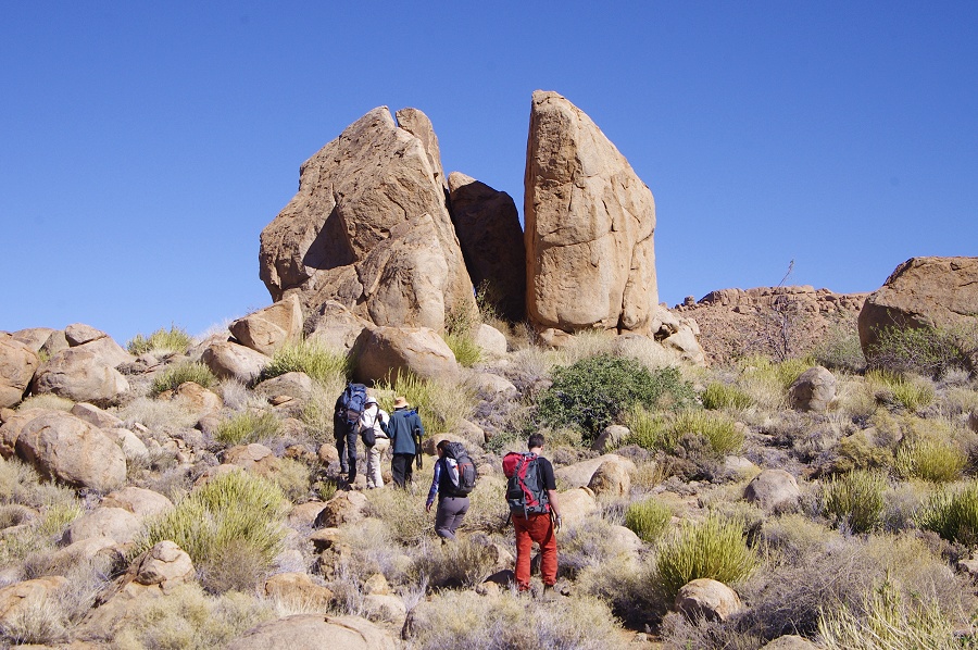
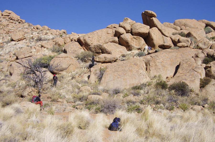
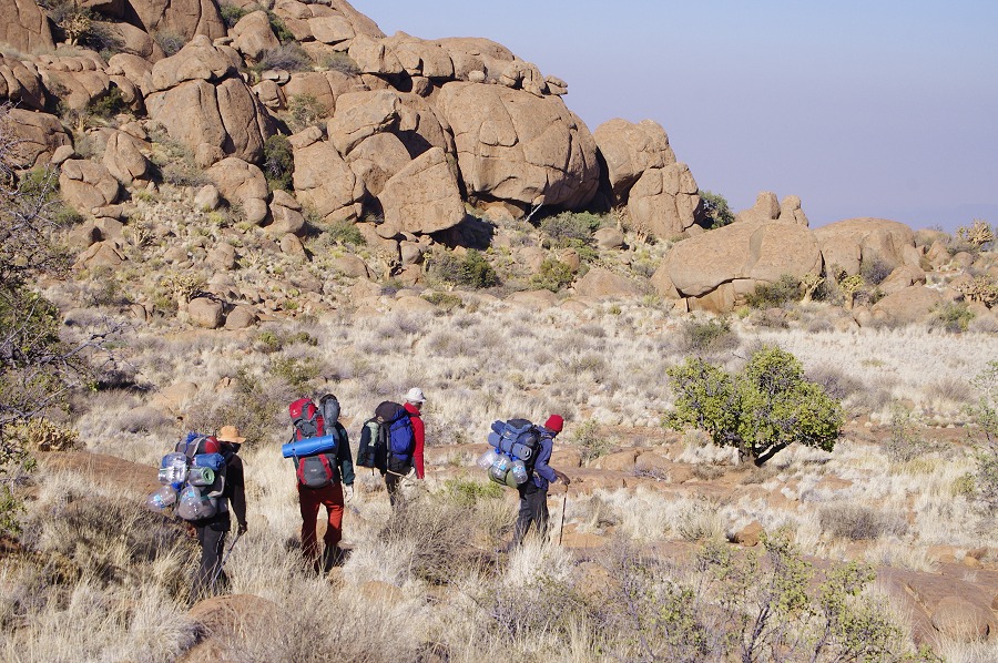
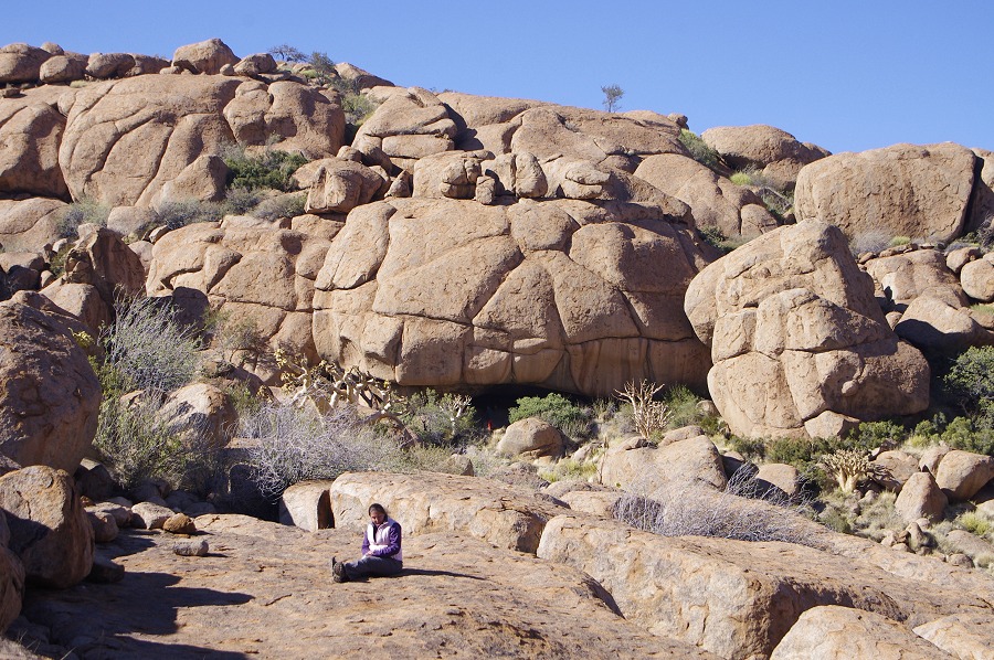
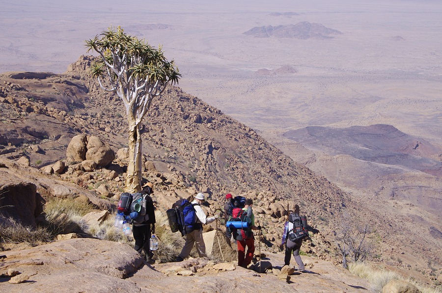
As we started in the afternoon, we passed by a rock in the riverbed that was surely H90, but we could not spot any trace of the paintings. We continued up the formidable looking ascent, but found the going to be much easier than anticipated. In an hour we were at the half-way basin, and in another hour we were up on the little plain by the trail leading up between the massifs of Aigub and Königstein, used by trekkers to access the peak of the mountain. We still had a chore - to collect our supplies that were dumped at he base of the tree guarded by the klipspringers a good half a kilometre away. What took less than a minute for the helicpter was over half an hour of scrambling over the rocks, more on the way back with the heavy boxes.


Day 7. - Upper Hungorob Gorge - Aigub peak sites
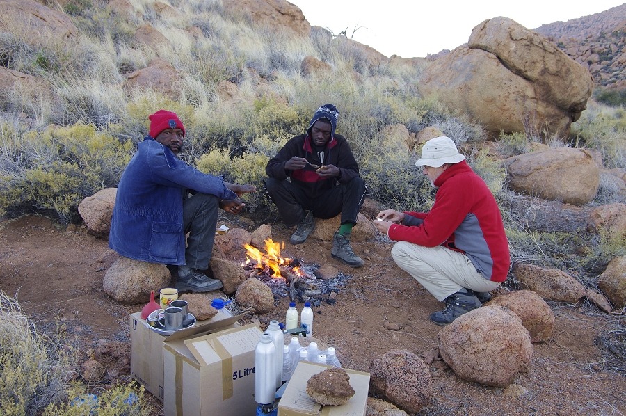
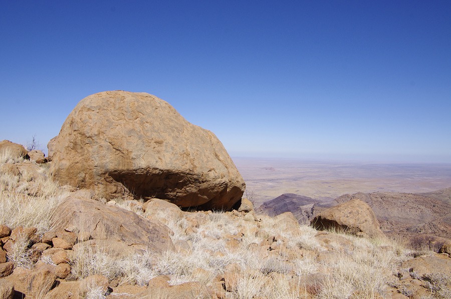
Our camp was to be for two nights here, with the day to be spent visiting the principal sites around the Aigub peak. At 2220 metres this was the highest altitude camp of our trip, unsurprisingly it was also the coldest, the morning temperatures were just a few degrees above zero. As we did not have a dificult day ahead, we could afford to cuddle around the fire for the first hour of daylight, and only start out after the sun started to warm the rocks.
We were following the well traveled climbers trail that passed just by our camp before starting the ascent into the valley between the peaks of Aigub and Königstein. Soon after camp we passed by two lesser sites, H58 and 59, both of them right on the trail.

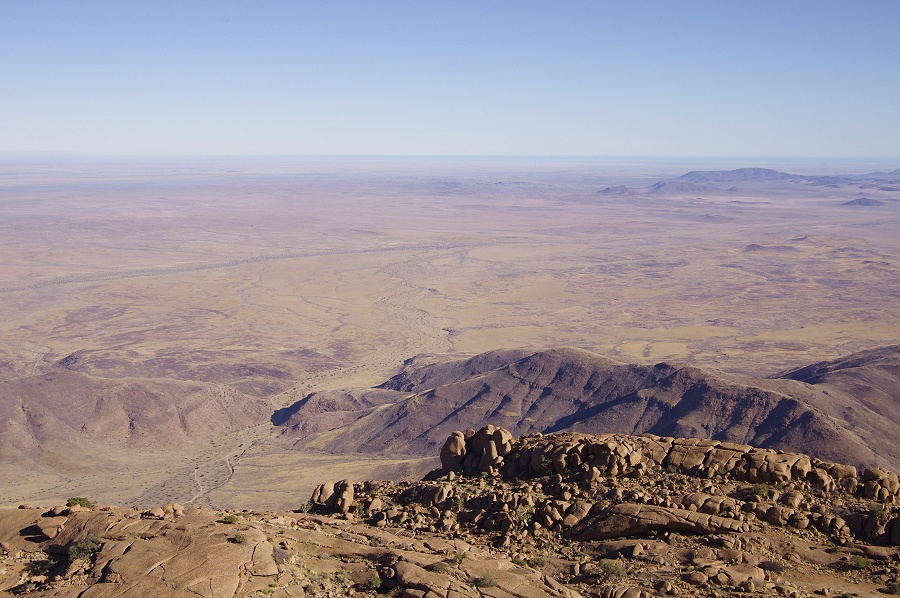
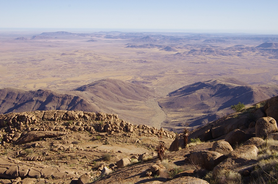
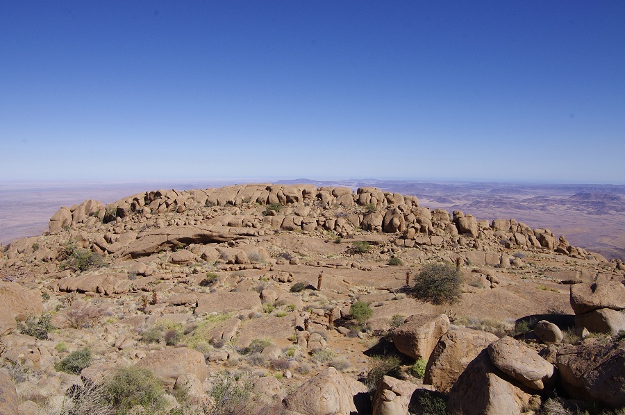
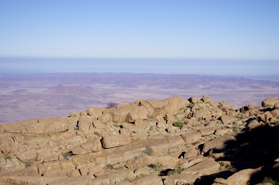
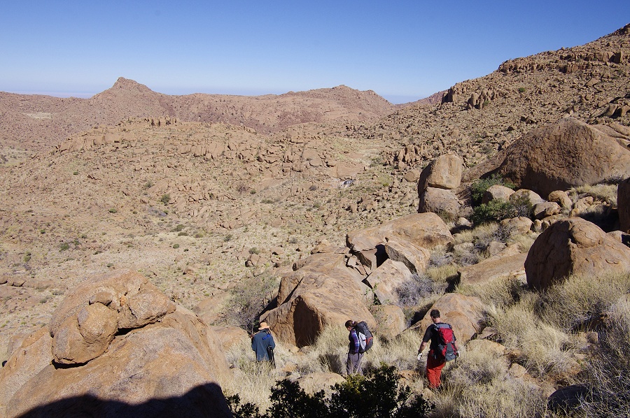
Following the sites there was a short section of steep climb, after which we have reached a series of flat grassy plains, one of the best goings we have encountered anywhere up on the Brandberg. In less than an hour's distance from camp, we have reached the ridge forming the watershed between the Hungarob and upper Numas gorges. Here the trail turned east towards the summit of Königstein, which was looming a mere two hundred metres above us, the radio repeater antenna and the pole marking the summit clearly visible.

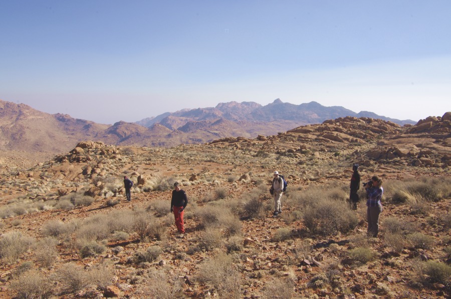
At this point we left the trail and turned west, rounding the northern face of Aigub along the 2400 metre contour. The terrain was by Brandberg standards flat and easy, within another hour we were in sight of a cluster of huge boulders on the north western slopes of Aigub hiding site N3, our principal objctive for the day.

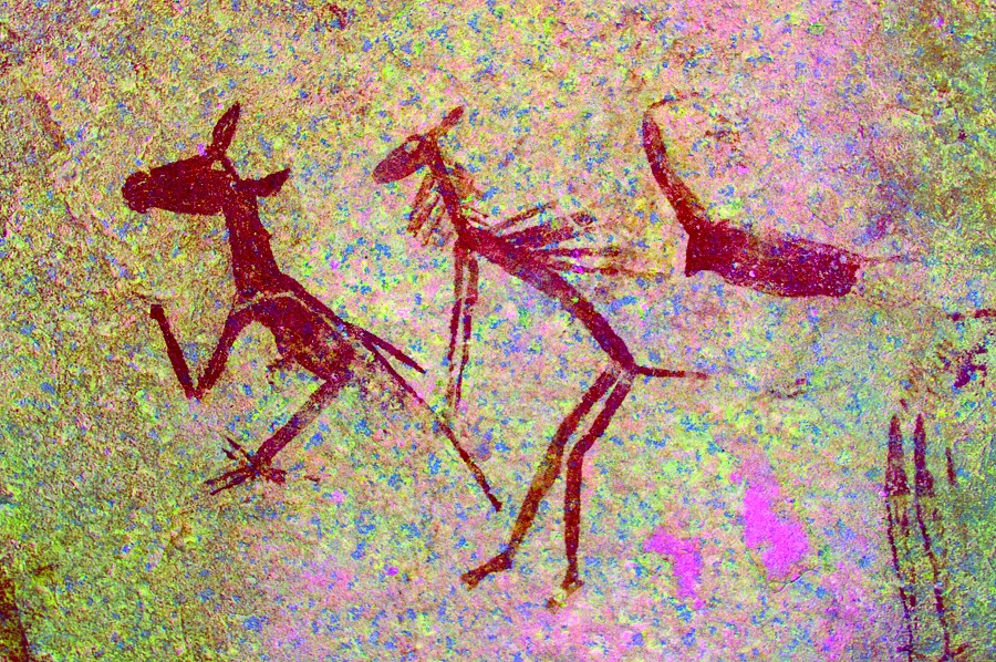
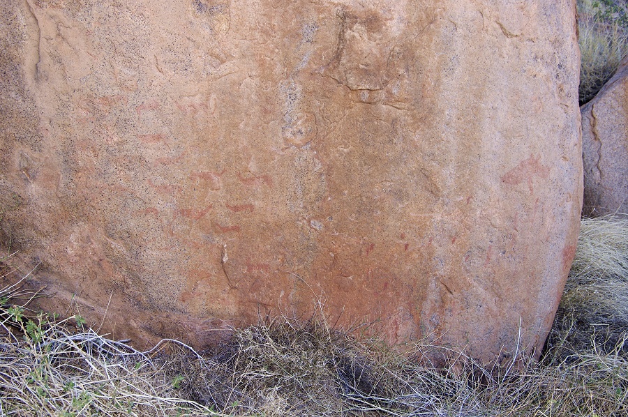
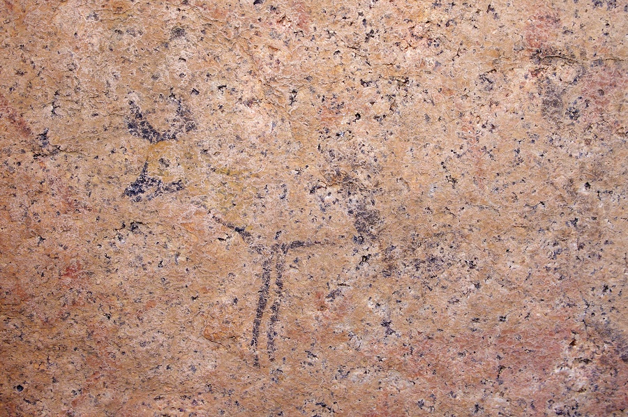
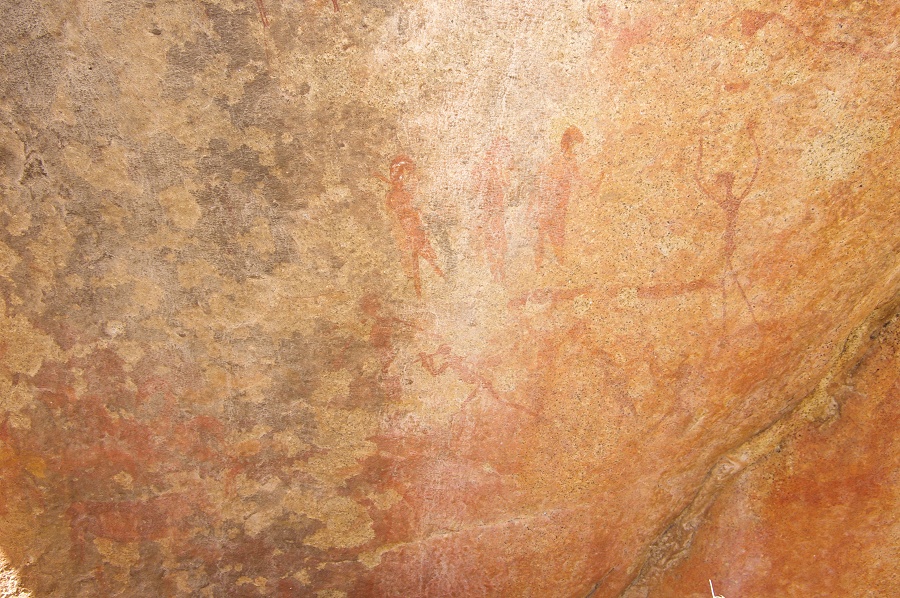
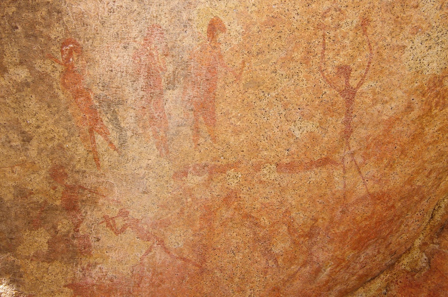
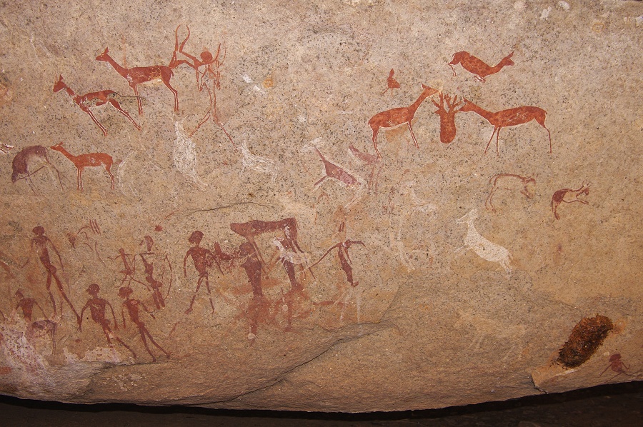
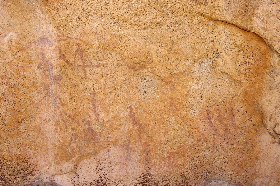
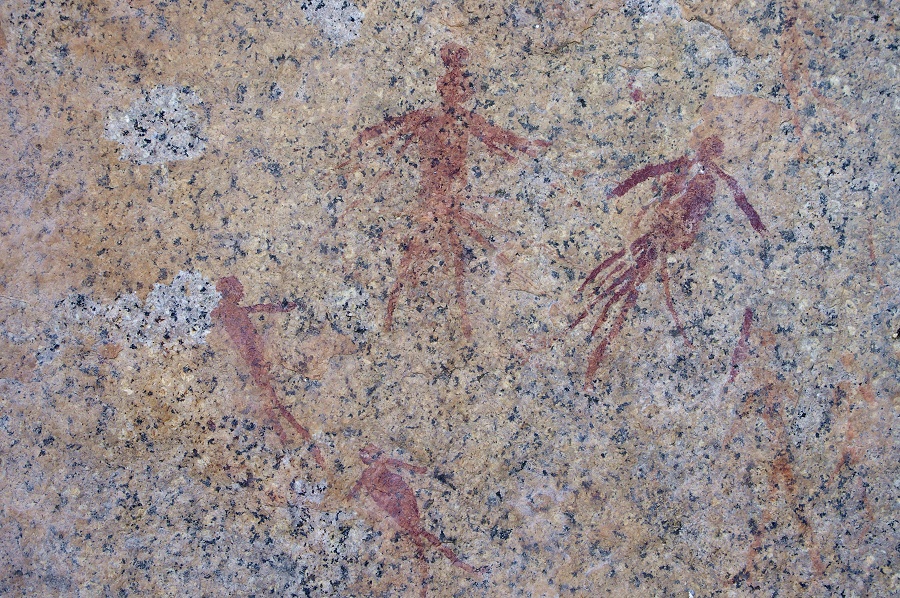
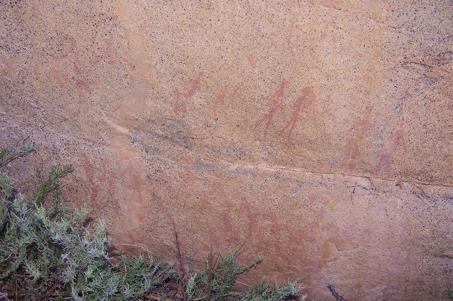
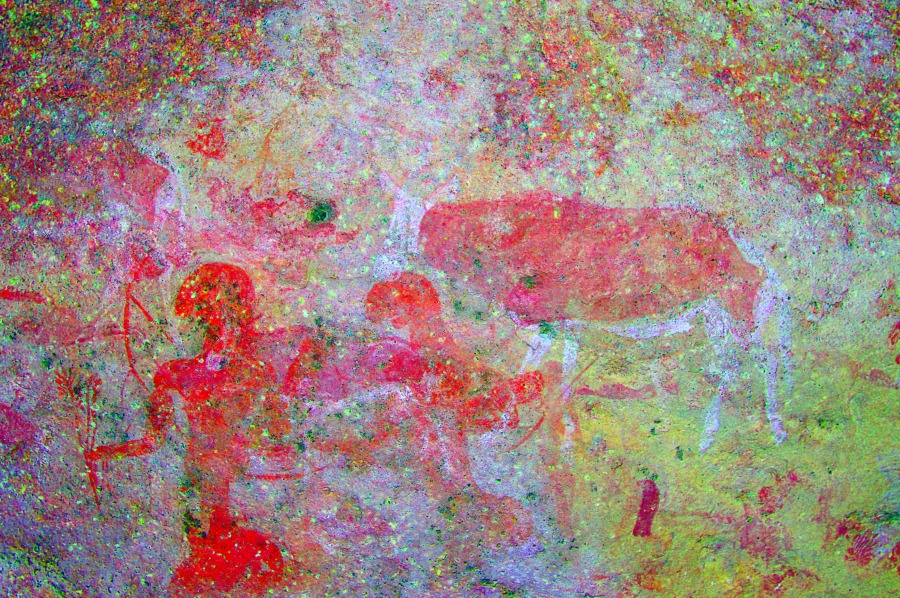
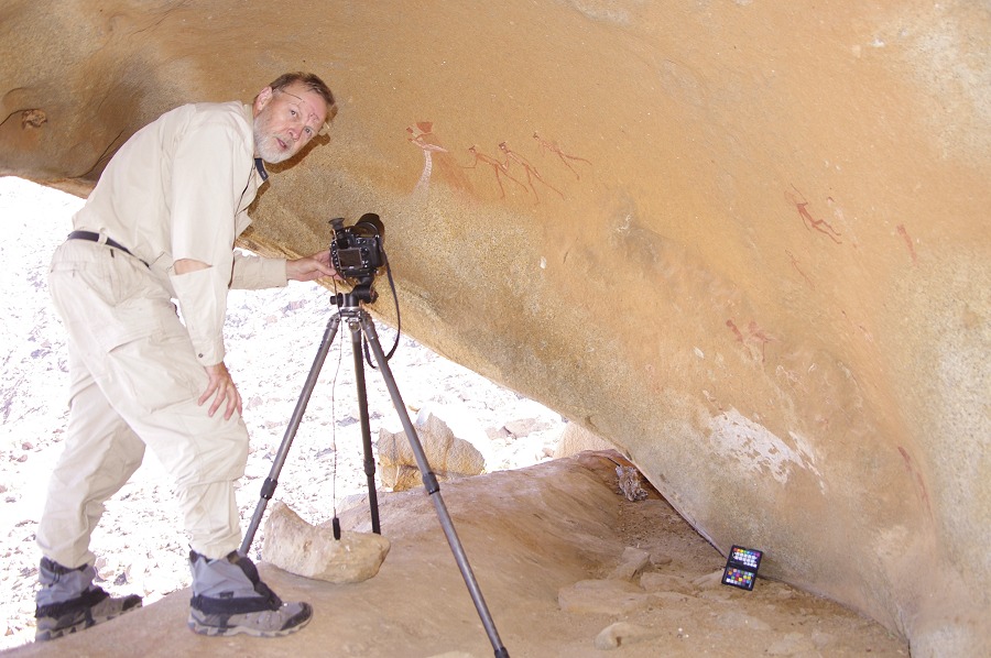
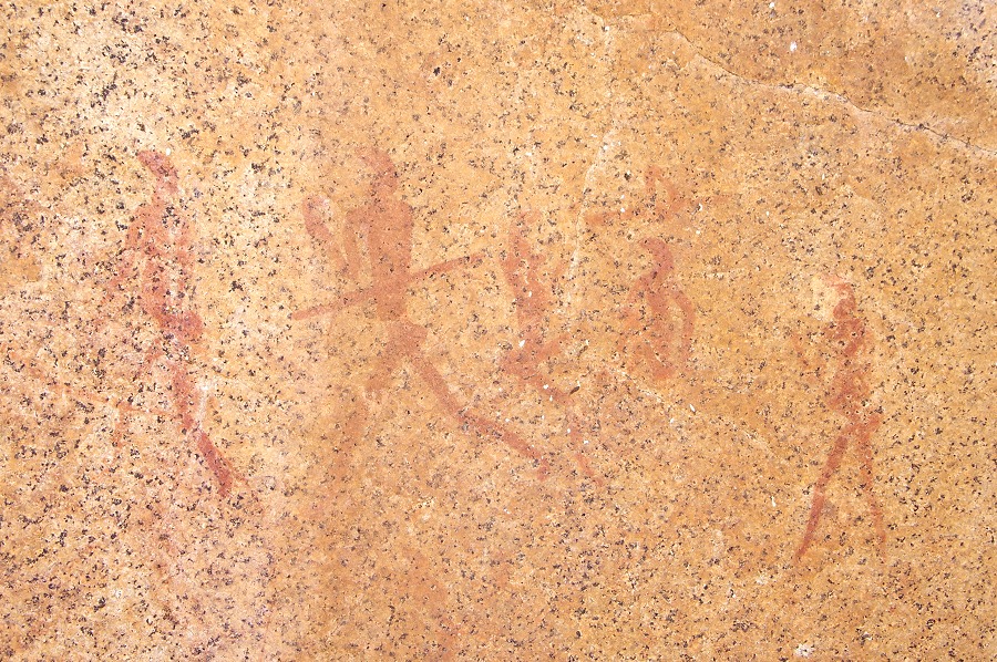
The site itself is on the largest boulder, a series of panels of paintings all around the boulder. The best known scene is a series of small upright chameleon figures depicted in a human posture, an absolutely unique depicton. There are several fainter chameleon figures on the rock, including some in yellow that can only be seen clearly when processing the images with dStretch. There are several other groups of human figures, making this huge rock one of the most excitng and unique rock art locations of the Upper Brandberg.

We spent several hours at the site, photographing every detail, and enjoying the fact that we had no pressing need to move on. At this altitude it was cool well into the morning, for the first time on the trip it felt good to lie out in the sun and soak up the warmth, in the shade it was distinctly cold. We took opportunity of the mobile reception behind a nearby ridge for a few quick calls home before starting to move back along the way we came. We looked at the few unexciting paintings on a large boulder (N4) that we passed in the morning before reaching the point on the plain at the foot of Königstein where we left the path earlier that morning. A cluster of boulders near the edge of the plain contains site N1, a couple of faint but fine panels of human figures. We had our lunch here before starting to move back on the trail towards camp.
With time on our hands, we could afford to search for site H67, supposedly somewhere close to the watershed between Numas and Hungorob. Agngula did not know this site, and there were no suitable looking large rocks anywhere near the top of the ridge matching Pager's site drawing, so we continued down the trail. On reaching the end of the long flat grassy plain, the cluster of rocks on the far side of the plain looked familiar, a quick comparison with the drawing confirmed that it indeed was the site. The panels of fine paintings were quite far above the level of the plain, and fully exposed to the sun, photographing them was a challenging exercise.

Our last objective for the day was to visit a small valley along the southern side of Aigub that contained several sites, including one of the finest panel of giraffe on the Brandberg (H60) not far from our camp. We left the trail near the lower end of the flat plain, and crossing a ridge descended into a flat bottomed basin, with the valey on the far side. We started going up the valley which was thickly overgrown with vegetation. Angula vaguely remembered the site, but not the exact location, it took some effort to find it. First we came upon a low shelter with some paintings outside and a built wooden structure of unknown age inside (possibly a rack for drying meat ?) which confirmed that this was site H61, and we were far above H60 in the valley.

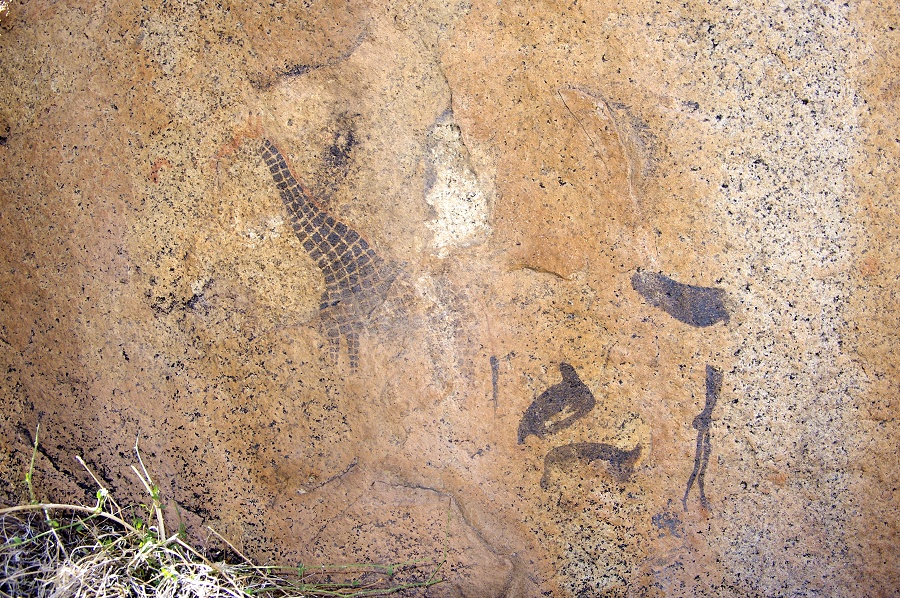
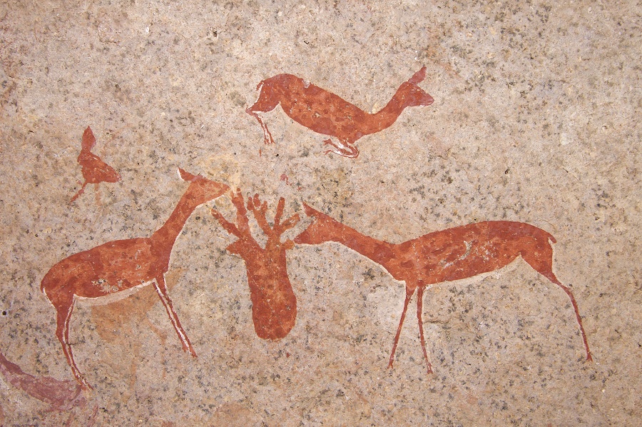
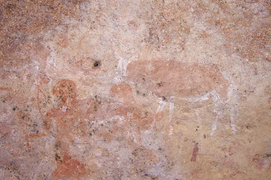
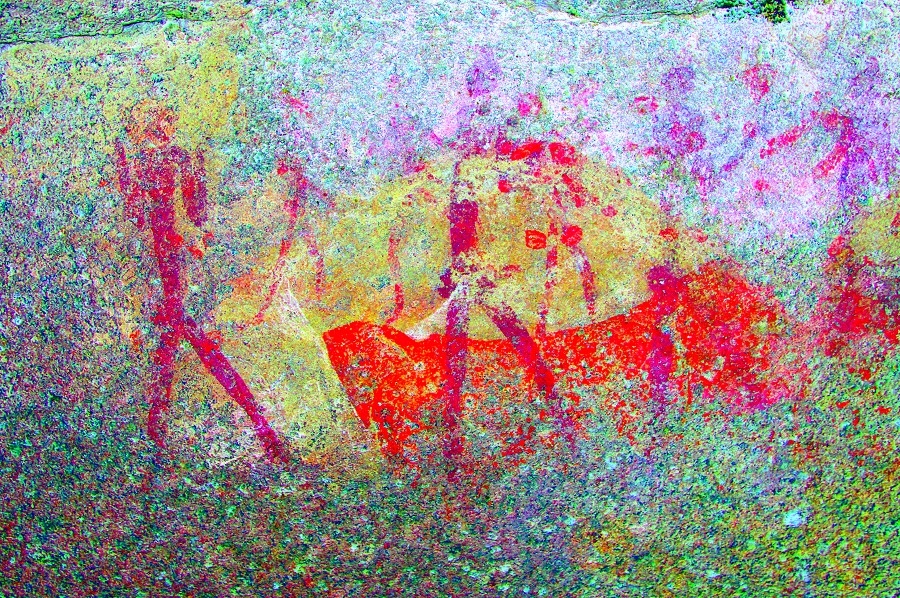
After re-tracing most of our walk up the valley, Angula finally found what we were looking for, a large rock with a low shelter underneath, quite far above the valley floor. The shelter contains an absolutely magnificent panel of giraffes and some other scenes.

As we started going back to camp, a short distance below H60 we found H62, a site spread out accross several boulders, with panels of varying quality. We re-traced most of our way back towards the trail, cutting accross the last ridge and reaching the trail just above the two sites we saw in the morning. From there it was a quick and easy walk back to camp, which we reached well before sunset.

Day 8. - Upper Hungorob Gorge - Snake Rock - Falls Rock Plain
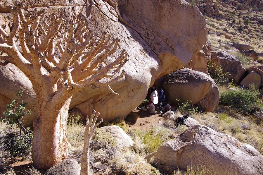
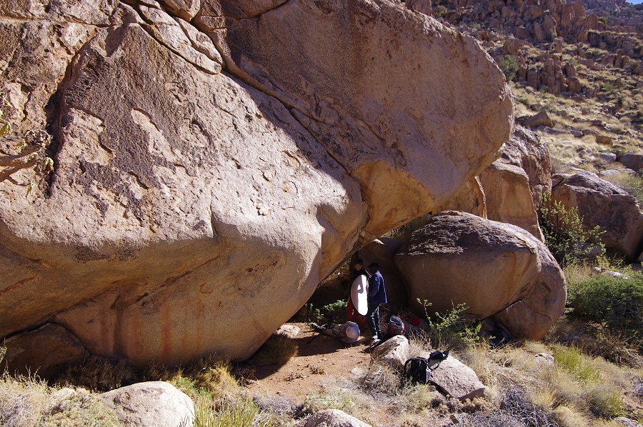
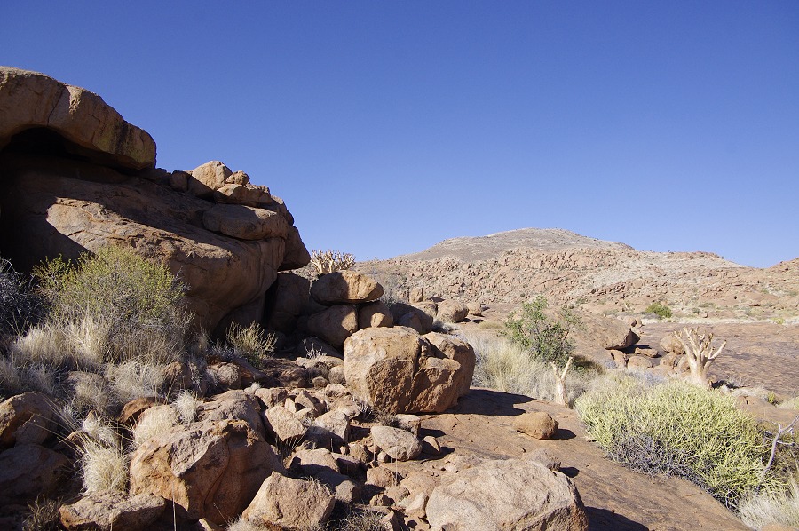
The morning was possibly colder than the previous one, even after the sun rose above the hills we had to keep the warm clothes on. It was to be an easy day after the long walks of the prior days. We only had a short half hour walk from camp to Snake Rock (H43), the main site of the upper Hungorob and one of the principal sites on the Upper Brandberg.

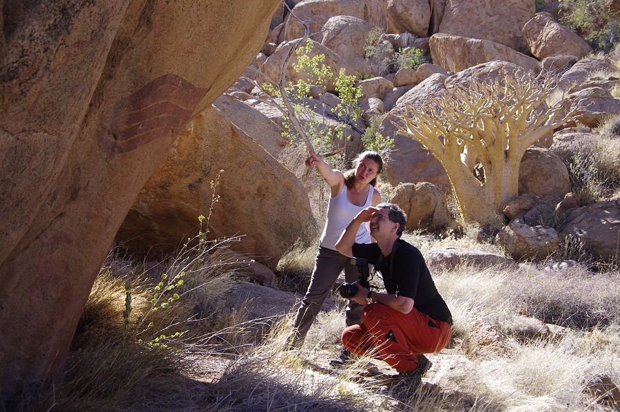
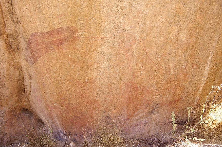
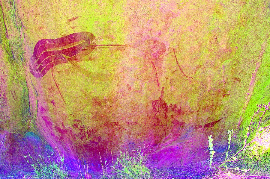
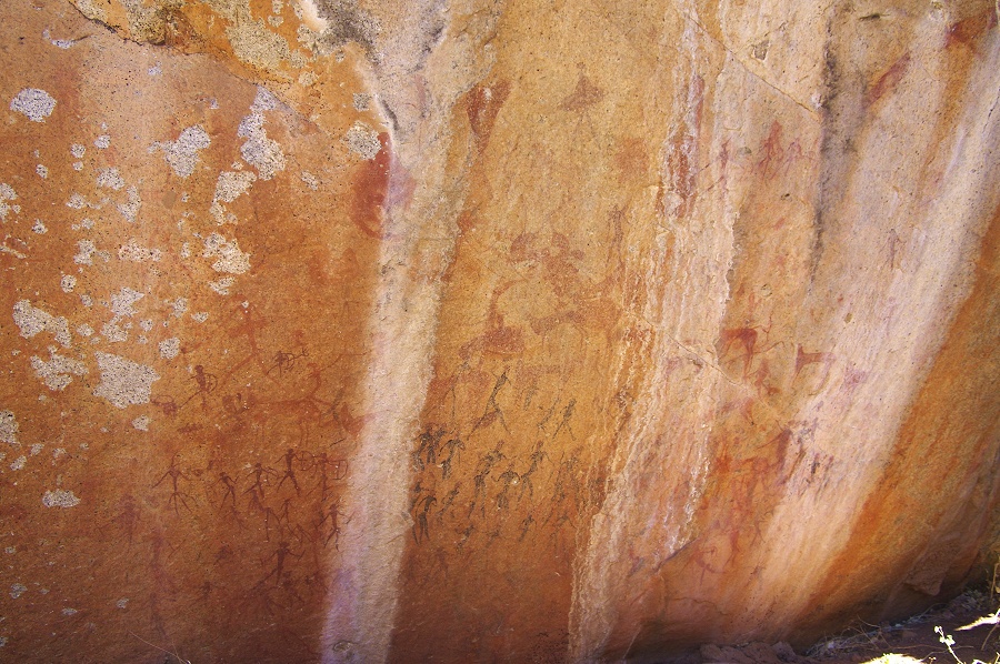
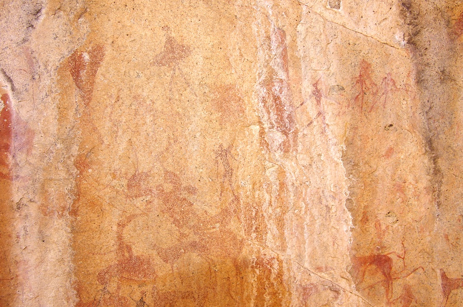
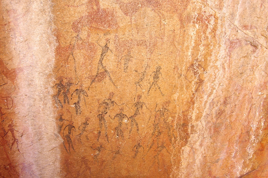
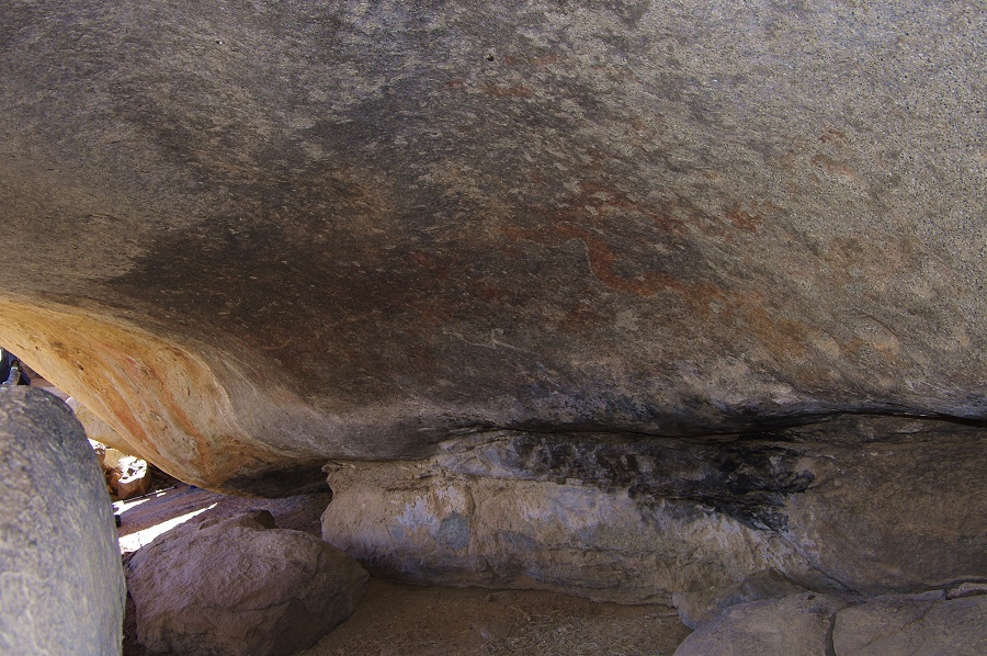
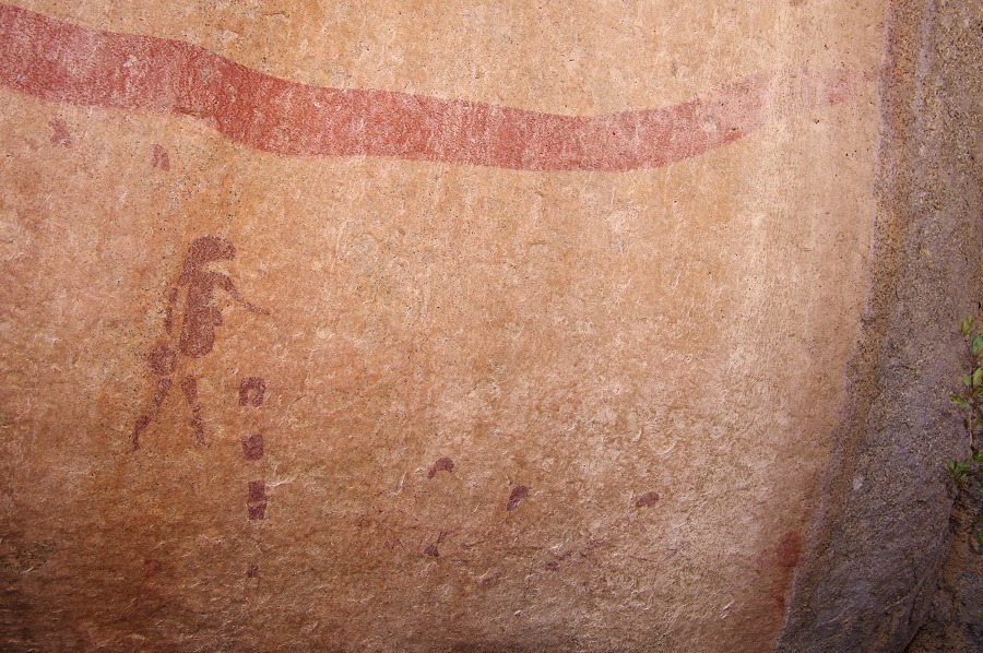
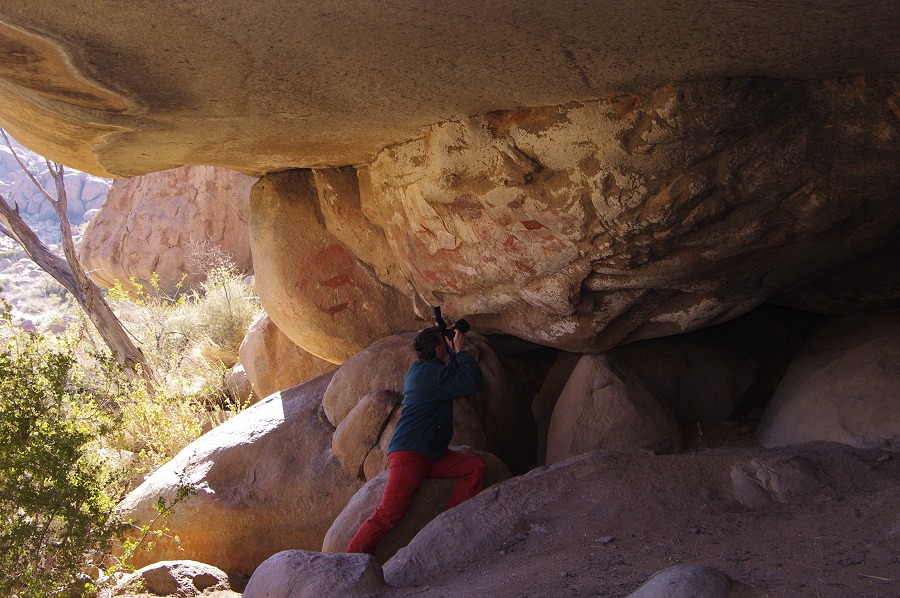
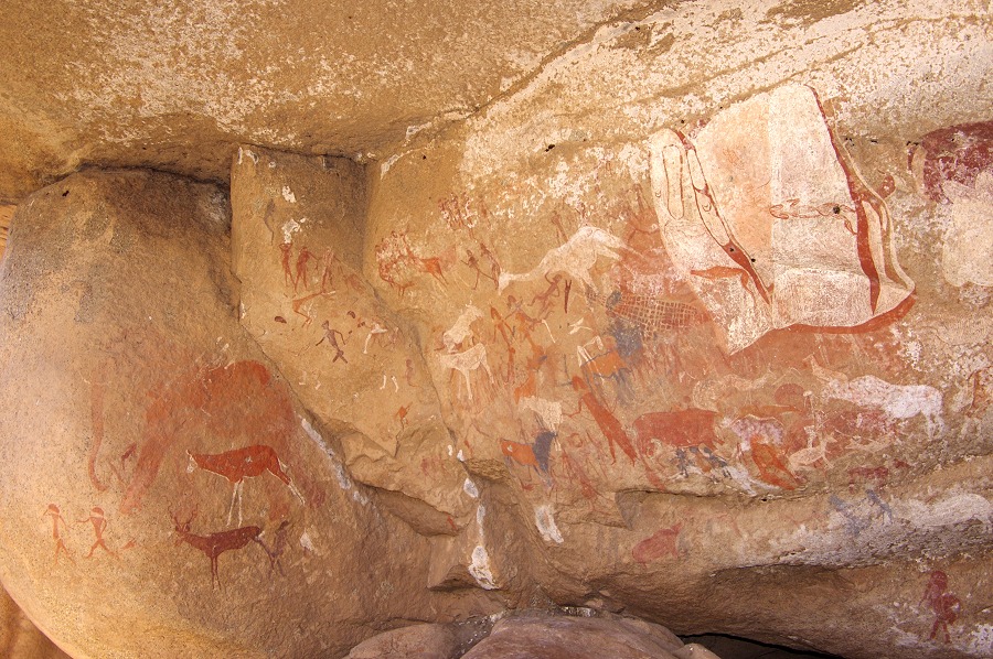
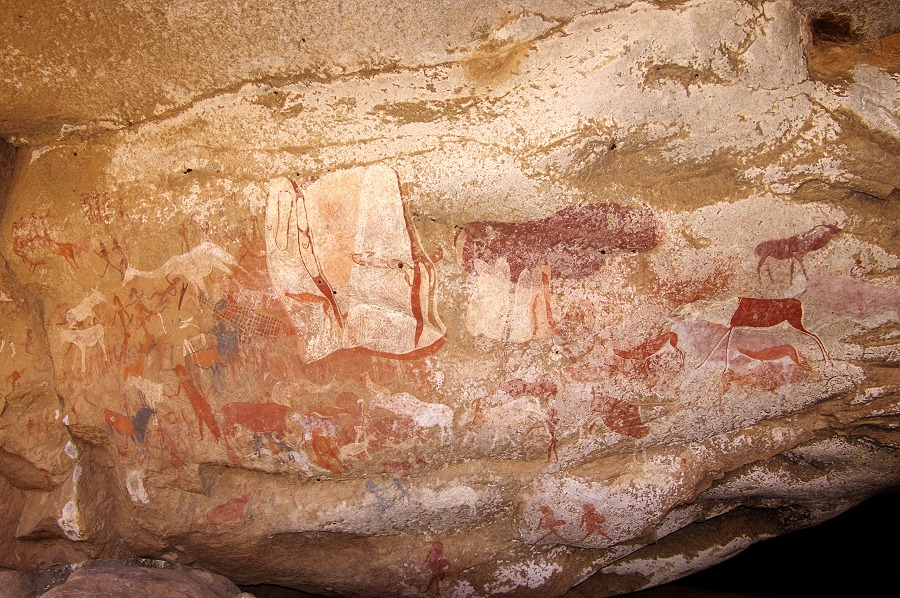
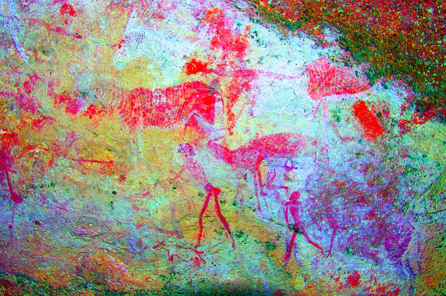
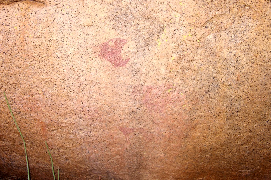
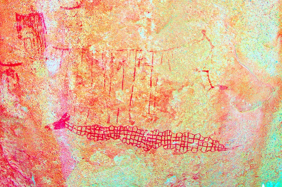
Snake Rock is a very large complex site, partially a shelter under a rock overhang, partially vertical granite faces surrounding a small terrace adjacent to the shelter that is now overgrown with vegetation. The name of the site is derived from the depiction of a huge, approximately five metre long eared serpent, painted on the real wall of the terrace, surrounded by a multitude of other figures.


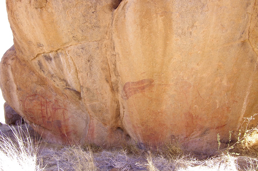
The best preserved panel is at the left end of the deep shelter, a multitude of human and animal figures surrounding (and underlying) an amorphous white shape of unknown meaning. The figures are drawn very delicately with elaborate detail, making this scene one of the finest examples of Brandberg rock art.


H43 is located right above a large basin in the riverbed which must hold water for a long time, but was now completely dry. It is surounded by several smaller sites, the majority of which only have a few and very damaged paintings. H44 is the most interesting of these, being a large rock about two hundred metres from H43 accross the watercourse, and containing tw large panels of complex paintings, unfortunately due to water seepage some of the most interesting scenes are obliterated to the extent that even with dStretch it is difficult to make sense of them.
H46 is a large boulder just under H43, within shouting distance. It contains a single damaged archer on its side. Not far from it another boulder had to be H47, however the sides were so densely overgrown with vegetation that it was impossible to find the paintings.


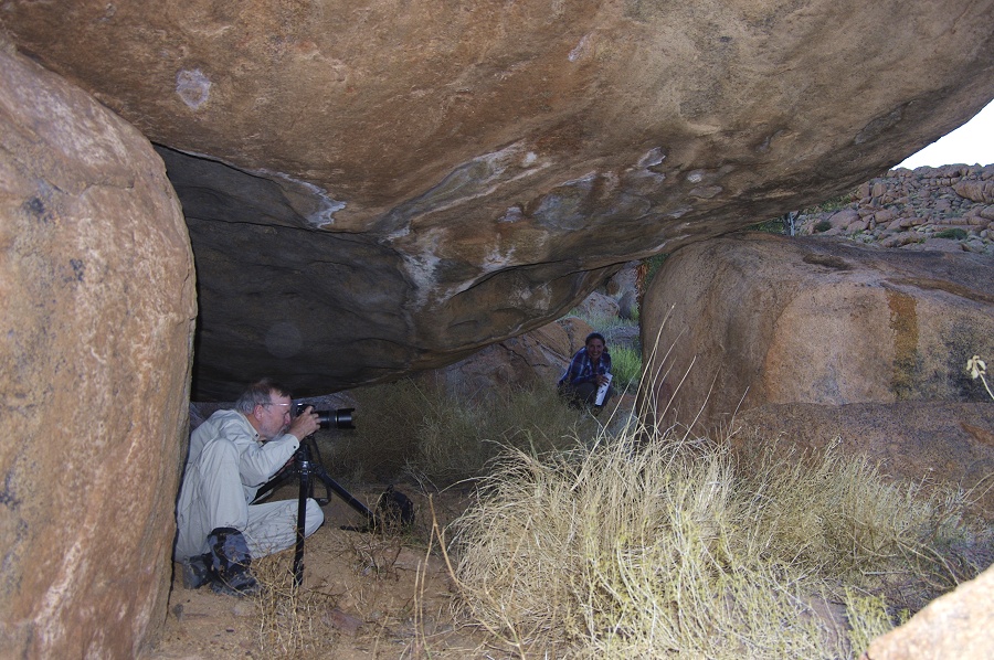
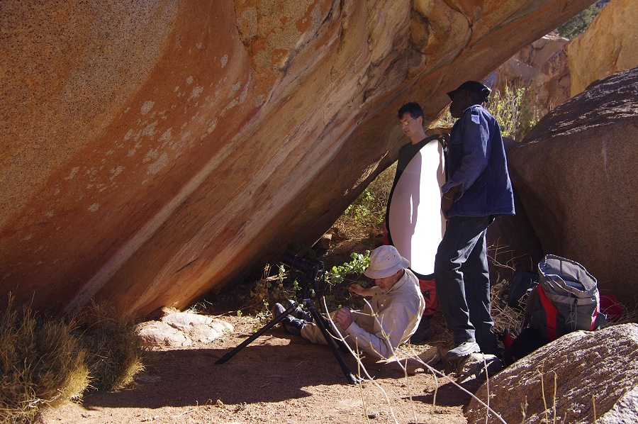
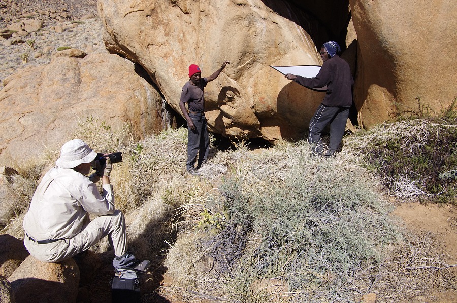
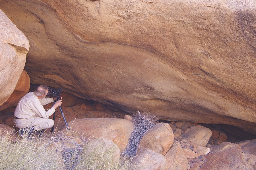
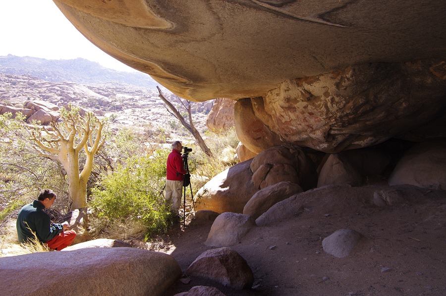
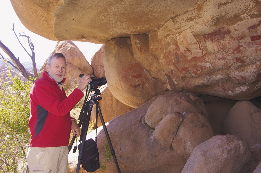
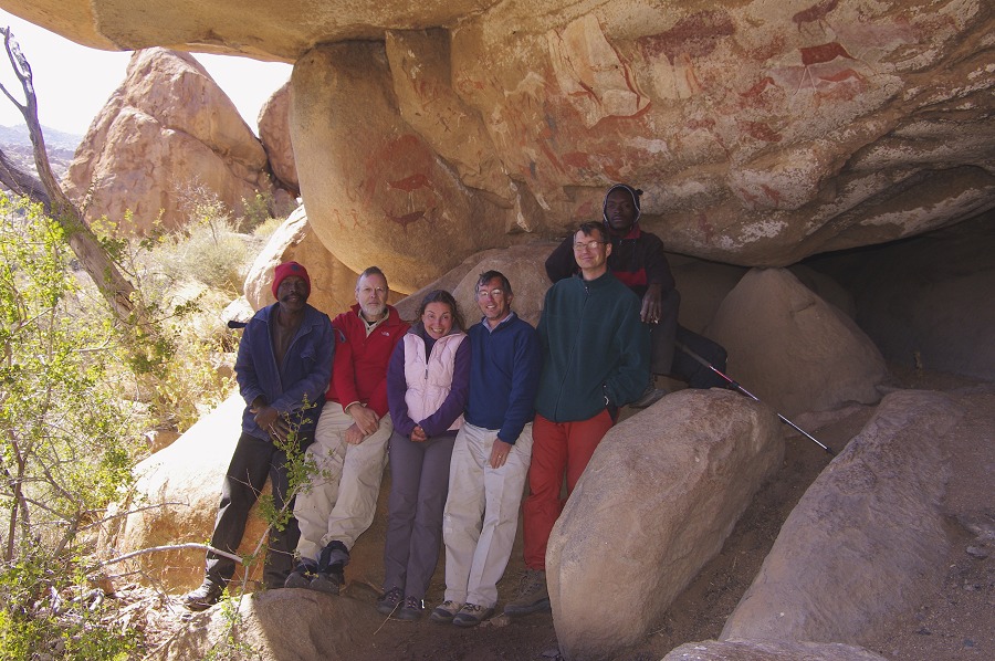
We spent practically all of the morning at Snake Rock (H43) and vicinty, photographing all the details. We also took this opportunity to take our group photo under the main panel, before around noon we started to make the short half hour descent to Falls Rock Plain, to our dump made under the large prominent tree on the southern side.

After lunch and some rest we started to explore the vicinity, which we were unable to do during our hurried visit in 2010. There were in all 12 sites around the edges of Falls Rock Plain (including Falls Rock shelter), all within a couple of hundred metres from our camp. It was a welcome and pleasant change to be able to wander about without the backpacks. We easiy found three of the sites, H38, H39 and H145 within a stone's throw distance from our camp.However finding them was one thing, seeing the paintings, some of which were very faint or hidden, required a careful comparison with Pager's plans.


A little later we started out with Angula to see the more distant ones, starting with H37 that proved to be on the other side of the granite ridge next to camp containing H38 (actually by Pager's definition the two should really be the same site, as in a straight line they are only 23 metres frm each other - probably Pager did not realize this when giving the site numbers). The site consists of a large panel of humn figures, most of which are only visible properly with dStretch.

Another 150 metres further towards Falls Rock we found H36, a large boulder at the edge of the watercourse with a low shelter underneath containing the paintings.
The last site along the southern edge of the plain, H35 was more hidden among a group of boulders, closer to the hillside to the south. Most of the paintings were faint and damaged just like all the other sites we have seen so far in the afternoon, but here tehre were some exceptional well preserved scenes - the finest site of the plain other than Falls Rock shelter.

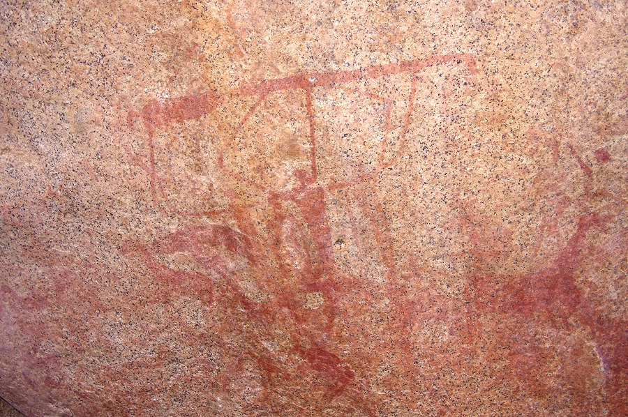
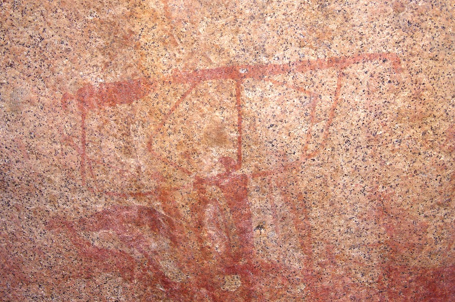
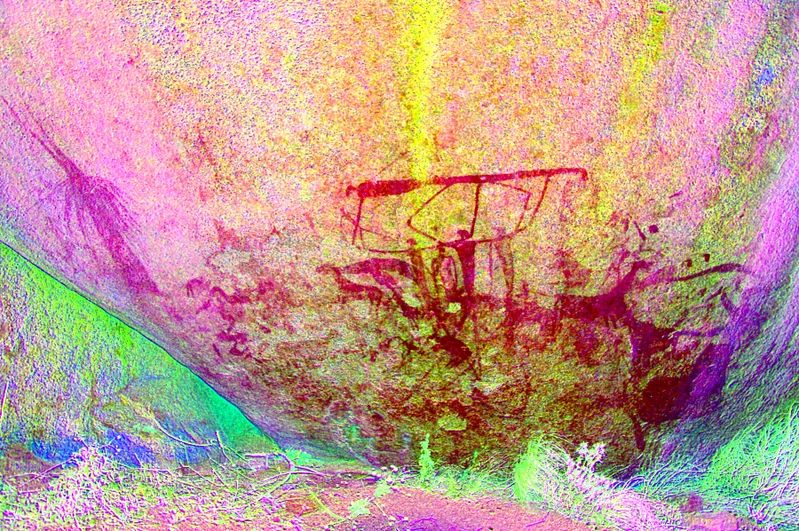
We continued to Falls Rock itself (H28), another couple of hundred metres away, passing by the large water hole that was still half full. We spent a good hour and a half in the shelter, marveling at the many details that we failed to see during our hurried 2010 visit.


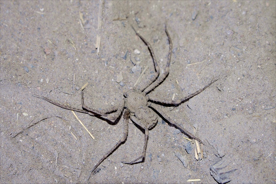
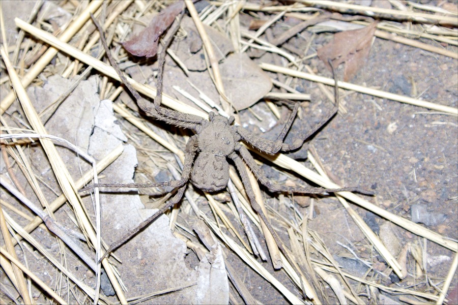
Deep inside the shelter I have spotted a fairy large (~5cm) and very dusty spider doing its best to get out of the way of the trampling feet. It was the only arachnid we have ever seen on the Brandberg, probably because we always visited in the middle of winter.
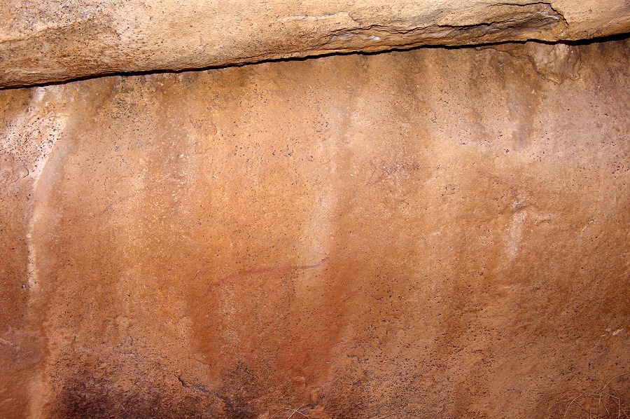
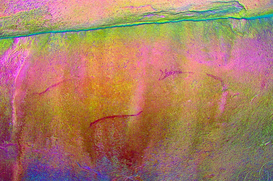
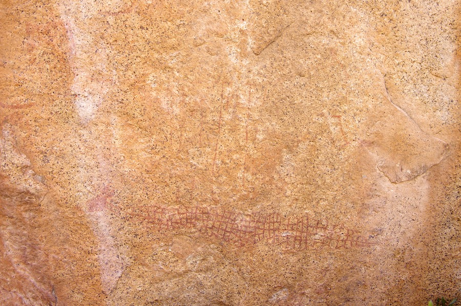
Starting back towards camp, we made a loop along the northern edge of the plain. First we stopped at H33, an inconspicious site just above Falls Rock shelter near the waterhole. According to Pager there was supposedly a painting of a fine oryx, but we could only see faint shapeless traces of paint. Looking at the photos back home with dStretch made it clear that Pager was right, as usual...

Continuing we passed by H40, a panel of paintings on the side of a low ridge, then H34, a large prominent boulder on the northern edge of the plain with a few paintings of giraffe and other figures.


Angula was not aware of any more sites, but Pager recorded two more sites on the northern side of the plain. One of them, H41 looked particularly interesting with a panel of three eared serpents. We knew it was somewhere to the west of H34, it did not take very long to find it a mere fifty metres away in a cluster of boulders.
We moved on to the eastern end of the plain to find H42, but that site proved elusive. We checked severl boulders in the bed of the stream coming down from Snake Rock where the site was supposed to be, but no results. We may have seen the actual boulder, probably the paintings were too faint to notice. With all sites ticked off, we moved back to camp to pitch the tents and spend a lazy hour doing nothing before sunset.


Day 9. - Falls Rock Plain - Upper Ga'aseb Gorge
It was again a very chily morning despite the lost altitude, this time coupled with a strong wind which made packing the tents a rather challenging excercise. As we were hoping to make the first part of our descent till the Helm Pools in shade, we did not have time to linger by the fire, we had to move on.

The first step of the descent to the Helm Pools took about an hour, losing 200 metres of altitude in the process. Near the bottom, on the smooth granite plates we passed by a small site with a few paintings, H11.

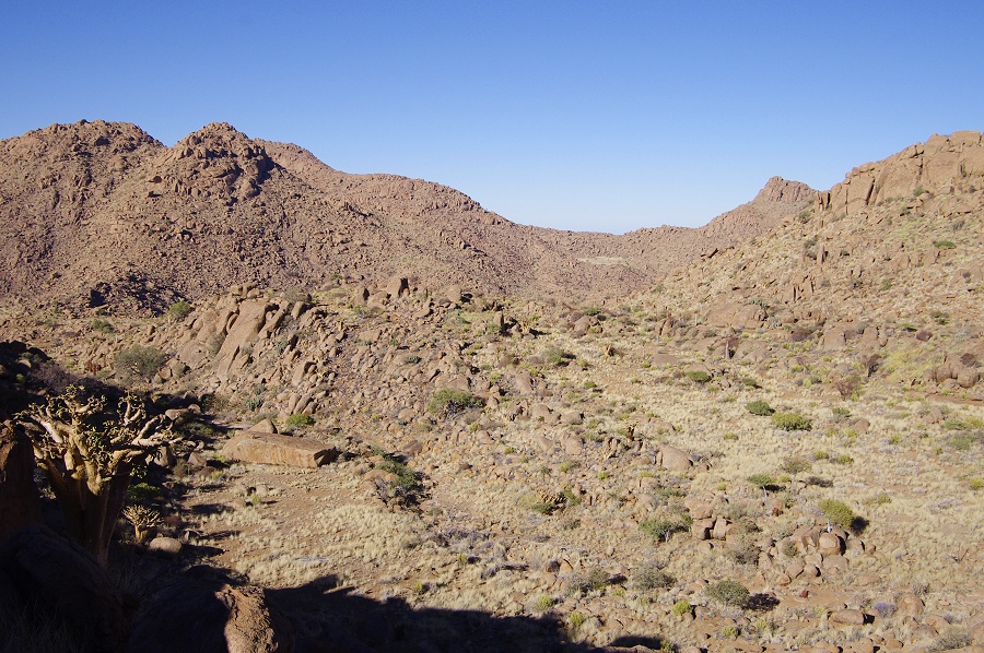
We quickly recovered our two boxes left by the helicopter at the small grassy plain close to the principal rock art site of the area, H3. We distributed the load and did not linger, as we have photographed this site extensively in 2010. We were re-tracing our route of two years ago, however this time with two days available instead of one, we were hoping to see all the important sites in the Ga'aseb Gorge during the descent. We started on our way, first up to to the col separating the Hungorob and Ga'aseb gorges. The going was rather dificult, we all had to carry an extra 4-5 kgs of load (mostly water for the next 2 days) as we were unable to make the dump with the helicopter at our intended bivouac. In about an hour we reached the col and descended into the top of Ga'aseb, stopping for a rest at site G28. Two years ago we did see this site with the fine eared serpent, but there were many more interesting details we failed to spot as we rushed by on the previous visit.
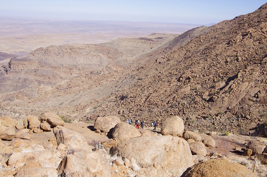
Cutting accross the top of the Ga'aseb gorge was a very tiring task with the heavy packs. We were now fully out in the heat of the sun, and the huge mass of the Orabeskopf above us blocked the northern wind which did not aid our progress either. While we kept to the trail, it constantly went up and down among and on big boulders, with not a stretch of flat firm going. It took over two hours to cover the one kilometre from H28 to a big cluster of boulders that contained the small site of G15. Angula suggested that we have our bivouac here, as this spot will be ideal for the descent the next morning, and we can make the climb up to G12, our main objective of the day, without the heavy packs. The small terraces between the rocks also provided the only opportunity to pitch tents along the descent route, the idea to stop was greeted with much enthusiasm.
There was substantially less enthusiasm when after our lunch it was time to start out to G12. It was the worst of the early afternoon heat, and the slope looming ahead looked particularly nasty, involving first a descent into the V shaped gorge ahead. In the end only Angula, Thomas and me decided on going, the others stayed at G15 to have a good rest before the full day descent the next day. Not feeling bound by the group, Angula switched into his fast forward mode, and in less than fifteen minutes we were at a huge angular boulder some 400 metres from our starting point, site G11. This site contains several panels on a nubber of boulders, in our haste we only saw the main panel containing a number of faint but fine paintings, including several elephants.
We crossed the bottom of the ravine nearby over some huge bouders cluttering the watercourse, then climbed the 100 metre slope ahead of us in a surprisingy short time, in another 30 minutes we were at the top on the small terrace stradding the ridge between the Ga'aseb and Orabes gorges, a far cry from the good hour I estimated at start. Site G12 is located in the middle of the terrace, dispersed on a number of large prominent boulders.

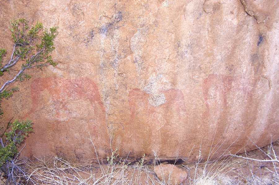
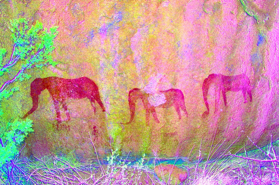
Unfortunately despite our speedy ascent, the main panels were already coming out onto the sun. This was not unexpected, the plan to bivouac here was made just because of this. There was not much to do but take a long siesta while the sun moved over the jagged top of Orabeskopf, and photograph the few lesser panels that were not on the sun. Finally after a good two hour wait the sun dipped below the top of the western cliffs, and the main panel came into view. It shows a large eared serpent, surrounded by a multitude of smaller figures. Immediately to the left, there is a unique scene of three large scale elephants.

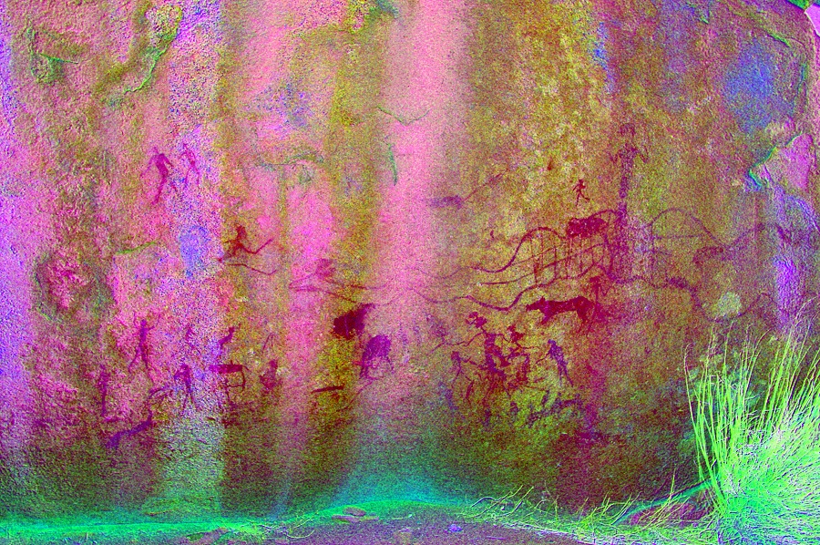


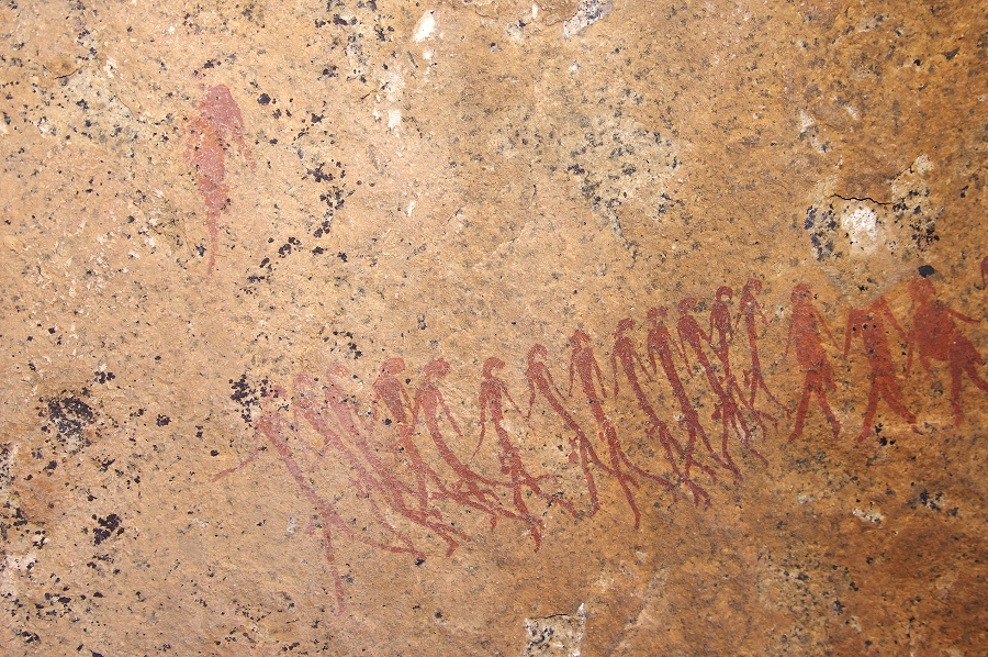
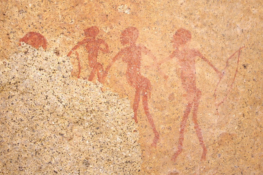
The most interestig scene (often referred to as the "funeral") is not on the main panel, but in a small shallow shelter on the adjacent large boulder. It depicts a group of thin, long limbed human figures who appear to carry a similar figure above their heads. Whether they are indeed carrying a dead body remains open to interpretation.
Finished with photography, we made our way back to our camp among the big rocks, collecting some firewood along the way. We were back before sunset and found the tents already up. We soon had a warm fire going as we watched the sunlight disappearing on the plain below. With the stress of the day gone, we had a nice relaxed last evening on the mountan.

Day 10. - Descent in Ga'aseb Gorge
At first light we packed up camp and started the descent, to make as much as possible in the shade. We had the worst of the terrain behind us, from hereon much of the going was on continuous granite plates, a much easier and faster way than accross boulders. Our packs were also much lighter with the previous day's food and water used up.
Our descent route was a little to the east of the rack taken in 2010, in order to see the chain of rock art sites marking the main watercourse of the valley. In less than an hour we hit on the first site, G9, a huge boulder with a shelter underneath with a few paintings.

150 metres further down another pile of large rocks hid a much more interesting site, G1, with two large panels of complex paintings on the sides of the two boulders forming a large spacious shelter.


From here it was another two hundred metres down to the principal site of the middle Ga'aseb, G7. The site is a group of large boulders adjacent to the watercourse, with several panels of paintings, some excellently preserved.
With Jon, Angula and Thomas we set out to tackle the difficult climb up to G8, a site clearly visible about 100 metres above us on the steep hillside, perched precariously on the upper edge of a dangerous looking steep granite plate. As we got closer we could see that the going is not as bad as it appeared from below, there was only a one metre stretch where the steep granite slope fell away too close for comfort, otherwise there was a continous fairly wide stretch of gently sloping granite with a good grip. In about half an hour we made it up to the long low shelter.


The site itself was one of the absolute highlights of the trip. The panel of paintings is in fact very small, hidden away in a small niche of the otherwise empty shelter. Due to the protected locaton and the good quality of the rock, the preservation of this unique scene is absolutely superb.

We could have stayed up at this magnificent spot forever, but we had to be down at the bottom before sunset, so reluctantly we started to go down back to Attila and Magdi at G7.


Taking our packs, we started on our way down, passing by a small site, G6 just downstream from G7 on boulders next to the smoothly worn bed of the watercourse.

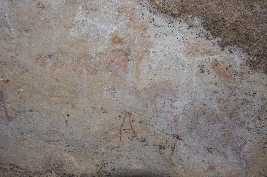
Climbing a ridge, we came upon a large boulder with clear stone structures in front of it, based on Pager's site sketch clearly site G3. There were some very damaged paintings in the shelter, and supposedly a fine giraffe at the rear. We spent several long minutes going through the rear of the boulder not finding any trace of the giraffe. Taking a few random shots of the rock face where we thought the giraffe to be, I was astonished to find the giraffe clearly revealed by dStretch back home, another testimony to Harald Pager's amazing eyesight.

We left our packs here to visit the last middle Ga'aseb site, G2 located in a big shelter under a large flat boulder at the end of a gully, a good 100 metres away. The shelter contains a beautiful panel of giraffes, comparable to the ones we have seen at H60 two days earlier.


Returning to our packs, we started a rapid descent on the steep granite plates, losing about 400 metres of altitude in the next hour. We took a brief lunch pause at the bottom of the steep descent, before continuing along the more gradual way down as the granite gave way to the black Karoo lavas.
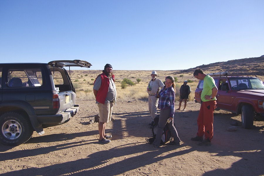
In another hour we reached the part where the valley flattened out, and before four o'clock we were at the end on the car track. In thirty minutes Basil apeared with two Landcruisers, treating us to some well deserved cold beers from the icebox in the back.


As we drove back to Uis, we stopped by a low granite knoll to take some photos of the Brandberg in the perfect afternoon light. Climbing to the top of a rise, my lens refused to focus. Taking a look at it, it was completely seized up, both the focus and the zoom rings refused to move one tiny bit. It was the one trip where to save weight I did not bring a backup lens... (Back home I took the lens apart and put it back together again, it works perfectly ever since. I could not figure out what made it seize...)
Day 11. - Uis - Windhoek
After a good shower and a fine dinner in Uis, the next day there was nothing worth mentioning other than driving back from Uis to Windhoek in the afternoon, going straight to the airport for the evening Air Namibia flight back to Europe.