
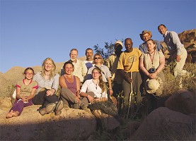
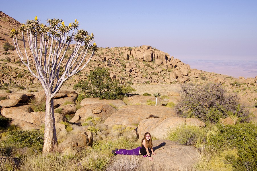
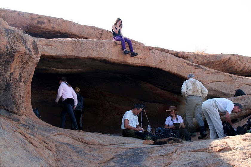
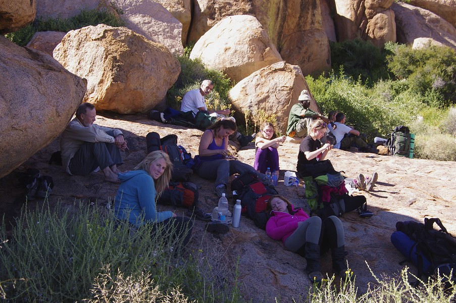
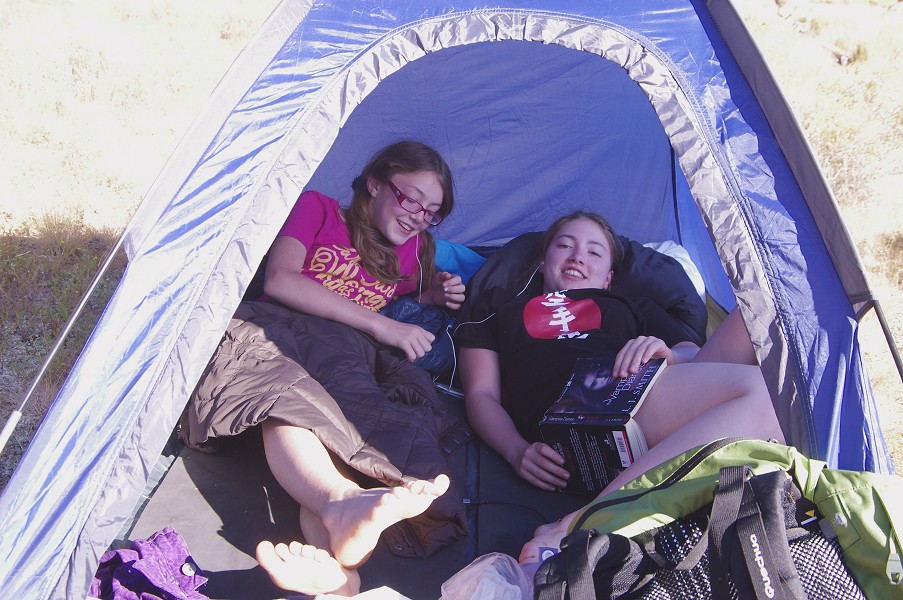
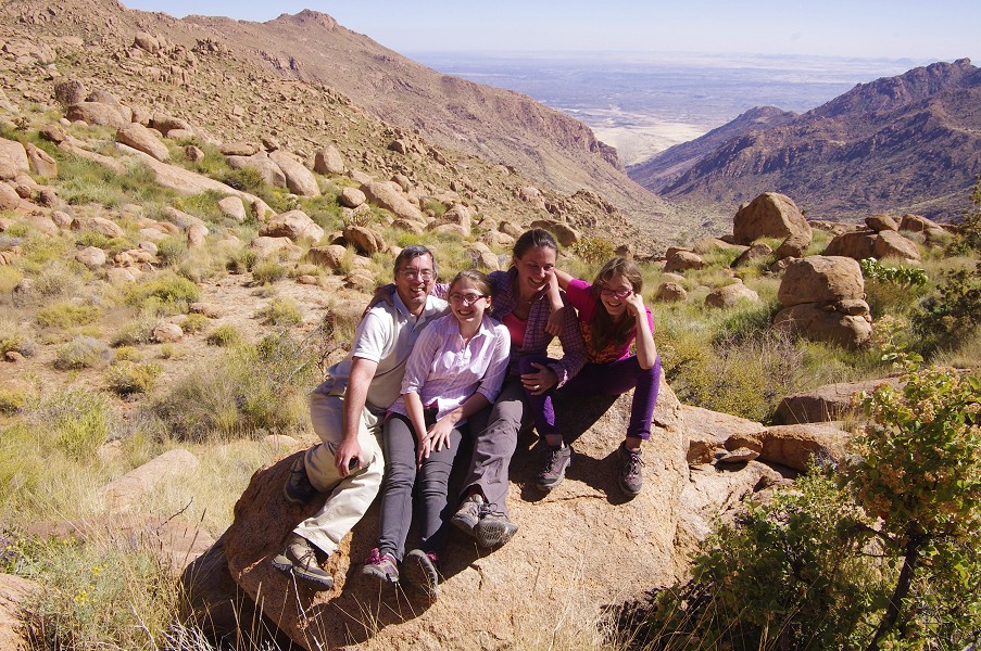
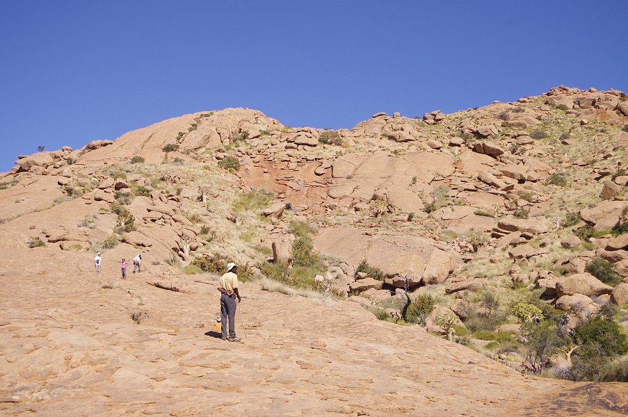
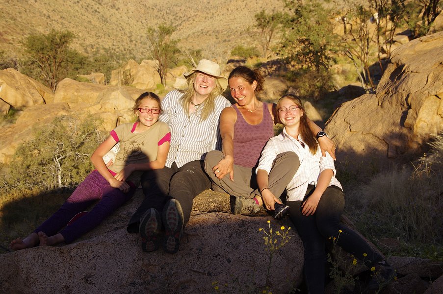
 Click on image for list of participants |
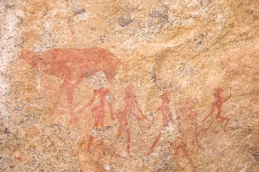
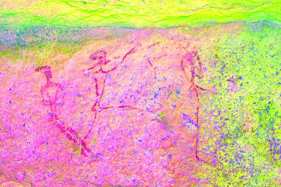
Upper Brandberg Expedition, Namibia 20th June - 3rd July, 2011 All site references based on Harald Pager's numbering system False colour images precessed with dStretch, a freely available software developed by Jon Harman |
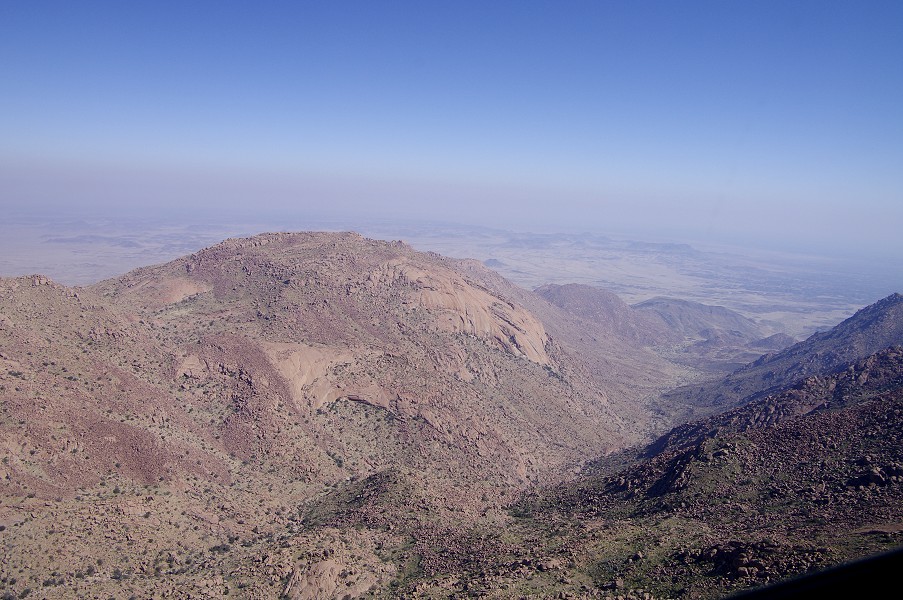
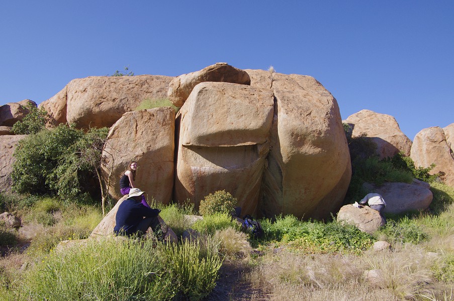
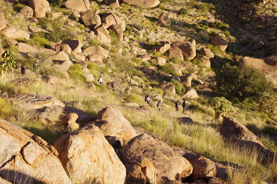
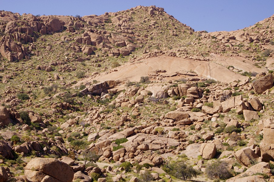
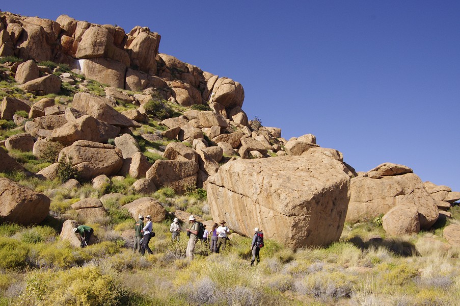
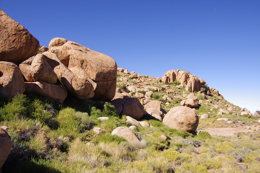
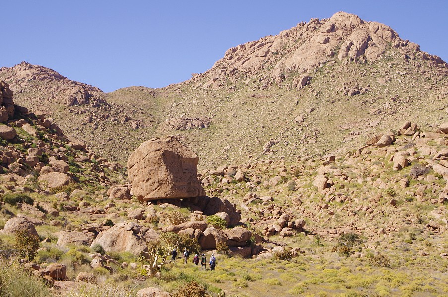
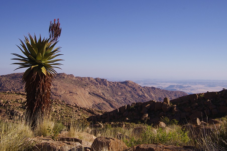
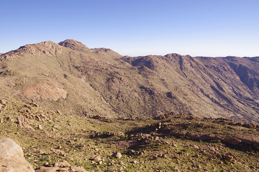
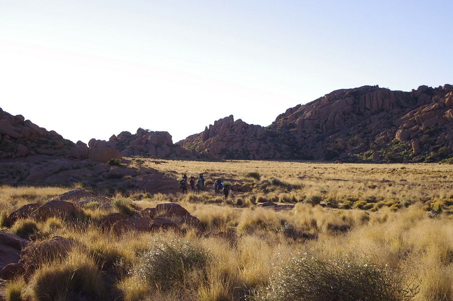
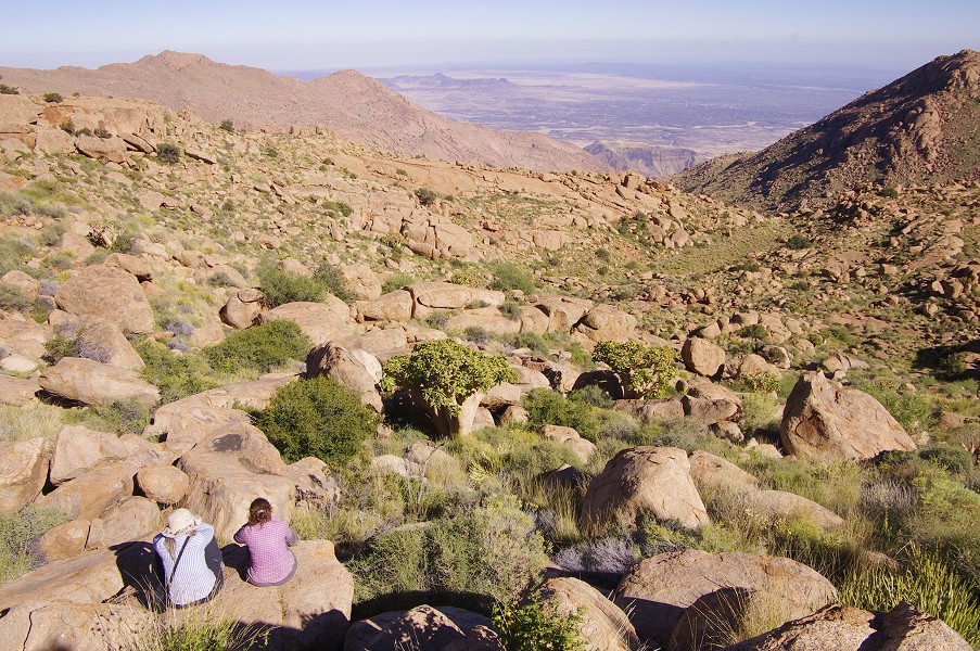
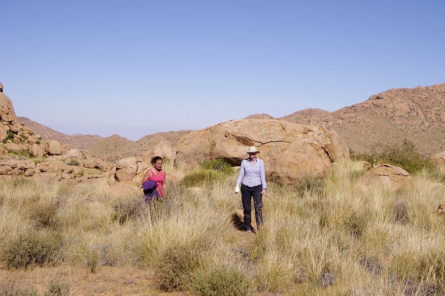
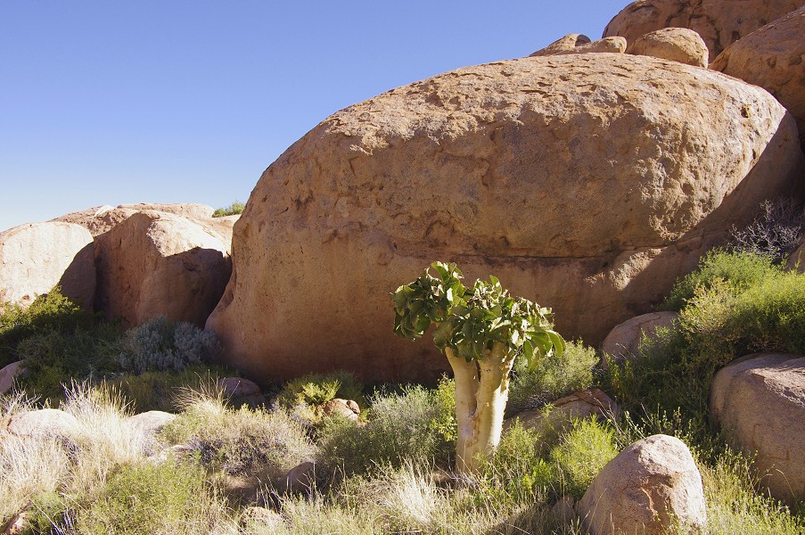
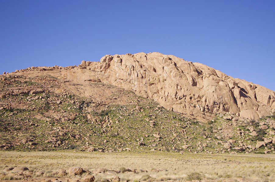
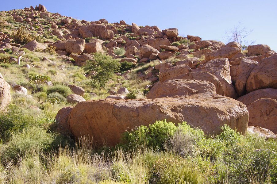
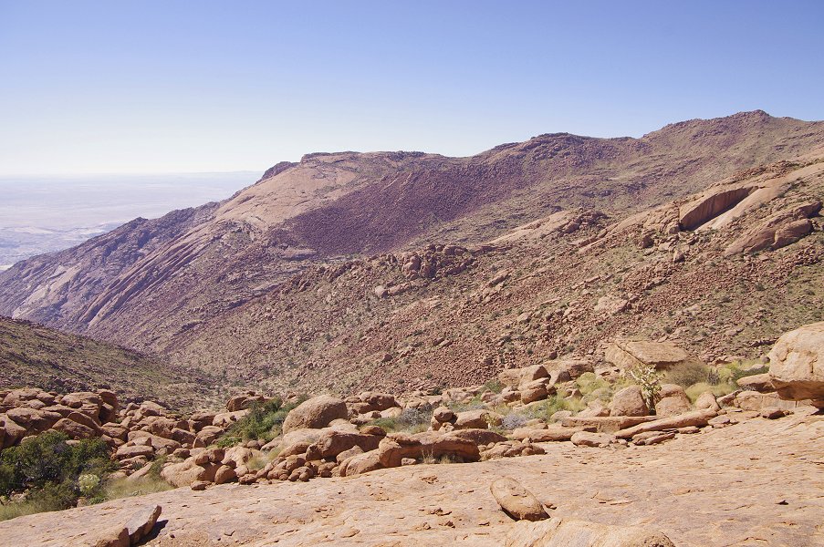
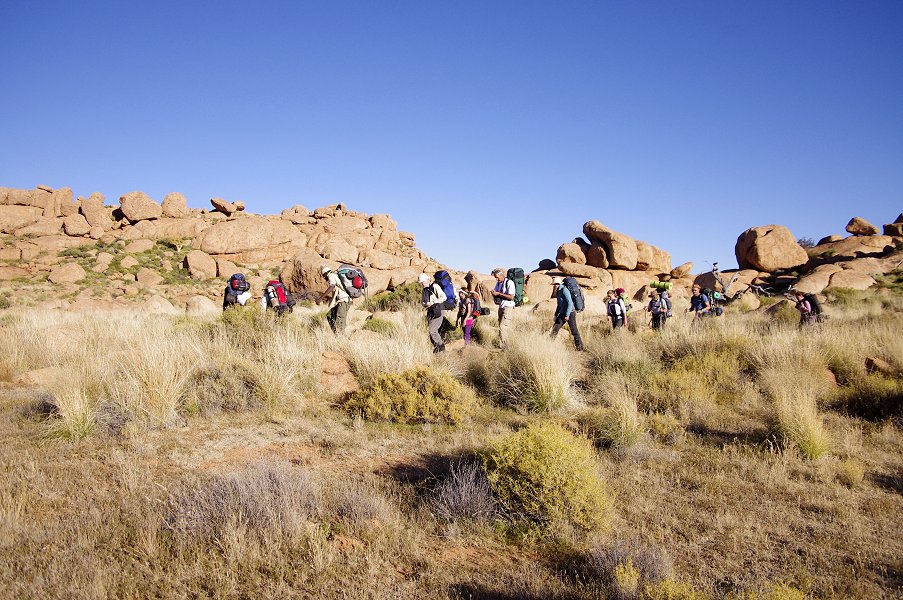
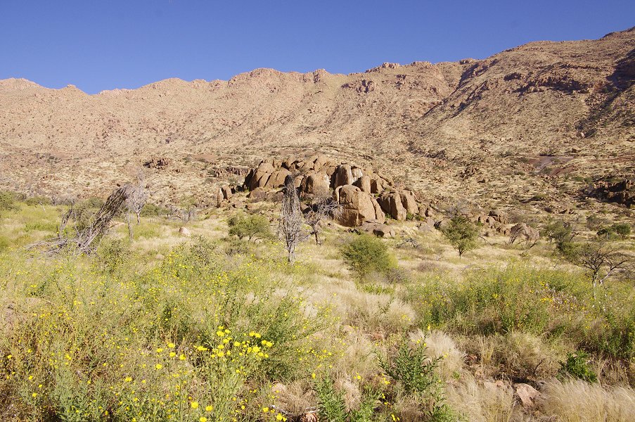
Armed with the experience of last June's expedition, we planned our return to the Brandberg with more caution and reserves, aiming for the western half of the mountain. This time we managed to visit most of the principal sites along our planned itinerary, a feat due in part to the lessons learned from last year, but also to having been able to engage Angula Shipahu, one of the principal helpers of Harald Pager, and his son Thomas to act as our guides. Our plan is to return again in June 2012 to continue to explore this amazingly beautiful, remote corner of the world.
Day 1. - Windhoek - Uis
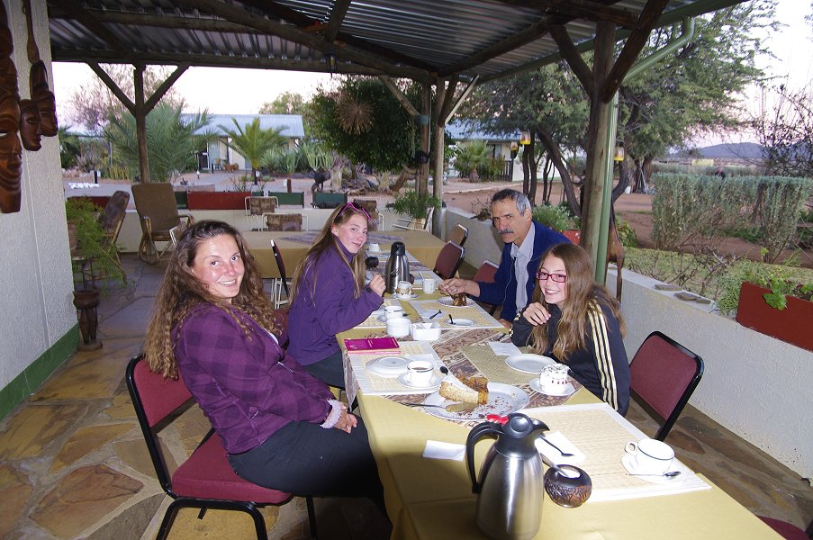
Sticking to the age old principle of not fixing if something works, our logistics arrangements were exactly the same as the previous year. Most of us took the overnight Air Berlin flight from Munich to Windhoek, meeting at Munich airport the evening before. For Dagmar and Peter, Frankfurt was next to home, they took Air Namibia arriving some 30 minutes before the rest of us. Mark of Dornbusch Car Hire was waiting for us at the airport, and by eight in the morning we were in town to purchase our supplies in the principal supermarket. By mid-morning we were ready to get on our way, once again stopping for lunch at the Okahandja Country Hotel before continuing towards Uis.
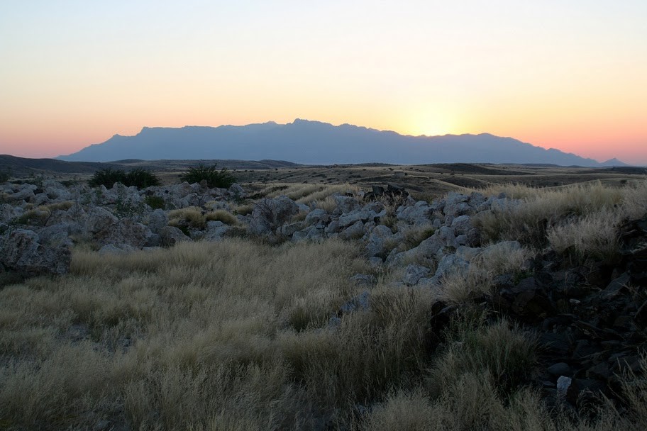
There was nothing worth mentioning along the way save for a few stray warthogs and springbok by the roadside. We reached the White Lady B&B at Uis by mid-afternoon, quickly dispersing before sunset to see the town and environs, start packing the supplies, or simply do nothing after the long flight and drive.

Day 2. - Tsisab Gorge
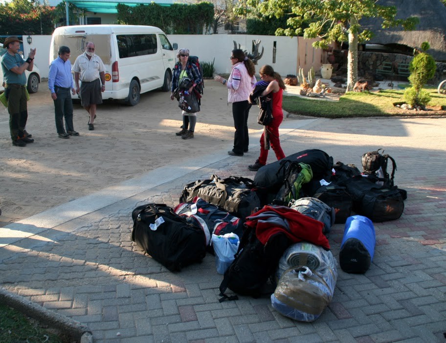
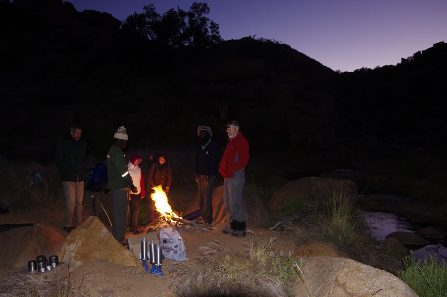
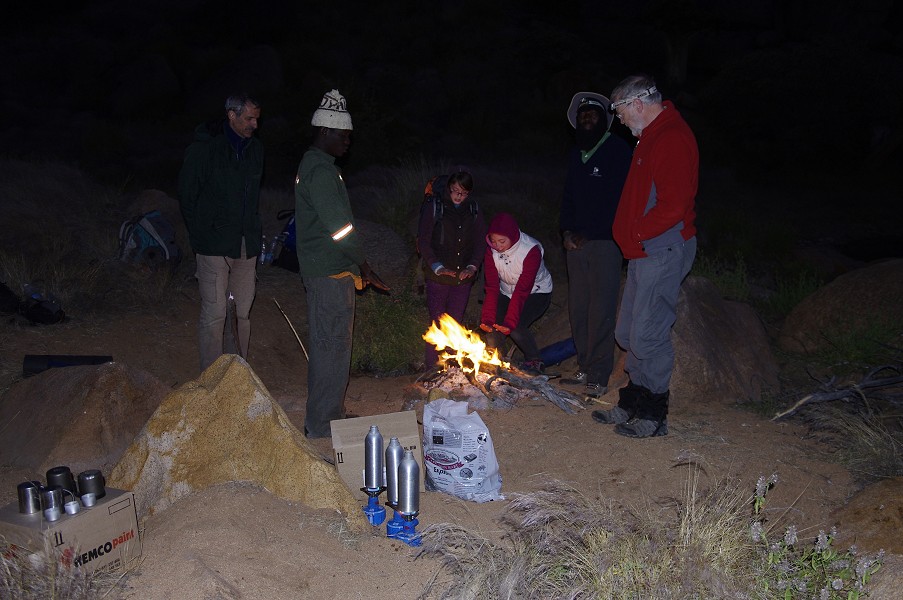
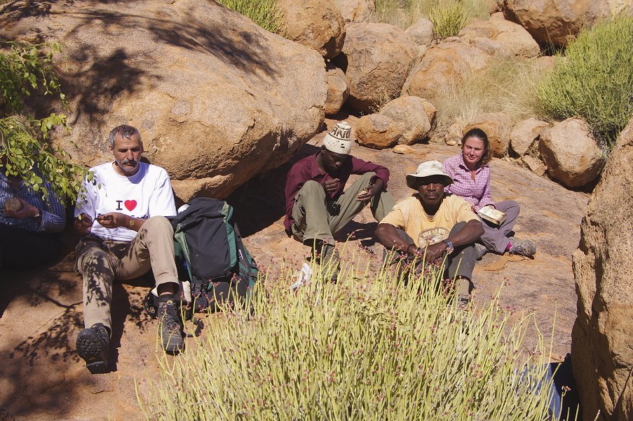
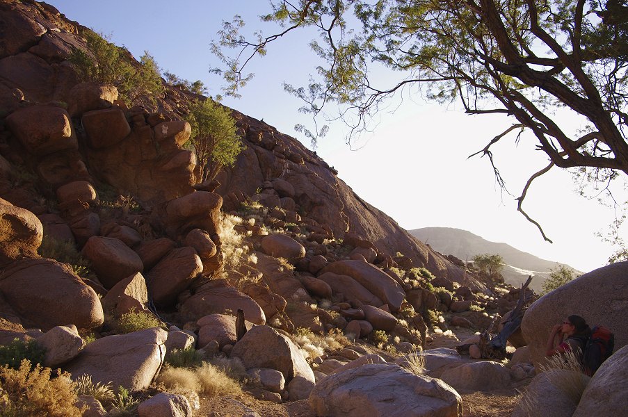
I remained in Uis the next day to sort things out with Angula and his son Thomas, talk the next day's plans over with our helicopter pilot, and pack our supplies into the boxes assigned to the various depots we intended to make on the mountain to assist our treks.
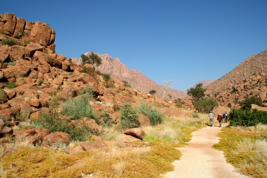
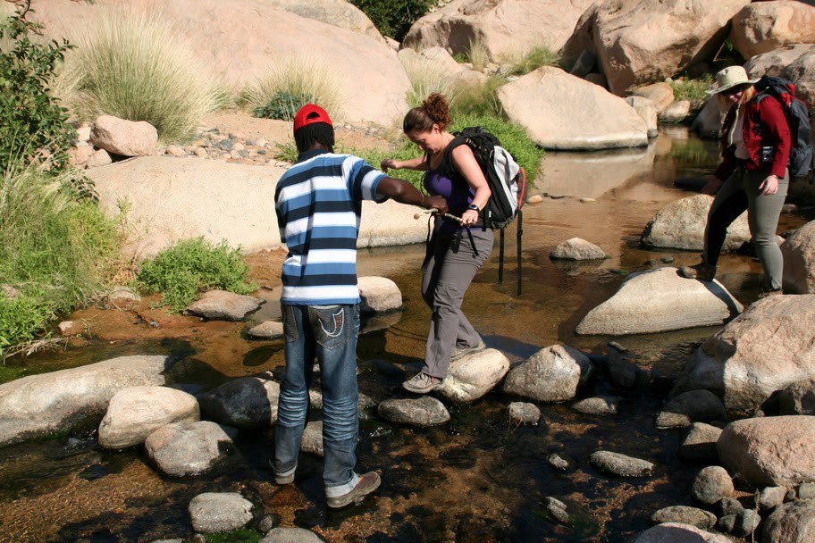
The rest of our party left with Mark and Alfons, our guide of the previous year to visit the paintings of the lower Tsisab valley, including the "White Lady" and the other sites on the Tsisab rock island.
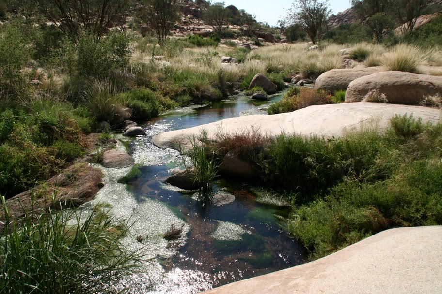
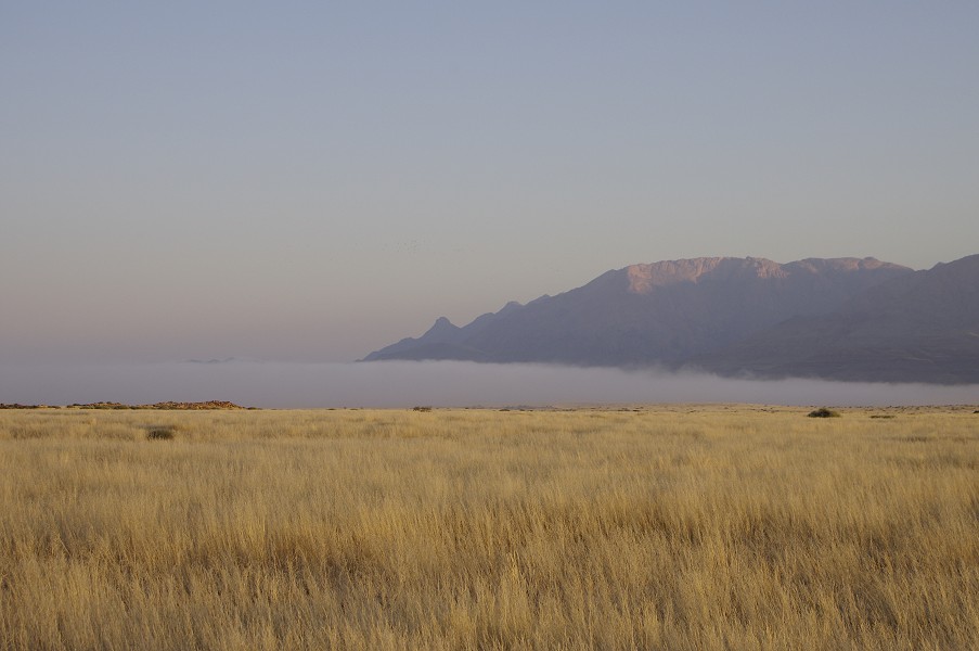
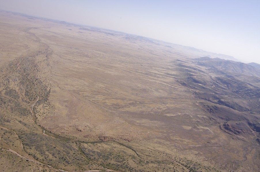
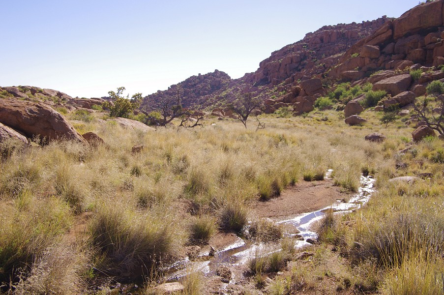
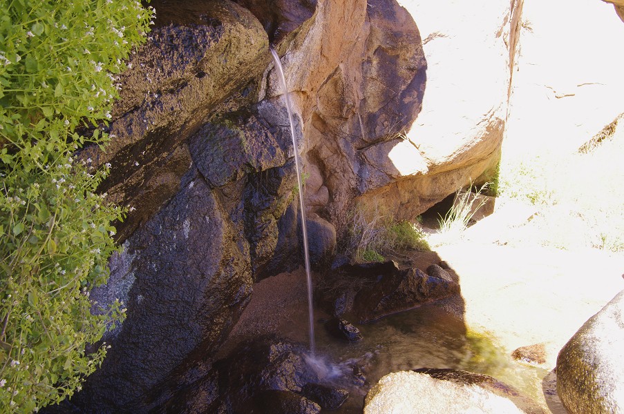
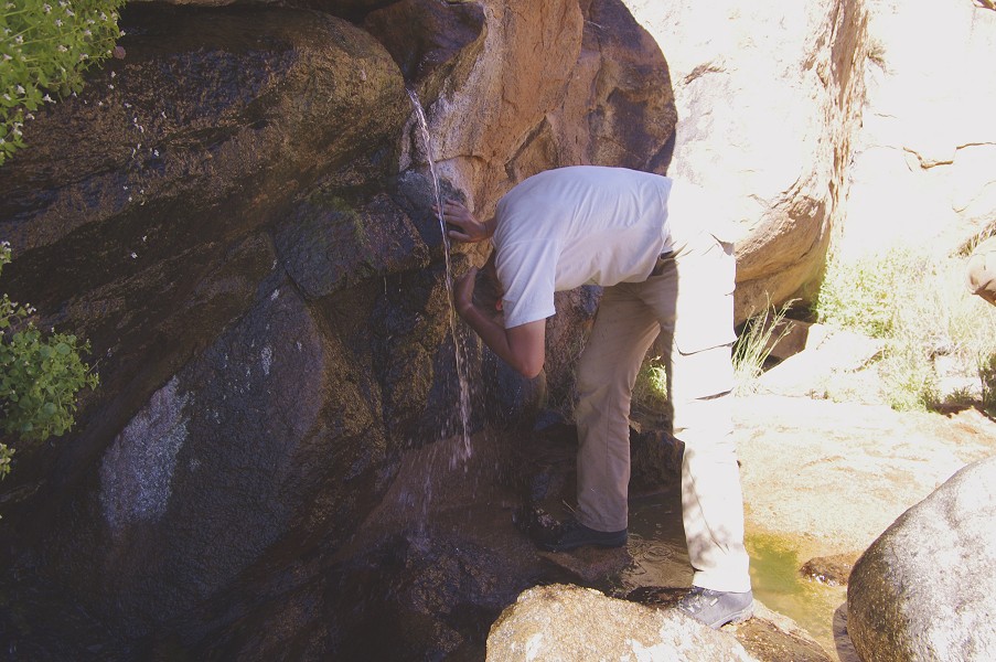
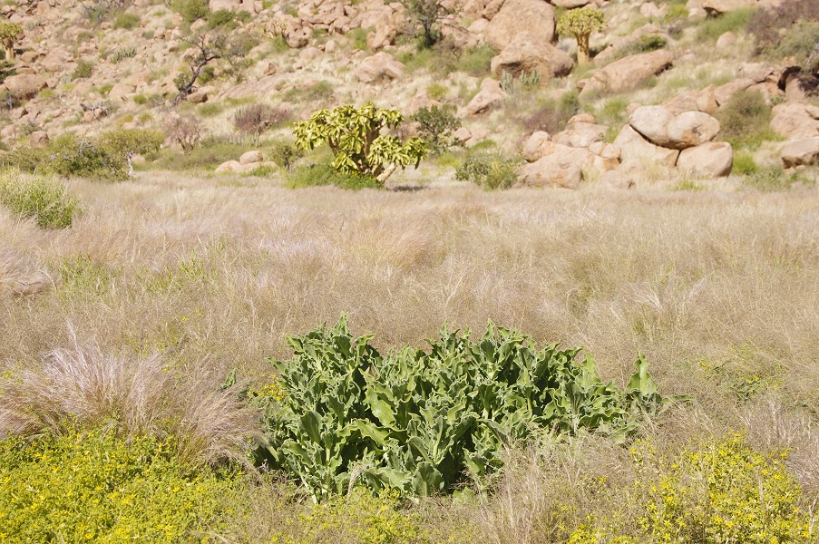
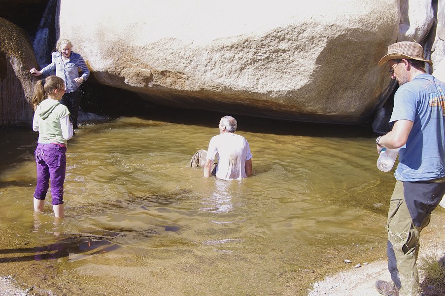
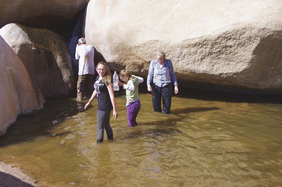
They have found the place much transformed, with abundant water flowing even in the lower courses of the Tsisab creek. There have been exceptional rains in Namibia this spring, something unseen in the past fifty years, with all the normally dry riverbeds that we crossed on our way from Windhoek still having running water. We could expect abundant water up on the Brandberg, something very helpful to our logistics.

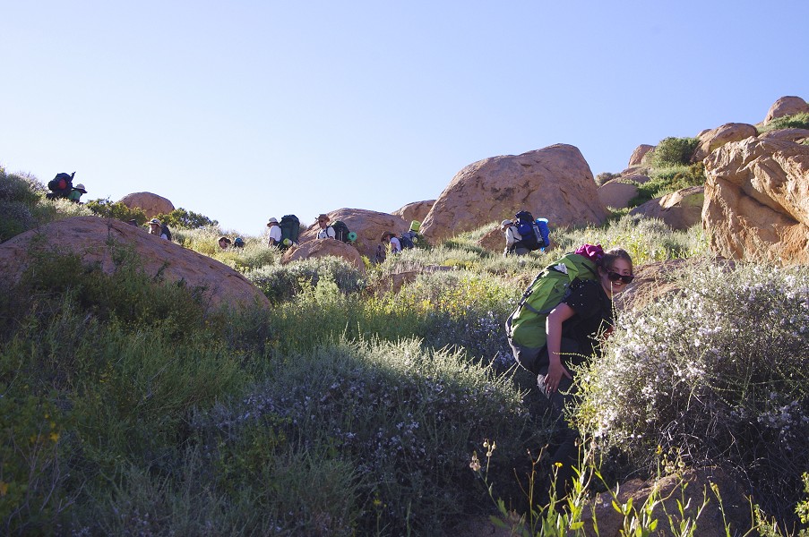
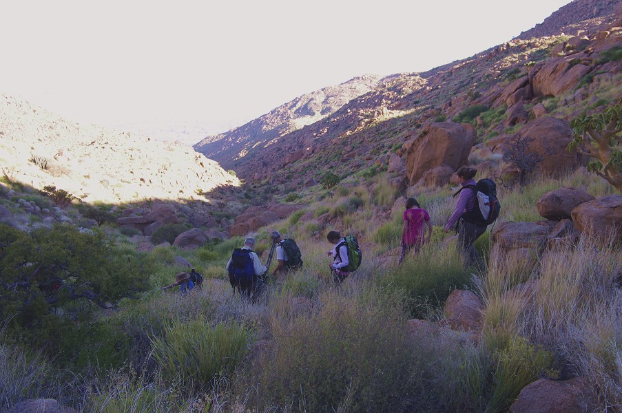
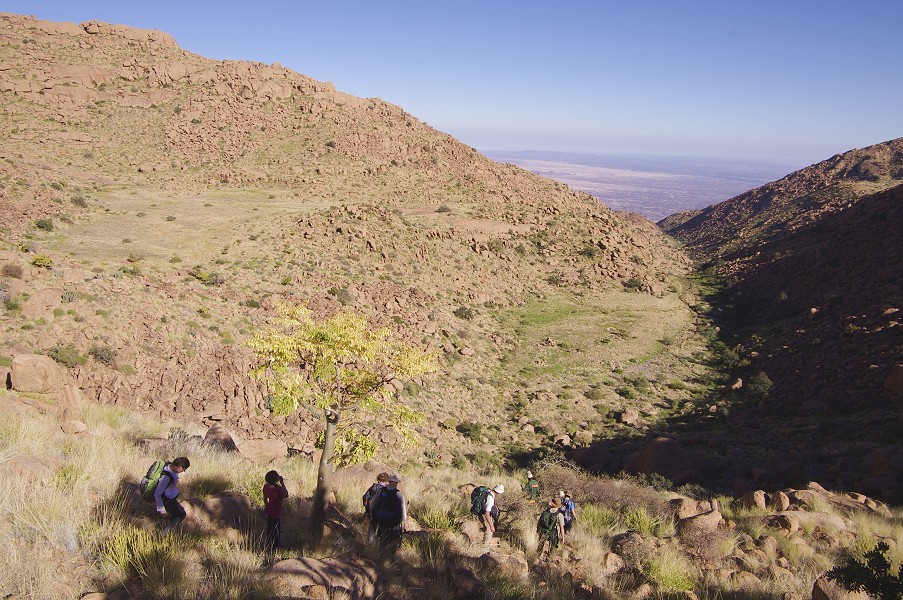
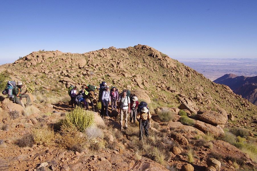
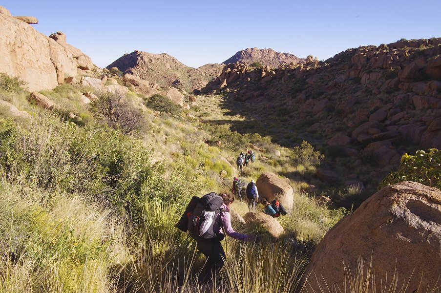
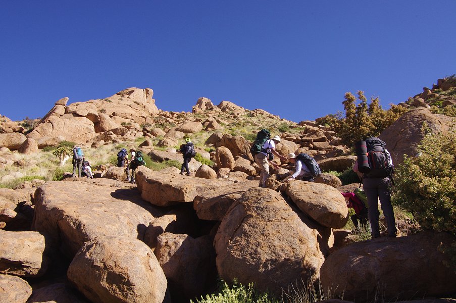
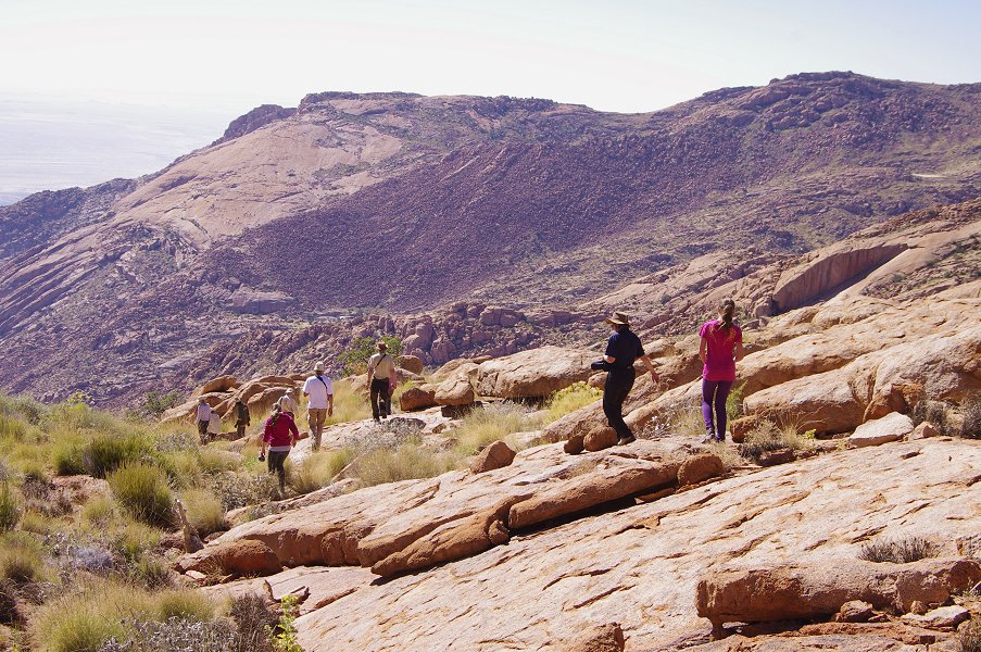
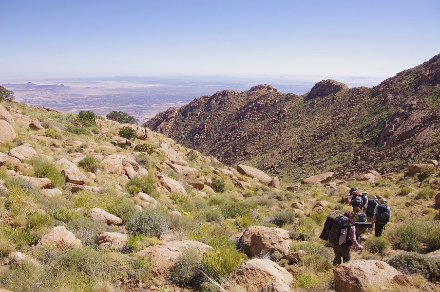
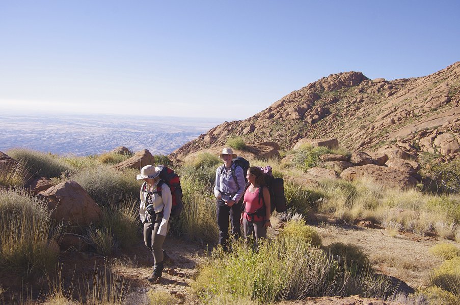
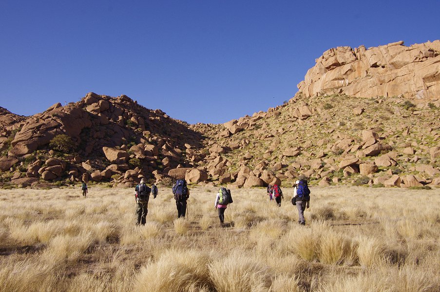
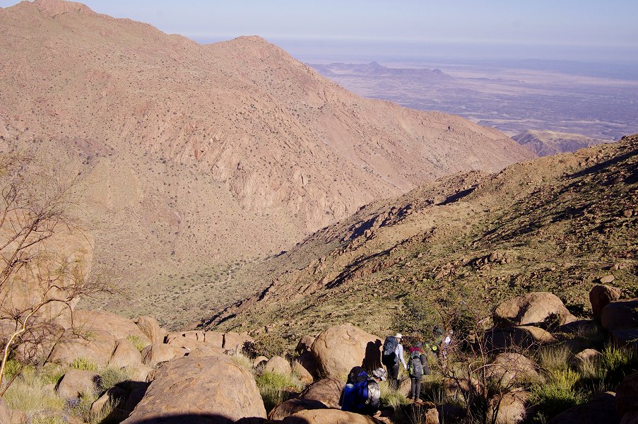
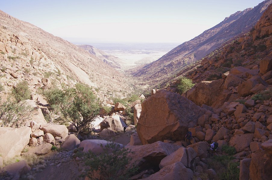
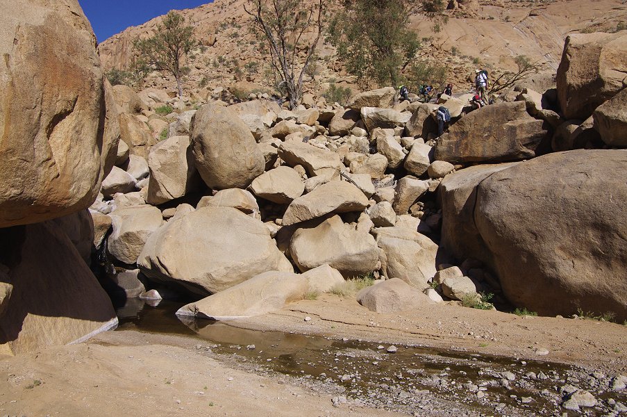
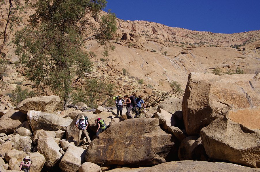
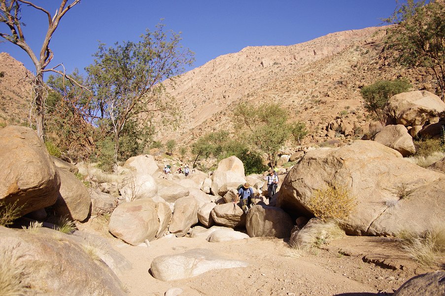
Day 3. - Ascent - Numas lower cascades sites
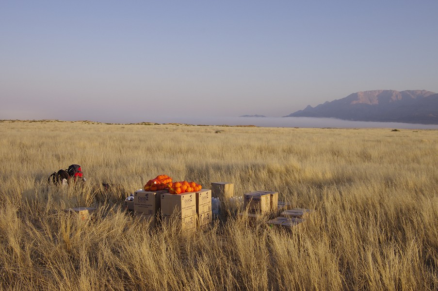
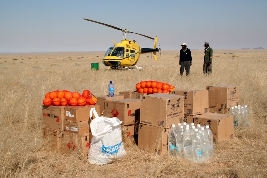
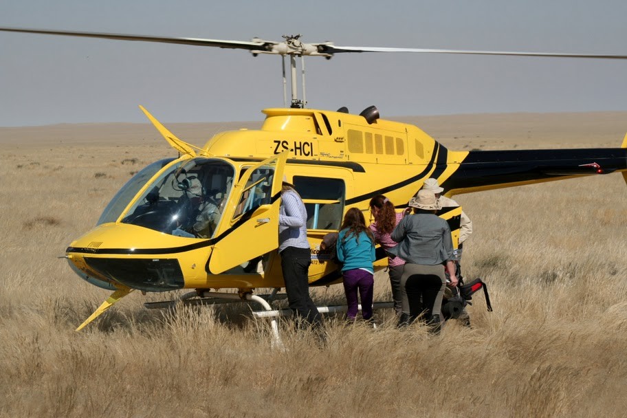
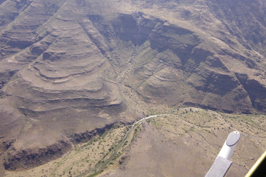
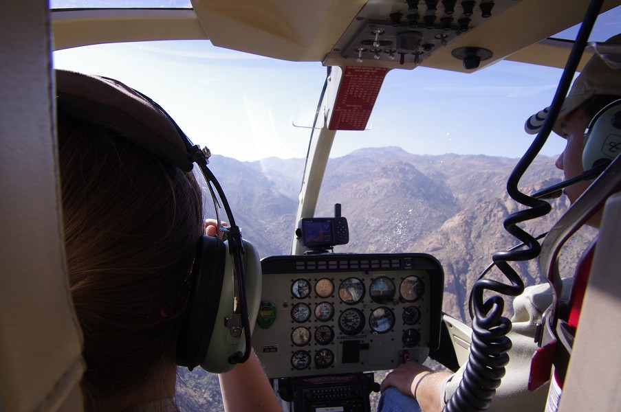
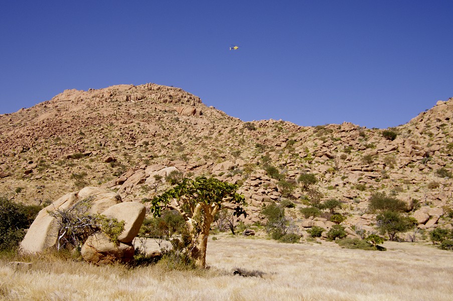
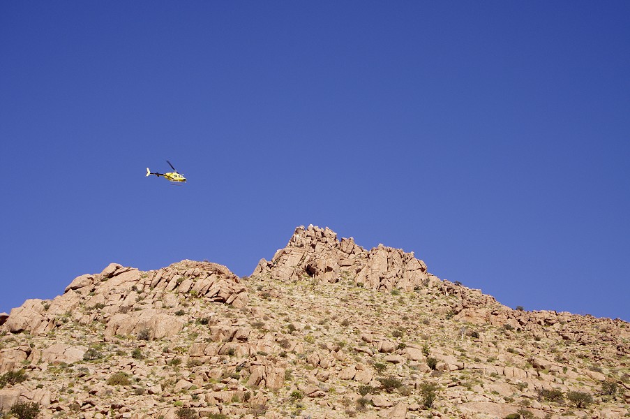
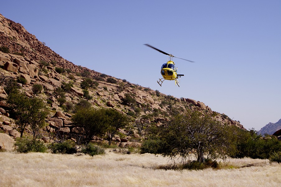
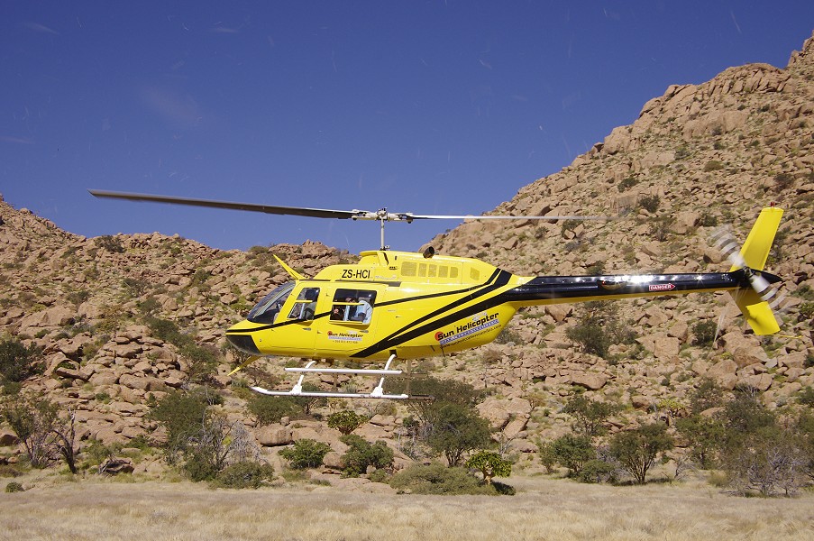
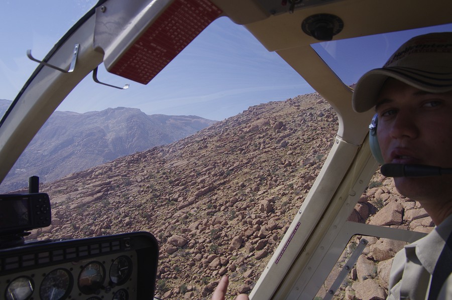
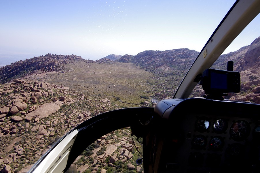
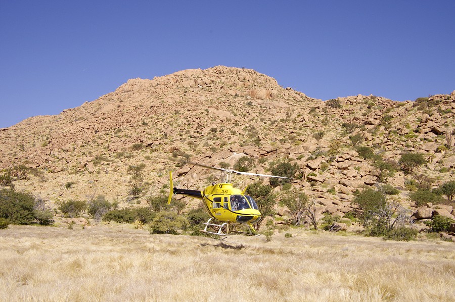
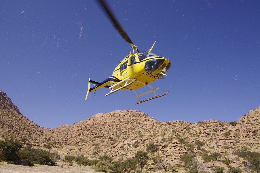
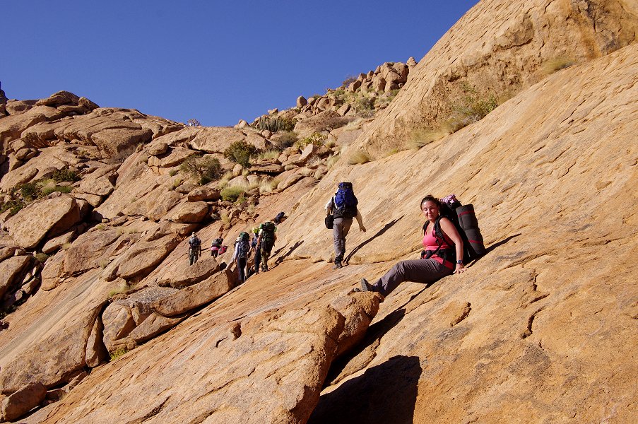
Getting up the mountain was a fairly complex task of logistics, as we have planned six depots of water and supplies to aid our treks from one base to another. Last year we have found that it is impractical to have to carry anything more than one days' supply of water, the heavy backpacks making progress very difficult. This time our camps and supply depots were planned around feasible-looking one day treks. Our helicopter was a Bell 206B, chartered from Sun Helicopters like last year.
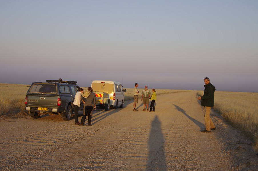
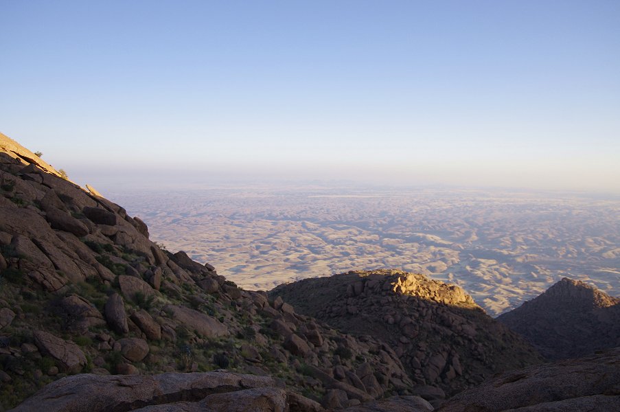
We had breakfast before sunrise at the White Lady B&B, then set out on a drive to the southern side of the Brandberg, to our agreed rendezvous point with the helicopter where the Hungorob/Messum river crosses the cape Cross/Brandberg West road. Karl from the White Lady provided support with his pickup, transporting two large drums of fuel for the helicopter, sufficient for the number of sorties we had to make. As we approached the intended spot, there was a small hiccup in the plan: a thick band of fog, rolling in from the Atlantic, reached all the way up to the western flanks of the Brandberg, obscuring our intended meeting point.
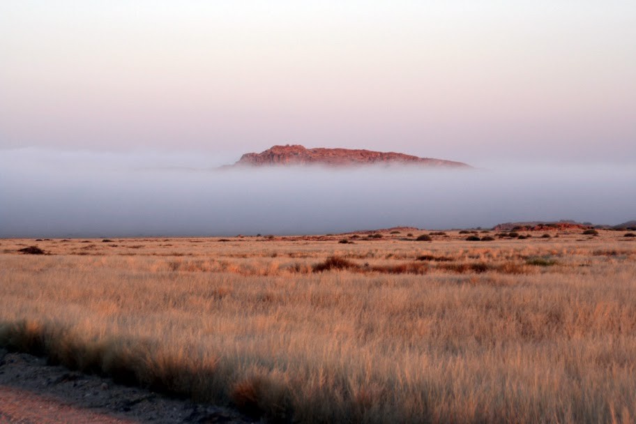
With our pilot being out of mobile coverage, it took some time to sort out a suitable spot from where we could start the ascent. It was from the plain south of Gaaseb gorge, a little off from our intended place, but not adding any material time to the actual flight times.
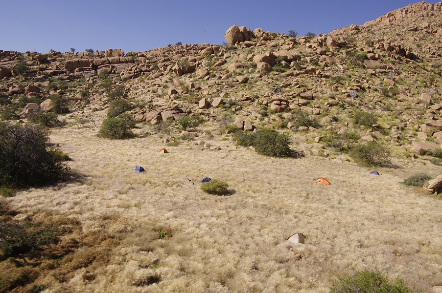
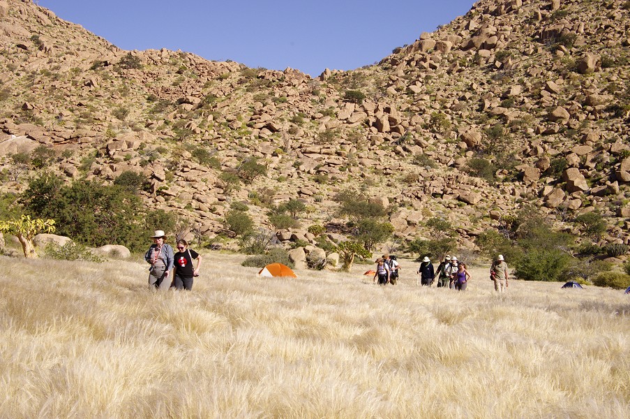
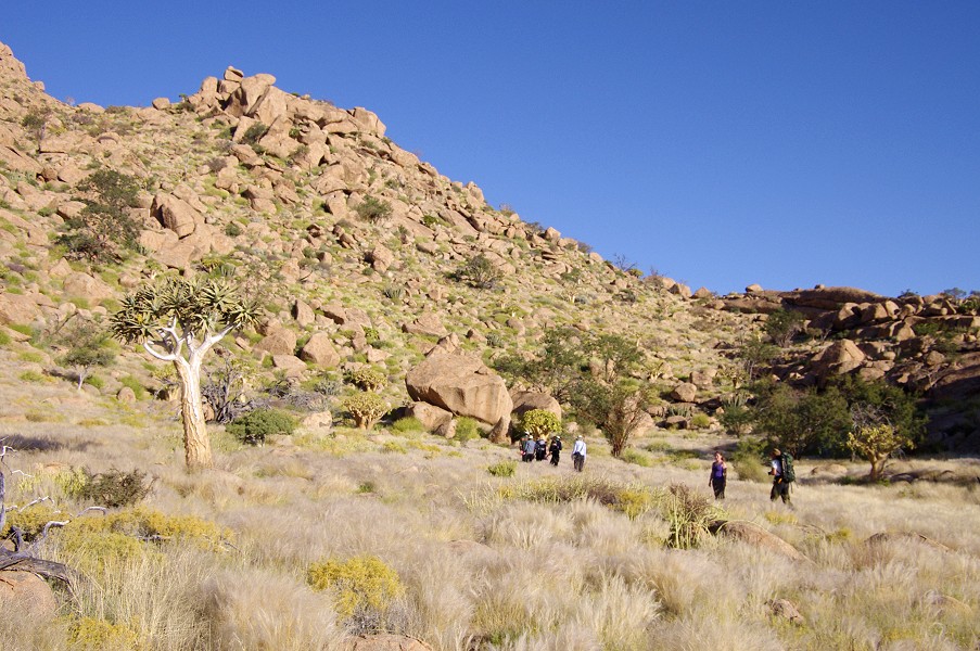
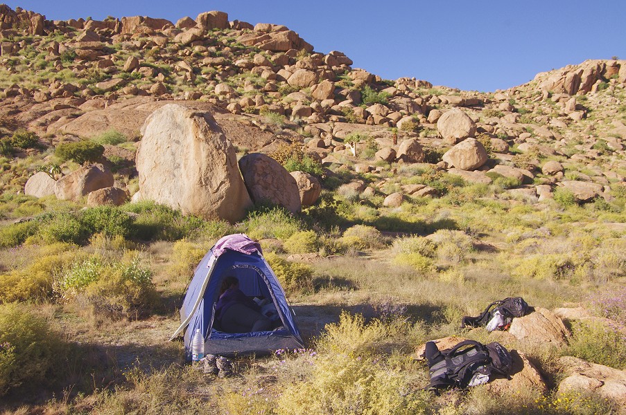
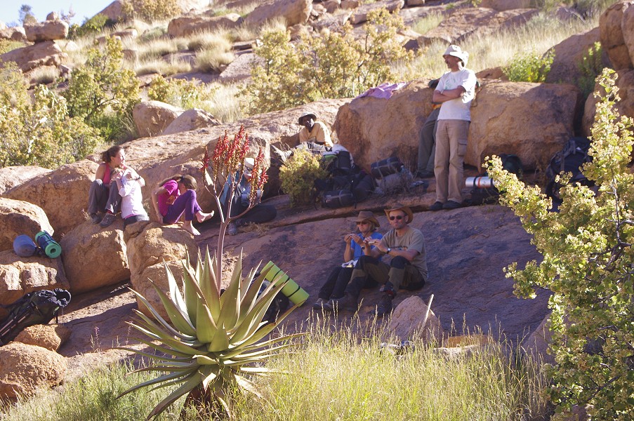
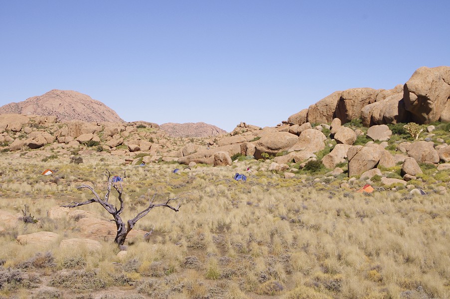
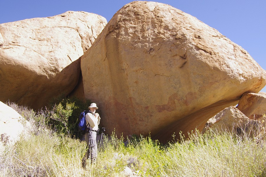
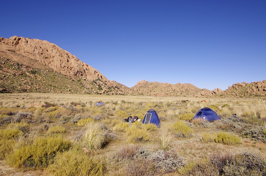
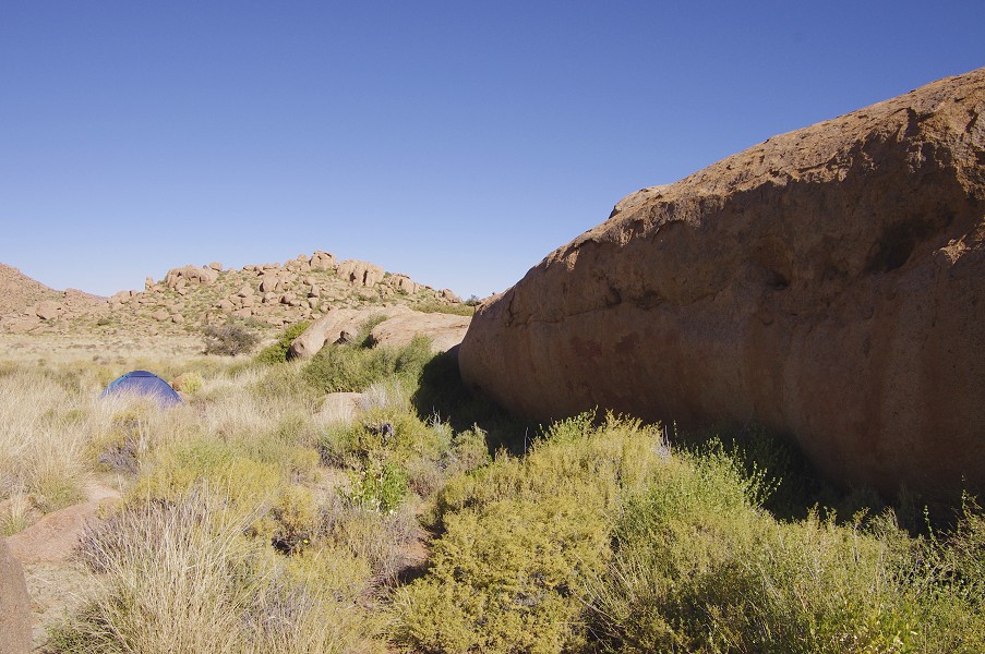
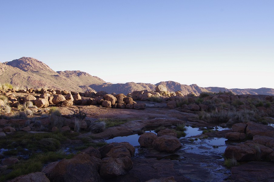
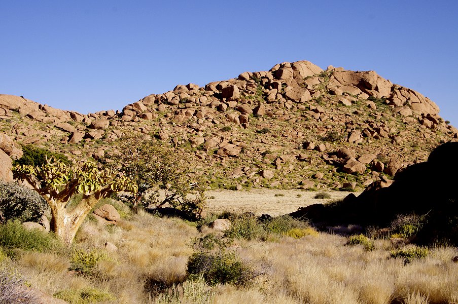
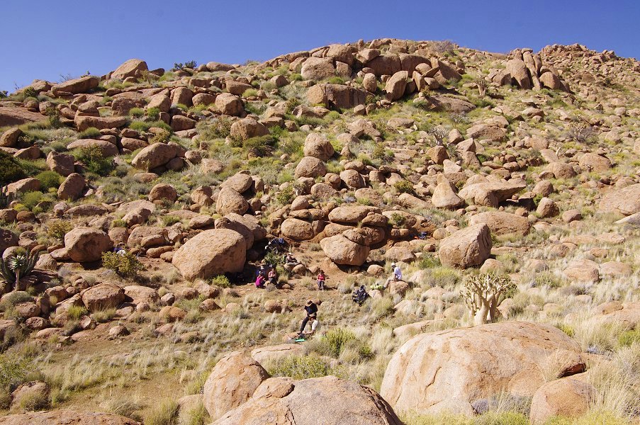
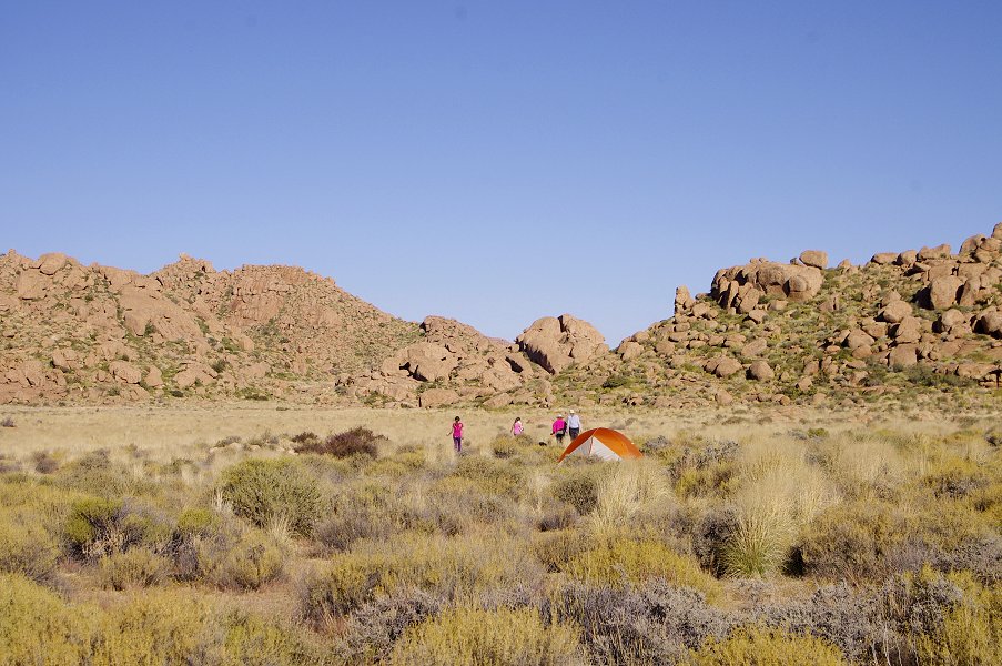
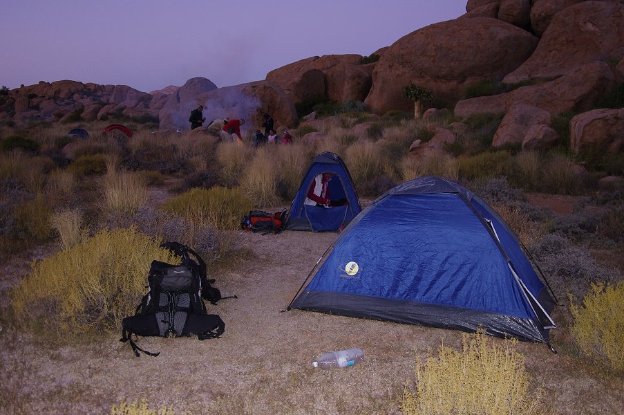
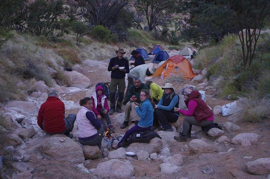
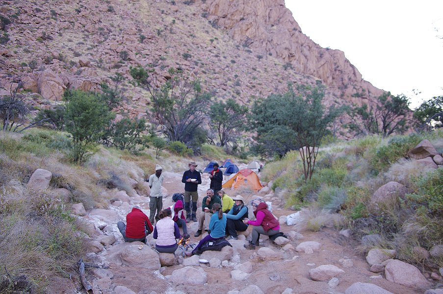
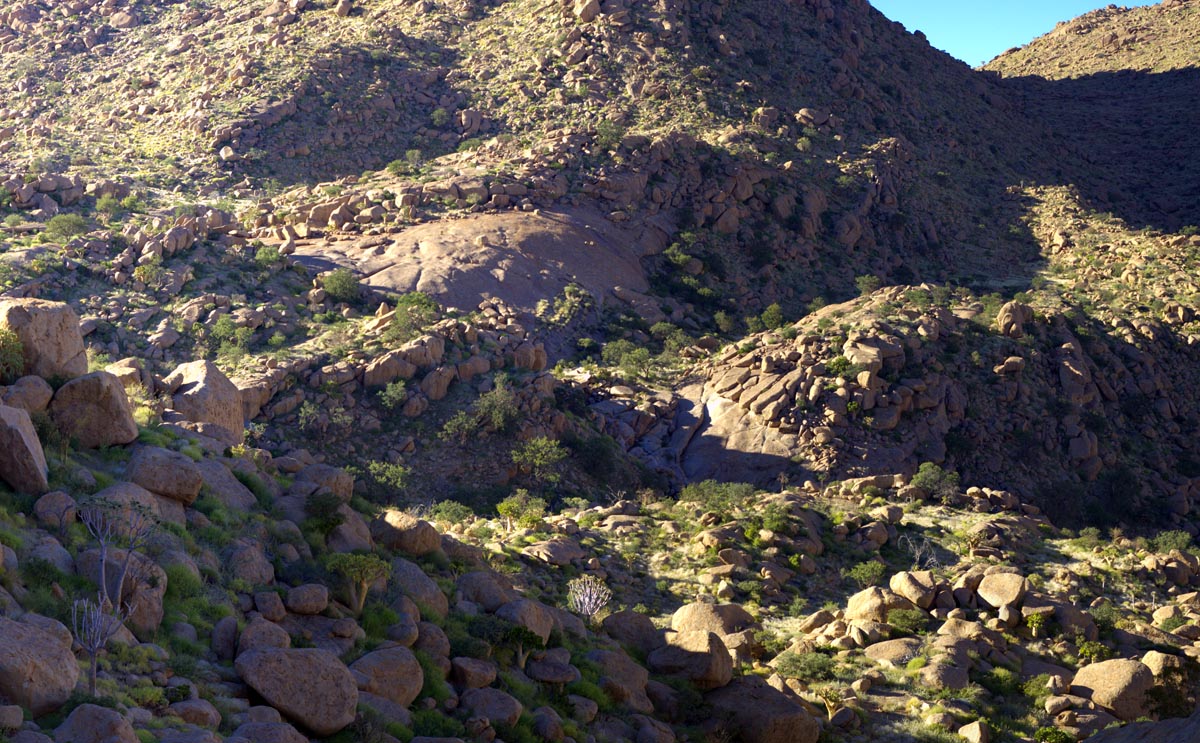
Our first base camp was in the Silberweide, a small flat basin in the middle Numas valley, offering a good spot from which to visit the upper Amis sites, and start our trek to the upper areas. It took us four flights in rapid succession up the Hungorob gorge and across the dividing col to get everyone and the supplies up to the first base, with those already up starting to prepare camp for the coming two days.
We just had enough fuel left on the last flight to continue with Jon for a quick dump in the Okapi Valley of upper Numas, then the helicopter had to return to the plain below for refuelling.

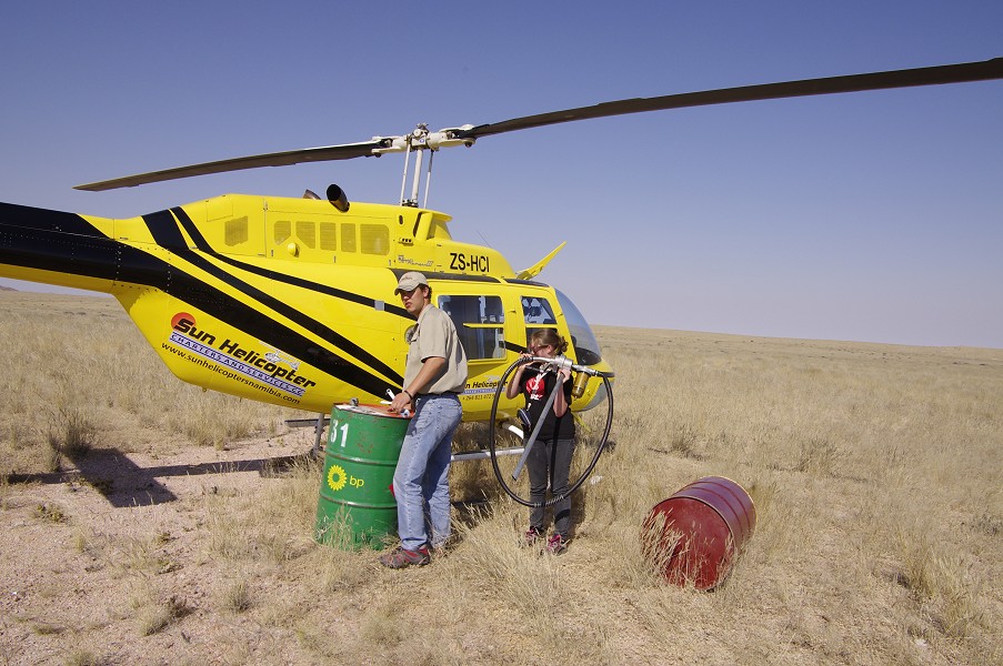

With tanks full, I made a long flight with the aircraft loaded to near maximum, to make our three dumps in the Naib Basin, the Engelhard Plain, and on the Porters Plateau. The first landing was tricky, with the many trees offering very few sufficiently clear spots. The Engelhard plain looked easy, until I got out and sank to the ankles into the soft waterlogged muck, with the helicopter skids already starting to disappear. Herman, our pilot made a quick getaway, and hovered about until I could find a reasonably firm spot some hundred metres away. It would have been decidedly embarrassing to get the helicopter stuck there... Unloading took some time, then we proceeded to the Porters Plateau, suspended on the edge of the sheer western slopes of the mountain for the last dump, before returning to the road for a final refuelling, and our good-byes to Karl.
While away the others have prepared the camp, on our return Jon made a shoth last flight to place supplies at a dump in the Upper Numas, then the helicopter left and we stayed alone with the mountain.
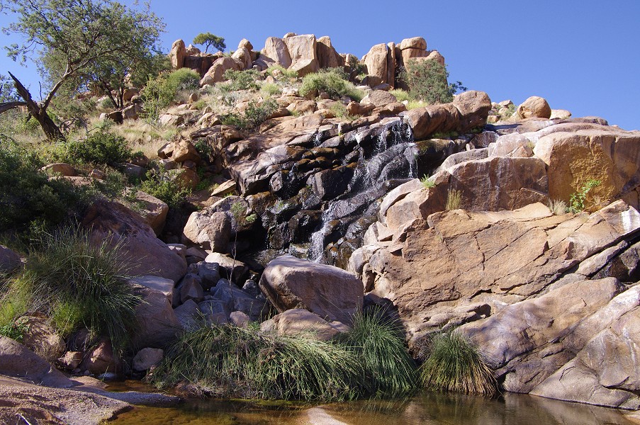
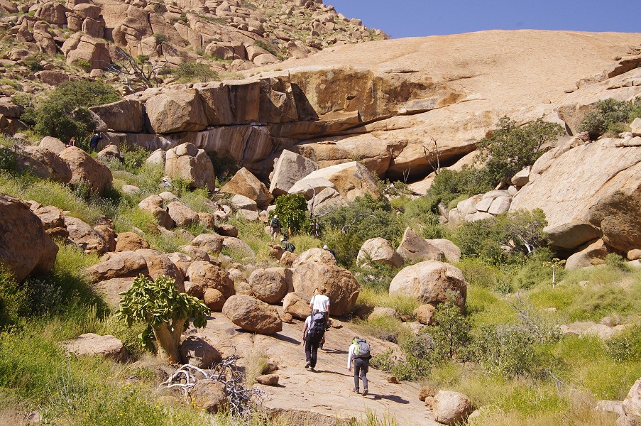
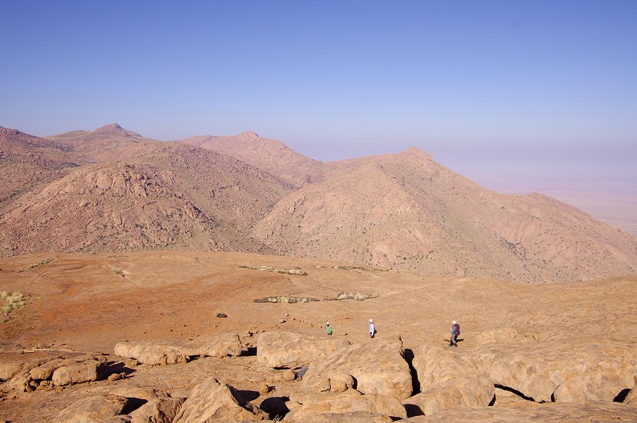
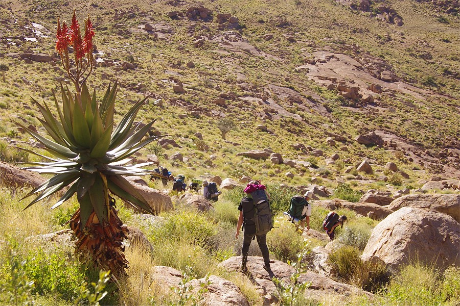
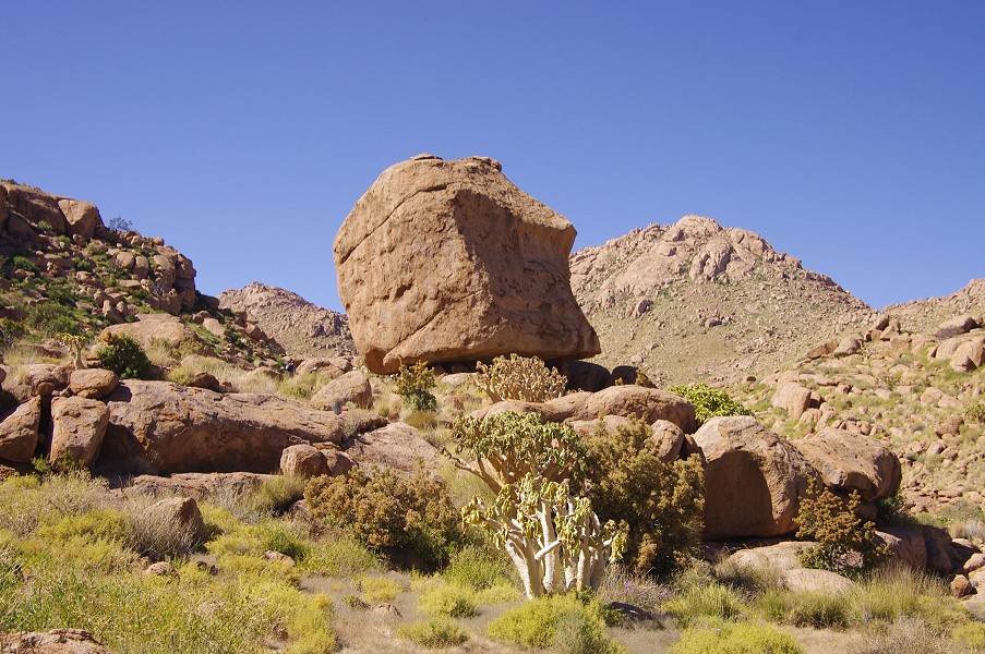
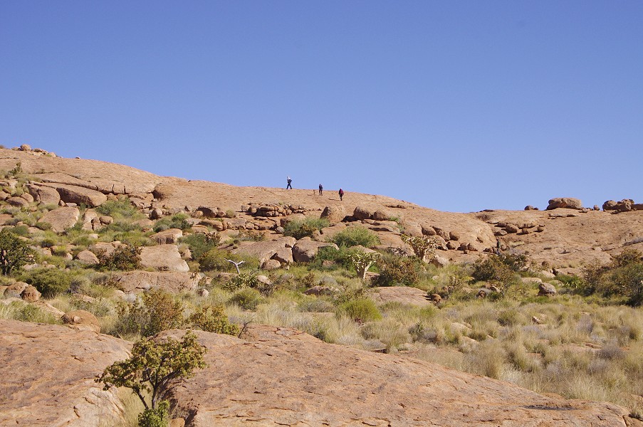
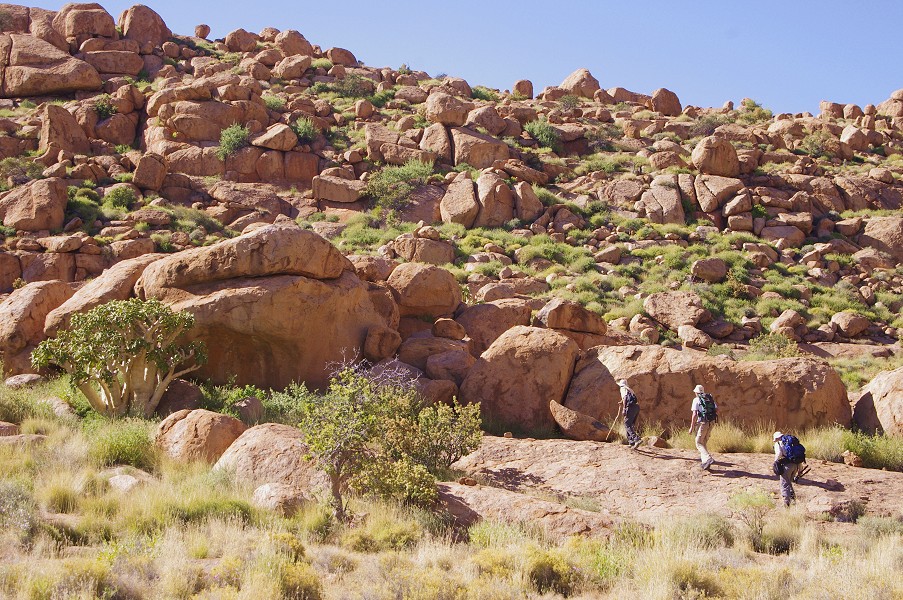
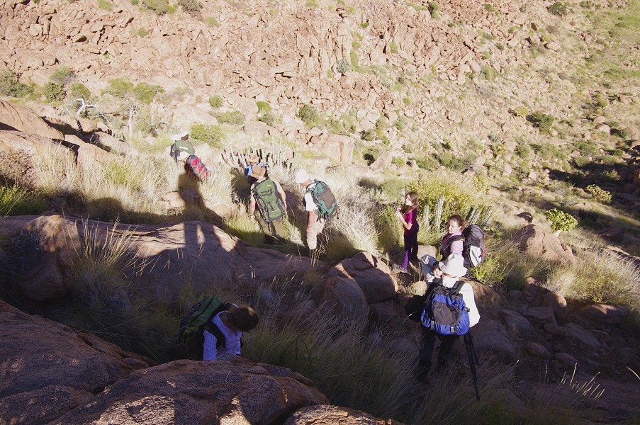
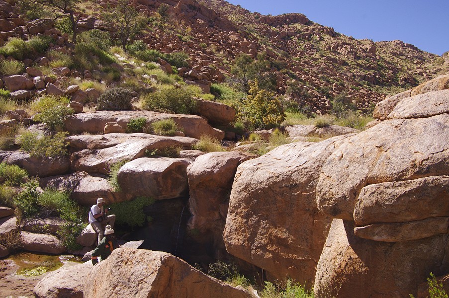
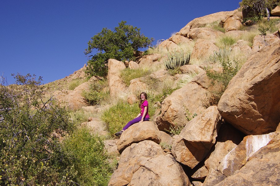
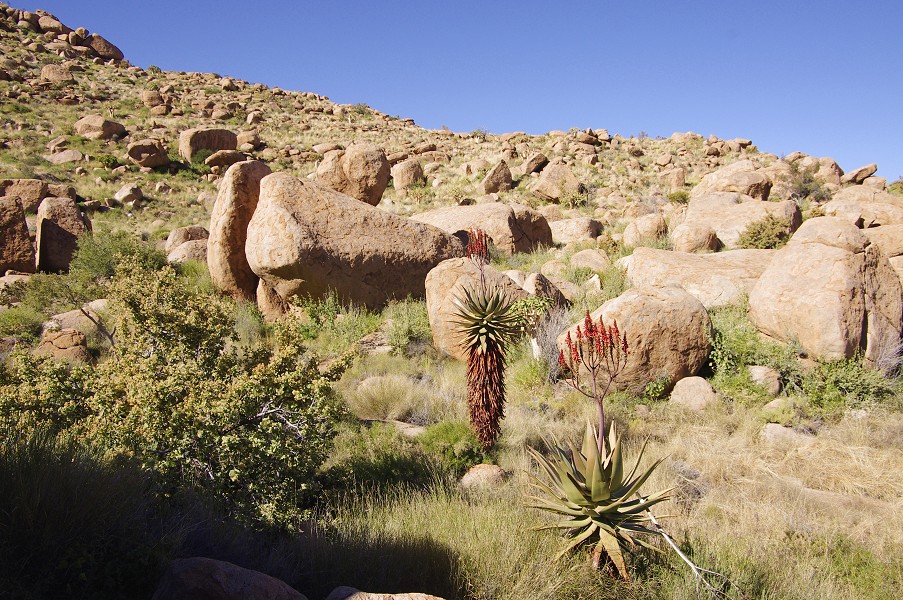
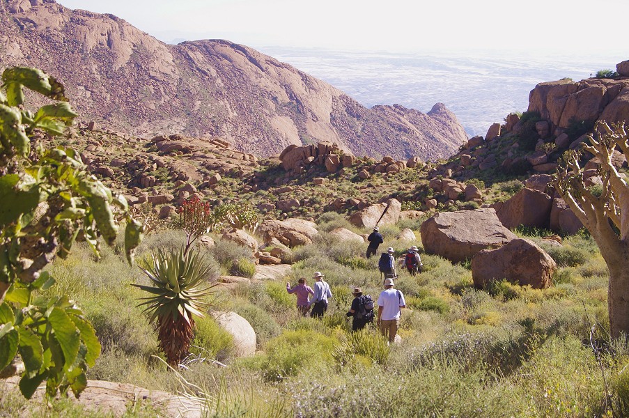
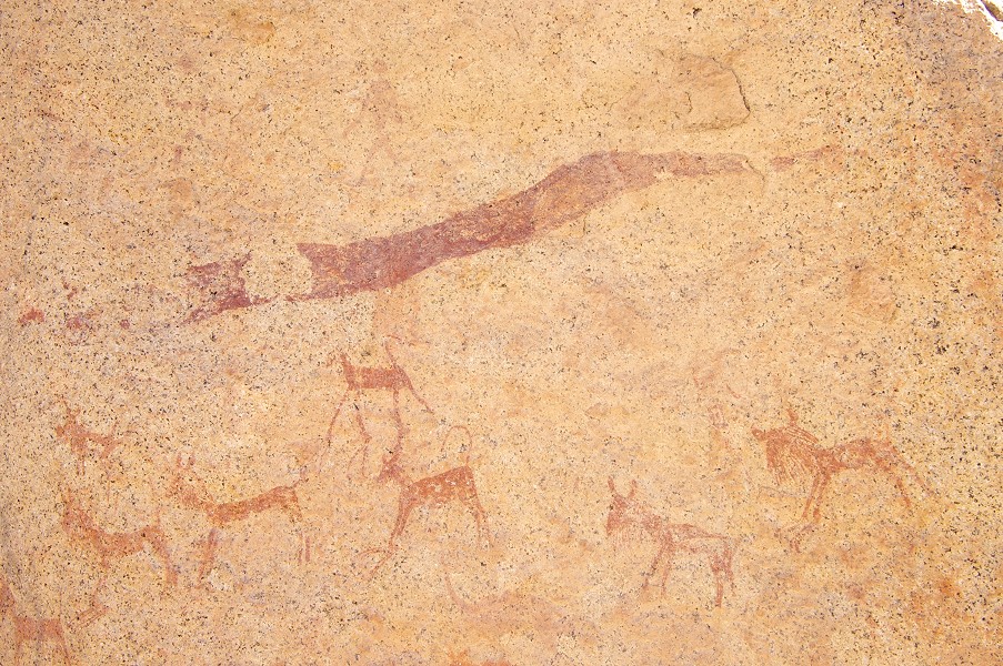
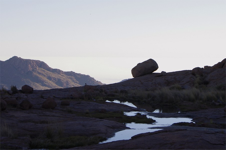
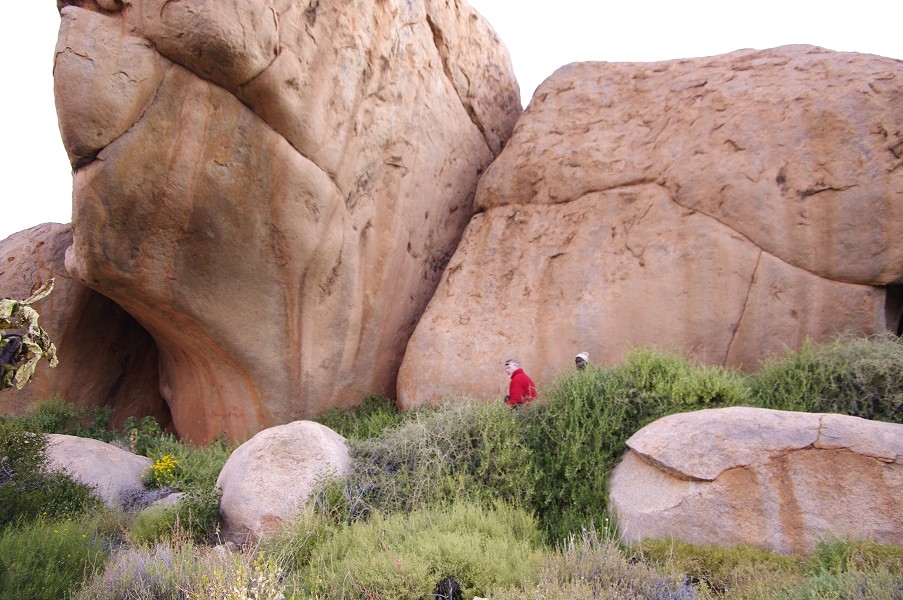
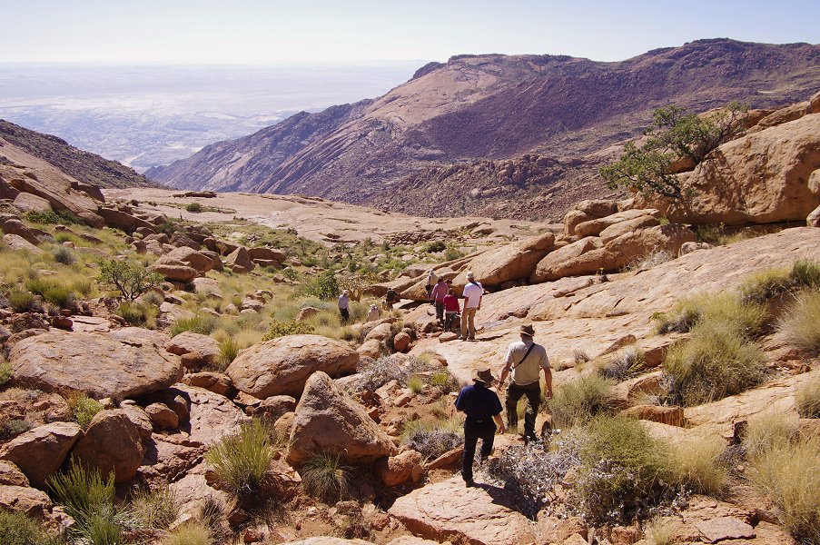
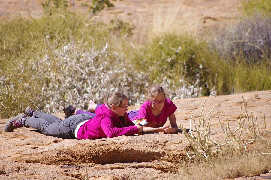
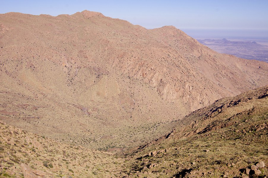
After a quick lunch we were ready to set out to see the rock art sites in our vicinity. The main Numas cascades were just a short walk from our camp, and showed a miraculously altered state from the previous year. Now the stream was still in flow, with a series of trickling cascades in the place where last year we only found bare rock.
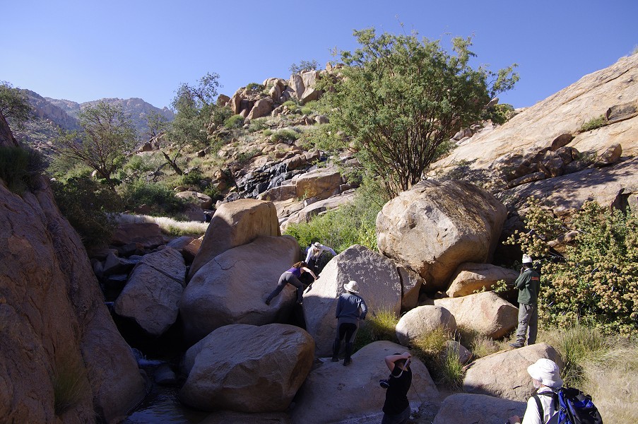
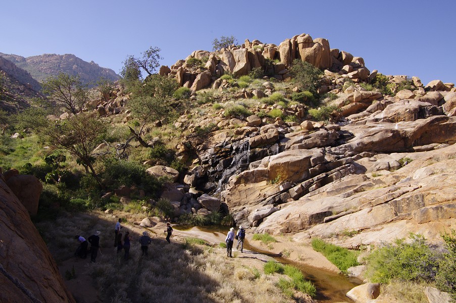
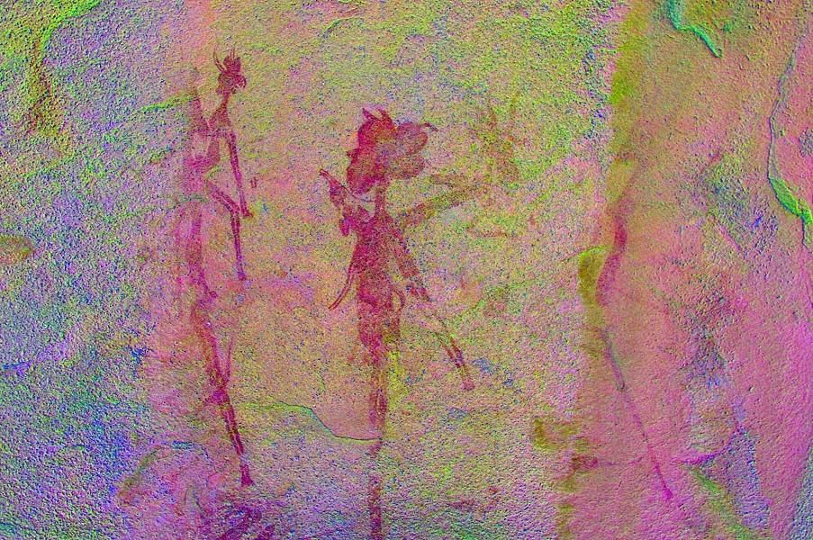
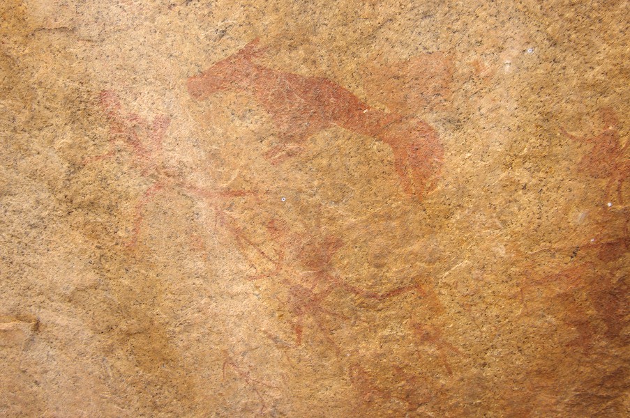
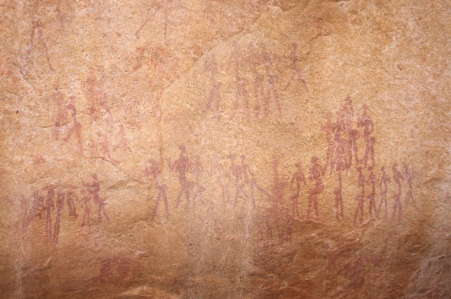
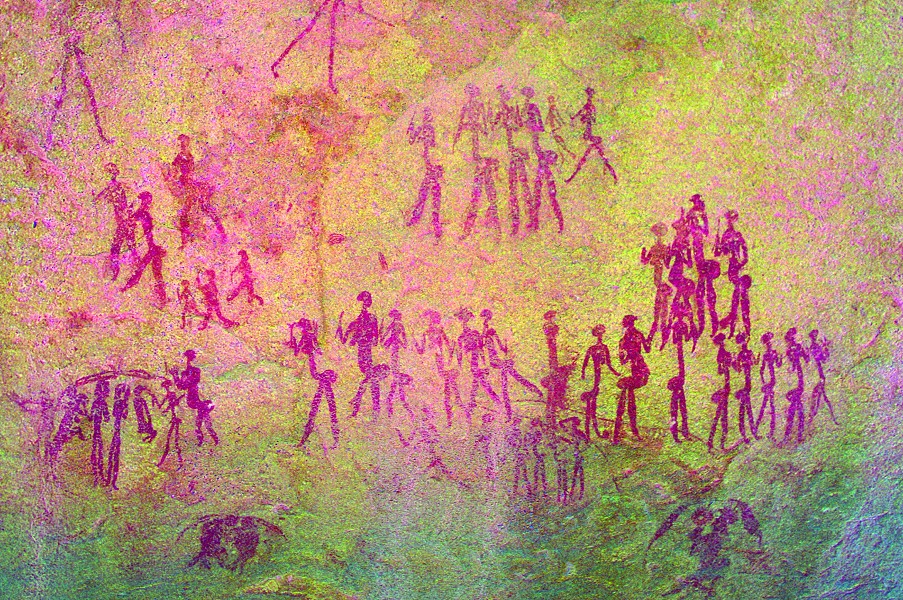
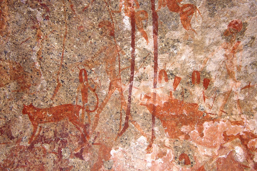
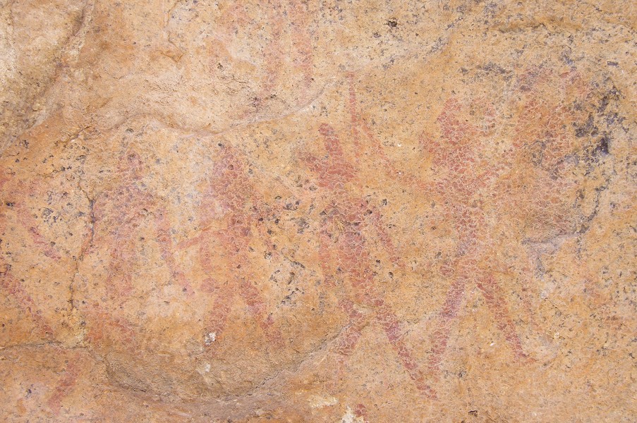
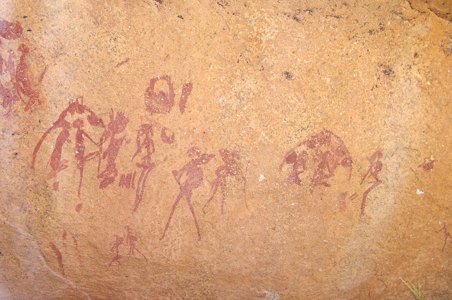
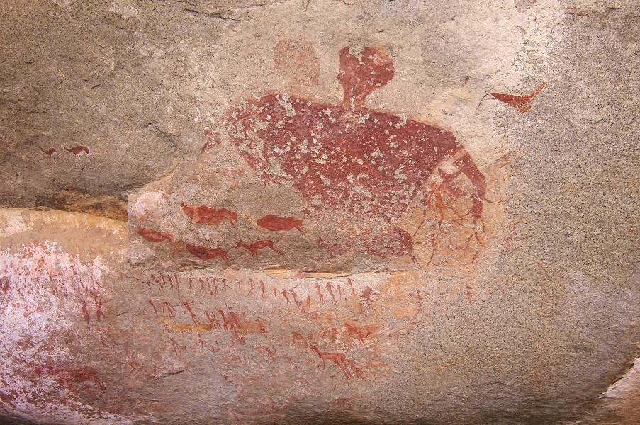
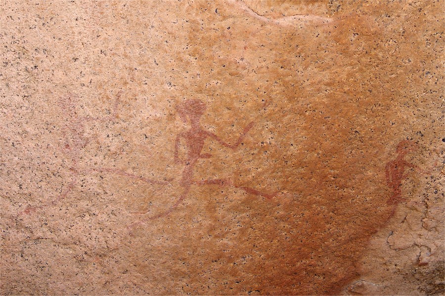
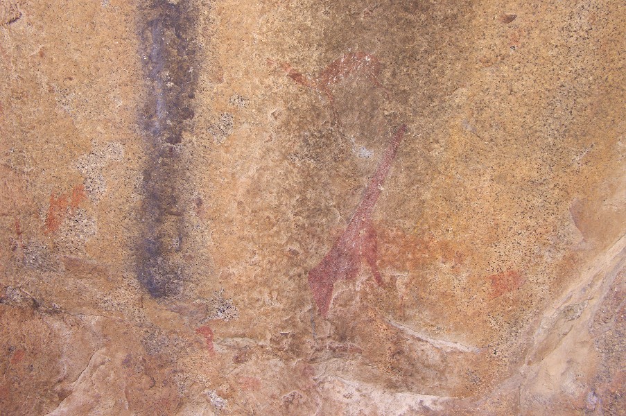
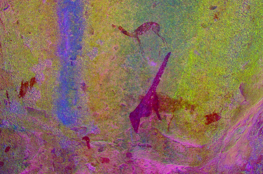
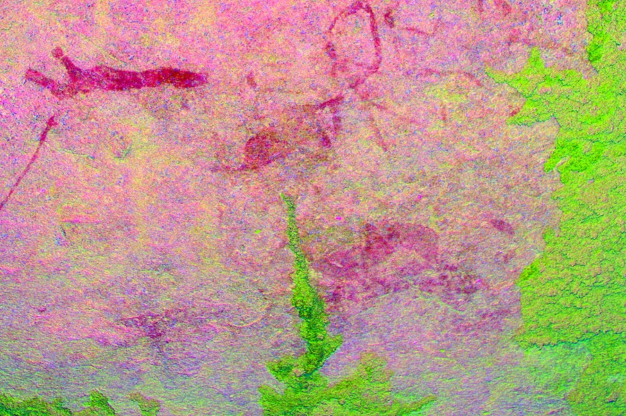
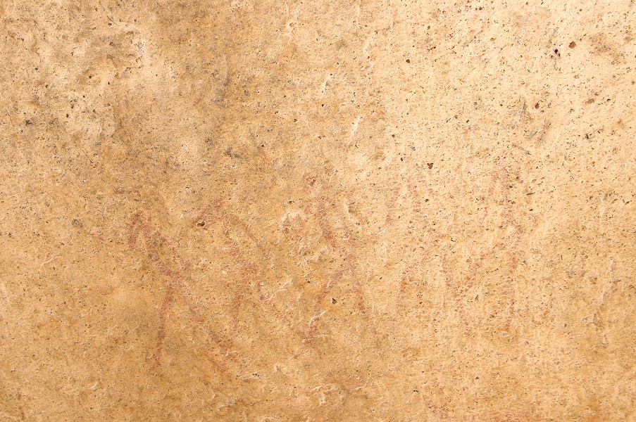
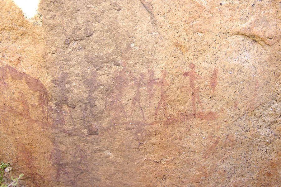
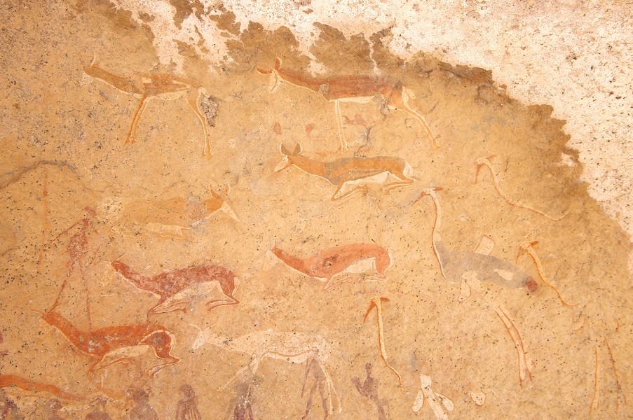
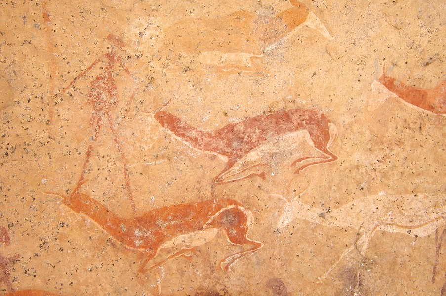
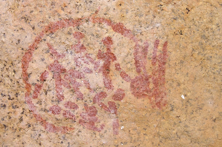
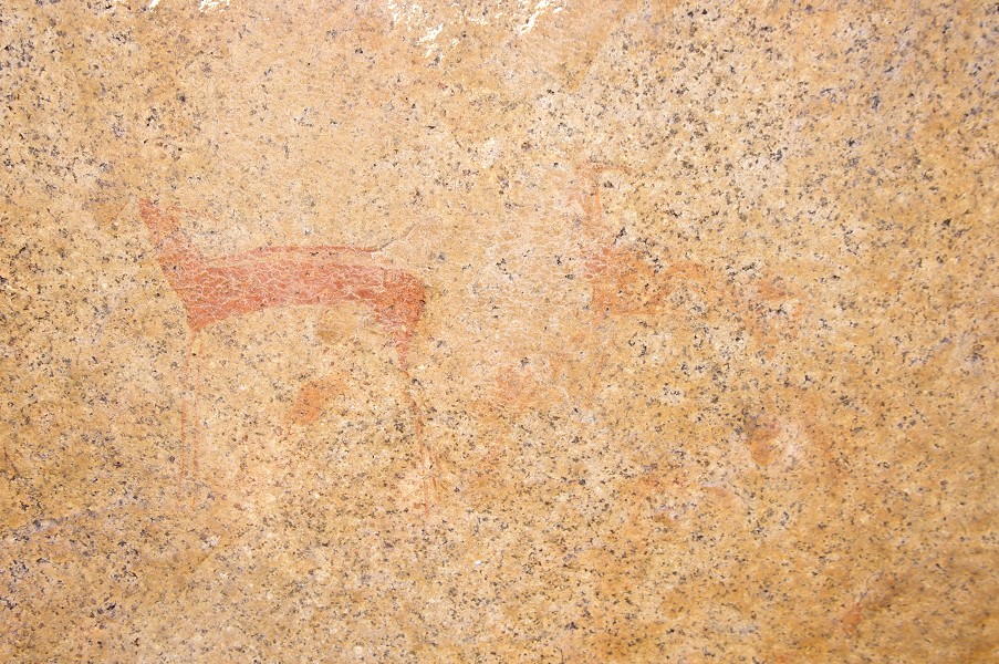
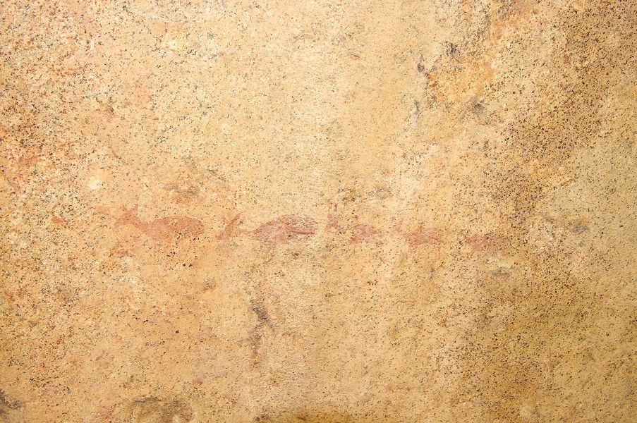
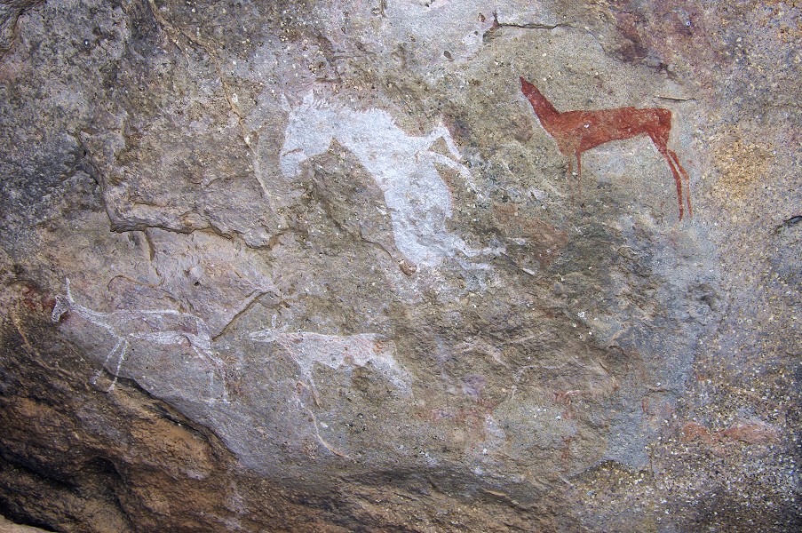
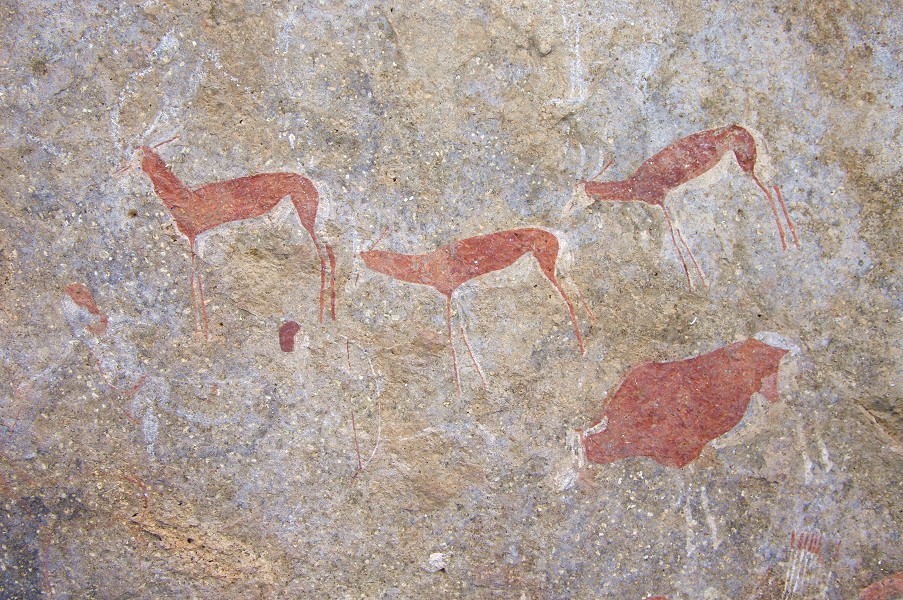
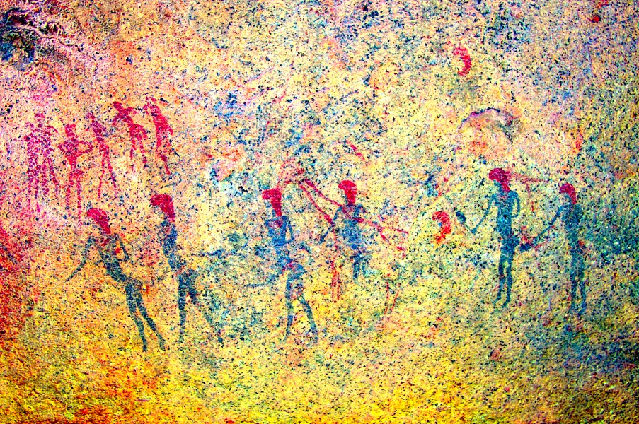
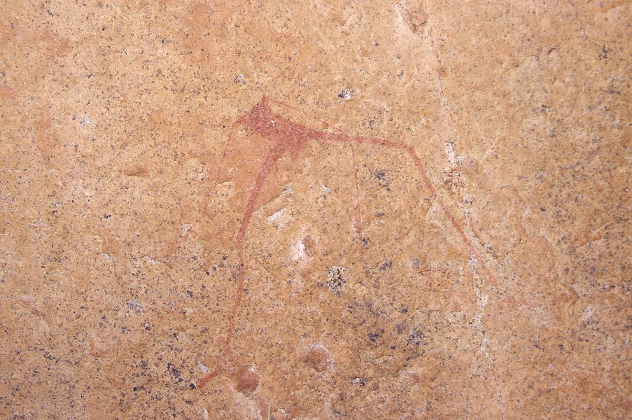
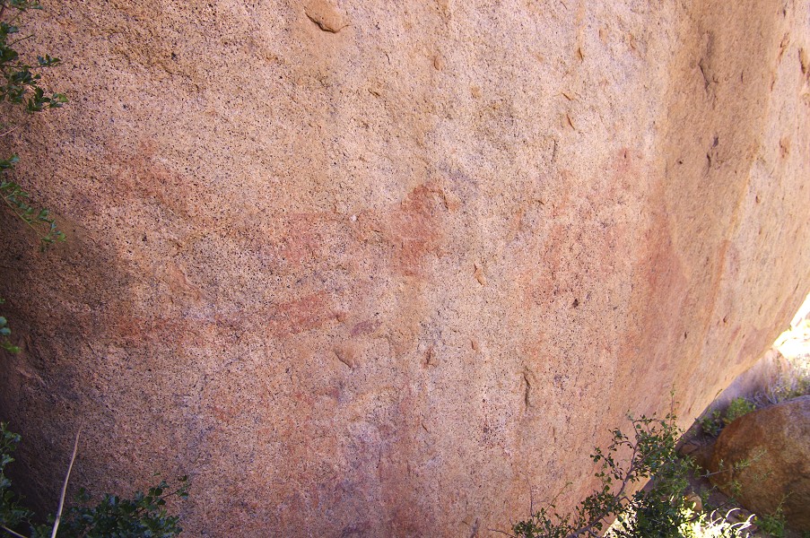
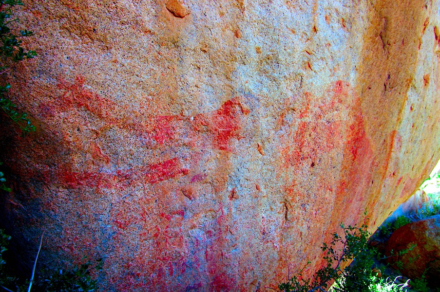
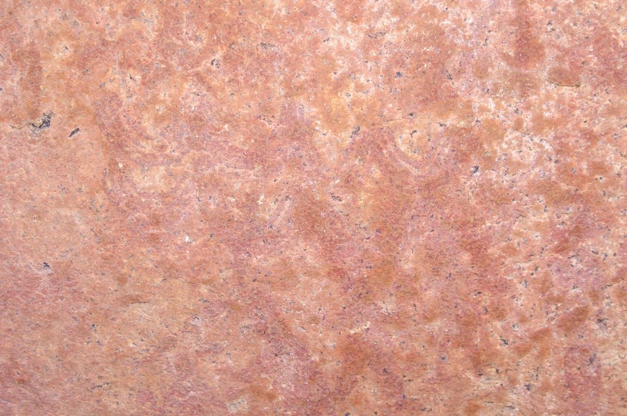
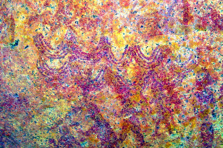
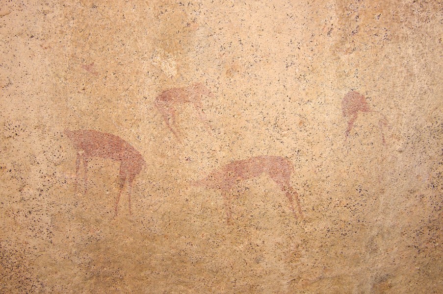
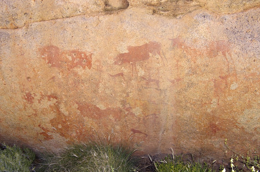
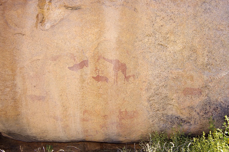
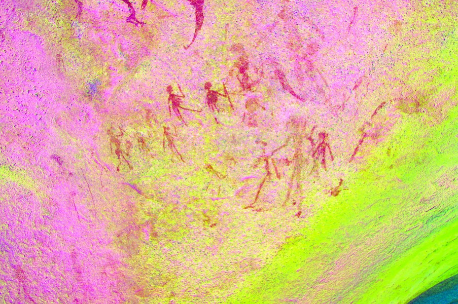
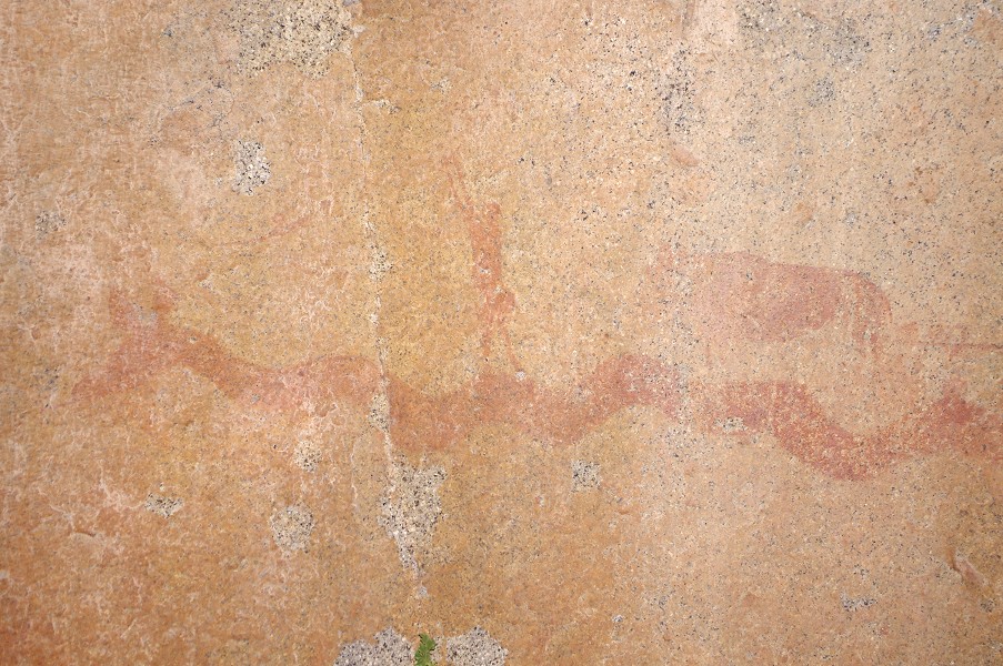
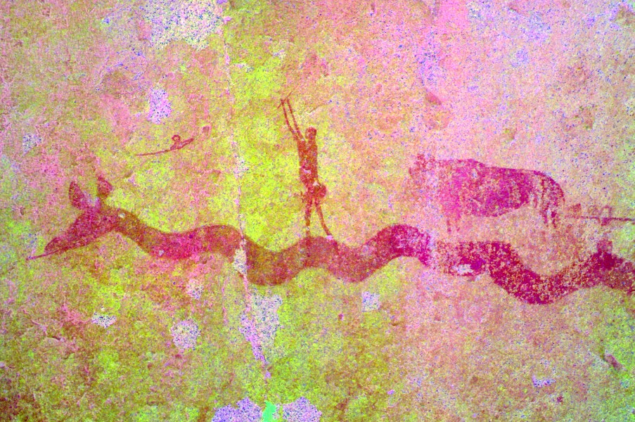
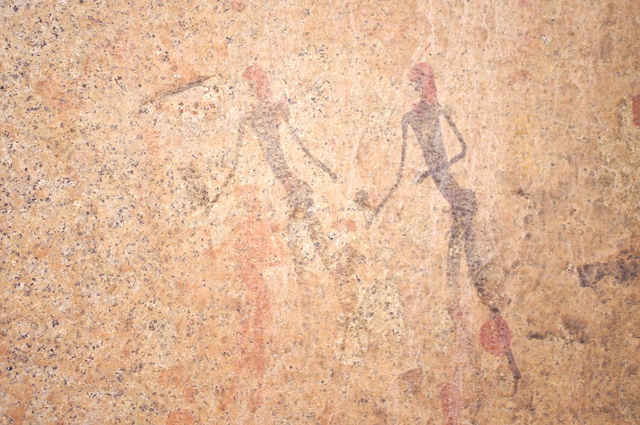
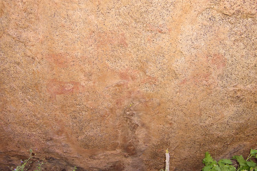
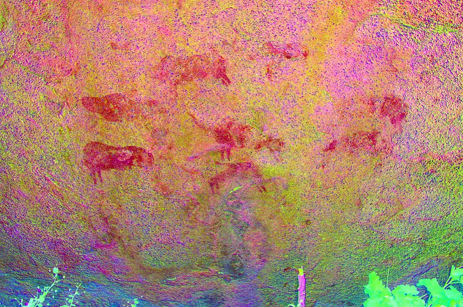
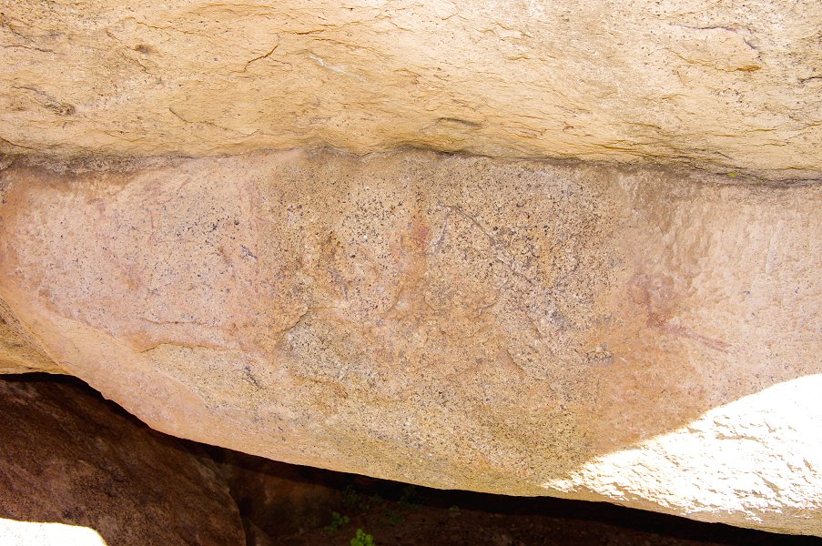
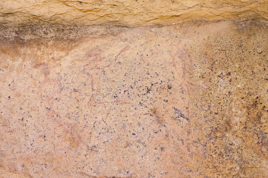
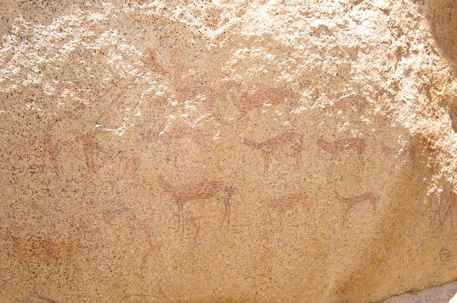
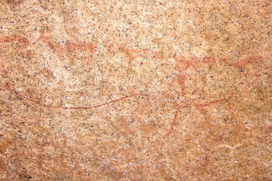
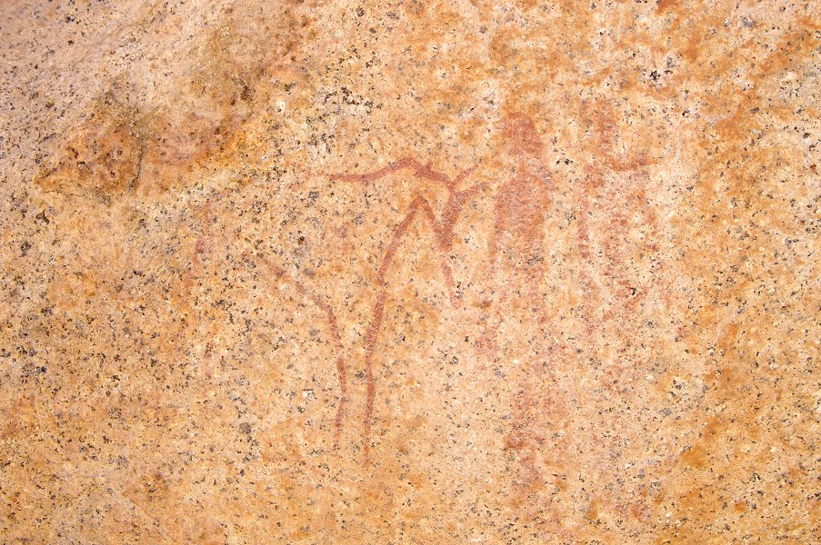
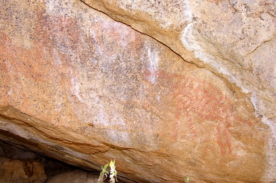
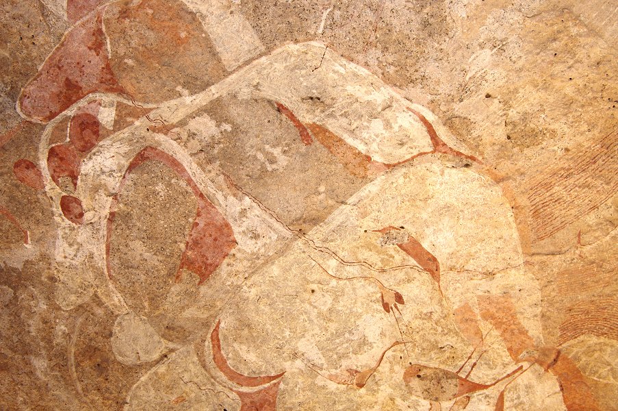
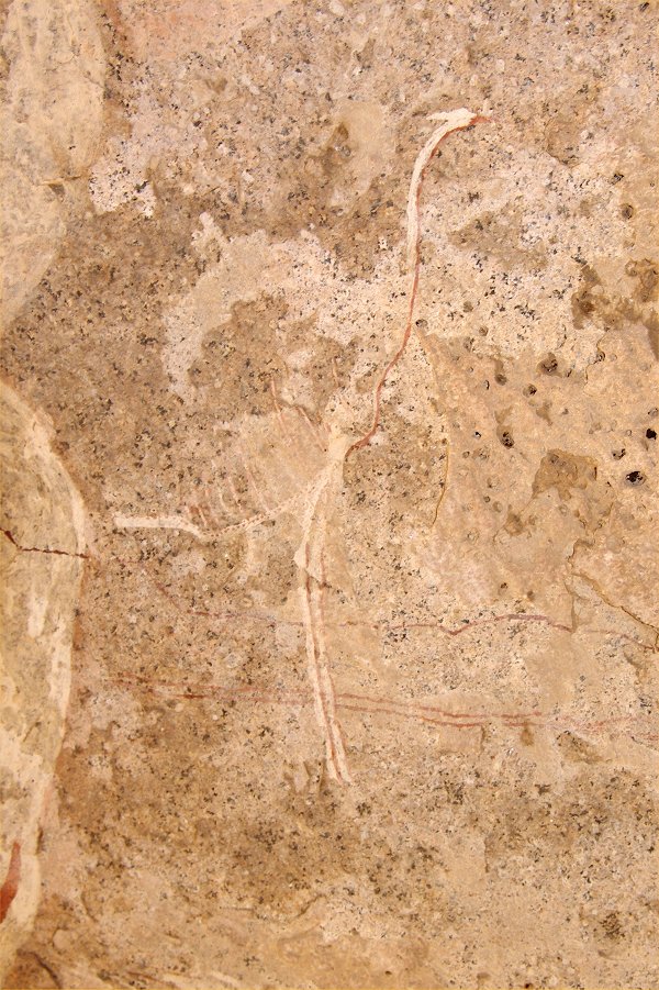
We continued to the top of the cascades, where last year we found a single and not too well preserved painting site (N23). However processing photos of some of the scenes with dStretch reveals some amazing details.

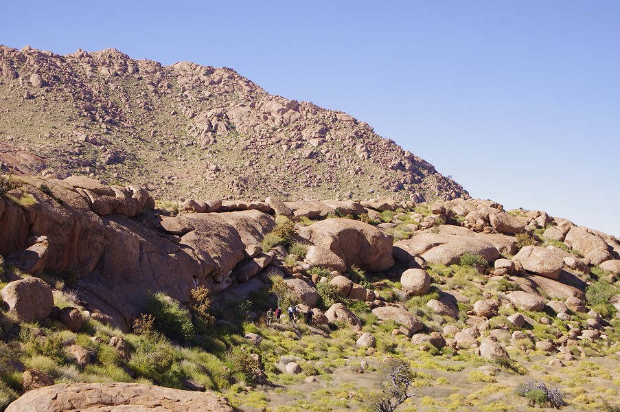
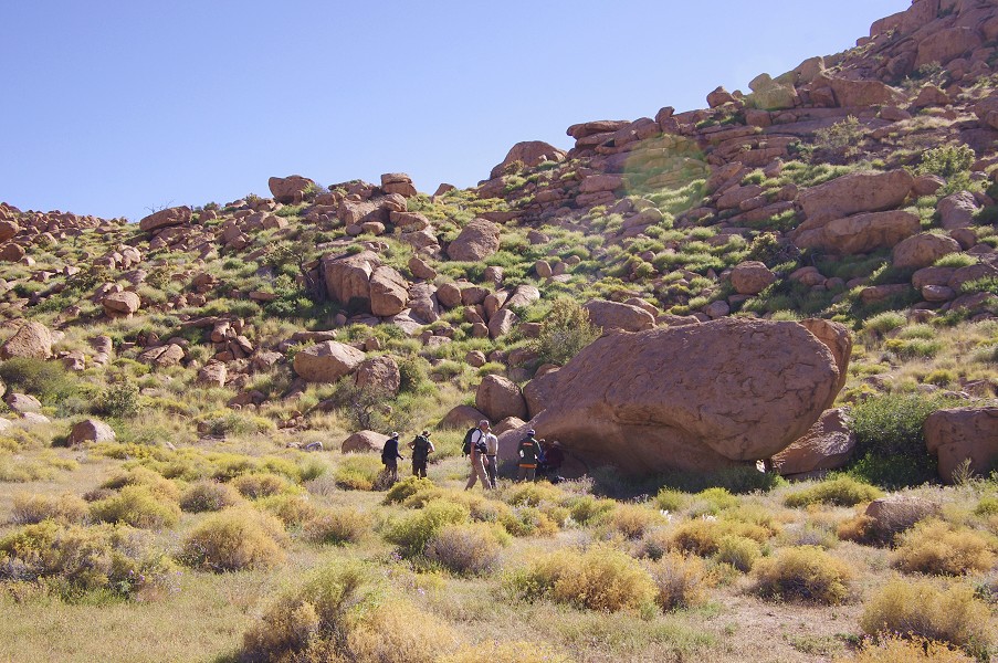
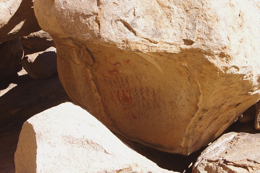
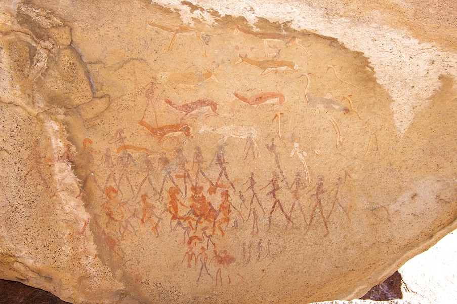
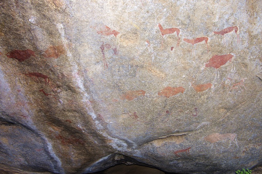
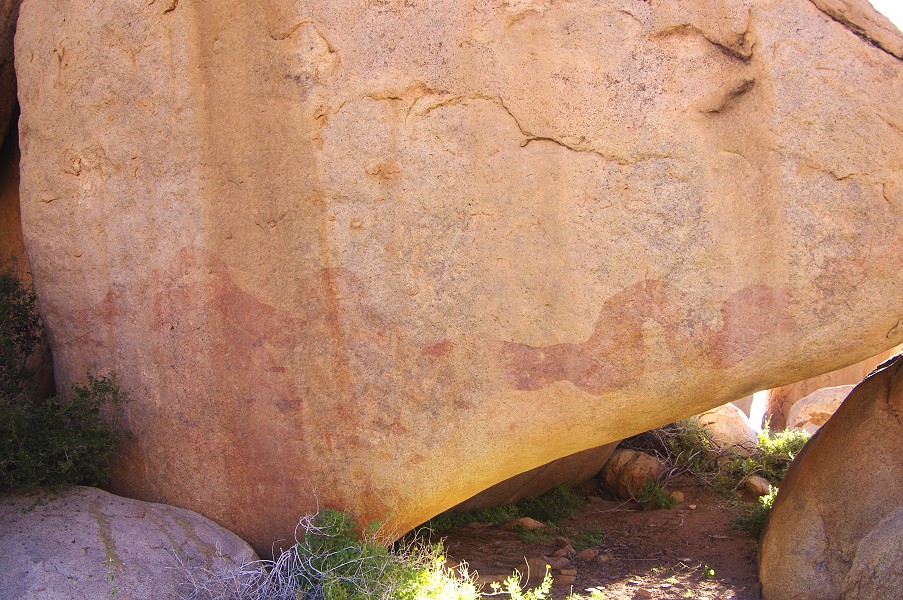
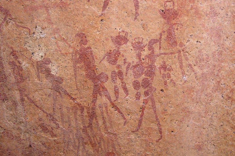
There are another half dozen or so sites in the vicinity, including one of the most important middle Numas sites (N25). Angula led us straight to it, avoiding the repetition of some of the long and sometimes futile searches we had to do on the previous trip. This site was spectacular, with several large well preserved panels.
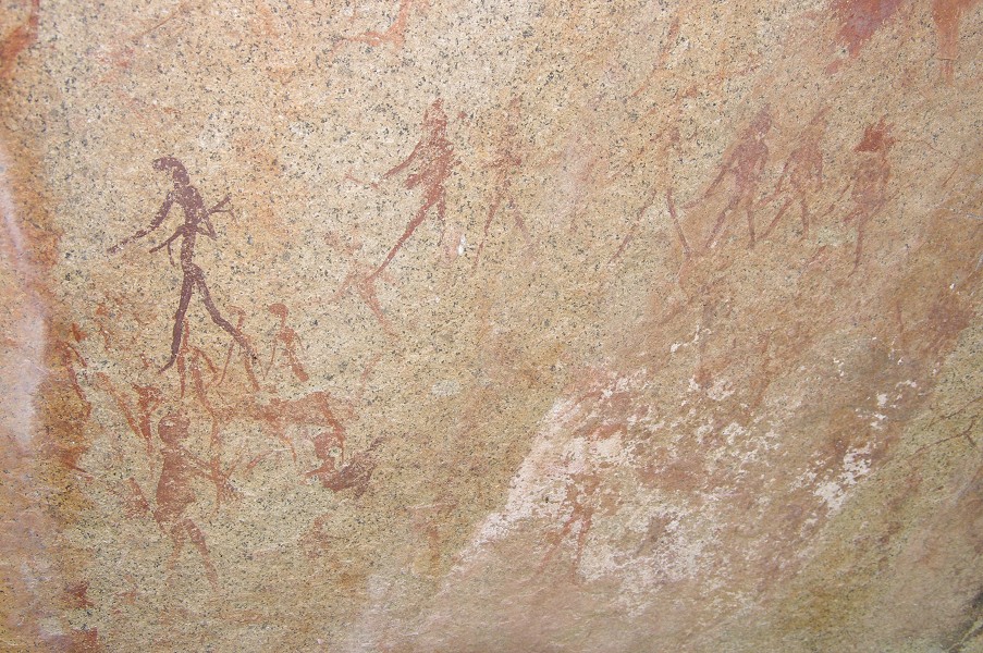
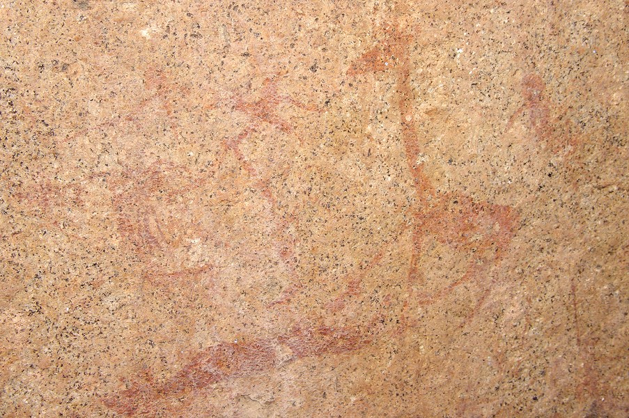
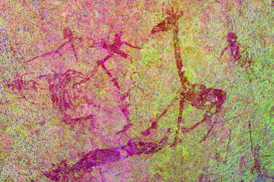
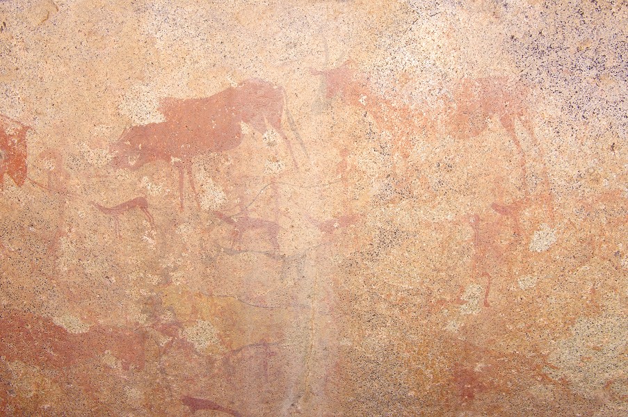
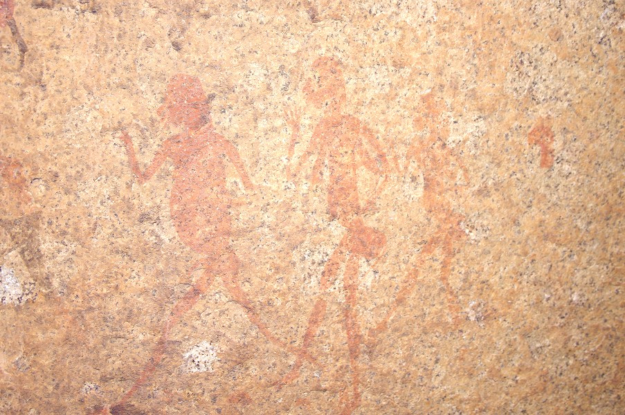
On our return we crossed the stream, passing by some of the huge eddy holes, and climbed to a large boulder some distance on the far side, site N28. While the preservation was not as good as the one we visited earlier, with dStretch it is possible to clearly make out some very complex and intriguing scenes.


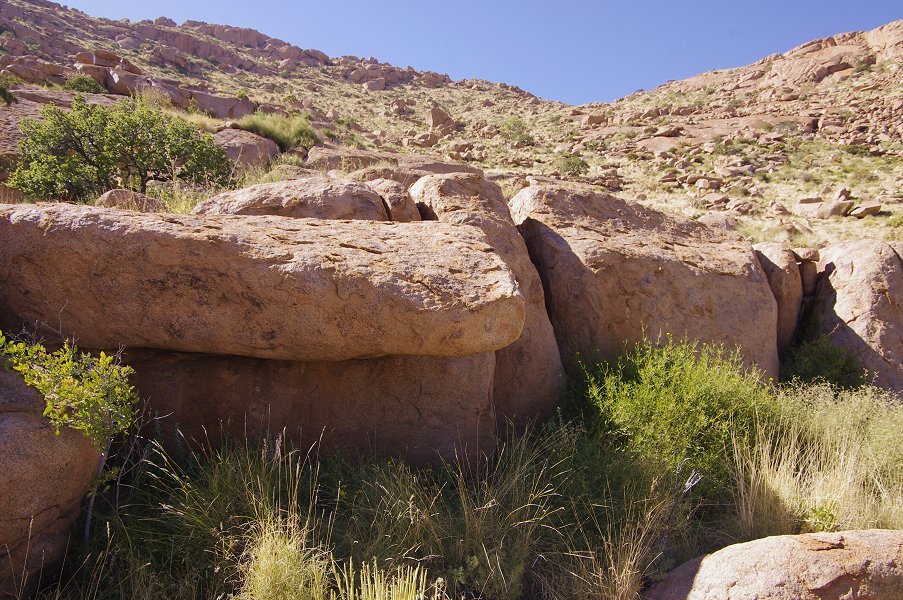
Cutting across the ridge towards camp, we passed by N21, a large well preserved site on the side of a large boulder which we came upon by accident the previous year.
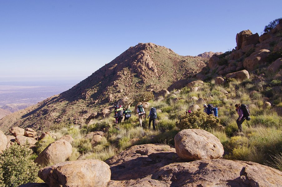
Day 4. - Upper Amis Gorge & Hungorob Plates
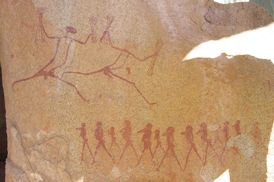
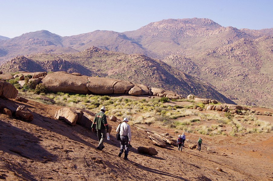
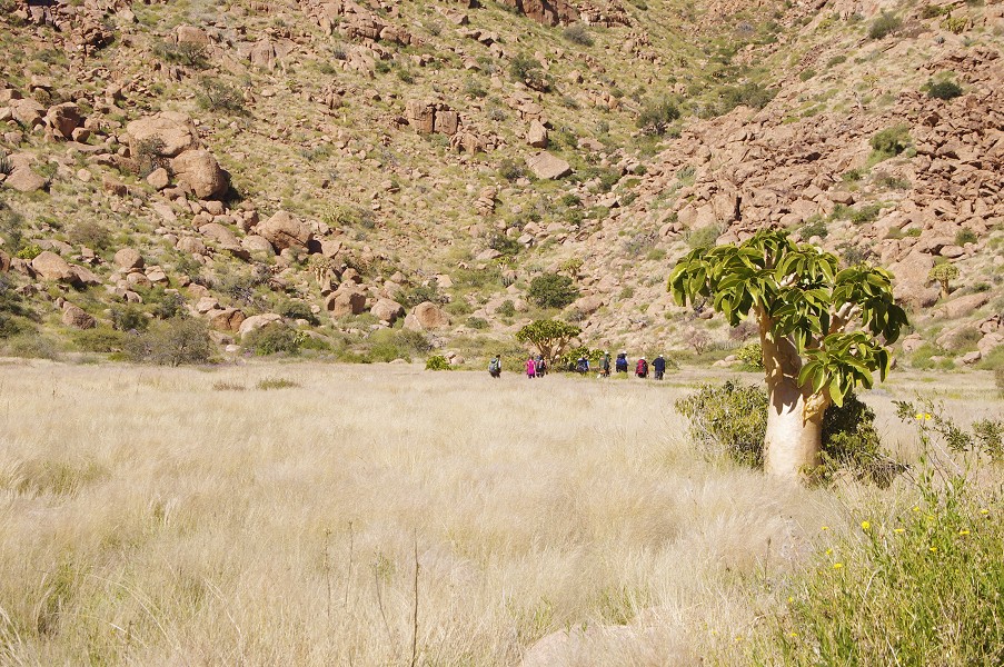
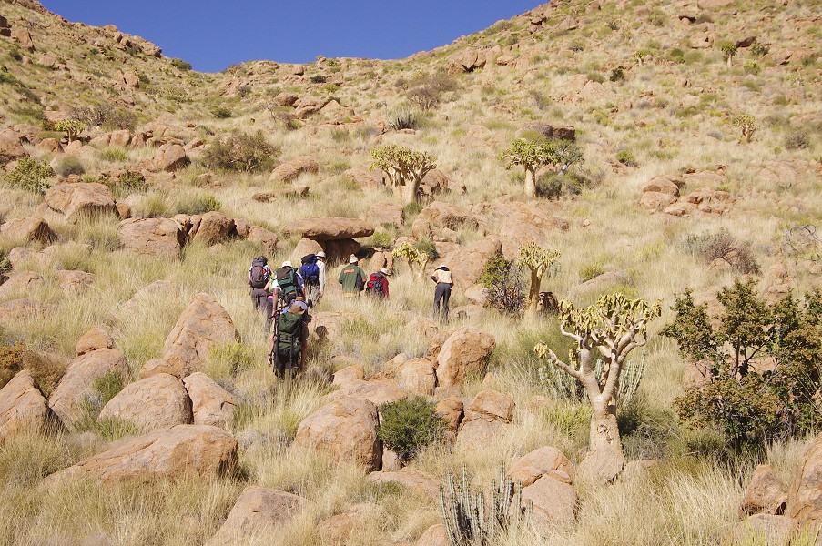
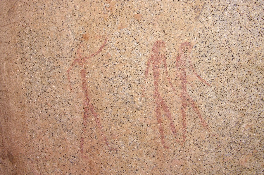
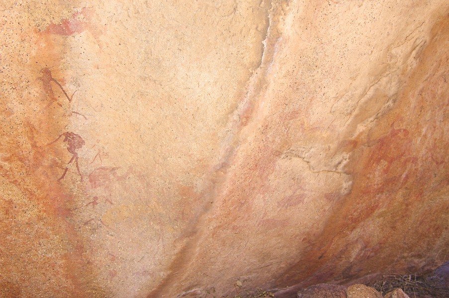
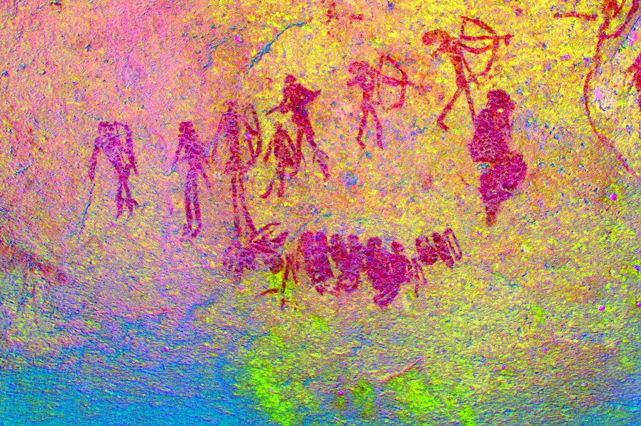
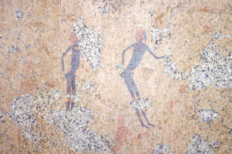
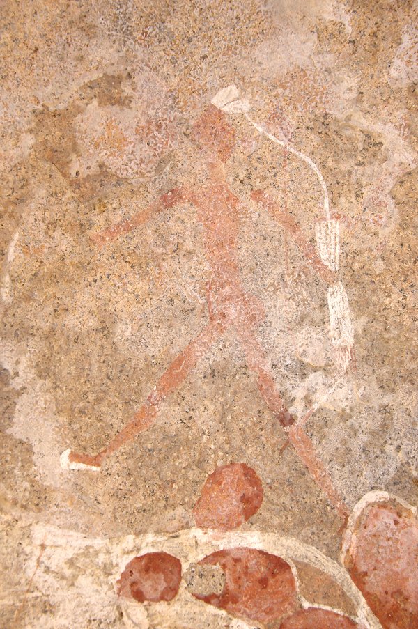
The principal sites of the upper Amis were the highlight of our trip last year. This time, with our closer base, we could afford a much more relaxed visit. With Angula's help we also hoped to visit the principal site on the Hungorob Plates on the ridge dividing Amis and Hungorob, which we failed to find the previous year. This time it was a short climb from camp into the small grassy valley containing the painting of the four fine archers (N8) before the col leading over to Amis.

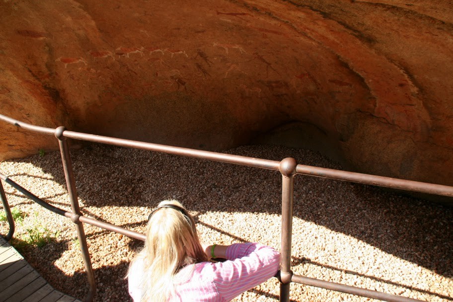
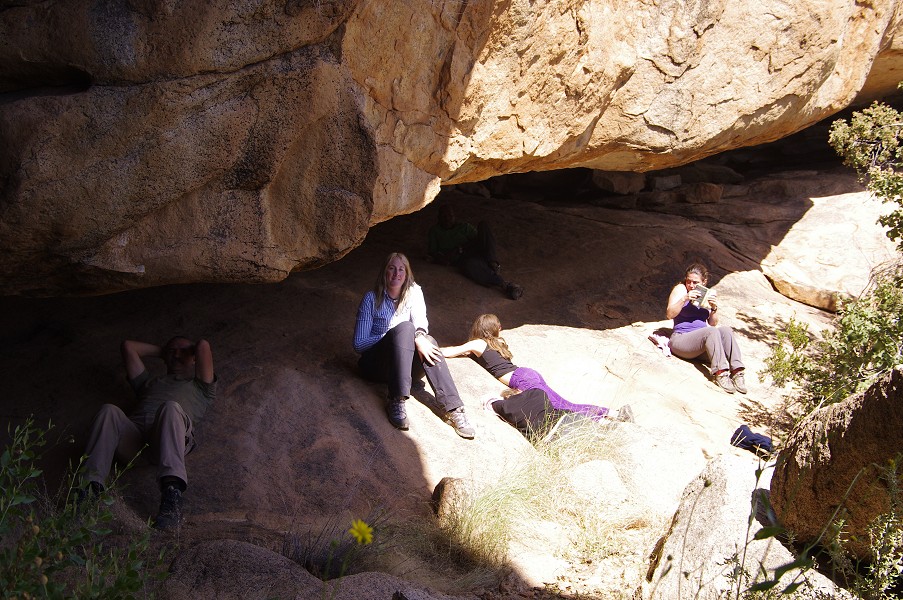
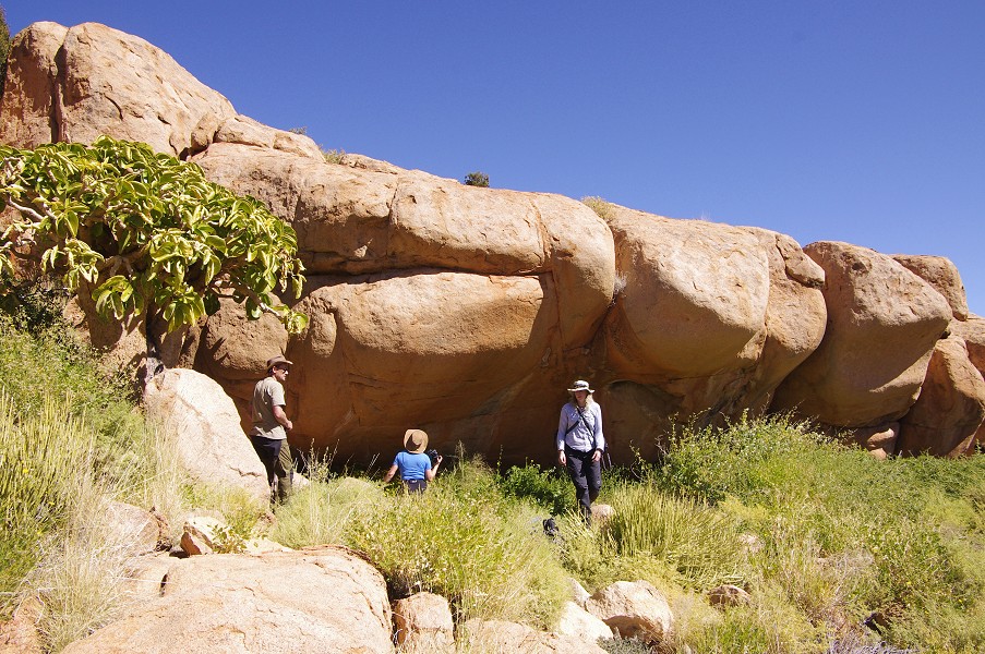
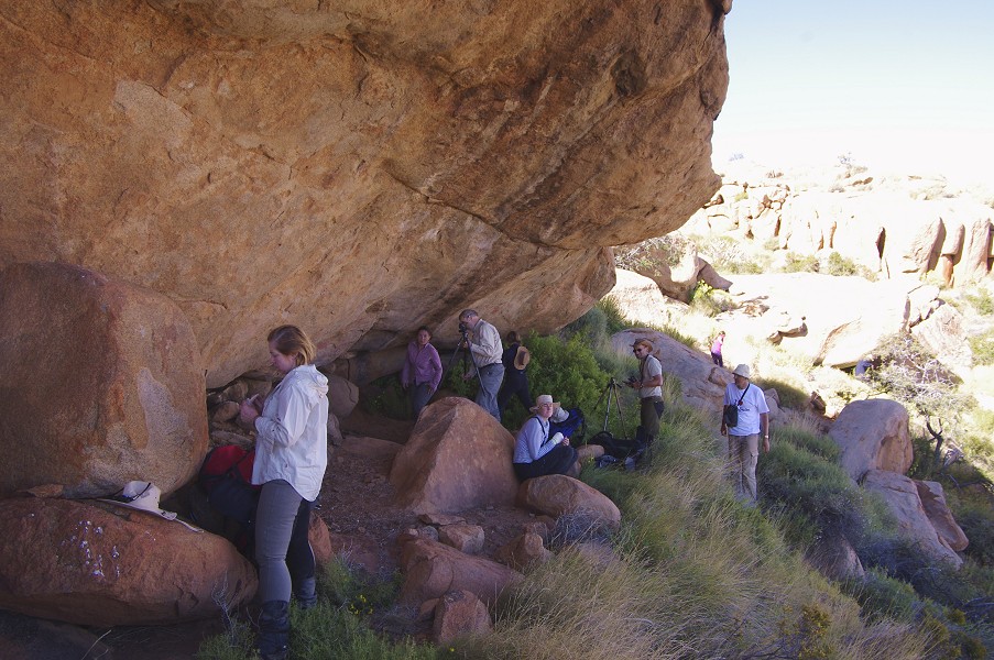
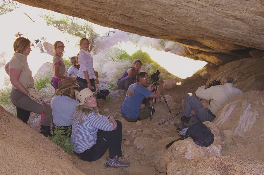
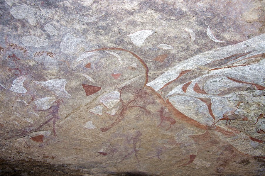
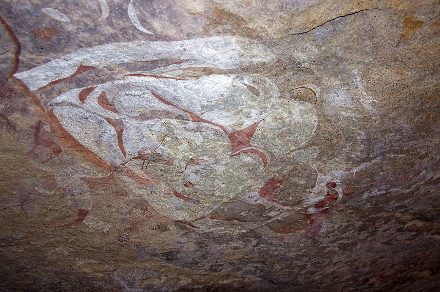
We crossed over the col to Amis, and continued straight to the lower level to start at the "Wind Cave" (Lufthöhle, A6), Harald Pager's favourite site, not without reason. Unlike our past hurried visit, we had plenty of time to enjoy every inch of the incredibly delicate and detailed paintings covering the rear wall of this wind excavated hollow.

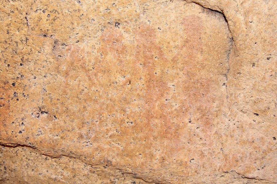
Angula pointed out another site (A9) on a large boulder, appearing to be just below the shelter. In reality it was quite a scramble down the steep smooth granite. The paintings were quite weathered and fully on the sun, nothing as spectacular as the ones above, however dStretch does reveal a number of complex scenes, well preserved despite the apparent faintness.


Once we were fully satisfied with the wonderful scenes of "Wind Cave", Angula led us west along the smooth granite plates, into a large generally flat bottomed basin comprising the western part of the Amis Gorge. There is a scatter of important sites all along the higher elevations of this basin, but those would have required another full day to visit (something for next time...). Instead, we went straight for the centre of the basin, to a cluster of large granite boulders comprising site A22. On the rear of the largest boulder, there is an excellently preserved panel with several homestead scenes, that are remarkably similar in style and composition to similar scenes of the Uweinat cattle pastoralists. The surrounding rocks contain another three panels of paintings in various states of preservation.

We returned to the eastern Amis basin via a direct route, going straight for site A12, hoping to find it still in the shade, unlike last time when it was in the full blaze of the afternoon sun. We were already late with the main panel, but with a higher sun angle we had an easier time casting enough shadow to fully photograph the scenes.
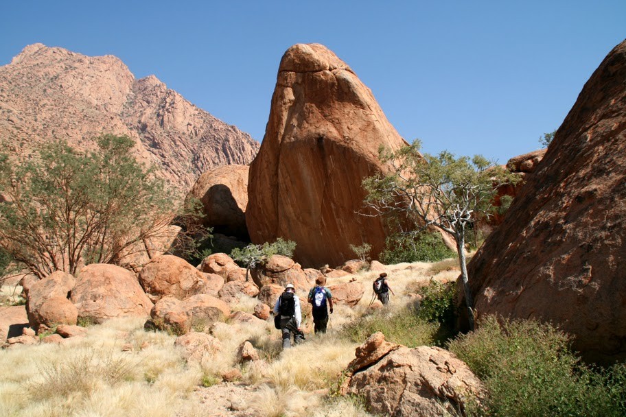
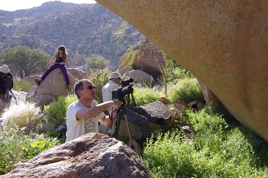
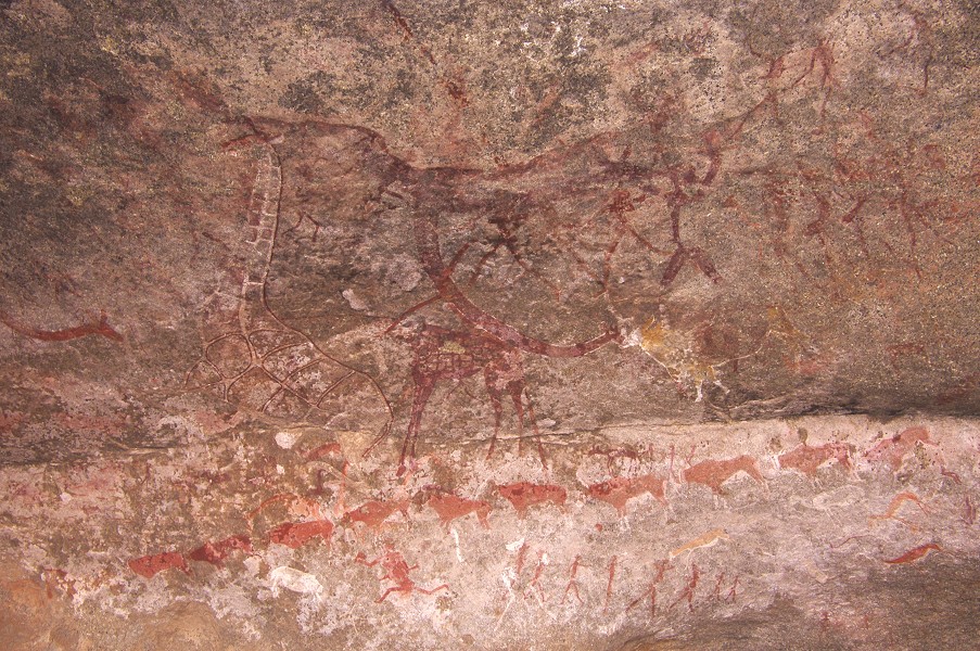
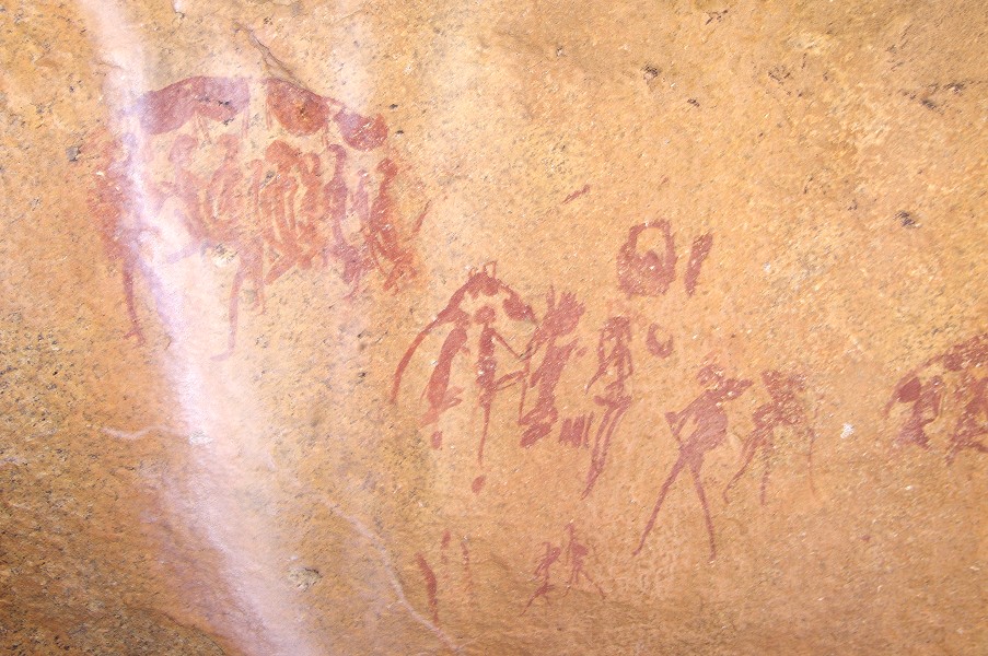
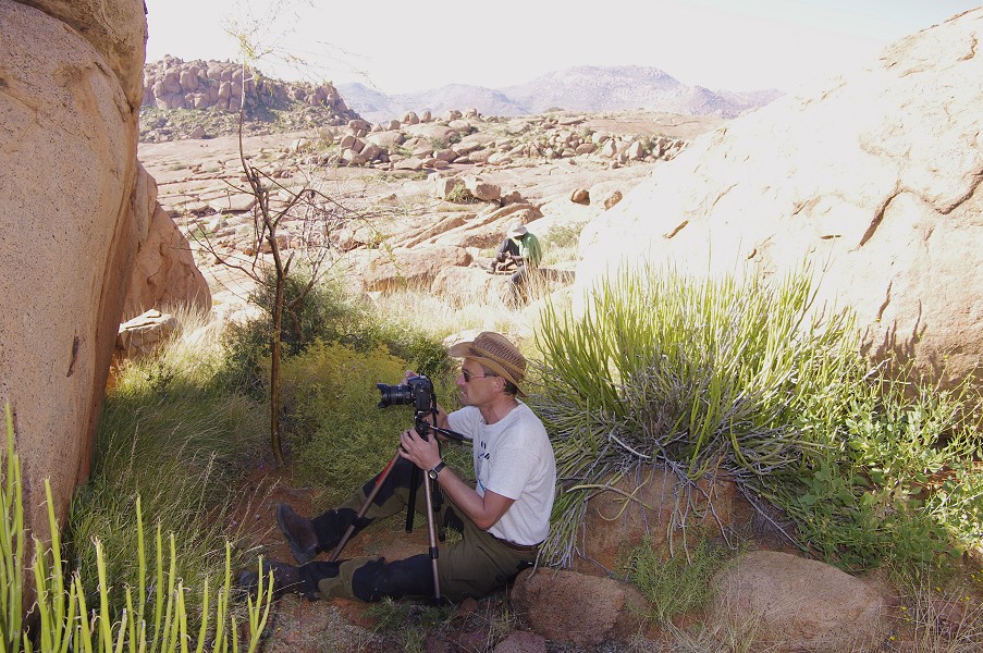
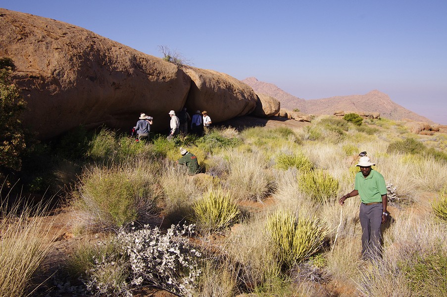
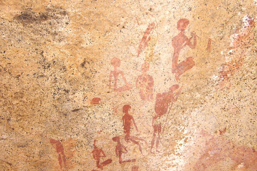
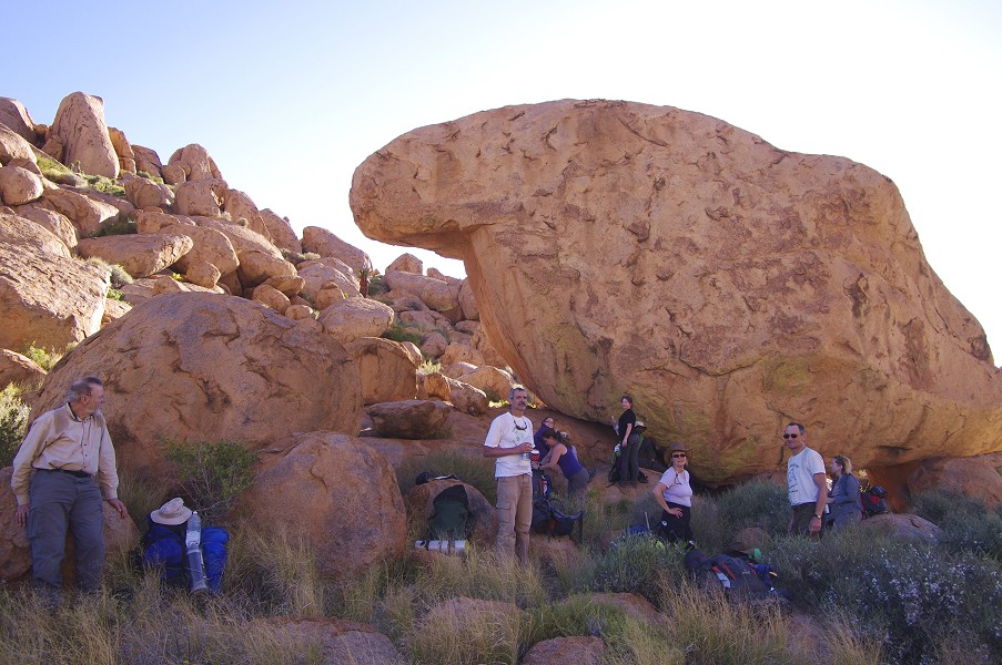
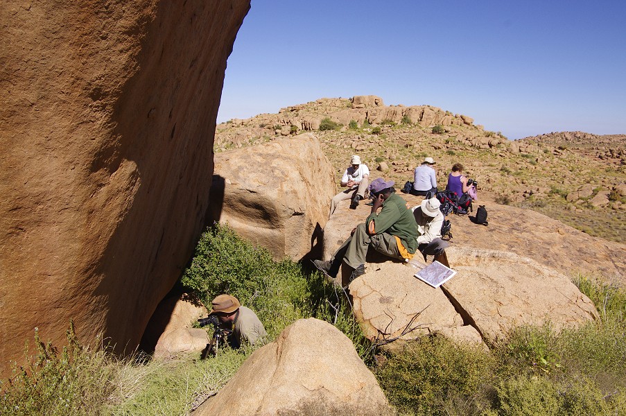
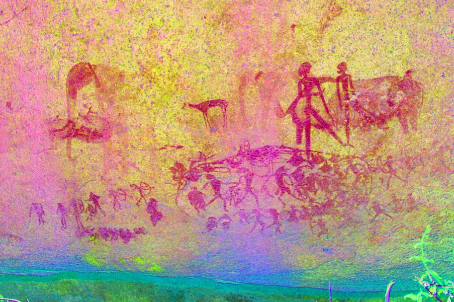
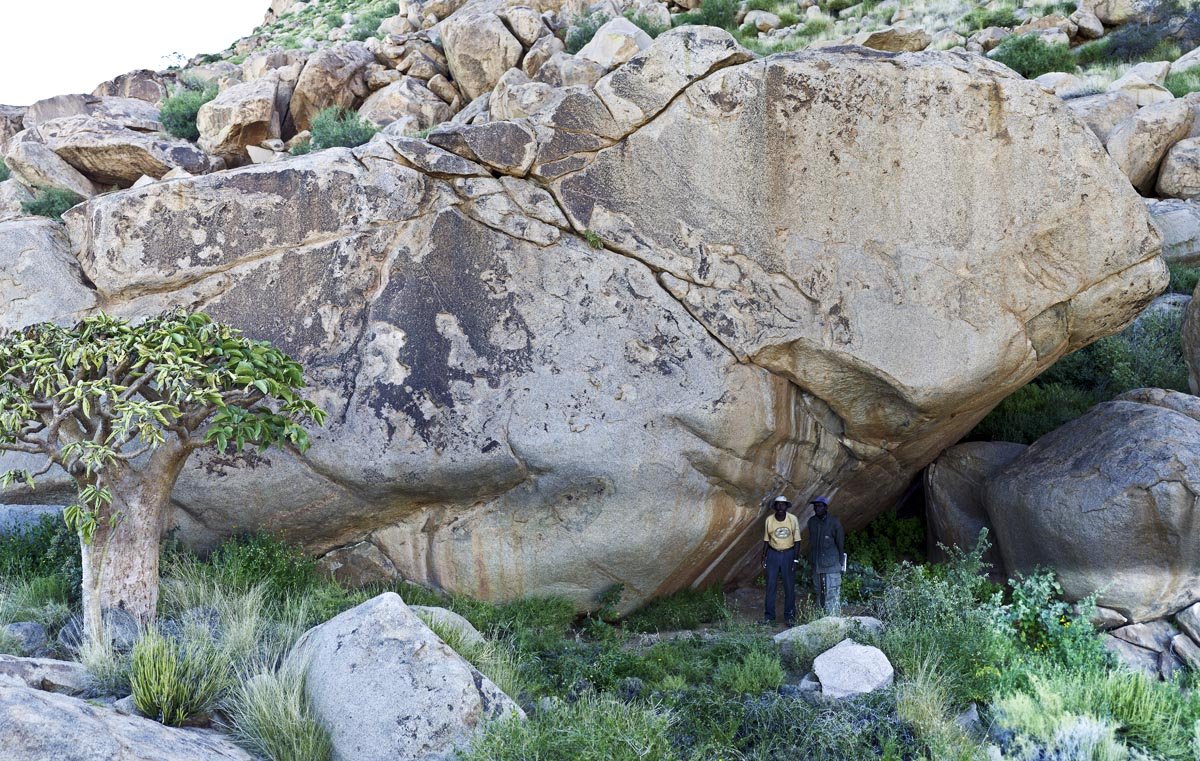
It was still late morning when we reached the "Giant's Cave" (Riesenhöhle, A10), the principal site of Amis Gorge. We spent a good two hours fully photographing all the scenes, occasionally interrupted by brief but intense spells of laziness inspired by the inviting flat granite surfaces, soaking up the sun (it was quite cool, especially in the shade of the shelters). Angula showed us a small enclosure of rocks filled with straw that was Harald Pager's bed during the several weeks he spent here copying the scenes. Overall the shelter is the largest site on the Brandberg, while other localities may have some finer panels or details, none match the sheer number and size of the paintings here.
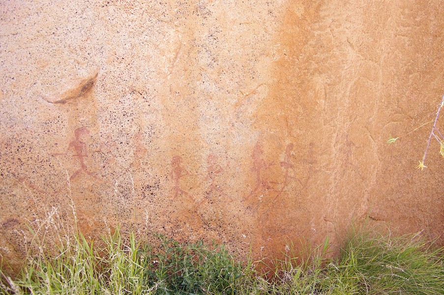
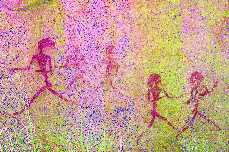
After a brief lunch, we started to climb above the shelter towards the watershed with the Hungorob Gorge, to the granite plates containing a number of the Hungorob sites which we failed to locate the previous year due to shortness of time and unfamiliarity of terrain. Angula took us up essentially on the same route as we took last time, going straight to the single site (H71) which we managed to find. However he did point out a panel on the adjacent rock which we completely missed, a row of fine running figures. Looking at Harald Pager's published tracings on our return, it is evident that there were still many more paintings at this site which we failed to spot.


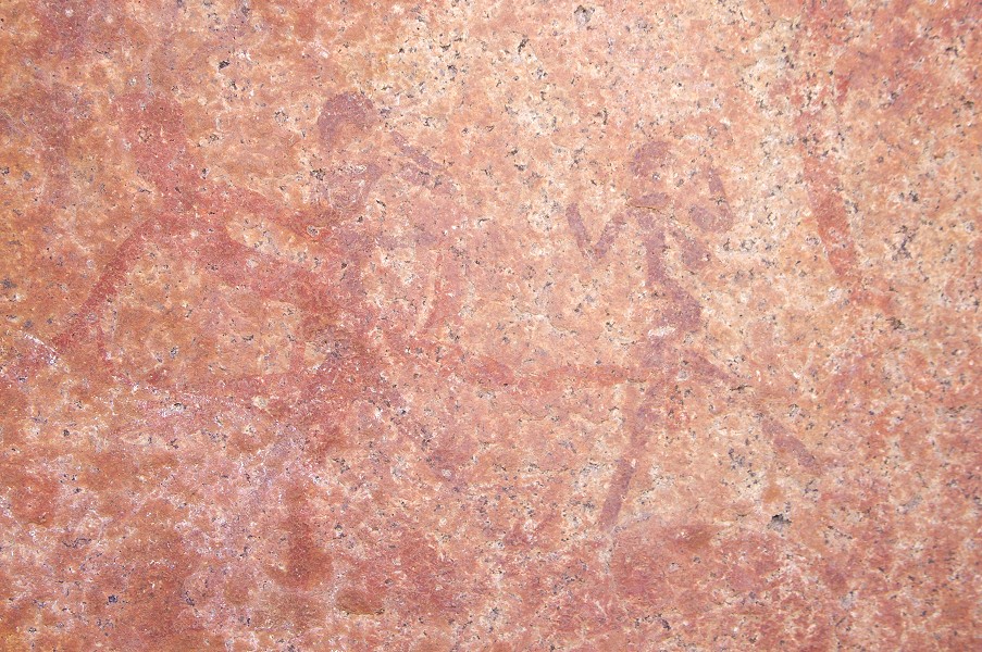
As we started walking towards H75, the principal site on the Hungorob Plates, it became clear that last year we have grossly underestimated the distances, it was still another half an hour to the site a good kilometre away. Angula first led us to another site, confusingly A64 as it is just across the watershed into Amis. It was a relatively small site, but with a row of very fine human figures along the side of a boulder.
Site H75 is truly at a spectacular location, along the edge of a large flat terrace overlooking the Hungorob Gorge deep below. It is a long site, with numerous panels along a stretch of about 25-30 metres, though their state of preservation was not quite what we anticipated based on Pager's copies. Nevertheless there were numerous interesting and unique scenes, including a depiction of a fish among the typical savannah wildlife.


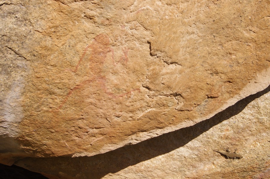
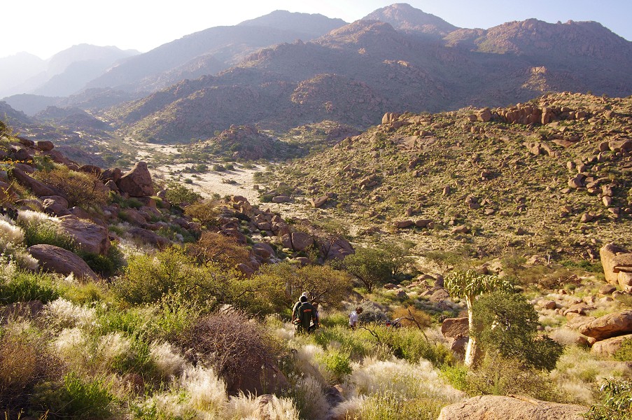
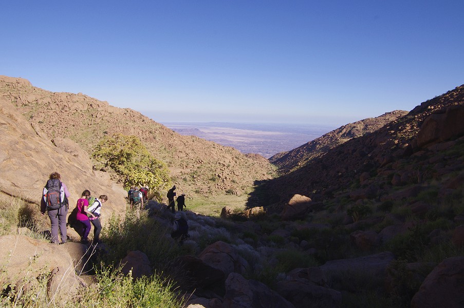
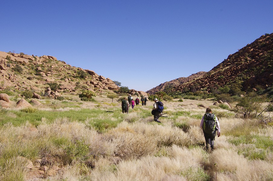
With the sun getting fairly low, it was time to start our return to camp. We took a different route down a small valley that joined the small basin of the Numas linking Amis with our campsite in the Silberweide. Near the watershed but inside Numas, Angula pointed out a rock with a few paintings on it (plus the inseparable resident gecko). After the rock the ground made a steep descent into the small side valley of the Numas, leading towards our final descent towards camp, which we reached well before sunset.
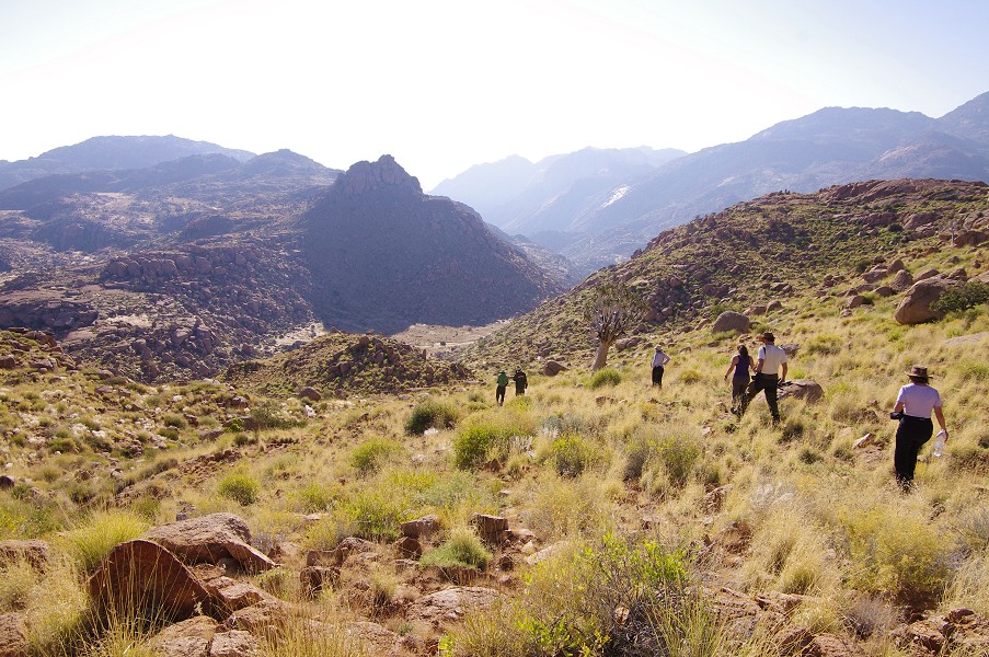
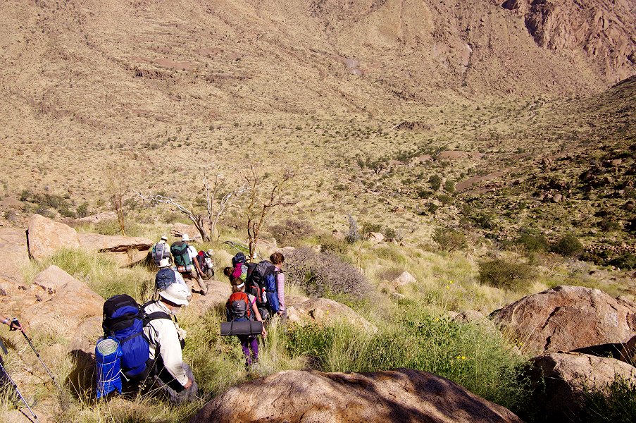
Day 5. - Ascent to Upper Numas
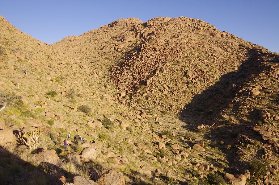
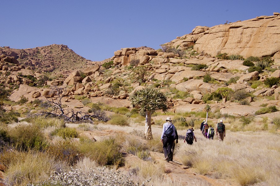
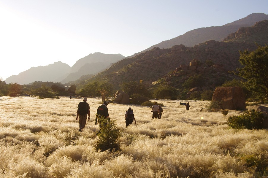
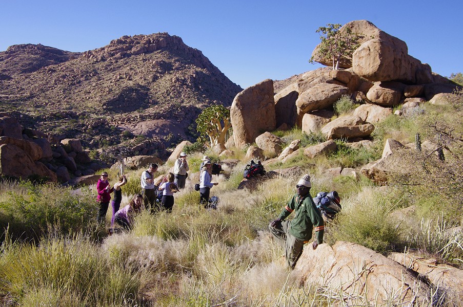
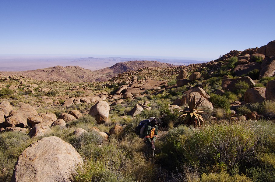
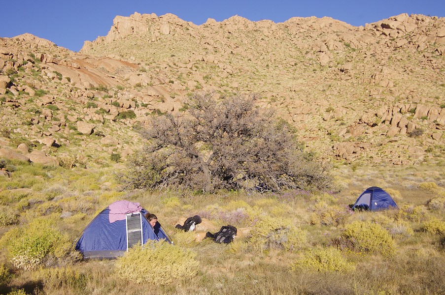
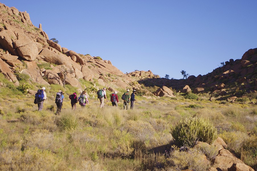
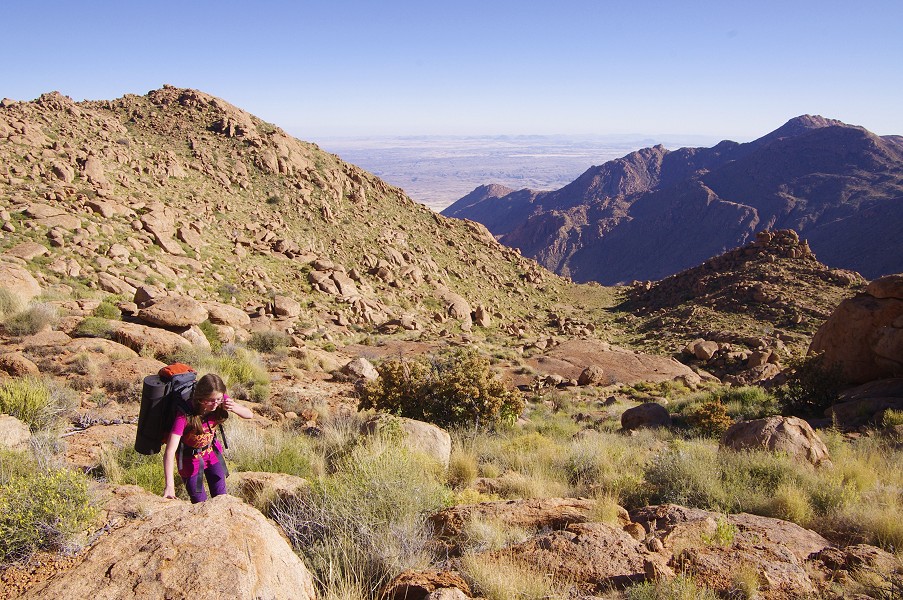
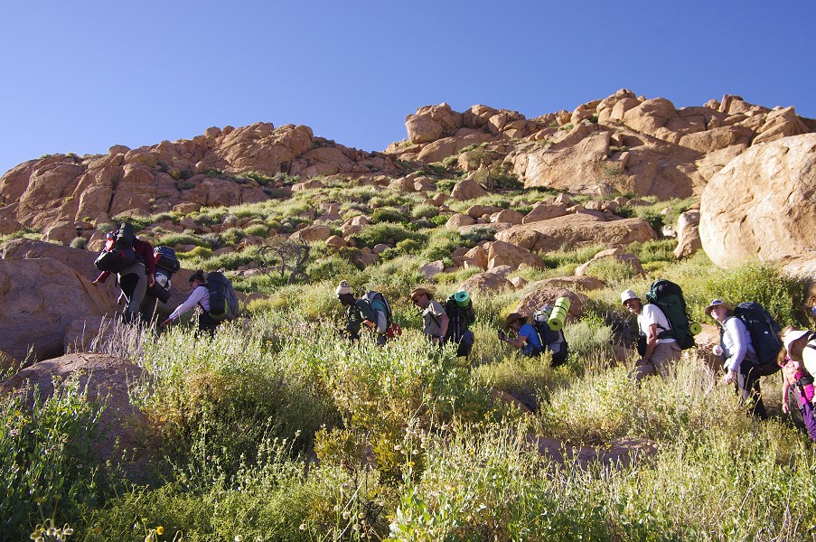
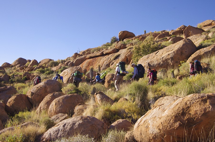
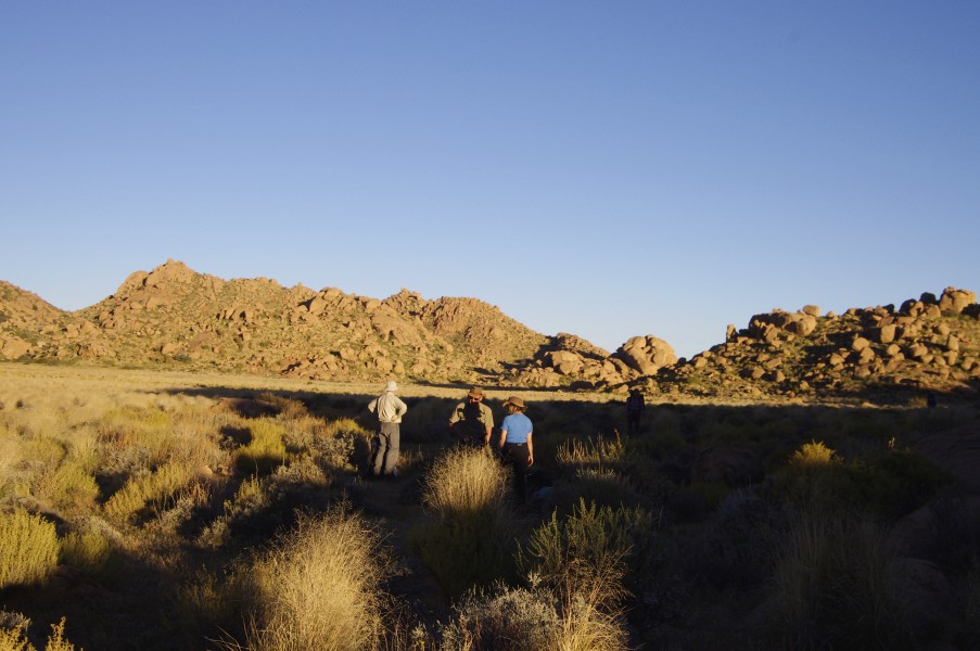
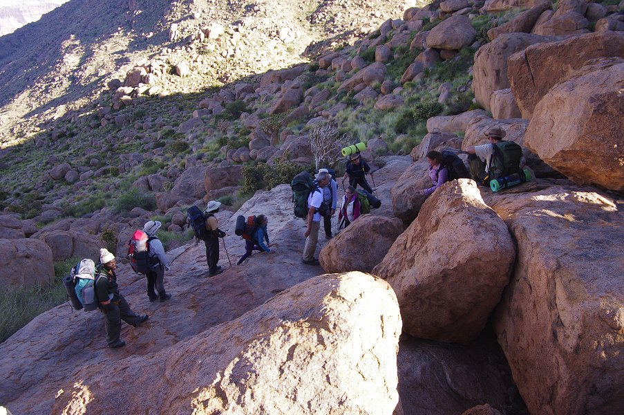
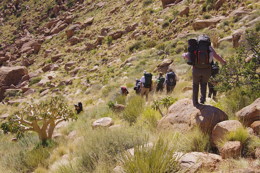
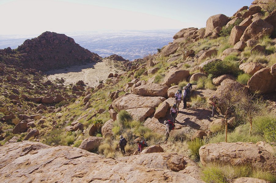
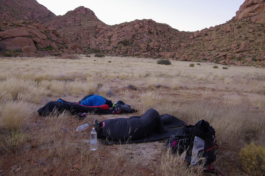
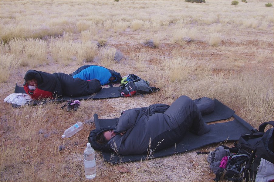
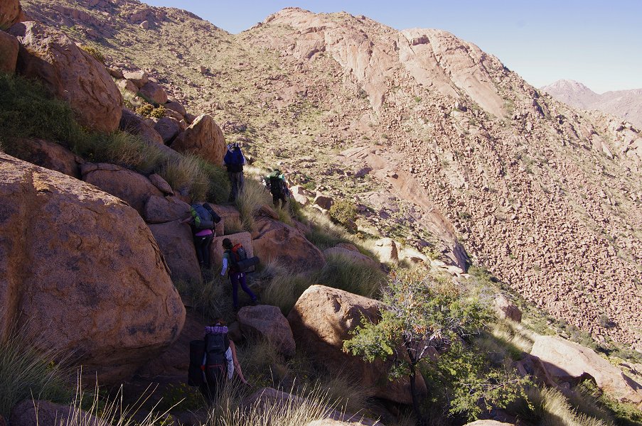
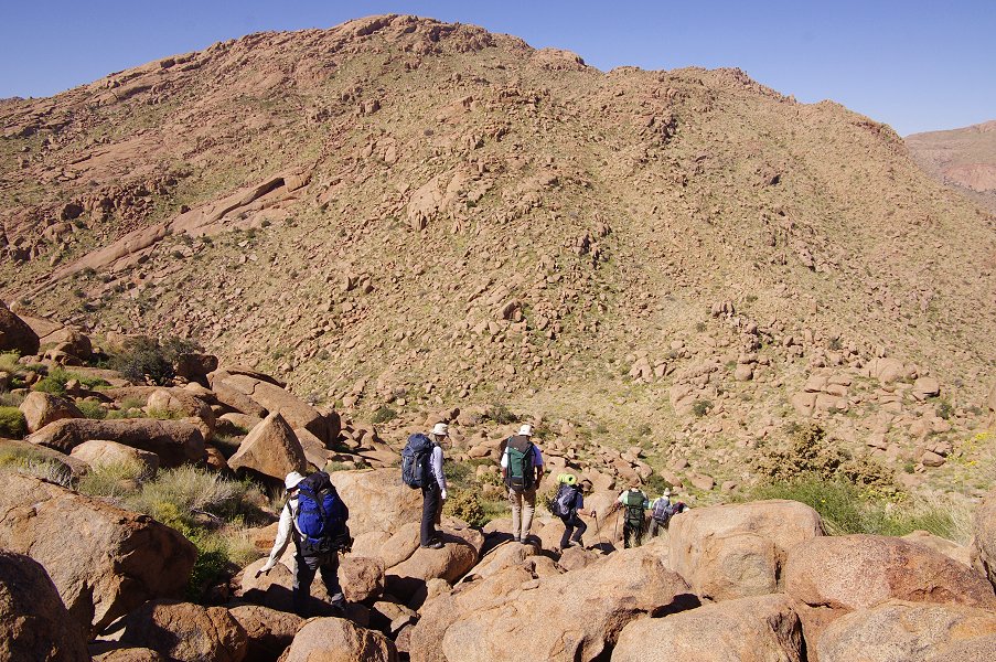
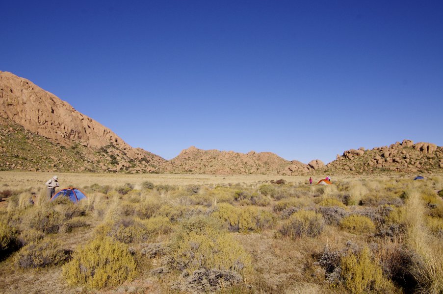
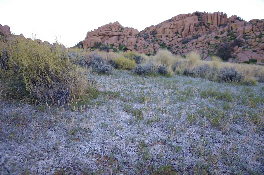
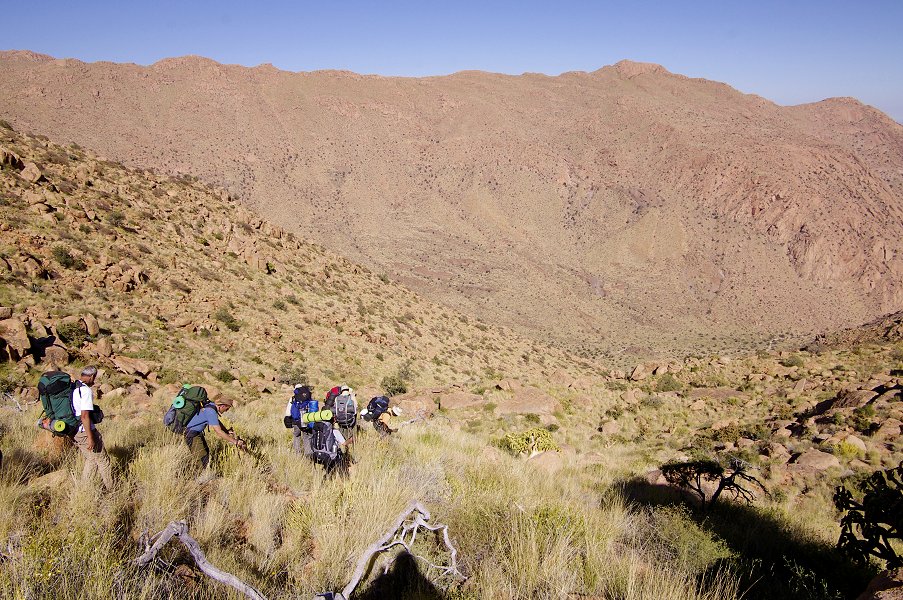
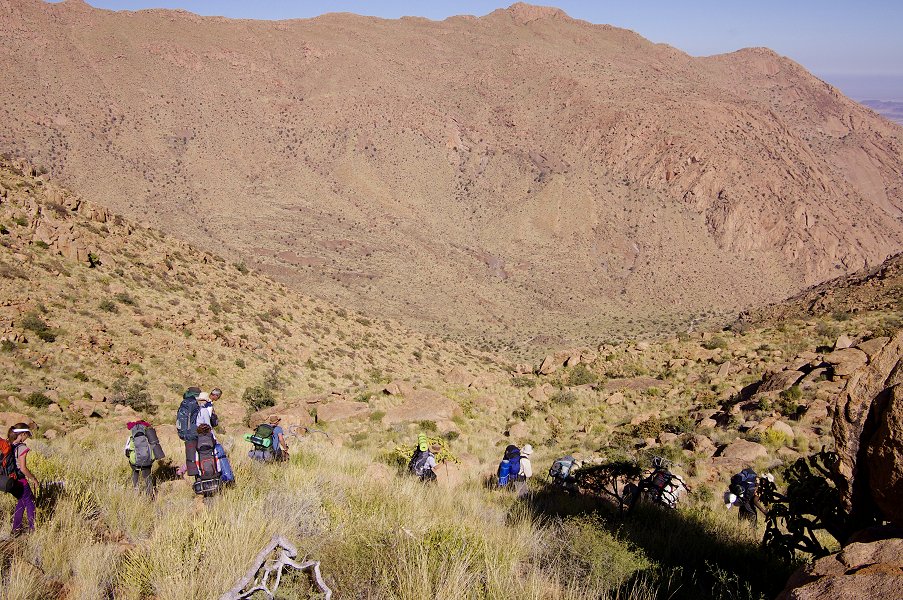
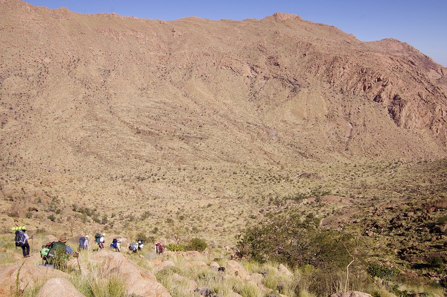
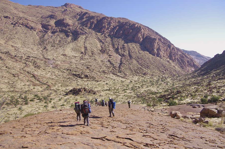
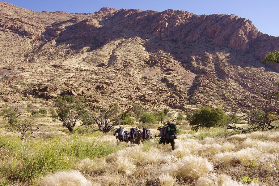
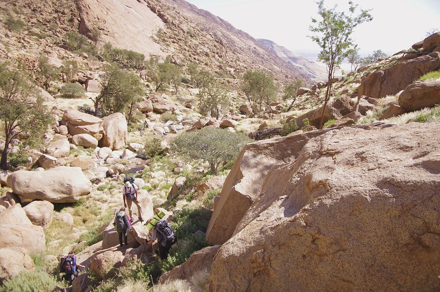
Our plan for the day sounded simple, but the task was formidable: to make the climb to the basin west of Numasfels at an altitude of around 2100 metres, a steep and heavily vegetated ascent from our camp at an elevation of 1600 metres. We intended to spend three nights up there, with one full day for a leisurely visit of the several major sites in the basin, the other day to make a trek to Circus Gorge and back. As we have made a dump with all the necessary supplies, we only had to carry food and water for the day, a lesson well learnt from the difficulties we had the previous year due to too heavy packs. We broke camp at a very chilly dawn (there were patches of frost on the ground), and after a quick breakfast and distribution of loads, we set out towards the flanks of Numasfels.

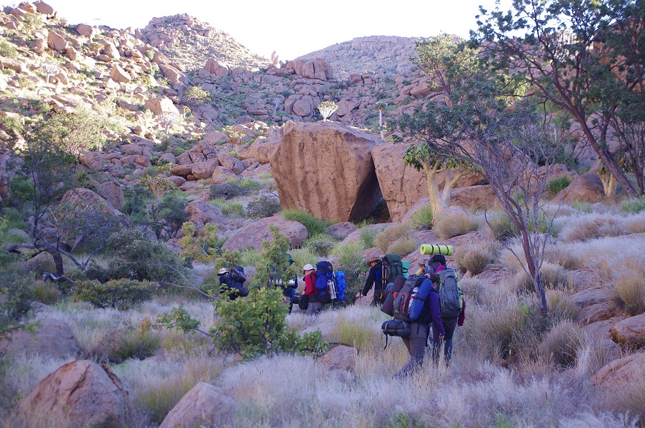
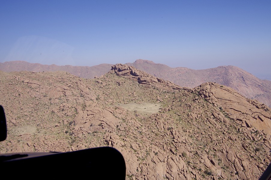
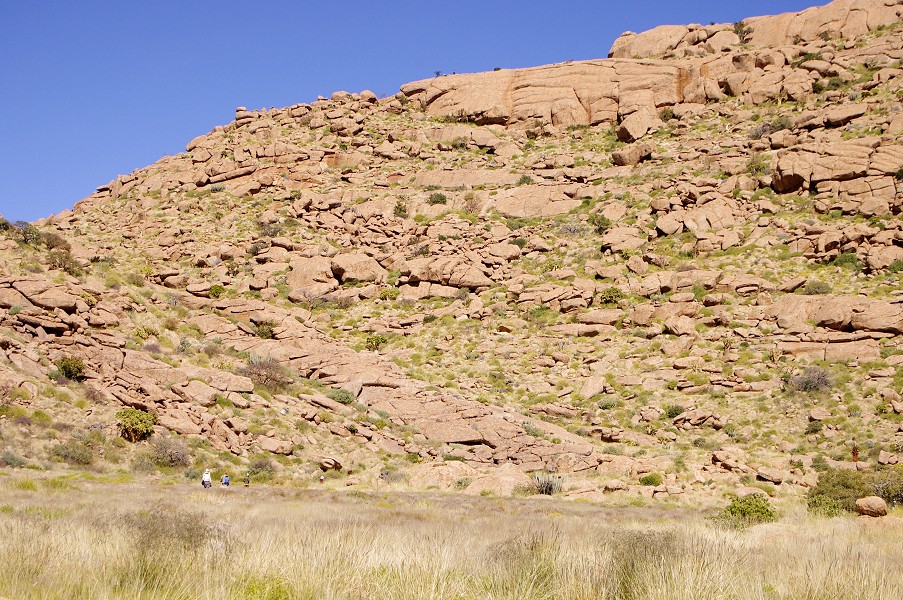
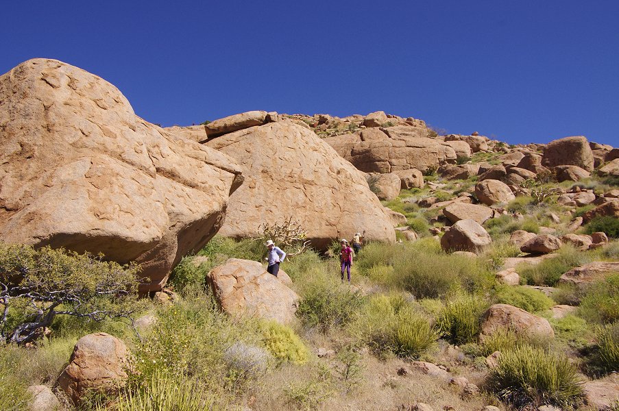
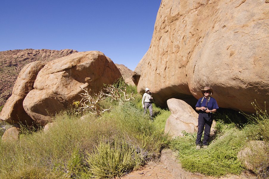
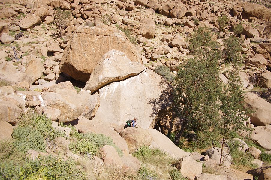
Our path led us close to a fine smaller site, N30 on a small terrace about 100 metres above our camp level. We left our packs at a col nearby and made the worthwhile small detour, as it turned out the last meaningful rock art site we have managed to visit along our ascent route. There are a number of major sites scattered along the south slopes of Numasfels, but to visit them would require a dedicated day or two on very nasty looking terrain.


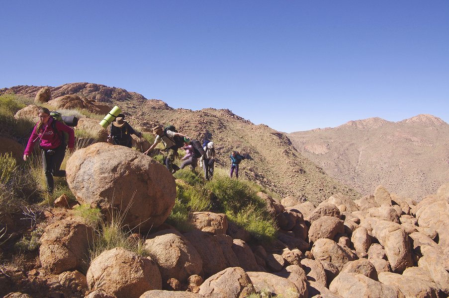
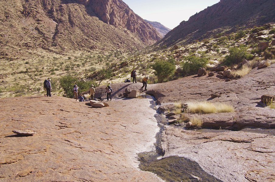
Beyond the site, we started to climb in earnest along the southern slopes of Numasfels, following a smaller valley which still had running water appearing in places. It was a long, arduous trek, broken by ten-fifteen minute rest stops every hour or so. Nevertheless, we made good progress, by lunchtime we were almost level with our intended camp, but still separated by a two hundred metre high ridge and col.

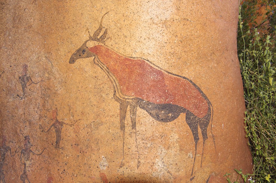
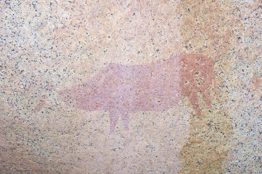
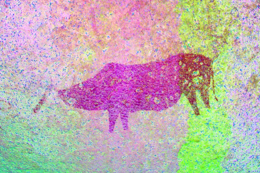
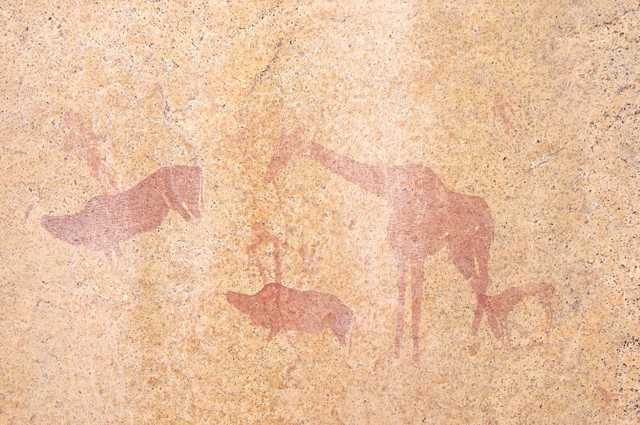
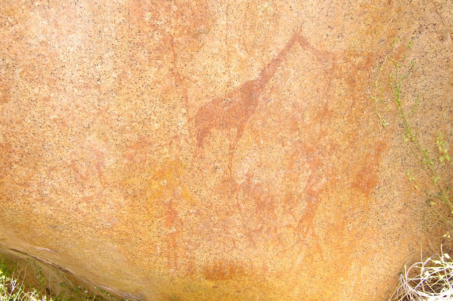
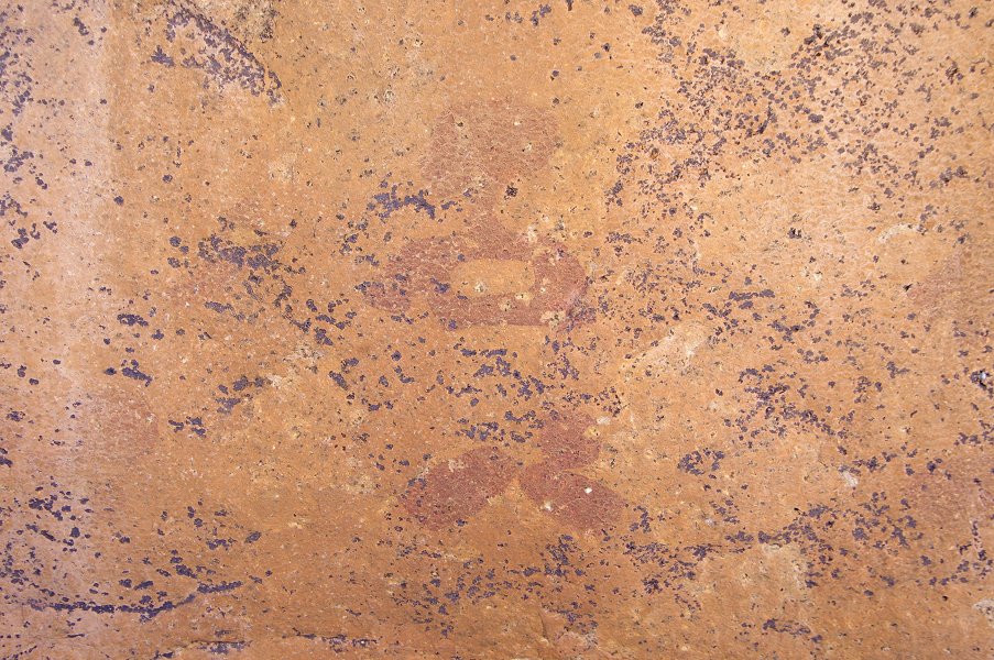
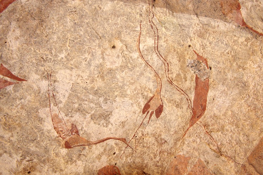
We had a longer lunch break in the early afternoon on the only small level plateau we have encountered during the entire ascent. It looked like a good living area, sure enough Angula pointed out a panel of paintings among the large boulders providing the shade for our lunch (N143). The paintings were not very spectacular, the only recognisable figures were a fine giraffe and an antelope, however with dStretch it is possible to see a number of other animal figures, as well as a yellow giraffe beside the dark red one, something invisible on the spot.
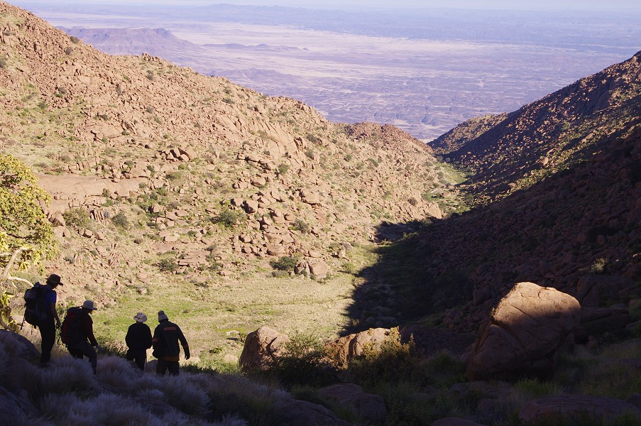
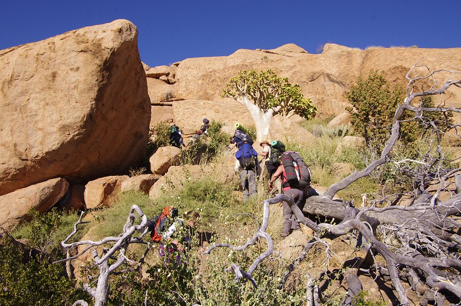
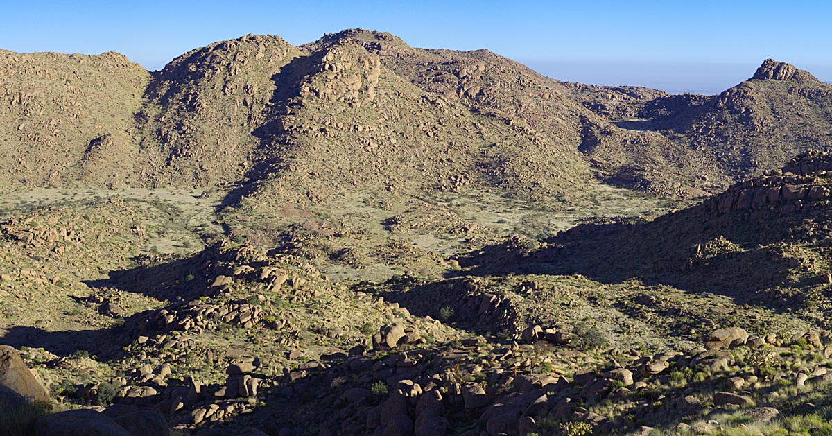
After lunch we continued the climb towards the col, which proved to be the most difficult part of the day due to the dense vegetation completely obscuring the rocks below. We had to fight our way through, a slow and laborious process. We were finally up on the col around 3pm, almost exactly level with the Engelhard Plain clearly visible on the far side of the Naib basin.
It was another hour and a half to scramble down the steep slopes to the bottom of the flat plain below. At the last rest stop I have rather stupidly managed to leave my camera bag on a rock, and only noticed that something was missing when we reached the plain below, a good half hour away. While the others made their way to the depot to make camp, I went back and attempted to find it, but could not recognise our rest stop among the identical looking rocks. I reached camp with still half an hour left till darkness, Angula immediately volunteered to take me back to the spot. Up till now he was maintaining a steady but slow and comfortable pace, suitable for every one of us in the group. This time however he obviously decided that without a backpack I can do better, and pressed the fast forward button. With amazing speed and agility that defied his age, he dashed forward with me panting and barely being able to keep up behind him. In 15 minutes we covered the distance that took an hour on the way down, and without hesitation he led me to a cluster of rocks which from even ten metres looked just like every other in the area. Sure enough, a black camera case was clearly visible on the top of one of them as we approached... With the same speed we dashed back towards camp, reaching the small dry riverbed near our camp just as darkness fell.


Day 6. - Upper Numas
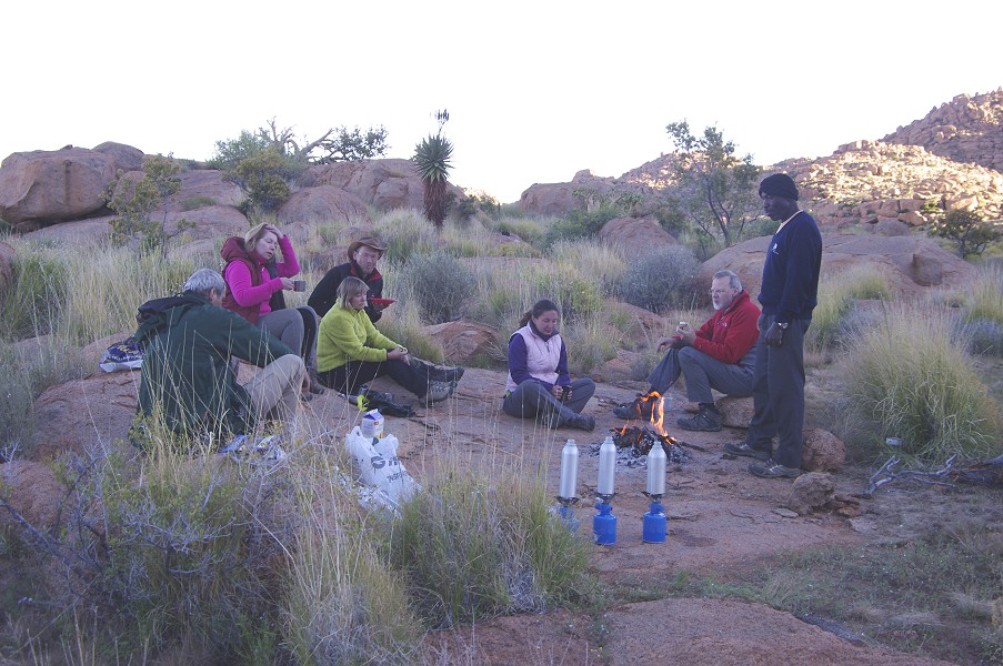
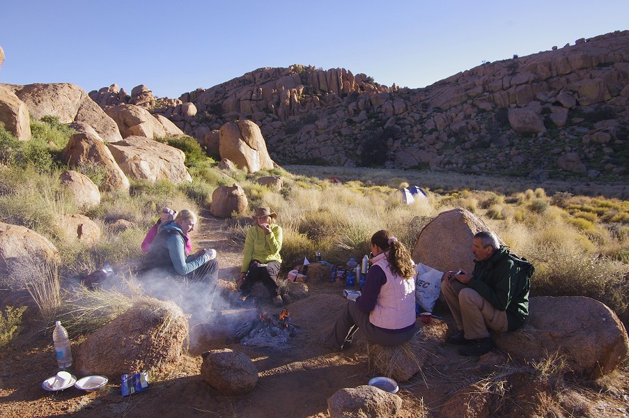
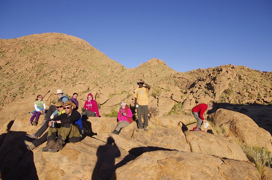
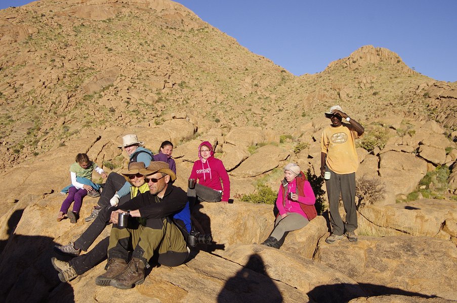
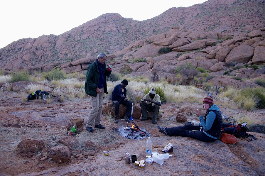
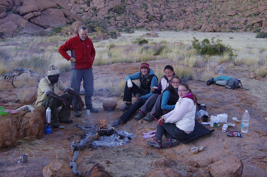
This day was planned to be rather relaxed one after the long and strenuous climb the day before. There was a scatter of principal and lesser sites within a radius of one kilometre around our camp on reasonably flat terrain (by Brandberg standards), which we intended to visit in a rather leisurely fashion during the course of the day. Accordingly we had a lazy morning, getting up well after sunrise and warming around the campfire till the sun rose above the hills.
The first site, N175 was the one farthest away to the north west but no more than 20 minutes from camp, overlooking the valley and col leading into Circus Gorge, our target for the following day. As we left the site, Dagmar picked up a camera half embedded into the damp mud of the valley floor. At first we thought someone from our party just dropped it, but on close look it became evident from the encrustaton of salt and mud that it must have lain there for a fairly long time, and was probably soaked at least once if not more. We hoped that perhaps the memory card would still be intact and provide clues to its owner.


A larger site, N177 was just across the ridge behind the first site, a short ten minutes away. Unfortunately much of the site is now covered by an encrustation of mud apparently built up by some insects in the good thirty years that elapsed since Harald Pager copied the paintings, but several panels are still visible.

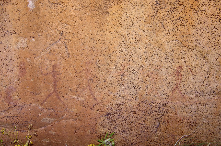
The next site, N171 tested Angula's memory. It was on the rear of a large boulder some way up the hillside, Angula had to look about for quite some time before finding the panel of fine painted human figures.


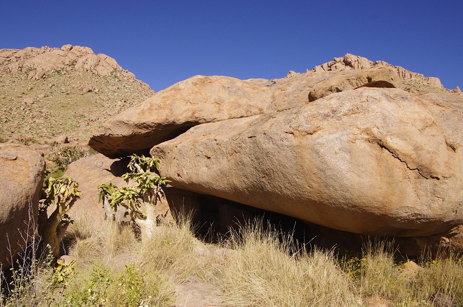
A few hundred metres away a prominent large boulder with a perfect shelter underneath just had to contain some paintings. At least it would at Uweinat... Sure enough, there was a rather small panel of faint paintings on the rear of the rock (N168), but surprisingly nothing in the shelter itself. The large rock overlooked a series of pools in the riverbed that still contained fine clear water.

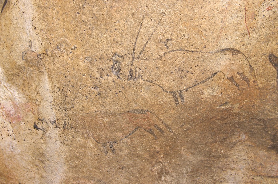
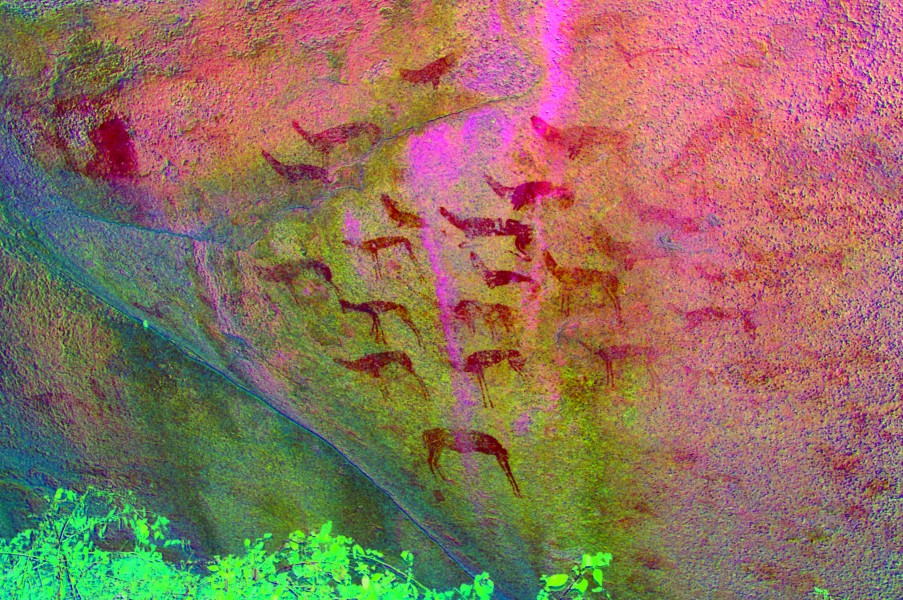
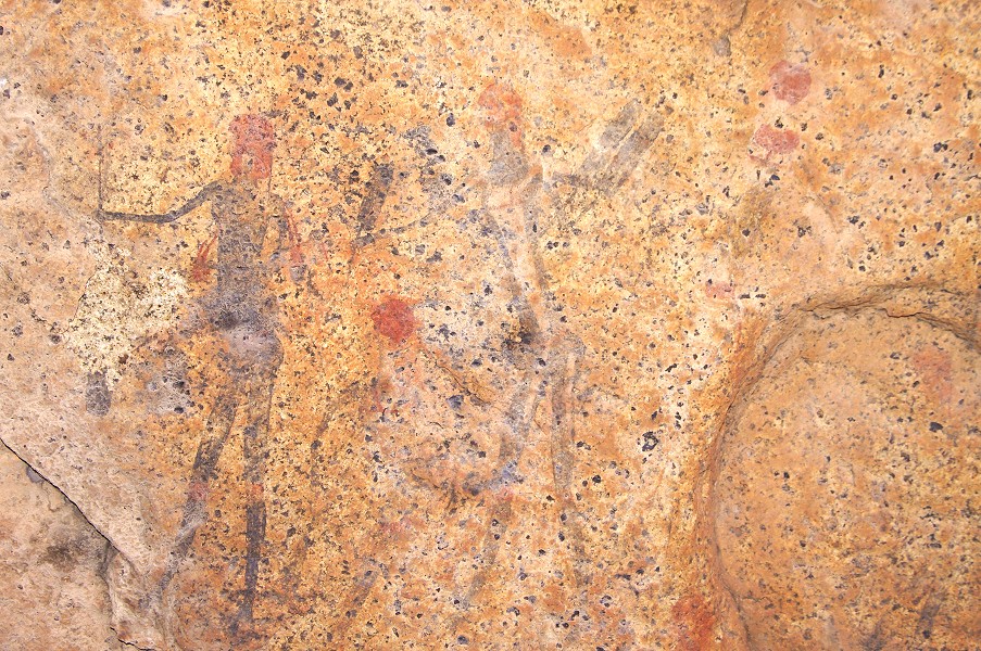
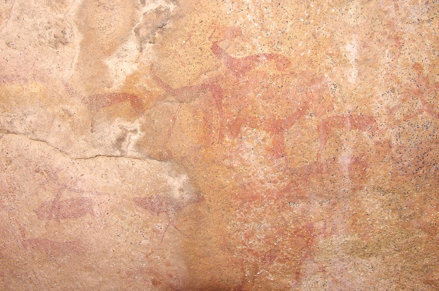
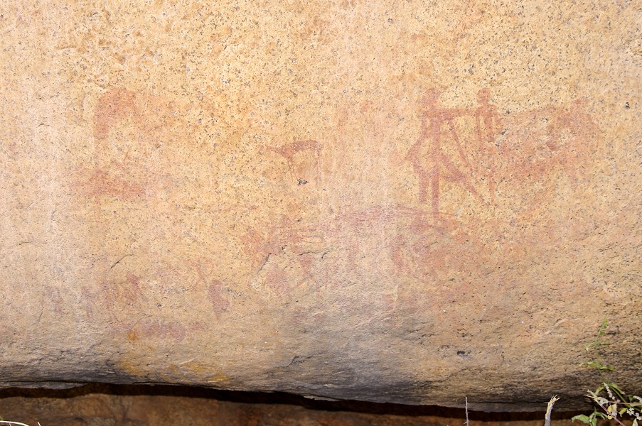
We crossed the riverbed to the north side of the small hill separating us from camp, to one of the principal sites of this area, N164. It is a large shelter along the hillside that showed up conspicuously already as we were making our descent the previous day. There are large and complex scenes of numerous animals and human figures, some quite difficult to make out on the spot without the help of dStretch.
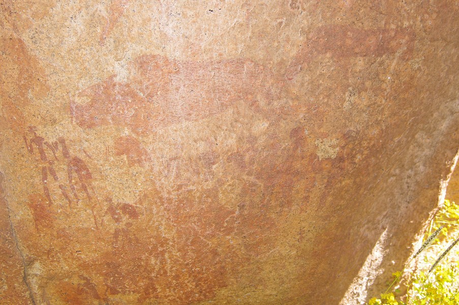
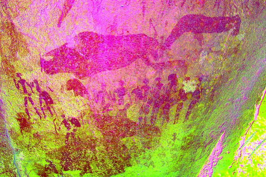
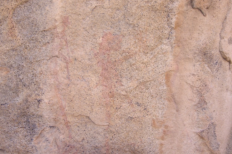
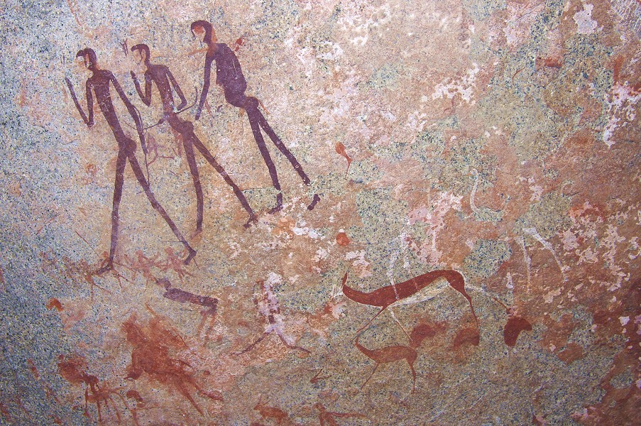
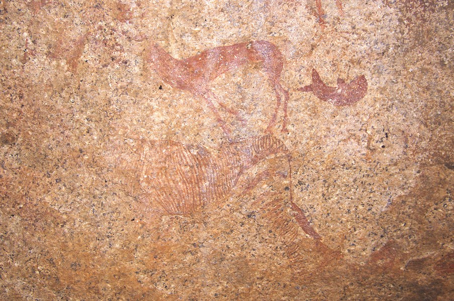
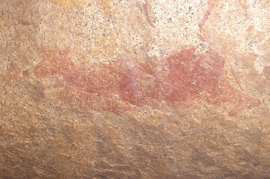
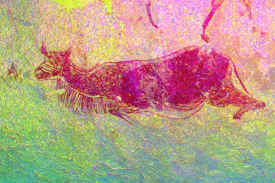
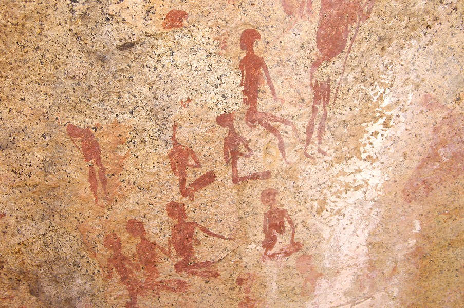
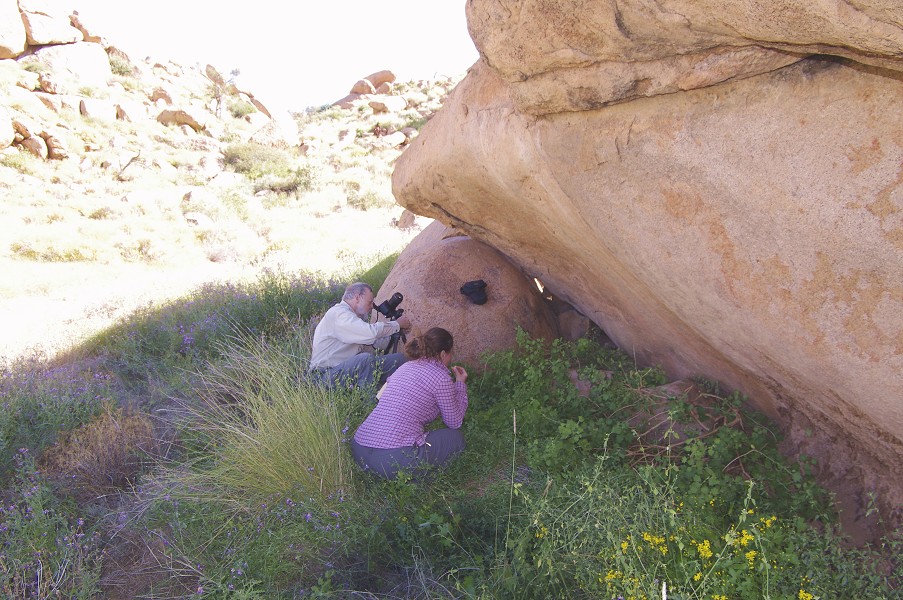
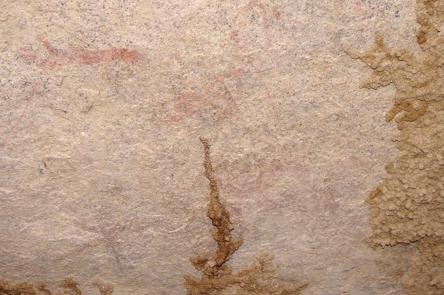
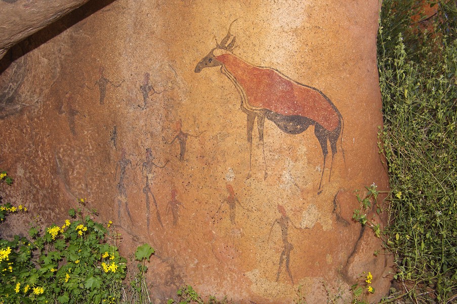
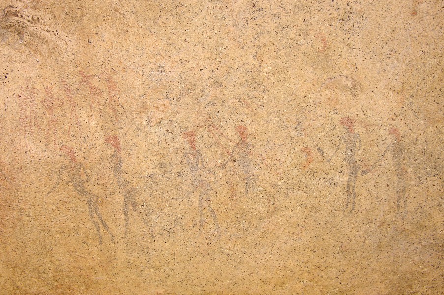
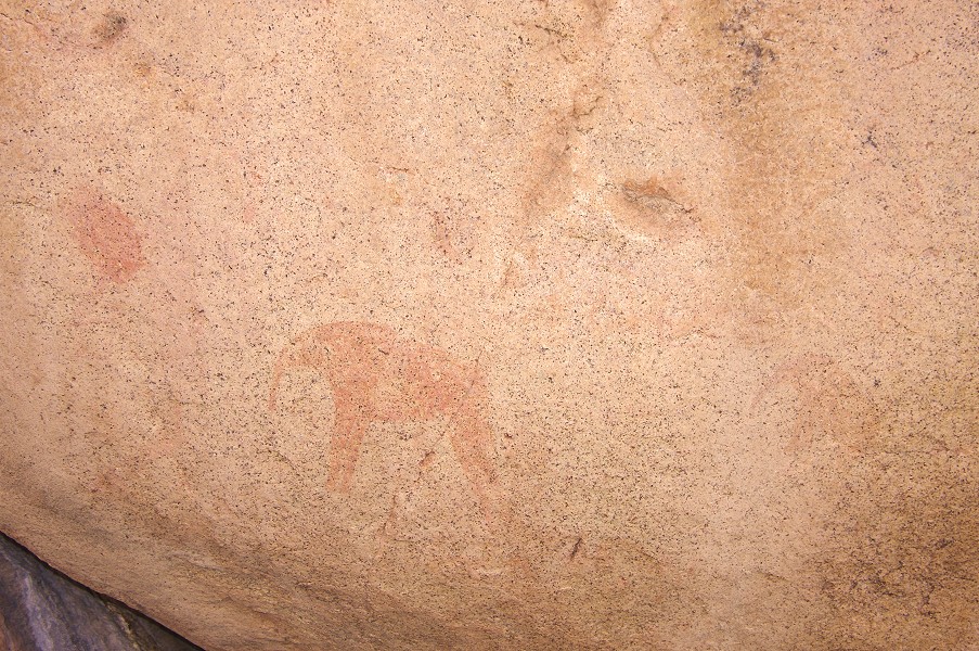
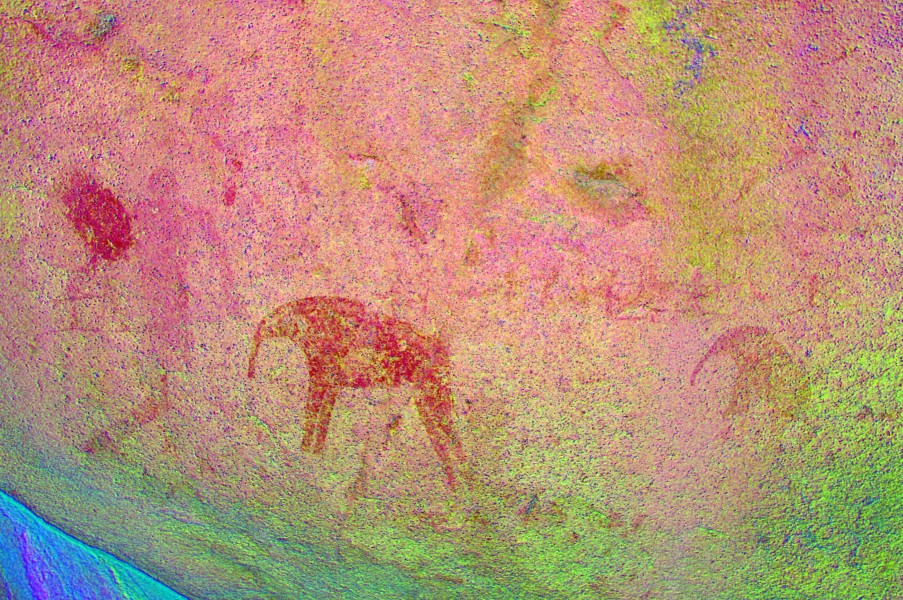
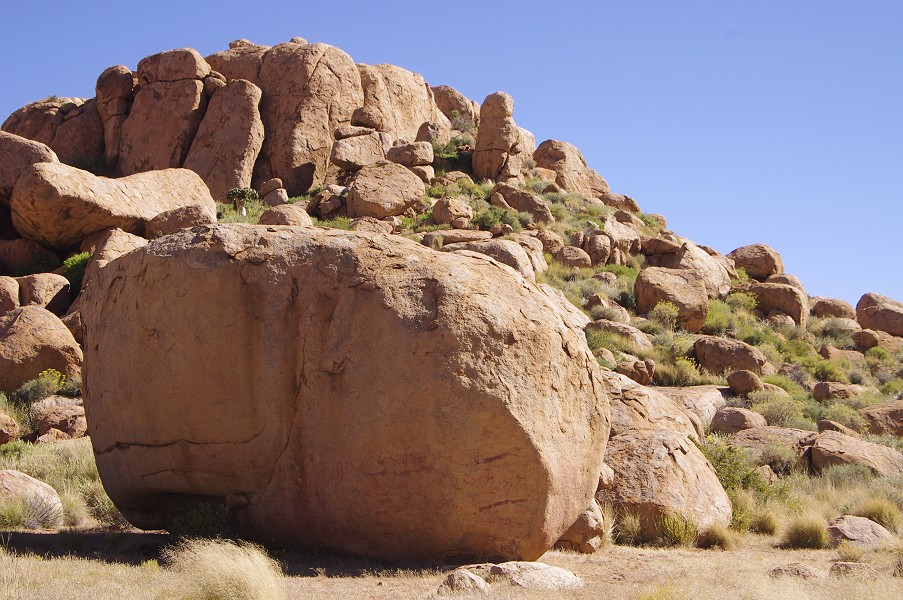
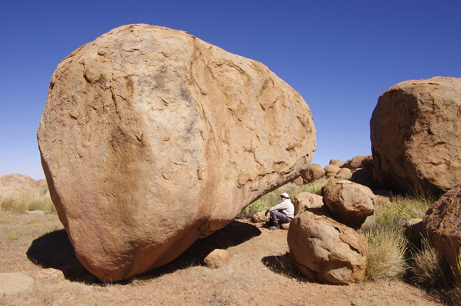
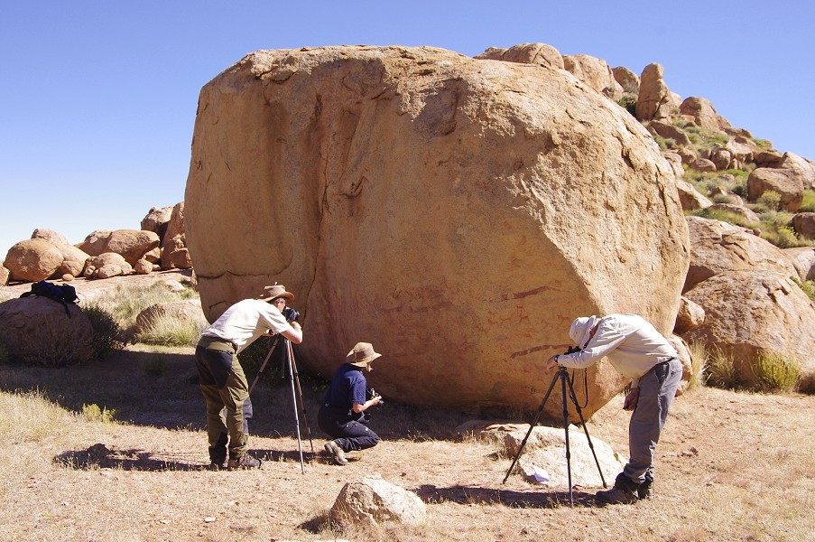
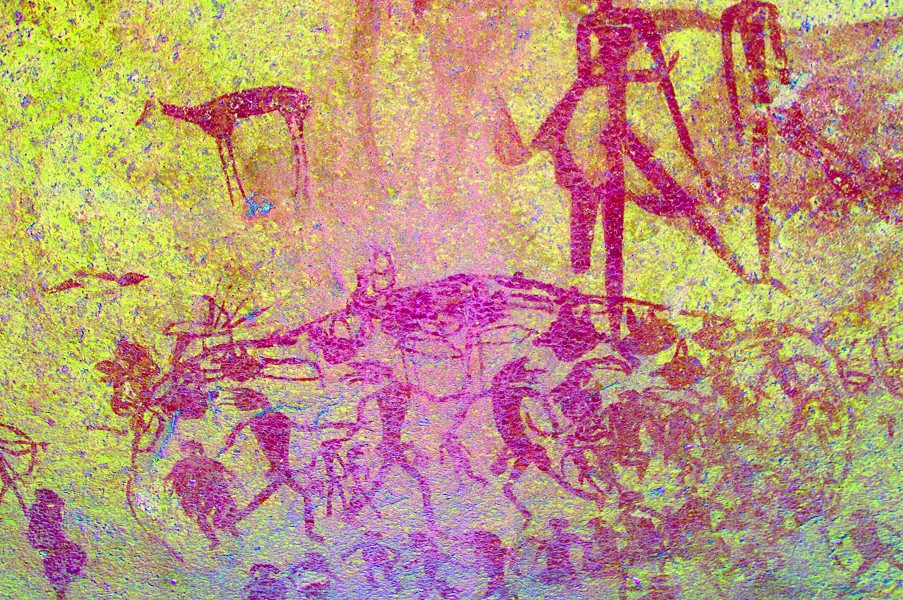
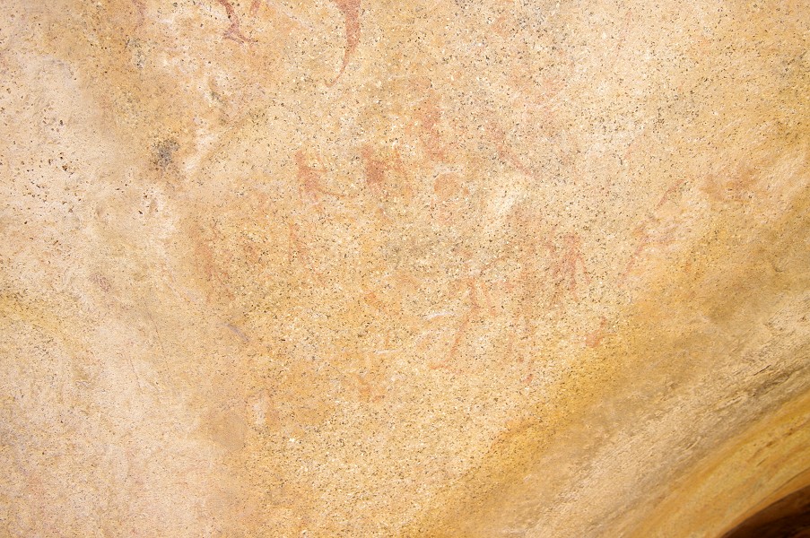
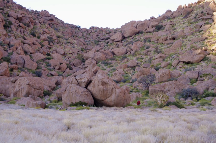
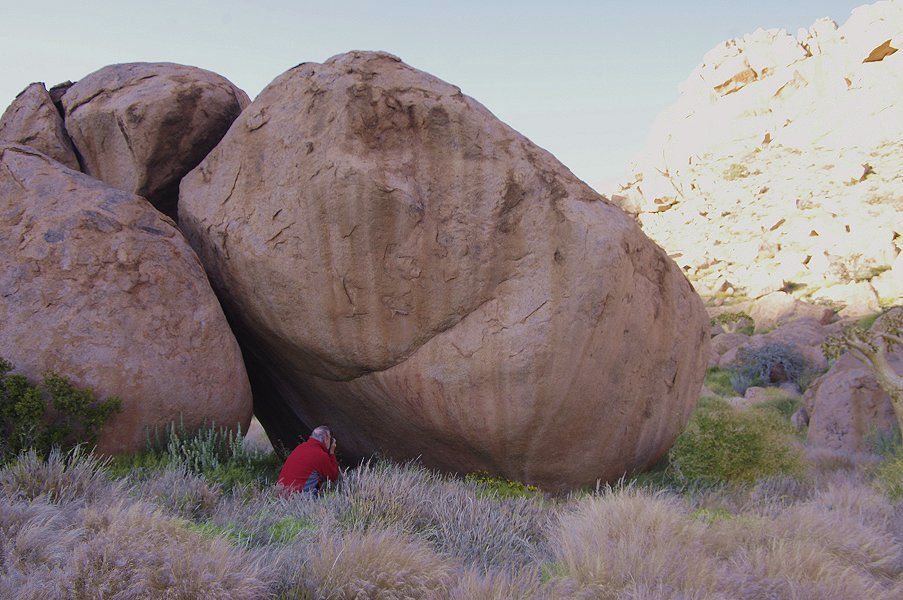
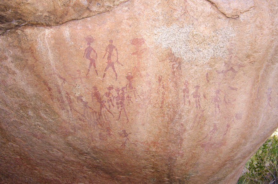
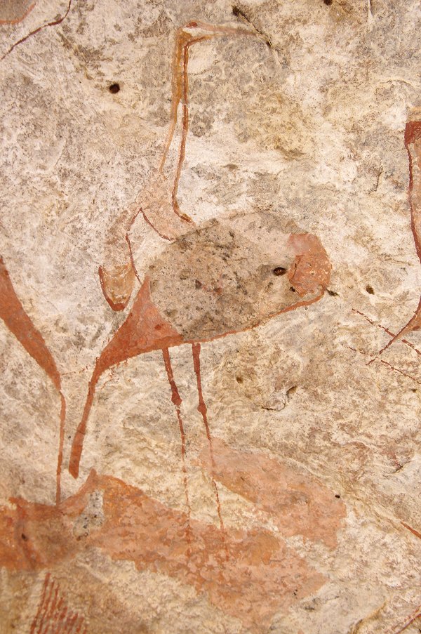
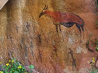
The highlight of the day (if not the whole trip...) was just behind the corner, a mere couple of minutes away. Site N162, the "Okapi Shelter" is in an unlikely location, at the foot of an eroding vertical wall of granite, with no readily visible shelters. One must climb up to the base of the rocks, and the magnificent panel of paintings only come into full view when one is just a couple of steps away. The large hartebeest (not an okapi) and the surrounding human figures form an amazing composition, and are in a perfect state of preservation, one of the finest examples of Brandberg rock art. There are paintings in a further four or five locations along the base of the rocks, including several perfectly drawn oryx and other wildlife.


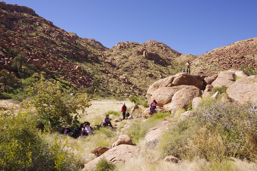
The platform in front of the paintings is very small, suitable for only one or two persons, so we proceeded to have lunch in the shade of a cluster of large rocks overlooking the site, and took turns taking our photographs. This locality was the last of the larger sites in the area, the bulk of our party elected to return to camp for a lazy afternoon, while Gábor, Jon and myself joined Angula to visit two lesser sites some way out along the eastern edges of the basin.
The two sites, N157 and N159 were both fairly small with rather weathered paintings, but it was a very pleasant walk through the plain on the bottom of the basin, with a trickle of water still flowing in the main watercourse. We soon turned back towards camp, and reached it only an hour after the rest of our party.


The rest of the afternoon was spent doing absolutely nothing, all of us enjoying a brief spell of intense laziness.
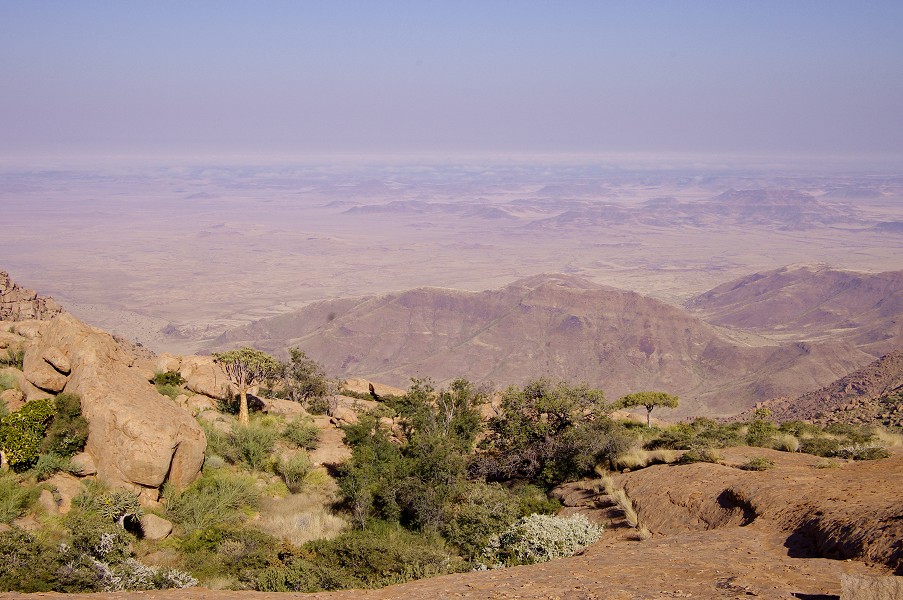
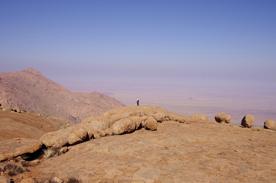
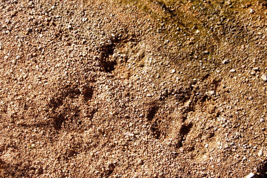
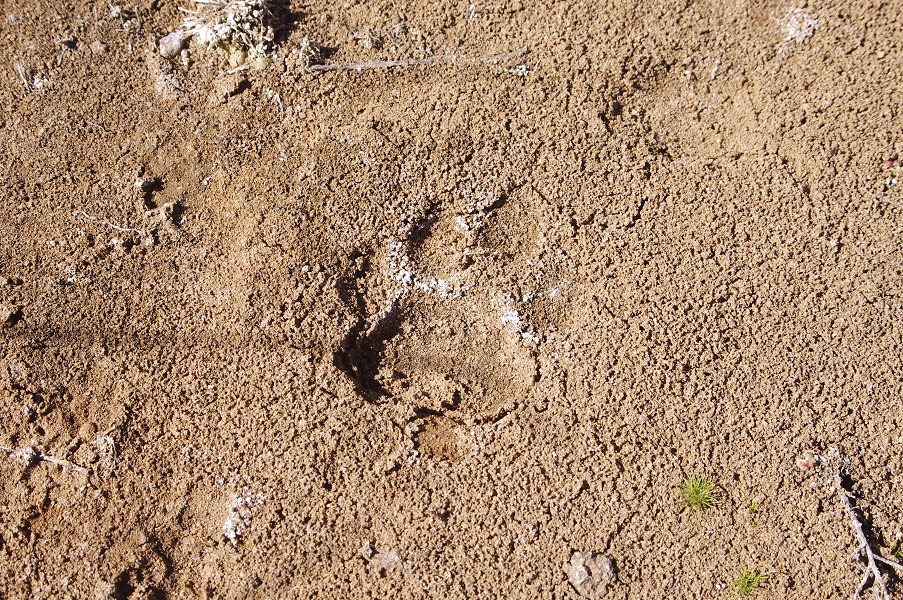
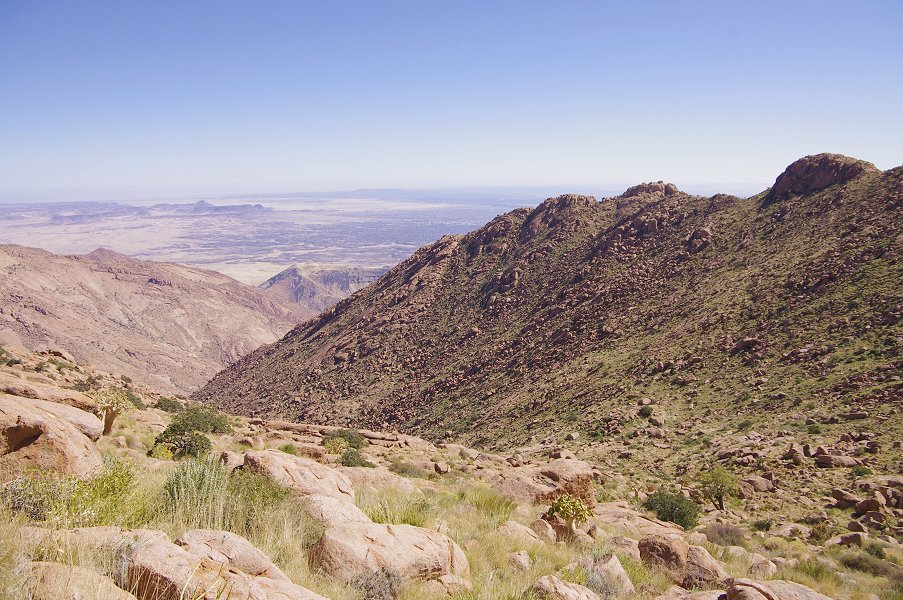
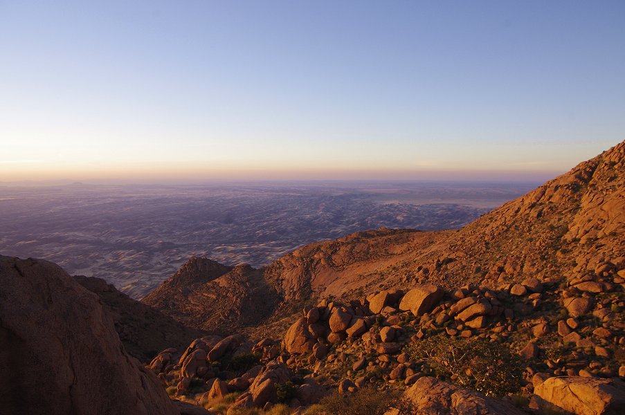
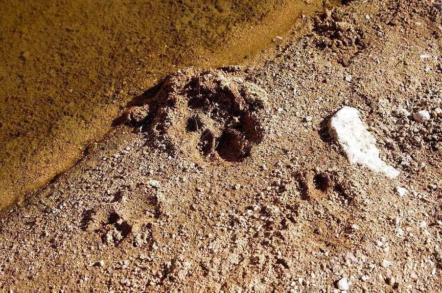
I have taken a short walk to the edge of the basin where we camped, which provided a superb view into the Numas Gorge below, and Messum Crater on the plains beyond. In the dried mud I have seen a couple of leopard tracks, they all appeared rather old, but were certainly fresher than the rains this year.

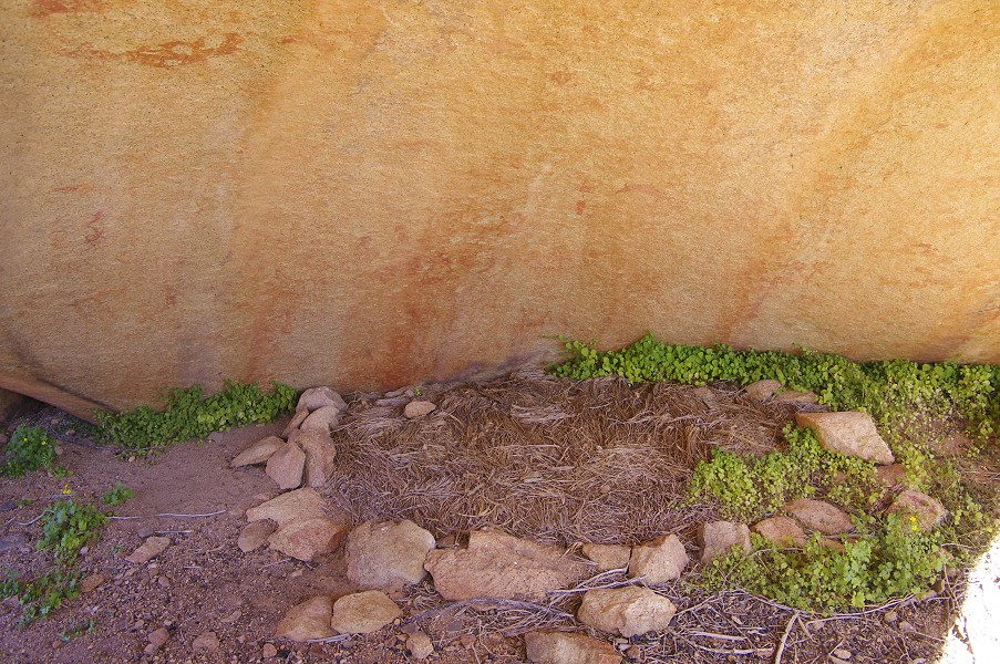
We also had our in-camp rock art site, the big rock just behind our tent contained a fine panel with human figures, site N169. It was out on the sun for most of the day, it was only possible to photograph it in the low light before sunset.
During the afternoon we have also solved the mystery of the camera which Dagmar found in the morning. After cleaning, much to our surprise the camera obediently came to life on pressing the on switch, and from the photographs and the time stamps it became evident that it belonged to someone who used Sun Helicopters to make a brief ascent to this part of the mountain on the early morning of the 8th May, almost two months earlier. (Following our return, the camera found its way back to its rather surprised and delighted owner.)
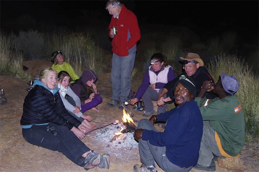
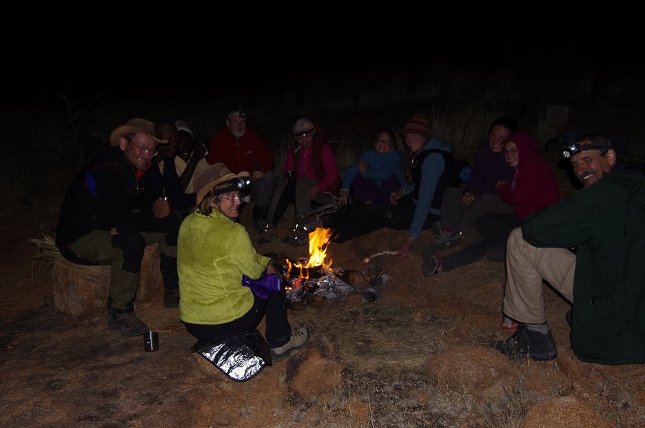
The day was capped by a serious session of marshmallow roasting, a tradition introduced to our desert travels by Hannah at Karkur Ibrahim in Libya eight years ago, and carried on enthusiastically by Dóra and later Viki ever since.


Day 7. - Circus Gorge
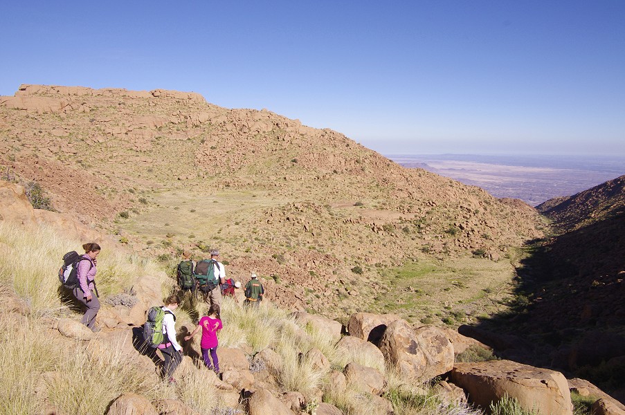
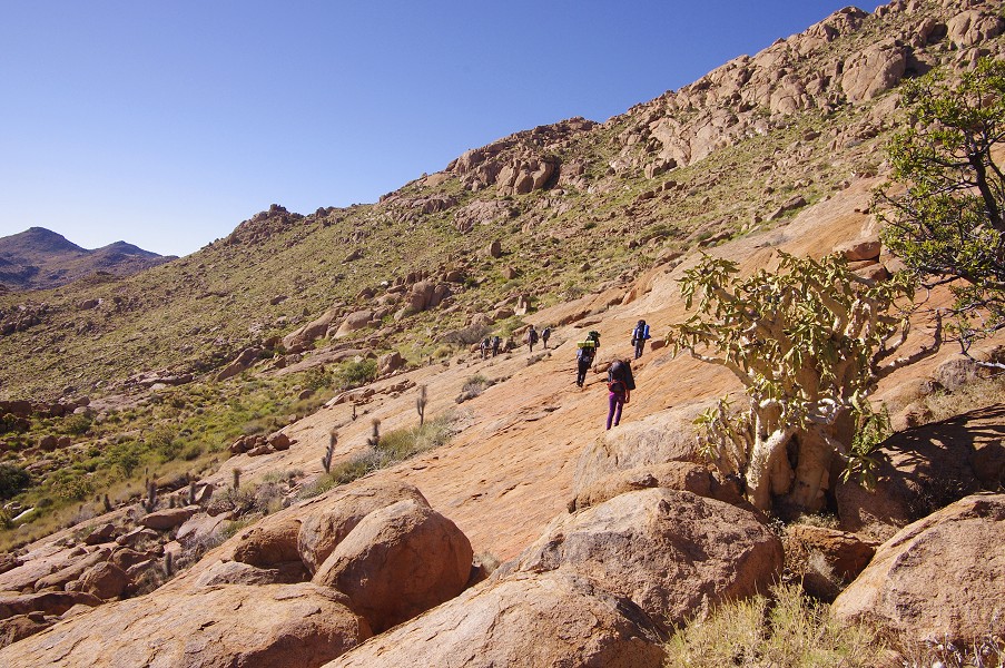
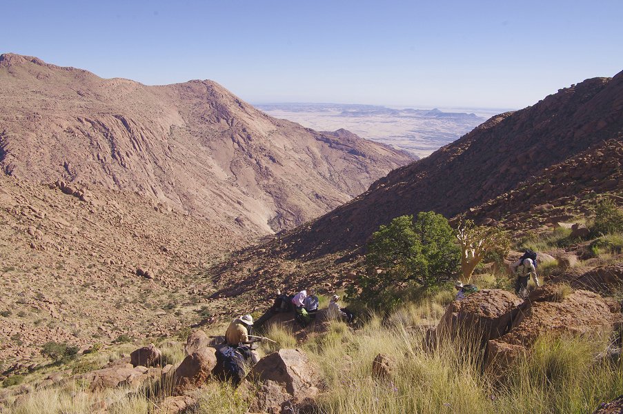
The plan of the day was to make a day-trek to the upper Circus basin, containing C10, one of the finest sites on the mountain. The distance to be covered was roughly three and a half kilometres each way, knowing the Brandberg terrain it appeared doable but we were expecting a long day. We started off towards the col north west of our camp at sunrise, with the first kilometre and half on easy terrain mostly tested already the day before.

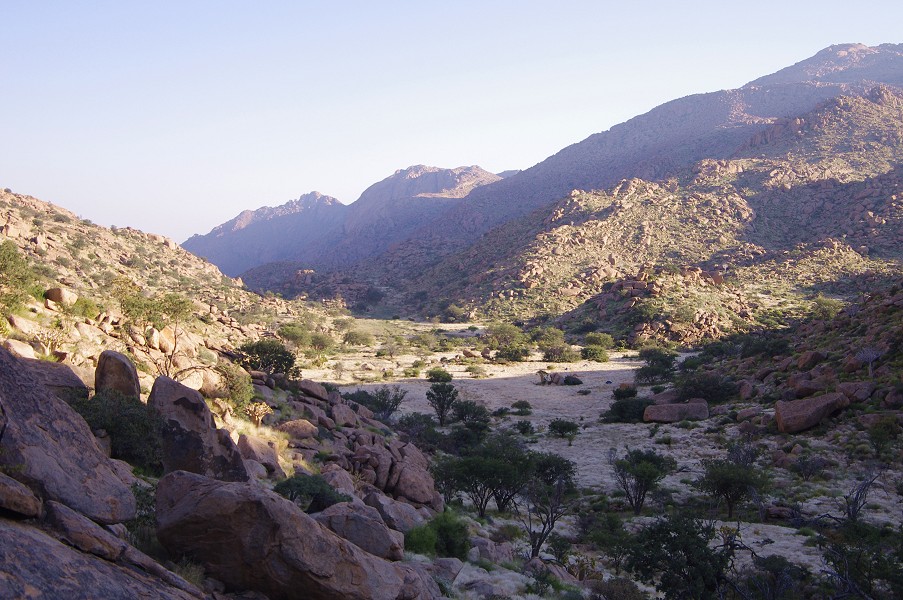
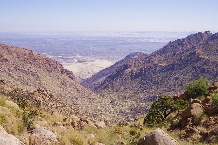
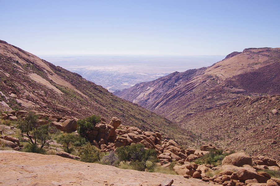
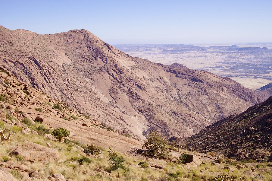
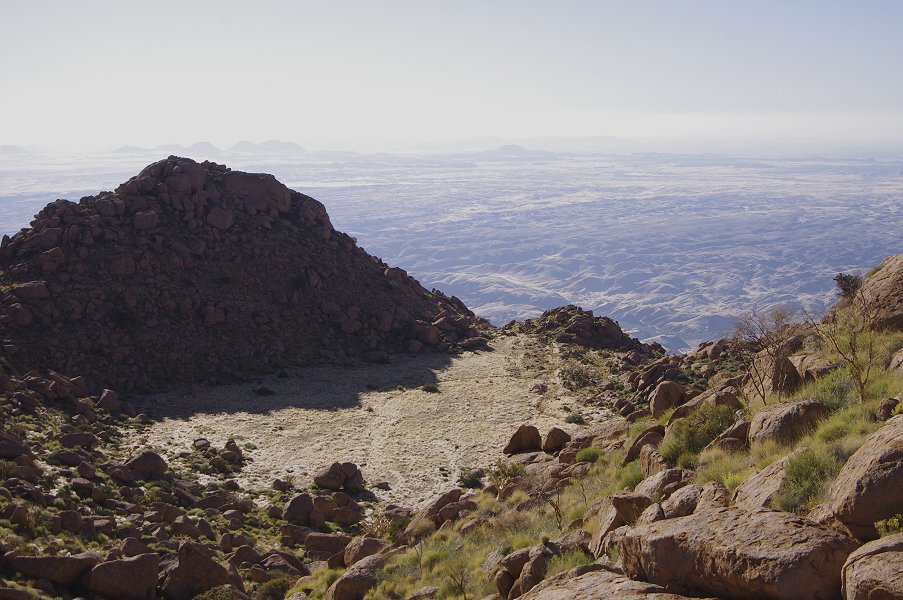
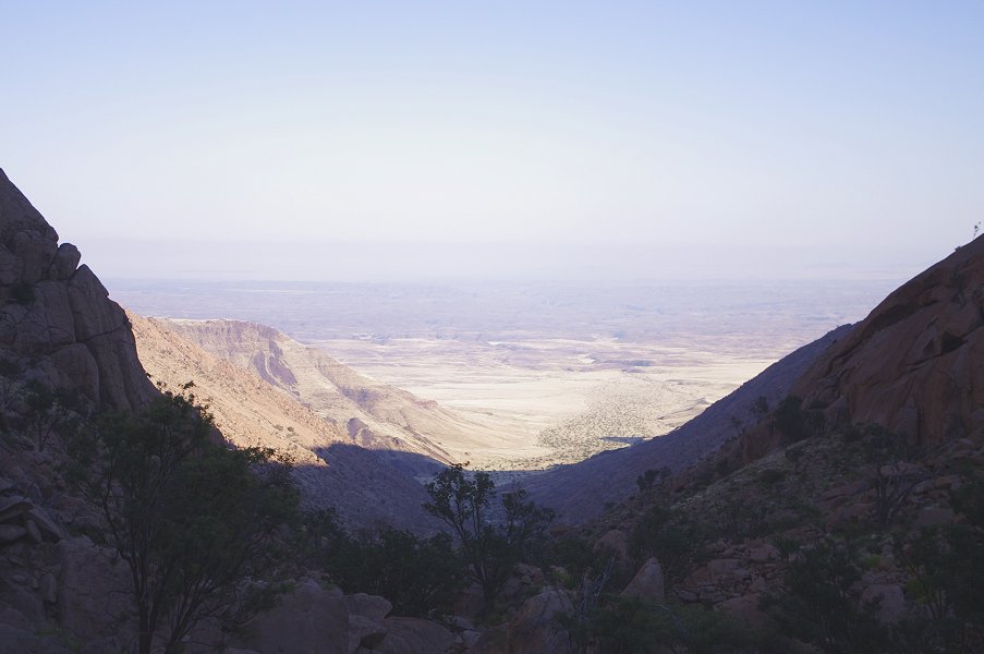
From the top of the col, Circus Gorge came into full view with the hills of Messum Crater on the plains below. It was a straight, not too steep descent, one of the very few pleasant terrain surprises experienced on the Brandberg. Based on the map, we had to lose about 350 metres of altitude till C10, the principal site.
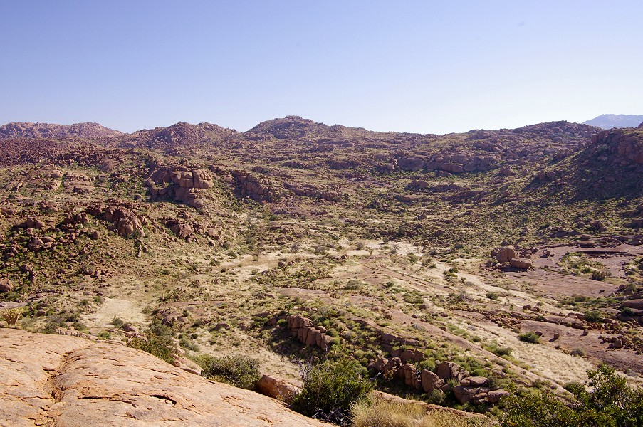
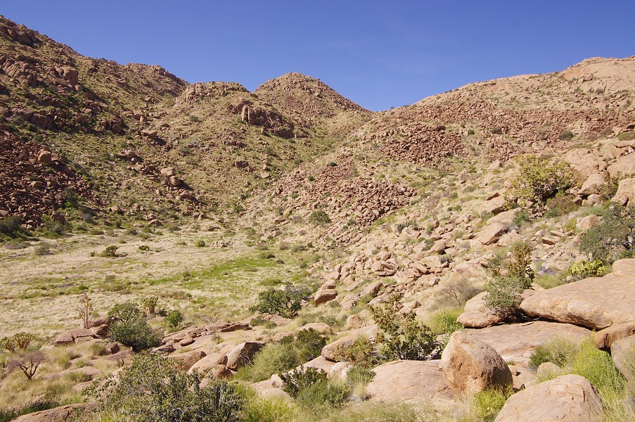
After a descent of about an hour, Circus basin came into full view. Getting closer, the origin of the name "Felsencircus" (Rock circus) became readily evident. The perfect oval basin showed a remarkable resemblance to a Roman amphitheatre.
The last slope proved to be the most difficult, with some rather steep sections, but in another hour we were down at the bottom of the basin, and Angula led us straight to the shelter with the principal paintings. It was shortly after 10am, we have made excellent progress, beating all expectations. A trickle of ice cold water was still running in the riverbed, offering the prospects of a rather cold bath for anyone brave enough...

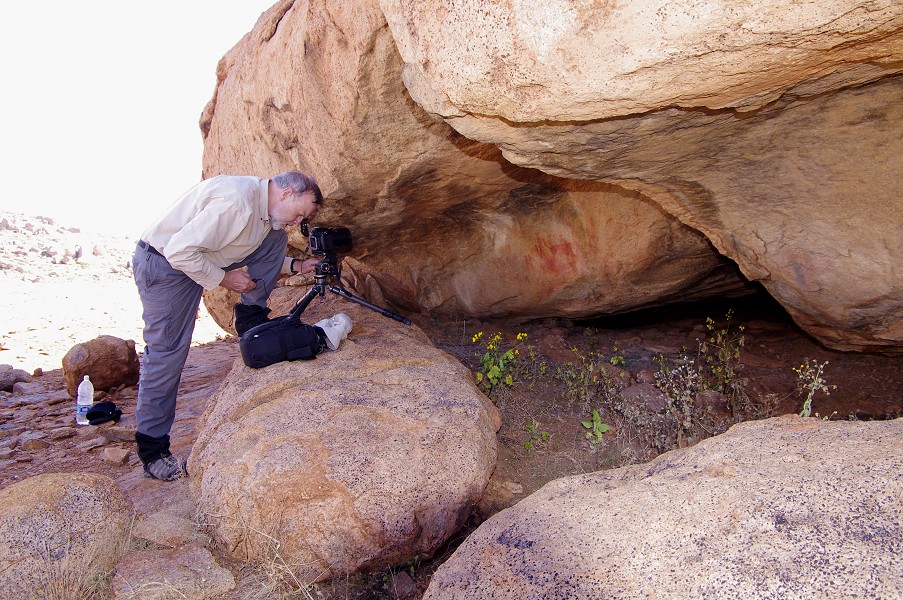
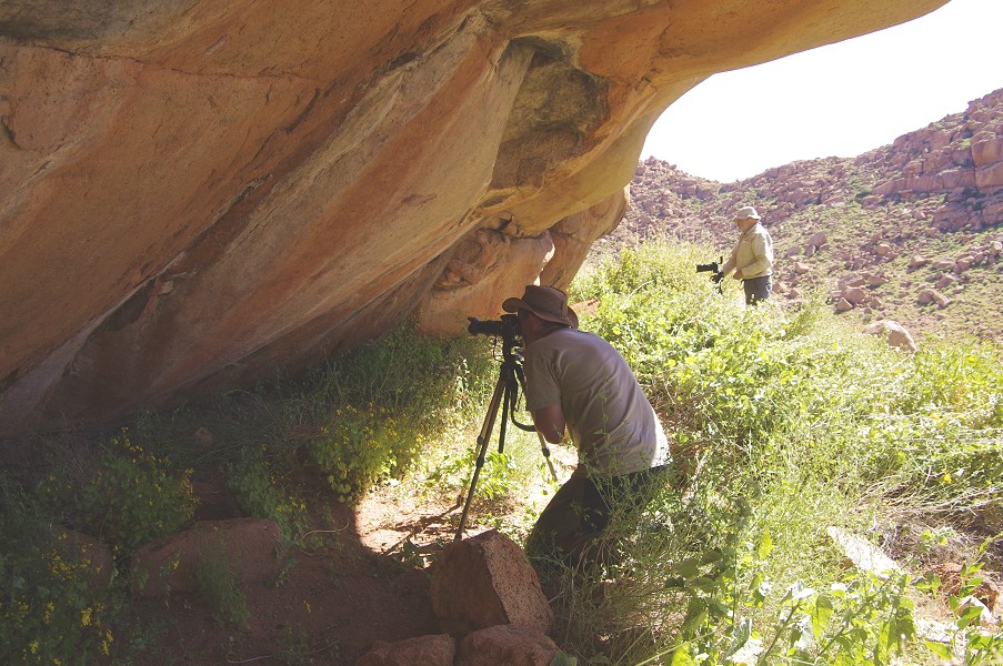
C10 is situated in a small shelter under a not particularly large or conspicuous boulder. The main panel is rather small, based on photographs I was expecting a much larger site, but in this case the exceptional nature lies not in numbers, but the absolutely perfect state of preservation and the exquisite artistic detail. The paintings are as vivid as if made yesterday, arguably one of the best on the entire mountain.


There is a smaller panel of human figures on the side of the rock opposite the shelter. These are in a much worse state of preservation, being out in the full blaze of the sun for most of the day.

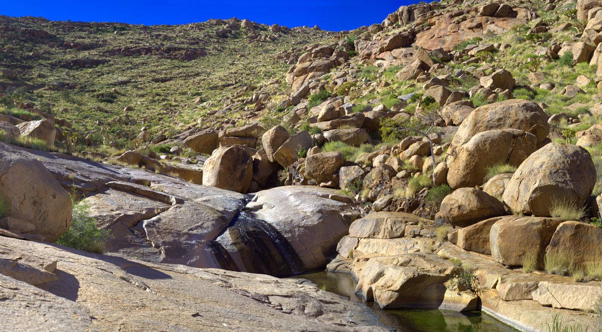
A short distance downstream from the shelter, the creek passes through a rock ledge, and through the ages the water carved a narrow channel in the rock emerging as a small waterfall on the far end. This was a perfect spot for an icy shower, apparently the ancient inhabitants thought so too, as there was a small rock art site (C11) with a fine shelter scene adjacent to the cascade. The pools at the foot of the waterfall were filled with hundreds of water beetles, constantly scurrying about on the surface, never stopping for a moment.


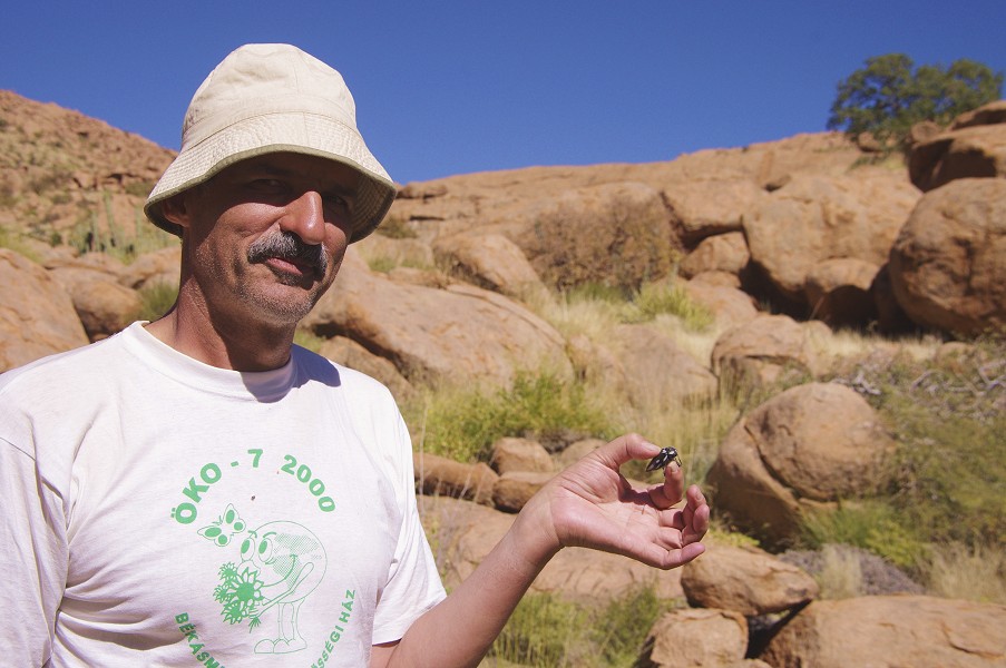
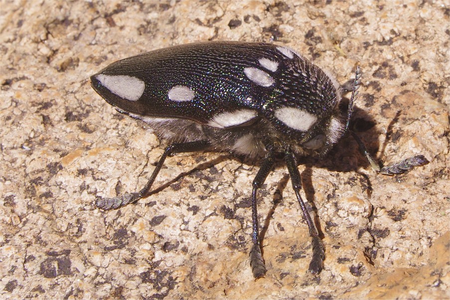
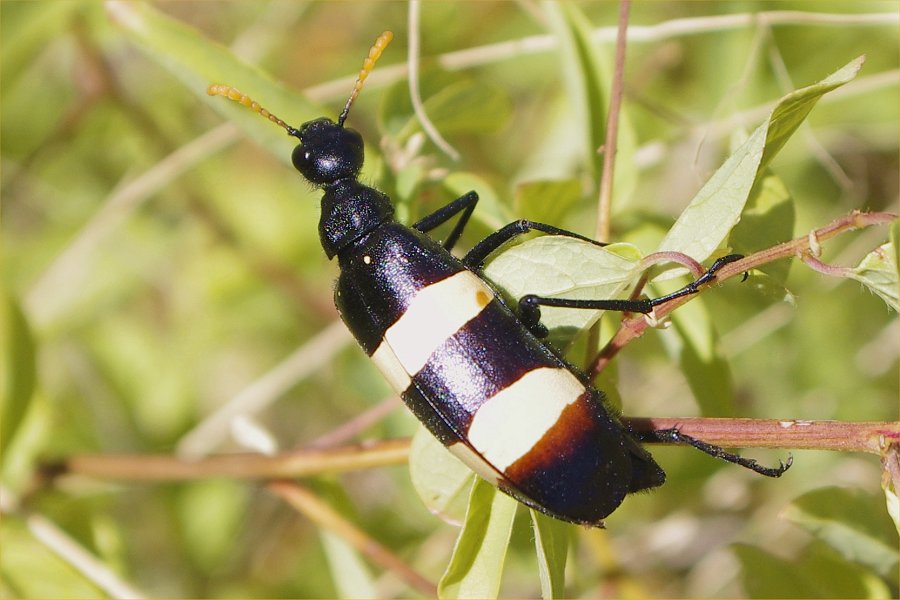
We had our lunch in the shade of a few shrubs in front of C10, and as we did an alarmingly large and noisy insect started circling us, then landed with an audible thud in a low bush nearby. On investigation it turned out to be a formidable but totally harmless giant jewel beetle (Sternocera orissa), the largest member of the Julodinae sub-family. It posed obediently for the photos, and did not even struggle much when picked up. It's appearance was an exception, we already noted on the previous trip the surprising scarcity of insects in the upper Brandberg.
After lunch the more energetic members of our party followed Angula up to the terrace some thirty metres above the basin to see another two sites with paintings. The first one, C8 was a small one with few paintings on the side of a larger boulder close to the edge of the terrace.

C7 was a more formidable site, some distance away on the far side of the terrace, among a cluster of large boulders. The state of preservation was not very good, but the site contains several panels showing large herds of gazelle and other animals.


Around 2pm we started our trek back towards camp. We re-traced our downhill route, the trampled plants still clearly visible, making our progress much faster. In under two hours we reached the col separating Circus and Numas gorges.


From the col camp was a mere 45 minutes away. As we crossed the stream near camp, Viki found a series of fresh looking leopard tracks in the dried mud.
In the evening as we were sitting around the camp fire, a two inch centipede (Scolopendra sp.) visited us, probably crawling out of one of the dead branches we collected for firewood. Later with Peter we went out on a scorpion hunt with the purposefully brought ultraviolet LED torch, but have found absolutely nothing, despite the Brandberg having supposedly one of the richest scorpion faunas in Africa. Perhaps it was the wrong season, or the wrong area.


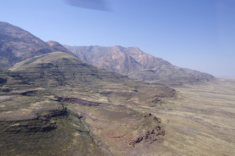
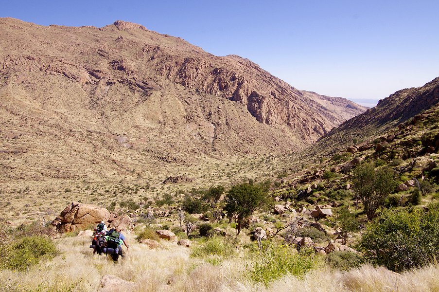
Day 8. Upper Numas - Engelhard Plain
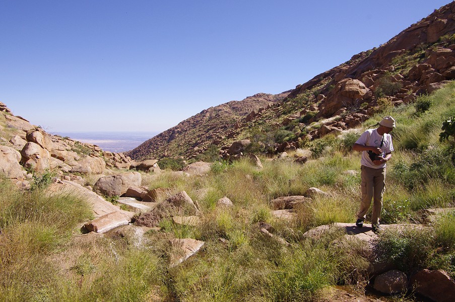
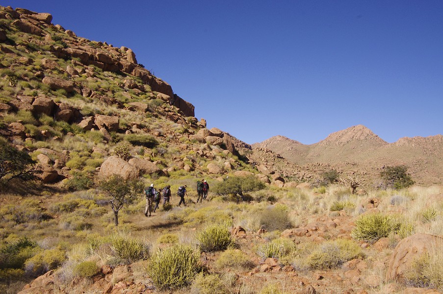
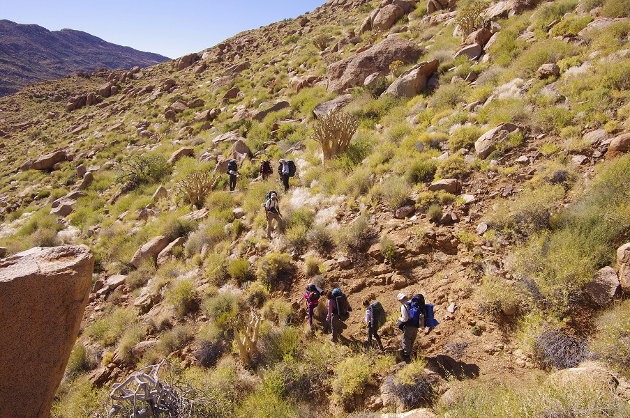
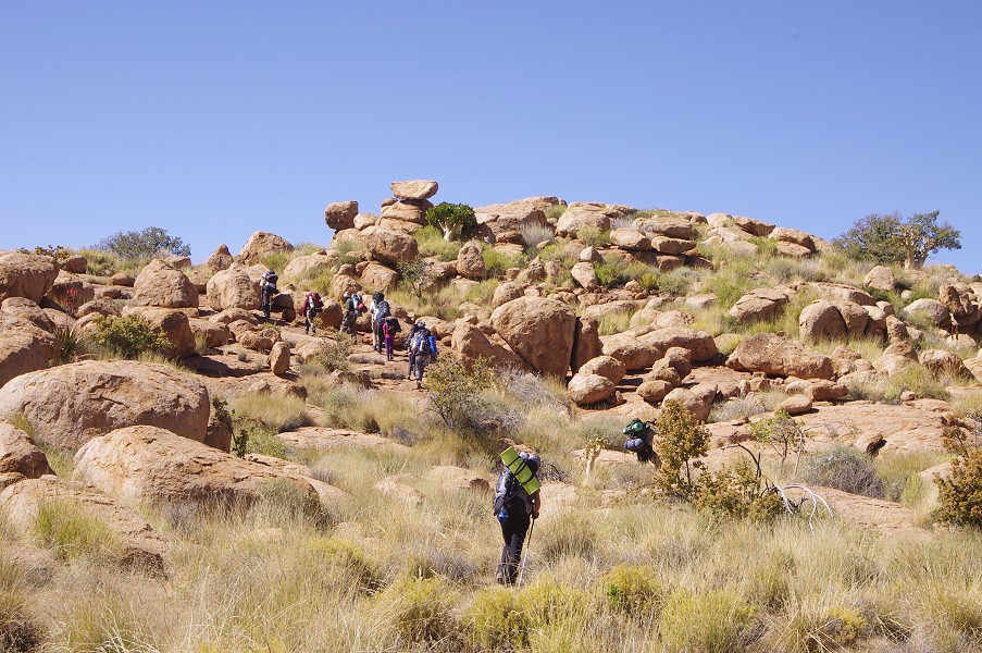
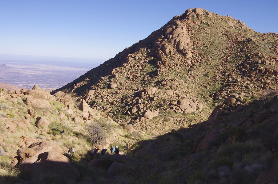
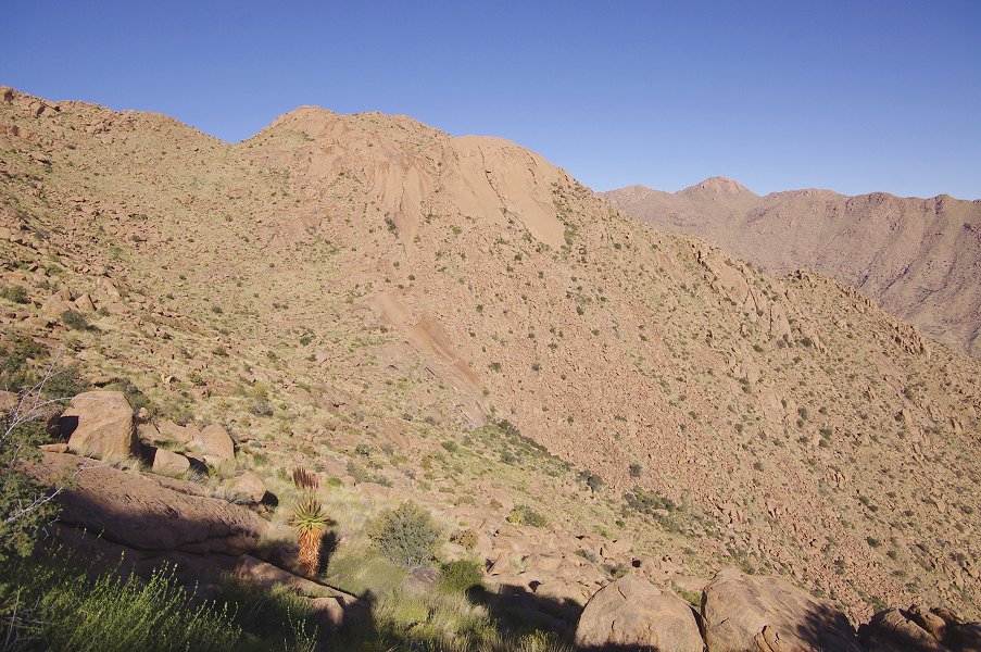
The task of the day was to make the long trek around the southern rim of the Naib basin, sticking to the 2100m contour to the best we could, and finish at the Engelhard plain, only 4 kilometres away as the crow (or helicopter) flies, but the actual route was more like ten. The direct route would have involved a descent of 700 metres into the Naib basin, then an ascent of 900 metres on the far side, something that would probably have taken two full days. We started out at first light, anticipating this to be the most difficult day of the trip. The first part of our route took us along the steep north slopes of Numasfels.
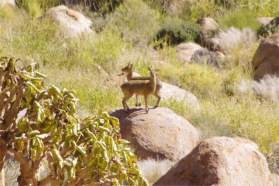
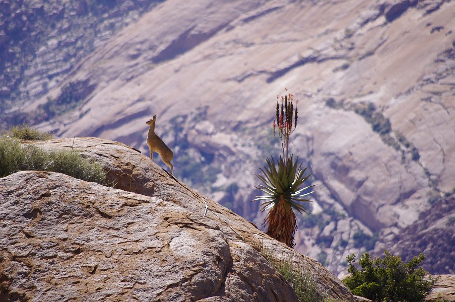
At one point we encountered a pair of klipspringers, perched on a rock deep below us, following our progress with their stare. Apparently they decided that we posed no threat, standing there motionless on the tips of their hooves for a good ten minutes, as long as they remained in view.
We made steady progress. The trail was long but not particularly difficult except where we had to cross one or another of the steep gullies descending from the slopes above. We stopped for a short rest every hour or so, but up till now the terrain was better than what we anticipated, with relatively little vegetation to hinder our advance. By mid-morning we were looking into Naib along it's length, nearing the spot where we intended to cross the riverbed.

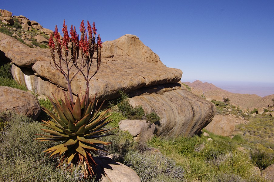
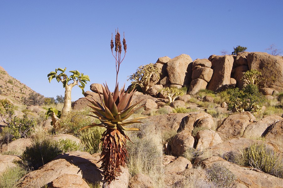
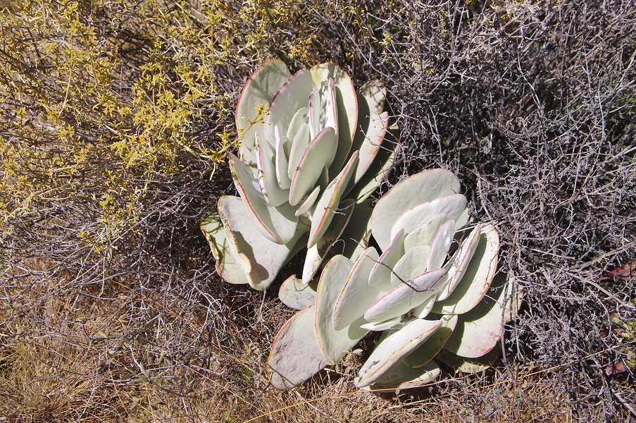
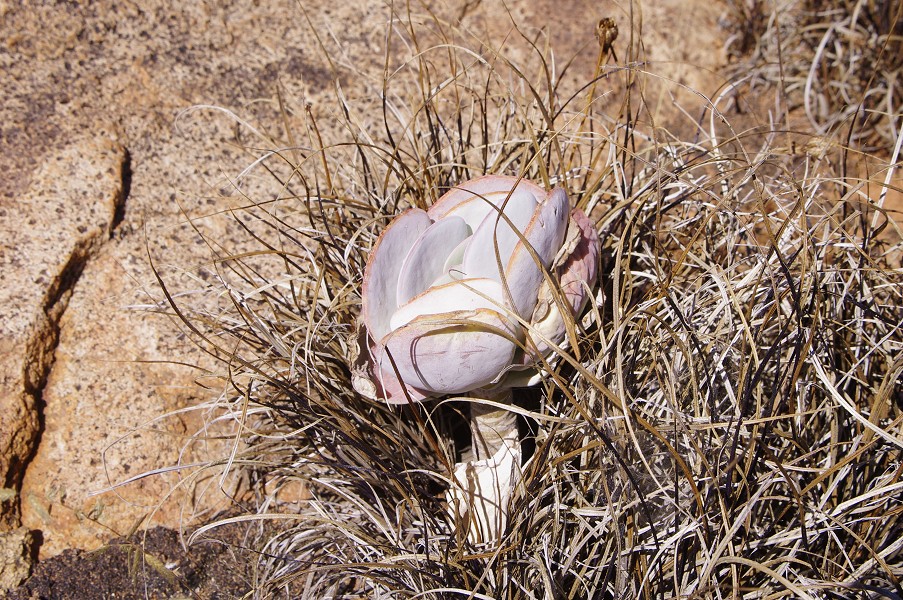
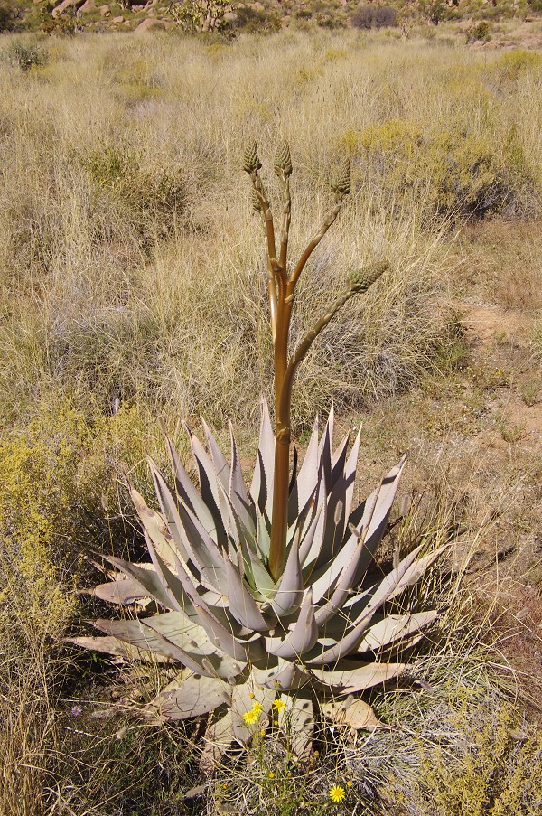
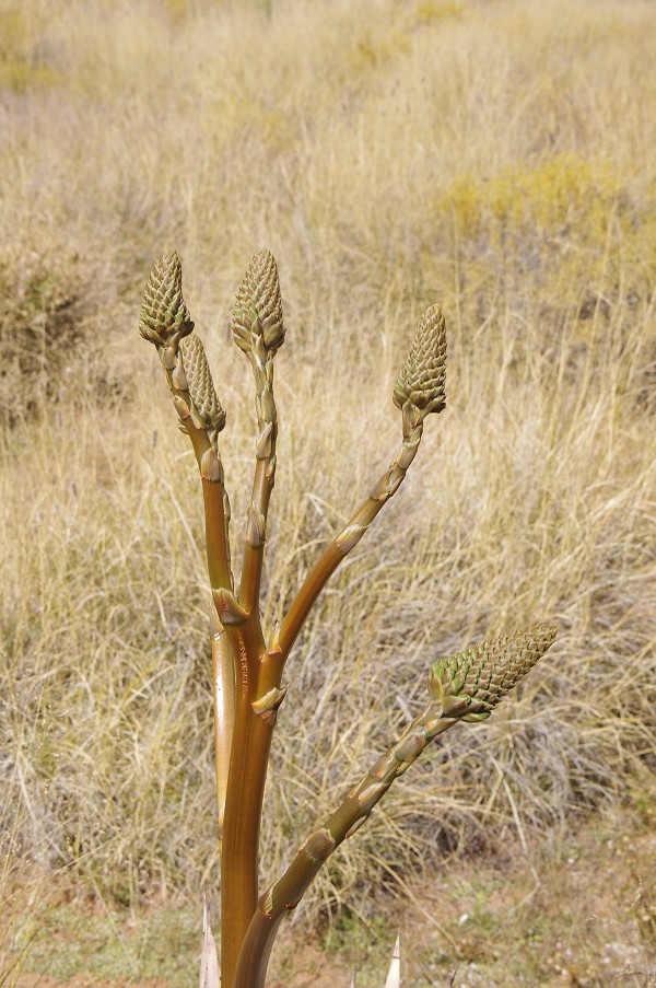
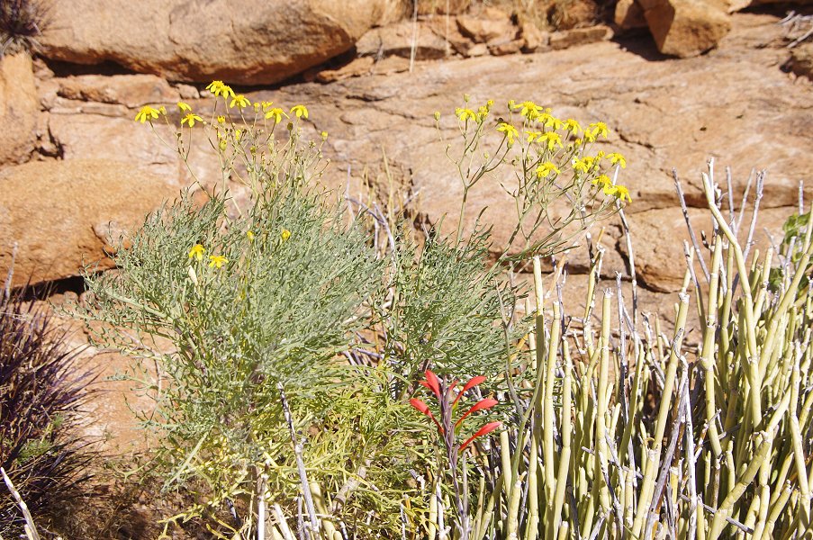
On a small level plain at the North Eastern flanks of Numasfels, we encountered a fleshy leaved plant not seen elsewhere, growing in the shade of other vegetation. In the same place we also saw an unusual young aloe with sprouting flower buds, all other seen examples were sporting the bright red plume of flowers, or the flowers have already withered.
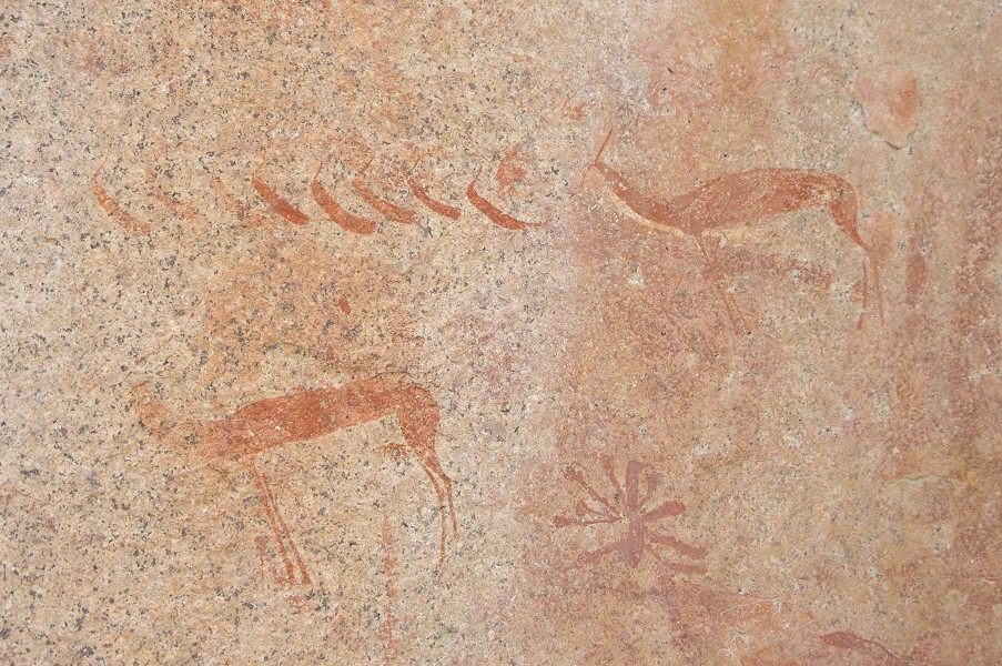
We crossed the Naib river, which was in full flow, near the 2050 metre contour. We have done a remarkably good job at keeping to altitude and not wasting energy by ascending and descending continuously. From here it was uphill all the way to the Engelhard plain, about 300 metres above us. We stopped for lunch beside a smaller rock art site (I123), the only one we had time for of the dozens of sites littering the slope below the Engelhard Plain. Of the multitude of scenes copied by Harald Pager at this site, only a fine row of antelopes was readily visible.
We continued uphill, now progressing significantly more slowly than earlier that day. Even with only the day's supplies the packs were becoming heavy, and in places dense vegetation made the going very slow. As we ascended, we had a perfect view of the route we have taken in the morning. We finally made it to the level of the Engelhard Plain by around four o'clock, taking a brief rest before pushing on for the final stretch to camp on the far end of the plain.


The small valley that led into the plain from the south east was found to be completely waterlogged. The ground looked deceptively firm, but in spots one sank till the knees into the soft mud. The only way to make it across with dry feet was to step on the larger tufts of grass, which supported one's weight. Some were more successful than others...
After this final struggle we were on the plain, reaching the pile of boxes dumped from the helicopter at the far end as the sun was setting below the surrounding hills. All in all it turned out to be a long, tiring, but perfectly doable day.
Day 9. - Engelhard Plain
Following the long trek of the previous day, this one was planned for quiet relaxation, just visiting the rock art sites scattered around the Engelhard Plain. It was a rare luxury to be able to stay in the sleeping bags till the sun came up, then warm around the campfire like a pack of lizards. In the light of the day we could also check out near the camp the deep ruts left by the helicopter skids in the soft mud as we attempted our first landing.

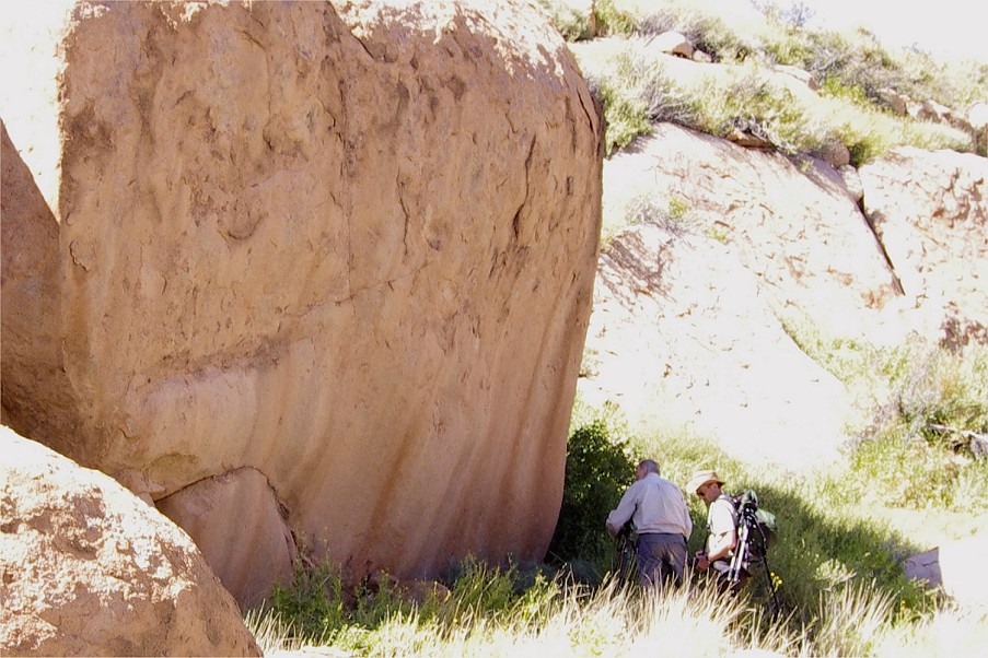
We started by making the walk to site I47, not actually on the plain but under a huge boulder on the hillside in the valley to the west of the plain. We were hoping that there might be an easier way than the one we found last year, but Angula led us on the same path, scrambling over huge boulders before reaching the shelter. This site is another of the wonders of the Brandberg, it was good to enjoy it without any time pressure.

We returned to camp, passing by site I57 along the way, which we failed to see last year. It appeared to be a fine site but now fully out on the sun, something to be re-visited when the sun is low in the afternoon. However the north western panel of I56 was still just in the shade allowing for much better photos than on our last visit, we continued there before going back to camp.

After a rest and second breakfast we moved to the northern edge of the plain, to locate the four sites recorded there by Harald Pager, of which at least I51 and I52 looked interesting. This was the single occasion when Angula's memory faltered. He looked in vain among the boulders for the sites, perhaps they were too faint to notice or he looked in the wrong places, in any case we have found nothing but a few old leopard tracks.
We moved on to the little eastern valley, where we have made our muddy entry the day before. This time we did not have to go up to the soggy ground, the two sites we have come to see were both in the lower section of the valley, just beyond the plain. I169 is on the northern side, on a large vertical rock face. Among various human and animal figures there is a strange headless depiction of a running figure.

On the far side of the valley there is a cluster of huge boulders with numerous panels of paintings dispersed among them (I170), including a huge entwined pair of eared serpents (or one with two heads) prominently visible from afar. Last year I have briefly visited this site as we were leaving the plateau, but missed many of the more hidden scenes. This time we could take as much time as we liked, starting with the upper shelter which I did not see before. We had to fight our way through in Indiana Jones fashion across a barrier of thorny bushes, revealing a spacious shelter with a number of very fine human figures painted on the walls and the slanting ceiling.

In the lower shelter below the large serpents Angula pointed out a stone enclosure filled with dried grass, which used to be his bed when they were surveying the Engelhard Plain with Harald Pager. He also showed a painting of what he said was a rhinoceros high up on the rock outside the shelter that I have completely missed both previously and now. It did not look very much like a rhinoceros but have not given much thought to it until processing the images, when dStretch revealed what appears to be one of the rare cattle depictions, a detail that apparently Pager himself failed to notice.
The left side of the large serpent panel was completely overgrown with a large thorny bush, obscuring both heads and the surrounding paintings. After much effort and with hands bleeding in several places, I have managed to break off the worst of the offending branches, allowing a reasonably unobstructed view for a few months to come. Unfortunately the panel is rather faint and weathered in places, even with dStretch it is difficult to make out exactly how the two serpents merge into one.


A large rock in the rear contains a panel with two discernible faint elephants, however dStretch here too reveals a multitude of other figures that are too faint to be seen on the spot.
From here we moved to the principal site of the Engelhard Plain (I55), a large egg shaped boulder at the edge of the plain near the principal water sources. The boulder contains paintings of varying quality all around, the best ones are on the north-eastern face, including the strange group of clawed animals together with several eared serpents. With the sun striking at different angles during the day, we later returned to this site several times to catch the panels out of sunlight. Some of the scenes are readily discernible, but some are so complex with a multitude of subsequent layers that even with dStretch it is difficult to make them out. It is amazing how Harald Pager managed to make sense out of some of them.


We slowly trickled back to camp for lunch, with the afternoon left free for all to do as they liked. I targeted the three sites around camp with the sun starting to be low enough, Gábor decided to climb the almost 2500 metre peak towering above the plain, the others also visited some sites or just enjoyed doing nothing for a change.

I started with the site just behind camp (I58) with two large panels, both of which we have seen last year, albeit in a rather hurried fashion, on our way to I47. The one on the right is slightly above the plain level in a shallow shelter, while the main panel about 30 metre to the right is on a rock wall on plain level. The shelter contains more usual scenes, but the wall on the right depicts a number of uncommonly large and detailed animals.

We have visited I57 in the morning in the small valley separated from camp by a low ridge (with I58 on the camp side of the ridge). Now the main panel was completely in the shade, ready to be photographed.

While the state of preservation of some of the paintings was surprisingly good given the exposed location, as usual there was more than what readily meets the eye...
I continued to the nearby I56, where the northern panel with the finely preserved elephants was in the shade. With more time at the shelter, I noticed a multitude of small faint human figures under the elephants, only visible properly after image enhancement.

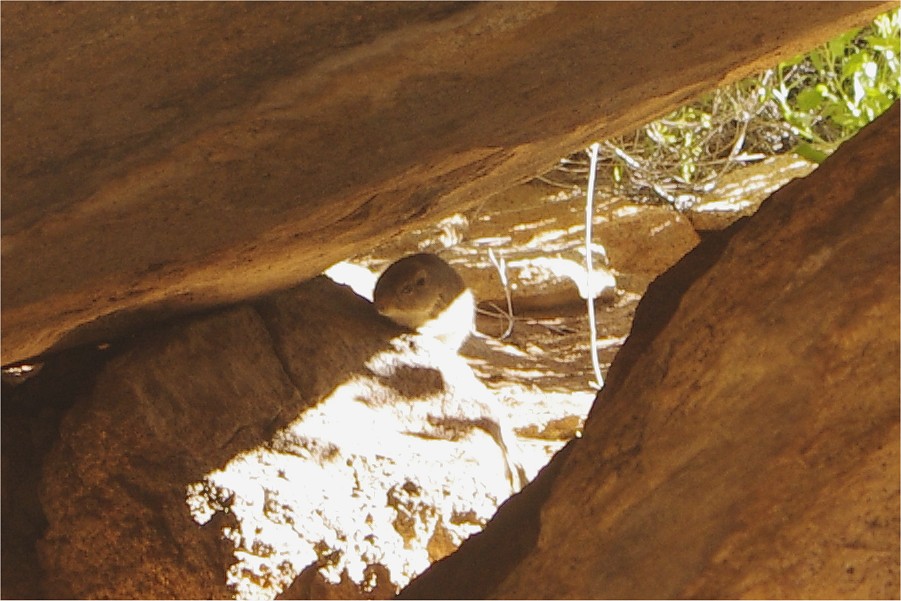
As I was busy photographing, there was some movement at the rear of the shelter. There was some kind of animal moving about, only discernible as a dark shadow. Finally it came out to the light, it appeared to be a ferret like creature with a long tail, but it never showed enough of itself to be certain. I managed a quick shot in very bad lighting conditions, the resulting picture came out surprisingly well. It still did not reveal much about it's identity, though the head appeared to be that of a rodent. Subsequently it was identified as a Dassie rat (Petromus typicus), apart of the mountain hares the only larger rodent living on the mountain.
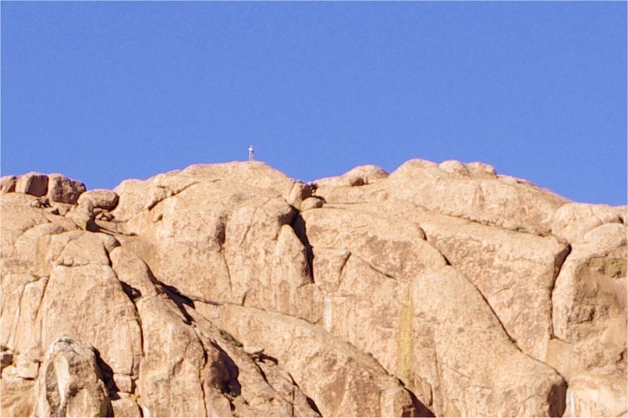
In the meantime I was keeping an eye on the top of the granite peak across the plain, and sure enough a white speck appeared, Gábor on the summit. He spent a good 15 minutes there before disappearing again, presumably on his way down.
Later in the afternoon, done with all photography, I went to fetch some cooking water from the pools next to I55. It was not an easy task, as most of the pools were filled with mosquito larvae, it was hard to fill a five litre bottle without getting any of the little wriggly things inside. Might have made a good soup though...
As the sun slowly sank, everyone started to converge on camp, Gábor too appearing as a white growing speck on the far end of the plain.

We were still missing one fine panel of paintings depicting an eared snake with a man apparently riding it. We believed it to be at I170, Jon and I spent quite some time looking for it in the afternoon without any luck. Now back in camp in the low light, a largish shelter was evident not far above our campfire spot. It was badly overgrown, but I fought through the thorns, and sure enough have found the missing scene in it, it was a part of I58 continuing on a higher level, with another fine panel of human figures close by.
With the looming darkness there was nothing left to do but to converge on the campfire for the evening bar and the subsequent dinner, then pack ourselves off to sleep before another long trek the following day.


Day 10. - Upper Karoab Gorge - Porters Gorge
At dawn we set out for the Porters Plateau, located at the upper end of Porters Gorge above the steep North Western slopes of the mountain. The trek was planned for two days, as even though the straight line distance from the Engelhard Plain was no more than four kilometres, roughly the distance we had to do to Circus Gorge three days ago, the terrain looked much more difficult. To lighten our load, we planned a bivouac without tents, just carrying a mattress and sleeping bag with the bare necessities. A cache of food, water and other drinks was waiting for us at Porters, dropped off with the helicopter. At first, we had to make a 250 metre descent from the Engelhard Plain to the Naib-Karoab saddle, a task that took us a good hour and a half.
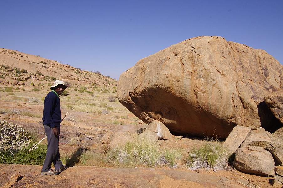
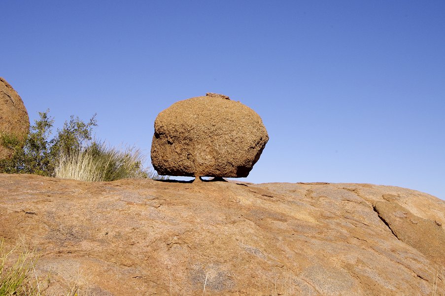
We had our first rest stop on the saddle, near an amazing balancing boulder that must have weighed a ton, yet it was only held firm by two little granite stumps of a few centimetres. Site K20 was supposed to be on the rocks all around the saddle, but with the best effort of Angula and ourselves we could not find any recognisable panels. Angula led us down to a large rock just under the saddle on the Naib side with a few barely discernible paintings (I43). This site supposedly contains one of the very few representations of a wildebeest, however it was impossible to make out anything but the faintest traces of paint.

As we started to move towards the steep rise on the far side of the saddle, Angula did find site K21, an isolated boulder with a panel of rather weathered paintings on its side near the base of the slope.
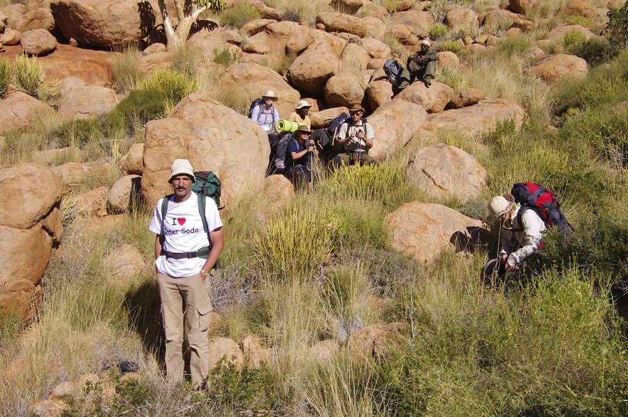
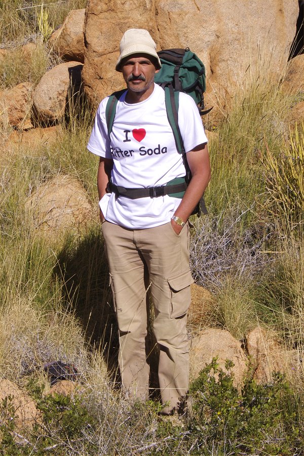
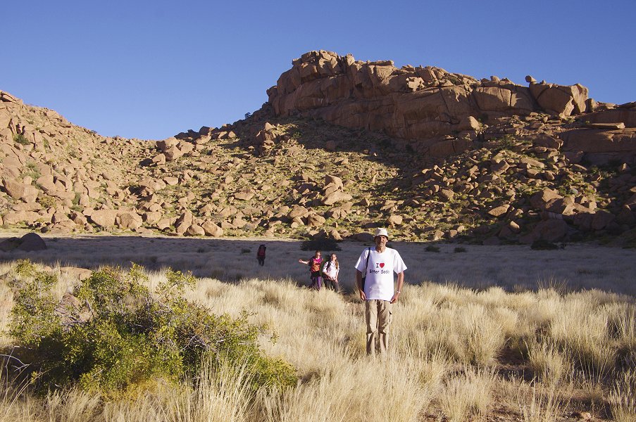
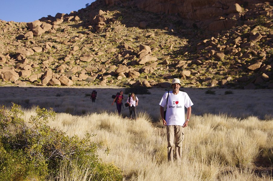
The brief pause provided the opportunity for Gábor to pose in his fine t-shirt specially made for this trip. For anyone who participated in the 2003 or 2010 Libyan expeditions the pun line was obvious, but for the uninitiated: bitter soda is a particularly vile fizzy concoction of purely artificial flavours, resembling a Campari soda but without any alcohol. In dry Libya it was the drink of choice for the evening bar, as practically anything else was hopelessly saturated with sugar to the degree of being undrinkable. Needless to say, after 14 days of nothing else, it becomes a love-hate relationship... :)
We continued up the slope along a ravine filled with huge rounded boulders, a long and rather difficult climb of nearly an hour. On reaching the top, we were rewarded with a wonderful view to the rugged far side of the Karoab Gorge, with a klipspringer obediently posing for a few moments on the ridge.
After a short search Angula led us to another site, K7 a little further up the now more gently sloping ridge, with a few very weathered paintings of human figures along the side of a larger boulder, only visible properly with dStretch.
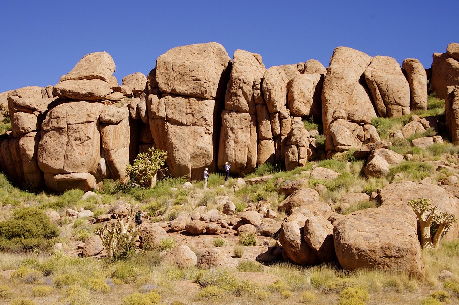
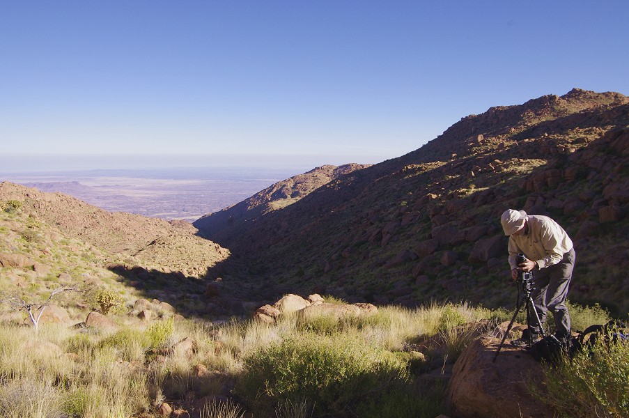
We left our packs at the top of a descending gully, and in a half hour made our way down on the smooth granite plates to a terrace on a level about 100 metres below us. A large cluster of boulders made up site K2, the principal site of the upper Karoab Gorge. It consists of three principal panels on two immense boulders, plus a number of lesser ones on the surrounding rocks. With the sun coming up to noon, the lighting was very difficult, with many of the paintings partially or completely out in the sun. We noted for a possible future visit that this site is best visited early in the morning, with the sun still rising behind the ridge.

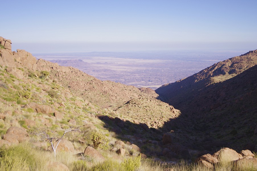
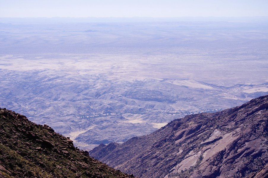
The terrace below the site must have been as perfect resting place in antiquity as it was now, with the edges dropping off vertically to reveal an amazing view of the whole Karoab Gorge, and the Ugab River deep below. We took in the view, taking mental notes of the better looking routes and possible helicopter landing spots. Karoab is so immense and difficult, that in the future at least half of an entire trip will have to be devoted to it, making the descent in stages of several days, visiting the sites dispersed in the valley along the way.
We climbed back up to our packs, and decided to move on for another hour to some shady spot for lunch. We climbed to the crest of the ridge, and were soon looking into the upper part of the Dassie valley on the Naib side, which we had to cross to the ridge on the far side, which was hiding Porters Plateau beyond.

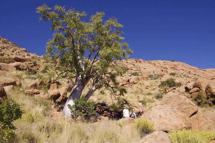
The terrain ahead was as nasty as only the Brandberg can offer. It was impossible to stick to our present contour, as several vertical rock faces barred the route, with large enough drops to rule out going over them. We had to lose an altitude of at least two hundred metres, before climbing up the same on the far side, among boulders densely overgrown with vegetation. A large tree with dense foliage offered a good lunch spot about fifty metres below us, we aimed for it to have a longer break before tackling the rest of the way.

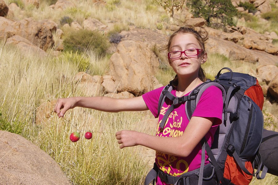
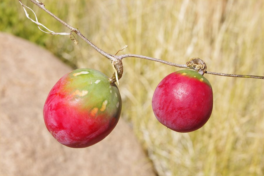
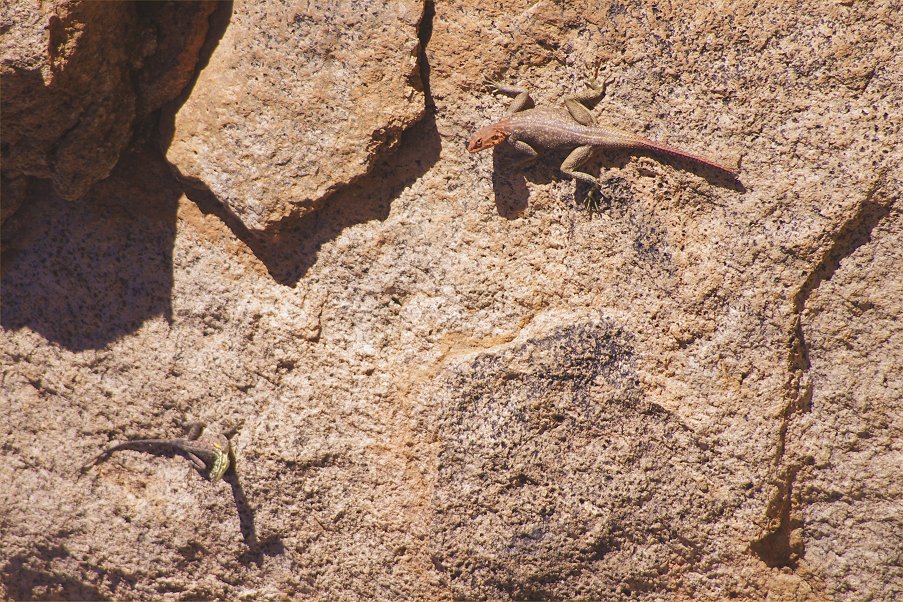
Crossing the Dassie Valley proved to be as difficult as it looked. The straight line distance was less than a kilometre, yet it took over two hours to make it across and to the top of the ridge ahead. Along the way we encountered several of a plant with tomato-like red fruit (in reality a relative of the colocynth, the desert melon). Viki also spotted a pair of red and yellow agamas, the first we have seen on this trip so far, they are almost completely absent from the upper parts of the mountain but are abundant below.
It was well into the afternoon when we reached the watershed on the ridge, and caught our first glimpse of the Porters Plateau, still a good 100 metres below us. It took over another hour to finally reach the level plain.
We have recovered our two supply boxes from under the shrub in the middle of the plain, and immediately declared the pile of rocks at the edge of the plain as the "Sunset Bar", not quite waiting for the sun to set before giving "the bar is open!" call.
From our vantage point we had a superb view of the rugged rocky terrain to the North West of the Brandberg, with the Ugab River gouging a deep canyon through. We sat there until the sun finally dipped behind the ridge separating Porters and Raiders Gorges.


With the sun gone, it rapidly became cold, we soon had a big fire going on a suitable patch of granite, and raided our supplies boxes (which also contained a pack of marshmallows, much to Dóra's and Viki's delight) for dinner, after which we all packed ourselves into our sleeping bags scattered about the plain at our chosen spots.

Day 11. - Porters Plateau - Engelhard Plain
The night was not particularly cold, but cool enough to cause some reluctance in parting with the sleeping bags in the morning, until Angula had the fire going again which acted like a magnet.
With the sun already out on the plain below, we went to the far end of the plain to visit the principal site (P1), the reason for our long trek here. The site is situated on several sides of two adjacent boulders forming a convenient shelter between them, with the principal panel running along both sides of the covered shelter. The best paintings are only viewable early morning or late afternoon, they are fully exposed in the sun for most of the day.


As the sun rose over the plain we returned to pack our gear, then ascended to the ridge along a different route than on the way down. The smooth clean granite plates certainly offered a better alternative to the overgrown boulders and rubble, where several of us had some nasty falls the previous afternoon.

We were soon on the top of the ridge, and after a brief pause continued straight on through the Dassie Valley, re-tracing our route of the day before. We stopped for a longer rest at a small terrace along the lowest point of our route across. Angula showed us a small rock art site just below on the side of some elongated boulders. This site is puzzling, according to the map it should be I5, the principal site of the upper Dassie Valley (or one of the adjacent I4/I6), however the photographed scene does not match any of Pager's copies. It might be an unrecorded site, or an unrecorded panel of I5, and we missed the others.
We continued up the far slope, then after another short rest down the bouldery slope to the Naib-Karoab saddle. Here we had lunch and a longer rest, before tackling the remaining climb back to the Engelhard Plain. The prospect of a long lazy afternoon with nothing to do pulled everyone along, we were back at camp by mid-afternoon.
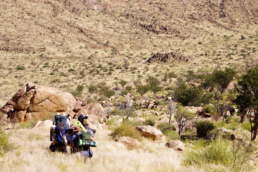
Day 12. - Descent into Naib Basin
Our target for the day was the bottom of the huge oval steep sided basin of the middle Naib, with our food and water cache near the principal rock art site of the basin near its Western outflow. We knew it would be a long and difficult day with an altitude difference of nine hundred metres, we have packed most of our gear the night before to be ready to start as early as possible. Our original plan was to make it back the same way we have ascended to the Engelhard Plain, then follow the course of the Naib to the basin, but Angula suggested we take the route to the Naib-Karoab saddle, then down the slope from there, as the Naib riverbed is filled with very large rocks, allowing only a very slow and difficult going. This also meant leaving out the Lempp Grottoes (I100), but all agreed in taking an easier route if possible.
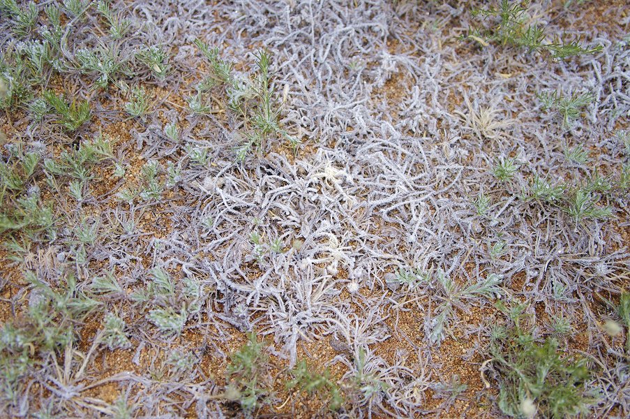
We were up before dawn, experiencing the coldest night and morning of our entire trip. The ground was thickly covered with frost, and there was a good half an inch of ice in our water bottles. Jon washed some of his clothes in a bucket made from one of the 5l water bottles the day before, and neatly set them out on a line to dry in the evening. Instead of dry, they were frozen stiff...

It took time to take down the tents and distribute all the supplies, we were ready to start just after sunrise. We followed the route taken on both the previous days to the saddle, where we turned left along the steep descending slope into the Naib.
After about two hours we reached a small terrace, and Angula pointed out a large boulder some 100 metres away which contained some paintings. Leaving the pack behind I scrambled over to investigate, finding some very meagre paintings (I44). In retrospect, I have to agree with those who quietly thought I was a complete fool to sacrifice my rest stop...

We continued down the increasingly steep slope at a slow but steady pace, taking brief rest stops every now and then. As we lost altitude it started to become warm, by midday is was distinctly hot unlike what we experienced over the past days at higher altitude. At one of the stops Angula took me and Jon to a site just behind a large adjacent boulder, but the way was so overgrown with thorny weeds that it took almost ten minutes to cope with the twenty metres. The site turned out to be I34, with an unusual scene of two zebras and a partial giraffe, only properly visible with dStretch.


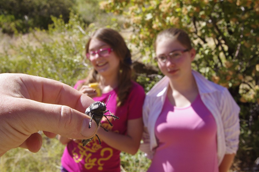
Slowly the slope started to become less steep, while we were still far from the bottom, we have made the bulk of the descent. We aimed for a little grove of trees near the watercourse to have our lunch stop, the only shade from the now burning sun. During lunch we were visited by a large black and yellow striped beetle that seemed to have a soft spot for the red heart on Gábor's t-shirt, it repeatedly landed on it, probably thinking it was a flower.
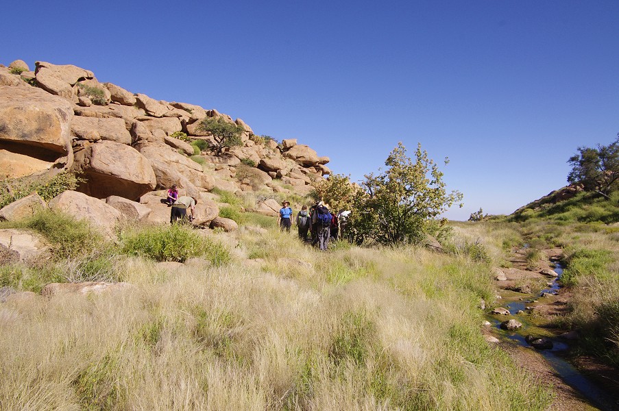
After our lunch stop the ground improved, with a series of interconnected granite plates offering an unobstructed way down. At one point there were a series of pools connected by a trickle of water, a welcome replenishment as our water bottles were starting to become empty in the heat.

Around 3pm we were finally on the flat plain at the bottom of the basin, about eight hours after we started from the Engelhard Plain. We collected our supply boxes, and left our gear at a suitable spot in the riverbed with plenty of soft sandy spots for the tents, then immediately started out along the watercourse to the main rock art site in the area, "Crane Rock" (I20) a few hundred metres downstream from camp.
The paintings are on the roof of a shelter formed by an immense flat granite boulder, one of the few that is reminiscent of the sites in the granite landscape of Western Uweinat (where the ceiling of the shelter is commonly used for paintings). The panel is unique, with some amazingly fine and detailed humans, animals and cranes (the ones giving the shelter its name) over a difficult to interpret white complex composition.


The main scene is in fact quite small, only one or two people can look at it at a time. We took the opportunity while taking turns to take our group photo just outside the shelter.


Once finished with the photography, we slowly trickled back to camp in the last light of the day to pitch our tents before the evening bar and our last night on the mountain.


Day 13. - Descent via lower Naib Gorge
For the majority of our party this was the descent day, however Jon was to stay on the mountain for another six days with Angula and Thomas. The plan was to go down together till where the Dassie Valley joins the main Naib, with a concentration of rock art sites, including the major I15 shelter. After visiting the sites, Jon, Angula and Thomas would return to camp where they left most of their gear, then climb up via the Naib to the upper Numas area for another couple of days, before descending via Numas and Amis gorges. The rest of us were to continue down Naib till the end of the track, where Analene and Karl would wait for our arrival with two pickups. The descent was only 600 metres in altitude, much less than the day before, we were expecting to be down by mid-afternoon.
From "Crane Rock" the Naib descends rapidly, with large boulders choking the watercourse in places. There was an option of going in the riverbed which was at least free of vegetation, but with rocks and occasional large drops, or to go along the slopes, where the ever present vegetation and the angular blocks made the going difficult. In the end we split into two parties, some preferring no climbing but more thorns, the others the opposite. In either case it was slow going, it was close to midday as we neared the junction of the Dassie valley.

Looking at the terrain it very rapidly became evident, that the rock art sites are beyond reach. Dassie Valley makes a very steep descent into the Naib, and the concentration of sites, while apparently very close to the main Naib river, are in fact a good 200-300 metres higher. Visiting them would have required climbing up again almost as much as we have already achieved coming down. We had neither disposition nor time to do that, so in the shade of a large rock we said our thanks and farewells to Angula, Thomas and Jon, and without much ado they started back towards camp and their water cache. We continued downhill, the ablest climber of our group, Viki taking the place of Angula at the lead, scouting out the route and choosing the best and easiest way down with amazing instinct.

Not far from where we parted, the river, which must have flowed somewhere underground as the riverbed was completely dry all the way down, suddenly resurfaced and soon we came upon a large pool with a small waterfall pouring into it. It was immediately decided to make our lunch break here, and soon the pool was full of a bunch of snorting hippos.

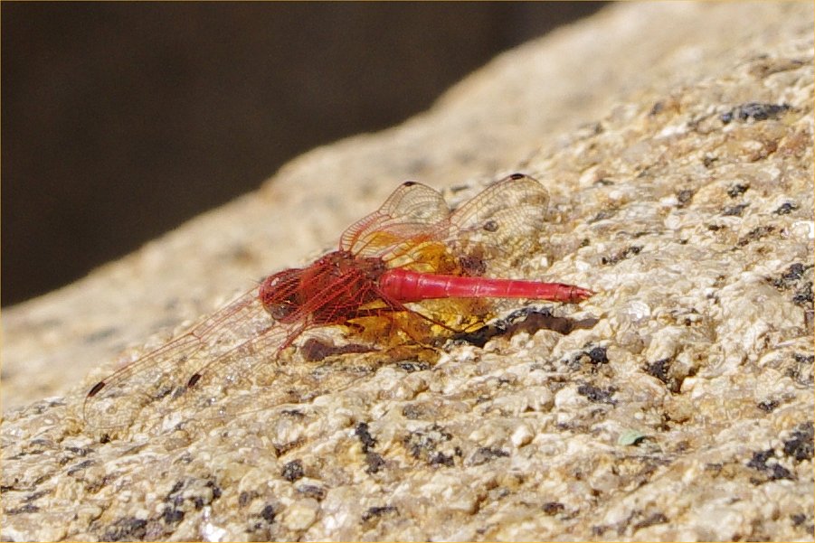
The pool was humming with swarms of bright red dragonflies, and Viki spotted the place where a leopard came down to drink not long ago, and slipped on the steep loose banks. We consumed whatever food we had left and dried ourselves before filling our water bottles and moving on to the final stretch of the valley.
Soon the water disappeared again, and the valley started to flatten out, with increasingly longer sandy stretches without any steep rocks to tackle. Still progress was slow, we were still several kilometres from the end of the track.
It was late afternoon when we reached the mouth of the gorge, guarded by a particularly noisy band of baboons, sitting high up on the rocks above us. By their tone they certainly did not appreciate intruders. Beyond the valley entered the plain among the foothills, with the end of the track still another two kilometres away. It was decided that with Viki we will make a quick dash to the car to assure Analene and Karl that everything is fine, and the rest will follow more slowly.


We reached the end of the track before sunset, with the mountain glowing like fire behind us true to its name. The track was empty, though fresh tracks and footprints did indicate that someone was there not too long ago. To make matters worse, my Thuraya phone which worked perfectly on the mountain failed to acquire a signal, probably due to a foothill to the north blocking the satellite. We were running low on both water and food, the prospect of spending the night there was not a particularly endearing one.

The others reached us in another half hour, we held council and decided that I will walk out along the track for three kilometres, both hoping to get a signal and also to see if perhaps there was an obstacle along the track which the cars could not tackle and were waiting there. I expected to return in maximum two hours, in the meantime the others were to make a fire to keep warm, and signal their location from afar. Viki volunteered to accompany me, and we trudged along the track in increasing darkness. After two kilometres I had a clear signal on the phone, neither Analene nor Karl was reachable, the housekeeper whom I managed to reach at the White Lady B&B said that they were out waiting for us. Asking her to convey our location as soon as they call in, we walked on with Viki till the 3km mark just in case, but the road was empty. On our return I tried Karl again and this time was successful, it turned out that he was close to Uis. Apparently at five they thought it might be a good idea to check the next valley in case we came down by that one instead of the agreed Naib, and drove in to the Numas entrance. Not finding anyone, they drove back towards Uis to get into mobile range. Karl assured that he was on his way back, but on those tracks the 80 kilometres meant at least two hours. It was seven, we could expect him after nine. We reached the others little over an hour after we left, the largish fire invisible except from the last hundred metres. We passed the news, then sat around the fire trying to keep warm while waiting for Karl to turn up, which in the end was closer to ten than nine. We finally reached Uis around midnight.
Day 14. - Uis - Windhoek
After the adventures up the mountain nothing much exciting or worthy of mention happened on our last day. Mark arrived with the minibus around 9am, after a fine breakfast at the White Lady B&B we departed for Windhoek, stopping for lunch at Okahandja as we did on our way to Uis. Dagmar and Peter took the evening Air Namibia flight, we dropped them off at the airport late afternoon, then the rest of us lodged in to the very pleasant Etango Ranch just across the main road from the airport for the night.
Day 15. - Windhoek - Munich
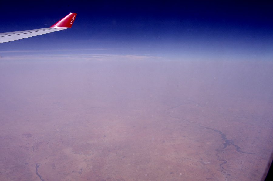
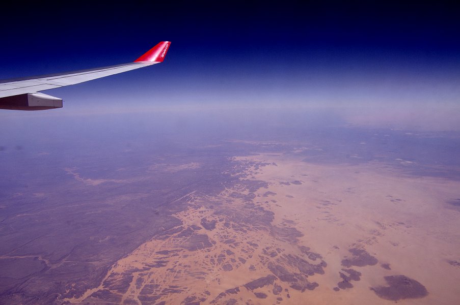
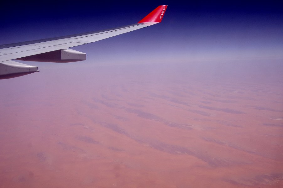
The 10 hour Air Berlin flight left early morning, flying past the Etosha pan which was still entirely filled with water. Unfortunately on this journey practically all of sub-Saharan Africa was covered in a thick opaque haze, so instead of watching the scenery I had to resort to reading and answering emails that I downloaded at the Ranch the night before.

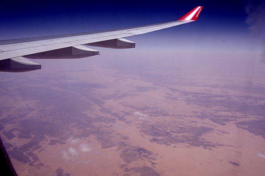
The haze only started to clear as we approached the southern fringes of the Sahara. Due to the closed Libyan airspace, our course was quite a bit to the west of the great circle route, taking us to the west of the Aïr massif, above the Tassili du Hoggar then past the Hoggar mountains, unfortunately all distant or hazy.

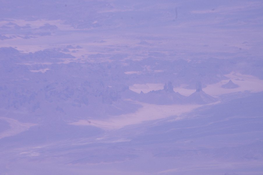
We finally had a good clear view of the Tedefest and the Grand Erg, before the clouds closed in again over the Atlas mountains, with not much to see until we landed in Munich in a cool drizzle.

Numas Valley - Again
While we returned home, Jon continued the trek on the Brandberg, the primary objective being to visit as many sites as possible in the Numas gorge. His aim over several trips - is to photograph the Numas Valley sites, to be published in digital form along with the hitherto unpublished tracings of Harald Pager. This ambitious project is a collaboration with the Heinrich Barth Institute, University of Cologne. The following is Jon's account of the extra six days he spent in Upper Brandberg:
"At about 12.30, near the junction of Naib Gorge with Dassie Valley, we all agreed that there was no time for the party to make a visit to Naib 15. This was the point where Angula, Thomas and I set off to return to the previous nights camp in Naib Basin. Despite going up-hill, we had little baggage to carry and got back to camp by 14.15 that afternoon. Having packed up the tents, we set off along the main Naib watercourse, initially making rapid progress. However, I was now carrying a full backpack and by 17.00 I was hot, tired and going slowly. I decided we should make camp, despite having little water between us. Angula and Thomas went forward to search for water, and I was extremely relieved when they re-appeared, only about 45 minutes later, carrying 15 litres of water. The deep pools from which they brought the extra supply are fed with clear water from Engelhard Plain.
Next morning, we continued upwards beside the Naib watercourse, which was getting steeper and more boulder-strewn all the time. Angula found us the best route, but it was to say the least strenuous with a full pack. Shortly before we arrived at the Lempp grottoes (site I100), I suddenly had a violent pain in my upper right thigh. The pain was muscle cramp due to loss of salt through sweat. At this point, we needed to leave the Naib watercourse and cut across the high-level traverse along which we had walked a few days earlier from Okapi Valley to Engelhard Plain. We had to gain height until we reached the pass between Naib and Numas valleys. After only a short part of the ascent towards Numas, the cramp in my leg returned, just as painful with each step as it had been earlier. The solution was for me to leave half my baggage (which Thomas collected next day) and to step forward only on my left leg. I thought the best source of salt among our food supply was biltong, so I chewed this as I walked. In future, a few small packs of salt would be a good addition to the first-aid supplies, at least for me.
Despite my slow progress, we made it to the box of food in Numas by about 14.30 that day. Next morning, while Thomas went to collect the gear I had left in Naib, I set off with Angula to start looking at rock art. Near our camp, he showed me a couple of good sites which I returned to later when they were not in sun. However, searching for other sites I soon lost track of Angula in the mass of boulders. When Thomas came back, I appointed him as 'map and tripod carrier'. He soon became skilled at interpreting the satellite photos on which I had marked the sites, based on co-ordinates I had been given in Cologne. These co-ordinates were also in my GPS, and during the afternoon we walked up the valley from site to site. However, while we knew when we were probably close to a site, we were very dependent on Angula's talent for spotting a likely place for paintings and to notice traces of pigment.
By the end of that day, I realised that the aim of completing a systematic study of the Upper Numas was no longer a good plan. If my leg cramp recurred on the way down the mountain, we would be in difficulties. So, I decided that we would start moving down the valley next morning, covering the distance over several days. This meant that Angula and Thomas had to find room in their packs for several days food, with the helpful result that they were now walking at a pace more suited to me.

On the afternoon of day 3, we made camp on the western side of the valley, some way above the watercourse. This allowed us to visit the fine panels of N52 ("Angula's Site").
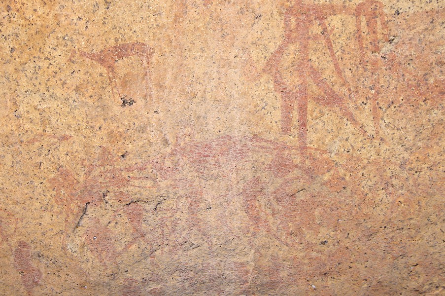
The next morning (day 4) we approached Silberweide, visiting a number of minor sites near our route. We then left our packs at a convenient spot to visit N145, a major site identified as a Sanctuary by the Cologne rock art specialists. These sites are usually difficult to access and perhaps coincidentally they tend to have extensive views. The key scene features a large antelope with human hind legs, and a group of highly decorated men and women. However, the middle of the panel has been affected by smoke from fires, something not seen elsewhere in Upper Brandberg.
On day 5, having camped again at Silberweide, we followed the main channel of Numas down-stream, eventually reaching the waterfall and pools known as Dreilochwasser. Here, it was Thomas who located N10, which has fine paintings in very good condition. We got back to camp about midday and climbed over the pass into Amis Gorge. This afternoons walking went well, much of it descending long granite slabs, and we eventually camped about half-way down, near site A2. The night was noticeably warmer, but windy.
Finally on Day 6, in the early morning we visited site A2 (a big site with some fine paintings), and at about 11.00 am, well ahead of schedule, we reached the point on the road where we had arranged to meet Karl. Karl and Analene brought us back to Uis by mid-afternoon.
Despite the change of plan, the extra days worked out well. My leg problem didn't bother me again on the descent. Including the time spent in Numas at the start of the expedition, I had visited 60 of the 182 Numas sites. Now the real work begins, matching up the photographs and the tracings made by Harald Pager, assisted by Angula Shipahu and others, around 1980."
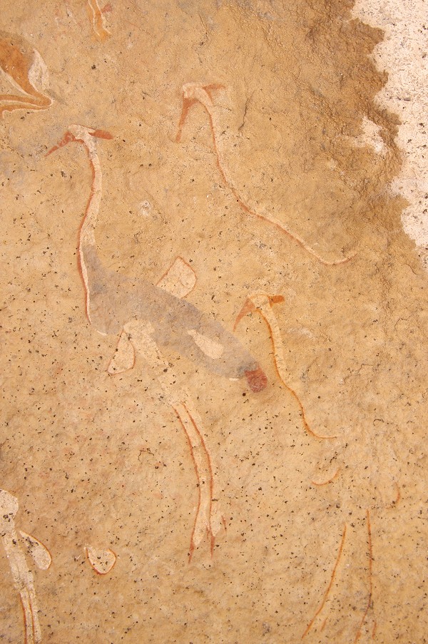
The plan is to have all the taken high resolution photographs stiched together to give uninterrupted overviews of entire panels, with details zoomable up to larger than life size. Ultimately these zoomable images will be overlain with Harald Pager's tracings as a separate layer. This format will provide maximum possible information for each site. Below is a work-in-progress example of the principal panel of N162 (Adobe Flash Player required):
See also:
Gábor's photo album of this trip at Picasaweb.
Peter's photos of the trip on his website