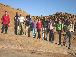
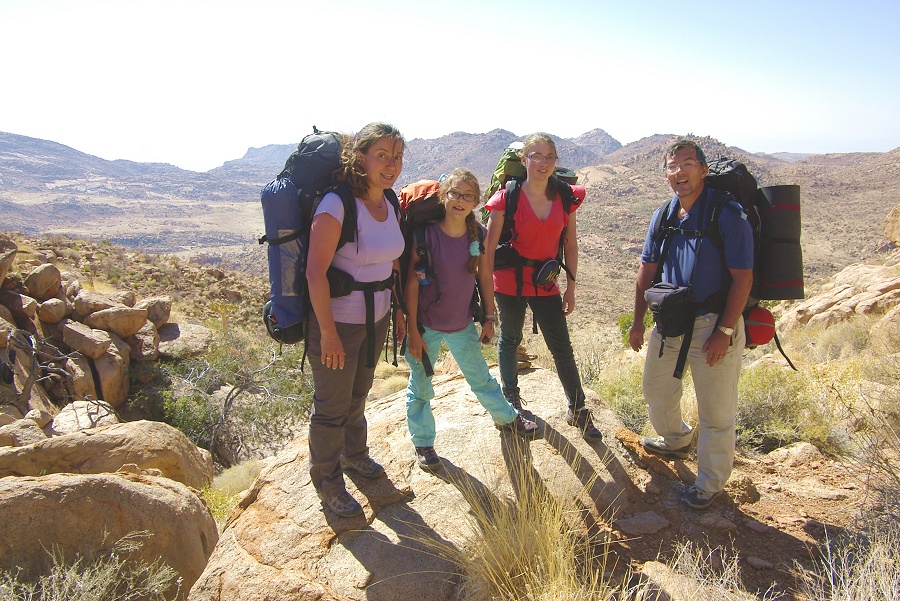
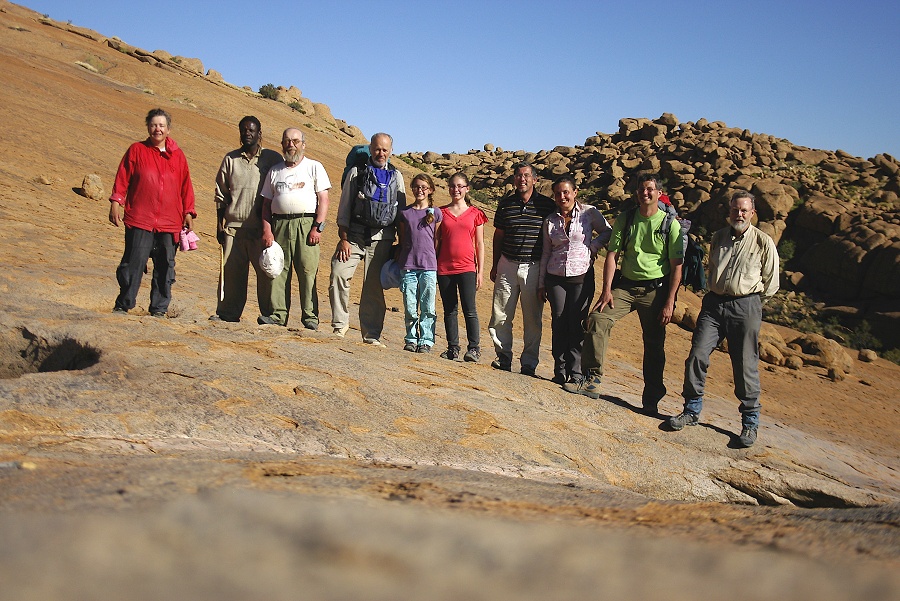
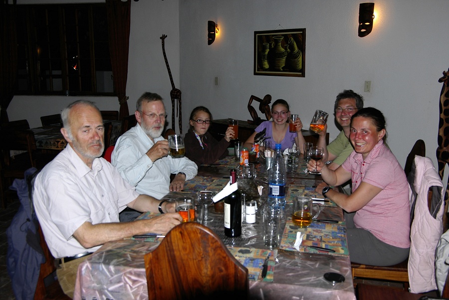
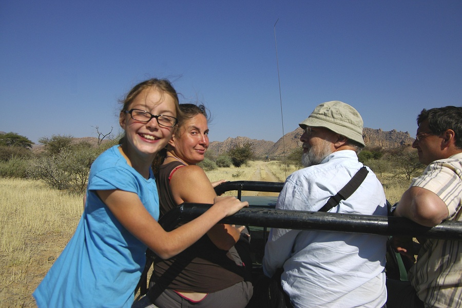
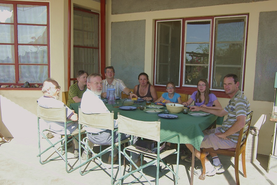
 Click on image for list of participants |
Upper Brandberg Expedition, Namibia 21th June - 4th July, 2010 All site references based on Harald Pager's numbering system |
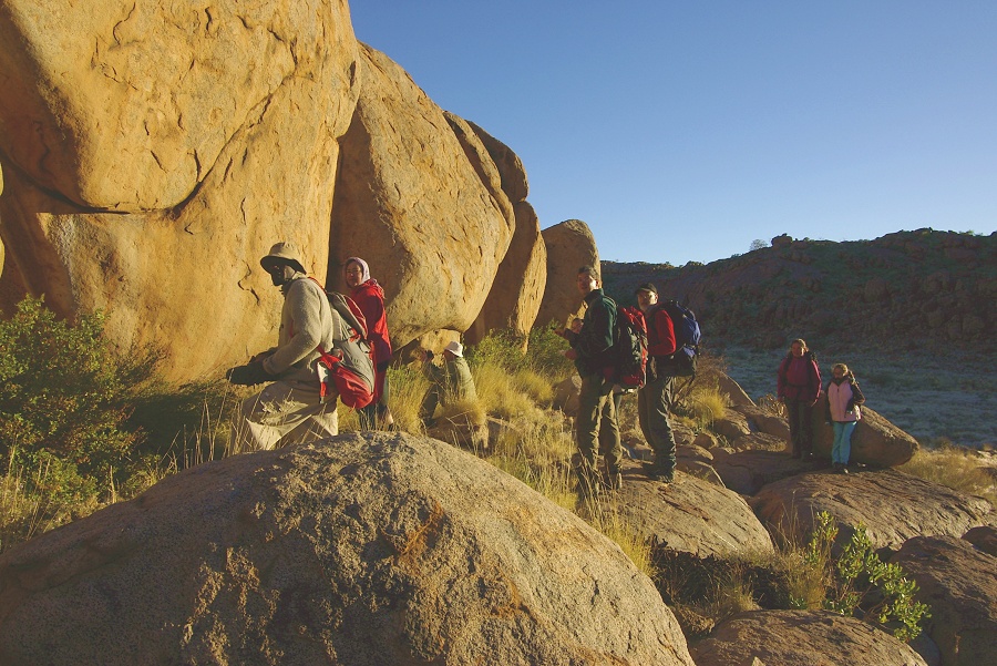
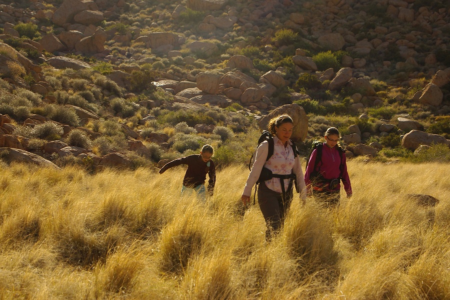
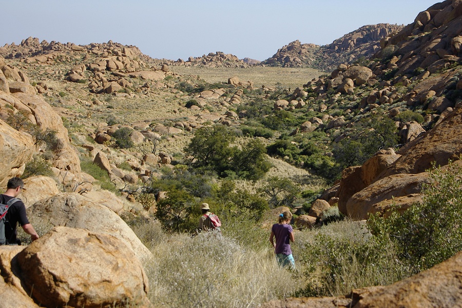
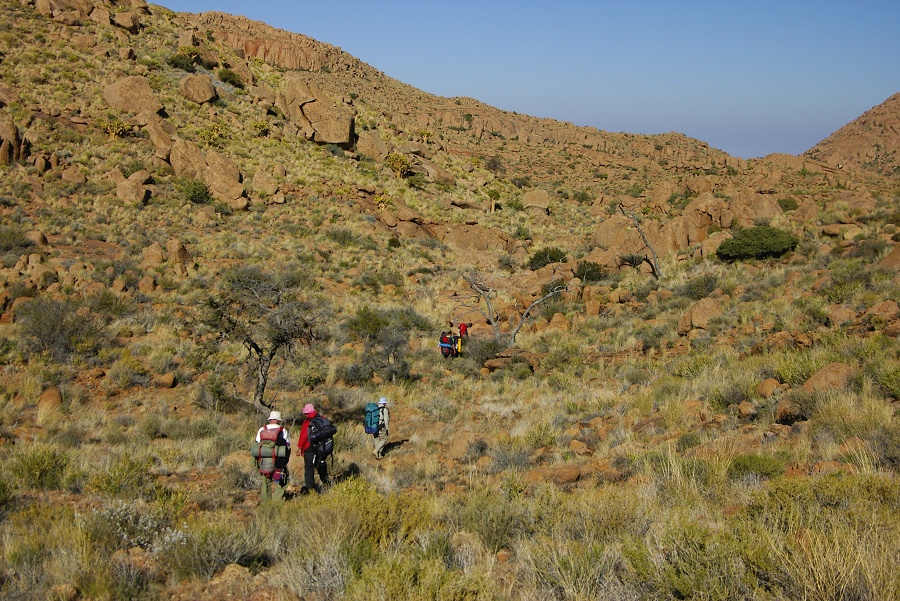
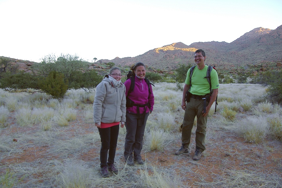
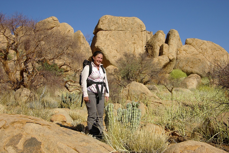
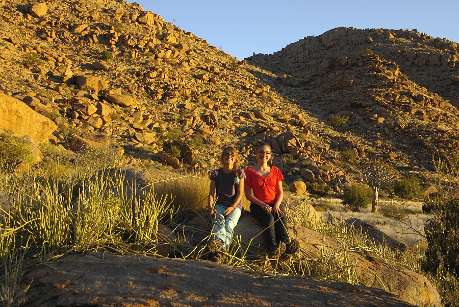
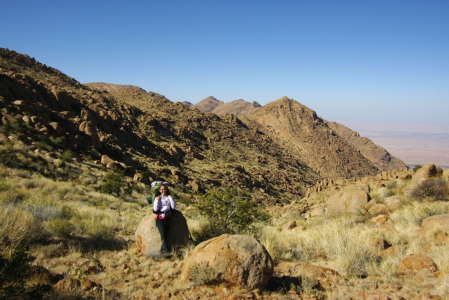
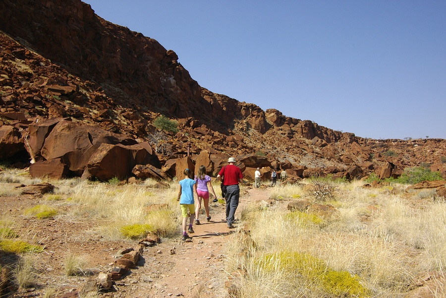
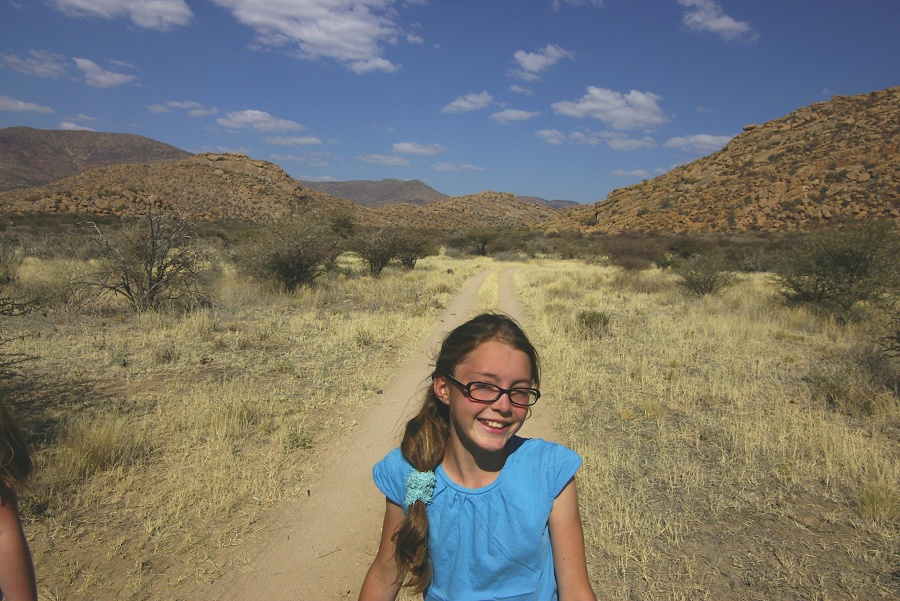
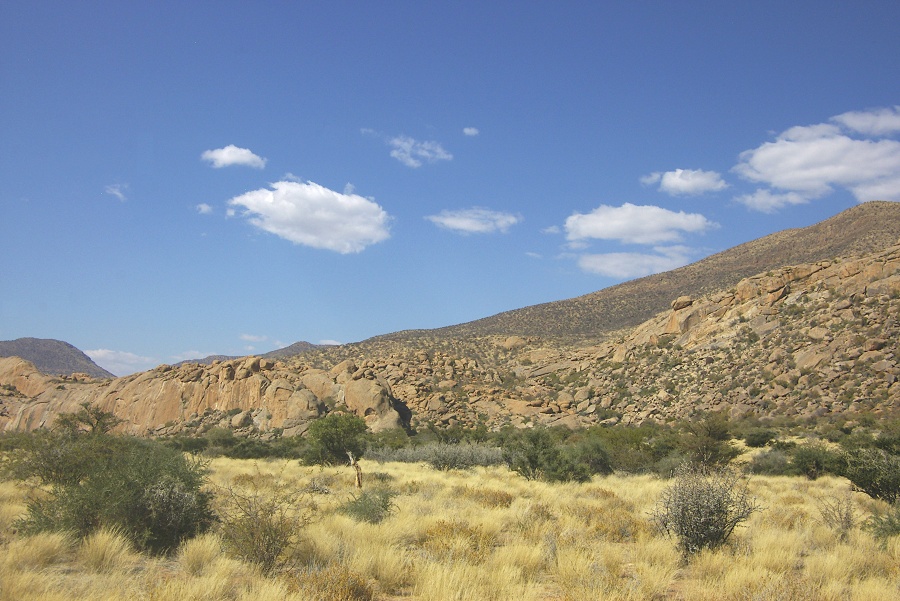
After months of planning and scheming over the Harald Pager volumes, the dream of visiting the rock art sites of the Upper Brandberg became a reality. While our plans proved to be somewhat over-ambitious in light of the extremely difficult terrain, all the logistics worked out fine, and we did succeed in visiting a substantial number of the principal paintings. Admittedly this was a reconnaissance trip to familiarize ourselves with terrain and conditions, regular trips are planned each June to this amazingly beautiful, remote corner of the world. In another first for us, both Viki and Dóra accompanied us on their first major trekking expedition, their strength and energy put all adults to shame.
Day 1. - Windhoek - Uis
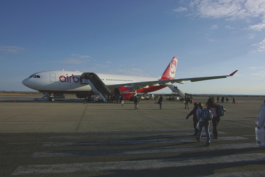
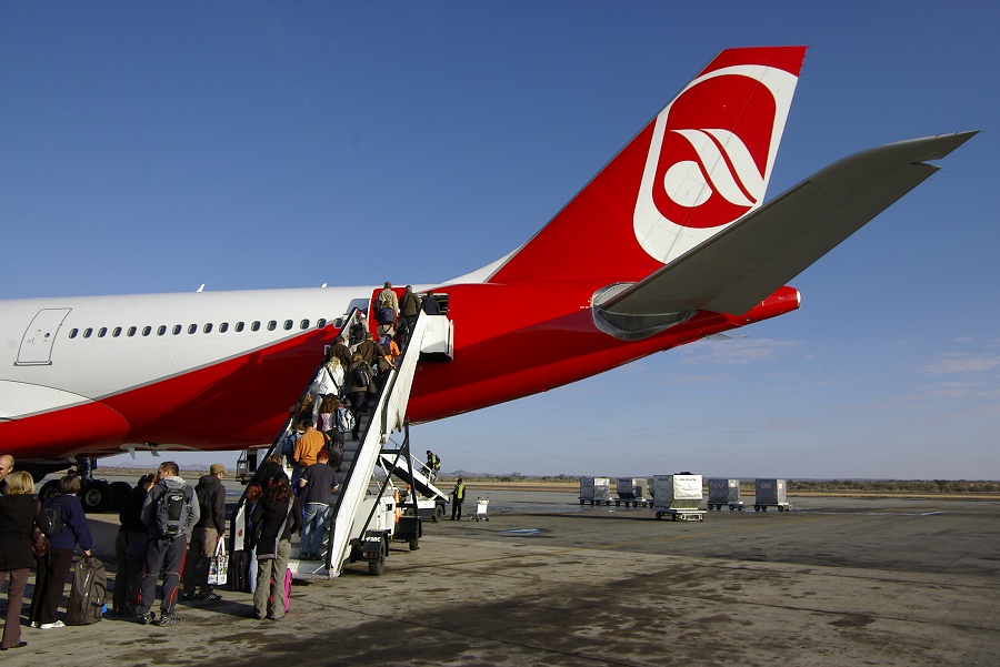
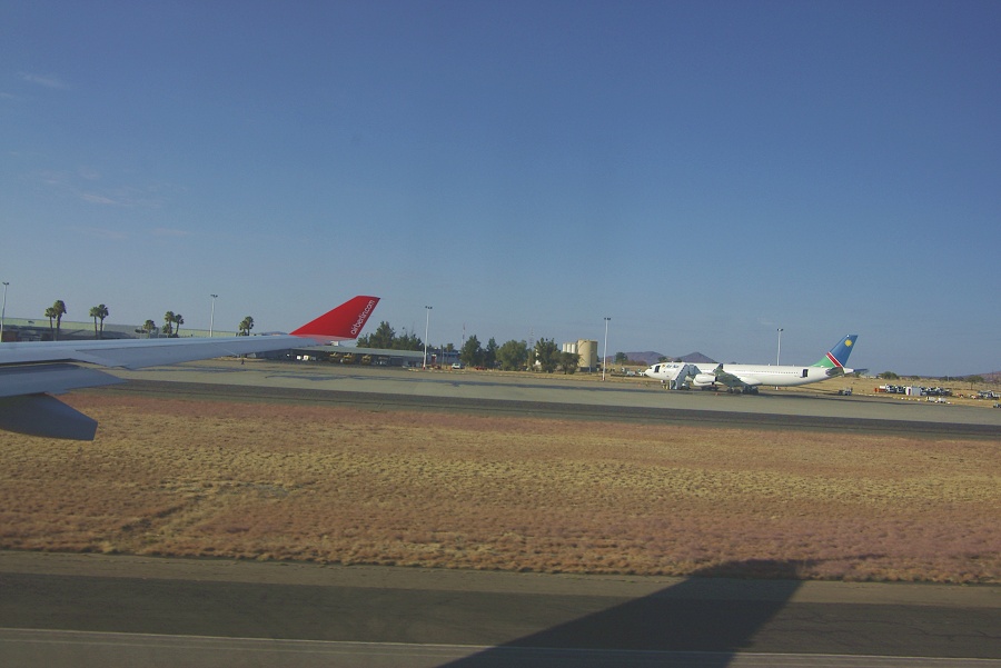
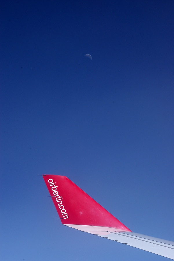
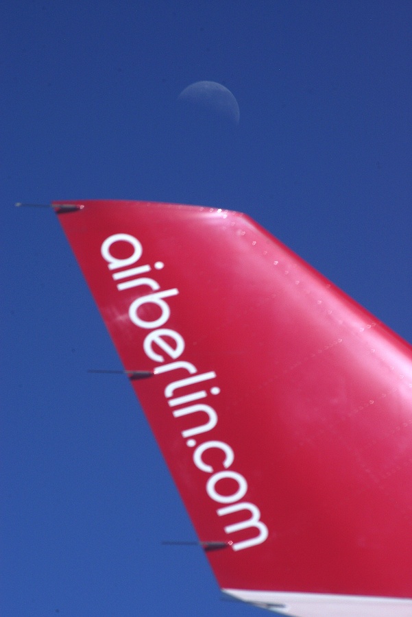
Most of us took the overnight Air Berlin flight from Munich to Windhoek, having met at Munich airport the evening before. We met Leena on arrival in Windhoek (she chose the Air Namibia flight from Frankfurt, the only alternative direct flight from Europe, arriving half an hour before the rest of us).
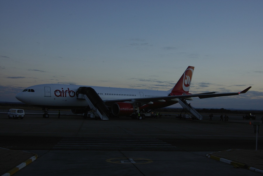
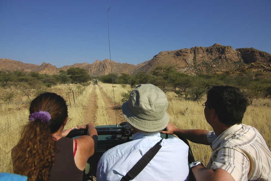
We were picked up at the airport by Mark Held of Dornbusch Car Hire, who provided all our land transport throughout the trip. The morning was spent purchasing and packing our supplies, before setting out on the road to Uis around midday. We stopped for lunch at a very pleasant guest farm on the outskirts of Okahandja, then continued towards Uis.
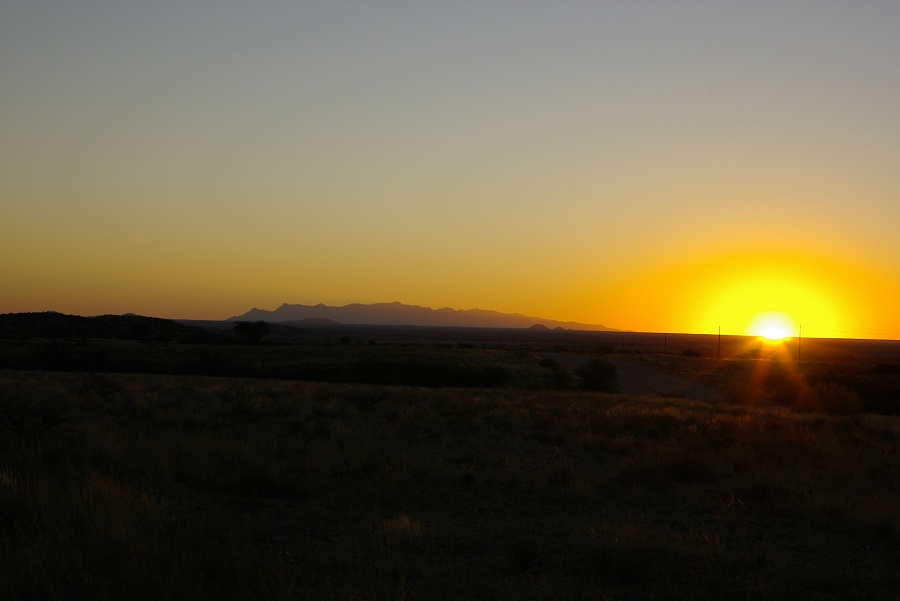
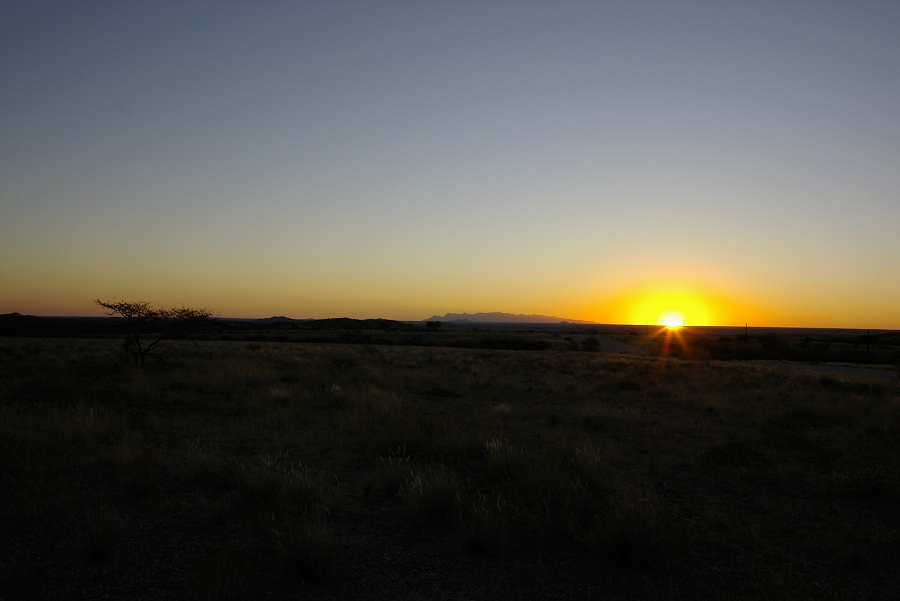
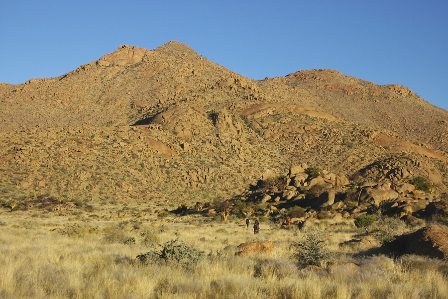
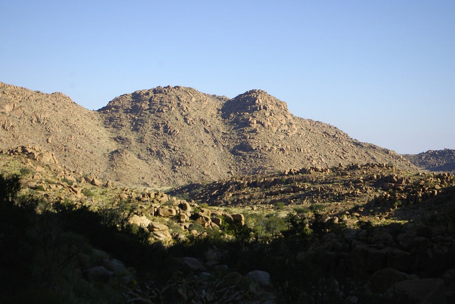
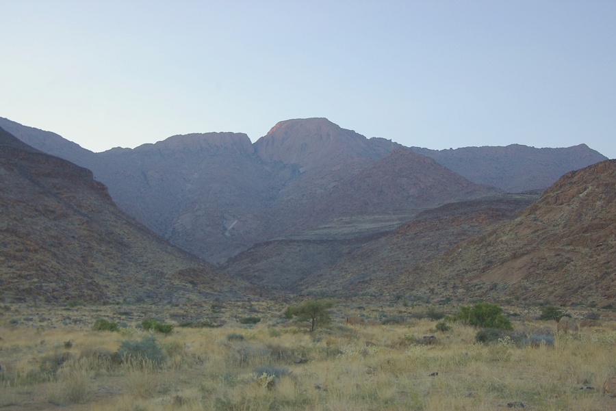
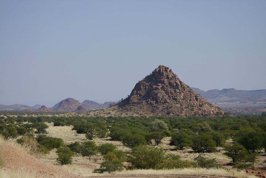
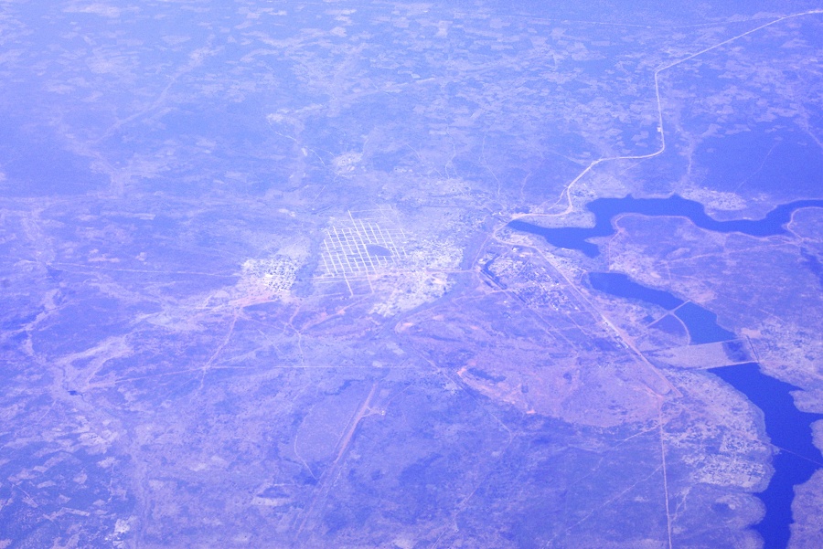
The sun was just setting as we caught our first glimpse of the Brandberg standing out on the horizon, still a good sixty kilometres from Uis.

Not far from Uis as we drove in the evening twilight, we noticed some movement beside the road. I took them to be the usual springbucks, but Mark slammed on the brakes - Cheetah! It turned out to be a family of at least four, about to start out on their night hunt when we rudely intruded upon them. For several minutes they looked at us in a curious rather than apprehensive stance before disappearing into the tall grass. Apparently such sightings are very rare, unfortunately it was too dark to take any usable photos, I only captured a pair of gleaming eyes reflecting the flash.
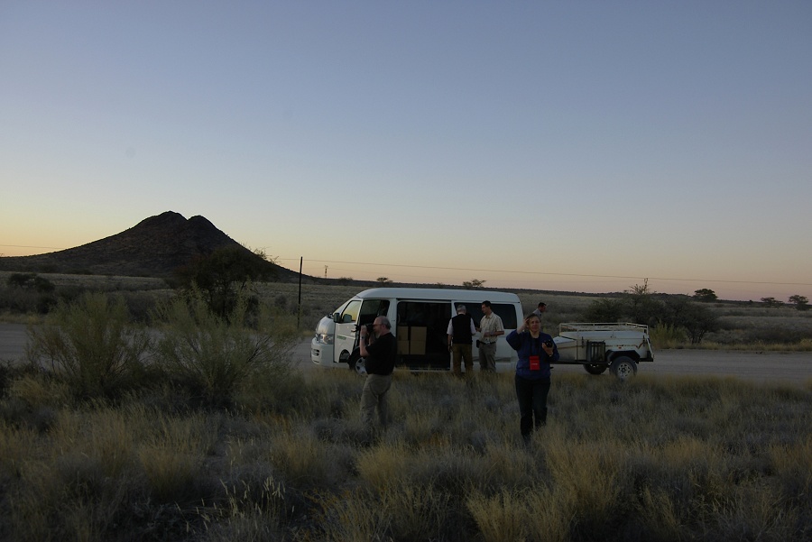
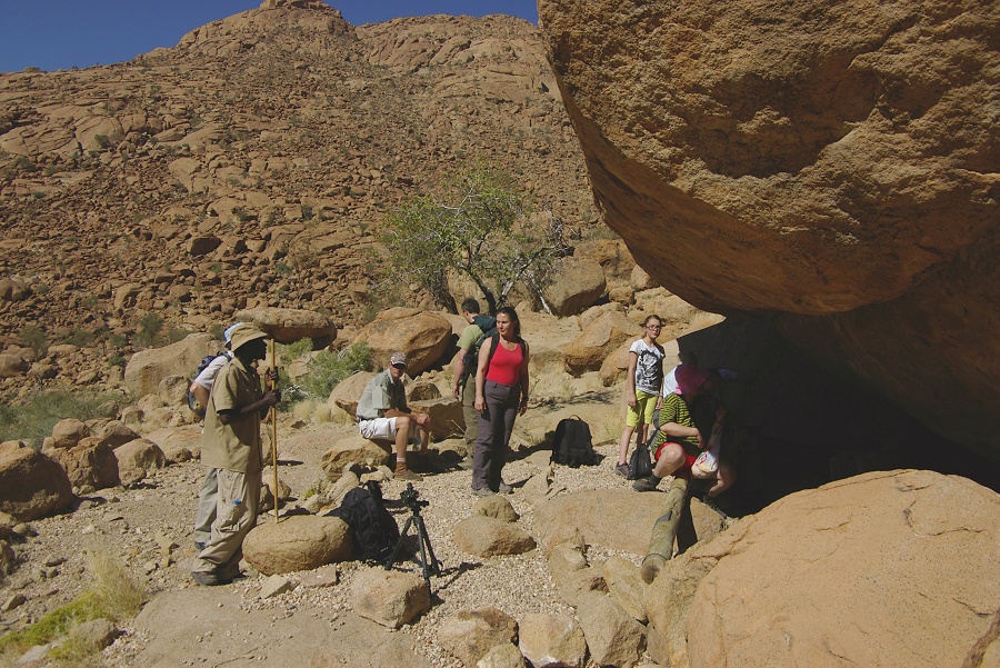
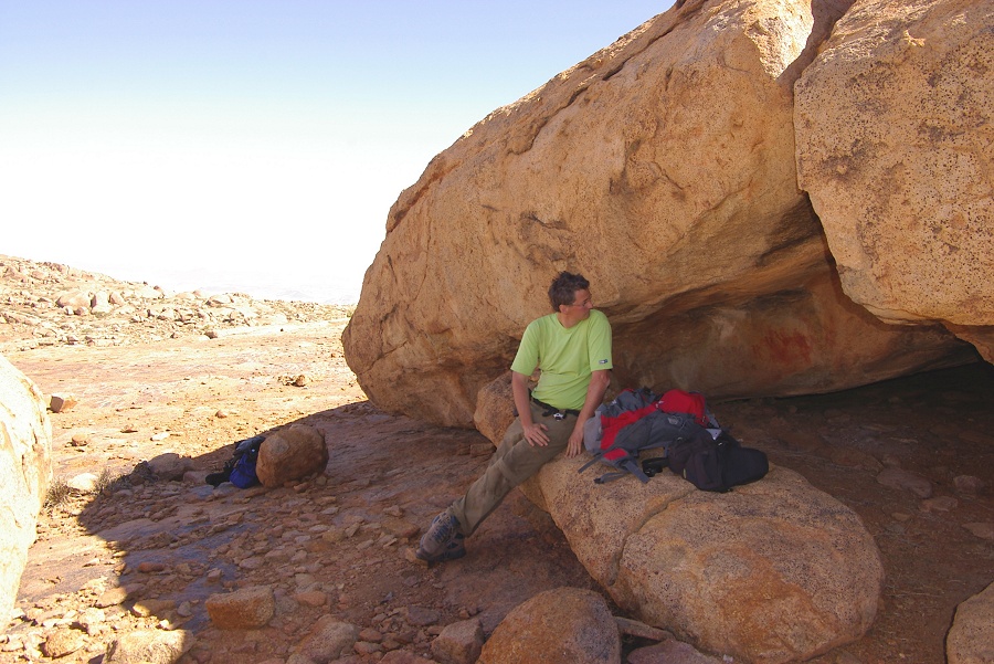
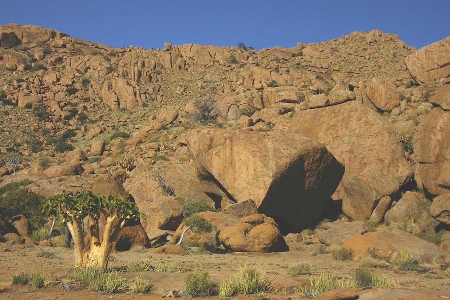
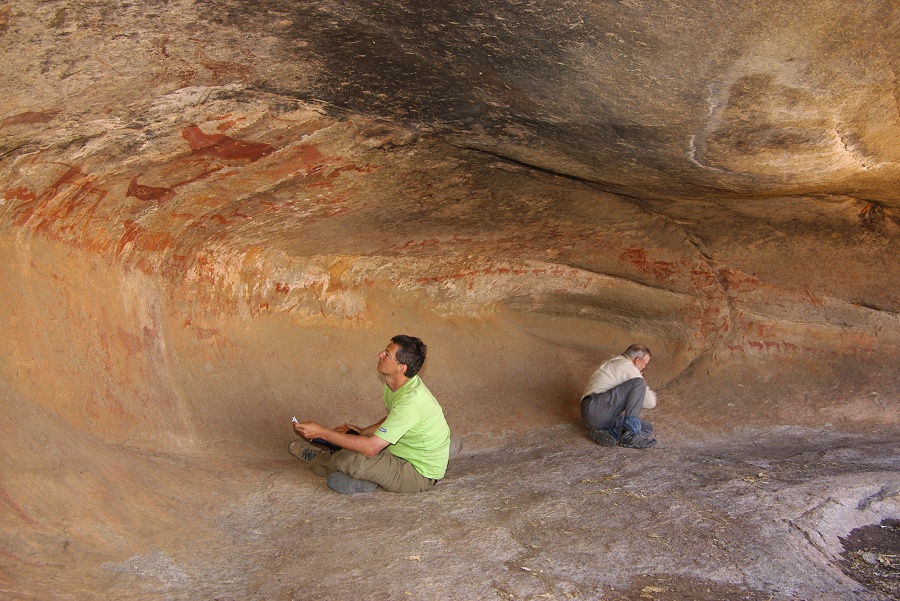
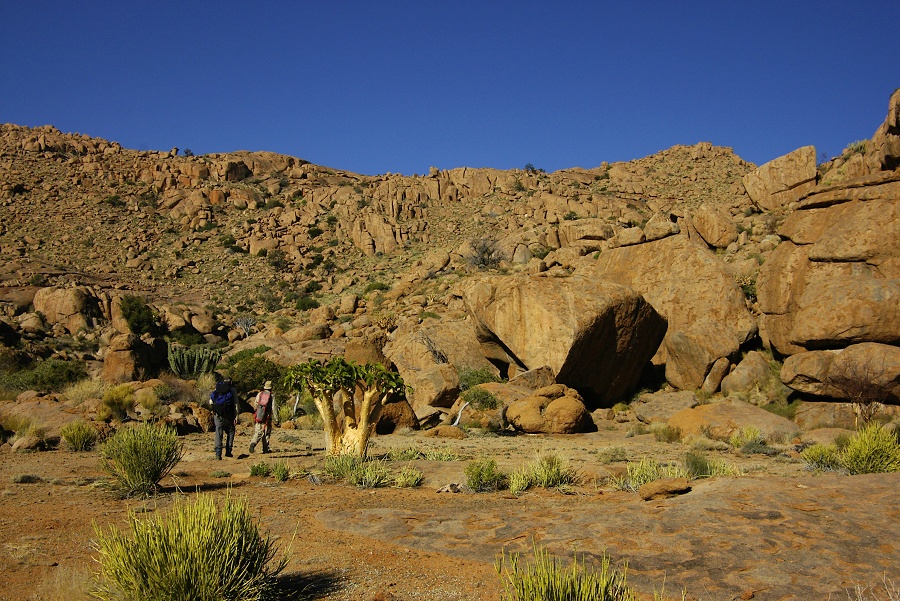
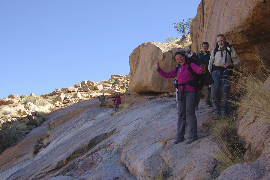
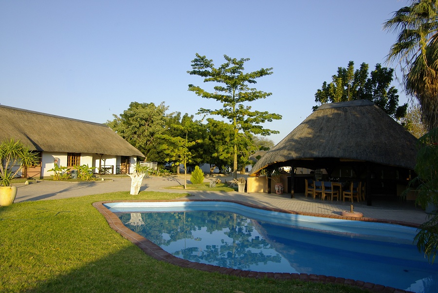
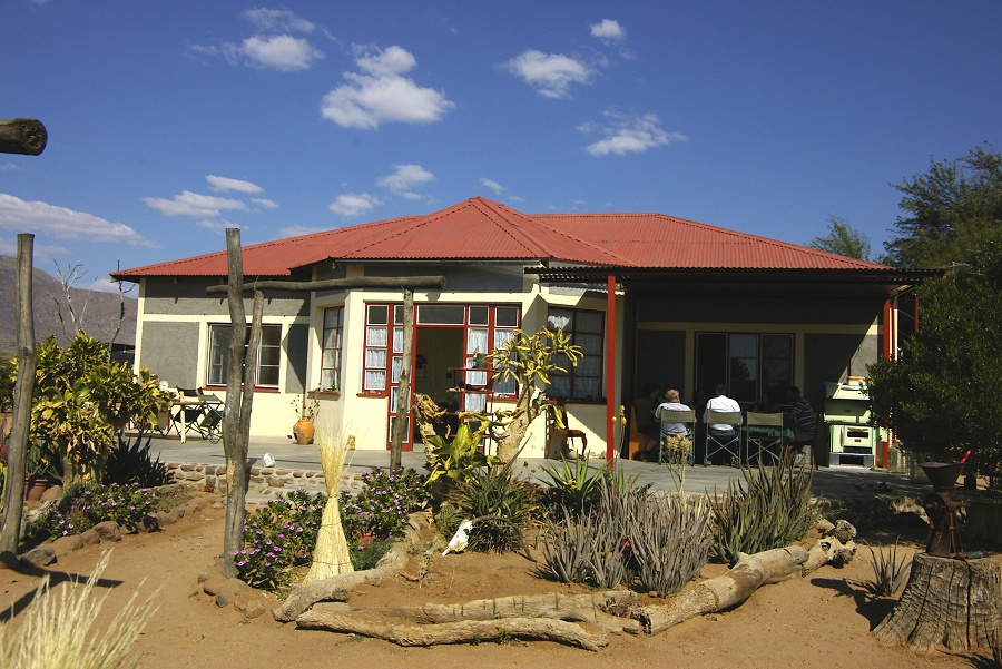
We soon reached Uis, and settled in for two nights into the basic but very comfortable rooms of the White Lady BB. Soon after arrival we met Alfons, our guide and companion to be for the next eleven days. Alfons spent several months on the Brandberg with Tilman Lenssen-Erz while doing the field research for the Pager volumes, and turned out to be a thoroughly knowledgeable and enjoyable companion on the trip.
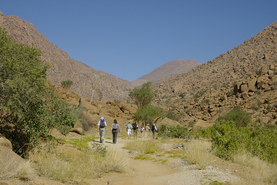
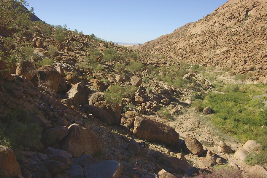
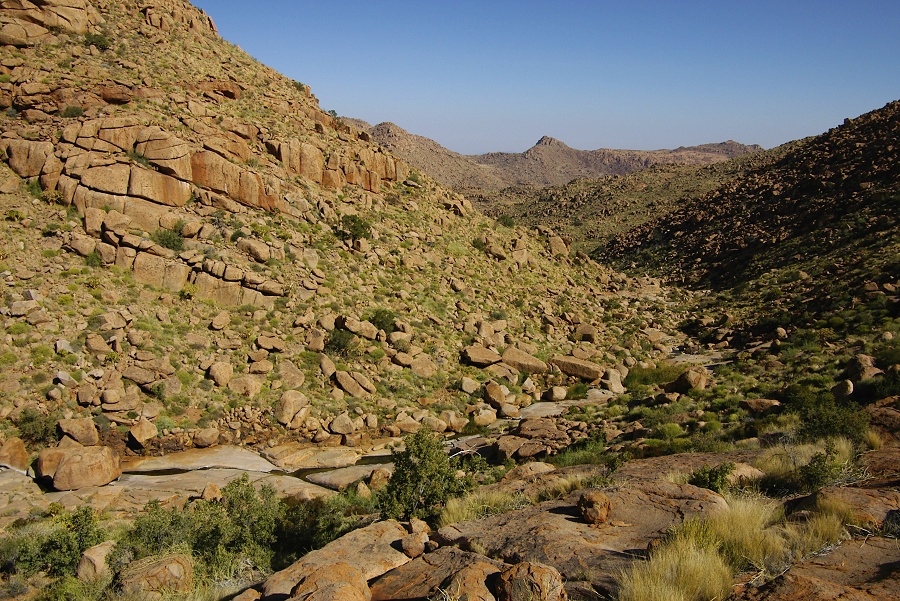
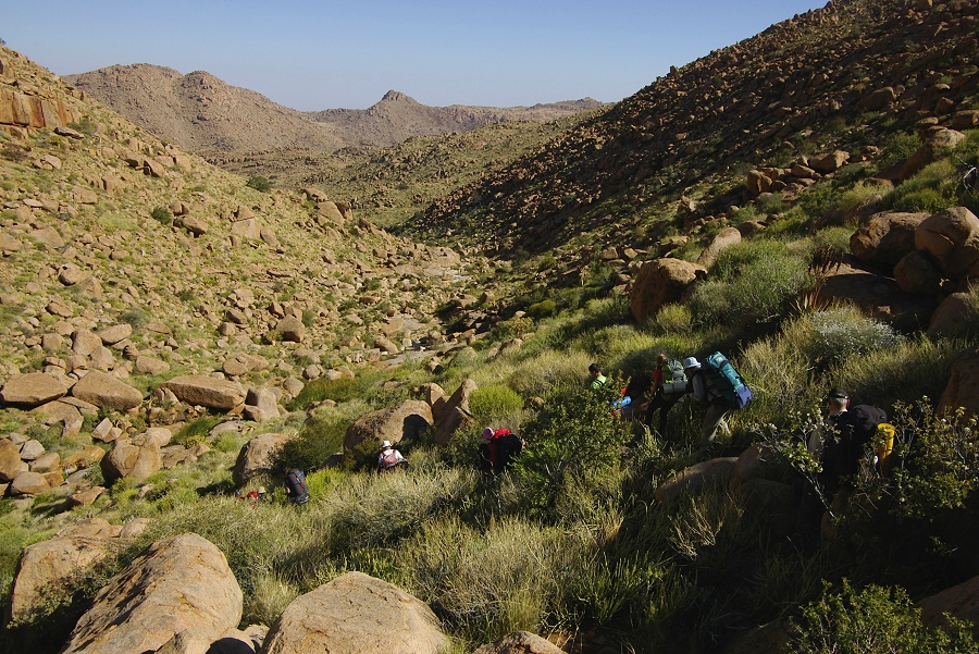
Day 2. - Tsisab Gorge
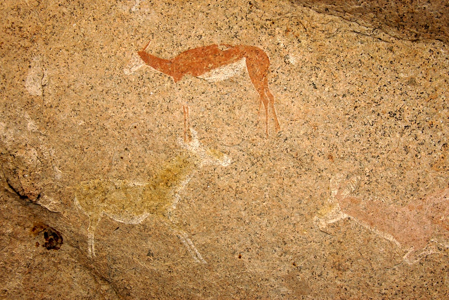
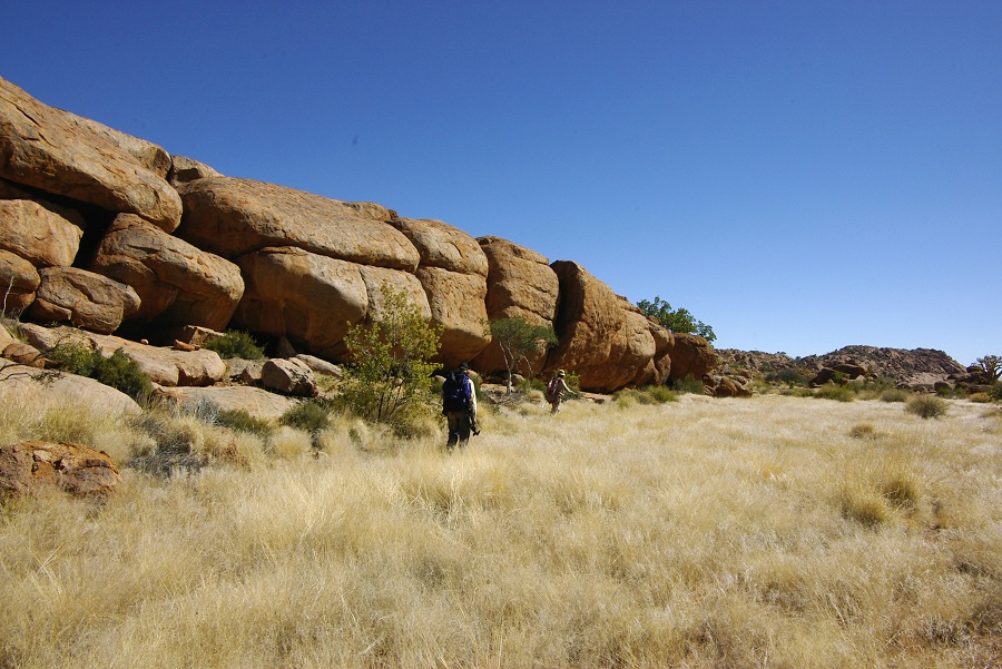
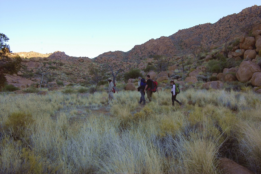
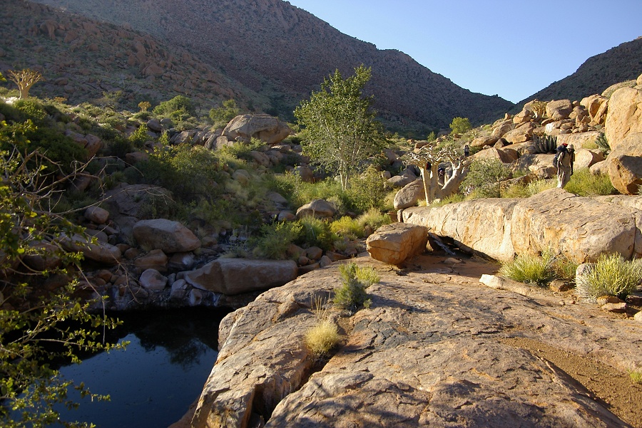
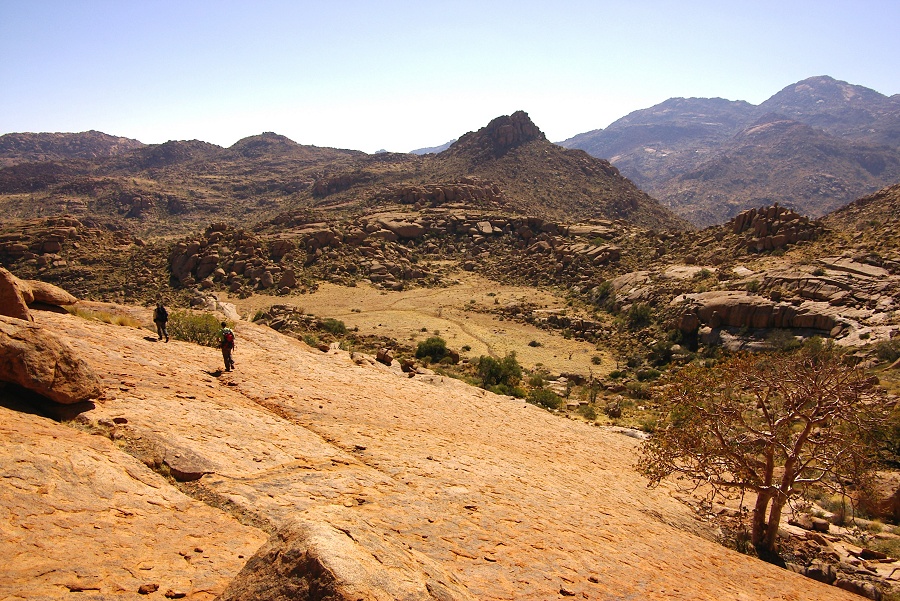
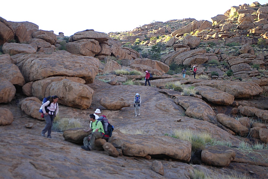
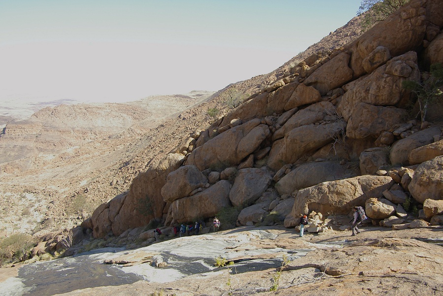
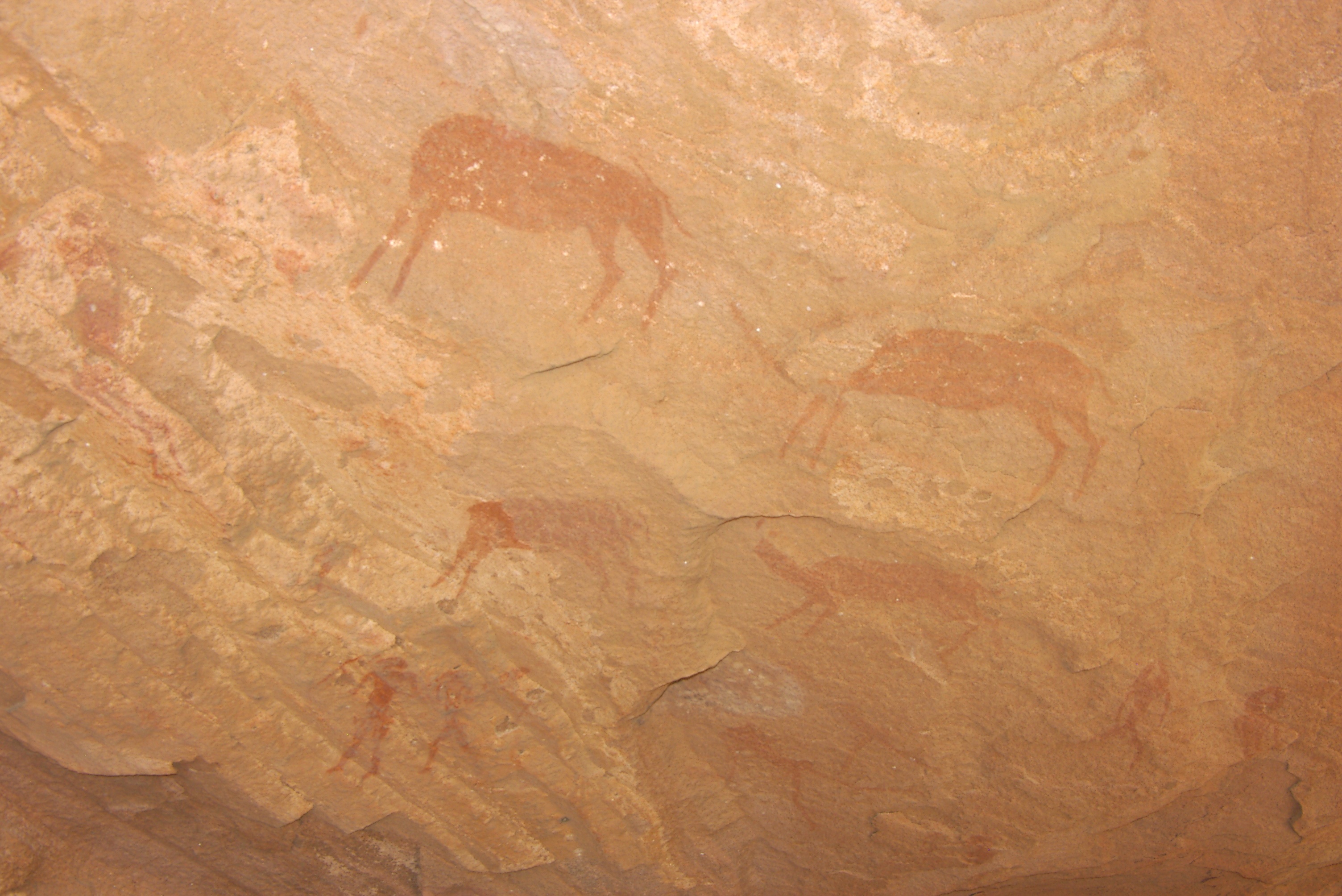
In the morning we purchased our water supply for our stay on the mountain at the small but well stocked local supermarket, then set out for a day trip to the Tsisab Gorge, the longest valley of the Brandberg draining towards the North-East. The lower parts of the Tsisab valley contain a wealth of relatively easily accessible rock art sites (including the famous "White Lady" shelter) which were extensively studied and published by the Abbé Breuil in the nineteen fifties.
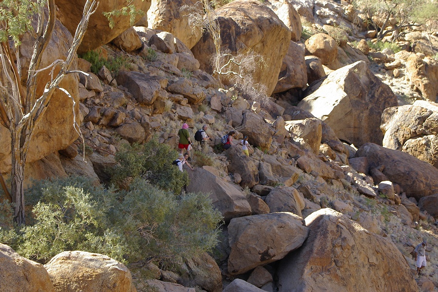
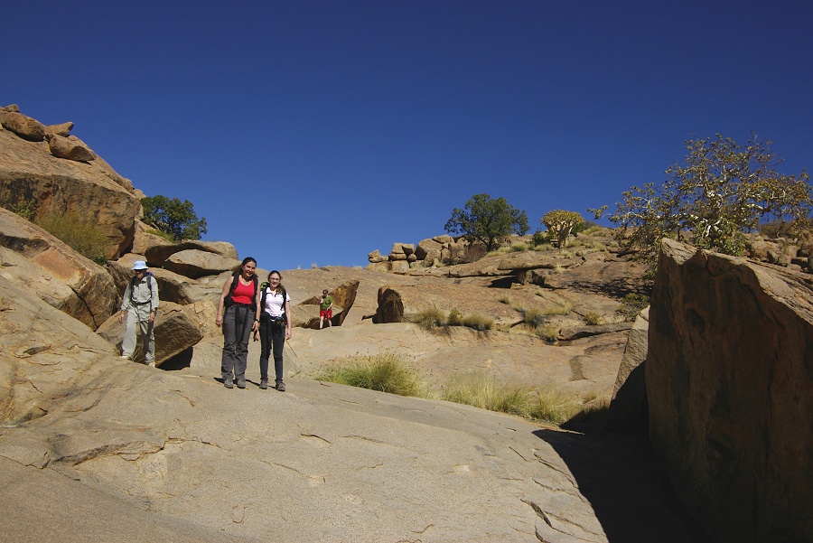
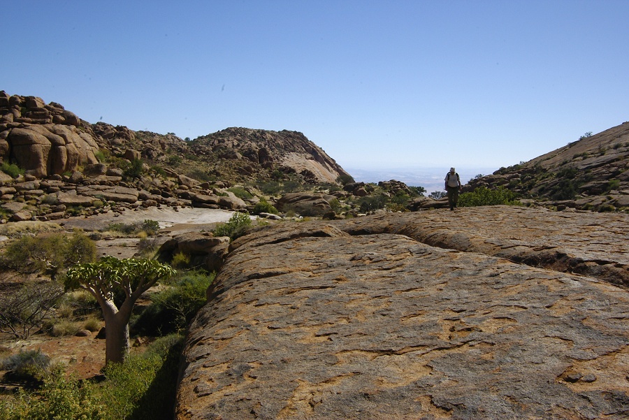
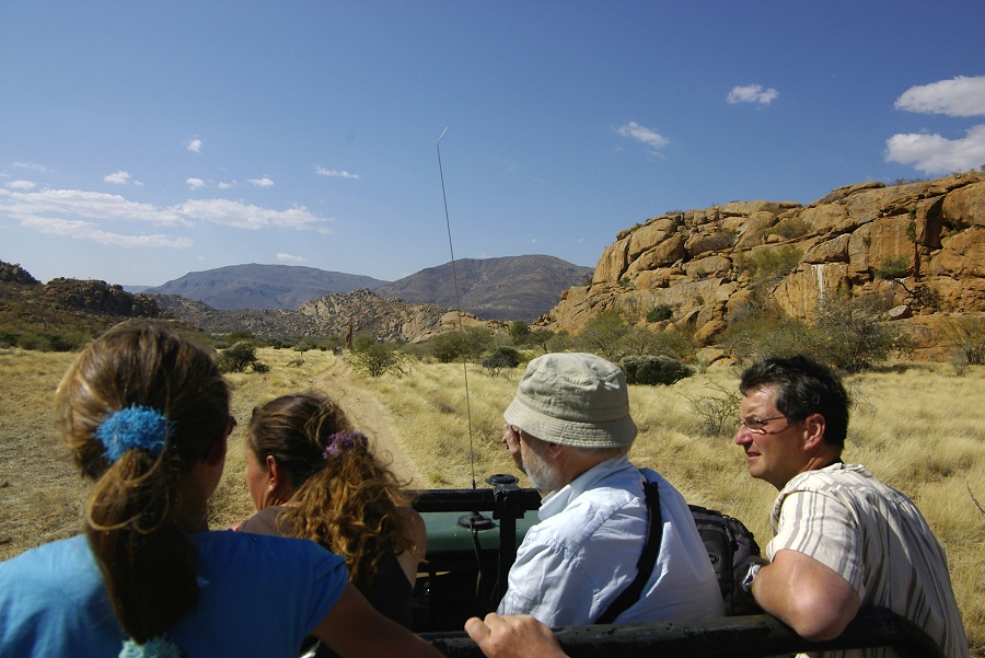
It is a roughly forty five minute drive to the car park at the mouth of the gorge from Uis. We walked up the well worn tourist trail that leads till the "White Lady" shelter, then beyond on the smaller paths to the upper concentration of sites which are seldom visited.
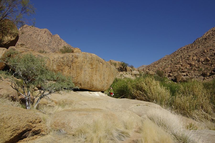
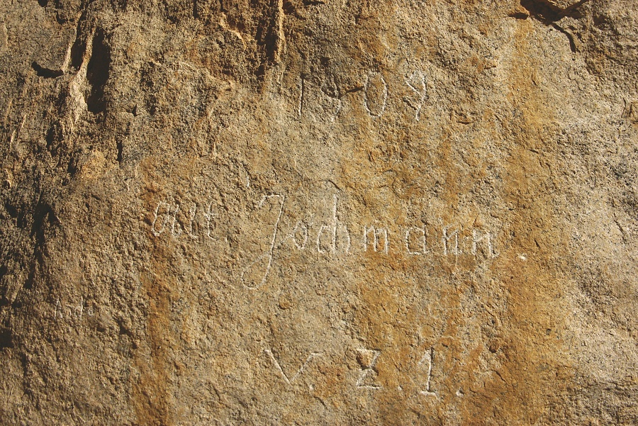
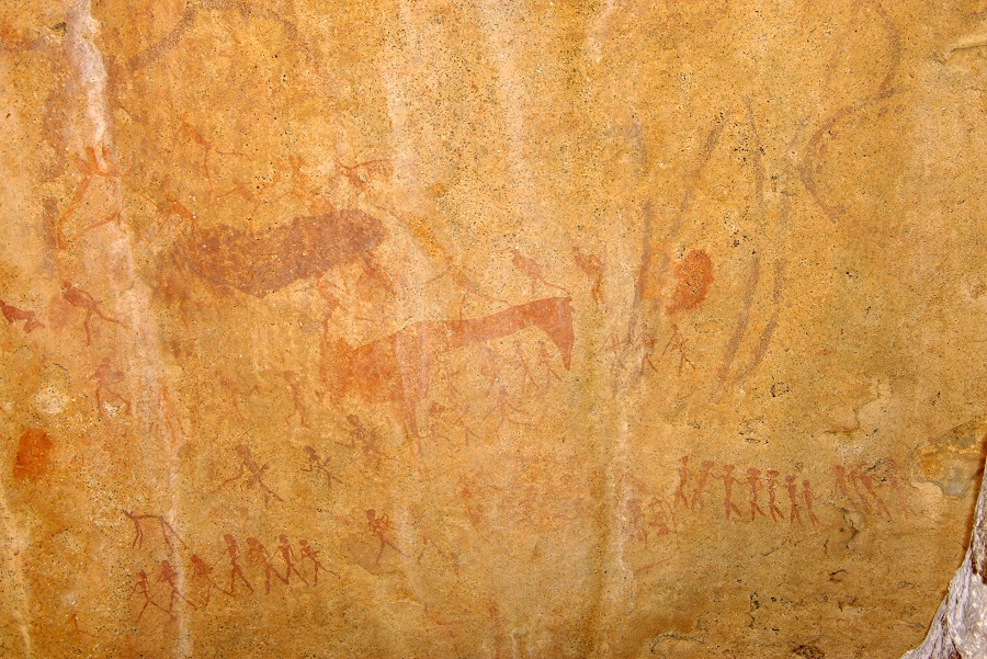
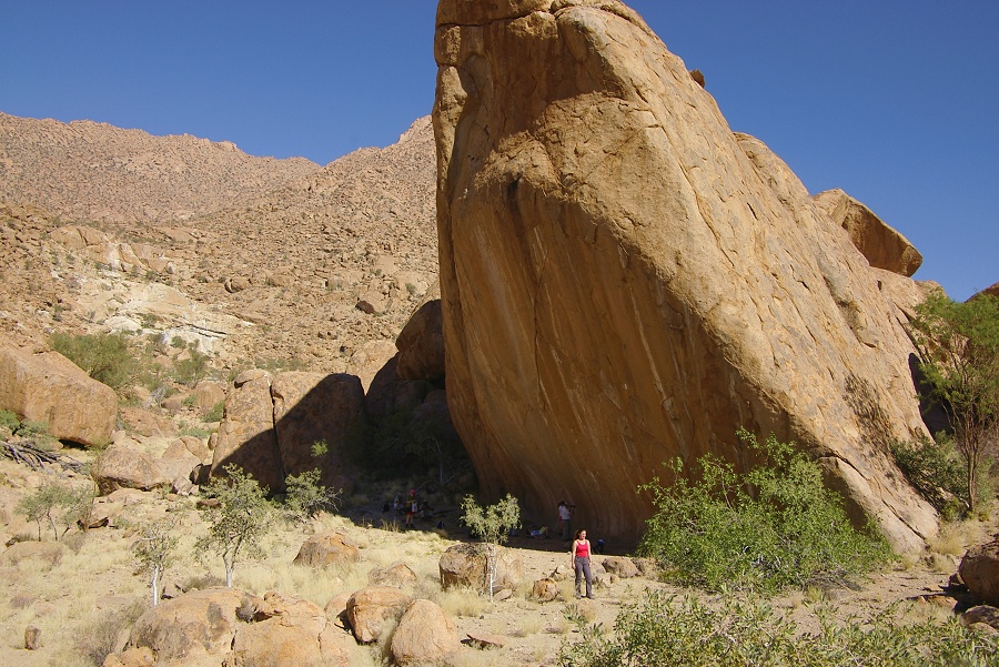
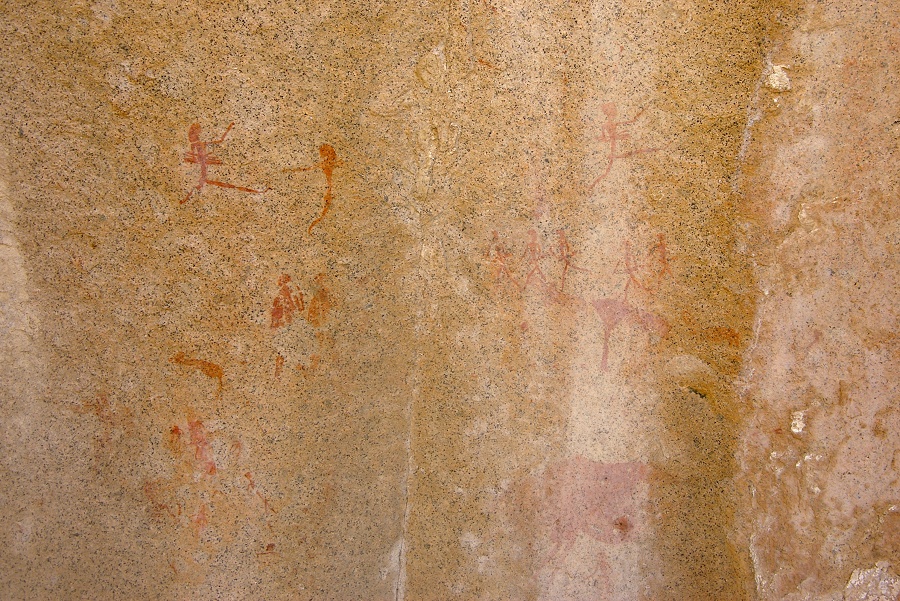
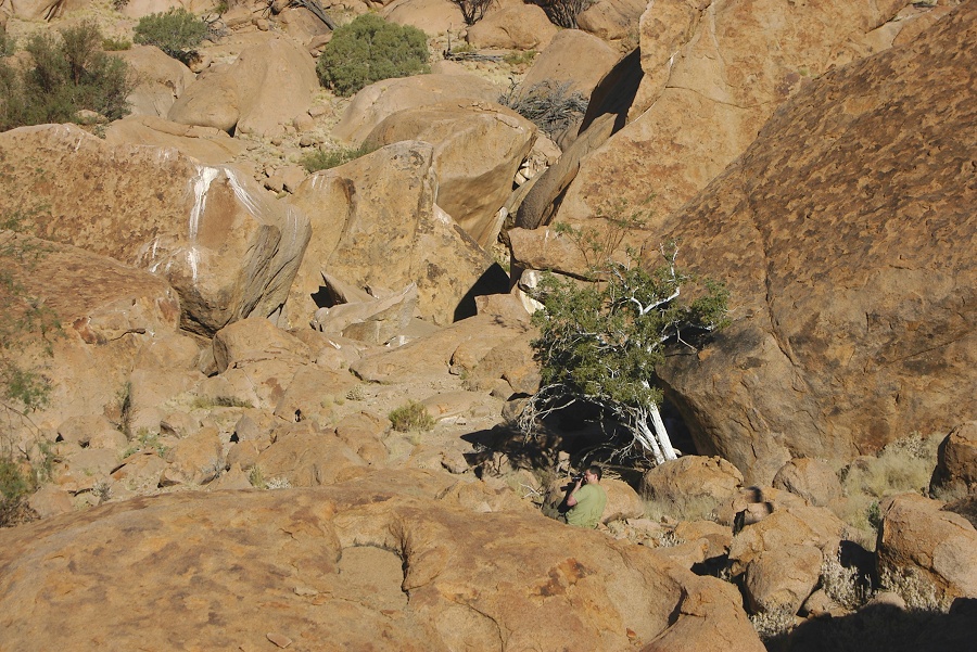
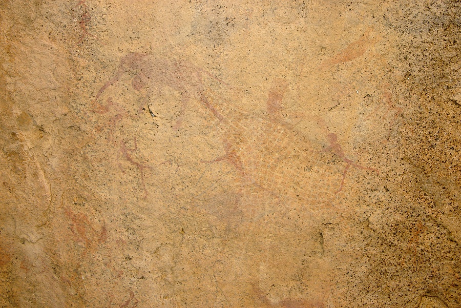
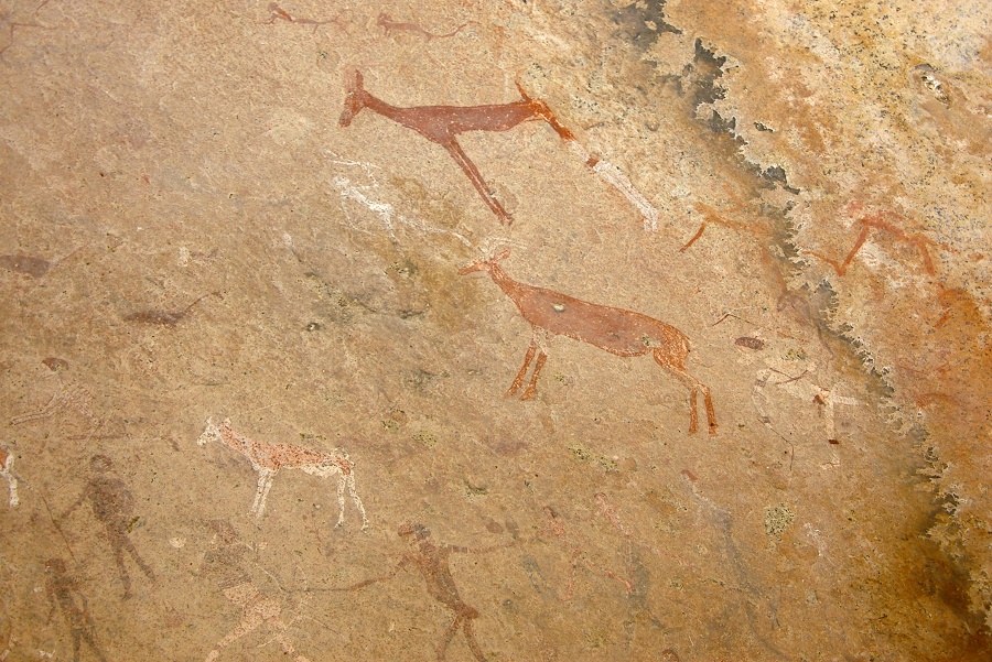
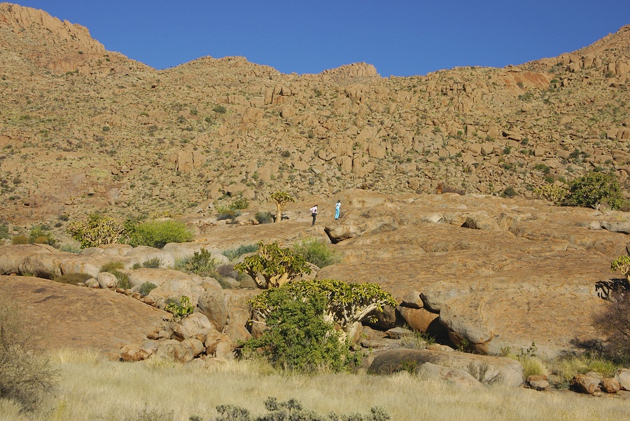
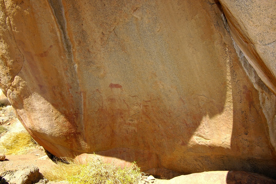
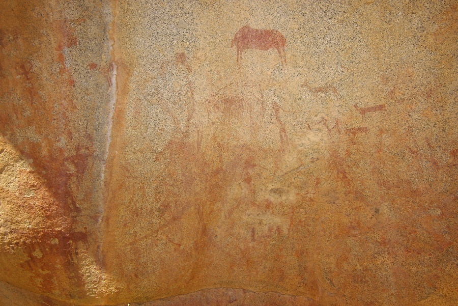
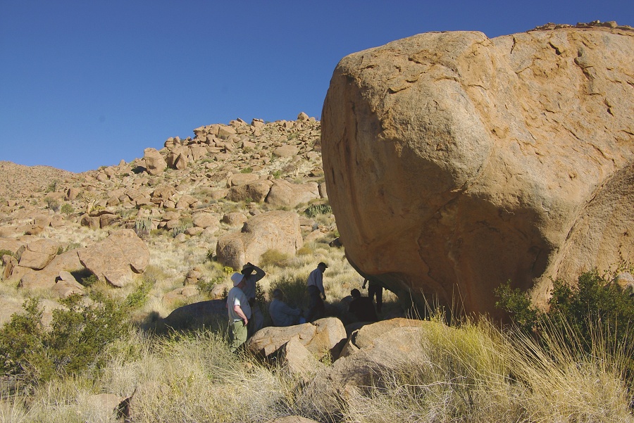
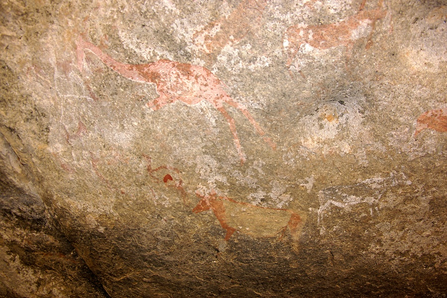
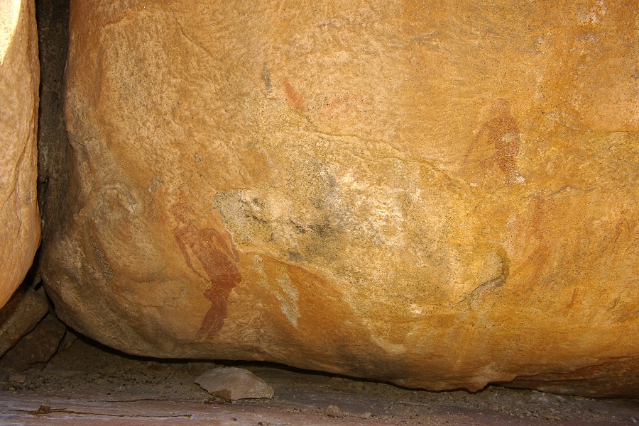
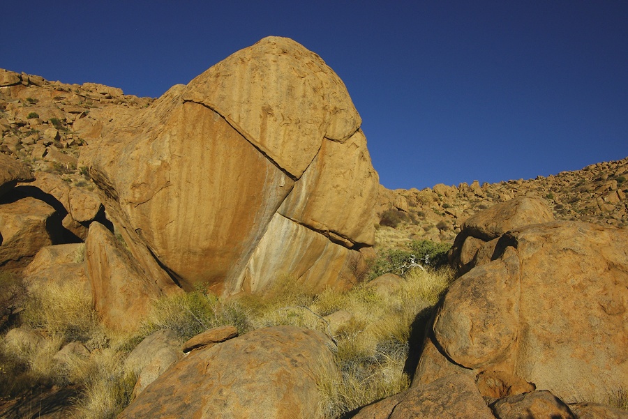
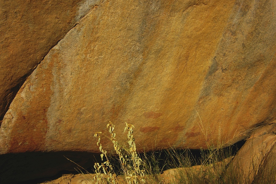
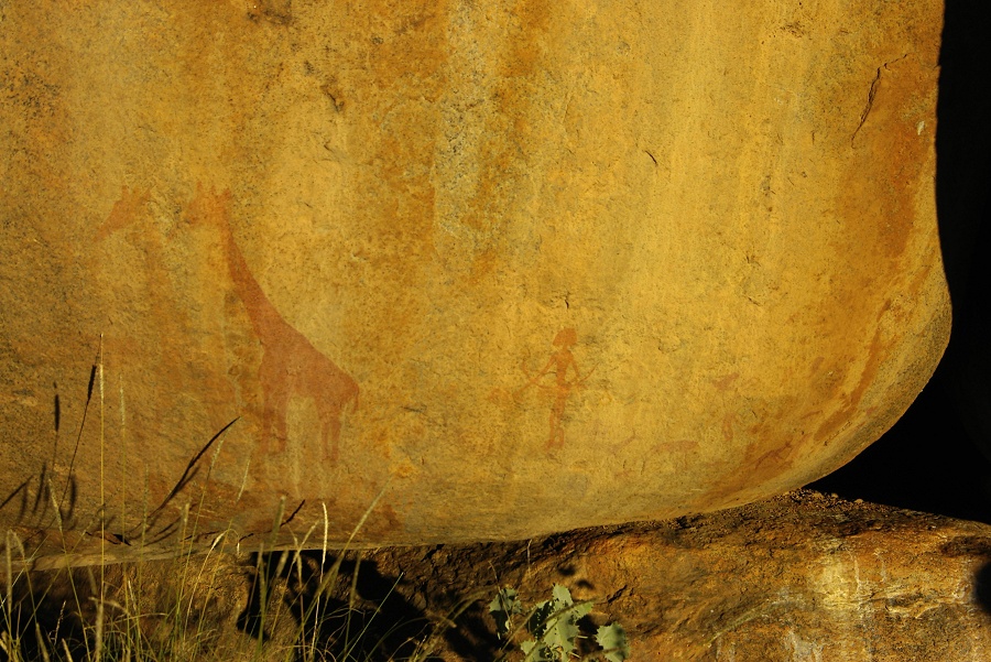
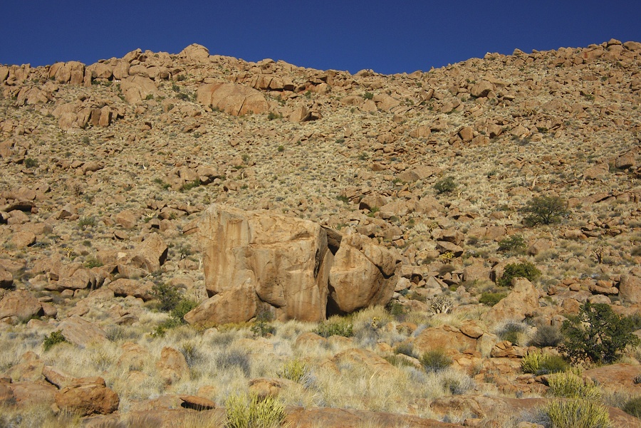
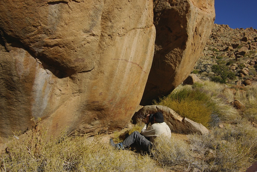
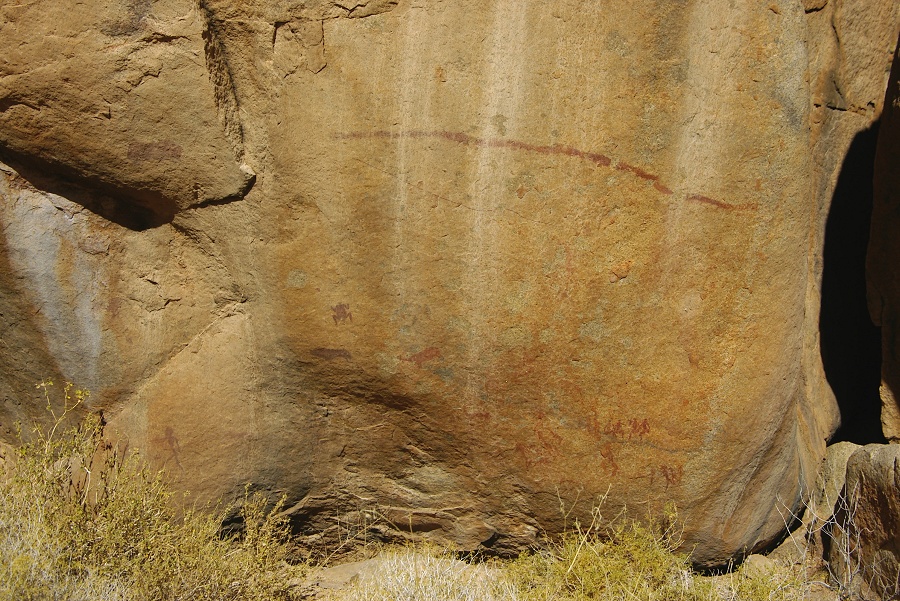
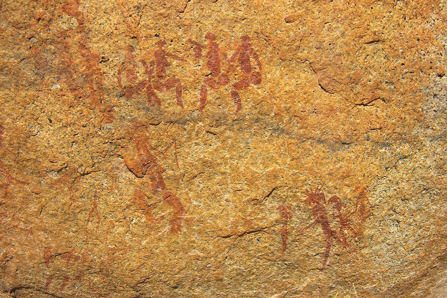
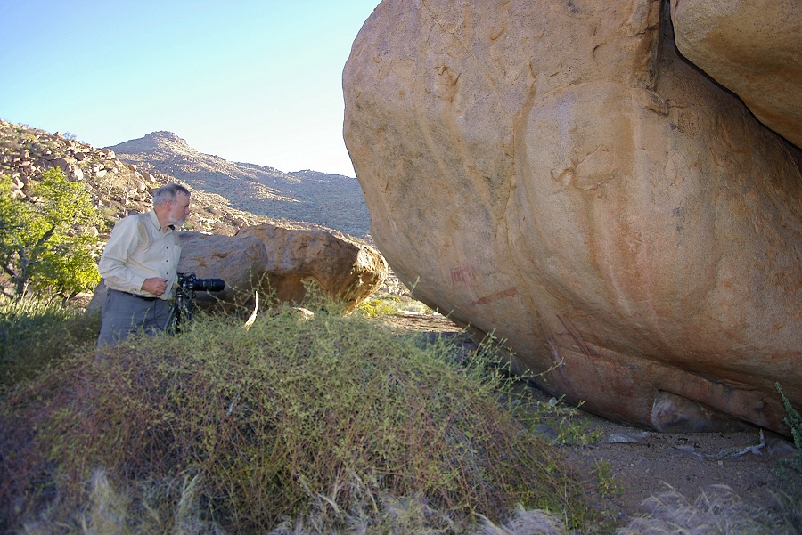
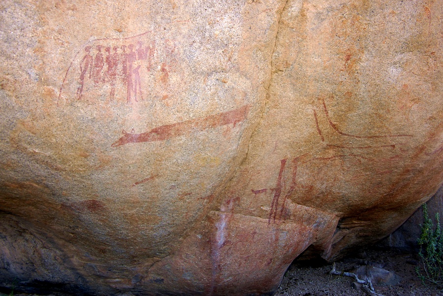
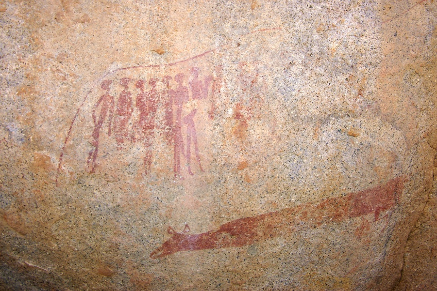
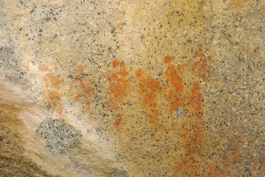
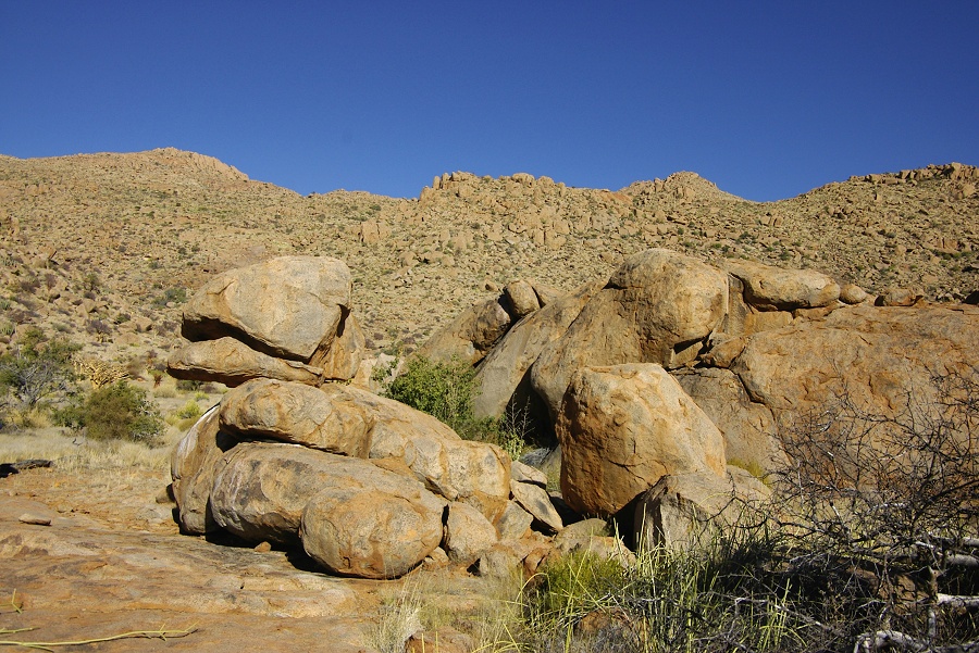
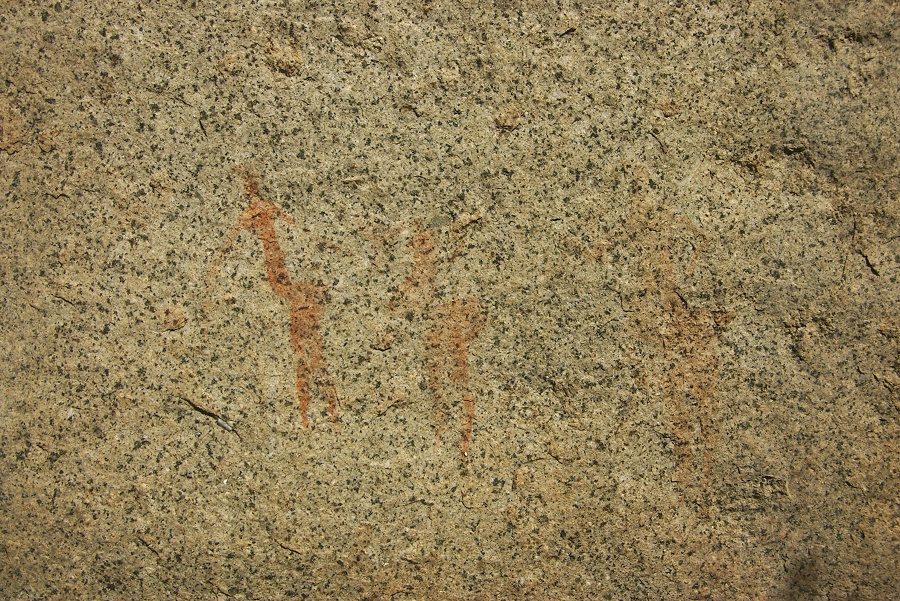
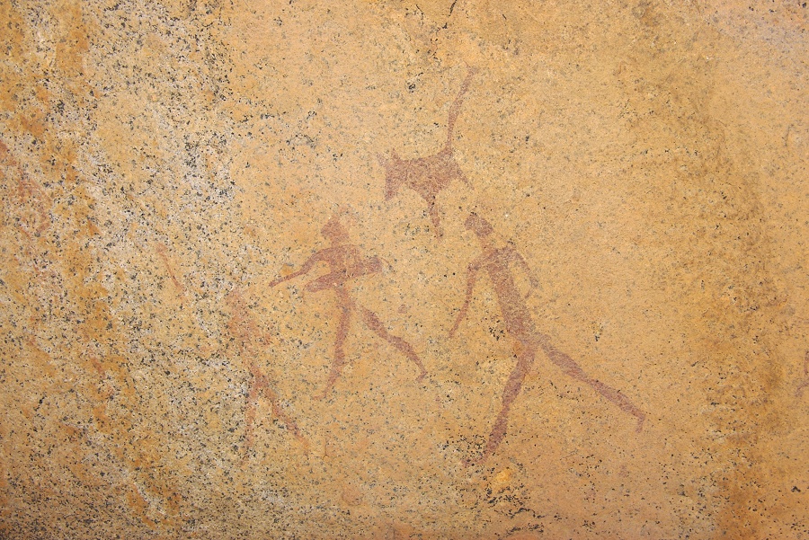
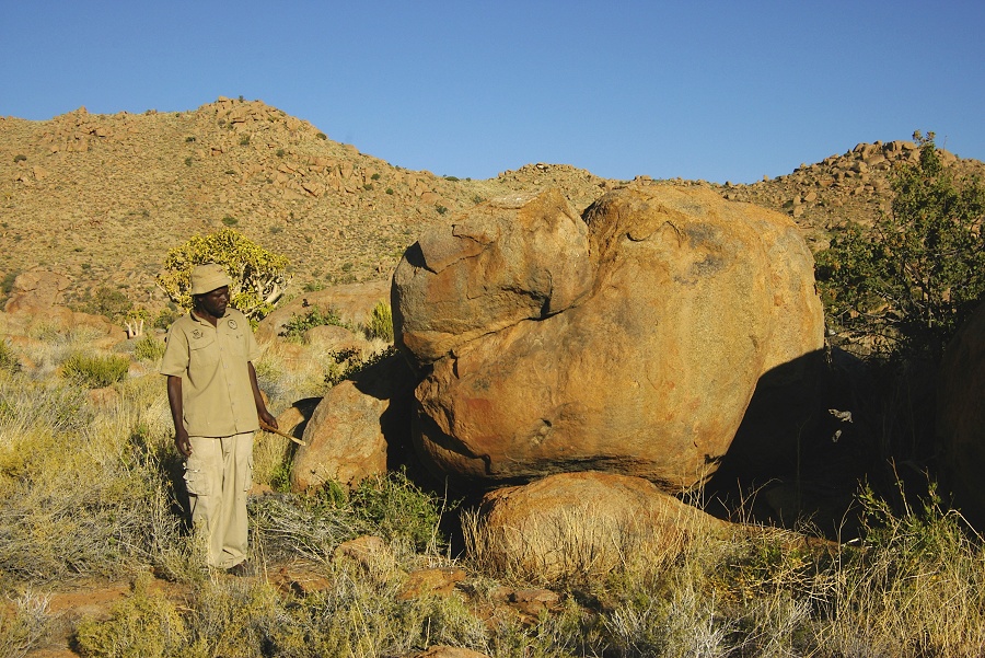
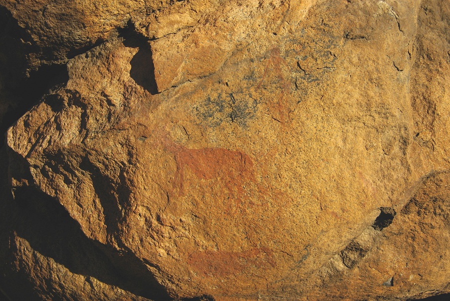
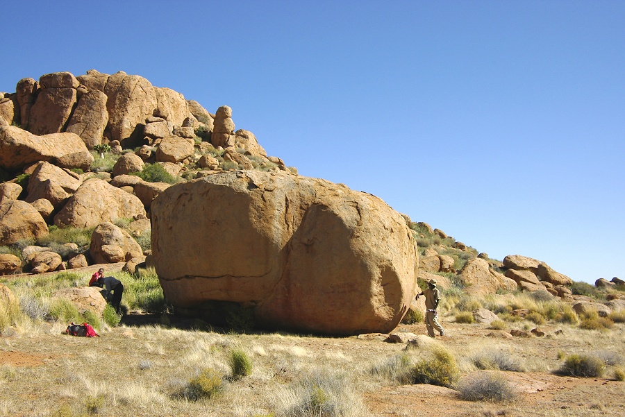
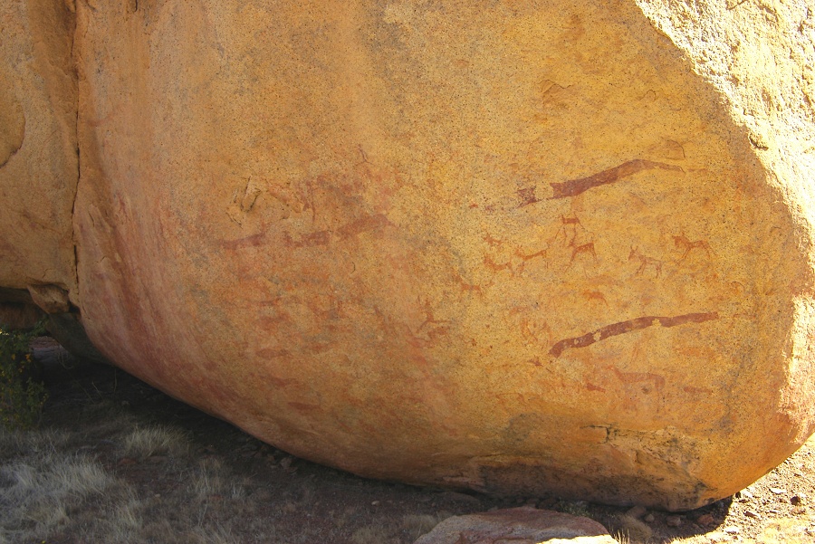
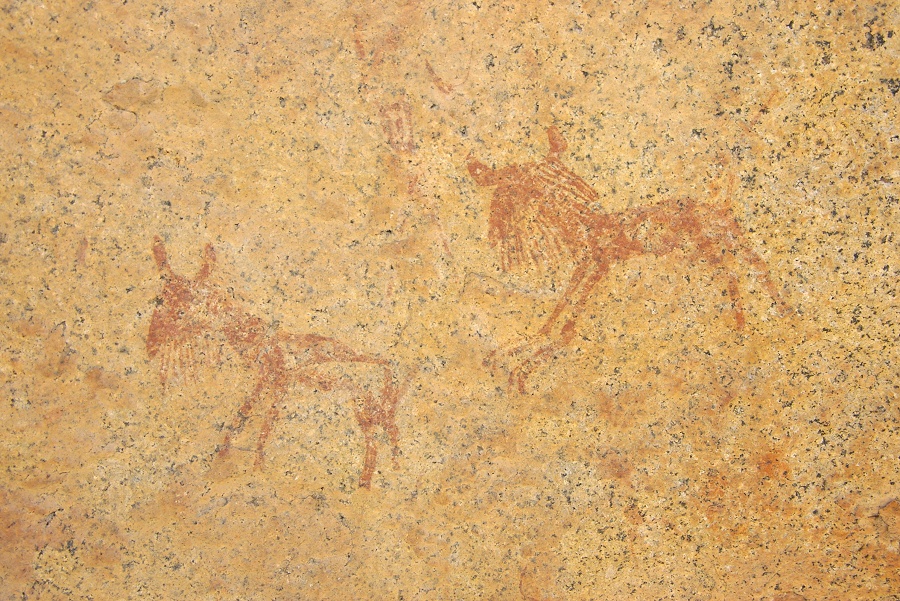
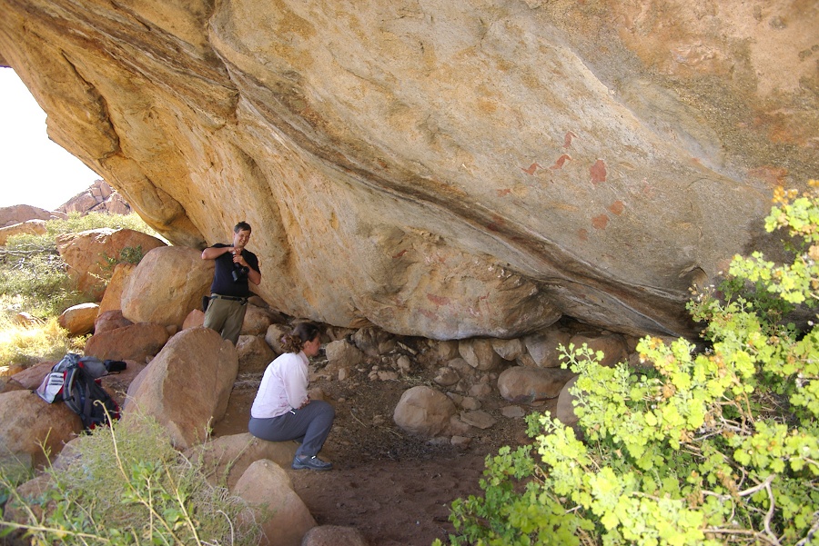
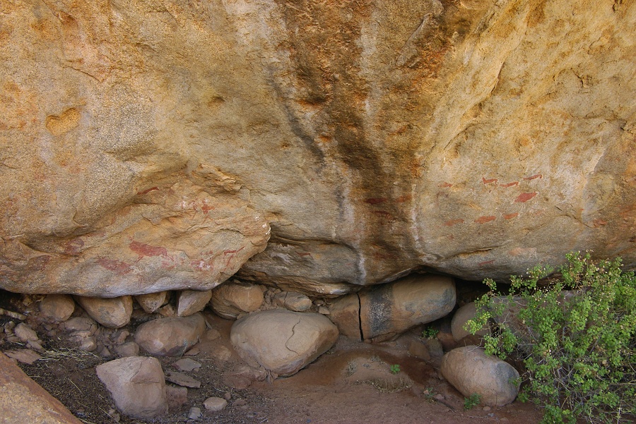
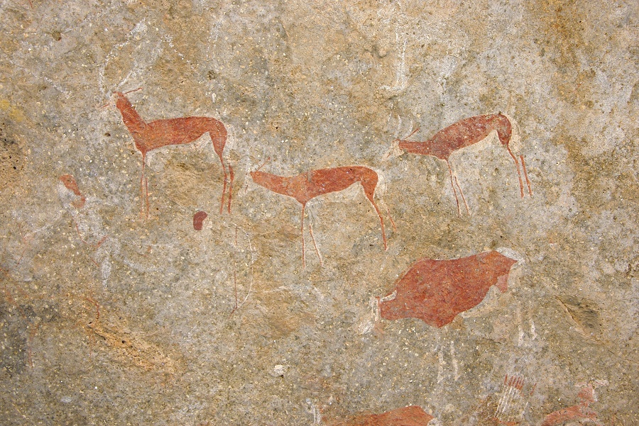
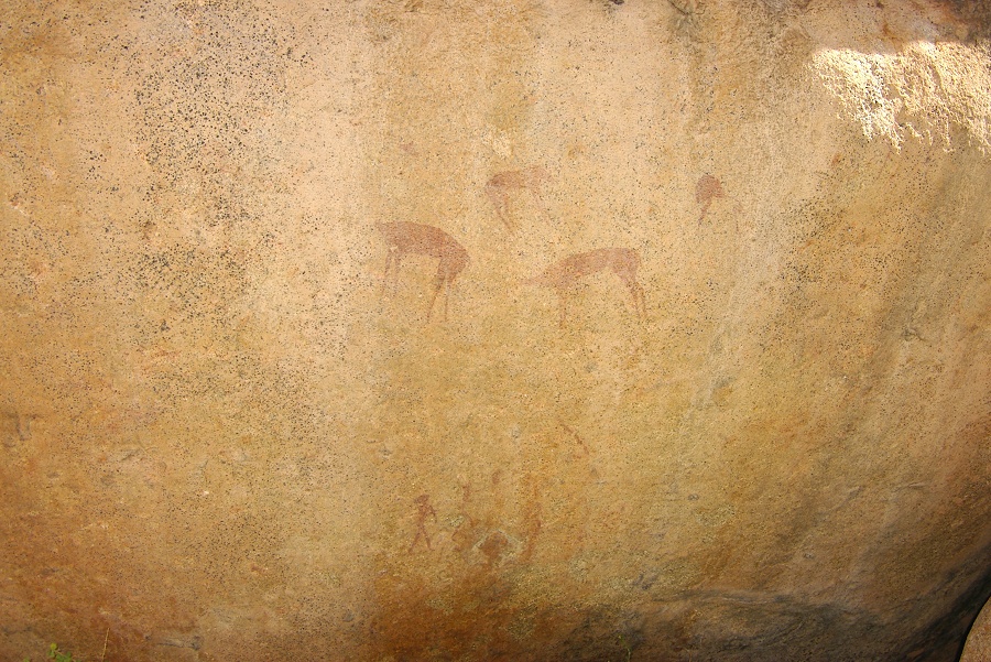
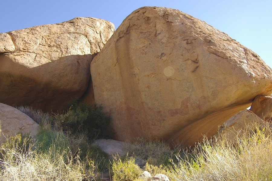
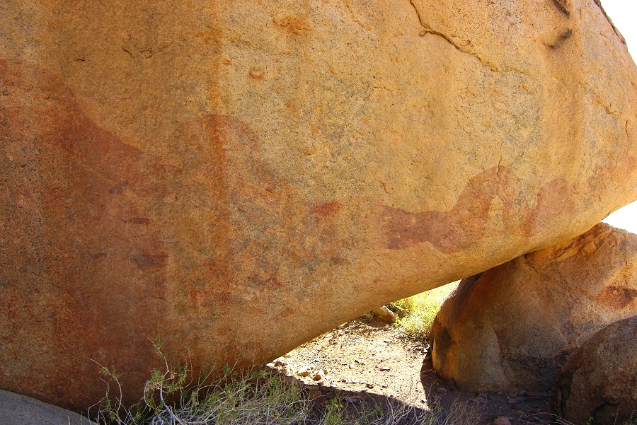
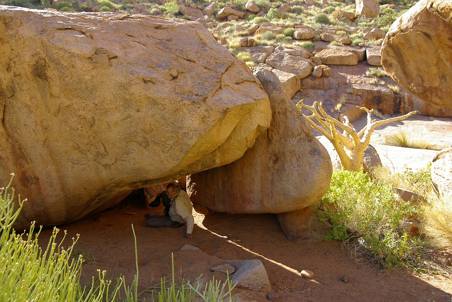
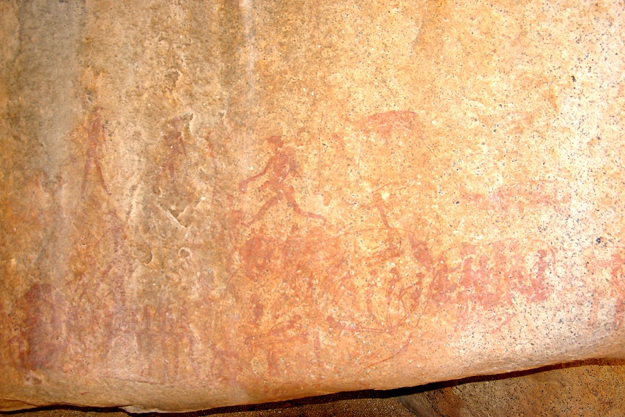
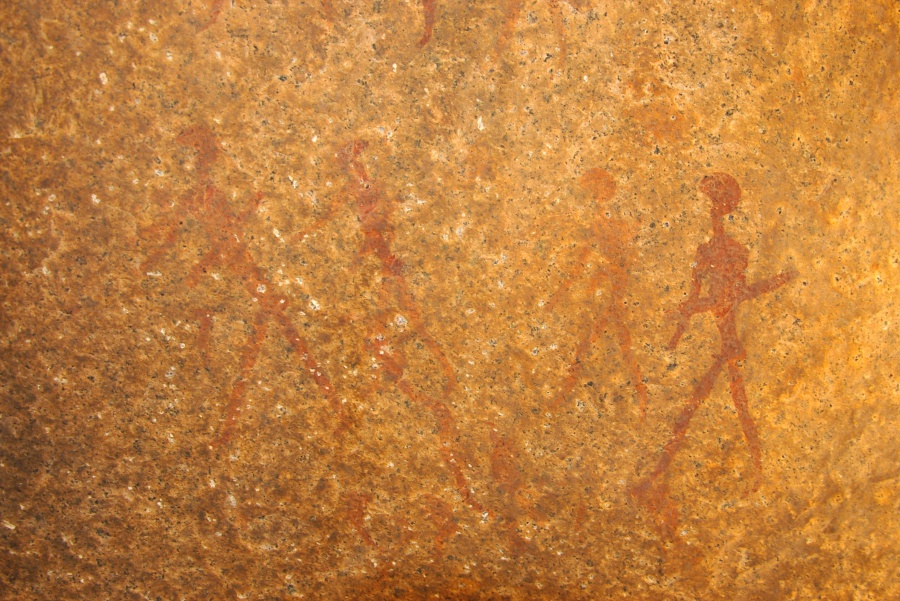
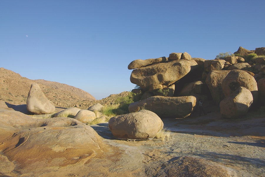
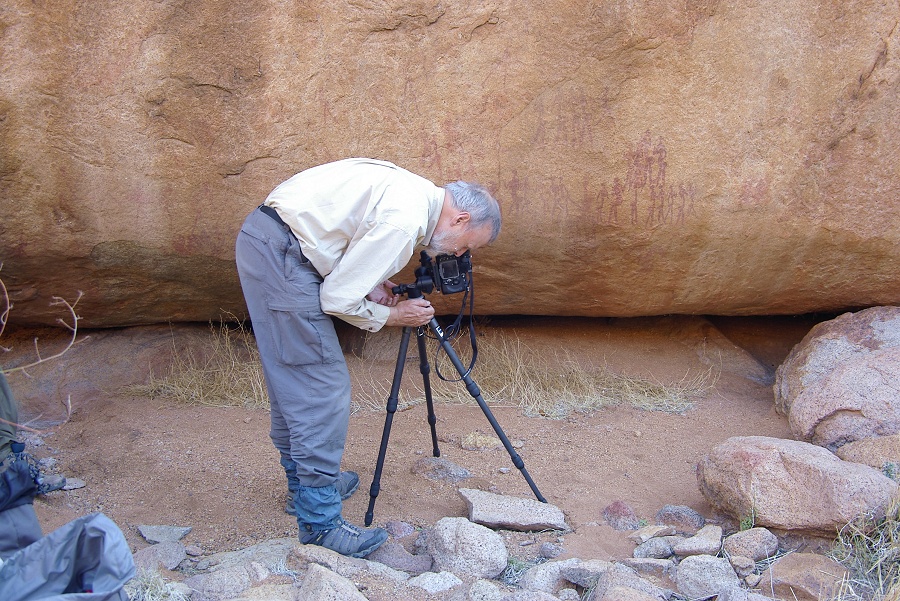
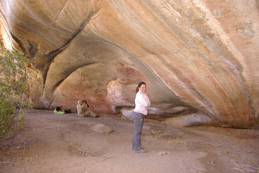
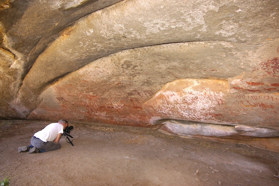
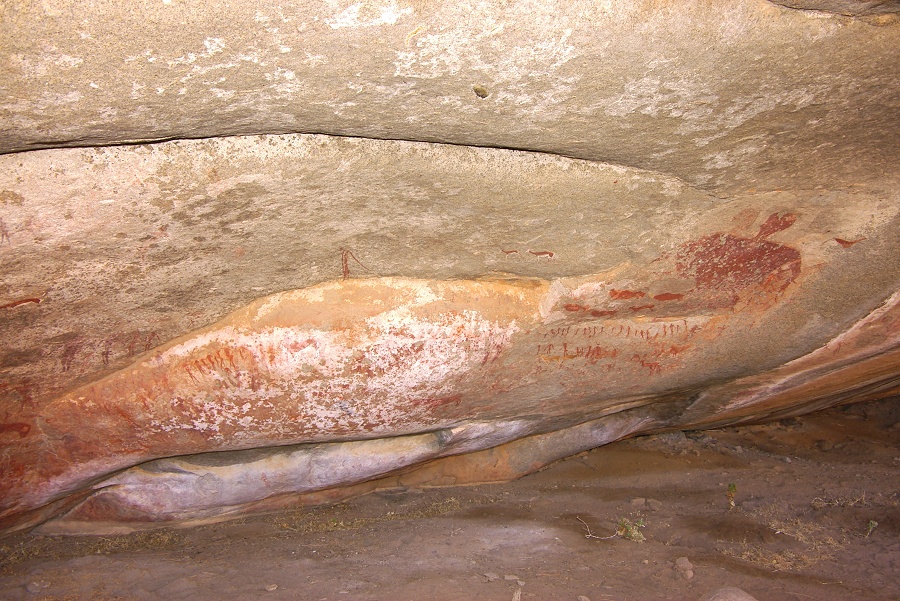
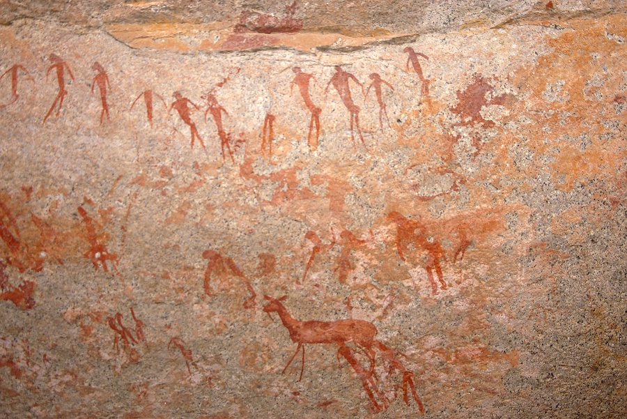
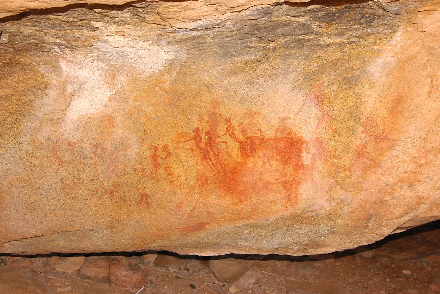
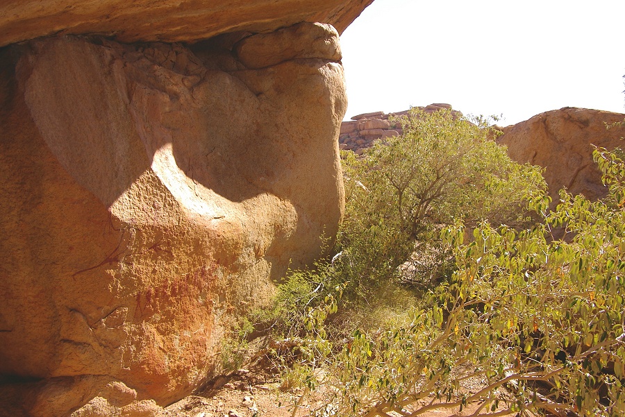
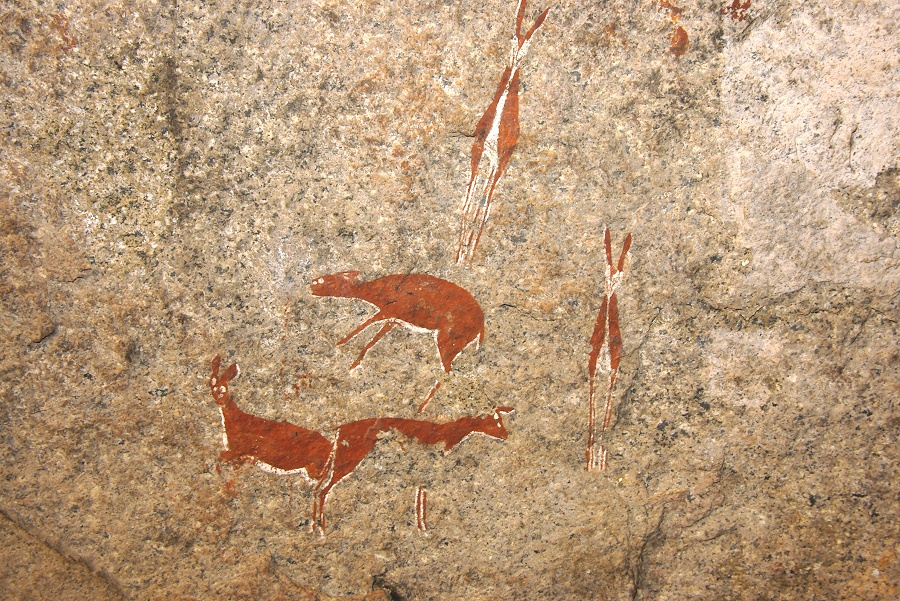
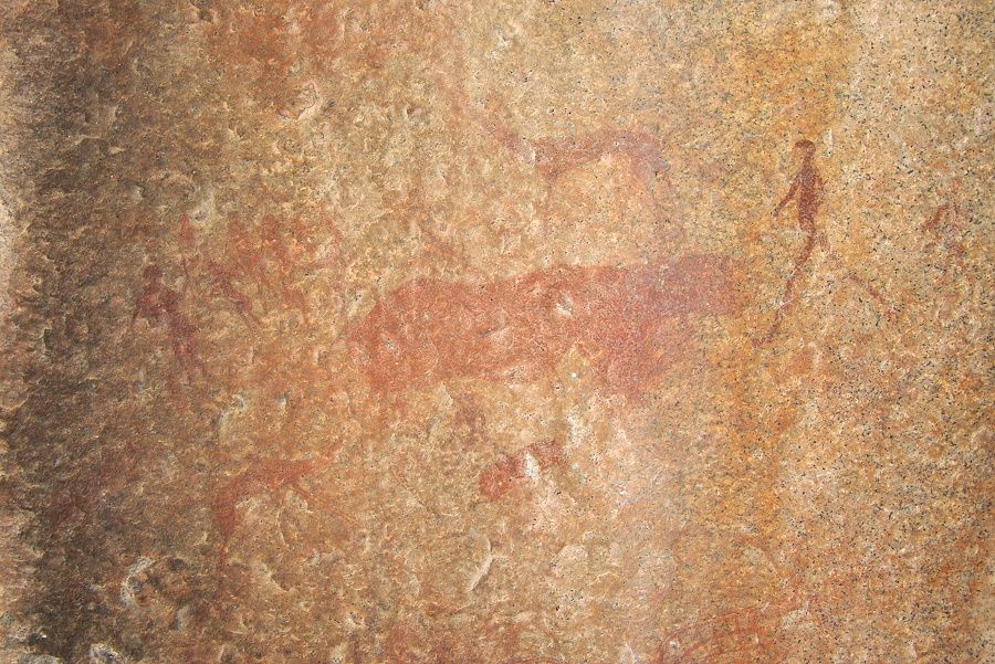
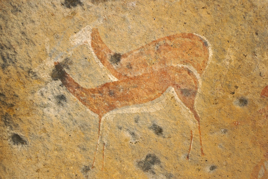
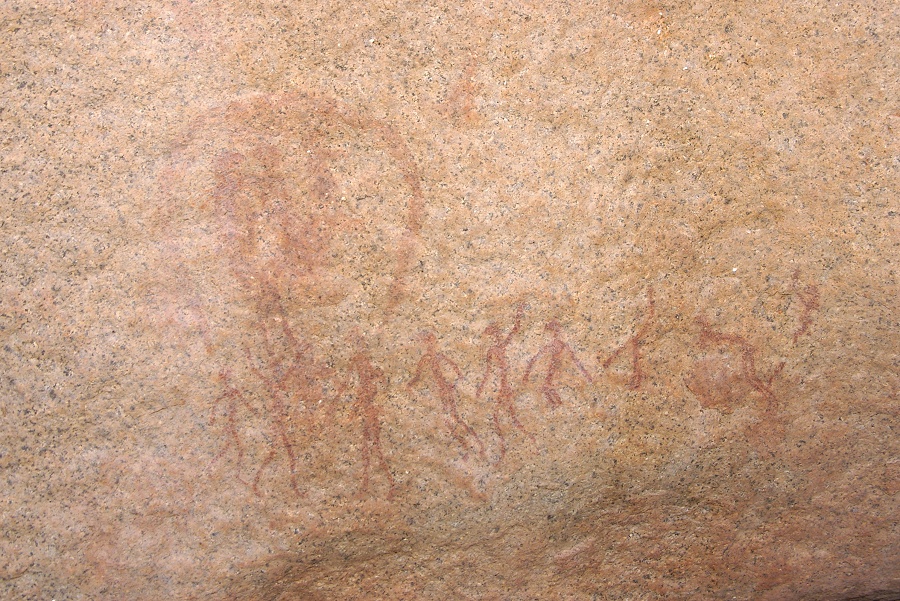
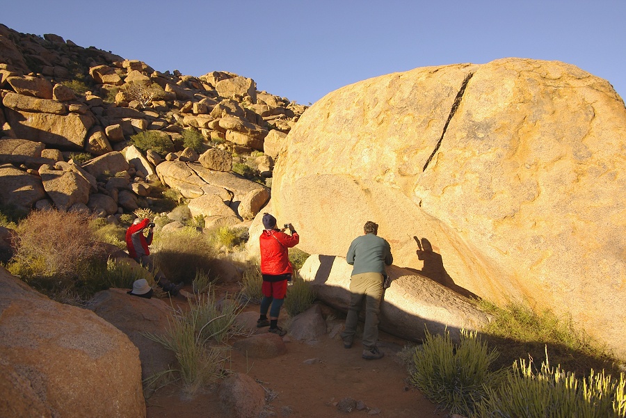
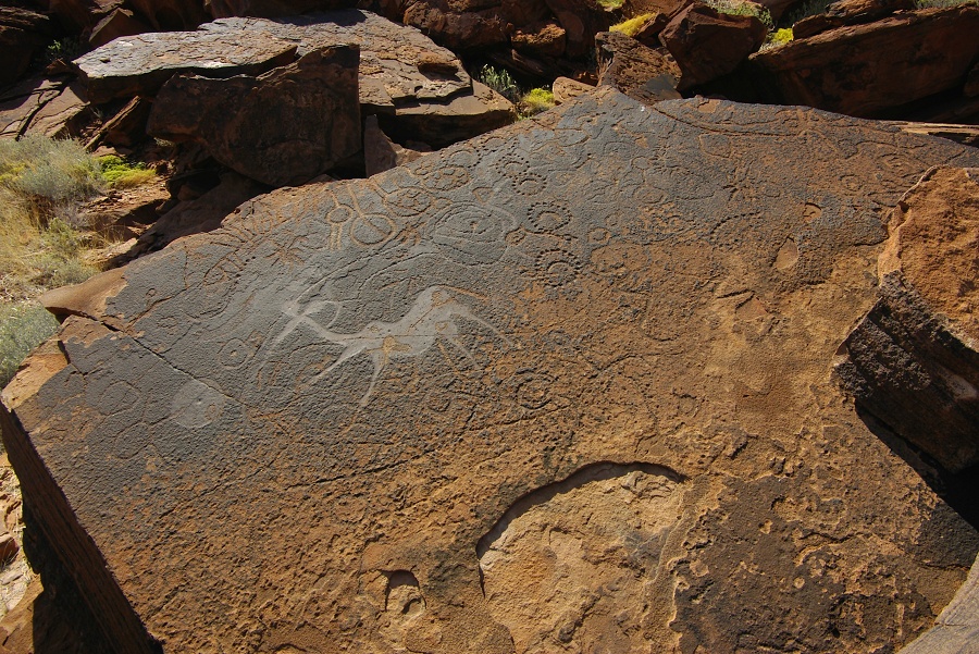
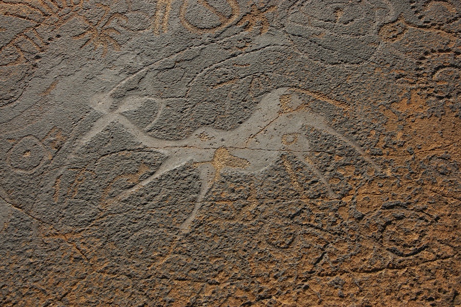
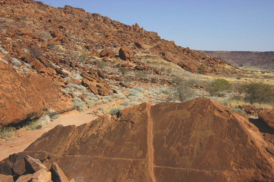
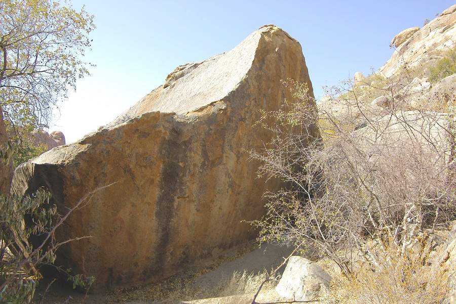
We started with the major site of the rocky island just upstream from the "White Lady" shelter, which our guide of the time was unable to locate when we last visited in 2005. "Jochmann's shelter" was named after the surveyor, Lieutenant Jochmann who discovered the site in 1909 (as attested by the graffiti he left there), but was only studied and published in detail by Breuil, together with the other sites in the vicinity. The site is situated along the base of an exceptionally large boulder, and both in terms of the quantity and in the quality of preservation ranks among the most important sites in the Brandberg.
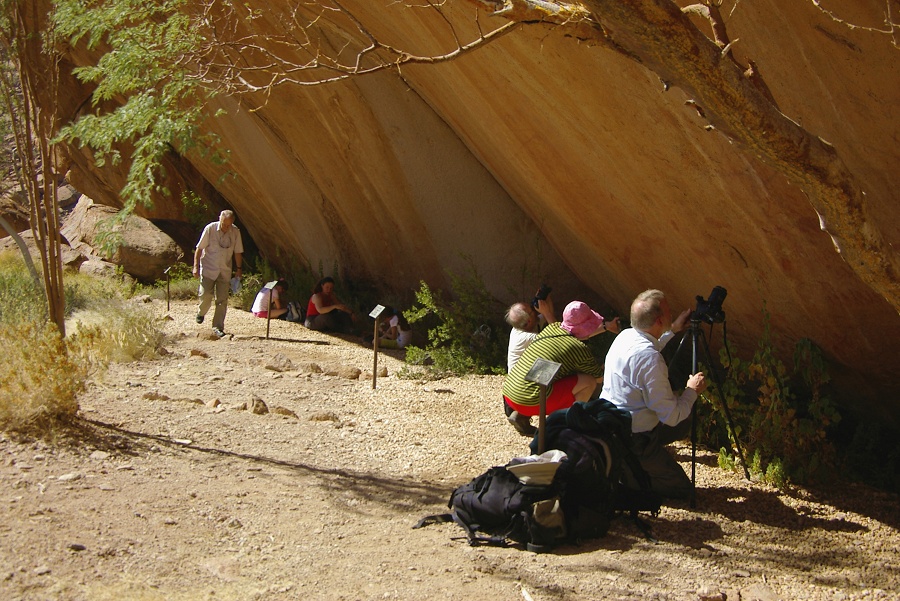
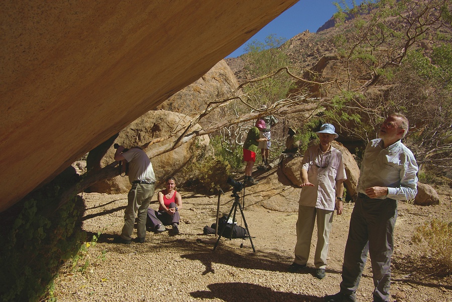
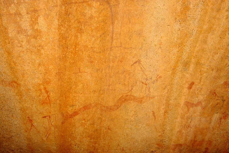
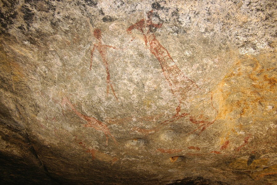
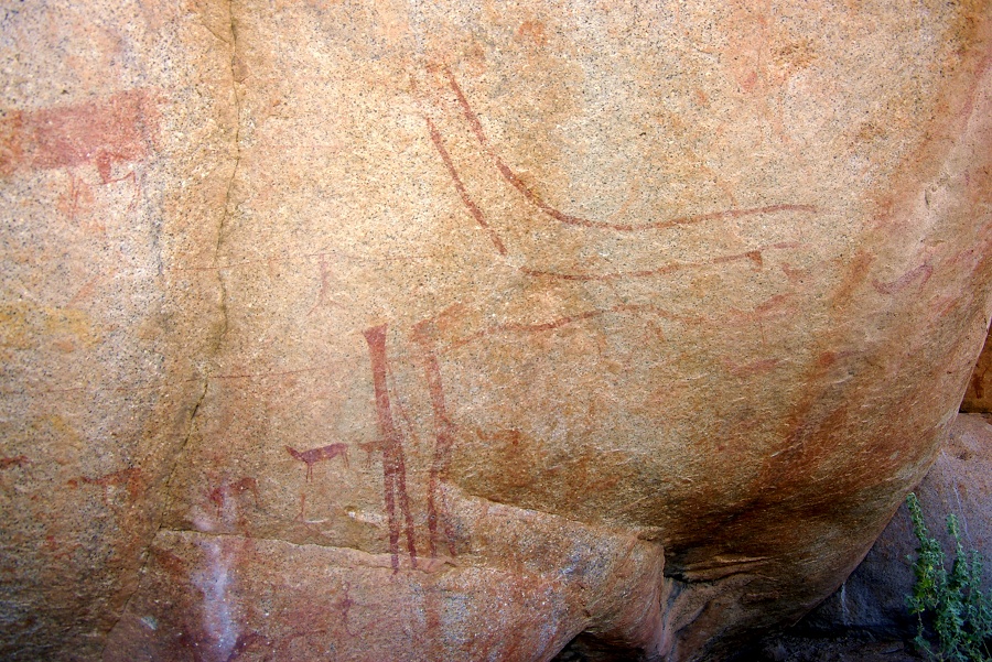
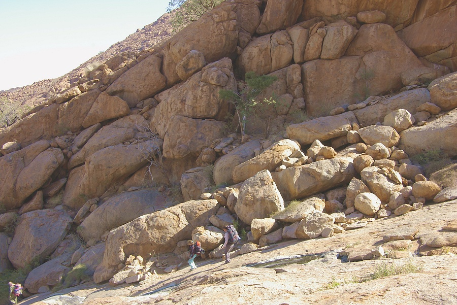
After Jochmann's shelter we walked about half a kilometre upstream till near the end of the island, where a large rock contains a panel of very fine paintings. This site was named "Skeleton shelter" by Breuil on account of a pair of skeleton-like human figures.

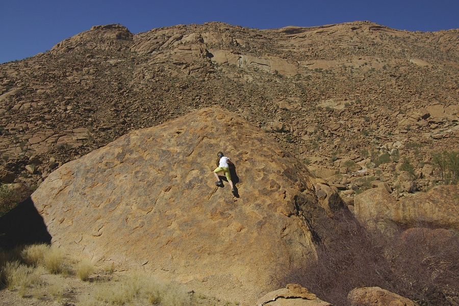
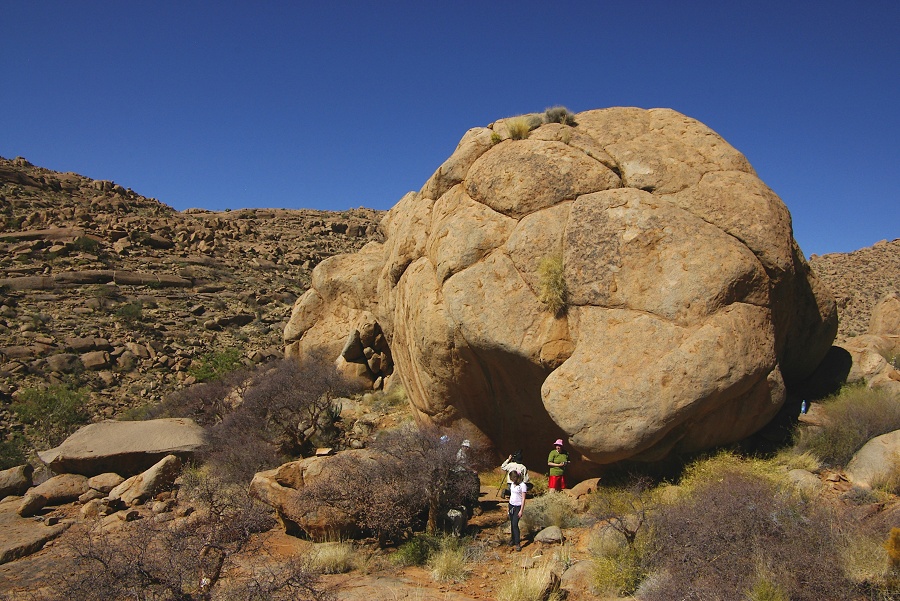
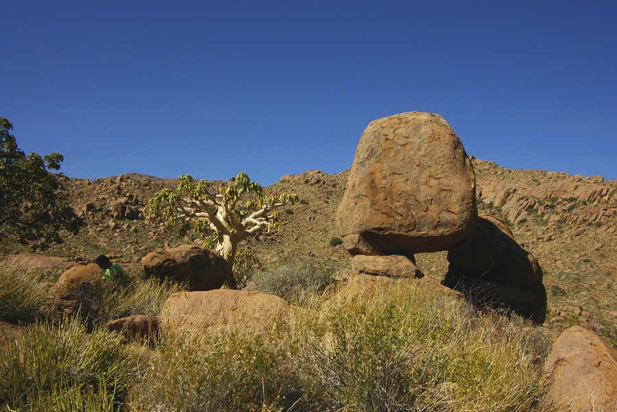
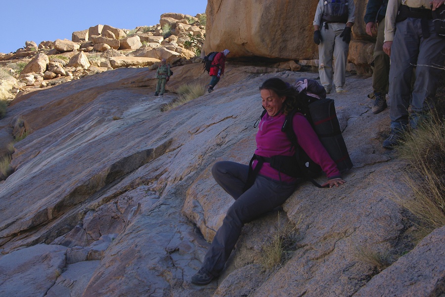
On our return we passed by Pyramid shelter, at the base of an immense pyramid shaped granite boulder. A nearby reasonably tame boulder provided the long awaited opportunity for Viki to practice her rock climbing skills, going up like a gecko at a place where I would never have even considered making an attempt...
After a quick lunch in the shade of Pyramid rock, we returned to the downstream tip of the island to see the White Ostrich and Tiara caves (the only two we managed to see in 2005).

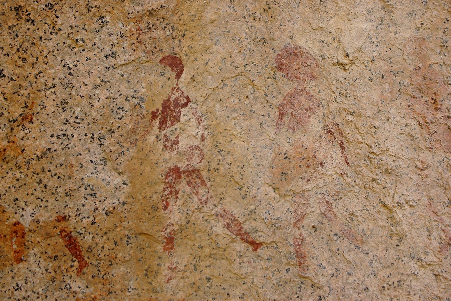
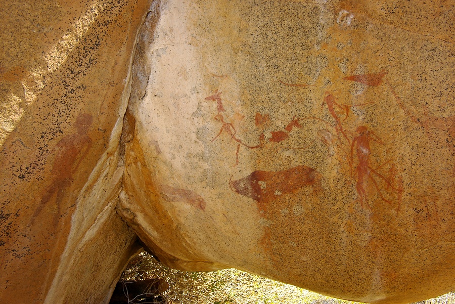
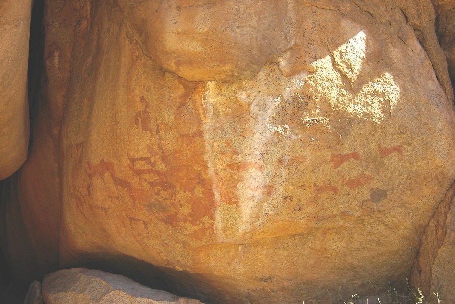
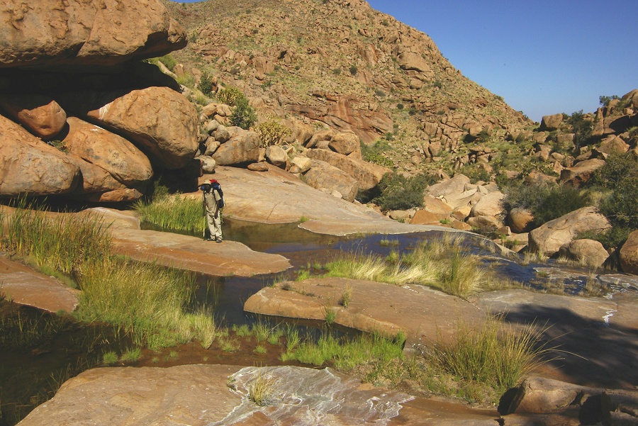
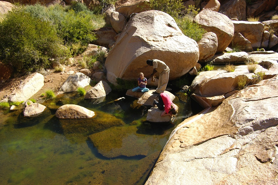
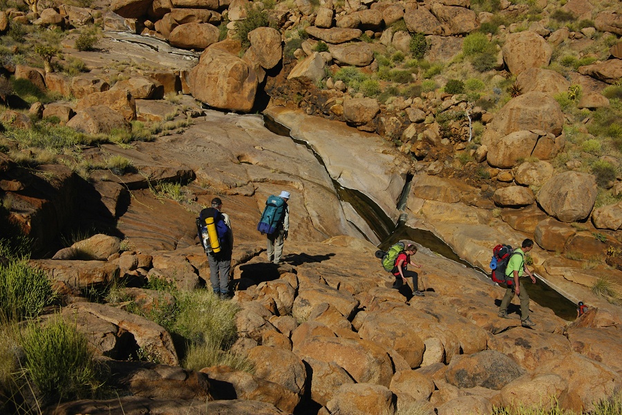
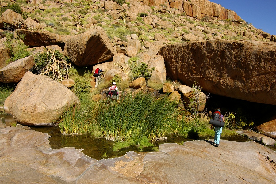
We crossed the deep ravine below Tiara cave, thickly overgrown with reeds and other plants at the bottom, and still having a trickle of flowing water in the main watercourse. We climbed the far bank (far above where I thought the site to lie in 2005) to one of the main highlights of the Tsisab, the "Girl's School" shelter, located at a somewhat isolated spot among huge granite boulders a good fifty metres above the valley floor.
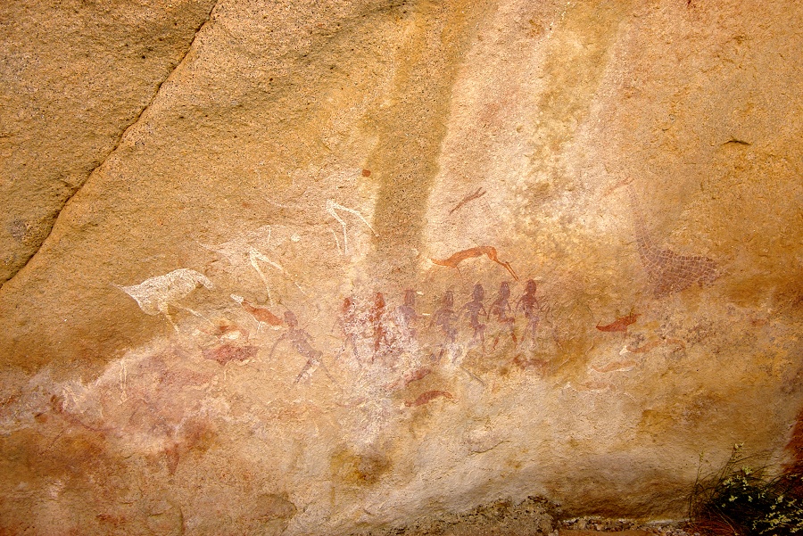
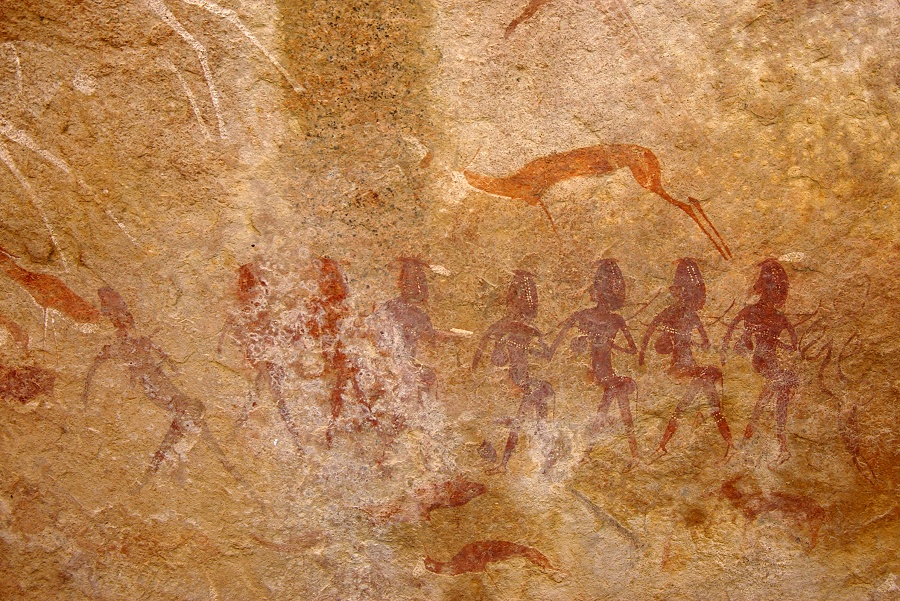
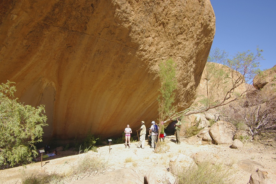
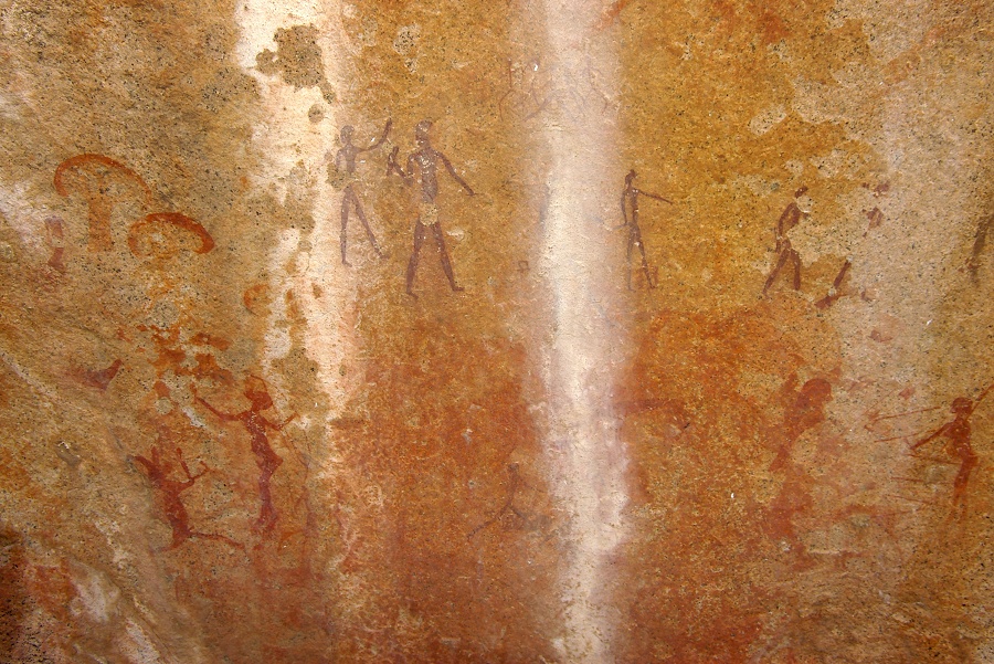
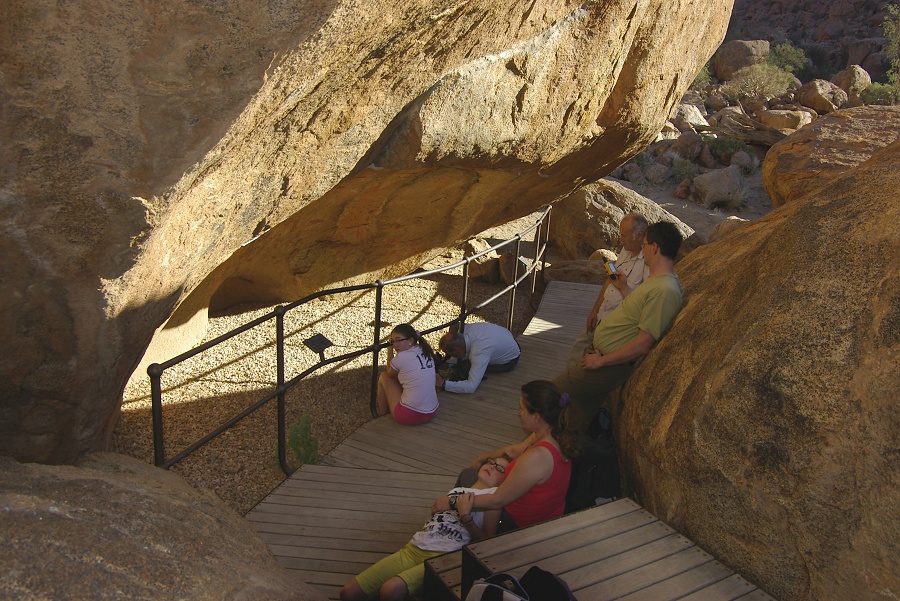
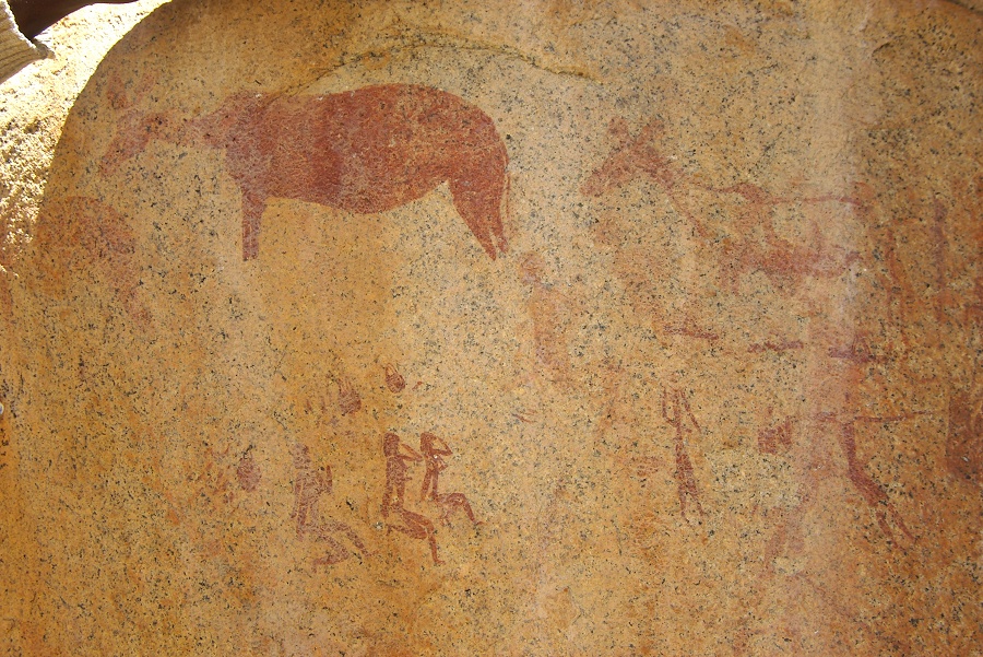
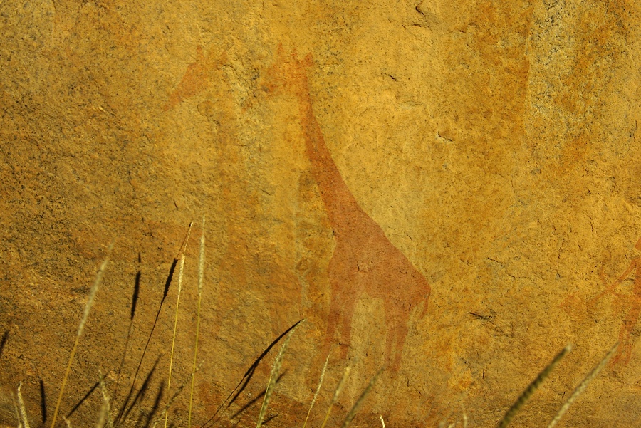
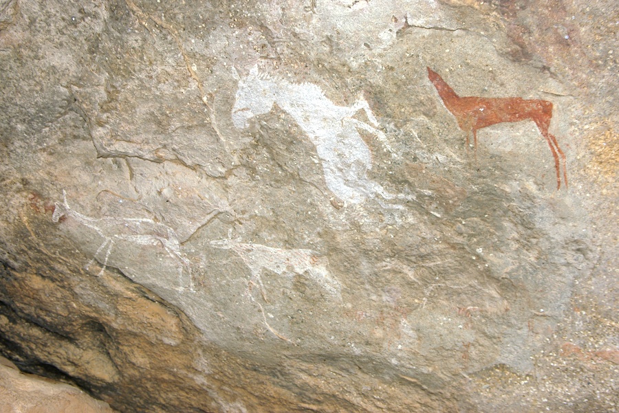
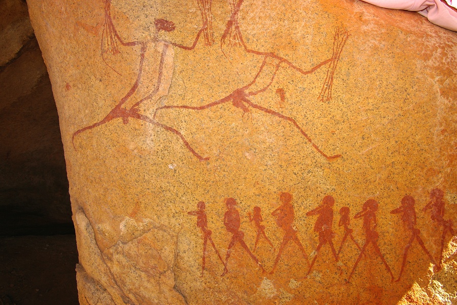
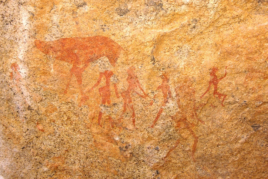
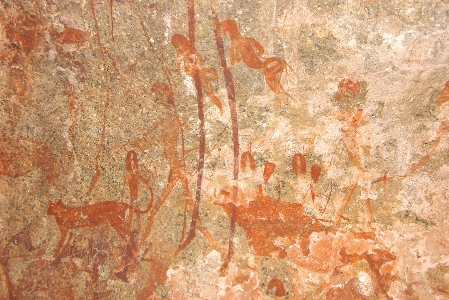
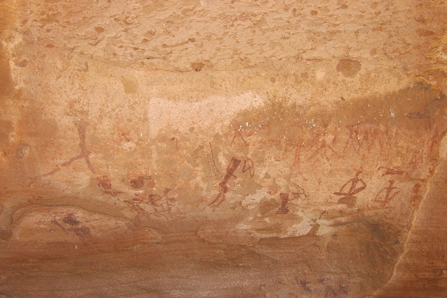
We descended by the way of Elephant shelter (on account of a now rather faint painting of an elephant), to conclude our list of sites at the famous Maack ("White Lady") Shelter. While the central figure is actually a man, and definitely not white, the name given by Breuil stuck, and this is the only Brandberg site that is firmly on the trodden tourist trail, with visitor centre, path, platform and railings to keep the crowds at bay. Fortunately by the late afternoon hour we reached there, we had the whole place blissfully to ourselves in perfect light.
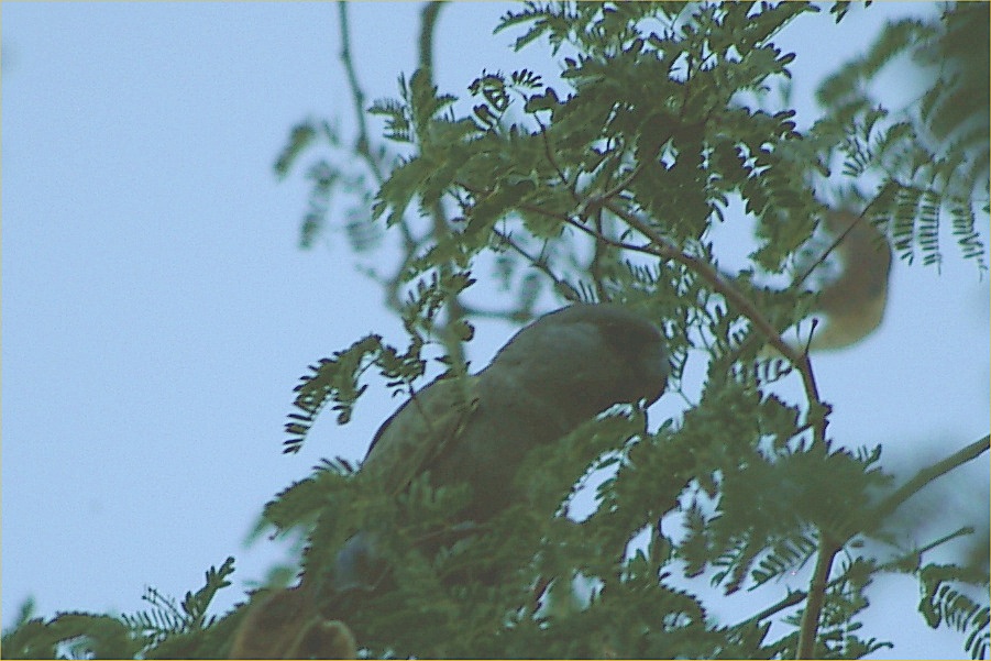
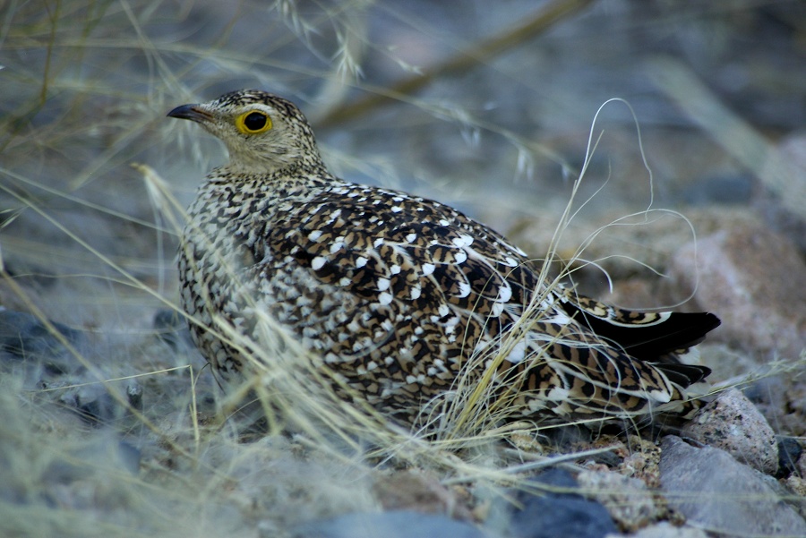
As we walked back along the lower Tsisab to the car park, we encountered a rather loud pair of parrots, and several sand grouse just beside the trail that appeared perfectly fearless, allowing themselves to be photographed at just a couple of steps away.
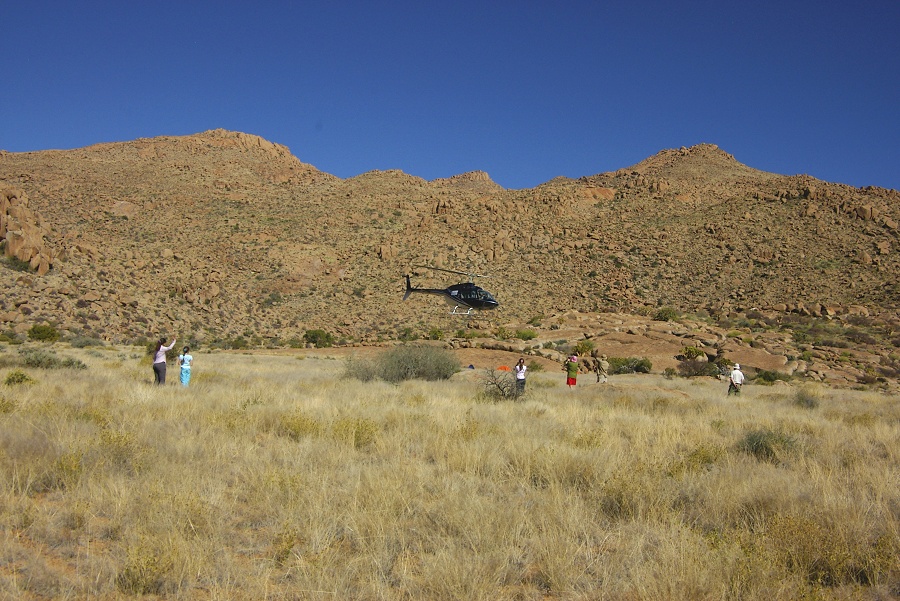
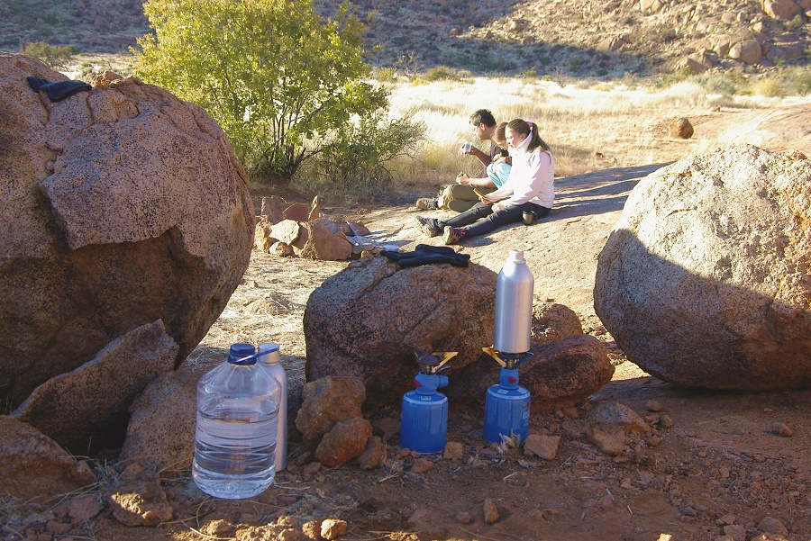
We reached Uis by sunset, and spent the evening packing our gear and supplies, leaving our surplus items in the good hands of Analene and Karl at the White Lady. I verified that our helicopter arrived to our agreed rendez-vous point, all was set for the ascent the following morning.
Day 3. - Ascent - Umuab sites
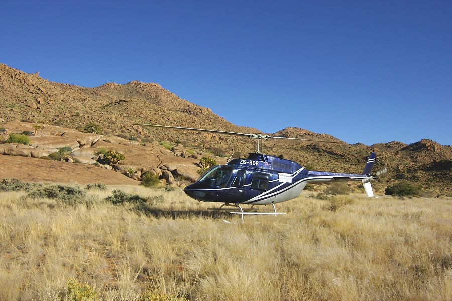
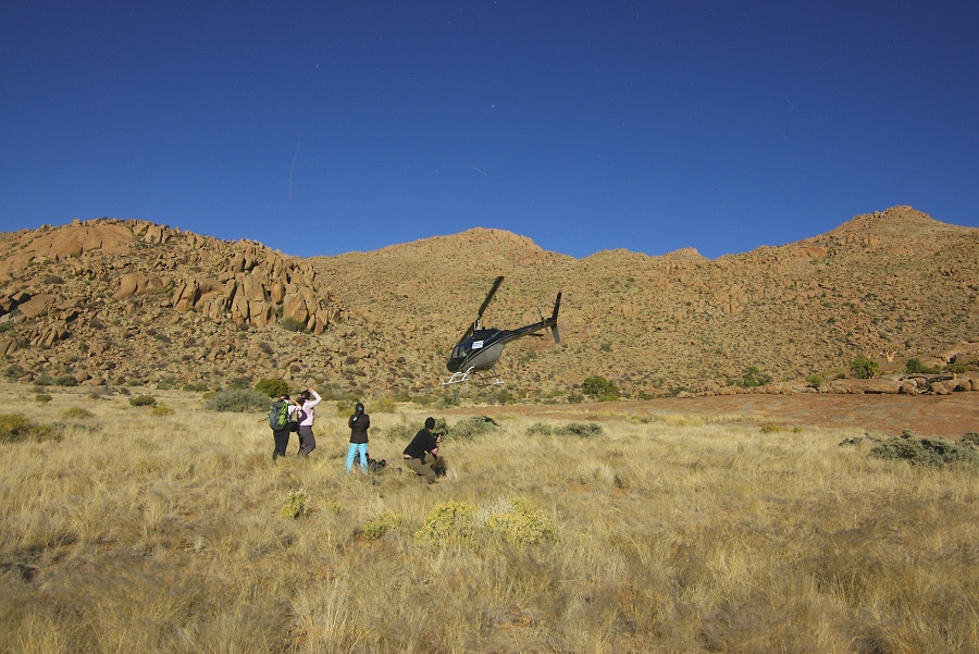
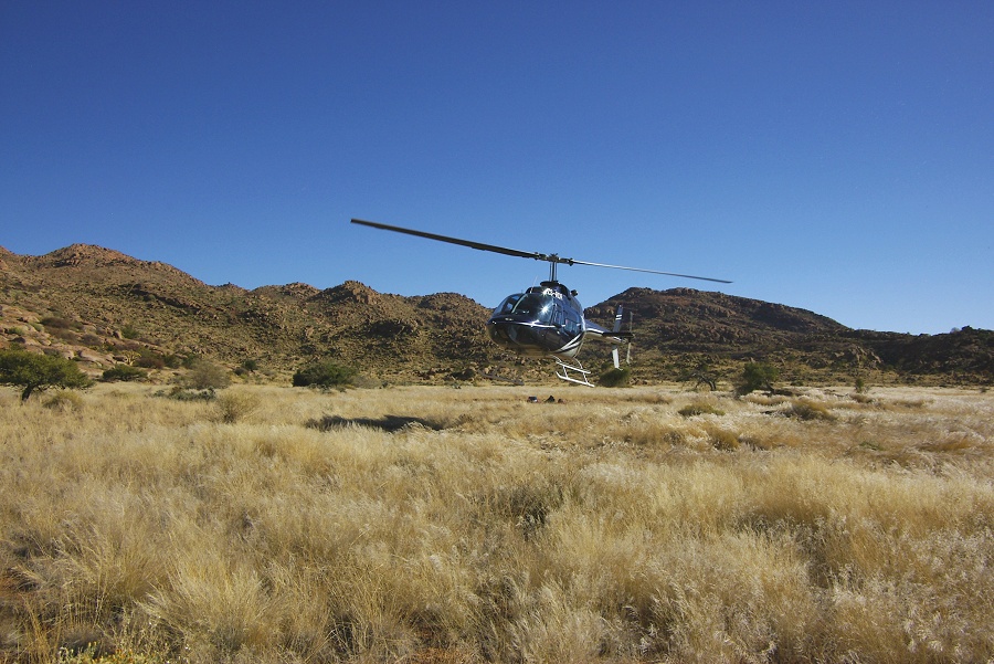
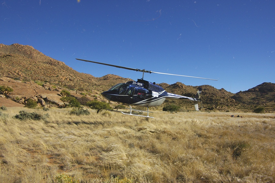
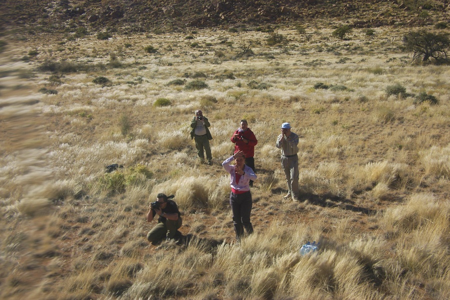
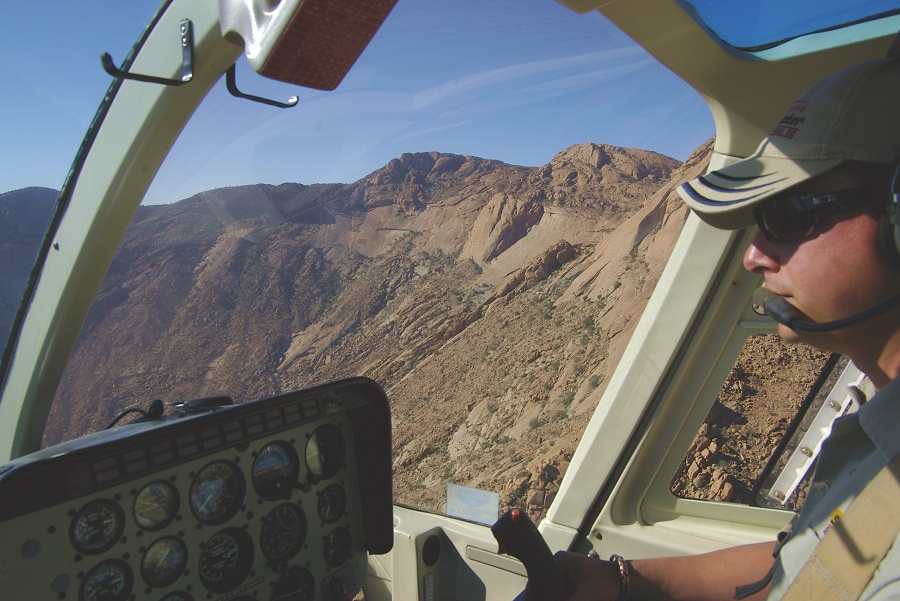
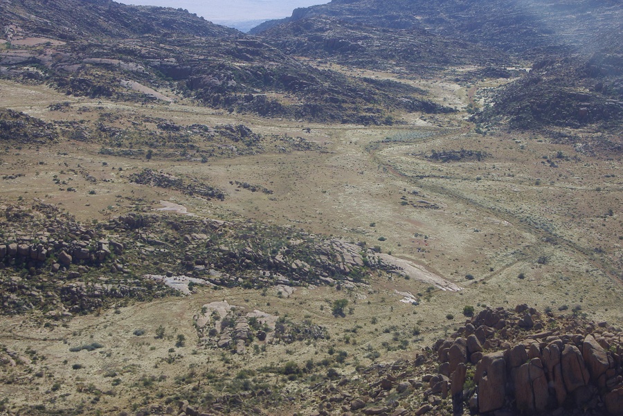
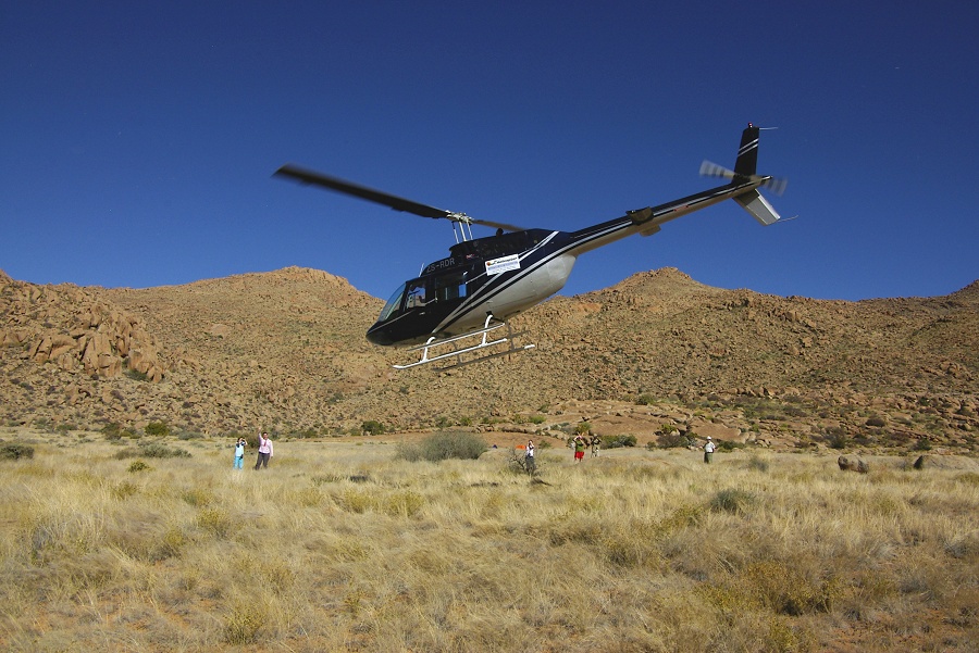
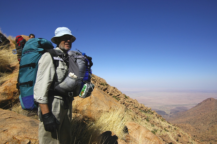
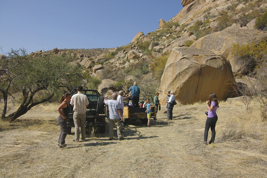
After a pre-dawn breakfast we set out on the same route as the day before to the White Lady Lodge (not to be confused with the White Lady BB in Uis) located along the banks of the Ugab river to the North-east of the Tsisab gorge. We have chartered a Bell 206B-3 from Sun Helicopters to lift ourselves and our supplies to our base camp on the Brandberg, with an agreed rendez-vous at 7am. When we arrived, our pilot Hadré van Deventer was already preparing the aircraft for flight. We have planned four flights, each taking up a payload of around 350 kilos, a comfortably light load for the possibly windy and tricky conditions to be encountered at the top of the mountain around 2000 metres.
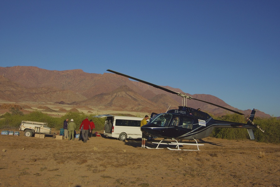
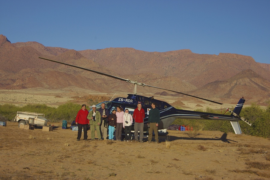
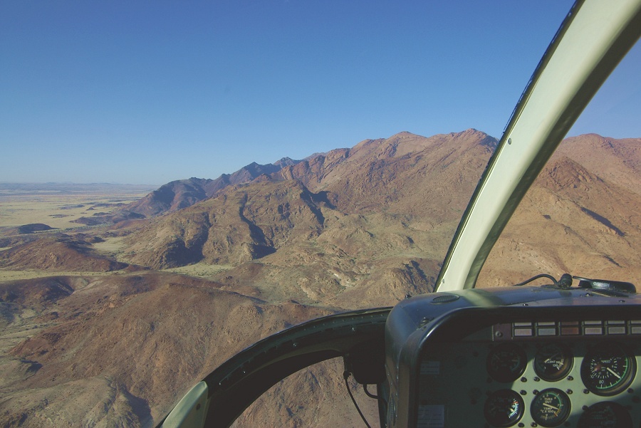
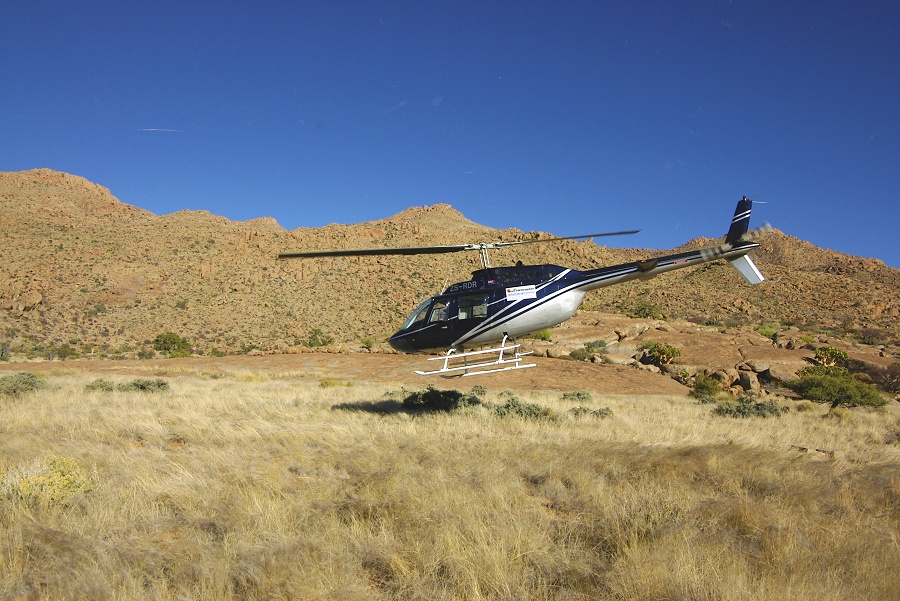
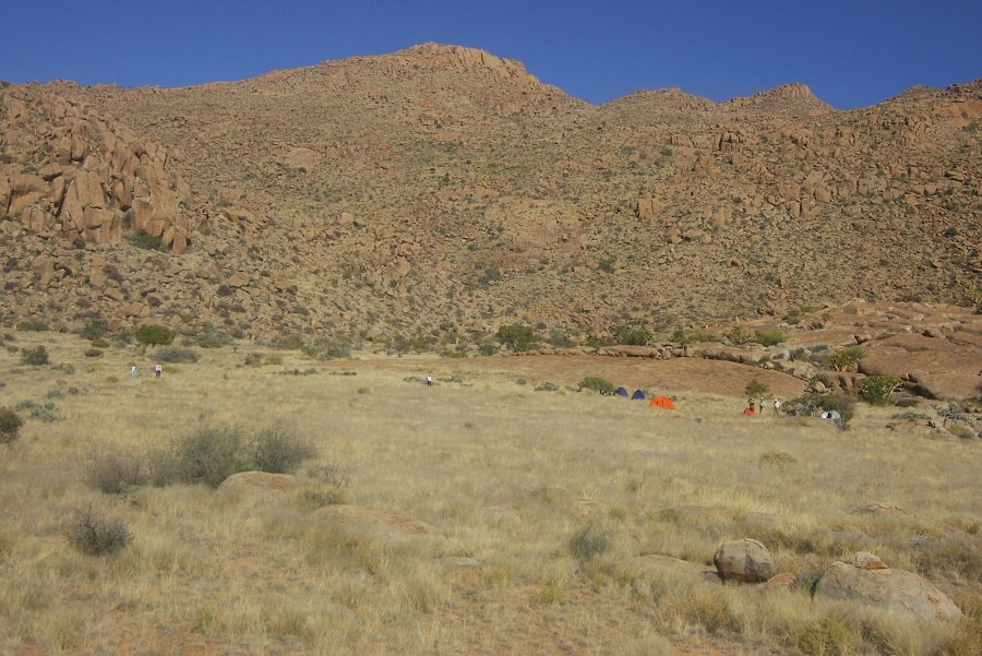
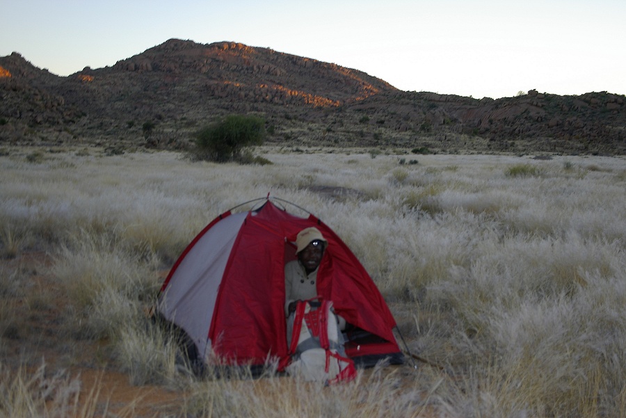
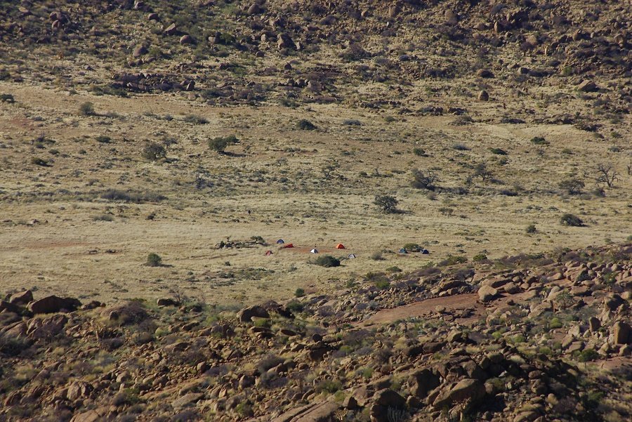
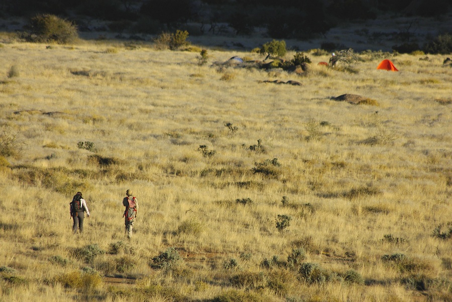
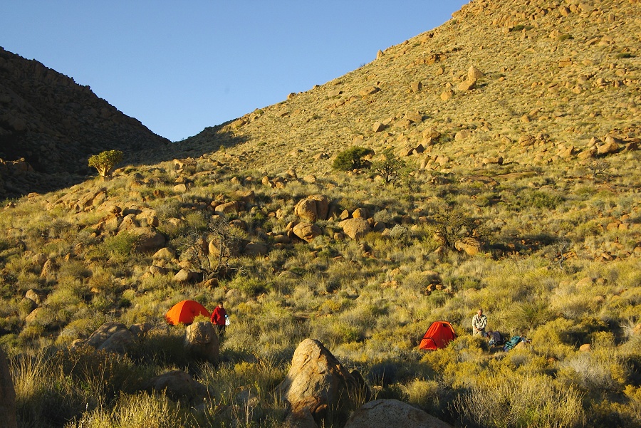
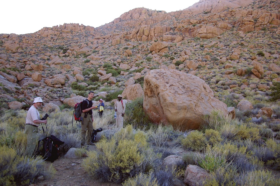
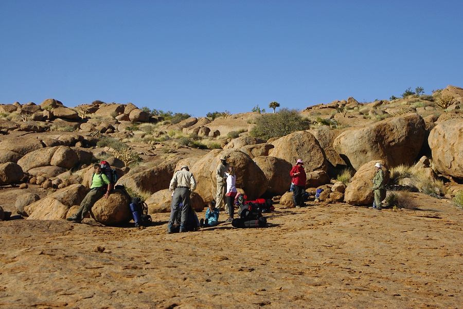
The first flight was taken by me, Attila & Alfons, together with some supplies, the lightest planned load to test the conditions. Fortunately the precaution proved unnecessary, the weather was perfectly calm and cool, as ideal flight conditions as one could wish for. The flight above the Brandberg was exhilarating, but much too short. After a very rapid rise to the level of the eastern peaks we were over the Umuab Plain, our chosen base camp location in a matter of minutes. After some hovering over the plain, we chose a landing place near a small granite rise with several trees and some open ground for tents near the southern end of the plain. We unloaded very rapidly with running engine, and Hadré left to make the next round.

In just over twenty minutes the helicopter returned with Geert, Magdi, Dóra, Viki, and the first batch of our supplies. After quickly dumping everything on the ground by the aircraft the helicopter left again, and we set out to organise camp. Alfons already left to search the vicinity for any possibly remaining water holes, we piled our supplies at the foot of a large tree offering shade all day beside the granite outcrop, while the girls scrambled off to explore the area.
After a longer wait (as the helicopter had to be refuelled) Erkki and Leena arrived with the bulk of our water and supplies. Erkki made a video of their flight (click on link to watch, Windows Media Player required).
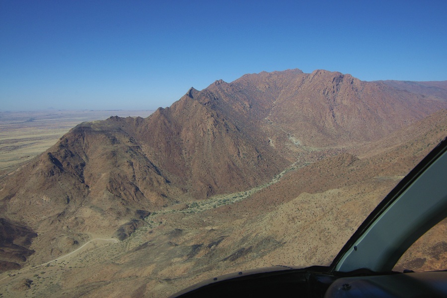
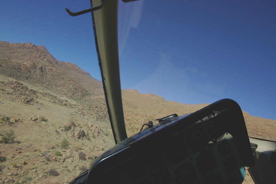
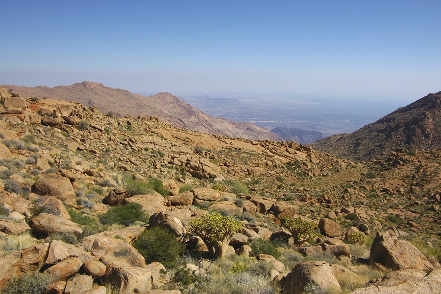
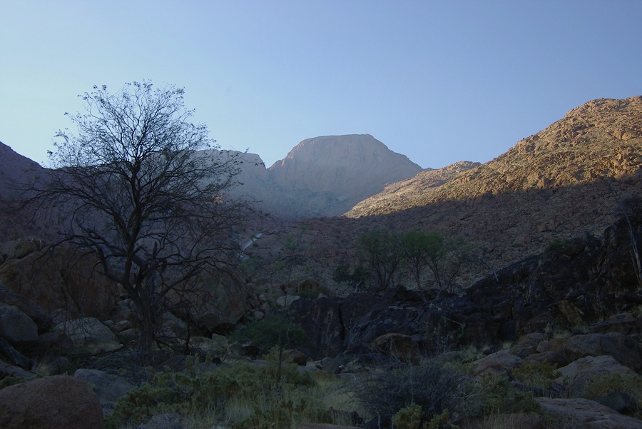
I have returned with the helicopter for the last flight, where we intended to make another dump for our second base. Taking off from the Umuab plain we followed the course of the Umuab gorge (did not glimpse any water in potential water holes), then turned east along the northern face of the Brandberg, a magnificent sight in the sharp morning sunlight.
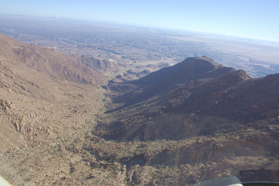
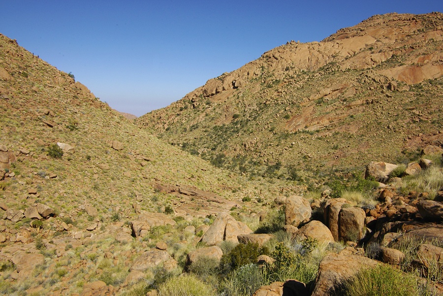
After another refuelling we were ready to go with Jon and the remainder of our supplies. This time we took off in the direction of the Tsisab gorge, it's length permitting a more leisurely ascent at a higher speed. We flew over the rocky island we visited the day before, then continued along the watercourse, passing the peak of Königstein to our right. We flew over the col separating Tsisab from the Hungorob gorge, and in a few moments we were over our designated dump site, a wide flat bend in the upper Numas gorge offering good landing ground. This time the engine was shut down, and we prepared our dump for our second base camp in the shade of a large rock.

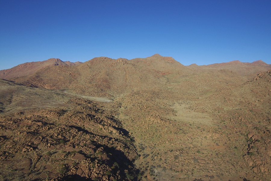
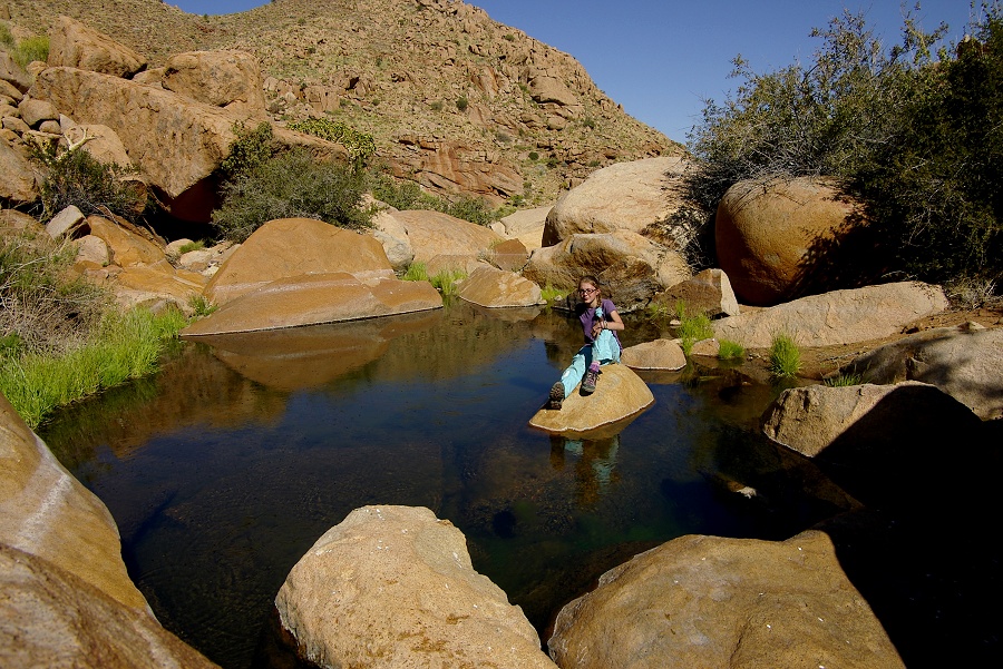
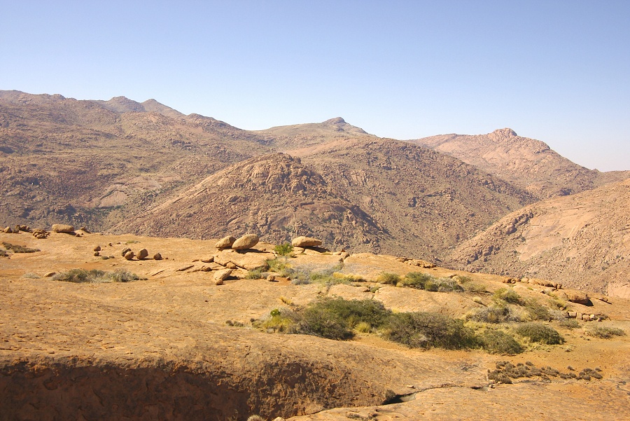
After take-off we flew low over the route we were planning to follow down the upper Numas valley. Soon we came upon a water hole with plenty of water in it, and a little further up we found the Numas valley flowing with water through several small cascades. At least in this part of the mountain, we had no need to ration water. We made a turn over the upper Naib valley to check out the water situation there, and we also saw a largish pool full of water. We continued up the pass to upper Umuab (noting the unpleasant looking rough terrain as we flew over it), and were soon in sight of the now set up camp on the bright Umuab plain.
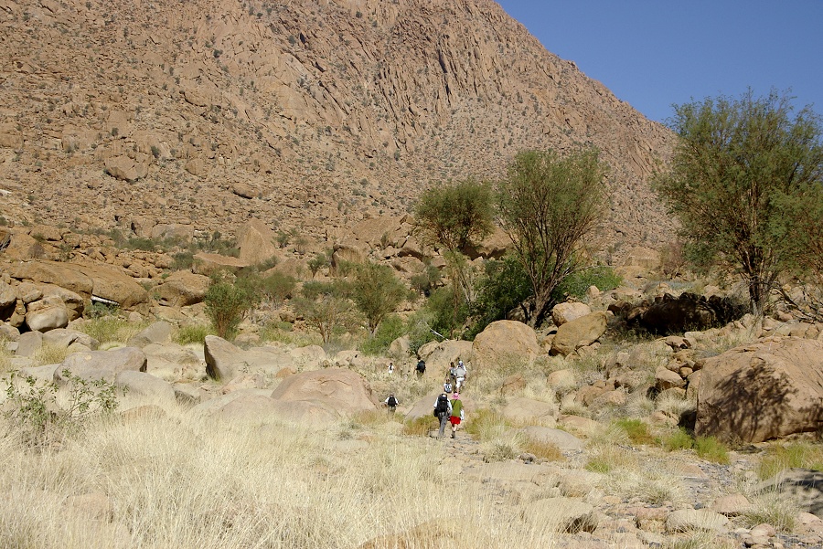
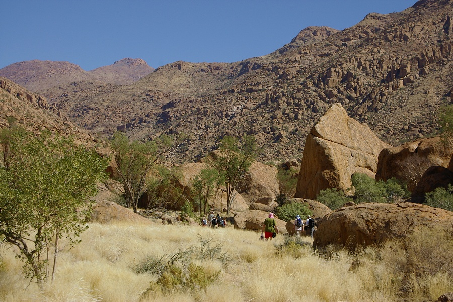
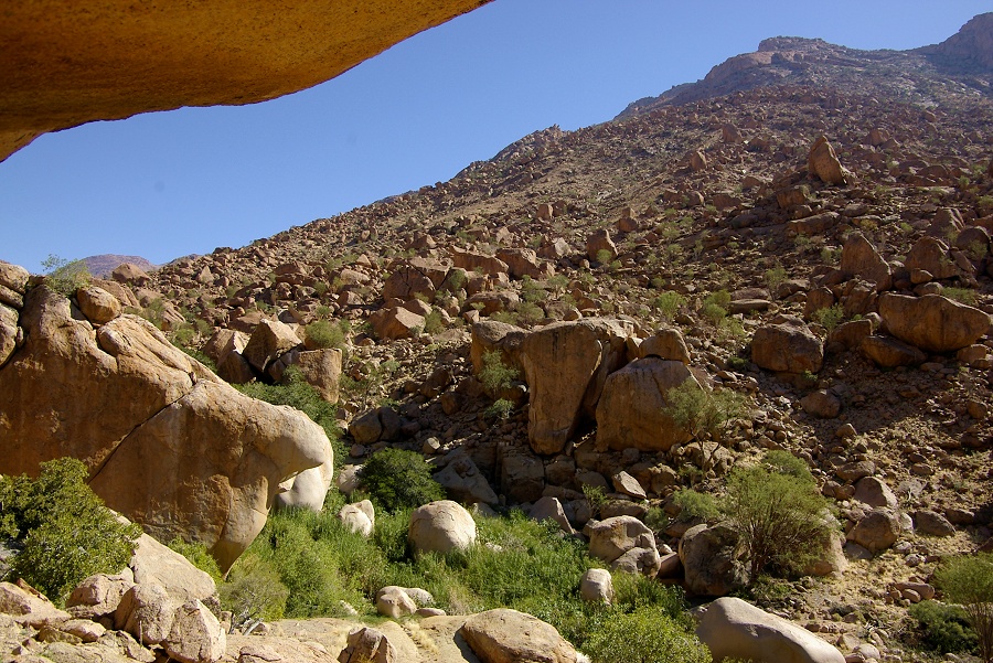
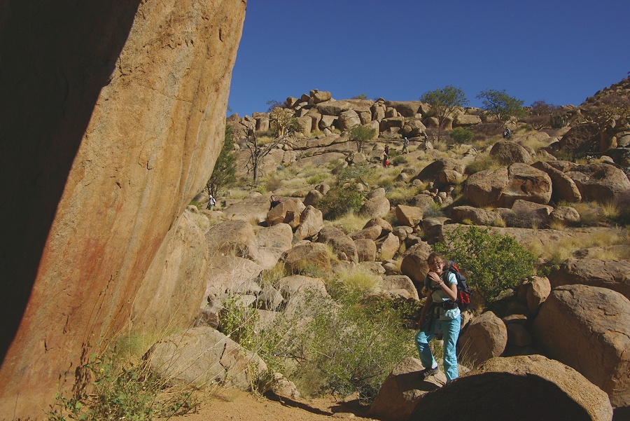
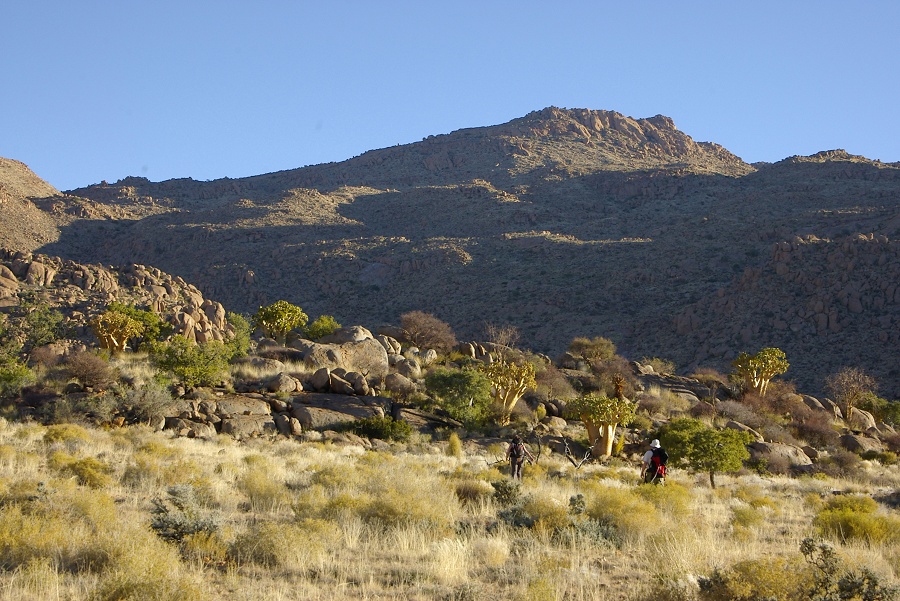
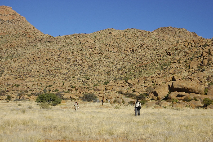
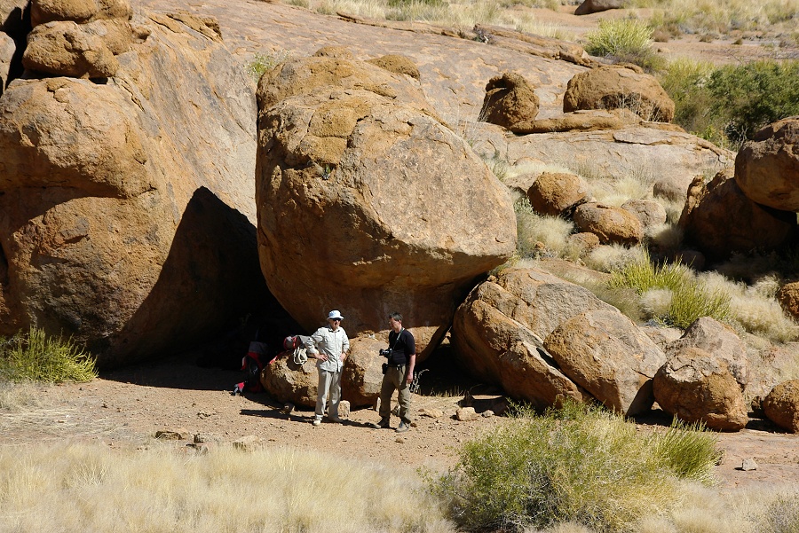
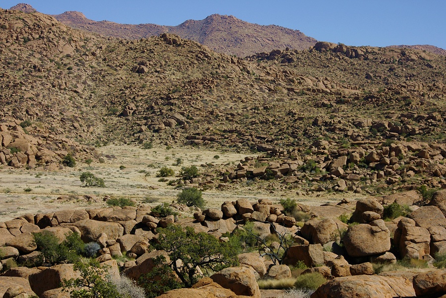
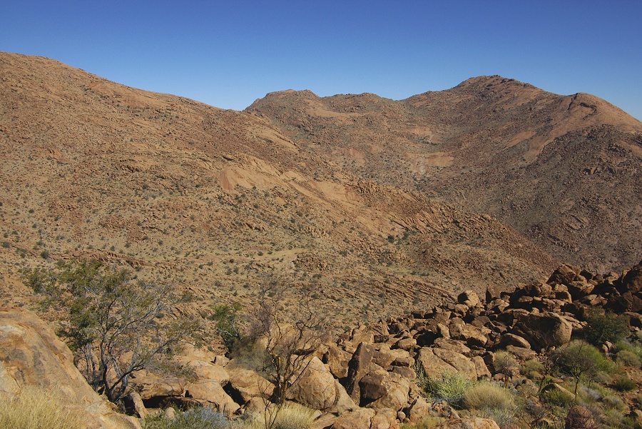
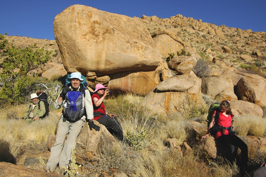
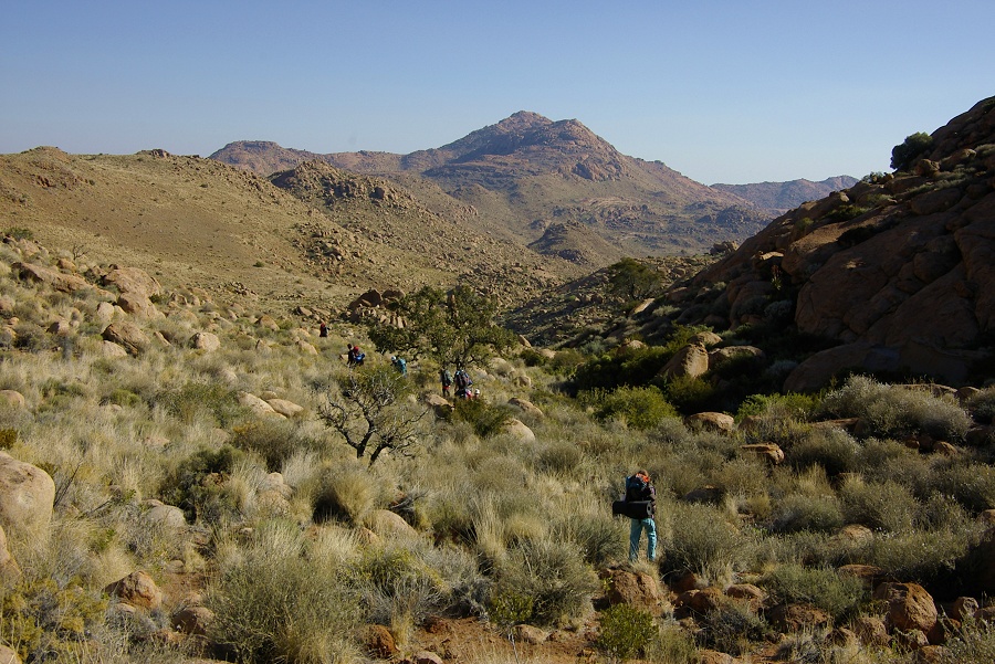
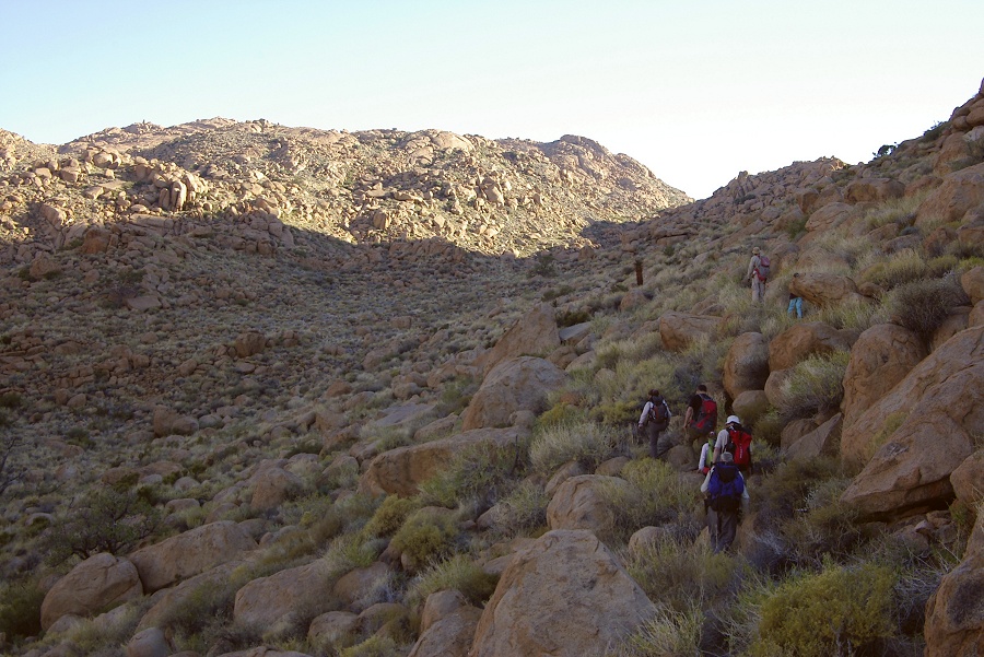
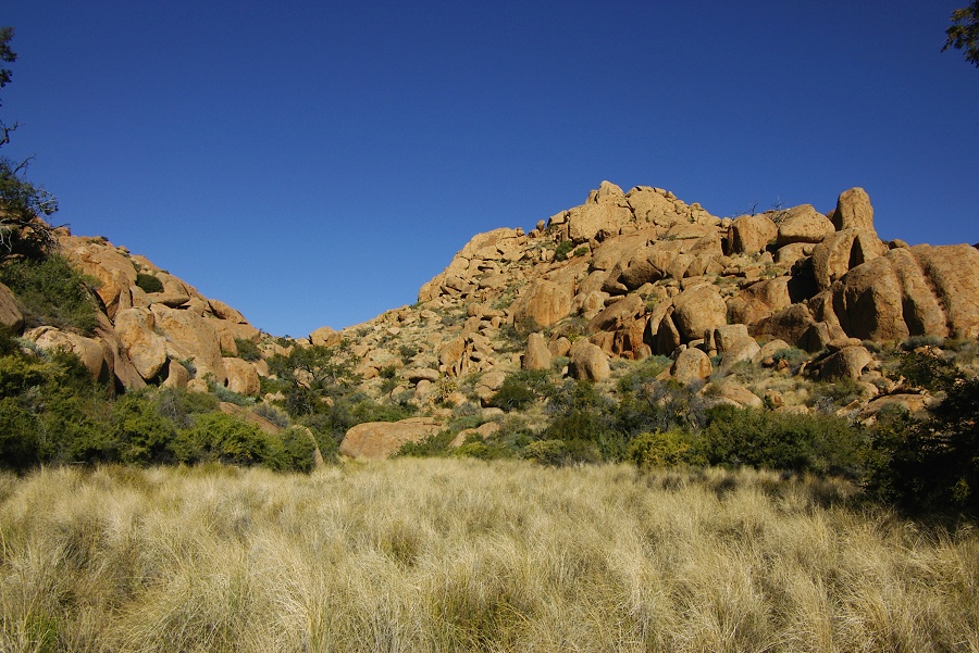
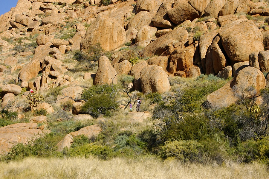
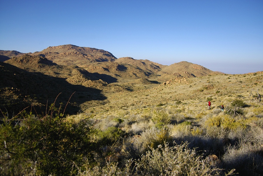
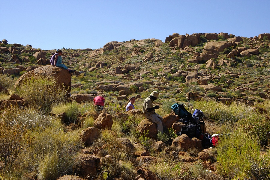
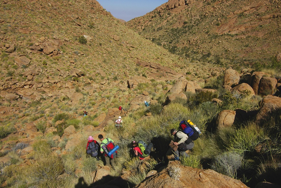
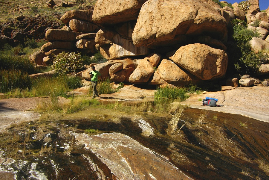
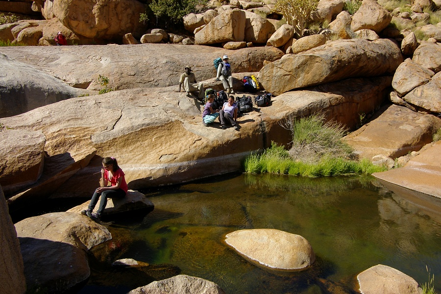
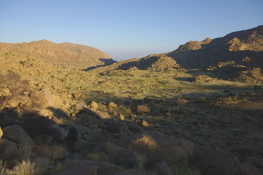
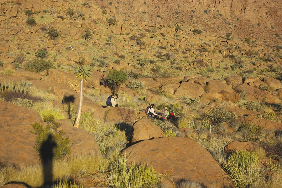
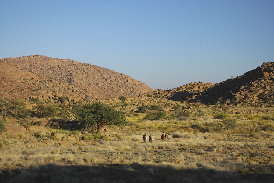
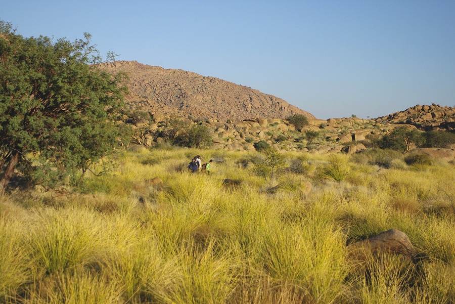
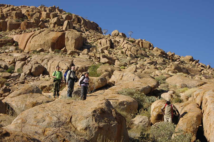
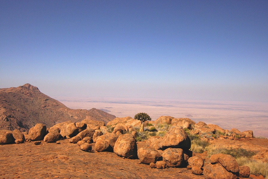
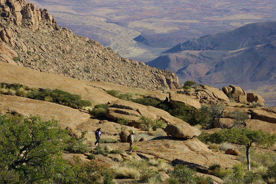
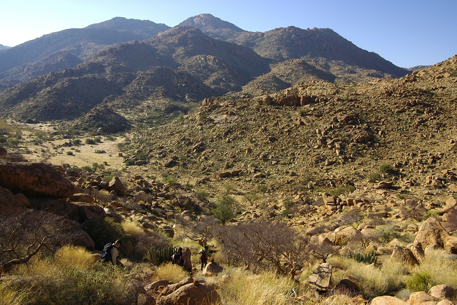
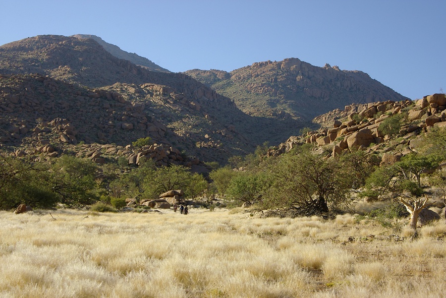
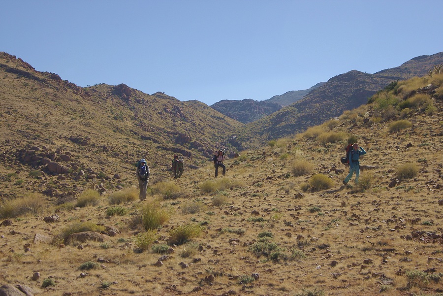
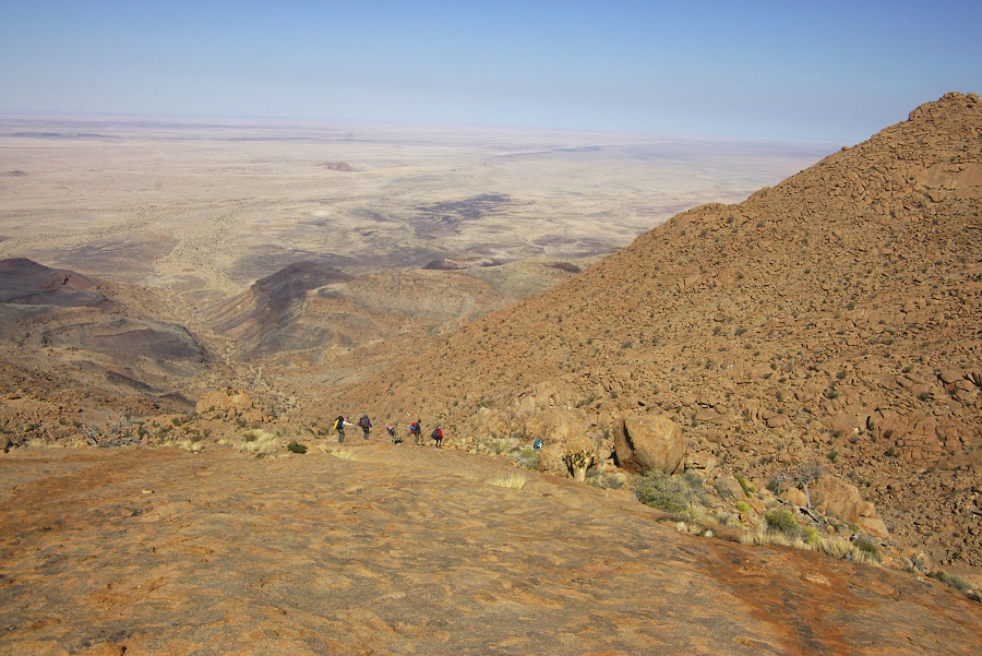
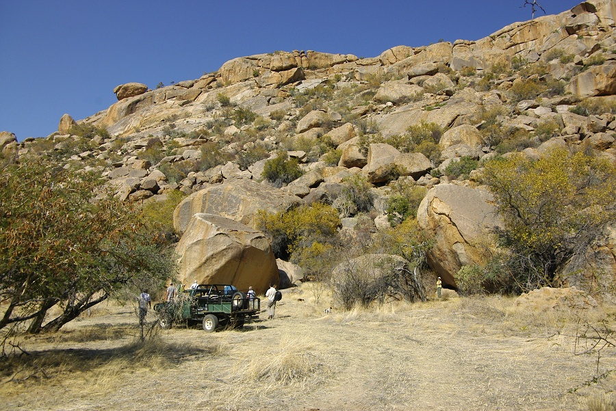
With not much left to offload, the helicopter left after a quick farewell, and we were left in the grandiose silence and solitude. In the mean time Alfons returned (without finding any water), and we soon set out for a two kilometre walk to the main Umuab sites, near the place where the valley starts to make a rapid descent after crossing the wide flat plain.
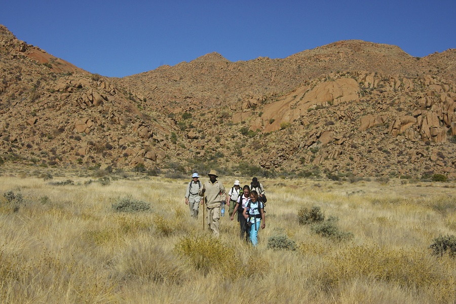
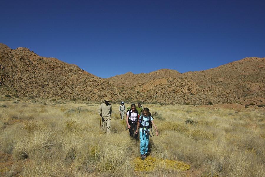
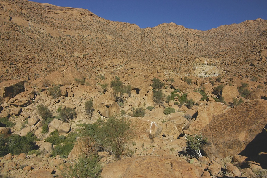
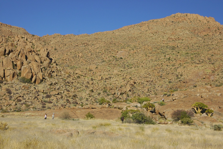
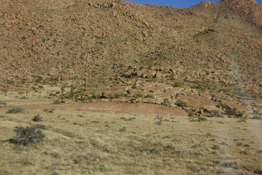
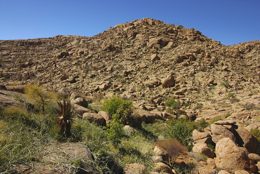
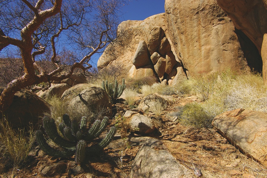
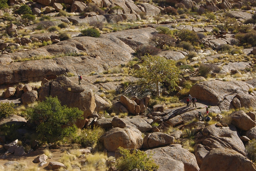
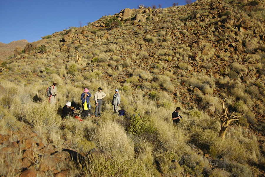
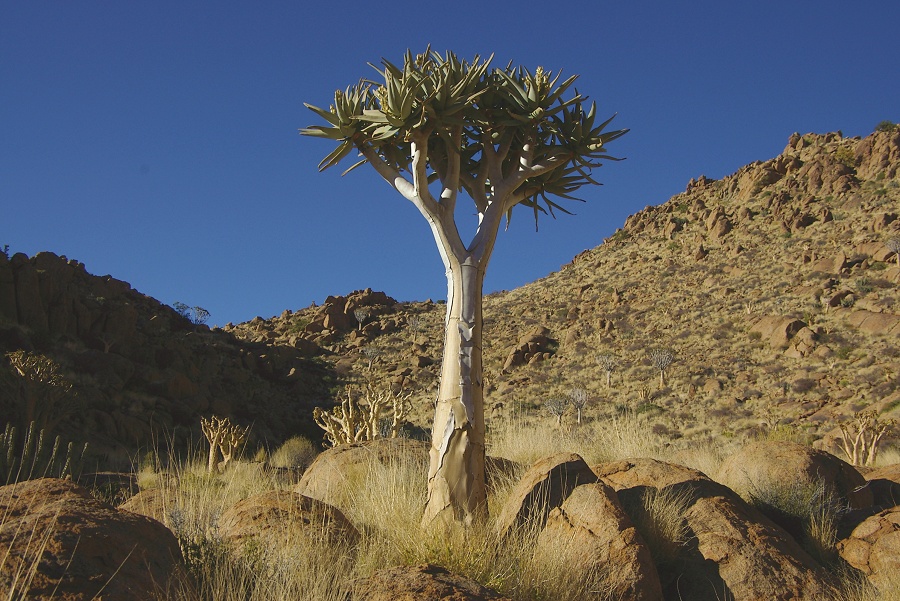
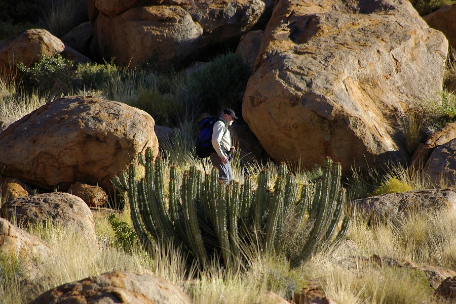
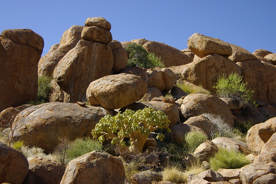
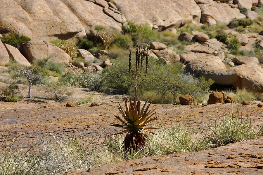
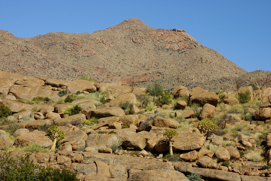
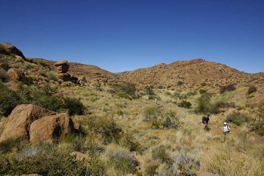
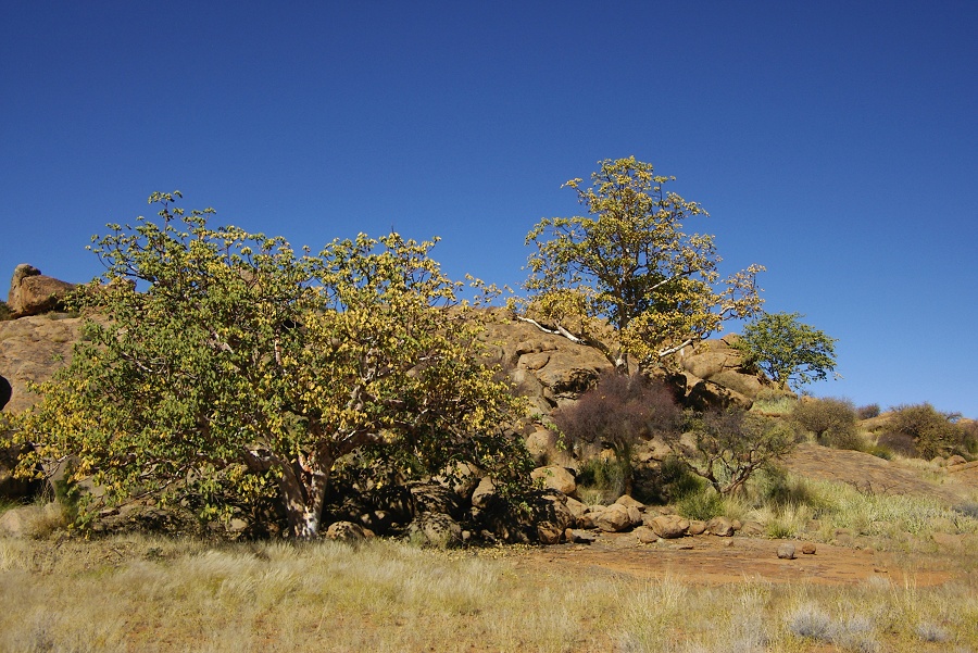
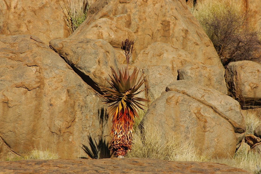
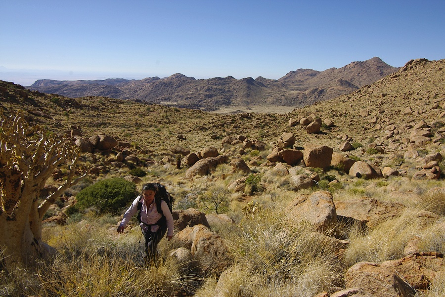
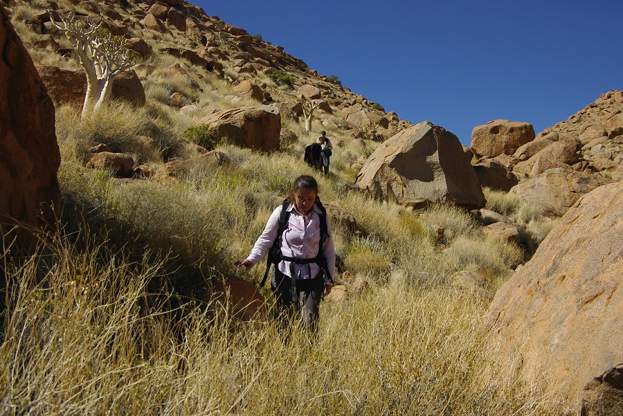
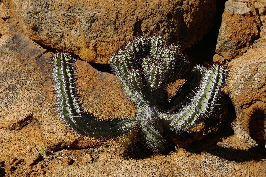
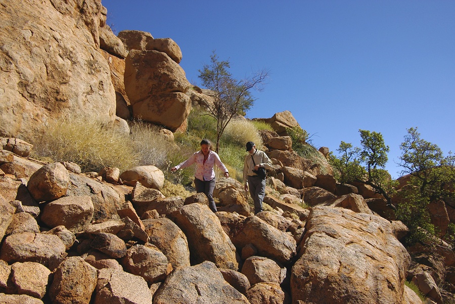
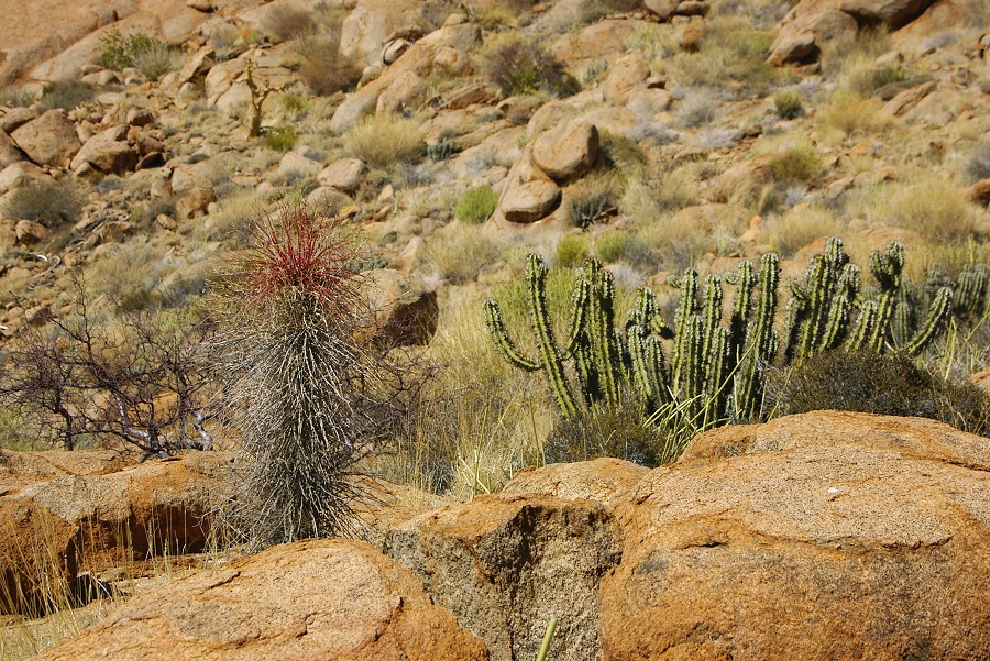
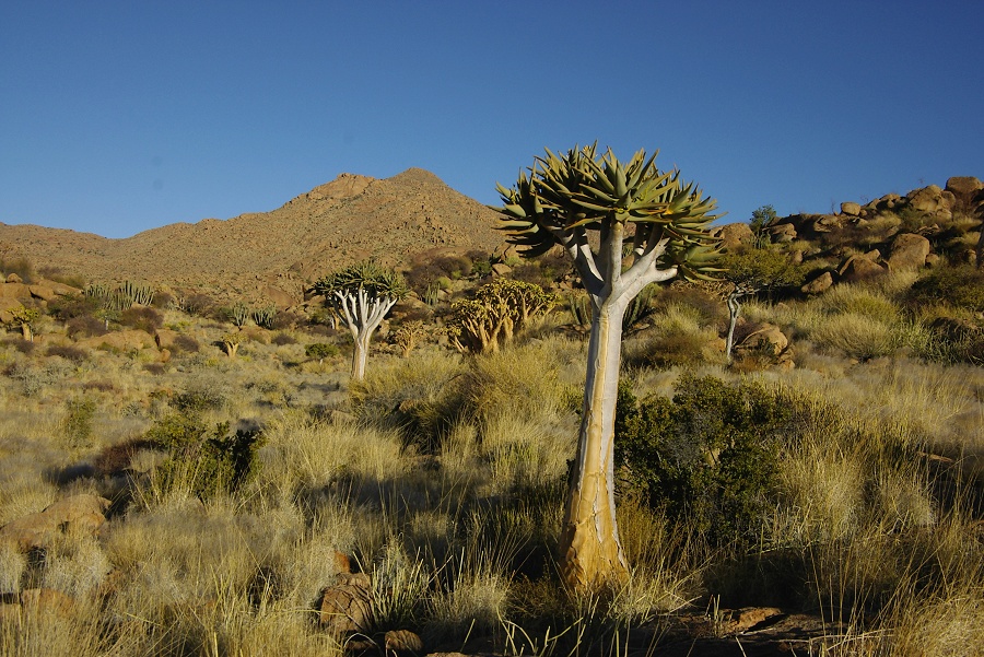
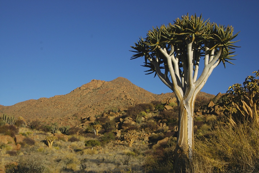
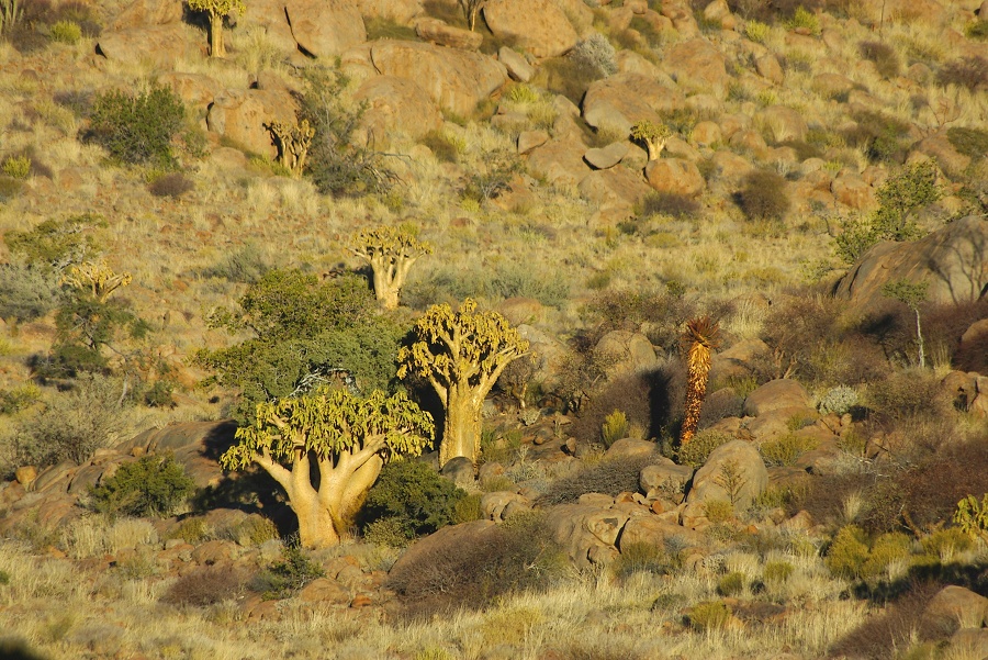
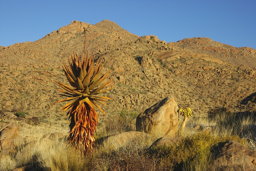
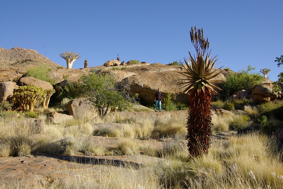
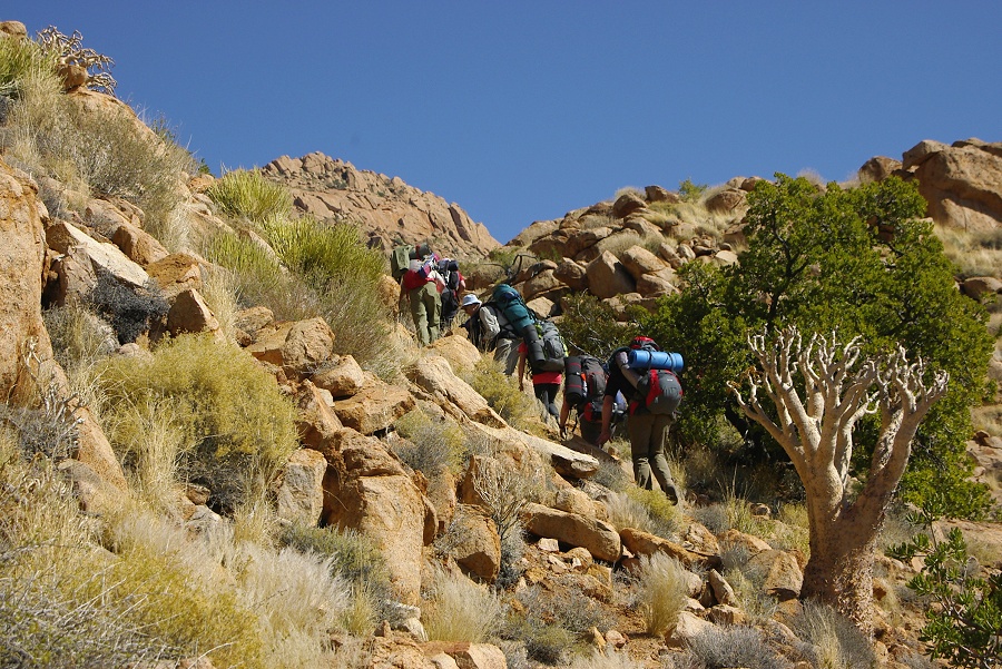
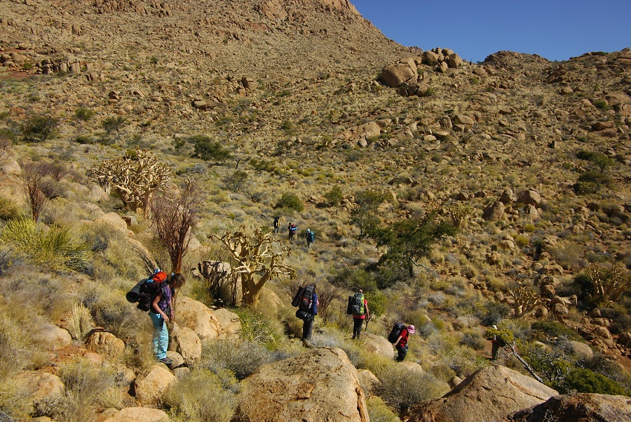
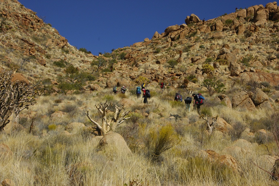
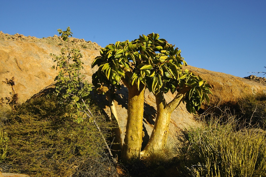
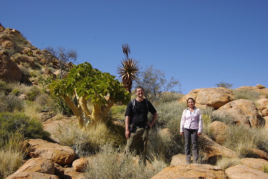
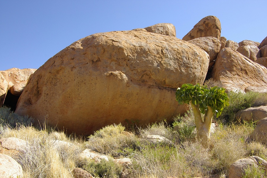
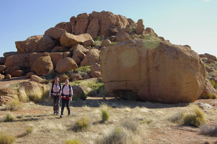
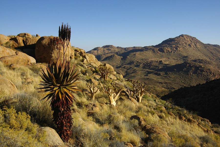
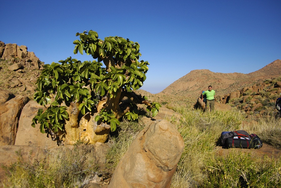
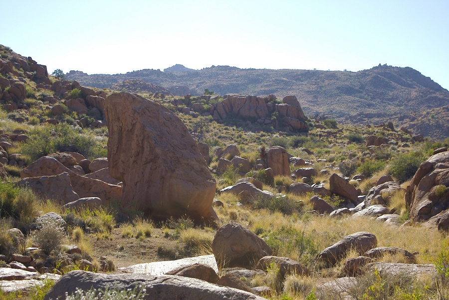
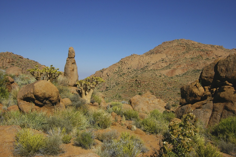
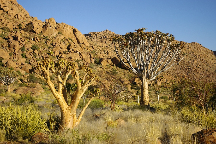
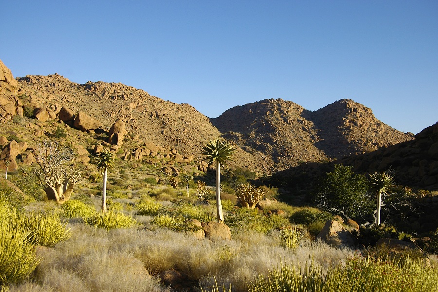
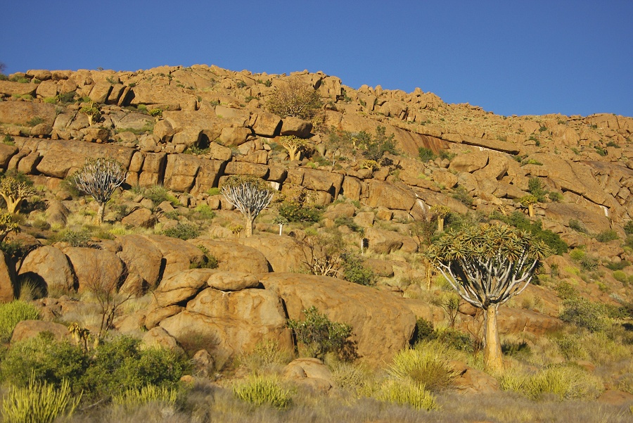
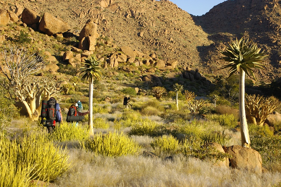
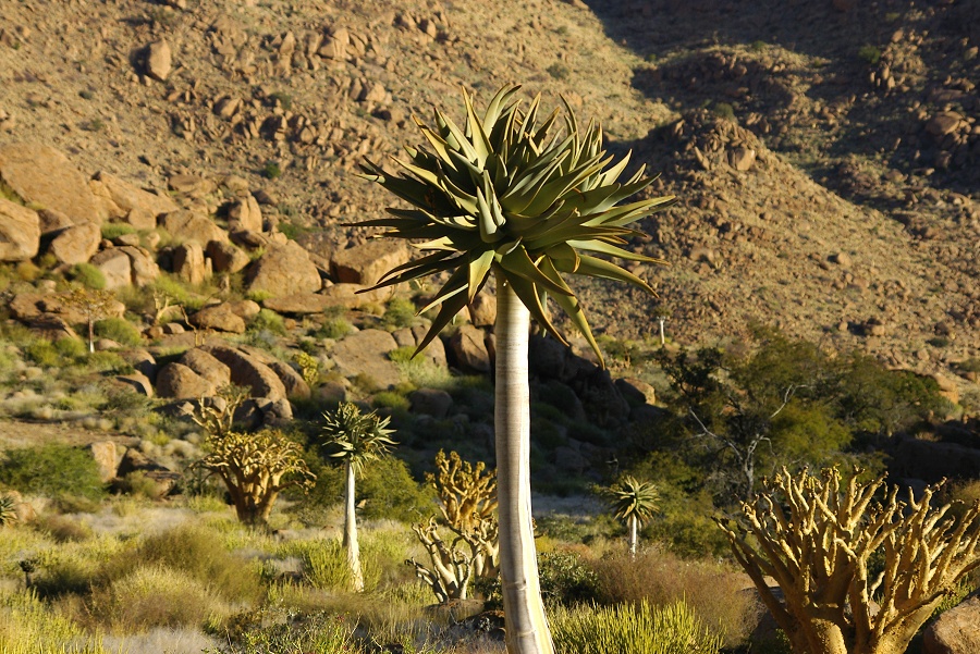
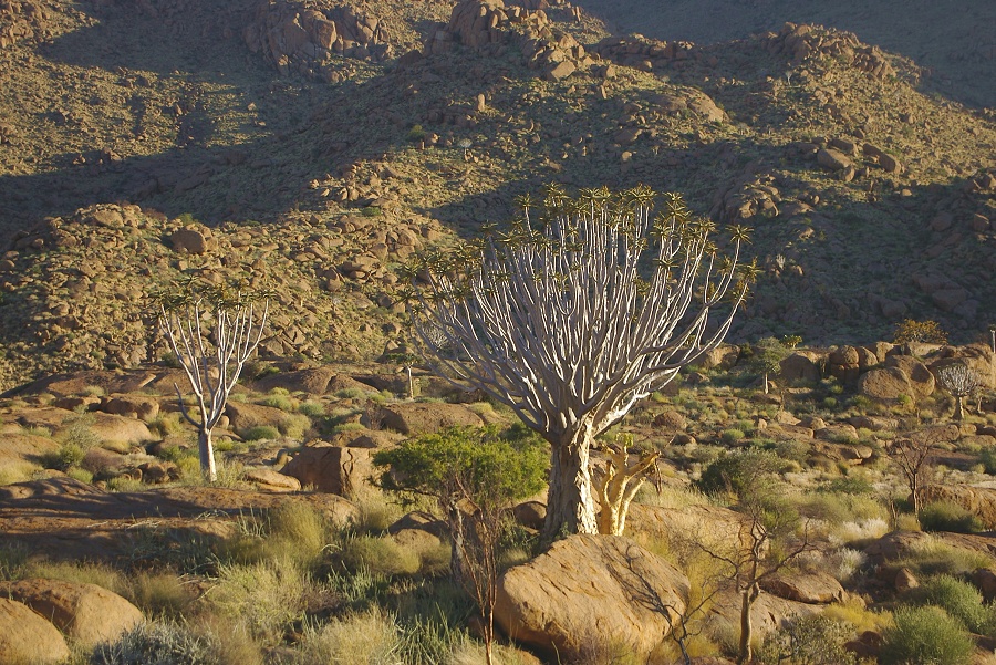
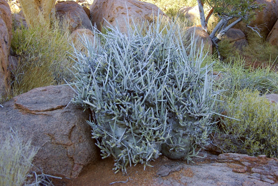
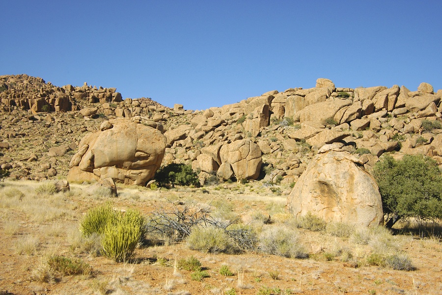
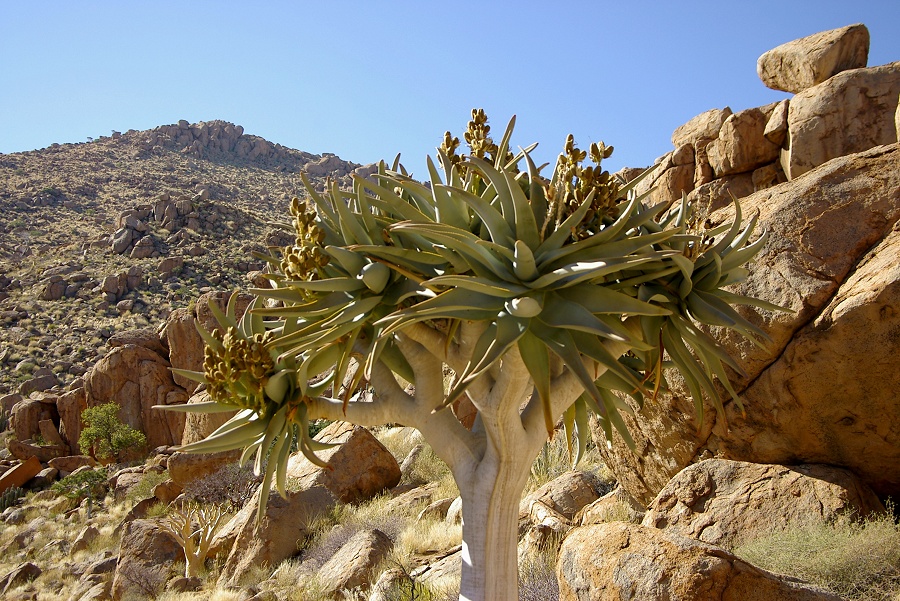
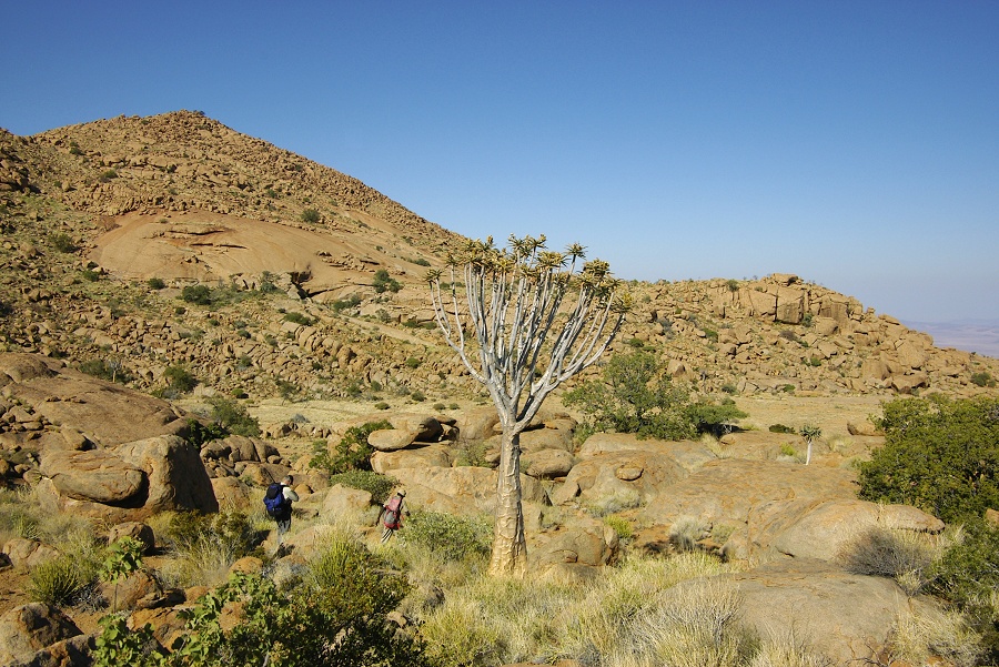
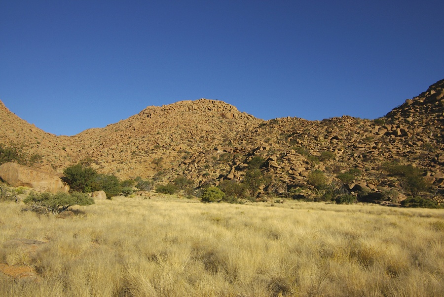
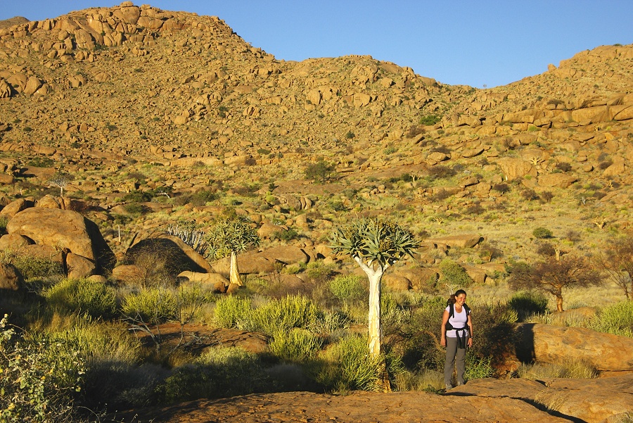
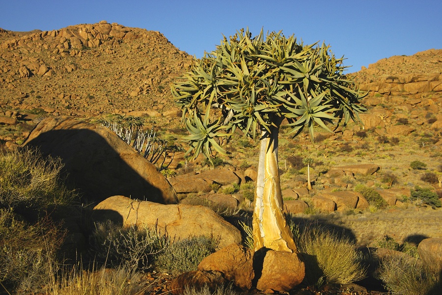
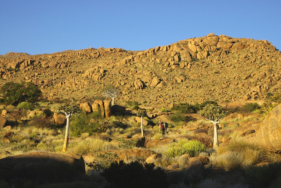
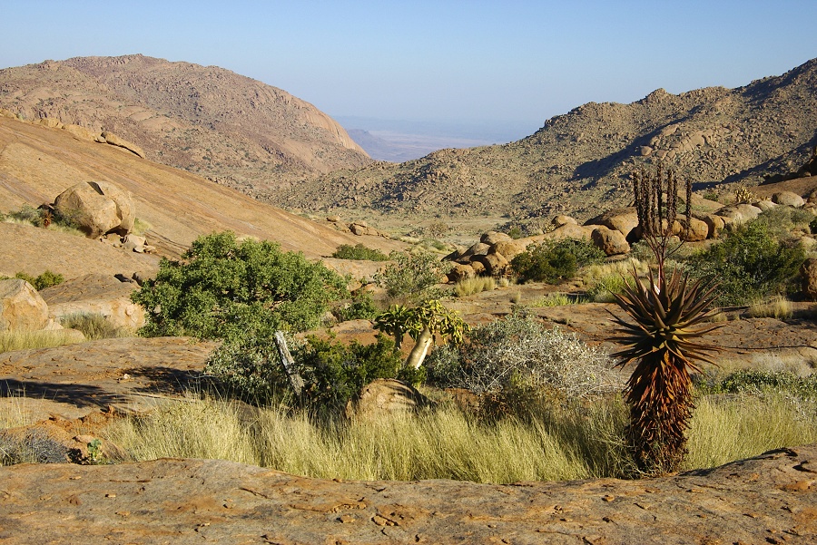
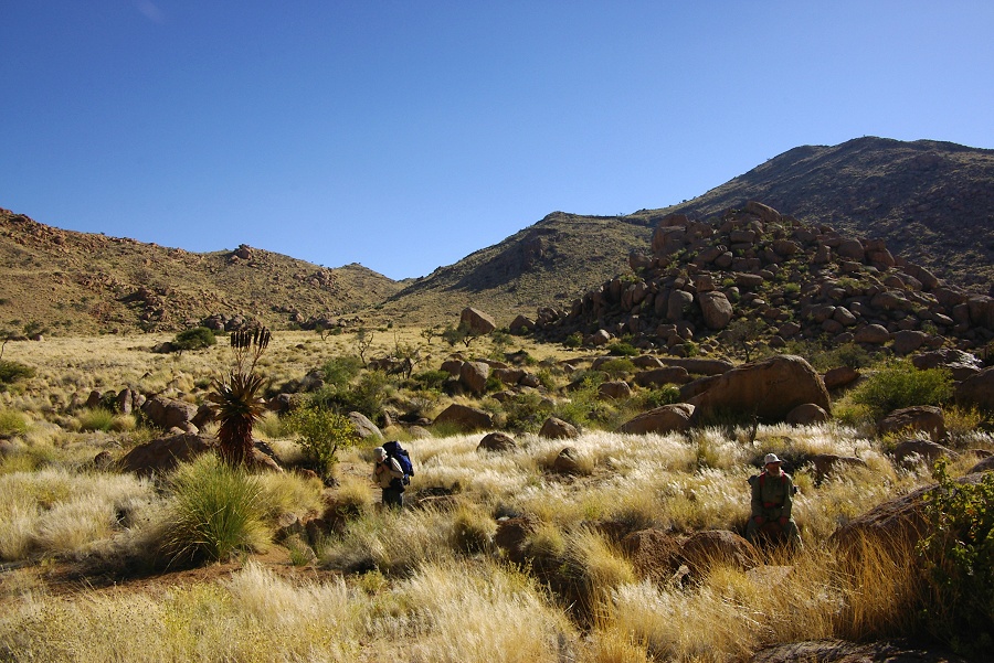
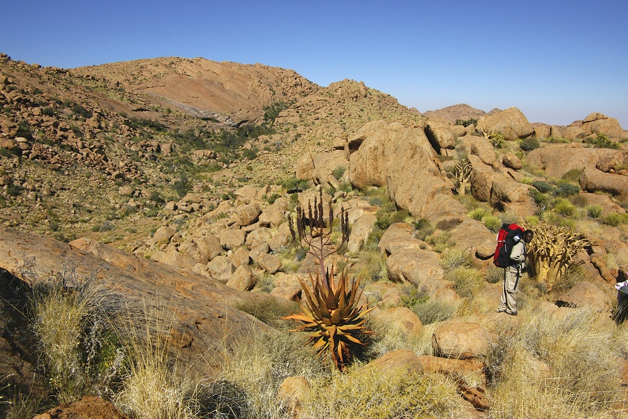
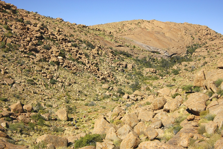
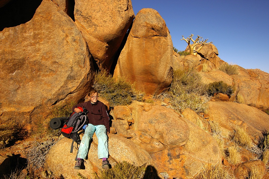
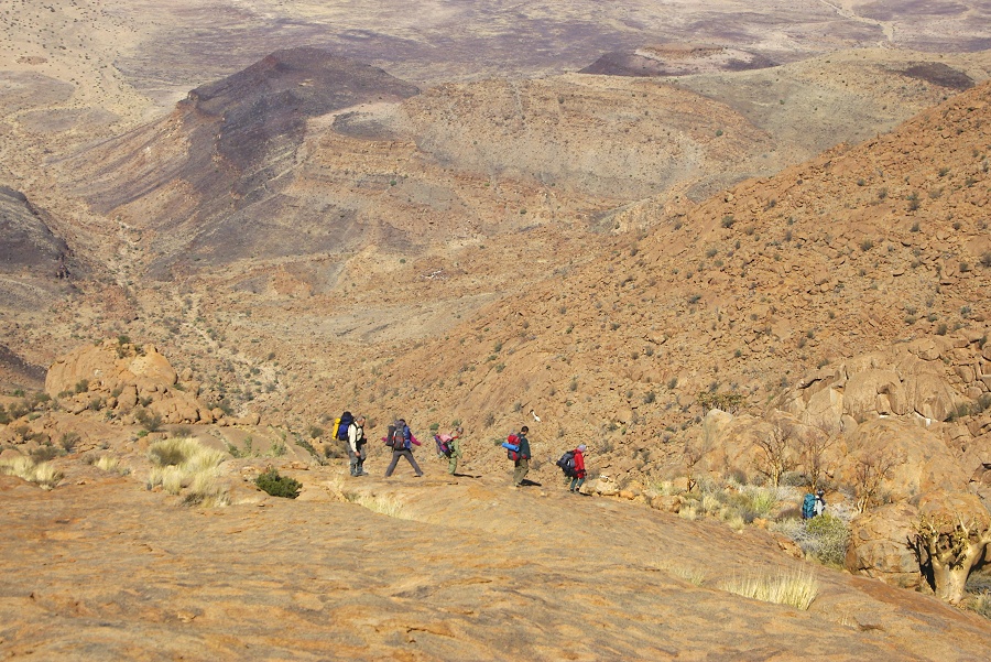
We reached the principal site of U21 after a trek of around an hour and a half over first flat, then sloping ground, cutting across several bends of the watercourse. We also had our first encounters with the strange plants inhabiting the upper Brandberg - the bottle trees, aloes and cacti, as well as several types of shrubs clinging to the rocks. We also learned that the plant life seems to have one principal aim in it's existence - to hinder access to the mountain! Even the most benign looking flowers sport sizeable barbs and spines, and many form a tangled web of loops among the rocks to trap the feet of the unwary, making passage no easy feat.
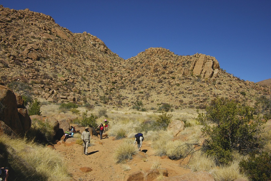
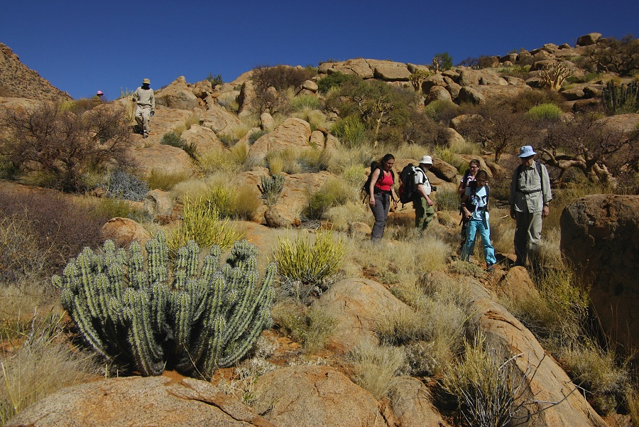
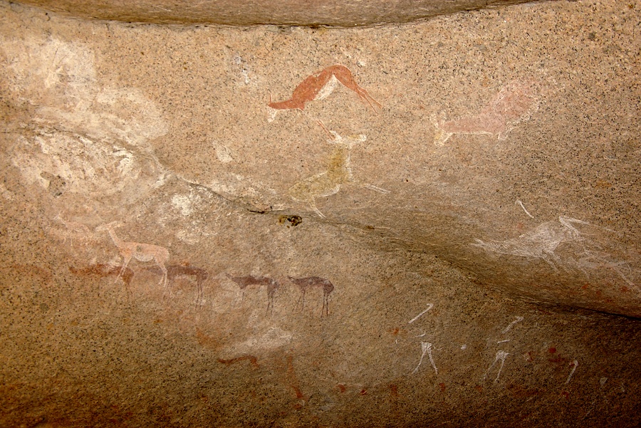
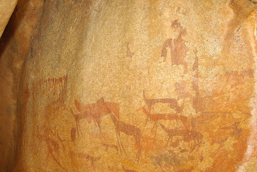
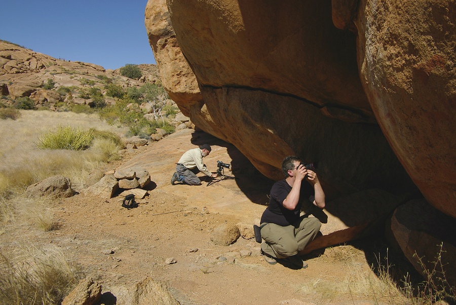
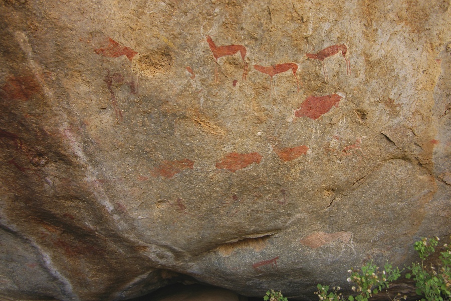
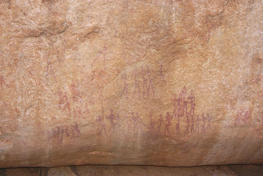
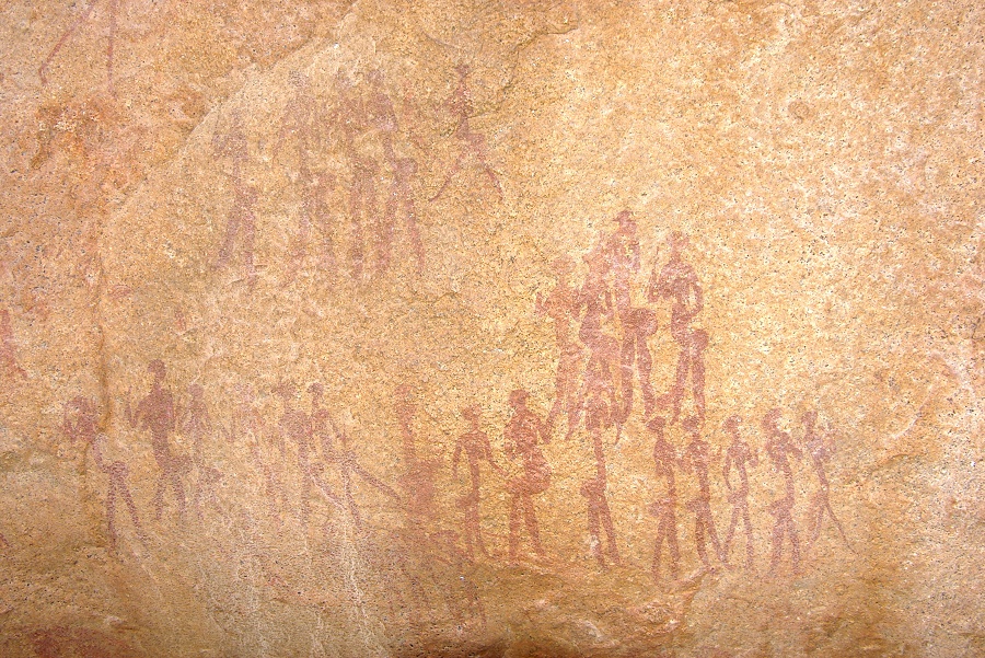
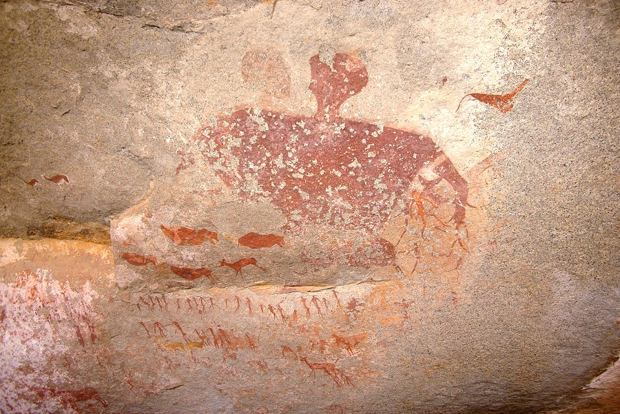
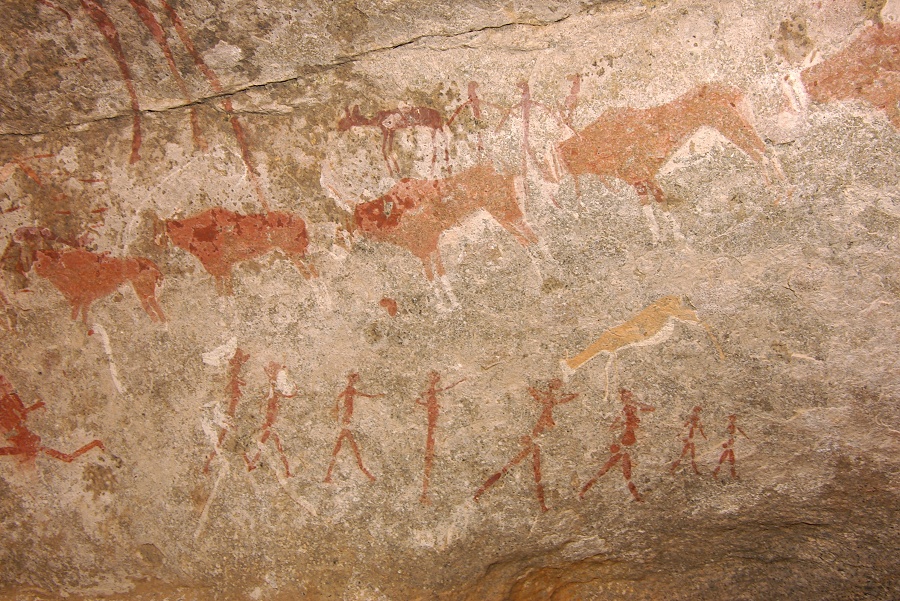
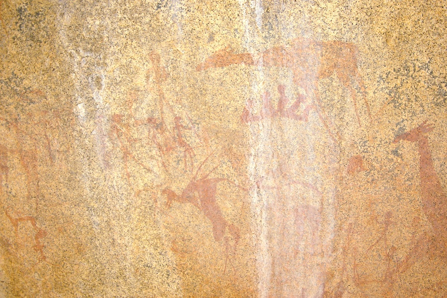
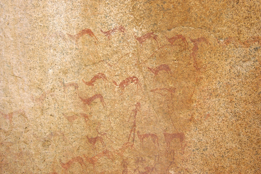
Site U21 is on the northern side of an enormous boulder, it was found by Angula Shipahu, one of the principal helpers of Harald Pager during their survey of the Umuab basin in 1982-84. The site, with over 1000 individual figures, is considered to be one of the principal sites on the Brandberg. It took several hours with a lunch break to fully photograph the site, with different parts coming into the shade as the sun moved slowly west.

Mid-afternoon we started our way back to camp, first visiting site U23 in the bed of the watercourse a short distance from U21, near some large but now unfortunately dry waterholes.

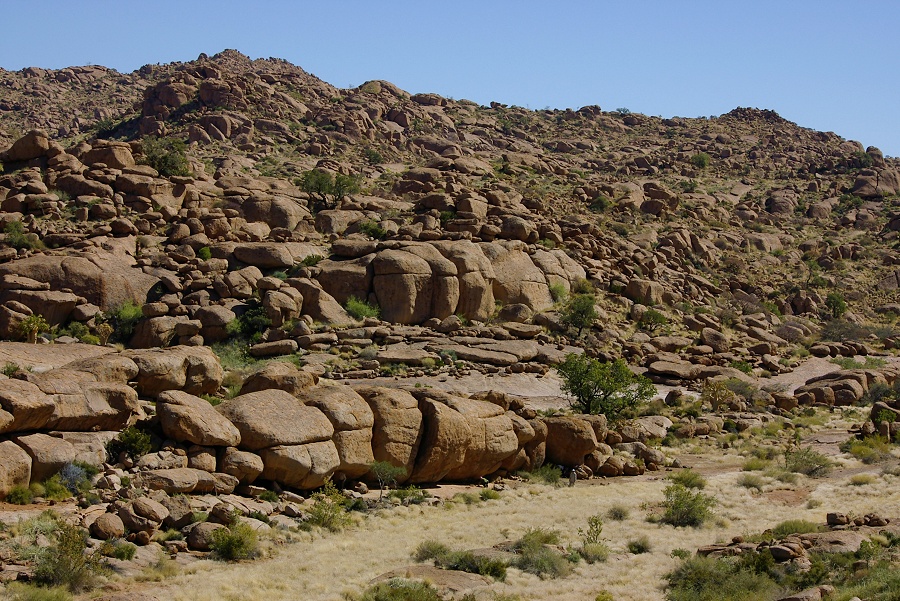
Continuing upstream we searched in vain for some other sites in the area, but soon found the going among the huge boulders in the bed of the watercourse very difficult, the vegetation covered hillside with all the vines and thorns still provided for a better going.


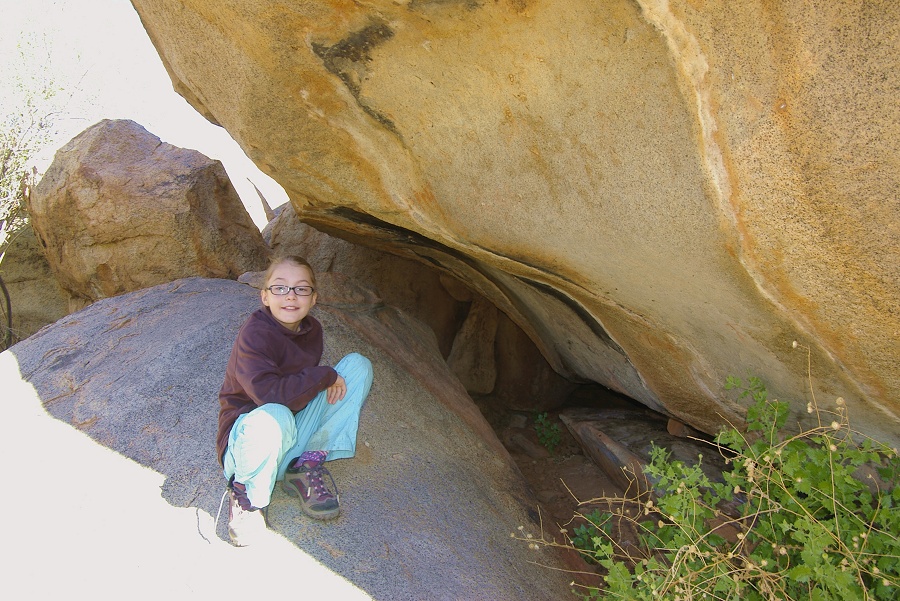
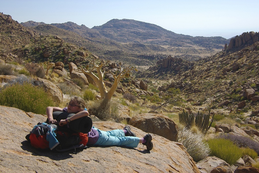
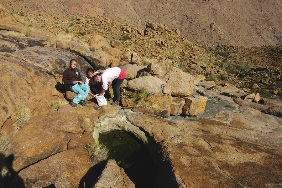
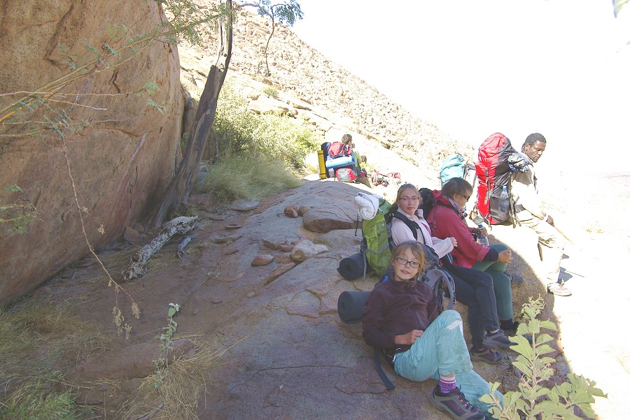
As we scouted a small hillock with some boulders and a suspected site with paintings (which we failed to find), we had the first and fortunately only mishap of the trip. Dóra caught her foot among the looped vines and slipped, spraining her right ankle in the process. She could continue walking, but with the ankle hurting badly, she made a hasty return to camp with Alfons, with the rest following after checking out a few more spots, with no result.
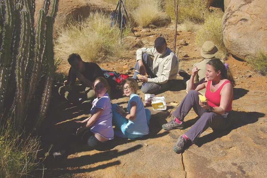
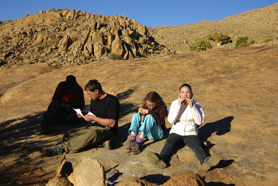
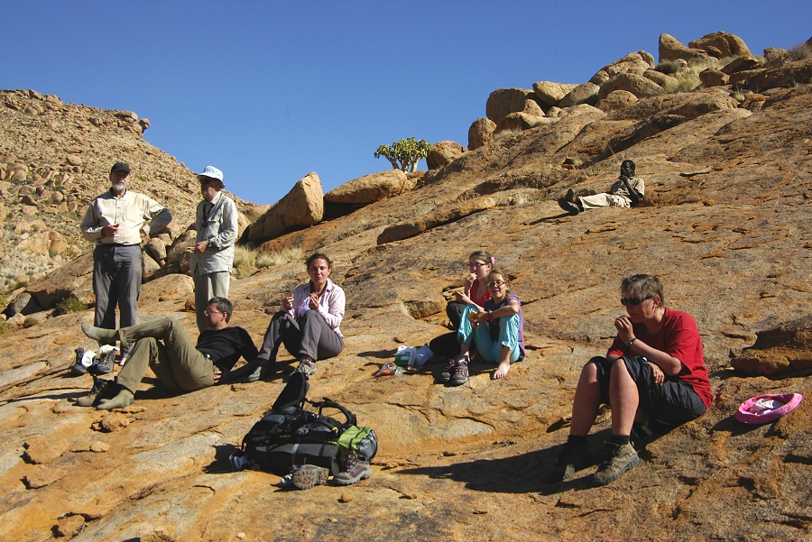
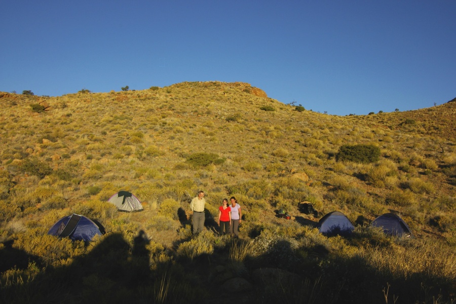
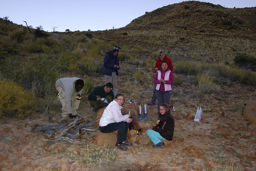
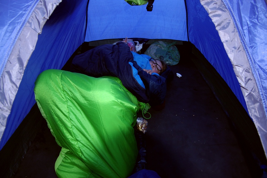
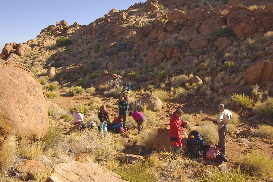
Dóra's injury and the encountered terrain made us re-think our plans for the next couple of days. Originally we planned a two-day trek to the neighbouring Karoab Gorge, returning via the Engelhard Plain, but we thought it wiser to bring forward the easier looking single day trek to the upper Numuarib Gorge lying to the East, to the principal Mason Shelter and "Bildergallerie" rock art sites. The walk only involved 8 kilometres there and back, with little altitude difference. It was decided that Dóra will remain in camp with Magdi & Viki to rest the leg, while the rest of us will make the trek to Numuarib. As evening fell we consumed the first batch of our freeze-dried meals purchased for the trip in the UK (Outdoors Grub Ltd.), while individual assessments of their appeal varied, the general agreement of the party was that they were well within the limits acceptable for human consumption.
Day 4. - Upper Numuarib Gorge
With only 11 hours of daylight, we were up before dawn to be able to make most of the day. It was a crisp, but calm and not excessively cold morning. We were expecting night time temperatures close to zero, but throughout the trip the weather remained pleasantly warm, never dropping below 6-8 degrees Celsius, and quickly warming to a very agreeable 20-25 degrees once the sun came up. By 7am we were on our way, climbing up to the col separating Umuab from Numuarib.
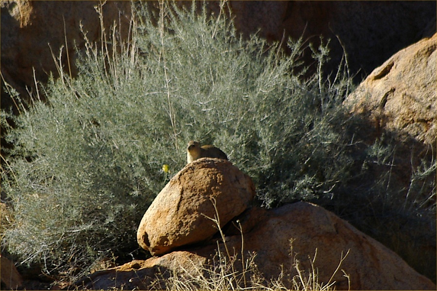
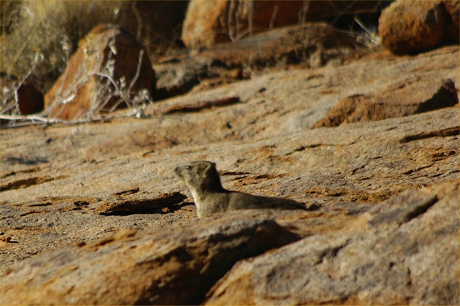
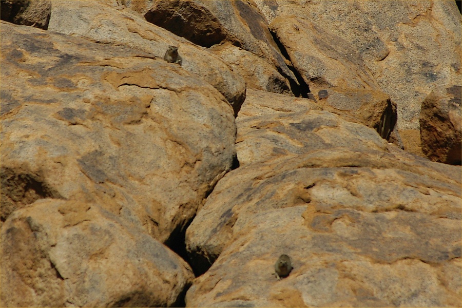
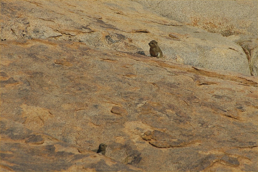
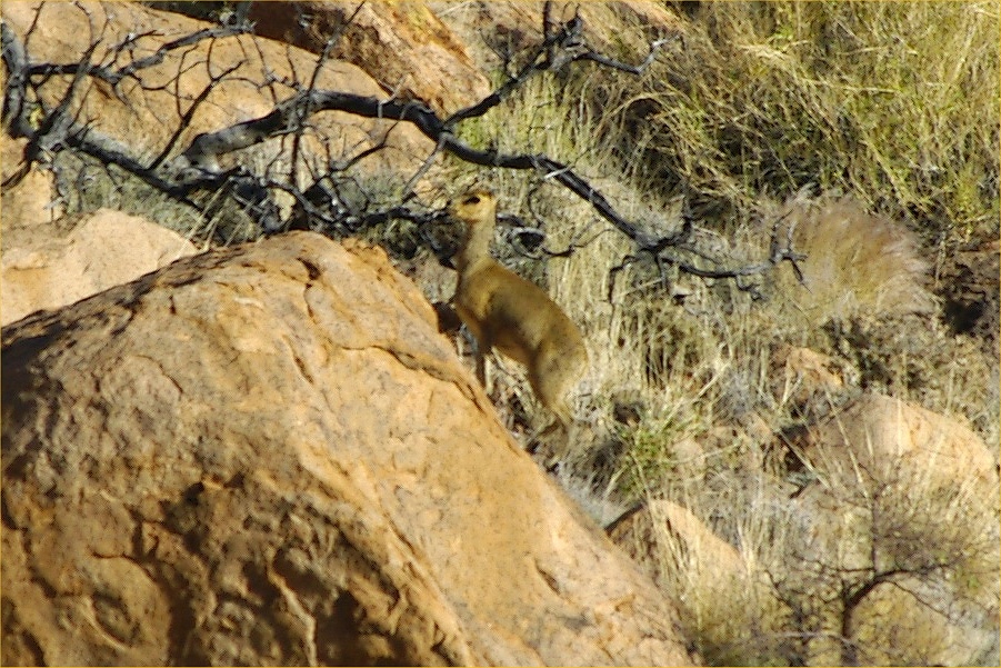
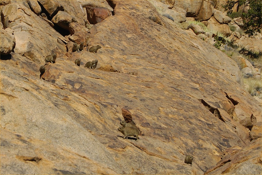
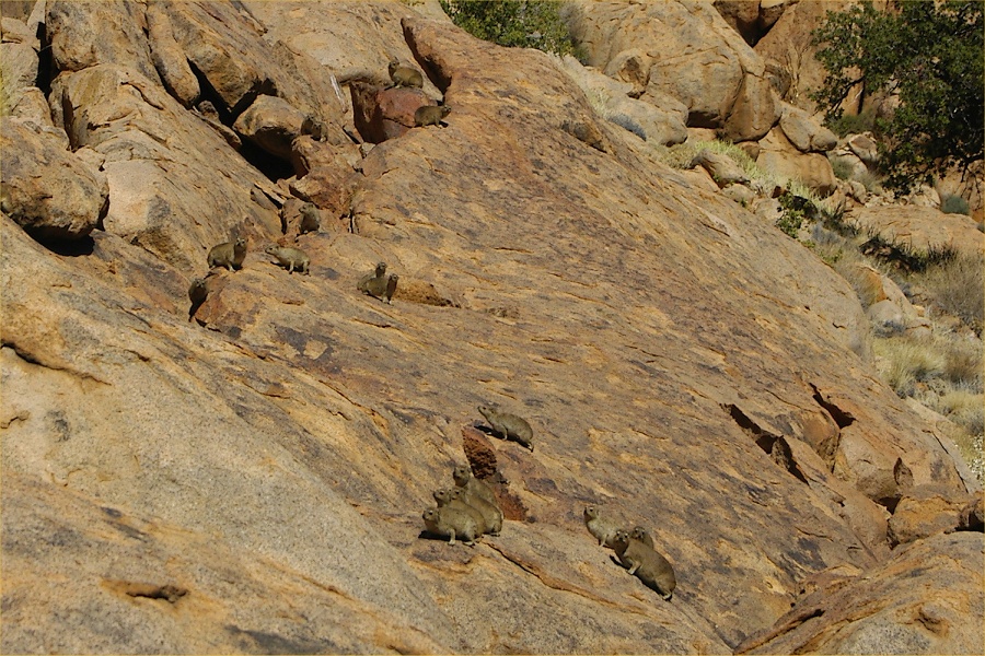
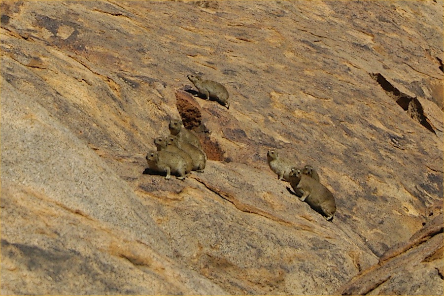
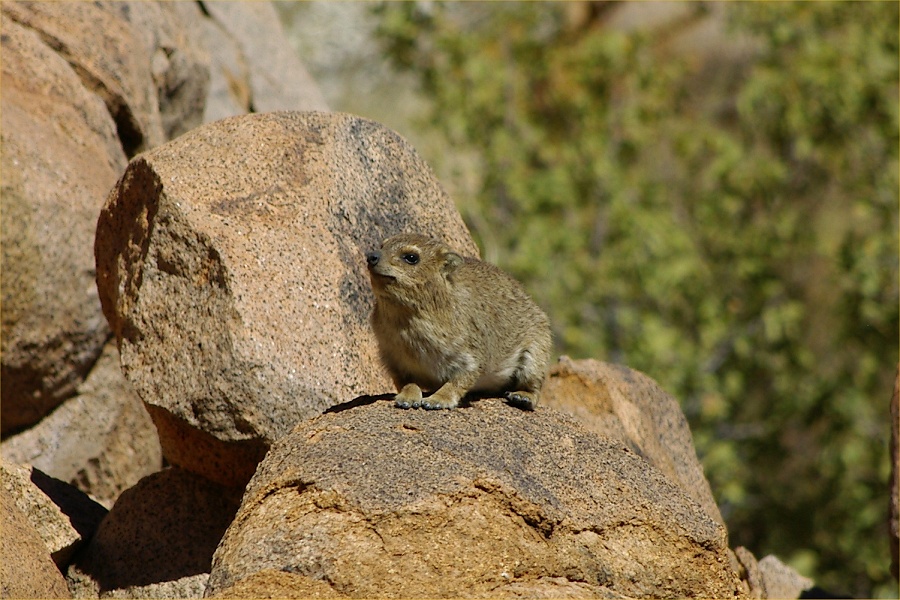
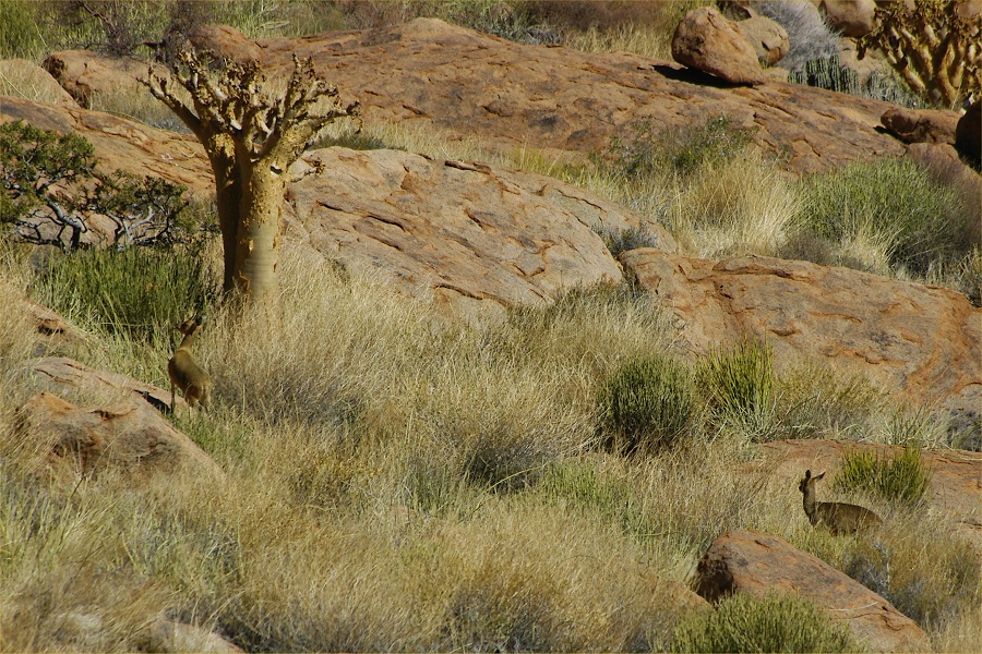
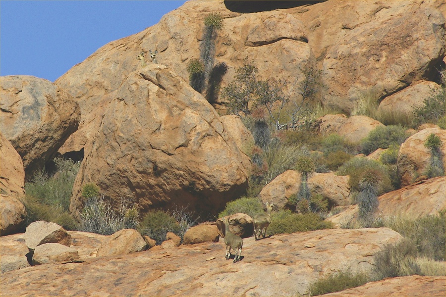
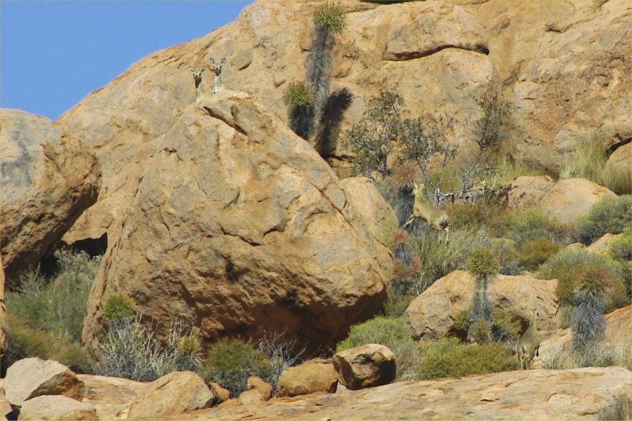
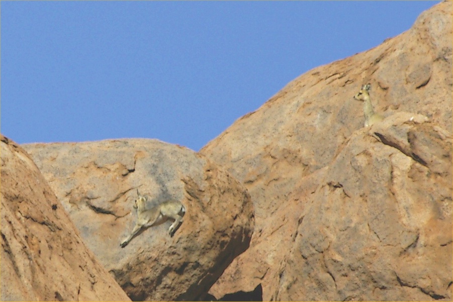
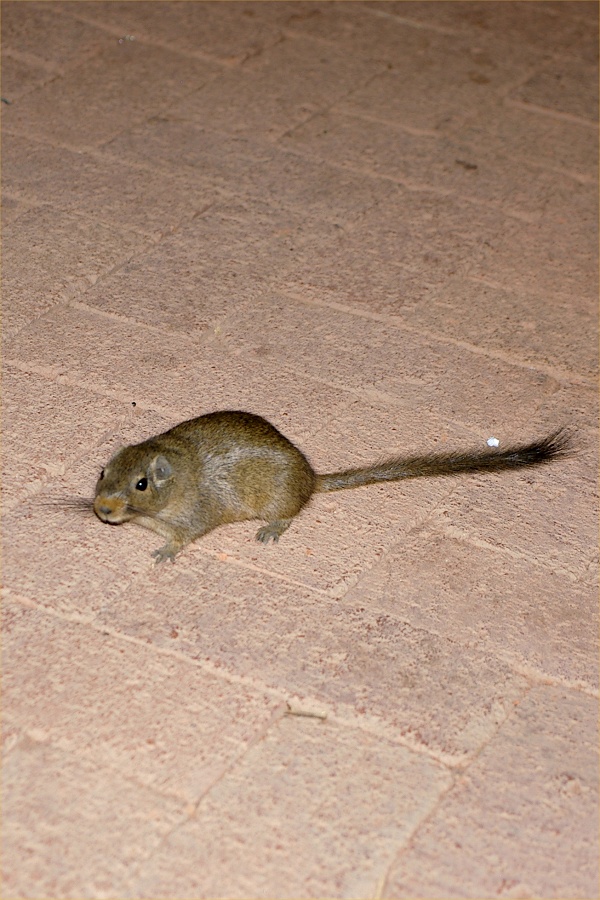
As we started descending into the upper Numuarib on the far side of the col, we encountered several klipspringers (small antelope) and rock hyraxes, the dominant mammals inhabiting the upper Brandberg. The klipspringers hopped away in a flash, but I have managed to snap a few distant photos of the hyraxes.
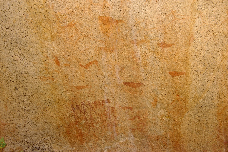
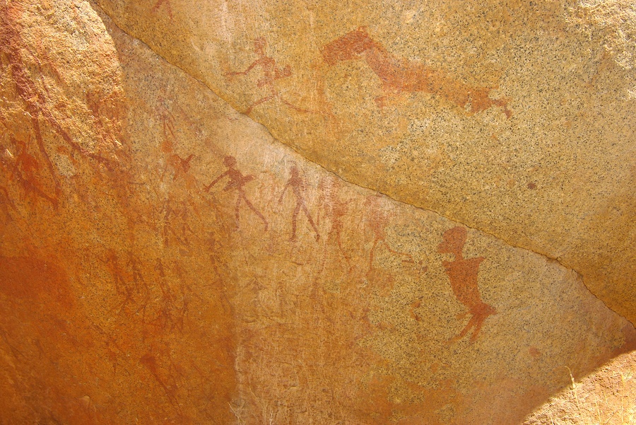
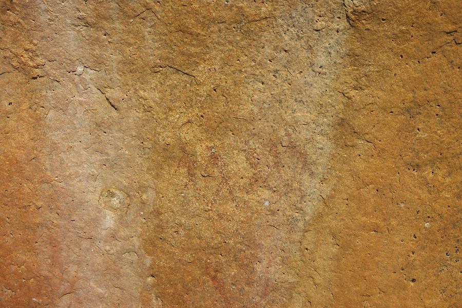
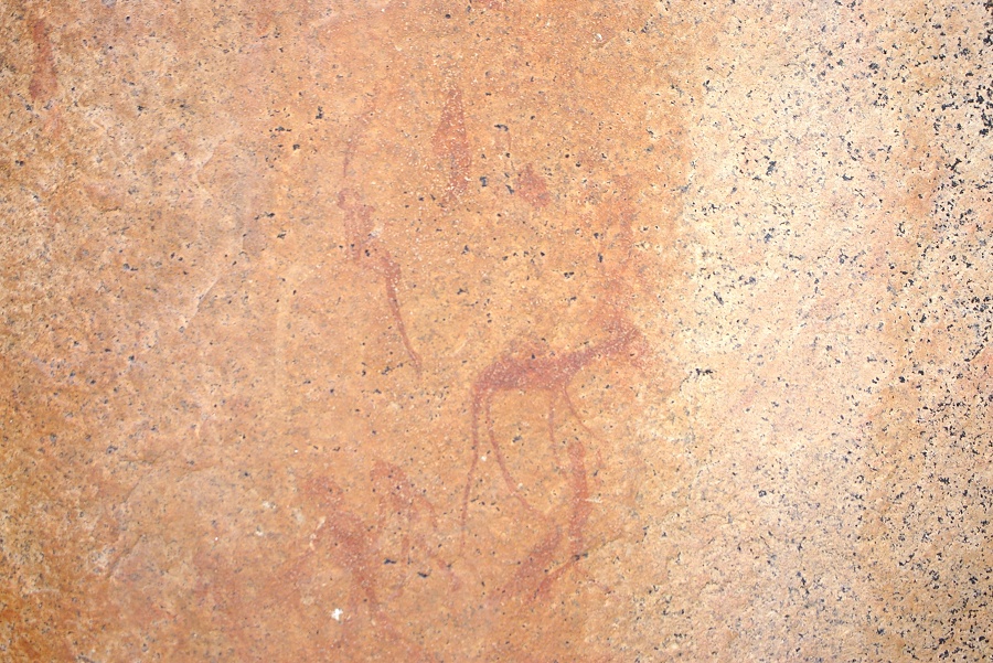
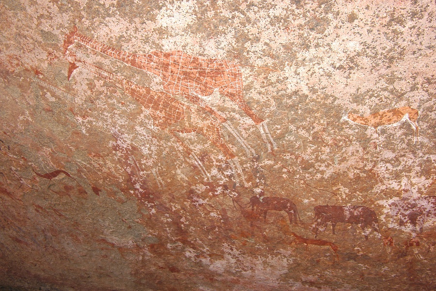
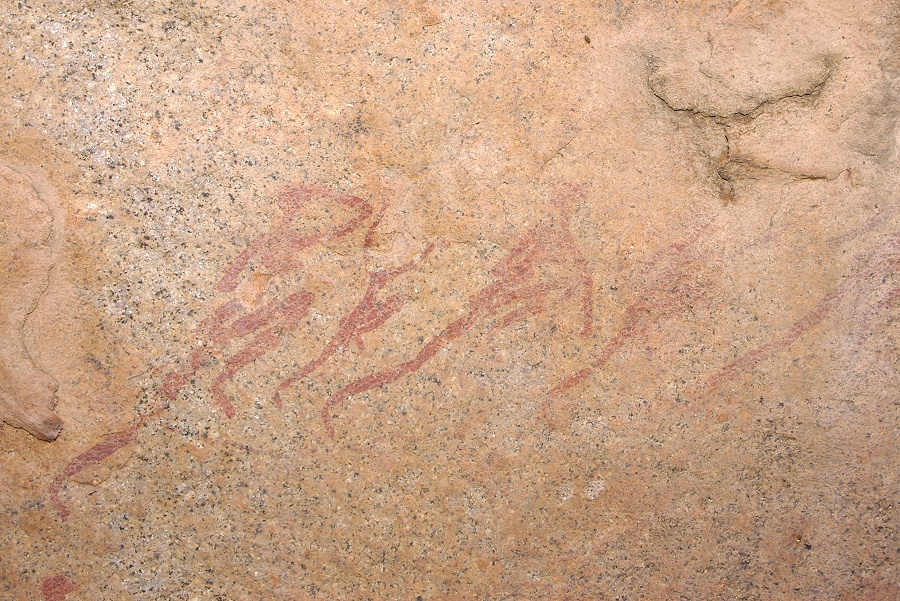
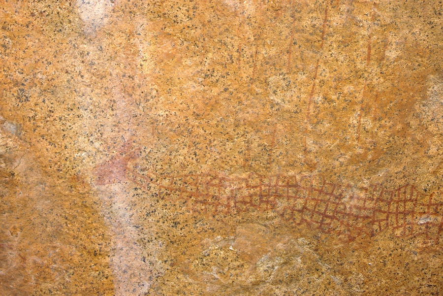
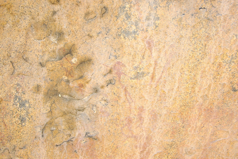
It took two hours to struggle down a very difficult, bouldery and overgrown hillside into the main valley of Numuarib. On a small terrace near the bottom we found a large boulder with some paintings. At present our understanding is that this must be an unreported site, Numuarib being one of the few valleys that have not been surveyed in detail by Harald Pager.
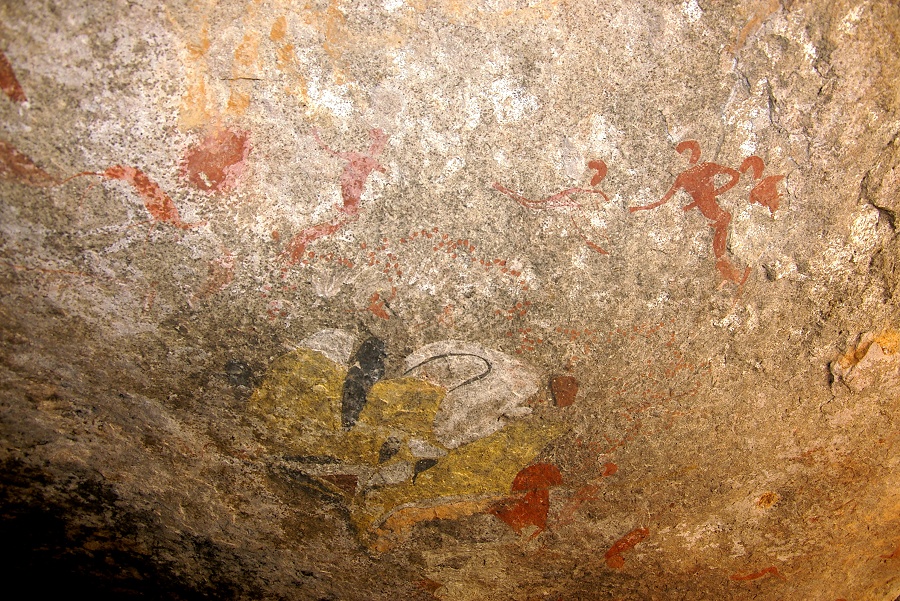
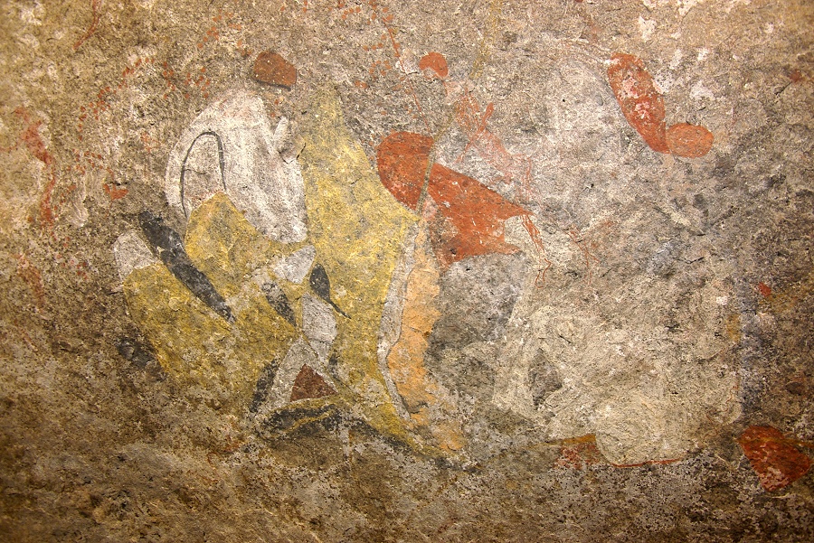
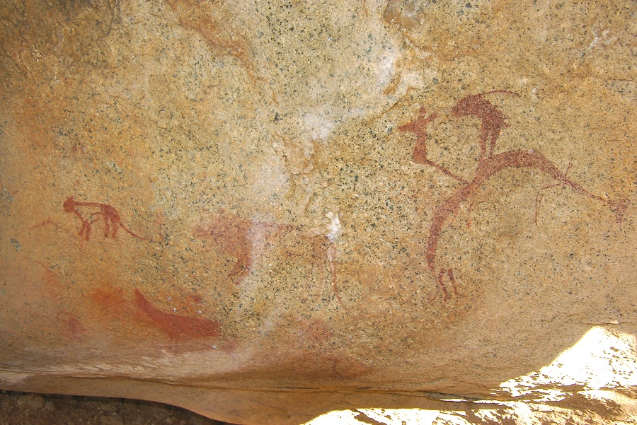
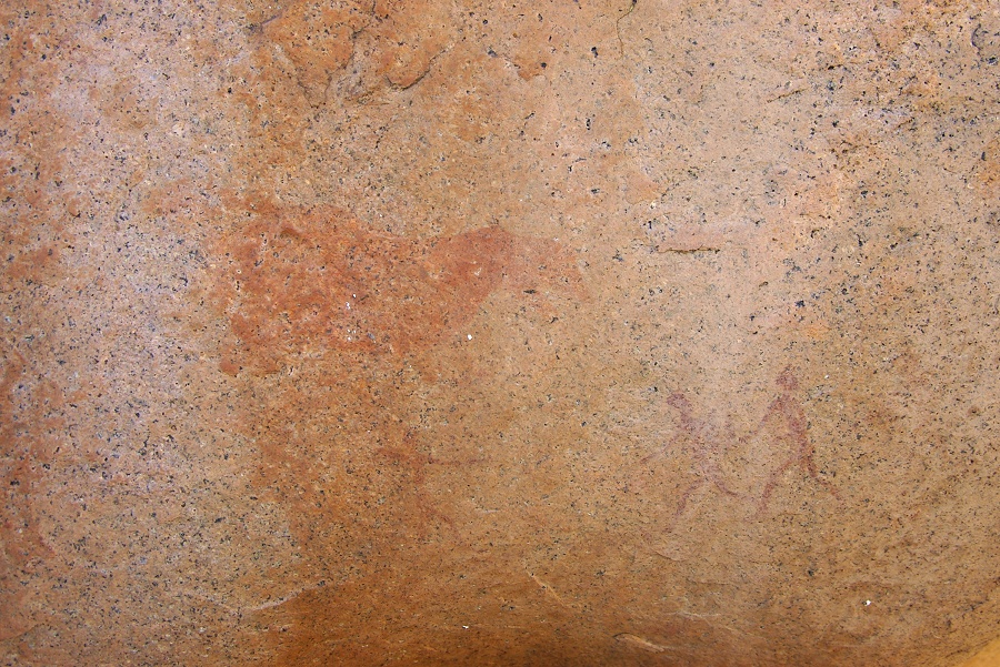
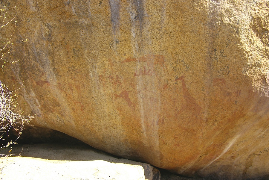
The going at the bottom of the valley became better, after another half hour we came upon the large Mason shelter in a rocky section of the main watercourse. This shelter has not been published in detail, we were not prepared for the amazing panel of paintings on the ceiling, including a large multi-coloured blob, of which none of us was able to make any sense.
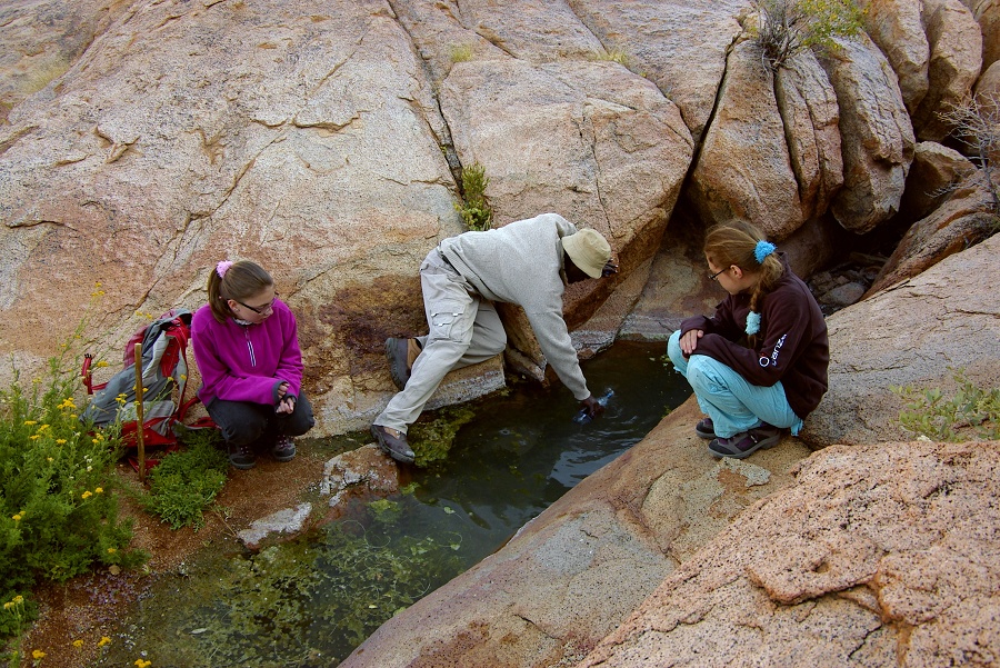
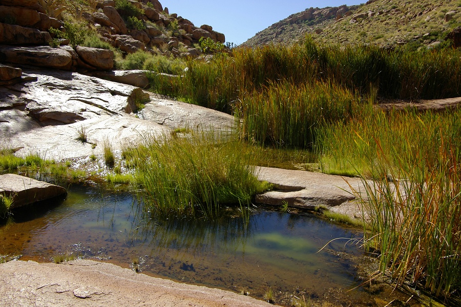
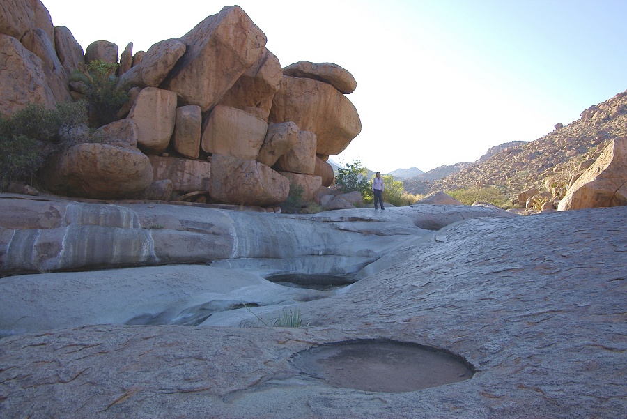
I was told that there is a very reliable water hole near the Mason shelter. Sure enough, soon after we started downstream towards the next rock art site, we found a deep pool at the base of a dry waterfall, still holding a copious quantity of crystal clear water, with two inch tadpoles densely inhabiting the bottom. We had a good drink and filled our empty water bottles brought along for this purpose - while our water was calculated to last even without finding any water holes, that calculation was based on a stringent ration of two litres per day, any addition was more than welcome. The rock wall by the pool contained the tree ring-like evaporation marks of each day since the pool filled, I could count roughly 80 rings, placing the rainfall somewhere around the 5th of April.

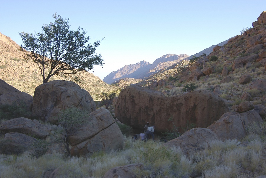
The "Bildergallerie" (Picture gallery) site is about a half kilometre north of the Mason Shelter, on the far side of a low granite ridge in an area where the valley opens up into a broad flat grassy plain before taking a steep plunge to the plains some 1000 metres below. It was a nice easy walk for a change.

The site itself is a series of shallow shelters along the base of a low scarp, running for about 50 metres. Again it was an unpublished site, so we knew little about it except for the name, and Alfons' assurances that it was "very nice". It turned out very nice indeed, a gallery of about half dozen excellently preserved panels, even surpassing the Mason shelter - certainly one of the major sites of the upper mountain.
Instead of lunch I wandered off to the large granite plates bordering the site to the north with the telephoto lens, in the hope of capturing some of the hyraxes that were scurrying about the rocks wherever we looked. However they were very cautious, again I was unable to make anything but a couple of distant shots, but the view from above was superb.
Around two we started our return to our Umuab base. We chose a different route that was to lead us into the Umuab valley below the plain, in the hope of finding some of the rock art sites, time permitting, that we missed the day before. At first the going was easy across the Numuarib basin, but the route led us into a steep sided valley choked with boulders, and we soon came to the unpleasant realisation that we should be on the ridge above the valley, not down below... It was a rather nasty climb up to the broad shelf above the valley, which continued down into the Umuab on the other side, far below us. By this time most of the party were tired to the border of exhaustion, Alfons led the majority back towards camp, while me and Jon stayed behind and descended into the Umuab in search of site U44, supposedly a major site on a very prominent boulder. After much tiring and fruitless search we gave up and started after the others, with the sun precariously low. On our way back we did come upon a boulder some hundred metres upstream from where we searched with some rather faint paintings. It was only after we arrived home and I checked the relevant Pager volume, that we realised we have actually found U44 - the majority of the paintings were hidden in a shaded shelter to the left of the rock, which we were too tired to check out.


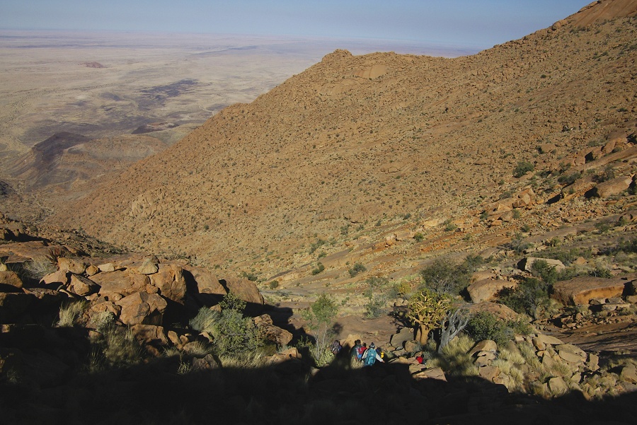
Our experience of what was to have been an easy day made us re-think our plans once again. Clearly what we considered achievable in the planned two day trek based on distances alone was impossible given the difficulty of terrain. There were some stretches where we managed less than a kilometre in an hour, twelve kilometres in a day was out of question in this country. Half of the party decided to stay in camp and rest for a day, while five of us were to go over the col into Karoab Gorge, and try to see as much of the principal nearer sites as possible before returning for the night. If successful, a direct day-trek to the Engelhard plain may be attempted the day after.
Day 5. - Upper Karoab Gorge
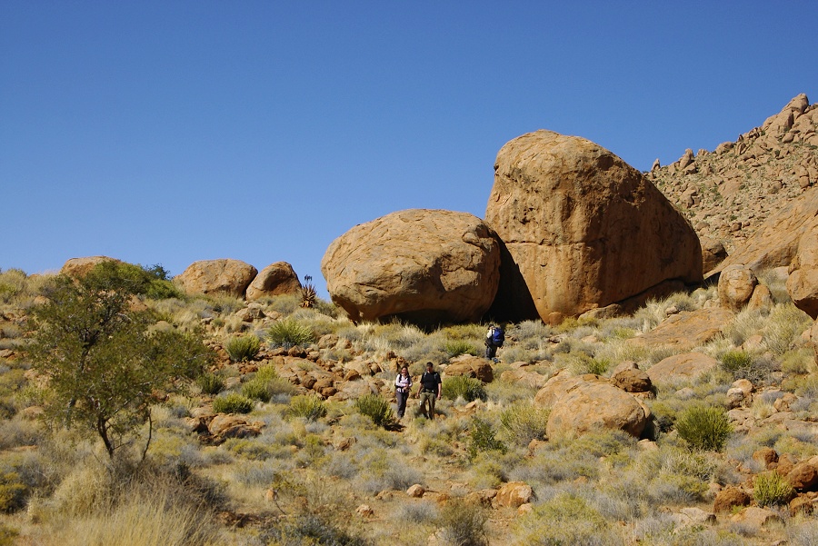
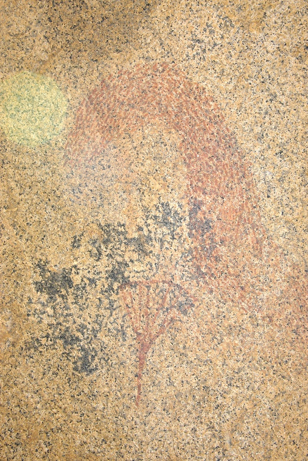
We all set out together in the morning to find two sites, U6 and U3 along our intended route to the Karoab. Fortunately Dóra's ankle was much better, while it still hurt a bit she could already hop on the rocks like before. We easily found the first site on a big boulder overlooking the Umuab plain within sight of our camp, with several fine giraffes and other scenes painted on the rock face.

At a short distance beyond, we also found U3, a major site with some very nice paintings including a well preserved eared snake. Half of the group remained to photograph the site, while the Karoab party (Alfons, Attila, Jon, Magdi & myself) continued towards the col, intending to see this site on our return. As we ascended the not too difficult pass, we saw several fleeing klipspringers, some of which I finally managed to photograph.

Climbing fast, we were soon high above the Umuab plain, nearing the top of the col. We were still in full sight of camp, with the little coloured dots of the tents clearly visible. However it soon turned out that what appeared to be the col was just a low pass to the western branch of Umuab, we were still no more than half way up as we adjusted course for the proper pass.


Under the pass we found the small basin with a huge split boulder in the middle, site U1. It proved to be a fine, well preserved site, with the paintings facing the perfect morning sunlight. This also confirmed our course, as it lay on the easiest direct route over to Karoab.
In another half an hour, still mid-morning, we were up on the col between the two valleys, marked by a big boulder with a couple of fine human figures, the first Karoab site K47.

Beyond the col the Karoab started a very steep, difficult descent. While the horizontal distance could not have been more than a couple of hundreds of metres, we still struggled for over an hour among the boulders and in places thick vegetation to get down to a small basin, which we expected would offer access to the closer of the principal Karoab sites.
As we walked down, Magdi spotted a strange-looking insect on a rock she was about to step on. It was unlike anything I have seen before, and Alfons confirmed that it was a specimen of the "gladiator", a family of insects thought to have become extinct 45 million years ago, it was only in 2002 that the living specimens were recognised as an entirely new insect order (Mantophasmatodea). Following our return, I made contact with Dr. Klaus Dieter Klass, co-author of the 2002 Science paper describing the new genus, he identified our specimen as "a male Tyrannophasma gladiator - one of the large, spiny species occurring in Namibia. However, it could also be a new species closely related to T. gladiator, as the taxonomy of the Tyrannophasma/Praedatophasma group is not yet well done".

As we approached the flat basin at the bottom of the descending valley, around one corner I found myself facing a large family of hyraxes spread out on the granite plates, and unlike on previous encounters, they did not scurry away among the rocks immediately, but continued to gaze at me as I snapped one photo after another. Some even waited patiently for me to change to the telephoto lens.
There was movement down in the basin too, a pair of klipspringers made a rather leisurely getaway, we could follow them up the facing hillside for a long time.

At this point it became evident, that the principal concentration of the Karoab sites we were aiming for are behind the ridge bordering the basin to the west, not further down the valley we were following. The time was close to noon, all we had time for was a quick dash to the sites less than a kilometre away before having to start our return. We scaled the boulder strewn slope of the ridge, and on the top the country opened up, finally giving an unobstructed view of the Karoab basin and the plains to the north. The valley dropped several hundred metres at our feet, even though we could see the probable location of the sites it was clear that they are unreachable in the available time - we would have needed several hours of climbing just to reach them. There was no choice but to turn back, leaving Karoab for some other time, better prepared with hindsight.
We had a quick lunch in the shade of a rock before starting our climb back. Near the spot we noticed the first examples of a strange plant that Alfons called "half men" on account of their appearance from a distance resembling a standing small figure.

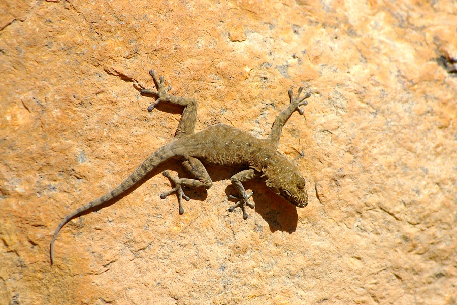
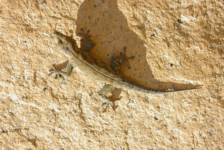
We made the climb back to the col and site K47 (where we left a stash of water for the return journey), and found the rock to be in full occupation by a largish gecko, who obediently waited for its portrait to be taken, unlike most others we saw.

We descended on the other side to the boulder hosting site U1, with the paintings being in the shade this time, permitting more detailed photos with flash.

After descending the ravine to the level of the Umuab plain, our next stop was the principal site of U3 which we already passed by in the morning. As we returned earlier than expected, we had plenty of time to photograph the site in its entirety.
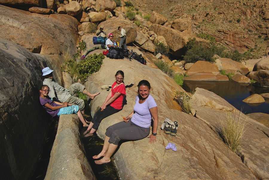
We walked back to camp in the perfect light of the late afternoon sun, tired and a little disappointed, but with a vastly increased respect for the mountain and the terrain that was still facing us.


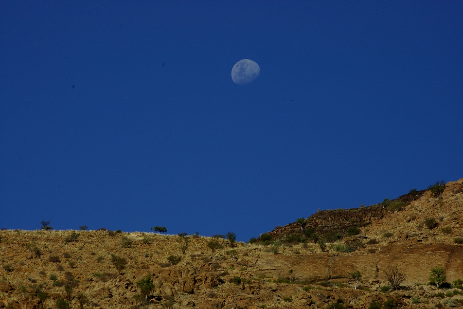
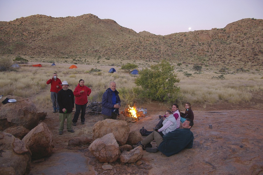
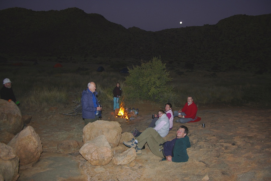
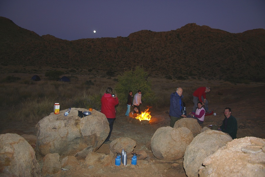
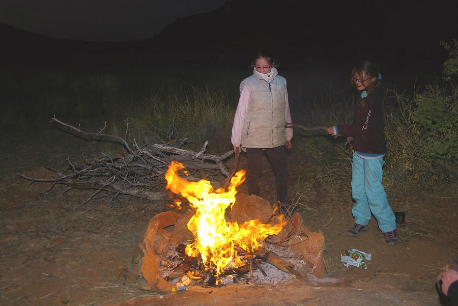
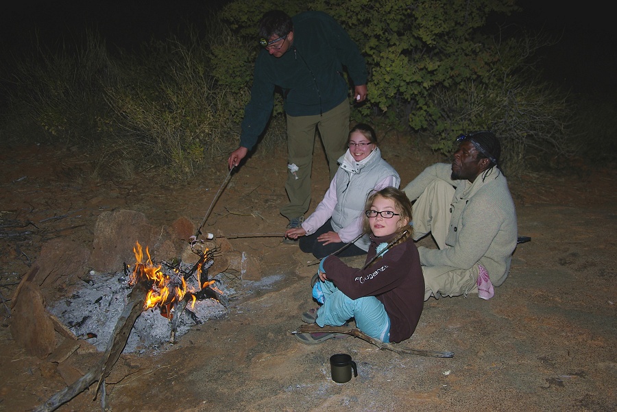
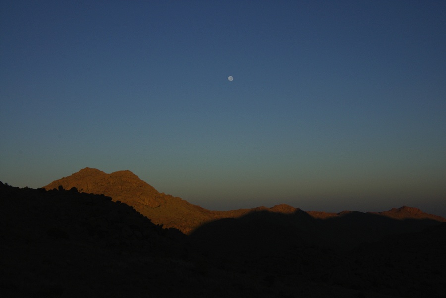
The girls were busy all afternoon preparing for the big event: roasting marshmallows! The tradition was started when Hannah McKeand produced a bag of marshmallows in Karkur Ibrahim much to the delight of Dóra, who felt obliged to continue the custom and spent the afternoon sharpening sticks with Viki. After our evening bar and meals, we succumbed to the sticky blobs in the light of the full moon.

Day 6. - Umuab plain
The experience of the day before caused yet another re-thinking of our plans. The Engelhard Plain was clearly beyond reach going there and back in a single day, so we decided to have a lazy morning checking out a couple of rock art sites within a couple of hundred metres from camp, and also we intended to have a look up the valley which we had to scale with full backpacks the next day. Our original intention was to make the trek to the upper Naib valley, from where we could make a day-trek to the Circus Gorge, the site of one of the most spectacular paintings on the entire Brandberg. However with the hindsight of the terrain encountered going to the Karoab, the 15km trek sounded impossible, even if the going was better than average. We scaled down our ambitions to make a day-trek to the Engelhard Plain from our Naib base, something that appeared feasible in light of what we achieved on the previous days.
One of the sites, U52 was already located by Dóra and Viki the day before, just fifty metres beyond our camp behind a low ridge.
Site U53 was supposedly a short distance away on some boulders on the plain. We circled the likely cluster without finding anything, until Alfons' trained eye caught a pair of barely visible human figures low on one of the rocks.
The location of U55 was rather obvious as a cluster of large boulder up some distance on a hillside about a hundred metres away, yet finding the actual sites proved rather difficult. We soon found a panel with a few human figures (strangely not included in Pager's copies of the site), however a search of the principal shelters revealed nothing. Alfons went to take a second look, and soon found the main panel in a shelter that was almost completely obscured by dense vegetation in front of it.
There remained one site, U51 in the vicinity. After some search in vain we wandered back to camp, Dóra remaining the only energetic one to continue the search on the rocks to the north of camp. Suddenly Alfons looked up after filling his cup with hot water at the stoves, and commented: there are paintings on the rock here! Sure enough, the rock behind our store was covered with figures. We only spent the mornings and evenings here before, now in full daylight the paintings stood out clearly. U51 was actually our kitchen and store.


After some discussion we decided that yesterday's Karoab party will make a survey of our route to be taken tomorrow, and will also take a cache of water up as far as we can reach, to lighten the load of the next day. Our second dump made with the Helicopter was still three days away, while we could be sure of finding water in the upper Numas on the third day, we needed to have at least three bottles per person for the other two days as a minimum reserve. We were joined by Viki, who volunteered to carry our lunch and an extra bottle for the cache. Dóra's ankle appeared all right by now, but she too stayed in camp to rest before the long trek with the heavy packs the next day.
We followed one of the southern branches of Umuab till the col between Umuab and Naib, each of us carrying four bottles of water and no cameras to lighten the load. It was a very steep rise in places, broken twice by relatively flat basins, but the overall going was not bad, the hillside was loose scree in many places instead of the overgrown boulders, something we were all familiar with from Uweinat. In under three hours we reached the little basin right under the col, where we made the water cache and had our lunch before starting our descent. As we came down, we consolidated most of our remaining water into two full bottles by a very prominent green tree roughly marking the halfway point.
As we descended further from the tree, suddenly Alfons gave a big yell: spitting cobra! Viki behind me was up on the top of a big boulder in a split second, while Alfons was waving his stick frantically at something in front of Jon that I could not see. Apparently Alfons stepped over the metre long sunbathing snake without noticing it, which in alarm turned towards Jon before thinking better and slithering away from the menacing stick.
We took a different route down, trying out the next valley to the east, where some nice long and flat connected granite plates seemed to offer an easier route. However we found the lower valley to be completely choked with boulders, cliffs and waterfalls, there was no way our party could have made it up the first hundred metres with the backpacks.
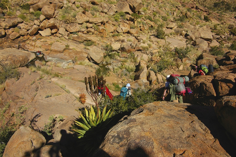
Day 7. - Umuab Gorge - Upper Naib Gorge
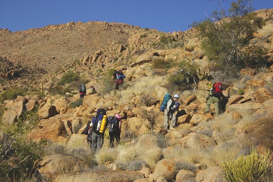
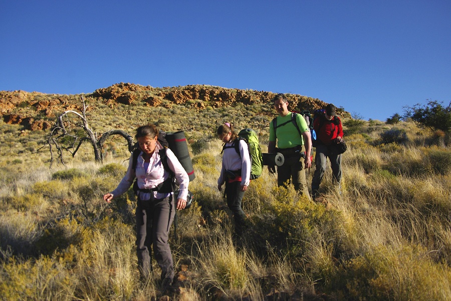
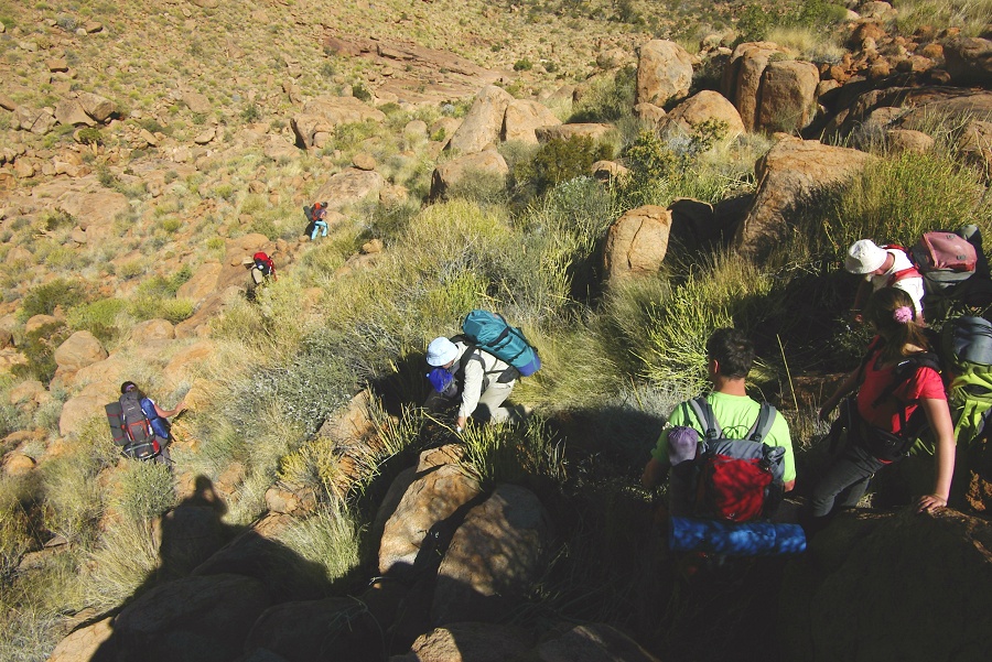
After packing up camp and distributing remaining food and water evenly, we set out along the same route the scouting party took the day before. Our packs were around 15 kgs (a bit less for the girls who were spared the need to carry a tent), more for those with heavier photo equipment. Our first stop was at site U57 near the start of the climb, a not too exciting site we found the day before.
After the site we started our climb in earnest. The going was slow with the heavy packs, with frequent rest stops. We reached the small basin with the cache by two pm, needing more than five hours compared to the less than three the day before.


We had lunch and a longer rest in the basin by the col. Having had a good look at the maps and satellite imagery, We decided that to save having to re-gain altitude with the heavy packs, we will try to make our Naib base camp as close as possible to our intended route to Numas, rather making a deeper descent with lighter packs when visiting the Engelhard Plain.
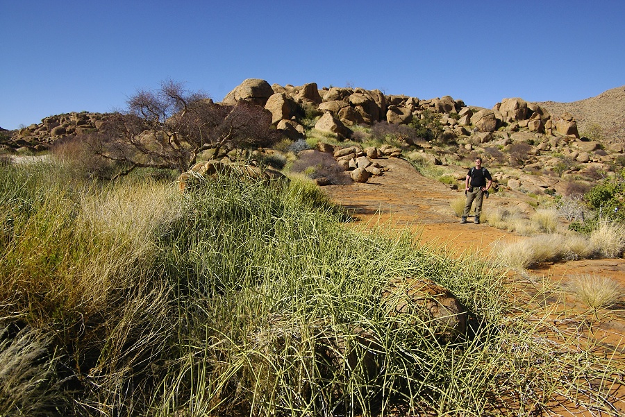
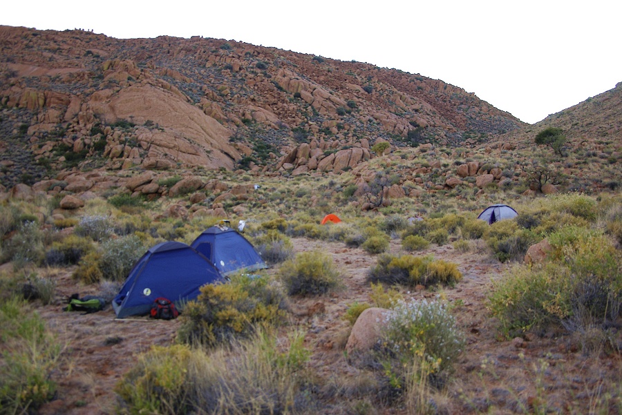
After collecting out water cache, we made our descent into the Naib valley on the western side of the col. The descent was not too difficult, in an hour we found ourselves on a small flat terrace behind a lump of rocks just a hundred metres below the pass leading to the upper Numas valley. It was an exposed but acceptable camping spot for two nights, fortunately the weather remained calm and warm for the duration of our stay.

We still had two hours of daylight left, with Alfons we set out to search for the water hole in the river bed below which we saw with Jon from the helicopter. We did a fairly extensive search, however as the watercourse was impassable for several stretches we were unable to look everywhere. We did not find any water, which made our existing reserves rather close to the minimum required. We did find however a rock art site, I108 on a little secluded plain.
We returned to camp still in sunlight, and had our evening bar overlooking the valley and the route we were to take to the Engelhard Plain, more benign looking than our trek today with the packs.

Day 8. - Engelhard Plain
Next morning we were up before dawn with the exception of Geert who elected to stay in the camp. After a quick breakfast by a small fire in the twilight, we set out as the sun lit up the peaks along the ridge separating Naib and Circus gorges.
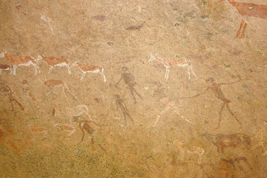
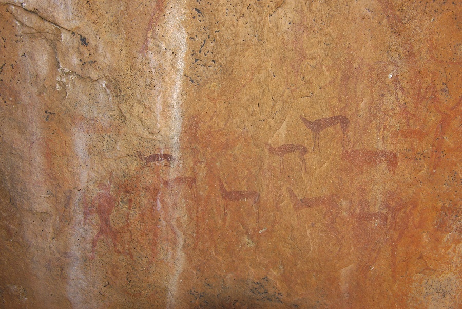
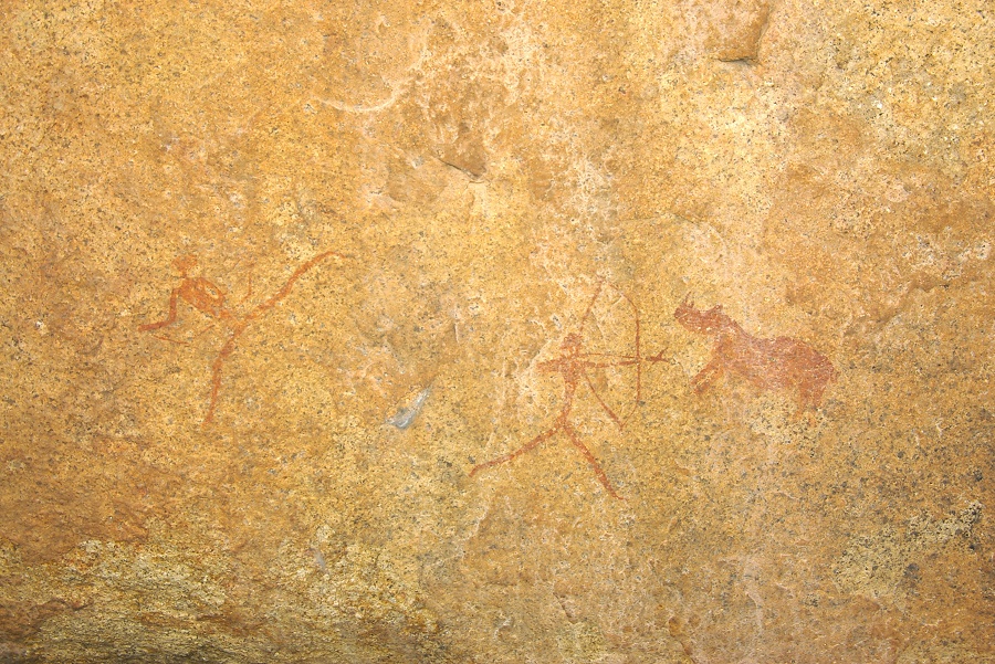
The going was not too difficult, in little over an hour we reached a small flat basin near the half-way point that contained a major site, I143 with the magnificent scene of a rhinoceros hunt and several other fine panels. Inside the shelter there were the remains of a recent looking straw bed, we could not help but wonder whether it was Harald Pager who last used this shelter when making the copies of the scenes in the early eighties.


About a hundred metre away, we found the other site of the basin, I144. This site is located on an exposed boulder, and was subject to much weathering, but still a number of interesting paintings remain.

Not far from the painted boulder, while we were busy taking photos, Alfons found a pool filled with good clear water - our water concerns were solved! We each had a spare empty bottle, with two full bottles we could drink at ease without having to worry about reserves, if necessary we could always return by the pool on the way back. After taking our fill we continued out of the basin up to the col at the edge of the Engelhard Plain.

At the top of the col, where we got our first glimpse of the plain beyond, we made a water cache for the return journey, then descended into a lush green, densely vegetated valley that led out to the plain.
As we entered the northern part of the plain, we saw four klipspringers hop away among the rocks on the southern rise. They were not very frightened, and permitted some acceptable photos as they jumped with amazing ease over gaps of four-six metres between the boulders.

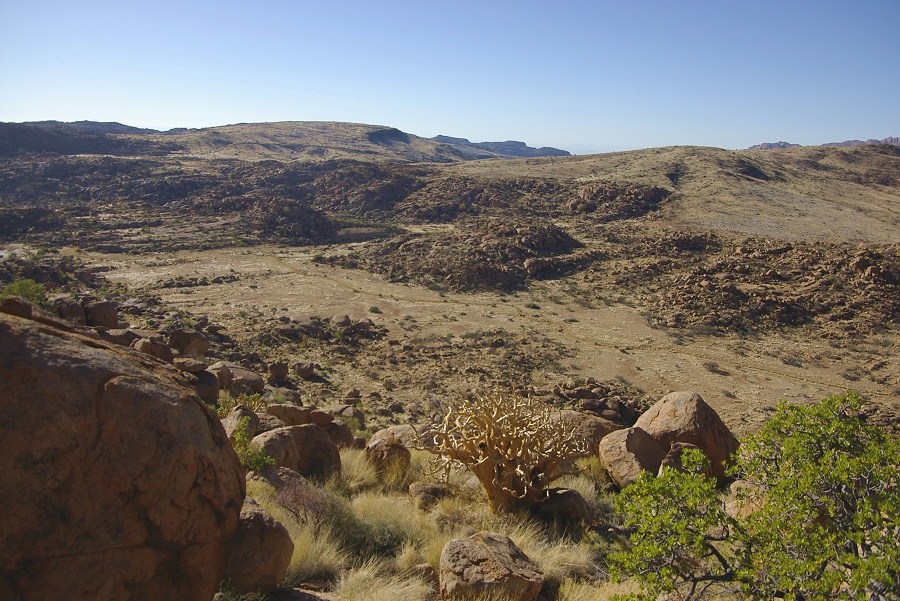
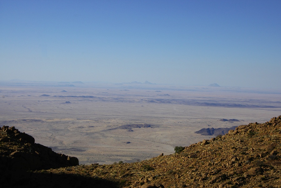
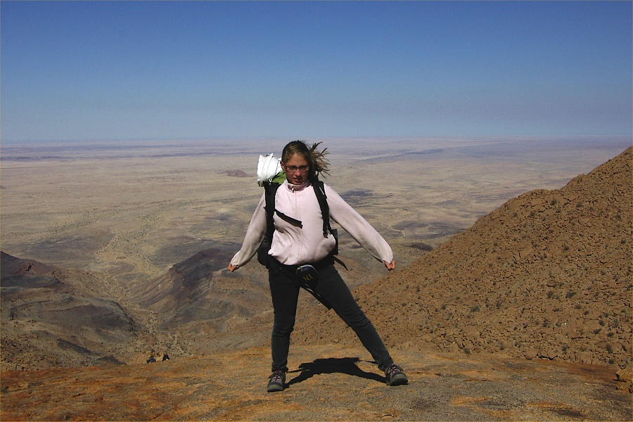
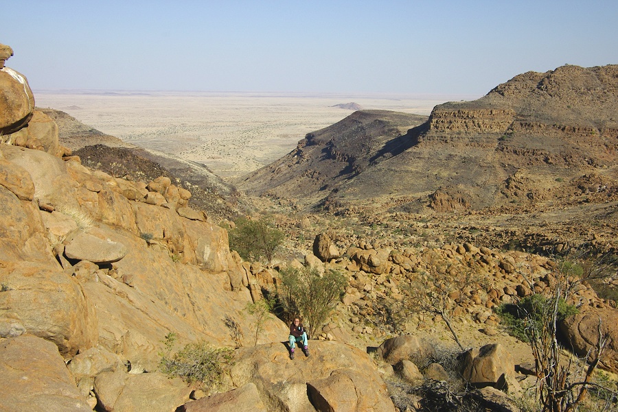
We made our way down a series of steps, and were soon at the edge of the Engelhard Plain, a perfectly flat sediment-filled basin extending for a distance of over a kilometre at an altitude of 2200 metres, the highest such environment on the Brandberg.


As we crossed the plain, we stepped over an ant trail that was crowded with large black ants (not unlike the big black desert ants known from Uweinat), all carrying tiny white flowers.
The perimeter of the Engelhard Plain is cluttered with rock art sites, the principal of which is I55 on a large boulder with paintings all around. We made for the boulder, and made a base there to explore the remainder of the plain.


Roughly a kilometre away, beyond the far end of the Engelhard Plain, there is one of the most important sites of the upper Brandberg, I47 under a huge boulder some way up a hillside. With Magdi and Attila the three of us set out to find it, while the others continued to photograph I55. Our plan was to call the others once the site is found. However the terrain proved dismal, after an easy half kilometre across the plain the rest of the way was through a series of rocky ridges, with the last 100 metres needing more than 20 minutes, in plain sight of the large boulder. In all, we struggled for over an hour to get there, the same back, but the beautifully preserved paintings were more than an equitable reward. The site sits high up on a hillside, with an amazing view of the surrounding country.

On our return we met the others looking at the other sites at the plain perimeter. on our way to I47 we already passed by I58, a large complex site with numerous panels in a series of shelters along a low scarp.
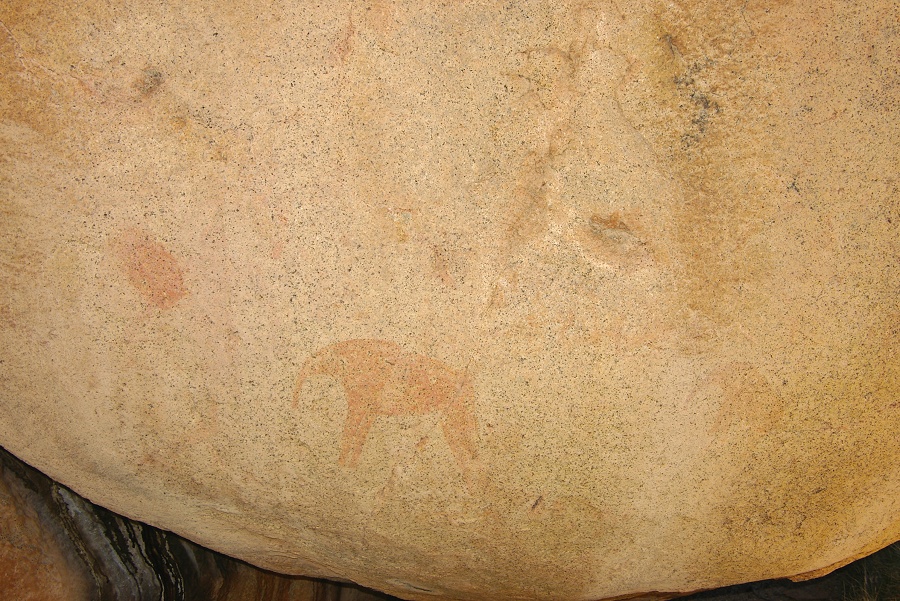
Not far, Alfons found another site, I56 that contains a fine panel with elephants, and another with elaborate human figures.


We made it back to the rock of I55 for lunch, and also an opportunity for a rather cold bath, as the others have found water in the series of rock pools just under the edge of the plain.


Our time was nearly up, we had to start heading back to camp soon. While the others had their last frolic in the pools, I dashed away to search for a major site, I170 that was some 300 metres from I55 south-east along the edge of the plain, beyond the pools. The site was not difficult to find in a small side valley among enormous boulders. There is a unique depiction of a two headed (or two intertwined) snakes that covers the side of a huge boulder, as well as several other panels. I just had time to take a few photos before having to return to the others to start our trek back.

We left the plain along the same route as we came, climbing up in the dense green valley leading up to the col where we made our water cache, then descending on the far side towards our camp. We had no need for any extra water, so we turned directly towards camp.

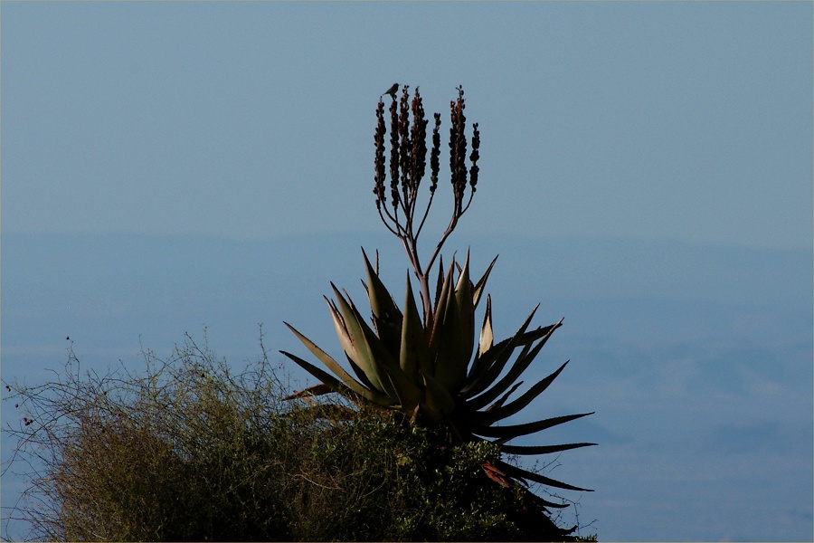
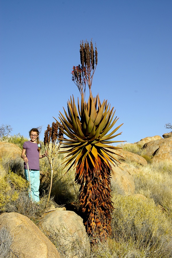
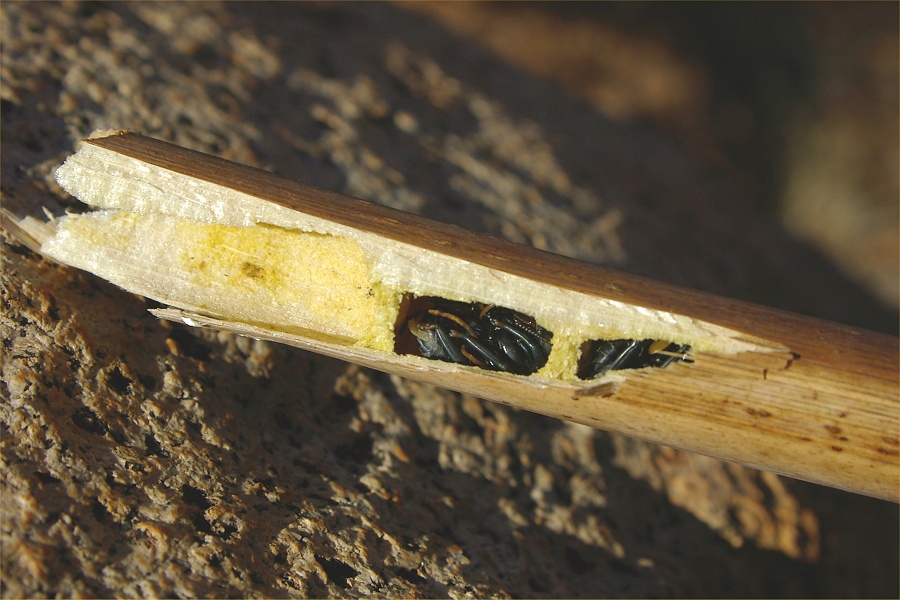
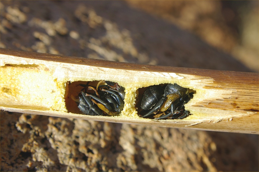
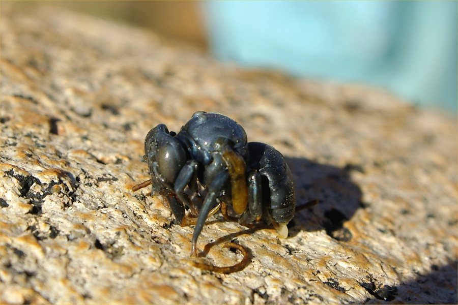
On the way down Viki made an interesting discovery while preparing a stick for herself. The tough stems of the flowers of the huge aloe plants are the incubators for the larvae of the large black bumblebees that we have seen buzzing around us on several occasions. As Viki broke a stem, a fully grown adult fell out and after the initial shock of seeing sunlight for the first time, flew off merrily. Inside there were another two almost fully grown nymphs.

This day's march was over reasonably good terrain, but with the add-ons to I47 and I170 it was the greatest in terms of distance, none of the other days made me so tired by the end of the day. Our timing was good, we reached camp just before sunset.
Day 9. - Upper Numas Gorge
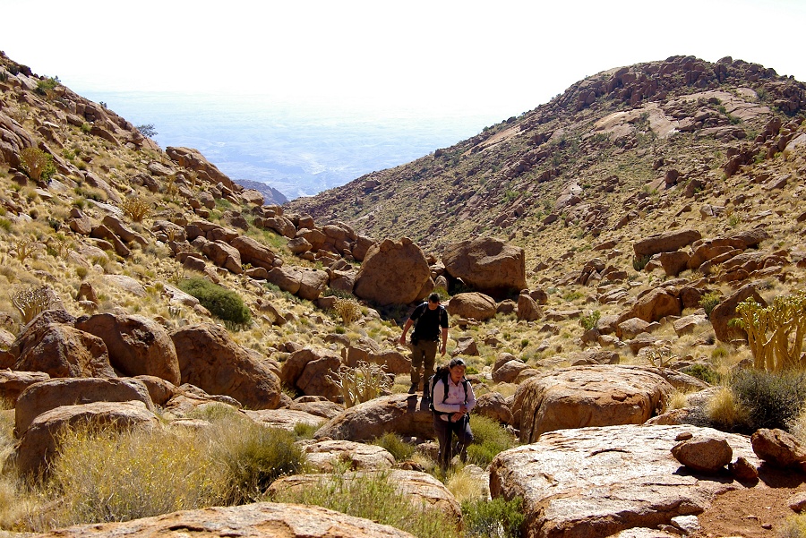
The whole day was planned for our descent down the Upper Numas till the bend in the valley where we left our second helicopter supply dump. All the going was to be downhill from the pass above the camp, but some sections of the valley were expected to be steep and rocky, making this likely the toughest day. Fortunately we knew that there was water to be found in the valley, so we could all start out with a light water load.

After breaking camp, we managed to start after seven thirty, climbing the col, then starting the descent into the upper Numas valley. The descent looked easy, but on closer look the hillside was found to be a mess of overgrown boulders, a slow and difficult going.

We reached the watercourse near a large boulder that contained some paintings (unidentified, as the Numas sites remain unpublished), then followed the riverbed till reaching a series of shallow pools upstream from the upper cascades of the Numas valley. These pools were stale and had an unpleasant smell, though probably the water would have been drinkable in an emergency.

We found an easy route bypassing the cascades, then continued down a relatively flat section of the valley under the Numas plain. After negotiating a ridge cutting through a bend of the river, we were looking down into the deep V shaped gorge containing the lower cascades.
The descent down the hillside was anything but pleasant, but we were rewarded with a fine clear pool at the bottom, and the prospect of drinking as much as we like for the rest of the day.
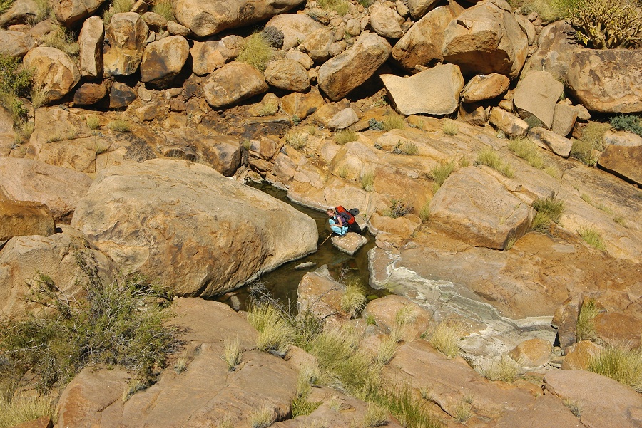

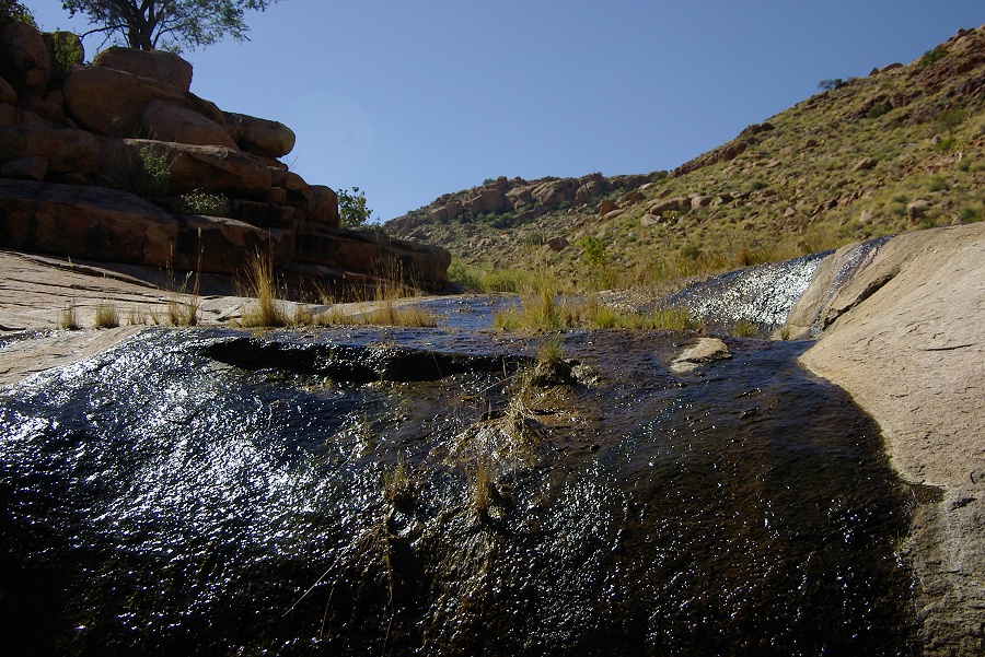
Continuing downstream in the river bed, after a half an hour we came upon a series of pools and waterfalls where water was still running. The sound of trickling water was amazing to listen to after eight days of complete silence. Even though it was a little early, the place was so pretty that we made our lunch stop there, using a little pool cut off from the rest of the flow as a footbath.
As much as we would have liked to stay, we had to press on, we were just about half way on our day's trek. Below the pools the valley was choked with boulders, and we had to cut again over a bend, making a rather nasty, overgrown and steep descent on the other side into the river, where water was flowing freely from one shallow pool to another.
Soon after a bend in the river we came upon a large pool mostly overgrown with reeds, with a large boulder by it's side. The only passage was around the boulder, on the far side we found several panels of fine paintings.
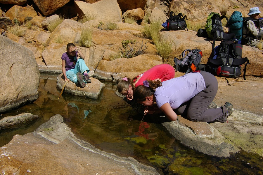
After some short but difficult scrambling over big rock steps, we reached the end of the cascades, and the valley began to flatten somewhat, though the going remained difficult among the shrubs and boulders. We finally glimpsed the sunlit bend of the river which we had to reach before nightfall, still a considerable distance away. We passed two large pools that were the last to contain drinkable water, the few remaining smaller ones further downstream were muddy and stale.


Finally the valley flattened and widened, offering easier going along the terraces beside the watercourse. However all of us were very tired by this time, slipping and stumbling even on the better going on this last kilometre, reaching our dump and campsite just before sunset.

Day 10. - Upper Amis Gorge
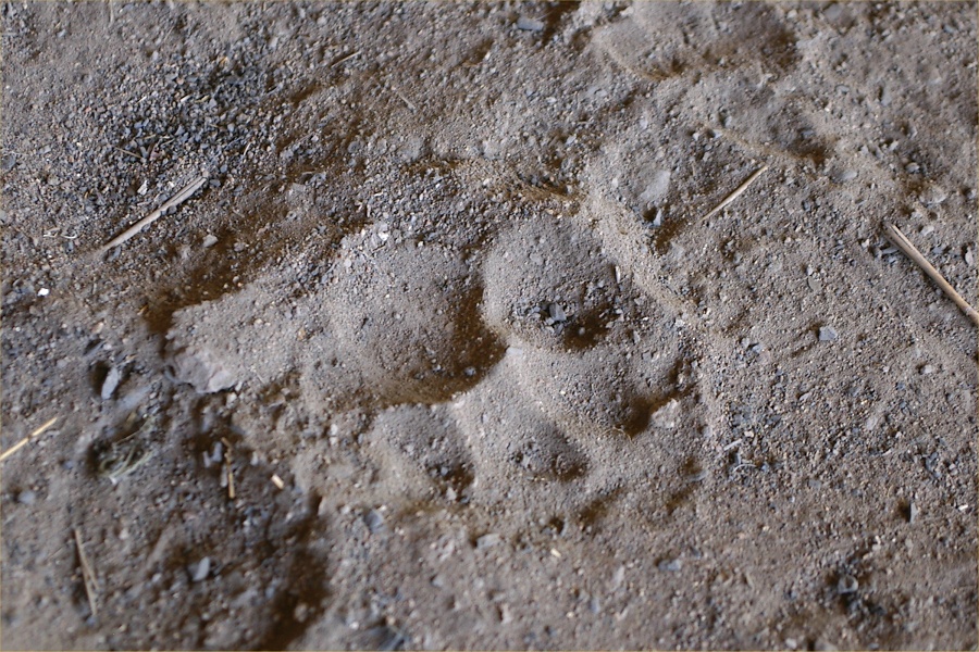
During the night, several of us heard repeatedly a subdued cough. Its un-human nature did not quite register in my semi-sleep state, however Alfons confirmed in the morning that it was the sound of a leopard, prowling about the camp in the small hours. We have seen many of their droppings and some old footprints, and judging by the abundance of klipspringers and hyrax, there must be a healthy population of the big cats on the mountain. However they are nocturnal and shy away from humans, in all his time on the mountain Alfons only managed to glimpse them twice.
Our camp was positioned for an easy access to the upper Amis Gorge, the site of several of the most important paintings on the mountain. The previous day's tough trek took it's toll, half of the group preferred to rest and just explore the vicinity of the camp (with a scatter of lesser sites about), rather than make another strenuous walk. With some of the others still comfortable in their sleeping bags, the same five who made the Karoab trek departed at dawn for Amis.


We cut across and over the ridge that forced the river to make a big loop, and on the crest immediately came upon one of the rock art sites that lay scattered about our camp.


We continued down along the valley towards the Numas Cataract, where the river tumbles down a series of granite steps, from where we could turn towards the lowest pass leading south towards the Amis Gorge. Descending the far side of the ridge, we came upon the first example of another strange plant of the upper Brandberg, that Alfons called "elephants foot" - a large bulbous stem that sported spiny long shoots, all heavily grazed by the klipspringers. Further down, the watercourse was thickly grown with elephant grass, making a difficult going, but still better than the overgrown thorny banks.
A large group of boulders just beside the cataract sported a fine rock art site, and one of the eddy holes in the rock still contained a small amount of rather stale looking water.
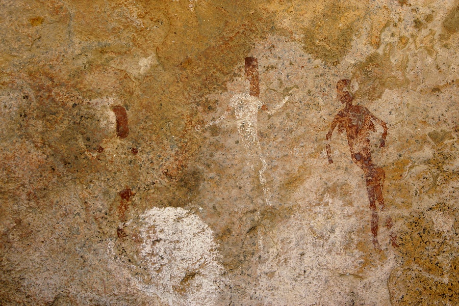
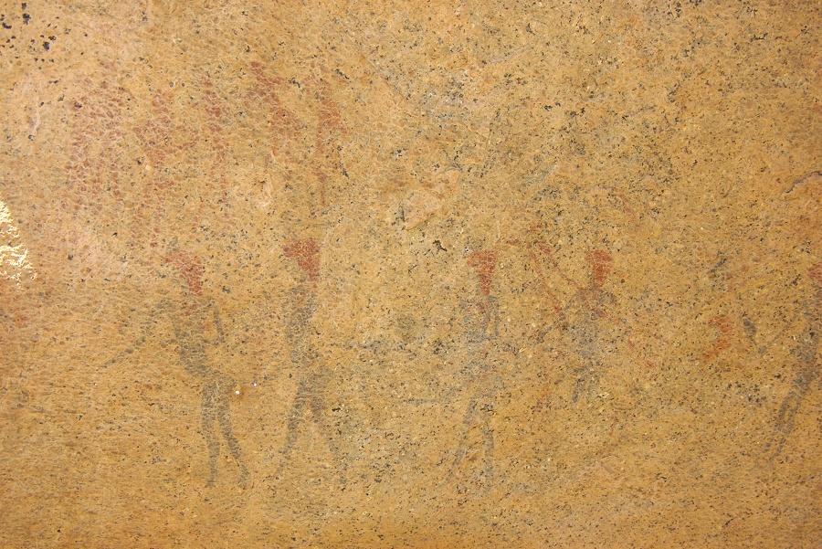
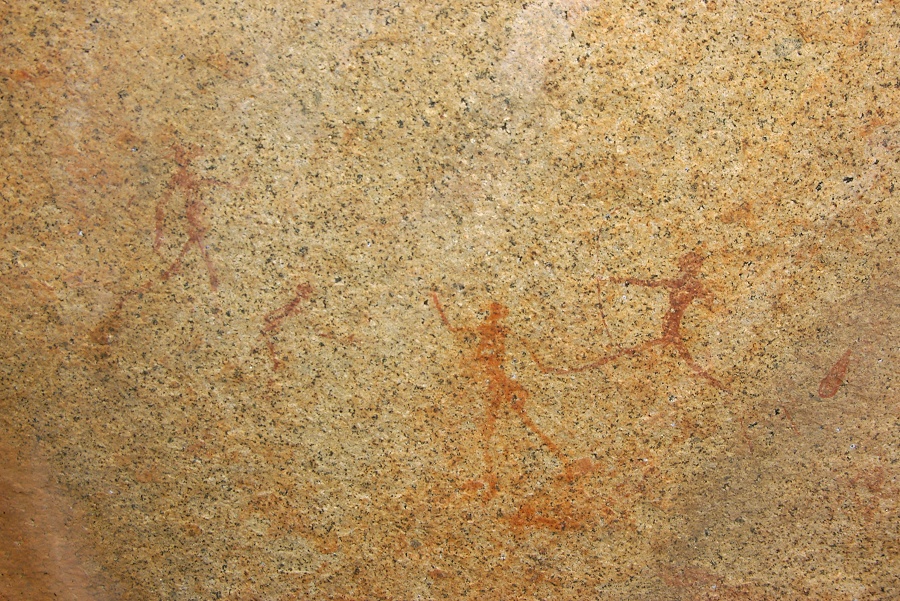
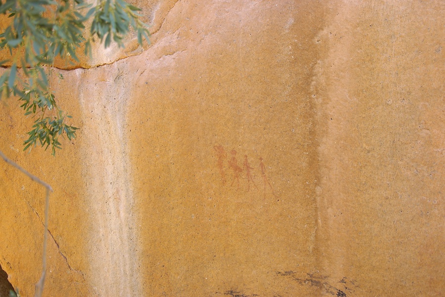
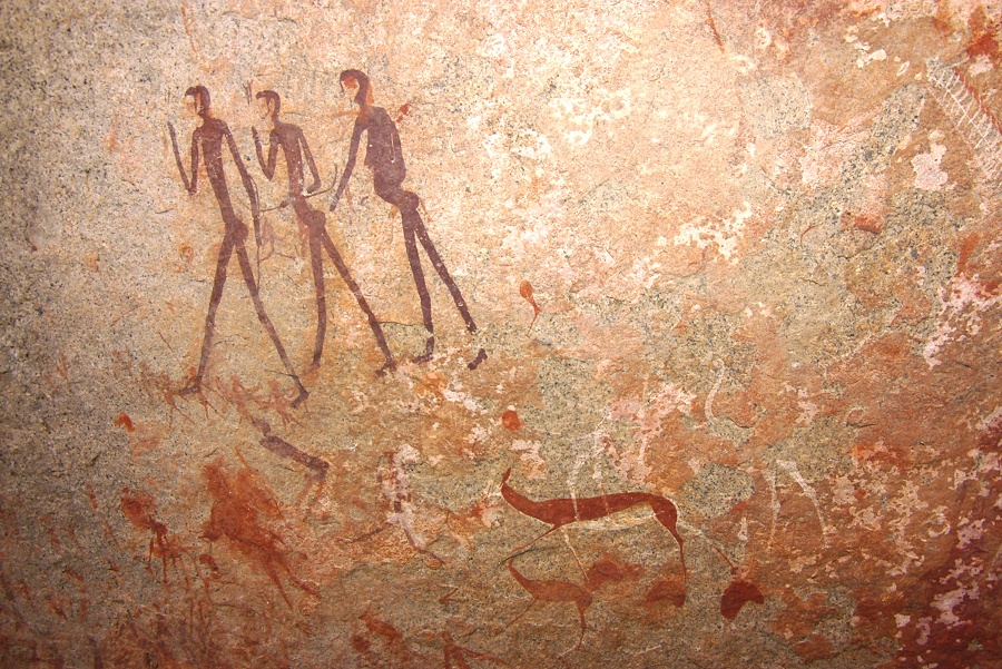
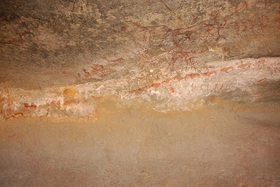
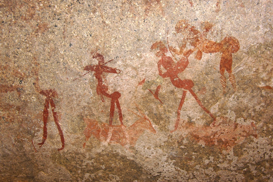
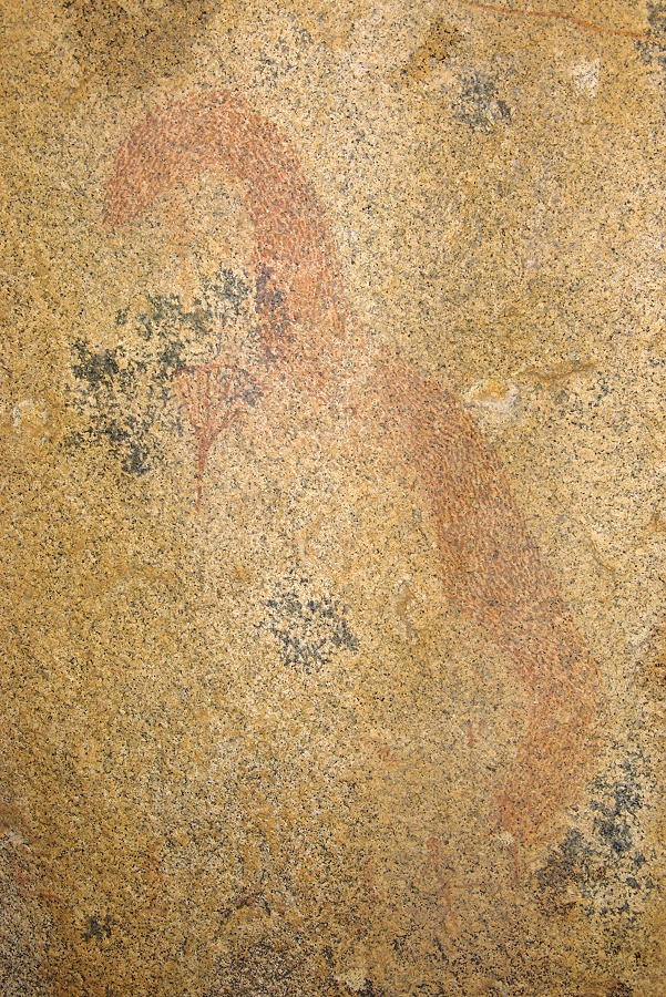
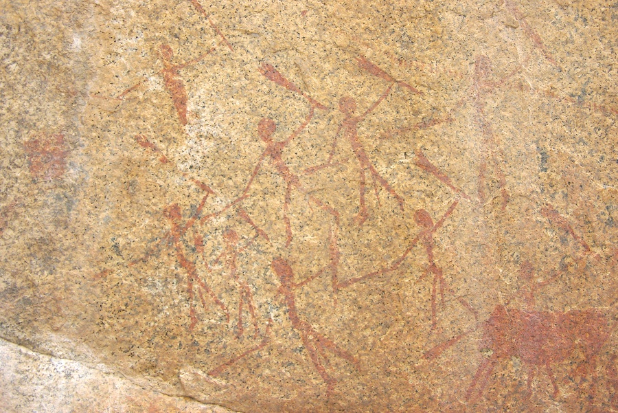
From the cataract we had to climb a ridge, and descend again into another branch of Numas before gaining access to the slope leading up to the pass. This side valley is called "Silberwelde" on the maps, it's flat bottom covered with thick grass, evidently one of the prime habitation sites in the upper Brandberg. Near the place we crossed, we came upon a very large boulder that contained an extremely fine panel of paintings of a multitude of human figures, this must be one of the principal sites of the upper Numas.


From the Silberwelde a relatively short and easy climb led us up to a large flat basin closed off on the south by a ridge, the far side was already Amis Gorge. A large boulder in the middle of the basin contained a small but very fine panel of painted figures, guarded by a particularly large gecko.

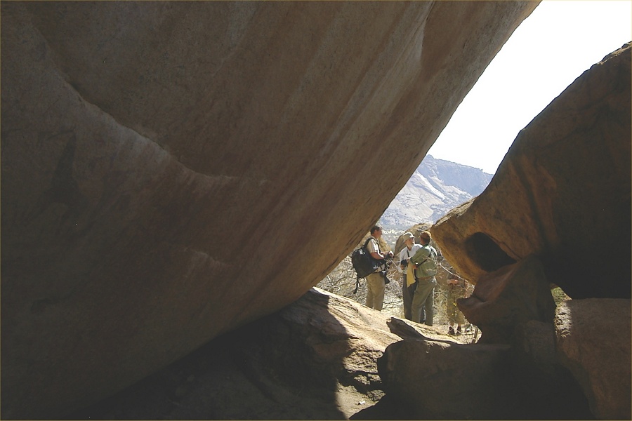
We climbed the last ridge, and shortly after 10am we were already looking down into the upper Amis basin, a much better progress than what we anticipated. On the far side of the basin, under a la large and conspicuous granite plate, the large shelter of A10, the principal site was clearly visible only a quarter of an hour's walk away.

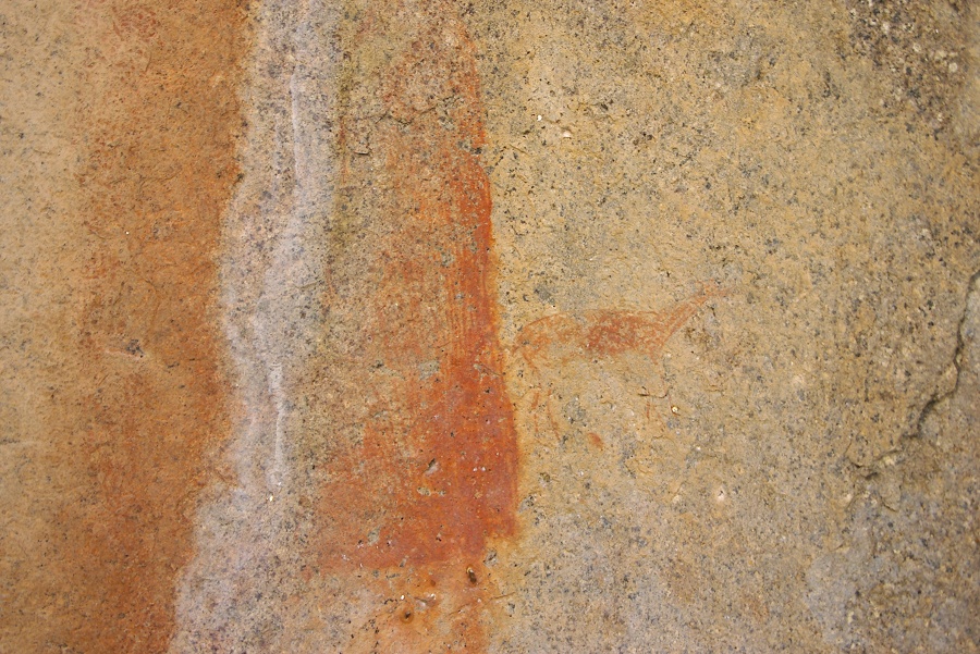
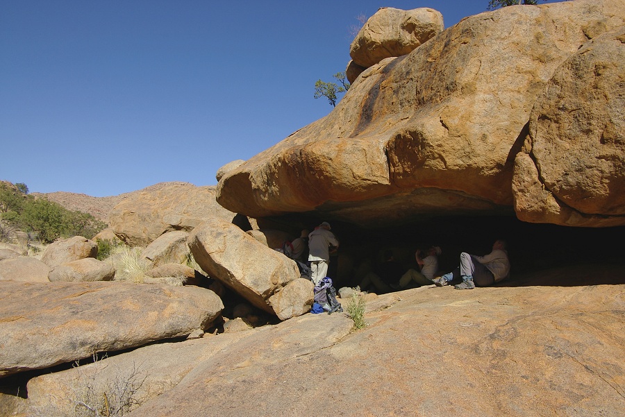
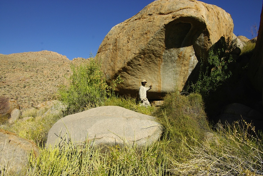
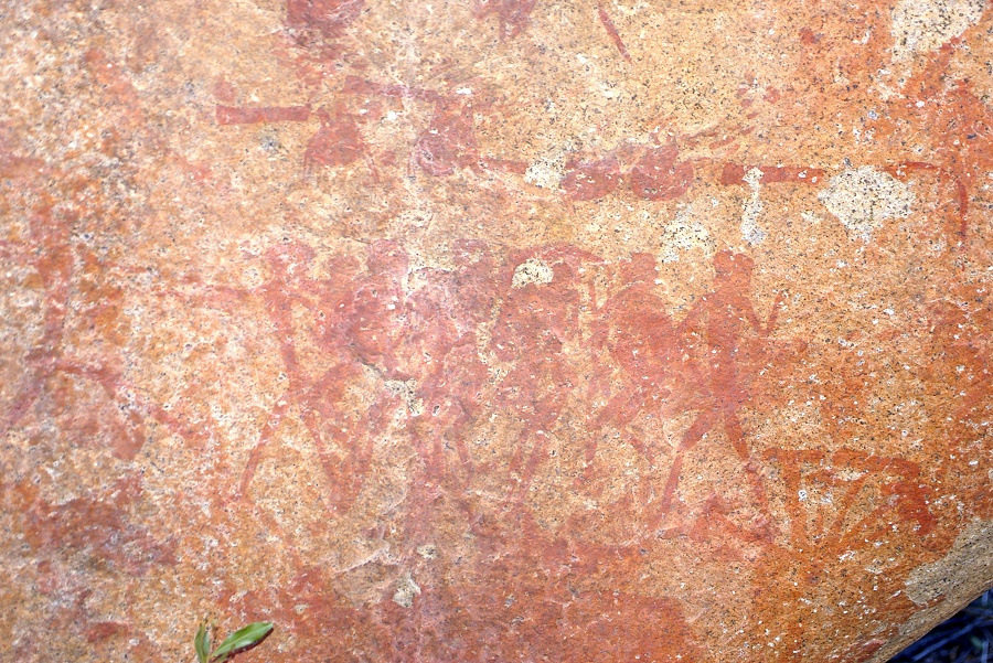
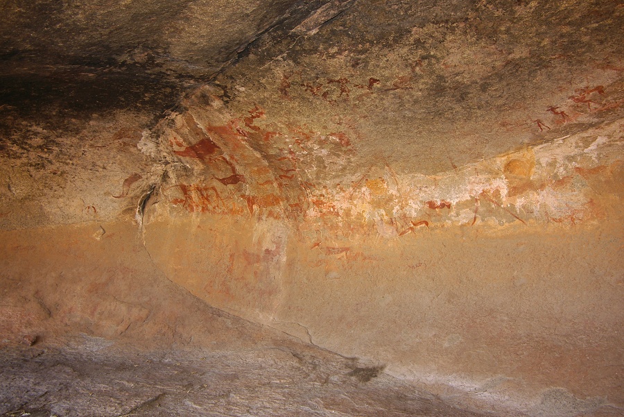
A10 (or "Riesenhöhle", the "Giant's cave" on account of the huge human figure) is one of the principal sites of the upper Brandberg, and certainly one of the most spectacular, occupying a very large and deep shelter, with paintings practically covering the rear wall, some in a superb state of preservation.
After an hour of intense photography, we set out with cameras only (Magdi in a lazy spell decided to stay at the shelter), to look for site H75, the principal site of the Hungorob plates, an area of huge barren granite exposure on the ridge above the A10 shelter, less than a kilometre away. The map suggested an easy walk, we were expecting to be back in an hour and a half. However the terrain proved more difficult than anticipated. We reached the granite plates easily enough, but there were breaks and gullies, sizeable scarps that made progress very difficult. After nearly an hour's search we failed to find the principal site, and had to console ourselves with a lesser site, H71 that we chanced upon, before being forced by time constraint to go back to the A10 shelter.
After a quick lunch, we continued to the other main Amis sites, first passing by A12, a fine site with several panels on the side of a cluster of large boulders.
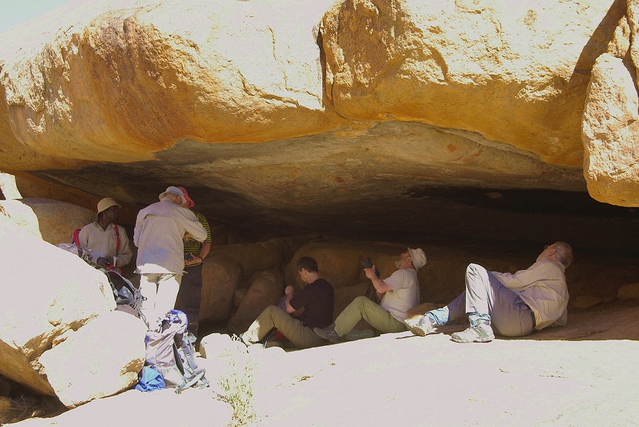
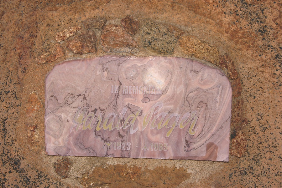
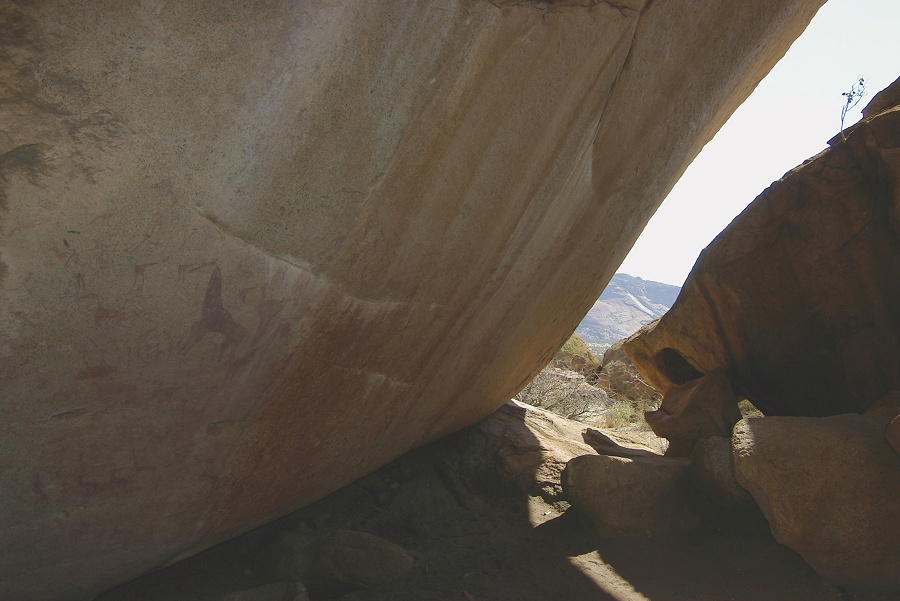
We continued, climbing up along the side of a large granite plate to A6 ("Lufthöhle", the "Wind Shelter"), a wind excavated hollow along a joint in the rock. The shelter is quite small, but once one moves inside, an incredible multitude of perfectly preserved paintings becomes visible on the rear wall. This site is said to have been Harald Pager's favourite, and it's not difficult to see why, with the beautiful panels and the amazing view from the mouth of the shelter. Some time ago a small tablet commemorating Pager was placed at the left entrance of the shelter.

While the three of us photographed the site, Alfons and Magdi went to check out the water hole a couple of hundred metres below the shelter, and came back after an hour with the empty bottles filled with water, a welcome addition to our supplies.


By this time it was past three in the afternoon, we needed to start our hasty retreat to camp to avoid getting caught with the sun down. We re-traced our path across the path into the high basin, then down into the "Silberwelde". Instead of climbing the ridge, we walked around along the flat bottom of the valley to the foot of the cascades, a much easier route than the one we took in the morning.


The remainder of the way up the cascades then along the Numas valley was a relatively easy stroll compared to what we have done in the past days, completed in the beautiful last hour of sunlight, reaching camp just before the sun set behind the ridge we crossed some minutes earlier.


The rest of the party had a leisurely day, making the walk down to the cascades, looking at the paintings and also filling some empty bottles with the water remaining there, having enough water now even for a small wash after the trek, a welcome luxury.
Day 11. - Hungorob Mulde - Waterfall Plain - Helm Pools
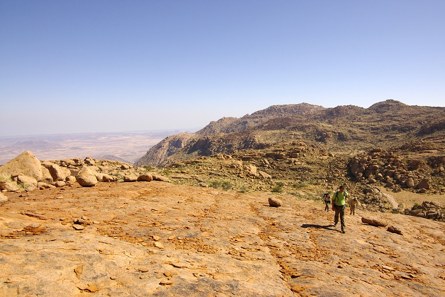
We packed up the camp in the morning, and started climbing the nasty-looking ridge separating the bend of the Numas from the Hungorob Mulde, on a long trek that was to place us by the evening at the Helm Pools in the southern Hungorob, close to our planned descent along the Ga'aseb Gorge the following day. Fortunately the ridge proved an easier ascent than it appeared from below, several large interconnected granite plates allowed a steep but at least obstacle-free ascent.

The descent into the Hungorob Mulde was uncommonly gentle, as we stopped for a pause in the middle of the basin some of us managed to make a quick dash to the big boulder on the side of the central rocky hill that contains site H85, the principal site of the basin with some fine paintings on the side of the boulder. Unfortunately, pressed for time, we could not even attempt to look for the dozens of others scattered about the basin.

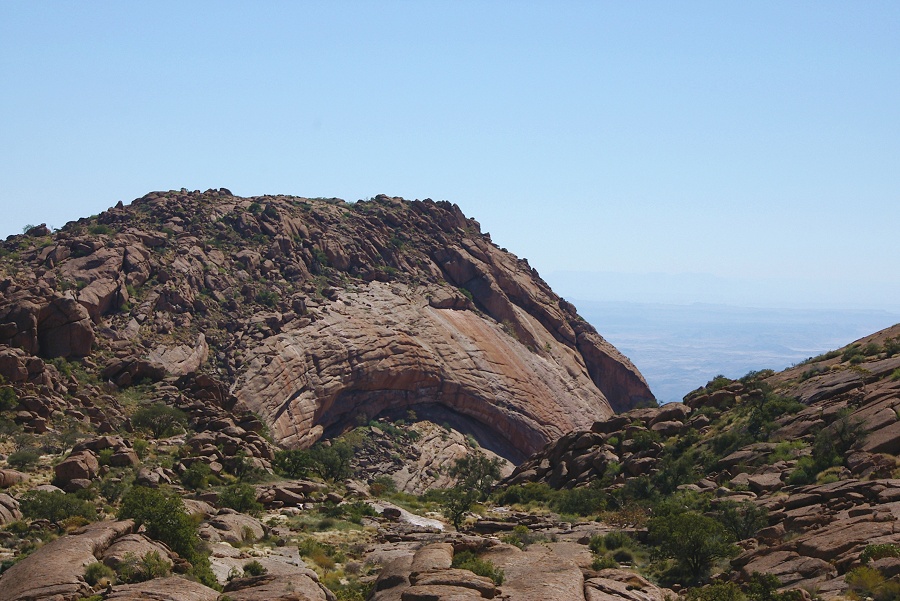
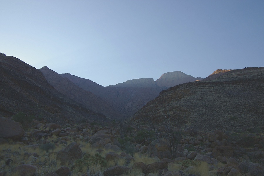
From H85 we had an unobstructed view of the valley and pass that we intended to take over to the Wasserfallfläsche (Waterfall Plain), a small basin along a tributary of the upper Hungorob with a major concentration of rock art sites, lying under the main peak of the mountain, Königstein. From our vantage point the route looked very difficult, with a very steep ascent to a level well above the altitude of the plain beyond, choked with house sized boulders - an unpleasant prospect with the heavy backpacks. After some discussion, Alfons suggested taking another route taking us after a little backtracking along the side of the main Hungorob Gorge, then ascending direct to the Waterfall Plain without the need to go any higher than necessary. In retrospect, it is hard to judge which route would have been worse. We struggled for about three hours along the steep side of the gorge, then up a somewhat better valley along a route that on paper involved less altitude change, but even level going meant climbing one 2-3 metre step among the rocks, then descending the same five metres away - hardly easy going. It was well into lunchtime as we approached the prominent white streaked granite plates marking the waterfall, with the large shelter with paintings underneath.
Falls Rock Shelter (H28) is the principal site of the area, with a multitude of paintings on the rear wall of the deep shelter, some in very good state of preservation. After the rains, the waterfall forms a curtain of water over the mouth of the cave, a truly spectacular location. Apparently a leopard also thought so, as we have found several of its fresh footprints in the soft dust covering the floor.


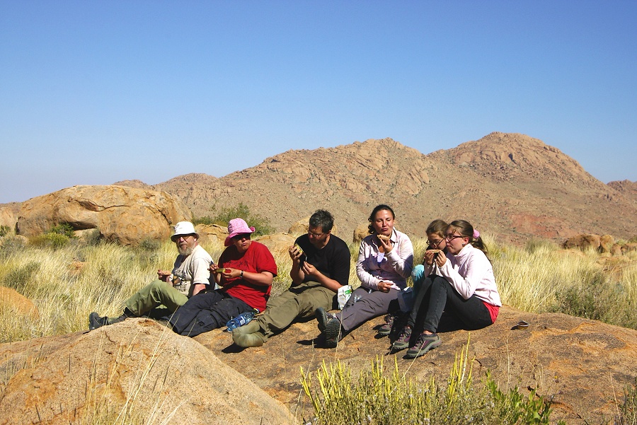
After a quick lunch and photography at the shelter, we pressed on. Unfortunately due to our slow progress we had to give up our plans to visit Snake Rock (H43), one of the major sites of the Upper Brandberg. The site was actually in sight, less than a kilometre away, up on the col at the top of the valley leading out of Waterfall Plain to the north. However the climb there and back, plus the time spent there would probably have prevented us from reaching the campsite near the Helm Pools by nightfall, and we definitely needed a full day for the descent the following day. We took our group photo at the edge of the Waterfall Plain above the shelter, then climbed the low col to descend towards the Helm Pools. Our judgement proved correct, we reached the campsite shortly before sunset.


The only excitement along the way was when Alfons came upon a sunbathing sand snake, a harmless creature that is a very close relative of the sand snakes living in the Gilf Kebir and Uweinat. It obligingly posed for a photo before disappearing in the undergrowth.

Our camp was very close to one of the major sites, H3 somewhere along the several parallel granite ridges crossing the small plain. Even though it was rapidly becoming dark, I could find the site a mere two hundred metres from camp based on the site description in the relevant Pager volume, the scan of which Jon had on his PDA. Our scouting of the area also revealed ample water in the main pool just behind our camp, but we has still more than two bottles each left for the descent, a plentiful supply.
Day 12. - Descent in Ga'aseb Gorge
The evening before a strong wind picked up, and strengthened to a near-gale during the night, with strong gusts rattling the tents. This just underscored how lucky we have been with the weather up till now. According to Alfons the nine days of calm and warm weather was highly unusual, usually at this time of the year strong and sometimes bitterly cold winds are the norm. Even though the temperature did not change much, it certainly felt colder in the morning with the wind.
We packed camp at dawn, and gave ourselves a little over half an hour to see and photograph H3, a large site with several panels on different boulders along the granite ridges.


After finishing with the site we donned our backpacks (now getting a bit lighter, with most food and water having been used up), and made our way towards the col separating the Hungorob and Ga'aseb gorges. Very close to the watershed, we found site H2 with an interesting but very faint panel depicting a group of humans transporting large loads on their heads, possibly an indication that this same route was used as the easiest access to and from the upper areas of the mountain in antiquity just like now.
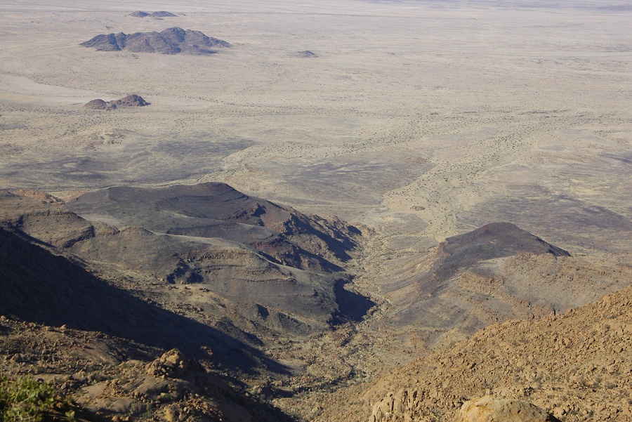
The descent on the far side was gentle at first, at first encountering a shallow basin with a large boulder in the middle, with a very fine eared serpent depiction on it, site G28. From here our way down was still hidden, but already we had a superb view of the Spitzkoppe and Erongo hills, standing out sharply on the horizon about 100 kilometres away.
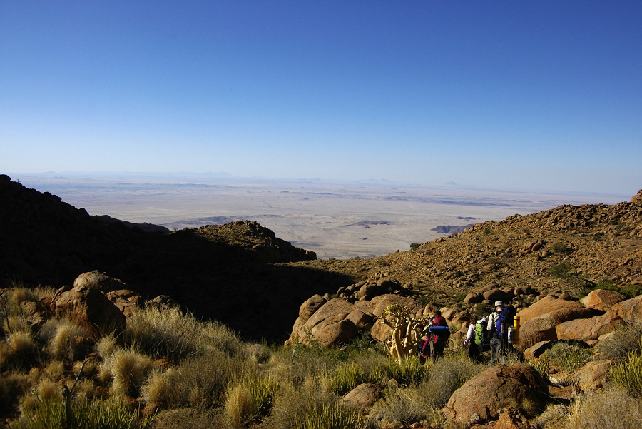
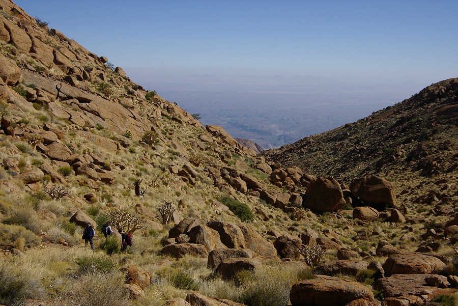
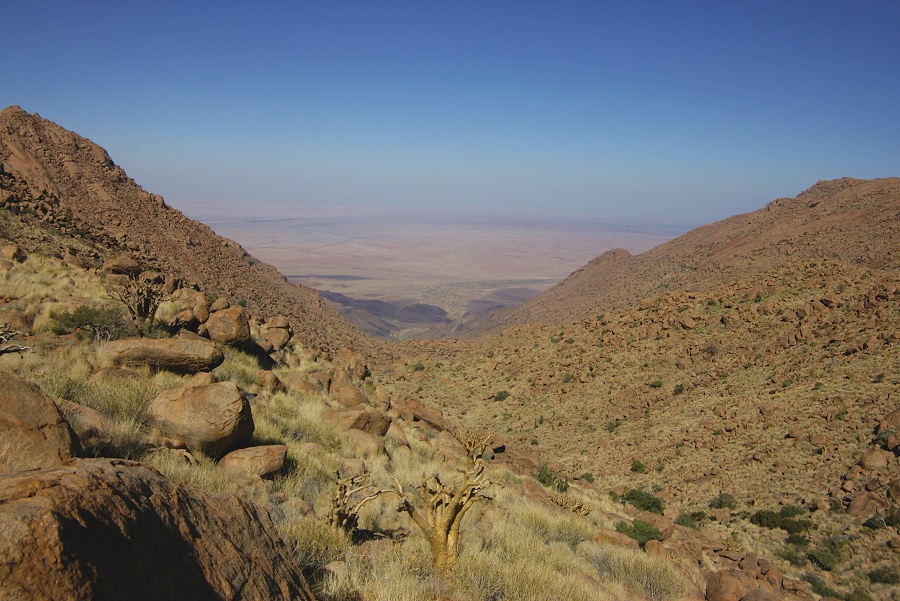
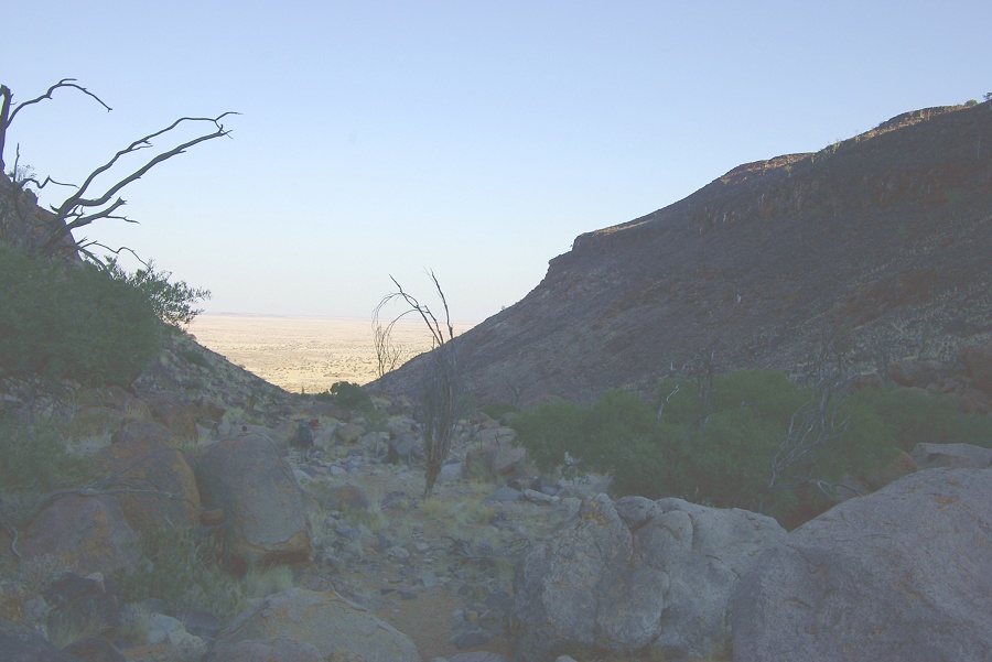
Passing the edge of the small basin, we had our first full view of the Ga'aseb gorge and our destination where a car pickup was arranged for that afternoon at the mouth of the gorge, about 1300 metres below us. From hereon we started our descent in earnest, zigzagging along the steep hillside.


On our way we passed by site G20, and as we made progress we passed the high ridge blocking our view to the west, and the blue streak of the Atlantic Ocean came into view.


At this point the steep bouldery slope gave way to a series of sloping interconnected granite plates. Whether easier or more difficult was a matter of personal taste, even though the granite offers good grip, and one can safely walk down on inclinations of less than 40 degrees, it is very tiring to walk in such posture especially with the backpacks. We soon had very aching feet, and were still way above the half-way point.

We continued down the smooth sloping granite in this fashion till midday near the half-way point, when we had a longer pause to eat whatever we had left (our supplies were calculated well - by the time we reached the bottom we just had two packs of bread left, and a few snacks, everything else was consumed, together with almost all of our water), before continuing again downwards.
Continuing our way down, we passed another rock art site, which was found after our return and a careful study of the relevant volume not to be any of Pager's recorded sites. Unfortunately our taken route was quite far from the principal Ga'aseb sites, and given our progress a side-trek to any of them was out of the question. We continued past the site on the sloping granite, which here still had some seeping and flowing water, and after a couple of difficult segments, reached the end of the steep slope, where the valley started to flatten towards the mouth, some two kilometres away.
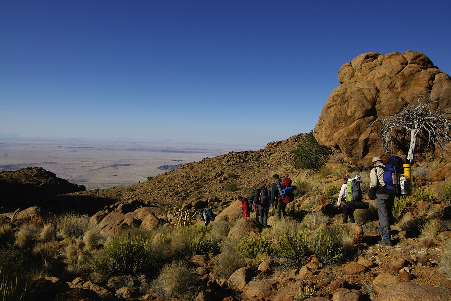
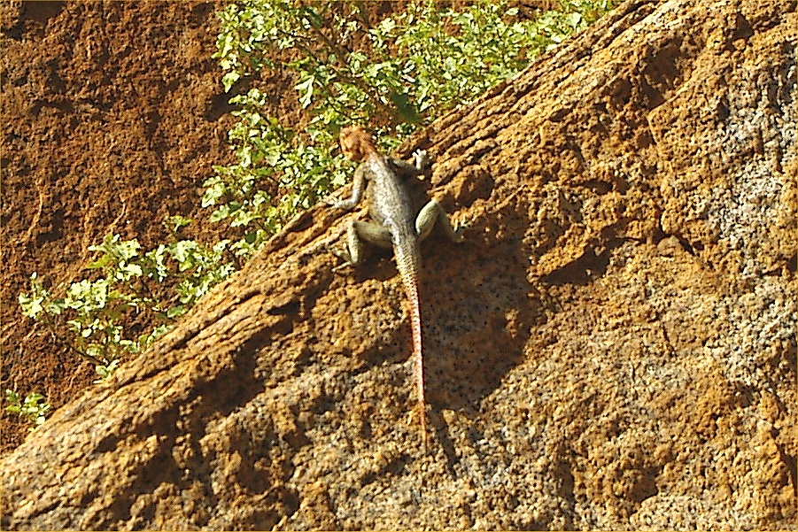
By this time some members of our party were seriously tired, and it was a rather slow struggle to make our way to the spot where the granites gave way to the Karoo series, the metamorphosed remnants of ancient sediments and lavas pre-dating the Brandberg massif. Here the going became better on the rubble slopes and terraces flanking the valley. Much to Viki's delight, who still had plenty of energy left to chase them, the big red and spotted yellow headed agamas familiar from the lower Tsisab started to appear everywhere, basking in the afternoon sun. They were curiously absent from the upper areas of the mountain.

It was another two hours till all of us made their way to the mouth of the valley, with the sun having disappeared behind the mountain. The turning point at the end of the road empty, but after a few calls it became clear that Karl was waiting in the next valley to the north, within half an hour we saw the approaching headlights, a very welcome sight after the long day.
It was another hour of bumpy ride in Karl's pickup till Uis and the comforts of the White Lady BB, with the first warm shower in ten days, and the prospect of a cold beer in the only restaurant of the town an hour later.
Day 13. - Twyfelfontein
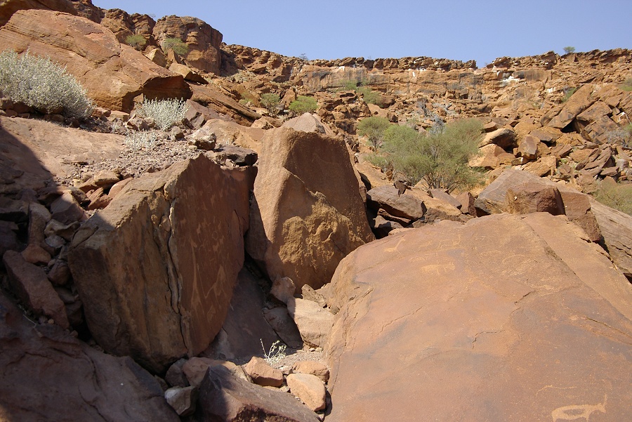
After the gruelling last two days, we finally had the prospect of a lazy morning, followed by a leisurely day. Mark and our minibus has arrived to Uis the evening before as agreed, our plans were to drive up to the rock art sites of Twyfelfontein to the north of the Brandberg, about 120 kilometres away (this was also a reserve day, in case we need an extra day to get off the mountain for any reason).
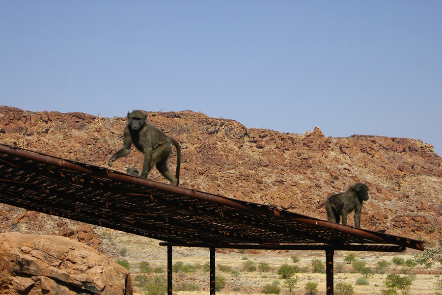
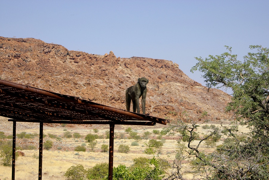
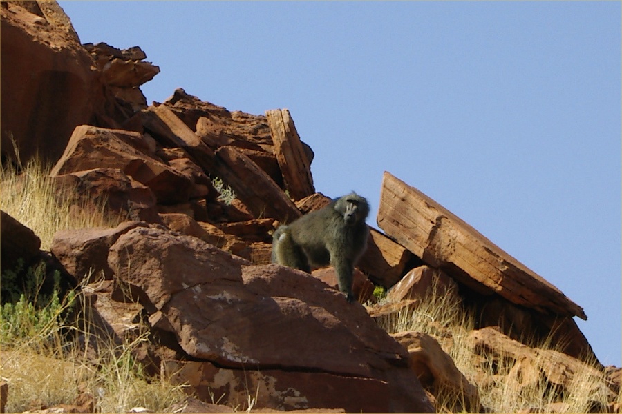
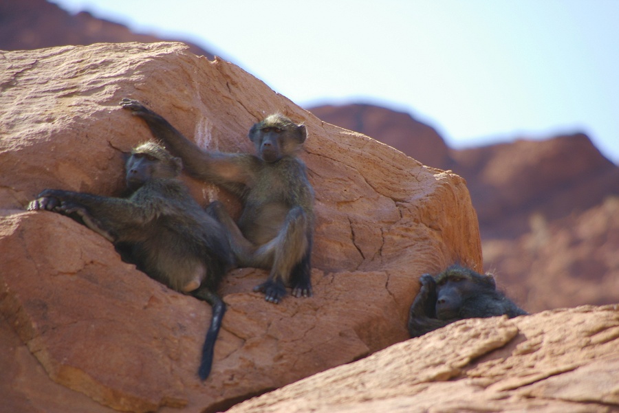
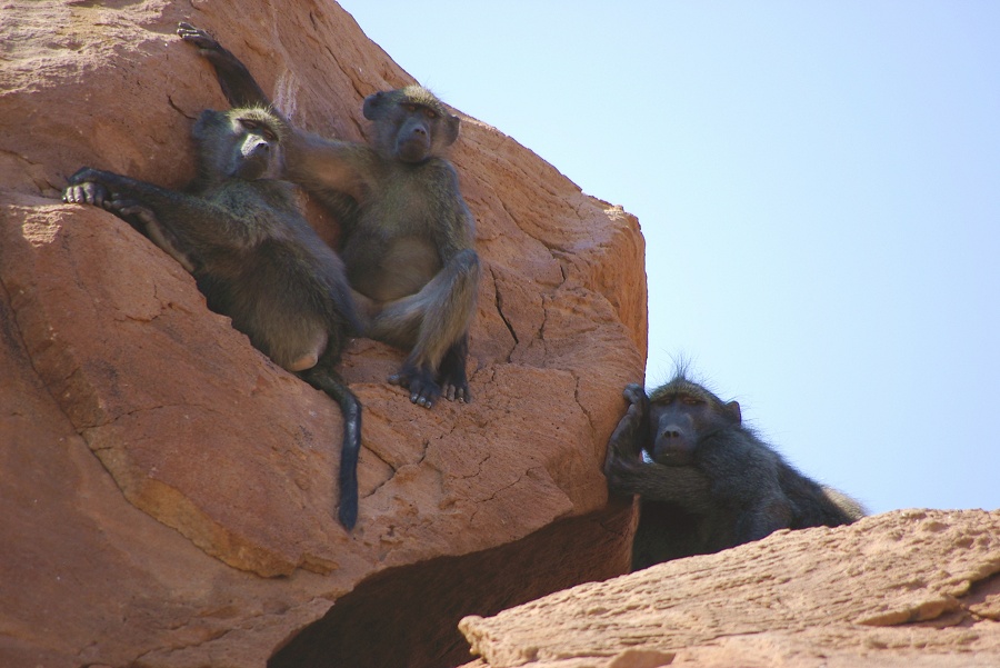
Following a drive among the granite knolls littering the country to the North-east of the Brandberg, we reached the parking lot at Twyfelfontein by late morning. The cheeky and fearless black birds and baboons, all expecting some scrap food, clearly showed that we were firmly back on the tourist trail.
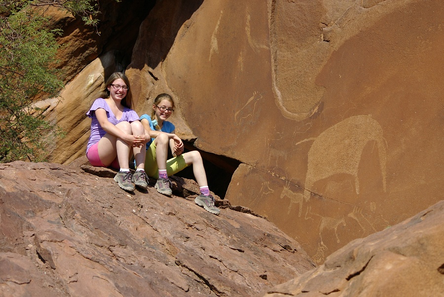
The visitor centre had been moved farther away and expanded since our last visit in 2005. We picked up our mandatory guide, and started out on the extended trail, that took us past several engravings and a large shelter with paintings which we did not see the last time.


The well was occupied by a rather noisy band of baboons, in clear anticipation that they might get something from us, but they had no luck this time.
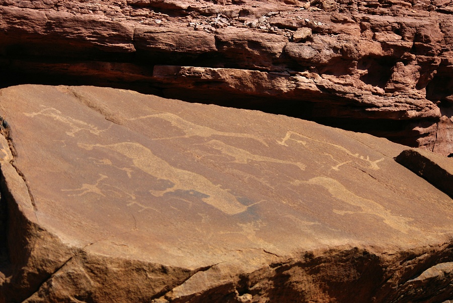
We continued along the main path, passing through the principal panels with engravings. Unfortunately the unsightly iron viewing platforms are still there, I'm sure there could be a less intrusive way of ensuring that the panels may be viewed and not touched at the same time.


We had our lunch in the visitor's center, entertained by the many tame creatures scurrying about our feet. Then we returned to Uis for a lazy afternoon of doing absolutely nothing at the White Lady BB till dinner in the evening.

Day 14. - Uis - Omandumba - Windhoek
After our morning breakfast at the White Lady BB we said our farewell to Alfons, Analene and Karl, and also Geert who decided to stay for a day, and accept a lift from Karl to Swakopmundand the day after to have a look around there for a couple of days left till the flight home. We were planning on stopping on our way back to Windhoek at Omandumba along the western side of the Erongo hills, site of several important rock paintings that were studied by the Abbé Breuil in the nineteen fifties.

Omandumba West is a farm among the Erongo Hills ran by Harald and Deike Rüst. Harald's father hosted Breuil when he came to study and copy the principal paintings of the north-western Erongo in 1948-50. Jon, who had been there previously, arranged our visit prior to our departure for the Brandberg. We were expected as we arrived, and soon moved into two 4wd pickups to drive through the rough trails to the main sites.

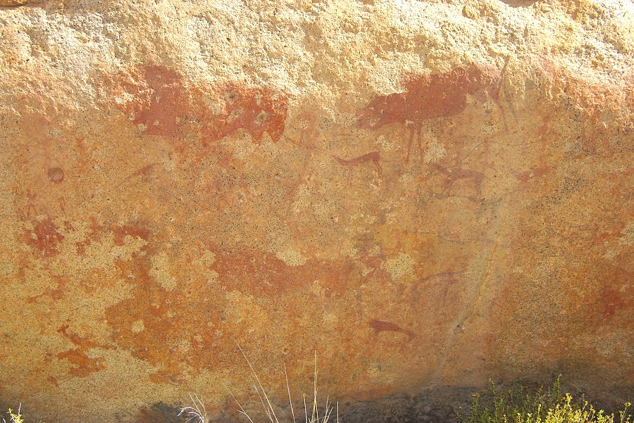
The actual sites we were to see have not been visited by Breuil, they were found after the Abbé's visit by Herr Rüst and Dr. Scherz. However they were published in Breuil's book Anibib and Omandumba. The first pair of sites we visited were named by Breuil Tuba Rock and Crown Boulder, and are just a stone's throw apart. The first is a large boulder on the left with some rather weathered paintings showing humans and animals.

Crown boulder about ten metres to the right is a major site, with a multitude of well preserved paintings. The name was given after a crown-like object in the centre of the main panel, however it may be any number of things, crown safely excluded.


On the rear of the boulder, there is a very well known scene of a bee swarm emerging from a tree and chasing away three hunters, plus several other depictions.
From here we continued along a fairly long drive to the principal site of Omandumba West, passing through the amazing scenery and the occasional cattle herds.

Torchbearer rock is a house sized granite boulder hidden among other rocks on a rather inconspicuous looking hill. There are paintings on all sides, but the principal panels are at the rear. The name comes from a group of human figures bearing what appear to be torches. The quality and preservation of the paintings makes this one of the principal Erongo sites.

After plenty of time at this site we returned to the farmhouse, where we were treated to a superb lunch of "just some salad and little this-and-that", which turned out to be the most delicious kudu and oryx steak one can imagine.

Having said good bye to our hosts, we started on the long drive back to Windhoek. Despite the warning signs by the road, there was not much in terms of excitement, we reached Windhoek by sunset.
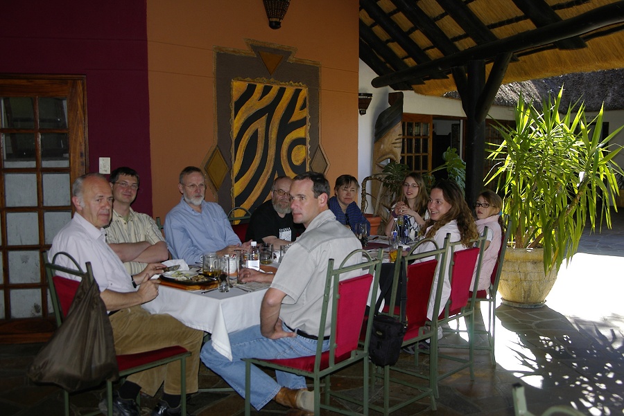
Our group parted at the downtown pension where those who took the Thursday flight stayed (Erkki & Leena planned to go to the Etosha Park for two days, while Jon to the National Archives to see the Pager copies and other available documents). We said our good-byes, and the rest of us were taken by Mark to a lodge half-way to the airport to save time the next dawn when we need to catch our flight.
Day 15. - Windhoek - Munich
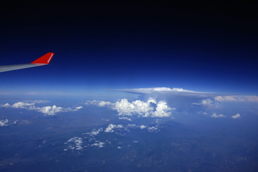
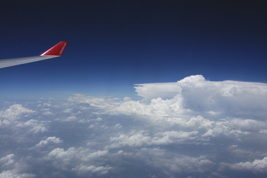
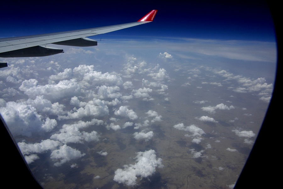
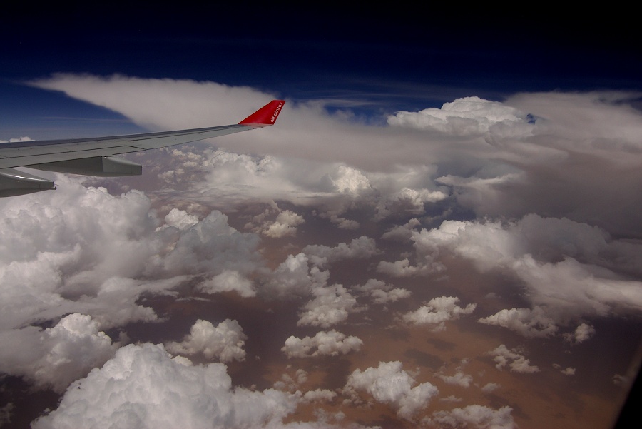
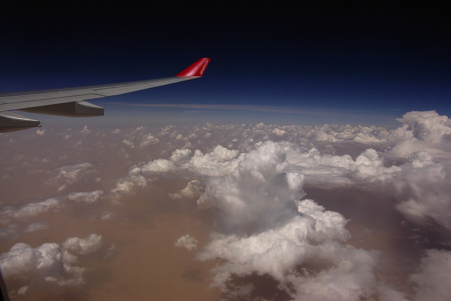
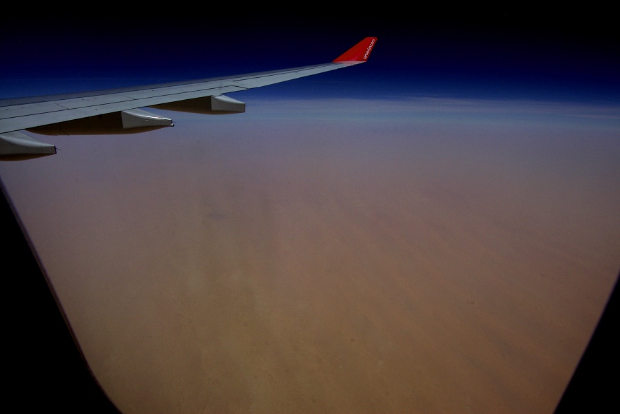
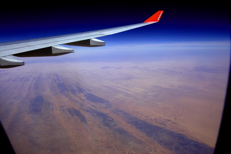
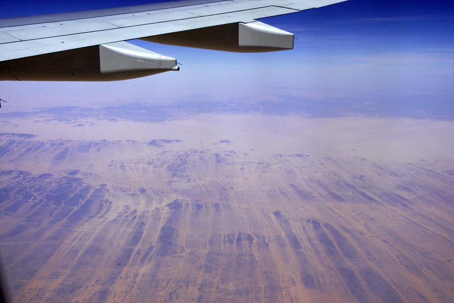
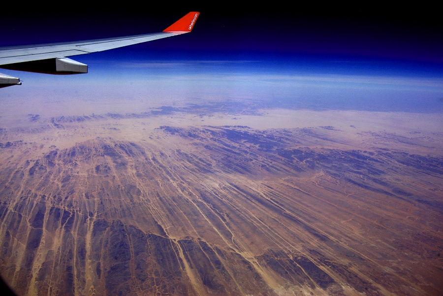
This day was practically filled with the 10 hour flight, something that would not be worth a mention except for the fact that it was the first time I ever took a daytime flight through practically all of Africa. With a window seat secured (actually the flight was not full, so I was free to move between the left and right sides as the scenery and the sun changed), I was particularly looking forward to the in-flight entertainment (it certainly beat the movies).

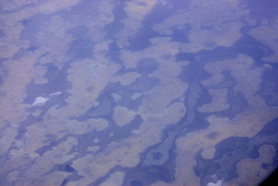
Our course was practically straight North, on a direct course to Munich. Soon after takeoff we passed the Etosha pan, with plenty of water left along the northern fringes.

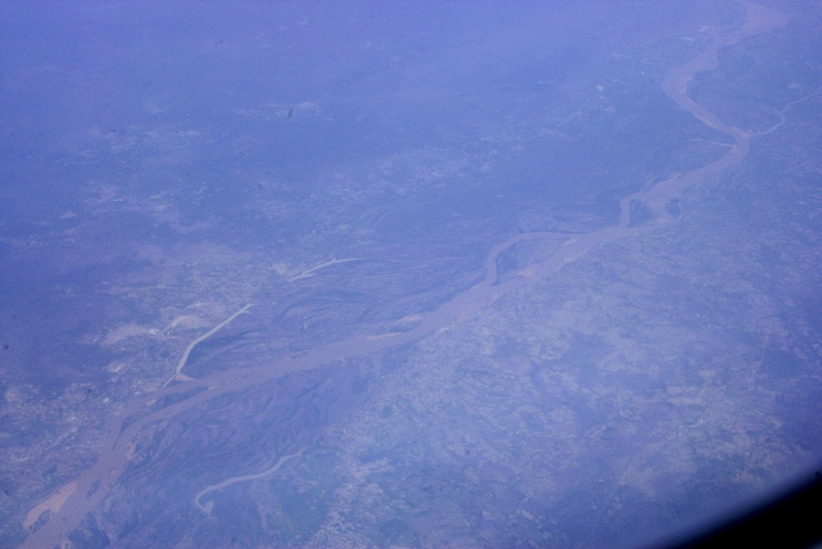
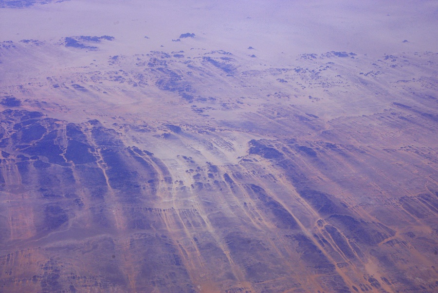
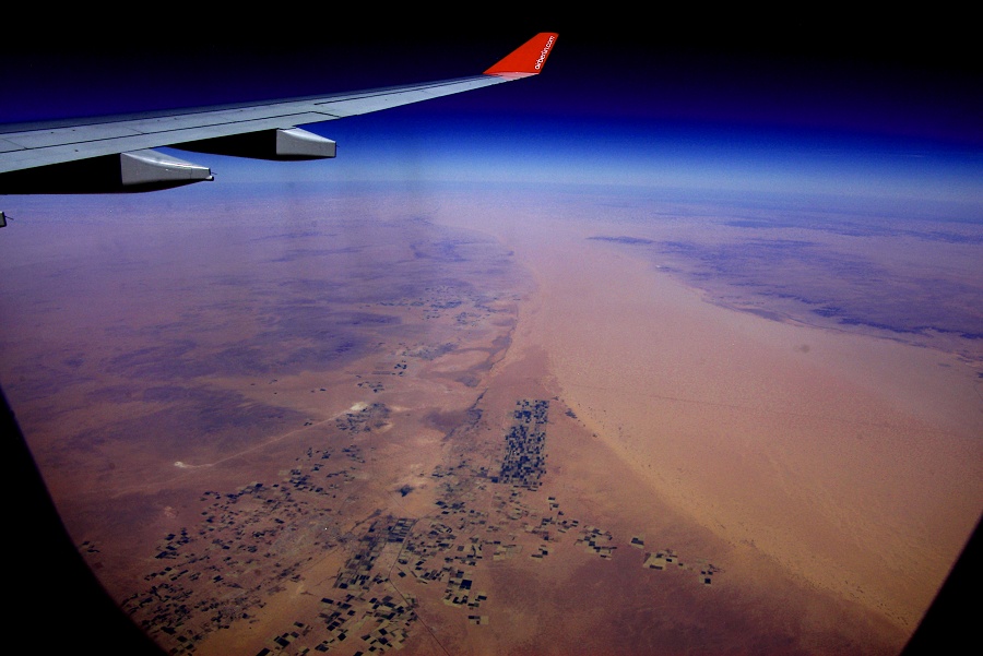
After Etosha we flew over northern Namibia, with a multitude of villages, each surrounded by a batch of barren, overgrazed land. The Angola border was a stark contrast, with nothing but unpopulated bush for nearly an hour, until we flew over a larger town (Cuanja, as I managed to identify later). In northern Angola we also flew over a spectacular canyon with a white water river flowing in it, later identifed as the Cuanza (Kwanza) River, at the point where it exits the Angolan plateau to the coastal lowlands.
It clouded up as we entered the equatorial region, all I could play with was capturing the setting moon behind our wingtip.

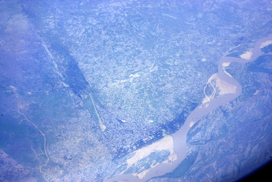
We passed a chain of big thunderclouds marking the inter-tropical convergence zone (where the northern and southern trade-winds converge) over southern Chad, and the clouds soon began to scatter revealing the Logone River, and soon the city of Bongor before N'Djamena (which was out of sight, right under us).
We flew over the eastern fringes of what once was Lake Chad, now a patchwork of dunes and isolated little lakes, and as we entered over the true desert, the clouds thickened, and soon we had to divert around huge thunderstorms that reached far above our flight level. It was amazing to actually see the rainy season over the southern fringes of the Sahara, could not help thinkinga of what it would be like to see clouds like this at Uweinat once...
The clouds ceased as we reached the Teneré, and for an hour we flew over a featureless yellow nothing.
We were passing to the west of the Tibesti mountains. Unfortunately we were too far to see the mountains themselves, however we did pass over the amazing eroded country flanking the mountains to the north-west.
We crossed over into Libya, passing to the east of Murzuq (over the modern development of Umm el Aranib), then over Sebha, reaching the coast just east of Tripoli.


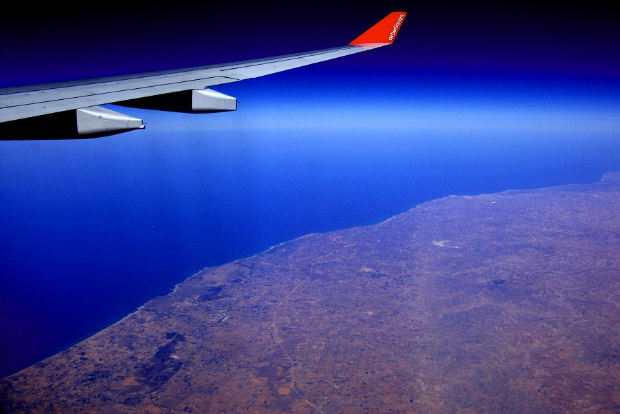
Gozo and Malta were just visible in the haze as we passed them, then came Sicily and the town of Palermo, and a spectacular chain of thunderclouds over the Appenines ended the show, as we started descending into Munich over the thickly overcast Alps.