
 Click on image for list of participants |
Upper Brandberg & Erongo Expedition 4th - 25thJune, 2019 Site references based on numbering system of Harald Pager (Upper Brandberg) and Ernst-Rudolf Scherz False colour images processed with dStretch, a freely available software developed by Jon Harman |
Day 1. - Windhoek - Uis
Uwe and ourselves both arrived to Windhoek the previous afternoon, spending the night in our usual haunt, the Pension Moni. After breakfast we did our rounds of shopping before setting out towards Uis, which we comfortably reached by lunchtime. In the afternoon I collected our NHC guide, Justus from the Tsisab ticket office, and we were all set to depart for the Brandberg the following morning.
Day 2. - Ga'aseb Gorge
We were planning two separate treks up the mountain. The first one was to be a four day trek up the Ga'aseb Gorge, then on to the Helm Pools in Hungorob, then proceeding up the eastern branch of the Hungorob which we never visited before to the Hungorob-Tsisab-Orabes saddle. From there we were to descend via the Orabes Gorge, visiting the mid-level sites on the way. The second trek was to be up the Naib valley, with a minimum goal to see Naib 80, which we could not reach with Magdi in 2017 due to lack of water. Should we find water, the plan was to continue up the Naib to see the principal sites in the main valley above the Naib basin, then cross over and descend via the Tsisab Gorge over the course of five days, meeting up with Dora & Gergő at the bottom.
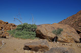
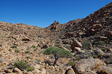
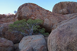
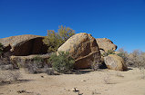
After an early breakfast at dawn, Karl drove us to the foot of the Ga'aseb Gorge, the starting point of the most used trail up the mountain (leading to the Königstein peak, the highest point of Namibia). The car soon disappeared, and we started on our long way up the mountain. It was 9m when we left the car, for the first two hours we trotted along the first gentle, then gradually steepening but easy path.


Around eleven we reached the first site, the rather nondescript G28 situated on a spacious terrace a little below the path. While the site itself is nothing special, it offered a good opportunity for a little rest after the non-stop climb.


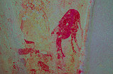
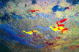
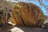
After the G28 terrace the path begins to climb steeply, and after ten minutes we stopped at the low rock just beside the trail with the magnificent and unique flock of Flamingoes (G32) which was not recorded by Pager, it was found by Alfons a few years back while guiding mountaineers to the peak.


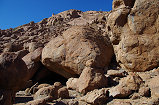
Continuing along the trail, we soon reached the bottom of the smooth but not too steep granite plates which offer the fastest and easiest way up. After an hour we reached the top, with the prominent boulder of site G3 offering good shade and resting place to catch our breaths.


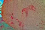
The prominent shelter of G8 (the finest site of the Ga'aseb, with the lovely rain giraffe) was looming above us, bt we resisted the temptation as we have all seen it (Uwe when descending with Alfons on the 2013 helicopter-supported trip. Instead, leaving our packs at G3 we aimed for the nearby G2, with the delightful scene of a giraffe family, situated in a spacious deep shelter under a huge boulder.


From G3 it was just a few minutes climb to reach the main lower cluster of Ga'aseb sites, centered around the huge boulders of G7. We made a brief stop at G5 for photos, then dropped our packs in the shade of G7 for a longer rest (and photo session).


After the midday rest we set out again upwards along the trail, and after a relatively short climb reached the broad terrace with the major site, G1 along its western edge. With the several large but faint and difficult to photograph panels, we spent nearly an hour here to take in all the finer details.


The boulder of G9 was just a short distance higher, here we only made a brief stop, but still I have managed to find the second panel of paintings which we missed on our more hurried previous visit.


Previously we have only descended the Ga'aseb (in 2010 and 2012), I remembered this particular stretch above the middle concentration of sites as one of the easiest, but that was of course going down. This time it was another two hours of increasingly tired struggle up among alternating boulder fields and smooth granite plates, it took us a good two hours to reach the cluster of boulders with the surrounding flat terraces, site G15, where we also camped with Angula and Thomas in 2012. The sun just set on the plain below as we reached our bivouac.


Day 3. - Ga'aseb Gorge - Eastern Hungorob Gorge
At first light, leaving our packs behind at G15, we set out to see G11, right under the looming cliffs of the Orabeskopf. The route was rather difficult, but without the heavy packs it was a breeze compared to the climb of the previous afternoon.


In 2012 I hurried past it on the way to G12, only noting a single panel. However the tracings of Pager reveal a total of 12 panels on various facets of the huge boulders that make up the site. As it turned out, the one I saw in 2012 was the main panel, all the others are just a few figures, mostly so faint that hardly anything may be made out on the spot. Nevertheless, having made the effort, we diligently searched for all of them.


Justus and Magdi returned to camp, while with Uwe we took a slightly higher route to search for site G16, about 100 metres above our campsite. Fortunately it was easy to find along the edge of a small terrace, and in the deep thorny thicket beside one of the panels we found a litter of three or four shivering baby hares (Lepus capensis), their mother must have fled on our approach. We left them in peace, poor little things must have had the fright of their life.


The site itself was certainly worth the small detour, there were two fine panels of paintings on two separate blocks.


At dawn we just had a quick coffee before departing, now we had a proper breakfast on our return before packing up and getting ready to continue the climb. The sun just rose above the ridge to the east as we departed, requiring a good hour and a half to reach the large terrace marking the upper end of the Ga'aseb. Site G27 was on the northern edge of the terrace, the trail going in the middle bypasses it, but now we made the detour to have a look. It is a very imposing shelter under large boulders, but there are only a couple of very faint figures.


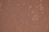
It emerged that when Uwe descended with Alfons they missed the main site of this terrace, G28, which is just adjacent to the trail. Leaving our packs, we went to take a look (and photos) of the very impressive eared serpent and other figures.


We climbed the last remaining low ridge, and soon we were in Hungorob, looking down into the eastern valley and the Helm Pools. Bu noon we were approaching the bottom, when passing a low rock we spotted some paintings on it (H153). There is a single recognisable animal figure plus some 'or somethings', after verifying back home in the Hungrob volume, it appears that this is a site Pager did not copy (though possibly it was recorded).


On both occasions when we passed the Helm Pools we were in a hurry, so we only looked at the main site of the area (H3), leaving a scatter of lesser sites unvisited on both sides of the trail. One of these was H9, a short distance to the left of the left of the trail as we approached, with several faint figures on a large boulder.


The series of basins in the smoothed rock of the watercourse were just a short distance beyond H9. Even though we were told that they hold water at the Tsisab ticket office, it was a relief to actually see the pools. Our trek was dependent on finding water here, we could only carry three days worth in our backpacks, so were these pools dry, we would have had to turn back immediately and return the way we came to reach the foot of the mountain by the end of the third day, abandoning all plans.
Fortunately this was not the case, there was good water, so we settled down in the shade near the pools for a quick lunch and some shade. Magdi and Justus felt entirely happy to take a siesta while we set out with Uwe to scramble over rocks and bush to find two lesser sites around a pleasant basin some way below the pools. The first of these sites, H7 was quite unique, high on a ridge facing the cascades as the valley descends from the pools. There is a strange abstract shape, reminiscent of 'Crane rock' (I20) or the 'Picasso' in Nuwuarib, but on a much smaller scale, accompanied by a few figures and animals.


The other site, H8 was a large rock at the edge of the flat basin, with a number of fine human figures on the wall of the shelter underneath.


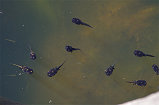
We returned to the pools to fill our empty bottles, and found them to be teeming with life. There were the big fat tadpoles (Marbled Rubber Frog, Phrynomantis annectens) which we have seen at other times, but more surprisingly the same pool was also full of small fairy shrimps (Anostraca) which we have seen previously in the Tassili n'Ajjer but never on the Brandberg.


We still had more than an hour till the agreed 3pm departure, with Uwe we went to explore the large plain upstream of the pools. Site H3 is spread out on several large boulders at the south of the plain almost next to the road, and there were two more lesser sites along the southern edge of the plain further east, we started at the more distant (H13), an enormous pointed boulder that was clearly visible form afar.


We easily found H12 just a few dozen metres further west, a smaller rock with just some faint figures on the rear side.


Site H14 was somewhere along the rocks bordering a terrace along the northern edge of the plain. Here the topography was much less clear, it took some time t find the cave-like shelter hidden among rocks. One of the shortcomings of the Pager tracings is that (intentionally) they give no indication on the state of preservation, so one only finds out on the spot how the paintings actually appear in real life. In this case we were very pleasantly surprised to find a perfectly preserved panel of fine human figures deep inside the shelter.


We still had a little time left to visit site H3 before returning to Magdi and Justus. When we visited this site in 2010 and 2012 it was both times morning, the most important west facing panel was in the shade, but several other fine panels looking east were hopelessly on the sun. This time it was the other way around, providing a perfect opportunity to complete the photos of this huge site.


By 3pm we returned to the others, and without much ado lifted our now again heavy packs and set out up in the eastern branch of the Hungorob. Unusually for the Brandberg, the way was actually easy, with a low gradient and many smooth granite plates to ascend on. In about 20 minutes we reached a pair of large conspicuous boulders, which have no rock art, but marks a series of pools in the watercourse.


Soon after the pools we reached a large flat terrace, seemingly a very comfortable living space with the pools nearby, but there is only a single site here, H15 among a cluster of rocks on the western edge of the plain.


We continued further upstream across the terrace, and in the ravine leading up to the next level we passed H16, a rather nondescript site in a shallow shelter above the watercourse, the first of a cluster of five sites in the mid-section of the eastern Hungorob.


As it was approaching sunset, we did not search for the remaining four sites, but looked for a suitable sandy stretch in the riverbed to make a bivouac for the night, leaving the paintings for the next morning.
Day 4. - Eastern Hungorob Gorge - Orabes Gorge
With the crisp morning at altitude we did not hurry to get out of the warm sleeping bags, the sun was already striking the surrounding peaks when we emerged from the cocoons. After a quick coffee we set out to find the remaining sites, as all faced east and were soon to become invisible. The first, H20 was straight forward to find in a low shelter under a boulder on the terrace above our bivouac.


Site H19 was a bit trickier to find, as it was on the vertical face of a rock which was one of a dozen, but being in the possession of the coordinates recorded by the HBI team, we soon found the fine sole figure of the running archer.


Site H18 proved more elusive, we searched all about the indicated position but found nothing resembling Pager's drawing. Seeing that H17 in the riverbed was coming out into the sun, we dashed there to take photos of the fine group of figures while still in the shade.


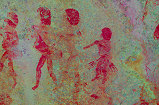
While with Uwe we were busy at H17, Magdi gave a yell from above, she found H18 a good 30 metres from the indicated position, just in the nick of time as in less than ten minutes this too would have been fully out on the sun. This was the finest site of the lot, with a long procession of human figures along the face of an elongated boulder.


Mission accomplished, we returned to our bivouac for quick breakfast before continuing up the valley, which rose at a pleasant gentle gradient. Not far from where we slept, we found a cluster of yet to be identified shrubs (I thought it was wild cotton, but it's not) which had fibrous, cotton-like seeds, from which I could easily spin a thread.


After a climb of about 45 minutes we reached site H22, along the side of a low rock ridge bordering the main watercourse.


Soon after H22 we reached the area where the remnants of the uplifted Karoo lavas still covered the Brandberg granite, and the weathered basalt created a strangely spongy, soft terrain, very easy to walk on. The vegetation changed too, with blooming aloes with pretty red flowers (Aloe hereroensis) everywhere.


We were abeam of the upper concentration of sites in the valley, but we have all seen those on the 2014 trip, so we bypassed them in favor of having more time in the Orabes. With the easy terrain, it took just two hours from the bivouac to reach the triple saddle between Hungorob, the Tsisab and Orabes gorges.


We made a short pause for rest in the shade of the big tree at the southern end of the pleasant plain at the start of the Orabes Gorge, then began our descent towards the upper cluster of sites. In 2014 we were not properly prepared, and only found three of the six sites in the maze of similar-looking rocks. This time all the sites were positively identified on Google Earth (or at least we thought so), so the chances looked better. We went to O4 which we already found last time, and left our packs there to lighten the load while searching for the other nearby sites.


This time we found O9 straight away, in a shallow shelter along a ridge about 200 metres south of O4. Clearly in 2014 we were just dozens of metres away, failing to spot the small but fine scene of a gazelle with its young.


O8 was only 80 metres from O4, but among a jumbled mass of boulders, even with the precise coordinates it took some time to locate the actual panels, spread out over a larger area.


Collecting our packs, we continued to the next known quantity, O6 with the fine large figure and the accompanying tiny ones. From here we carefully searched the same ridge to the north, and this time found O5 without difficulty just 60 metres away. In 2014 we probably walked just past it.


With all the missing sites located, we went to the huge site of O7 for a longer rest in the shade under the enormous boulder. We also had time to photograph all the panels at leisure, unlike on the previous hurried visit.


After an hour of rest we continued down the Orabes towards O21, the main site of the middle concentration. Soon after passing O7 we reached a little terrace full of the characteristic 'Brandberg halfmens' (Euphorbia monteiri ssp. brandbergensis, distinct from the Pachypodium namaquanum plants also referred to as 'halfmens').


After the terrace the terrain steepened and the going became much more difficult, the horizontal distance between O7 and O21 is measured to be only 800 metres, but there is a 300 metre altitude difference, of which at least 200 is a near-vertical cliff, requiring a sizable detour to the east. In 2014 we had the somewhat naive idea that we will do the trek down to O21 then back again, but seeing the terrain we decided (very wisely, in retrospect) to retreat.


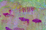
It took us a full two hours without stopping to reach O21, even Uwe admitted with some reluctance that it was a good decision to turn back in 2014. The site itself consists of two enormous granite boulders embedded into the steep hillside below the cliffs. There is no real shelter, but at least there is a little flat ground in the lee of the rocks, a rare commodity in this very harsh terrain. The main panel of paintings is on the left boulder, a large scene depicting a large group of small human figures, though it is not very clear what exactly is happening.


There are some more paintings along the base of the right boulder, but less exciting than the left panel. Sunset was approaching as we finished with the photos, but we still had an hour of daylight left, after a little debate we decided to continue to the cluster of other sites about 100 metres lower in altitude and find a place to camp there.


In retrospect this turned out to be an unwise choice. As we descended to the vicinity of the sites, we could not find a single flat patch large enough for a person to sleep, not to mention four. We had to descend far below the sites to find a series of tiny terraces, quite far from each other, where we could prepare a bivouac. The little terrace in front of O21 would have made for a much better camp. Nevertheless we made the best of the situation, and we soon had a little campfire going, and a lovely view overlooking the valley, with the lights of Uis in the distance and the silhouette of the Erongo on the horizon.


Day 5. - Orabes Gorge - Uis
In the morning leaving our packs behind, we climbed back to the slope above camp to see the two sites we bypassed the previous evening in search of a campsite. O26 was straight forward, a huge boulder about 100 metres above our bivouac, with a small shelter underneath containing the paintings, unfortunately some of them already out on the sun.


O25 was rather more difficult to find. While it was quite obviously among a cluster of huge boulders adjacent to the main watercourse, having left Pager's site plan in the backpack below, it proved to be frustratingly difficult to find. We finally came upon it in a very small little shelter under one of the huge boulders on the side away from the watercourse.


Our plan was to check out all the sites in this middle cluster of sites, but the search for O25 took up all our allotted time, we had to return to our packs and start our descent along this untried route to be sure to reach the bottom by sunset. Our route down bypassed the huge funnel-like steep granite slopes (which appear too steep for safe passage) leading straight down, crossing over instead to the Eastern branch, where a manageable-looking less steep rubble slope offered a reasonably easy way down. We took the easiest looking route, which fortunately did turn out to be just past the prominent boulder with sites O27 (just missing O22 and O24, higher up the slope).


Site O28 was just a little below, facing towards the steep slope, a rather insignificant site with just a single animal figure.


We continued down towards a little terrace behind a ridge bordering the steep slope (which in retrospect would have made a perfect camping spot), with a boulder in the middle with a single painting (site O29) serving as a landmark for the easiest way.


On the far side of the terrace the terrain dropped steeply in an uninterrupted rubble slope leading down to the ravine of the eastern Orabes. The only piece of flat ground was a small terrace on the far side of the watercourse, our aiming point. It was not a particularly difficult slope, but still according to the timestamps on the photographs it took us over two hours to reach the terrace, of which it must have been almost an hour to make it across the densely overgrown riverbed, strewn with huge boulders to make the crossing even more challenging. Finally around noon we reached the terrace, and were a little surprised to find paintings on the two boulders at the southern edge. After consulting the scriptures, it became clear that we unintentionally stumbled upon O30, our intent was to cross the riverbed a couple of hundred metres below it. Clearly this too is a landmark site, along the easiest (practically the only) way to the upper reaches of the Orabes. While I photographed the panels, Magdi spotted a motionless stripe-bellied sand snake (Psammophis subtaeniatus) trying to blend in among the vegetation. After realising that it had been spotted, it quickly slithered away, but not before I could snap a few photos.


We took a short rest and a quick lunch on the terrace, then continued to the ridge a little above, from where we hoped to see a continuous slope leading down to the base of the mountain. We were not mistaken, this stretch was the last uphill climb among the big granite boulders, from a little terrace on the ridge we could see the relatively easy continuous way down. From this point there was also a superb view over the valley and the terrain we have crossed, with our bivouac at the upper end of the steep granite plates now reaching far above us.


Despite the way being relatively "easy" with lightened packs, it still took three hours to reach the bottom of the slope and the riverbed a little above the reliable rock pools (and the sites recorded by Scherz). The pools were occupied by a band of baboons, however they were surprisingly well behaved, there was hardly any rabble just a few grunts as they sat on the rocks above and waited for us to pass. In another couple of hundred metres we reached the end of the tracks, where Karl was waiting for us with the car to take us to Uis for a comfortable rest at the White Lady B&B.


Day 6. - Uis - Naib Gorge
With the water situation on the mountain not particularly encouraging, already on our way down we debated what to do on the second trek, as it was rather unlikely that we could accomplish the originally planned traverse from Naib to Tsisab. Justus confirmed that there was no water in the Tsisab, and our previous experience in the Naib was not too encouraging, that corner being the driest part of the mountain. Magdi was not particularly enthusiastic about a climb up the Naib just to see if there is water to be found, she elected to stay down in the comforts of the White Lady while with Uwe we planned a shortened trek just in the Naib, going as far up as water permits, then returning the same way, avoiding the need to be driven there. We spent the morning relaxing by the pool at the White Lady B&B, and in the afternoon we drove around the mountain to camp at the end of the Naib track, planning on an early start up the next morning.


Day 7. - Naib Gorge
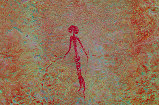
We left the car at dawn (6am), as soon as there was enough light to see a few steps ahead. We carried four bottles of water, enough for two and a half days, hinging our plans on the state of the big pool above the Naib basin. It was still before sunrise as we passed the fine procession of human figures (Naib C), the highest site Scherz recorded in the valley.


We continued up the trail Alfons marked out in June 2015 when we first climbed up to I15 with Magdi. With the marked trail the going was fast, we reached the big rock of site I65 while it was still well in the shade, revealing the main panel that is completely invisible later in the day when the sun shines on it.


From here there was no more marked trail, we needed to turn up towards the steep valley side, towards the huge rock marking site I15 still high above us. However it was still relatively cool, and we could continue in the shade, with our light packs we made quick progress. By 9:30am we were up at the site which was still entirely shaded, just three and a half hours after leaving the car. Leving our packs at I15 we set about to explore the nearby sites. I16 was somewhere straight above, in 2015 we missed it, this time we found it straight away at the rear wall of a small terrace immediately above the main site. It is a relatively minor site with just a few not too well preserved figures.


We also visited the nearby huge shelter of I13, where with Magdi last time we missed the most interesting panel. This time armed with Pager's site plan we could find it after some searching, hidden on the inside lip of the shelter, about half-way along its length, with a fine smaller panel just opposite on the rear wall.


Returning to the principal site (I15), we spent a long time photographing and just marveling at the wonderful compact panel, one of the finest ensemble of paintings on the mountain.


Around 11am we set out to continue, trying as much as possible to retain the gained elevation while returning towards the bottom of the valley as we continued upstream. By this time the valley was fully out in the sun, and it soon became very hot with no wind whatsoever. Reaching the riverbed, we stopped at the base of suitable shady rock for a long midday rest, only continuing when the heat started to abate mid-afternoon. In all, it took us a good six hours to reach the edge of the Naib basin, a mere 200m metres above I15 in elevation, with a horizontal distance of just 1.3 kilometres. We dropped our packs at our planned campsite in a sandy stretch of the riverbed just as the sun was setting behind us.


Day 8. - Naib Basin
At sunrise we set out to check out the principal waterhole of the Naib basin, located near the bottom of the ravine leading up to the Karoab saddle. We passed site I23 just beside our camp, and made a little detour to the small rocky hill in the middle of the basin to see site I24 before the sun strikes the rock face, rendering the paintings completely invisible.


Given the state of the vegetation and the very dry overall appearance of the valley it came as no surprise that the waterhole was dry. We climbed a little higher to see site I29, with the huge rhinoceros which I failed to properly discern in June 2017.


We held council on how to proceed given the water situation. We had enough water to last another day if used sparingly, not enough to reach any of the potential water sources in the upper Naib with enough reserves to return if no water were found, a rather likely scenario. We had to be down at the car latest by late morning the next day. This left us with enough time (and water...) to make the climb up to site I80 with the magnificent Kudu, which I already wished to see in 2017 but had to give it up for the same reason, the lack of enough water. With the lower Naib turning into an oven in the afternoon, the most sensible choice was to spend the remainder of the day visiting the sites of the Naib basin, then making a rapid descent in the cool of the morning with the valley is still in the shade.
There were two sites close to the waterhole and I29 which we had to skip with Magdi in 2017 due to a lack of time, now we started with these, just a few minutes below the granite plates, among rocks littering the scree slopes. We started at I28, a fairly large site spread out over several blocks, but only one panel worth mentioning. I27 was about 100 metres further down-slope, a large pyramidal rock with a panel of paintings at its base. We just finished there before the sun rose above the eastern bulk of the mountain.


Site I80 is situated on a large prominent rock on the southern slopes near the eastern end of the basin, a good 200 metres higher in elevation. The terrain was not particularly difficult, and after a while we were quite certain about our destination, a prominent outcrop with nothing comparable in the vicinity. It took us about an hour to reach it, finding the main panel with the large kudu completely exposed to the sun, and due to its orientation staying like that for the rest of the day.


The panel was high above our heads, and we had no means of shading it, so had to make do with photos taken on the sun. Fortunately the light was almost perpendicular, there were few disturbing shadows. To be honest, the site was a bit of a let-down, from Pager's tracing I expected the Kudu to be much more spectacular, akin to the "okapi" (in reality a hartebeest) at N162. The figure is very weathered, perhaps in the shade it would have been a bit better, but out on the sun it was hardly visible, and even dStretch fails to improve it as much as one would wish.


There is a scatter of lesser sites below I80, towards the bottom of the valley. The first one encountered was I81, a rock ledge offering some shade in the afternoon, with just a small panel of paintings.


Located under a large rock further downhill, I82 proved to be much more interesting with a fine procession of human figures in the small shelter under the rock.


There was another site, I83 somewhere on the ridge between I82 and the main watercourse, but being on a small boulder it turned out to be impossible to find, quite possibly we walked right past it. By this time it was approaching noon and becoming rather hot, we walked back along the scorched basin to our campsite where some big rocks offered good shade for the whole day. Along the way I spotted the dry remains of a large millipede, the first I ever saw on the Brandberg, and also a plant that closely resembled a dry Rose of Jericho (possibly Geigeria ornativa ?).


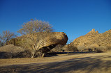
The worst of the midday heat offered the perfect opportunity for the lengthy photo session at "Crane rock" (I20), the most important site in the Naib Gorge, just a few dozen metres from our camp. The shelter under the big flat rock is always in the shade, and the openings on all sides permit the movement of air, so it is pleasantly cool even in the worst of the afternoon heat, no wonder it was picked for the amazing paintings.


Once the heat started to dissipate, we set out to make a round of the three sites around camp, I21 and I22 in the same big cluster of rocks to the south of the riverbed, and the northern side of I23 which comes into the shade in the afternoon.


We still had an hour of daylight left, so we returned to I20 to take a few more photos and just marvel at the paintings until the lights were switched off as the sun dropped below the horizon.


Day 9. - Naib Gorge - Lower Numas Gorge
We were up again at first light, and after a quick cup of warm coffee started on our way down before sunrise to make the most of the cool of the morning and the shade in the valley. Soon after the start of the descent we encountered the only living creature in the Naib, much to our surprise a very much alive black millipede. There was nothing else eventful for the rest of the way down, until the sun caught up with us around site I65, with I15 already high above us. As the heat intensified, it brought out the millions of tiny irritating sweat bees which kept us an unwelcome company all the way down to the car.


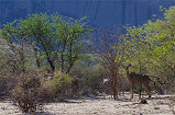
With nothing more left to do in the hot Naib valley, after some rest and a decent brunch we got into the car to make the short drive to the entrance of the Numas gorge, to spend the remaining day visiting the sites recorded there by Scherz. As we entered the Numas valley we finally saw some wildlife, a single Southern steenbok (Raphicerus campestris ssp. campestris) and further in a pair of Hartmann's mountain zebras (Equus zebra ssp. hartmannae) walking out along the well worn game trail leading to the aptly named Zebrawater spring.


With a couple of hours left till sunset, we parked the car at the campsite and set out to see the nearer cluster of sites. The regular trail leads along the western side of the valley, but this time we decided to go along the eastern bank, and not far from the campsite Justus found a faint panel of paintings on a large boulder which to my knowledge have not been reported before (tentatively designated Site 77/T using Scherz's numbering scheme).


We made a detour to the eastern tributary to see the big shelter (77/R) with the anthropomorphic baboon (uniquely holding a bow and arrows), another unpublished site which was only discovered a few years ago.


While with Uwe we were taking photos at the baboon shelter, Justus, having acquired the taste for it, started exploring the rocks and shelters at the entrance of the tributary, and found more paintings in a low shelter (77/S1).


Just outside the mouth of the tributary, more paintings were found on a vertical wall. Very little was visible on the spot, but dStretch revealed two women plus some fainter damaged figures (77/S2).


Thoroughly searching all the rocks in the area, Justus found another single but fine human figure holding a bow and an arrow (or stick ?) on the side of a round boulder (77/S3) a few metres from the previous panel.


We continued along the eastern bank till Scherz's site I with the fine eared serpent depiction and many other scenes. With the afternoon light it was now fully in the shade, providing a good opportunity to take photos of the lesser details missed during the previous hurried morning visits.


With a little time left till sunset on the way back to camp, we set out to search for two of the yet unlocated panels reported by Scherz at his site K, about half-way between site 77/I and the campsite. Spreading out, it did not take long to find both, the first a pair of figures in a small cave formed under a cluster of boulders, the other a procession of human figures under a large flattish rock.


While we searched the rocks the sun descended ever lower, and the Numas valley turned to the characteristic flame colour that gave the Brandberg its name. We reached camp just as the sun dipped below the horizon.


Day 10. - Lower Numas Gorge - Uis
Early morning we set out to reach the cluster of sites reported by Scherz on the rock island adjacent to the Zebrawater spring, about two kilometres upstream of camp. When making a day-trip from Uis these sites are already out on the sun for most of the day, this was a welcome opportunity to photograph all the panels that are practically invisible later in the day.


We checked out Zebrawater, it still had a sizeable shallow pool of water, clearly the Numas valley received some rain further upstream, unlike the completely dry Naib.


We still had some time while the valley was in the shade, we could photograph unhindered sites 77/D and 77/B a little upstream of the pool.


While with Uwe we were taking our photos, Justus enthusiastically searched the rocks along the edge of the valley, and did find a cluster of rocks hiding a shelter with some paintings inside, which again appear to be unreported. By now the sun flooded the valley, and we started on our way back towards camp, catching site 77/J just in the nick of time to be able to take a shot of the panel still in the shade.


It was still only half past eight in the morning, not being pressed for time we took the long route back towards camp along the riverbank, rather than the more direct and easier game trail. Justus again searched the rocks, and found two more small sites with paintings. I suspect a good systematic search of the lower Numas would probably reveal many more.


We found nothing else as we returned along the western side of the valley, finishing at the known site 77/N near the campsite, recorded by Scherz. Despite having looked through the site several times, in the different light of the morning I spotted a small panel on the western wall of the shelter which did not show up on any of my earlier photos.


With nothing much more left to do, we had a quick breakfast and packed up camp, passing by site 77/A at the entrance of the valley before taking the bumpy road back to Uis for a good shower and a lazy afternoon.


Day 11. - Brandberg, Tsisab Gorge
Dora and Gergő arrived from their tour of Etosha the previous afternoon, in the morning we set out for a day-trip to the Tsisab Gorge sites together. There was some commotion at the White Lady B & B in the morning as Karl caught a nice big thick tailed scorpion (Parabuthus villosus) near the house. Much to my liking it was simply relocated to the bush behind the fence after having the opportunity to take a couple of photos.

Reaching the Brandberg we started out at the White Lady site which is in the best light in the morning, though that is also the time when visitors tend to crowd the small platform. Fortunately we were the only ones this time, we could spend a long time photographing and jus marveling at the lovely scenes.


As we continued towards the Tsisab Island sites we passed the nearby cascades. The pool below was completely dry, apparently there was no rain this year in the Tsisab basin either. Passing Breuil's "boulder of the dispute" (T14) I took some time to search the hillside for the nearby T15 site reported by Scherz, it was found at the rear of a rather obvious boulder just 35 metres away, a scene with a number of human figures.


We spent a long time the Tiara Cave (T2) as on the June 2013 trip we only made a very hurried pass on our way down from the mountain, this time Uwe had plenty of time to go through all the exquisite details. While the others were taking photos I did a quick search of the area uphill, and just beside the path I found the "three graces" (T24), a small site Mary Boyle found while the Abbé Breuil was making copies at the Tiara Cave.


We continued our round of the remaining Tsisab Island sites, finishing off at the End of Island shelter (T9) before returning to the Skeleton shelter (T8) for lunch and a little rest.


On the return we climbed up to the Girls' School shelter (T11), another highlight of the day, for a lengthy photo session.


We made the walk back to the car in the mid-afternoon, with all the agamas and lizards out on the rocks in full force, a few of them even posing for photos rather than making a quick getaway.


Day 12. - Twyfelfontein area
A few years ago local rock art enthusiasts have found an important concentration of engravings in a remote valley in the Twyfelfontein area, we planned to visit these exciting new panels rather than the very touristy main concentration of sites. Leaving the car at the end of a ravine, we continued on foot for a good two hours on rough stony terrain towards the reported location. The site itself is in a very similar setting as Twyfelfontein, on a little hillside terrace with massive sandstone boulders which are covered with numerous panels of engravings.


The themes and style too is the same as at Twyfelfontein, but minus the crowds and the rather unsightly viewing platforms. One unique feature is a panel of human footprints, something not present at the Twyfelfontein main site. As there was no detailed description available, we spent a long time to search all the rocks to make sure we did not miss any of the panels at this lovely deserted location.


It was well into the afternoon when we took the walk back along the same way to the car. With the long drives and walks it was close to sunset by the time we reached Uis.


Day 13. - Uis - Omandumba
This day was mostly just some admin and logistics, with Dora and Gergő having to return their rented car at Omaruru, and we also needed to stock up on supplies for the second part of the trip at the Superspar. With a quick lunch and a required tyre repair at Omaruru, it was well into the afternoon when we reached the Bushcamp at Omandumba. Mot of the party was happy to take a relaxed afternoon at camp, while with Uwe we went for a quick visit to see the nearby site (126/E using Scherz's numbering system) with the unusual paintings that were just discovered by Harald and Deike the previous year.


Day 14. - Omandumba West
In the morning we set out to explore Omandumba in earnest. Our plan was to visit a number of lesser sites which were missed on previous visits, but also show the highlights to Uwe and Gergő who have not been to Omandumba before. We started out at the "Flute players" (site 131/L) which are only visible in the early morning light, later in the day the sun obliterates all details.


At breakfast Harald spoke to us of a small unpublished site near the "Strys cave" (131/Q), it was not difficult to find a few dozen metres further along the track, a large boulder clearly visible from the road with a single panel of very weathered paintings (site 131/R)


We continued to the southern valley to see a site usually skipped by Harald for the "tourist circuit" which we have never seen before, even though it is just by the road. This site (131/D) is at the foot of a long vertical cliff, and requires some scrambling to get up to, but one is rewarded with a pair of very fine giraffe and some distance away a pair of kudu cows.


Late morning before lunch we returned to the unquestionable Omandumba highlight, "Torchbearers' rock" (131/N) to photograph it in the best light.


In the afternoon we set out to visit one of the remotest areas of Omandumba, the very end of the southern valley at the foot of the high Erongo. For some reason Scherz gave a different area number to three sites here, next to the Korichas well. With precise instructions given by Harald they were not difficult to find, the first one (coming from the well) a large rock with a fine panel of paintings on its shady southern side (site 130/C).


The other two sites were a few dozen metres away on the far side of a low granite ridge, the first (130/B) a shallow shelter along the ridge, the other (130/A) a deep cave between a cluster of boulders with some meager paintings on a rock at the entrance.


Next to the Korichas well Harald's father built a low observation tower, no doubt it was a perfect hunting spot, now it s just an abandoned ruin but still offering a superb view over the southern valley.


On our way back we stopped at "Kudu rock" (131/E1), and aside the paintings we found a little black spotted lizard (a juvenile Bushweld lizard, Heliobolus lugubris) which I have not encountered before.


We continued to one of the other Omandumba highlights, the "Priest" (site 131/O) perched high on a ridge with a perfect overview of the southern valley.


Having seen all the important sites in the southern valleys, we drove past the Bushcamp to visit the cluster of sites adjacent to the border with the neighboring Anibib farm (the Ai Aiba Lodge). Along the way we spotted a fine Monteiro's hornbill (Tockus monteiri) which, in a rather unusual manner, did not fly away as soon as it saw us, but sat still for a few seconds, long enough for a couple of quick photos.


There are two major sites just inside Omandumba, not far behind the Ai Aiba lodge on the far side of the fence. "Porters boulder" (site 129/E) contains a row of human figures carrying some load on their heads, one of the best examples of these figures which also occur at the nearby Springbokfontein, but also on the Brandberg. Nearby, the Strey boulder (site 129/D) is one of the most difficult to photograph sites, as one needs to balance precariously on a narrow ledge in front of the paintings, with an uncomfortable two metre drop.


Descending from the Strey boulder towards the car we met the band of baboons that roam Omandumba, moving from one hill to another.


With sunset just around the corner, we only had enough time to make a quick visit to site 129/C before heading back to the Bushcamp for a well earned sundowner and dinner.


Day 15. - Tubusis - Springbokfontein
When we visited the Springbokfontein sites (across the ridge to the west of Omandumba, along the western edge of the Erongo behind the village of Tubusis) the previous year Jeff La Fave mentioned that he was shown two splendid sites to the north of Tubusis by Harald's father, Herr Rust some 20 years earlier. One of the sites had an exceptional giraffe-headed therianthrope. At the time we did not have the time (not a suitable 4wd vehicle) to investigate, but this year we were determined to find the sites, the likely boulders having been identified on Google Earth with the help of Jeff. Leaving Omandumbe after breakfast, we drove around the north-western corner of the Erongo till the closest point to the sites accessible with car, then continued for the remaining kilometre or so on foot. After ascending a shallow slope the big boulders of both sites were clearly visible ahead. The area was completely deserted, we only met a somewhat uncommon Ground agama (Agama aculeata) basking in the morning sun.


We were heading for the nearer of the two sites (tentatively assigned site 96/Z, continuing from the area numbering assigned by Scherz to the sites to the north of Tubusis), a huge boulder perched on a flat solid granite slope at the bottom of the same hills that flank the Bushcamp at Omandumba on the other side. Based on Jeff's description we immediately found the astonishing and unique depiction of the therianthrope along the shaded southern side, accompanied by a number of fine small antelopes.


There is another larger panel of paintings on the northern side of the rock, unfortunately it is out on the sun for most of the day, one needs to reach here very early in the morning to be able to see it in the shade.


The enormous boulder of the other site (tentatively 96/X) was clearly visible about 300 metres away. As we walked towards it, we passed another large boulder with some traces of painted figures (96/Y) but nothing comparable to the other two splendid sites. Reaching the boulder, we were not quite prepared for the wealth of depictions, as Jeff mainly spoke about the therianthrope. Site 96/X consists of at least 8 separate panels of paintings strewn over a number of boulders set against the largest one, with a number of splendid depictions.


We found the finest panel at the south side of a somewhat removed block on the south side of the cluster, an enormous wall once completely covered with paintings. Flowing rainwater has caused significant damage, but still there are many exceptional details, including a large group of "sphinxhes" well known from the Spitzkoppe and some other sites. The right side of the panel is better preserved, with a large number of animals and human figures.


Most of the morning passed photographing the Tubusis sites, it was past midday by the time we returned to the car to move on to the Springbokfntein sites in the broad valley to the east of Tubusis. We drove to site 98/O, one of the few to provide good shade at noon for lunch. After lunch we spent a little time exploring the valley above the site towards Omandumba, but found nothing more.


We spent the afternoon visiting the row of Springbokfontein sites at the foot of the Erongo, finishing the day at the bizarre two headed animals of site 98/I.


We still had a little time before sunset, allowing us to search for the nearby site of 98/L with a fine but incomplete rhinoceros. We did not need to search for long, it was on the side of a conspicuous rock right where Scherz marked it on the map.


Day 16. - Omandumba West - North Eastern Erongo
After the intense previous day only Uwe and myself had enough drive left for some more sites, the rest of the party decided to call a lazy morning in camp. With Uwe we set out to find the cluster of three sites a little to the north of the road designated area 127 by Scherz, about a kilometre and a half west of the Omandumba farmhouse. With Harald's instructions we easily found the most prominent boulder (127/C) with a small shelter underneath containing a few figures.


Site 127/B was just a few dozen metres away, also a prominent boulder, with some more interesting paintings on two sides, including a very bizarre twisted neck giraffe which looks as if someone started out drawing an elephant, then added a giraffe head to the tip of the trunk as an afterthought.


The third site, 127/A was a bit more difficult to find, hidden among a pile of smaller boulders, and is also the least interesting out of the three with just a few faded human figures.


We still had plenty of time till lunch, we used it to see the cluster of sites near the border with Omandumba East, the "Speaking kudu" shelter (129/G) and Scherz fissure (129/I), completing our rounds of the most important Omandumba West sites, including a good number missed on previous trips.


Scherz reported three areas with paintings adjacent to the road leading to Omandumba West from the Usakos-Okombahe main road. Last year we already found two sites with paintings beside the track leading from Tubusis towards the Omandumba road (which could not be conclusively matched to any of Scherz's sites), now we planned to spend the afternoon to search the more prominent rocks and hills of the area. We started at a prominent boulder north of the D2315 road, based on the location we were not at all surprised to find a very fine panel of paintings on the eastern wall. However despite the prominence, it cannot be matched with any of Scherz's reported sites, though it does appear to be in area 94. Tentatively it was assigned site 94/D (with 94/C a nearby rock with some smudged unrecognisable figures).


There is a prominent isolated rocky hill a few hundred metres to the south of the D2315 (Scherz's area 86 ?). Driving to the foot of it, we spread out to check the rocks and shelters. In a huge dark grotto formed under a pile of giant boulders we came upon a gig roost of bats (probably Damara Horseshoe Bats, Rhinolophus damarensis), but no rock art.


Climbing a little higher, we came upon a small terrace at the foot of a huge rock wall, at its base finally we found a few faint paintings, again not matching with any of Scherz's published sites (assigned 96/D).


Completing our rounds, we found a large but not well preserved panel of paintings (96/C) on a boulder at the foot of the hill, just below the terrace, but with no direct access, only through a circuitous difficult climb.


Scherz reported four sites on boulders along the edge of the Erongo to the south of the road leading to Omandumba (area 97) but his sketch map is so simplified that it provides no match to the real terrain. I have identified several clusters of boulders along the edge of the mountain that looked promising, we checked out each slowly moving back towards Omandumba, but found absolutely nothing.

Finally about two kilometres before the gate to the Erongo Conservancy we did come upon a huge boulder with a prominent overhang. Unfortunately it is now used as a picnic spot, and the walls are covered with modern charcoal graffiti, but underneath there are some recognisable paintings, probably this site matches Scherz's site 97/D.


A short distance away we found a small shelter that contained a few animal figures (including a splendid oryx) and a pair of human figures, apparently an unpublished site (assigned 97/E).


Day 17. - Omandumba West - Ameib
The previous evening while having a fireside chat with Harald, he casually mentioned that a few years back a new site was found by a friend on the top of the mountain behind the Bushcamp, and that there is a relatively easy way up there with a cleared path in a ravine between the smooth granite plates. In the morning we set out for the hike (with Magdi, in retrospect very wisely, electing to stay in camp). The "easy way" turned out to be a one hour struggle through dense and spiny undergrowth, with some traces of clearing visible in parts, but now mostly overgrown. It was as bad as the worst of the Brandberg, we finally reached the top but failed to find any trace of the site, which could have been anywhere on the rugged mountaintop. We searched a little, but soon realised that without a precise location it would be completely futile, so we descended back into the bush in the ravine towards camp.


After a brief discussion on the precise semantics of an "easy way", we said our good-byes to Harald & Deike, and moved on along the western edge of the Erongo to Ameib, which only recently re-opened to visitors after a lengthy closure due to some legal wrangling between the owners.


Our main target at Ameib was the Philipp Cave, but before that we drove to the "Geisterkampf" site (Ghost fight, 150/A) which was still just about in the shade when we reached it, to stay out on the sun later till sunset.


As we returned towards the Philipp cave turnoff, we spotted a large herd of kudu cows in the bush.


We spent the rest of the morning with the walk to and from the Philipp cave, with a lengthy photo session in between.


For lunch we returned to the "Bull's Party" rocks to the north of Philipp cave, taking some time to visit the modern paintings by Eric Lon inside the shelter under the boulders.


After lunch we climbed up to the "Red Indian shelter" on the back of the "Elephant's head" rock, where two years earlier my camera met its inglorious end. This time I could properly photograph all the scenes, and noticed a strange group of figures at the right of the shelter which do not appear to conform to the stylistic conventions of any phases of Namibian rock art, rather look like some Iberian cave paintings. I suspect these are modern additions to the genuine panels (including the "Red Indian").


Finishing at the "Red Indian shelter", we went around the base of the hill to the cluster of sites at its northern end, starting at the boulders of 147/A, then climbing up to the shelter 147/B in the side of the hill.


Coming down, on the hillside we passed a mean looking plant which I have never seen before. In addition to the stems covered in needle sharp spines, even the leaves were full of them. Not far, we found the remains of a large monitor lizard, the first I ever saw in Namibia.


We returned by way of the other boulders of site 147/A, which once contained a spectacular panel of paintings, but they have suffered much in the past from repeated wetting by visitors.


As we drove back towards the Ameib campsite, we encountered a herd of Impalas, and a little later a fine herd of giraffe, grazing in the late afternoon light.


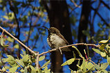
Once back at camp, I've spent the last hour of sunlight trying to capture a decent photo of the numerous sunbirds that were hopping about in the shrub next to the tent, but it was almost impossible, they never stayed still for more than a fraction of a second.


Day 18. - Ameib - Swakopmund - Blutkoppe
Our core trip was mostly over, after a lazy breakfast at the Ameib campsite we packed up and started towards Swakopmund, where we said good bye to Uwe, who stayed on for a couple of days with a friend, while we moved on for a quick visit to Sossusvlei and the Fish River Canyon.


On our way to the Blutkoppe campsite we passed the coastal dunes between Swakopmund and Walvis Bay, the first time I have ever seen the Ocean in Namibia in clear weather.


Day 19. - Blutkoppe - Sossusvlei
We had a nice lazy morning at the Blutkoppe campsite, entertained by the rather assertive Pale-winged starlings vying for every possible scrap and morsel. They were completely accustomed to humans, the braver ones even accepting some morsels from hand.


For a long time I was not aware, but Scherz actually recorded a site with paintings at Blutkoppe, not at the main massif but along the riverbed that now leads towards the Uranium mine a few kilometres downstream. With time on our hands, I did a short walk and found the site a few hundred metres from our campsite.


We continued towards Sossusvlei, reaching the dunes mid-afternoon after the long drive. As we stayed for the night at the Sesriem campsite, we could stay at the dunes till dusk, only driving back to camp after the sun has set.


Day 20. - Sesriem - Fish River Canyon
We took the little back roads from Sesriem to the Fish River Canyon, it took most of the day. We hoped to see some wildlife along the way, but we only saw a pair of Oryx shortly before reaching the Fish River campsite. After checking in we continued to the canyon edge for the magnificent late afternoon and sunset views.


Day 21. - Fish River Canyon - Windhoek
After packing up camp we drove back to the canyon edge for a morning view, then started the long drive back to Windhoek, to catch the flight home via Johannesburg the next day.


Covid situation permitting, for June 2021 we are planning a 16 day circuit to see a wide selection of the Rock Art sites of Namibia plus some of the natural wonders of the country, staying at lodges and guest farms along the way. Please visit the News page for any updates (or "follow" the FJ Expeditions FaceBook page).