
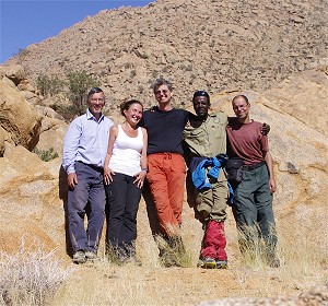
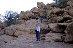
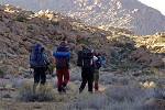
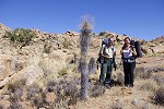
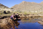
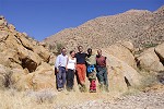
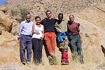
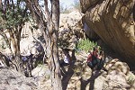
 Click on image for list of participants |
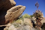
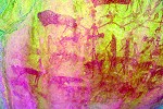
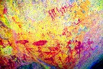
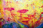
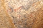
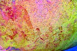
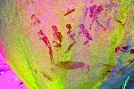
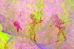
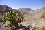
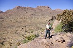
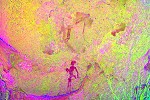
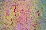
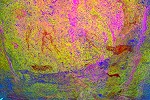
Upper Brandberg, Namibia 11th - 23ndJuly, 2014 All site references based on Harald Pager's numbering system False colour images precessed with dStretch, a freely available software developed by Jon Harman |
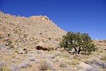
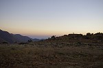
Day 1. - Windhoek - Uis
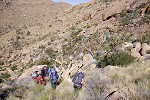
With Magdi we arrived to Windhoek two days before start to purchase the necessary supplies and sort out the NHC permits. Attila and Uwe arrived on the morning of the 11th, and we immedately started for Uis with a brief lunch stop in Omaruru. We reached Uis well before sunset, before dinner we had time to load and fuel the helicopter for next morning;s flight.
Day 2. - Circus Gorge
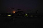
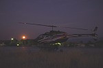
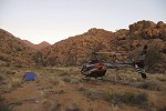
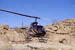
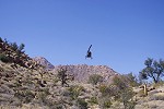
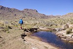
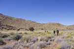
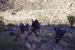
While the rest of our party had their breakfast and could make their leisurely way afterwards to the pick up point at the entrance of Tsisab Gorge, with Stefan we went to the helicopter as an almost full moon was setting beside the Brandberg, in order to finish all pre-flight checks to take off as soon as there was sufficient light. The first flight was to make a depot of food and water at all our campsites (except the first two and the last) , in order to avoid having to carry more than the day's water and lunch in our packpacks on any day, except during the final descent.

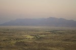
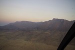
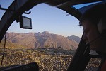
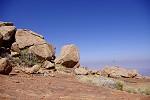
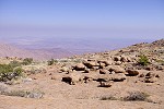
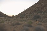
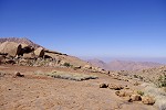
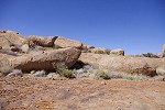
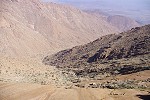
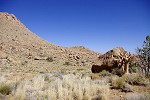
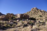
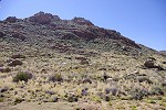
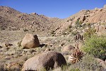
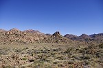
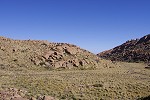
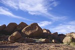
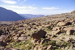
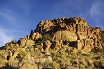
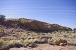
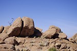
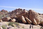
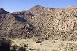
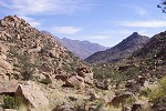
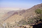
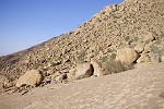
After takeoff we were aiming for the Basswaldrinne, the conspicious low pass at the top of the Sesaub Gorge at the corner of the mountain closest to Uis, one of the fastest (but not easiest) climbing routes into the central part of the mountain. There is a large pleasant plain just beyond the pass on the Tsisab side. We made our first dump at the prominent cluster of rocks in the centre of the plain (also a major rock art site). Interestingly there was a strong temperature inversion, with a blanket of cold air covering the plains around the Brandberg. In Uis it was 8 degrees at takeoff, but at the Basswaldrinne, almost 1000 metres higher it was 15 degrees, surprisingly warm at this time of the year.
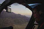
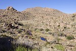
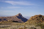
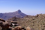
By the time we continued to our two campsites near the oppsite ends of the dark flat Orabes plateau the sun came up, lighting up the Königstein peak as we flew past it. We made another drop in the upper Hungorob on the plain between Aigub peak and Königstein (where I was delighted to see a large pool of water next to our chosen campsite), then on the upper Numas plain under Numasfels, finishing at our Numas base camp near the upper cascades where Stefan left me to bring up Attila and the remainder of our supplies.
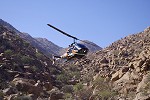
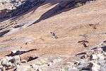
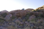
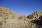
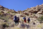
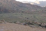
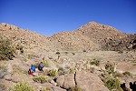
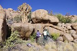
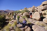
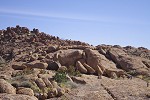
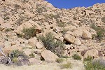
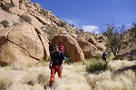
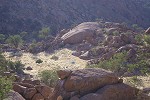
With the loading and fueling at the pick-up point, it was almost an hour until Stefan and Attila returned. In the mean time I could check out the nearby Numas river, and found flowing water in it, a reassuring addition to our airlifted water supplies. Leaving some more supplies at Numas, we took off for our camp on a small plain in the middle Circus gorge near the (dry) Weyersbrunn pool. Leaving our supplies and packs at camp, we continued with the helicopter to the terrace 350 metres higher near the Circus - Naib watershed, with the two prominent rock art sites C20 and C21 and a number of surrounding lesser sites. We were dropped off with Attila, while Stefan made another round to bring up Alfoms, Magdi and Uwe with the last flight.The Messum Crater below and the surrounding plains were still covered by patches of fog, while up on the mountain it was already pleasantly warm.
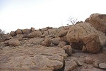
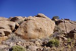
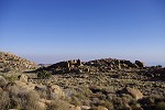
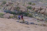
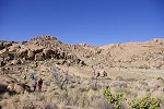
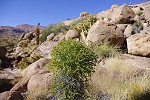
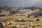
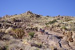
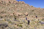
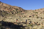
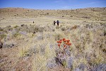
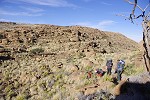
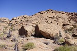
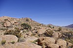
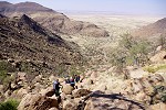
With our ascent logistics complete, we se out to see the sites we came here for. The previous year we have managed to reach this general area, but it was unplanned, and without any preparation and site plans we were very lucky to find C28. With Uwe we spent an hour searching for other nearby sites, and we could even guess (correctly) that the large prominent boulder on the terrace high above, beyond range given our limited time, was C21. This year, armed with site plans and locations identified from Google Earth, our objective was to systematically visit all of the sitesin the mid section of Circus Gorge.
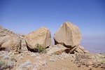
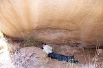
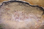
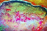
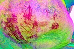
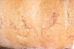
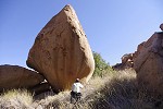
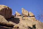
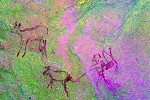
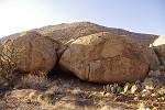
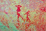
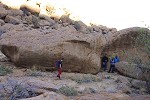
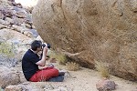
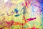
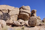
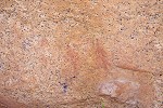
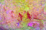
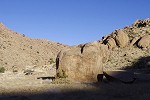
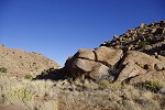
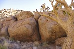
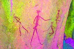
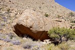
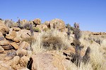
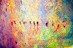
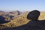
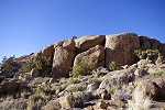
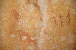
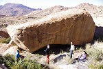
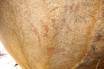
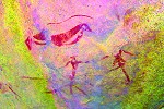
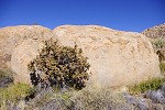
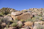
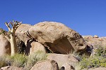
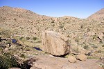
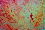
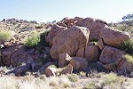
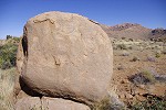
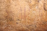
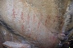
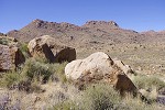
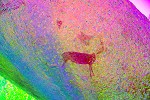
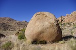
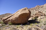
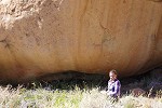
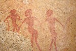
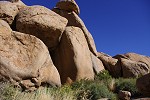
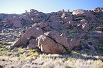
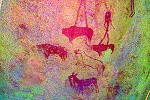
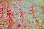
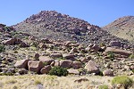
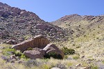
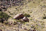
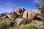
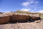
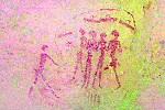
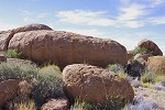
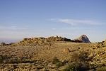
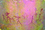
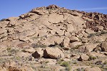
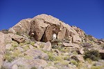
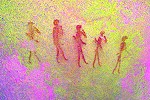
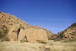
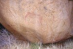
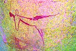
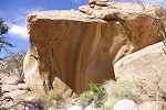
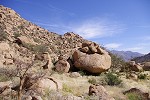
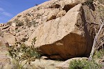
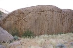
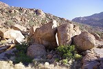
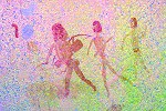
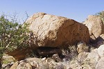
C21 is a huge, house sized split boulder that must have rolled down from the peak above. It contains a number of panels of paintings on all sides, the most important a large panel on the Northern side with a procession of human figures. It was mostly out on the sun, the blanket used by Stefan in the helicopter to wrap fuel jerrycans to soak up any spill came very handy to make shade, despite the all prevailing smell of kerosene.
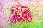
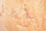
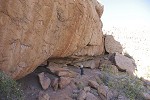
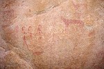
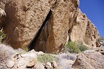
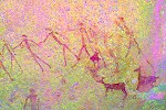
C20, the other important site on this small high plateau is on the side of a long boulder, within sight of C21 on the other side of the terrace. The best preserved panel is in a small hollow that protected the paintings from rainwater, and contains among others a procession of ostriches, a fairly rare scene. There is also a large and mostly faded eared serpent and many ther figures above the hollow.

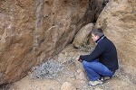
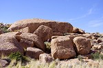
C22, a cluster of small boulders was a bit lower near our chosen landing spot. This is a lesser site, nevertheless it has some interesting panels, including a small scene with a group of humans inside what appers to be a hut or shelter with quivers hanging from the ceiling.
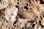
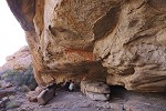
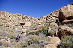
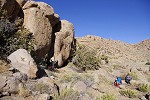
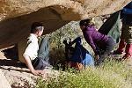
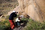
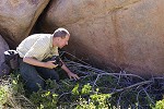
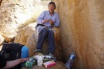
The last site in this upper area was C23, a cluster of large rocks near the edge of the slope dropping off into the Naib Gorge, with several panels of paintings, one of them with well preserved human figures including a pair with a very curious oblect on their heads. Whikle we had our lunch here, Stefan discovered a couple of tiny creatures living under some pebbles on the rock we used as our table. There was false scorpion (Pseudoscorpionidae species), and the larva of some ant lion (Myrmeleonidae) species, both about 5-7 mm. After lunch Stefan, Attila and Alfons returned to the helicopter to descend to the plain lying half-way from here to camp to see and photograph C28, the most important site of the area, while with Magdi & Uwe we descended on foot to seek out C24-C27 which we tried to find last year without any success.
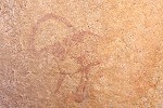
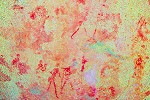
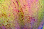
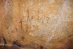
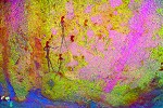
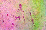
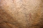
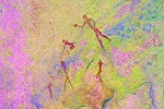
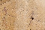
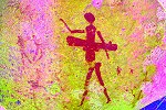
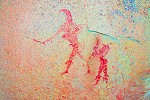
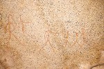
The descent from C23 to the small terrace below was easier than expected, it looked more formidable from below (in fact with hindsight, we were within 5 minutes from C23 with Uwe when we turned back). We were almost down as we heard and saw the helicopter descend to the large plain further down. With the site plan in hand C24 was easy to find, in the middle of the terrace among a cluster of smaller boulders. The paintings are very small, almost unnoticeable (except if one knows exactly where to look). There is an interesting scene with what Pager copied to be an ostrich, but looking at it with dStretch, it could also be a hunter disguising himself as an ostrich (someting still practiced by the modern San people of the Kalahari).
We could also easily make out C26 higher up on the far hillside, a conspicious large tear-shaped boulder in the middle of a gully. Getting to it was another thing, a maze of rcks and boulders made access difficult, and the other side of the rock looked like one of a dozen. As we reached it, we heard the shouts of the others from below, approaching after their visit to C28.
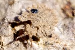
We continued to C27, the highest site in this area, an inconspicious boulder a bit hidden among the various small terraces on the ridge separatingCircus and Naib, with a rather insignificant panel of paintings showing some faint human figures. More excitement caused by a small (about 3cm) praying mantis, which dcided to take a ride on Uwe's shirt before being spotted here.
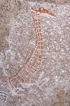
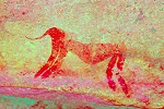
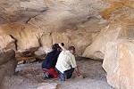
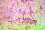
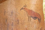
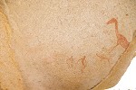
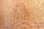
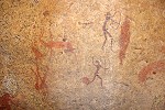
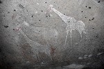
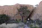
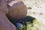
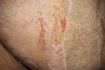
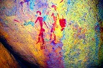
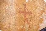
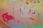
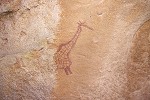
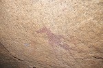
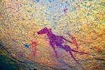
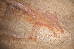
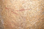
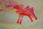
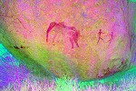
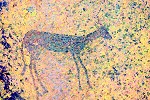
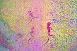
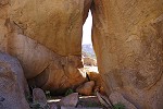
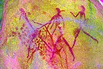
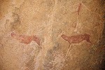
From here it was a straight-forward descent to C28, the long low shelter under a dry waterfall containing the small but stunningly beautiful panel with the sitting giraffe and the two very elaborately drawn and decorated girs facing it.
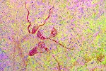
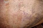
The last site to find in the area was C25, a little low shelter with some figures a short distance from C28. This too we passed last year, without recognising it. Apart of a group of faint antelopes there was an animal which appeared on the spot to be a damaged feline, but dStretch reveals a bizarre headless two-tailed creature (Pager's tracing does sugegst a head on the right).
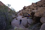
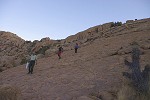
Mission accomplished, with Uwe we made our was down the steep 200 metre descent to the Weyersbrunn plain with our camp, while the others took te easy way down with the helicopter. Without any packs the scramble among the boulders was not as bad as we thought, we made it down in 40 minutes.
It was still mid-afternoon, we had time to continue to the cluster of sites on the low plateau just south of, and a little above our camp, with its edge dropping off steeply into the Numas gorge. We started off with site N182, a very large shelter in a cliff-like seting under a vertical rock wall, only accessible from Circus above as the slope continues almost vertically into the Numas below. In the morning when making the approach to camp we have already spotted the site with Attila. It looked very prominent, but with the steep drop it was impossible to see it from above, and we made several false attempts before hitting on the correct path. Despite the large shelter ideally suited for human habitation (a bit resembling Hungorob 28, 'Falls Rock shelter'), there is only a single small panel of paintings.

The remaining four sites, C32-35 were scattered about the plateau on smaller boulders. We found all of them without much difficulty, there were a couple of interesting figures, but generally their state of preservation is poor.
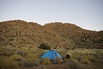
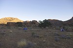
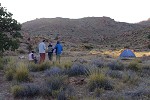
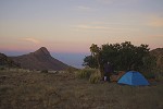
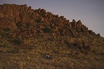
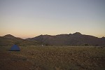
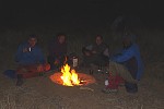
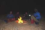
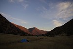
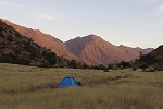
With sunset approaching, we returned to the nearby campsite to set up our tents before darkness. It was a surprisingly warm evening, much better than our expecations for mid-winter.
Day 3. - Circus Gorge
Stefan and the helicopter stayed with us for the night, in order to make an easy ascent of Circus Gorge to the upper sites. The year before we have experienced the meanness of the middle circus, and the marginal cost of another 30-40 minutes flight time was well worth saving a whole day of uphill struggle among large boulders and dense thorny vegetation. However before starting uphill, we first planned to visit the two lowest sites of Circus on a medium-sized plain 100 metres beliw our camp elevation.
We started along the watercourse at dawn to beat the sun (one of the sites faced fully to the East), reaching the dry Weyersbrunn pool at the outlet of our camp plain, flanked by a large boulder with a few painted figures - site C31.
We found the route down the watercourse to be fairly easy, we only had to scramble ofer a short stretch of boulders before reachng a series of interconnected smooth granite plates that led us all the way down to the plain below.
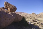
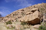
Site C37 is a huge boulder on the souther side of the plain, with the main panel of paintings on the upstream facing side, and a few barely discernible figures on the far side. We reached it just in time to photograph the main panel before the sun rose above the mountain, and made the paintings almost invisible.
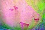
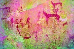
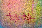
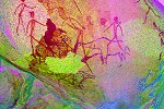
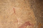
Site C36 is closer to the Eastern edge of the plain, thus remains shaded longer. We have already spotted it as we passed towards the more distant C37 along the side of a huge flat elongated boulder. This is one of the principal sites of Circus, with a large panel with dozens of human male figures executed in black and red, in a very good state of preservation despite the completely exposed location. There is also a smaller panel with a lovely oryx facing a human figure.
We returned the way we came up the watercourse as the plain was emerging into the full sunlight, but our climb was still in the shade until reaching our camp plain, past the big bolulder of C31. We proceeded to pack our dried tents (drenched with condensation in the morning) and supplies getting ready for the move.
Attila, Uwe and Alfons took the first flight, going up to the plain adjacent to C10 to visit that magnificent site (Attila never had the opportnity to visit it).
When Stefan returned, we packed all our remaining gear and supplies, to be moved to our second camp on the plain adjacent to the upper Numas / Circus watershed (which we crossed previously on our way to Circus). After a short hop Stefan droppped us on a small plain very near the watershed, and left to fetch the others. The landing site was adjacent to the huge granite ridge that falls off on the far side near vertically into the lower Numas. This ridge contains the cluster of sites C2-c6, all along the granite ridge near its highest point.
After a good 40 minutes (Stefan also taking the opportunity to see C10) the helicopter returned with the rest of our party. Having had a very early breakfast, we decided for a quick lunch before seeing the sites, avoiding the need to carry more than our cameras. Stefan was to part with us here, returning to Uis and then to base in the afternoon, but only after seeing the main site on the ridge.
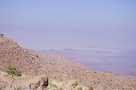
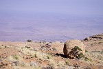
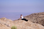
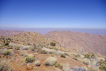
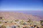
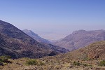
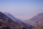
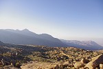
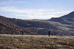
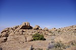
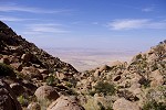
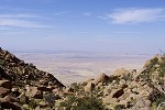
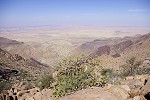
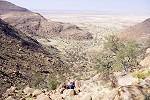
We climbed the smooth granite plates starting near the landing site, offering an uninterrupted easy way up to the crest of the ridge in only five minutes. It is amazing how on the Brandberg a distance of 250 metres with an altitude gain of 50 metres may take anywhere form five minutes to half an hour depending on the terrain. Reaching the top, there was a stunning wiew over the Numas basin, but the Namib Desert beyond was blanketed by a thick haze.
Site C2 is on a pair of low elongated boulders near the watershed between Circus and Numas. It has many figures on the two adjacent rocks, but most are very faint, hardly visible.
Site C3 is the principal site of this cluster, within sight of C2 on the far sde of the smooth granite plates 150 metres away. It is a series of vertical rock faces along the northern side of a low granite ridge, with large complex panels of paintings on all of them in fairly good state of preservation. They were mostly exposed to the midday sun, so it was a challenging exercise to produce the shade necessary for good photography over the large panels.
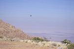
Stefan left us at this pont, needing the afternoon to return to base. The helicopter was out of sight below, but soon we heard the whine of the starting engine, followed by the appearing helicopter as it made a low pass above us before climbing and disappearing behind Numasfels. We finished photographing C3 and continued towards the far end of the ridge, where the smooth granite fell in a near-vertical cliff towards the bottom of Numas Gorge 1000 metres below. A good distance below us a lone martial eagle (Polemaetus bellicosus) made a pass along the cliff, probably looking for a dassie that let down its guard.
Site C4 was just adjacent to the look-out spot, along the sides of a large impressive rock formation forming the peak of the ridge. There are numerous panels and aintings here, but all in a very poor state of preservation, most we cold not make out except that something was there. The single composition that was reasonably well preserved does not seem to make much sense either....
Site C5 was just a short distance below C3 on the slope leading down towards the landing site and our packs. It is rather difficult to find, as the area is littered with similar looking inconspicious boulders. There are just a few faint human figures painted on the side of the boulder.
The last site of this cluster, C6 was found by Magdi right next to the little plain where the helicopter landed after a futile lengthy search along the larger plain to the west. It was a good illustration of how difficult it is to find the lesser sites even if one as a good description and idea of where they should be. In this case Pager's site plan, while perfectly accurate, did not capture the site from the perspective one would normally look at it from below. This site contains several fine giraffe alongside some human figures and antelopes.
Having seen all the sites in the area, we collected our packs and crossed over the nearby watershed into Numas, rounding a smaller hill to reach the large plain with our campsite, at only half hour's distance. These upper Circus sites can be considered more a part of the cluster around Okapi shelter (N162) than related to the main group of Circus sites far below.
With a good hour and a half left till sunset, we descended into the valley leading out of the large plain, hiding an elongated flat plain about a hundred metres below our campsite, before the river makes the steep plunge into the main Numas valley. Pager recorded three sites on this plain, but we had no idea about their size, content or condition. The fist, N180 we found under a small overhang at the tip of a very large long boulder at the proximal end of the plain. Despite the prominence of the spot and the many good surfaces, there was just a small group of human figures.
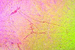
We expected site N179 to be the prominent angular boulder near the middle of the plain which we have seen already from afar. However on reaching it we did not find any paintings on any of the sides. There was one patch of rock with a slightly reddih hue, but we could not quite decide if it was paint or just a natural discoloration. I took a pint-blank photo nevertheless, and was quite surprosed when dStretch revealed a pair of gazelle or antelopes.
The last site, N178 was near the far end of the plain, consisting of two distinct parts, one on the side of a regular granite boulder, the other on the vertical ridges of a strange adjacent rock formation. This proved to be the most interesting site, with a number of fine human figures.
Day 4. - Upper Numas Gorge
The next morning we made an early start after a quick breakfast and packing camp. We had to climb up to Numasfels plain on the far side of Numasfels, by way of a pass just 150 metres under the peak. It looked like a long and difficult climb (involving an altitude gain of 300 metres), we expected it to take most of the day.
We stopped briefly at sites N162 ("Okapi shelter") and the adjacent N164, mainly for the sake of Attila who did not see these sites before. Both were fully exposed to the sun, with the main panel of N164 appearently hosting a major social event for the geckoes of the area.
We continued to the North eastern corner of the plain, adjacent to the slope leading up to the Numasfels pass. There are two sites here on large conspicious boulders which we did not see when we first visited Okapi plain with Angula in 2011. The first one, N158 is a large flat boulder, with a large but very damaged panel of paintings of human figures on the side.
N157 is just a hundred o so metres away on a smaller boulder but at a prominent position, with a commanding view over the entire Okapi plain. There is a large panel with many human figures and a pair of fine giraffe on the side of the boulder.

After the sites we started our climb up the steep slope leading up towards the peak of Numasfels. It looked formidable, but in fact the going was much better than anticipated, with mostly grass covered slope with no big boulders. In about an hour and a half we were approaching the col under the peak of Numasfels, a much faster than expected progress.
On the far side of the pass we searched for some time in vain for site N135 (we must have been very close), then we made our descent to the wide flat plain filling the basin ahead. Our supply dump was made near the middle under a conspicious tree, we reached it in tme for a late lunch, rather than the late afternoon we were planning for.
One of our principal objectives were to see the cluster of sites around the Numasfels plain, and on the far side of the ridge above our camp on a series of flat terraces. As we still had several hours till sunset, we set out to see the latter, climbng a continuous smooth granite plate to the top of the ridge. On the far side the the granite plates continued at a gentler gradient into the basin below, a very easy way compared to the usual Brandberg terrain.
The first site, N127 was just at the bottom of the granite plates on a rather inconspicious low boulder. It had two panels of paintings, one showing a group of rather bizarre figures, the other a large complex panel of more conventional hman and animal figures.
N128 was a further 100 metres away, a small but fine site on the side of a large boulder with two facing archers. Beyont the grund dropped off to another terrace some 50 metres below, with a dense concentration of five sites surrounding a prominent granite ridge in the centre.
N129 is on the sife of a leaning upright bouder at the corner of the ridge. There is a fine procession of human figures on the side of the rock, unfortunately much damaged by the flaking of the rock. It is a very good illustration of the verious stages of fading due to weathering, many of the similar scenes only retain the outlines of the wigs of the human figures, without any trace of the rest of the body remaining.
The adjacent N130 on the far side of the ridge is the principal site of this cluster, with sevelal panels of paintings scattered about some enormous boulders. Some of the lesser panels were very overgrown, it appeared that nobody cleared them since Harald Pager copied them thirty years earlier (even though Jon did visit these sites with Angula in 2011 after our trip). The large main panel is covered with a continous (and often overlapping) set of paintings over a good 3-4 square metres, unfortunately in not the best state of preservation.
The remaining three sites N131-133 were scattered about the small terrace adjacent to N130 on larger and smaller boulders. They all contained only smaller scenes, with only N133 at the far end of the terrace showing good preservation.
As the sun was rather low we started going back towards camp, taking a different route to see site N126 (which we missed, making a bad assessment of its position), but eventually ending up at the smooth granite plates, which led into the plain with our campsite..

Day 5. - Upper Numas Gorge
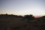
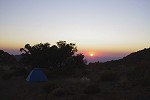
Despite being at our second highest altitude camp of the trip at 2250 metres, the night and the morning remained surprisingly warm (something that remained for the rest of the trip). There was none of the expected frost, it was about 8-10 degrees (C) when we woke up befre sunrise, just as the moon was setting over Numasfels.
Leaving the packing of camp for later, we set out early after a quick breakfast to beat the sun at site N122, the principal site on the plain in sight of ur camp a couple of hundred metres away. This being the most important site on Numasfels with a number of well preserved large panels, we settled in for a lengthy photography session.

Another major site is N125, at the extreme Northern end of the plain, hidden among a mass of huge boulders some way up the bordering slope.There is an almost continous series of paintings along the hard-to-access rear side of the huge rock, unfortunately mostly faded.

On our way back to camp we passed N124, a large boulder with some hardly noticeable paintings along the side, mostly faint human figures and the remnants of a giraffe.
The last site, N123 was adjacent to our campsite on a very large conspicious boulder near the edge of the plain. It was a pleasant surprise to find a fairly well preserved panel of black and red human figures and three little antelopes on the side of the boulder.
As it was approaching midday, we had our lunch early to avoid having to carry it, then packed up camp and set out towards the main Numas watercourse. The Numasfels plain continued East for another half kilometre beyond N122, then there was an abrupt drop of two hundred metres into the valley below. The slope was rather difficult to tackle, with many large boulders and several vertical steps that had to be circumvented.
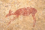
Despite the difficult descent we made it down in little over an hour. After a short rest in the shade of a large boulder (which should have been equally attractive in prehistory, but alas no paintings), we continued to a large terrace above, adjacent to the main watercourse behind it, containing a cluster of sites around the perimeter of the plain. The first one , N76, was a large boulder along the Western edge with two panels of human figures, and a curious animal that very much appears like a rabbit.
Site N77 was not far away on a small inconspicious boulder with a low shelter underneath.It only contains a single human figure and some animals, of which only one is visible with a naked eye.
The main site of this terrace is N78, situated on five boulders spread along the Northern perimeter of the plain (really N77 could be considered a part of them, just beyond the 30 metre rule Pager used for defining a separate site). The panels are of varying quality, with some very interesting scenes, and often there is much more than what was visible on the spot.

The last site of this cluster, N119 was at the southern side of the plain, on the route leading towards the main channel of the Numas river. It was a small site with a few faint animals and a well preserved scene of a few human figures.
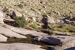
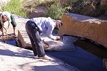
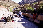
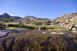
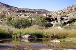
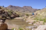
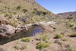
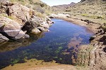
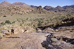
After a short struggle through some dense vegetation, we reached the flowing river which was trickling from one crystal-clear pool to another. We chose a suitable spot of smooth granite, and soon turned into a herd of snorting hippoes, enjoying a good wash and the freedom of drinking as much as one wished for (not knowing in advance if there would be any water on the mountain, we had a strict ration of 2 litres per person per day from the airlifted supplies).
Leaving our packs, we followed the river downstream for a few hundred metres to see site N75, a small vertical rick face right next to the trickling stream. There are only a few paintings, but one is a rather interesting pair of human figures, with some bizarre associated shapes (unclear if they are joined or the humans are a separate layer).
By the time we returned to our packs, the shadows were growing long. Fortunately we did not have much left to go till camp. After following the river upstream on the granite plates, we turned uphill on the East bank and climbed a short valley that led straight up to the terrace with our supply dump.
Day 6. - Upper Numas Gorge
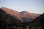
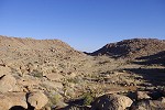
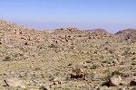
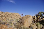
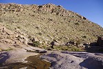
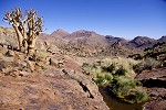
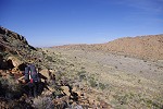
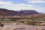
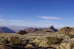
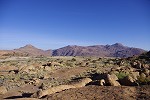
After the two long days involving much ascent and descent, this was to be a fairly lazy day. Our campsite was located on a small plain adjacent to the Upper Cascades of the Numas, and our day's plan was to see all the sites in the upper Numas valley as far as we can comfortably reach, with barely 50 metres change in elevation along this two and a half kilometre stretch of the river. This terrain located at the exact geometrical centre of the Brandberg is unique, it is the largest patch of generally evel ground anywhere on the upper Brandberg. The sheer number of rock art sites in the basin clearly indicates that it was a preferred spot in prehistoric times too.
The first of the sites, N82 was right next to our camp on a big boulder guarding the path leading down to the river (the way we came up the previous afternoon). There is a large panel with numerous human figures and a herd of antilopes on the side facing the plain.
The next site, N83 was still in sight of camp a short distance away, a cluster of boulders with some very faint human figures.
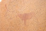
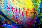
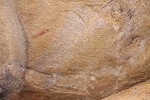
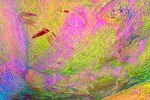
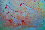
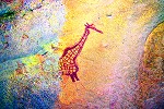
Site N84 was a little further along the ridge, but still within sight of camp. The boulder forms a good shelter, which contains a fine, well preserved panel of a giraffe and some human figures. The three faint blobs of paint to the left of this scene was indiscernible on the spot, but dStretch showed a scene of three rhinoceros, a unique and truly unexpected revelation.

Site N85 is a prominent boulder on a little rise near the Eastern end of our camp plain, close to the bend in the Numas ricer. There is a large but faint panel on the side of the boulder with numerous human figures executed in black paint, intermingled with a few done in red.
Two sites, N80 and N81 remained in the immediate camp vicinity, both on the vertical rocks bordering the river as it plunges down a series of rocky steps called the Upper Cascades. Here the river was no longer flowing on the surface, but a series of pools still remained. The paintings were not very exciting, with only a few discernible figures, they were visited more for completeness, like many of the Numas sites further upstream.
Site N88 was at an interesting location on the opsite bank of the river, some way up the hillside facing the cascades. It is a long low shelter under a conspicious balancing boulder on the top of the slope. One would have expected more paintings here, but there is only one well visible human figure and some other very faint ones.
Above N88 there is a small terrace overlooking the bend of the Numas river, containing three small sites (N89-N90) on rocks and boulders around its perimeter. They all contain only a few and mostly damaged paintings.
Site N92 was about 200 metres upstream in the main river valley, following a sharp right bend. This was the only one of these upper Numas sites which we noticed as we descended the Numas on our very first Upper Brandberg trek in 2010. At that time we only observed a few of the numerous faint figures all around the prominent rock, adjacent to a large basin which now was full of water, clearly a principal water source along this stretch of the valley as the riverbed was mostly dry further upstream for a long stretch.
After the bend the valley opens up into a big shallow basin with a diameter of about 500 metres, very little gradient along its bottom. While it is a very pleasand area, there are only two small sites on boulders situated near the middle of the Basin. Of these N93 is the more interesting, with a very nice painting of a kudu in a shallow shelter under the rock, the nearby N94 only contains a few barely discernible human figures.
Continuing upstream along the main watercourse the valley narrowed as it passed between two prominent hills into another wide basin further upstream. Site N95 is in the middle of the narrow section, with a rw of very fine human figures along the side of te large boulder, one of the better sites among the generally exposed and poorly preserved upper Numas paintings.
As we entered the upper basin, we passed a series of large pools, the main water reservoirs of the Upper Numas. Here the river is flowing mostly underground, but it emerges to the surface in these series of sandy basins. As the water is continuously replenished, they resist drying out for a long time after rains. Not surprisingly, there is a pair of rock art sites on the slope immediately above the pools (really all a part of the same cluster of three prominent boulderj, just the right boulder is separated by 35 metres from the centre one). There is a large panel of human figures in a spacious shelter under the right rock, site N97.
Site N96 is on the centre and leftmost boulders, with the more interesting scene on the far boulder, depicting a pair of human figures, one with a strange indistinct double pointed headdress.
We had our lunch at the largest pool, then leaving our packs we climbed the hillside opposite sites N96/97 up to N98, a site on a terrace at the foot of a prominent granite ridge with high vertical cliffs. It is a fairly strenous climb to reach this site which only has a single small panel of paintings, but a commanding view of the entire basin below.
Returning to our packs, we moved upriver to see the remaining cluster of eight sites, all lying within a 200 metre radius from the point where the main watercourse forks near the Eastern end of the basin (the right branch leading up to the foot of Königstein, the left towards the Umuab and Tsisab watershed). Site N99 is the closest to the fork, next to a prominent rock exposure which we first mistook to be the site itself. The paintings are actually on a small insignificant boulder near the rocks.

Site N106 is the largest and most important of this group, lying a short distance upstream in the left fork. It was also the most distant (there are more sites further upstream in this valley, but we did not have time left for those), so we aimed for it allowing a slow trickle back towards camp via the other sites. It consists of a cluster of several boulders, with the most important panel of paintings on the face of the largest rock.
The most interesting, though rather damaged scene is in a very low and difficult to access shelter formed by two adjacent boulders. Even with dStretch it is very hard to make out the scene. Possibly there are two human figures, but they are very indistinct, with a totally baffling depiction around their heads (if they are indeed humans...).
Sites N102-N105 are all on smaller rocks and boulders scattered about the hillside bordering the Eastern edge of the basin South and within sight of N106. We visited them in reverse order, all had very faint and mostly small scenes, the most interesting was N102 with a large panel with somewhat better preserved animals and human figures.
The remaining two sites were on the far side of the right branck, on a low ridge overlooking the centre of the basin. N100 is a prominent rock in a very picturesque location among an unusually dense cluster of bottle trees. It only has one scene, but it is an exceptionally fine one, depictng a group of four human figures facing a giraffe, the latter being practically invisible on the spot.
Site N101 is some distance away in a small shelter among a cluster of rocks, offering a very good viewing point overlooking N100 and the entire basin. There is seemingly just a single blob of red paint which we assumed to be the body of an animal, but surprisingly dStretch reveals the head of a very fine giraffe, and some other animals which were practically invisible on the spot.
With the sun quite low, we started on our way back to camp, re-tracing our route along the main watercourse, past the pools at N96. With no sites to halt at, we reached the pool and the big rock at N92 in little over half an hour.
With still an hour of sunlight left, we could afford a short side-trip into the valley adjacent to our camp plain to the east. There were two sites in the valley, but also as this was our intended route up the side of Aigub to N3 the folowing day, a litte scouting of the route seemed like a good idea. We soon found site N86, a cluster of three huge boulders of which one was completely overgrown by a shrub, something I have never seen elsewhere on the Brandberg. The paintings were not particularly exciting, but from the site there was a perfect view over the lower part of our intended route. A series of interconected granite plates seemed to offer an easy route up, but more importantly we could see water flowing down the granite, indicating that we could start with a light water load, as we could replenish on the way and a full waterhole was awaiting us at the next camp.
Our camp plain was just behind the ridge near N96, after a short climb we were overlooking our tents and the promise of a sundowner by the campfire to finish off this, by Brandberg standards fairly relaxing day.
Day 7. - Aigub peak sites
In the morning after packing camp we re-traced our route back to site N86, passing a large stone circle which we failed to notice the previous afternoon. We continued to site N87 another 150 metres further upstream on a large conspicious round boulder and a few smaller adjacent rocks. The main panel was on the large boulder, with a large number of reasonably well preserved animals and human figures, one of the best sites of the upper Numas.
After finishing with all the panels of N87 we crossed the adjacent plain and started to climb the slope leading up towards the foot of Aigub peak, following the main watercourse. We soon reached the granite plates which indeed offered an easy and quick way up, alongside the trickling stream and the occasional larger pools of water. As we climbed, Numasfels came fully into view, we covered the first hundred metre ascent in less than half an hour.
There was a small flat terrace at the top of the granite plates with a large pool of water where we took a short rest before continuing, now on typical prandberg terrain with rocks and boulders interspaersed with various thorny vegetation. Nevertheless the going was not too difficult, we left the valley and turned upslope towards where we guessed site N3 to be, and reached the top of the slope within sight of the huge boulder. We already visited this site in 2012, the detour was princpally for Uwe who was not with us on that trip, but it was fairly close to our intended route and we were all keen to see this wonderful site again.
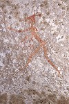
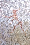
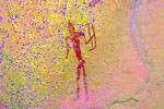
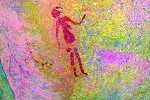
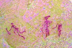
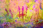
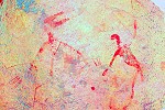
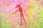
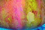
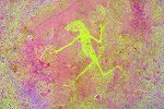
Site N3 is one of the most interesting and unique sites on the mountain, both on account of its location and the depicted scenes. At an elevation of 2365 metres it is the highest altitude site, and it is also one of the remotest, with only two minor sites lying within a radius of 1.5 kilometres. The most interesting scenes are those depicting half human, half chameleon figures in red and yellow paint, something without parallel amont the thousands of depictions to be found on the Brandberg. Despite its remote location, it was already discovered in 1955 on only the third expedition to ascend to the central part of the Upper Brandberg (previous expeditions only reached the summit of Königstein from the Tsisab valley).
We spent a long time at N3 photographing all the panels, and just enjoying the opportunity to look at the scenes without having to hurry on. We started out after lunch, rounding Aigub close to the 2400 metre contour, meeting the climber's train on the plain under the summit of Königstein. We continued accross the Numas - Hungorob watershed into the pleasant long level plain between the two mountains, with our depot and campsite at the far end.
Site H67 is the highest Hungorob site at the upper end of the plain overlooking the watershed. We passed by in 2012, but this time we bought a good sunshade and have seen many more details than on the previos visit. It is a very fine site, apparently the geckoes sunbathing on it thought so as well.
We continued to our campsite at the end of the plain, verified that our supplies were in place under a large tree some distance from the trail, then leaving our packs we descended into the basin accross a low ridge containing sites H60-H64. Our target was H60 with the wonderful panel of giraffes (which Uwe was very reluctant to have to miss the previous year), but we also hoped to see the other sites in the basin. However the going turned out to be more difficult than anticipated, the valley immediately before H60 was rather dificult to cross, so the sun was getting rather low as we finally reached the giraffes.
We only had time for a brief visit to the adjacent H62, then we had to make a hasty retreat to camp to use the short remaining daylight to recover our boxes and pitch the tents before darkness.
Day 8. - Upper Hungorob Gorge - Orabes Gorge
Despite being at our highest campsite (at 2300 metres) the night and the following morning was surprisingly warm. Before packing up cam we climber over the ridge to the East into another basin with a pleasant small plain almost level with our camp, with two sites at either end of the plain. We did not have time to visit these sites two years ago, now we could make op for it. The first one, H66 contains a panel with some very fine oryx and other antelopes. The other one at the lower end, H65 has a less exciting panel with a number of human figures.
Ticking these off, we returned to camp to pack, and also to take water from the pool adjacent to it, as this was likely the last place where we could find water on the trip, we did not see water in the vicinity of any of the earlier dumps with Stefan. We were quire right to do so, the last stale pool was a few hundred metres further downstream from camp. There was no water to be found anywhere further in the lower Hungorob.
We descended the well trodden Königstein trail, past the two prominent sites H59 and H58 right next to the path. Both of them have large and complex panels of paintings, with the lower H58 having some unique scenes.
We continued along the path, past our 2012 campsite, to a small plain below. There are two sites here, H57 and H69 which we failed to see two years ago, but now we had time to make up for it. The sites were both adjacent to the trail, but it turned out to be a rather frustrating search. Pager's site plans were drawn from an angle not readily recognisable from below, and we spent a good half an hour checking out each promising looking rock until both were found. At H69 we the paintings were so faint that even the extremely accurate eye of Pager failed to spot the fourth figure in the row, only revealed by dStretch at the right of the photo.
Our next destination was the large plain at the Southern foot of the Königstein massif, where in 2012 we made our cache with Stefan under a prominent tree in the centre (stirring up a pair of Klipspringers while landing with the helicopter). With Uwe we searched in vain for sites H55 and H56 the previous year on the terrace above Snake Rock. Pager's published sketch was rather misleading, these sites are in fact much higher than where we looked. A painstaking search on Google Earth located H56 at the far edge of the plain based on p6369Pager's site plan, nearly half a kilometre beyond where we searched.
Site H55 was even further, in a broad valley leading up to the foot of Königstein. It was a cluster of prominent rocks, visble from afar, but we found the principal panel of paintings to be completely overgrown by a large shrub with thick branches. Clearly this site was not visited since Tilman Lenssen-Erz surveyed the Hungorob sites 25 years ago. It took a considerable effort to break the thick branches and clear the ground sufficiently to be able to take photographs. At least the effort was worth it, there is a large panel of paintings with dozens of human figures accross the face of the rock.
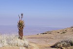
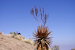
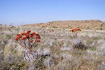
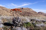
We have completed all that we planned for the upper Hungorob. Our next challenge was to move accross the black Koaroo basalt patch capping the granite above Falls Rock plain, and reach the triple Hungorob-Tsisab-Orabes watershed without having to gain or lose too much altitude. The route required the rounding of the promnent basalt peak at the Western end of Tsisab. It looked feasible on Google Earth and was only three kilometres on relatively flat ground, but Alfons never took this way, so we started early to be prepared for all surprises. We climbed the col leading out of the lpain to the South east, and looked into the upper Hungorob on the far side, forming a shallow basin on the black lava capping. The going looked easy till the foot of the hill, but the eastern side (the route we intended to take) dropped very steeply into the Tsisab, with a number of vertical cliffs, definitely not an easy route. The western side looked better, we diecided to go till the col overlooking the Hungorob again (the valley leading down to the Helm pools) for our lunch stop, and decide on the final route from there. As we crossed, we found the plain to be littered with aloe plants in full bloom, supporting bright red clusters of flowers. We also passed a few stone circles, hinting that this plain was inhabited at some remote time.

Crossing the eroded lava plain looked easy, but in fact it was very tiring. There was soft soil among the angular rocks, sometimes with cavities formed by rainwater, and despite the appearance there was hardly a patch of smooth flat ground. To make things worse, Alfons made a bad step and hurt his foot, and was badly limping by the time we reached our lunch spot. A painkiller offered a bit of relief, and by re-distributing some of his load we could manage to walk up to the foot of the hill, to the col overlooking the Tsisab. There was a grandiose view over the Tsisab and the plains beyond, but also we could see from this point that the western side of the hill offered an easy passage to the far side, from where hopefully we could make an easy descent into the upper Hungorob.
After some scrambling along the steeper gradients of the hillside, trying to stick to the contour, we reached the lava terrace on the far side, directly overlooking the Hungorob with an uninterrupted view down to the Helm pools. There was a good route along this ledge eastwards, and soon we found a reasonably good place to make the descent to the plain forming the watershed between Hungorob and the Tsisab.
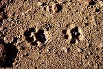
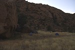
The plain was again full of flowering aloes, and was as difficult to cross as the previous, especially for Alfons who winced every time he had to step on a sharp angular stone with his aching foot. Fortunately our campsite was not far, on a small plain at the head of the Orabes Gorge a short distance beyond the black lava plain. The plain must have been a waterlogged swamp quite recently, there were numerous large leopard tracks in the dried mud around our campsite. While the march of the day was not overly difficult, it did take significantly longer than planned both on account of the terrain and Alfons' injury.
We still had an hour of daylight left, before making camp we set out to see the three sites situated around the perimeter of the plain. We started with O1, very near the triple watershed. A couple of boulders formed a narrow, corridor like covered shelter, with paintings on both sides. The more interesting was a strange caricature-like female figure, accompanied by what appears to be an unfinshed female torso with prominent buttocks.
Site O2 was in a shelter under a huge flat block of granite on the far side of the plain not far from our campsite. Despite the inviting location, only a single blob of red paint marks this locality.
O3 is close by, just a litle beyond the 30 metre rule Pager applied to make it a separate site. It s the principal site of the plain with three distinct panels on separate rock surfaces, but only one contains better preserved paintings, the rest are mostly too faint to be made out on the spot.
We returned to the campsite to make our tents just as the sun was setting. The big tree next to our camp was the resting place of a leopard, as there were dassie bones and skulls lodged into the forks of the branches. As we were making camp, we were probably being watched by a pair of big yellow eyes from some shelter nearby, but if so the leopard made no sign of its presence over the evening or during the night.

Day 9. - Orabes Gorge & Upper Hungorob
Alfons' foot got a bit beter by the morning, but it was still hurting. As the distance to our next campsite was just over 2.5 kilometres along the reasonably flat Orabes ridge, something comfortably achievable in an afternoon, we decided to swap the order of the day, and visit the upper Orabes sites in the course of the morning with a very early start leaving Alfons at camp to rest, and then visit the scatter of upper Hungorob sites near our campsite and make the move to our next camp in the afternoon.
There is one site, O21 wih some particularly interesting scenes of some bird-headed human figures in the Upper Orabes. Unfortunately it is in a very inaccessible place, in the middle of the steep slope under some vertical cliffs. It was a good 300 metres below camp altitude, something technically doable in the course of a full morning, but only if the going was good. We decided to give it a try, starting from camp at 6am before sunrise. We trudged down the reasonably easy upper slopes of the Orabes, first along a series of granite plates offering easy going. However soon the route led us into a maze of big boulders, and after an hour and a half we only succeeded in making a descent of about 100 metres, one third of the way. The continuing path looked even worse, with the steep descent just startng, so reluctantly we had to resign to missing O21 and just seeing the upper cluster.
The spot we reached was not far below the principal site of upper Orabes, site O7. It is located among a cluster of huge rocks, with a number of large panels in and around the large shelter formed by the principal boulder. The scenes are complex, and sometimes difficult to make out even with dStretch. The most interesting is a small scene on a boulder inside the shelter with three (severed ?) oryx heads depicted under a pair of hunters.
There are another five sites in this section of the uper Orabes, but the proved to be very difficult to find, even with Pager's site plans and a good understanding of their general position. Only O7 was readily identifiable on Google Earth, we spent a considerable time looking for O5 and O6, supposedly both within sight of O7. Finally we succeeded in locating only O6 on an inconspicious cluster of rocks with a prominent well preserved human figure, and surprisingly some very unusual tiny adjacent figures.
The remaining three sites proved similarly difficult to find. We have stumbled upon O4 on the side of a low granite ridge, quite far from where we orignally believed it to be. This site has only a pair of very faint, but rather elaborate and interesting male figures (plus some meagre traces of other paintings). Site O8 and O9 were somewhere in the vicinity, but despite an hour long search we found nohing (now we know that we passed within a few dozen metres of both).
Our time was up as we agreed to be back at camp by 11am, to leave enough time for the Hungorob sites and the trek accross to the next camp. All in all it was one of our less successful mornings, only being able to see three out of the planned eight sites. Once again we found out the hard way that on the Brandberg it is almost impossible to locate sites (except by accident) unless they are identified beforehand on Google Earth or we know their precise position. Nevertheless with the remarkable success rate of the trip so far, we had nothing to complain about.
We returned to camp to pack up after a quick early lunch to reduce the load we needed to carry, and made the short distance to the black lava plain. Leaving our packs at a prominent rock, with Uwe and Magdi we set out to see the five known lesser sites on the Hungorob site, while Alfons and Attila explored the Tsisab side to find the four sites mentioned by Tilman Lenssen-Erz which may be considered a part of the same cluster. This time we had no difficulty finding the sites, all on smaller but prominent boulders at their expected location at the edge of the plain. H27, H26 and H25 were all individual rocks with just smudges of remaining paint.
H24 and H23 were a bit better sites, both on a group of boulders, with some better preserved scenes. H24 has a particularly nice shelter scene.
Having ticked off these sites, we returned to Alfons and Attila, who searched about the rocks on the Tsisab side but only found one of Tilman's sites, a long low rock with some very faint human figures on the side close to where we left our packs.
It was early afternoon when we started towards our campsite on the far side of the flat Orabes plateau, looming ahead on the horizon. We planned to search the series of small terraces along the Tsisab side of the Orabes ridge, expecting to find further undocumented sites, but the few promising spots we passed were all empty. We soon realised that we have no time for search and detours, as the going became very rough and slow among large boulders. After a while we just pressed on without stopping to look, spurred by the lengthening shadows.
We reached the valley between the Orabes ridge and the Orabes plateau, the half-way point, with only an hour of sunlight left. However much to our relief from here on the going became easier on the flat black plateau, and we easily covered the remaining distance to camp with time to spare.
In retrospect, we would have been better off had we done the day in reverse order, coming via the Orabes sites vith our packs and approacking the Orabes plateau from the far side of the ridge as originally planned. We were all rather exhausted after this long day, probably the most tiring on our trip so far. Uwe was the only exception, still having the energy to check out the towering rocks above our camp in the last light of the day, just in case there were any sites up there (there were none).
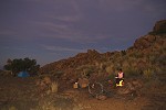
The rest of us just pitched our tents in a rather energy saving mode, then settled down to watch the lovely sunset spectacle. It did not quite register up till now, but this was our first campsite where we had an uninterrupted view towards the Eastern and Western horizons, all our previous camps were in sheltered basins with a blocked view. Fortunately there was no wind, it was a pleasant warm evening, especially once the fire was going.
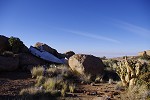
Day 10. - Orabes Plateau - Basswaldrinne plain
Next morning we were up at sunrise, with another long day ahead of us. We planned to visit the cluster of sites located just off the Eastern edge of the Orabes Plateau, then we had to make the descent of over 500 metres, nearly half of the total descent from the mountain. Learning from the previous day, we planned the trek to the Basswaldrinne camp to take almost a full day. Alfons and Magdi stayed at camp for a lazy mornng, while the rest of us set out for a quick climb up to the sites.
The Orabes Plateau feels a bit out of place on the Brandberg. It is the largest piece of flat ground anywhere on the mountain, and its stark black appearance makes it stand out among the red granite rocks. The inviting obstacle-free plain gave the idea in the early nineteen sixties to prepare an aeroplane landing strip to provide easy access to the upper Brandberg for researchers and mountaineers.
The full story is told by J.F. Botha, the Manager of the Uis Tin Mine in the IV/8 (August, 1963) issue of the Newsletter (Mitteilungen) of the S.W.A Scientific Society (Landing on the Brandberg Muntain with a Cherokee 180 light aircraft, p.2-4.):
"
...detailed research has always been hampered by the absence of open water during the greater part of the year. Due to the roughness of the terrain, the going on foot is also difficult and tiresome. The building of any form of road up the mountain would be very expensive, if not impossible. The construction of a landing strip for light aircraft on the Brandberg to fly interested parties and their supplies up there, appeared to be the only remaining method of opening up the upper regions of the mountain for research. A preliminary air survey indicated that there were two areas of Karoo basalt which appeared level enough for the construction of a landing strip...
...arrangements were made for a party to go up on the 13 and 14th of April 1963. ...the ascent was made up the valley known as the Basswald Rinne. The first evening was sepent just below the top of this valley and early the following morning, the climb was continued. On reaching the top of the valley, the party split, with F. Prinsloo and the writer climbing up the Tsisab valley side of Orabes Wand, while the rest of the expedition followed the crest of the ridge. Here the going was very difficult and the climbers had to retire before reaching their goal.
Prinsloo and the writer found the going easier and reached the landing area just after 10.00 a.m. They found the flat terrain covered in grass (Aristida sp.) growing 9 inches high. The basalt has weathered into a black clayey soil, soft to walk on, with pieces of unweathered basalt anything up to 6 inches in diameter, littered over the area.
After a brief survey, the most suitable landing strip was selected. It was found that this strip could be cleared for 1200 feet without much difficulty, provided that manpower and time is available. A distance of 500 feet was next provisionally prepared, piling the larger stones along the side so as to demarcate the runway. The descent was commenced at 2:00 p.m. and the foot of the mountain reached at 5.00 p.m.
The next step was to prepare for the actual landing. As the strip required further clearing and lengthening before take-off could be attempted, it was decided that a second party should go up on foot to be there when the first landing takes place. The aircraft would bring along a number of rakes with which the loose stones could be cleared from the surface of the runway.
On the 23rd of May 1963, a party ... set out to climb the mountain. ...
At 9:45 a.m. on the 24th, the Cherokee ZS-CBR took off from Uis with just enough fuel to land on the Brandberg and to return to base. The ground party was spotted at the strip and a successful landing was made shortly after 10.00 a.m. According to the altimeter of the aircraft, the height on the ground was 7000 feet above sea level.
The rest of the day was spent preparing the strip with the help of the rakes flown up. But it was soon realised that the ground was softer than anticipated and that the soil would have to be compacted before it could take heavier aircraft without the danger of their wheels sinking into the ground.
At 6.00 p.m. the writer took off alone and returned to Uis. The rest of the party spent the evening on the mountain returning the following day.
In its present condition the surface of the landing strip is too soft to safely land and take off again with heavily loaded aircraft. The next step is therefore to find some way of compacting the surface. ...the suggestion to fly some light soil compacting machine up to the strip, appears to be a possible solution. Should this method prve to be successful, it would open up the upper regions of the Brandberg to research workers and tourists alike.
"
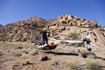
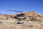
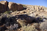
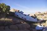
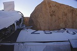
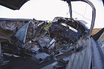
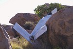
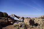
Our own observations matched the account, the surface of the plateau is very soft, with earth mixed with angular sharp rocks. However we could not find any remaining trace of the cleared landing strip. The above account well illustrates the risks taken, the aircraft making the first landing being unable to take-off before the strip was extended - not exactly what I would call bestpractice... However apparently some means of soil compaction was found, as in the subsequent year Botha airlifted the Swedish botanist Bertil Nordenstrom and his companion with the same aircraft for a four day stay in April 1964. Nordenstrom described "...a dangerous landing on a very rough air strip on the plateau... (Nordenstrom, The Flora of the Brandberg, Dinteria 11, December 1974). Sometime soon after the risks of this operation caught up with ZS-CBR (a Piper Cheroke PA-28 180), it crashed among the rocks just off the Orabes Plateau. The wreckage lies among some granite boulders 300 metres beyond the edge of the plain, with the left wing torn off. The right wing is wedged under a round granite boulder, and the damage indicates very little forward speed at the time the aircraft hit the rocks. There is no first hand information on the accident and its precise date, but secondary sources claim that there were two occupants (the pilot was probably Botha, as it was his aircraft). Supposedly the pilot was badly injured with broken legs, the other only received some light injuries. Both were rescued some days later. The engine and flight instruments were removed, either for salvage or to aid the investigaton. From the wreckage it appears that the aircraft stalled on take-off, either due to an engine failure or simlpy due to a mis-calculation on part of the pilot. The 400 metre soft runway combined with the 2100m altitude and potentially very hot weather (made worse by the black surface) is very marginal for this airplane model. In any case, the landing ground was not used ever since.
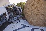
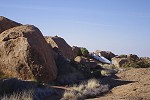
The wreck came to a stop in the middle of a cluster of three rock art sites, narrowly missing O12, located on the vertical wall of a granite ridge facing the plain. This, and the adjacent O13 are the largest sites of this cluster, with numerous complex panels of paintings. At O12 the paintings are on several distinct panels along a large vertical surface, unfortunately very much faded but with many interesting details.
Site O13 is a cluster of large boulders at the end of a ridge, within sight of the aircraft wreck. There are numerous panels of paintings on smaller and larger boulders, some in a protected position and well preserved. Overall, it may be considered the best site of the upper Orabes Gorge.

Site O14, the third of this group was a short distance further among the parallel granite ridges, in a long spacious shelter under an elongated flat boulder. At the left of the shelter there is a very nice scene of a number of elongated human figures and an uncommon elephant. There are further smaller scenes along the shelter and on an adjacent boulder on the far side of the ridge.
Site O15 is a large exposed rock outcrop a little removed from the three previous sites but within sight of O14. It is a somewhat unusual place to fnd rock art, with no real shelter and only a few suitable surfaces at the foot of the rock. The depictions are unusual too, three solitary human figures placed quite far from each other, all except one in a rather crude style.
The remaining four sites O16-O19 are a few hundred metres further down the Eastern ravine of the Orabes Gorge, scattered about a pleasant small terrace. They were a little further than where we first looked, but with the help of Pager's site plans we soon identified all but O16. Site O17 was on a cluster of rocks in the middle of the terrace, while the other two on prominent boulders on opposite sides of the basin. All had small but some very nice scenes.
We spent some time with a futile search for the missing O16, but as it was an unimortant site we decided to rather spend our remaining hour till we needed to return to camp searching for possible sites on the far side of the ridge on the Tssab side. It had a number of promisng boulders with good shade and shelters, but there were no paintings. We returned to camp to pack up and have an early lunch before departing for the trek to the Basswaldrinne campsite.
Our route initially took us accross a series of level terraces and plains with small altitude differences. It was a fairly easy way, and we could afford to look at more promising rocks for any possible sites, as this part of the Tsisab Gorge was never surveyed in a systematic way (if Harald Pager ever did a survey here, it was not recorded in his diaries). However all the promising rocks we looked at were blank, probably these terraces were far too removed from semi-prmanent water sources to be practical as living sites.
As we reached the end of the last terrace, a large triangular shelter came into view in the near-vertical cliffs above. It did not look too inviting, but after some careful scanning frm below Alfons proclained that there are paintings inside. The rest of us could not see a thing, Uwe volunteered to make the steep climb to check. He still saw nothing, until Alfons guided him to the left to the shaded part of the shelter from a good fity metres below. Indeed there were a row of human figures, quite faint but clear if one knew where to look. It was astonishing how Alfons could spot them from the distance. As the route we took was traversed in the past from the Basswaldrinne towards Königstein, it is unlikely that we were the first to spot this site, but it is not reported anywhere to my knowledge.
After this last terrace the slope started to descend steeply into a gully that was draining down to a large terrace some 200 metres below. It was a fairly difficult way, littered with large boulders, leading past us a pair of huge rocks (which looked promising, but contained no paintings). It took us over an hour to struggle down this stretch, settling down for a rest on the plain (and a quick survey of the surrounding larger rocks, again without results), before moving t the edge which finally overlooked the lower Basswaldrinne plain and our campsite. This next stretch was another steep descent of 250 metres, it took us another hour and a half to get down to the huge rocks in the middle of the plain.
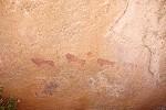
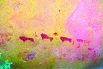
The paintings on the large rocks in the middle of the lower Basswaldrinne plain were first noted by Albert Viereck in 1957, and were published is more detail by Herman Jipsen following a visit in May, 1961 (Prehistoric living sites in the Upper Brandberg, Part 1, 1963). There are paintings on all sides of the three main boulders, some in a very good state of preservation. We spent the remaining time till dusk photographing the various panels which were not on the sun, leaving the remainder for the following morning.
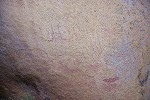
The paintings exhibit a number of curious and unique aspects. One of the most striking observation is the presence of a good 30cm mud deposit on the side of the large boulder covering some of the paintings, indicating that the centre of the plain can sometimes be inundated, and the level has certainly risen since prehistory. Some of the paintings possibly depict cattle, a very rare theme on the brandberg. Also an ostrich hunt scene and a strange animal-headed archer (in some ways resembling the "chameleons" of N3) are without obvious parallels.
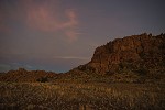
As darknes set in we prepared our camp, the campfire posing a special challenge. The plain was covered with thick dry grass, the risk of fire spreading was very real, and there were no rocks about to build a good sheltered fire place. In the end we dug a hole for a small campfire in the gravel of the riverbed, as far as possible from the dry grass. Around sunset we heared the cough of a leopard from quite close, from the direction of the upper plain. The many droppings about our campsite clearly indicated their continuous presence.
Day 11. - Basswaldrinne - Sesaub Gorge
We were up again at sunrise, as we had another long day ahear. We planned to see the otehr sites of the Basswaldrinne, then start our long descent in the Sesaub Gorge to our campsite at the main conentration of Sesaub sites, about two thirds of the way down.
We started by photographing the remaining panels around the main boulder which were exposed to sunlight the previous afternoon. The most intriguing scene is a large elephant that appears to graze from a tree. There is another elephant at the corner of the rock, and multitude of aimals and human figures.
While we had breakfast and packed our gear, we spared some time for a small ceremony to commemorate what was probably the first (and very likely last) jar of Marmite to have made it to the Tassili, Jebel Uweinat, the Tibesti and the Brandberg (twice) during its lengthy career that started at the Tesco Superstore in Newbury. It was bought at the request of Dora for the 2012 Tassili trip (after acquiring a taste for it from Hannah on the 2011 Brandberg trip), but somehow the jar always seemed to have returned near full, becoming a standard fixture in our fridge in between trips ever since. The nominal expiry date is better left unmentioned... Finally on this trip Attila and myself decided to take a change from the staple pate and cheese breakfast, and finally the jar became officially empty this morning. After taking the commemorative photographs, being made of plastic it was ceremonously placed on the pyre.
Before starting uphill towards the upper plain and the Basswaldrinne pass, we walked to the Western end of our plain to take a peek into Tsisab, and to check out some rocks at the far end for any paintings, even though there were none reported. The view was not as good as we hoped, and we did not find any more sites, but it was a lovely walk back towards the central rocks, the bright morning sunlight turning the grass covered field a deep golden yellow.
Lying 60 metres higher, upper Basswaldrinne plain is very similar in appearance, but is about one quarter the size of the larger lower plain. In 1961 Ruth Jipsen found a large shelter with a nice procession of human figures on its Eastern slopes, it was not difficult to locate them based on the good description.
The other site of the upper plain is at its Eastern end, a mere hundred metres from the pass and the Sesaub watershed (the Basswaldrinne plains drain into the Tsisab Gorge). This site, situated around a large conspicious boulder directly on the path, was already noted by Viereck in 1957. There are a number of interesting, uncommon and outright bizarre scenes on the rock, one of the principal Tsisab sites.
We moved up to the pass, and after a brief pause for photos continued into the Sesaub Gorge. There is a site on this side of the pass too at a similar distance, site B1, also first seen by Viereck in 1957 and reported by Jipsen in 1963. It is a medium sized rock with a few paintings on the side, mostly in a black colour.
Beyond B1 the going down the Sesaub started to become rather difficult, with steep valley sides and the watercourse blocked by huge boulders. We spent a considerable time tackling this stretch, only achieving a distance of a few hundred metres before halting for lunch in the shade of a large rock.

After the lunch stp the going got a bit better for a while, with a series of steep but manageable granite plates offering a good way down. Soon we reached a point from where the small plain adjacent to the cluster of rock art sites became visible. It looked deceptively close, but it was still several hundred metres below us. The granite plates gave way to a rough bouldery slope again, and it took the better part of the afternoon to scramble down to the small plain over the rocks.
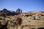
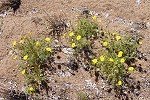
The sun already set behind the mountain when we reached the plain, which was full of seemingly lovely yellow flowers, which on closer look had nasty half-inch needle-sharp thorns and barbs in true Brandberg fashion.
Before darkness we only had time to quickly pitch our tents and go to see the two sites at the perimeter of the plain, B2 and B3. They are both on larger rocks, with only a few poorly preserved scenes.
Day 12. - Sesaub Gorge - Uis
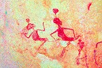
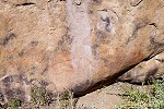
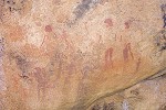
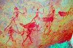
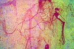
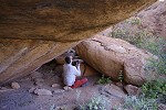
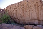
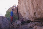
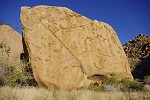
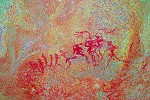
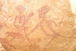
In the morning before packing camp and completing our descent, we made the close to 100 metre climb to the white granite plates above our camp terrace. Aflons' foot was better, but still hurt after the strain of the previous day so he stayed in camp to rest, while the rest of us tackled the rather difficult climb to the cluster of three sites. Site B4 on a couple of large boulders by the dry waterfall is the principal site of the Sesaub, with numerous panels on various rock faces. The most important is a scene of bird and rabbit headed human figures, an absolutely unique panel, fortunately in a good state of preservation inside the main shelter. There are several other well preserved scenes both inside the shelter, and on the surrounding rocks.
Site B10 is opposite B4 on the far side of the granite plates, among some rather inconspicious looking boulders. This site too has a number of panels on the surrounding rocks, but the main panel is inside a large spacious shelter, on the rear ceiling. It contains a multitude of animals and human figures in a very fine refined style, it is one of the highlights on the mountain. Even though we knew it wll be an important site, we were not prepared for the sheer beauty of the principal figures. Not counting the repeatedly visited C28 and N162, this was the finest site we saw on this trip, a very fitting ending. The main panel was very difficult to photograph though, due to the lowness of the shelter it could only be avhieved in segments.
There was one more site left in this cluster, B9 about 100 metres uphill along the watercourse along a steep gradient. Only Uwe and I tackled the slope to the huge rock, which also had a number of panels of paintings. In the main shelter there was only a single but very fine gazelle, but at the rear of the huge rock there is a low niche with a very complex panel of paintings with human figures

There is a further cluster of lesser sites in the lower Sesaub in a side valley which was visible as we descended the previous day. However accessing them would have required coming up to B4 with our packs and continuing from here first down, then up again. Already the previous day we decided that it was beyond reach in the time we had available, so finishing with the nearer sites we returned to camp to pack up and start our final descent. On the col leading ou f the camp plain we took our obligatory grou photo, and as we were within sight of Uis, we could call Basil Calitzat the Brandberg Rest Camp on the mobile that he could expect us at the bottom of the Sesaub in three hours for the agreed pick-up.
We were three hundred metres above the elevation of the surrounding plains, there was still a steep section of the valley to tackle before it started to flatten out. It was a fairly difficult struggle among the big boulders, intersparsed with steep gravel slopes with where patches of the Karoo basalt remained. It was slow going, and we started to notice that the weather has become much hotter at this lower altitude, taking a toll on our rather depleted water reserves.
It took a good two hours (and almost all our remaining water) to reach the part where the valley started to flatten. At this point there was a huge boulder on the right bank, which offered some shade for a rest. We found a few paintings on the side, and have assumed that this must be Ernst Scherz's site Sesaub C (Scherz surveyed the lower parts of all the Brandberg valleys in the nineteen sixties and early seventies), however on comparing the photos of the scenes it became evident that this is an unpublished site. This is rather puzzling, as it is right on the track leding up to the Basswaldrine, and Pager must have noticed it as he climbed to the other Sesaub sites. The terms of his engagement were that he would record any site beyond those copied by Scherz.

We only had about a kilometre left on flat terrain, so we took a longer rest in the shade of the rock before setting out on the last stretch. Our planning was good, we reached the rock at the end of the car track about five minutes ahead of agreed one thirty we promised Basil. After three minutes we heard the sound of an engine, and in another minute Basil appeared in his landcruiser. Looking at his watch he grunted a 'you're early' in lieu of greeting, then broke into a broad grin and produced several bottles of ice-cold Windhoek draft from the ice chest at the back of the car to toast our safe return.
The Sesaub Gorge is the corner of the mountain closest to Uis, it was a little over 30 minutes of bumpy ride along the rough track to get back to the White Lady B&B to indulge in the luxuries of a warm shower and a lazy afternoon and evening by the poolside.
Day 13. - Uis - Windhoek
Uwe stayed in Uis for a couple more days to visit the lower Tsisab sites and Twyfelfontein with Alfons, while the rest of us departed for Windhoek in the early morning. Attila had a flight to catch in the afternoon, while with Magdi we stayed the night at the Etango Ranch near the airport before taking our late morning flight home the next day via Johannesburg.
We are planning further expeditions to the Upper brandberg for June 2015, one with full helicopter support to see the principal Brandberg highlights, and a trekking expedition similar to this years to see some selected areas of the mountain in more detail. Please visit the News page for any updates (or "like" the FJ Expeditions FaceBook page).