
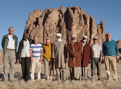
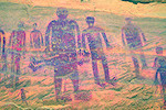
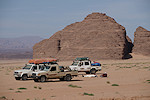
 Click on image for list of participants |
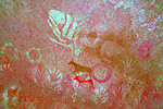
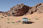
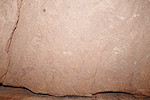
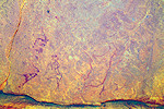
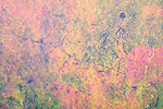
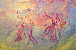
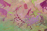
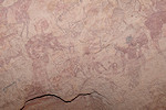
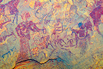
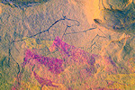
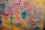
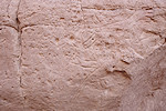
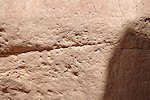
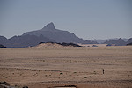
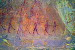
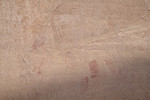
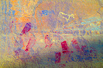
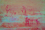
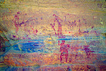
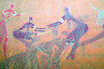
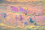
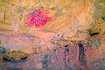
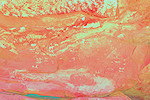
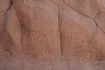
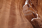
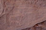
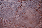
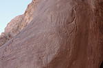
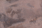
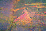
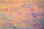
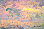
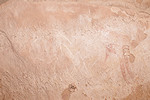
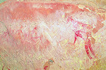
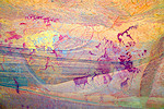
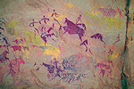
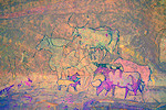
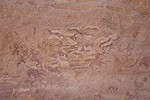
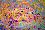
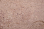
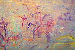
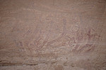
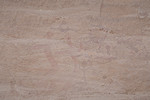
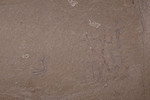
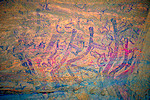
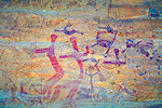
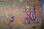
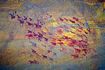
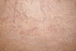
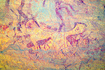
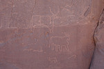
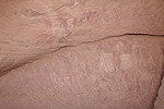
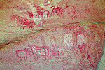
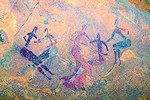
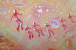
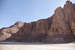
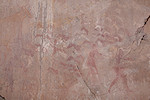
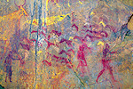
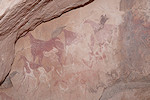
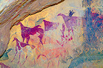
Ouri plain, eastern Tibesti, Chad 18th November - 8th December, 2024 Site references based on numbering system of Adriana and Sergio Scarpa-Falce, Aldo and Donatella Boccazzi False colour images processed with DStretch, a freely available software developed by Jon Harman |
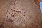
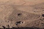
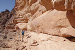
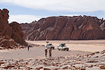
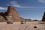
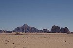
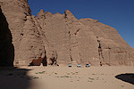
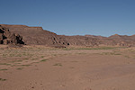
This was our fourth return to the Ouri plain and it's collection of spectacular rock art sites (following January 2015, January 2017 and November 2022). We took the eastern approach via Gouro, and aside seeing the key localities and a number of previously unvisited but known sites, we also had time to explore some of the unsurveyed areas, with excellent ground logistics provided by Tchad Evasion.
Day 1. N'Djamena - Camp before Massaguet
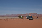
With most of our party arriving with an overnight flight in the small hours of the same day, our departure was a bit later than usual, we rolled out of the gates of the Hotel Irrisor around 9am. This time Issa was our guide and lead driver, with Mohammed and Abu Bakr the other drivers and Rigobert our cook. We made a brief stop at the market at the edge of N'Djamena to top up some fresh supplies before continuing towards Massaguet.
The once reasonably good asphalt road between N'Djamena and Massaguet is now in a terrible condition after the heavy rains of last August, full of huge potholes, many times driving parallel to the road was faster than on it. With the late start and the slow progress we only made it till before Massakory for lunch and a short rest.
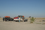
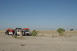
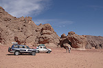
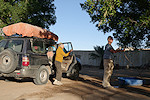
The road between Massakory and Massaguet was somewhat better, but soon one of the two Nissan patrols we had started developing some fuel feed problems limiting engine power. Mohammed was an able mechanic, but his experience was mostly with Landcruisers and after several stops and heads disappearing under the bonnet he could still not figure out the problem. After some discussion over the phone with Faris (owner of Tchad Evasion) we decided that the Nissan Patrols may have been a good idea (they are indeed more comfortable that the Landcruisers), for the trip we are about to do the Toyotas are more suited. We drove till near Massaguet and made an early camp, while two replacement cars were dispatched from N'Djamena and reached us by 10pm.
Day 2. Massaguet - camp after Salal
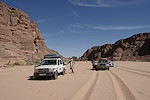
In the morning we quickly re-loaded the new cars, and parting with the Nissans we soon left the asphalt and continued on the track to Mussoro, the last meaningful town before heading out into the wild. We took fuel and the last cold drink for a while, then were on our way again to catch up on the time lost the previous day.
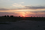
The rest of the day was a long and dusty drive up along the Bahr el Ghazal, with a quick lunch-stop after Mussoro. By late afternoon we passed Salal, from where the going became better along the flat plain bordering the ancient riverbed. We continued till sunset, making camp off the road on the plain.
Day 3. Camp after Salal - Faya-Largeau
This was another long day of driving, the objective being to catch up on our delay and reach Faya as planned by the evening of the third day. We were up at dawn, and soon after sunrise we were ready to roll.
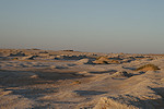
We made a brief stop in Kouba Olanga to fuel, then headed north ito the Erg Djurab. We crossed the dunes without any mishaps, and we reached the yardangs in the dry lakebed before Faya by sunset, making it to the resthouse before dark.
Day 4. Faya Largeau - Gouro
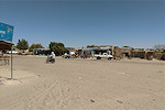
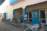
The town of Faya has not become any more endearing since our last visit, after a quick stop at the market to top up our supplies we were on our way again.
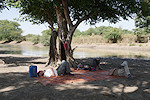
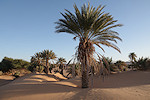
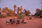
The drive to Gouro was uneventful, we only made a few rest stops and a longer lunch-break, reaching the town by late afternoon. This time we made camp in the palmerie near the old French fort along the western border of the oasis.
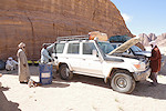
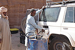
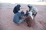
At sunset Idriss, our guide of the November 2022 trip arrived with his pickup loaded with a 200l drum of diesel. The cars were fueled, and Idriss departed, planning to meet us at his house in Bini Erde, some 80kms to the North west.
Day 5. Gouro - camp east of Kozen
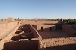
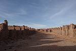
At sunrise, while our crew packed camp and loaded the cars, we walked to the nearby old French fort, which was in a surprisingly good condition given it's use as an artillery position during the Libyan wars, apparently there was no heavy fighting in Gouro itself.

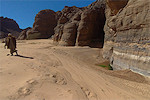
By the time we returned, the cars were ready. We drove to the sous-préfecture to have our permits seen and endorsed, everything went very cordially, Idriss was clearly on good terms with the officials. We took water from the principal well in the village, then set out on our way. The pass out of Gouro was less difficult than last time, despite being heavily loaded wo got all cars up in one go on the soft sandy pass.
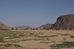
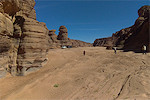
The well and small village Bini Erde lies just to the west of the Emi Koussi volcano, at the foot of the Tibesti. At some point a large lava flow descended from the volcano and still forms the western bank of the large oued, the track winds at the foot of the basalt cliffs. We approached the village about midday, we stopped for lunch in the shade of some large acacias in the oued before going to meet Idriss.

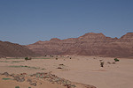
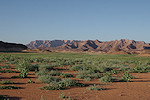
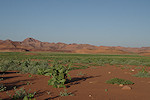
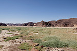
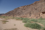
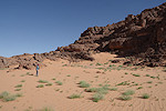
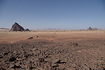
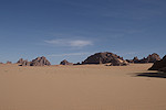
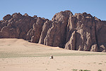
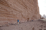
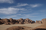
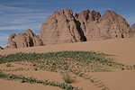
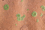
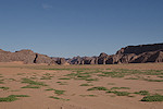
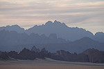
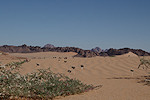
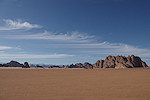
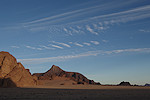
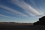
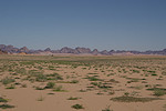
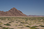
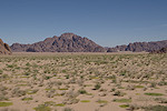
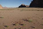
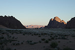
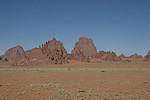
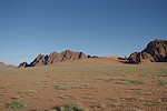
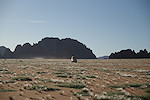
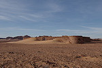
In the afternoon we continued along the track north (the same which we took in 2022) till arriving at the Kozen valley some 60 kilometres further north. Even before we saw many green patches where previously there was only barren desert, but as the valley opened up, it was an amazing sight. The country ahead was covered with a continuous solid green carpet (mostly Schouwia thebaica), not only in the watercourses but also on the adjacent sandy slopes, there must have been a spell of unusually heavy rainfall in this area.
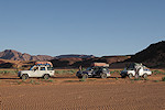
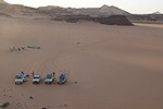
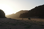
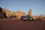
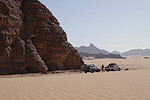
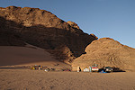
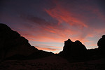
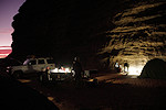
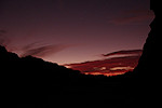
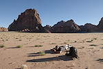
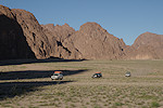
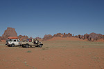
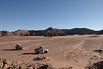
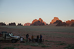
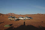
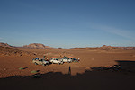
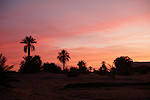
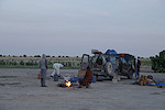
After driving for another half an hour we made an early camp in a small valley adjacent to the main one, finally enjoying being in the desert after five days of almost continuous driving. We all scrambled to a high point above camp to take photos, while Rigobert set about to finally prepare a dinner in daylight.

Day 6. Kozen - Ouri Sao - Enneri Borou East
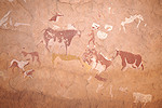
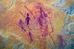
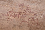
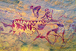
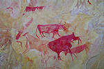
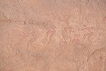
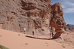
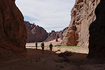
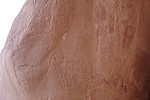
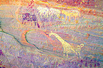
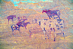
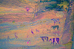
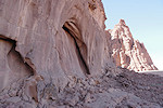
From our camp, we had little over a hundred kilometres to go till the mouth of the Ouri Sao (or Enneri Yangara, as the outer section is known). With an early start, we covered this distance in the morning, reaching the first rock art site in the valley by midday, the splendid Karnasahi style paintings reported by Yves Gauthier (Les Cahiers de l'AARS 22) after their 2017 expedition.
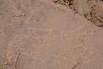
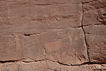
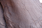
We continued further up the valley, which was also filled with dense vegetation, stopping at the multiple engraved panels of site OS 02.
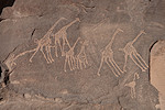
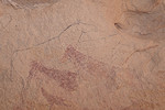
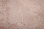
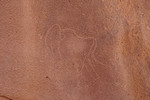
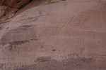
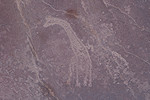
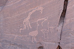
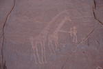
The valley underwent some dramatic changes. Two years earlier the lovely panel of giraffe (OS 07) found by Yves Gauthier and party was mostly hidden behind a dune bordering the valley. Now the dune was completely gone, even with the GPS point it took a while to recognise the giraffe, high on the vertical rock face above the valley floor.

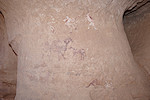
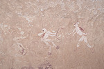
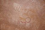
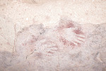
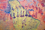
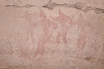
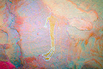
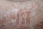
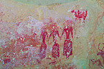
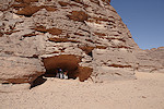
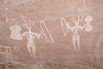
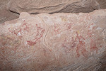
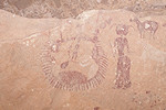
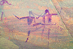
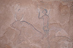
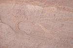
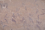
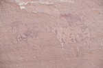
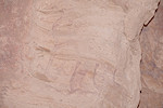
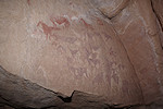
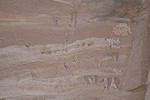
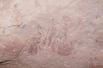
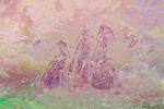
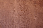
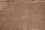
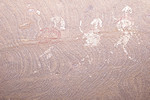
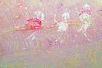
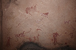
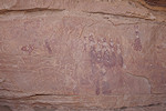
Our camp was to be made in the lower Enneri Borou, a few kilometres upstream of where it joins the Our Sao. Before camp we went to see the principal site of Borou East, BE 01 with the strange white figures which don't readily fit any of the local stylistic conventions.

We made camp in the small side valley near the cluster of sites BE02-05, and set about to explore the area, including the strange engraved therianthrpe at BE 02.
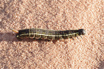
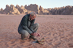
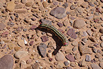
As we walked about, it was impossible not to notice the huge amount of large caterpillars, some crawling on the sand in a purposeful way, others feeding on the fresh vegetation. They were all the larvae of the Sphinx moth (Hyles livornica) in different stages of development, Attila was particularly captivated by them.
It was a lovely quiet afternoon and evening, we just enjoyed finally being at our destination and able to wander around without the need to get beck into the cars again.

Day 7. Enneri Borou East - Mossei
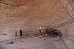
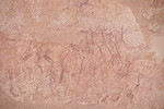
After breaking camp we drove to the large shelter of Siekouba (SK 01) which has some exceptional large cattle depictions. When we visited in 2022 they were fully out on the sun and practically invisible, we noted this was an early morning site. This time we could see more, but the large cattle are very weathered, the right one was practically obliterated by water flowing over it.
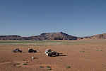
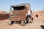
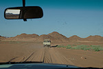
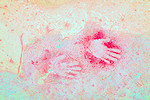
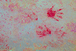
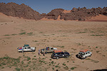
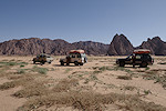
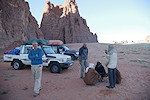
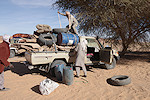
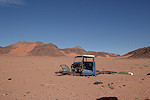
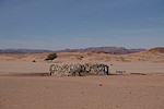
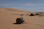
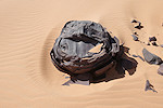
We continued North in the valley of Siekouba to site SK 02, tucked away in a small enclosed bay just off the main track leading north towards Mossei and Libya. As we visited the depicted handprints and strange circles, looking back we spotted a car on the far side of the valley, with no visible movement around it. Our drivers went to check it out, it turned out to be an abandoned Toyota FJ45 pickup, fully loaded with supplies and belongings. It was not there two years earlier but he deflated tires indicated that it stood there for quite some time. Idriss did not recognise it as belonging to anyone local, as customary in these parts it carried no license plates, so we could not even tell if it was from Chad or Libya. I wonder if it will be still there on our next visit...
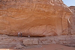
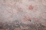
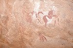
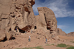
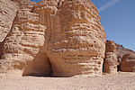
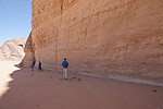
Our route continued North, making a little detour towards the West to the hill with the major site of Ouri 00 ("Riparo del mani"), which we embarrassingly failed to find and visit in 2022, mistaking the lesser site OU 00/B a couple of hundred metres away on the other side of the hill as the main site. The main site is truly spectacular, with a large Karnasahi style frieze along the rear and outer ceiling of the shelter, with the positive and negative handprints prompting the name of the site (it was discovered by Aldo & Donatella Boccazzi in the early nineties) tucked away in a deep corner of the ceiling.
After the "Riparo del mani" we soon joined the main track leading from Ouri to Rebiana (about 400 kilometres away, more than Gouro but doable in considerably less time due to the better terrain). The track passes right by the main shelter of Mossei (MO 00), hidden in a small shelter in the side of a hill.
While we were busy clicking away in MO00 (one of d'Alvergny's original sites), Gábor wandered off to the far side of the valley, and when we picked him up on departing, he reported finding some engravings at the promontory opposite the main shelter. Departure was cancelled and we all proceeded to check them out, finding numerous panels of unrecorded cattle engravings all around the rock outcrop.
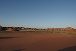
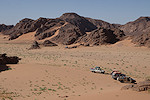
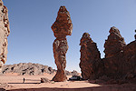
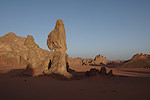
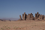
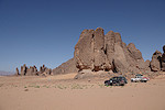
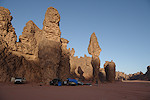
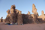
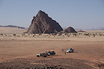
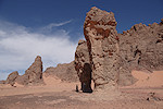
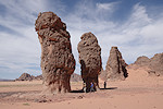
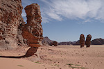
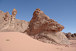
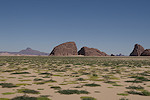
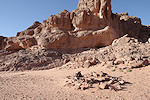
We made camp at the spectacular rock spires surrounded by red sand in the northern part of the Mossei region, to be used as a base for the next two days. Here too on the side of the spires we found some further unrecorded crude engravings.

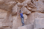
In the afternoon with just two cars we set out to visit the principal lesser sites of Mossei. One that particularly interested me was MO 03/B, a site supposedly somewhere above MO 03 (which we did find) on the same rock outcrop. Reaching the site, this time the layout was obvious. There was a long shelter along the side of the hill right above MO 03, with no apparent access, except perhaps up a crevasse some 20 metres to he right. I could make it up to the level of the shelter in the crevasse, but the ledge leading to the shelter was very narrow with the 15 metre drop to the side, I did not feel comfortable giving it a try. I later learned that Aldo Boccazzi (an accomplished mountaineer) did use this ledge, the only access to the fine Karnasahi style paintings. We had to console ourselves with photos taken with a telephoto lens.
We passed by MO 15 which is a shelter that was inhabited till recently (with some belongings still left on a ledge). There is a fine panel of Karnasahi style sheep and cattle on the wall, but the most curious painting is a faint figure of the ceiling with a strange headdress.
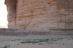
We also visited the pair of compass graves near MO 15 which are some of the best visible ones when on the spot (most can only be made out on satellite imagery, hardly visible on the terrain), with a convenient ridge behind them from where they can be seen and photographed. Little is known about these monuments other than their orientation (always pointing east, hence their name), but based on some analogies with the "keyhole" monuments of the Tassili, they might be associated with the Karnasahi pastoralists, at least their range and density closely overlap.
We finished the day at MO 09, the most spectacular of the lesser Mossei sites with a large panel of Karnasahi style figures covering the entire rear wall of the shelter.

On the way back to camp we were in time to catch the amazing spectacle of sunset among the sandstone spires and red sand.
Day 8. South Dohone
Already in 2022 Iddriss offered to take us to the north across the nominal border, where the Ouri plain continues along the foot of the northern extension of the Tibesti (Dohone) for another 120 kilometres. The Tibou of Gouro (and Ouri) consider this a part of their land. At the time, as our itinerary was full, we declined the offer, but now having plannined for it we gladly accepted. Jacques Gandini and the Boccazzis reported a number of spectacular sites in the area, with a good concentration of them just to the north of the border. We set out in the morning, joining the main track leading north that bypasses the numerous minefields laid out during the Libyan Wars and the subsequent Tibesti rebellion in almost every passable wadi. I presume Idriss must have been involved in their laying (Ouri and Gouro were both rebel strongholds) as he had full details of each of them, including the names and fates of the occupants traveling in the wrecked vehicles that now mark them out.
Our first stop was a group of hills some kilometres to the east of the Oued Meussa Kouda, where Jacques Gandini reported a number of engravings, including some very interesting ones seemingly in a style that is a close match for the Karnasahi paintings. Unfortunately his published waypoints are very inaccurate (to the degree of several hundred metres), we only found some of them. As our time was limited, with more interesting sites to come, we decided not to waste time searching but continued.

At a cluster of rocks a couple of kilometres away the Boccazzis have reported a site with some paintings of unclear affinities, as well as a fine panel of cattle engravings.
We continued another ten kilometres to the north to the outer Enneri Tahon, where Jacques Gandini reported a cluster of interesting Karnasahi style paintings and a panel of engravings at a very picturesque rock outcrop.

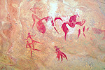
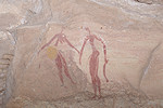
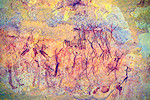
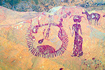
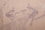
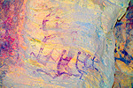
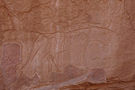
The small but spectacular shelter of Tasko Mohammel (TM 01) was definitely the highlight of our trip. It was reported by Aldo & Donatella Boccazzi in 2009, together with the other sites of the area. All the walls of the shelter are densely covered with paintings, some the pre-Karnasahi figures known from Korossom Timy and the Enneri Daobou, but the majority the classic Karnasahi style.
Site TM 02 is a few kilometres away along the northern banks of a large wadi, this too has a number of Karnasahi style panels
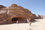
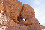
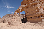
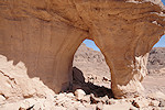
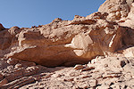
Not far, along the southern side of the same oued there is a large rock with a hole through the middle, with some spectacular paintings along the wall of the natural arch (TM 04). There are two remarkable animals depicted, the heads suggest horse but the bodies are non-equine, probably they represent hippotragi (but strangely with no horns).

Nearby on another small rock there are several panels of late pastoralist paintings (TM 03) which are exactly in the same style as some of the Ennedi paintings.
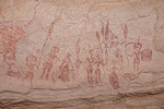
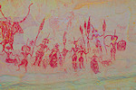
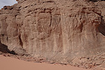
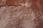
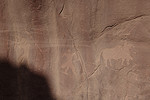
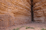
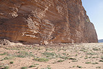
It was now almost midday, it was time to move back towards the south towards another two valleys with a number of reported rock art sites. After some time along the main track we entered the Enneri Tahon, a major watercourse with its source high up near the prominent Pic Betté (later corrupted to Bikku Bitti, the highest point of Libya). Here the Boccazzis reported a unique major site (TA 05), not in the main valley but in a branch to the north, strangely not in a shelter but along an exposed vertical rock ledge.

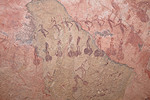
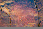
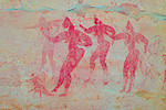
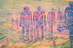
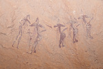
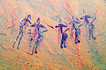
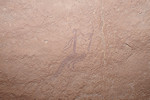
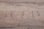
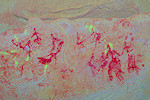
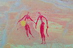
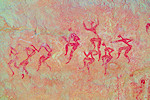
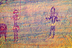
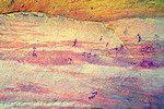
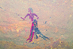
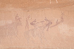
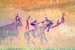
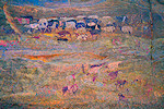
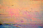
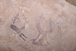
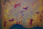
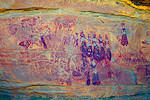
The huge panel along the rock face contains several groups of very large human figures (the largest approaching a metre in height) in a style very different from others on the Ouri plain (but bearing some resemblance to the Wadi Sora style paintings in the Gilf Kebir). The large figures appear to be archaic, with some very faint weathered pastoral paintings superimposed. Unfortunately facing south, the entire panel was fully exposed to the midday sun that made it almost invisible. However using a very powerful flash t flood out the sunlight, I did manage to take some reasonably good photos revealing many details which we could not see on the spot.
The time was ticking much too fast for our liking, we left the deep interior of the Enneri Tahon with a few lesser sites for some other time and re-traced our route to the outer section of the wadi. We stopped at a big guelta to fill our empty jerrycans, interestingly despite the abundant greenery the only place along the Ouri plain where we found standing water (though we did not visit any of the principal known waterholes).
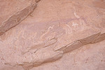
Site TA 03, also reported by the Boccazzis, was at a prominent outcrop to the north of the watercourse, not far from the point where the wadi enters the sandy plain to the east. There are crude engravings and some weathered paintings all around the rock, the most interesting being a "femme ouverte" (the easternmost example known in the Sahara) and a pair of elephants.
Our last target for the day before retreating to our camp was Messi Kouda, a wadi running parallel to the border just a kilometre or two to the north. Jacques Gandini reported here a number of sites with both engravings and paintings. We entered the valley with some apprehension, as several other of Gandini's points turned out to be very inaccurate, but the big shelter of MK 01 turned out to be pretty straight forward to find, visible from afar even if the published point was several hundred metres in error. Inside there are several weathered Karnasahi style panels.
MK 02 turned out to be far more difficult to find. Gandini's point placed it somewhere on the northern side of a small side branch, but we could find nothing resembling a suitable shelter. After a rather lengthy search we did find it, tucked away under a rather inconspicuous rock along the southern side, quite far from the indicated point.
Site MK 03 was easier, as while we searched for the previous, Issa and Idriss checked out a low rocky outcrop and found the paintings, again nowhere near where Gandini indicated them. This site turned out to be much more impressive than anticipated, with a splendid panel of Karnasahi style sheep and goats covering the ceiling.

At this point we were a mere 4 kilometres from camp as the crow flies, but it was a good 30 kilometres drive, backtracking along the wadi then taking the main track south, dodging the minefields before re-entering Mossei. As sunset was fast approaching we had to leave, only having enough time for a brief stop where Gandini reported a few engravings along the northern edge of the valley. The supposed engravings were nowhere to be found at the marked point, but in a low shelter Bruno found a couple of interesting, archaic looking human figures executed in white and yellow.

Day 9. Mossei Ouri - Araské
The past days were already cooler than normal, but this morning was distinctly chilly, just a few degrees above zero. It was more reminiscent of mid-winter than the usual late November weather, giving a good incentive to quickly pack camp and get inside the somewhat warmer cars. Before leaving the Mossei area we made a brief stop at site MO 01, a large shelter with some late pastoral paintings.
Continuing south towards the Ouri Sao we passed another compass grave prominently visible on Google Earth, as it was close to our route we stopped to investigate.
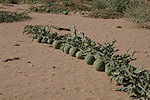
We made another stop at the hill of Ehi Turqui, where we found the surrounding sand plain vanished under a dense carpet of colocynths and other plants. We visited the small but splendid little Karnasahi style site of ET 01 before moving on towards the nearby Ouri village.
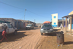
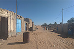
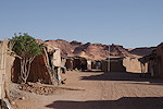
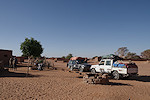
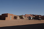
Ouri seems to have grown since our last visit, more of the houses showed signs of occupation, and while there was only a single old Toyota pickup two years ago, now almost every house had a car parked next to it. Idriss made a quick visit to see his parents now living here, then we were on our way again.
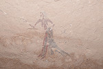
From the village we drove straight south across the sand plain to the Enneri Araské, aiming for the cluster of hills on the far side with the small but beautiful site of AR 00 (one of d'Alvergny's original sites). We also visited the nearby site of AR 13/B with the hairdressing scene that we found in 2022.
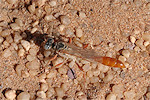
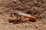
We made camp nearby at the same spot as two years earlier. Setting out the table we noticed a strange looking wasp I have never seen before, busy digging a hole. After reaching home and consulting with a wasp specialist ti was tentatively identified as Parapsammophila foleyi, a member of the thread-waisted wasps family.
It was still rather cool with a strong wind, lingering around at camp was not a very pleasant prospect, so after a quick lunch we set out again, to see the sites scattered about the inselbergs littering the plain to the south of the Enneri Araské. We spent a leisurely afternoon, enjoying the rare luxury of being able to spend as much time as we liked at each of the sites.
It was late afternoon by the time we returned to camp, just in time to enjoy a proper sundowner in perfect light.
Day 10. Araské - Enneri Borou
After packing camp in another chilly morning we continued our southward progress along the Ouri plain, towards the Enneri Borou. We spent the morning with the sites along the northern bank, cherry-picking the finest sites and scenes and enjoying the magnificent scenery, almost unrecognisable with all the fresh green vegetation.
Late morning we crossed over to the southern bank, made a bit tricky with the tracks at the crossing having been washed away and replaced with very soft sticky sand. We continued through a number of sites before heading to camp early afternoon. It was still very cold, in a rather unusual fashion we all sat out on the sun soaking up the warmth as if on a skiing holiday while Rigobert prepared lunch.
The rest of the afternoon was spent with a rather leisurely circuit of the south Borou sites, discovering a few scenes which were missed when we first visited these sites in 2017
.

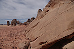
At site BS 04 we found much of the original ground below the paintings washed away, with only a narrow ledge left, a good illustration on how at some sites the paintings appear far above what appears to be reachable at present, with the ancient shelter floor long gone. By the time we finished with all the sites it was late afternoon, it was close to sunset as we rolled back to camp.
Day 11. Borou south - Enneri Borboré east
Overnight some clouds moved in, creating a beautiful sunrise as we reluctantly crawled out of our warm sleeping bags. It was still cold, though perhaps not as chilly as the previous nights. We were to use this camp as a base for two nights, so after breakfast we immediately set out to the nearby huge site of BS 06 to beat the sun, which obliterates most of the paintings after 10am. This being one of the largest and most important sites on the Ouri plain, we spent a long time photographing all the details.

By the time we were finished, the sun was approaching the shelter, and the clouds were dissipating. Two cars soon arrived to take us to our next target in the Enneri Borboré, BR 03, which we have only managed to see in the afternoon when out on the sun, now we finally had the chance to see and photograph the exquisite figures in good light.

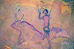
We continued to the nearby outstanding sites of BR 04 and BR 02 with the splendid polychrome cattle. Unfortunately the latter was now fully on the sun, much to the disappointment of Attila and Bruno who saw it for the first time, but thankfully some clouds drifted in enabling better photos.
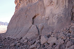
It was still mid-morning, our objective for the rest of the day was to visit the eastern parts of the Enneri Borboré, two large basins separated by a ridge (with a connecting pass), where the Boccazzis reported a few engravings at three localities. In particular BR 12 looked interesting, with three rhinoceros on a single panel. This area is separated from the part of the Enneri Borboré crossing the Ouri plain proper by a two kilometre canyon as the main watercourse enters the low sandstone plateau to the east of the plain. About half-way through the canyon I spotted a shelter high up in the cliffs, worth a look as it was easily reachable on the talus slope. Climbing up to investigate, a large blob of red paint was immediately visible. On close look it turned out to be an amazing scene of a large flock of red sheep with black outlines, with another similar but faded scene below. It was a splendid find, Issa and Idriss immediately caught on to the thrilling concept of exploring for new sites.
We started exploring the broken northern part of the main basin, and in a lateral valley we found another high and inaccessible shelter with some paintings, though not quite as spectacular as the first one.
In the distance a group of prominent rock towers, echoing the landscape of our Mossei camp looked very inviting, though there were no known sites marked there. Assuming the Boccazzis would have checked out such a prominent spot I did not expect to find anything, but immediately as we stopped we found engravings all around the base of one tower. Idriss and Issa enthusiastically checked out all the surrounding rocks, and soon there were yells coming from all directions signaling more panels on almost every rock outcrop for a good 200m stretch along the southern tip of the promontory. They were mostly the usual crude cattle, but there was also a nice panel with human figures and a solitary, rather schematic elephant.
Having ascertained that there were new sites to be found even at such a prominent spot, it became clear that the valley was far from having been systematically explored. Probably the Boccazzis came here for water, as a guelta was marked aside the engravings, and probably just did a cursory look at some promising sites. As we still had all afternoon, we could do a more systematic search. Bruno recalled that there was a prominent shelter visible at the end of a tributary we just passed, we returned and indeed found some Karnasahi style paintings, including a delightful little scene of a cattle being restrained by a group of humans. Driving back the same way, we spotted another fine panel of engravings some distance before the rock towers.
For midday we decided to go to the guelta in hope of finding some water as well as shade, as finally the weather started warming, though it was still cooler than normal. We found the guelta dry, but the sand was still damp around with a colony of Cavernous Crystalworts (Riccia cavernosa, a species of thalloid plant loosely related to mosses, which we have also seen at Jebel Uweinat after rain in similar settings) and a multitude of caterpillars (Hyles livornica). On the smooth rocks leading to the guelta we found some unreported crude engravings, and on the wall which provided good shade there was a larger panel, again clearly the area was unexplored. Searching further, we found a large panel of cattle engravings on the far side of the rock providing the shade.
Driving along the rocks bordering the basin we found another two smaller panels of cattle engravings before reaching BR 07, the only site reported by the Boccazzis in the large of the two basins, with some rather fresh looking engravings of cattle and spear wielding figures.
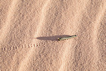
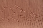
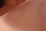
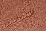
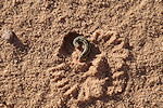
A narrow passage led from BR 06 along a partially washed-away dune into a crevasse, which ended in a small circular room with a sandy floor (no guelta), and on the walls we found some very finely engraved cattle, reminiscent of those painted in the Karnasahi style. The side of the blocking dune was full of tracks very reminiscent of horned viper tracks, but still a bit different. We have seen many of these before, now finally the mystery was solved: these tracks were made by caterpillars climbing the dune, slipping down and attempting again...
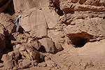
By this time it was mid-afternoon, we had to move over to the southern basin if we wished to have any time to explore other than a brief look at the two known sites. The gap in the ridge was just opposite BR 06 on southern bank, with a blocking dune barring the outflow from the southern basin in this direction. We found a large dry playa behind the dune, and not far further, along the north side of the valley, a rock tower with numerous shelters on multiple levels. The lower ones were found to contain some paintings, while the "upper floor" was full of a rather spectacular set of engravings.
Site BR 11 of the Boccazzis was a couple of kilometres further upstream along the southern side of the valley. A large defile was visible from afar, probably the most obvious location to be checked out along the entire valley so far. We did find the panel of cattle and the crude elephant, but to our surprise there was more. At the rear of the same rock Bruno found three fine ithyphallic therianthrope figures, rather unique engravings with just a handful of examples from the entire Eastern Sahara.
Before heading back towards camp we made a very rapid visit to the last known site, BR 12 with a series of fine engraved rhinoceros and other animals.

We exited the southern basin through another narrow passage into the northern basin, which here was covered with a dense growth of Aerva persica, giving the impression of a grass covered savanna rather than a sandy desert.

On our way back we had time to make another stop at BR 02, which by now was comfortably in the shade. Before heading to camp we also visited the nearby BR 04 with the large white cattle.
Sunset caught us on the plain between Borbré and Borou, the spot with perhaps the most spectacular view along the entire plain, with Ehi Muskorbé and the rising foothills of the Tibesti forming an impenetrable wall along the western horizon.
Day 12. - Enneri Borou - Enneri Borboré - Enneri Fofoda
It was another very chilly morning as we packed camp and set out again towards the Enneri Borboré, this time the central and western sections. We started at the spectacular site of BR 14, a huge and exceptionally well preserved panel of Korssom Fantastic figures, which we found during our 2017 expedition.


As we stopped to check out a small rock outcrop, we were astonished to find a whole field of Desert Inkcaps (Montagnea arenaria) growing on the top of the adjacent trailing dune. I have never before seen so many in a single cluster, usually one finds them solitary or just a couple.


The plan for the rest of the day was to explore the western part of the Enneri Borboré, beyond the last known point. On the south bank BR 14 was at the limit of terrain passable with vehicles, but along the northern bank there are several interconnected sandy plains leading deeply in towards the Tibesti foothills, with a possible passage visible on Google Earth leading back towards the main wadi with a connection to the very interesting looking plain to the south. We quickly found that this passage was for camels only (their path was clearly visible on Google Earth), with large rocks barring any crossing with vehicles (one would have needed several crowbars and probably a day's work to clear the way). We had more luck exploring the rest of the plain, from afar a large shelter was visible and our hunch was correct, it contained two large panels of Karnasahi style and some late pastoral paintings.
Continuing in the same valley system we found another three sites with mostly faint and damaged paintings, Issa and Idriss again taking the lead in checking out all possible places, having experienced the thrill of new discoveries the day before.
With the passage in the valley blocked, we made an attempt to follow the riverbed, where there were several fresh tracks. The sand was very soft, we became stuck several times, but in the end we managed to reach the end of the tracks, a series of almost dry deep gueltas beyond which the sand was so churned and piled into heaps by the recent rain that it was clearly impassable.
To reach the target area (and back) on foot would have required a whole day, as it was already past midday we returned to our usual Fofoda camping spot for lunch and a little afternoon nap before heading out again to make a round of the principal Fofoda North sites, primarily for the benefit of Attila as the rest of us have visited them already in 2015 and 2017.

We finished the day at the amazing FN 00 shelter, one of the key sites of d'Alvergny and certainly one of the ultimate Ouri plain highlights.
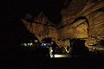
After sunset and dinner we made the short walk from camp in the dark to the magnificent FN 01 site, to visit it in torchlight before the serious photo session the following morning.
Day 13. - Fofoda North - Fofoda South
In the morning after packing ur bags and breakfast we went back to FN 01 for a lengthy photo session, while our crew packed camp and loaded the cars. As the rock face is quite uneven, this early morning light with the sun behind the mountain is the best time to take photos, with no disturbing sidelight. Later in the day the reflected sunlight creates strong shadows, and after late morning the entire panel is on the sun.

Once we were done, we walked back to camp and drove with the cars to the southern bank of the Enneri Fofoda, again cherry picking the best sites, including some that were found by Yves Gauthier and party in 2017. We spent the whole morning in the area, racing the sun from site to site to have good lighting.
The southern part of the Ouri plain was astonishingly green, with practically all of the sand covered with vegetation. This was particularly dense as we approached the FS 03 site, where we intended to camp.
The large Korossom fantastic site of FS 03 is out on the sun till late afternoon, so after lunch we set out to explore the hinterland not reachable with cars. We searched a number of rock outcrops, but found nothing new. On the return we passed by the small site of FS 05 reported by the Boccazzis, which we have not seen on any of the previous trips.
By the time we returned the shadow moved in, and we could start photographing FS 03. With no time pressure this time, we could afford a leisurely session along the wall, which revealed a number of very faint archaic scenes above and to the left of the main panel which I have completely missed on previous visits.

Day 14. - Fofoda South - Luli Edrenga - Karnasahi
In the morning after packing and loading we left camp and made a brief detour to site FS 07, another Korossom Fantastic site which is usually out on the sun, we just managed to catch it in good shade. With the better conditions, here too I found several scenes which were missed earlier.
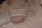
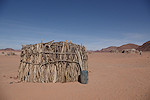
We continued to the rocks of Luli Edenga, visiting the more important sites of the locality along the southern side of the open plain surrounded by scattered inselbergs. In one shelter we found some left-behind belongings of nomads, appearing just like the depictions of shelters in the ancient paintings.
Mid-morning we continued to Karnasahi, which was hardly recognisable. The golden sand was all gone, replaced with a thick green carpet everywhere. We made camp at the central cluster of rocks that provide shade all day (it was finally getting warmer), then set out on foot to visit the various sites following the sun. First we walked across the meadow to KS 07, then back to KA 11 before returning to camp for lunch and some rest.
In the afternoon we made another longer walk to site KA 02, not only for the lovely paintings but also to enjoy the amazing scenery. Along the way we solved another mystery: what is happening to all the caterpillars. We saw several busy digging themselves a burrow to pupate, no doubt emerging as full grown moths in a couple of weeks.

We finished the day at KA 00, the principal site of Karnasahi, which comes into the shade mid-afternoon. After a lengthy photo session we returned to camp just as the sun was setting.
Day 15. - Karnasahi - Tcherughé - Korossom East
We left the last full day on the Ouri plain to explore a complex system of interconnected northern tributaries of the Enneri Korossom along the eastern edge of the plain. To our knowledge these wadis have never been explored, and any number of sites may lie hidden there. However there were still two major sites for the morning, both of which face south west and are only visible early morning (or late afternoon). We after packing camp and making our group photo we started at KA 06, one of the most important Korossom fantastc sites, reaching it just in time before sunlight reaches the main panel.
We moved on to the huge site of Tcherughé (TC 01), which was far better now that in the late afternoon light on our previous visits, especially the first shelter with the large format cattle which were always out on the sun.
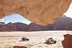
From Tcherughé we turned north, crossing the Enneri Korossom at an easy spot where two facing sand filled tributaries offered an easy way down and up through the otherwise steep banks. We headed for a group of inselbergs high above the valley on the sandy (but now completely green) plain, seeking out a suitable campsite where we could leave two cars while we set out to explore further east. We found a good flat sandy patch at the northern foot of the hill with a large shallow shelter that offered good shade all day. It was certainly put to the same use in the past, as attested by a giraffe and a few other engravings.
As we set out towards the entrance of the valley system a some kilometres to the east, just a few dozen metres from camp we passed a large panel of crude cattle engravings, including a unique representation of three smaller cattle drawn inside a larger one, judging by style and patination a single composition.
Just at the entrance of the valley we found another cluster of similar engravings, spread along the edge of a rock outcrop, at a commanding position with a clear view of all the valley and much of the open plain to the west.
Moving further in, we saw a prominent shelter along the southern side of the valley. On exploring, we found plenty of remains of ancient habitation, but the quality of the rock here was very bad, only a few traces of paintings remained of what was probably a covered wall. We had more luck at the cluster of rocks below, finding several more panels of the familiar crude cattle engravings.
Exploring a little further, Attila found a low natural arch along the valley edge, with a large panel of very fine engravings of cattle and a large human figure, the same type as the engraved figures we have seen at Messa Kouda east (ME04).
On the northern side of the valley after a turn we spotted a long, broad and accessible terrace with several shelters along following an unconformity in the sandstone beds, a typical location for sites. We climbed up, and immediately beside a natural arch found some crude engravings, but of a different style than those before. However the rest of the terrace was disappointing, despite several suitable spots the rock quality was very bad, we only found a single very weathered panel of Korossom Fantastic paintings.
After a quick lunch we continued upstream, tackling a series of rocky steps which nearly blocked the way as the valley descends towards the main branch of the Enneri Korossom (also called Ounga in the lower section). We found more scattered engravings, including a unique depiction of two running gazelle.

A shelter along the side of a solitary rock outcrop yielded the first meaningful paintings, plus an engraved "femme ouverte" on the adjacent wall.
We were now in the middle section of the valley, a good six kilometres from the entrance. We found several more engravings and a small shelter with paintings, all at conspicuous spots recognisable from afar. At one site we saw what appears to be a trapped giraffe, common at Jebel Uweinat but the first such representation here.
After another bend the valley opened up, we reached the broad basin where the second northern branch merges with the main one (with the third a few more kilometres downstream). At a point about ten kilometres from the entrance, just before the valley starts to narrow again, we found a shelter on the southern side, again with the bad quality rock. The ground was littered with shards of the typical pastoralist ceramics, but there were just some vestiges of paintings.
We checked out two more shelters without finding anything, by now it was well into the mid-afternoon so we needed to start on our return. As we did, we spotted a promising shelter at some distance along the northern side of the valley, and decided to give it a last try before starting back. It was certainly the right decision. In the prominent shelter we only found some fine engraved cattle, but there was a low shelter to the left, not visible from a distance, which contained some exceptional Karnasahi style paintings, the finest find of the day.
While we were busy photographing, Ursula wandered off to behind the rock outcrop, and soon we heard her yell - she found another shelter with some fine paintings, including a row of figures wearing the same "aerobics socks" as those at Mossei.
By now we really needed to start back, with the sun getting precariously low on the horizon. Fortunately we had our tracks to follow at the difficult bits, so we quickly covered the 15 kilometres back to camp, reaching it just before sunset. All in all it was a very fine day, we found 14 new sites, and we have covered less than a third of the valley system, leaving plenty for another visit.

Day 16. - Korossom East - Enneri Fofoda - camp east of Binem
After some slightly warmer days it was again a very chilly morning, and the shading mountain that did such a good service the previous day was of no particular help in the morning, ensuring that the sun remained out on the plain, too far to comfortably walk there with a cup of warm coffee. We quickly packed up and loaded the cars to leave as fast as possible, as inside the cars at least there was no wind.
Our time was up, we had to start on our way back to Gouro. However we were not quite finished, this time we planned our exit via the Enneri Fofoda where the Bocazzis reported several sites in the lower section. In 2022 we already entered it part of the way to see one site, and at the time we discussed with Idriss that while he has never been that way, the numerous fresh tracks suggested the way was safe. Thus now we first drove north along the grass covered plain, to get back to the eastern entrance of the Enneri Fofoda.
The riverbed was sandy but not particularly difficult, and unlike the Enneri Korossom (Ounga) which was filled with a lave flow from the Aozi volcano and forced to make many wide bends, the Enneri Fofoda cuts through the sandstone hills in a much more straight line, so even with the backtracking the total distance to be traveled when exiting the Ouri plain was less. It took a little over an hour to reach the first site, FE 03, a panel of engravings (including giraffe hunt) on a prominent rock wall along the bank of the wadi.

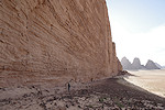
Further downstream, FE 05 is a prominent but not very comfortable shelter at the base of the cliff bordering the valley some way up the talus slope, with a large panel of Karnasahi style paintings on the vertical wall.
Sites FE 01 and FE 02 lie very close and within sight of each other about half-way between the Ouri plain and the exit to the west, both shelters high up at the base of the cliffs reachable on the talus slope. FE 02 is not particularly exciting, but FE 01 has some very nice late pastoral paintings, one of the largest sites of this style in the area.
We still had half of the morning left, we continued along the Enneri Fofoda till reaching the open country to the East, and continued along the same course until hitting the main track from Ouri Sao to Bini Erde, the same we took on our onward journey. From here it was an uneventful bumpy ride till the lower course of the Enneri Korossom (Ounga), where we stopped for lunch. Idriss took the opportunity to fill his now light pickup to the brim with the finest acacia driftwood collected from around the lunch spot, tying the now empty fuel drums to the top of the already precarious pile.

From here we continued along the track for the rest of the afternoon, only stopping when the sun set at a small secluded alcove not far from where we camped on our onward journey.
Day 17. - Kozen - Bini Erde - Gouro
By now packing up was routine, getting up at first light by sunrise we were ready to leave camp.
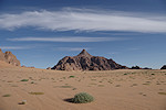
We tackled again the minefields (many of which were now hidden by the tall vegetation), and by mid-morning we approached Bini Erde. We had our first unobstructed view of Emi Koussi, which from this direction appears to be an unimpressive low mound, not quite the 3440m mountain it really is. In Bini Erde we stopped briefly at Idriss' hose to unload the collected firewood and greet the family, then continued towards Gouro.
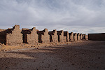
We reached Gouro late afternoon, we still had enough time before sunset to visit the Senoussiya (the old Senoussi Zawiya, a fort cum religious school), the only such standing monument anywhere (in Libya Khadafi eradicated all traces of the Senoussi, bulldozing all the remaining monuments).

We went to the same pleasant spot among the palms near the old French fort as on our onward journey, setting up camp just as the sun disappeared.

Day 18. - Gouro - Bembechi - Faya-Largeau
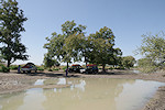
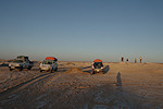
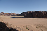
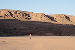
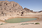
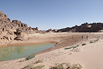
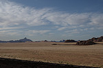
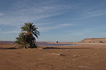
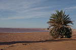
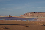
In the morning we said good bye to Idriss, then drove out of Gouro, only to make a stop at the edge of the basin to look at it's newest wonder. With the huge rains last year, the dry lakebed was now full of water. Issa said that certainly there was no other such event in his lifetime, and only some of the oldest inhabitants remember ever seeing standing water there.
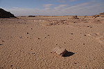
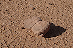
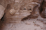
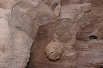
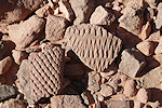
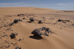
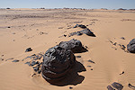
We made another stop as we were approaching the Borkou plateau (near the spot where we camped in 2022) to see the strange exfoliating ferric concretions we found there the last time.
By late morning we reached the small oasis of Bembechi (the easternmost of the inhabitable Borkou oases), pausing at the hill with the engravings and paintings. This time in a different light one of the hillside boulders revealed a panel of engravings which none of us has spotted on previous visits, the last just ten months earlier.

After a lunch stop at another of the Borkou oases we continued without any mentionable events or mishaps to Faya, reaching the resthouse by mid-afternoon, allowing a quiet afternoon to sort our gear or just relax and do nothing.
Day 19. - Faya-Largeau - Kouba Olanga
With the cars needing some spares and Rigobert topping up supplies, we started a bit later than we became accustomed to, warming in the morning sun while the cars were being readied.

Driving all morning pretty much non-stop, we managed to cross the Erg Djourab b early afternoon, stopping for lunch among some low dunes on the far side. Then we again drove without stopping till Kouba Olanga, which we crossed this time without stopping, Issa judging that we had sufficient fuel to last till Moussoro. We made camp about 70km south of Kouba, nearly half-way to Salal.
Day 20. - camp after Kouba Olanga - camp after Moussoro
After all the cold up in the North, we finally had a pleasant quiet morning. We were up before sunrise, taking breakfast and packing up before continuing along the bumpy and dusty tracks of the Bahr el Ghazal towards Moussoro.
We only made a brief lunch-stop, then continued till reaching Moussoro mid-afternoon. Our timing was a little bit off, we found the fuel station closed as it was prayer time. We waited for the proprietor to arrive from the neighboring Mosque, then we were on our way again, making camp a good 50 kilometres beyond the city.
Day 21. - Camp after Moussoro - N'Djamena
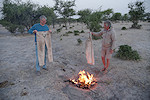
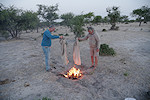
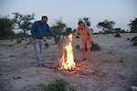
This being our last camp, in the morning we packed our gear, and with Attila completed the ritual of burning our tattered trousers which were beyond saving, their state not even making them suitable as oil rags...
We reached N'Djamena by mid-afternoon, in time for everyone to take a shower at the Irrisor hotel after all the dust of the Bahr el Ghazal before we needed to go to the airport to catch our respective flights.
Following this smooth and successful trip, we are planning a return to the Ouri Plain in November 2026 along the same fast route via Gouro. The trip will start and end in N'Djamena, and will take 21 days using cars, with some shorter treks to and around the sites. Please visit the News page for any updates (or "like" the FJ Expeditions FaceBook page).