
 Click on image for list of participants |
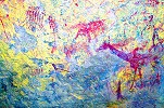
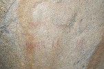
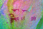
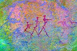
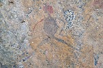
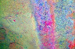
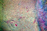
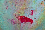
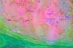
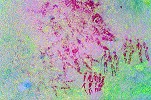
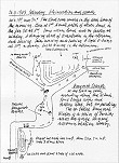
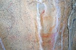
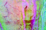
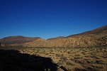
Upper Brandberg, Namibia 11th - 21stJune, 2016 Site references based on numbering system of Ernst-Rudolf Scherz & Harald Pager False colour images precessed with dStretch, a freely available software developed by Jon Harman |
Day 1. - Windhoek - Okahandja
We arrived via Johannesburg, taking the early afternoon South African flight to Windhoek. After receiving the car from Mark and Nadine we immediately set out to Okahandja to camp at the Country Hotel. Stephen & Adrienne already set out from Cape Town a couple of days earlier driving North at a leisurely pace, reaching Uis by this evening.
Day 2. - Okahandja - Uis - Umuab Gorge
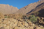
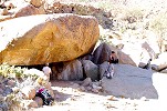
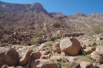
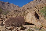
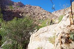
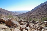
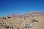
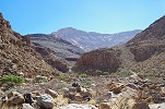
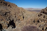
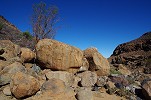
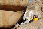
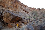
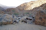
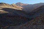
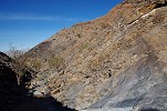
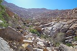
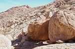
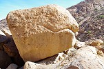
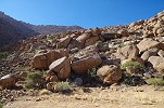
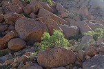
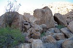
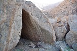
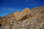
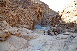
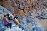
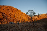
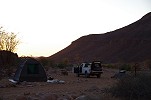
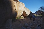
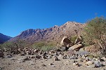
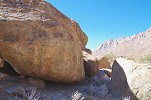
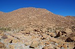
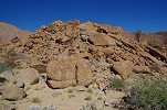
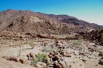
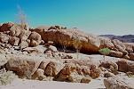
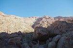
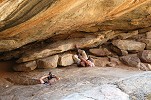
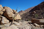
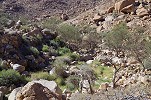
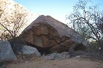
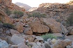
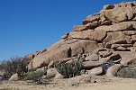
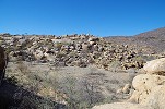
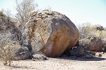
With an early start (not all that difficult, as we were still half ticking on Indian time) we reached the Omaruru Spar just at the 8am opening time. We purchased our supplies and continued to Uis, reaching the White Lady B&B half an hour before the agreed midday rendez-vous. Alfons & Marco (our NHC guides) soon joined us, and we immediately set out to Umuab Gorge on the Northern side of the mountain, via the track that crosses the Ugab River just by the White Lady Lodge. Despite some apprehension about the condition of the sandy river crossings (Stephen's bakkie had only 2wd, though with diff locks) we made it to the entrance of Umuab by mid-afternoon without any mishaps, with the track ending at a little open sandy stretch of the riverbed, a perfect camping spot. It was unseasonably hot, the temperatures were well over 30C when we reached our campsite. We had our lunch in the shade of a large cluster of rocks along the riverbank, then waited to the heat to subside.
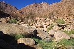
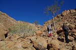
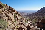
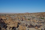
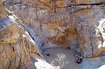
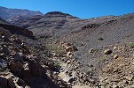
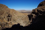
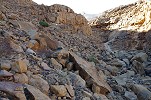
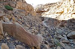
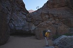
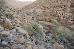
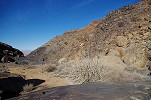
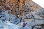
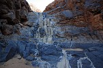
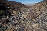
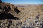
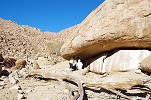
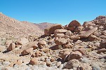
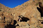
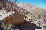
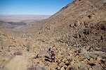
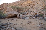
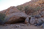
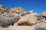
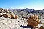
Our main goal was to reach site U20, a fabulous isolated panel of paintings a little less than half-way up the Umuab at an elevation of 1100 metres (our base camp was at 500m, while the Umuab Plain is at 1800m). We expected to reach U20 in a day, allowing time to see the lower cluster of sites, U29-U33 about 2.5 kilometres upstream and 200 metres higher than our camp. The heat started to become more bearable around 2:30 pm, with three hours of daylight left we decided to prepare a water cache at a point which we could reach in 1.5 hours, also allowing us the opportunity to scout a part of the route. The first 1.5 kilometres above camp was fairly easy, along flat terraces beside the main watercourse. Beyond that the valley became bouldery, and we reached a series of dry cascades which at first looked formidable, but we found an easy passage fairly rapidly. We rapidly gained altitude, and reached a broad generally flat basin above the rapids, where we left our water bottles at the foot of a cluster of boulders. GPS reading indicated that the first site was only 400 metres beyond.

Day 3. - Umuab Gorge
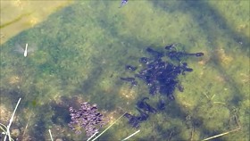
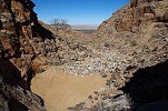
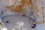
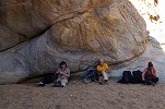
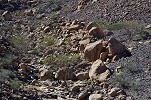
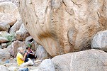
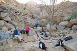
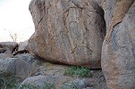
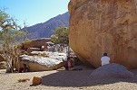
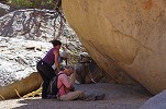
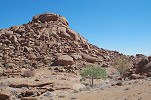
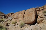
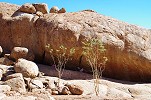
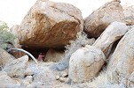
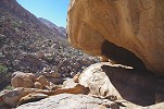
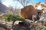
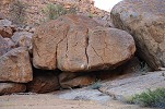
We started at sunrise, and with the benefit of having scouted our route the afternoon before, we reached our water cache in little over an hour. We continued along the fairly flat basin, and in another half an hour we reached the huge boulder by the riverbank, site U29. The big surprise came at the basin beyond the site, which was full of good clear water with many tadpoles, despite the lack of rain on the mountain this year. It must be a permanent spring, unlike the other pools which fill up only after the rains. We settled down in the shade of the boulder to photograph the panels.
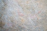
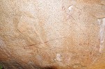
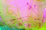
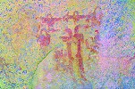
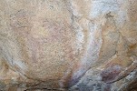
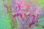
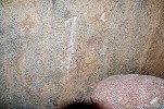
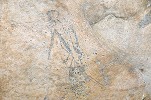
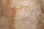
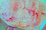
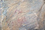
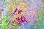
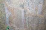
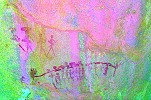
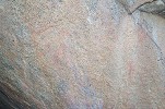
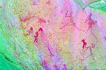
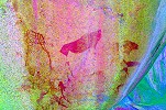
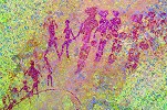
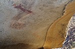
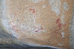
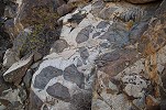
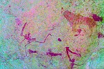
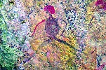
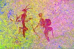
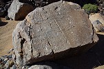
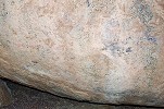
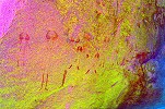
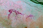
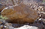
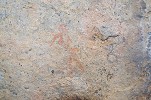
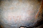
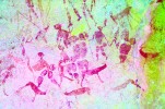
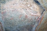
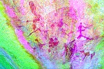
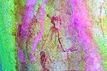
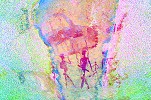
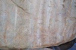
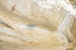
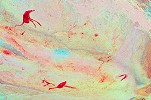
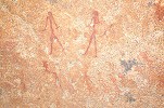
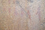
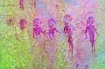
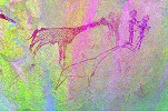
The site was discovered already by Albert Viereck in 1958, the main panel on the face of the rock contains a multitude of human and animal figures, unfortunately in a rather poor state of preservation.
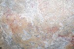
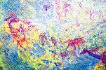
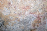
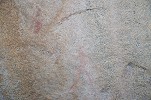
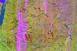
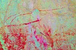
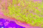
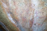
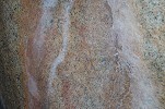
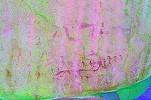
There is another panel of paintings on the ceiling of the shelter under the boulder, very faint but with dStretch it is possible to see the many gazelle, a fine human figure and several barely perceptible ostriches.
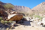
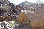
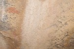
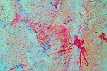
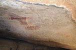
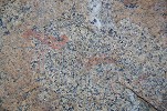
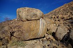
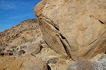
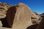
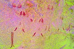
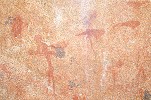
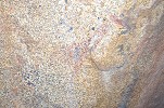
Site U30 is just a short distance to the West, in the middle of the gravel and boulder terrace filling the middle of the flat basin. It consists of a couple of larger boulders with three rather weathered panels of paintings. One panel shows a rather unusual composition of abstract shapes, which are the remnants of the body decoration of a large human figure, the paint representing the body having completely disappeared.
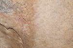
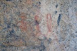
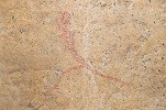
Site U31 was not far on the far side of the broad valley, a cluster of large boulders with two minor panels of paintings, and one rather interesting one, depicting several eared serpents.
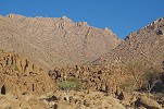
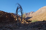
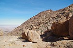
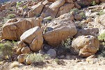
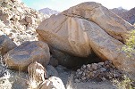
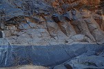
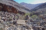
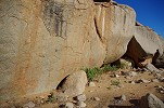
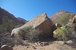
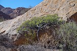
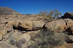
The last sites of this concentration in the lower Umuab were about half a kilometre further upstream, where the flat plain ends and the valley starts to make a steep ascent. One of these, U32 was already noted by Scherz in 1948, two panels of paintings on an adjacent pair of very large boulders with a comfortable shaded terrace between them. Just a little upstream there is an enormous wild fig tree growing near the now dry basins which usually hold water for a long time after rains.
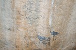
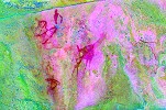
We left our packs at U32 to climb up to U33 which is located on a terrace about a dozen metres higher. The site is a cluster of boulders at the Western edge of the terrace. One rock displays a faint shelter scene with many utensils attached to the ceiling, while the larger panel shows a group of once very fine animals including two large birds (and some humans), unfortunately water flowing over the rock has obliterated much of the scene.
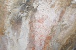
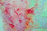
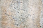
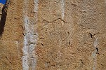
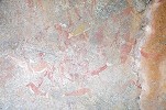
We returned to the shade at U32 for a quick lunch and midday rest combined with a lengthy photo session. There is a lot going on in the main panel of the site, but unfortunately all of the paintings are very weathered, and some parts have been completely obliterated by water flowing down the rock face during rains. The state of the paintings is well illustrated by the fact that we only recognised the elephant, taking a prominent place on Pager's tracings, after matching the wall to the photocopies following a futile 10 minute eyeball search.

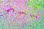
The other panel at U32 shows a number of gazelle and a few human figures, some of whom have almost completely disappeared except for the prominent wigs. Overall it may be said that while the lower concentration of sites in the Umuab do contain some nice scenes, overall the sites are not that impressive, much better sites may be reached with a comparable effort in the Tsisab, Hungorob or Numas gorges. It was good to visit them for completeness, but despite their relative ease of access I would not recommended the climb up to this cluster for anyone who did not yet visit the other valleys.
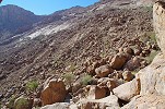
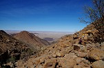
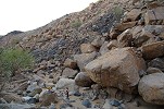
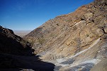
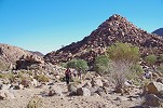
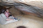
It was another very warm day, we waited till 2pm for the heat to subside a little before starting out towards U20. The site was only 400m higher with a horizontal distance of 1.8 kilometres, something that sounded easily manageable in the more than three hours of sunlight left. The valley started to rise steeply soon after the big fig tree, and we gained altitude rapidly as we climbed the slope strewn with small boulders along the West side of the watercourse. After an hour we reached a castle-like rock with huge vertical walls barring the route. The way to the left was impassable, the watercourse was blocked with house-sized boulders with no passage in-between. We were following a trail marked with small stone cairns, that led to the foot of the cliff and there it mysteriously disappeared. It took us over an hour to find that the path led to a narrow and low tunnel under some boulders at the base of the cliffs, where one could only crawl through without the packs. The path continued beyond, and someone even left a full water bottle in the tunnel. Beyond, the going become much more difficult with big boulders mingled with unpleasant loose scree, it soon became evident that we will not reach U20 that evening, and with sunset approaching we searched for a suitable sandy patch in the riverbed for our bivouac. We stopped at sunset at an elevation of around 900 metres, with still half of the altitude gain and horizontal distance to go.
Day 4. - Umuab Gorge
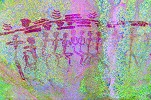
Judging from our pace of ascent the previous day, we had roughly a three and a half hour window to make the ascent to U20 and return to our bivouac. Adrienne, who really struggled on the last stretch with the big boulders, decided to remain at camp with Alfons to give us a better chance. The rest of us started out at first light, leaving all camping gear and most of everything except for some water and the cameras. We tried the Eastern side of the valley which appeared marginally better from below, but it was the same struggle among large boulders. Nevertheless we made progress, and passed the 1000m elevation within 45 minutes. Continuing along the slope above the riverbed, we were aiming for a large boulder with a conspicuous diagonal crack in the riverbed still well above us. My GPS reading taken by an attempt to match Pager's site tracing with Google Earth features showed the site to be a further 200 metres upstream.
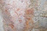
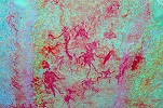
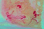
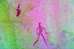
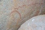
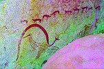
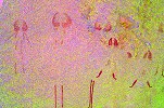
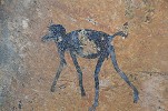
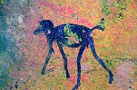
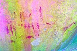
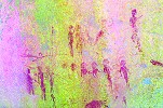
As we passed the boulder to continue upstream, we spotted a cluster of dark shapes at the base which on a closer look turned out to be the panel of paintings we were aiming for. Needless to say we were rather pleased with this navigational error, and the lovely paintings have definitely made the rather difficult climb worth-while.
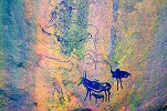
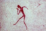
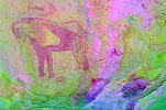
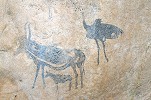
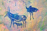
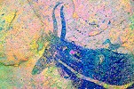
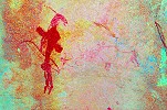
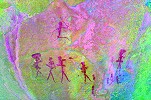
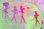
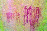
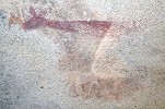
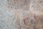
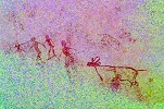
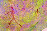
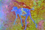
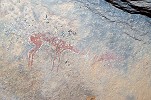
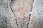
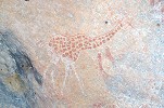
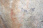
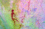
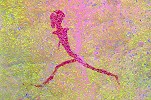
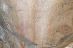
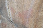
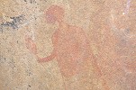
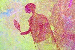
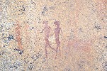
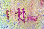
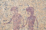
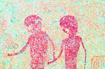
The paintings here are not many, but their style and execution rank them among the best on the Brandberg. The site itself must have been a resting place on the route to the Umuab plain, apart of this single panel there are no known paintings at all between U32 and the huge U21 site a short distance below the lip of the Umuab Plain at an elevation of 1750 metres. All the figures (except the red tail of the ostrich) are executed in black paint, in the same style as the "okapi" (really a hartebeest) at N162. The eland drawn in outline is unique on the Brandberg, as is the hartebeest with a bird sitting on its back. The whole composition is of a very high quality, it has been suggested that it is the handwork of a single artist.
We could linger at the site for about 30 minutes before we had to start our way down. This pretty much coincided with the sun rising above the crest of the ridge to the East, after which the panel of paintings is fully exposed to the sun all day until sunset - our timing was perfect. We started down in the watercourse, deciding that it cannot be any worse than the hillside. We were proven correct, despite a couple of bigger drops we made it down to our bivouac spot in 45 minutes, half the time it took to reach the site in the early morning.
We spent the rest of the morning re-tracing our route back to site U29. Knowing the route certainly helped, in two hours we made it down to the big fig tree, then continued to U32 for a little rest before moving on.
The weather did not change, it was very unusual to have such a continuous hot spell on the Brandberg with midday temperatures hitting the mid-thirties. We returned to the shade of the big rock at U29 to have our lunch. Entertainment was provided by the hundreds of water beetles and rather fat tadpoles in the pool adjacent to the site. Despite the hot weather the water was icy cold, but still we braved a quick wash taking water in our empty plastic bottles.
Originally our plans were to return to camp by midday and move to the entrance of the Eros Gorge by sunset, but after the rather exhausting two days we were in no mood to pack up camp and make the move, especially as Eros had no track leading in, we had to find our own way. We decided to stay the night in Umuab, giving us the luxury of waiting in the shade till the midday heat was over. We reached camp and a somewhat anxious Marco by the time the shadows started to lengthen, but the wind stayed calm and the temperature remained warm throughout the evening and the following night.

Day 5. - Lower Eros Gorge
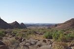
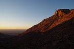
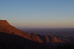
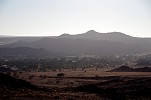
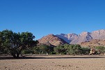
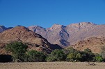
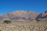
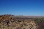
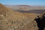
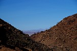
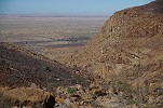
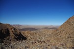
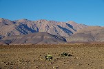
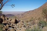
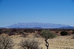
We made an early morning start, packing camp and driving back towards the track through the Ugab river, stopping at places for the perfect morning view over the Northern Brandberg.
Crossing the Ugab River, we saw several fresh-looking tracks and dung, apparently the desert elephants were still in the area despite the drought on the Brandberg. However if they were indeed around, they hid themselves well, aside a few springbok we saw no other wildlife in the valley or along the northern Brandberg track.
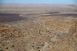
As we passed the mouth of the Tsisab Gorge, the drought became more evident. This area is usually covered with a dense golden field of rolling grass, with many grazing zebra and gazelle. Now all that remained were the completely grazed stubs of last year's growth, in the absence of rain no new grass sprung up this year.
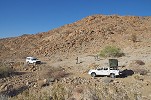
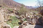
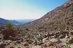
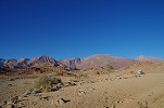
We continued along the track past the Sesaub and Orabes gorges to where the trail crossed the Eros River, about two kilometres from the base of the mountain. With no track leading in, we turned off the track trying our best to keep Stephen's two wheel drive bakkie on firmer ground. A little push was required at a softer patch, but after reducing the tyre pressures it fared perfectly, we could approach the valley for another kilometre before the riverbed became too rocky for any further progress with the vehicles. We made our camp aside a few bushes and a rather meagre tree, and immediately set out to explore the lower course of the valley (with a number of paintings) and to prepare a water cache at the base of the mountain for our trek up the valley the following day.
The lower Eros is a box canyon cut into the ancient (pre-Brandberg) Damara granites that underlie the black Karoo series forming a ring around the younger granite dome of the Brandberg. The canyon ends in a dry waterfall with a circular basin which was now dry, but it must hold water for a long period after rains, as we were following a very well trodden zebra path leading to it. We left our water cache at the base of a rubble slope offering a by-pass to the upper level before entering the canyon, leaving the rock art sites for the return journey in cooler weather. Reaching the waterfall we found that it had an upper level, with a perfectly round terrace with a sandy bottom, accessible on a narrow ledge. Amazingly the zebras are able to get up to here, there was a small hole in the sand excavated by the animals, which still had some water at the bottom.
The small circular basin was completely in the shade as the sun went around, offering a perfect spot for lunch and a midday break. We waited for the sun to get behind the mountain, for the rock art sites in the valley below to get into the shade for easier photography.
Adrienne & Magdi were quite content not to do anything as long as they could stay in the shade, but with Stephen we became restless of doing nothing after an hour, and decided to climb up to the two sites just above the waterfall. A scree slope to the left of the cliffs offered a possible way up, and soon we were up on the ledge above the circular basin, with a good view into the valley beyond. We could immediately spot the cluster of rocks with the two sites a short distance upstream.
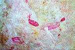
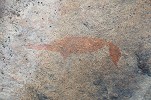
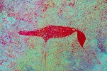
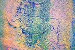
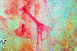
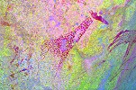
Site E9 is just a triangular rock in the middle of the riverbed, with only one clear figure, a very nice giraffe. There are some traces of paint in front of the animal, likely a human figure with a bow.
E10 is a short distance upstream, just far enough to qualify as a distinct site. It is a much larger site with several panels of paintings on the side of a huge boulder resting in the riverbed. The longer North facing side was fully exposed to the sun, fortunately the most interesting scenes including a rhinoceros and an uncommon tree depiction were on the west facing side still in the shade.
By the time we returned, the creeping shadow nearly reached the sites located in a jumble of rocks under the waterfall. We collected our packs in the sandy basin, and by the time we reached the first site it was fully in the shade, revealing the faint paintings that are invisible in sunlight.
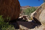
E8 is an unusual site, it consists of two angular granite blocks resting on the scree slope near the path leading to the basin under the waterfall, with no shelter or horizontal platform. On one rock there are the remnants of an unidentifiable animal, while on the other the animal with curved tail is definitely a feline, either a lion or a leopard.
A short distance below, E7 is a more usual site, with several panels of paintings on large blocks surrounding a comfortable flat platform. Most of the panels are very weathered and hardly visible, but there are some nice scenes on the single more sheltered panel.
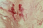
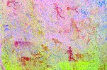
E6 lies about 250 metres further downstream along the Eastern side of the valley, marking the point where the valley begins to widen and flatten, emerging to the plain at the foot of the Brandberg. It is just a small rather inconspicuous rock, with a single panel of paintings, including two figures in a rather bizarre contorted posture. This site is one of the rare few where one may catch some inaccuracies in Pager's tracings (or rather the interpretation of Tilman Lenssen-Erz based on the tracings). The two figures at lower left are not a continuation of the row of walking archers, but two women, also walking but in the opposite direction. There is a third indistinct woman under the archers, a part of the same earlier composition.
E5 is a cluster of rocks on the western side of the valley, immediately across from E6. Two boulders contain paintings, the first three rather weathered oryx of which only the bodies remain. The second rock has a large weathered panel along its side with a better preserved but headless group of human figures superimposed over a large animal, and many other indistinct paintings.
E4 is a row of boulders along the riverbank about 250 metres downstream, with five rocks containing paintings. Most are very damaged, except the panel on a large flat sided low rock, which represents the finest set of paintings in this lower concentration of sites in the Eros gorge.
Site E3 is very similar to E4, a row of boulders along the riverbank about 80 metres downstream, with four rocks containing paintings. The two sites are within clear sight of each other. Among the numerous panels, only one contains a series of better preserved human figures.
Site E2 was somewhere further downstream, supposedly the first conspicuous granite boulder one encounters if approaching from the plain. We searched several rocks on our way back to camp but could not find it (in retrospect we probably searched too far down, it must be in the vicinity of E3). We returned to camp to catch the last of the sunlight on the plain.
Day 6.- Eros Gorge
We arose before dawn to make the best use of the cool morning hours when making the ascent into the upper Eros Gorge. Adrienne stayed at camp with Marco, the rest of us set out as soon as it was light enough to see our steps. We re-traced our route of the previous day, collected some of the water left at the cache, and ascended the scree slope to the right of the gorge. We emerged very close to site E10, with a clear view of the gorge ahead. There were several vertical sections of lava beds in the strata ahead, and as this was an unknown route for Alfons we did not know what to expect at the ascents. But these were problems to deal with once we reached there, first we made a quick stop at E10 to take some quick photos.
The North facing panels of E10, which were practically invisible the previous day, contain some very fine scenes, among the best we have encountered at Eros so far.

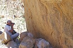
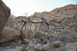
Beyond E10 we reached the zone of the black Karoo basalts, making fairly good progress on the angular rubble slopes. We by-passed two of the vertical ledges visible in the river valley below without any difficulties, and reached our first bigger obstacle just above the 1000m elevation. Here the river cut through a hard band of quartzitic conglomerate, creating a low waterfall with a very pleasant sandy basin underneath. A deep undercut made the ascent of the waterfall impossible, and the valley was hemmed in between vertical cliffs. Fortunately a rubble filled chute offered a way up to the right, and after a climb of about 50 metres we could access a ledge which led us back to the valley above the waterfall. Immediately ahead there was another step, formed by a similar band of hard strata sandwiched between the apparently softer lavas. With a little scrambling this could be climbed without the backpacks which were passed up, and beyond we soon reached the boundary between the black lavas and the pink Brandberg granites.
The middle concentration of Eros sites was just 150-200 metres above the Karoo/granite divide. We did not stop to see the sites, only had a short rest and left all our overnight gear, half of our water and everything else in a suitable sheltered spot. Our plan was to make a quick dash up to the upper concentration of sites with a light load, returning here for the night. We made good progress, it was not yet 10am and we have gained 350 metres elevation, we only had 300 more to go over a horizontal distance of less than a kilometre so it looked feasible. We pushed on, soon reaching a section of the valley with vertical granite walls on both sides, and a large ledge blocking the way in the middle. We wasted a good half an hour trying to make it to the top of the vertical rock on the East, but then we did find a manageable route on the western side, and a series of steep but interconnected granite plates led us up towards the already visible ledge with the sites just beyond. The last 200 metres were rather miserable along a slope filled with large boulders, with very slow progress. It took us three hours, an hour more than planned, but by 1pm we made it up to the huge conspicuous boulder just below the ledge. There is a large shelter underneath, but strangely no paintings despite many chipped tools on the shelter floor. We had a quick lunch before setting out to explore the sites we had time for, leaving our packs behind and agreeing to start our way down at 3pm, allowing 3 hours for the way down just like the way up.
The upper accumulation of Eros sites is centered around a small flat terrace just above the high waterfall at 140 metres altitude. Site E18 is a cluster of boulders in the middle of the terrace adjacent to the main watercourse, surrounded by flat granite plates. It contains several panels of paintings on distinct boulders, but only the main panel located in a shelter between two large boulders contains any better preserved figures.
A short distance to the East, site E17 is a large solitary boulder perched on the edge of the precipice. It contains several scattered paintings all around, and a larger panel on the ceiling of the low shelter facing the terrace upriver.
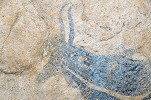
The principal site of this cluster is E16, located slightly above the Eastern edge of the terrace. It contains a fairly large hollow shelter (now hidden from sight by a shrub growing near the entrance), the rear wall of which was once full of paintings. Now the most conspicuous remaining figure is a large eared serpent, at least 5 metres long, spanning the right half of the shelter. Water flowing over the rock after rains has erased most of the paintings, leaving only a few other scattered scenes including a fine white rhinoceros under the eared serpent.
Sites E20 and E21 are located at the edge of a pleasant flat grassy terrace about 20 metres above site E16. E21 consists of two low boulders at the nearer end of the plain, but only the one on the left contains any readily recognisable paintings, the one on the right just some bare traces.

E20 on the far side of the plain was much more interesting, with several panels of well preserved paintings among the huge boulders making up the site.
By the time we finished photographing the panels the shadow crept across the little plain, and we had to start our way down. There was one remaining unvisited site, U19 clearly visible on the far side of the valley, a cluster of huge boulders a little up on the hillside. However the Brandberg is deceptive, the few hundred metres would have taken at least 15 minutes to cover, not to mention the time needed to photograph the panels, reluctantly we had to leave it for some other time.
Collecting our backpacks at the huge rock below the waterfall, we started making our way down along the way we came. With a better understanding of the route we made faster progress, in an hour we reached the end of the vertical walled canyon where we struggled to find a way up. Soon we reached the contact zone of the granites and the black lavas, passing several blocks of conglomerate with shattered pieces of angular basalt embedded in the pink granite, formed as the huge blob of molten lava forced its way up through the solid rocks.
In a little over two hours we reached our bivouac among the middle accumulation, a good hour before the light started to disappear.
Day 7.- Eros Gorge - Numas Gorge
We were to meet Francois and Andra de Wet at the Numas track junction in the afternoon, requiring us to be down at the cars by lunchtime. This still allowed a couple of hours after sunrise to see the four sites making up the middle accumulation before we had to start on our way down. Unknowingly we made our bivouac right among the boulders making up site E11 in the riverbed. The site is not particularly impressive, there are several scattered panels on rocks and boulders spread out over a fairly large area, but they only contain a few damaged figures. The finest were a set of running and walking figures, barely discernible on the spot.
Site E14 is the most important one in this cluster, and arguably the most interesting we have seen in the entire valley. It is a huge rock with panels of paintings on the three flat vertical sides, with a slanted slab leaning against it forming a large shelter, with the most interesting panel on the inner side of the slab. We had to spend quite some time to find it, as it was not in the riverbed as expected, but some way up on the gentle western slope bordering the watercourse.
The paintings on the main rock are a mix of human figures and animals, including several unusual or unique scenes. The most interesting are a group of three male figures, two represented full face, a rather unusual perspective. Several of the animals have curved tails, likely they are felines.
On the inside of the slanted slab forming the wall of the shelter, the most conspicuous figure is a large white male archer (the head and weapon is no longer discernible) nearly one metre in height, one of just a handful of human figures drawn on such a scale among all of the Brandberg paintings. There are several other scattered paintings on this wall, unfortunately mostly faded or partially erased.
Once having found E14, spotting E12 was easy. It is a prominent large boulder capped with a smaller one on the same terrace above the main watercourse, being at the centre of this cluster roughly equidistant from all the other sites. It only contains a few damaged paintings, the best figure being covered by the urine streaks of the dassies (rock hyrax) inhabiting the crack between the rocks.
The last site of the cluster, E13 is a huge granite boulder some way up the hillside that is mostly made up of the crumbled black basalt. It has a natural tunnel running through it, forming a large shelter that must have been occupied for a long time, judging from the soot covering the walls obliterating most of the paintings inside. There are some better preserved paintings on the smooth side of the rock facing the valley, but overall the site is rather meager compared to the size of the boulder and the fine living place it offers.
Collecting our packs at E11 we started our descent, walking past the series of now dry pools which during normal years provide a reliable source of water for many months after rains. The pools were in the contact zone of the basalt and the granite, in the smoothly worn riverbed one could clearly see the cracks in the shattered basalt being filled with veins of pink granite.
We scrambled down the series of waterfalls where the river cut the deep canyon in the Karoo series, through the alternating layers of black basalt and coarse quartzitic sandstones infilled with large rounded quartz pebbles. It appears that the volcanic events were far spread out in time, allowing a thick accumulation of river bourne sand and gravel before the next volcanic episode.
After clearing all the waterfall ledges the going became much faster, we soon approached the rocks of site E10, making the final descent on the scree slope beyond, with the cars clearly visible far out in the lower Eros riverbed. We reached them a little after midday, with plenty of time to spare for a lunch and some rest before we needed to set out for our agreed rendez-vous.
We managed to re-trace our tracks in the Eros without any mishaps, and after pumping up the bakkie's tyres we continued on the track rounding the Brandberg. With perfect timing we just reached the West Brandberg road junction as another pickup was approaching, not surprisingly it was Andra and Francois. Together we drove to the entrance of Numas Gorge, making camp at sunset at the end of the drivable track.
Day 8. - Numas Gorge - Hungorob Gorge
We were planning a relaxed day in the lower Numas after the tough two days in the Eros. We started out early, to catch the lovely eared serpent at Scherz's site I before it becomes fully exposed to the sun for most of the day.
We continued another kilometre upriver to spend the mid-morning visiting and photographing the concentration of sites found by Scherz near the "Zebra water" spring. We started out at the most distant Site D, trickling back along the edge of the rock island.
We already located most of these sites with Liz & Jon the previous year, however we could not find Sites E and J. This time with a little more time (and luck) we stumbled upon site E not far from Site C on the side of a large split boulder with a flat vertical side. However Site J remained elusive, despite doing a thorough search in the area indicated on Scherz's map.
Once we made our round of the known sites, most of our party made their way back to the cars, with Steven & Alfons we stayed behind to spend a couple of hours surveying the area to the North of the main valley. This area consists of a series of low ridges and flat terraces, and it was visited by Harald Pager who mentioned several sites in his diary, but without any details. They were certainly not copied by Pager, we were hoping to re-locate at least some of them. Spreading out, we aimed for a number of promising rocks along the Northern bank of the river, however most of them contained no paintings. Alfons was the lucky one, the rock he headed for, just across the river from Scherz's sites, contained a faint herd of gazelle.
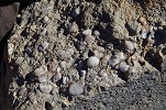
The series of flat terraces above the valley contained many suitable looking boulders and shelters, and the ground was littered in many places with stone tools and the occasional pottery shard. We checked out the most promising shelters (several already identified from satellite imagery) but none contained any paintings.
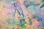
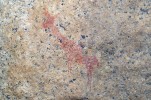
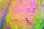
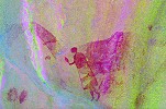
We reached the small Northern tributary that joined the main valley a short distance upstream from our camp. Unexpectedly we found reeds and fresh grass growing in its sandy bed, suggesting some permanent water source underground. Nearby at the rear of a large boulder flanking the riverbed we found a panel of rather curious paintings. At first the long legs appeared to be those of birds, but on close scrutiny they turned out to be some very unusual human figures, represented in full face, with most of the bodies gone, only the legs and the hair remaining.

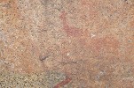
We continued down the tributary, bypassing a deep dry waterfall which led down into a dark canyon with some green vegetation in it, possibly also water. We reached the large basin just before the main valley where Christine and Stefan, the Swiss couple we met here last year found a large site after we left. It was not hard to find, the prominent crack running along the Southern side of the basin was clearly visible from afar. The most readily visible painting here is a black baboon at the left end of the long shelter, which appears to have been painted over some indiscernible red composition. The animal is an almost identical copy of the one in site Amis 50, but on a much smaller scale. With dStretch it is possible to discern an exceptional feature - the baboon is carrying a bow and two arrows in its right paw, as far as I now without any parallels among other Brandberg paintings.
The shelter is filled with numerous other scenes for a length of about ten metres, unfortunately they are all very weathered, almost impossible to make out except with the help of dStretch. Some of the scenes are rather difficult to interpret, like the strange lyre shaped object or the outlines of something very large at the extreme right. The two dark objects under the lyre shape are not ostriches as assumed, but apparently half human - half animal figures (rear human legs barely visible with dStretch).
After lunch and some rest to let the midday heat pass, we packed up camp to make our move to the entrance of the Hungarob Gorge in preparation for our last two day hike up the mountain. On our way out we passed by Scherz's Site A with the lovely pair of gazelle and many other scenes.
We continued, for a part via the West Brandberg road, before hitting the track leading to the entrance of the Hungorob Gorge. On the stony plain before reaching the valley we encountered a desert hare sitting near the road. Instead of the usual mad panic it decided to play it a rock, enabling a few photos of this cute creature, common also on the upper Brandberg where it is almost impossible to photograph.
Day 9. - Hungorob Gorge
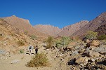
We got up at first light to make the most of the cool morning making the ascent to the middle levels of the Hungorob Gorge. Andra and Francois stayed behind for a leisurely morning before packing up and going to Uis, while the rest of us set out along the trail as soon as it was light enough. Our plan was to make it up to "Springbokwasser" and the adjacent Clauss shelter (H137) as fast as possible, while the ridge to the East sheltered us from the sun. In a spurt of about an hour we reached the lower concentration of sites, stopping briefly at H102 where last year I have missed most of the faint paintings on the ceiling.
It took a little over another hour to get up to the Clauss shelter along the well traveled mountaineer's path, with the sun out only for the last 30 minutes. Dropping our packs, we could afford a longer stay to enjoy the paintings and search about.
Harald Pager explored the area around the Clauss shelter in November 1983, and he (and Angula Shipahu) located a number of sites both around Springbokwasser, and in the level area ("Falsche Hungorob Mulde") just below the junction of the main Nortern and Eastern branches of the Hungorob. His untimely death in 1985 prevented his return to copy them (H137 was copied by the HBI team in Pager's style) however a page in his diary published in the Hungorob volume provides a general sketch of their number and location. Our main objective was to locate as many as we could of these sites, in addition to the three already found last year.
Pager's sketch showed a shelter simply marked "Shipahu" below the Clauss shelter, clearly a site located by Angula (and possibly not even seen by Pager himself). The logical location was somewhere on the far side of the watercourse, behind the huge boulders surrounding the water basin (which was now completely dry). It was a tough struggle to find a way up among the huge rocks, but once we coped it was not too difficult to find the West facing shelter at the base of a boulder with the panel of paintings containing a number of human figures, the best of which was a solitary female.
Returning to the Clauss shelter (H137) we spent a leisurely hour photographing the site and taking an early lunch, before gathering the strength to make the last short climb up to the flat section of the valley a hundred metres higher.
In the midday heat it was not a pleasant climb, now fully exposed to the sun, but in about 45 minutes we accomplished the worst of it up the steep rubble slope. We crossed the plain with sites H129 in the middle (marked 2. on Pager's sketch, one of the few sites in the area he did trace), and made our temporary camp at the same spot as the previous year, beside the huge painted boulder marked as site 4b on Pager's sketch. The reeds below the boulder were green, and we could find a little murky water at the bottom of one of the rocky basins - probably with some digging good water could have been found.
While Adrienne and Steven were photographing the main site at the campsite, I made an attempt at finding the North facing shelter marked 3. by Pager, apparently just a short distance beyond our camp on a higher level. There indeed was a shelter at the marked spot, but with the best effort I could not find any paintings either outside or on the ceiling. There was a largish hollow adjacent to the shelter, facing West into the deep ravine below, which appeared to show traces of paint. With dStretch and a bit of imagination it might just be possible to discern a running figure (or something else), but it remains unclear if this indeed was the site marked by Pager, or it remains to be found somewhere higher up the hill above.
Around two in the afternoon we set out again to explore the valley above. We passed the two sites we located the previous year (marked 5. & 6, the latter the huge triangular rock with a hugging shrub flattened against it), and crossed to the other side of the river where site 7. was expected to be.
Site 7. was a little further up the river than we expected, it took a good half an hour scrambling among the big rocks to find it, but once we reached it the location of the paintings was obvious, in a little hollow at the back of an enormous rock flanking the river, facing a small flat terrace. There are a number of human figures, overpainted by an enigmatic composition of stripes and rounded blobs.
Site 8. was easy to find a little further upstream, a large shelter facing a pleasant flat terrace flanking the river. Once it was completely enclosed by a stone wall, the remains of which are clearly visible, as well as several other stone structures on the terrace.
The shelter contains several clusters of paintings, unfortunately much damaged by water flowing across the rock. Nevertheless still several interesting scenes remain, once this must have been a very fine set of paintings.
Site 9. was a large South facing shelter conspicuous from afar, adjacent to a series of sandy basins that must hold water for an extended period of time (there still were some green reeds growing there), just below the confluence of the two branches of the river. Despite the promising appearance the shelter contains only a single recognisable blob of paint on a low boulder, probably a human figure.
At the fork we split, Stephen going right attempting to reach sites 11-12, while I tackled the left fork, going after site 10 and possibly some of 17-19. We both found terrible terrain, the valley and its flanks were flooded with huge rocks and boulders, requiring constant scrambling and detours. In the end, neither of us found any of the sites, Stephen had to return as the time was up before reaching high enough, while I spent a good hour among the huge boulders above site 9. without any success. Looking at the terrain, going anywhere higher in the left fork in the short time available was out of the question.
Stephen returned to site 9. first, by the time I got back he was admiring a faint but rather fine panel of paintings on a rock just to the right of the shelter, looking incredulous at my enthusiasm about his find. He was led to them by my own footprints passing just a metre past the panel...
Day 10. - Hungorob Gorge - Uis
In the morning we spent some time photographing the giraffe panel on the large campsite boulder (Pager's site 4b) which was exposed to the sun by the time we reached the site the previous day. We were in no particular hurry, from hereon we would just be descending and stopping at some sites along the way, in order to reach Uis by the afternoon with the promise of a hot shower and real beds at the White Lady B&B.
As we started our descent, from the edge of the terrace above our campsite we could see for the first time on this trip the sea fog rolling in, but not quite reaching the Brandberg. It was rather dense, but dissipated an hour after the sun was up.

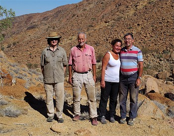
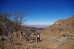
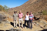
By mid-morning we reached site H117, the finest in the lower concentration of Hungorob sites. We spent a good hour photographing and just enjoying the lovely paintings, as well as to take the opportunity for a photo of our by now rather tattered party.
We continued our descent past site H103, making our last stop at H101 to photograph the panels still in the shade, unlike our last visit.
We reached our cars by midday, after a quick lunch we packed up camp and set out towards the White Lady B&B in Uis. Anelene and Karl were away, we had the entire place for ourselves for a relaxed afternoon and evening.
Day 11. - Uis - Omandumba
Adrienne and Steven needed to be back in Cape Town by Monday so they set out early for the long drive, we could afford a more leisurely morning, planning to spend the night and the next day on Omandumba Farm in the Erongo, where we only made hurried visits previously. After a relaxed breakfast we set out on the road towards Omaruru, stopping at a low lump of Damara granite within sight of Uis and the Brandberg.
A few months before our trip our good friend Richard Engberts passed here, and found a panel of paintings on a large rock behind the hill, including an interesting figure that appeared to be a therianthrope. We did find the paintings and I took photos, but I only realized once back home and checking with dStretch that I have somehow managed to miss the most important figure. Another task for next year...
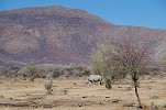
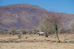
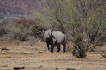
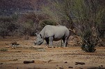
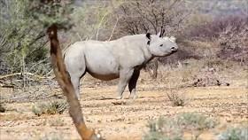
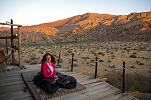
When we reached Omandumba, we received a treat for lunch far surpassing all expectations. Dieke's food was excellent as usual, but the big surprise came when we were called from the lunch table with the information that the rhino is at the waterhole! Omandumba is hosting one of the relocated rhinos, and it just made its appearance as we arrived, being absent for the eight previous days much to the regret of the guests staying at the new cottages overlooking the water hole. It is a young animal (sadly the horn must be sawed off regularly to protect it from poachers), it put on a full show for us before retreating back to the bush.
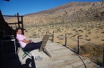
For the afternoon we were given possession of the "cave", an absolutely amazing retreat which Harald and Dieke built some years ago amongst a cluster of granite boulders. The cottage with a large terrace is wedged in between two rocks overlooking the southern valley of the farm and the Erongo Hills, and we had all this huge space all for just the two of us. It was an amazing experience, especially after the omnipresent crowds of India.
For a while we just sat there taking in the view, then while Magdi stayed on the terrace I took a big walk on the grassy plain below. The valley turned out to be rather deserted, I saw no fresh tracks but strangely the ground was littered with the remnants of thousands of giant millipedes, they must have been all over the place after it last rained. Aside some abandoned weaver bird nests, there was surprisingly little trace of any wildlife, all creatures must have moved on because of the persistent drought.
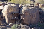
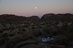
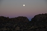
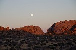
The "cave" is designed as a campsite so it comes unfurnished, originally we planned to spend the night in our rooftop tent, but the terrace was so inviting that we moved up our bedding and gear, to spend the evening and night there under the light of the full moon.
Day 12. - Omandumba - Windhoek
We had a beautiful night on the terrace, and at dawn the moon and the sun put up a splendid spectacle. The place was so thoroughly pleasant that we had a difficult time nudging ourselves to start packing, in order to be ready when Harald was due to meet us to visit some of the remoter rock art sites on the farm.
Harald arrived at half past eight, and we set out along the egde of the hills towards the central part of the farm. On a low ridge among some spectacular granite boulders Harald's father found a unique panel of paintings which he referred to as the "priest". It was discovered after the Abbé Breuil copied the paintings on the farm, and to my knowledge remains unpublished.
The main panel contains a number of rather faded animals and some human figures, with one well preserved (and apparently more recent figure) at the lower left that gives the site its name. It is a man with clear facial features wearing a knee-length cloak, and holding a stalked and pointed object in his right hand. I am not aware of anything remotely similar among either the Brandberg or other Erongo paintings. The figure is painted over an earlier giraffe, much of which is only revealed when using dStretch.
On the left rock facing the main panel there is a low shelter containing two well preserved (and probably rather late) ostrich with a running human figure, and an unfortunately badly damaged eland antelope, a fairly rare depiction in Namibia.
Next we visited the "Kudu shelter", a very fine site at the distant corner of the farm which we already saw in a more hurried fashion in June 2013. The rock has several panels of well preserved paintings on all sides, including the fine female kudu giving rise to the name.

Harald left the best for the last, taking us to the Northern part of the farm to see a site recently discovered by a friend, after whom it is referred to as "David's site". It is a low inconspicuous boulder on the top of a low ridge, but the well preserved paintings on its side are unique.
The most striking scene is a group of human figures, all obviously male, at the left corner of the rock. Two of them are better preserved, and their style strongly resembles that of the "hook headed" figures of the Brandberg. However in this case uniquely their facial features are present. The adjacent animal appears to be a sheep, suggesting a relatively recent date for these figures.
Further to the right there is a large panel, a little worse preserved, with many human figures and a fine giraffe. One of the figures (possibly a woman) also shows facial features, while a lower row of males have very elaborately executed coiffure.
Continuing right past the corner of the rock, one finds another fine panel with two giraffe and several human figures, again with the elaborate hairdo.
On the long straight side of the rock further right one may only observe two enigmatic conical shapes and a few blobs of paint, but with dStretch a whole herd of giraffe appears (without revealing anything more on what the conical shapes could be).
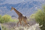
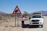
Our time up, we thanked Dieke and Harald for their wonderful hospitality, and especially for the amazing last site that was a very befitting ending to the trip, and started out on the road towards Omaruru. All of a sudden the wildlife that was nowhere to be seen appeared. Not far from the farmhouse we encountered a fine herd of kudu crossing the road, and effortlessly hopping over the 2m high fence as we approached. A little further down the road we spotted from afar two curious giraffe, intently gazing at us. They showed little fear as we slowly and silently approached, only moving off the road as the car was only two dozen metres from them, walking slowly past us without any sign of agitation. The only creatures not making an appearance were the elephants, despite all the prominent warning signs by the road.
After a quick lunch stop at the Okahandja Country Hotel we continued to Windhoek, which we reached by late afternoon. After dropping off the car at Mark's garage we drove to our usual departure haunt, the Etango Ranch, to be close to the airport for our flight out the following morning.
For June 2017 we are planning a different format trip to Namibia, making a more varied 15 day circuit to see not just the Brandberg but a wider selection of the Rock Art sites of Namibia plus some of the natural wonders of the country. Please visit the News page for any updates (or "like" the FJ Expeditions FaceBook page).