
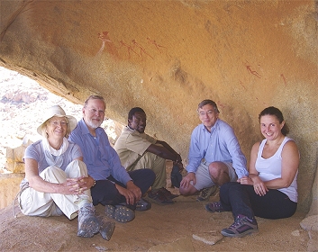
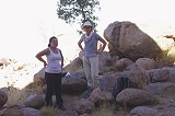
 Click on image for list of participants |
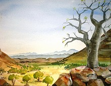
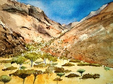
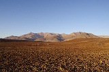
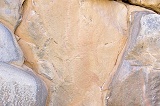
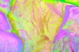
Upper Brandberg, Namibia 6th - 19thJune, 2015 Site references based on numbering system of Ernst-Rudolf Scherz & Harald Pager False colour images precessed with dStretch, a freely available software developed by Jon Harman |
Day 1. - Windhoek - Okahandja
We all arrived via Johannesburg, taking the morning South African flight to Windhoek. After collecting the cars from Mark and Nadine we did our shopping before setting out on the short drive to Okahandja, where we stayed at the pleasant camping ground of the Country Hotel. Exhausted after the long overnight flights from Europe, we had an early meal at the excellent restaurant, then settled in for the night.
Day 2. - Okahandja - Uis - Schaf River - Ga'aseb Gorge
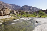
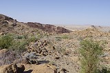
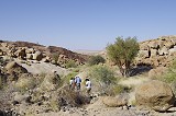
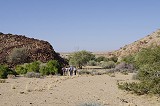
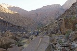
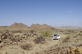
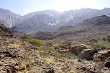
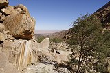
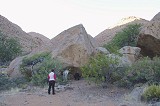
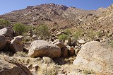
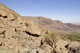
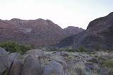
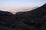
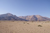
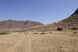
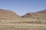
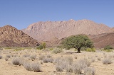
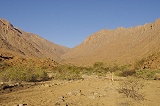
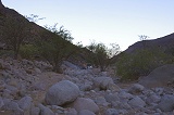
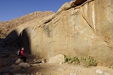
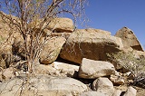
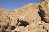
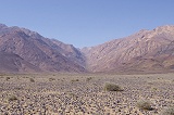
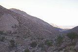
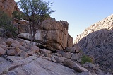
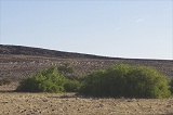
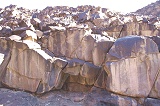
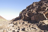
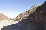
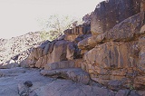
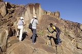
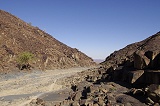
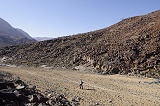
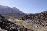
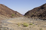
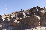
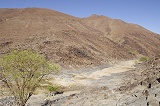
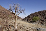
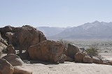
After a relaxed morning with the last hot shower and full breakfast, we departed for Uis, stopping briefly at Omaruru to top up our supplies with fresh fruit and vegetables. Reaching Uis, we went straight to the ticket office in Tsisab to meet our NHC guide Alfons, and sort out the ticket formalities (we had our pre-arranged NHC trekking permits from Windhoek). Due to some miscommunication it emerged that Alfons was waiting for us at the Rest Camp in Uis, but Colin just returned with a group from the White Lady, and immediately volunteered to take us to the nearby sites of the Schaf (sheep) River, our first objective. We drove a short kilometer North along the track branching from the main road along the banks of the Tsisab, then leaving our vehicles we continued on foot along a small watercourse towards the mountain.

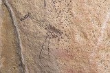
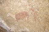
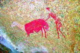
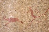
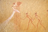
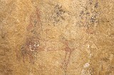
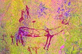
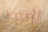
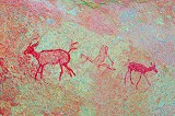
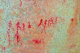
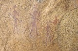
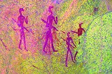
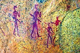
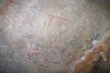
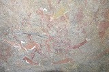
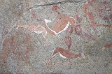
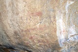
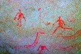
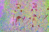
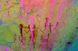
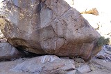
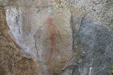
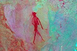
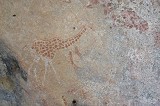
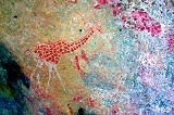
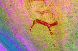
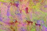
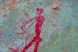
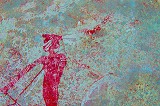
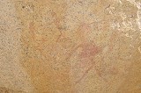
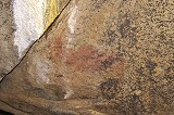
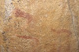
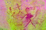
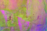
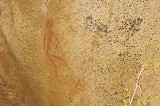
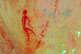
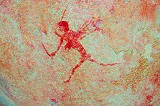
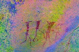
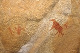
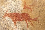
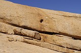
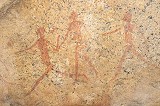
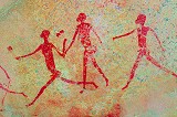
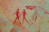
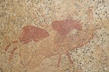
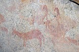
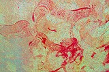
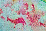
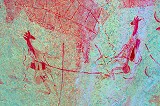
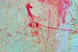
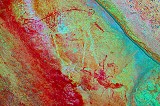
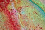
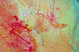
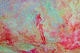
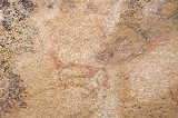
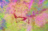
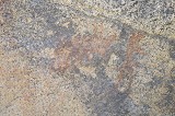
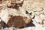
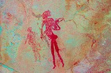
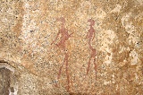
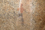
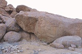
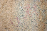
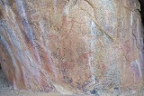
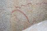
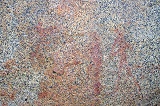
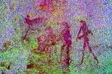
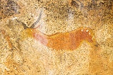
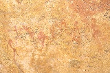
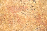
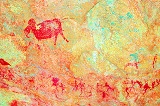
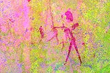
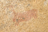
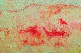
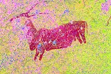
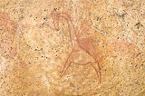
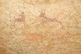
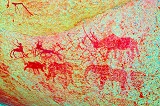
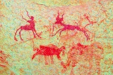
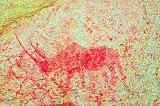
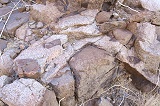
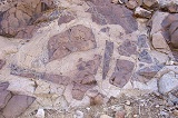
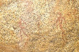
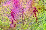
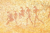
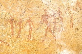
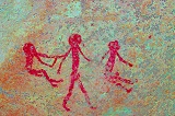
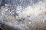
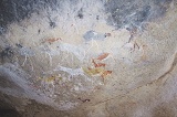
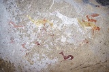
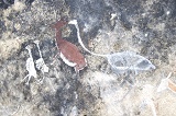
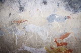
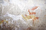
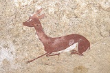
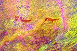
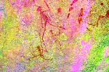
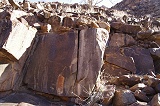
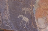
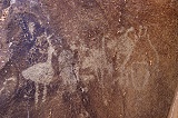
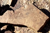
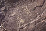
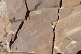
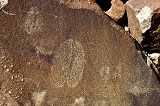
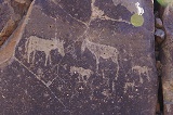
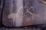
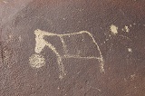
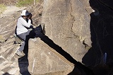
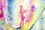
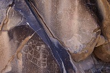
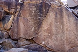
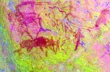
These paintings were discovered by Otto Schroeder, a member of the 1948 Breuil party right at the end of their stay in the Tsisab valley, and were copied by the Abbé in 1950 (reproduced in The Tsisab Ravine volume). The most remarkable scene is that of a fat tailed sheep accompanied by a hook-headed figure, at the time of discovery the only known sheep representation at the Brandberg. In the Breuil volume this small side-valley of the Tsisab was named "Zebra water" on account of the near-permanent water source used by zebras, but Scherz refers to it as Schaf River. Scherz recorded 12 sites, accompanied by a sketch map, which however is so distorted that it was impossible to match the marked features to true topography. The guidance of Colin was very much welcome, we would never have found the principal site by ourselves.
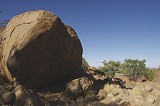
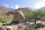
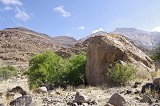
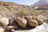
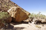
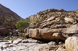
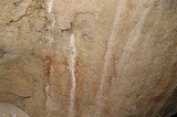
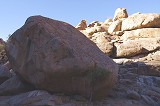
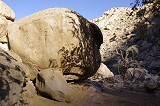
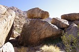
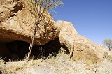
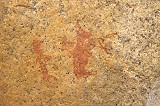
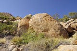
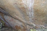
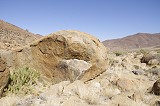
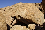
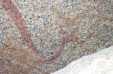
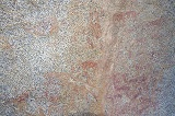
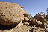
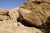
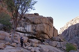
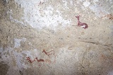
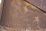
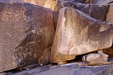
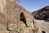
After only a few hundred metres from our cars we came upon a granite sheet with water flowing across it - Breuil's "Zebra Water". A large boulder adjacent to the flowing water had a prominent painted figure which was also published by Scherz (Site E). A short distance upstream there were three more boulders with paintings, probably Scherz's site G and L, but the paintings were too weathered to make a positive identification.
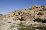
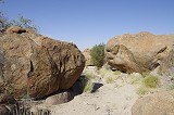

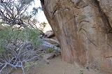
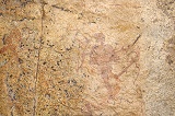
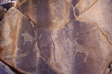
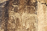
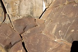
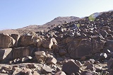
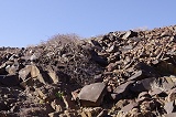
The boulder with the sheep scene (site C) was another two hundred metres further up the hillside, nowhere near where one would have expected it based on Scherz's map. It is a large boulder among a cluster of other undecorated rocks, with only a few paintings. Fortunately the fat tailed sheep with the human is the best preserved scene, grabbing attention as soon as one approaches the rock. While not unique, there are very few such sheep depictions on the Brandberg, the other clear example being the one executed in white at site I47 near the Engelhard Plain.

As Alfons was waiting for us in Uis, we did not continue to the other two sites of doubtful quality further upstream, leaving them for some other visit. We started back towards the cars, re-tracing our route past the other sites and the spring.
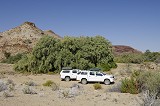
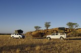
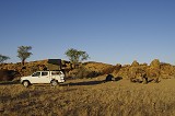
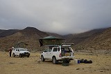
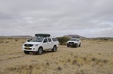
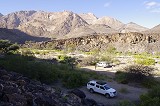
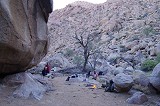
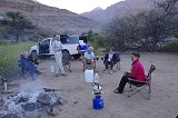
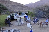
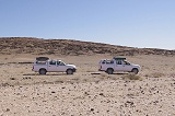
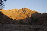
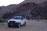
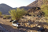
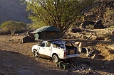
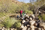
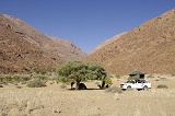
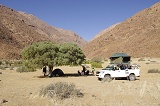
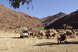
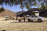
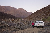
We dropped off Colin at his house in the nearby small village of guides, then took the road back to Uis to collect Alfons who was waiting patiently at the Branberg Rest Camp. Alfons also brought along Marco, a fellow guide whose task was to mind our cars and camp while the rest of our party is up on the mountain (while the Brandberg area is generally secure, there have been a few cases of theft from unguarded vehicles in the past, we did not want to take the chance). After greeting Basil we all set out to our fist camp at the mouth of the Ga'aseb Gorge, reaching it before sunset.
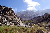
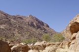
Day 3. - Ga'aseb Gorge
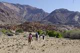
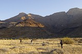
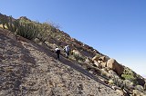
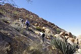
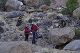
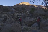
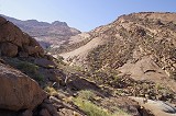
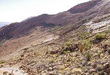
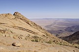
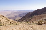
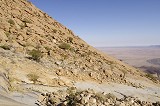
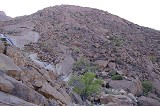
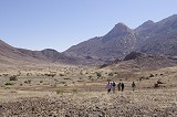
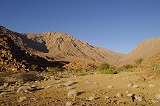
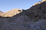
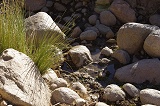
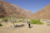
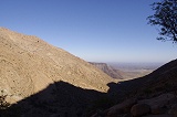
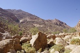
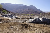
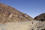
Our target was to make the trek up to the magnificent G8 site and back in a single day, visiting whatever other sites we may reach along the way. While Jon and I managed to see G8 on our way down in 2012, Magdi did not want to risk the steep and difficult ascent on our last day at the time, and Liz never saw it either. Liz had a double knee operation two years ago, this trip was the first serious one to test the results, and Ga'aseb with the only proper trail seemed the best option to test her abilities. We left camp at sunrise and swiftly crossed the flat lower section of the valley to the point where the path started making an ascent among the black lava hills skirting the Brandberg, trying to make as much of the ascent as possible in the shade.
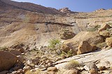
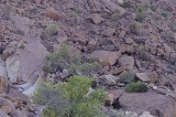
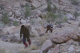
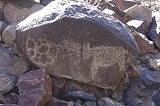
While the others continued along the path, I broke off near the lava/granite boundary to find two sites reported by Pager about half-way to the lower cluster of sites near G7. G30 was a solitary boulder by a largish flat terrace that is surrounded on all sides by massive boulders in the riverbed, a very difficult access. It only has two human figures painted on the side of the rock, very faint on the spot but dStretch reveals some fine details.
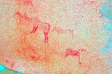
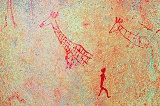
G24 is a few hundred metres further upstream, on a pleasant terrace a little above the nearly impassable riverbed which is strewn with car sized boulders. Pager copied a fairly large and complex panel, but all one could make out on the spot was the upper outline of a fine giraffe.
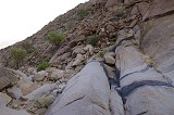
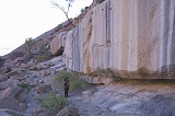
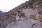
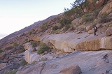
Climbing straight up the near-continuous granite plates starting right above G24 I caught up with the others near the top. Liz's knees were keeping up with the task, and after three hours we were beside the huge rocks on the riverside, site G7, the centre of the cluster of middle Ga'aseb sites.
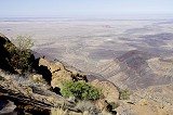
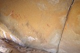
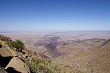
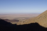
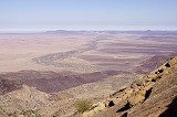
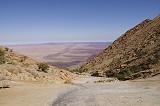
We left our packs at G7, and started the climb up to G8, clearly visible a hundred metres above us. Jon brought along a length of mountaineering rope to make the ascent more secure, and we inched our way up the steep slippery granite plates. Despite the difficult path, in a little over thirty minutes we all reached the shelter and the beautiful panel of paintings. Looking back, it appeared amazing how much altitude we have actually covered in three and a half hours (650 metres over a horizontal distance of 3 kilometres), our cars were just two white specks far below.
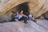
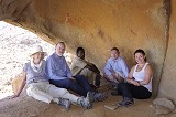
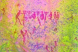
We spent a leisurely hour at the site, gazing, drawing and photographing the fine details, or just staring at the marvelous view. This was our main objective of the day, everything else we could still see was just added bonus. The site also gave itself to our group photos, despite our somewhat tidy and fresh appearance compared to those taken on the last days of other trips.
We returned to our packs at G7 for a quick lunch. Liz & Jon stayed at the site, while with Magdi and Alfons we set out to find the nearby sites G5 and G4 which we missed in 2012 in favor of finding the giraffes of G2. G5 was on a huge boulder just seventy metres below G7 in the riverbed (in retrospect, we could have easily seen it last time, just were too tired to look). It has a number of well preserved scenes scattered about the rock.
G4 was another hundred metres lower, on a smooth vertical side of a large boulder bordering the watercourse just above the point where the river plunges through an impassable waterfall over the streaked granite plates. The main panel is very faint, but there are some fine animal depictions (there is also a well preserved panel which we missed, only revealed back home in the Pager volume, hidden in the narrow crack between the boulder and the adjacent rock).
On our first Upper-Brandberg expedition in 2010 we passed on our hurried way down the Ga'aseb a single site, which later I was unable to associate with any of Pager's sites. It was less than 100 metres beyond G4, on the far side of the smooth granite plates. At the time water was seeping from the rock there, but now all was dry. The site itself, tentatively numbered G31 (G30 is the last Pager recorded), is along a narrow ledge with a vertical rear wall offering a rare shaded spot at noon (something we have made use of during our descent at the time). In 2010 I have only taken a couple of shots, now I could photograph the whole rock face and noted many more paintings, mostly human figures and a number of unrecognisable smudges.

We returned to G7 for a quick lunch, and to photograph the East-facing panels of paintings, which were fully exposed to the sun when we were here in 2012. Now we could afford to stay longer until all the paintings were in the shade, enabling much better photos of the many fine human figures, including a group of "flute players".
We started our descent at 2pm, expecting the same time as the journey up. We passed above G4, and continued along the less steep part of the granite plates to the bottom, reaching a small terrace a few dozen metres above G24 (I could not see it during the ascent, but the path in fact passes within 20 metres from the latter site).
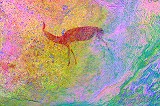
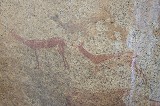
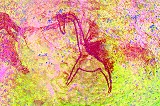
On this little terrace an inconspicuous round boulder nearly hidden among vegetation has a panel of very interesting paintings near the bottom, invisible except if one knows where to look. Alfons was shown this site by Tillman Lenssen-Erz, but it is not one of the sites copied by Pager (tentatively G32). The remarkable little scene shows a flock of flamingoes, a very rare theme among Brandberg paintings.
We continued on our way down and reached our cars and a very bored Marco before sunset, pretty much as expected. While Liz did have sore knees, she was delighted to have managed the climb, and appeared ready for some other less strenuous walks up other valleys.
Day 4. - Lower Orabes Gorge
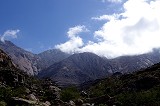
We awoke to an amazing sight, never encountered on the Brandberg at this time of the year. There was a low cloud hanging over the mountain and the surrounding plain, hiding much of the Brandberg in thick fog. The cloud base was just below where we were up the previous day, the streaked granite plates below G4 were just visible.
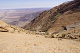
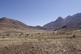
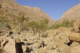
After the tough climb the day before we were planning a more relaxed day, visiting the mouth of the Orabes Gorge, where Scherz recorded a number of sites. After packing up our camp we drove to the mouth of Orabes five kilometres to the East (but more than double that on the track which goes far out on the plain). The weather remained cloudy as we drove along the track, with some blue patches and glimpses of Orabeskopf appearing as we reached the end of the trail in the main branch of the Orabes Gorge.
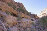
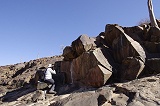
Leaving the cars and Marco at the end of the track we set out for the point where the triangular mouth of the valley narrowed to a gorge, where the main sites were according to Scherz's sketch. This time the map was fairly accurate, we did find site C among a cluster of large boulders near the tip of the triangle, where we expected it to be, less than 300 metres from the cars. It was a large site, with several panels of varying quality spread over several huge rocks and shelters. There were many more panels than the three recorded by Scherz, paintings were noted on at least seven separate rocks.
By the time we finished, the cloud mostly cleared, there were just a few white tufts left on the deep blue sky. We continued, finding Site B on a boulder in the narrow section of the riverbed some 150 metres further upstream, with just a pair of human figures visible.

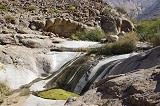
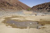
A short distance upstream we came upon the first of a series of basins, interconnected by smooth granite plates, which still contained water. Site A was supposedly up at the top of this "waterfall". It was not easy to get up the slippery smooth rock, but we did find a way and reached a large shallow shelter overlooking the topmost pool, with a series of very fine paintings of human and animal figures.


We returned the way we came up past the waterholes, then to the cluster of rocks at site C. Site D was marked as an isolated boulder South of C, there was a likely looking candidate about 150 metres to the south. Reaching it, indeed we did find a delightful little panel on the southern tip of the boulder. On the spot only the gazelle (which Scherz took to be an oryx) was readily visible, but dStretch reveals the entire scene.
About sixty metres away there was another boulder with two separate panels of human figures, Scherz's site E. The scenes are very faint, one can only appreciate them fully if viewed with dStretch.
Alfons found another boulder about fifty metres East of the last one with very faint paintings of human figures, apparently these have not been noticed by Scherz.
We returned to the cars and drove back along the track to the fork leading into the Eastern branch of Orabes (named "Kleine Orabes-Schlucht" by Scherz), and continued upstream till the end of the trail. After lunch we set out to find the five sites recorded by Scherz here.
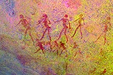
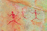
As we walked upstream, we passed a row of four rounded boulders with some very fine paintings on them. The human figures on the best preserved panel showed clear signs of wetting (a technique pioneered by Breuil who passed it down to Scherz and others), however it did not seem to fit any of the described Scherz sites. While according to the sketch map we were at the right place, We explored the valley both above and below these paintings, but did not find any more sites.
Regardless, we had a fairly successful day already, so after some more fruitless search we returned to the cars, and started out towards our next camp in the Hungorob gorge, stopping at a hill along the way taking advantage of the available mobile signal for some quick calls. We reached camp early, allowing plenty of time to prepare for the two-day hike up the Hungarob the following day.
Day 5.- Hungorob Gorge
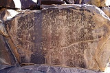
Our aim was to get up to the lower accumulation of sites in the Hungorob between the 850 and 900m contours, find the most important sites, then continue to "Springbok water" with the adjacent main site H137 at 1100m. Depending on the availability of water we might continue further to the few sites around a terrace a hundred metres higher. The following day we could return in a more leisurely fashion, seeing all the sites along the way. It was a very cold night, condensation turned into a thin film of ice on our bags which were left on the rocks next to our car. We waited until the sun rose above the eastern ridge before starting, first following the flat winding bottom of the Hungarob that extends for two kilometres into the Brandberg before starting to rise noticeably. Even afterwards it was an easy gradient along a well traveled path (this is one of the alternate routes for climbers to Königstein), and in litle over an hour and half we reached one of the first of the sites in the lower accumulation, H102. It was a spacious shelter under a huge boulder with a couple of paintings on the supporting blocks and the ceiling.


We continued for a few dozen metres to one of the central site of the lower Hungorob group, H103, to have a longer rest before continuing. It is a large site spread over several large boulders spread around a small terrace along the riverbed. It has many panels of paintings, unfortunately most of them very faint and weathered, there are only a few more recognisable details.
Above this point the trail leaves the boulder-choked river and continues along the adjacent slope. We followed the trail for a hundred metres, then returned to the riverbed for a rather frustrating and futile search for site H114, the most important among this cluster. We believed it to be in the riverbed somewhere along the Western side, and spent nearly two hours (interrupted by lunch) scrambling among the boulders with no result. Finally we decided to move on to Springbok Water, leaving the remaining lower accumulation sites for the following day.
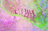
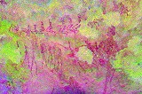
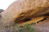
It took another hour to reach the series of waterholes and the adjacent deep long shelter, H137. This major site was discovered by B. Clauss in 1972, and it was the next on Pager's list to be documented when he last descended the mountain in 1985, not to return. The documentation was uniquely completed in Pager's style by members of the HBI team preparing the Hungorob volume. The main panel carries many superpositions, with a number of splendid springbok painted over large earlier human figures.
By the time we finished photographing the site, the sun descended below the crest of the high ridge to the west (with the Hungorob Plates on top). We set out for the last leg of the climb, a short half an hour to a terrace a hundred metres above. We made camp for the night beside a huge rock covered with paintings adjacent to the riverbed and a waterhole providing good clean water.
We started by checking out the boulder next to camp which we assumed to be H128, but on comparing notes it soon emerged that it was not a recorded site. Re-reading the Hungorob volume it became clear that Pager did record the position of a dozen sites in this area above the Clauss shelter (H137) in November 1983, but his untimely death prevented him from completing the tracings of these sites. Given the scarce resources the HBI team only copied H137, leaving these sites in the area undocumented. The huge boulder (provisionally H138) was clearly a very important site, with several large panels with hundreds of individual figures, some in very good condition.
We climbed back to the plain above camp, where there were the two sites documented by Pager. H128 was on the ridge overlooking the plain, with a panel of very nice giraffe and human figures on the ceiling. H129 was among a cluster of boulders in the middle of the plain adjacent to a stone circle, with several panels of paintings including three very unusual female figures.
To finish off the day, Alfons led us to the two nearby sites he knew about (there are another eight undocumented sites further upstream). Both were on prominent boulders within earshot of the main site beside our bivouac.
Day 6.- Hungorob Gorge
The night was not as cold as the one before, we had a good sleep out in the open in our sleeping bags, and started to stir with the light of dawn.
After breakfast we had another look at the H138 boulder, and found several new paintings which we missed the evening before, some on adjacent smaller boulders. Liz also found several human figures on the far side of a large rock some 25 metres distant, also a part of this site..
We just finished with all the panels as the sun rose over the rock, making further photography impossible. We started our way down to the lower accumulation via the quick route from the little plain, bypassing the detour to Springbok Water and H137.
On our way up we already noted the likely locations of H117 and H118, not far from where the trail passes on the hillside overlooking the riverbed. H118 was easy, with a prominent flat boulder resting atop the larger rock with the shelter, a clear giveaway from a distance. Inside there is only a single female figure.
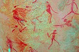
H117 is one of the most important sites of the lower accumulation, with a large panel of paintings at the rear of a spacious shelter under a huge boulder. There are some lovely scenes of giraffe, a rhinoceros and a flock of birds at the left of the shelter, in addition to many human figures and other animals. The overall state of preservation is not the best, but some of the scenes were fortunately preserved with a fresh look.
We continued to H103 where we left our packs in the shade, and spread out to look for the other sites. H108 was easy to find, right below in the riverbed on a series of boulders among a dense cluster of reeds (but no water), but with only some very faint paintings.
H110, just across the river on the far bank, was more interesting, with several panels, some well preserved, spread over a number of medium sized boulders surrounding small separate terraces along the watercourse. The site also hides a re-assembled pot that was left there by the HBI expedition led by Tilman Lenssen Erz.
We spent some time looking for site H111 somewhere close up the western hillside, but it remained elusive. However the search produced an unexpected result, Jon stumbled upon the huge boulders of site H114 quite far up the slope, nowhere near the expected location in the riverbed where we did our futile search the day before.
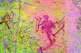
H114 consists of two parts. The bulk of the paintings (Fix A) are on the side of a large elongated boulder to the left of the entrance of the shelter that is hidden under the larger rock. The paintings on the left are wall are quite preserved, and depict a number of animals and human figures.
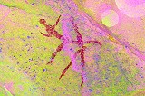
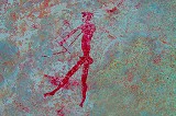
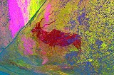
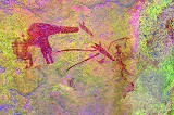
However the main attraction of the site is a single human figure on the ceiling of the large shelter which only contains few and insignificant paintings aside this scene. This walking figure, only 15 cm in length, is executed in an extremely fine detail, with very elaborate body decoration. He is playing a musical bow, a depiction that is unique among the Brandberg paintings. Adjacent to it there once was a giraffe, but it was almost completely obliterated by weathering, which remarkably left the figure untouched. (To the right, appearing to be the continuation of the man's headdress, there is some white paint which I think is the head of a giraffe the neck line is visible further right - but even with dStretch it is very difficult to make out.)
With the location of H114 established, it was easy to find H113, an extensive site on numerous boulders surrounding a small plain right under H114. There are some very nice panels of wild animals and humans on some of the boulders composing the site.
With Magdi we considered an attempt at climbing up to site H115 & H116, about 45 minutes away up the side valley leading up to a waterhole at the base of some conspicuous granite plates. However we found the route filled with huge boulders, and it appeared an altogether unpleasant climb, racing against the clock. We rather returned to H103 to join the others for a leisurely lunch and a longer rest before making our descent to camp. I took the opportunity to make a quick visit to two more sites nearby. One, H107 was in the riverbed a little downstream from H108, a solitary boulder with just some smudges of paint on the side.
H109, a house-sized boulder on a small plain along the west bank of the river, was much better. It contains two fine panels of paintings on two sides. The south side depicts a row of running figures, while on the east side there is a large scene of animals and humans.
Around 2pm we started our descent, with four more sites of the lower accumulation along the way. H101 was just a short distance downhill adjacent to the path, a large conspicuous shelter under a huge rock which we already spotted on the way up. Strangely there are no paintings in the shelter itself, only a few human figures on the exposed rock face to the right of the shelter.
H101 is on the other side of the path opposite H100 on a number of boulders, the two really comprise a single locality (considered two sites because of Pager's 30 metre rule). There are several panels, but only two human figures stand out, the rest are in a poor state of preservation.
The remaining sites H99 and H98 were both about fifty metres to the west of the path, on boulders on the terrace adjacent to the main watercourse. The former is a deep shelter with only a few poorly preserved paintings (including a row of seemingly headless humans), while the latter has two panels of paintings on adjacent boulders, one of them a fine scene of giraffe and humans. Below there are no more sites (except the insignificant H106 which we did not visit), in little over an hour we covered the remaining distance to our camp, allowing a relaxed hour of doing nothing before sunset.
Day 7. - Trichter (the "funnel")
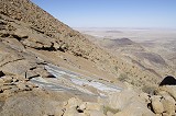
Hungorob has an Eastern tributary that joins the main watercourse just before it crosses the lowest black lava hills before exiting to the plain. This tributary rapidly rises to a huge semi-conical continuous granite plate that channels all rain runoff to a single narrow channel, hence the name Trichter (funnel in German). The main watercourse is impassable due to a series of cliffs and waterfalls, but there is an easy back door a little further upstream in the Hungorob, from where mountain zebra make the ascent to the lower parts of the Trichter valley to a semi-permanent water pool along a relatively shallow gradient. The attraction of the valley lies in a major site, H121 near the bottom of the granite plates at an elevation of 1400 metres. We were planning a trek of a day and a half up to H121 and some other sites higher up, making the ascent in the shade of the early morning, visiting the sites the same day and making a descent the morning after. Liz was to remain with the vehicles spending the time painting, while Marco joined us in order to accompany Jon who planned to only come till H121 and make the descent the same day. We started from camp before sunrise, and were already well on our way when the first rays hit the peaks above.
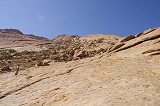
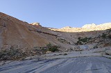
The path to Trichter branched off the main Hungorob trail about one kilometre upstream of camp, rising gradually along the contour of the slopes along a series of terraces formed by the layered Karoo lavas. We were close to the granite / lava boundary, after an hour from camp we reached a big granite boulder resting on the basalt that must have rolled down the slope, with some faint traces of paint on one side - site H104. After a brief stop to rest we continued along the basalt / granite boundary until reaching the Trichter watercourse. From our vantage point it was clear that the river valley is impassable due to heaps of large rounded granite boulders, the only passable way was the side slope towards the sheer granite plates high above.
We reached an elevation of 1200 metres, where our route was barred by a steep continuous granite plate that rose from the valley bottom all the way to the peaks above. There was no way around, it had to be crossed to reach H121. After some scouting it became clear that there was no crack or ledge which could be followed, the only route ahead was on the smooth granite inclined at a 35-40 degree angle. Jon and Magdi were both uncomfortable with crossing the plates without any support, and after some discussion it was decided that they will return with Marco, and only Alfons and myself will attempt to continue. In retrospect probably the first twenty metres from where we parted was the worst, the granite was solid with a rough surface offering a good foothold. We made good progress, only struggling to find a way around a 3 mere vertical ledge barring our way which was too high to climb. By 11am we reached the bottom of the "funnel" and were relieved to find the water hole full, meaning we did not need to ration water.
We took a good rest near the waterhole, where we also left our camping gear to lighten the load. Alfons found the small undocumented site nearby (a mystery why Pager did not copy this one - which he must have seen - while he did the much more inaccessible high Trichter sites). It has a very well preserved, but apparently unfinished scene of wild animals under a low overhang that is cramped and very awkward to get to. The panel may only be viewed when lying on one's back on a narrow ledge no more than 30cm wide, I nearly rolled off the 2 metre drop while moving to take photos.
After the pit-stop we set out towards the plates above, only carrying a single pack in turns. We climbed the bouldery slope between the smooth granite where we expected site H121 to be, but found nothing. We checked all larger boulders, but after each proved to be empty we concluded that we must have passed the site which is lower and closer to the water hole than anticipated. Not wishing to lose already gained altitude, we decided to continue up the plates to sites H124 and Furrow 1 just across the watershed.
The smooth side of the "funnel" offered a good easy way up, the granite was coarse and firm and the steepness was just less than what would have been uncomfortable. We could go straight up, and covered the 300 metre elevation to the ridge in less than an hour. We were pleased to find F1 just where it was expected to be, a few metres beyond the watershed, essentially a Tricher site but for the technicality. The paintings are on two panels on either side of a smaller boulder jutting against the larger painted one, with a multitude of well preserved human figures, certainly worth the strenuous climb to reach them.
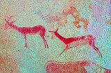
Site H124 was just a few dozen metres away on the other side of the watershed, a large boulder surrounded by smaller ones with a large panel of paintings on its face, unfortunately completely exposed to the sun. The most important is a herd of oryx, unfortunately not too well preserved, only the red body outlines are visible, the heads, horns and legs are mostly missing.
We consumed whatever we had in the pack for lunch in the shade of a rock on the top of the ridge, Alfons making use of the availability of mobile signal. I took the opportunity to make an attempt at finding H123, seemingly an easy way less than 300 metres away on the vegetated terrace running across the Trichter plates at mid-level. It turned out to be a half an hour struggle over big boulders and thick vegetation before I found the inconspicuous rock facing he slope, with the lovely little scene of gazelle on it. After clearing the encroaching vegetation the paintings were fully exposed to the sun and being alone I had no means of shading, but dStretch does a good job even on sunlit rough granite.
Starting straight down I followed Alfons who already started the descent, having kept an eye of my movements. We met about half-way down, and made a plan of where to search for H121 from above. The most likely area was a batch of boulders slightly East of where we ascended, and significantly below where we first looked.
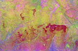
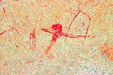
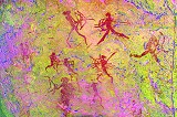
This time our hunch was correct, it did not take long for Alfons to yell over that he found the site. It is a rather flat rock despite its size, and it is lost in view from the direction of the main watercourse among the other rocks. The true nature of the site only becomes visible if viewed from the far side (from where Pagers sketch was also made).
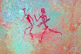
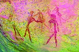
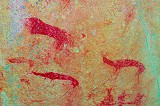
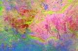
The principal panels were exposed to the sun, so we returned to the waterhole and our gear to spend the time while the sun set over the ridge above us. After about an hour the shadows started creeping up, ever faster to the site so I set out with my camera. Reaching the rock it was evident that nobody visited the site for many years (probably no-one since Tilman in the early nineties). The shelter floor was full of vegetation, the site needed much cleaning before it could be photographed. There are two principal panels (merging near the centre), the one at lower left dominated by a herd of zebra, with the most striking figures being a zebra apparently caught by the neck by a supposed lion (though from the proportions of the predator I would not rule out hyena). On the right there is a unique scene of two facing therianthropes among a large herd of giraffe and other animals.
While I was photographing the main site, Alfons found a lovely little panel of paintings down at the site by the waterhole, hidden away in a narrow crevice. The nature of the white striped animal on the top is unclear, it seems to have too long legs for a zebra, and unfortunately the head has been so obliterated that even dStretch offers no clues.
Day 8. - Trichter - Hungorob
We awoke at dawn after a pleasantly warm but windy night. There was quite a chatter at the waterhole after we went to sleep, with large flock of sand-grouse arriving for a drink, a bath and plenty of socializing. The tweeting and chirping went on for a good hour, occasionally interrupted by the splashes. Then something frightened them, and the whole flock flew away with a huge clapping of wings. After a quick coffee and some breakfast we packed up still in twilight, and started the descent as soon as we could see where we were stepping.
We re-traced our route across the granite plates, and reached the bouldery hillside. We left our packs at a prominent rock to descend into the valley to the gleaming white waterfall, with site H125 just above. Even though we could easily identify it from above, it took a while to find the paintings among the mass of boulders. There are some fine paintings of gazelle and other animals here, plus some very faint traces of other figures.
We returned to our packs and continued the descent, taking a steeper but faster route across the basalt outcrop skirting the granite. By the time the sun rose above the lip of the Trichter, we already reached the flat basalt terraces above the main Hungorob valley.
In another hour we reached the terrace with the rock of site H104. H105 was supposedly 100 metres to the North of it, we did not have to really search because the large boulder nearly level with H104 was a fairly obvious target. We found the single scene of seven human figures walking in a row low on the Western side. We also spent some minutes cooling in the welcome shade, as since the sun rose it started becoming uncomfortably hot. The wind of the night was gone, the air was completely still.
It was still a considerable way to reach the Hungorob riverbed, from where we walked the last level kilometre to camp, reaching it soon after midday.
After the tough climb and descent it was nice to have a lazy afternoon in camp. Jon & Magdi reached camp by midday the day before, they had time to go into Uis with one car to top up our water and fresh supplies, so we had nothing to do but sit in the shade while the worst of the midday heat was over.
We were expecting visitors for the evening - Francois de Wet, out friend and travel companion to Uweinat (and the nephew of Major de Wet, commander of the ill fated SAAF 15sqn Blenheims at Kufra) has recently moved to Walvis Bay to work on the new port project, and together with Andra were planning to spend an evening and a day with us at the Brandberg. We agreed to meet at the junction of the Messum and West Brandberg roads at 4pm, so at half past three we set out with Magdi across the rocky plain dotted with Welwitschias to the rendez-vous point. In the afternoon light and from the distance the funnel shape of the Trichter valley stood out very conspicuously - it seemed incredulous that we managed to get down from there in a half day. Francois and Andra were waiting at the agreed place and time, and after driving back we spent a very pleasant evening together at the Hungorob camp.
Day 9. - Amis Gorge - Numas Gorge
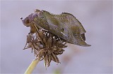
We took a leisurely morning in camp, before packing up to move to the bottom of Amis Gorge. As I sorted the boxes, I found a huge (~5cm) leaf-mimicking moth in one of them, safely evacuated to one of the reeds about camp.
It was a short drive to Amis, the next valley to the West. Here too Scherz recorded a number of rock art sites at the bottom of the Gorge, which has a topography unlike any other valley. The three branches of Amis have carved out a large flat grassy basin between the granite and the black basalt ringing the mountain, before the river exits to the plain across the basalt dam via a narrow canyon. Scherz's sites are mainly concentrated in the Eastern basin. We parked the cars under some large trees in the middle branch, then set out on foot to locate the sites, using Scherz's sketch map as a guide.
Sites B and C were not difficult to find, they were right where we expected them to be, B an enormous free standing angular block, while C a large flat rock a mere 40 metres away.
Site B once must have contained numerous paintings, but now only traces remain. Most of what remains is only visible with dStretch. There are several scenes with recognisable small human figures, but all show the legacy of decades of moistening by researchers and tourists alike.
Site C has only a smaller panel of paintings in a shallow shelter along the Eastern side of the flat boulder, also very fragmentary and hard to make out. The best scene is a little buck tucked away to the left corner of the site.
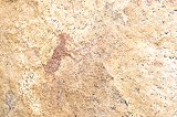
We continued along the riverbed towards a prominent boulder on the southern side which seemed to fit the description and location of site G. Just before the riverbed we found a site which we first took to be site F, but as that site was later found, this appears to be an unrecorded site. On the first boulder there was a bizarre animal together with a human figure (and more humans around the rock), but dStretch also reveals a whole group of tiny human figures to the left of the strange animal (perhaps rhinoceros?). Forty metres away to the North there was another block with some human figures in an unusual style.
The block on the far side of the river was indeed site G, the figure of what appears to be an adult carrying a child matched that published by Scherz. There are several other panels of human figures all around the rock.
While the others waited at the bottom of the slope, with Alfons we tackled the boulders leading up to the dry waterfall, and a likely waterhole (marked on Scherz's map).

It was nearing midday and it was becoming very hot in the enclosed basin with no wind, we all agreed that we have seen as much as we wanted, and returned to our cars. We exited Amis, Francois and Andra left us on the main road to go to the Rhino camp for a night, while we continued towards the Numas Gorge.
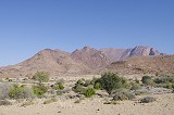
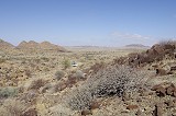
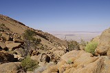
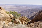
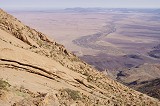
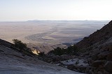
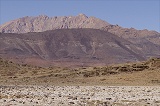
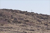
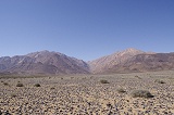
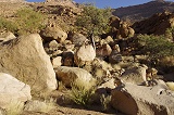
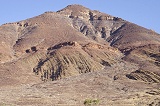
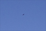
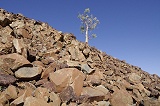
The Western side of the Brandberg presents a very different appearance than the grassy plains along the Eastern and Southern sides. Here the very ancient rocks that formed the supercontinent of Gondwana are exposed in a series of ridges. The black Karoo lavas that formed when Africa and South America split cap these metamorphic rocks, and from a high rampart around the Brandberg granites. The landscape is an almost true desert, with just a few plants, mainly Welwitschias scattered about the barren rocks. Despite this there is more wildlife due to the absence of humans, zebra, gazelle and ostrich roam the hills and the green valleys cutting across them. This time we only saw a large bird, a Ludwig's bustard (Neotis ludwigii) that blended so well into the rocky plain that it was almost impossible to spot if it stayed still.
The lower Numas valley was reached just after a fifteen minute drive across the rocky country, a belt of intense green Salvadora persica shrubs intermingled with acacias, in places strikingly similar to the Enneri Miski in the Tibesti mountains some 4500 kilometres away. We drove to the end of the track and made camp at the point where the rocky sides close in on both sides to form a narrow gorge.
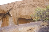
It was still mid-afternoon and it was unusually hot, well over thirty degrees Celsius. After lunch while the others took an afternoon rest in the shade I scouted the environs of our camp. Scherz reported a number of sites in the lower Numas, a few of which were visited by Liz and Jon a decade earlier, but the locations were rather vague. Like in other valleys Scherz's sketch map bore little resemblance to any real topography, several places could have been the start of the paintings. I had the hunch that a little side valley just before our camp could hide site A next to a dry waterfall, so this was the first pace to be searched. It did not take long to find the site, a spacious shelter under a very large boulder close to a dry waterfall where water would remain in a pool for a long time after rain.
The paintings were of a surprisingly good condition, clearly this site is known only to very few people. There were a number of very fine human figures, as well as several well executed gazelle, including one from a rear view. There were also a few panels outside the shelter and on the far side of the block which were already exposed to the late afternoon sun, I took note that this site is best viewed in the early afternoon, when the sun is at the highest.
Walking back towards the camp I passed a large pile of very old elephant dung, and Marco also pointed out a series of rhino tracks near the camp. Judging by the relatively small footprints, it was a young animal that probably went up to the permanent water hole like the zebras do.
At 4pm when it started to cool a bit, we all set out to make a preliminary reconnaissance of the upper valley, the target of the next day. We walked up to a cluster of rocks which we presumed to be one holding Scherz's site L, the most important site of the locality. We found no trace of the site where we expected it near the upstream tip of the ridge, but as we started walking back we found a large panel with numerous well preserved paintings exposed to the setting sun. We made a mental note to start early the next day, as this panel is exposed for most of the day. A little lower we found another couple of rocks with paintings of fine human figures, unclear exactly which based on the sketch map.
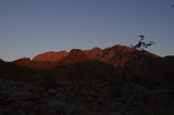
By the time we returned to camp the mountain turned a fiery red, true to its name. Consulting Schers's site descriptions it became clear that the large site we found was site I, meaning the next day we will have to search for the other sites much farther upstream.
Day 10. - Lower Numas Gorge
Jon and Alfons set out before dawn in an attempt to reach the cluster of sites N184-187 in the mid-section of Numas, about 6.5 kilometres upstream from camp and a good 650 metres higher. With Magdi & Marco we set out at sunrise to photograph site I and look for the others, while Liz elected to stay in camp and paint. Along the way we stopped to photograph another boulder of Scherz's site K which we found the day before, with a number of quite well preserved human figures and animals.
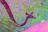
We did well to start early, site I was still shaded by the ridge on the far bank of the valley, but the shadow was rapidly shrinking. I just managed to photograph all the panels before the sun crawled across the large vertical rock face. The most interesting scene is a very well preserved eared serpent, enclosing a fine giraffe, accompanied by a row of gazelle. There are numerous paintings of humans and animals on a large surface to the left and right of this scene, but in a much poorer state of preservation.
The next site, Scherz's site G was nearly a kilometre further, quite far beyond where we expected the bulk of the sites. It was a large shelter under a big slab at the downstream end of a rocky ridge forming the south bank of the valley. There were a number of panels both inside and outside the shelter. In the shelter there are a number of dark triangular shapes which make little sense, probably they were a part of a composition made with another colour which disappeared without a trace. On the outside of the rock there is a lovely antelope and some other animals.

Site M was just two dozen metres away (by Pager's 30 metre rule they are really the same site) on a large boulder. There were many animals and humans painted on the rock, sadly all quite badly preserved. The best scene is a row of three running figures.
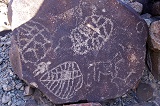
Another hundred metres further upstream we came upon an elevated terrace along the watercourse, surrounded by large boulders with numerous panels of paintings on them. This was Scherz's site F, the largest site in the lower Numas. Mos of the panels were weathered with just a few good scenes, but on the largest rock there is a panel facing the river with dozens of well preserved human figures and animals.
For some reason Scherz singled out a large rounded boulder at the edge of the terrace right at the riverbank as a separate site L. It has some very interesting paintings reaching nearly around the rock, but it is clearly just one of the several boulders around the terrace making up site F. There is a panel with a number of "flute players" (or whatever else they are doing), plus numerous others with more conventional human and animal representations.
Just behind the boulder of site L there was a large rock forming a shallow shelter, a part of site F. There were once many paintings inside, unfortunately most have been damaged by water flowing down the rock side, however there is a lovely preserved scene of several gazelle, one of them depicted head-on.
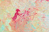
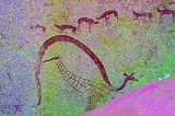
Another twenty metres further, on a lower level along the watercourse there is an immense boulder resting on another one, with a shallow shelter around its edge, Scherz's site H but technically still a pert of the large site around the plateau. The upper rear wall of the shelter has some intriguing but weathered paintings of what appears to be a large eared serpent (the head is gone), a group of several fine gazelle, zebra and a bird, and on the extreme left what appears to be an eland (a very rare representation on the Brandberg) with several archers and a rather enigmatic scene with humans and some unidentifiable small objects.
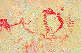
There is a much better preserved panel on the western side of the rock, depicting two giraffe and a number of other animals. On close look there are some intriguing features: the right giraffe, with a very strange body proportion, is painted over a very fine and well preserved oryx. The left giraffe is even stranger - its front legs seem to be tied together with a rope, depicted in yellow, very difficult to discern except with the dStretch yellow filter.
While I was photographing the panels, Jon and Alfons suddenly appeared from the upstream direction. With their very early start they did manage to reach N187, the lowest and main site of that cluster by mid-morning. Finding the route further up to the other minor sites very steep and bouldery, they decided to return before it became vary hot, reaching us before midday. After a short rest they continued bank to camp, Magdi joining them, while with Marco we set out to search for the remaining couple of known sites beyond the tip of the rocky ridge.
At some time in the past this part of the valley was filled to a considerable depth by fine cemented granite gravel and sand, before the river cut through this fill to a lower level, forming large barren terraces on both sides. About 250 metres upstream from site H there was a very large conspicuous boulder sitting on the gravel terrace, which was screaming of rock art from a distance. We walked up to it and indeed found a panel of paintings along the Western side. We first presumed this to be Scherz's site B, however as we later found that site this one had to be an unpublished one.
Working our way backwards along the boulder-strewn bottom of the slope, Marco soon found a shelter with some paintings in it a hundred metres below the previous paintings. The rhinoceros was a clear giveaway, this was Scherz's site B.
While I was taking photos of site B, Marco found another panel of paintings in a narrow passage among some promising-looking boulders. These all depicted human figures with a few animals and some enigmatic objects, all rather faint. The site did not appear to match either Scherz's map or site descriptions.
As we rounded a large boulder in the same cluster the mystery was solved, we found the panel with the pair of kudu that was copied and published by Scherz as site D, quite far from the point suggested by the sketch map in Scherz's book. There is also a panel of small human figures, and dStretch reveals a very fine rhinoceros and a pair of elephants from a layer pre-dating the kudu and the human figures.
Strangely we have found site C exactly where it was expected based on Scherz's sketch map - possibly these maps were drawn from memory many years after the actual site visits. It was a spacious shelter under a large cracked boulder, with only some rather disappointing traces of paintings.
There was supposedly one more site in the area on the far side of the ridge, but we could not locate it. We did find water though, a series of shallow pools among the small bushes in the riverbed about 100 metres upstream from the end of the ridge. These water holes are semi-permanent, attracting wildlife from all over the plains and hills to the west of the Brandberg.
It was becoming uncomfortably hot, so we too started on our way back to camp, stopping briefly at the big boulder downstream from site I where the paintings were now well shaded. We already saw this rock the previous afternoon, but in the better light many more paintings became visible. This one was one of the three rocks which Scherz lumped together as site K.
As we returned to camp, we found some unexpected company in the form of a Swiss couple, Christine and Stephan, who were spending several months driving in their own 4wd camper across the southern part of the continent. We spent a lazy couple of hours in the shade of the cars, then set out together to see Scherz's site A which I located the day before in a better light. Aside the fine figures seen the day earlier there were several more panels, including a large but very hard to discern eared serpent. Some more paintings were on the far side of the rock, including a very fine panel of archers in a narrow passage that was just-about in the shade along the right side.
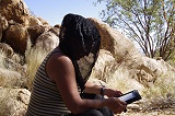
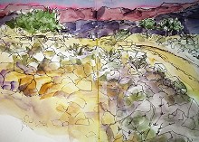
The remainder of the afternoon was spent in a rather relaxed manner. Liz was painting, Magdi went up the valley with Christine and Stephan to visit site I, while I targeted a dark shelter near our camp just coming into the shade, Scherz's site N. At present it is very visibly taken over by the dassies (rock hyrax), yet some paintings remain despite the damage.
As I was returning, I noticed that the boundary layer between the red Brandberg granites and the much older black Karoo lavas runs just adjacent to our camp. As the granite forced its way up, it shattered the basalt, but at the edge it was not quite hot enough to melt and dissolve the basalt fragments. In large patches along the boundary there is a conglomerate of granite filled with angular basalt blocks.

Overall I was very pleasantly surprised and pleased with our stay in the Lower Numas valley. Scherz only published a few of the outstanding panels, so I was unprepared for the quality and sheer quantity of paintings at some of the sites. In Pager's diaries there are reports of several other sites on the terraces to the North of the watercourse, so possibly we may re-visit the area for a more thorough exploration some other time.
Day 11. - Numas Gorge - Naib Gorge
In the morning we made use of the opportunity to replenish our dwindling water supplies, walking up to "zebra water" to fill a couple of empty 5l water bottles. The water was a bit murky, but was perfectly good for cooking and washing.
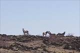
After packing camp Christine and Stefan continued their journey towards Uis, while we moved towards the entrance of the Naib Gorge. On the track among the rocky ridges we encountered a herd of mountain zebra, probably waiting for us to move out of Numas so they could access freely the water holes.
We reached the Naib before noon, and drove in till near the end of the track to make camp at a large tree, the only comfortable shade in the area. Liz and Jon planned to spend the afternoon and the morning of the next day in the area, while with Magdi & Alfons we planned to make the tough climb up to site I15, one of the Brandberg highlights, which we bypassed when we descended the gorge in 2012. The site was clearly visible from our campsite, at the base of a vertical cliff adjacent to a huge boulder perched on a small ledge some 200 metres above the valley floor, about 3.5 kilometres from where we were. The altitude difference was not daunting, we were at 550 metres and the site was at 1100m, but we recalled that the valley is very difficult to traverse, with huge boulders making the going very difficult. The best plan was to make the ascent in the valley to a point a few hundred metres below the site in the afternoon, then make the final steep climb in the cool of the early morning, before returning to camp.

We set out at half past two, planning three hours to reach a suitable overnight spot below the I15 shelter. Initially the going was good in the riverbed, in little over half an hour we covered the first kilometre, reaching a difficult step over huge boulders. Peeking in behind a patch of thick vegetation looking for a possible way, instead of a passage I unexpectedly found a shelter with some paintings of humans and a strange antelope - the first panel of Scherz's site C. We knew there were some lesser sites in the lower valley, but Scherz did not publish any tracings or map. With our tight schedule we did not have time to do any search, so were quite pleased to chance upon the site.
As we searched for a way past the blocks blocking the riverbed, Alfons found another panel of paintings near the bottom of a large block about 40 metres from the previous one. The paintings depict a very well preserved procession of human figures which were described by Scherz.
While I was taking photos with Magdi providing the shading, Alfons found another panel of paintings under a large boulder 25 metres away. This site only contained two rather weathered bucks.

On the far side of the river a deep shelter under some boulders also contained a couple of curious neckless round-headed human figures, guarded by a very dusty large spider on the shelter floor. Probably had we more time, we could have found some more paintings in the area, as there were several promising looking boulders higher up the slope, but we needed to press on towards our main objective.
Beyond the sites near the waterfall (and a sandy basin which in better years must be a major water source and the reason for the concentration of sites here), the valley started to rise, not steeply but noticeably. At one point we left the riverbed, finding a series of relatively flat terraces on the South bank offering easier going, until the slope turned steep and it was a scramble among boulders either way.
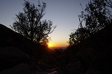
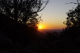
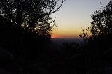
As sunset was approaching we reached a pleasant sandy terrace in the riverbed at an altitude of 850 metres. The big rock adjacent to I15 was looming close above, only 400 metres away but still 200m higher. This looked like an ideal overnight spot, sheltered from three sides by big boulders, so we dropped our packs and enjoyed our only unhindered view of this trip as the sun disappeared on the far horizon.
Day 12. - Naib Gorge - Grosse Domschlucht
We had a pleasant warm night, and awoke at first light, taking a quick breakfast before setting out. We left most of our gear behind, climbing the steep gradient with just one light pack among the three of us with some water, taking advantage of the shade and the cool of the morning. We already covered half of the altitude by the time the sun rose over the plains below. In an hour we reached the large vertical rock face below site I13, only a short distance to the west of our target.
We only had to struggle over a remaining metre high vertical rock ledge, and we were standing level with I15 at the base of a huge cliff, only a few dozen metres away. It was 8am, we made the final ascent in about an hour and a half.
The site is a deep shelter under the cliff edge, with a large panel of perfectly preserved paintings on the ceiling. The most striking is a procession of ostriches along the top of the panel, with a flock of lesser birds at far left. There is a very fine group of zebra and gazelle in the centre, with some bucks in the lower part of the panel in extremely fine detail. It is definitely one of the Brandberg highlights, worth all the effort of struggling up to it.
We spent a good hour photographing the shelter and just marveling at the lovely scenes before it was time to start our descent. The near side of the valley was still in the shade, we could expect to make most of the way without the sun.
On our way down we passed by site I13, a very impressive long shelter almost on the same level as I15. Despite the attractive location it only contains a few very weathered human figures.
We returned along a slightly different way to the small basin in the riverbed with our packs, and continued immediately down the valley towards camp. As soon as the sun reached the valley bottom it started to become very hot, stirring the rather irritating swarm of small flying insects, which attempted to enter any available orifice. We already encountered them at other valleys, but here in the Naib they were so bad that we resorted to the head nets always carried in the pouch of our backpacks, originally intended against the botflies at Uweinat. At first we thought they were flies, but in fact they were a species of small wasps, with a particular liking for one's ears.
By midday we reached the part where the valley started to flatten, continuing along the terraces of the south bank by-passing the sites we saw on the way up. We reached a terrace near the mouth of the gorge where under a large boulder we found a shelter that contained a few paintings of gazelle - Scherz's site B.
Continuing to the flat part of the riverbed we encountered a large "A" and an arrow drawn in the sand, pointing towards a large round rock on the far side of the watercourse. Clearly Liz & Jon found Scherz's site A and left a sign for us along our up-going footsteps. The site contained several human figures, some quite well preserved.

We reached our campsite by one in the afternoon, quite close to our estimate of how long the overall trek would take. While we were away Liz completed a couple of watercolours, and they have explored the lower reaches of the valley, only finding site A.
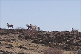
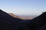
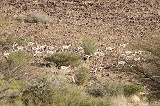
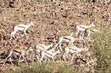
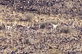
We waited in the shade of the tree until the temperature started to drop, then packed up to move to our last camp in Grosse Domschlucht (Greater Dom Gorge). As we drove out the Naib, we encountered a huge herd of springbok (Antidorcas marsupialis), composed of perhaps two hundred or more individuals. They were all around us, those on the right of the road bolting to overtake the cars and join the main herd, which broke into a trot and passed us in a procession taking a good ten minutes. They were still filing past the hill with the contorted schist layers as we reached the main track, with a perfect afternoon view up the Naib giving a good perspective of the route we have taken in the morning, the big rock by I15 clearly visible.
The Grosse Domschlucht is the larger of the two watercourses that descend from the mountain to the West of the huge granite dome (hence the name) somewhat removed from the rest of the mountain, on the Dom - Western Amis watershed. Uniquely it not only contains paintings, but also engravings on blocks and outcrops of the Karoo series where it is cut through by the river. This valley is very little visited, and even though Marco has visited the place with Tilman many years ago, it was trial and error until we hit upon the correct track leading in to the gorge. We reached the end of track past sunset, making camp among a rather inhospitable rocky section of the valley.
Day 13. - Grosse Domschlucht - Uis
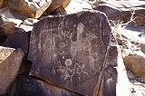
At sunrise we started out to visit the sites of the valley, which started just 700 metres upstream from our camp, where the watercourse narrowed and passed between low rock walls. Surprisingly we found many more paintings then engravings, nearly all smooth suitable rock faces showed traces of red paint. Unfortunately most of them were very faint, both on account of the closeness to the flowing water, and also presumably because they were moistened extensively by Scherz and others visiting and copying the sites.
Near the beginning of the North site we noted a panel with some faint large human figures, and some barest traces of paint to the right of them. Processing with dStretch reveals a very complex panel, with some exceptionally large human figures (on the scale of 60-70cm), completely invisible on the spot.
Continuing, paintings dominated on both sides of the valley, with just a few engravings here and there, their crudeness in a strange contrast with the sophistication of the paintings. It appears likely that the engravings are more recent, and have been produced by people with a completely different set of traditions and conventions than those who made the paintings.
In the Domschlucht there are no real sites if one considers Pager's 30 metre rule, the paintings and engravings continue along both the North and South banks of the valley for a stretch of 500-600 metres where the river cuts through the Karoo series ringing the Brandberg. Paintings continued to dominate (all very faint, barely visible), with a couple of rather unconventional scenes among the more usual themes.

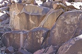
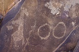
After reaching roughly the half-way point along the row of rock art panels, the proportions changed markedly, with engravings beginning to dominate (usually on individual blocks, not on solid rock outcrops) among fewer panels of paintings. We also found a couple of engravings which were scratched out with a sharp object rather than pecked like the majority of panels. Some of the engravings showed circles, ovals and other geometric shapes, usually on blocks separate from any animal depictions.
The panels on the South side of the valley ended in a rich concentration of engravings on several blocks and outcrops. Here we saw the first of the characteristic animal hoof-prints which also feature prominently at Twyfelfontein.

The engravings continued for much longer along the North bank, reaching ever higher among the boulders on the rocky slope. The themes remained the same, animals with some circular and other geometric objects, with some hoof-prints added to several panels.
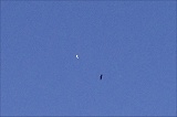
While we were busy taking photos, an aerial battle developed right over our heads. A large martial eagle (Polemaetus bellicosus) which was circling above us for some time was suddenly attacked and chased away by a much smaller white bird which we could not identify, involving many loud cries and shrieks.
Far up the slope we found a prominent rock outcrop with what was the last but also the finest series of paintings in the valley. Unfortunately this too is very much weathered, but several hook-headed figures and two fine zebras may be discerned. There are also some engravings on the side of the rocks.


Beyond the last paintings the North slope was full of rocks and boulders with engravings, the biggest concentration along the entire valley. Aside the themes already seen there were several examples of an enigmatic leaf-like patterned object. This cluster also marked the end of the row of rock art sites, they ceased as suddenly as they started, even though there were further suitable blocks for a considerable distance.
The concentration of sites was no doubt related to the closeness of a major water source, just below in the riverbed. Here a rock ledge dammed the river, thus the gravel upstream could retain water for a long time. There was water just under the surface above the ledge, with several holes scratched out by animals coming here to drink. There was a very well traveled game trail coming up to the water holes, Alfons noting mainly tracks of zebra and giraffe.
The richness of rock art in the Domschlucht was a very pleasant surprise, and a fitting end to our Brandberg stay. Based on publications we mainly expected engravings with a few paintings, not the vast quantity of painted panels lining the river on both sides. As we returned to the cars around midday Alfons found the last treat, a rock with a pair of very fine scratched giraffe half-way between the first known sites and our camp.
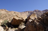
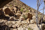
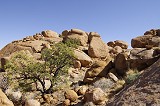
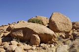
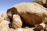
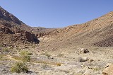
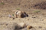
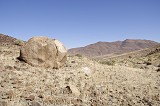
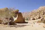
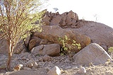
We drove out of the Domschlucht, then went along the West-Brandberg road to "Elephant Rock", a prominent granite hill about seven kilometres to the south of the Brandberg. Despite a superficially similar geology, these small granite hills are very ancient, pre-date the Brandberg by hundreds of millions of years. The name was given because an elephant-like eroded granite rock along its side. We had a brief lunch-stop and looked for the rather meagre paintings which Scherz recorded here.
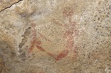
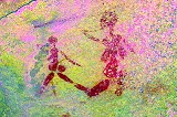
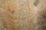
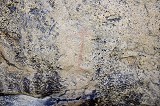
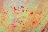
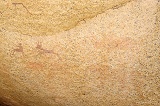
Fortunately Scherz's diagram was reasonably accurate here, so it did not take long to find the paintings in a few shallow shelters next to the "elephant". They were rather poorly preserved, though one scene does show a rather curious animal (?) figure.
In the afternoon we drove back to Uis, dropping off Marco and Alfons before settling in to the White Lady B&B for a long lazy afternoon preparing for the flight back to Europe the next day.
Day 14. - Uis - Windhoek
As our flight to Johannesburg was mid-afternoon we departed for Windhoek at first light, for a time driving in a thin ground-hugging mist until the sun rose and cleared it up. After a brief breakfast stop at Omaruru we continued reaching Windhoek well before noon, dropping off our vehicles with Mark and Nadine before driving to the airport to catch our flights home.
We are planning further expeditions to the Upper brandberg for June 2016, one with full helicopter support to see the principal Brandberg highlights, and a trekking expedition to see some selected areas of the mountain in more detail. Please visit the News page for any updates (or "like" the FJ Expeditions FaceBook page).