
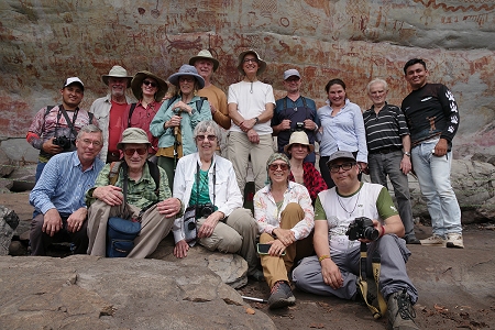
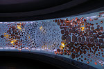
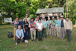
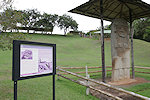
 Click on image for list of participants |
Serrania de la Lindosa, Colombia 24th January - 9th February, 2025 |
On our first ever rock art tour outside the African continent we made a two week expedition, primarily to see the fabulous and much publicised rock art sites of the Serrania de la Lindosa in the Colombian Amazon, but also sparing time to see the spectacular Archaeological sites of San Agustín and Tierradento in the central Andes. This trip was organised in cooperation with GIPRI Colombia.
Day 1. Bogota
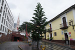
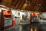
Our party arrived with various flights the day (and night) before. With various degrees of jetlag in both directions, we took a lazy morning in our hotel before, heading downtown to see the principal sights of Bogota, the Archaeological Museum and the Museo d'Oro. Forewarned about the bad traffic, we chose a hotel with good access to the airport and to the west, which meant it was a good hour to reach the downtown area. With a patchy drizzle, it was the perfect museum afternoon. The archaeological museum is tucked away in a relatively small old mansion near the main square, but with some very nice exhibits.

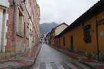
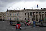
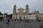
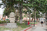
Compared to other Latin American cities the old part of Bogota is surprisingly small and not very exciting, we made a quick visit to the main square and the Cathedral before escaping from the rain to a nice restaurant for a late lunch.
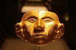
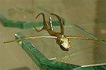
After lunch we went to the Museo d'Oro (gold Museum), which turned out to be the main attraction of the town. On four floors there is an incredible collection of pre-Colombian gold artifacts (mostly grave goods) of an extremely fine workmanship, we spent every possible minute till the evening closing time in front of the display cases.


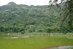
Day 2. Apulo (Laguna de Salcedo)
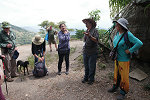
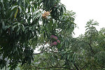
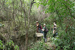
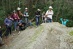
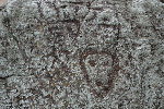
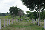
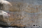
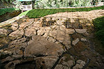
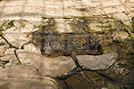
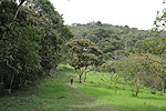
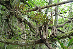
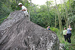
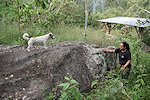
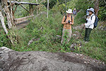
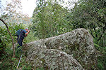
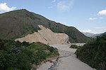
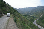
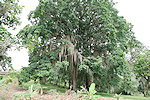
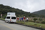
In the morning we made an early start to make the three hour drive to Apulo, a town of the western side of the Cordillera Oriental, about half-way down into the Magdalena valley. We were accompanied by Judith Trujillo and Carlos Rodriguez from GIPRI, our target was a series of petroglyphs near the Laguna de Salcedo, a small lake up in the mountains above the town, which were extensively documented by GIPRI. At the site entrance we were met by Guillermo Munoz (founder & leader of GIPRI), and after a brief introduction we set out towards the small lake on a winding path among the mango plantations.
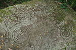
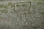
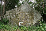
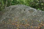
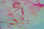
The petroglyphs are on the sides and top of large sandstone boulders, rather difficult to access in the dense jungle vegetation. The motifs are mostly spirals and other non-figurative symbols, with a few triangular schematic faces. They are quite spread out it took well into the mid-afternoon to see the readily accessible ones.
The late afternoon was the long drive back to Bogota in the heavy Sunday traffic. We stopped at a roadside restaurant for dinner (and the unwarranted hope that the traffic will get better with time...), reaching our Bogota hotel well after dark.
Day 3. Bogota - San Jose del Guaviare
This day was all about traveling, with our flight to San Jose at midday. After a late breakfast we were taken to the airport by the hotel shuttle, taking a surprisingly pleasant and comfortable one hour flight to San Jose on Clic.

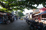
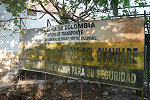
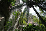
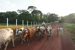
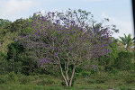
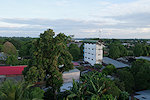
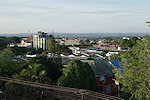
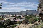
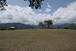
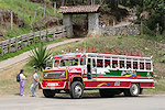
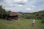
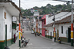
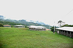
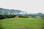
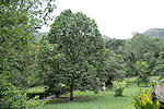
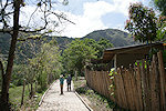
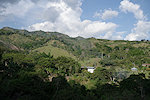
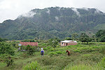
San Jose del Guaviare was pretty much the expected sleepy backwater, spread out along the south bank of the Rio Guaviare, a major tributary of the Orinoco River. Technically it is not the Amazon basin, but the watershed is just to the south of the town, with the country south of the Serrania de la Lindosa escarpment already draining towards the Amazon. After settling in to our hotel (the only in town) and a quick meal we set out to explore the unexpectedly neat and clean town.

Day 4. Nuevo Tolima
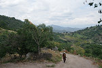
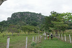
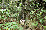
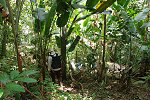
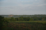
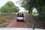
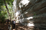
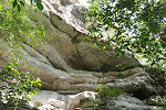
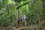
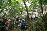
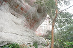
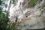
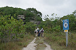
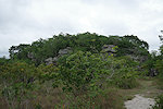
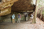
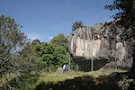
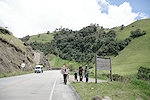
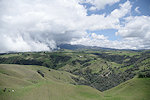
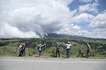
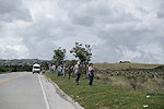
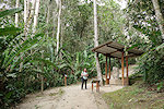
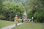
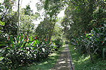
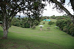
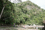
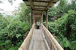
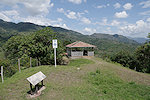
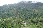
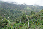
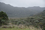
The painted shelters are spread out along the southern face of the Serrania de la Lindosa escarpment, a spur of the same sandstone country that forms the famed Tepuis of Venezuela further to the East. There are three clusters of sites accessible to visitors, we started at the closest one to San Jose, the site of Nuevo Tolima. Taking two 4wd pickups we drove on some bumpy (but by African standards excellent) roads among the cattle ranches till the site entrance. From a small visitor centre a fenced path leads across the fields to the foot of the escarpment, from where a narrow trail continues through the dense jungle.

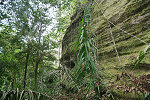
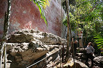
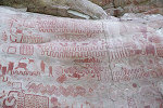
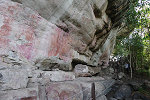
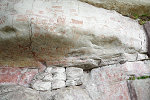
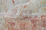
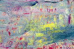
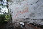
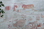
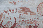
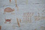
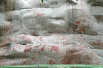
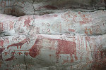
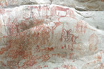
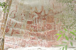
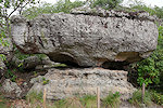
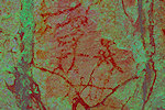
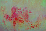
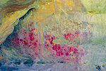
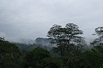
In the town and on the road it was not so evident, but once on the trail there was no question that we were in the rainforest, we were drenched in a matter of minutes from sweat, and the camera lens fogged up under the lens cap. It takes about half an hour through the jungle on the steep and narrow path to reach the main site about half-way up the cliff. On reaching the platform in front of the very shallow shelter one is amazed by the sheer size of the painted panel, covering a good 25 metres along the rock face, reaching up to a height of 8-10 metres (making one wonder how did they reach up there...?).
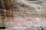
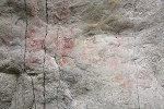
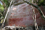
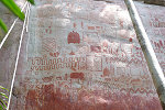
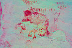
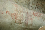
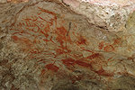
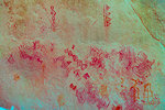
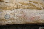
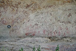
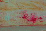
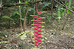
At first one only sees a jumbled mass of red shapes, then slowly individual details start taking shape, animals, geometric shapes, abstract human figures... There is little sense of composition, everything seems to be haphazardly painted next to each other and over existing figures. On closer scrutiny one notices snakes, birds, lizards, but it is very hard to discern any meaningful interaction between any individual figures.
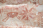
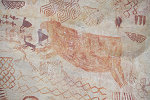
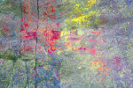
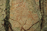
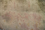
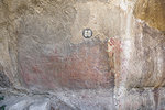
Most of the paintings are in red, but some (especially the geometric shapes which seem to be the older layers, with figurative paintings in superposition) are fully or partially in yellow. It was not evident on the spot, but looking at the various polichrome shapes and figures with DStretch it appears that the yellow is the product of weathering of the red pigment, as the two colours always fully overlap.
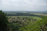
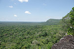
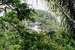
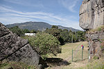
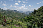
We were in no particular hurry as this was the only main site for the day. With the immense panel we spent several hours taking photos and just marveling at the multitude of details. There was also a splendid view from the shelter over the surrounding countryside.
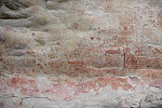
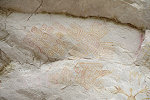
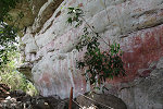
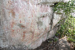
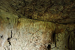
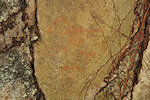
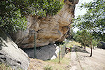
After making our descent along the path we came, we continued a little further towards the west at the foot of the escarpment to another shelter, the floor of which was excavated by Judith a decade ago. One particular question was whether there would be any remains of wooden structures that would have enabled access to the high painting levels a good 10m above the shelter floor, but no post holes or any other evidence was found. The paintings here are faint and unimpressive in comparison to the main shelter, but present an excellent example of the weathering of the red pigment to an orangish yellow.
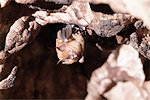
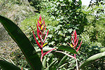
While we were busy taking photos, our local guide spotted a bright orange male Guianan cock-of-the-rock (Rupicola rupicola) among the dense shrubs. Apparently we were very lucky, birdwatchers can spend weeks looking for them, we had one posing patiently for photos on our very first day in the jungle.


It was well into the afternoon by the time we returned to the visitor center and the cars, driving to a nearby hacienda for a very pleasant lunch and a little rest.
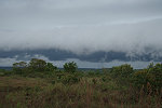
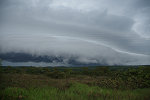
We were rather lucky with the weather, even though we visited (on purpose) in the driest part of the year, daily rains are the norm. It was all dry (sometimes even sunny) from morning to mid-afternoon, but as we drove back to San José a band of dark clouds approached, heavy rain hitting the town just as we reached the hotel.
Day 5. Cerro Azul
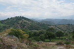
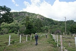
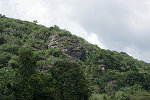
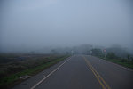
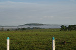
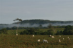
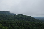
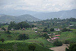
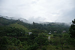
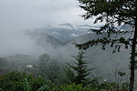
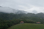
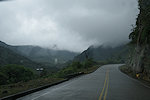
The sites of Cerro Azul are near the western end of the Serrania de la Lindosa escarpment, a good two hours' drive from San José. Forfeiting breakfast at the hotel we started from San José at dawn, with patches of thick fog along the way after the heavy rains of the past evening. As the sun rose the fog started to disappear while we drove along the cattle ranches with the continuous escarpment to our right.
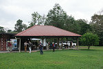
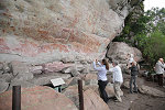
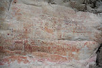
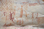
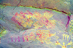
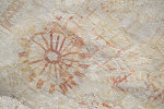
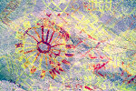
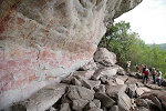
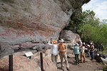
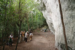
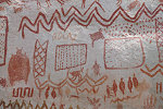
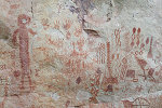
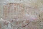
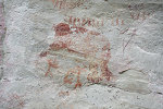
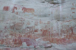
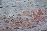
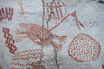
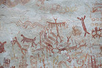
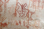
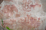
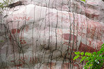
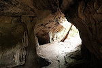
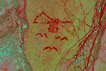
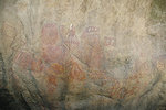
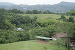
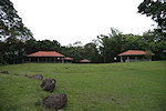
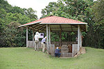
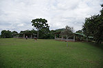
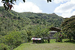
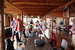
At the start of the Cerro Azul trailhead there is a very pleasant family-run visitor centre with a big lapa, we had breakfast there before heading out towards the sites. The setting is very similar to that at Nuevo Tolima, a mostly level trail leads to the foot of the escarpment, from where a narrow path winds through the jungle up to the mid-level of the cliffs, to the first site ("Principal"). This is the site most frequently shown on photographs, with astonishingly bright and well preserved paintings. Here too geometrics are combined with figurative art, some of the most striking are some well recognisable bats, but here there are also some decorated handprints which we have not seen at Nuevo Tolima.

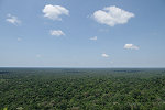
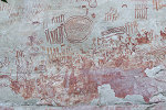
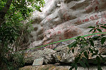
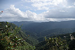
Cerro Azul is an outlier of the main escarpment, with a number of painted shelters all around, but only the main ones accessible for visitors (the others require serious climbing with ropes to reach). The trail from the "Principal" panel leads to the entrance of a natural tunnel that cuts right through the mountain, and after about 100 metres emerges on the far side near the largest panel of the locality, "El Más Largo", where a small platform provides a perfect view towards the south and west over the rainforest canopy, here no longer interrupted by any agricultural clearings.
At the "Principal" panel (which is not really the main one, just perhaps the best preserved) Carlos & Judith already warned us that we are merely in the "antechamber" and they were right! The "El Más Largo" panel is true to its name, it is a wall over 40 metres long and 8-10 metres high fully covered with paintings, though perhaps not quite as well preserved as the ones seen so far.
Here too there are a number of good examples of the red pigment weathering to yellow. it seems to be a universal phenomenon in the region, probably governed by the interaction of the pigments, rainwater, climate and the local chemistry of the rock.
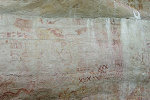

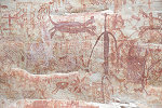
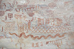
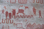
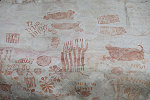
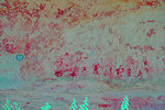
At this site there are a few scenes which do appear to be compositions rather than independent figures, including a scene which is generally interpreted as fishing. There is another scene that some interpreted as a mammoth hunt (in support of the proposed late Pleistocene dates), but looking at it with DStretch it is clear that the animal is some quadruped with the entire forepart missing, the "trunk" being just the remains of a forelimb.
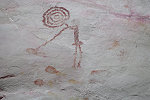
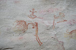

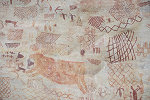
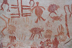
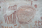
Just a few dozen metres further north from the end of "El Más Largo" there is a third huge fully painted shelter, named Las Dantas on account of the two very prominent tapirs on the wall. Arguably this is the finest of the three main panels at Cerro Azul, with a number of intriguing figures and scenes not seen elsewhere, including the large tapirs, a number of groups of elongate human figures, sloths (thought to be giant sloths by some favoring the late Pleistcene dating, but there is no reason to assume association between the animal and the adjacent small human figures, there are numerous other similar examples), possible therianthropes and a very rare clear hunting scene.
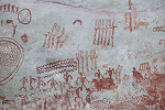
It was mid-afternoon by the time we finished taking photos at these immense sites. On the way down we passed by a fourth site with only a few paintings, but important as it was the place of the excavations where clear and uncontested archaeobotanical evidence was collected for late pleistocene human presence (Morcote-Ríos et al. 2021). Unfortunately by inference the paintings in the shelter were dated to the same period, without any clear evidence. One figure in particular was declared to be a "clear" Pleistocene equid (after they became extinct there were no horses or other equids in the Americas till the Spanish conquest). Looking at the rather crude indistinct quadruped, I find it somewhat difficult to make any definitive statements...
We returned to the visitor center where our hosts were awaiting with a simple but very tasty lunch, taking a group photo with them before parting, taking the long bumpy ride back to San José, this time not along the cattle ranches, but on a marginally shorter but worse road on the top of the escarpment.

Day 6. Raudal del Guayabero
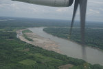
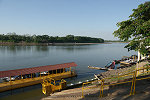
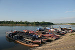
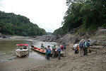
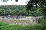
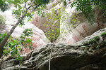
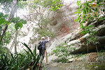
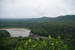
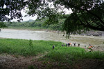
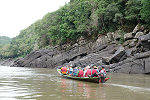
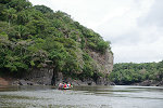
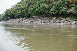
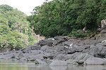
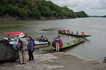
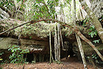
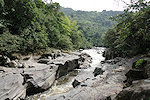
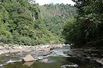
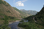
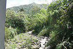
The third major locality of the Serrania de la Lindosa is Raudal del Guayabero, a small town on the Guayabero river (a major tributary of the Guaviare) just downstream of the rapids where the river cuts through the sandstone escarpment. There are several sites in the area, but the only visitable one is Angosturas II, a large painted shelter not far upslope from the riverbank about two and a half kilometres upriver from the town. It is only reachable by taking a boat on the river, there is a well organised operation in the small town catering to visitors.

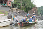
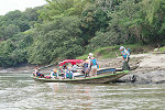
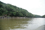
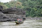
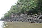

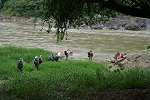
The ride took about 30 minutes along the picturesque gorge, we made a landing along the banks of a broad bend just above the rapids. It took another 15-20 minutes along a trail through the dense jungle to reach the site, less of a shelter, more like a rock wall. The weather was not particularly cooperative, it started to rain just as we reached the site.
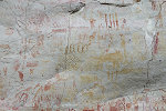
The paintings at Angosturas II are very similar to what we have already seen at other sites, with a number of interesting details. Unfortunately visitors are only allowed access to the lower half of the site, there is an upper terrace with the finest panels of the site which would not be too difficult to reach, but is off limits so one can only take distant and partially obstructed views with a telephoto lens.
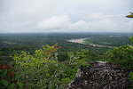
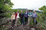
As this was the only site of the day, we took our time to take photos (and hide from the intermittent rain to the extent possible). The more adventurous of our party also made the climb to the top of the escarpment above the site for a superb view over the river winding through the jungle and the edge of the escarpment.
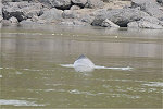
On our return we had another extremely lucky encounter, passing among the multiple rapids we spotted an Amazon River Dolphin (Inia geoffrensis ssp. geoffrensis), which despite its name also exists in the Orinoco basin.
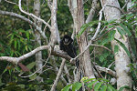
We had a late lunch at Raudal del Guaybero (not surprisingly river fish was on the menu), then made the late afternoon drive back to San José. On the way a Black Titi (Cheracebus lugens) sitting on a roadside tree with its young was the cause for some excitement, we reached the town just before sunset in time for a sundowner on the roof terrace of our hotel.

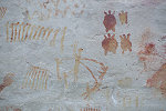
Having seen all the main sites, I have revised slightly my initial assumptions and opinions regading the age of the paintings. While the repeatedly proposed late Pleistocene dates (eg. Iriarte et al. 2022) are clearly ridiculous (see my detailed comments on FB), the paintings are not as recent as I have presumed based on a rather limited selection of photographs. For one, the presented "equids" which, in combination with the very vivid fresh appearance, I took to be a clear sign of a post-contact date, are rather indistinct quadrupeds, and can be anything really. I would have expected more, but they are only a fraction of the thousands of figures, we have only seen two and apparently there are another two at inaccessible sites. Contrary to some claims there are no clear domesticated dogs either, which would be another evidence for a post-contact date. Also the sites show clear signs of weathering (naturally the published photos show the best preserved parts), and the process of turning the red pigment yellow is likely a lengthy one. Summing up, I am now comfortable with a date going back a couple of millenia, though certainly nowhere near the claimed age.
Day 7. - Serrania de la Lindosa - San José del Guaviare Bogota
Our flight back to Bogota was early afternoon, we still had a free morning remaining, which we intended to use to see one of the natural sights close to San José. We had our breakfast on the rooftop terrace of the hotel, then set out with our cars on the track along the top of the Serrania de la Lindosa.
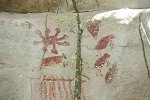
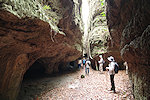
We were heading for "Los Tuneles", a series of natural tunnels eroded into the sandstone on the plateau top. On the path leading to the site we passed a number of mushroom shaped rock formations, one of them contained a panel of crude paintings, not quite of the same quality as the ones we saw the previous days (and probably more recent).
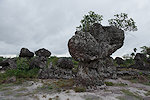
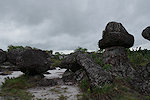

"Los Tuneles" is a fairly small sandstone rise on the top of the plateau, which had been eroded along fault lines and weaker strata in a fashion remarkably similar to the "rock cities" of the Tassili n'Ajjer. The main difference is that here water erosion is still active, while in the Tassili it happened during geological eras when the African continent slowly mover across the equator. There are the same 'streets' with shelters along both sides, plus a number of natural tunnels where erosion is still in the formative state.
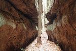
To make the Tassili analogy even stronger, we also found some engraved grooves and faint traces of paintings in the tunnels and shelters. One remarkable small scene appears to depict bats, the same creatures which inhabit the tunnels to this day.
We could have spent much more time exploring the walls, but we had a plane to catch, and also ominous dark clouds were approaching, so we made a hasty retreat to the cars. Collecting our gear at the hotel, we made the short hop to the small airport, taking the plane back to Bogota in the afternoon.
Day 8. - Facatativá
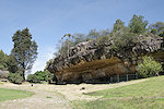
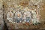
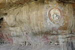
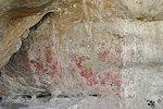
We made another day-trip out of Bogota, this time to visit the rock art sites of Facatativá, a town some 30 kilometres to the north west of Bogota. The area used to be a quarry, much of the rock art was undoubtedly destroyed, what remained was enclosed within an archaeologcal park since the 1940s. Unfortunately till recently the park was much neglected, most panels were heavily damaged by countless graffiti. In the past decade GIPRI was involved in a major project to catalogue and to the extent possible clear the graffiti and restore the paintings. Judith and Carlos accompanied us on the bus from Bogota, we met Guillermo and other members of GIPRI at the park entrance. Most of the ancient rock art at Facatativá are geometric shapes, there are very few figurative motifs. The sites are scattered along sides and shallow shelters along the remaining rock outcrops, with built paths and a very pleasant park surrounding them.
The trail through the park is a good kilometre long, it took the whole morning to slowly make our way along the dozens of sites bordering the path. Unfortunately all the sites are now fenced or caged, sadly necessary to protect them but not helping photography. When the park was opened most sites were marked with painted numbers, sometimes placed next to (or even over) the paintings.


The trail ends at the centre of the park at the largest shelter, which also contains some modern rock art next to the ancient ones, portraits of the heroes of the Colombian independence movement made some 200 years ago.
It was well into the afternoon by the time we finished our round of the park, we had lunch at a local restaurant then said our thanks and good-byes to Judith and Guillermo who left us here to head home, then made our way back to Bogota in the heavy afternoon traffic.
Day 9. - Bogota - Popayán - San Agustín
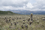
We have completed our tour of the Colombian rock art sites, but there is more to Colombia than rock art. The sites of San Agustín and Tierradentro are some of the finest archaeological sites on the South American continent, we allotted a full week for the visit with enough time for a leisurely pace everywhere. From Bogota we flew to the city of Popayán (an hour's flight to the south), where a minibus was awaiting for us at the airport. We immediately set out for the five hour drive across the Cordillera Central to San Agustín, stopping at scenic spots, the Espeletia (Frailejones) fields and a small roadside restaurant near the crest of the mountain range for lunch.

After lunch we continued across the densely forested Parque Nacional de Puracé, reaching San Agustín shortly before sunset.
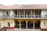
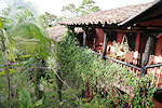
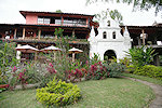
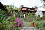
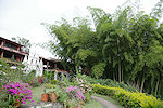
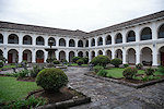
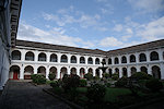
At San Agustín we stayed at the Hotel Monasterio San Agustín, a small boutique hotel converted from an old monastery, a lovely change from the practical but rather nondescript hotels we had in Bogota and San José


Day 10. - San Agustín
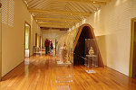
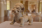
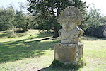
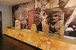
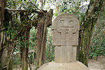
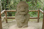
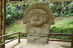
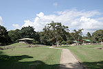
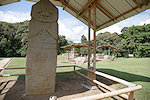
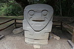
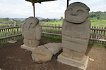
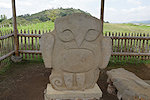
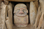
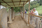
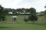
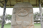
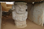
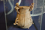
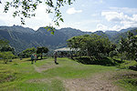
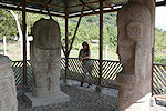
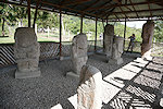
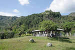
The San Agustín culture flourished in the first millenium AD (though the origins can be traced back to at least another two millenia), and was one of a number of related but distinct pre-Colombian civilisations residing along the fertile valleys between the three Cordilleras. Much like Ancient Egypt, most of what we know about them comes through the elaborate megalithic funerary monuments, decorated with statues carved from the basalts of the upper Magdalena valley. Most of the finds are centered on the town of San Agustín, hence the name. The town hosts a large archaeological park and museum, displaying both in-situ finds and scattered pieces rescued from the surrounding farms and estates. By opening we were at the park gates, starting with the small museum that gives a good overview of the culture and monuments.
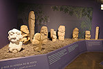
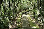
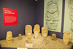
From the museum a winding path leads to the interior of the park lined with dozens of statues from throughout the region, all once associated with funerary monuments. Many of the monuments were excavated and often destroyed during colonial times, with the uncovered statues decorating haciendas and village squares until collected to a permanent display in the park.
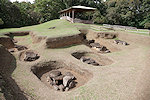
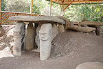
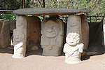
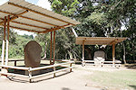
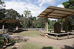
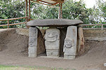
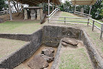
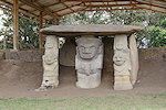
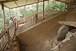
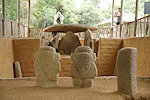
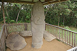
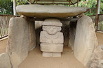
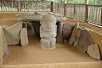
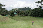
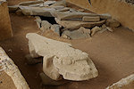
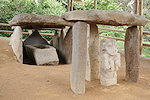
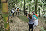
The path leads to Mesita B, the largest of the combined ceremonial places and burial grounds excavated on the park grounds. Here all the finds have been left in situ, showing how the carved idols fit into the general plan of the burial chambers which were once covered with an earthen tumulus.
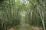
Continuing uphill another path leads through the bamboo forest to Mesita C, a smaller ceremonial and burial ground with larger and smaller tombs of the same general layout.
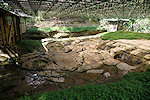
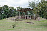
Shortly above Mesita C, Fuente del Lavapatas is a huge ceremonial platform carved into the basalt along a streambed, with a number of figures in sunk and raised relief. Unfortunately the site is now covered over, with the roof structure casting a chequered shadow, taking good photos is virtually impossible.
From the streambed platform it was a fairly long, hot and steep climb up to Alto de Lavapatas, a leveled hilltop ceremonial and living site with a commanding view of the town and the surrounding countryside.
We returned by way of Mesita C and B (which was now in better light) to the third ceremonial place, Mesita A, with a number of large tumuli all containing a megalithic tomb chamber decorated with the now familiar idols.
We spent the entire morning in the park, it was time for lunch by the time we finished. We went to a nearby local restaurant, it was a tasty meal though the prominently advertised cuy asado (roast guinea pig) was sadly off the menu...
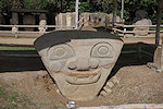
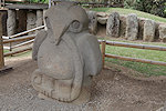
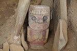
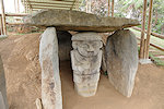
After lunch we drove to the somewhat removed La Pelota and El Purutal sites, not far from our hotel, but on a steep and winding road, with hindsight it was a good idea to take the minibus and not walk. La Pelota has a cluster of statues including one of the large birds, while the nearby El Purutal is unique in having pigments remaining on the idols, showing what they all used to look like.
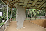
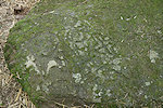
We still had enough left of the afternoon to visit the two remaining sites within the town precinct. The first was the La Chaquira site, a single idol carved into a rock quite a way downslope in the Magdalena valley, with some soaring views. There were also a few more engravings on the surrounding rocks, but so weathered that they were hardly recognisable.
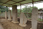
The last site was El Tablon, a smaller collection of carved idols near the road leading to La Chaquira. These were not in situ as the ones seen previously, but collected from surrounding localities for display near the ethnographical museum.
Day 11. - San Agustín
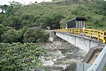
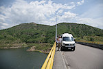
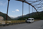
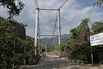
There are two major outlier sites near San Agustín, both hilltop ceremonial and burial sites on the far side of the Magdalena river. In a straight line the more distant was under 15 kilometres away, but the steep winding roads plus the descent and ascent from the Magdalena valley necessitated more than an hour to get there. We had an early breakfast in the hotel, then set out to make the most of the cool of the morning. On the way we made a brief stop by the bridge over the Magdalena, which here is just a small rapid mountain stream cutting deep into the relatively soft volcanic rocks of the region.

The more distant site is Alto de las Piedras, about six kilometres north from the town of Isnos on the main road towards Popayán. After a short climb from the entrance gate one reaches an artificially leveled mountain crest, bordered on all sides by now excavated tumuli and stand-alone idols. It is a relatively small site, under a hundred metres across the terrace, and the structures were also smaller than at San Agustín.
Alto de los Idolos, is just a few kilometres from Isnos, not far from the steep drop into the Magdalena valley. It is the largest of the San Agustin culture ceremonial / burial grounds, extending along a crescent shape on the leveled crest of a ridge for half a kilometre. This too is enclosed in an archaeological park with a small site museum and a well built path leading to the hilltop plaza.
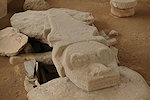
One remarkable feature not seen elsewhere are a pair of caimans carved of rock, alongside the more usual anthropomorphic figures.
At the southern end of the site there is an elevated terrace that is completely surrounded by tumuli with megalithic funerary monuments, some plain others decorated with the carved idols. Two of them contain stone sarchopagi which we did not see elsewhere. With no more major sites to see we spent the remainder of the morning and the early afternoon leisurely strolling from tumulus to tumulus, or just taking in the lush surrounding landscape.
After the park we had lunch at the nearby restaurant, then took the back road towards San Agustin. We made a quick stop at the small museum of Obando, showcasing a small excavated tumulus in the middle of the town and the associated smaller finds, including an exquisite small golden flying fish.
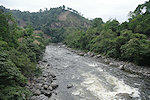
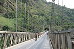
From Obando we continued along a narrow, steep and winding road down to the bottom of the Magdalena valley, making a stop at the picturesque rapids just downstream of the only bridge other than the one we crossed in the morning.
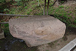
Just beyond the bridge near the rapids on the San Agustín side there is a small park with a number of petroglyphs carved into large boulders on the steep hillside. Not much is known about their exact age or purpose, they are very rarely visited (our driver did not even nkow about them despite being a native of San Agustín). The family owning the land was delighted to have us, we probably generated several days' turnover at their roadside drink stall.
We reached our hotel a good hour before sunset, it was a pleasant change after all the packed days to have a little time to do nothing and enjoy a sundowner in the very pleasant gardens.
Day 12. - San Agustín - Tierradentro
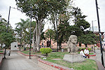
The distance between San Agustín and Tierradentro by road is less than 200km, but given the mountainous conditions a good six hours are needed to cover this. We started out in the morning, making a brief stop at the main square of San Agustín where a number of the ancient statues have been collected for display.
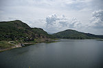
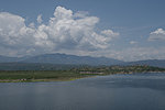
Continuing, we descended into the Magdalena valley and followed the river downstream along route 45, passing the town of Pitalito. We made a brief stop at Timaná, a sleepy backwater colonial town dominated by an oversized brickwork baroque church. After the town of Garzón, leaving the main road, we turned west towards the mountains again and crossed the Rio Magdalena which here was a wide lake behind the El Quimbo dam.
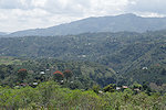
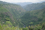
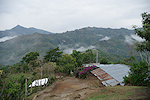
We stopped for lunch at a rather nondescript restaurant in the town of La Plata, then continued ever higher on a narrow winding road along the Rio Páez valley, with some spectacular views from the bridges as we crossed the numerous tributaries. Our planning was good, we reached Tierradentro an hour before sunset. Despite the World Heritage status, there is no larger accommodation only small family run pensions, we had to spread out over three places to get enough rooms for our group & driver.
Day 13. - Tierradentro
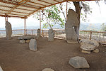
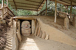
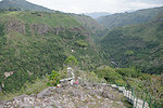
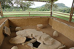
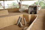
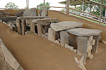
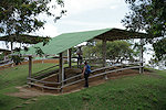
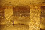
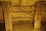
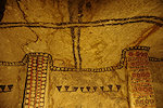
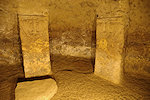
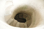
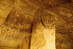
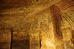
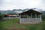
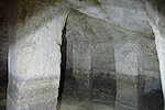
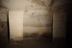
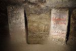
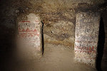
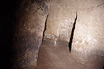
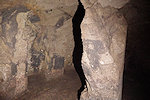
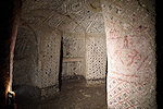
Tierradentro is considered a part of the broader San Agustín culture, the main difference being that (probably influenced by local geology) instead of constructing megalithic tomb chambers covered with earthen tumuli, underground chambers were cut into the relatively soft volcanic rocks of the region. These tombs are concentrated on a number of artificially leveled plazas on mountain crests ("Altos"), the two most important being Alto de Segovia and Alto del Duende, both within the realms of an archaeological park. It was a wet foggy morning as we started our climb to the sites along a roughly one kilometre long steep winding path. Alto de Segovia is a broad flat grassy area with not much to see other than the protective roofs above ground, a very welcome feature in drizzling rain.
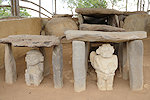
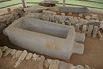
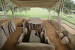
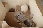
The wonders start after descending a series of high and often broken stairs to the chambers below. The tombs are all built to the same general plan, a roughly oval chamber with two or three pillars supporting the roof, with varying degree of decoration on the pillars, rear wall and sometimes the ceiling. In one smaller tomb the grave goods are still visible in situ.
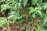
From Alto de Segovia it is another kilometre to Alto del Duende on the crest of the adjacent hill. The path leads through coffee plantations, reaching the leveled terrace on the hilltop after a rather steep climb. Here too there is a grassy area with the protective covers, with a commanding view of the surrounding rugged countryside.

The tombs at Alto del Duende are very similar to the ones we have seen below at Alto de Segovia, but much fewer in number.
The two high places took the whole morning, as we returned we had a look at the small museum by the park entrance containing many of the grave goods found during the excavations of the subterranean tombs.
Around midday we drove the two kilometres uphill to the village of San Andrés to see Alto de San Andrés, the third plaza cum cemetery located not too far above the village. There was a restaurant at the start of the trail, learning from previous experiences we ordered our lunch before setting out to visit the site.


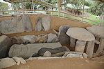
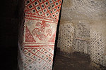
At Alto de San Andrés there were only two tombs open to visitors, but one of them had the finest decorations we have seen so far, with vivid red and black colors.
After lunch we drove to the other side of the village, to El Tablón, where a number of large stone statues found in the area, similar in style to those at San Agusín, were collected for display.
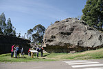
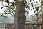
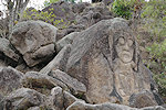
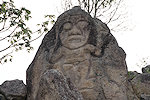
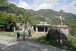
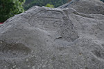
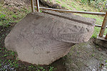
On the way back we stopped by the village church, a large rock nearby contains a number of petroglyphs, including a well recognisable face and several less clear figures.
It was close to sunset by the time we returned to our respective accommodations for a quick shower and rest before dinner after the long packed day.

Day 14. - Tierradentro - Popayán
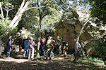
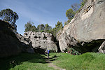
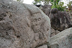
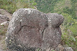
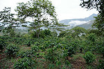
The previous day we have left one high place, Alto del Aguacate unvisited. It is the most distant one, at an elevation almost 500m above the valley, accessible on a steep, winding (and in wet weather very slippery) trail. As the drive back to Popayán was just a couple of hours, we still had the morning available, the night before we agreed to let the weather decide. In the morning it was raining steadily, so we decided to give Alto del Aguacate a miss, and start our drive towards Popayán. Along the route there was still a cluster of isolated carved rocks at El Hato (a part of the broader Tierradentro site), one showing a toad, another a (rather schematic) crocodile. There were no signs, but a local lady agreed to take us to the sites, really hard to find among the coffee plantations.

Our return journey involved climbing once more to the crest of the Cordillera Central, we ascended to just below 3400 metres, again passing fields of Espeletias (Frailejones) before stopping at a roadside restaurant for lunch soon after the pass.
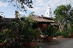
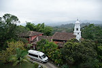
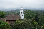
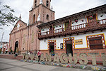
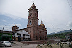
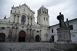
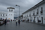
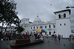
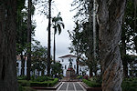
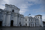
We reached Popayán mid-afternoon, our hotel was again a converted monastery in the centre of the city. It was a rather gloomy afternoon, but after a spell of rain it got a bit drier, so we made a quick venture to the main square and the Cathedral close to the hotel.
Day 15. - Popayán - Bogota
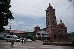
Our flight back to Bogota was midday, so we could afford a morning stroll into town again, this time in much better light and weather.

Our trip really ended here, from hereon it was just a series of transports to get home. The short flight back to Bogota on Avianca was uneventful, after another drive in the Bogota traffic we reached our hotel by mid-afternoon, enough for a little rest before dinner and packing for the flights back home the following day.
We plan to return to Colombia again in January 2027, broadly along the same itinerary but also planning to visit some more remote sites. The exact itinerary will be decided as departure time draws closer. Please check the News page periodically or "like" the FJ Expeditions FaceBook page to receive notices of news and updates.