
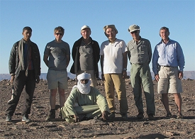
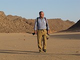
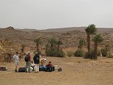
 Click on image for list of participants |
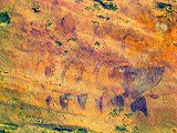
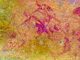
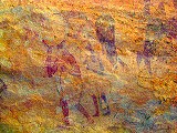
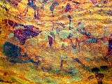
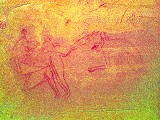
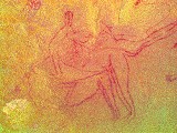
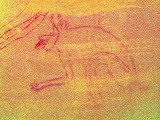
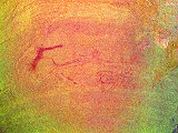
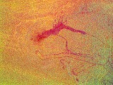
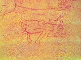
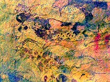
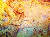
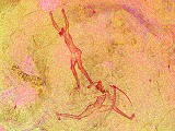
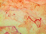
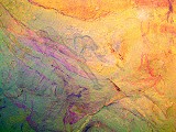
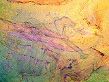
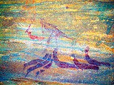
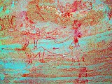
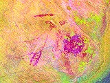
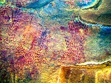
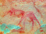
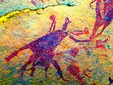
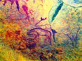
Central Tassili N'Ajjer, South Algeria 2nd - 15th November, 2014 False colour images processed with dStretch, a freely available software developed by Jon Harman |
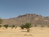
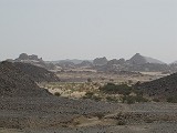
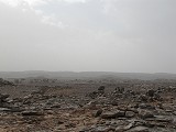
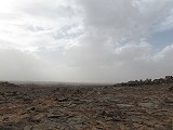
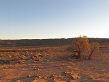
With the plateau above Djanet still closed to locals and foreigners alike because of the tense security situation accross the border in Libya, this expedition was planned to visit the central part of the Tassili N'Ajjer plateau, partially re-visiting much of our October 2012 itinerary, but adding another week to visit the engravings of the Wadi (Oued) Djerat, one of the most important classical saharan rock art localities. We timed the start of the trip to coincide with the Sabeiba festival (held on the Day of Ashura) in Djanet.
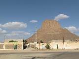
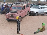
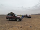
Despite some apprehension following reports of others having difficulty obtaining visas for anywhere in the South following the In Amenas attack, preparations went very smoothly. All of us received visas within days of each other, several weeks before our planned start, despite having applied at five embassies on four continents. We met at Algiers airport in the afternoon/evening of the 1st November and continued together on the evening direct AirAlgerie flight to Djanet. We arrived to Djanet airport at midnight and spent the remainder of the night at the premises of Essendilene Voyages.
Day 1. Djanet area
When we planned our trip, it was not yet known due to the uncertainties of the Islamic lunar calendar whether Ashura and the Sabeiba festival would fall on the 2nd or 3rd November. By the time we arrived, we knew that it will be on the 3rd, thus we spent the first day to see the sights of the Djanet vicinity in a relaxed fashion, rather than the usual rush before leaving for the plateau.
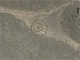
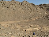
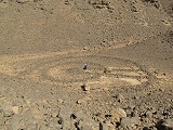
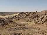
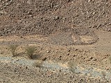
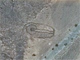
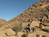
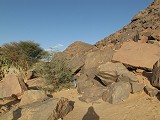
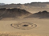
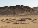
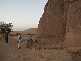
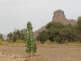
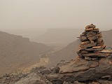
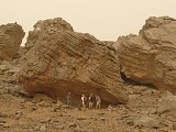
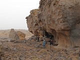
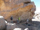
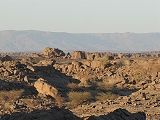
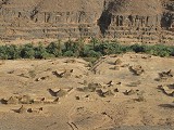
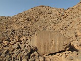
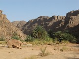
The area of Djanet (and the entire Tassili) is littered with pre-islamic monuments of a very pecluliar construction. These "keyhole" monuments consist of a central tumulus with an approaching causeway and an outer circular or oval perimeter, giving an impression very much like a real keyhole. There is some evidence (not entirely rock solid) that they generally date from the 3rd - 2nd milleneum BC. We know nothing about the culture who made them, and whether they are related in any way to the people who made the rock art. With the availability of high resolution Google Earth imagery dozens may be spotted doing a virtual survey. I have already noticed a number of them when planning our October 2012 trip, but at that tie we did not have time in the end to visit them.
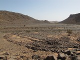
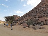
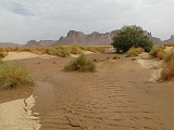
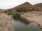
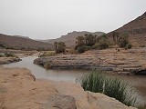
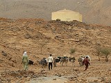
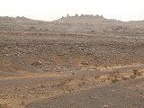
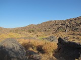
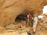
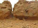
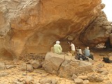
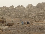
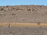
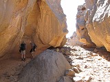
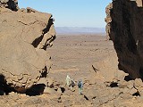
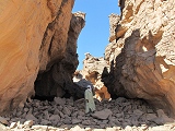
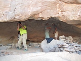
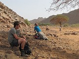
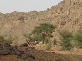
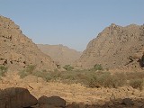
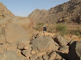
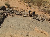
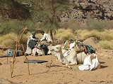
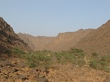
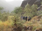
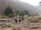
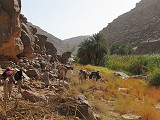
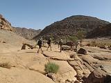
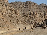
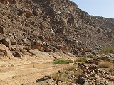
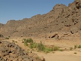
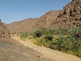
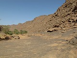
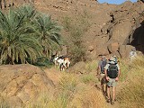
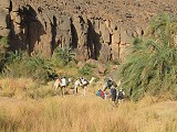
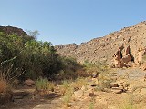
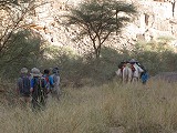
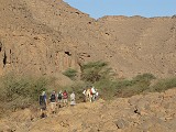
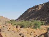
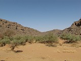
We set out in the morning with Abdou Borgi, the owner of Essendilene to visit a large valley a mere 15 kilometres to the North of Djanet, on the way towards the Akba Assakao, with several monuments hidden among smaller hills. Despite having traveled through the valley endless times Abdou was not aware of any of these monuments, and was very keen to see them. The first structure was in a narrow valley quite high above the main valley floor, in a rather secluded yet easily accessible place invisible form below.
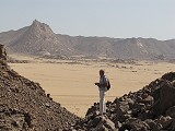
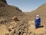
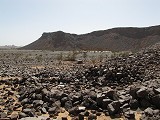
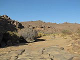
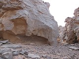
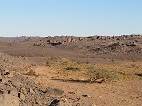
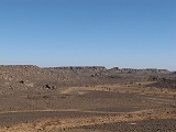
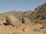
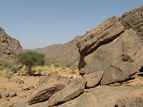
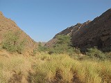
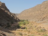
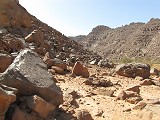
The valley itself was very different from the surrounding sandsone country. Here a wide watercourse removed all of the overlying sedmentay rocks, revealing the very ancient granite basement that underlies the Tassili everywhere, but is only exposed in a few select locations.
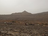
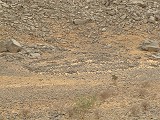
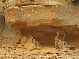
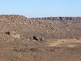
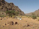
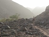
Another smaller monument was hidden among the low granite knolls littering the plain, in a small valley again invisible from the plain below. Clearly they makers intentonally placed it out os sight, yet within easy reach of the valley, a rather typical setting for these funarary structures. Their orientation is invariably towards the East, with only a very small variance among the hundreds of similar known monuments.
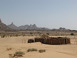
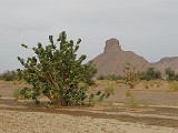
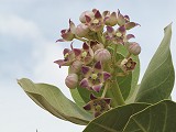
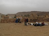
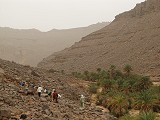
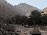
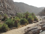
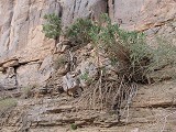
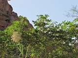
Moving further up the valley we passed a small deserted village with a few huts among a bright green grove of Calotropis procera shrubs.
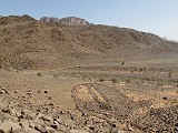
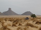
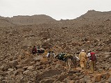
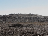
The largest "keyhole" monument was at the northern end of the valley, where the road continued towards the Akba Assakao. It was just beside the road, yet again Abdou never noticed it before, the structure blending in with the other rocks on ground level and only being visible clearly form the hillsides above (and of course Google Earth).
It was a rather hot & stuffy day, we returned to the Essendilene premises for lunch and an afternoon nap after the short night before setting out again in the afternoon.
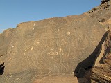
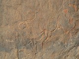
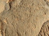
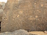
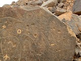
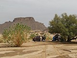
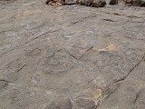
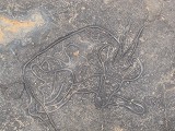
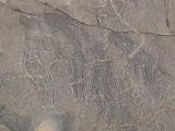
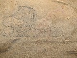
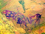
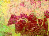
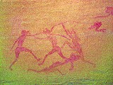
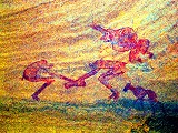
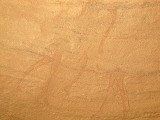
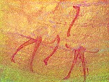
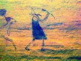
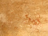
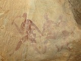
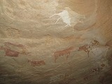
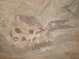
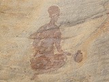
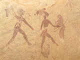
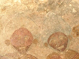
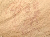
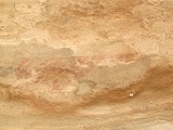
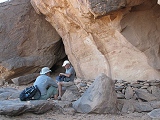
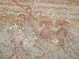
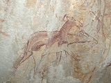
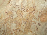
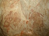
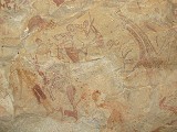
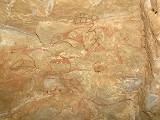
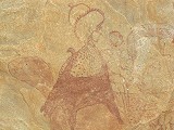
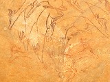
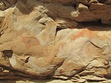
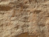
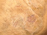
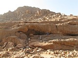
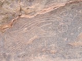
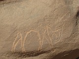
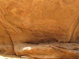
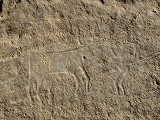
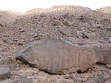
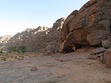
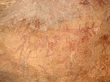
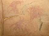
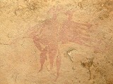
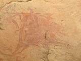
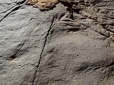
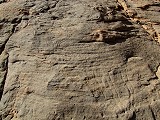
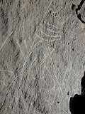
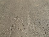
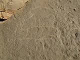
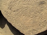
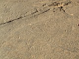
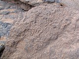
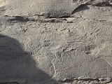
Our first stop was at the splendid panel of engravings at In Debiren. These cattle are in the same fine refined style as the nearby famous "crying" ones at Terarart. The only publication to discuss them in any detail, Karl Heinz Striedter's Felsbilder der Sahara (München, 1984) places them well to the East of Djanet on the map. I have only recently found out that they are in fact practically in town, very close to the old airport. Abdou knew of them, but inexplicably they are off the tourist trail, and the suroundings are in a rather sorry state on account of the proximity of a rubbish dump.
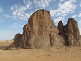
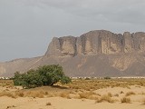
On the far side of the old airprt there are a series of long parallel ridges of igneous rocks, the remnants of ancient dykes. In a long narrow valley among them there is the largest of the "keyhole" monuments in the Djanet area. This one is well known, and appears in several publications. Somehow we never had the time to visit it in the past, now finally we could pay a visit at leasure, climbing to the top of the ridge for a superb overview.
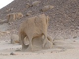
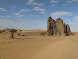
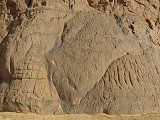
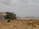
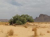
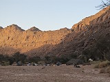
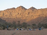
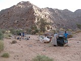
With sunset approaching, we drove on past a granite rock resembling an elephant to the sandstone towers of Terarart, to look at the lovely "crying" cows in the last light of the day, before moving to some nearby rocks at the edge of the Erg Admer for our first desert camp.
Day 2. Djanet Sabeiba festival
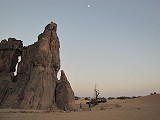
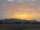
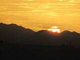
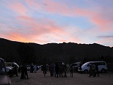
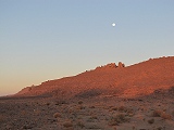
We had a pleasant warm and still night, with the moon up till the small hours. A band of clouds moved in at dawn making a perfect backdrop for the sunrise.
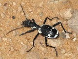
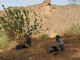
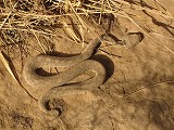
As we packed camp, we disturbed a large Anthia sexmaculata, a nocturnal beetle that hunts other insects, common all accross the Sahara. It had no inclination to stay motionless even for a split second, but one shot came out rather well among many blurred ones.
After packing we went back to the "crying" cows to photograph them in the different morning light.
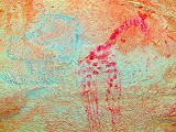
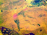
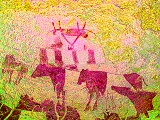
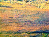
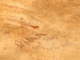
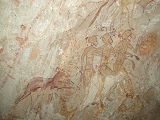
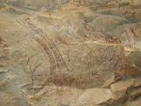
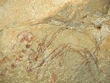
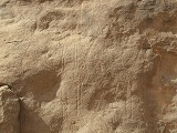
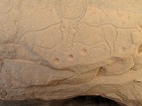
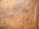
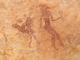
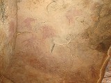
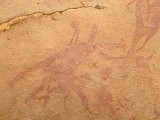
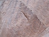
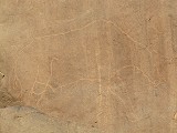
As we walked around the other rock spire adjacent to the one with the main panel of engravings, Peter spotted some engraved lines high up on the rock which did not make much sense. As the sun rose and gave a perfect contour light, from a distance it started to become clear - a very large (~3m) cattle was engraved high on the rock face, in generally the same style as the ones on the main panel, but this one being in an unusual raised relief. I have never noticed this engraving before, and to my knowledge it is not published anywhere. Abdou knew about it, and took it for granted that I must have seen it many times on earlier vists.
We passed by the engravings of In Debiren again, this time in a somewhat better light. We also cleaned up the immediate vicinity of the panel as best as we could before heading back to town, allowing Abdou to start preparing and dressing for the festival that was due to start in the late morning.

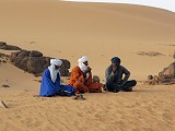
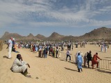
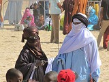
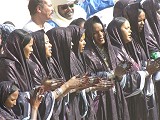
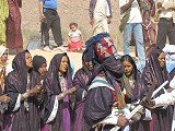
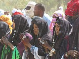
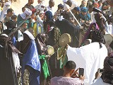
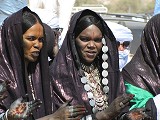
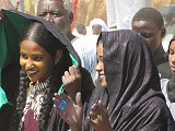
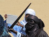
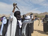
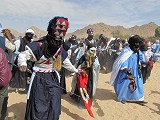
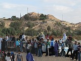
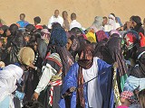
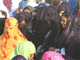
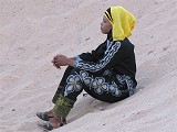
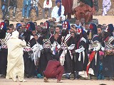
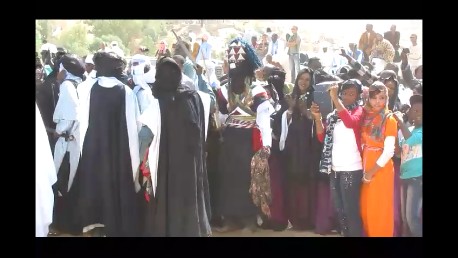
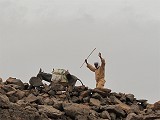
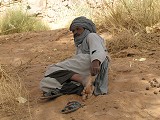
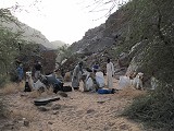
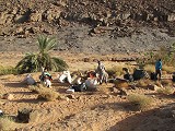
The Sabeiba festival commemorates the making of peace between two tribes of the Kel Ajjer touareg about 3000 years ago. The two tribes still inhabit distinct areas of Djanet, Azelouaz (the nothren Suburbs where Essendilene is located) and El Mihan (the central area), and the event is a supposedly a re-enacted battle followed by a renewal of the peace wows. It is surely not by coincidence that it is held on the Islamic Day of Ashura, merging old traditions with the new religion. However by now it is more a village fest where locals go in their finest attire to see and be seen, much like a New Year Concert. Even though it was originally revived as a tourist attraction (capitalising on the fame of the Festival du Desert in Mali), With tourism in the South of Algeria non-existent these days, it is a genuine local festivity rather than a corrupted version performed for the benefit of visitors. As we entered town already we saw smaller and larger groups of men and women congregating in their traditional indigo garbs (no doubt made in China these days...). While Abdou started the long process of changing into his finest we went to the market to purchase our needed supplies.
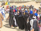
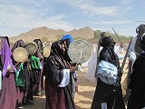
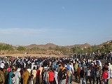
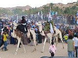
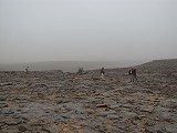
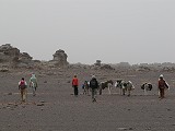
The festival was held in the bed of the oued crossing Djanet near the centre of the town, with sand viewing embankments framing a rectangular football field sized area, and a smaller fenced enclosure inside for the dancers. When we arrived there was already some activity, with members of the two tribes grouping at the two opposite ends of the enclosure. Abdou immediately joined the Azelouaz lot, while we went up the embankment for a better view. The crowds were still arriving, and while there was a little singing and dancing on both ends clearly it was not yet the main show.
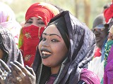
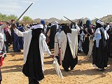
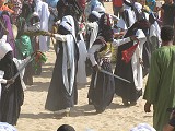
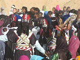
By midday the crowds grew noticeably thicker and more dancers arrived. The performance itself was rather simplistic, the younger girls lined up claping and chanting a monotonous line while older women were beating drums. The men slowly stepped or turned about to the rythm wielding fake swords and scarves. Many of the men wore the traditional battle attire with face masks, though I'm not quite convinced those masks would have come handy in real battle...
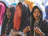
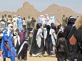
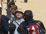
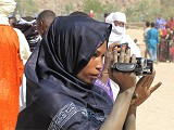
While the two contesting groups were rehearsing at the opposite ends of the enclosure, life went on merrily with the audience socialising and taking photos and videos, mainly on phones and tablets, a clear sign of how times have changed in the Sahara. It soon became clear that the fence closing off the dancers' area from the spectators was rather symbolic, everyone with a camera device went in through the entrance gaps to film and photograph so we followed suit. Local TV crews were running about taking shots and interviews. They soon found Tak and immediately pounced on him to make an interview showcasing the fact that indeed there are tourists around (there were about a dozen scattered about, including the five of us) who no doubt came just for the festival, some even from as far as Japan!
Finally after another half hour some action began, the men of the two rehearsing groups started to spread out along the perimeter of the enclosure, hand to hand, appearing like a frieze of giant bats along the fence. While this happened, another part of the opposing groups started a dancing procession around the field, escorted by a rather vocal goup of women with their drums. Clearly this was the climax of the morning session, as within ten minutes the singing and dancing stopped, and the performers and spectators alike dispersed to gather some rest for the afternoon.
The performance started again about one and a half hours before sunset, and essentially it was more of exactly the same. However it was clear from the numbers and the fancy dresses that the morning was really just the rehearsal, the main social event was taking place in the evening. As the performance did not differ in any detail from the morning, soon my attention wandered off to the audience, some of whom put on a veritable show themselves.

The festival ended around sunset with the same procession around the perimeter as in the morning, followed by a great comotion with two mounted camels appearing as the grand finale. Poor Tak missed all this with jetlag finally catching up...
Day 3. Djanet - Oued Dider/Tin Terirt - Iherir
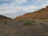
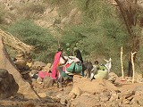
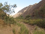
After spending another night at the Essendilene premises we started out in the morning towards Iherir. We were in no particular rush as the total distance is only arund 200 kilometre, comfortably doable in one day. It was a cloudy day, and as we reached the Oued Essendilene (about 70kms North east of Djanet) we saw very fresh traces of flowing water, there must have been a large rainfall during the night. Similarly there were traces of fresh water in all the smaller wadis as we made the shortcut bypassing Zaoutallaz (the small garrison town where the Tamanrasset road branches off) and the time consuming checkpoint.
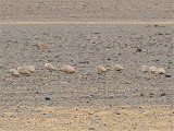
We stopped for lunch in the Oued Bourahla, a large valley winding among some outliers of the plateau before rejoinng the road. Here too there was fresh wet mud in the main watercourse, a delight to Koen and eter as they could take stock of all the wildlife that passed here in the past day. Aside the sheep and goats of the nearby village there were numerous hare, gazelle and jackal tracks, but Koen also spotted the tracks barbary sheep, unexpected so close to human settlement.
As we ascended the plateau and reached the plain of the Oued Dider, the overcast thickened and a strong cold wind picked up from the south. It was the kind of autumn weather we were expecting to leave behind as we arrived to the Sahara. We turned off the main road towards the engravings of Tin Terirt a few kilometres off the road. Peter spotted a flock of birds in the distance, which turned out to be crowned sandgrouse (Pterocles coronatus).
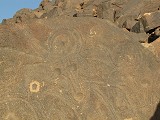
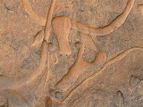
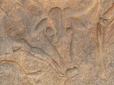
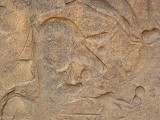
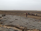
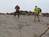
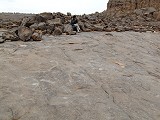
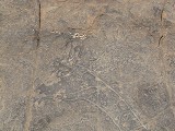
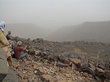
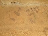
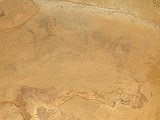
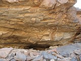
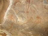
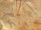
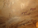
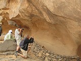
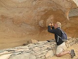
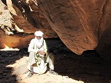
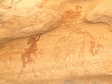
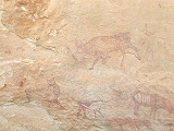
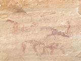
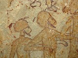
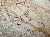
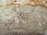
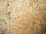
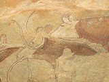
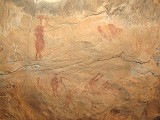
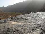
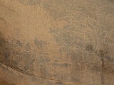
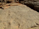
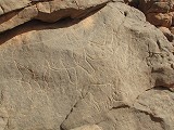
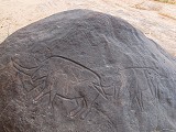
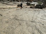
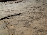
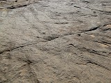
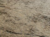
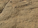
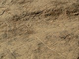
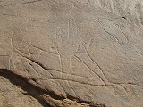
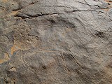
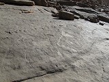
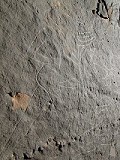
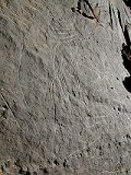
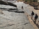
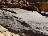
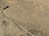
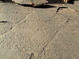
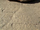
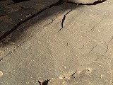
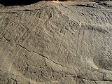
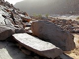
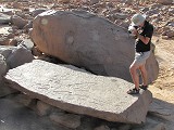
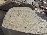
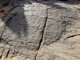
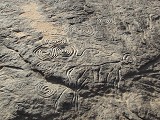
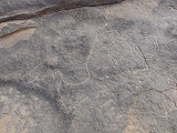
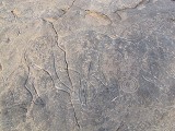
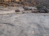
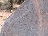
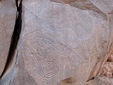
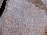
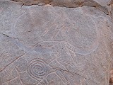
The Tin Terirt engravings are made on a large exposed smooth surface of sandstone, visible from afar The whole rock is covered with carvings, only a fraction of which are published. There is a mixture of cattle (which predominate) and some wild fauna, all in the same general style. Despite the remote location there is a guardhouse and a neat path leads up to the rock, where visitors are very sensibly required to remove their shoes. Unfortunately with the diffuse light of the thick overcast it was very difficult to see many of the engravings, and almost impossible to photograph.
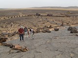
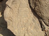
The best known figure, reproduced in a number of books, is a very large cattle, about 3 metres in length. The overall style is quite similar to tose at Terarart near Djanet, but here the body is filled with curved and spiral patterns, creating a uniue scene. It is very difficult to photograph, one would need a high platform to see it in its entirety without distortion (all publications just show the head).
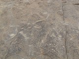
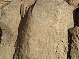
There are several other large cattle figures over 2 metres in length scattered about the rock, though none match the elaborate detail of the largest one.
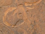
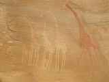
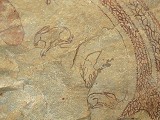
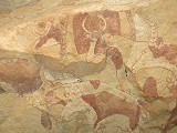
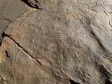
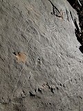
The other well known scene is a group of crouching gazelle. Only the best preserved one is reproduced in books, however there are five of them in a group (four deeply carved, one just scratched). In addition there is a pair of overlapping ostrich just beside the gazelle.
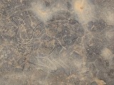
There is also an intriguing scene of a group of seemingly headless human figures, the carved heads made almost invisible by later polishing. Throughout the rock there are scattered individual and grouped giraffe and rhinoceros, and plenty of other figures that are too faint or damaged to be discernible (except perhaps in an ideal sunset light).
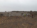
As we were about to leave a police car pulled up with eight soldiers in it, seemingly coming to visit the site themselves. After a few greetings they merrily walked up to the engravings while we left, but it was certainly not a coincidence. Our progress from Djanet to Iherir was discretely watched, but never in a way that was disturbing or intrusive, unlike some other fine lands we have traveled in accross North Africa.
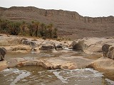
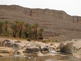
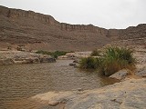
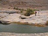
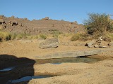
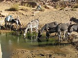
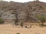
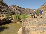
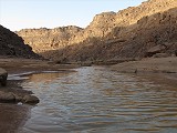
We reached Illizi in the mid-afternoon. After settling in to the campsite we walked down to the guelta where we found the river to be in full flow, with little waterfalls along the valley downstream. Predictably the large guelta was full of muddy water instead of the crystal clear water we saw two years earlier. There was however a smaller pool at a slightly higher elevation which was not mixed with the rainwater, only fed by the artesian spring.
Day 4. Ascent to Tadjelahin plateau - Issalamen Oued Telmest
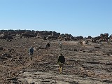
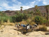
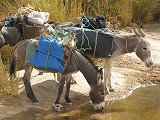
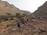
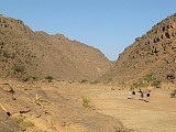
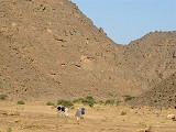
There was a howling wind overnight, brewing up into a proper sandstorm against which the rather flimsy huts offered little protection. It also cooled further, and it was a distictly unpleasant autumn weather as we awaited the loading of our donkeys. Our guide was Ibrahim again, with whom we traveled to the Tadjelahine plateau on our previous visit in 2012.

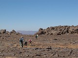
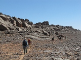
Once the donkeys were packed we set out without much ado, first accross the small valley leading to the pass up the platea, then up the zigzagging trail. Our herders were not the best, loads were constantly shifting on the animals and we had to make several halts to re-load them. We were already late in starting, and it took a good two hours to make it to the top of the pass.
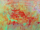
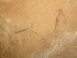
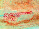
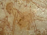
Our first objective was the sites if Issalamen, about 3 kilometres from the top of the ascent. We reached it in little over an hour, and after a quck lunch we set out to see the row of shelters set out along the Eastern side of a rocky area. I was very keen to take better photos of the elephant hunt scene which was unexpectedly discovered in 2012 after processing the taken photos with dStretch. The elephant is so faint that even when knowing what to look for, it is very hard to spot it in the low light of the shelter.
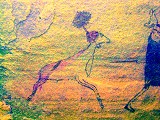
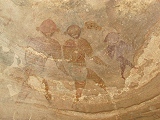
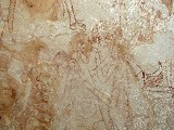
As we walked back to our donkeys behind the cluster of rocks, we passed a large shelter which we did not see two years ago. Ibrahim dismissed it as one having only some crude and unimportant paintings, however we have found a very curious scene on the ceiling which at first did not make much sense. Only when rotating the taken photos did I realize that in fact they were a group of very fine Iheren style human figures. The one on left appears to be emerging from an oval shape, however even dStretch gives no clues as to what it could be. I am not aware of this scene having been published anywhere.
As we continued towards our campsite in the Oued Telmest the haze cleared, revealing large rainclouds. A partcularly large storm with visible rainfall moved along the edge of the Fadnoun plateau, unfortunately out of range to fill any of the gueltas in the wadis we were to visit. Water was a concern as Ibramim told us that all the pools were dry, and our donkeys needed water after three days with the only source being Iherir.
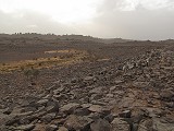
We reached the Oued Telmest shortly before sunset, right opposite a large "keyhole" monument in the valley below. Subsequently I have found over a dozen similar structures scattered about the Tadjelahine plateau, mainly built ongravel terraces in the beds of the major watercourses. As we walked along the edge of the wadi towards the donkey pass leading down into the broad sandy basin a few hundred metres further, rain started falling in big drops. It was not enough to create standing water on the ground, but it was enough to dampen our clothes. It was the first time I ever used the waterproof cover on my backpack...
Day 5. Oued Telmest Tahon Tarokhet Iheren Tin Abenhar
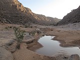
We had a nice clear sunny morning, all the clouds and haze of the previous day was gone, it appeared that the proper expected weather returned. We started the day walking downstream to the large guelta and the main painted shelter beyond. As expected we found the guelta dry, but as we approached we found a narrow crack still filled with murky water, with a dense scatter of water beetles on the surface. Ibrahim was delighted with this find, he went back to camp to fetch the donkeys while we continued to the shelter.
The Oued Telmest shelter is one of the lesser known Iheren style sites. the fine panel on the left of the shelter has been noted and published, but there are many other faint scattered scenes, some covered with modern charcoal graffiti. In 2012 we found a panel on the right ceiling that was unknown to Ibrahim, and there are many more figures individually and in grooups on the rear wall. This time we noted a giraffe and a large camel rider, both of whom are only properly visible with dStretch.
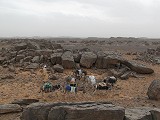
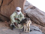
As we were busy snapping our photos Ibrahim reappeared, accompanied by a loudly bleating little goat. Apparently it had lost its way several weeks ago when the family living in the valley moved to Iehrir as the water was running out, and now it was desperately seeking human company. Despite the frail looks it must have been a rather sturdy little creature to survive the jackals for three weeks. It immediately adopted us, and was merrily trotting behind as we started back to the guelta.
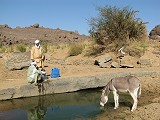
When we reached the guelta our donkeys were arleady there filling themselves to the brim. We also filled our empty jerrycans, with this unexpected supply we could last the remaining three days without needing to send some of the donkeys back to the bottom of the pass, the closest other water source.
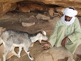
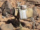
With the watering our start from camp was later than planned, but we only had a short journey of five kilometres to our Iheren camp. We made a direct climb out of the valley while our donkeys took the longer zigzaging trail, the little goat trotting behind but struggling to keep up. Finally he was placed in a plastic bag and tied on top one of the donkeys, a means of travel apparently it was acccustomed to as the anxious bleating stopped and a very content little goat rode along in the saddle.
We paused a little over half way at the site variously referred to as Tahount Tehort / Tahountarvat / Tahon Tarokhet, a cluster of rocks with an elaborate system of stone walls creating a large enclosure in their midst which Lhote likened to a fortress, but it more appears to be an animal pen. A large mushroom-shaped rock in the middle of the enclosure contains a large but unfortunately very faint panel of Iheren style paintings. Spending some more time we spotted a few more similar figures on the ceiling of a small shelte nearby which we missed on the arlier visit.

I was hoping to get some better and more detailed photos of the main panel of paintings, but unfortunately no luck, there is some surface deposit over the paintings which prevents flash improving visibility, and also interferes with DStretch as the processed results are much worse than what would be expected..
We went through the row of shelters facing the plains at the edge of the rock cluster, here there are some better preserved scenes, with a few exceptions all seen and photographed on the previous trip. While we were preoccupied with the paintings the weather outside canged, the blue sky was replaced by a dusty haze, the wind picked up and by the time we departed it strengthened into a proper sandstorm.
Passing along the Western edge of the rocky area with the enclosure and paintings at the eastern tip, we found a pair of shelters after only a couple of hundred metres which looked promising, despite Ibrahim knowing of no paintings there. The first one contained only a few traces of human figures. The second had a large panel of well visible camels on the rear wall, but on close scrutiny we also found a series of faint and interesting panels in the Tin Abenhar style.
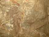
In a rather dismal weather - fortunately with the wind and the stinging sand mostly to our back - we crossed the open plain between the two rock clusters to the ssouthern part of Iheren. It was only a kilometre but it seemed like an eternity struggling along in the blowing sand to reach the sheltering maze of rocks. We started at the site farthest south, the lovely panel of red cattle in the fine Iheren style which we already saw in 2012.
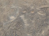
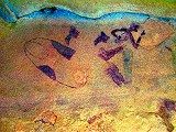
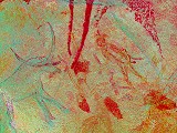
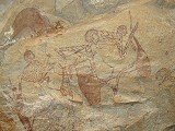
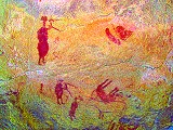
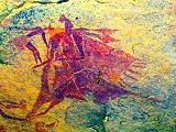
Nearby Ibrahim led us to a shelter which he missed two years earlier. It contained some very faint paintings, but one panel proved to be rather unusual. It contains several therianthropes, some dog (or jackal ?) headed, some with the head of some horned animal. A pair is copulating while others are seemingly attacking with big spiked clubs. The scenes are rather faint and damaged, but dStretch reveals the finer details quite well.

We continued to the nearby shelter where in 2012 I have accdentally discovered a very fine panel of therianthropes by taking point-blank shots at some very indiscernible red blobs of paint. This time, knowing what to look for, I have managed to get some much better shots, including many details and also overviews of the full scenes. The larger panel is a good example on how different dStretch filters reveal very different details of the scenes. The left of this shelter also contains a pair of fine ostrich.
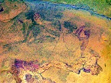
On our way towards the main Iheren shelter and our nearby campsite we passed a small shelter which Ibrahim did not show us two years earlier. Now he pointed out a few very faint figures on the ceiling, which turned ot to be the delightful little scene of two dog or jackal headed therianthropes, one shooting arrows at the other accompanied by a sheep with an elaborate headdress. This scene was copied by Pierre Colombel at Iheren, however it could not be relocated by any later visitors (Malika Hachid even suggested it was a fake). It was confirmed to exist by Yves Gauthier and Denis Lionnet (Sahara 16, 2005). The precise location was not published, we assumed it was somewhere at the main sheter, now too faint to be visible. Finding it was certainly one of th highlights of the trip. The scene itself is very faint, but dStretch brings out all the finer details.

We crossed the small wadi sepaating the southern cluster of Iheren from the rock maze cntaining the main shelter in very gloomy weather. Despite being midday, it was as dark as if it were dusk. Our donkeys were already grazing among the meagre tufts of grass, our luggage having been downloaded at the campsite near the main shelter. We found an unexpected surprise at the shelter - sometime in the intervening two years since both Tak and myself were last here, a well built low stone wall was erected by the National Park service to keep visitors at a distance from the paintings. Unfortuntely this ambition was achieved a bit too well, with the Iheren shelter paintings being faint and delicate as they are, from a distance of 2-3 metres practically nothing is visible save for the few better preserved figures and scenes. With the present setup the details may only be seen with a high power telephoto lens, and having a tripod is essential to make good quality photos.
On our visit two years earlier we were so excited about the main shelter that we failed to noice a small one less than 20 metres from the main site, on the way towards the campsite, which contains a vell preserved panel of cattle in a somewhat unusual style, together with a pair of giraffe.
With the light being very bad at the Iheren I. shelter, we did not linger long hoping for better conditons in the morning. We moved to our campsite a few hundred metres away, and after a quick lunch set out for Tin Abenhar some two kilometres away at the western end of the same maze of rocks.
We spent the remainder of the afternoon zigzagging among the rock maze of Tin Abenhar, visiting all of the principal paintings there, some of which are among the best preserved ones on the Tadjelahine plateau. Some others, while poorly preserved, appear to be among the oldest paintings in the region, showing similarities to the art of the "roundheads" on the Tassili du Tamrit around Djanet. (The sites of Tin Abenhar are described in detail in the accountof our 2012 October expedition.)
Day 6. Iheren Oued Afen Tin Toudouft
Next day the sandstorm was gone, finally we had clear skies and good visibility, but the morning was rather chilly. The light at the main shelter was prfect, we spent the first couple of hours photographing the shelter. I have managed to capture several details (especially along the very damaged lower left side of the shelter) which I have missed on the previous trip.
Before breaking camp we walked the short distance accross the flat stony plateau to the Iheren II shelter. Here too we found a newly erected wall, but much closer to the rock wall so it did not interfere with photography. The shelter was as fine as ever, we took our time going through all the superb detail.
We were about to leave, when I noticed a very faint dark shadow near the conspicious standng figure with upraised arms with an archer below. At first I was not sure if it was paint or just the texture of the rock, but looking close I realised that the shadow in fact was an elephant facing the human figures (dStretch reveals that they are in fact two elephants, one charging at the upper figures, while the other facing the opposite way). The seemingly incomprihensible scene finally made sense: the figure with upraised arms is challengng the animal by appearing to look bigger, while the archer below is fleeing. Further below, another archer belonging to this same scene is firing an arrow at the elephant, accompanied by a fine sheep. Apparently this elephant or lion hunt scene with some variation was repeated in all the principal Iheren style paintings.

Rather pleased with this unexpected result, we started back towards Iheren and the camp to load our donkeys and move camp to our next destination.
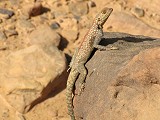
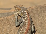
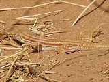
Our next campsite was a mere 3.5 kilometres away, an easy hours' walk along a generally flat easy terrain. There was not much to see along the way except the occasional lizards. Most of them slipped away before one could take a photo, but one posed for a few seconds enabling a photo and identification as Messalina guttulata.
Our camp was in the bed of the Oued Afen, beside the same promnent ancient tamarisk where we camper two years earlier. We had a short spell of laziness before setting out for the afternoon, planning to take our lunch at our destination..
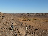
Our afternoon objective, Tin Todouft was an houur's walk away along a belt of eroded rock outcrops starting on the plateau above the valley just adjacent to our camp. We walked in and along the maze of rocks for 3.5 kilometres until reaching the corridor containing the series of paintings. It is a bit unclear why this particular spot was chosen, as there were several similar lanes among the rocks with good shelters, but no paintings.
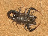
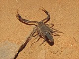
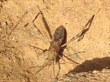
While we visited and photographed the shelter with the large panel of opposing archers on the ceiling, Tak created a small comotion by stirring up a small black scorpion from under a rock in the shelter. It was clearly much more afraid of us than the oher way around, it was hardly possible to snap a few photos as it scurried to safety among some other rocks. Its affinity is unclear at the moment, the body proportions are very similar to Leiurus quinquestriatus but the lack of any yellow colour at the extremities suggests that it belongs to another Leirus species, perhaps even an undescribed one.
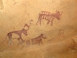
We continued among the maze of rocks passing by the series of sites (almost all of them containing cattle in various sizes, colours and flavors). We slowly made our way to the northern edge of the area, finishing at the magnificent pair of life-sized hippos which are definitely the highlight of this area, and are unique among Saharan rock art. This time, having more time on our hands, we could look through the shelter at leisure, and we found a faint panel of human figures between the two hippos which was missed on our previous visit. We also had time to make a brief survey of the "streets" beyond the hippos with a number of prominent shelters with good unweathered rock surfaces, but strangely they all lacked paintings.
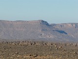
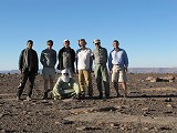
On our way back to camp we walked along the Northern side of the belt of rock maze, with a superb view of the Fadnoun plateau in the low afternoon light. This was also a good opportunity for our group photo, as it was the first fine clear day since we left Djanet.
We reached our campsite to a peaceful sunset scene, with our donkies and the litle goat merrily munching away on the plentiful green vegetation in the broad sandy bed of the Oued Afen.
Day 7. Oued Afen - Tadrast Timerssaoussin - Tasakarot - Tahilahi
At sunrise we started to pack the camp and soon we set out west towards Timerssaoussin, to visit the large shelter there plus the nearby sites of Tarrast. This time we did not follow the bed of the oued Afen, but the donkey path on the plateau above, a much faster way.
The only excitement along the way were two of the same large Eremiaphila species (desert mantids), completely blending in among the surrounding dark rocks and only visible when moving.
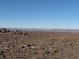
The track led directly towards the (now dry) guelta of Timerssaoussin whre we camped two years ago, bypassing the large bend of the Oued Afen. Near the wadi we passed by a series of tumuli and a large stone monument, no the 'keyhole' type but just a simple oval enclosure surrounding the central mound.
Our donkeys continued straight to the Tahilahi campsite while we made a detour to the sites of Tasset, a rock maze about a kilometre from the Timerssaoussin guelta. We have thoroughly explored this site in in 2012 and it was not on ur planned itinerary, but with the time gained with the shortcut it was a welcome additon. There are several sites with fine cattle pastoralist scenes, mainly in the Tin Abenhar style, but the most interesting panel is the one with three large figures represented in full face, and apparntly pre-dating the pastoralist paintings. These figures are unique, they do not fit any known pattern or style in the viciniy nor elsewhere among saharan rock art.

We returned to the guelta and the path to visit the Timerssaoussin shelter, one of the lesser known of the principal Iheren style sites. This too contains a splendid elephant hunt scene among other fine scenes of humans and cattle.
After a quick lunch in the shade of the rock behind the shelter we continued towards Tahilahi, first passing by the fine crouching giraffe which we found in 2012. It was surprisingly difficult to find, even though both me and Ibrahim thought to have remembered the place well we took a good half an hour among the maze of rocks to hit upon the actual shelter, though we were never more than 100 meres from it. After the giraffe we passed by the double shelter of Tasakarot, which contains a mix of fine Iheren style paintings and some cruder ones of later date.
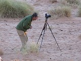
We arrived at the Tahilahi campsite by mid-afternoon, with plenty of time to visit and photograph the principal shelter a short distance away. Tak brought along a GigaPan tripod mount to create a high resolution 360 degree panorama of the entire shelter, with excellent results.
As I checked for details I spotted a faint but delightful scene which I missed despite repeated visits in 2012. It is located at the upper right of the shelter (above the giraffe held by the tail by two figures), and it displays a flock of very fine sheep with a pair of humans, one of whom is holding a number of newborn lambs.

Day 8. Tahilahi - Iherir - Tikadiouine
At sunrise we packed camp, and went back to re-visit the Tahilahi shelter and environs while the touaregs went to collect our donkeys that wandered off in the night in seek of forage. There are several known shelters with faint paintings among the rocks behind the main shelter, however Tak managed to find some faint paintings that were new to Ibrahim and possibly unrecorded. They depict a faint white elephant elephant, a giraffe and several dama gazelle together with human figures on a wall which on first look appeared to only contain modern charcoal grafitti.
We saw and photographed all the lesser sites, but there was still no trace of the animals. It became clear that they must have wandered off far, possibly in search of water which they lacked now for three days. Ibrahim too left us to join the search as it appeared that the herders were not familiar enough with the terrain, and we spent our waiting time photographing the innumerable fine details in the principal Tahilahi shelter.
Finally it was Ibrahim who found the donkeys, they were near the pass leading down to Iheren, they were aiming home as suspected despite the herders insisting that they must have went grazing up the valley at Tahilahi (the same thing happened to Tak on an earlier voyage). It was past 10am by the time all were found and we could depart, the time of our agreed rendez-vous with the cars at the end of the trail near Iheren. In a rather fast trot we made the three and a half kilometres to the pass well under an hour, and after ascertaining that our donkeys with our bags were visible on the horizon, we immediately started our descent down the pass. The pack animals soon caught up with us, accompanied by the loud cries of our little goat strapped to the back of one of them, all eager to have a drink at the pools in the valley.
It was another half an hour to the end of the trail near Iherir, we reached our cars and a rather anxious Abdou past one o'clock. We quickly offloaded our donkeys, said our good-byes to Ibrahim and the herders, and jumped into the vehicles to try to make up sme time. We drove out of the Iherir valley to the viewing point above the abandoned village of Idarene, which lies about 5 kilometres upstream from the permanent guelta of Iheren. Our cook was awaiting with a hot lunch, a welcome change after the days of wasa bread and freeze-dried meals, then we started out again for our princpal objective of the day, the Tikadiouine shelter.
The Tikadouine shelter is one of the best-kept secrets o the Tassili. It is close to the western edge of the Tadjelahine plateau, near the asphalt road and is approachable with vehicles. Yet it is only known to a handful of people, Abdou himself has only been here just once over a decade ago. Despite its relative accessability this shelter was not known to Lhote or other early explorers, its existence was only signalled by Alfred Muzzolini and Aldo Boccazzi in 1991 (The rock-paintings of Tikadiouine (Tassili n'Ajjer, Algeria) and the Iheren-Tahilahi Group, Proceedings of the Prehistoric Society, Vol. 57/2). We reached the site in the late afternoon, well after our planned arrival. As it was getting late, we made our camp in the riverbed near the shelter before dashing to the site to make the best of the remaining light.
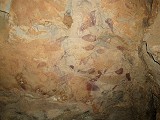
The Tikaidouine shelter, together with Iheren and Tahilahi, is the finest manifestation of the Iheren style. It is a large shelter, carved out by flowing water eons ago, at present a good 10 metres above the valley floor. The rock split in small blocks, producing a very uneven surface, nevertheless the outer ceiling of the shelter at about human height is covered by a dense series of extremely fine paintings.
The scenes present a distinct local variation of the Iheren style, some of the human figures are almost caricaturesque, shown beside the usual assortment of domestic and wild fauna (cattle, sheep, dog, giraffe, gazelle, ostrich). There is also an exceptional pair of hartebeest, and several of what appear to be hares, but the long head and the curved tail leaves some doubt. Sometimes it is unclear what activity the humans are engaged in, but one remarkable scene seems to show an ostrich being butchered with the long curved (metal?) knives.
Day 9. Tikadiouine - Illizi - Oued Djerat
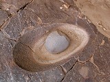
In the morning we returned to the shelter to marvel at the finer details in the better morning light until the sun rose to obscure much of the paintings. We also noted a large and very well made grinding basin at the left entrance of the shelter which we missed the previous evening.
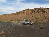
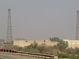
Leaving the Oued Tikaidouine, we contnued along the tarmac road towards Illizi. As we neared the steep ascent to the top of the Fadnoun plateau, the blue sky turned hazy, and a strong wind picked up. By the time we reached the far side of the plateau and the dunes around Illizi, it became a full fledged sandstorm with visibility reducing to just a few kilometres. We did not enter Illizi itself, just went to the outskirts of the town to the house of a partner of Abdou, and leaving most of our party went for a quick shopping round and fetched some water near the old french fort (now an Algerian military installation).
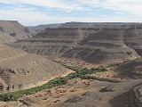
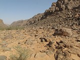
As soon as our chores were done we left Illizi, which did not look like a very inviting town, especially not in a sandstorm. We hit a well travelled track leading South east towerds the Oued Djerat. I was very much looking forward to this part of our trip, the Oued Djerat being one of those mythical places of Saharan prehistory which I was hoping to visit some day. It was here in 1932 that Lieutenant Brenans made the earliest rock art discoveries in the Tassili, reporting literally thousands of engravings of wild animals, including the long disappeared elephants and rhinoceros, as well as cattle and humans. The valley was systematically surveyed by Henri Lhote in 1970-71, and his two volume report is one of the few systematic documentation of rock art anywhere in the region. All site number references below are from his publication (Les Gravures Rupestres de L'Oued Djerat *Tassili-n-Ajjer, Tomes I-II, Memoies du Centre de Recherches Anthropologiques Prehistoriques et Ethnographiques Vol. XXV, Alger, 1976). Unfortunately he only recorded the engravings, the numerous paintings remain largely unpublished.
It remains a mystery why this particular wadi contains such a prolific amount of rock art, while the countless other similar wadis draining the Fadnoun plateau towards the North have just very few or none. On the Messak Plateau in Libya, where similar engravings exist, all of the main watercourses have numerous concentrations. Here for some reason the ancient artists preferred just this one...
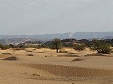
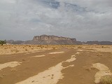
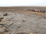
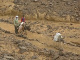
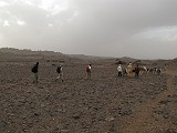
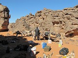
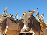
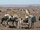
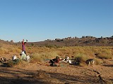
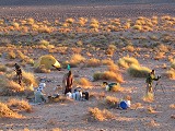
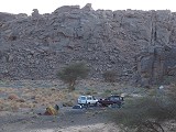
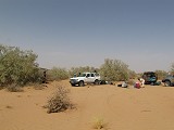
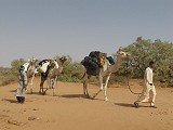
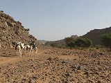
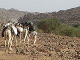
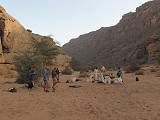
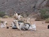
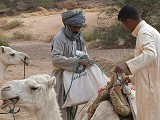
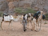
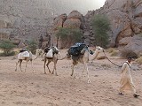
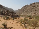
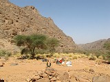
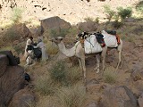
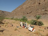
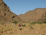
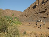
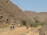
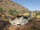
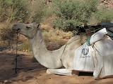
We reached the entrance of the wadi around midday, a wide shallow sand-filled valley bordered by low hills and filled with large green mounds of tamarisk. We drove among the vegetation till reaching a well and a small abandoned tourist camp, the spot where our arranged camels were waiting. We had a quick lunch in the rather meagre shelter of the tamarisks, probably crunching as much sand as food, then started to load our camels with the bags, water and supplies for the five day trek into the valley.
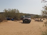
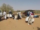
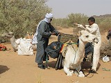
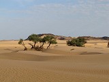
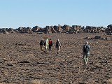
We had three camels, each carrying about 80 kilos of load, about half of that water, and were accompanied by an old guide and a young lad, Mohamed and Hamed. At first we walked in soft sand speckled with large tamarisks and the omnipresent Calotropis procera shrubs. The valley was wide with only a low rocky rim. We trudged along without seing anything else on this rather difficult terrain, keeping our heads low as the wind was still blowing the sand in our faces. Nevertheless had to make good progress, as the main concentration of rock art sites start quite far up in the valley, we had to go 30 kilometres upstream to reach the start of the main area, and return the same distance, all in the available five days.
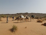
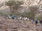
After three kilometres we reached a bend, which also brought about a marked change of scenery. The Cliffs along the sides of the valley began to rise, and acacias replaced the tamarisks as the dominant vegetation, with the first big trees appearing after the bend. With the rising cliffs the wind also diminished and the blowing sand ceased, a welcome change after the so far rather unpleasant day. We started to settle into our trekking routine, taking about 45-50 minute marches followed by a 10-15 minute rest, covering about three kilometres in an hour.
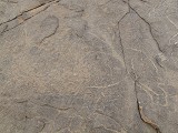
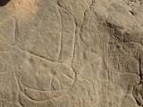
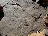
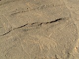
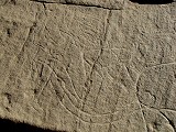
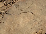
After the bend we encountered the first rock art site, a big boulder covered with numerous engravings of very fine cattle, in part covered by cruder giraffe of a later period. This site was apparently not recrded by Lhote, at least it is not published or marked on the map.
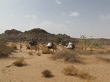
As we continued, the sides of the valley moved in and it eventually turned into a narrow canyon no more than a hundred metres wide, with increasingly taller bordering cliffs. The acacia vegetaton also turned denser, and after another bend we encountered the only human settlement, signalled by a cute child's drawing made of scattered camel dung. The 'village' consisted of a pair of huts occupied by a single family who just arrived with their donkeys from the guelta at a good day's distance further upstream.
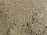
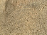
We continued upstream, passing a few scattered smaller rock art sites along the way (Station LXXI). One large boulder contained a fine large hippopotamus, while a house sized block some distance above the valley floor had an almost life sized fine cattle engraved on its vertical side.

We made camp before sunset in a flat sandy stretch of the riverbed about ten kilometres from our starting point. While we did not get in quite as far as I would have hoped due to our delay the prefious day, our progress was good, the distance was covered in about three hours of actual walking time. We were now confident that we could comfortably cover the required distance, with enough reserve to have plenty of time at the principal sites.
Day 10. - Oued Djerat
It took about an hour in the morning to pack camp and get on our way, including a quick breakfast while the camels were rounded up by Hamed. Once the camels were there, Mohammed and Hamed were surprisingly quick and efficient in loading them, in 15 minutes we were ready to go.
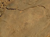
A short distance from our campsite near the cnfluence of a small lateral wadi we came upon a large and comfortable shelter which mostly contained modern charcoal garffitti, but there was a small panel of old paintings, depicting an antilope, a human figure and some unclear shapes.
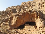
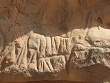
Not far upstream there was a larger shelter, higher up the canyon cliffs. This one proved to be more interesting, with an engraving of a two horse chariot on the shelter floor, showing the horses in full gallop (Station LXV). In the shelter there was a panel of paintings with several human figures and animals, all in a fairly unrefined style.
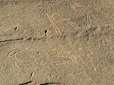
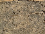
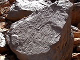
Two kilometres after our campsite we reached a sharp bend where the valley turned east. A cluster of big boulders along the western edge of the valley contained the first majo cluster of engravings - several fine rhinoceros and elephants, including a large one on a flat rock containing the spiral motifs so characteristic of the Oued Djerat. This site (Station LXV) also contained one of the most intriguing scenes of the valley, a pair of antelopes without forelegs, ending in a common head.
After the cluster of sites the valley made another sharp turn towards the South, and continued on an almost straight southerly course for four kilometres. Strangely after the rich cluster of sites there were hardly any engravings along this stretch, we only passed a large boulder (Station LXI) with a couple of elephants, one of which was partially re-pecked well after it was made. A lttle further there was a large rock wall with a herd of long horned cattle (Station LVI). There was also a shelter along the eastern side of the valley with numerous paintings of camels, but nothing more.

It was a long walk along this straight stretch of the valley, as the temperature became increasingly hot with a still air filling the valley. Apart of the few sites the only notable feature was a terrace of carbonate conglomerates rimming the valley in several sections. Such carbonates were also noted at Jebel Uweinat and appear to be remnants of permanent standing bodies of freshwater in the early Holocene.

After walking a little over seven kilometres from our morning camp we reached the confluence of a larger lateral wadi joining from the east. The smooth rock face at the junction contained a large and conspicious group of engravings (Station LII), the most notable being a huge giraffe, several elephants and herd of bubalus. The Lhote team appears to have missed several scenes here, a very fine conspicous elephant and theBubalus do not appear in the book.
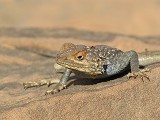
The site had its guardian, a very friendly agama which posed very obediently to the cameras unlike most of its kind. It did not even bolt when the lens was brought up ony a few inches from its eyes. It was an Agama tassiliensis, native to the Tassili and the surrounding central Saharan massifs, only recently recognised as a separate species (Geniez, Padial & Crochet, 2011).
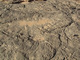
We stopped for our midday break at a sandy patch just bejond the junction. After lunch we explored the surrounding rocks which all contained smaller or bigger engravings (Station L). The finest was a pair of rhinoceros on a large boulder which also offered perfect shade for a little midday nap. There were also some of the characteristic spiral motifs scattered about on flat surfaces surrounding the boulders.
We rested for about two hours until the worst of the miday heat was over, then re-loaded the camels and set out for the shorter afternoon march. As usual the camels marched ahead at a steady pace, while we fell behind to see the sites along the sides of the wadi.
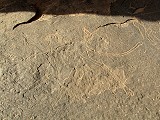
We did not have to go far from our resting place for the first sites (a continuation of Site L). Perhaps a hundred metres upstream the smooth waterworn rocks along the wadi bed were full of large panels of engravings, including a number of very fine rhinoceros, hippopotamus, giraffe and a rather unique scene of a man riding a cow.
A little further upstream a large rock overhang contained the finest panel of paintings we have encountered in the lower Oued Djerat (there are more further upstream, beyont the areas we managed to visit). It was a large group of giraffes, unfortunately in a rather por state of preservation, but dStretch reveals some of the finer details.
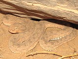
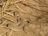
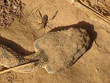
After the painted shelter there was a long empty stretch, with the excepton of a single boulder with three engraved rhinoceros (Station XLIX) there were no more sites for several kilometres despite several suitable-looking rock outcrops and shelters. As we walked along the camel path, Koen spotted some movement amond the rocks - it turned out to be a farily large sand viper (Cerastes vipera) which quickly sought refuge under a rock, clearly more afraid of us than the other way around.
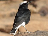
We continued upstream, first generally west then towards the South-east as the valley took a sharp turn. Mohammed wanted to stop around four in the afternoon, accustomed to the more relaxed tourist pace (though admittedly he did not bring any ourists t the valley in the past three years), but we managed to convince him that we were perfectly capable of walking till sunset, covering another three kilometres of this long and relatively uninteresting part of the valley, and shortening our distance to be covered the next day. We did see a few scattered sites, including a well known scene of a human ahd a Bubalus on a boulder near the big bend (Station XLVII), and another fine scene of cattle (Station XLIV). We were also followed by a moula-moula (white-crowned black wheatear, Oenanthe leucopyga), always lifting off just as one managed to focus the camera lens on it, I finally managed to snap a photo of it as we stopped at a small sandy area at sunset to make camp.
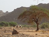
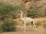
After making camp our camels did not wander off immediately as they usually do, but stayed with us munching at the abundant green acacias scattered about our campsite. It was fun to watch how they can nibble delicately on the spiky twigs, stripping them of the fresh leaves while seemingly not hurting themselves. As they stood high on their front legs stretching their long necks, it was also apparent how much they resemble their close relatives the giraffes. Watching their feeding, it also becomes clear why smaller acacias cannot survive if there are camels about. Koen last visited the Oued Djerat twenty five years earlier, and it was almost barren except for the larger trees, while now twe wadi bed was filled with a thick bush of small acacias. Clearly in the last 20 years the few families permanently living in the valley with their camels moved out, allowing the natural vegetation to recover.
Day 11. - Oued Djerat
We set out early in the morning, breaking camp at first light in order to reach our objectve by the late morning, the Bartou Guelta which was still some seven kilometres further upstream.
Shortly after our campsite we reached the confluence of a rocky tributary, with a conspicious large shelter that contained a few scattered paintings. One figure was a strangely proportioned but otherwise very fine giraffe, of the same style like the ones we have seen the previous afternoon.
As we moved upstream, the appearance of the valley changed markedly. The near continuous dense acacia bush was replaced by more sparsely spaced tamarisks, with the intervening ground densely covered with tall grass. We also passed a number of rocy basins which held water recently (at most the year before), with oleanders growing around their perimeter.
As we followed the narrow winding camel path through the tall grass, the thought did occur that it was perfect snake country. Sure enough, after only a few minutes Mohammed suddenly halted, and pointed to a small sandy patch just off the path. A fairly large sand viper (Cerastes vipera) was basking on the morning sun, staying perfectly motionless as we snapped away with the cameras. More remarkably, it stayed still even as a large insect approached it. It looked very strange, unlike anything I have ever seen in the sahara. After our trip Koen managed to identify it as a broad-headed bug of the Alydinae sub-family.
This vas a very pleasant scenic part of the valley, but it was rather difficult going for our camels. There were many bouldery basins to cross, and the loads shifted constantly as the camels stumbled over the rocks, requiring frequent stops. The path zig-zagged constantly accross the valley floor as one side or the other offered an easier going.
After three kilometres the valley took a slight turn to the west, and we reached the first cluster of date palms. There was no surface water, but their presence clearly indicates permanent groundwater at fairly shallow depth. The going also became better, as from hereon large smooth patches of exposed bedrock formed the riverbed along both sides. By now the walls of the canyon were so high that even though it was mid-morning, the valley bottom was still shaded.
Just before the group of palms we found a shelter with a large panel of paintings, mostly depicting human figures in a number of distinct layers.
A short distance downstream there was another large boulder which also contained paintings. These were also human figures, but remarkably elaborate and sophisticated, in a style that I have not seen elsewhere in the Oued Djerat or the broader Tassili. Lhote only published the Oued Djerat engravings, I'm not sure if these paintings have ever been published anywhere (though they must have been noted, the position is very prominent), they were certainly the most interesting we have seen in the valley.
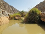
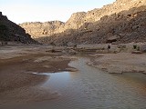
We continued upstream, past a boulder with a fine pair of engraved rhinoceros, and soon reached another cluster of palms in a large bend of the valley. The vegetation was increasingly denser and greener, signaling the close presence of water. After coming around a large bend, all of a sudden a deep hole appeared in the bedrock, and the bottom was filled with a large pool, the Bartou guelta. We moved a little upstream to make camp in a sandy area, and soon enjoyed our first bath since leaving Djanet.

Unlike the common rainwater-fed gueltas of the Tassili, the Bartou guelta is a permanent body of water, fed by artesian water that propagates along a shale aquifier sandwiched between the horizontal sandstone layers. As the wadi cuts itself ever lower flowing northward, this layer emerges at this point in the riverbed, forming the small pool which was teeming with life. The air above and around was abuzz with dragonflies and damselflies (mainly the bright red Trithemis arteriosa and the small blue Pseudagrion hamoni, thans to Stefan Ober for the identification), but there was also a large male Anax imperator prowling teh air above the pool, fortunately landing on a reed long enough for me to snap the photo. More surprisingly there were small fish living in the pond, another confirmation that the water was permanent. They were Barbus deserti, a species endemic to the Northern Tassili wadis (the same species live in the Iherir guelta and other larger bodies of water in the Oued Imirhou).

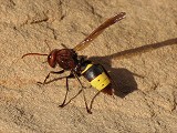
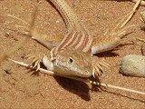
Other creatures converged on us as we were having our lunch. Like at all camps, a moula-moula was hopping about, hoping to be able to pick up some morsels, while the large hornets (Vespa orientalis) common all over the tassili were much bolder, attempting to grab a bite from whatever was on our plates. There were also lizards among the grass (Acanthodactylus boskianus), comically raising their feet to avoid them being scorched in the hot sand.
The area of richest concentration of engravings in the Oued Djerat is the approximately five kilometre stretch starting one kilometre upstream from the Bartou guelta. Our plan for the afternoon was to go as far upstream as possible while seeing the sites, then return to the camp at the guelta for sunset. As our camels stayed near camp we could immediately depart after a short lunch and rest, we were on our way by early afternoon.
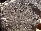
The most impressive panel of engravings in the Oued Djerat is just under a kiometre above the Bartou guelte, on the smooth flat rock surface where a western tributar joins the main valley. The site is known as Tin Tehed (Station LXXII), and depicts a dozen or so life-size giraffes of 6-7 metres size. Adjacent to the giraffes there is also a depiction of a lion or some other large feline. Due to the size of the panel it is impossible to photograph the entire scene except s small segments. The Lhote team assembled a high scaffolding from ladders to be able to photograph the scene in its entirety.
Just a hundred metres further upstream the engravings continued along the smooth bank of the main watercourse. This panel (Station XXXII) contained a wild ass as well as a number of fine large Hippotragus antelope, some of the more unusual depictions.
As we were busy photographing the panels, a large conspicious white bird flew low along the valley, then started circling above our heads, clearly interested in who we are. Koen identified it as a little egret (Egretta garzetta) common in wetlands all over the Old World including sub-saharan Africa, but more unusual here in the Tassili.
This section of the oued was almost completely barren, the rivermed made of smooth exposed rock where little vegetation could take hold. There were several shallow basins, as we walked upstream rounding a bend to the right (towards the West) we came upon a large shallow pool of rainwater that must have collected there faily recently, at most a month or two before our visit.
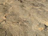
The engravings were near continuos here for a stretch of about 200 metres along the Northern side of the valley (Station XXX). The majority were wid animals with the occasional panel of cattle, and a few scattered human figures. There was a large animal of unclear affinities, perhaps an antilope, clearly looking like an adult yet a stretch of the umblical chord was depicted attached to its navel. There was also a very worn addax (or perhaps kudu ?) given away by the better preserved spiral horns.
Just a little further upstream the appearance of the valley changed again, with lush vegetation appearing in the riverbed, at first a grassy savana of acacias intermingled with blooming oleanders, then a dense grove of date palms.
The palm grove is bordered by a dense scatter of engravings along the southern side of the wadi (Station XXXI). This stretch starts with a very large scene composed of several animal figures (cattle and sheep), and well-known scene of a man and a woman on a very large scale. The execution of the human figures is rather crude in comparison to the finely done animals. The woman is wearing a large triangular hat and a skirt, while the man is naked and they appear to have sex. The sexual aspect of many of the depicted human figures in the Oued Drerat (and also in the Messak plateau in Libya where similar engravings exist) is very apparent, and is in strange contrast to the paintings of the Tassili regon where scenes of a sexual nature are very rare.

Continuing, there were several more panels, unfortunately the angle of the sun made them very difficult to photograph. This is generally true for all the Oued Djerat engravings, ideally one would need to wait for the low morning / late afternoon light for best contrast at each site, but this would require several weeks in the valley. The scenes mainly depicted cattle with a few human figures, but there was also a very fine figure of a lioness, and a group of three jackals.
At this point we crossed back to the Northern side of the valley (continuation of Station XXX), to a fine large panel of giraffe and a multitude of other animals, executed on the horizontal part of bedrock lining the riverbed. Some of the more unusual depictons were a pair of ostrich and a unique long limbed monkey, a tropical species that somehow must have expanded this far north during the wetter periods of the mid-holocene.
Continuing, we passed a number of other engravings on a large scale along the southern bank (Station XXVII), including a fine giraffe in a strange posture, with an outstretched front leg, a large ithyphallic figure, and a rather bizarre scene of a small figure with an enormous penis having intercourse with a bull or a Bubalus.
The farthest point we reached upstream was a flat block along the southern side of the valley as it started to make a sothward turn, about five kilometres fro our camp (upper end of Station XXVII). It had a large fine human figure on it, accompanied by a doble and single spiral motif. There would have been plenty of other engravings in the next couple of kilometres further upstream, but it was past 4pm and the sun was rather close to dipping below the top of the cliffs. We have left one of the most interesting sites last to be seen in the best low light, so it was time to turn back.
We crossed over to the far side of the valley, and walked along the northern bank, where there were only few engravings, a large running human figure with a hornless antelope-looking creature (lower end of Station XXV), and a small but fine panel of rhinoceros (Station XXIX). The choice of location for rock art shows no clear pattern, the northern bank offered as many suitable smooth surfaces as the southern one, yet they were all empty.
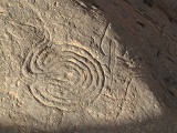
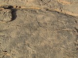
We returned to the south bank where a rough rocky terrace contains perhaps the most intriguing site of the valley (Station XXVIII). The terrace on an area of perhaps 100-150 square metres is covered with a multitude of the already known spiral symbols, including several in a triple pattern, perfectly visile (and photographable) in the low late afternoon light. These symbols are associated with rhinoceros and antelopes, and while they do occur in single fashion elsewhere in the valley, there is no other such ensemble of these unexplained engravings. Similar symbols exist elsewhere in the Sahara, including the Tibesti mountains which we were fortunate to see earlier in the year.
A little further towards camp there were some more spirals associated with animals, already in the shade, and a fine pair of running ostrich which we missed on our outward walk as they were nearly invisible in the direct sunlight.
As we walked back towards the camp the sun slowly dipped below the western cliffs, and by the time we reached the rain-fed pool before the last bend to camp the entire valley was in deep shade.
On our way back to camp we passed the Tin Tehed giraffes, hoping that perhaps the light will be a bit better for photography, but they were no different than in the morning, still very hard to discern. We passed our grazing camels and reached camp by the guelta just before darkness.
Day 12. - Oued Djerat
We have accomplished as much as we could in the Oued Djerat given the time available. Our remaining objective for the last two days was simply to get back to the mouth of the valley and rendez-vous with Abdou and the cars to reach Illizi the night before our flight. This still left us with a good half-day reserve for any unexpected delays, as our flight to Algiers was departing only Sunday mid-afternoon.
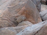
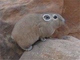
After packing camp and while the camels were being colected, with Tak we made a quick dash back to the giraffe panel just in case we might catch the early morning sun striking it at a low angle. However at the site it soon became clear after the sun rose that it will take several hours until the direct sunlight reaches the panel, already when the sun is high up. As we approached the giraffes I spotted something small and brown move among the rocks. I expected it to be a hyrax, but it was smaller and rounder. By the time I got the camera out it was gone, but on the sound of Tak's approaching footsteps it emerged at another rock, and stayed still long enough for me to snap a photo. It was an extremely cute creature I have never seen or even heard of before, a Mzab gundi (Massoutiera mzabi), a guinea-pig sized rodent that is only found in the desert parts Algeria and other Saharan massifs accross the border in Mali and Niger.
By the time we returned to camp the camels were rounded and the loads nearly ready, soon we started our long march back towards Illizi. We had no specific target to reach by the evening, but with about 28 kilometres to go till the cars, we wanted to do at least half of it, hopefully a little more.
As we walked downstream, we could well observe the slowly rising aquifier layer that was feeding the permanent pool. While water no longer seeped from it there was enough remaining moisture to support wild figs, tamarisks and oleanders, all of which require their roots to reach permanent water. A fallen slab covered with the characteristic Arthropycus trace fossils confirmed my suspicion that this shale layer was the product of a marine transgression sometime in the Ordovican or Siluran periods.
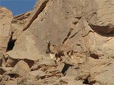
We took the far side of the large bend after the guelta, and from there it was more evident that this secton contained the lushest vegetation anywhere in the valley. The date palms were intermingled with bright green castor bean plants, oleanders and a few wild figs. Continuing we soon reached the open grassy savana with the deep grass. Apparently this was the favorite spot of the local wildlife too, we passed a herd of feral donkeys, then much to our surprise a barbary sheep (Ammotragus lervia), which raced up the near vertical cliffs in no time, just slowing down enough near the top for a quick photo before it disappeared over the horizon.
We walked for several hours along the long straight stretch bearing on slightly west of north course. With the sun almost exacly behind our backs there was no shade on either side of the valley, and it started to become uncomfortably hot. Fortunately we could afford an early midday break, we only had to go nine kilometres from the guelta to reach an isolated but remarkable panel of engravings (Station XLVI) which we passed on our way up because of te unfavorable light. It was a solitary rock by the side of the valley, with a depiction of a flock of a dozen shoe-billed storks (Balaeniceps rex). Lhote referred to them as Pelicans, however the thick beaks with the hook at the tips are clear and unambiguous diagnostic features. This of course makes much more sense, as pelicans are seabirds only occurring in near-shore environments, while the ancient range of the shoebills (now restricted to the swamps of the southern Nile basin, mainly Uganda) could have easily included the wetlands of the central Sahara at a time when hippoes also inhabited the area. We had our lunch and rest nearby, waiting for the sun to reach the perfect angle for taking photos of this unique panel.

Once the midday heat started to subside a bit we continued, soon passing our second campsite in the valley, and the fine engraving of a Bubalus antiquus framed by a human figure on the left and a therianthrope on the right (Station XLVII, somewhat better visible now in more favorable light conditions).

We re-traced the route of the afternoon of two days earlier pretty much without stopping, passing our midday resting place in the sandy patch near the confluence of the major tributary just as the shadows started to reach the valley bottom. As it was now pleasantly cool and we had another two hours to go till darkness, we pressed on along the long straight section of the valley leading directly North. Near the bend on the side opposite the fine panels we have seen on our upward trek, there was a fine rhinoceros on the smooth rock bank (Station LI), and some other engravings on large blocks below (Station LIII).
Near the middle of the straight stretch, where a small western tributary joins, we reached the last major site on our must-see list (Station LVIII). It was a large block at the side of the valley, in the middle of an area which was a touareg settlement until recently, the animal pens built of thorny acacia branches and the scattered refuse were still there. The site itself contains one of the finest Bubalus antiquus representations in the valley (though Muzzolini argued that all these animals are in fact domesticated cattle and younger than thought, this is still much debated), associated with a characteristic double spiral. The crossing lines of the animal and the spiral do not overlap but appear to be exactly contemporary, suggesting both are part of the same composition. On the right face of the rock there is a very unusual rhinoceros, depicted in full gallop (apparently missed by the Lhote team), with the interior of the body pecked smooth, something I have not observed at any other engraving in the valley.
About a kilometre downstream there was a large dry basin with soft sandy bottom in the middle of the valley, and ideal camping spot. We have already covered 15 kilometres, leaving about 13 for the last day, something easily doable in a full morning and a short afternoon, so even though the sun was still quite high up we called it a day and made our last camp in this very pleasant spot.
Day 13. - Oued Djerat - Illizi
On this last day we had nothing to do but to reach the cars. We packed camp in a rather leisurely fashion after sunrise, setting off to make as much use as possible of the shade offered by the high sides of the canyon. By mid-morning we passed our first campsite and the large engraved cattle high above the valey floor nearby, and continued past the small touareg settlement (which was now empty) till one of the last large trees where we could have our midday rest in the shade.
We had a fairly long siesta, there was no need to hurry as our cars were only expected around 4pm in the afternoon and we only had six kilometres to go, something comfortably doable in two hours or less. We set out at 2pm and soon reached the sandy part of the valley where the acacias ceased and the low tamarisks took over. We witnessed a large raptor ( long-legged buzzard, Buteo rufinus) being chased by a pair of ravens (a scene also witnessed during our lunch break), unfortunately I was only able to snap a shot of the escaping buzzard, not of the chase itself.
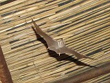
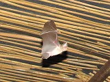
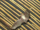
We did reach the waiting cars before four, and after offloading our camels and saying our farewells to Mohammed and Hamed we set out along the track to Illizi, to spend the night at a local 'tourist camp'. As there were no tourists around for many years, the camp was closed and only opened in our honour. It was a simple affair with a couple of zeribas with matresses and a large communal building, but there was shower with hot water, which was all that we needed. After taking our bath and waiting for our dinner to be prepared, we had a nice evening on the covered terrace sipping our last cocktail and watching the bats going after the swarm of flying insects attracted by the bright lights. They were incredibly fast, but a couple of point-blank shots taken with flash at high shutter speeds and pre-set focus came out surprisingly well. They were identified as Aselia tridens, trident-nosed bats by Mourah Ahmim (University of Bejaia), a typical desert species not reported before from the Tassili nor the Hoggar.
Day 14. - Illizi - Algiers
When we woke up at sunrise we were greeted with some alarming news. Peter was already feeling unwell in the evening and tucked in early, and in the morning he was sitting upright in his sleeping bag with a strong back pain, unable to sleep for most of the night and having some difficuty breathing. With the prospect of a long flight back to Australia the day after it looked serius enough to seek any medical help available, so with some misgivings we set out with Abdou to see the local hospital. Fortunately the fears were unfounded, the facility was surprisingly clean and well equipped, with a very friendly doctor who spoke some English and did a thorough checkup, and came to the conclusion that it was likely to be a pinched spinal nerve (something later confirmed in Australia), nothing more serious. After administering some strong pain killers and prescribing more for the journey, a much relieved Peter was declared fit to fly.
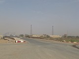
With the medical scare over, we said good-bye to Abdou and Tak (who returned to Djanet to see some more sites in the area over another week), and they left with two cars, leaving the remaining four of us with a local friend of Abdou to drive us to the airport to catch our flight. Illizi airport is quite far out, some 30 kilometres north of the town on a rocky plateau that is free from the sand dunes surrounding Illizi and covering the area further north. We spent most of the afternoon at the airport as the flight was delayed by about an hour, we finally boarded around 4pm.
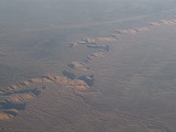
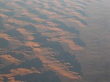
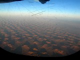
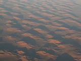
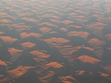
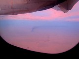
The Illizi - Algiers flight at over four hours must be one of the longest ATR flights in the world, flying at a slow 450kph, half the speed of the bigger jets. Fortunately for us, the ATR also flies at a much lower altitude, so we had a pefect sunset view of the Grand Erg Oriental in the best possible light before darkness set in, reaching Algiers after 8pm.
We plan to return to the Tassili n'Ajjer in the autumn of 2015, with a planned itinerary to include the lesser visited but no less interesting Tadrart region and a number of remoter sites along the Djanet - Illizi road, mostly accessible with vehicles and short walks. Application deadline for this trip is end of July 2015.